Verulamium

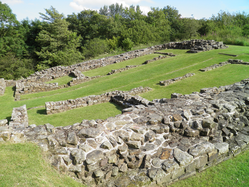
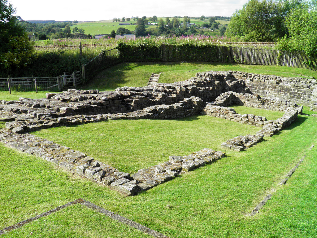
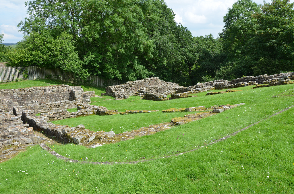
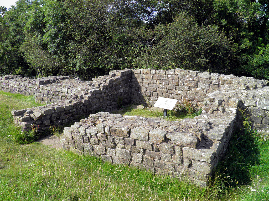
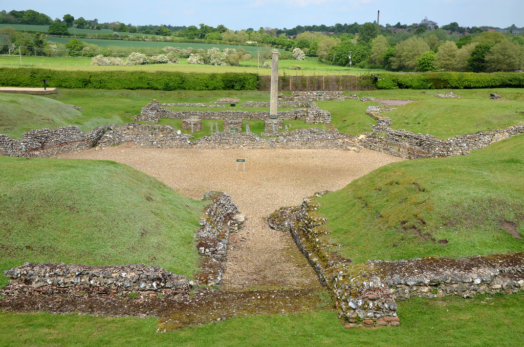
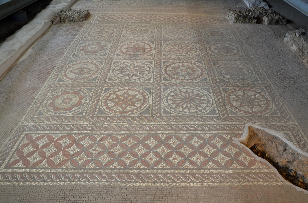
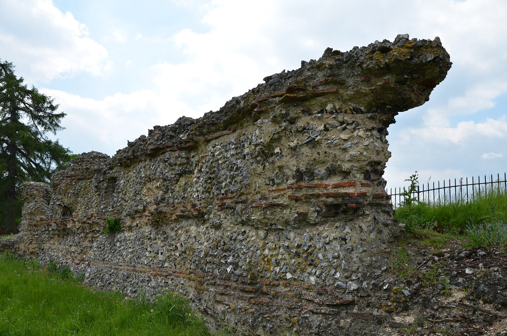
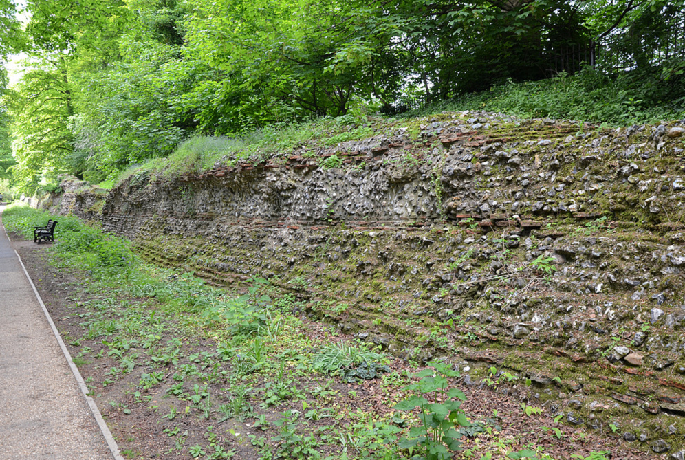
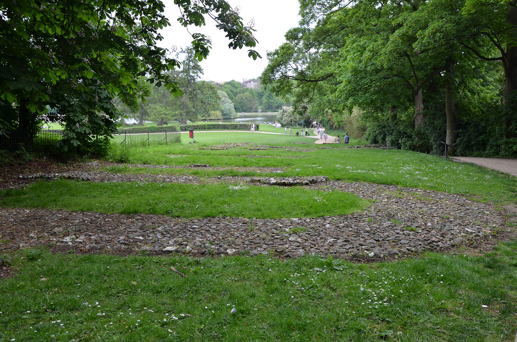
Verulamium was one of the largest towns in Roman Britain. It was established on the location of a late Iron Age settlement and a major centre of the Catuvellauni tribe. Its ruins now stand in the southwest of the modern city of St Albans in Hertfordshire, 33 km northwest of London. The excavations uncovered parts of the city walls and a hypocaust under a mosaic floor, but the Roman theatre was the most spectacular. Since much of the modern city has been built upon the ancient town, a large portion of Verulamium remains unexcavated.

Coordinates: 51° 45′ 0″ N, 0° 21′ 14.04″ W

Verulamium was founded on the ancient Celtic site of Verlamion (meaning ‘settlement above the marsh’), a late Iron Age settlement and a major centre of the Catuvellauni tribe. After the Roman invasion of AD 43, the city was renamed Verulamium and became one of the largest and most prosperous towns in the province of Britannia. Around AD 50, Verulamium was granted the rank of municipium, meaning its citizens had “Latin Rights”. It grew into a significant town and, as such, was a prime target during the revolt of Boudicca in AD 61. Verulamium was sacked and burnt to the ground on her orders, but the Romans crushed the rebellion, and the town recovered quickly. In its heyday, Verulamium was the third-largest city in Roman Britain.

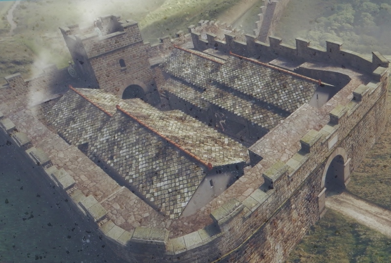
By AD 140, the town had doubled in size, covering 100 acres, and featured a forum with a basilica, public baths, temples, many prosperous private townhouses and a theatre. Despite two fires, one in AD 155 and the other around AD 250, Verulamium continued to grow and remained a central Roman town for the next four hundred years until the end of the Roman occupation.

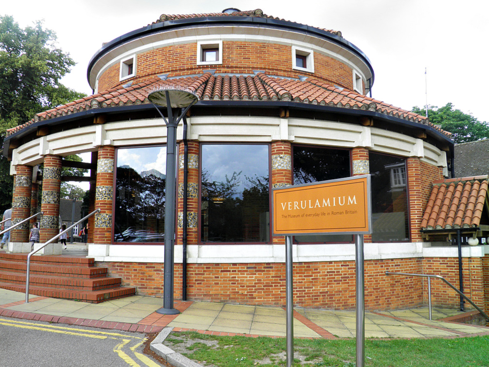
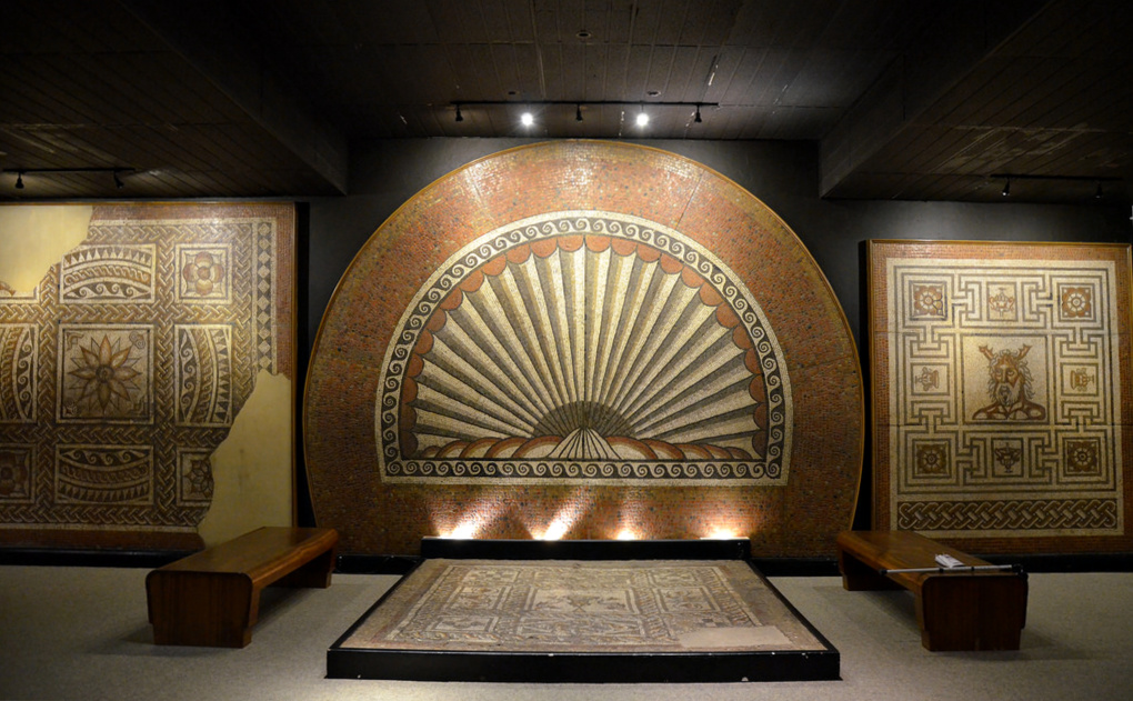
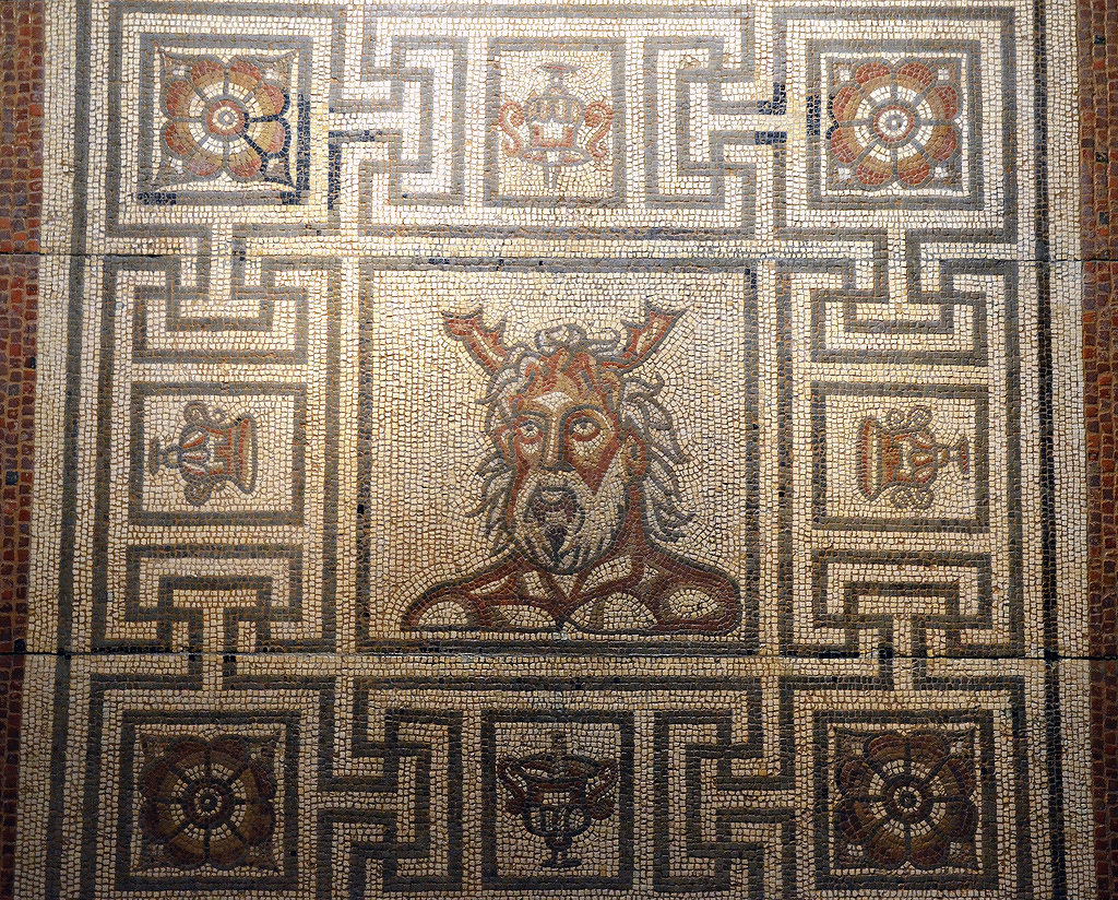
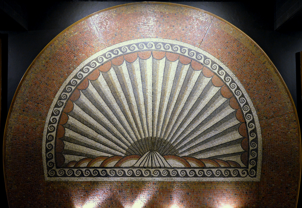
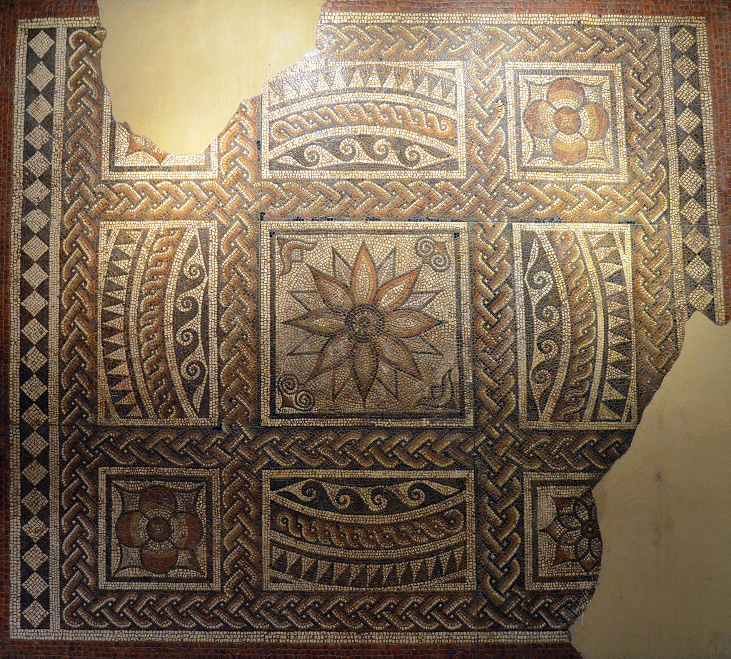
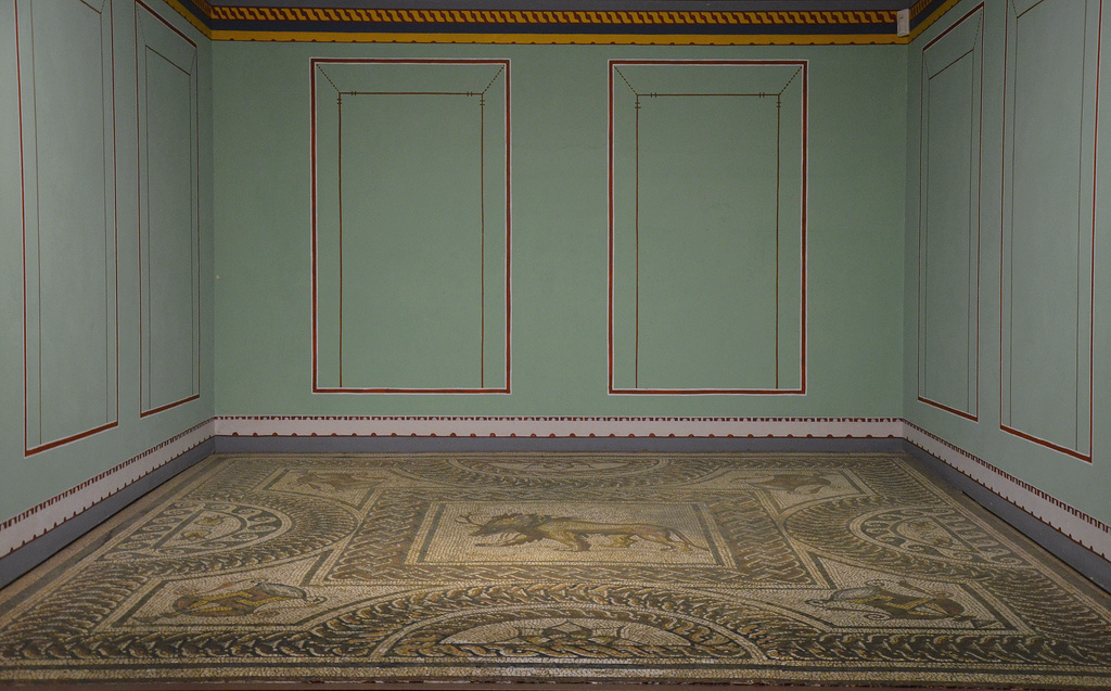
Today the site of Verulamium sits in a beautiful public park. Archaeological excavations were undertaken in the park during the 1930s, during which the 1800-year-old hypocaust and its covering mosaic floor were discovered. Further large-scale excavations uncovered the theatre, a corner of the basilica nearby and some of the best-preserved wall paintings of Roman Britain. On the outskirts of the park is the Verulamium Museum which contains hundreds of archaeological objects relating to everyday Roman life.

PORTFOLIO

The Roman Theatre, built in about 140 AD, is unique. Although several towns in Britain are known to have had theatres, this is the only one visible today.
The theatre could accommodate several thousand spectators on simple wooden benches and had an almost circular orchestra in front of the stage where town magistrates and local dignitaries were seated. The theatre was radically altered by AD 160-180, with the stage enlarged.
The theatre was built close to the site of an earlier water shrine and was linked to two temples dedicated to Romano-British gods: one stood immediately behind the theatre and the other on the opposite side of the river a short distance outside the town. Today the remains of these temples lie buried.
The theatre was lined with shops with storage spaces and sleeping quarters behind the main shop area. When the shops were excavated in the 1950s, broken crucibles and waste metal showed that most of the shops had been occupied by blacksmiths and bronze workers.
Around AD 170, a large townhouse was built behind the shops, part of which can still be seen. The house had a hypocaust and an underground shrine.
The Hypocaust and Mosaic. During the 1930s excavations, archaeologists uncovered an 1800-year-old underfloor heating system, or hypocaust, which ran under an intricate mosaic floor. This floor is considered part of the reception rooms of a large townhouse built around AD 180.
The mosaic is of great size and contains around 200,000 tesserae. The floor comprises a central section with 16 square panels, each having a circular roundel with a geometric design. The borders are bands of single and double interlaces and strips of wide and thin dark and light material.
The city walls were constructed around AD 270 and were over 3m thick at foundation level and over 2m high.
The walls were built as a complete circuit around Verulamium with a total length of 3.4 km (2.25 miles) and enclosing an area of 82 ha (203 acres).
The city walls of Verulamium.
The surviving foundations of the London Gate. Large gateways controlled the four main entrances to the town of Verulamium. The best preserved is the London Gate on the south side of the town.
Reconstruction drawing of the London Gate.
  • The Verulamium Museum

The Verulamium Museum in St Albans. Located in Verulamium park, the Verulamium Museum was established following the 1930s excavations carried out by Mortimer Wheeler and his wife, Tessa Wheeler.
The Mosaic Room.
The Oceanus Mosaic, AD 160-190. The figure could be the god Oceanus – or it might be Cernunnos, the god of the woods.
The Shell Mosaic, dated to c. AD 15.
The Dahlia Mosaic with flower motif, AD 175-200.
The reconstructed painted plaster walls date to about AD 180.
Wall painting with imitation columns and panelling.
Verulamium Museum.
The reconstructed dedicatory inscription from the Basilica inscription dated to AD 79 or 81. The inscription is notable because it mentions Gnaeus Julius Agricola, the Roman governor of Britain from AD 77-84. He is otherwise known from a biography written by his son-in-law Tacitus.
The Lion and Stag Mosaic.

Links & references:

Milecastle 48 (Poltross Burn)

Milecastle 48 (Poltross Burn) is one of the best-preserved milecastles (a small, walled fortlet) along Hadrian’s Wall. It is located just outside the village of Gilsland in Cumbria, 3km east of Birdoswald Roman Fort (Banna). Milecastle 48 was built to a standard plan but is substantially larger than many other milecastles. It contains the remains of the north and south gates, two barrack blocks, enclosing walls and short sections of Wall on either side. Unusual features include an oven and a set of stairs giving access to the rampart walk. The two turrets associated with this milecastle (48a and 48b) have also survived as above-ground masonry. English Heritage currently manages the monument.

Coordinates: 54° 59′ 20.37″ N, 2° 34′ 24.67″ W

Built on a steep slope overlooking a tributary stream of the River Irthing, Milecastle 48 is one of the most significant and most informative of all milecastles. Internally, it measured 21.5m north to south by 18.7m across and had a broad wall (2.90m thick) built of large masonry, indicating that the milecastle was built before the decision to narrow the Wall. The wing walls (short lengths of curtain wall) extended 4m either side of the milecastle and connected with the Narrow Wall curtain of Hadrian’s Wall.

Inside were a pair of small barrack blocks flanking the central space of the milecastle. Each barrack had four rooms, large enough to accommodate a garrison of around 64 auxiliary troops, the largest number possible in a single milecastle. As the whole structure was built on a slope, the internal buildings had to be terraced and stepped. The north-west corner of the milecastle contained a cooking area, with a round oven. In the north east corner, the lower courses of a flight of steps were found, suggesting that the parapet walk stood 3.66 metres above ground.

Theoretical structural model plan of Milecastle 48.

This milecastle was of Type III, generally thought to have been built by the Sixth Legion (Legio VI Victrix). It was occupied from the AD 120s into the 4th century, and several alterations were made inside the building. Both gates were narrowed, and the barracks were redesigned to make three larger rooms. Milecastle 48 was first excavated in 1886, and subsequently between 1909 and 1911. Further excavations were undertaken between 1965 and 1966.

An reconstruction drawing of the Poltross Burn Milecastle at around AD 170.

Each milecastle on Hadrian’s Wall had two associated turret structures. The turrets associated with Milecastle 48 are known as Turret 48a and Turret 48b. The site of Turret 48a is situated on a river terrace on the south bank of the River Irthing. Turret 48a is one of the best-preserved turrets on the Wall. It measures 4.15 metres across, and the north wall stands 1.85 metres high. Turret 48b is situated 150m west of Turret 48a. It too survives as an upstanding stone feature but has lost its south wall. Built into the wall is a building stone inscribed with the name of the centurion Gellius Philippus (RIB 3407). Three other inscriptions (now in Tullie House Museum) were found close to Turret 48a (RIB 1859, 1860, 1861). Both turrets were completed with wing walls on either side before the Wall was narrowed.

Poltross Burn Milecastle and its turrets are just two miles away from Birdoswald Roman Fort, where visitors can explore the longest continuous stretch of Hadrian’s Wall. It is part of the Birdoswald Roman Trail, which starts at Lanercost Priory and finishes at Willowford Roman Wall and Bridge Abutment.

PORTFOLIO

Poltross Burn Milecastle.
The north side of Milecastle 48.
One of the barrack blocks on the west side of the milecastle.
The north side of Milecastle 48 with the remains of a flight of stairs on the right.
The foundations of Milecastle 48, looking north east.
Turret 48a. Both this and turret 48b before the Wall was narrowed ca. AD 125.
Turret 48a. Several hearths and evidence of bronze and iron working were found in the interior.
Turret 48b (Willowford West). The line of ditch and rampart can be seen in front of the wall.
From geograph.org.uk by John M (CC BY-SA 2.0).
Building inscription (RIB 3407) found east of Turret 48b, now built into a farm outbuilding at Willowford Farm.
c(o)ho(rtis) V / c(enturia) G(elli) P(h)ilippi
Fifth Cohort, the century of Gellius Philippus (built this)
Part of Hadrian’s Wall at Willowford, showing the lower courses of the Broad Wall (AD c.122) , with its narrower successor sitting on top (AD c.125).

Links: