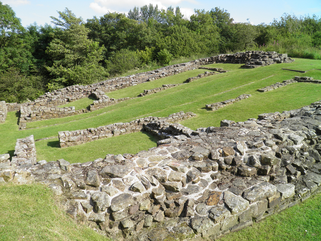
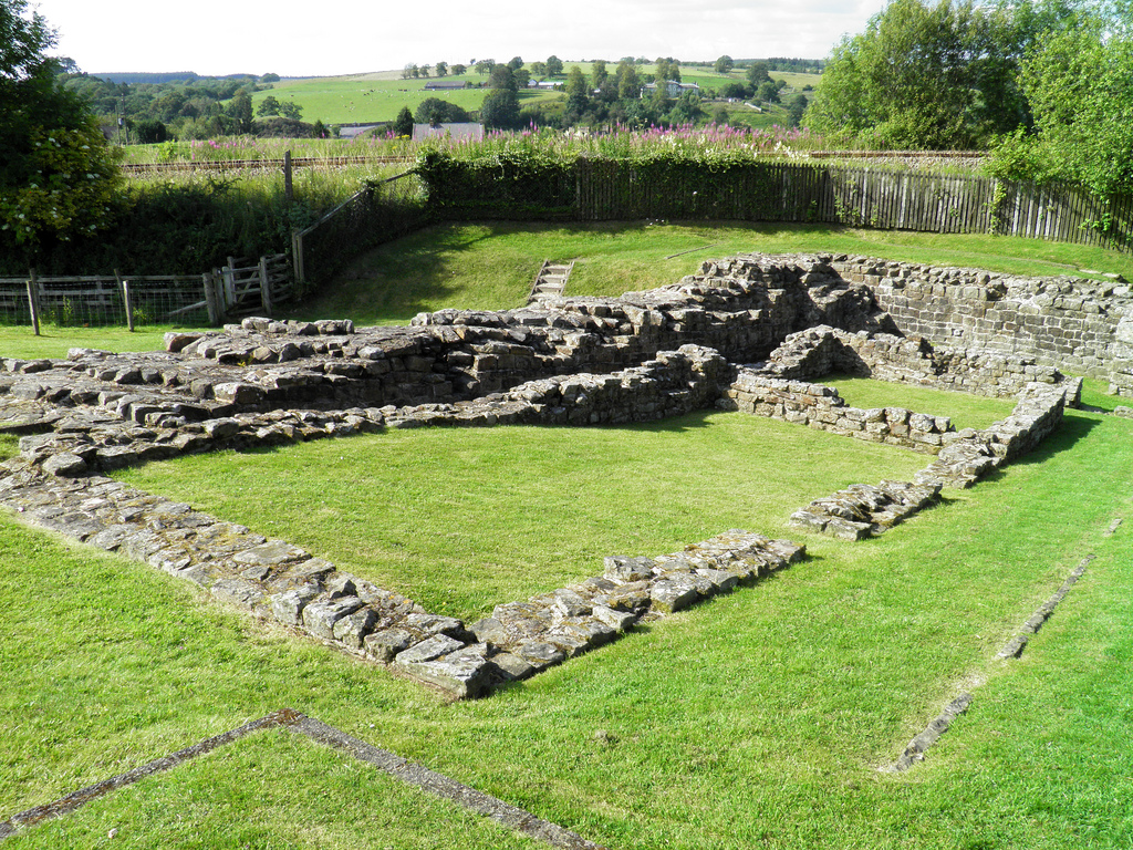
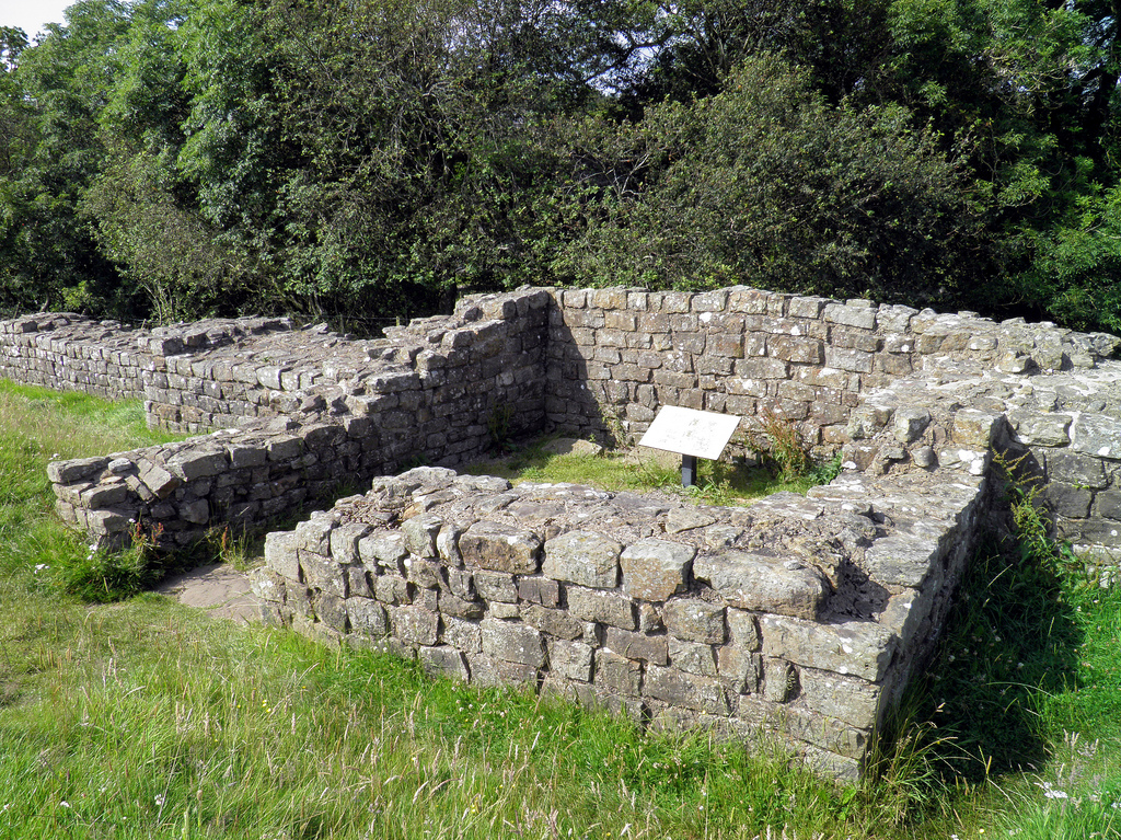
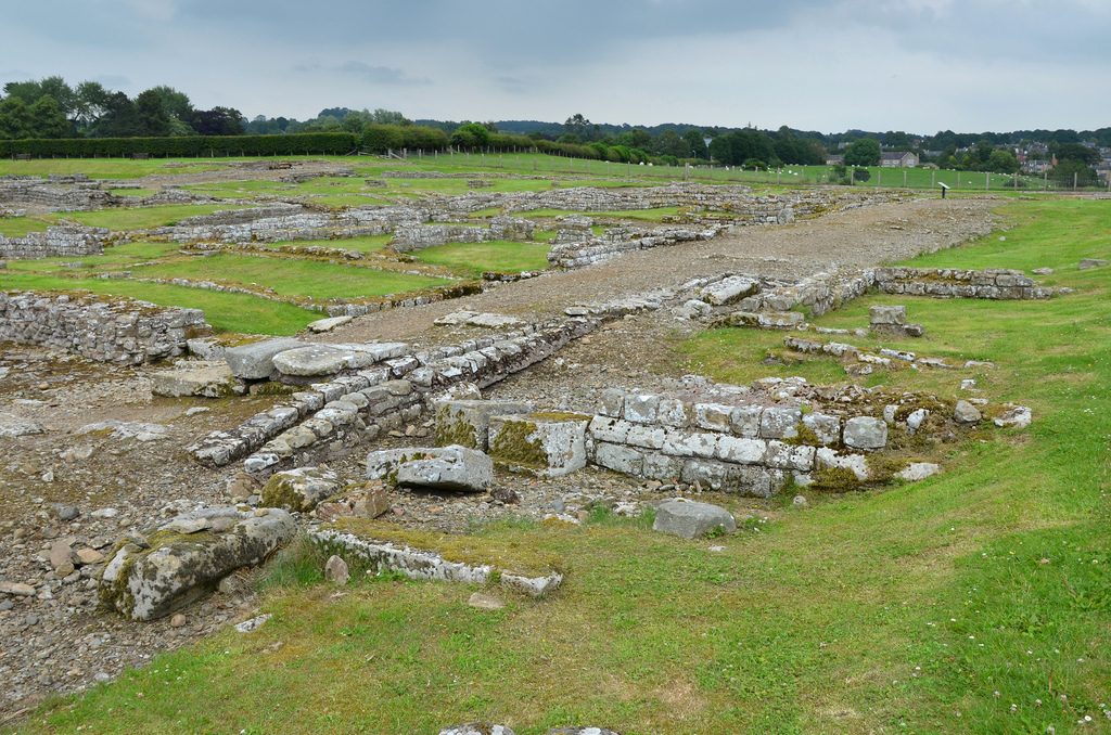
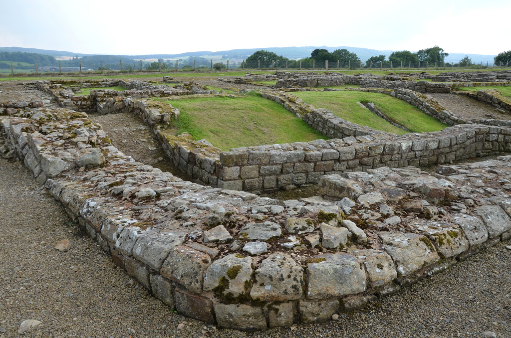
Milecastle 48 (Poltross Burn) is one of the best-preserved milecastles (a small, walled fortlet) along Hadrian’s Wall. It is located just outside the village of Gilsland in Cumbria, 3km east of Birdoswald Roman Fort (Banna). Milecastle 48 was built to a standard plan but is substantially larger than many other milecastles. It contains the remains of the north and south gates, two barrack blocks, enclosing walls and short sections of Wall on either side. Unusual features include an oven and a set of stairs giving access to the rampart walk. The two turrets associated with this milecastle (48a and 48b) have also survived as above-ground masonry. English Heritage currently manages the monument.
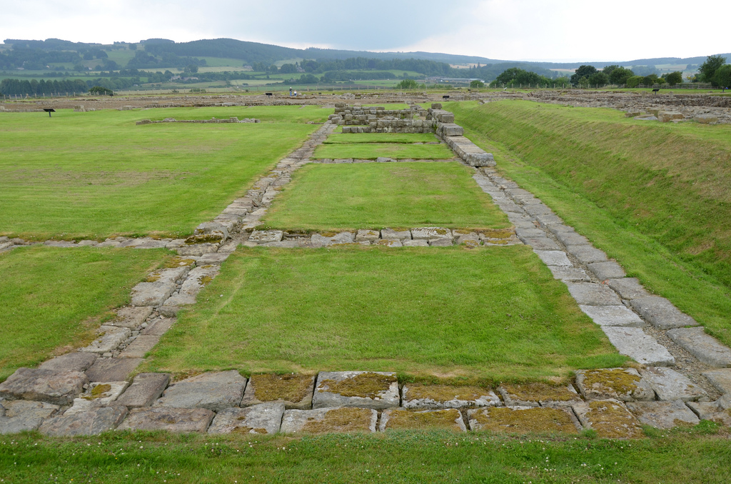
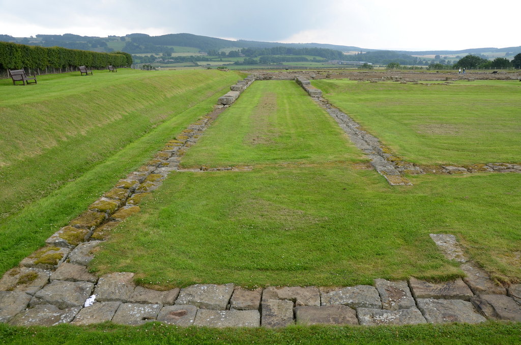
Built on a steep slope overlooking a tributary stream of the River Irthing, Milecastle 48 is one of the most significant and most informative of all milecastles. Internally, it measured 21.5m north to south by 18.7m across and had a broad wall (2.90m thick) built of large masonry, indicating that the milecastle was built before the decision to narrow the Wall. The wing walls (short lengths of curtain wall) extended 4m either side of the milecastle and connected with the Narrow Wall curtain of Hadrian’s Wall.
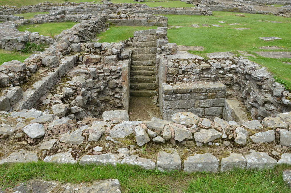
Inside were a pair of small barrack blocks flanking the central space of the milecastle. Each barrack had four rooms, large enough to accommodate a garrison of around 64 auxiliary troops, the largest number possible in a single milecastle. As the whole structure was built on a slope, the internal buildings had to be terraced and stepped. The north-west corner of the milecastle contained a cooking area, with a round oven. In the north east corner, the lower courses of a flight of steps were found, suggesting that the parapet walk stood 3.66 metres above ground.
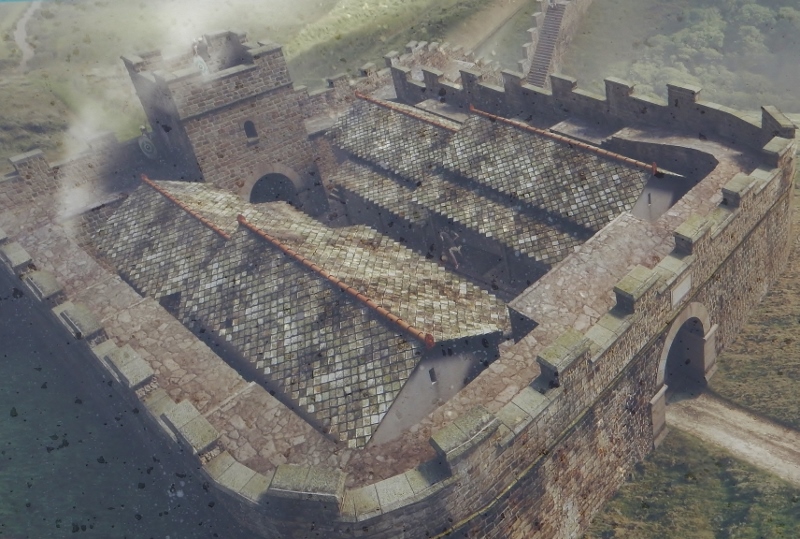
Theoretical structural model plan of Milecastle 48.
This milecastle was of Type III, generally thought to have been built by the Sixth Legion (Legio VI Victrix). It was occupied from the AD 120s into the 4th century, and several alterations were made inside the building. Both gates were narrowed, and the barracks were redesigned to make three larger rooms. Milecastle 48 was first excavated in 1886, and subsequently between 1909 and 1911. Further excavations were undertaken between 1965 and 1966.
An reconstruction drawing of the Poltross Burn Milecastle at around AD 170.
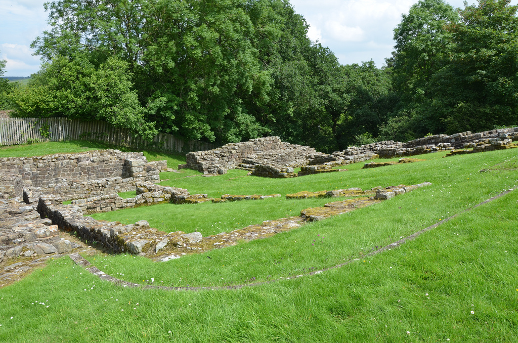
Each milecastle on Hadrian’s Wall had two associated turret structures. The turrets associated with Milecastle 48 are known as Turret 48a and Turret 48b. The site of Turret 48a is situated on a river terrace on the south bank of the River Irthing. Turret 48a is one of the best-preserved turrets on the Wall. It measures 4.15 metres across, and the north wall stands 1.85 metres high. Turret 48b is situated 150m west of Turret 48a. It too survives as an upstanding stone feature but has lost its south wall. Built into the wall is a building stone inscribed with the name of the centurion Gellius Philippus (RIB 3407). Three other inscriptions (now in Tullie House Museum) were found close to Turret 48a (RIB 1859, 1860, 1861). Both turrets were completed with wing walls on either side before the Wall was narrowed.
Poltross Burn Milecastle and its turrets are just two miles away from Birdoswald Roman Fort, where visitors can explore the longest continuous stretch of Hadrian’s Wall. It is part of the Birdoswald Roman Trail, which starts at Lanercost Priory and finishes at Willowford Roman Wall and Bridge Abutment.
PORTFOLIO
Poltross Burn Milecastle.The north side of Milecastle 48.One of the barrack blocks on the west side of the milecastle.The north side of Milecastle 48 with the remains of a flight of stairs on the right.The foundations of Milecastle 48, looking north east.Turret 48a. Both this and turret 48b before the Wall was narrowed ca. AD 125.Turret 48a. Several hearths and evidence of bronze and iron working were found in the interior.Turret 48b (Willowford West). The line of ditch and rampart can be seen in front of the wall. From geograph.org.uk by John M (CC BY-SA 2.0).Building inscription (RIB 3407) found east of Turret 48b, now built into a farm outbuilding at Willowford Farm. c(o)ho(rtis) V / c(enturia) G(elli) P(h)ilippi Fifth Cohort, the century of Gellius Philippus (built this)Part of Hadrian’s Wall at Willowford, showing the lower courses of the Broad Wall (AD c.122) , with its narrower successor sitting on top (AD c.125).
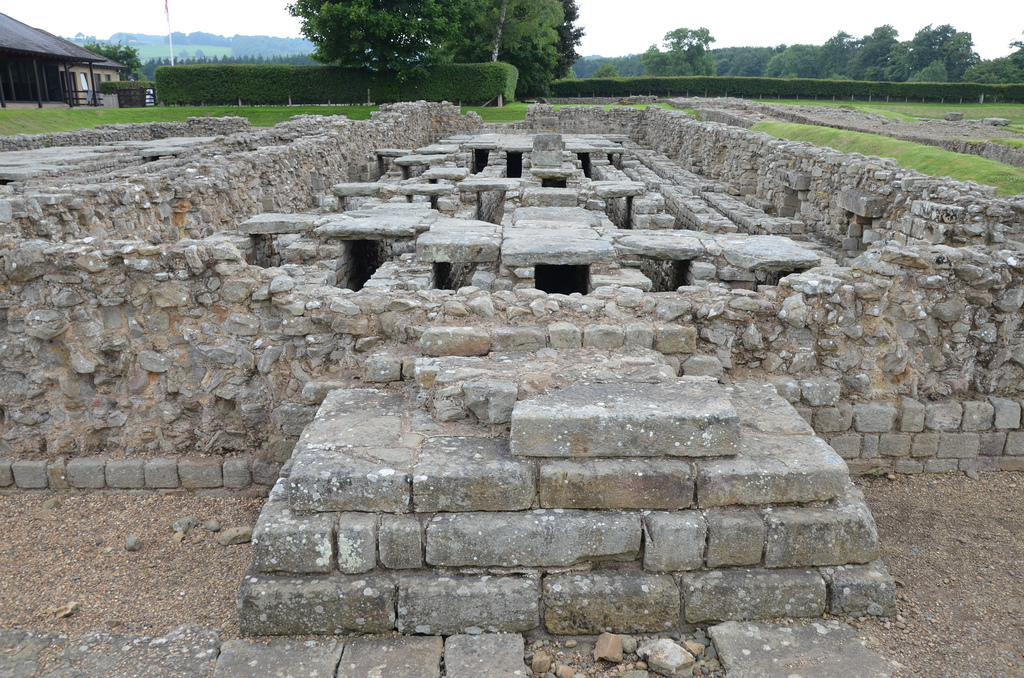
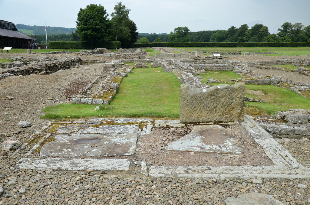
Coria (also known as Corstopitum) was a fort and town in the Roman province of Britannia immediately south of Hadrian’s Wall, on the east-west road stretching from Corbridge to Carlisle (Luguvalium) and now known as the “Stanegate”. The site lies to the west of the modern town, on the north bank of the River Tyne in the English county of Northumberland. A number of forts, which are now deeply buried beneath the remains, were built during the 1st and 2nd centuries. Coria largely developed after AD 160 and continued to thrive until its abandonment in the early years of the 5th century when Roman administration in Britain collapsed.
The first fort at Cordbrige lay around 1 km west of the Roman town at Red House, and was discovered during construction of the A69 road in 1974. Dating to the late 70s and classified as a vexillation fortress, it was probably established as part of Julius Agricola’s planned conquest of Scotland. A decade later, about AD 86, this early fort was abandoned, and the garrison moved to a new turf fort on the present site. It was followed by another fort at the beginning of the 2nd century, but it was burnt down, possibly by enemy action. Afterwards, a new fort (Fort II), still in turf and timber, was built directly upon the destruction layer of Fort I to secure the new border line.
Fort II was modified in about AD 122 to provide support for Hadrian’s Wall and to accommodate a different garrison of 1,000 infantrymen. From about AD 125 until AD140, the fort at Corbridge lay vacant, while the forts on Hadrian’s Wall thrived with activity. From AD 139, when the frontier was pushed further north, and the Antonine Wall built, the first stone fort (Fort III) was erected under Quintus Lollius Urbicus. This activity is attested by a couple of inscriptions recording the work of the Second Legion during his governorship. Further alterations to the internal layout followed in the early AD 160s when the function of Corbridge suddenly changed to that of a base for legionaries. Detachments from the Twentieth Legion (Legio XX Valeria Victrix, whose main base lay at Chester) and the Sixth Legion (Legio VI Victrix, from York) were present at Corbridge. These legions built temples, granaries, a fountain house and other significant structures (known from inscriptions).
A relief of a boar. The boar was the emblem of the Twentieth Legion, who were present at Corbridge in the AD 160s.
It was not until the reign of Septimius Severus (AD 193 – 211) that the buildings, still visible on the site today, began to assume their final form. Two stone-walled compounds were built to house the legionary detachments. The eastern compound contained two houses and other buildings, while the western had workshops and a small headquarters building in which there was a strong room. These were connected with the Second (Legio II Augusta) and the Sixth Legion (Legio VI Victrix) and may have been part of the supply network for Severus’s expedition in Caledonia. The granaries were also probably rebuilt under Severus in their visible form.
By the early 3rd century, a large civilian town of 12 hectares had grown up around the core of the military garrison. Corbridge continued to thrive as a civic centre for the next two centuries and became the administrative centre of a civitas (self-governing administrative division). The town seems to have been rapidly abandoned when Roman administration in Britain collapsed in the early years of the 5th century.
The remains of the Roman town of Coria were identified in the 16th century. By the early 18th century, the site was almost entirely levelled and under the plough but in 1906 excavations began to reveal the extent of the town. The remains of the site visible today represent only a tiny fraction of the Roman town built around the site of successive forts. These include the best-preserved granaries of Britain, a market complex, an ornate fountain, and compounds for legionary soldiers. The site museum has one of the largest of the Hadrian’s Wall collections, with over 34,000 finds. It gives a vivid insight into life in the northernmost town of the Roman Empire.
Statue of a lion attacking a young stag, 3rd century AD. Museum of Cordbridge.
PORTFOLIO
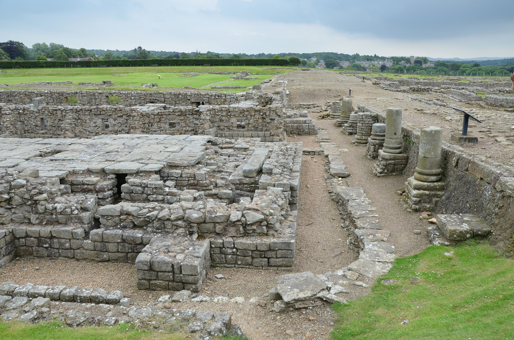
The Stanegate. The broad follows what was one of the main roads through the fort, the via principalis, which connected the east and the west gates.The granaries at Cordbridge are the best preserved of the standard military type anywhere in the Empire. The remains visible today are of those probably built under Septimius Severus.
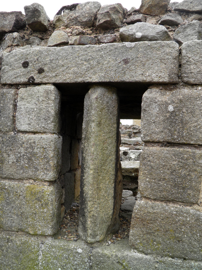
The West Granary. This granary was built over an earlier one, probably belongs to the legionary supply depot of the AD 160s.The East Granary stands higher than the west. In the east wall one of the ventilators still has the stone mullion that blocked access to the basement.The only surviving mullion in a granary ventilator slot in Britain.To keep the contents of these two grain stores cool and dry, the floors were raised on dwarf walls above a ventilated basement. In front of the doors were loading platforms covered with porticoes which column bases can still be seen.The Fountain House. It is an elaborate fountain built in the late 2nd or early 3rd century as the main public water supply for both legionaries and civilians.The Courtyard Building. This vast building may have served as the headquarters of a legionary fortress, a forum for a civil town. It has a square shape of 66m surrounded by ranges.The west side of the Courtyard Building with the headquarters building of the Hadrianic period.The east side of the Courtyard Building with the commanding officer’s house of an earlier fort.The West Compound. It contained workshops and a small headquarters building in which there was a strong room.The Principia (Headquarter Building) of the West Compound.The Strongroom within the Principia of the West Compound. The steps led to an antechamber giving access to the shrine of the standards.Relief found in the west principia strongroom of Hercules raising a club to strike the Hydra. Minerva (left) directs his blow.The West Compound with the Civilian Buildings on the left and the Barracks (later workshops) on the right.The West Compound with a water tank in the foreground and two rectangular barracks in the background.The East Compound comprising the Headquarters (Principia), Workshops, the Barracks and the Officer’s Accommodation.The Officers’ Accommodation. This complex originally formed two houses with an entrance corridor and seven rooms arranged around a central courtyard. They accommodated officers in charge of the legionary detachment.The Barracks or Workshops of the East Compound. The undulating ground was caused by subsidence following the Roman departure.The Barracks of the East Compound.The massive base of the East Compound enclosure wall.The Corbridge Lanx as displayed in the British Museum. It is 4th century AD Roman silver dish found near Corbridge, northern England in 1735. Once part of a large Roman treasure, only the silver lanx remains from the original find.
Source:
Hodgson, N, Roman Corbridge: Fort, Town and Museum (English Heritage guidebook, London, 2015) [buy the guidebook]