Hardknott Roman Fort

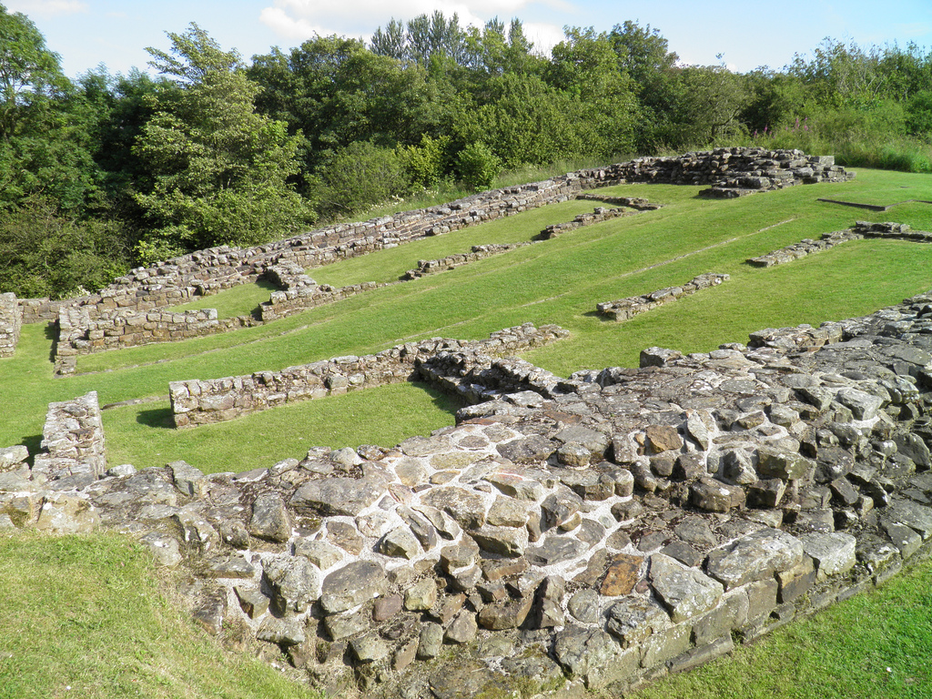
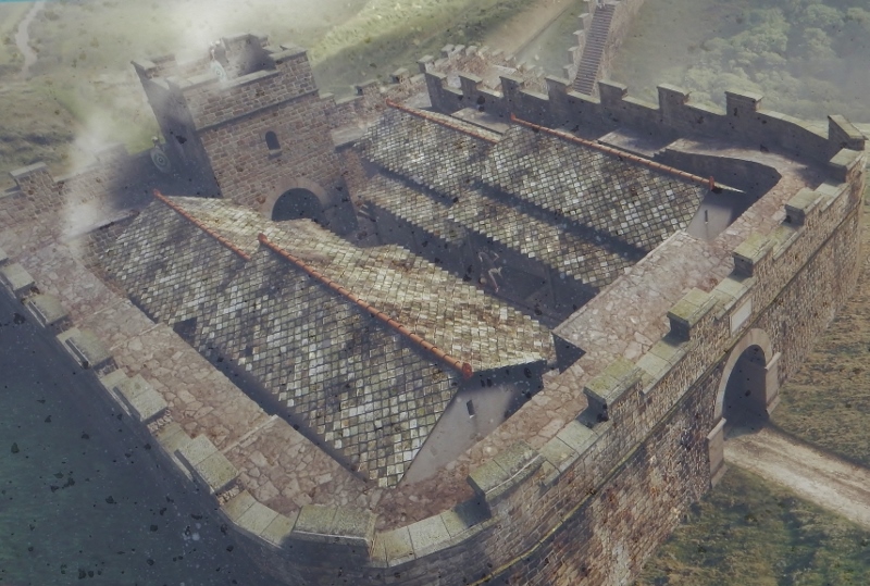
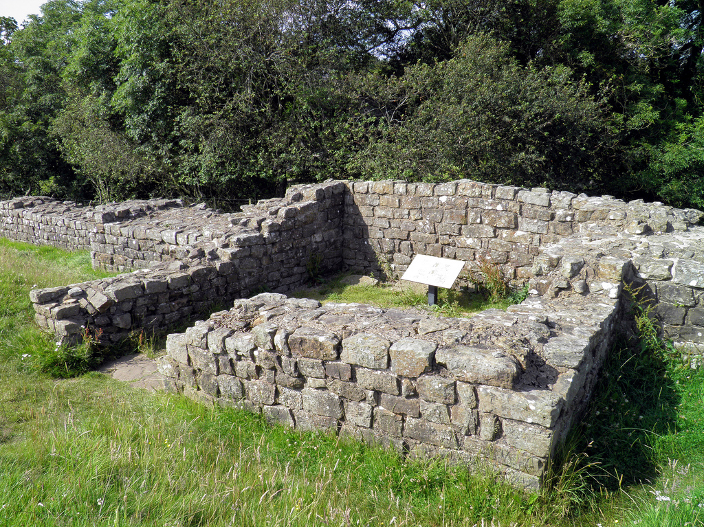
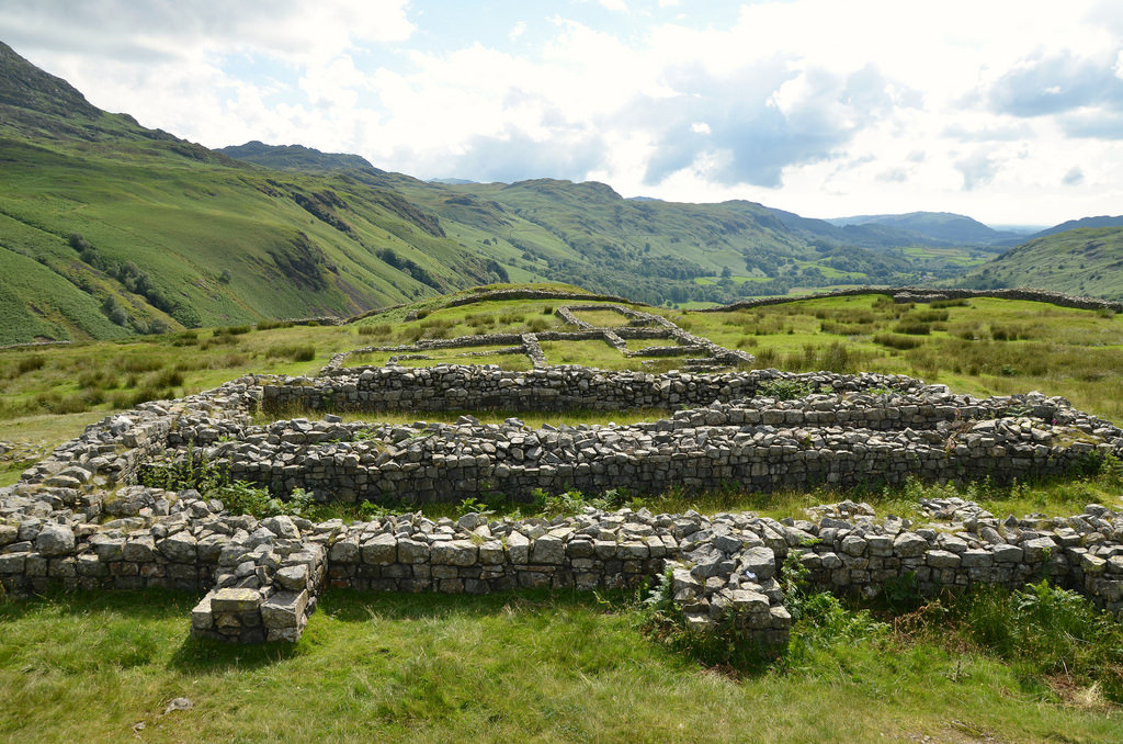
Hardknott Roman Fort is situated on the western side of the Hardknott Pass in the middle of the Lake District National Park in Cumbria. The fort was built during the reign of Hadrian high upon a rocky spur overlooking the River Esk at an altitude of 245 m above sea-level. It guarded the Roman road between Ambleside and Ravenglass from invasion by the Picts and the Brigantes. The remains include the fort’s defences and gateways, the headquarters building (principia), commandant’s house (praetorium), two granaries (horrea), and a bathhouse outside the fort’s southern defences. The fort is on land owned by the National Trust, part of the Trust’s Wasdale, Eskdale and Duddon property, and maintained by English Heritage.

Coordinates: 54° 24′ 10″ N, 3° 12′ 19″ W

Hardknott Fort was one of the most remote and dramatically sited Roman forts in Britain. Its construction was contemporaneous with the early phase of Hadrian’s Wall, and coin finds indicate that the fort was initially occupied only briefly from AD 120 to AD 138. It was subsequently evacuated under Antoninus Pius (AD 138-61) when the Antonine Wall was established before being re-occupied under Marcus Aurelius when the frontier returned south twenty years later. It was finally abandoned early in the 3rd century.

A fragmentary inscription (RIB 793a), discovered in 1994 near the south gate, records that fort was erected “for the emperor Caesar Trajanus Hadrianus Augustus” by the Fourth Cohort of Dalmatae (Cohors Quartae Delmatarum).

The Fourth Cohort was an auxiliary infantry regiment of 500 men recruited from the Dalmatian tribes who inhabited the areas bordering the eastern Adriatic coast in the modern countries of Croatia and Bosnia-Herzegovina.

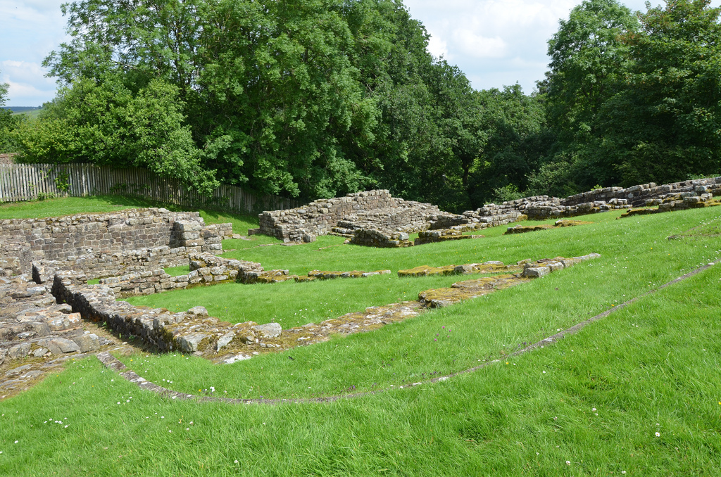
The stone-built fort is square and covers 1.2 hectares. It is flanked by two ditches on the uphill side. It has four gates in the usual position and four rounded corners with internal guard towers. The fort is entered through its main (south) gate, which, like those in the eastern and western walls, had two carriageways; the north gate had just one. Internally, the principia occupies the centre of the facility which is flanked by the praetorium and two horrea. Timber framed barracks and workshops occupy the rest of the fort (no traces of these remain).

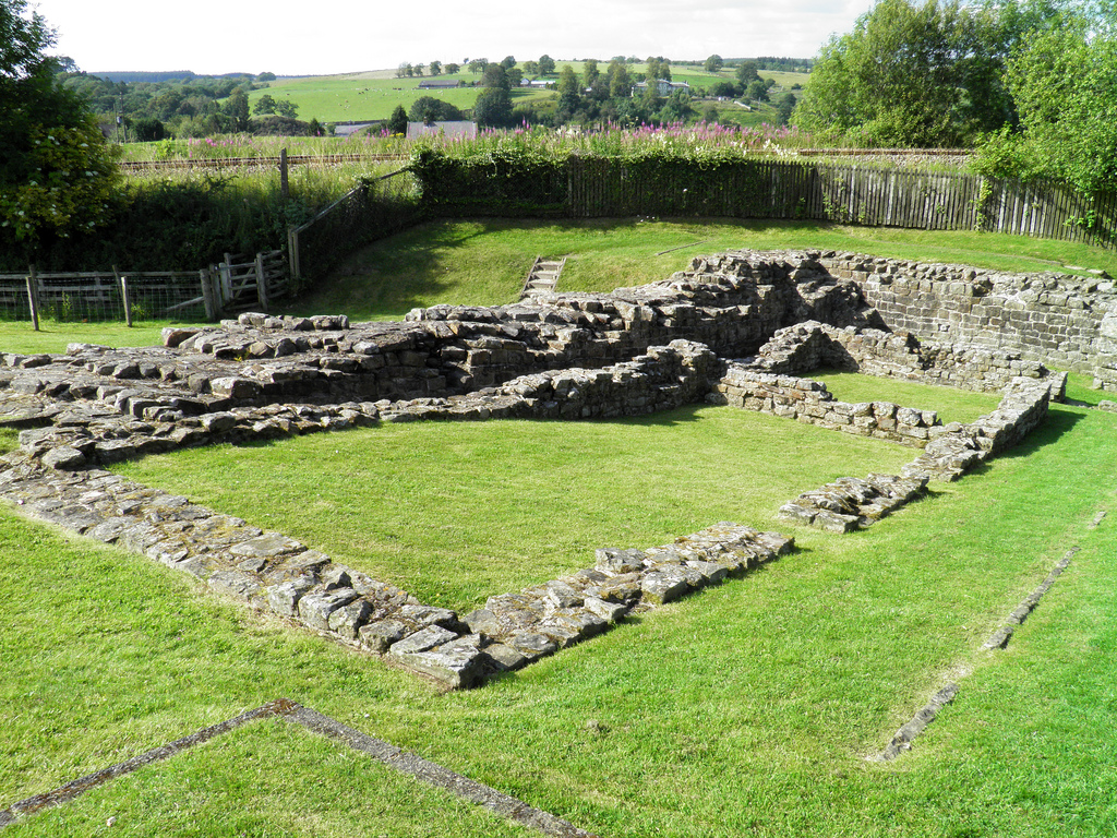
The bathhouse, lying east of the fort, consists of one circular building containing the furnace and another three rooms with hot, warm and cold baths.

An artificially levelled ground lying on a plateau about 200 metres to the east is believed to be a parade ground where the garrison exercised and practised drill manoeuvres. It has a large ramp of stones leading up to a command platform or tribunal.

In 2015, physics researcher Amelia Carolina Sparavigna found that the gates that led in and out of Hardknott Fort were aligned with the summer and winter solstices (read more here). Sparavigna also suggests that the construction of the fort was designed for the soldiers to engage in sun worshiping and to pay homage to solar deities Mithras or Sol Invictus.

PORTFOLIO

The Hardknott Roman Fort is located in the picturesque Hardknott Pass.
The Headquarters Building located in the centre of the fort.
The Headquarters Building comprised a courtyard flanked by narrow rooms, possibly used as armouries.
The Commanding Officer’s House was large and single storied, probably with rooms arranged around a central open courtyard.
One of the Angle Tower. A square tower was constructed in each of the corners of the fort.
The Granaries. These long buildings had thick outer walls which were heavily buttressed, presumably to support the weight of their superstructure and roof.
The North-West Gate.
The South-East Gate.
The remains of a tribunal, a platform from which the Commanding Officer would have given orders for the day and officiated over ceremonial and official occasions.
The west side of the Fort.
The South-West Gate.
The east side of the Fort.
The North-East Gate.
The South-West Gate.
Off the track from the road to the fort lie the remains of a stone bath house, which provided facilities for the soldiers’ relaxation.
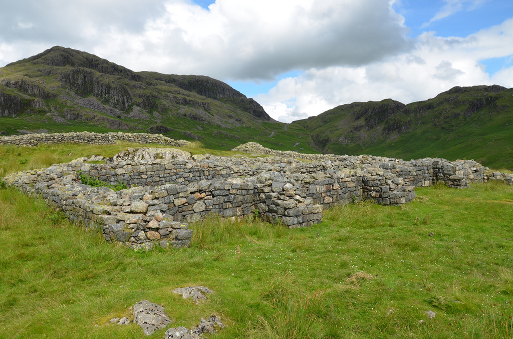
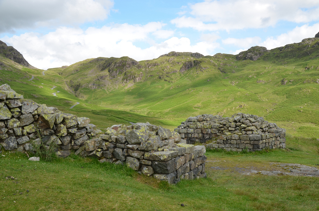
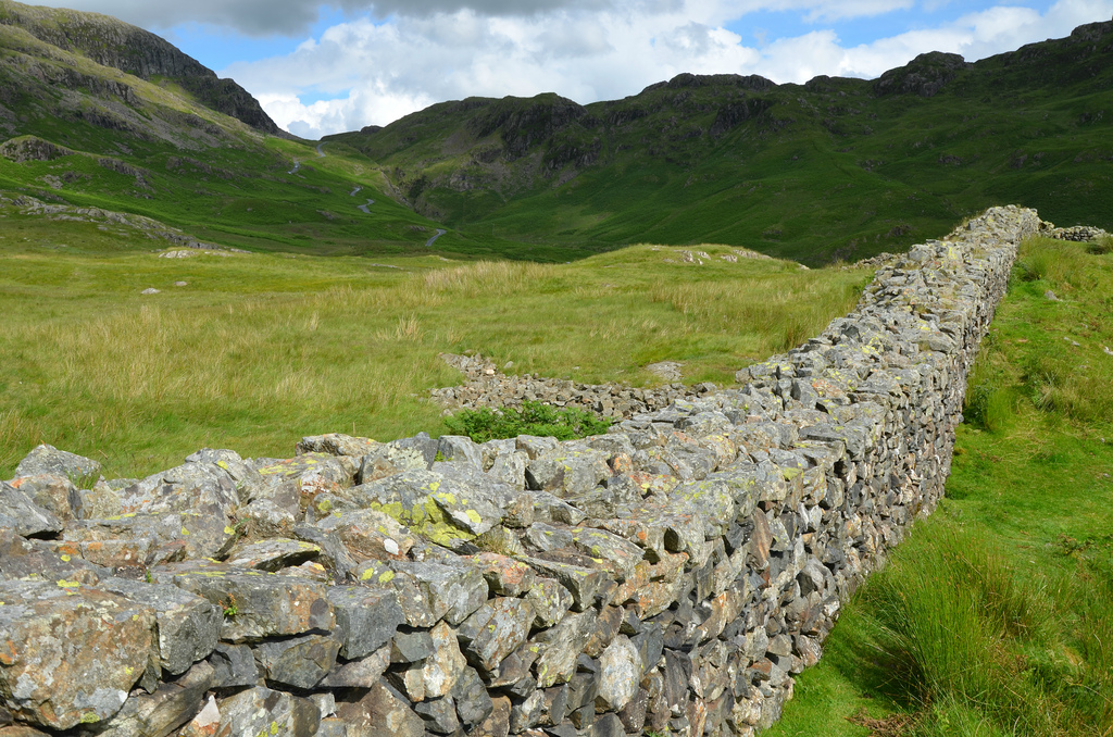
Photo by James Stringer (Flickr-CC BY-NC 2.0)

Links:

Milecastle 48 (Poltross Burn)

Milecastle 48 (Poltross Burn) is one of the best-preserved milecastles (a small, walled fortlet) along Hadrian’s Wall. It is located just outside the village of Gilsland in Cumbria, 3km east of Birdoswald Roman Fort (Banna). Milecastle 48 was built to a standard plan but is substantially larger than many other milecastles. It contains the remains of the north and south gates, two barrack blocks, enclosing walls and short sections of Wall on either side. Unusual features include an oven and a set of stairs giving access to the rampart walk. The two turrets associated with this milecastle (48a and 48b) have also survived as above-ground masonry. English Heritage currently manages the monument.

Coordinates: 54° 59′ 20.37″ N, 2° 34′ 24.67″ W

Built on a steep slope overlooking a tributary stream of the River Irthing, Milecastle 48 is one of the most significant and most informative of all milecastles. Internally, it measured 21.5m north to south by 18.7m across and had a broad wall (2.90m thick) built of large masonry, indicating that the milecastle was built before the decision to narrow the Wall. The wing walls (short lengths of curtain wall) extended 4m either side of the milecastle and connected with the Narrow Wall curtain of Hadrian’s Wall.

Inside were a pair of small barrack blocks flanking the central space of the milecastle. Each barrack had four rooms, large enough to accommodate a garrison of around 64 auxiliary troops, the largest number possible in a single milecastle. As the whole structure was built on a slope, the internal buildings had to be terraced and stepped. The north-west corner of the milecastle contained a cooking area, with a round oven. In the north east corner, the lower courses of a flight of steps were found, suggesting that the parapet walk stood 3.66 metres above ground.

Theoretical structural model plan of Milecastle 48.

This milecastle was of Type III, generally thought to have been built by the Sixth Legion (Legio VI Victrix). It was occupied from the AD 120s into the 4th century, and several alterations were made inside the building. Both gates were narrowed, and the barracks were redesigned to make three larger rooms. Milecastle 48 was first excavated in 1886, and subsequently between 1909 and 1911. Further excavations were undertaken between 1965 and 1966.

An reconstruction drawing of the Poltross Burn Milecastle at around AD 170.

Each milecastle on Hadrian’s Wall had two associated turret structures. The turrets associated with Milecastle 48 are known as Turret 48a and Turret 48b. The site of Turret 48a is situated on a river terrace on the south bank of the River Irthing. Turret 48a is one of the best-preserved turrets on the Wall. It measures 4.15 metres across, and the north wall stands 1.85 metres high. Turret 48b is situated 150m west of Turret 48a. It too survives as an upstanding stone feature but has lost its south wall. Built into the wall is a building stone inscribed with the name of the centurion Gellius Philippus (RIB 3407). Three other inscriptions (now in Tullie House Museum) were found close to Turret 48a (RIB 1859, 1860, 1861). Both turrets were completed with wing walls on either side before the Wall was narrowed.

Poltross Burn Milecastle and its turrets are just two miles away from Birdoswald Roman Fort, where visitors can explore the longest continuous stretch of Hadrian’s Wall. It is part of the Birdoswald Roman Trail, which starts at Lanercost Priory and finishes at Willowford Roman Wall and Bridge Abutment.

PORTFOLIO

Poltross Burn Milecastle.
The north side of Milecastle 48.
One of the barrack blocks on the west side of the milecastle.
The north side of Milecastle 48 with the remains of a flight of stairs on the right.
The foundations of Milecastle 48, looking north east.
Turret 48a. Both this and turret 48b before the Wall was narrowed ca. AD 125.
Turret 48a. Several hearths and evidence of bronze and iron working were found in the interior.
Turret 48b (Willowford West). The line of ditch and rampart can be seen in front of the wall.
From geograph.org.uk by John M (CC BY-SA 2.0).
Building inscription (RIB 3407) found east of Turret 48b, now built into a farm outbuilding at Willowford Farm.
c(o)ho(rtis) V / c(enturia) G(elli) P(h)ilippi
Fifth Cohort, the century of Gellius Philippus (built this)
Part of Hadrian’s Wall at Willowford, showing the lower courses of the Broad Wall (AD c.122) , with its narrower successor sitting on top (AD c.125).

Links: