Chesters Roman Fort (Cilurnum)

Chesters is one of a series of permanent forts built during the construction of Hadrian’s Wall. The cavalry fort, known to the Romans as Cilurnum, was built in about AD 124 above the west bank of the River North Tyne. It housed some 500 cavalrymen and was occupied for nearly 300 years until the Romans left Britain in the 5th century. Cilurnum is considered to be the best preserved Roman cavalry fort along Hadrian’s Wall. Pioneering excavations in the 19th century exposed the structures visible today. These excavations yielded one of the best collections of inscriptions and sculpture on Hadrian’s Wall.

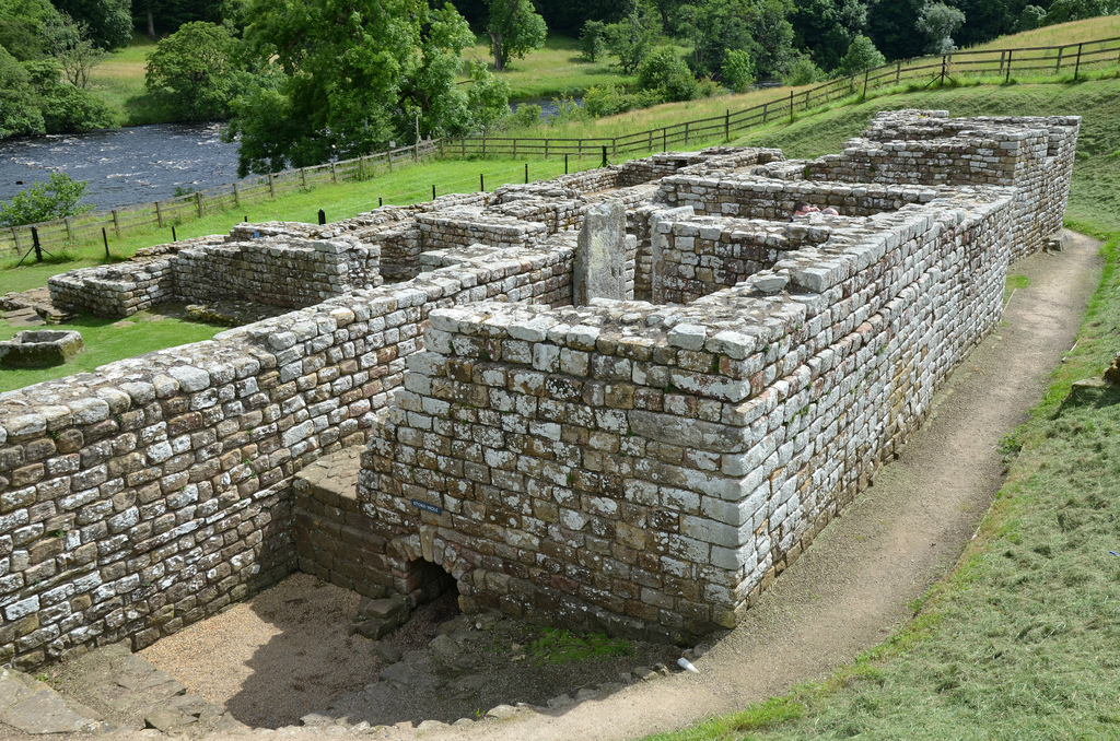
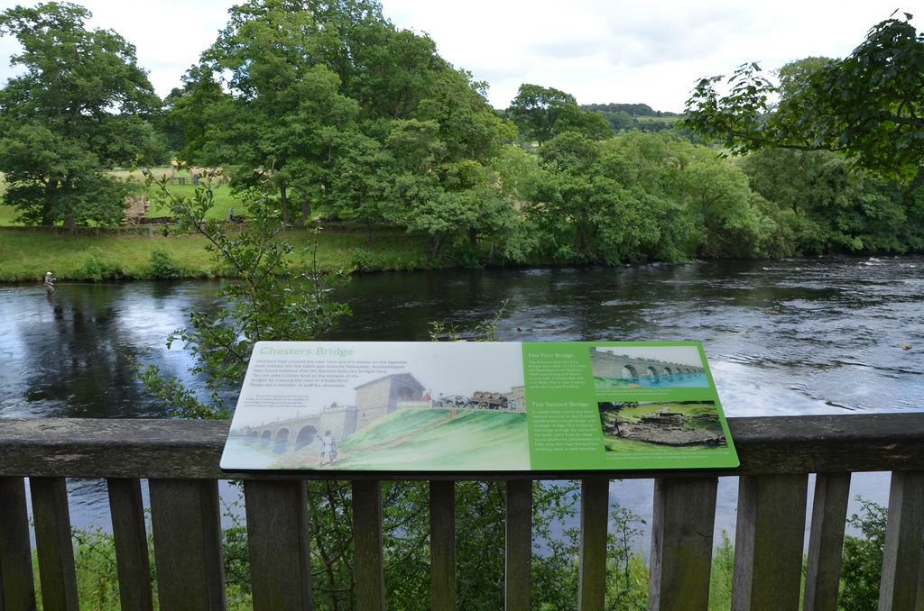
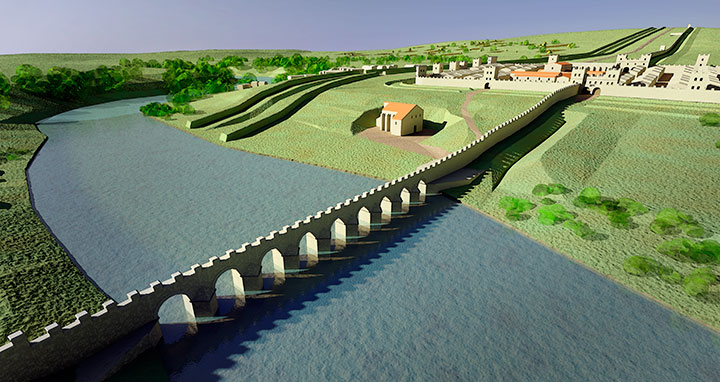
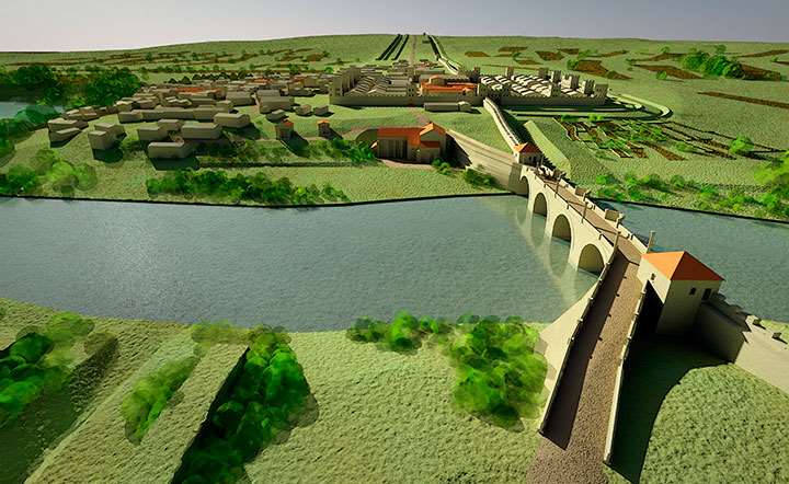
At Chesters, the ditch that fronted the Wall was filled in and a recently built Wall turret demolished to make way for the fort. It marked the point where the Wall crossed the River North Tyne, the first major obstacle on its route from east to west. A large road bridge with stone piers whose abutments survive spanned the river there.

A reconstruction of the fort and civilian settlement at Chesters as they may have appeared in about AD 200.
© Historic England (illustration by Mikko Kriek)
DISCIPVLINAE IMP HAD AVG ALA AVG OB VIRT APPEL

The first attested Cavalry unit at Chesters was the 500-strong ala Augusta ob virtutem appellata – ‘the cavalry regiment styled Augusta for its valour’. It is mentioned on an altar dedicated to Disciplina and dated to Hadrian’s reign (RIB 1496c). By around AD 180 until the end of the Roman period, Chesters Fort was garrisoned by a cavalry regiment originally raised in northern Spain, the ala II Asturum (‘the Second Asturians’).

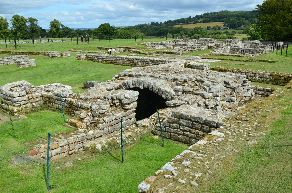
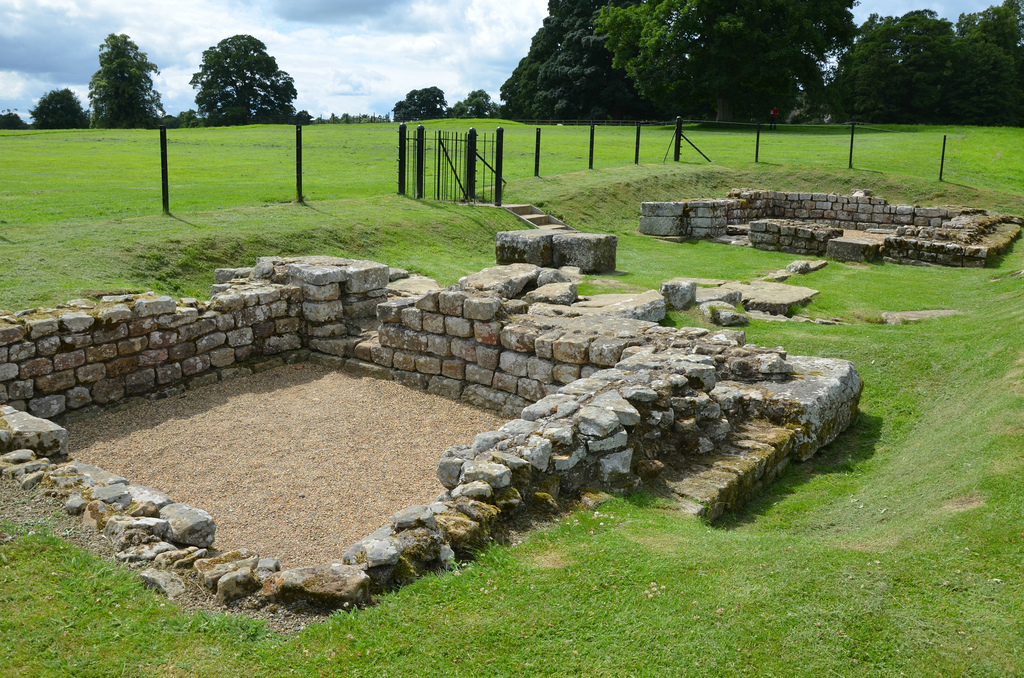
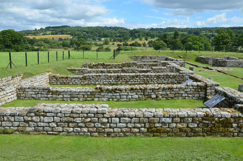
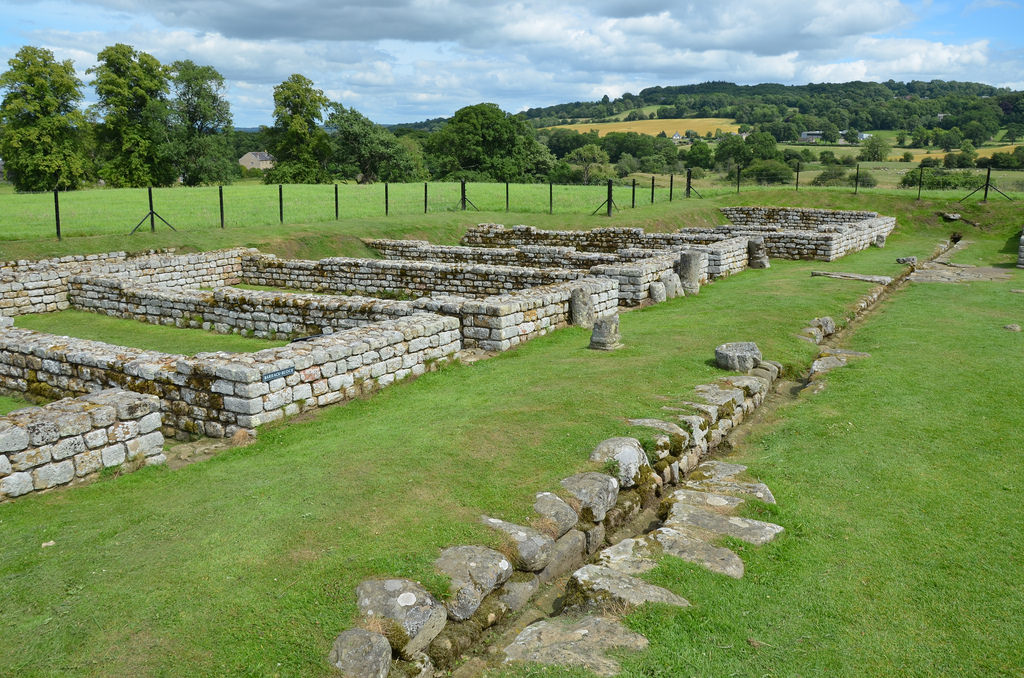
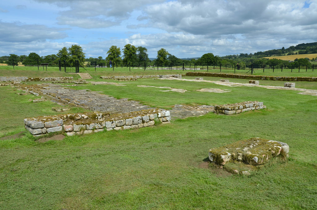
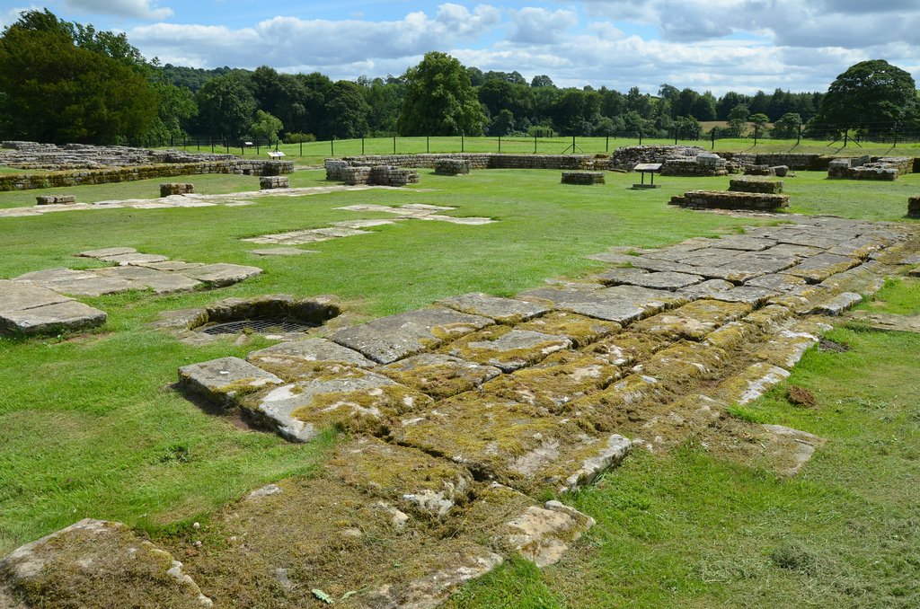
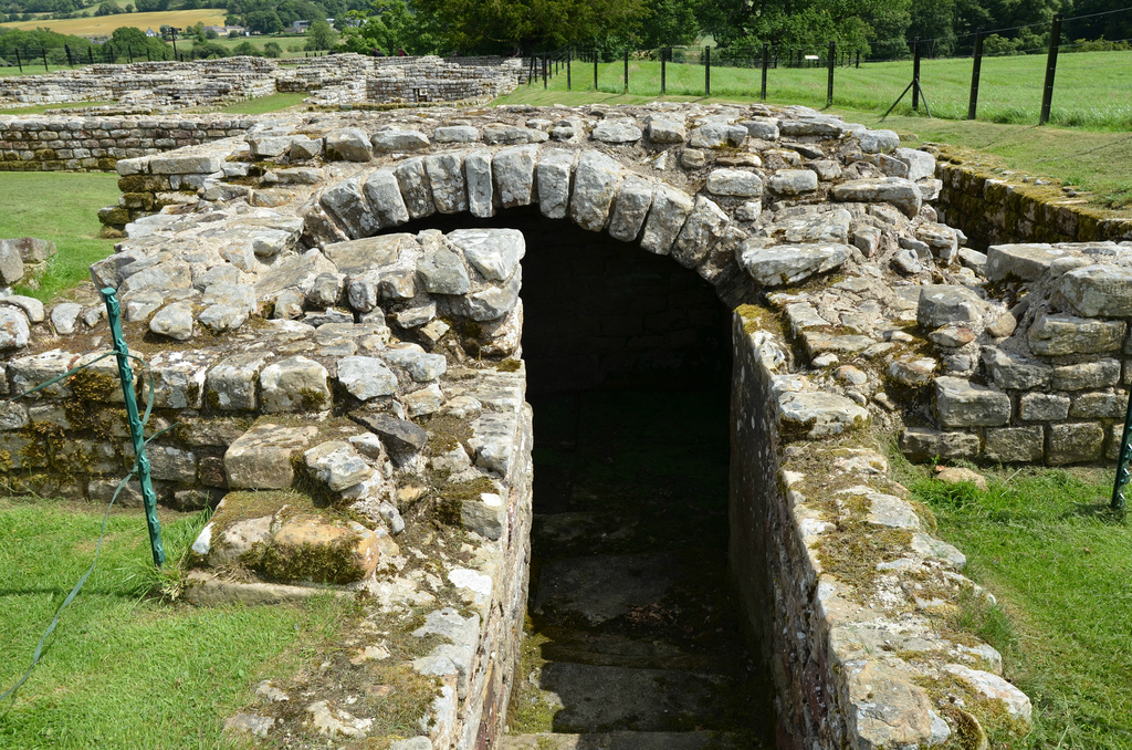
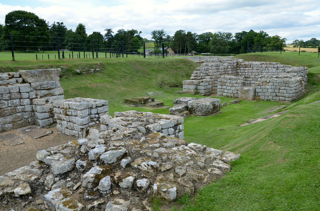
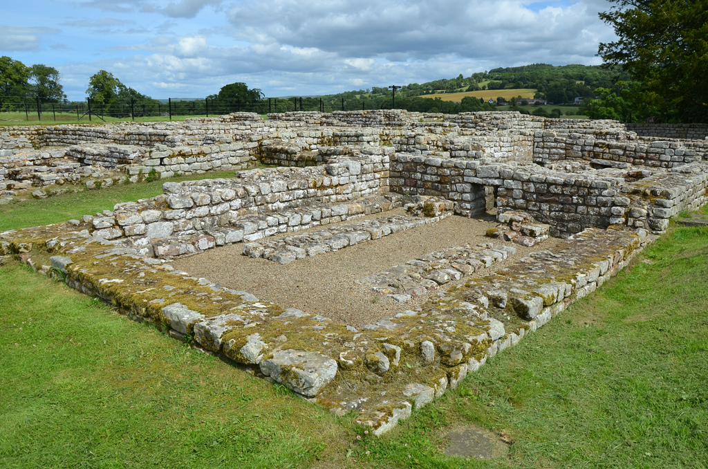
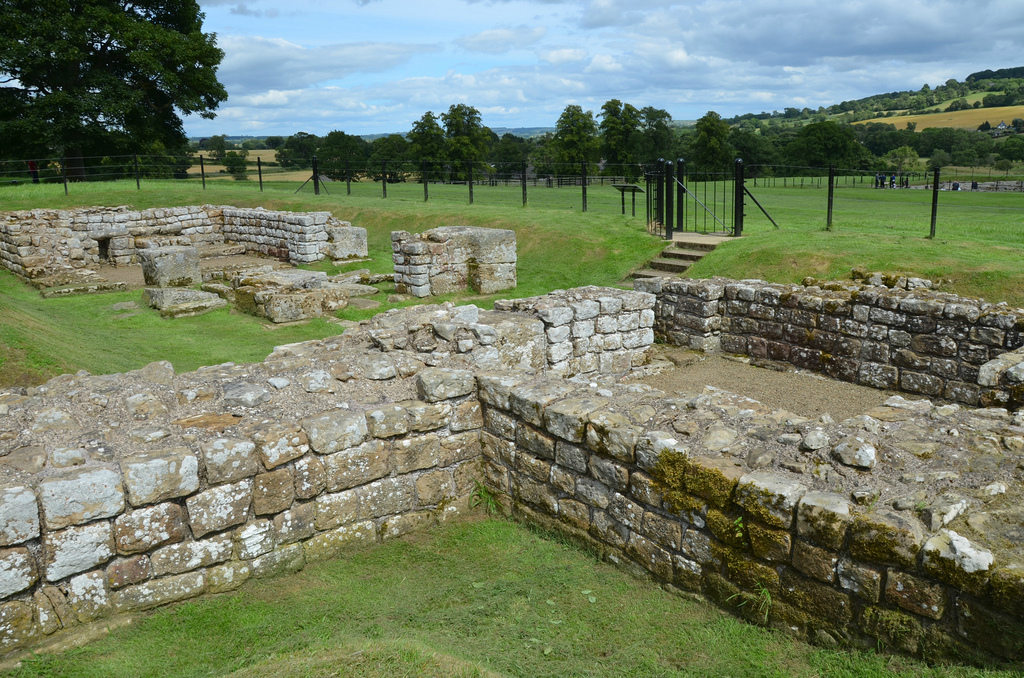
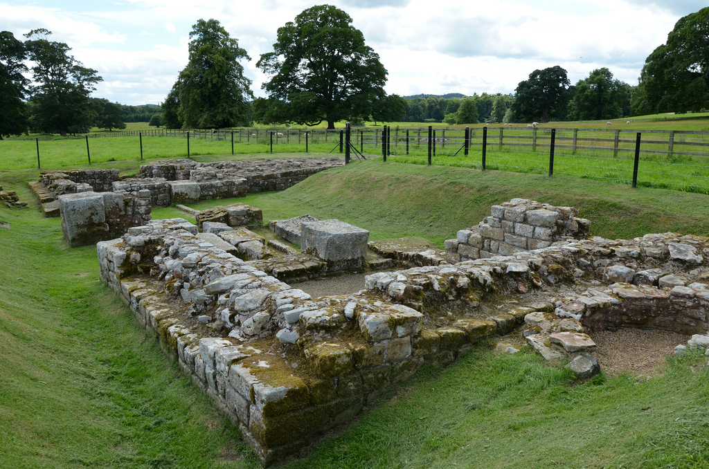
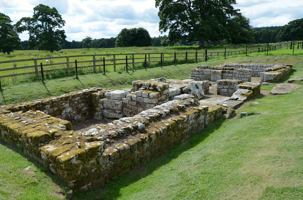
The fort was of the usual rectangular shape, covering 2.3 hectares, with large, double gateway in each side. The walls were of stone, some 1.5m wide, backed by an earthen rampart and fronted by a single ditch on all sides. The defences were completed with four stone corner towers and eight interval towers, two on each face. In addition to the four monumental gateways, two smaller, single gates at either end of the via quintana gave access to the fort on the south side on the Wall.

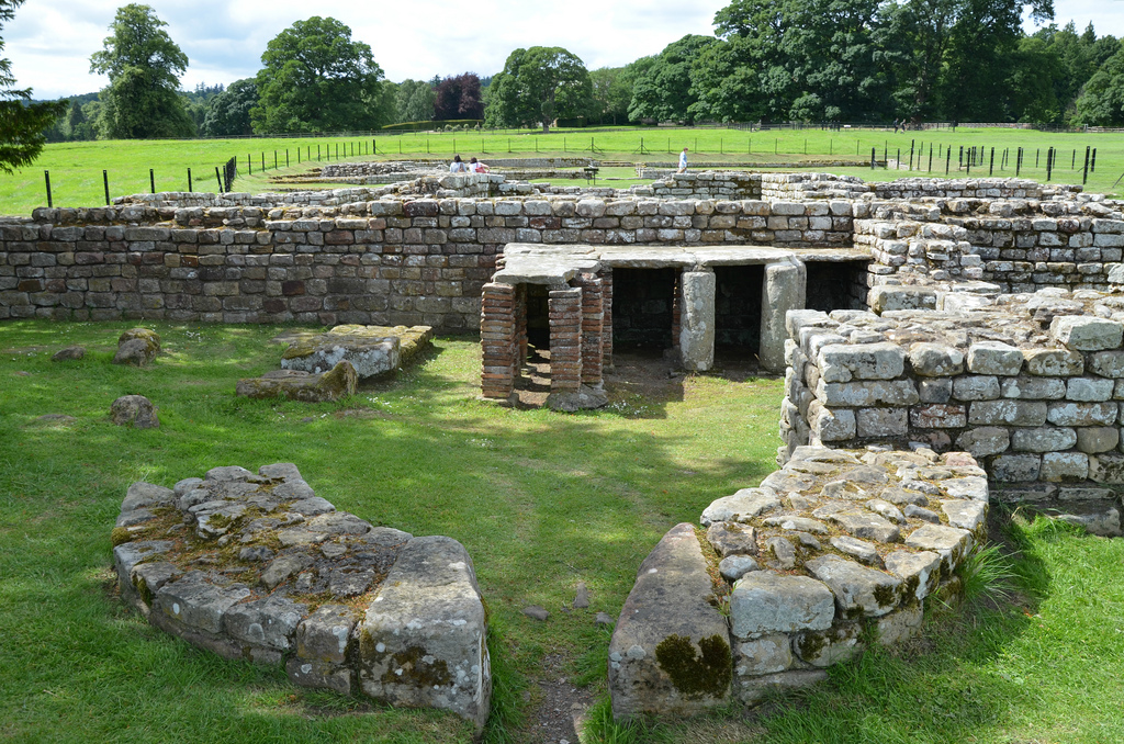
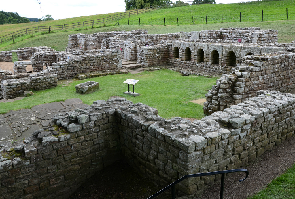
Remains survive from various periods in the 300-year life of the fort but most of its interior is unexcavated and is still buried. The visible selection of buildings result from the excavation campaigns of Nathaniel Clayton, the wealthy land-owner of Chesters House and Estate, between 1843 and 1893. They include all six gateways, the two interval-towers in the southern defences, a small section of the fort wall to the immediate south of the northern interval tower, the headquarters building (principia), the commanding officer’s house (praetorium) with its own central heating system, as well as two barrack blocks that could each accommodate a turma or cavalry troop of about 30 men. The most impressive building remains are those of the headquarters building (principia) in the middle of the fort.

The site museum houses finds from the fort and elsewhere along the wall, including Roman sculptures, inscriptions and altars, many of them collected in the 19th century by John Clayton (see images here). Following his death in 1890, his nephew Nathaniel commissioned the building of a permanent museum (completed in 1896) in order to house the Clayton Collection.

PORTFOLIO

The North Gate, used to gain access to the area north of Hadrian’s Wall. It was one of four identical main gates with a square tower to each side of a double passageway.
The Barracks blocks, located in the north-east part of the fort. They probably date from the later 2nd or early 3rd century AD. The barracks were over 50m long, providing sufficient space for ten men, each shared by three men and their horses.
A view looking east up the street that divided two of the barrack blocks. Each block consisted of a row of rooms divided into front and back parts. Three men slept and ate in the rear part while their tree horses were tethered in the front part.
The remains of the central headquarters building (principia) built between AD 122 and 138.
The headquarter building occupied the central place in the fort. It was built around a paved courtyard, surrounded by colonnades.
A well was located in the north-west corner of the headquarters. It was probably used for religious ceremonies.
A phallus carved on a flagstone near the ceremonial well in the headquarters.
The East Gate. It is the finest gate at Chesters and one of the best preserved on the whole of Hadrian’s Wall. The two carriageway openings and flanking towers are clearly visible.
The Commanding Officer’s House (praetorium) dating to AD 150-400. This was a peristyle house (with a colonnaded courtyard at its centre) modelled on the sort of urban mansion and used by the commanding officer and his family.
The Praetorium Baths. This complex is traditionally described as the private baths of the commanding officer, but it is of considerable size and seems more likely to have been for the soldiers.
The West Gate. This gateway allowed the garrison to leave the fort to patrol north of the frontier.
The West Gate, guarded by two towers. The remains of a bread oven are visible set into the fort wall.
The South Gate. It was the main entry into the fort from the vicus which lay to the south of the fort.
The Baths, located outside the fort close to the river. They are considered the best-preserved Roman military building in Britain.
The external baths were uncovered in 1884–5 and are of Hadrianic date with many later additions and alterations.
The remains of an internal tower along the southern fort wall.
The remains of the south-east angle tower.
The viewing platform overlooking the site of the west end of the Roman bridge over the North Tyne.
Reconstruction of the bridge at Chesters in the time of Hadrian, when it was designed to carry the Wall alone on nine narrow arches.
© Historic England (illustration by Richard Lea)
The eastern bridge abutment and tower of Chesters Bridge, looking east. The bridge was an imposing structure with an overall length of 58 metres and with four arches each 10.8 metres wide.
The second bridge, built in the AD 160s, was wide enough to carry the Military Way across the Tyne on four arches and had guard towers on each bank.
© Historic England (illustration by Richard Lea)
The remains of the two successive Roman bridges at Chesters encapsulate some of the main developments in the history of Hadrian’s Wall.
The face of the north wing of the east abutment showing the carving of a phallus and characteristic curved tooling lines on the face of the blocks.

Links:

Leave a comment

This site uses Akismet to reduce spam. Learn how your comment data is processed.