The Fraktin Hittite rock relief is an ancient carved sculpture located near Kayseri in Central Anatolia, Turkey. It dates back to the Hittite Empire, around the 13th century BC. The relief depicts a Hittite king in a ceremonial scene, showcasing the artistry and cultural significance of the Hittite civilisation. The Fraktin Hittite rock relief is part of the region’s rich archaeological landscape, including various Hittite sites.
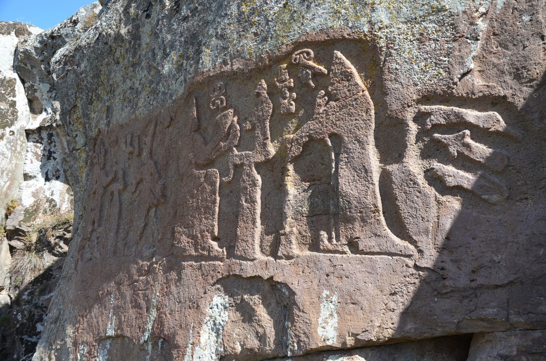
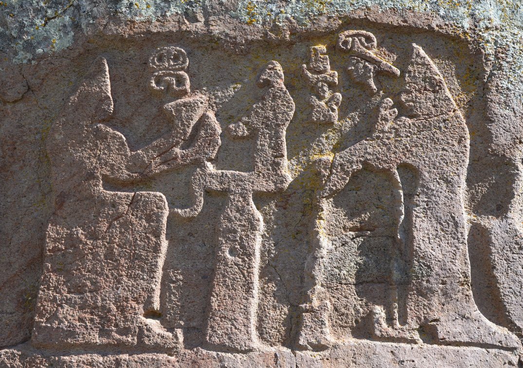
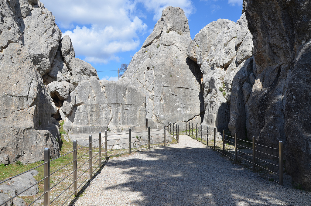
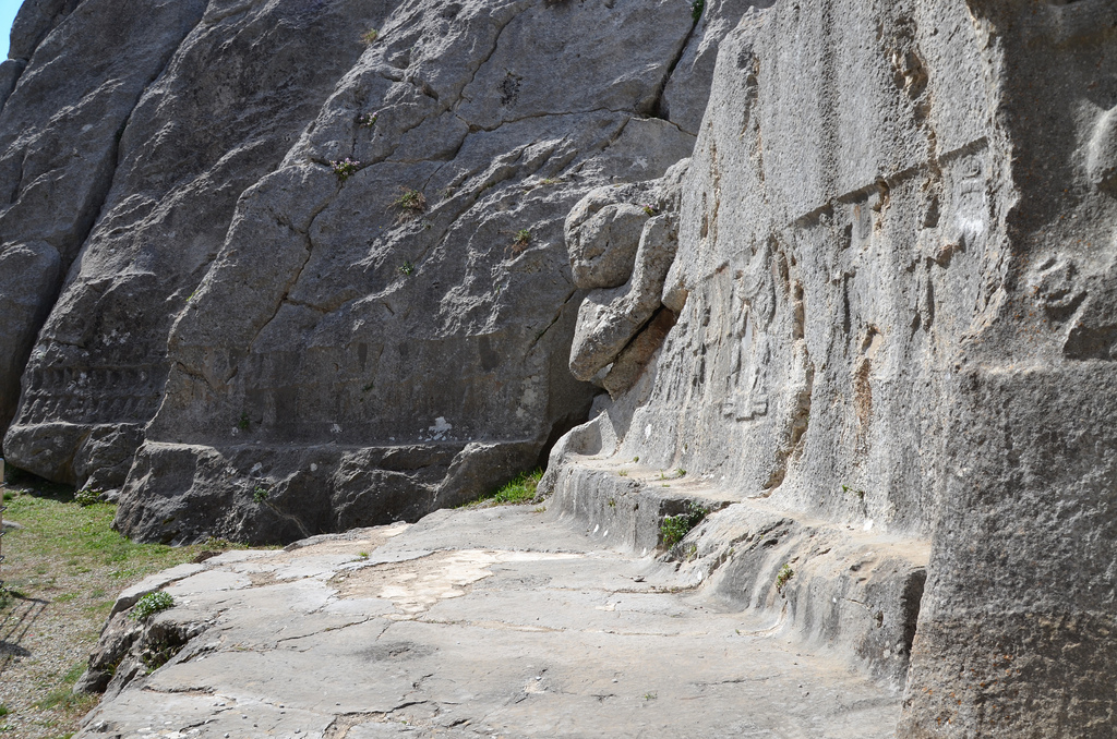
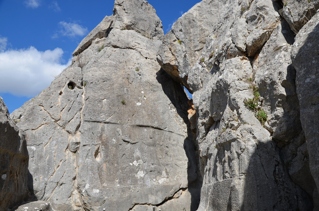
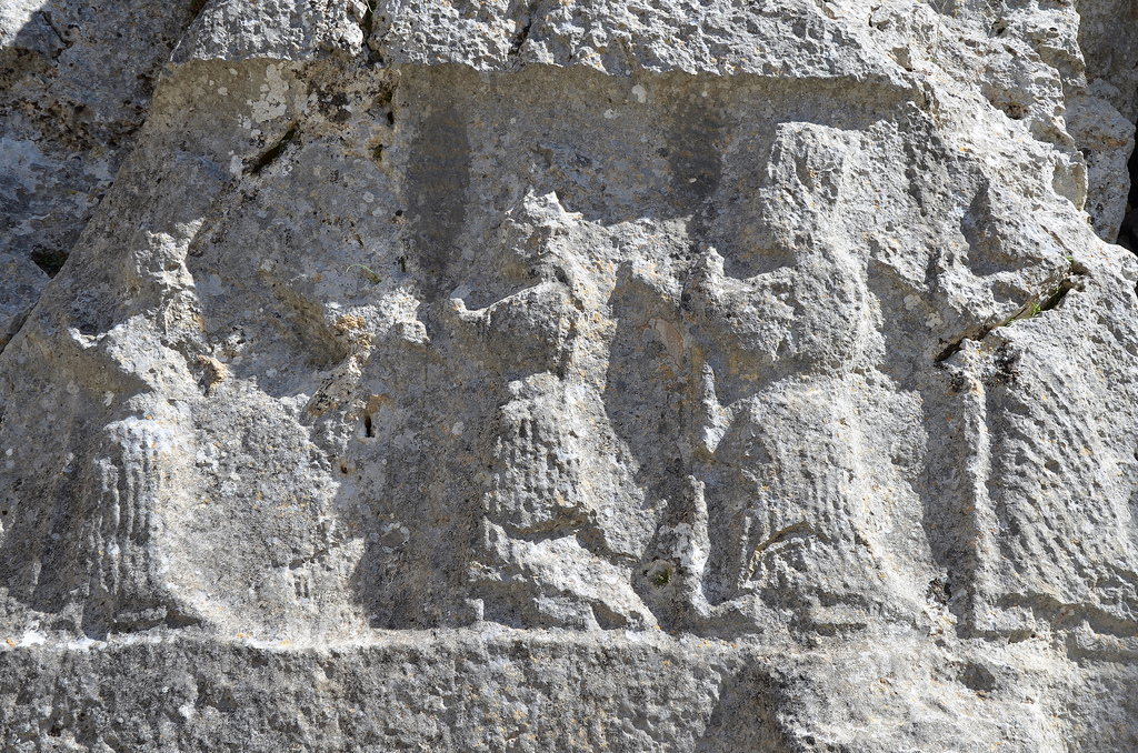
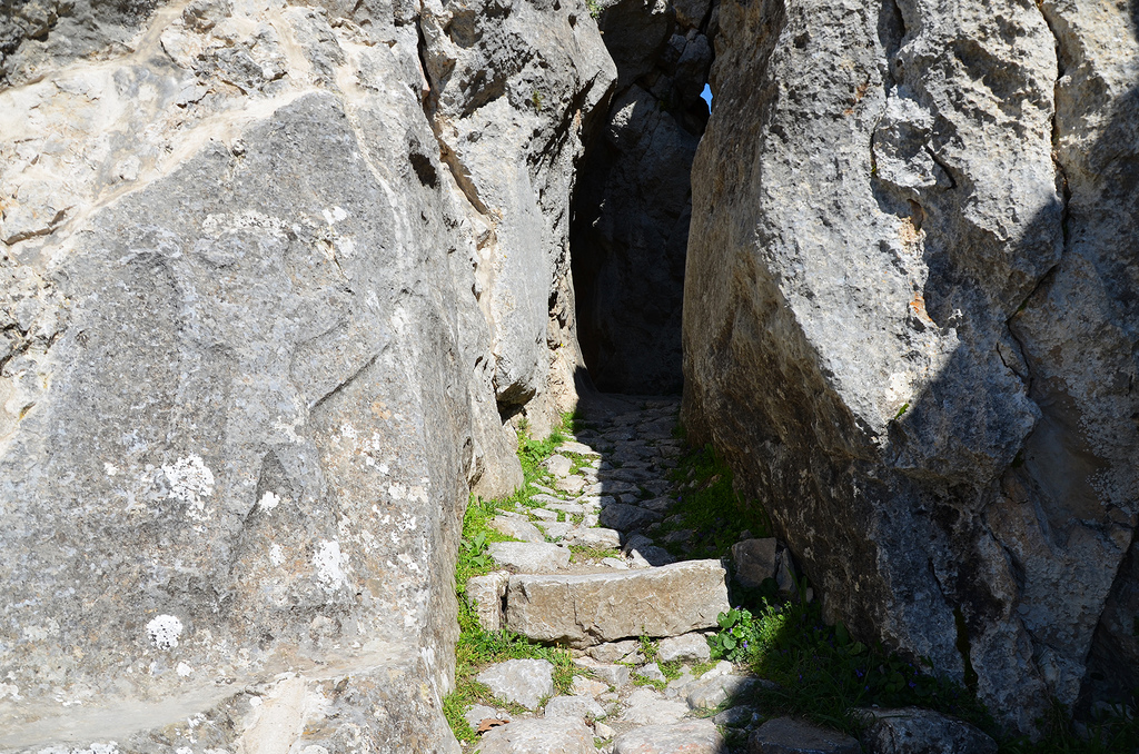
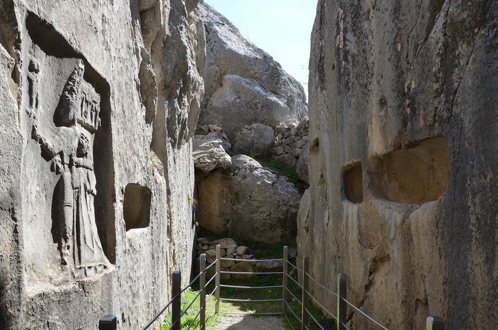
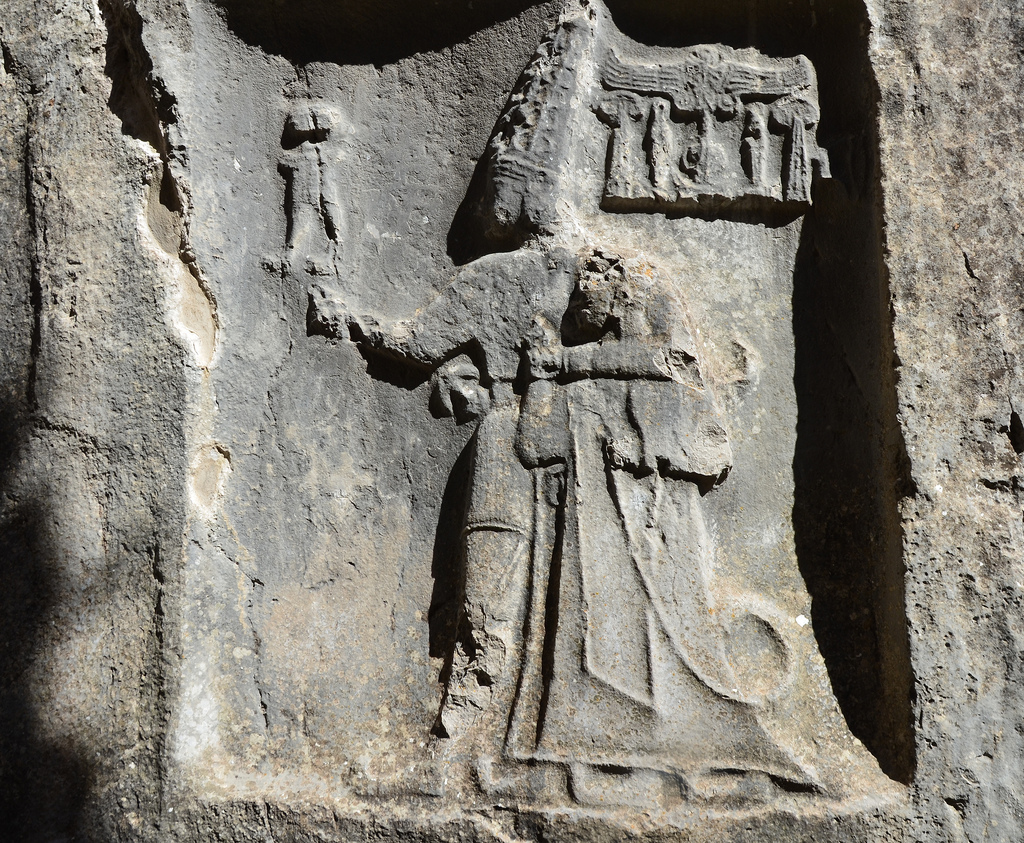
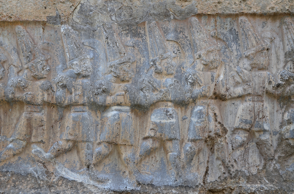
The Fraktin Hittite rock relief is in a steep valley between Mount Erciyes and the Anti-Taurus Mountains. It depicts a king and queen offering wine to a god and a goddess blessing them. There are two scenes, and the figures are identified by labels in Luwian hieroglyphs. The scene on the left shows Hittite King Hattusili III (1275-1250 BC) pouring libation to Teshub, the Thunder God. Between them, there is an altar-like structure. The god and king wear short tunics, pointed shoes and conical hats, symbolising divinity. This means that King Hattusili III was deified, and the image was probably made after Hattusili’s death in the reign of his son and successor, Tudhaliya IV.
The scene on the right is unfinished. It shows King Hattusili III’s wife, Tawannanna Puduhepa, making a libation to the Sun goddess Hebat. There is an altar between these two figures, with a bird or a bird-shaped vessel on top of it. The queen is depicted standing, clothed from head to foot, in her priestess’ robe. A concrete copy of the relief can be viewed at the Kayseri Museum.
PORTFOLIO
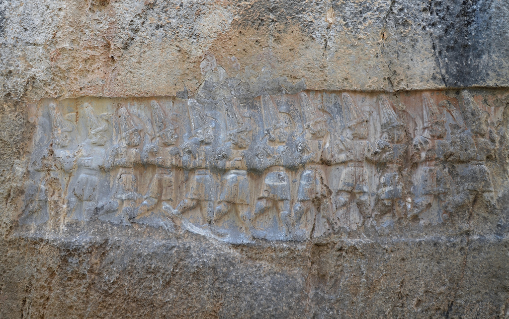
Overview of the Fraktin Hittite rock relief.Left scene showing Hittite King Hattusili III pouring libation to the Teshub the Thunder God.Right scene showing King Hattusili III’s wife, Tawannanna Puduhepa, making a libation to the Sun goddess Hebat.Luwian hieroglyphs.
Concrete copy of the Fraktin Hittite relief in the Kayseri Archaeology Museum’s garden.
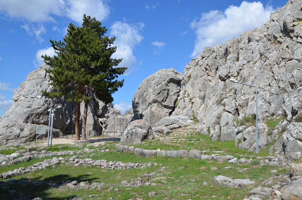
Yazılıkaya (“Inscribed Rock”) is a Hittite rock sanctuary located about 1.5 kilometres northeast of Hattusa, the capital city of the Hittite Empire. It is the largest known Hittite rock monument. The sanctuary consisted of a temple-like building and two open-air chambers cut into the bedrock.
The Yazılıkaya sanctuary served as a place for the celebration of the arrival of the New Year each spring. These ceremonies took place in the open air in front of the Hittite Pantheon. The sanctuary was made of two rock chambers, later labelled Chamber A and Chamber B, by archaeologists. The walls of each chamber were covered with the richest and most striking samples of Hittite relief art. They featured gods and goddesses and the figures of the Great King Tudhaliya IV (ca. 1237 – 1209 BC). There are a total of 83 images, 66 in Chamber A and 17 in Chamber B.
Human activity on the site probably began in the 16th century BC, although what we see today is probably the result of modifications made in the late 13th century BC, not long before the Hittite Empire began its steep and mysterious decline.
The entrance to Yazılıkaya sanctuary.
Chamber A, the largest of two chambers, is 30 metres long and about 20 metres wide. Its walls are almost entirely decorated with reliefs running horizontally. The deities are aligned in two rows, perhaps in procession, with male figures on the left wall (with two female attendants) and female figures on the right wall. The name of each deity is given in Luwian hieroglyphs above their raised hands, but due to natural deterioration, some parts of these names have disappeared. These two rows are directed towards the main scene in the middle, where the Storm God Teshup and the Sun Goddess Hepat meet.
Engraving from a relief at Yazilikaya by French archaeologist Charles Texier (1882).
Engraving from reliefs at Yazilikaya by French archaeologist Charles Texier (1882).
Engraving from a relief at Yazilikaya by French archaeologist Charles Texier (1882). Teshub stands on two deified mountains (depicted as men) alongside his wife Hepatu, standing on the back of a panther. Behind her, their son, daughter and grandchild are carried by a smaller panther and a double-headed eagle.
Chamber B is accessible via a narrow passage with winged demons on both sides. Chamber B was believed to have been built as a memorial chapel for Tudhaliya IV, dedicated by his son Suppiluliuma II at the end of the 13th century BC. Buried until the mid-19th century, the reliefs on the walls are much better preserved than those in Chamber A. A line of gods of the Underworld is pictured on the wall immediately to the right of the entrance. On the opposite wall is a representation of Nergal, the God of the Sword and the Underworld. To the left of this relief, a cartouche with the name of Tudhaliya IV is visible, and this same king is shown embracing the Thunder God Teshub on the right side.
PORTFOLIO
Chamber A
Overview of Chamber A.Chamber A, rock relief depicting a procession of male deities.In Chamber A, two bullmen stand between male gods on the hieroglyphic symbol of the earth and supporting the sky.The left wall of Chamber A depicts male gods.Chamber A, main scene in the middle of the chamber where Teshup and Hepat meet and female goddesses in procession on the right wall.Chamber A, goddesses in procession.Chamber A, main scene depicting (left to right) the God Kumarbi (chief god of the Hurrians), the weather and storm god Teshuba, the earth goddess Hepat, Sharumma (son of Teshuba & Hepat) and Alanzu (daughter of Teshup Hepat).Chamber A, relief depicting the sanctuary’s founder, King Tudhaliya IV, standing on two mountains.
Chamber B
Entrance to Chamber B with the relief of a winged, lion-headed demon.Chamber B. The narrow gallery is thought to be a memorial chapel for Tudhaliya IV, dedicated by his son Suppiluliuma IIChamber B, the niches were probably used for offerings.The west wall of Chamber B depicts the twelve Gods of the Underworld.The east wall of Chamber B has a depiction of Negal, the Sword God, and the God of the Underworld.Chamber B, cartouche showing the name and title of King Tudhaliya IV.The East wall of Chamber B depicts in a niche the God Sharruma (son of the Thunder God Teshub) embracing King Tudhaliya IV. The god has his left arm over the king’s shoulders while holding the king’s right wrist. The god wears a short tunic and has pointed shoes. The king wears a long coat and carries a sword and a lituus.The west wall of Chamber B depicts the twelve Gods of the Underworld.