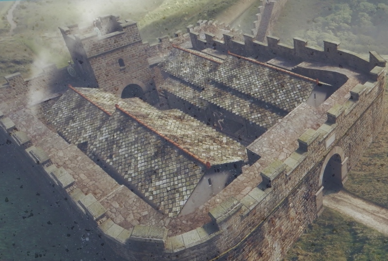
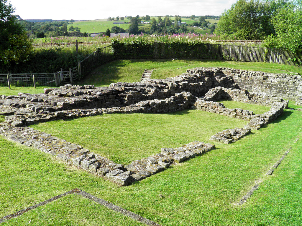
Milecastle 48 (Poltross Burn) is one of the best-preserved milecastles (a small, walled fortlet) along Hadrian’s Wall. It is located just outside the village of Gilsland in Cumbria, 3km east of Birdoswald Roman Fort (Banna). Milecastle 48 was built to a standard plan but is substantially larger than many other milecastles. It contains the remains of the north and south gates, two barrack blocks, enclosing walls and short sections of Wall on either side. Unusual features include an oven and a set of stairs giving access to the rampart walk. The two turrets associated with this milecastle (48a and 48b) have also survived as above-ground masonry. English Heritage currently manages the monument.
Coordinates: 54° 59′ 20.37″ N, 2° 34′ 24.67″ W
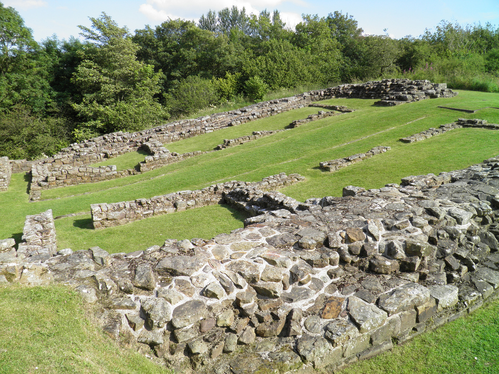
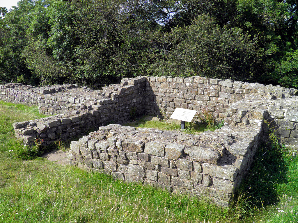
Built on a steep slope overlooking a tributary stream of the River Irthing, Milecastle 48 is one of the most significant and most informative of all milecastles. Internally, it measured 21.5m north to south by 18.7m across and had a broad wall (2.90m thick) built of large masonry, indicating that the milecastle was built before the decision to narrow the Wall. The wing walls (short lengths of curtain wall) extended 4m either side of the milecastle and connected with the Narrow Wall curtain of Hadrian’s Wall.
Inside were a pair of small barrack blocks flanking the central space of the milecastle. Each barrack had four rooms, large enough to accommodate a garrison of around 64 auxiliary troops, the largest number possible in a single milecastle. As the whole structure was built on a slope, the internal buildings had to be terraced and stepped. The north-west corner of the milecastle contained a cooking area, with a round oven. In the north east corner, the lower courses of a flight of steps were found, suggesting that the parapet walk stood 3.66 metres above ground.

This milecastle was of Type III, generally thought to have been built by the Sixth Legion (Legio VI Victrix). It was occupied from the AD 120s into the 4th century, and several alterations were made inside the building. Both gates were narrowed, and the barracks were redesigned to make three larger rooms. Milecastle 48 was first excavated in 1886, and subsequently between 1909 and 1911. Further excavations were undertaken between 1965 and 1966.
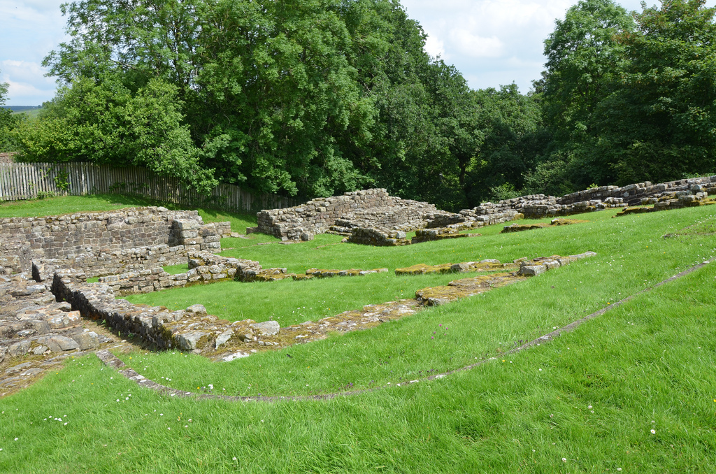
Each milecastle on Hadrian’s Wall had two associated turret structures. The turrets associated with Milecastle 48 are known as Turret 48a and Turret 48b. The site of Turret 48a is situated on a river terrace on the south bank of the River Irthing. Turret 48a is one of the best-preserved turrets on the Wall. It measures 4.15 metres across, and the north wall stands 1.85 metres high. Turret 48b is situated 150m west of Turret 48a. It too survives as an upstanding stone feature but has lost its south wall. Built into the wall is a building stone inscribed with the name of the centurion Gellius Philippus (RIB 3407). Three other inscriptions (now in Tullie House Museum) were found close to Turret 48a (RIB 1859, 1860, 1861). Both turrets were completed with wing walls on either side before the Wall was narrowed.
Poltross Burn Milecastle and its turrets are just two miles away from Birdoswald Roman Fort, where visitors can explore the longest continuous stretch of Hadrian’s Wall. It is part of the Birdoswald Roman Trail, which starts at Lanercost Priory and finishes at Willowford Roman Wall and Bridge Abutment.
PORTFOLIO


From geograph.org.uk by John M (CC BY-SA 2.0).

c(o)ho(rtis) V / c(enturia) G(elli) P(h)ilippi
Fifth Cohort, the century of Gellius Philippus (built this)

Links:
