Sala Colonia

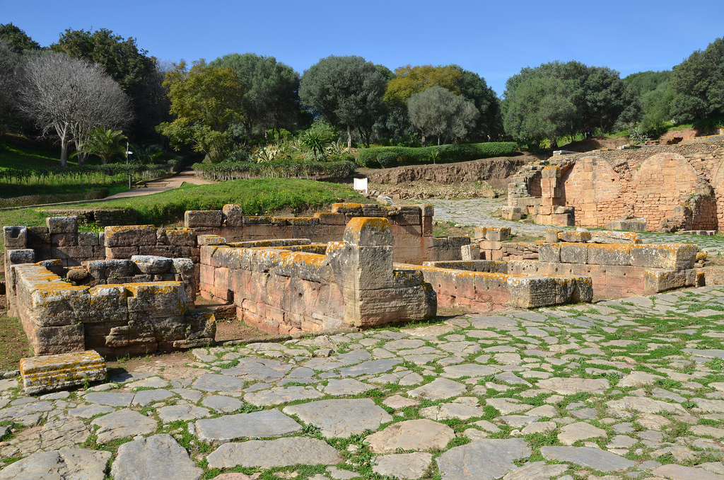
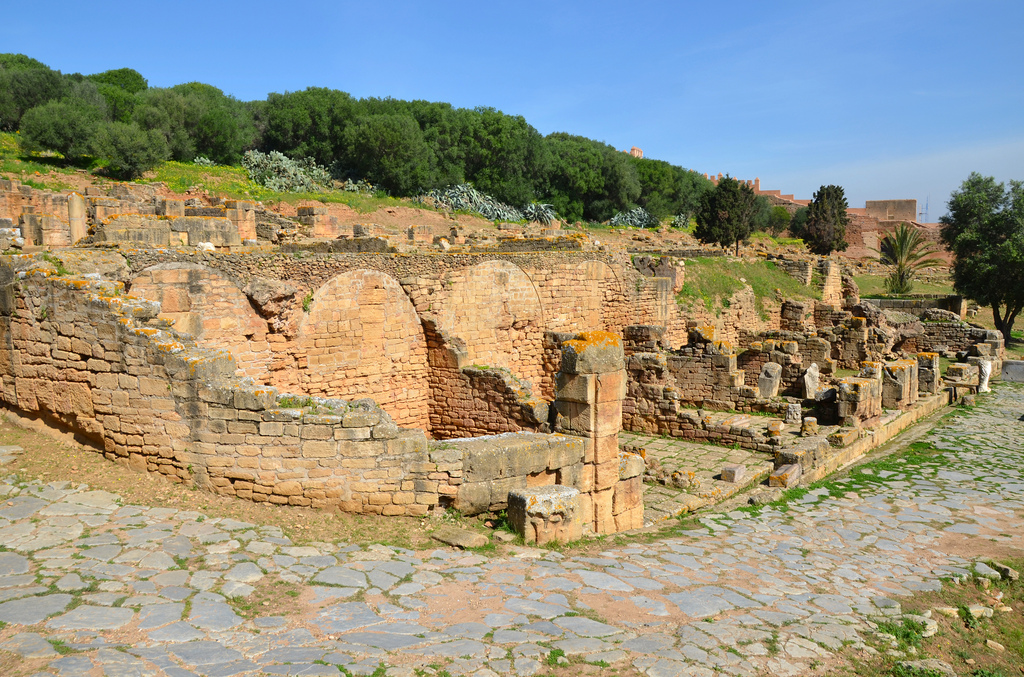
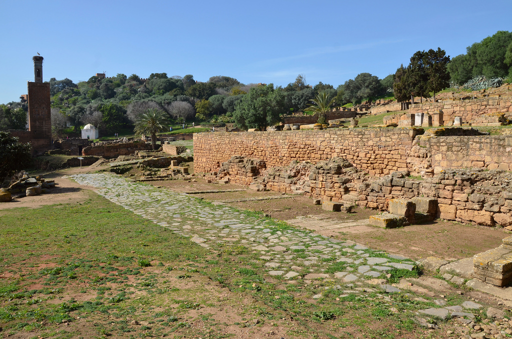
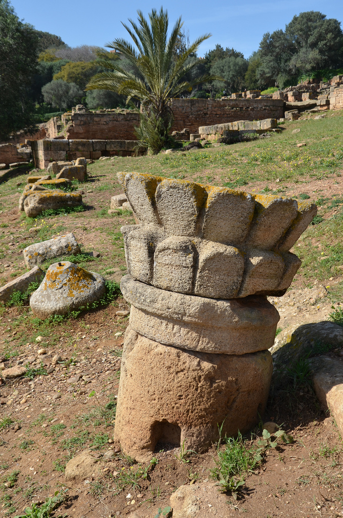
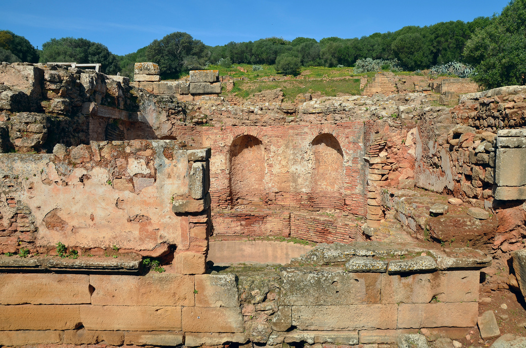
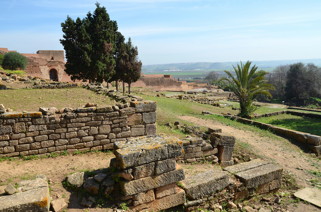
Sala Colonia is an ancient city situated on the outskirts of Rabat, the present-day capital of Morocco. The site contains the ruins of an ancient port city referred to as Sala by the renowned Greek geographer Ptolemy. Built on a trading post used by the Phoenicians, Sala sits on a hill above the fertile plain of the Bou Regreg river, which flows into the Atlantic Ocean. The first excavations undertaken on the site (1929-1930) unearthed the remains of several buildings from the time of Trajan (AD 98-117), including a forum, a monumental fountain, a capitol, a triumphal arch as well as the decumanus maximus (the main east-west-oriented street). Its Roman remains were later incorporated into a medieval necropolis called Chellah.

Coordinates: 34° 0′ 24″ N, 6° 49′ 13″ W

Phoenicians traders were the first to settle on the northern Moroccan coast as early as the 8th century BC. They founded several colonies, including the settlement they called Sala on the banks of the Bou Regreg river. Under the Punic influence, Sala became a city-state with diverse commercial relations with the Iberian peninsula and the Mediterranean and issued its own currency. The Phoenicians were later followed by the Carthaginians from the 3rd century BC onwards. The Romans took control of the area in about AD 40 during the reign of Emperor Claudius, and Sala became part of the province of Mauretania Tingitana. It was the most southwestern outpost of the Roman Empire in Africa. The Romans brought Sala to the status of an important port and thriving economic hub. The city witnessed an important urban development, as evidenced by the layout of the Forum, the capitolium and the curia, the octagonal Nymphaeum, the triumphal arch and the thermal baths. An inscription confirms the city’s status as a Roman municipium, enclosed by a wall in AD 144.

In about AD 250, the Romans lost control of the site to native Berber tribesmen, but Sala remained a trading centre and was still linked to the Roman Empire. Archaeological objects of Visigothic and Byzantine origin found in the area attest to the continuing commercial relations between Sala and Roman Europe.

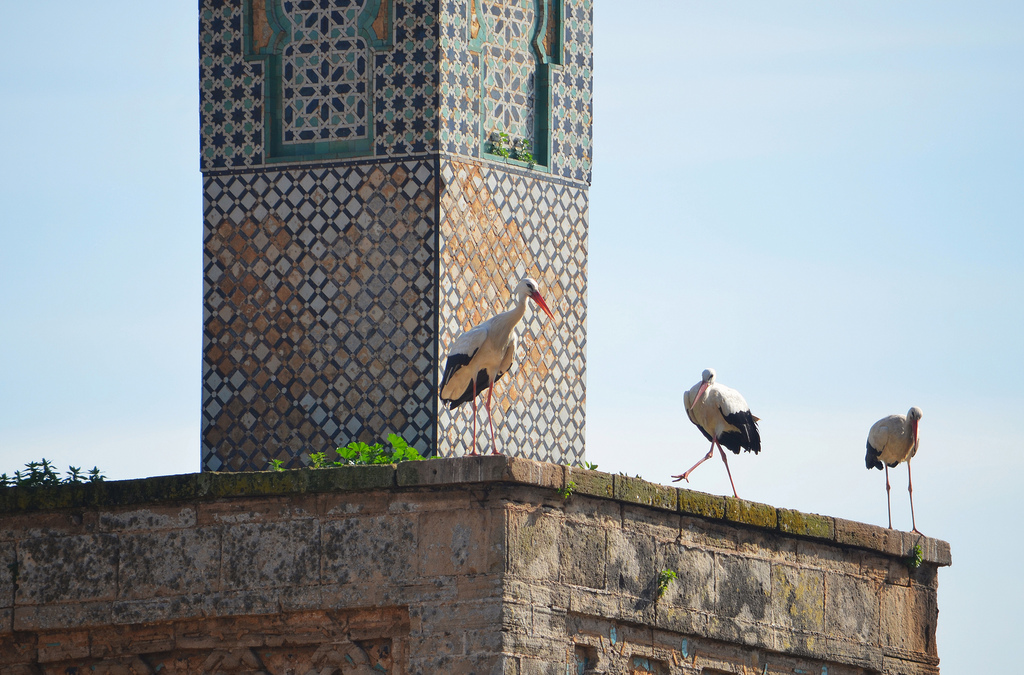
What remained of the ancient city was abandoned in 1154 in favour of nearby Salé. The site of Sala lay deserted until the 14th century when the Merinids built a holy necropolis (or chellah), a mosque and a minaret on top of the Roman site, enclosed by a wall which still marks its boundaries today. If you visit Chellah in winter or spring, you will get additional wildlife as a large colony of storks inhabits the ruins. As part of the metropolitan Rabat, the site was granted World Heritage Status in 2012.

PORTFOLIO

The foundations of the of the triumphal arch, it stood south of the capitol and faced the forum.
The foundations of the three-bay triumphal arch stood south of the capitolium and faced the Forum. It was built during the reign of Antoninus Pius (AD 138-161).
The foundations of the triumphal arch.
The Capitol, the official temple of the Capitoline Triad: Jupiter, Juno and Minerva, built on two terraces arranged on a rectangle 46 m long and 26 m wide.
The Capitolium, the official temple of the Capitoline Triad: Jupiter, Juno and Minerva. It was built in opus africanum on two terraces.
The Capitol was subdivided into several spaces, including a peribole, a covered Corinthian portico, a paved courtyard of blue limestone, with an altar, three adjoining rooms preceded by a pronaos with a staircase and a room reserved for the treasury temple.
Claudius Hosidius Severus, the prefect of a Syrian cavalry squadron of Roman citizens, paid for the Capitolium of Sala. The main building phase of this complex is dated between the end of the 1st century AD to the beginning of the 2nd century AD. It was probably inaugurated at the beginning of Hadrian’s reign in AD 120.
The Capitolium was subdivided into several spaces, including a peribolos (a court enclosed by a wall), a covered Corinthian portico, a paved courtyard of blue limestone, an altar, three adjoining rooms preceded by a pronaos with a staircase and a room reserved for the treasury temple.
The vaults of nine shops looking out over the decumanus maximus.
The Capitolium was supported by nine vaulted chambers (tabernae?) opening on the decumanus maximus.
The Decumanus Maximus, bordered on its eastern end by the Forum.
The decumanus maximus is bordered on its eastern end by the Forum.
View of the Forum with bases of honorary inscriptions dedicated to the emperors and the great magistrates of the city.
The lower level of the forum with six shops serviced by a secondary road.
The lower level of the Forum with six shops, served by a secondary road.
Trapezoidal, it is covered with large blue limestone slabs kept up to 20.60 m of the podium. Built during the works carried out during the reign of the emperor Trajan, this public square was closed by two monumental gates, of which the powerful foundations still remain.
The Forum was a trapezoidal structure paved with large blue limestone slabs. This public square was closed by two monumental gates whose foundations remain. It was built during the reign of Trajan.
Pseudo-lotus capital outside the forum.
Pseudo-lotus capital outside the Forum.
Roman mosaic in one of the workshops in the artisan quarter.
An apotropaic phallus as a symbol to avert the evil eye inside a workshop.
An apotropaic phallus is a symbol to avert the evil eye inside a workshop.
The ruins of the Curia Ulpia adjoining the basilica. The epithet Ulpia recalls the solicitude of Emperor Trajan, who undoubtedly granted financial aid to the local senate to erect the building.
The ruins of the Curia Ulpia adjoin the basilica. The epithet Ulpia recalls the solicitude of Emperor Trajan, who undoubtedly granted financial aid to the local senate to erect the building.

The public baths of Sala located at the intersection of the decumanus maximus and the cardo maximus.
The public baths of Sala are located at the intersection of the decumanus maximus and the cardo maximus.
The octagonal Nymphaeum. It formed a water tower and was supplied by an aqueduct.

Roman ruins of Sala with 13th century minaret.
Roman ruins of Sala with 13th-century minaret.
Storks nesting on the 13th century minaret.
Storks nesting on the 13th-century minaret built of stone and zellige tilework.

Links:

One thought on “Sala Colonia

Leave a comment

This site uses Akismet to reduce spam. Learn how your comment data is processed.