Patara was one of the main cities of Lycia, located at the mouth of the Xanthos River and closely associated with the fortunes of its harbour. From early on, it became a major port, linking the interior of Lycia to maritime trade routes across the Mediterranean. It later became an important centre of the Lycian League, reflecting its political and economic significance. Under Roman rule, the city expanded, acquiring monumental buildings, baths, and a theatre. However, its prosperity gradually declined as the harbour became silted, cutting it off from the sea. By the Byzantine period, its significance had diminished, and the site was ultimately abandoned. Much of the city remained buried beneath sand until modern excavations began to uncover it once again.
Patara’s early history is closely tied to both myth and geography. Ancient tradition connected its foundation to Patarus, a son of Apollo, reflecting the city’s long-standing association with the god and his oracle. Historically, Patara’s earliest mention dates back to the Bronze Age, when it is thought to have been known as Pttara in Hittite records, indicating its presence as an established settlement long before the classical period. The city later developed as a key Lycian settlement at the mouth of the Xanthos River, giving it access to both inland routes and the Mediterranean. This advantageous location allowed Patara to emerge as an important harbour and trading centre from an early date, linking the fertile Xanthos valley with wider networks of exchange.
By the Classical and Hellenistic periods, Patara had become one of the principal cities of Lycia. Its growth was influenced by both commerce and its religious significance. The city developed a more defined urban character, with its layout organised around the harbour and surrounding hills. Evidence of early public buildings and necropolises indicates a settlement that was economically active and structurally established. During the Hellenistic period, Patara was renamed Arsinoe, most likely under the Ptolemaic rulers who briefly controlled parts of Lycia. The name honoured Arsinoe II, the sister and wife of Ptolemy II Philadelphus, reflecting the common Hellenistic practice of renaming cities after members of ruling dynasties. However, the name did not persist. The city soon reverted to Patara, the name by which it is known in both earlier tradition and later historical periods.
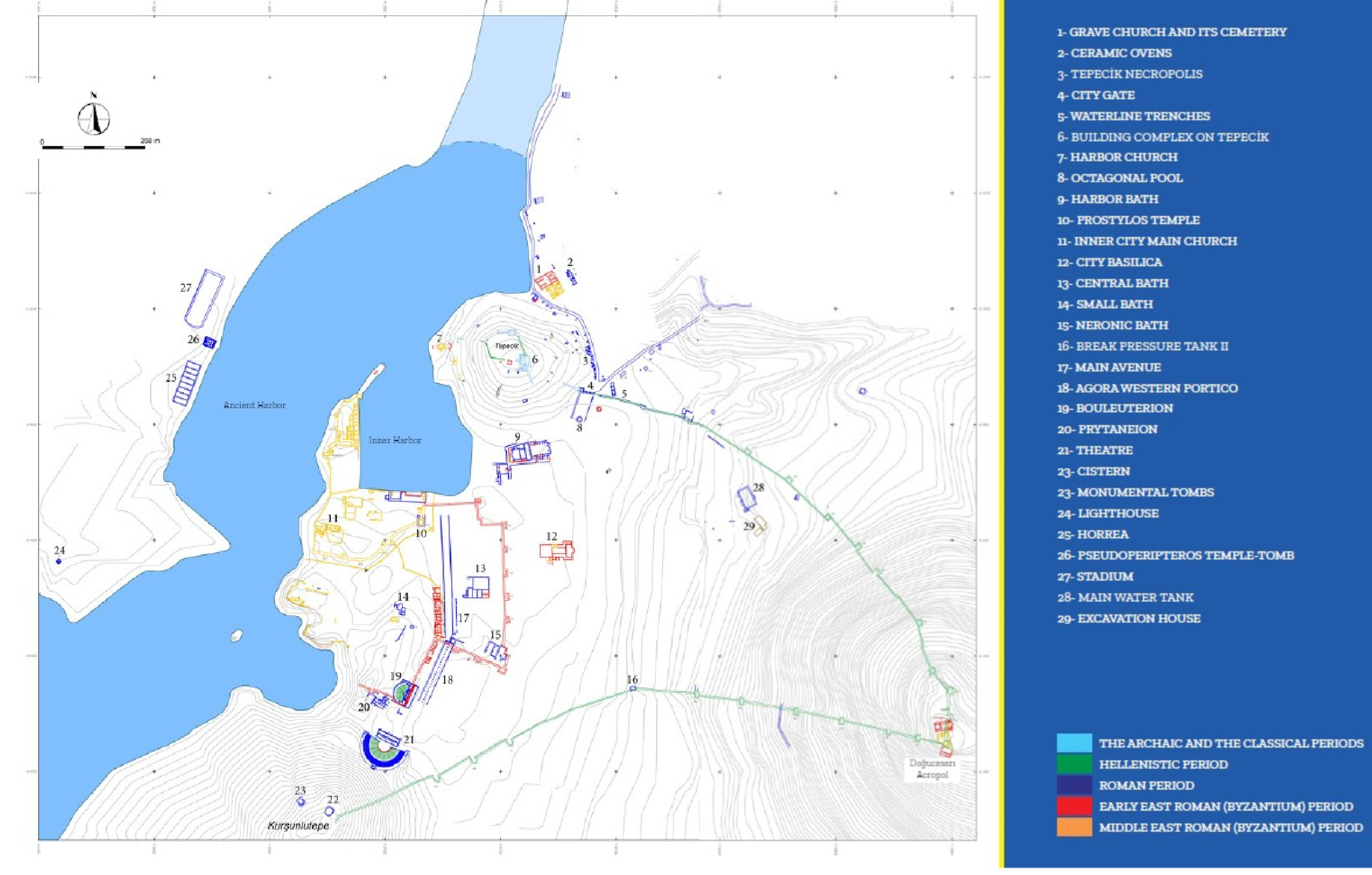
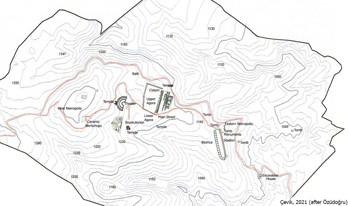
Patara city plan.
Under Roman rule, Patara reached the height of its importance and development. Following the annexation of Lycia in AD 43, the city became the administrative capital of the province and a central hub for both governance and trade. Its harbour remained a key asset, linking the interior of Lycia with the wider Mediterranean and ensuring continued prosperity. This period saw extensive urban expansion, with the construction of monumental buildings including baths, a theatre, colonnaded streets, and the Bouleuterion. Patara also played a significant role within the Lycian League during this time, reinforcing its political status, while its connections to the imperial network, particularly routes linking to Constantinople, further secured its position as one of the region’s leading cities. Patara was recognised as the metropolis (chief city) of Lycia and held the prestigious status of a high-priestly centre and twice as neocorus (temple warden) of the Lycian nation. This status was confirmed by inscriptions from the 2nd and 3rd centuries AD.
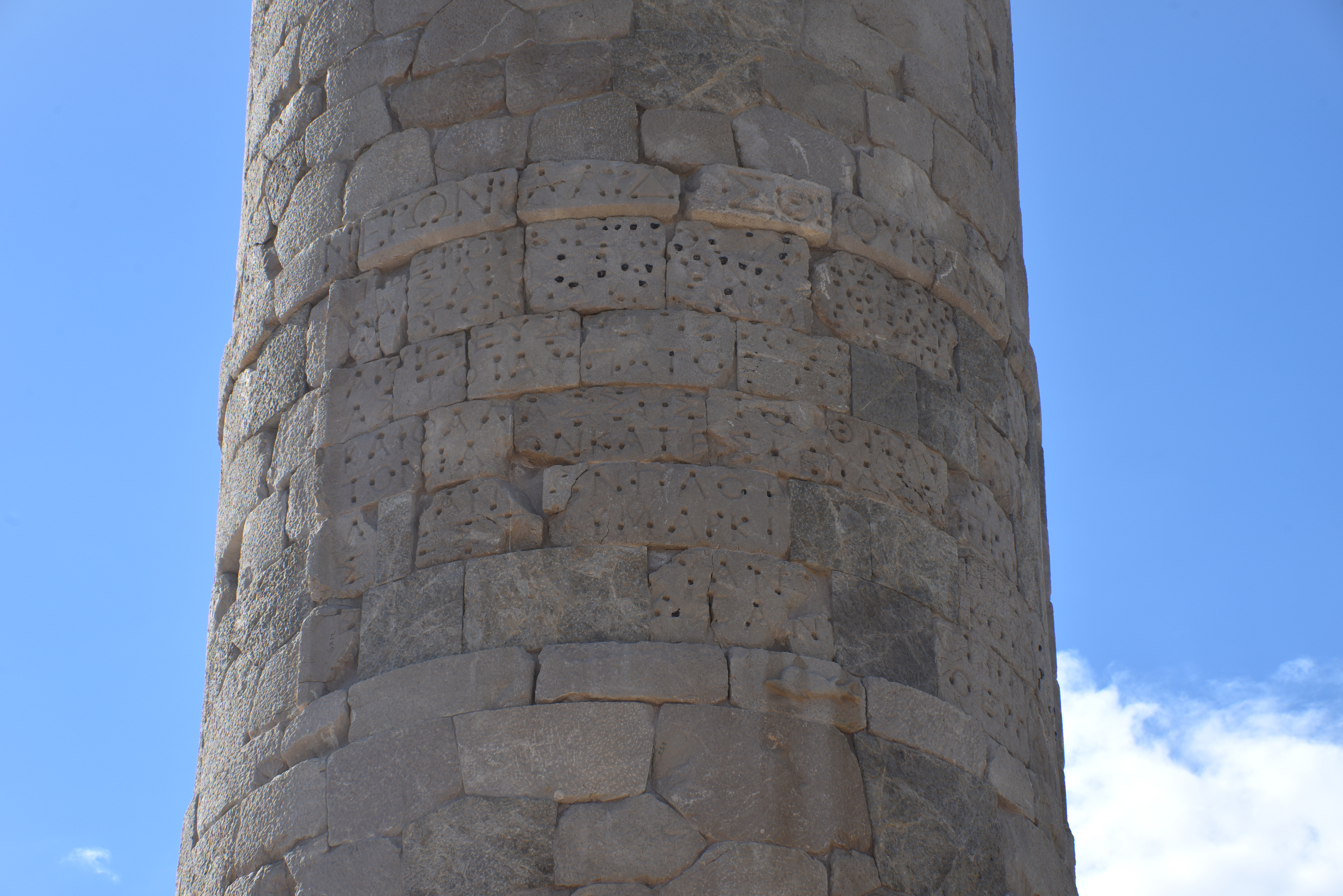
Hadrian visited Patara in AD 129 or 131, and his reign was marked by significant imperial attention to the city. This is confirmed by an inscription on the eastern facade of the horreum (granary) located on the western part of the city (TAM II 397). Additional inscriptions specifically honour Hadrian and his wife Sabina, associate them with Zeus of Olympus (TAM II 409) and ‘New Hera’ (TAM II 412). Furthermore, other inscriptions honour Hadrian as “saviour and builder” (TAM II 410).
HORREA IMP. CAESARIS DIVI TRAIANI PARTHICI F. DIVI [NERVAE NEPOTIS TRAIANI HADRIANI AUGUSTI (Horrea of the commander-in-chief Caesar, son of the divine Traian, who defeated the Parthians, grandson of the divine Nerva, Trajan, Hadrian, and Augustus).
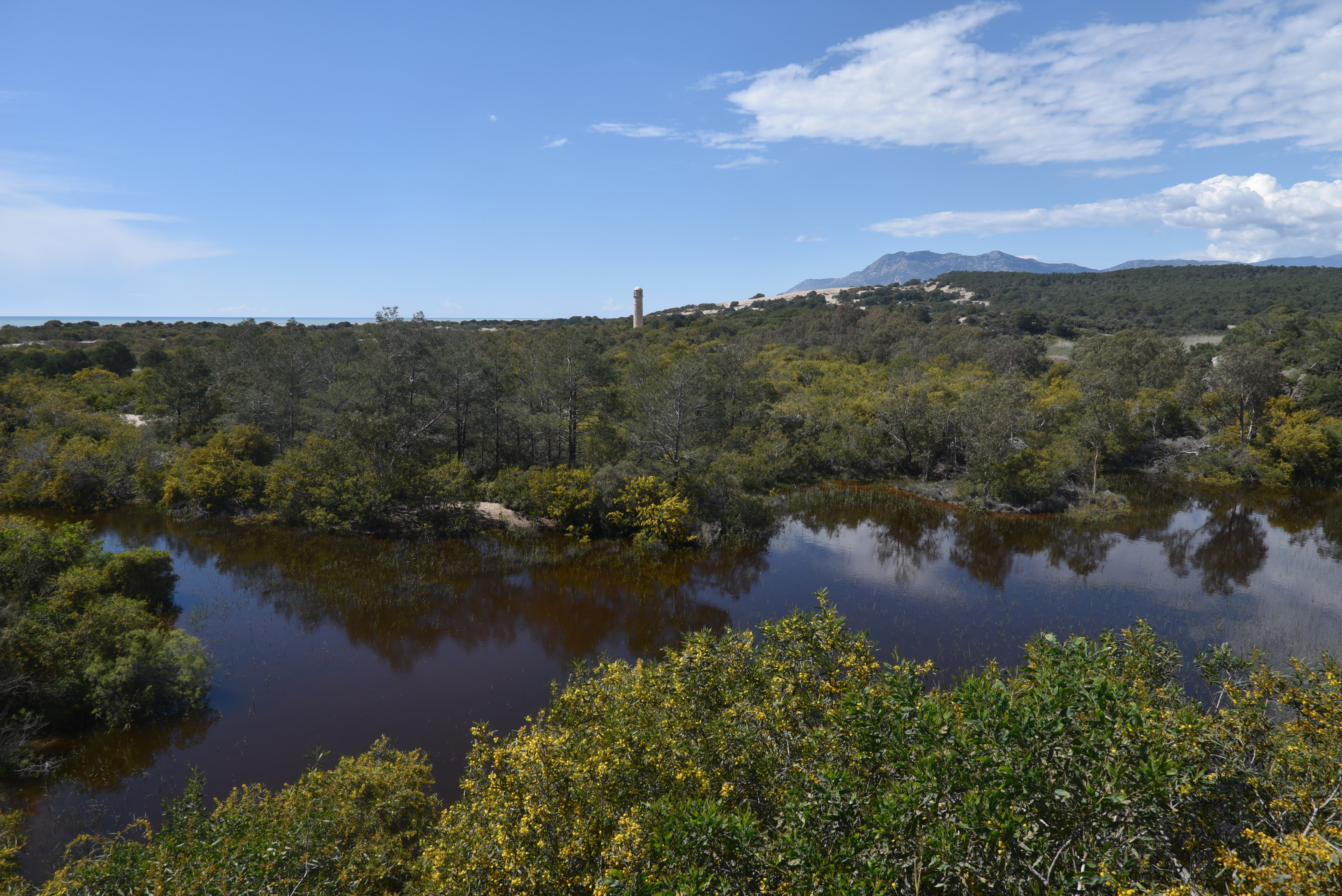
During Late Antiquity and the Byzantine period, Patara remained an inhabited and active city, retaining its role as a bishopric and maintaining connections within the Christian world. The city had already acquired an important place in Christian tradition as the birthplace of Saint Nicholas, the 4th-century bishop of Myra who later became one of the most venerated saints of the medieval world. However, Patara’s fortunes gradually declined due to broader changes affecting the region. Repeated raids, coastal instability, and disease weakened the city over time. At the same time, the continued silting of the harbour further reduced its economic importance, cutting it off from maritime trade. Although occupation persisted for several centuries, Patara steadily diminished in scale and significance, and by the medieval period, it had been largely abandoned, its remains gradually buried beneath sand and sediment.
Systematic excavations at Patara began in the late 20th century and have since revealed a city that had long lain hidden beneath sand. As work progressed, major structures emerged, including the theatre, baths, colonnaded street, and the Bouleuterion, many of them remarkably well preserved due to their burial. Among the most significant discoveries has been the Roman lighthouse, originally built under Nero near the ancient harbour. In recent years, this structure has been carefully reconstructed using anastylosis, with its original blocks reassembled to restore its form. The result is a rare example of a Roman lighthouse brought back to life, standing once more as a marker of Patara’s former maritime importance.
Another significant discovery was the Stadiasmus Patarensis, a monumental Roman inscription uncovered in the aftermath of a fire in Patara in the summer of 1993. Erected around AD 45, it served as both an honorary monument for Emperor Claudius and an official record of the Roman road network in the newly annexed province of Lycia. The monument listed numerous roads, cities, and distances (in stadia), functioning as a provincial itinerary. For instance, the inscription included routes such as “from Patara to Xanthos: 56 stadia,” and continued with other cities and distances, allowing reconstruction of the ancient Lycian road network. The blocks were found scattered and reused in later construction, with some still embedded in the Byzantine wall.
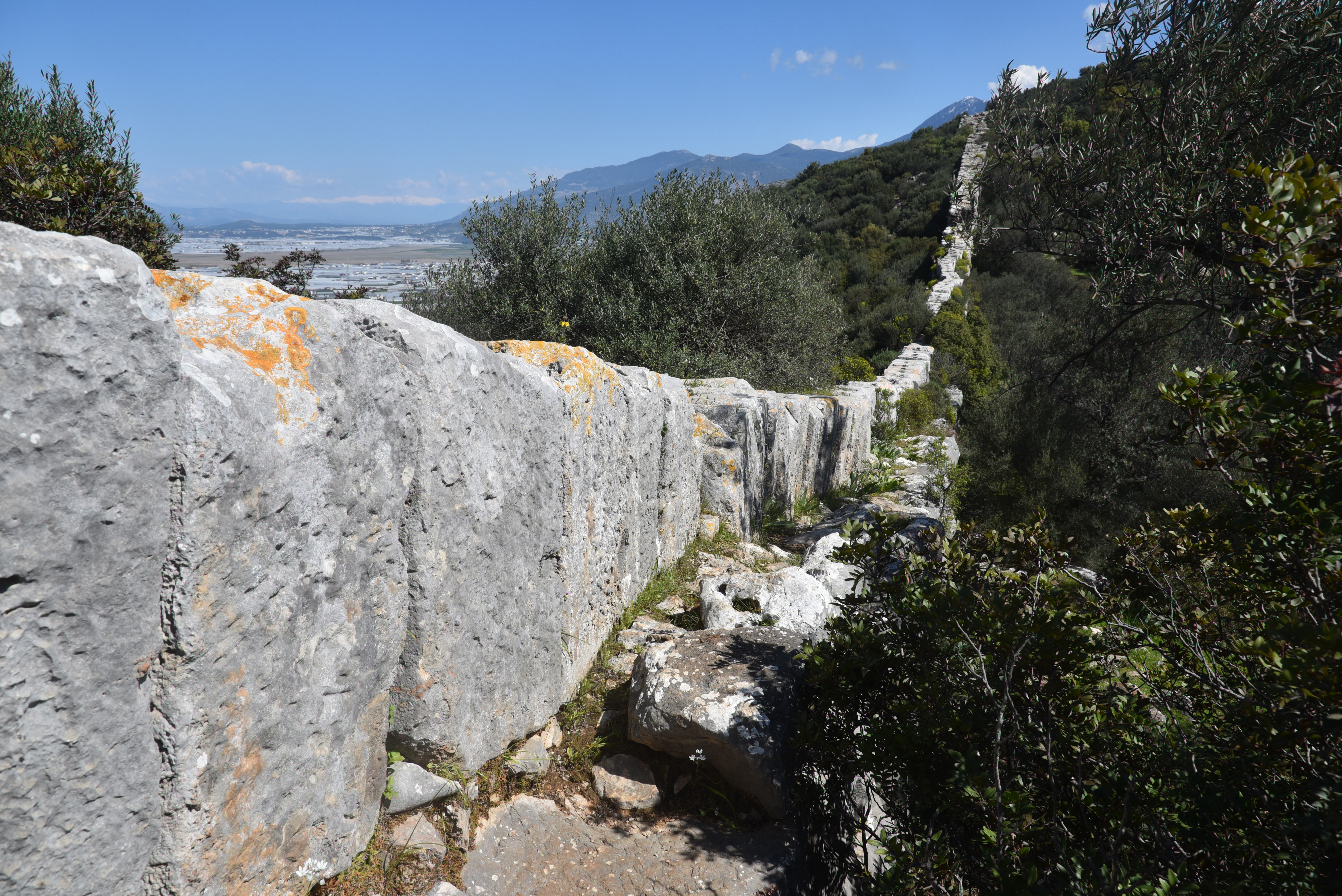
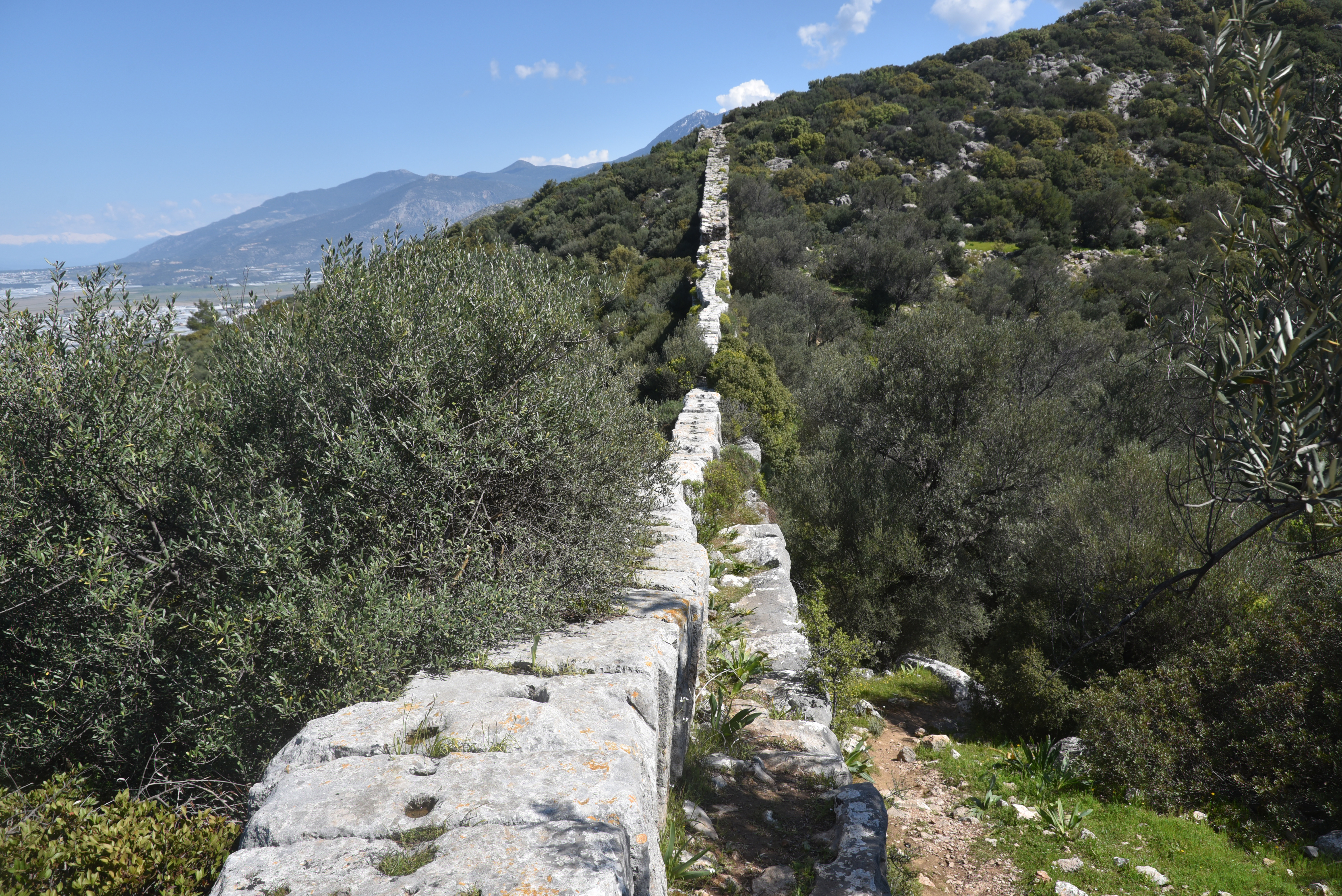
A 22-kilometre-long aqueduct supplied Patara with fresh water from springs in the surrounding hills, carrying it across the landscape to the urban centre and harbour district. Like many Roman aqueduct systems in Asia Minor, it combined channels cut into the bedrock with masonry conduits and elevated sections that maintained a steady gradient over long distances. One of its most fascinating features is the Delikkemer, a 200-metre-long pressure bridge that carried water across the valley from springs in the hills toward the city, using an advanced hydraulic design (reverse siphon) rarely preserved so clearly in the ancient world.
PORTFOLIO
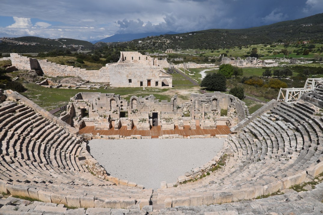
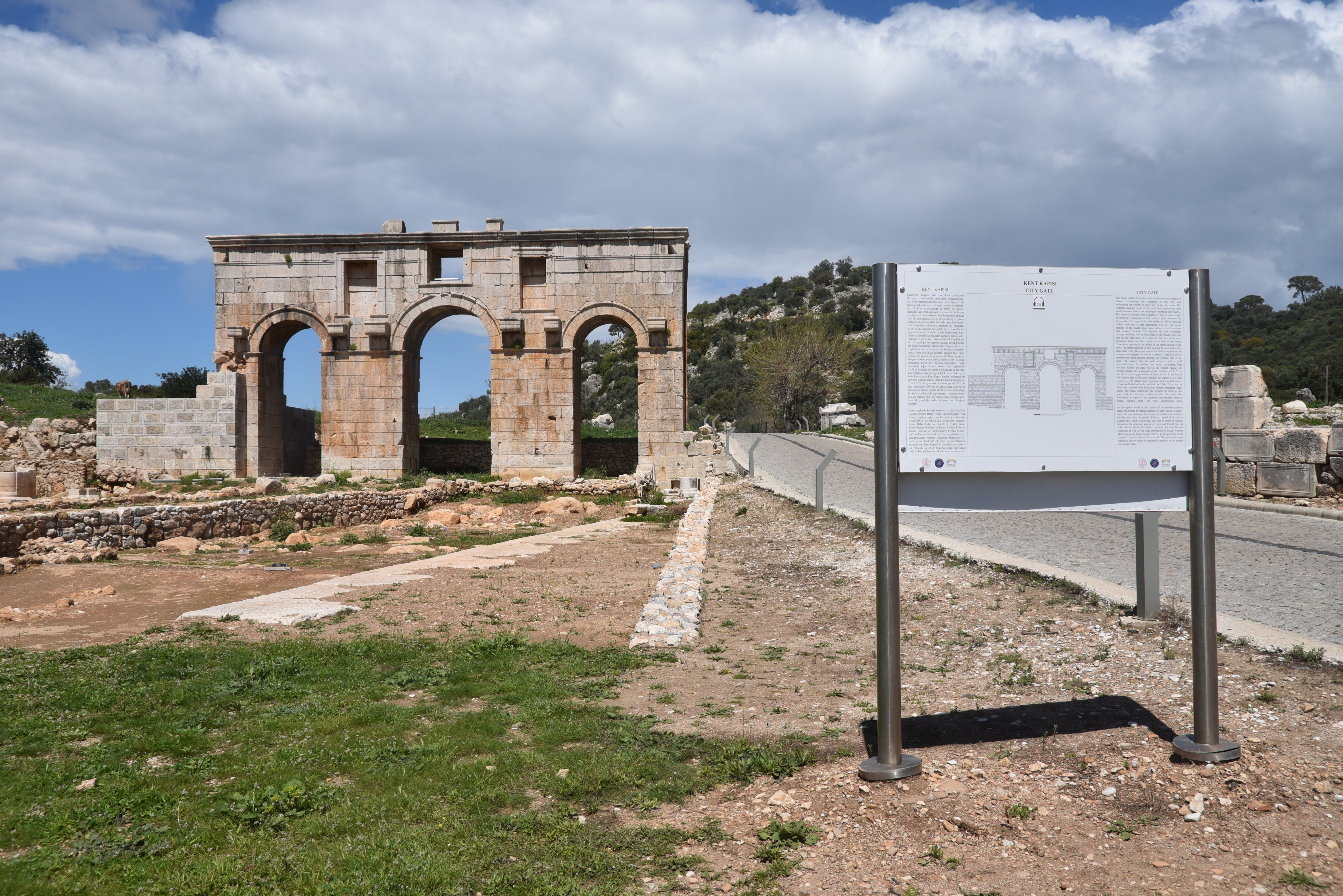
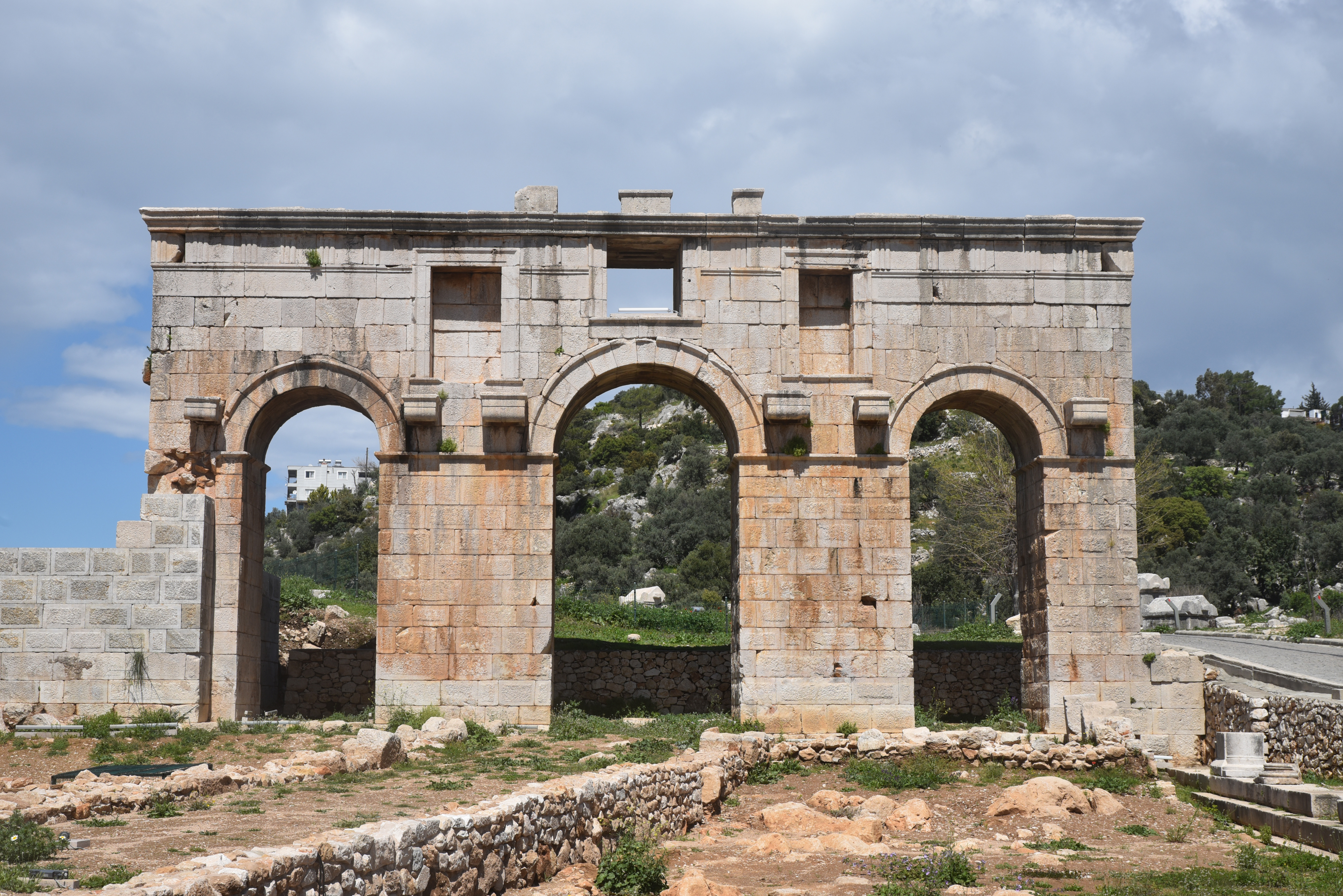
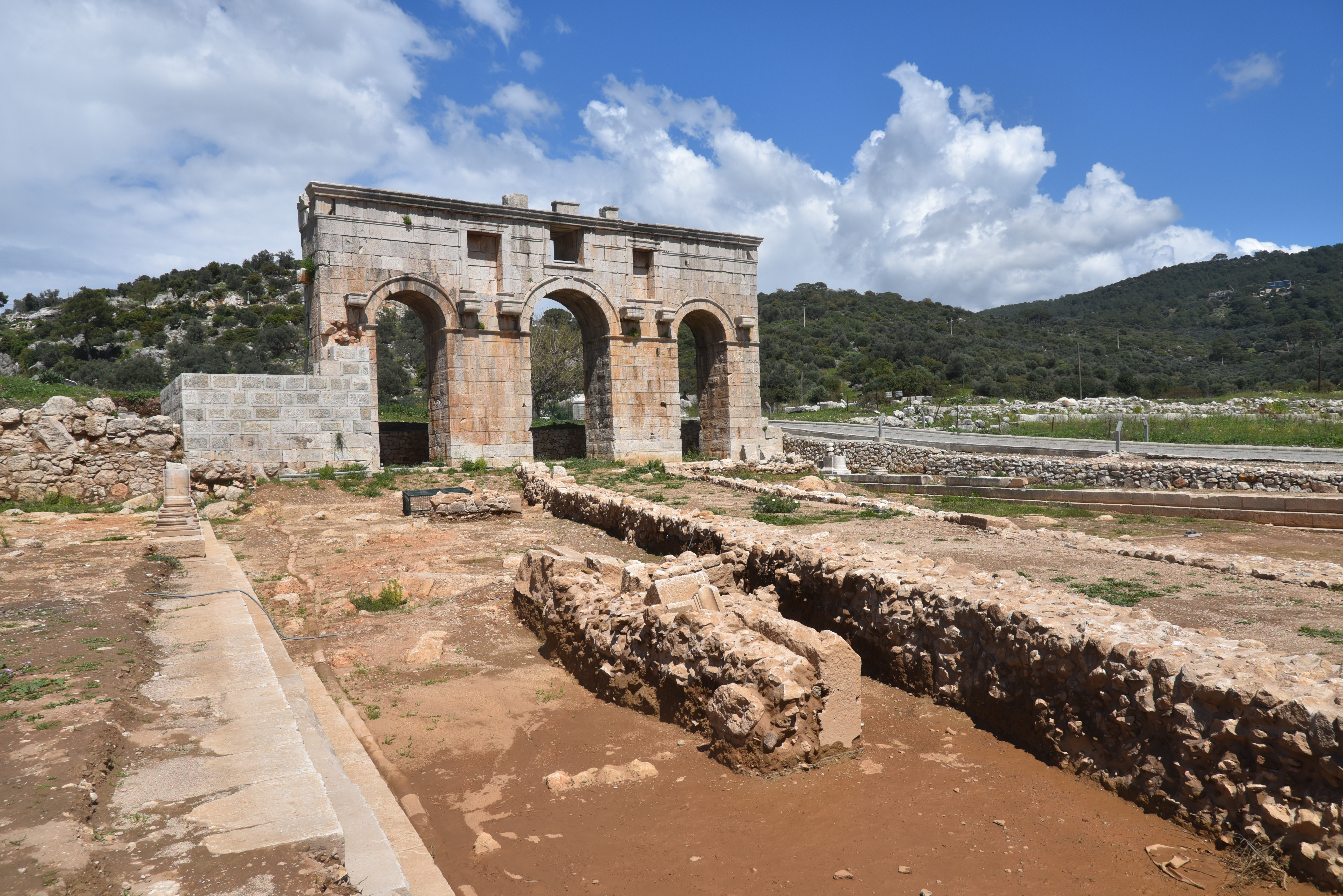
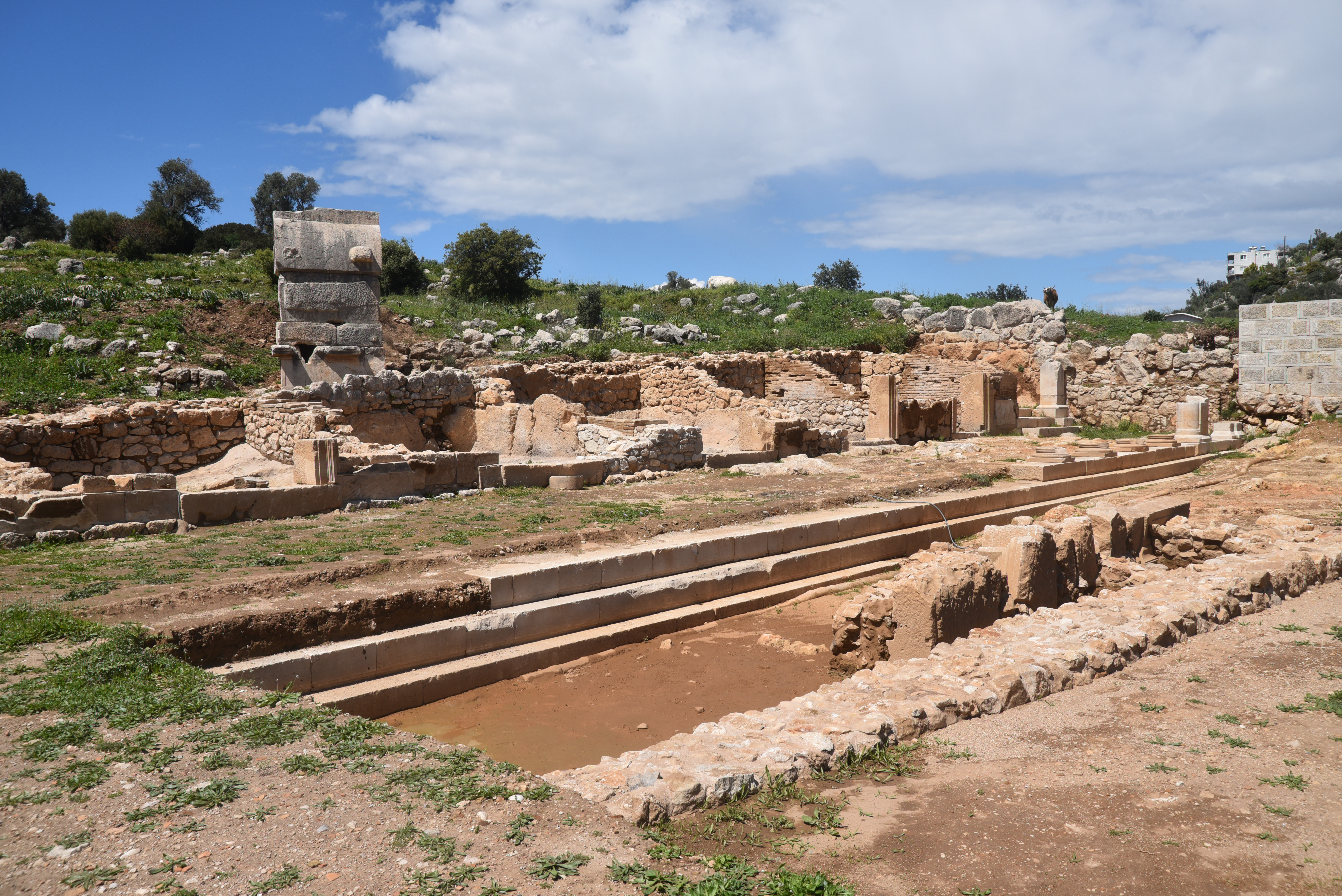
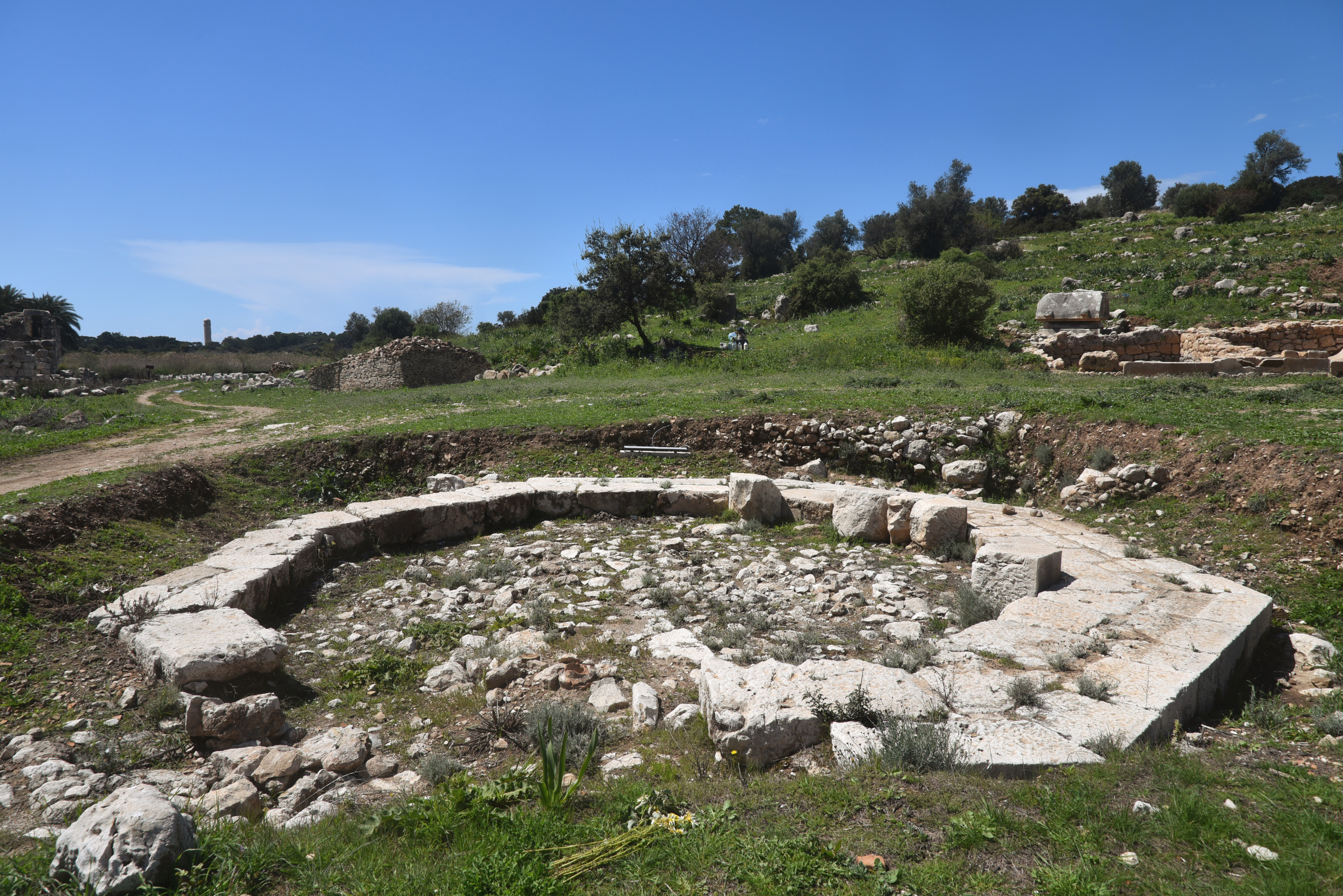
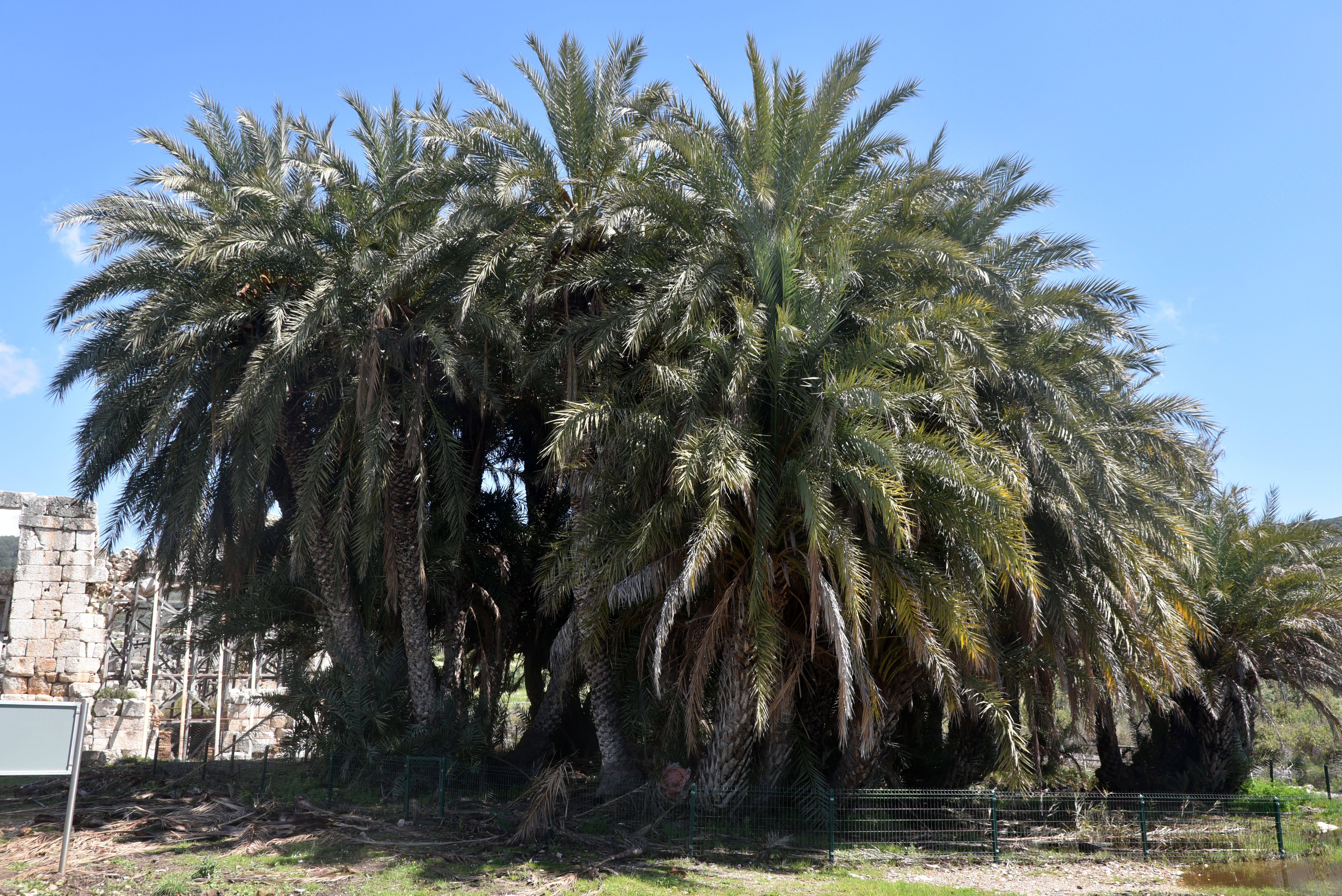
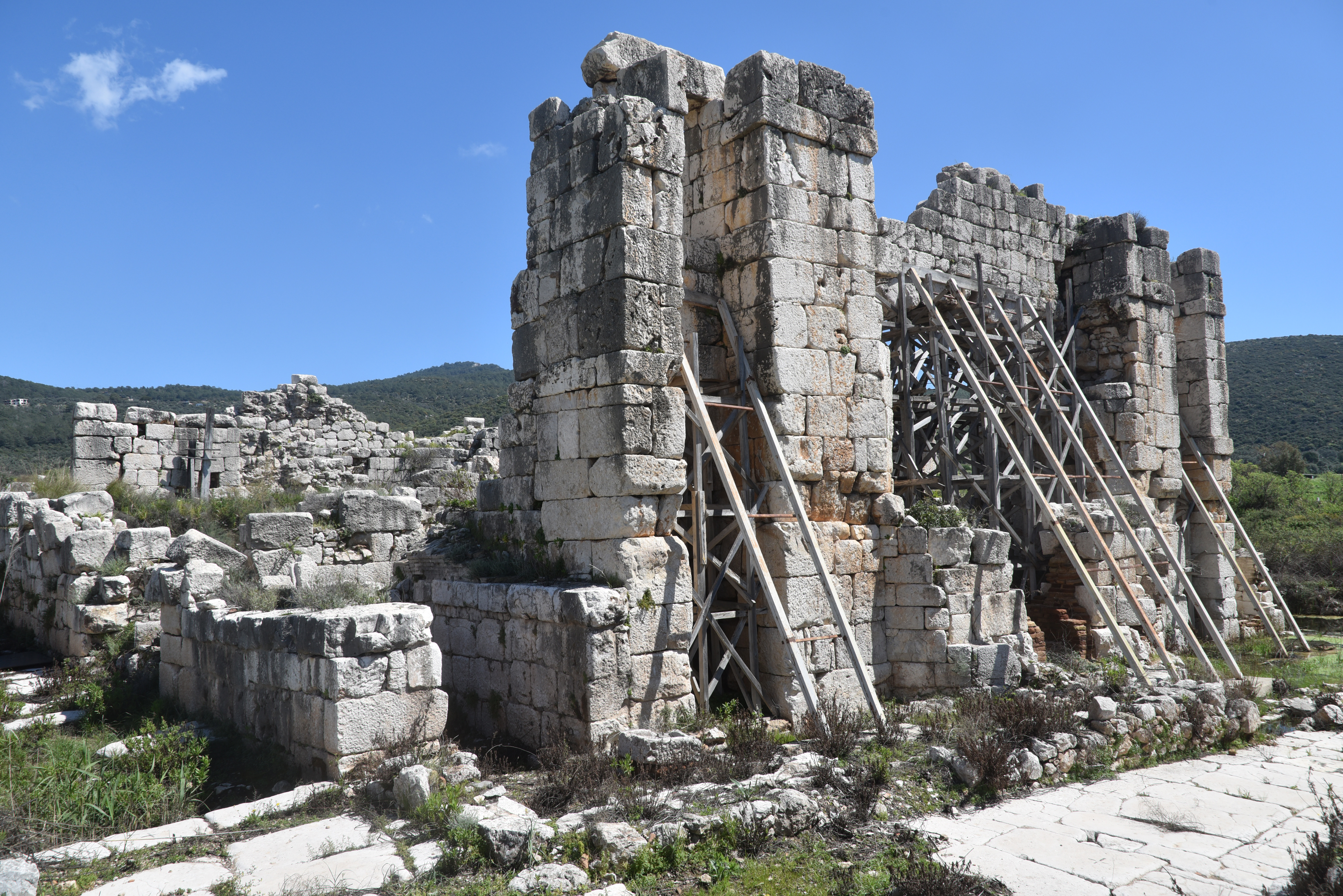
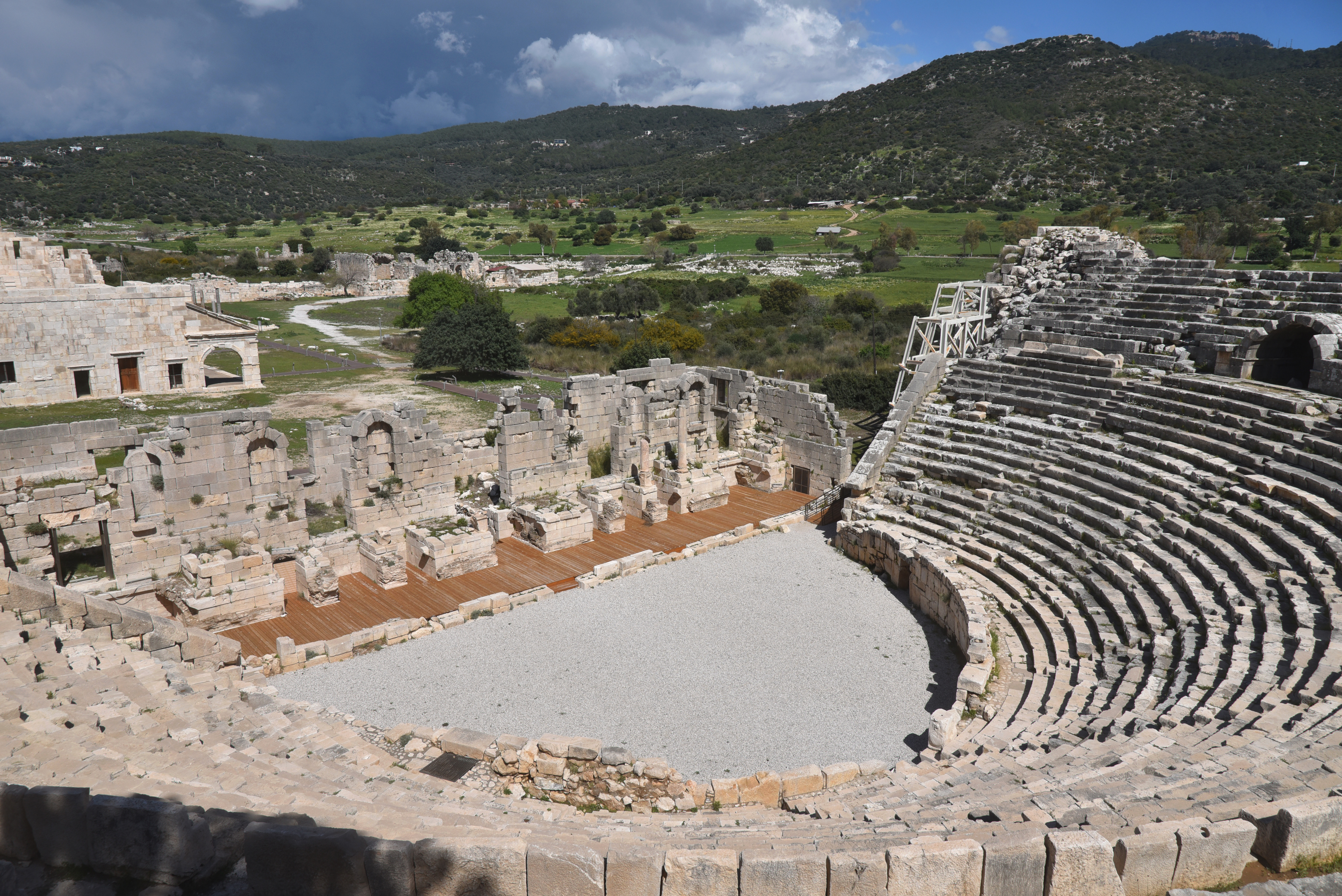
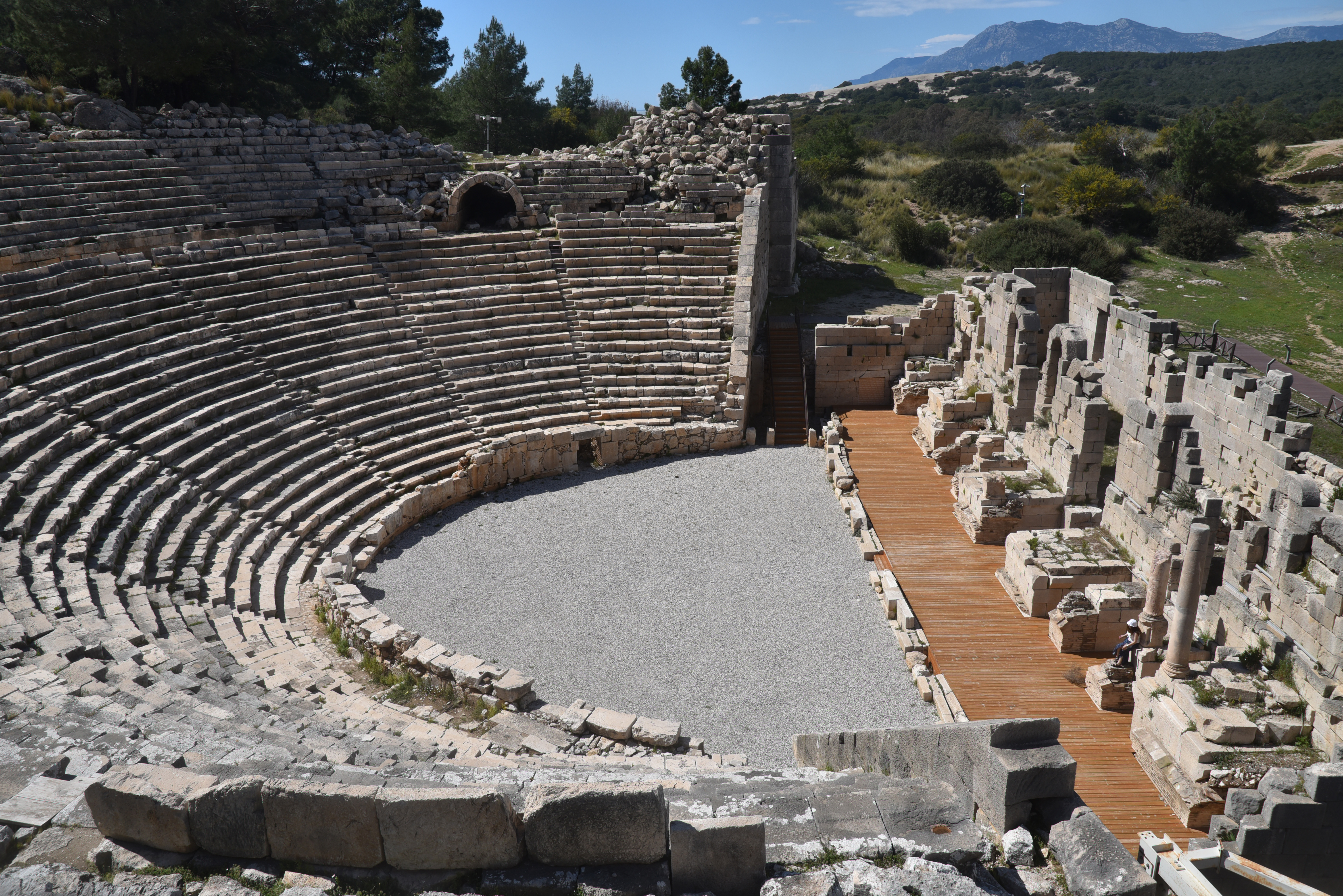
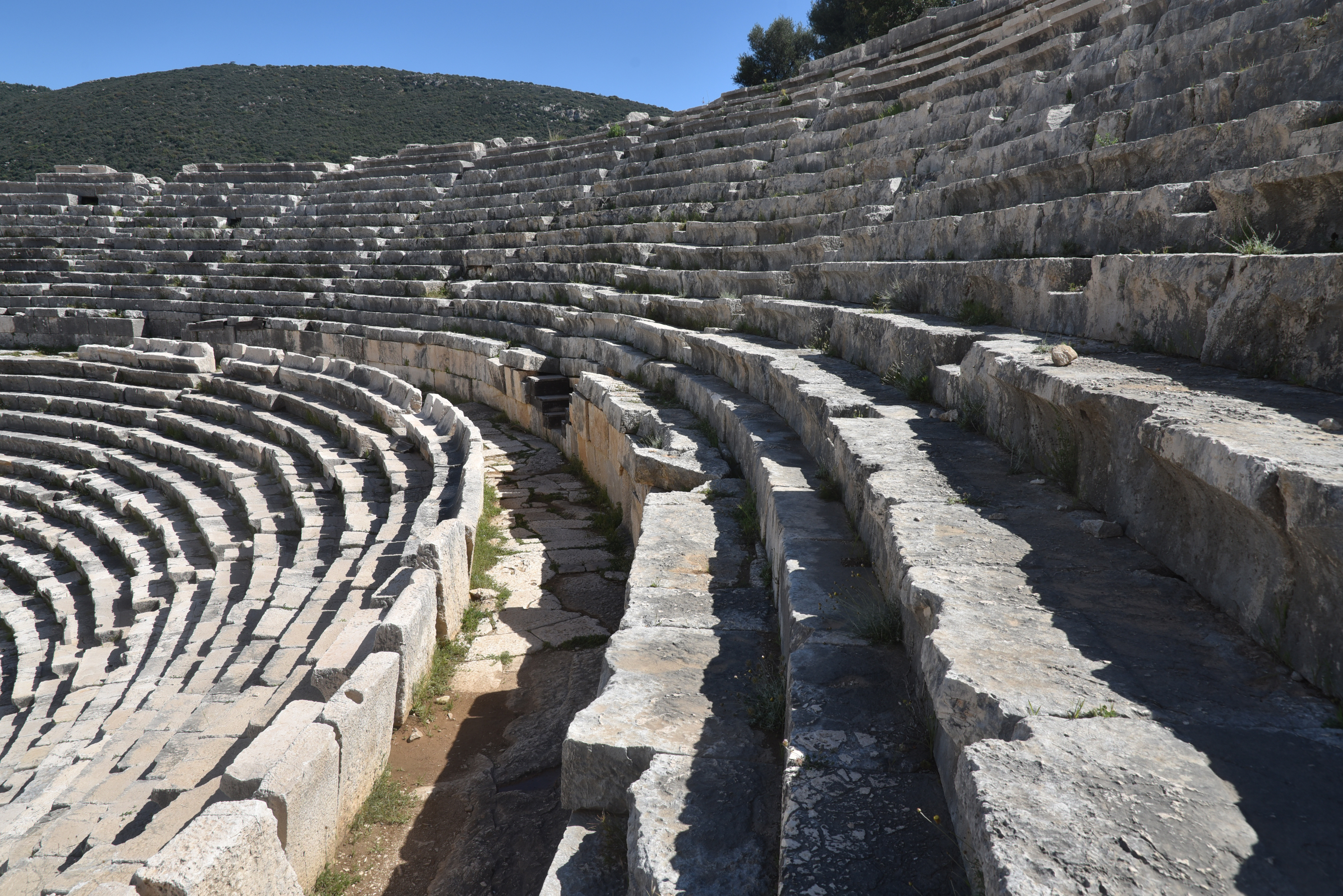
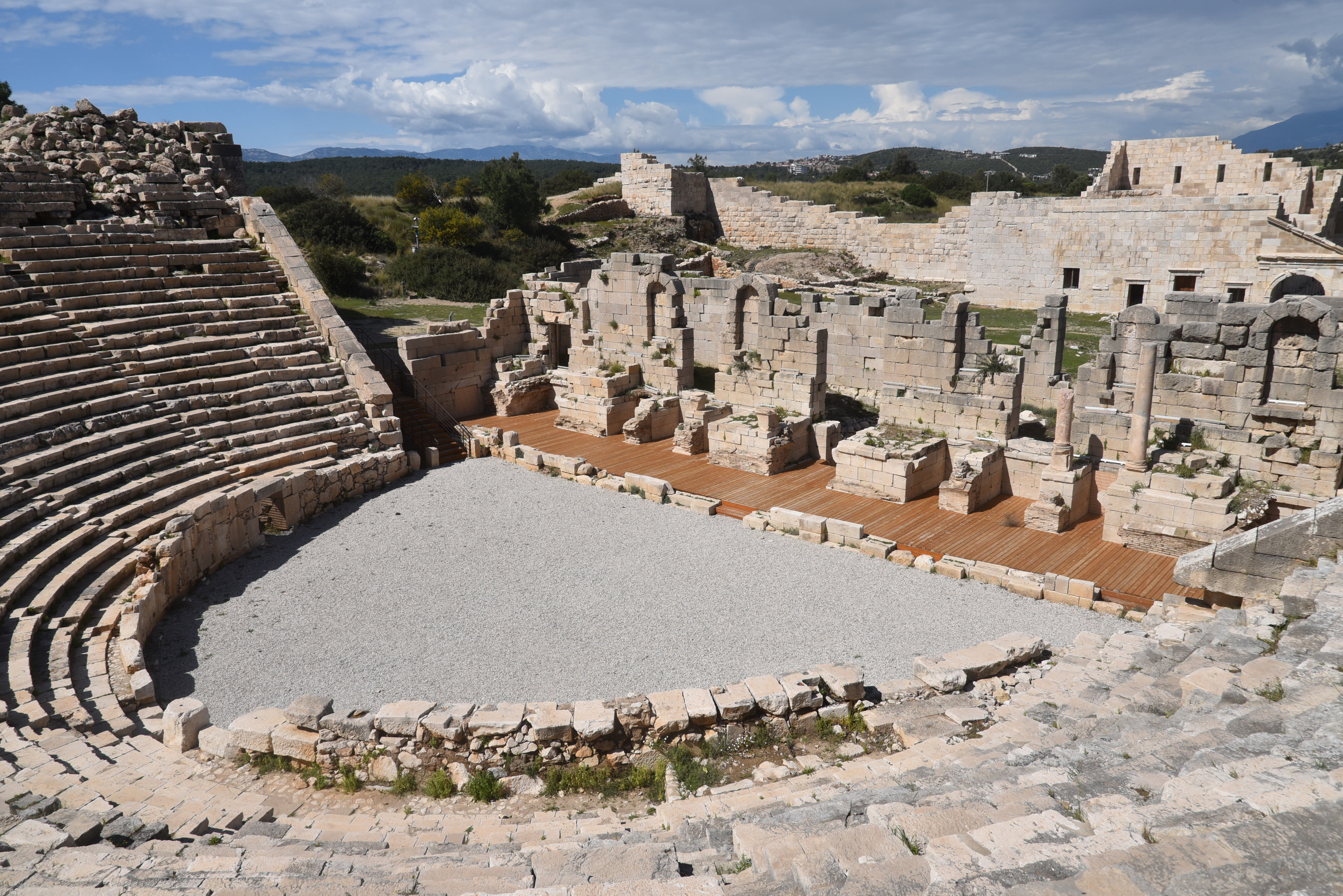
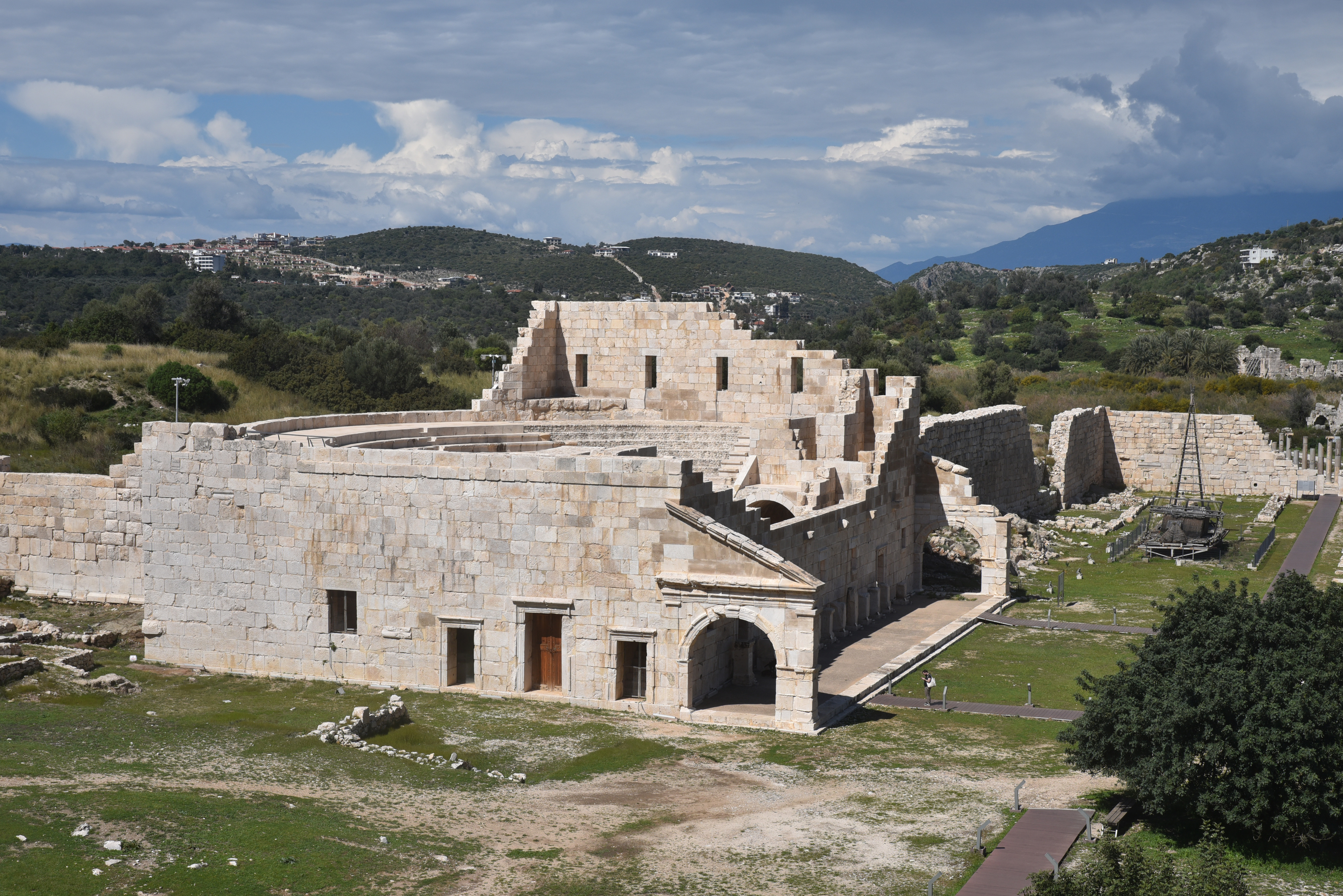
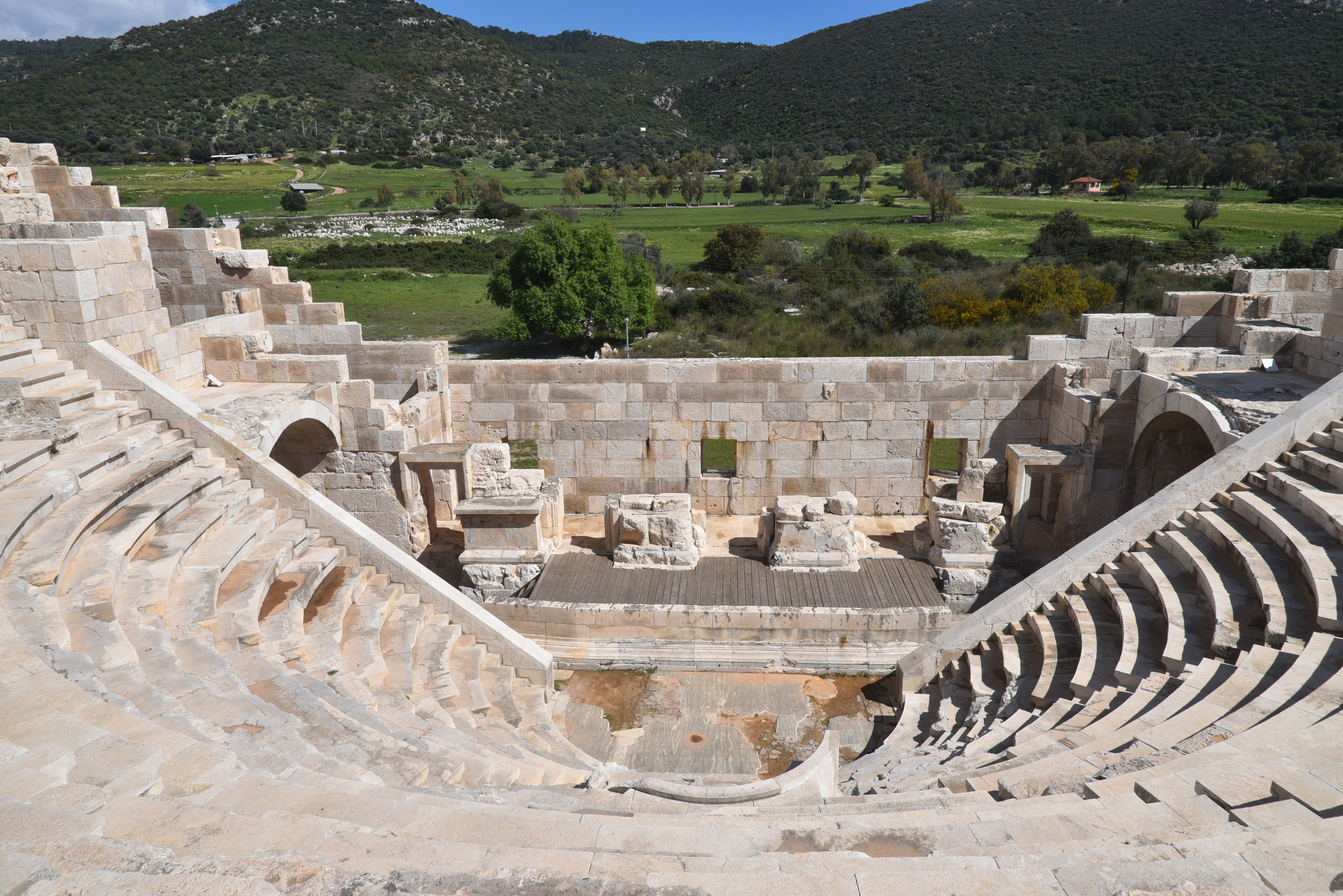
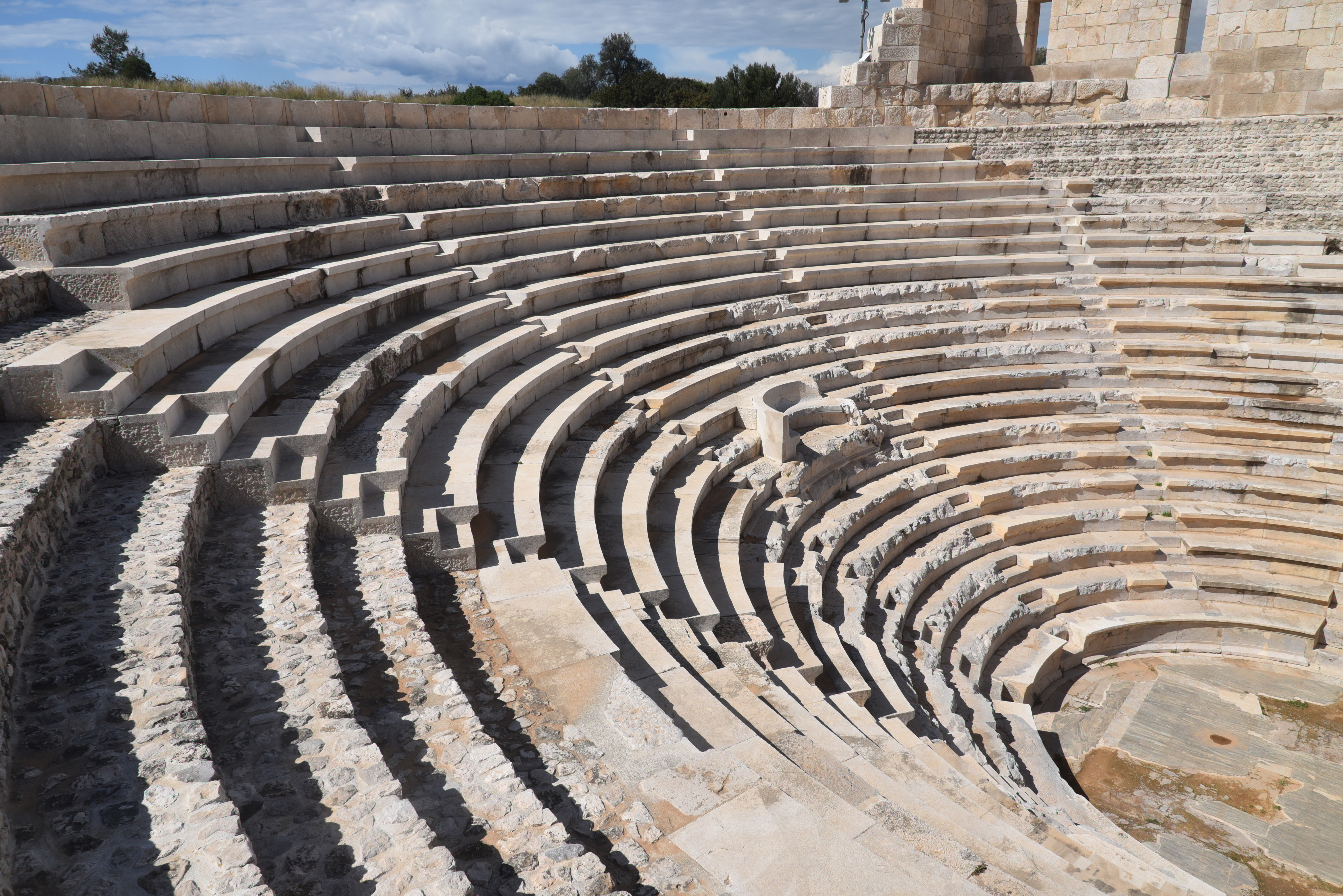
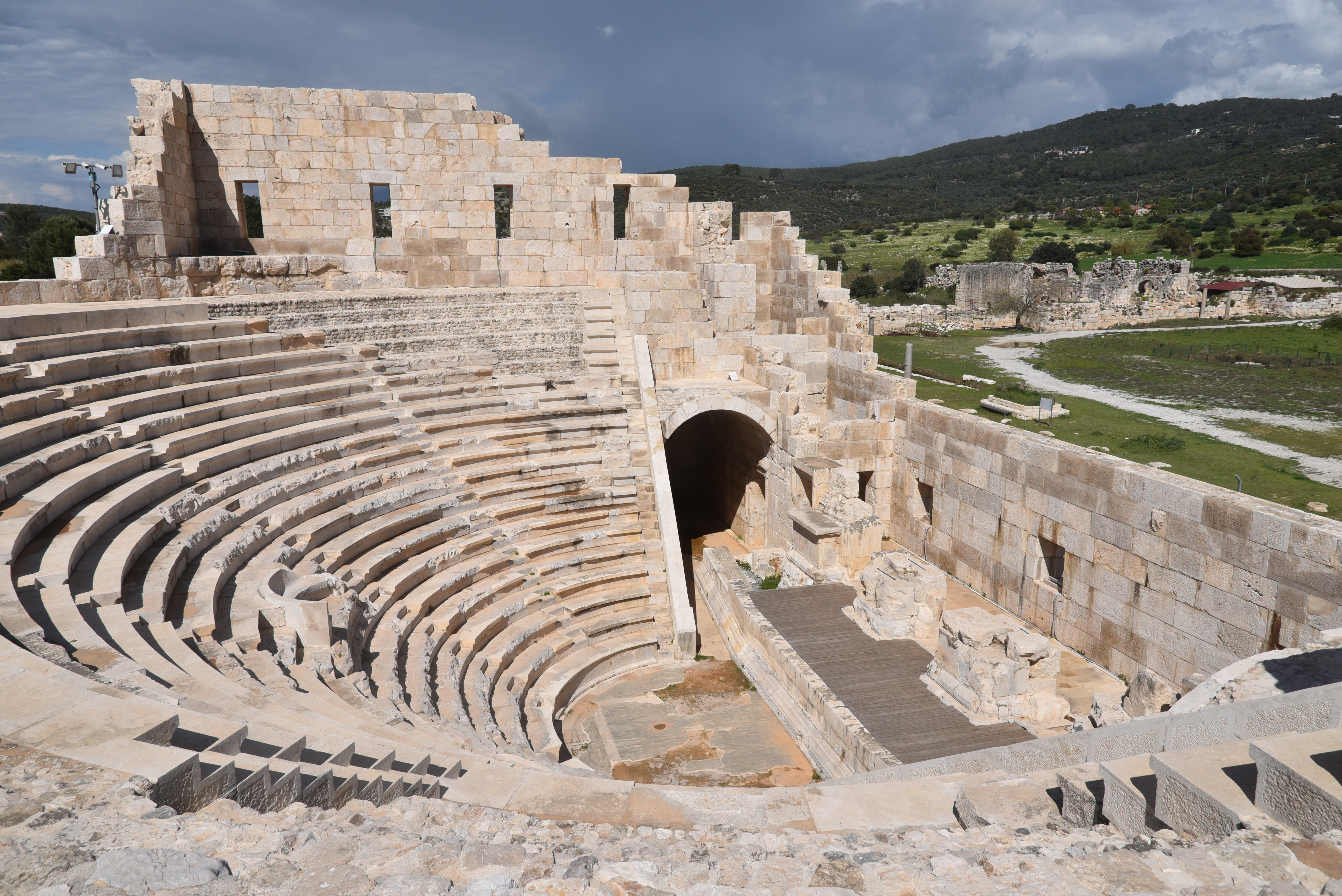
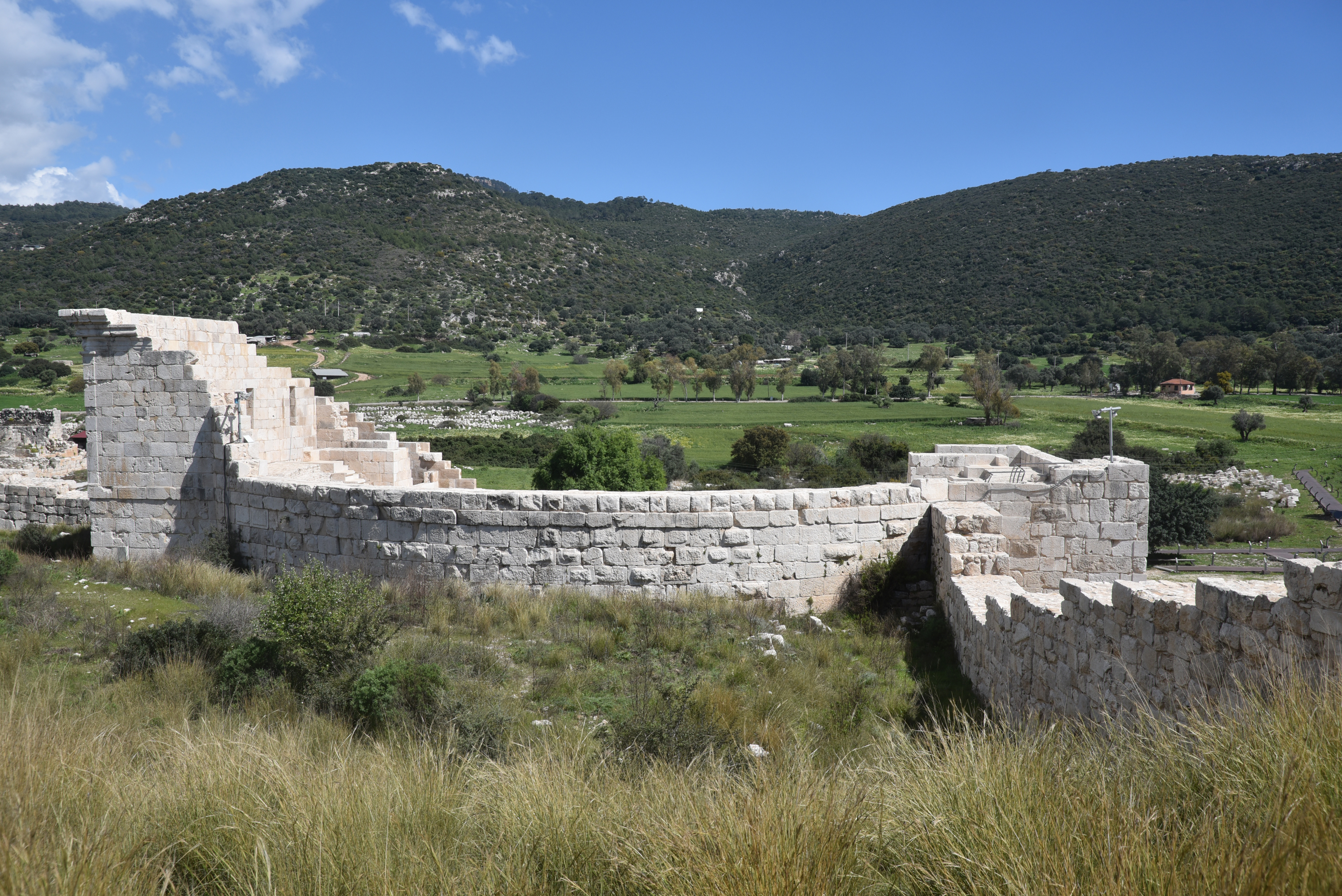
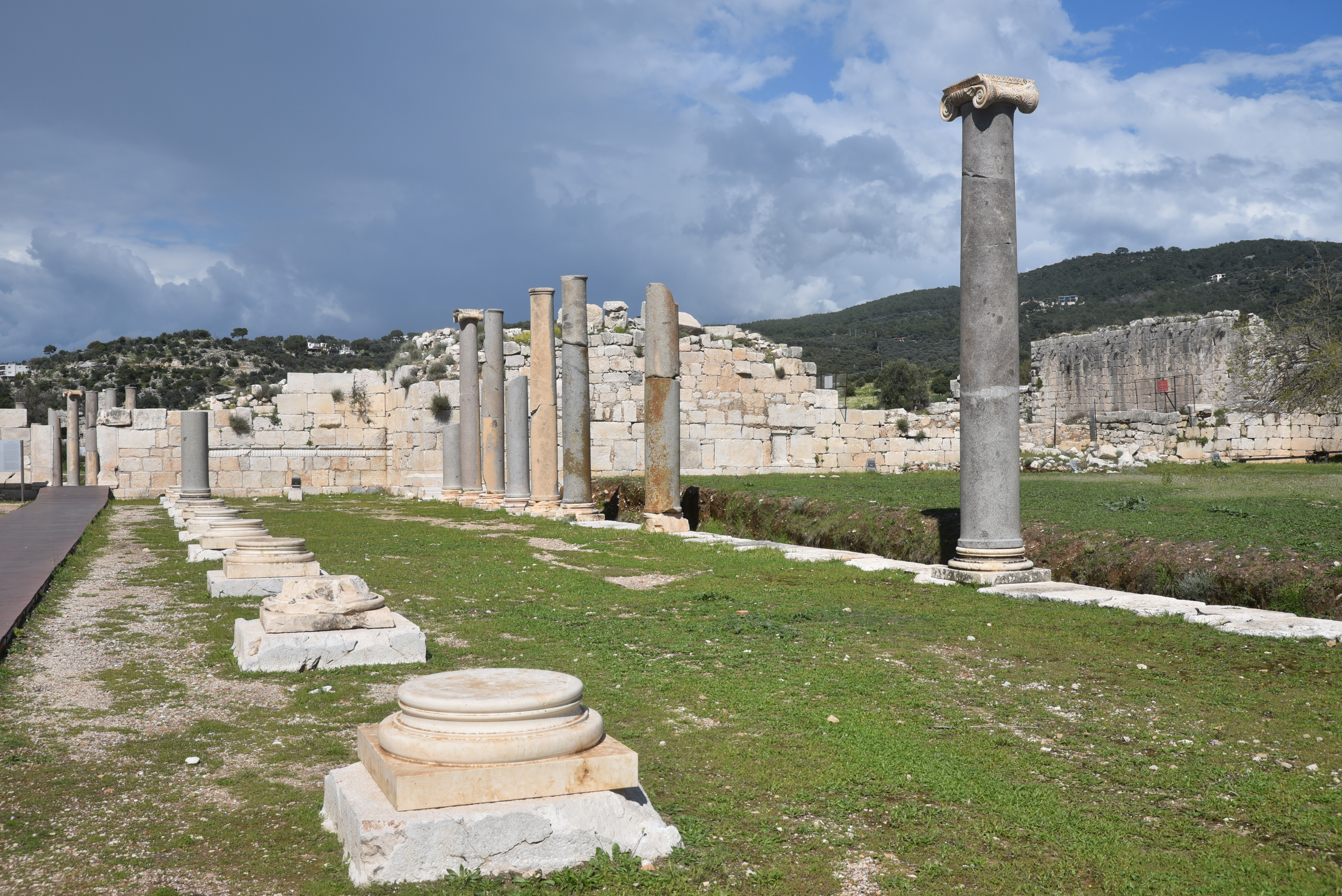
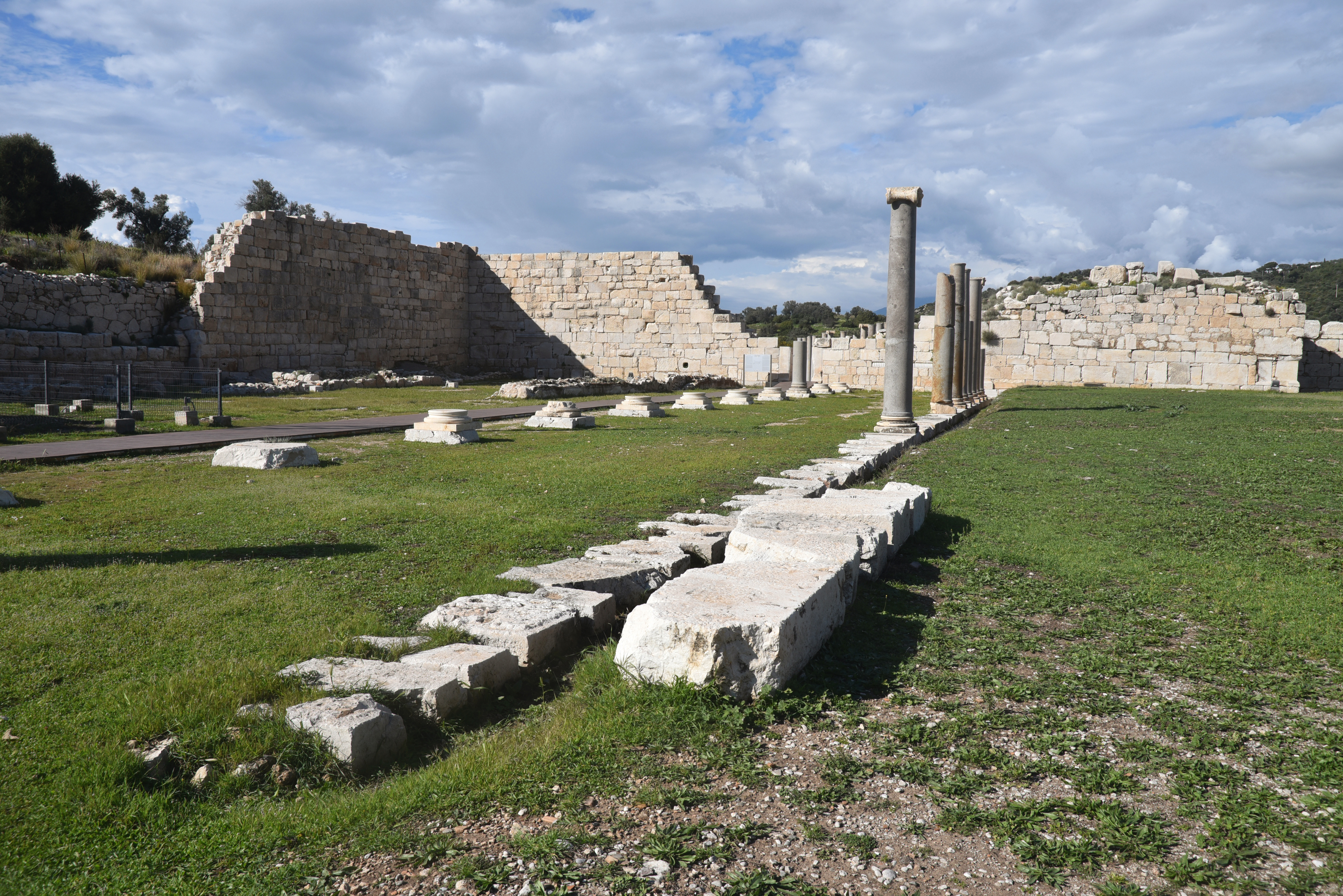
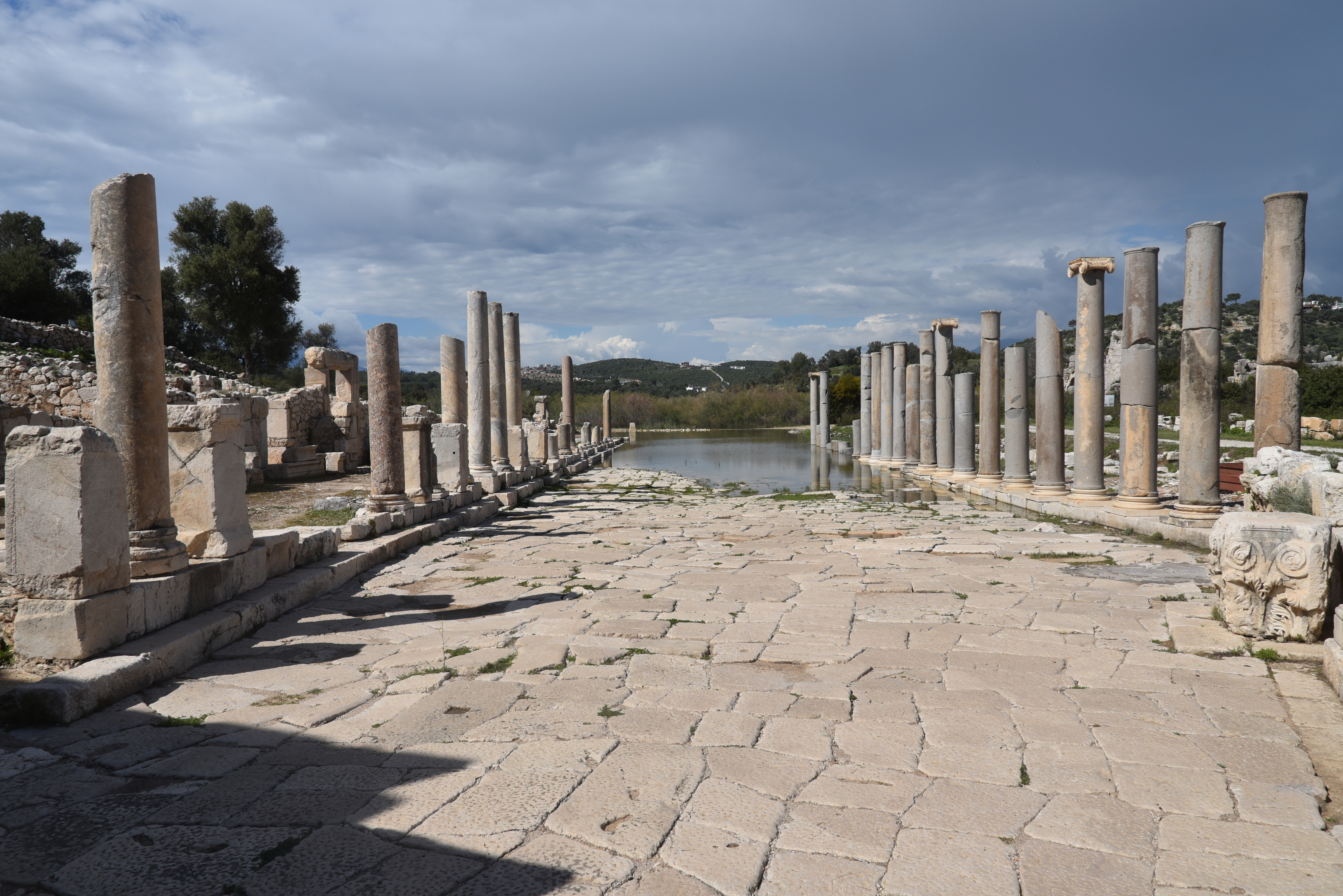
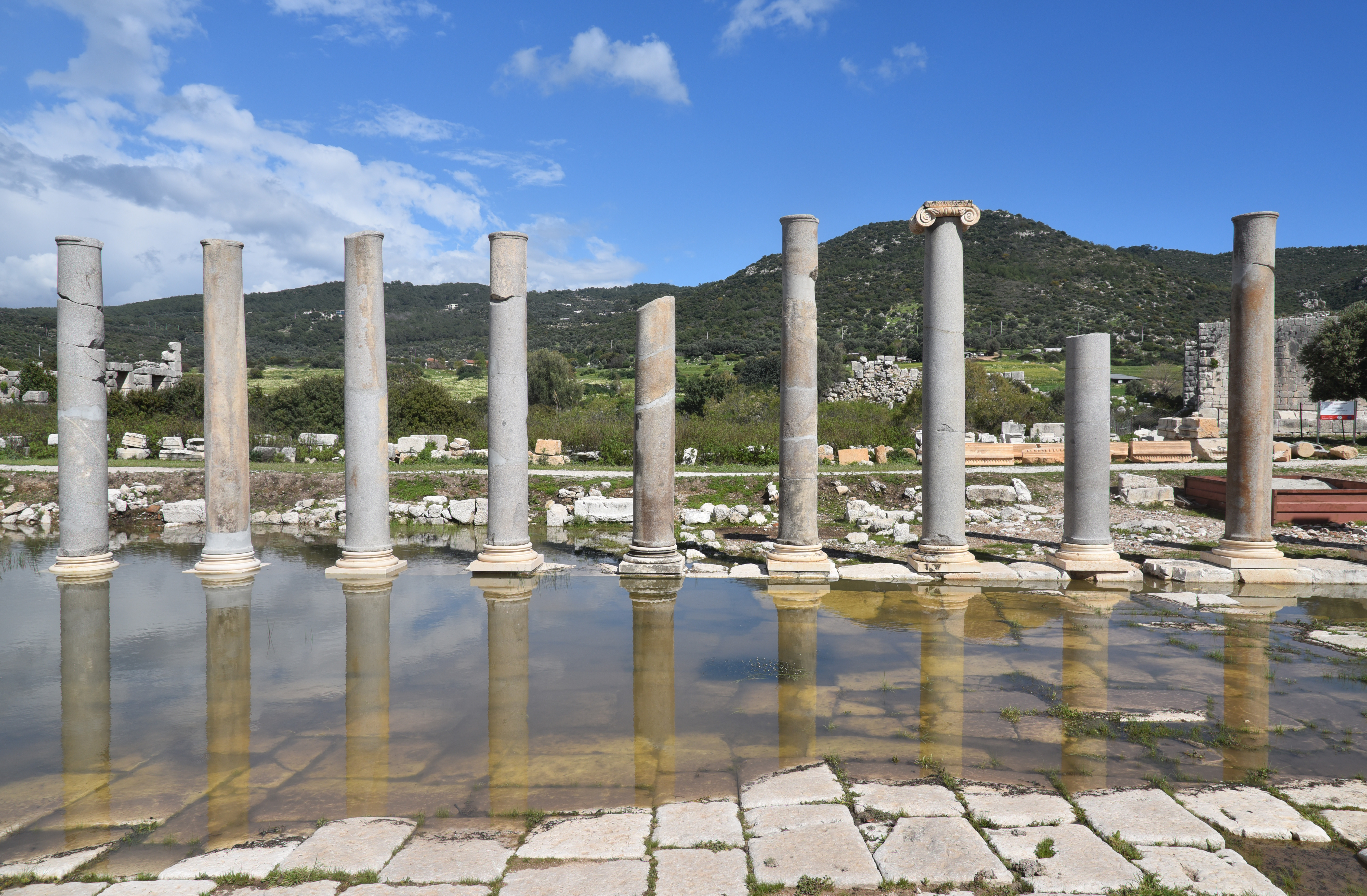
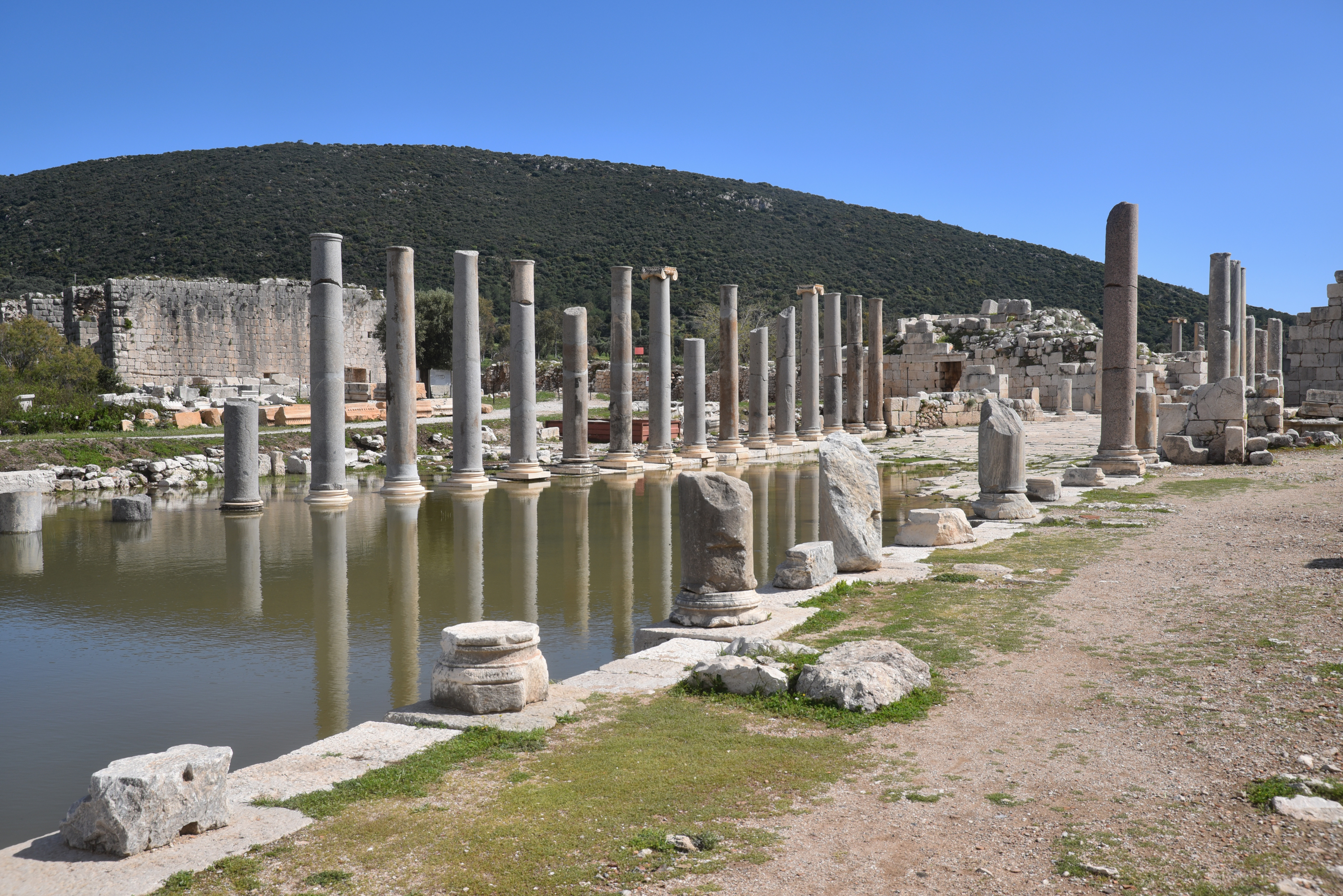
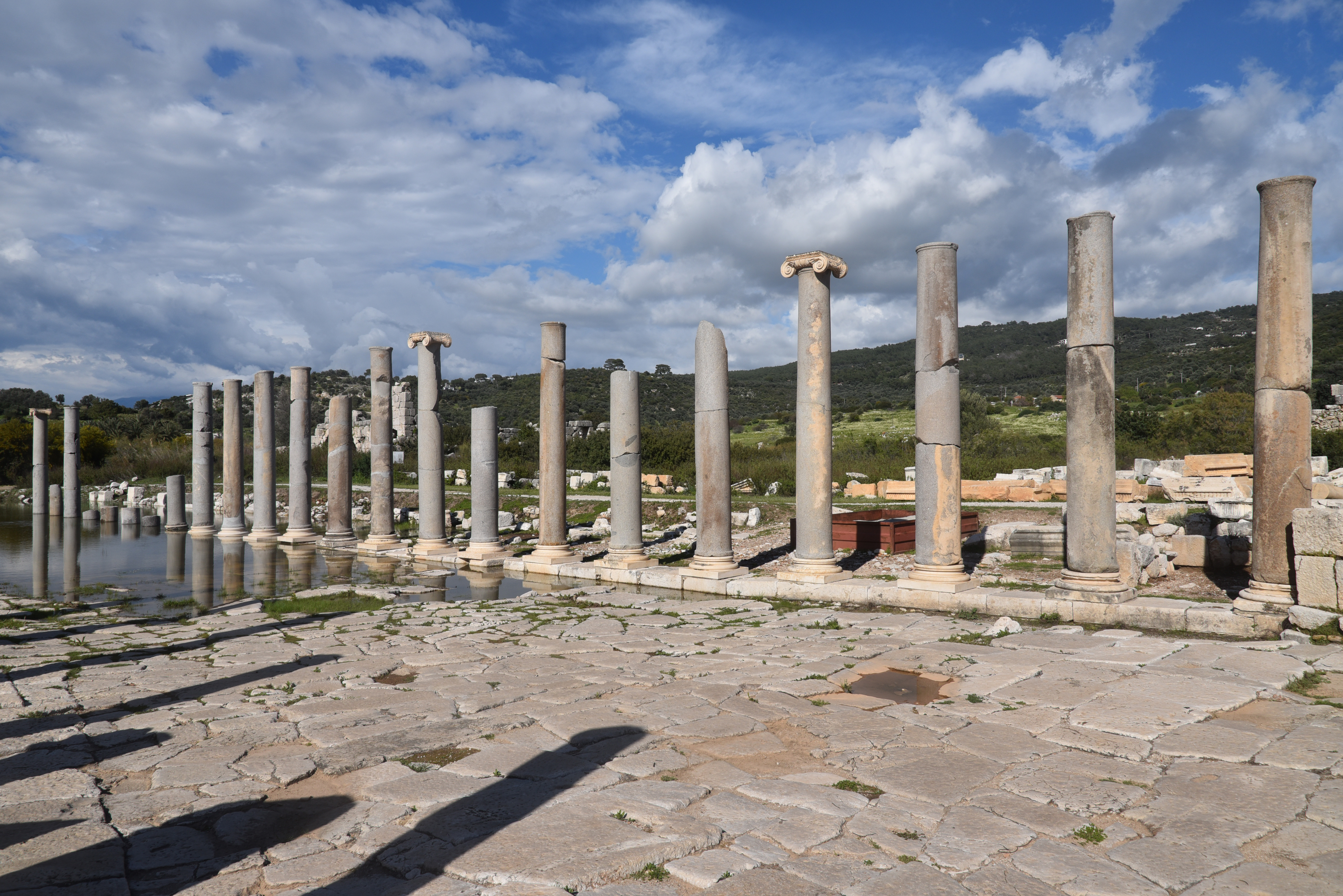
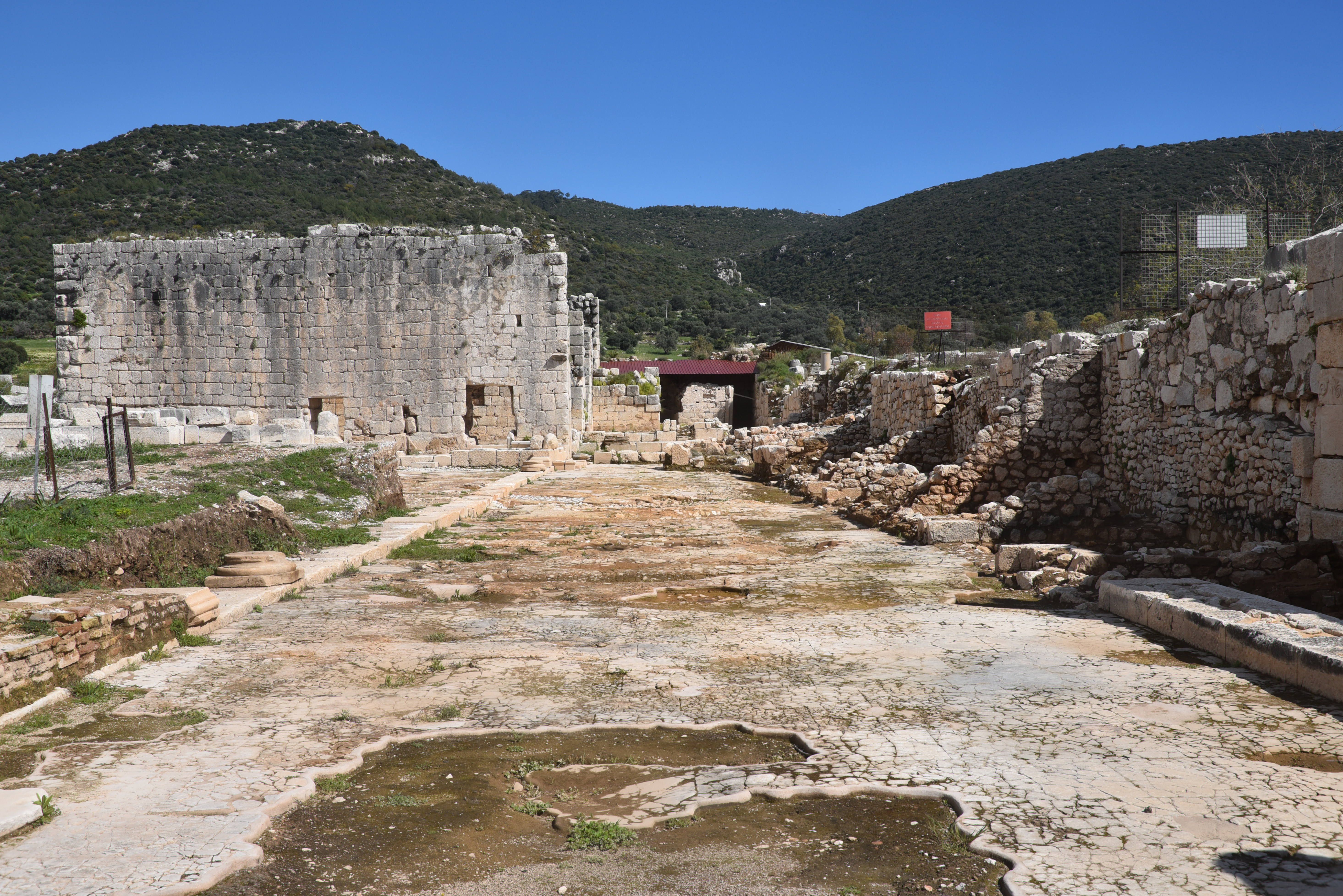
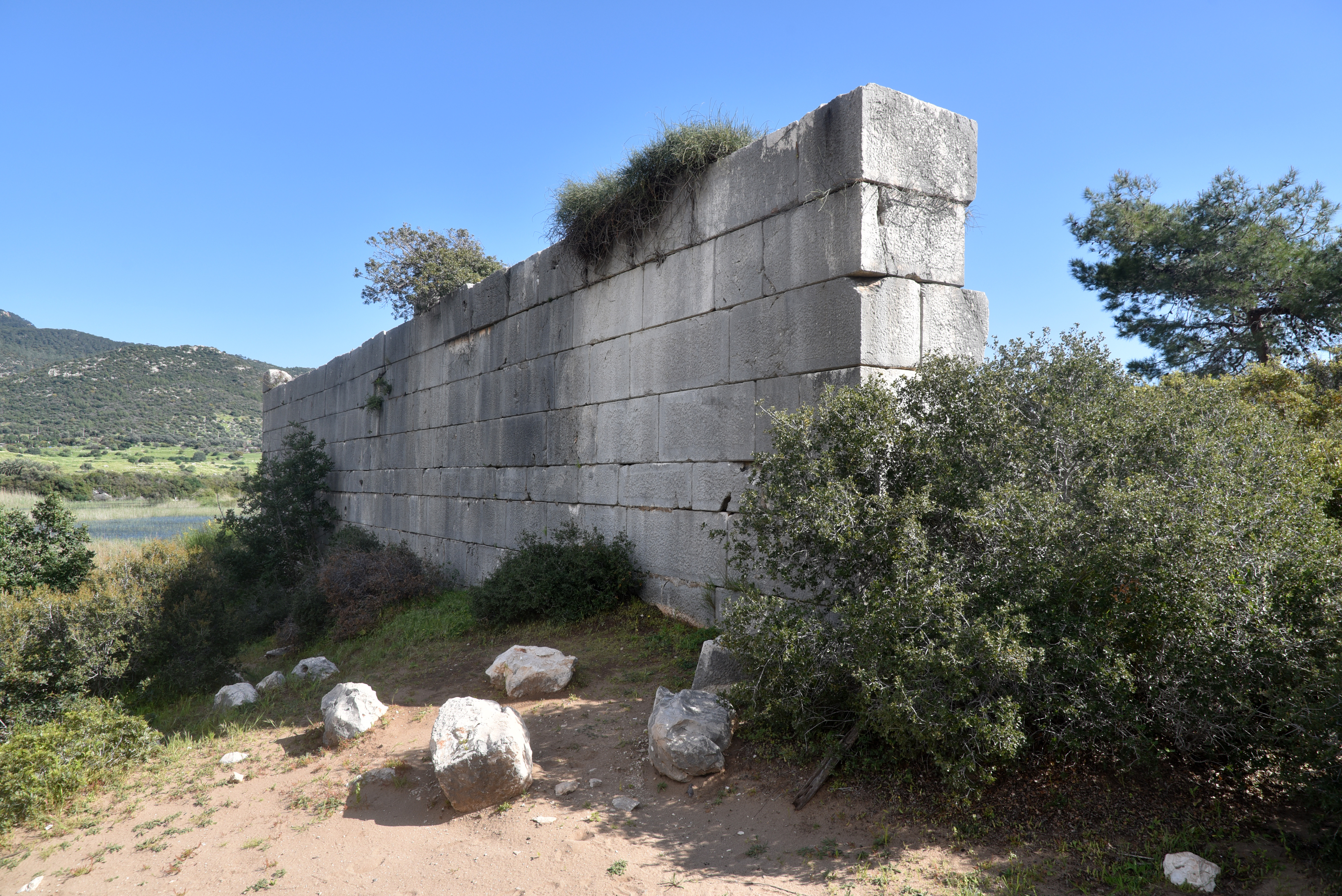
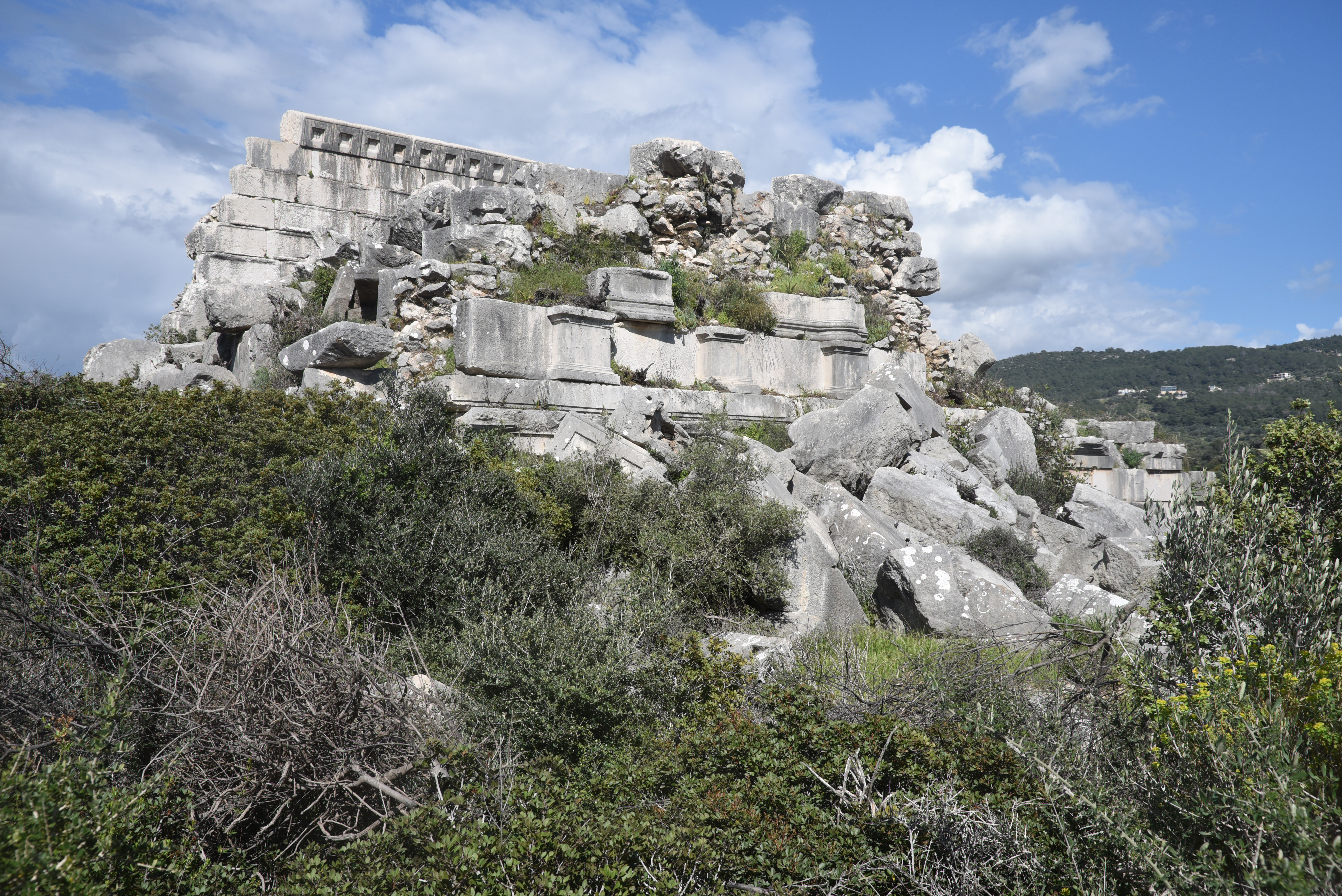
The City Gate is a triple-vaulted triumphal arch dedicated by the people of Patara to Mettius Modestus, a Roman governor of Lycia and Pamphylia during the reign of Trajan, between AD 99 and 102. It marked the formal entrance into the city from the harbour side.Built of large limestone blocks, the City Gate consists of four massive piers connected by three vaulted passages, with the central arch wider and more prominent than those on either side. The façade was richly decorated, with niches that once held statues and architectural detailing such as metopes and triglyphs.Evidence suggests the City Gate was integrated into the water system, with pipes running through the structure and a reservoir-like basin at its base. Beyond the gate, a broad colonnaded street led directly into the city centre.Shops (tabernae) lining the colonnaded street just inside the City Gate. They formed a planned commercial frontage, likely with porticoes in front.The Octagonal Pool, a carefully designed water feature located along the main street, about 50 metres south of the City Gate. Constructed from local limestone blocks, the pool was built around a central water reservoir. The pool functioned primarily as a civic water feature, likely serving both practical and decorative purposes along the street.The Palm Grove of Leto is associated with the mythological birth of Apollo. According to ancient sources, Leto gave birth to Apollo while grasping a palm tree, making the palm grove a sacred setting tied to themes of birth, renewal, and divine presence. While later traditions placed this event on Delos, there is a long-standing suggestion that a Lycian version of the myth existed, connecting Patara itself with the story.The Harbour Baths were constructed in the 2nd century AD at the eastern edge of the ancient harbour. This complex followed the typical design of Roman bathing architecture, featuring rooms arranged along a single axis: the frigidarium (cold room), the tepidarium (warm room), and the caldarium (hot room). The structure also included a palaestra, an open exercise area located on the eastern side, which reflects the broader social and athletic functions of the baths.The Theatre was originally constructed during the Hellenistic period and was later restored and expanded in the 2nd century AD; it could accommodate approximately 6,000 spectators.The theatre was built into the northern slope of Kurşunlutepe hill, using the natural terrain to support its semi-circular cavea. With a diameter of around 80 metres, it could accommodate approximately 6,000 spectators, arranged across 38 rows of seating divided by a central diazoma.The seating was organised into two tiers, with stairways creating wedge-shaped sections, while a removable awning (velarium) once provided shade. The cavea was completed under Tiberius (AD 14-37).The stage building (skene), about 41.5 metres long, was designed as a two-storey façade with elaborate decoration, including columns and architectural ornamentation. Access to the orchestra and stage was provided through side entrances (parodoi) and additional passageways.A small temple stood at the top of the cavea of the theatre, dedicated to a god or the imperial cult.The Assembly Hall of the Lycian League (Bouleuterion) was a substantial civic building that accommodated up to 1,400 people. Built on a large rectangular foundation, it combined architectural features of a council chamber with those of a small theatre, reflecting its dual function as both a political and ceremonial venue.Originally constructed in the Late Hellenistic period, when Patara served as the capital of the Lycian League, the Assembly Hall of the Lycian League underwent several phases of modification during the Roman period. These included expansions to the seating and the addition of architectural elements such as a stoa and stage building, allowing it to function not only as an assembly hall but also as a venue for performances.The seating arrangement in the Assembly Hall of the Lycian League included a designated area for the Lycian governors.The Assembly Hall of the Lycian League also included an orchestra area with marble flooring and was enclosed by substantial masonry walls.Later, in the Byzantine period, the Assembly Hall of the Lycian League was incorporated into the city’s fortifications, marking a shift from civic use to defensive purpose.The Central Agora, with its double colonnade extending for around 120 metres and opening toward the agora. It occupied a broad open space between the Assembly Hall and the southern end of Harbour Street, forming the civic heart of the city. Although much of it has been lost, its blocks reused in later fortifications, the overall layout of this rectangular marketplace can still be traced through the remains of its surrounding stoas.The colonnaded porticoes of the agora provided shaded walkways and spaces for commercial and social activity, linking the agora to nearby public buildings such as the theatre, baths, and assembly hall.The Harbour Street formed the main north–south axis of the city, linking the inner harbour directly with the agora. At around 12.6 metres wide, it was one of the broadest and best-preserved streets in Lycia, flanked on both sides by colonnades approximately 6 metres wide.
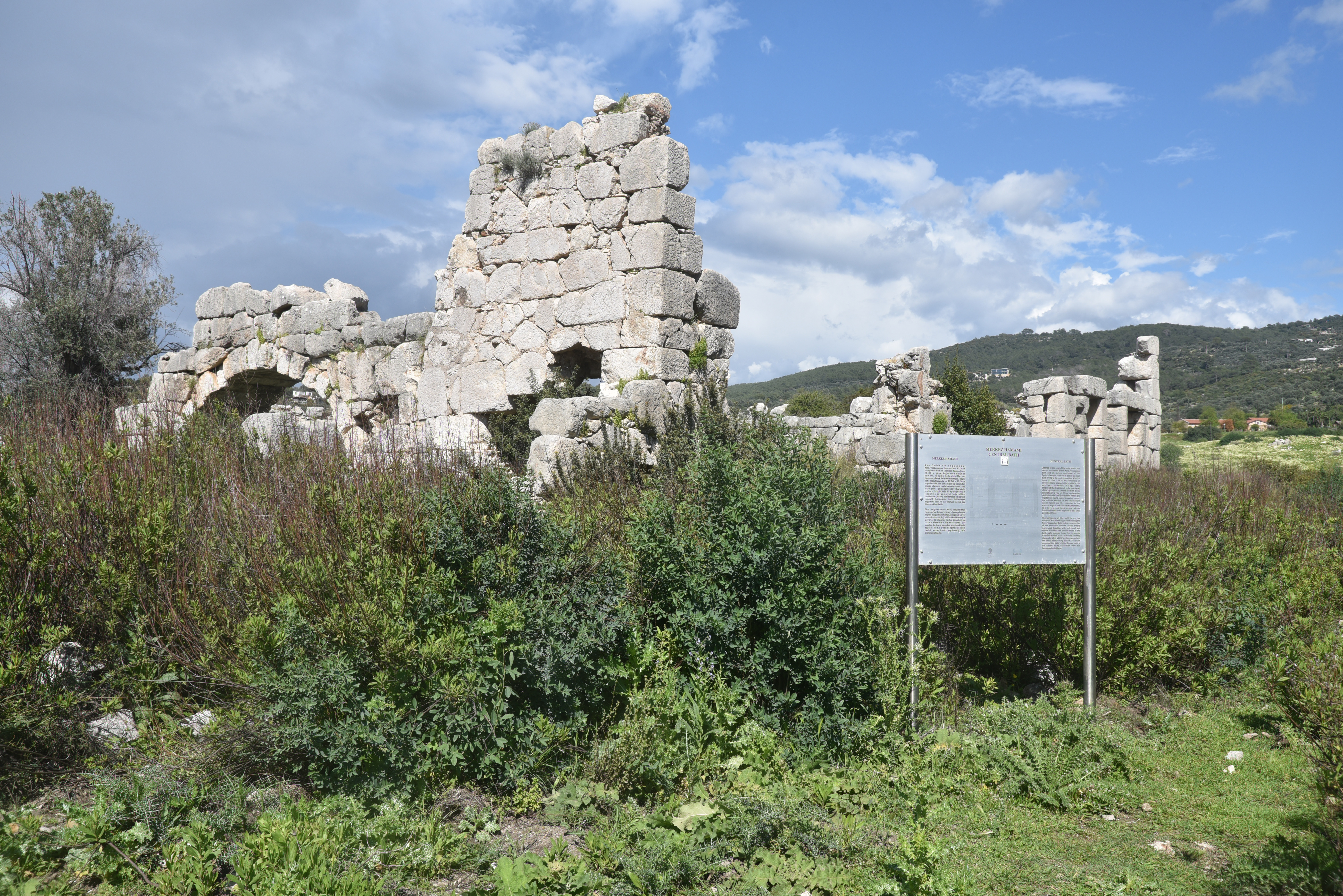
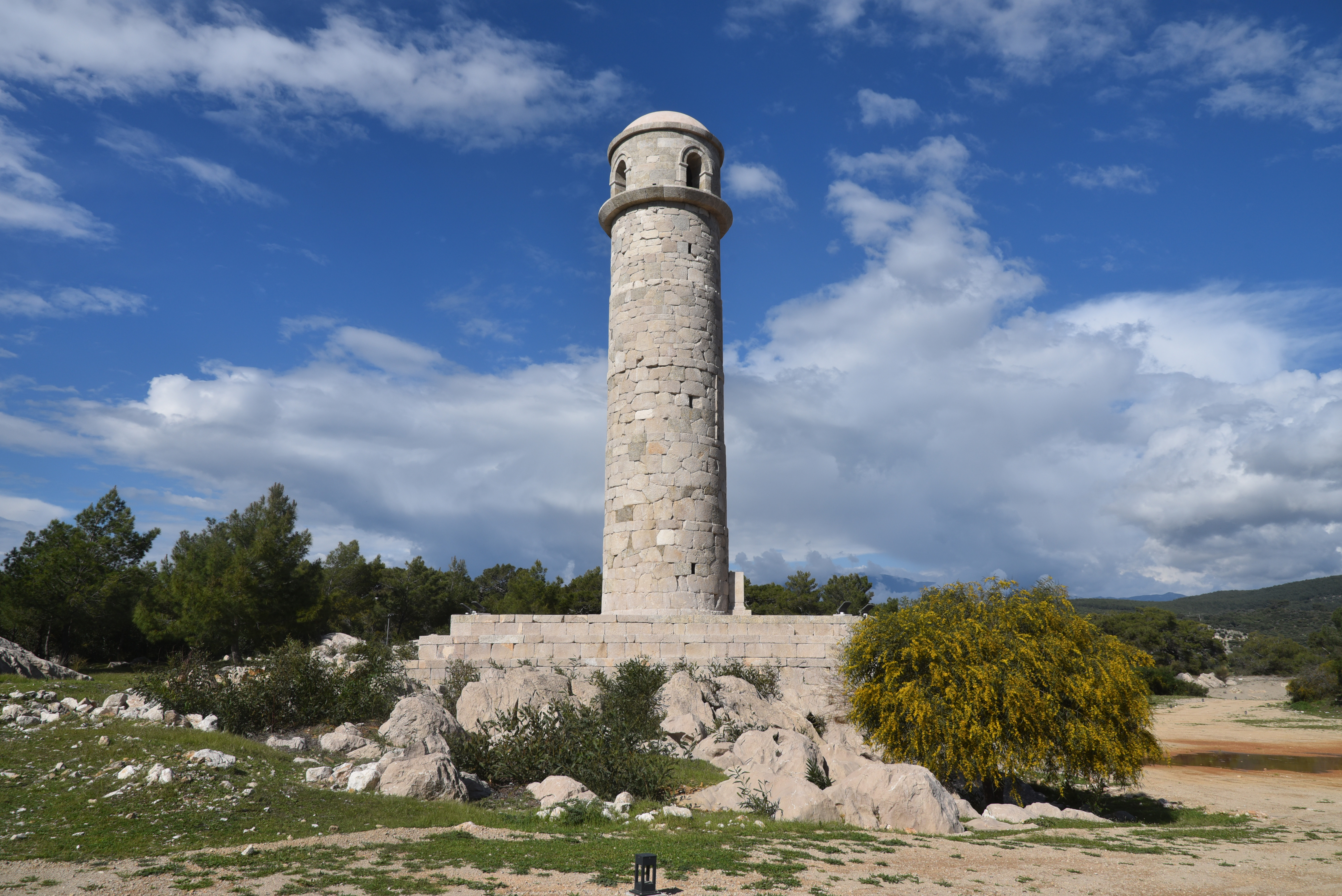
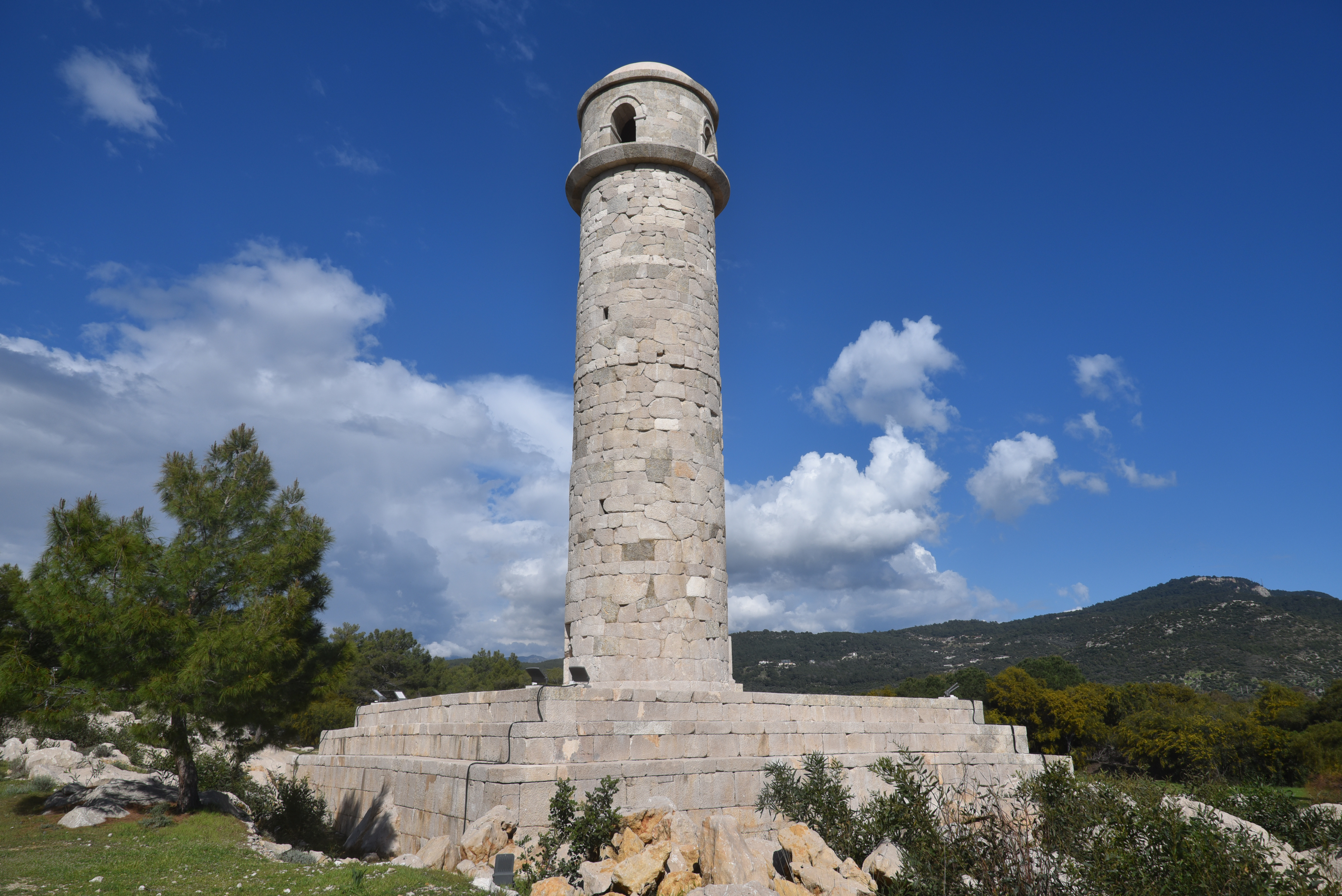
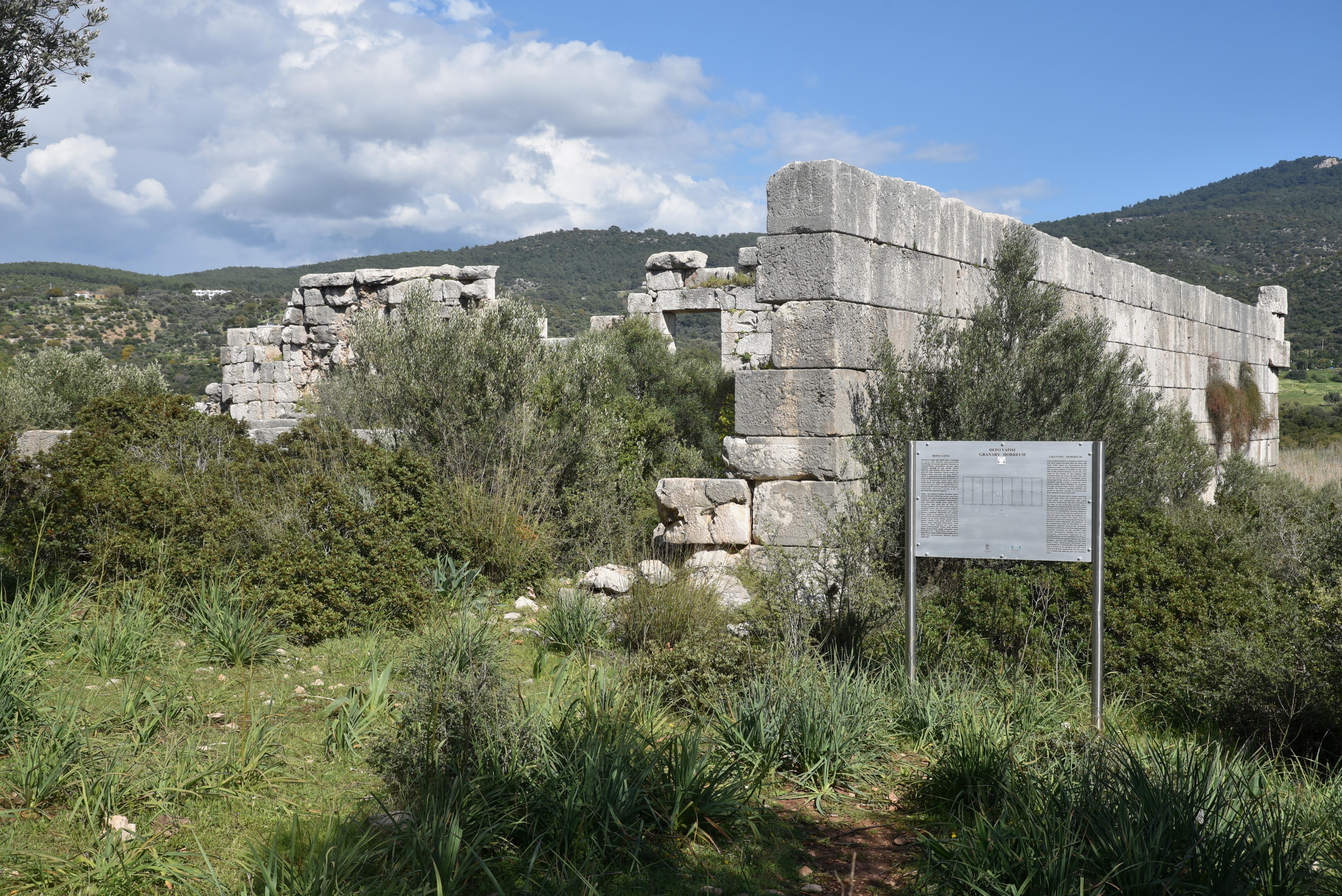
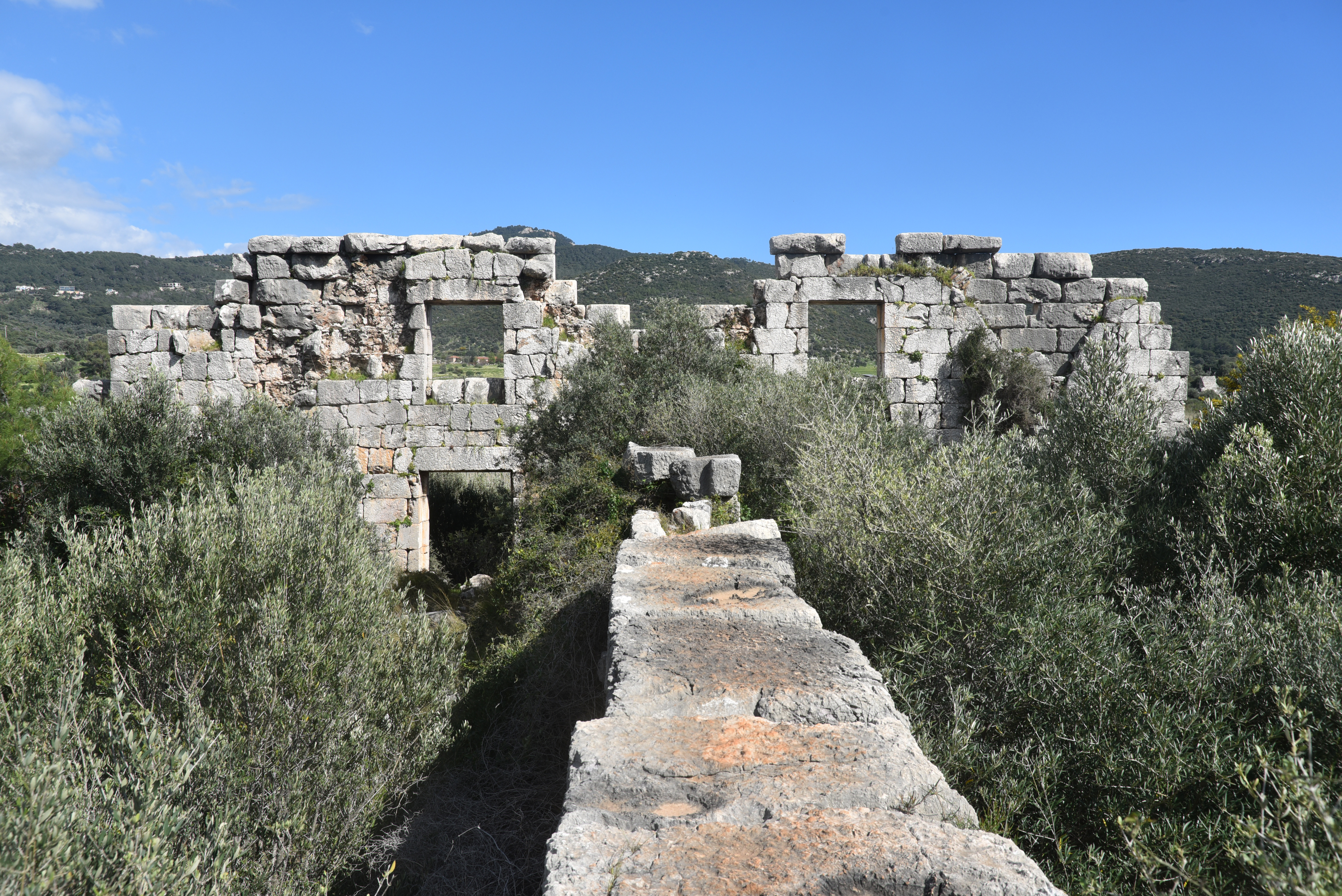
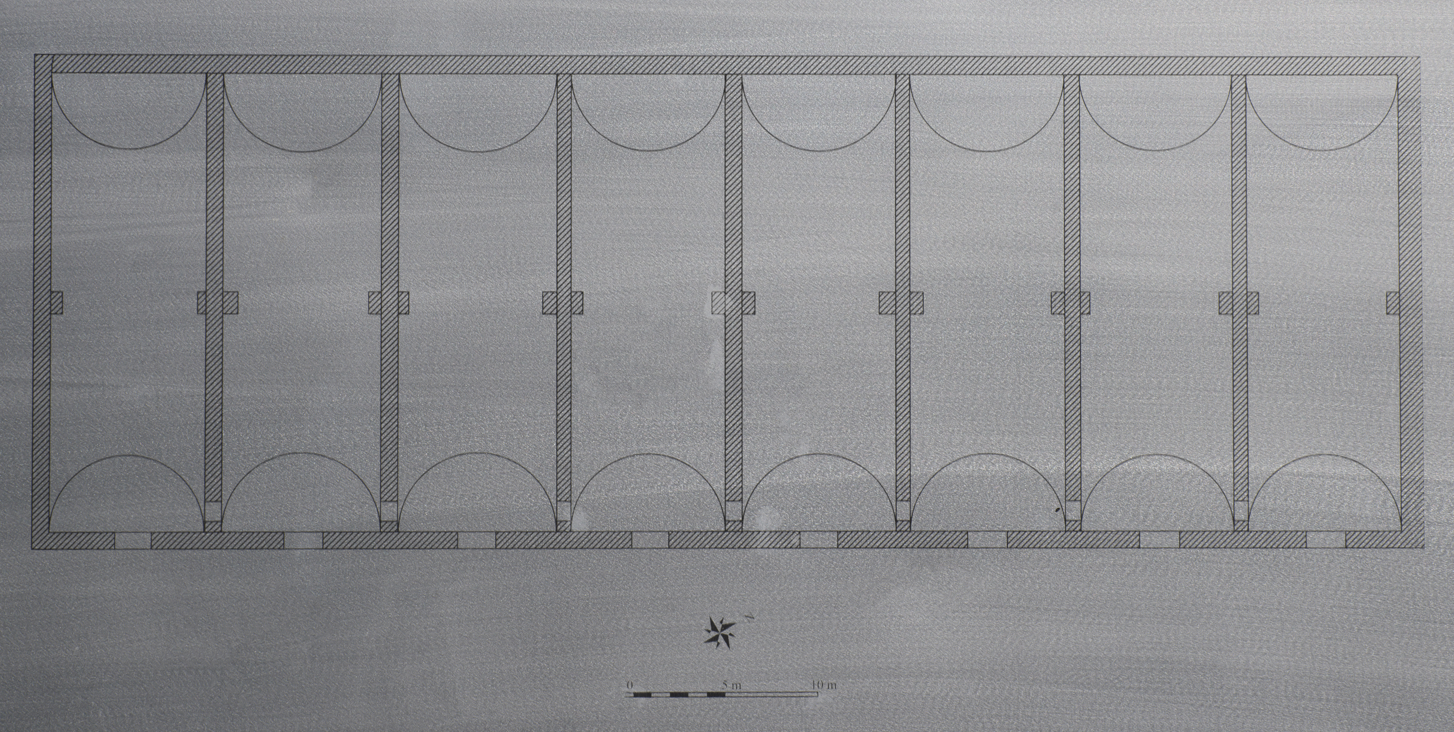
Originally laid out in the Hellenistic period, the Harbour Street was later rebuilt under the Romans as a cardo, intersecting with an east–west decumanus near the Prostylos Temple and continuing southward to the harbour.The eastern colonnade of the Harbour Street was built with granite columns, while the western side used marble and was once decorated with a geometric mosaic pavement. Behind these porticoes lay a series of shops, indicating the street’s important commercial role.The Harbour Street remained in use for several centuries, from at least the 1st century BC until as late as the 7th century AD.The Baths of Nero were originally constructed under Emperor Nero and later expanded during Vespasian’s reign. They are one of the largest and most significant bath complexes in Lycia.The Corinth Temple is a well-preserved 2nd-century temple from the Roman imperial era, located near the ancient harbour. It is built on a high podium and is notable for its intact cella walls. Currently, it is unknown to which deity or emperor the temple was originally dedicated.The Central Baths are located just east of the main street, between the larger Nero/Vespasian Baths and the Corinth Temple. Modest in scale, the complex measures approximately 12.5 by 25 metres and follows the traditional Lycian “row-type” layout, with three rectangular vaulted rooms arranged side by side along an east–west axis.View toward the ancient harbour and lighthouse.The Patara Lighthouse was a substantial freestanding structure that marked the entrance to the harbour, built during the reign of Emperor Nero in AD 65/66. Designed to guide ships safely into the port, it was built on a square podium, about 20 metres on each side, from which a tall tower originally rose to a height of around 26 metres.An inscription in bronze letters once crowned the Patara Lighthouse, recording that the lighthouse was built by the governor Sextus Marcius Priscus. A second inscription refers to additional harbour works, including another lighthouse at the eastern entrance of the port, suggesting a coordinated system of maritime infrastructure (a pair of lighthouses, a pharos, and an antipharos).Destroyed, most likely by an earthquake in the late medieval period, the lighthouse has since been carefully reconstructed using its original blocks, allowing its form to be understood once again within the landscape of the ancient harbour.The Neronian inscription on the lighthouse of Patara, dated to Nero’s twelfth tribunician power, AD 65/66.The Hadrianic Horreum, a key storage and distribution centre for goods arriving by sea, was built in AD 131 and dedicated to Hadrian.The Hadrianic Horreum measured approximately 75 by 25 metres and was divided into eight long, parallel chambers separated by thick internal walls. Each chamber opens toward the harbour through high doorways, while smaller passages within connect the spaces, allowing for the controlled movement of stored goods.
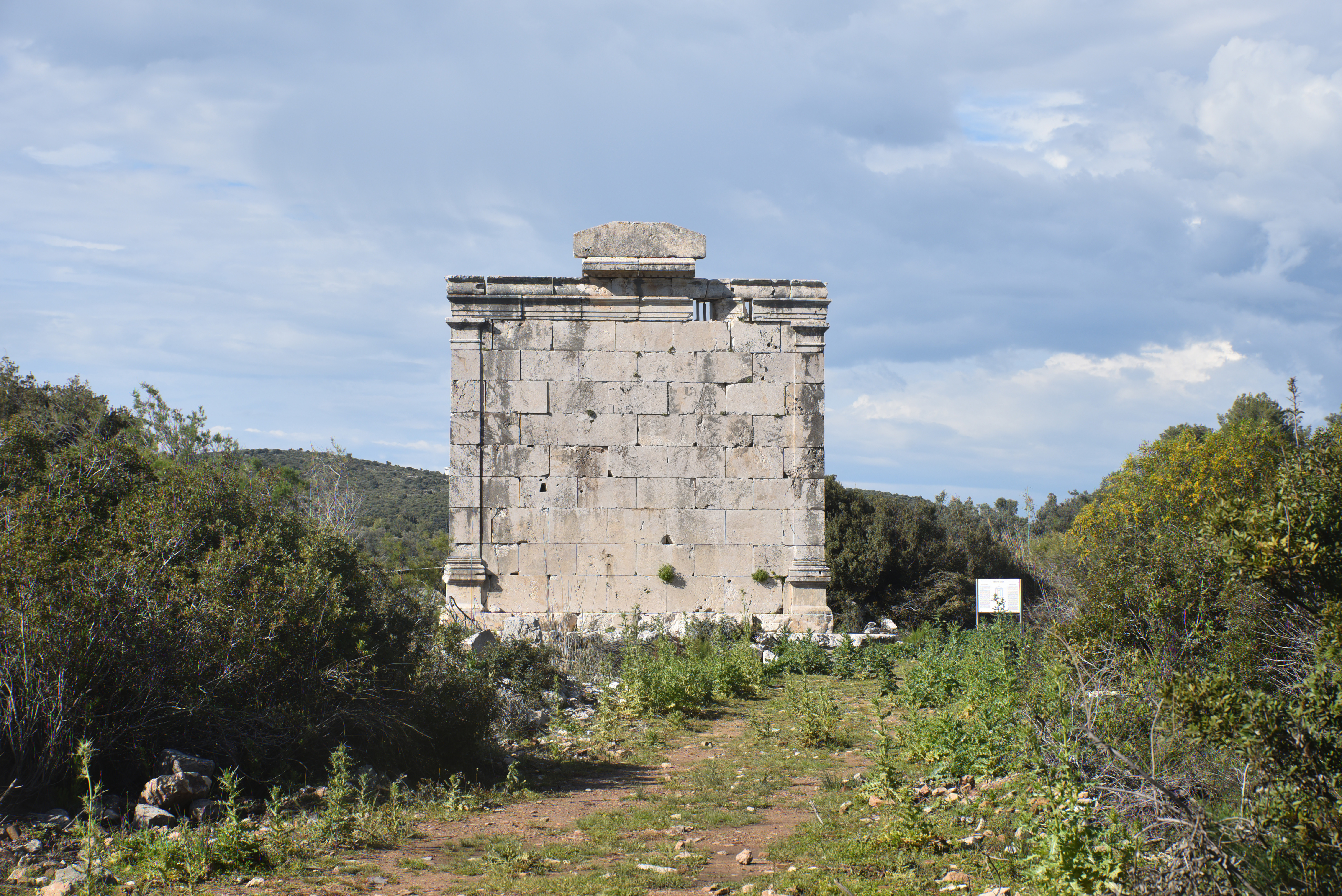
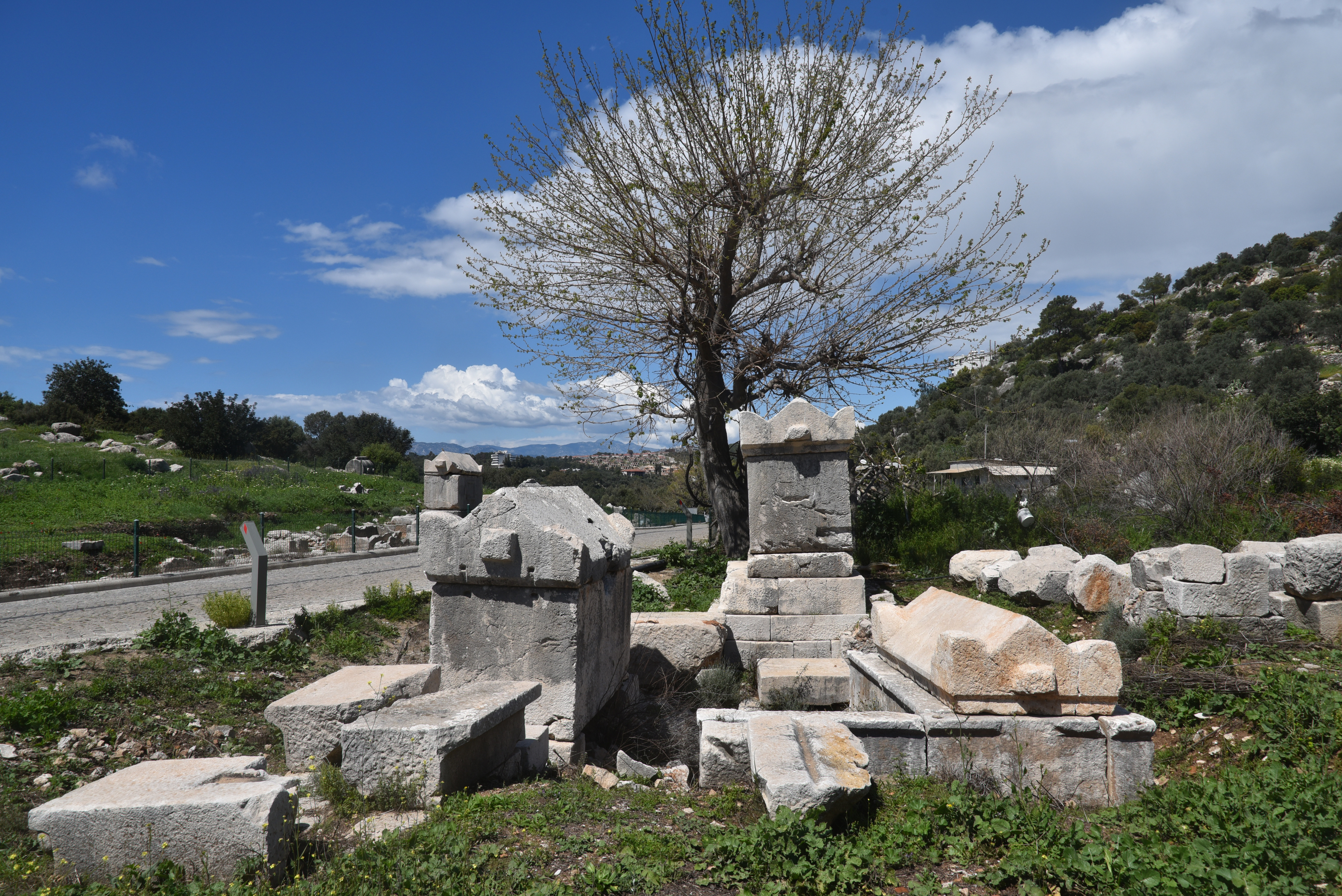
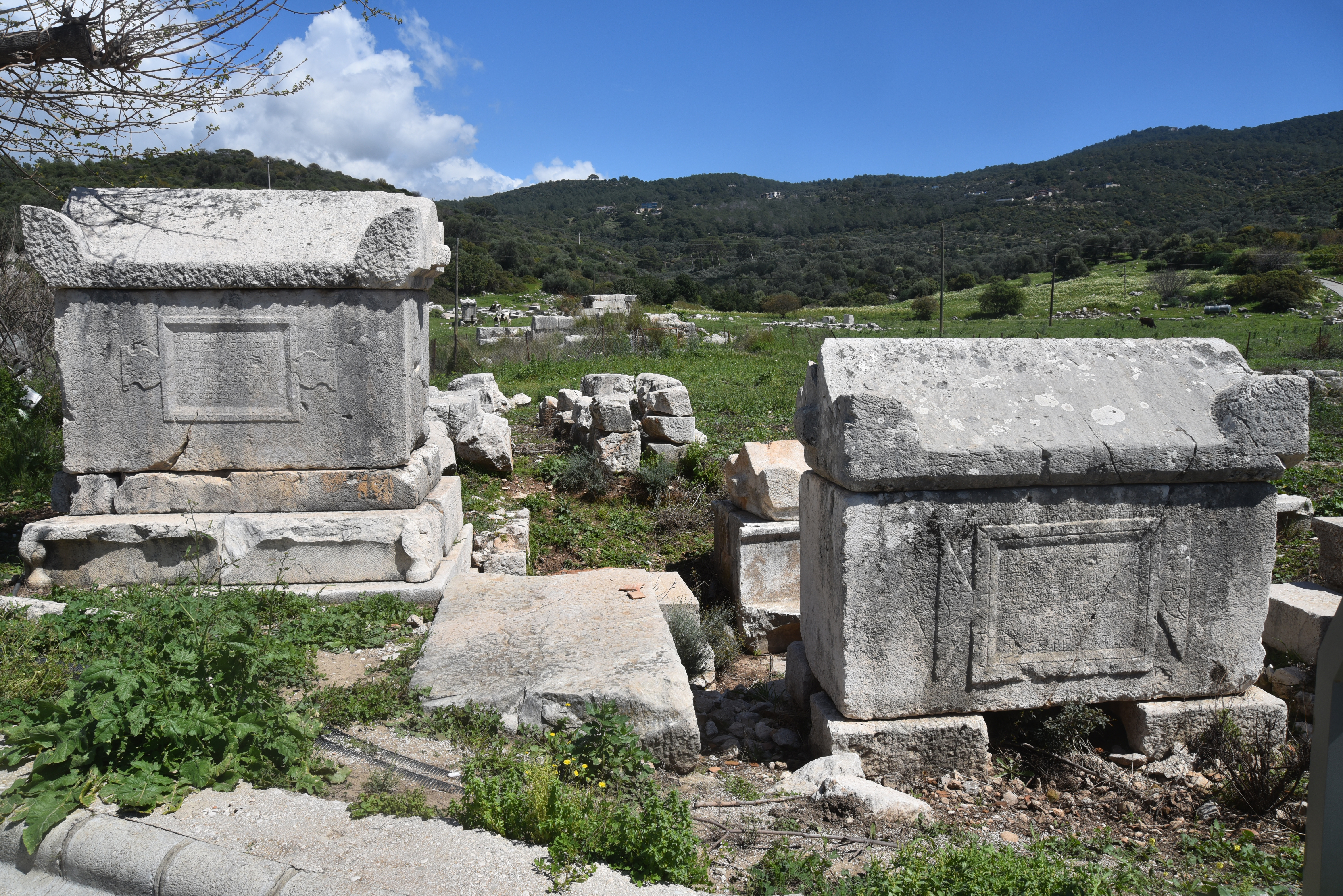
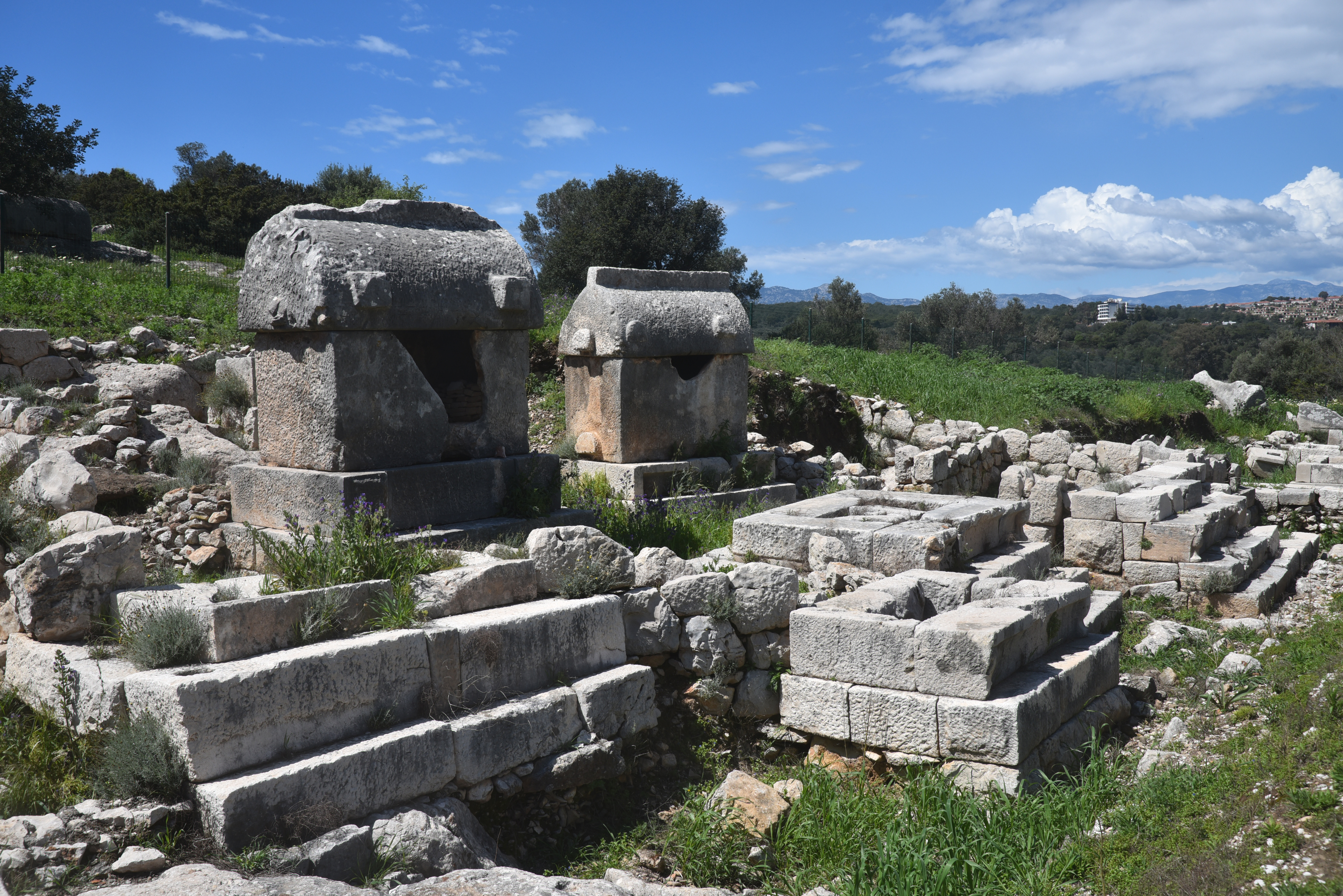
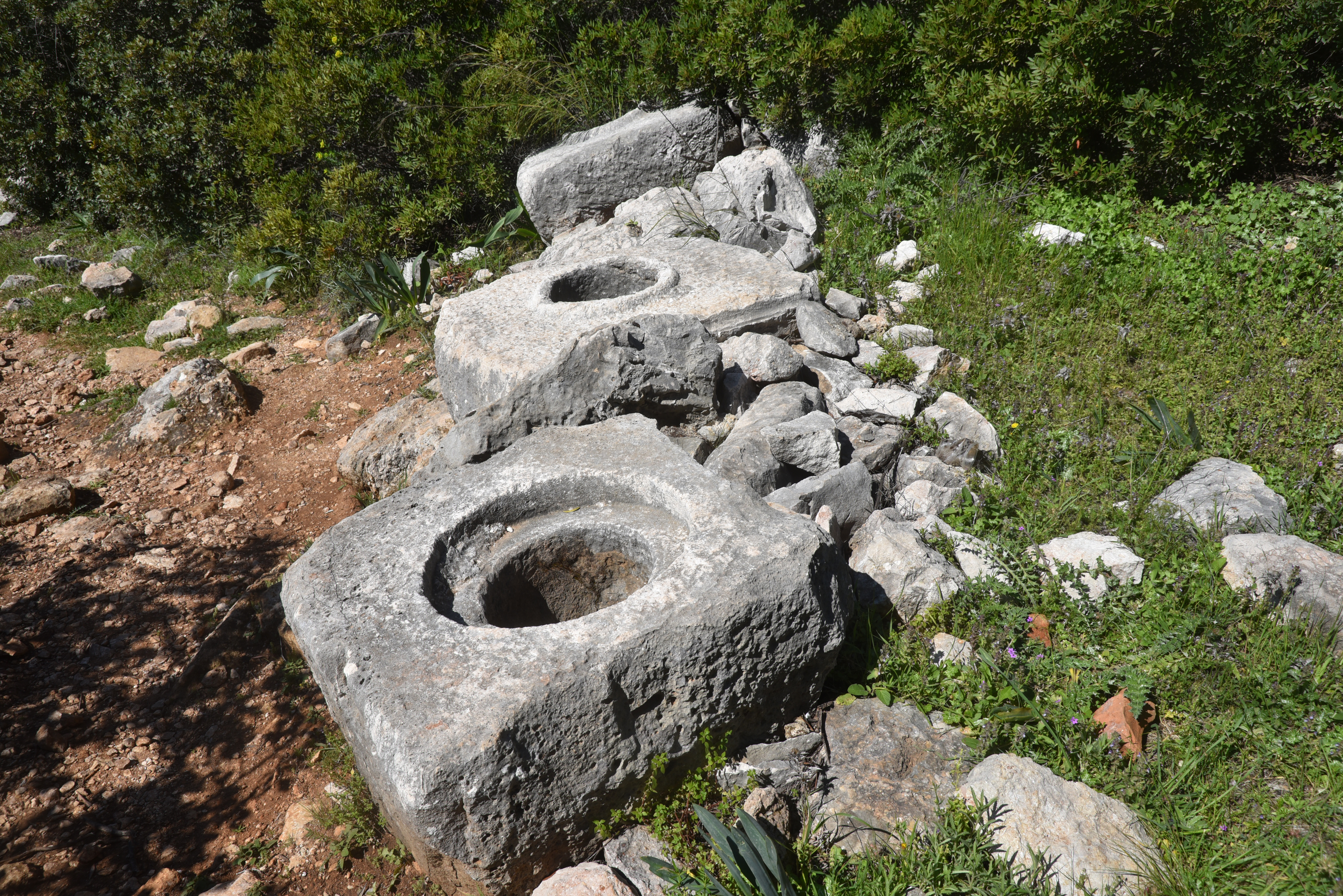
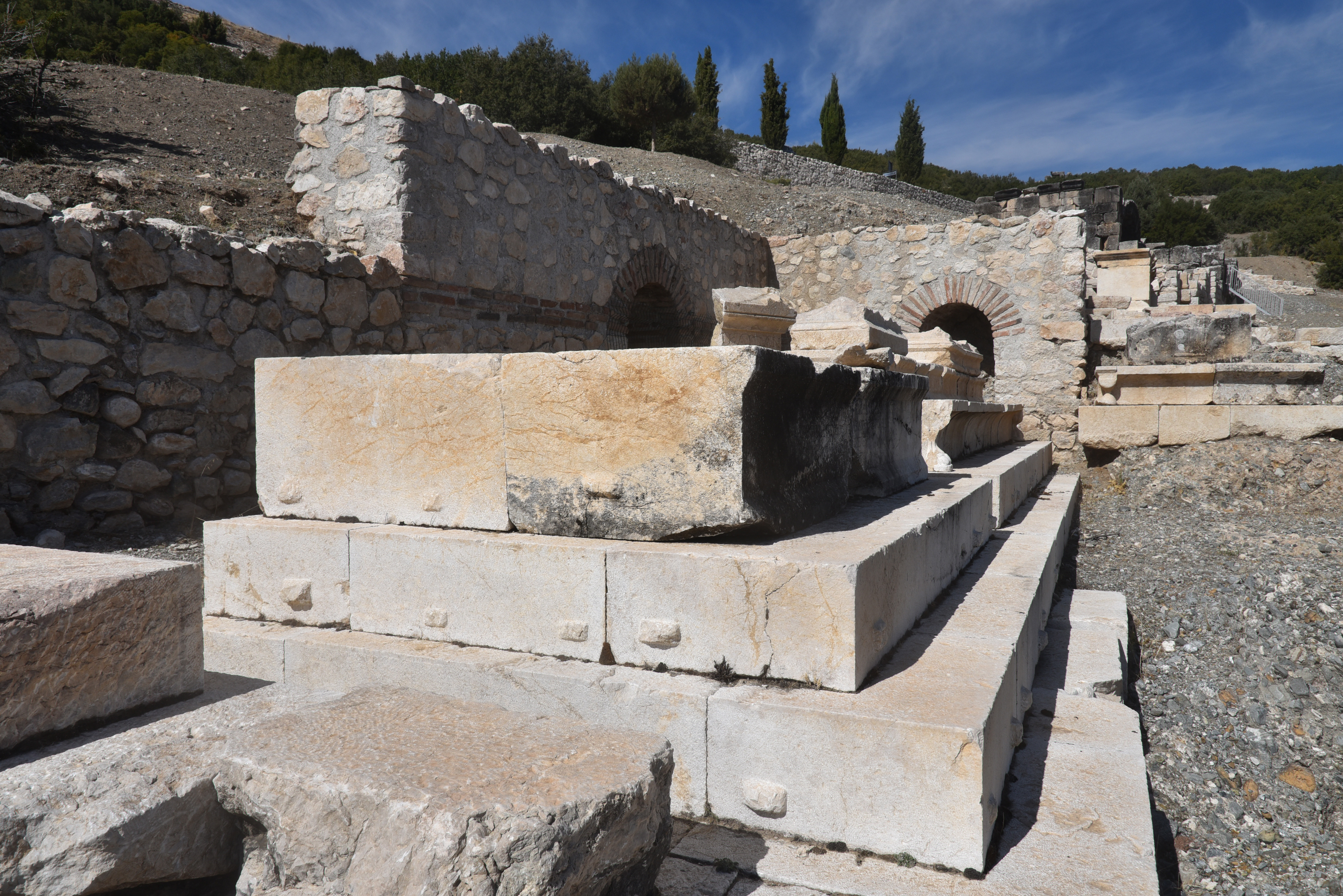
The Hadrianic Horreum is preserved almost to its full height, and its interior was originally covered with barrel vaults. Its façade, though architecturally simple, is carefully articulated with mouldings, projecting lintels, and restrained decorative features that lend rhythm to the long elevation facing the harbour. Subtle details, including cornices and carved garland motifs, add refinement to what is otherwise a highly functional structure.The tomb of Publius Pacconius Hermelas, a citizen of both Rhodes and Patara, dates back to the 1st century AD. It is located on the western edge of the harbour, just north of the Hadrianic granary and south of the stadium. Built from limestone blocks and oriented east-west, the monument stands on a substantial podium that measures approximately 19 by 14 meters. Accessed by a short flight of steps, it gives the structure an imposing appearance, like a small temple.The Necropolis, featuring distinctive Lycian-style sarcophagi.The Necropolis.The Necropolis.The Delikkemer Aqueduct, located a short distance north of Patara, formed one of the most impressive sections of the city’s aqueduct system. This monumental pressure bridge carried water across the valley from springs in the hills toward the city, using an advanced hydraulic design rarely preserved so clearly in the ancient world.Unlike the familiar high arcaded aqueducts of the western Roman Empire, Delikkemer functioned as an inverted siphon. Water descended through stone pipes into the valley and was then forced upward by pressure to continue its course toward Patara. The structure itself consists of a long stone-built bridge with regularly spaced arches, within which terracotta and stone pipes once carried water under pressure.The massive stone pipe blocks of the Roman inverted siphon system had a carefully carved circular opening at their centre, where pressure pipes were joined to form the sealed conduit transporting water across the valley. These blocks, cut from local limestone and scattered beside the ruined aqueduct line, provide a rare glimpse into the technical infrastructure hidden within the masonry of Delikkemer.The masonry walls of Delikkemer were constructed from large, carefully cut limestone blocks, engineered to withstand the considerable hydraulic forces generated by the inverted siphon system. Its thick walls provided both stability and protection for the water pipes running through the top of the bridge.
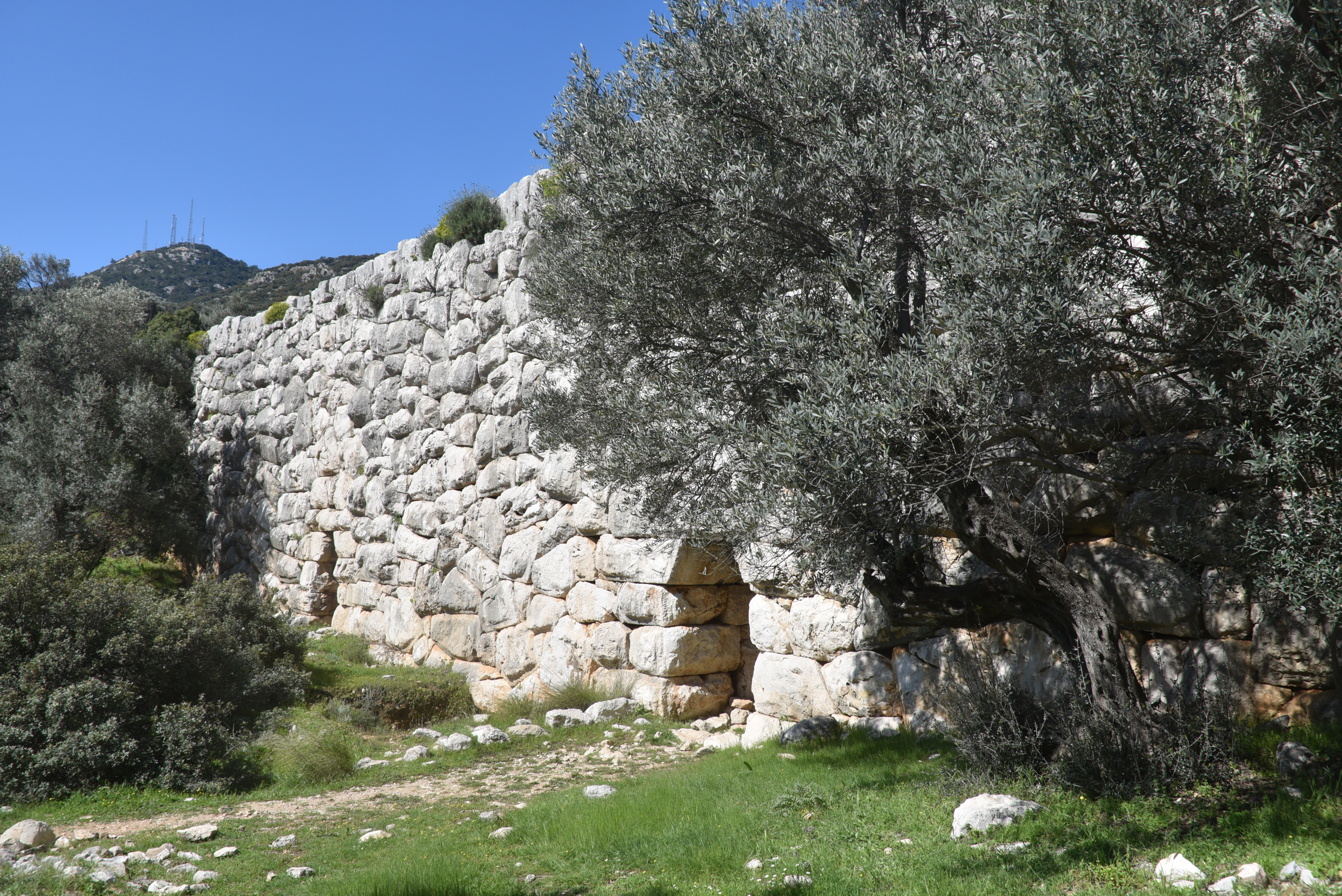
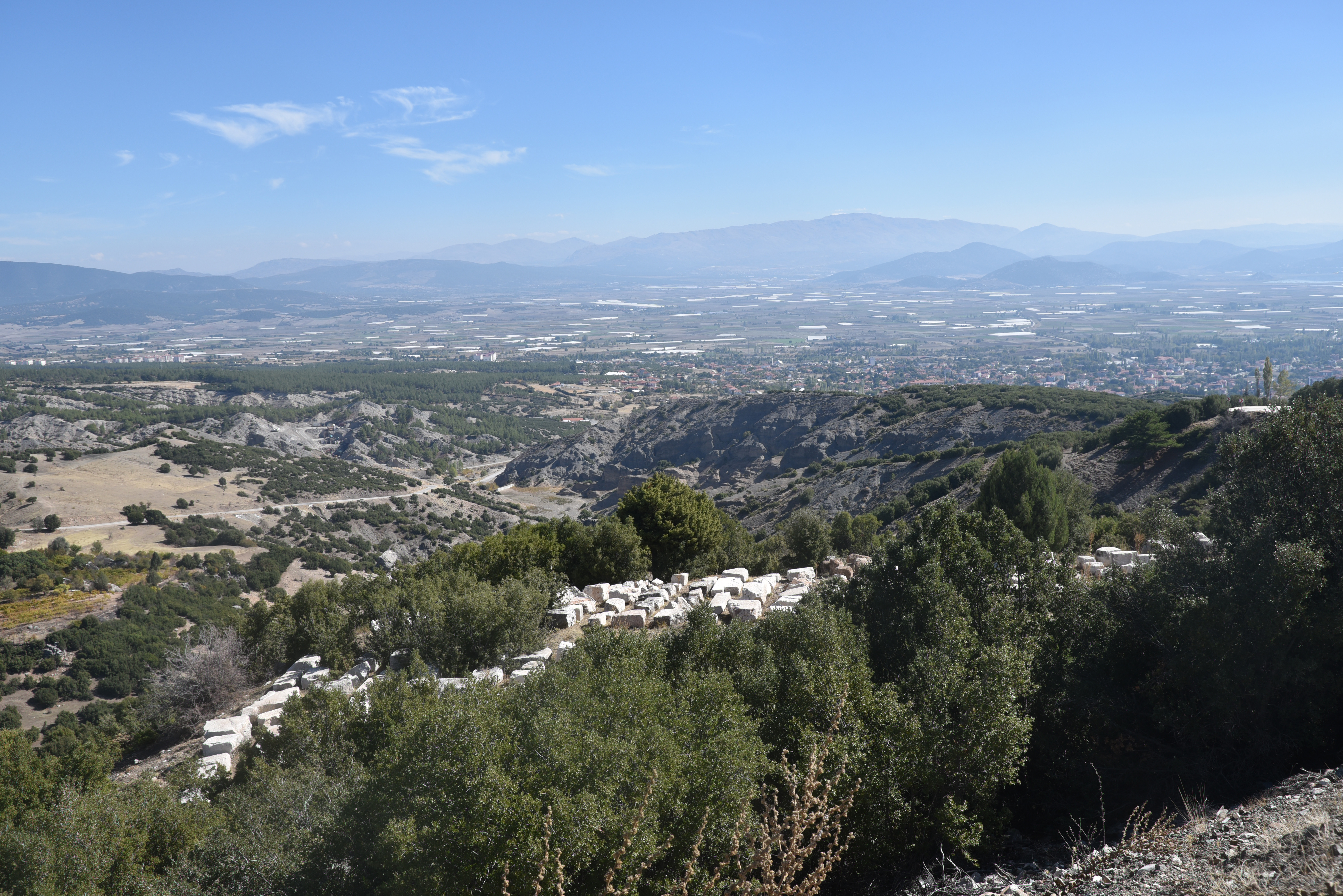
Kibyra was an ancient city located on a mountainous site, spanning three prominent hills, southwest of modern-day Gölhisar, approximately 110 kilometres from Burdur in southwestern Turkey. It was important in the ancient world due to its strategic location at the intersection of the cultural regions of Lycia, Caria, Pisidia, and Phrygia, and at the crossroads of important north–south and east–west commercial routes. The city prospered and developed during the second half of the 2nd century BC, becoming the political centre of the Kabalia or Kibyriatis region. Most of the buildings standing today were constructed in Roman times, following the city’s destruction by an earthquake in AD 23.
Geographer Strabo (13.4.17) first mentions Kibyra in ancient sources, noting that the city was founded by the Lydians and that its inhabitants spoke four languages: Pisidian, Solymian, Greek, and Lydian. Initially established near Uylupınar Lake, it was relocated to its current site in the 3rd century BC, likely for security reasons. Geographically, Kibyra lies within the Kabalis region (later known as Kibyratis), a cultural crossroads where Lycia meets Pisidia, Caria, Lydia, and Phrygia. The population of Kibyra was ethnically and linguistically diverse. Archaeological and epigraphic evidence from nearby mounds, such as Yusufça and Sorgun, shows that the area has been continuously occupied since the Late Chalcolithic and Early Iron Ages.
Kibyra rose to prominence during the Hellenistic period, coming under the control of the Kingdom of Pergamon in the early 2nd century BC under Eumenes II. Shortly thereafter, it became the leading member of a tetrapolis, known as the Kabalian League, a federation of four cities: Kibyra, Boubon, Balboura, and Oenoanda. The league was dissolved by the Roman commander L. Licianus Murena in 82 BC. Following this, Kibyra was incorporated into the Lycian League and became the administrative centre of the Roman province of Asia. After a devastating earthquake in AD 23, Emperor Tiberius provided financial aid and tax exemptions for its recovery, leading to the city being renamed Kaisareia Kibyra.
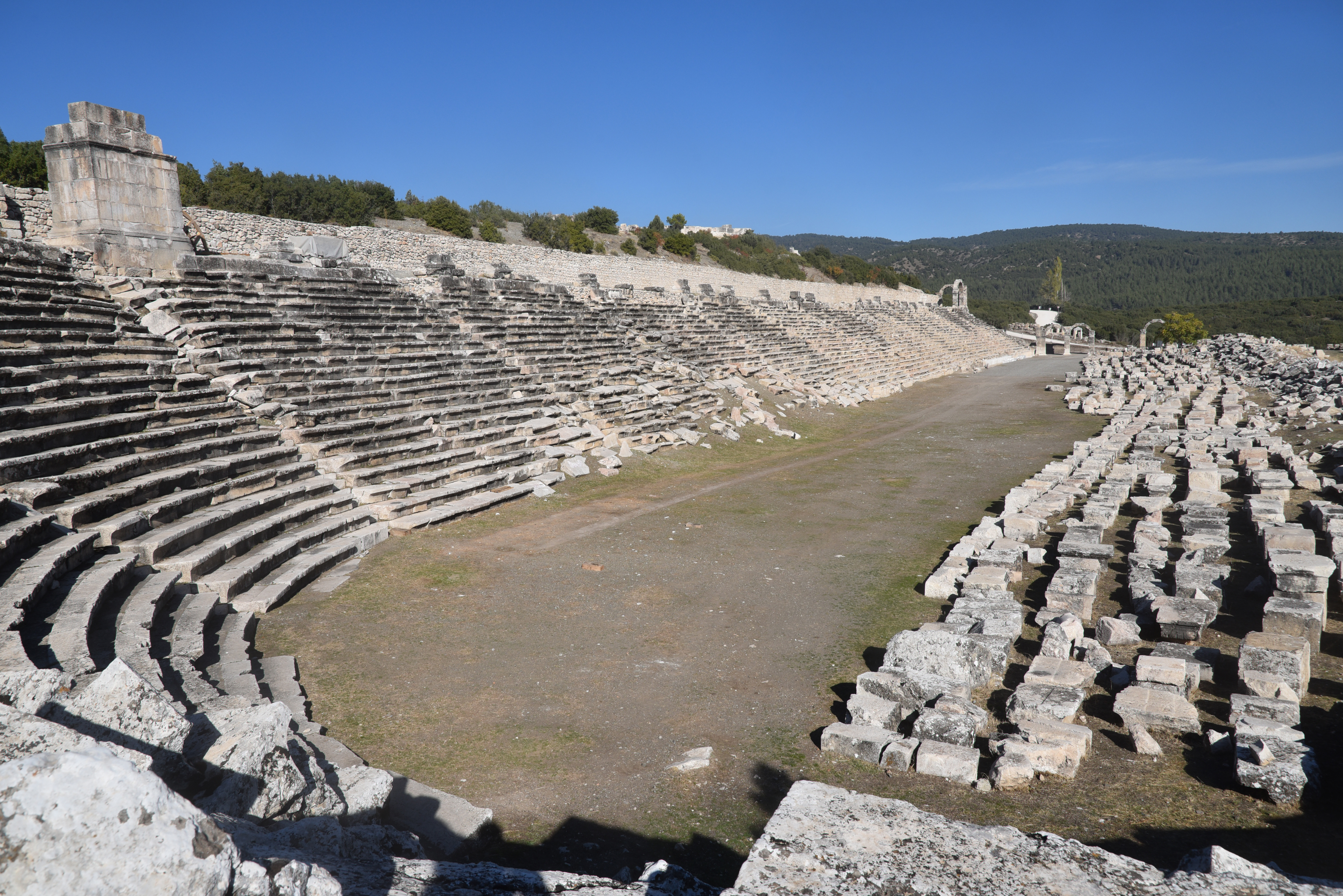
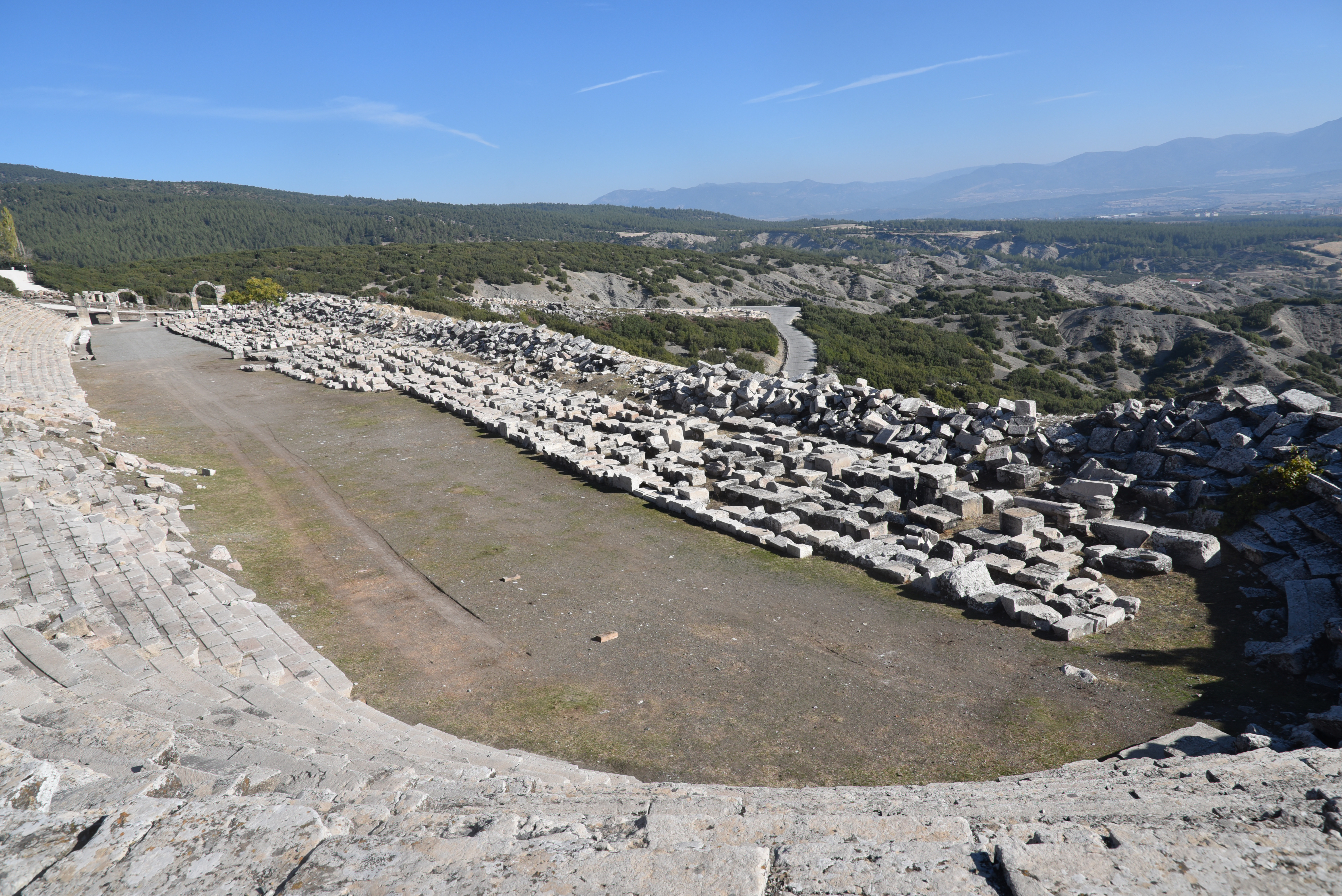
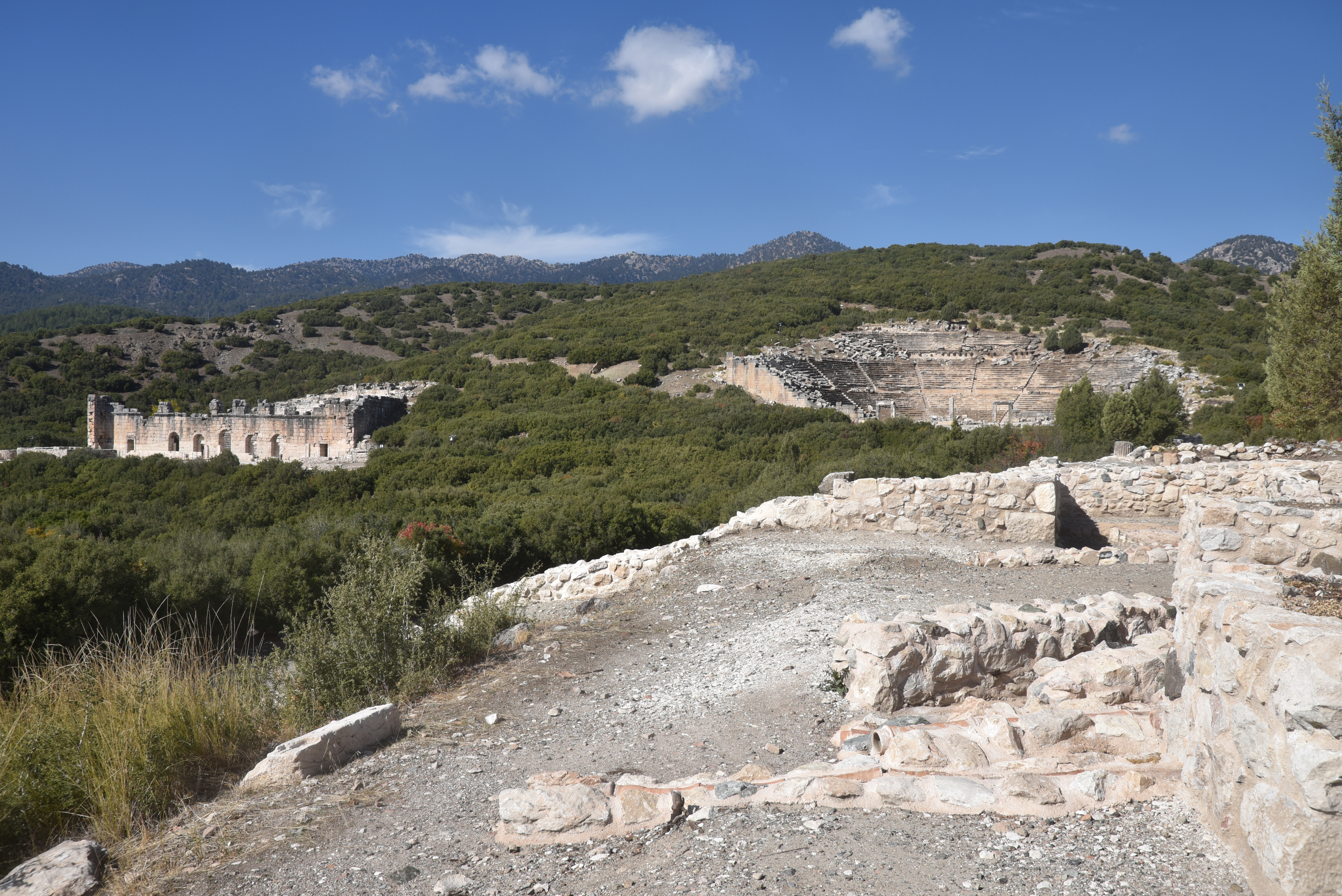
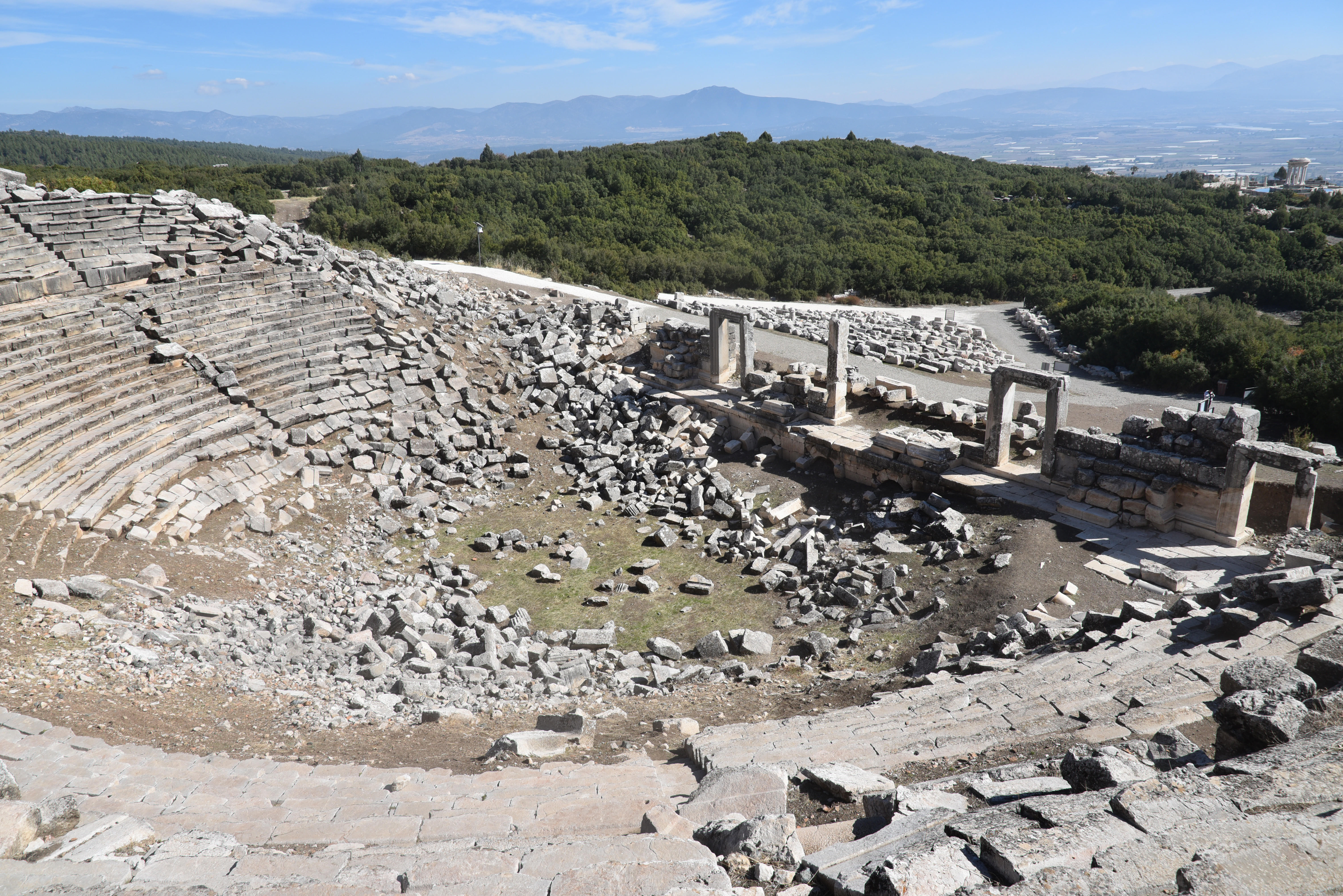
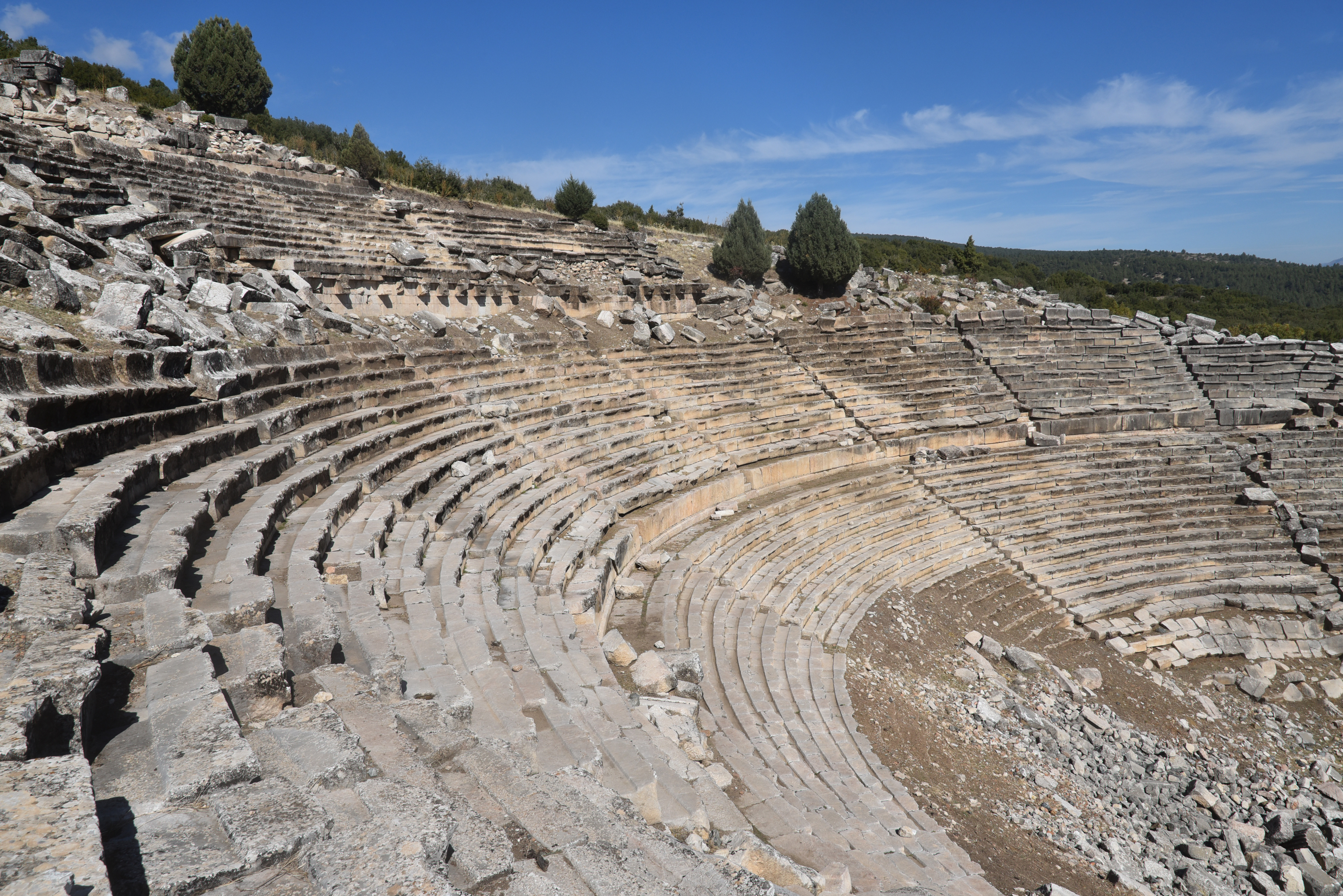
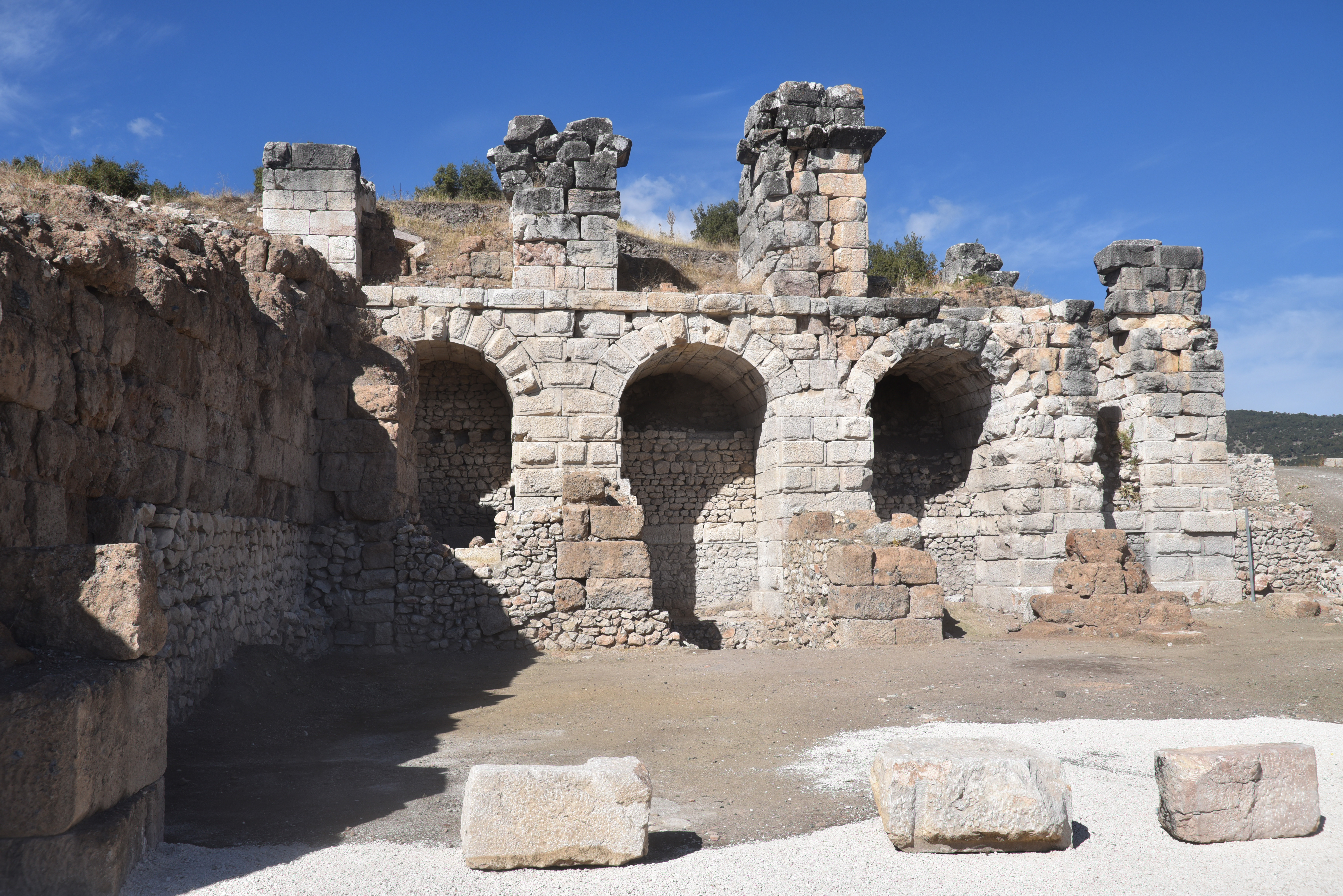
Under Roman rule, Kibyra reached its peak of prosperity. It became well-known for its agriculture, animal husbandry trade, and, particularly, its skilled production of ironwork, leather, and pottery. Kibyra was architecturally impressive, built across three hills and featuring monumental structures that highlighted its wealth and significance. Among these structures was a stadium measuring 185 meters in length, capable of accommodating around 10,000 spectators. The theatre, partially hewn into a hillside, had seating for about 9,000 people and showed evidence of a velarium and inscriptions referring to local clans and economic exchange rates. Adjacent to the theatre stood the Odeon, a multifunctional indoor theatre and council hall seating approximately 3,600. This venue was beautifully decorated with coloured marble, statues, and a distinctive Medusa mosaic in opus sectile on its orchestra floor. It is considered one of the best-preserved civic structures in Lycia. Additionally, nearby Byzantine baths featuring hypocaust systems demonstrate the region’s continuous urban development.
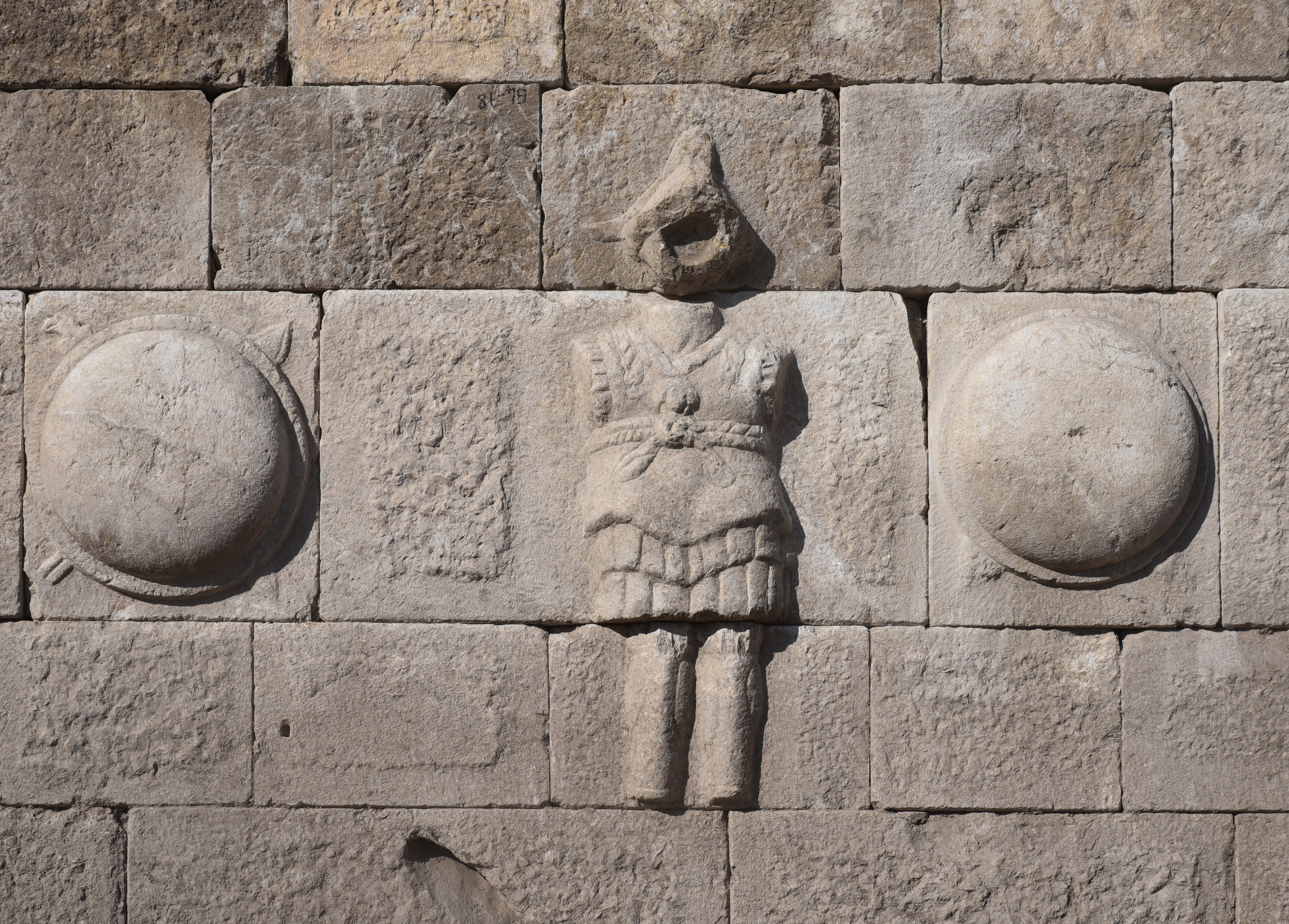
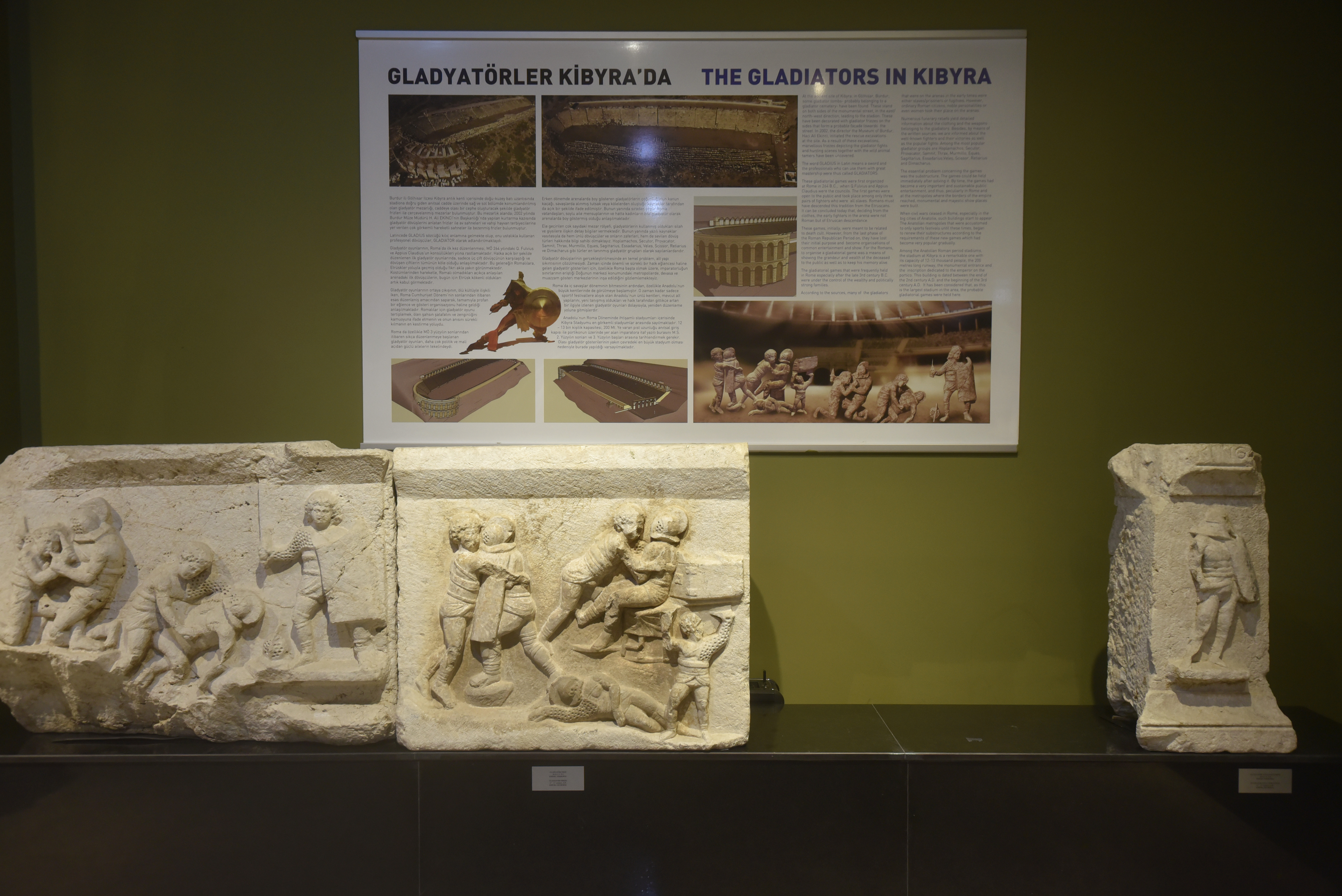
The most important finds in Kibyra are a body of architectural reliefs and stelae depicting gladiatorial contests, discovered during excavations by the Burdur Museum on the road to the necropolis east of the stadium. These friezes, which belonged to three different monumental tombs of munerarii, depict various aspects of gladiatorial games, including duels between gladiators and the hunting of animals. Along with reliefs on locally produced oil lamps, these friezes indicate that gladiators played an important role in the social life of Kibyra and that the stadium was used not only for athletic competitions but also for gladiatorial fights and venationes.
The city was repeatedly damaged by earthquakes, notably in AD 417, when a quake severely damaged the stadium and other structures. Despite these setbacks, Kibyra remained a prominent urban centre until its eventual abandonment after the 7th century AD.
PORTFOLIO
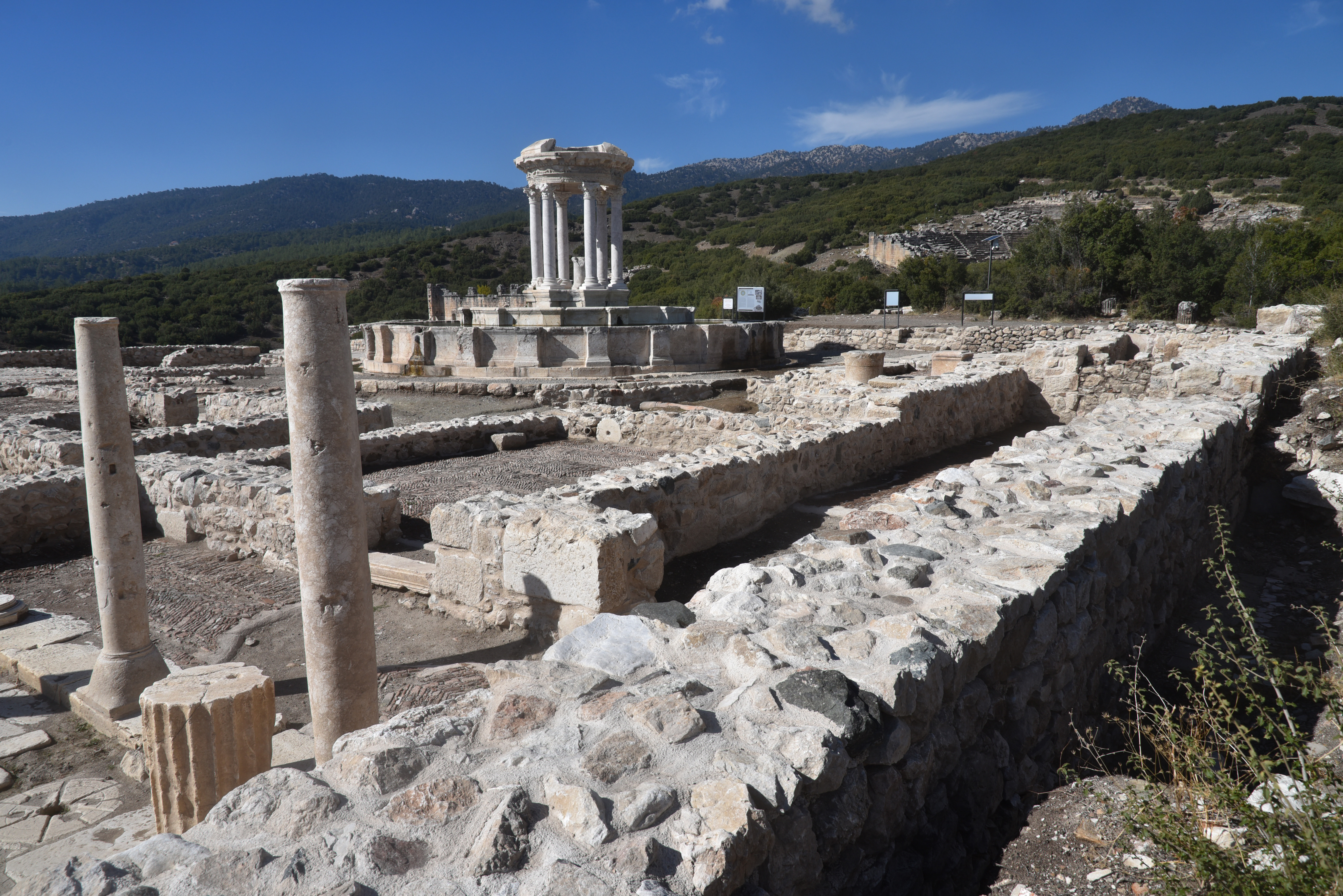
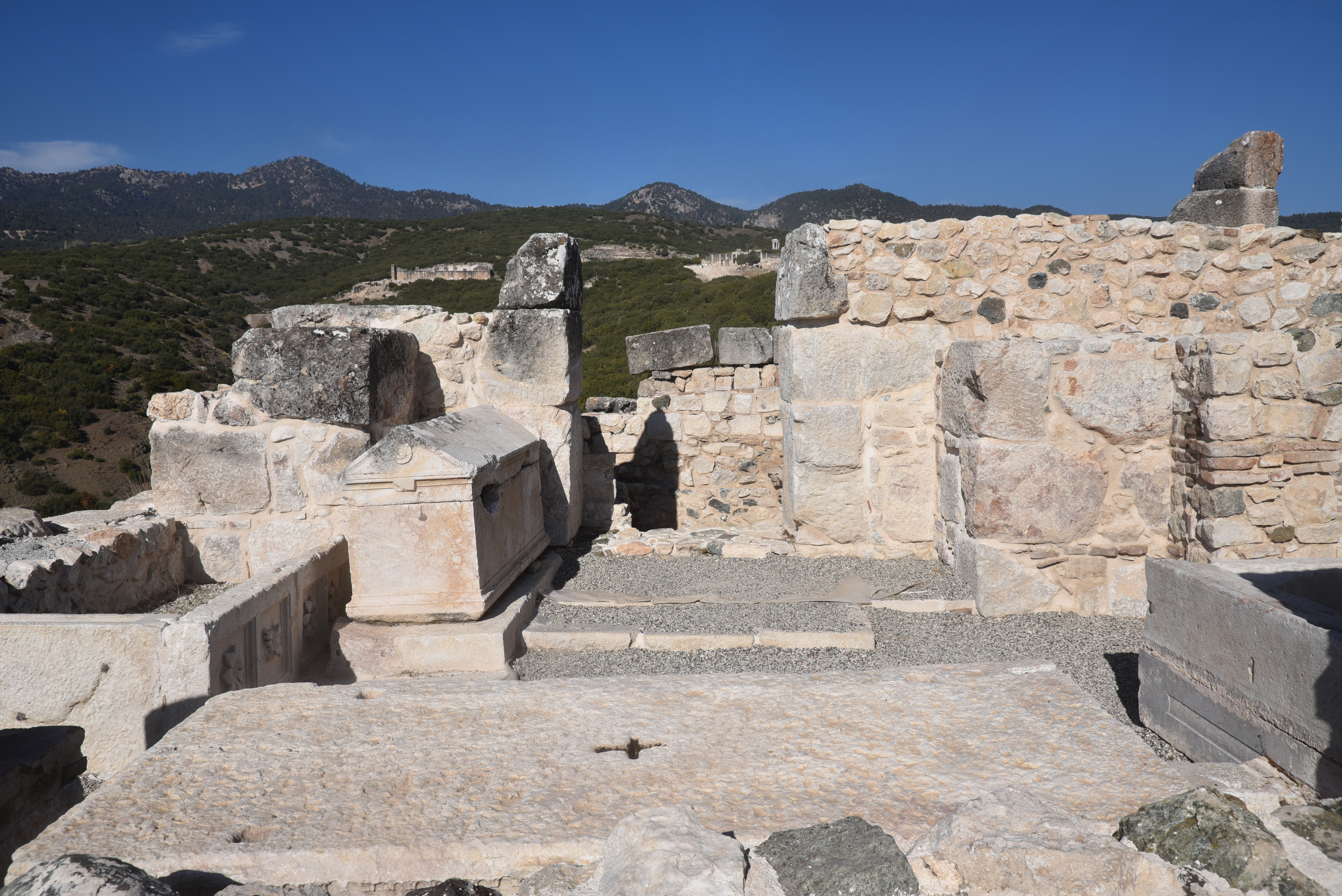
The stadium. Dated to the late 2nd to early 3rd century AD, the stadium was strategically located on the slopes of the main hill, integrated into the urban fabric of Kibyra.The stadium features a single U-shaped sphendone design, accommodating approximately 10,000 spectators.The stadium had 21 rows of seats on the western side, carved into bedrock, while the eight rows on the eastern side were supported by a retaining wall. The stadium was damaged by earthquakes, notably in AD 23 and AD 417, leading to its eventual abandonment.The stadium of Kibyra was accessed from the north through a propylon featuring five arched entrances. The propylon stood 7.94 meters high and spanned 25.35 meters in width. The estimated date of the stadium is based on an inscription found on the propylon and dated to AD 198-211.In-situ relief on the wall of the stadium, likely representing a tropaion (“trophy”) relief showing a male figure with a helmet, breastplate and greaves between two round shields with spears.The excavated 40m-long main street near the Upper Agora, which ran from the stadium to the theatre. It was approximately 800 m long, extending east to west, and was formed of stairs due to the elevation.The colonnaded street of the Upper Agora with stoas and shops on both sides.The colonnaded street of the Upper Agora.A fountain along the colonnaded street of the Upper Agora.The tholos-nymphaeum on the third terrace of the Upper Agora, unearthed during the 2016 excavations. The circular, temple-like fountain structure was dedicated to the nymphs and associated with the city’s water supply system. It was decorated with columns, embossed friezes, and sculptures.A bronze lion head water spout on the Tholos-Nymphaeum.The Tholos-Nymphaeum consists of a circular structure with a central water system made of blocks and two surrounding circular pools. The central structure is covered with a conical roof carried by columns.The Tholos-Nymphaeum was most likely constructed after the earthquake in AD 23. It underwent three phases of use: during the first phase, it featured a single pool and a circular structure with a central water system. A second pool was likely added in the late second and early third centuries AD.Terracotta water pipes surrounding the Tholos-Nymphaeum. The excavations revealed that the structure was not only a fountain but also a castellum that supplied water to its immediate surroundings.The third terrace of the Upper Agora with the Tholos-Nymphaeum.The third terrace of the Upper Agora.View of the Theatre and Odeon from the Upper Agora.The Theatre, built on a natural slope and seating around 8,000 people, dates to the Hellenistic period, but the upper cavea and the two-storey stage building were added in the 2nd century AD.The Theatre.Traces of wooden posts used to carry a velarium to protect spectators from the sun and rain can be seen on the cavea.The Odeon with its colonnaded forecourt paved with black-and-white mosaics.The Odeon was constructed in the 1st century AD and embellished in the 3rd century AD.The cavea of the Odeon has a capacity of 2,500.The orchestra floor of the Odeon with the Medusa mosaic.Kibyra’s captivating Medusa mosaic was made in opus sectile, a technique using thin marble slabs. Unearthed in 2009, the mosaic dates to the 2nd or 3rd century AD.The foundations of the temple of the imperial cult (Kaisarion), a temple dedicated by Quintus Veranius, the governor of Lycia in the Claudian period, to the emperor’s worship. It was built during the reign of Claudius (AD 41-54) and dedicated to Emperor Augustus (as Zeus Patroos Augustus) and his wife Livia (as Nea Demeter Augusta).Dedicatory inscriptions and architectural fragments from the temple of the imperial cult.The Roman Bath Complex, dated to the 1st century AD.Roman Bath Complex.The Golhisar plain at the foot of Kibyra.Basilica Church, a religious building with three naves, a triconch apse, and burial chambers, dating to the 5th century AD.Burial chambers inside the Basilica Church, dated to the 5th century AD.Burial chambers inside the Basilica Church, dated to the 5th century AD.The Main Road leading to the Stadium has a necropolis area on both sides, primarily consisting of sarcophagi.A necropolis on one side of the Main Road leading to the Stadium. Here, two sets of friezes depicting gladiators in various actions were found, belonging to two monumental gladiator tombs that, along with other tombs.The gladiator reliefs from the necropolis of Kibyra in the Burdur Museum.The gladiator reliefs from the necropolis of Kibyra in the Burdur Museum.The Eastern Necropolis, a burial area with different types of tombs built during the Roman Period.Sarcophagi in the Eastern Necropolis.The Eastern Necropolis.
Berns, C., & Ekinci, H. A. (2015). Gladiatorial games in the Greek East: a complex of reliefs from Cibyra. Anatolian Studies, 65, 143–179. http://www.jstor.org/stable/24878381
Kileci, Senkal & Önen, Nihal. (2024). Restoration Works in Kibyra during the Claudian Period: New Inscriptions, τὰ σεβαστὰ ἔργα of the Lycian Governor Quintus Veranius and New Inscriptions Concerning His Family.
Dökü, F. Eray, and M. Can Kaya. “The Architecture and Function of the Stadium of Kibyra”. Adalya, no. 16 (June 2013): 177-201.
Karabacak, Volkan & Yönlü, Önder & Dökü, Eray & Kıyak, Nafiye & Altunel, E. & Özüdoğru, Şükrü & Yalciner, Cahit Caglar & Akyuz, H. Serdar. (2013). Analyses of Seismic Deformation at the Kibyra Roman Stadium, Southwest Turkey. Geoarchaeology. 28. 531-543. 10.1002/gea.21456.