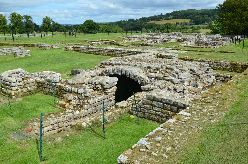
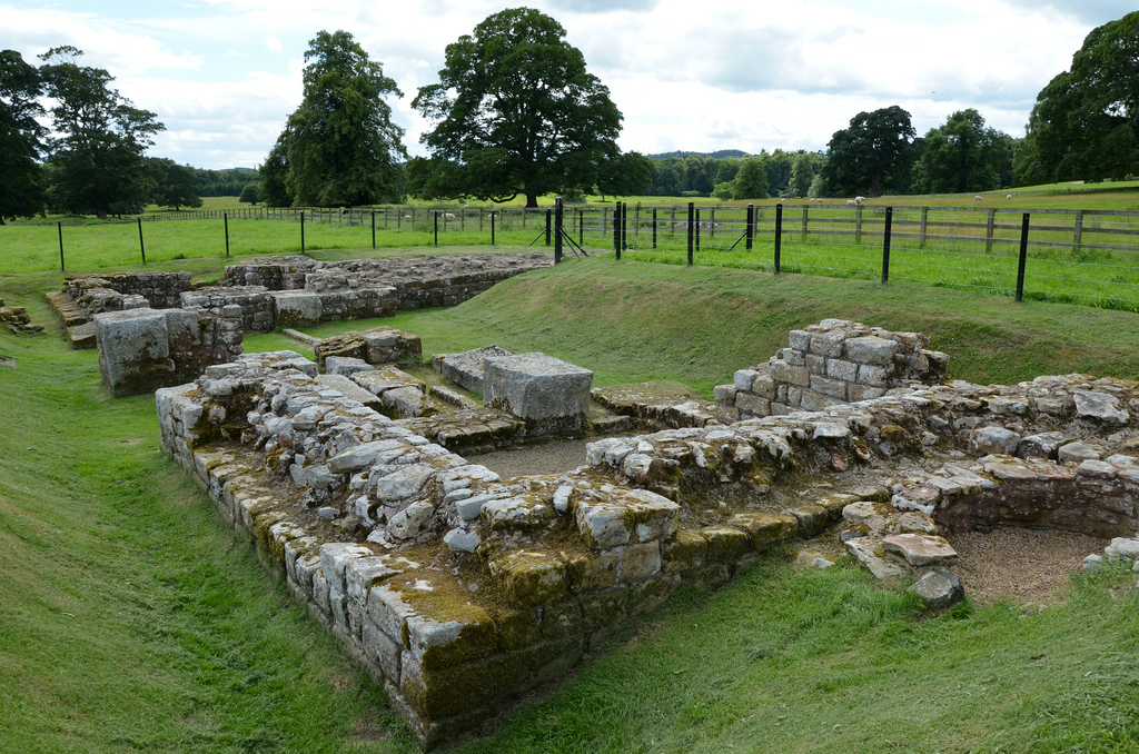
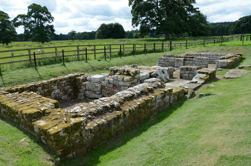
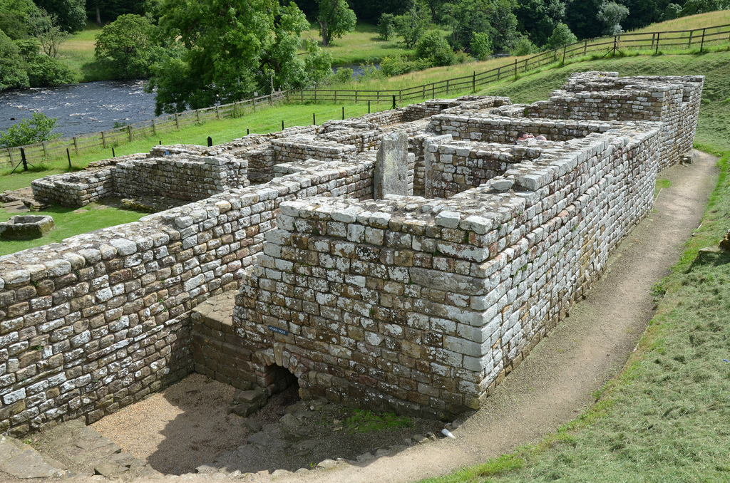
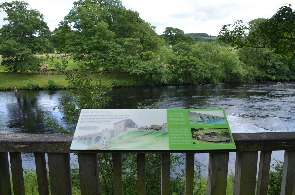
Chesters is one of a series of permanent forts built during the construction of Hadrian’s Wall. The cavalry fort, known to the Romans as Cilurnum, was built in about AD 124 above the west bank of the River North Tyne. It housed some 500 cavalrymen and was occupied for nearly 300 years until the Romans left Britain in the 5th century. Cilurnum is considered to be the best preserved Roman cavalry fort along Hadrian’s Wall. Pioneering excavations in the 19th century exposed the structures visible today. These excavations yielded one of the best collections of inscriptions and sculpture on Hadrian’s Wall.
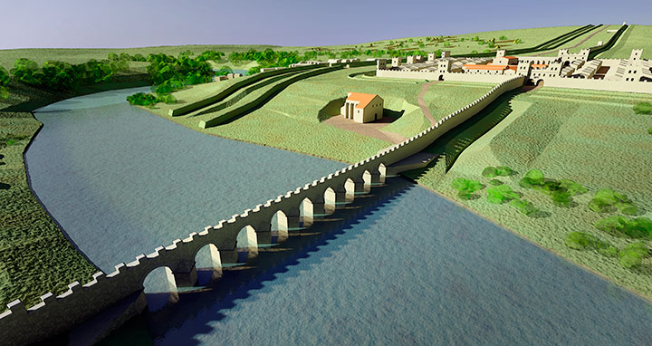
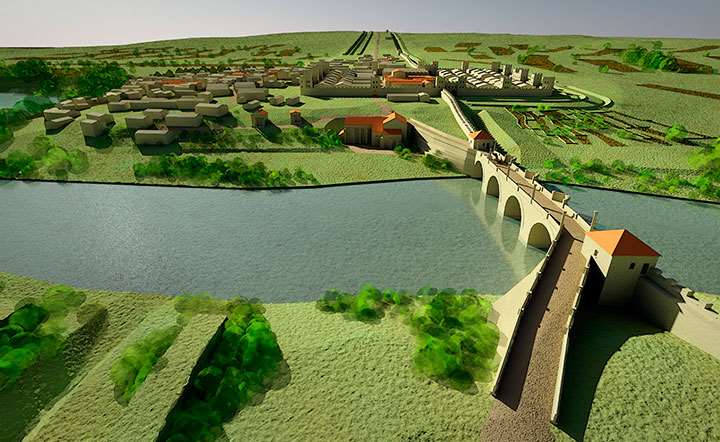
At Chesters, the ditch that fronted the Wall was filled in and a recently built Wall turret demolished to make way for the fort. It marked the point where the Wall crossed the River North Tyne, the first major obstacle on its route from east to west. A large road bridge with stone piers whose abutments survive spanned the river there.
The first attested Cavalry unit at Chesters was the 500-strong ala Augusta ob virtutem appellata – ‘the cavalry regiment styled Augusta for its valour’. It is mentioned on an altar dedicated to Disciplina and dated to Hadrian’s reign (RIB 1496c). By around AD 180 until the end of the Roman period, Chesters Fort was garrisoned by a cavalry regiment originally raised in northern Spain, the ala II Asturum (‘the Second Asturians’).
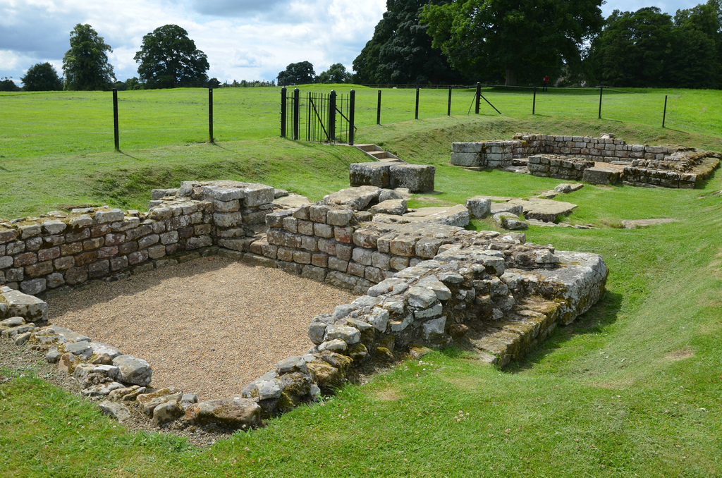
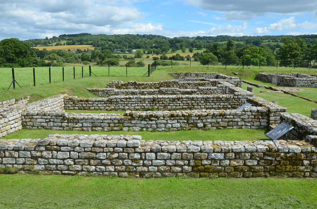
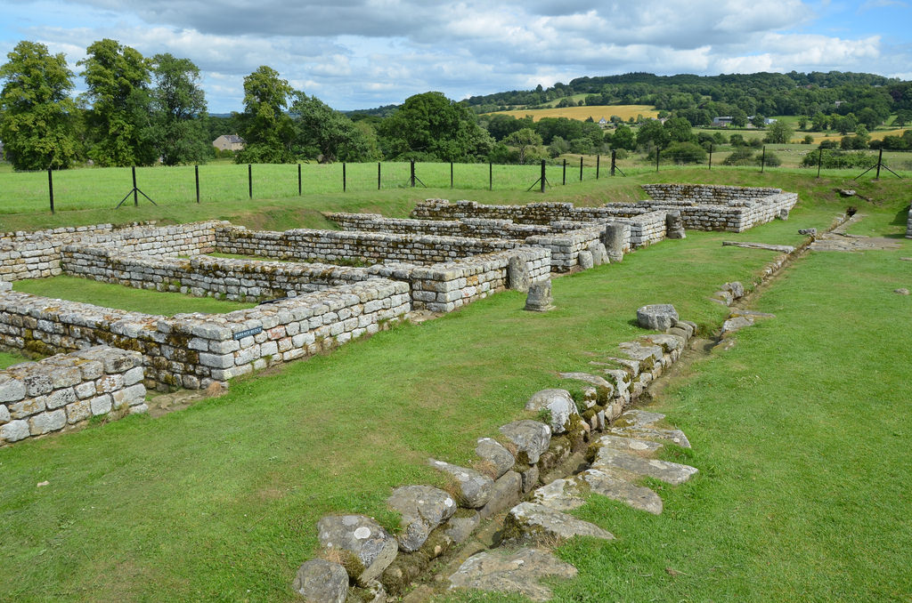
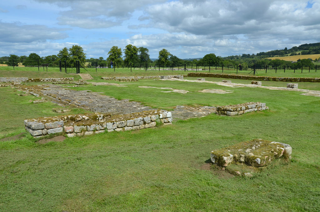
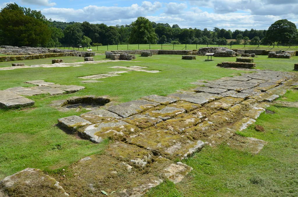
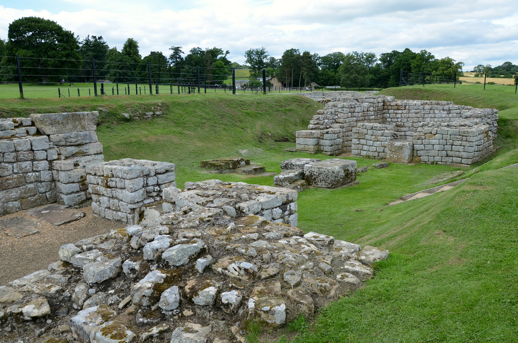
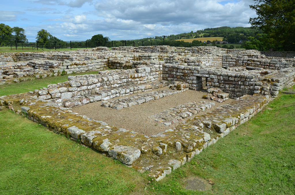
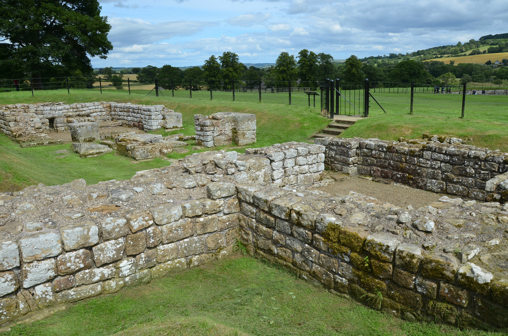
The fort was of the usual rectangular shape, covering 2.3 hectares, with large, double gateway in each side. The walls were of stone, some 1.5m wide, backed by an earthen rampart and fronted by a single ditch on all sides. The defences were completed with four stone corner towers and eight interval towers, two on each face. In addition to the four monumental gateways, two smaller, single gates at either end of the via quintana gave access to the fort on the south side on the Wall.
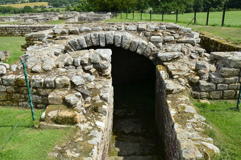
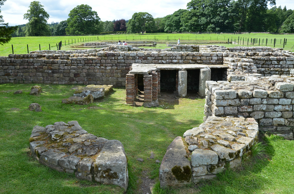
Remains survive from various periods in the 300-year life of the fort but most of its interior is unexcavated and is still buried. The visible selection of buildings result from the excavation campaigns of Nathaniel Clayton, the wealthy land-owner of Chesters House and Estate, between 1843 and 1893. They include all six gateways, the two interval-towers in the southern defences, a small section of the fort wall to the immediate south of the northern interval tower, the headquarters building (principia), the commanding officer’s house (praetorium) with its own central heating system, as well as two barrack blocks that could each accommodate a turma or cavalry troop of about 30 men. The most impressive building remains are those of the headquarters building (principia) in the middle of the fort.
The site museum houses finds from the fort and elsewhere along the wall, including Roman sculptures, inscriptions and altars, many of them collected in the 19th century by John Clayton (see images here). Following his death in 1890, his nephew Nathaniel commissioned the building of a permanent museum (completed in 1896) in order to house the Clayton Collection.
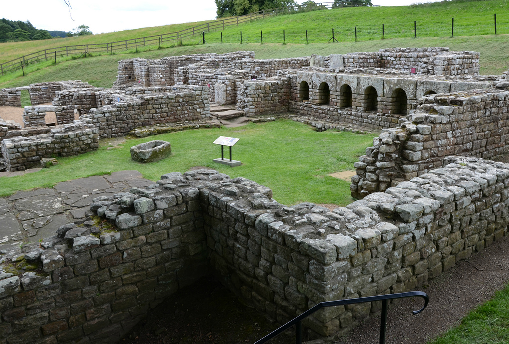
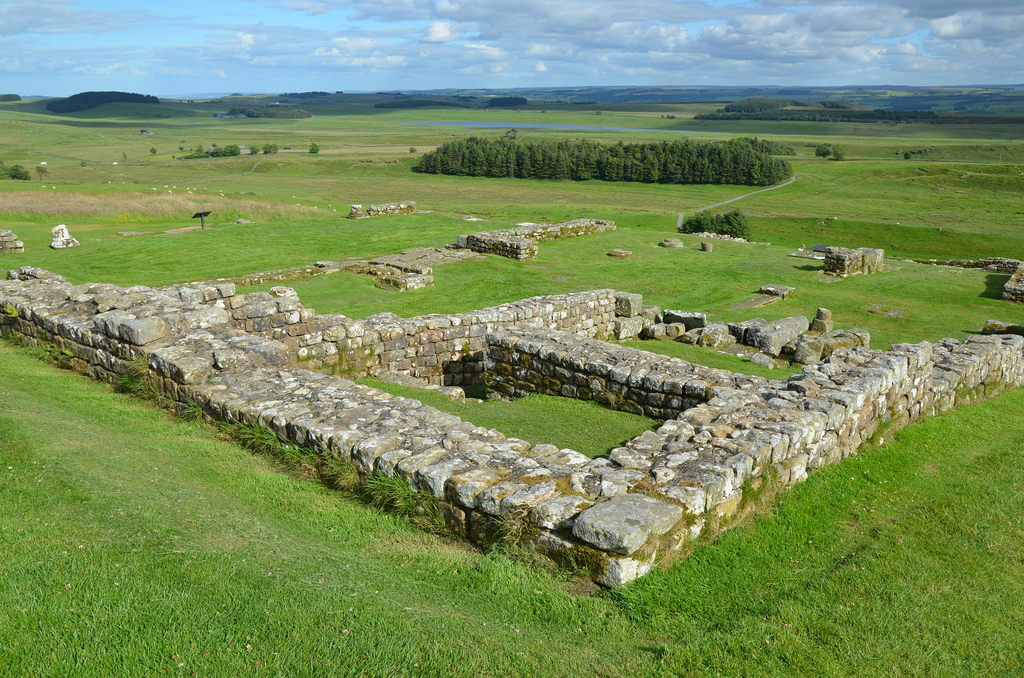
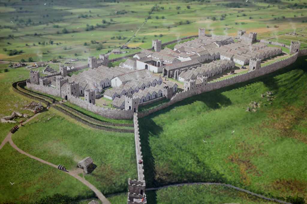
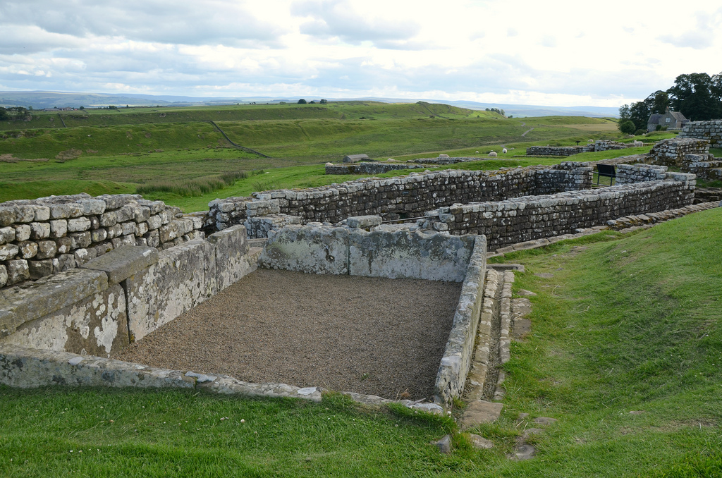
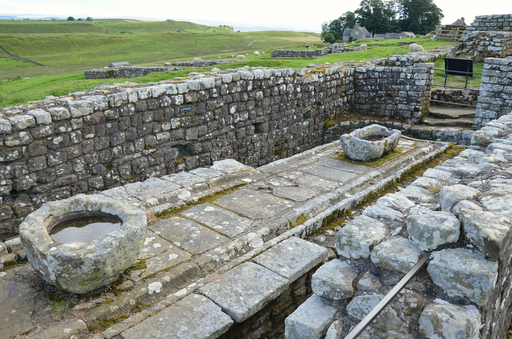
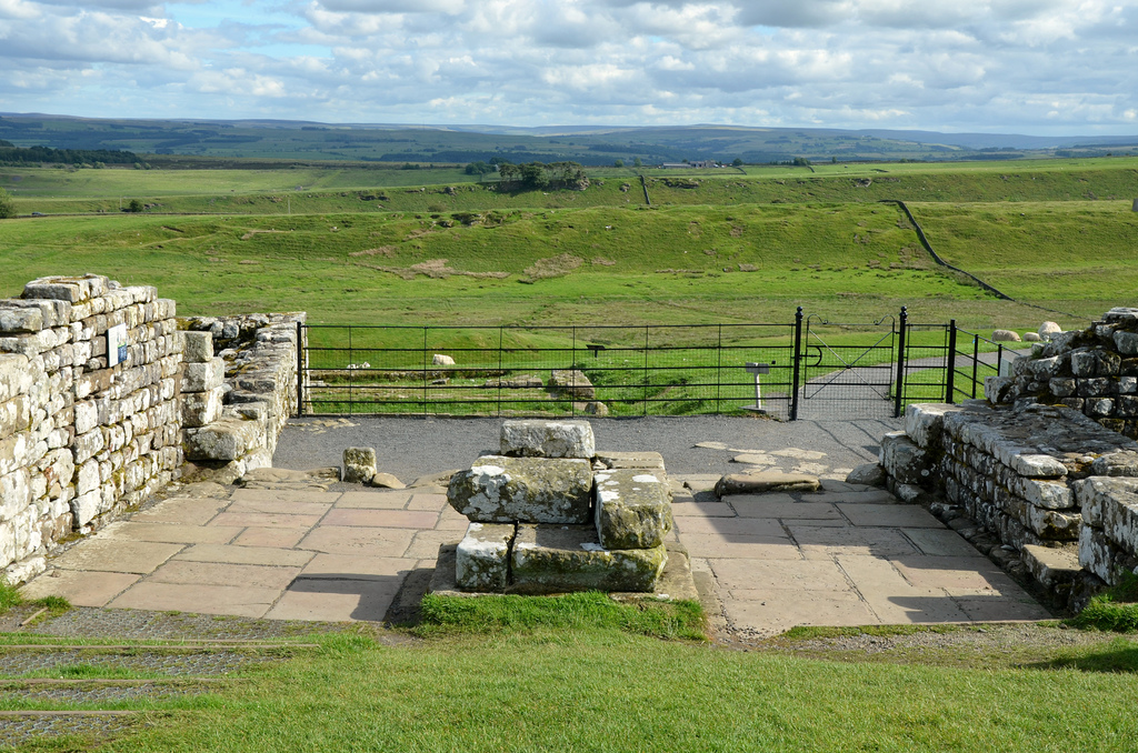
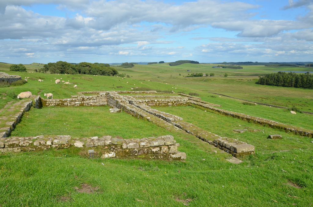
Housesteads Roman Fort is an auxiliary fort lying about midway along Hadrian’s Wall. It is the most complete example of a Roman fort in Britain, and one of the best-known and best preserved. It was built shortly after work on the Wall began and was garrisoned by an 800-strong infantry regiment for much of the period of Roman rule in Britannia. Excavations have revealed major buildings of different periods, defences and a civilian settlement outside its walls (vicus). The visible remains also include the finest preserved latrines known from Roman Britain.
Housesteads fort as it may have looked in the 2nd century AD. Reconstruction drawing by Peter Urmston
Housesteads was built in stone by Roman soldiers around AD 124 over the original Broad Wall foundation and Turret 36B. It was a large fort covering 2.2 hectares and was arranged on a regular grid plan with a stone wall up to 5m high. Four gates led onto the streets that divided the fort into three areas. The central area contained administrative buildings, the headquarters (principia), the granaries (horrea) and a hospital (valetudinarium), as well as the commanding officer’s house (praetorium). On both sides of the central area were at least 10 barracks blocks where up to 800 soldiers lived, and also workshops and support buildings.
In the 2nd century AD, the garrison consisted of an unknown double-sized auxiliary infantry cohort and a detachment of legionarii from Legio II Augusta. From the late 2nd to the 4th centuries AD, the Cohors I Tungrorum (the first cohort of Tungrians, a German people from the region of Tongres, in modern Belgium) was stationed at Housesteads with additional units recruited beyond the Rhine frontier in Frisia, now north-east Holland.
The vicus developed along the main military road outside the fort. However, it may not have been as long-lived as the fort. Archaeological evidence points to its abandonment around AD 270, though the temple area nearby probably continued into the 4th century AD. Temples and other buildings are known to have existed to the south of the vallum and a Mithraeum (temple dedicated to the god Mithras) was excavated to the west of it.
Housesteads fort in the later 4th century AD. Reconstruction drawing by Peter Urmston
Housesteads was occupied until the end of the Roman period in Britain, shortly after AD 400, during which time many changes were made to the buildings and their use; the hospital and most of the granaries had been converted into living quarters.
Housesteads is probably the best preserved Roman fort on display in England. It has produced many significant archaeological finds including quantities of statuary, altars, inscriptions, pottery and small finds.
PORTFOLIO
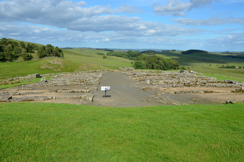
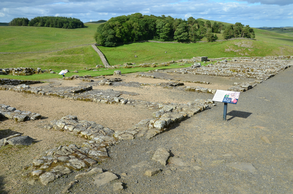
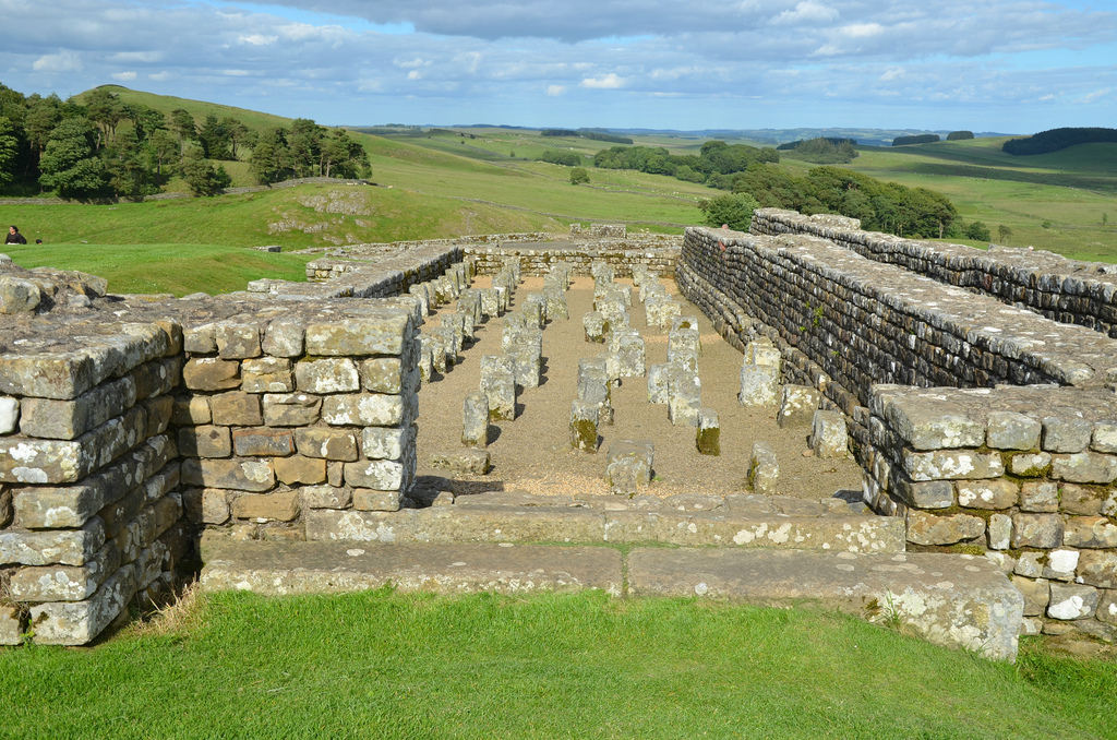
The East Gate (porta praetoria), the main entrance to the fort leading straight to the headquarter building. It was a monumental structure with a double entrance and two high towers.The Headquarter Building (principia), the administrative, ceremonial and symbolic heart of the fort where regimental organisation and the imperial state religion was focussed.The Commanding Officer’s House (praetorium), the largest building in the fort.The Commanding Officer’s household included his family and several servants who looked after the domestic tasks, under the supervision of the commander’s wife.The Barrack Blocks dating to the 4th century AD. The two existing buildings consist of a series of rooms in which the soldiers lived, with a larger suite at the east end for the officer.Each barrack was allocated to a century of men (probably 80 in number), commended by a centurion. The barracks were long and narrow and subdivided into 10 rooms (contubernia).The Granaries (horrea), the fort food supply. The fort had granaries to store the huge quantities of food required by hundred of soldiers.The Hospital (valetudinarium), a building constructed around central courtyard behind the headquarters.The North Gate and the line of Hadrian’s Wall reaching eastwards across Knag Burn.The north curtain wall.The foundations of Turret 36 B and the remains of a later rampart building along the north curtain wall.The Water Supply and the Latrines located in the south-east angle at the lowest point in the fort to take advantage of rainwater collected from the roofs and streets.The Latrines seen from the west. In the foreground are the water tank and the Angle tower.The Latrine was fed by water from various tanks. Wooden seats would have covered the main sewer channel. The smaller channel on the platform was used for washing the sponges used instead of paper.Reconstruction drawing showing the communal latrines in use.The South Gate leading directly out to the civilian settlement (vicus). In the background, the vallum between the field boundary west of milecastle 36 and the field boundary west of turret 37a in wall miles 36 and 37.The Building 1 and 2 of the Vicus located outside the South Gate.19th Century Well.