Biriciana (Kastell Weißenburg)

Biriciana (also called Kastell Weißenburg) is a former Roman cavalry fort built around AD 90, about six kilometres south of the Upper Germanic-Rhaetian Limes. It lies in the borough of Weißenburg in the Middle Franconian county of Weißenburg-Gunzenhausen in Germany. Together with the Lower Germanic Limes, the Upper Germanic-Rhaetian Limes forms part of the Limes Germanicus, a UNESCO World Heritage site since 2005. The site contains a reconstructed north gateway, large thermal baths and a Roman Museum with an integrated Limes Information Centre.

Coordinates: 49° 1′ 50.99″ N, 10° 57′ 45″ E

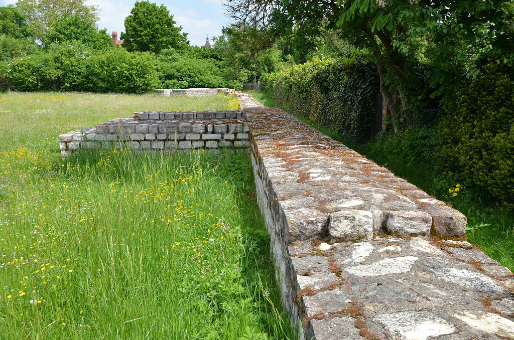
Originally made of timber around 90 AD to secure the territory newly conquered by Domitian north of the Danube, the nearly square fort (170/174 x 179 m) was rebuilt in stone in the middle of the 2nd century AD. The fort covered an area of 3.1 hectares, and each external wall was approximately 170 m long. Three V-shaped defensive ditches were situated in front of the perimeter wall, which had four gates flanked by towers in the south (porta praetoria), in the north (porta decumana), in the west (porta principalis dextra) and in the east (porta principalis sinistra). The perimeter wall was rounded at the corners with two defensive towers. Between the gates and the corner towers stood another smaller tower.

Artist’s impression of the Biriciana Roman cavalry fort. Some details are speculative.

Biriciana was the site of the Ala I Hispanorum Auriana from the last years of the 1st century AD to the end of the Limes in the middle of the 3rd century AD. The Ala I Hispanorum Auriana was a Roman cavalry unit originally established in Spain. Alae were well-experienced mobile troops stationed at the Limes as rapid reaction forces that controlled the frontier, carried out military patrols and protected trade routes. In addition to this ala, the Cohors IX Batavorum milliaria equitata was also stationed there between AD 100/110 and 117/125, as recorded on a stone inscription (CIL 03, 11918).

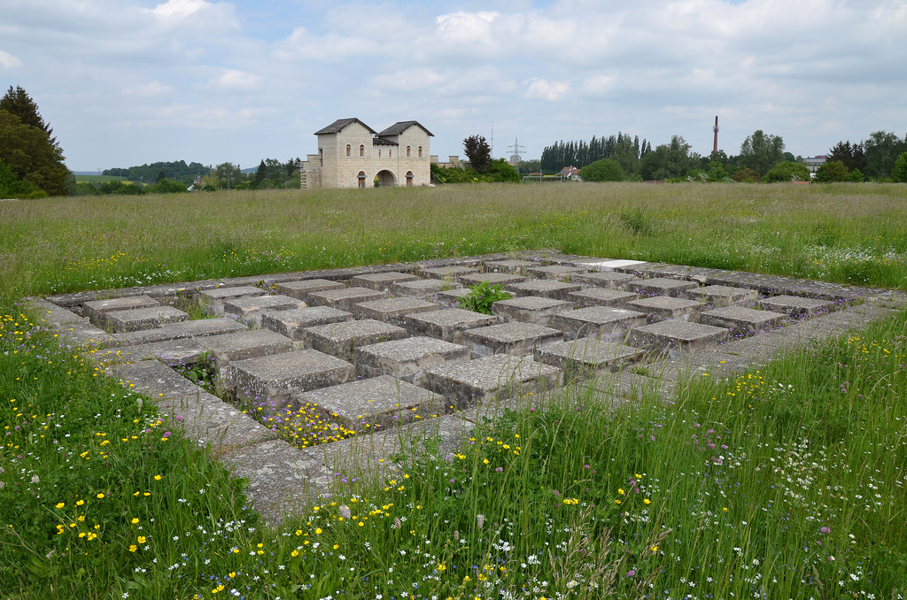
The administrative and utility buildings were all built of stone and were located in the central part of the fort, which included the principia (headquarters) with its aedes (shrine where the signa militaria or standards were kept) and a basilica. Near the principia stood the horreum (granary) and the praetorium (commander’s house). The fabricae (workshops) and the valetudinarium (hospital) were in the western area of the fort. In contrast to these buildings, the barrack blocks were made of timber. The barracks were found in the retentura (rear northern part of the camp), and the stables in the praetentura (front, southern part of the camp). Each contubernium (barrack room) was the home to a squad of eight soldiers who lived in close quarters. There were 14 barracks in the fort at Weißenburg, each housing 30 men. The garrison must have had a total of 420 mounted soldiers.

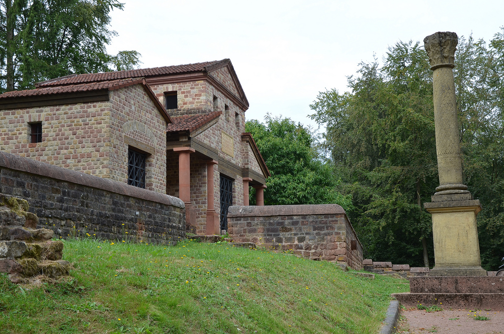
One of the most remarkable relics of the Biriciana Roman fort is the remnant of the large thermal bath complex that served the garrison from 90 BC to 259 AD. Discovered in 1977, west of the Roman fort, the baths were restored and turned into a museum in 1983. The construction of Roman Baths in Weißenburg had three historical phases: building Phase I around 90 AD, building Phase II in 130 AD, and building Phase III around 180 AD.

Historical reconstruction of the Roman Baths in Weißenburg. (www.cyark.org)

A vicus developed in the immediate vicinity of the thermal baths where family members of the soldiers, traders and craftsmen settled. The vicus of Biriciana, whose exact limit can no longer be localised, stretched over a total area of ​​about 30 hectares and probably reached a population of about 2500 inhabitants in the 2nd century AD.

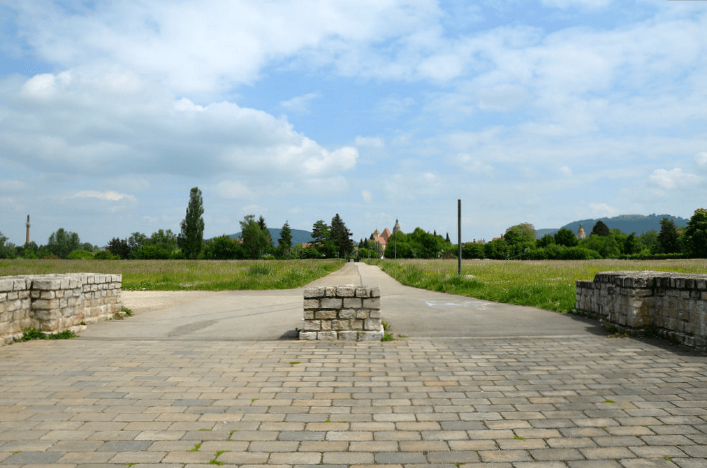
The remains of the Roman fort and vicus at Weißenburg were investigated by the Reichs-Limeskommission (Kohl) between 1890 and 1905 and later again by the State Office for Monument Conservation. The ground plan of the parameter walls and the principia of the fort are preserved. The north gate and the adjoining parts of the parameter walls were completely reconstructed in 1990.

PORTFOLIO

THE FORT

The reconstructed northern gate (porta decumana).
The front side of the porta decumana with the with the first V-shaped ditch.
The porta decumana.
Middle section of the fort comprising of the head-quarters (principia). In the background the northern gate.
The western gate (porta principalis dextra) and the via principalis.
The via praetoria with the northern gate in the background.
The remains of the perimeter wall.

THE LARGE THERMAL BATH COMPLEX

The cold water basin with original preserved floor. It was the largest pool of the thermal baths (8,80 mx7,70 m).
The tepidarium (warm room).
The heated dressing room with hypocaust.
The second frigidarium.
A square water basin in the caldarium.

Links:

Tawern Temple Complex

The Roman Temple Tawern (German: Römischer Tempelbezirk Tawern) is a reconstructed Gallo-Roman sanctuary on the Metzenberg in Tawern near Trier in western Germany. The original sanctuary was built in the 1st century AD above a major road leading from Divodurum Mediomatricorum (modern-day Metz) to Augusta Treverorum (modern-day Trier). It remained in use until the end of the 4th century AD.

Coordinates: 49° 39′ 51.31″ N, 6° 30′ 34.41″ E

The sanctuary was excavated between 1986 and 1988, and seven buildings of various periods and differing sizes and plans were discovered within the complex. Under the direction of the Rheinisches Landesmuseum of Trier, the temple district and a large building were partially reconstructed on the original foundations. The finds (especially coins) revealed that the temple district was constructed in the first half of the 1st century AD and was used right up until late into the 4th century AD. Travellers on the nearby main Roman road would have stopped at the sanctuary to thank the gods for their successful journey or to invoke blessings as they made their way to Rome.

Mercury, the god of trade, commerce, and travel, was the main deity worshipped at the sanctuary. The slightly larger-than-life-size limestone head found in the water well came from a statue of the god. With the help of this find, a reconstruction of the statue was produced in 2002 and is now exhibited in the large Temple of Mercury. Five inscriptions found at the site were also dedicated to Mercury.

The sacred area, surrounded by walls, had a trapezoidal ground plan. It was entered through a small gate. The construction plan consisted of several phases. The first phase shows that five temples were arranged side by side. Various gods were worshipped, among them Mercury, the goddess Epona, Apollo, and Isis-Serapis. The temple district was later extended to cover an area of 48 m in width and 36 m in depth. Three temples were demolished to make way for the great main temple.

At the north-west corner of one temple, a water well originally more than 15m deep was unearthed. It was filled with stones, earth, and architectural parts. There were also fragments of inscriptions and figurative reliefs.

In the village of Tawern, at the foot of the Metzenberg, one can also see the remains of the small Gallo-Roman town (vicus) whose antique name was Tabernae. The name of the vicus was preserved in the modern name of the village, Tawern. The inhabitants of the vicus mainly provided goods and services for travellers. The nearby sanctuary attracted numerous pilgrims. A total of nine buildings were excavated on both sides of the Roman road.

PORTFOLIO

The entrance to the complex, a Jupiter Column.
The main entrance to the sacred complex. A reconstructed Jupiter Column was also added.
The reconstruction main temple of the sanctuary dedicated to Mercury.
The reconstruction of the main temple in the sanctuary dedicated to Mercury.
The reconstruction main temple of the sanctuary dedicated to Mercury.
The reconstruction of the main temple of the sanctuary dedicated to Mercury, with Tuscan columns on three sides.
Reconstruction of the Mercury statue inside of the main temple dedicated to the god.
Reconstruction of the Mercury statue inside the cella of the main temple dedicated to the god. The cella was 7.50 m long and 5.70 m wide.
The reconstruction main temple of the sanctuary dedicated to Mercury.
The reconstruction of the main temple in the sanctuary dedicated to Mercury. The modern inscription, dated to August 1, 1989, honours the excavators of the site (Dr. Sabine Faust and Dr. Karl-Josef Gilles).
Immediately before handling sandstone channels are laid, which catch and dissipate the rainwater flowing from the roof. Parts are still in the original and original place.
On the floor, sandstone water channels were laid out around and between the temples. They were used to catch and disperse the rainwater flowing from the roof.
The foundations of Temple III.
The reconstructed Temple II, the the only one that has been preserved during all the construction phases of the temple district.
The reconstructed Temple II is the only original temple preserved during the various construction phases of the sanctuary.
In the temple stood a statue of the gods, which was revered here, probably the Celtic horse goddess Epona. She was the goddess of the drivers, the horses and mules. The relief depicted here, which was found in the well, gives a hint. It shows the goddess on a horse.
In the cella of Temple II stood a statue of the god, probably the Celtic goddess Epona. She was a protector of horses, ponies, donkeys, and mules. The relief dedicated to Epona in the cella is a replica of the original found in the well. The wall-painting colours of the cella are based on plaster fragments.
The foundations of the early temples and a well.
The foundations of the early temples and the reconstructed well.
The back entrance to the sanctuary.
The reconstructed building just outside the sanctuary. Its function of the professional building has so far not been very clear. It is hardly a dwelling-house of one or more priests. The large room to the side of the mountain was probably closed by a wall - unlike in the present reconstruction. He might have served as a stable. Perhaps the travelers could strengthen themselves in the Profangebäude and buy souvenirs, sacrificances or Weihengaben.
The reconstructed building just outside the sanctuary. Its function is unclear, but it might have served as a stable.
Profangebäude
The interior of the reconstructed building just outside the sanctuary, which may have served as a stable.
The main entrance to the sacred complex.
The Tawern Temple Complex.
The vicus Tabernae located along the major Roman road leading from Divodurum Mediomatricorum (modern-day Metz) to Augusta Treverorum (modern-day Trier).
The vicus Tabernae is located along the major Roman road leading from Divodurum Mediomatricorum (modern-day Metz) to Augusta Treverorum (modern-day Trier).
Computer reconstruction of the vicus and the four-sided arch.

The Saarland and the Mosel Valley’s ancient Roman heritage has a lot to offer to tourists and scholars alike. More than 120 antique sights along the Moselle and Saar rivers, as well as in Saarland and Luxembourg, are a testament to the Gallo-Roman era north of the Alps (further information here).

The temple area is not fenced, so it can be visited at any time. Admission is free.

Links: