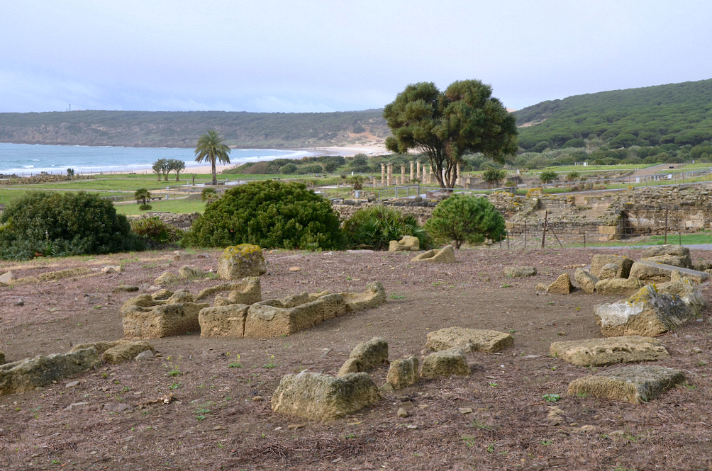
Baelo Claudia is an ancient Roman city lying on the shores of the Strait of Gibraltar in southern Spain. It was settled at the end of the 2nd century BC, and its history and subsequent development are closely associated with the salting industries and its maritime communication with North Africa. The ruins of Baelo Claudia, with its theatre, temples, forum and basilica, and especially its large fish-salting factory, testify to the city’s glory as an important and successful trading centre.
The Roman army landed on the shores of the Iberian Peninsula towards the end of the 3rd century AD in an attempt to halt the advancing Carthaginians, with whom they were engaged in a dispute for the control of the Western Mediterranean. The Roman victory at the Battle of Ilipa in 206 BC signified the end of the Second Punic War (218-202). The whole area was annexed under Augustus and became the most Romanised province in the Peninsula.
According to the oldest archaeological finds on this site, the prosperous city of Baelo Claudia was founded towards the end of the 2nd century BC. As shown in the legends of its Republican coins, the city was first known as Bailo. The abundance of fish in the Strait of Gibraltar facilitated the settlement of the coast and the exploitation of resources from the sea. During this period, the fish salting industries were established, and the city’s strategic position facing the North African coast led to its expansion as a trading centre.
Around the dawn of the new era, the city experienced a period of urban expansion while the first salting industries were rebuilt and made larger. Its strongest development was under the rule of Emperor Claudius (41-54 AD), who raised the city to the level of a Roman municipium with Roman rights. It was also at this time that Baelo received the name of Claudia. During this time, the city acquired a large forum with monumental public buildings, three aqueducts guaranteeing water supply to the population and two factories for the production of garum (fish sauce). The city walls that had been built a few years before during the reign of Augustus were also completely rehabilitated. The economic peak was maintained well into the 2nd century AD.
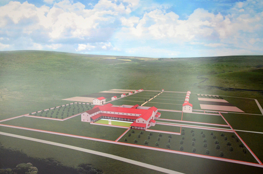
Model of Baelo Claudia.
However, economic activity started to decline at the beginning of the 3rd century AD, perhaps due to a major earthquake that occurred at the time and that may have destroyed most of the city. Also, the general socio-economic crisis that occurred in the empire during the 3rd century may have affected trade and commerce. The city experienced a slight recovery later in the century, but by the 7th century, the town was abandoned.
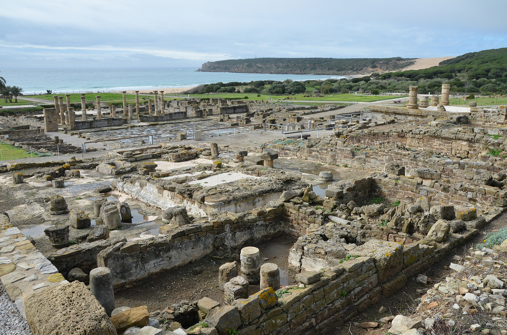
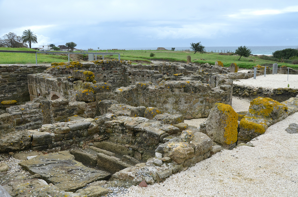
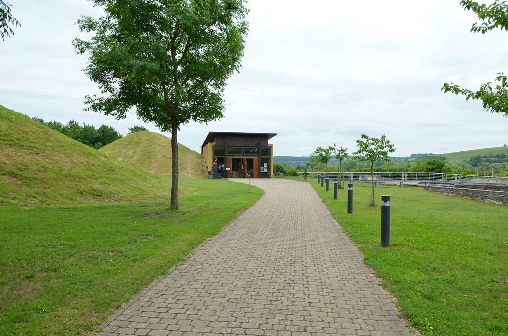
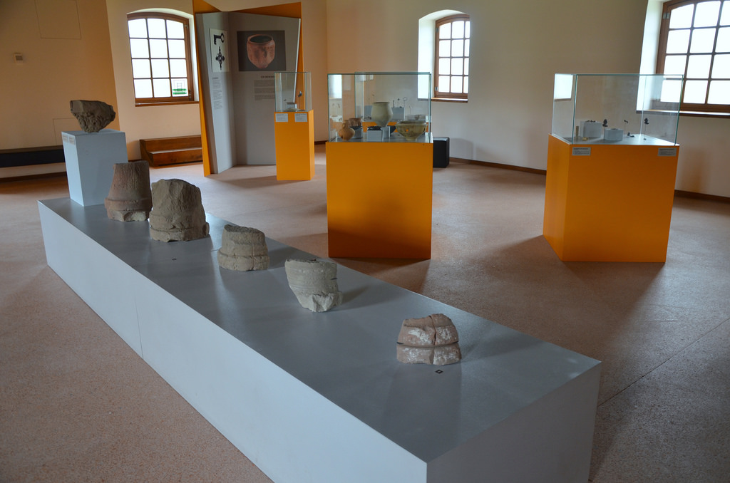
The excavations at Baelo Claudia have revealed the most comprehensive remains of a Roman town in the Iberian Peninsula. The site contains all the representative elements of a Roman city: the forum, temples, basilica, administrative buildings such as the curia, the marketplace, theatre, baths, industrial zone, and aqueducts. A modern Visitor Centre showcases many artefacts and offers a comprehensive introduction to the site.
PORTFOLIO
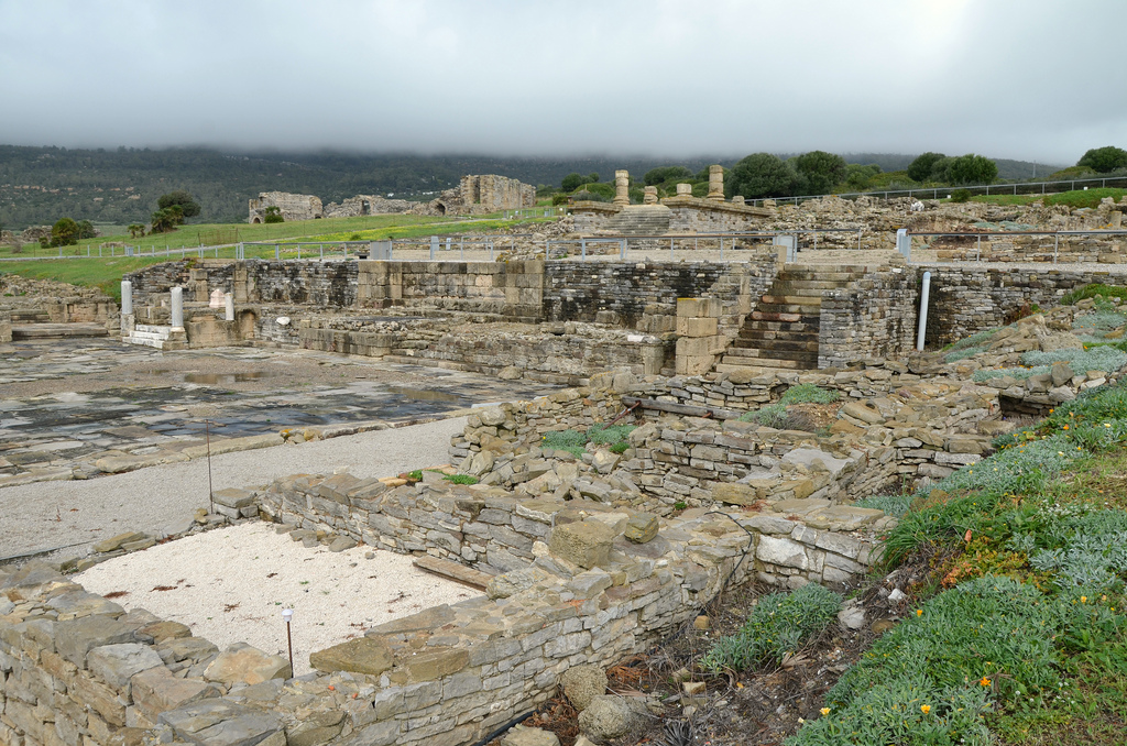
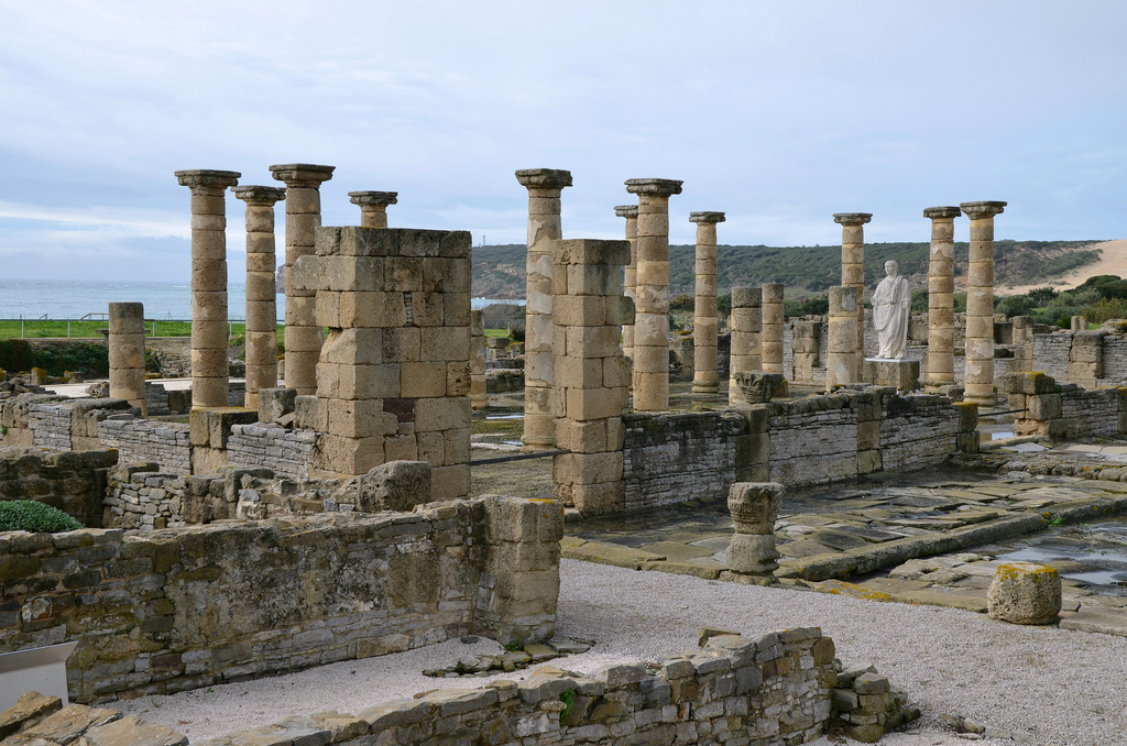
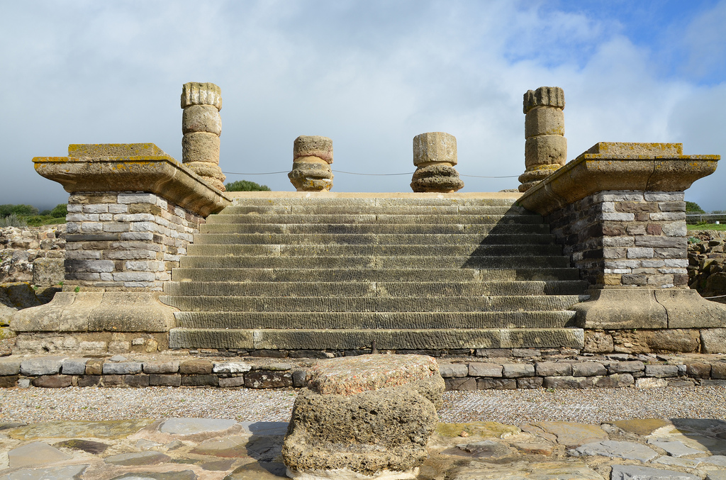
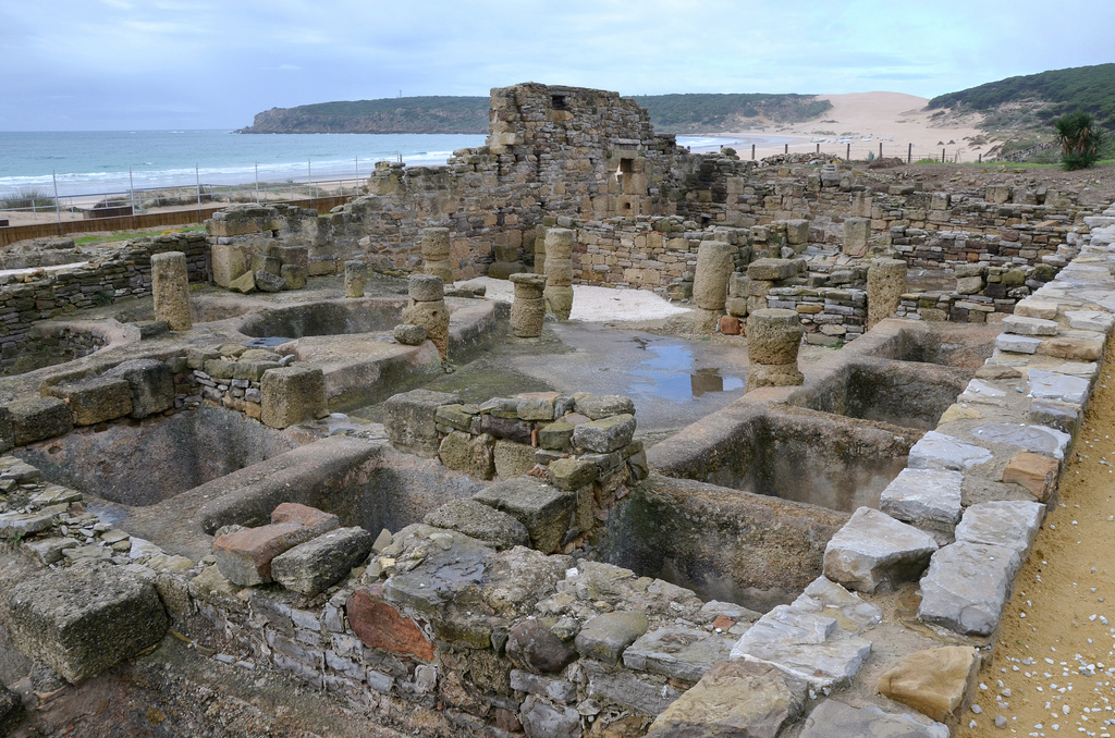
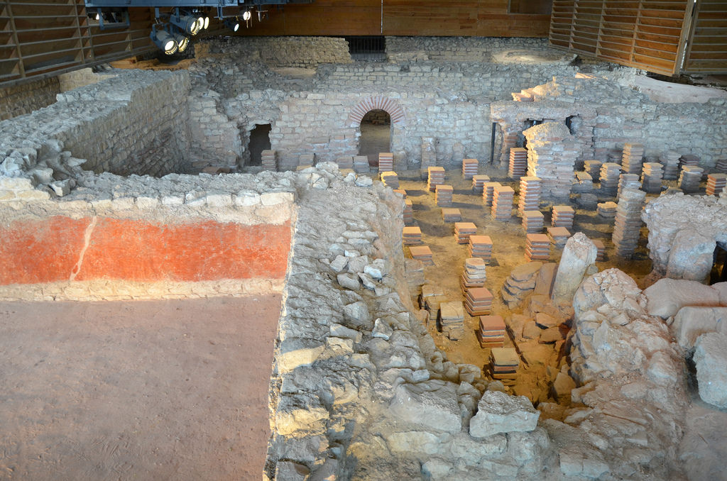
The Decumanus Maximus maintains its original flagstone paving. Along its length were shops, the public market building and the south side of the Forum. There were porticoes on either side.View of the Forum, the vital centre where administrative, political, judicial and religious activities were taking place. The Forum occupied a rectangular area of 115 x 87 metres.Although the original forum in Baelo dates back to the Augustan period, the nucleus of the forum area that we see today was remodelled between the years 50 and 70 AD (reigns of Claudius and Nero). The Forum is in very good condition and is the only completely excavated forum in Hispania.The Forum had porticoes on the east and west sides, with shops in the east part and administrative buildings in the west. To the south was the basilica, and to the north was a monumental fountain and a staircase leading to the Capitolium.The Basilica was one of the most important buildings in Baelo Claudia. It was built between 50 to 70 AD and was located in the main area where the city’s public life took place.The Basilica was built of ashlars and masonry walls, which were painted and stucco applied. A peristyle of twenty columns made up the inside space. It had two floors, the ground floor was of Ionic order and the top floor was of composite.The city of Baelo Claudia erected a colossal statue of Emperor Trajan and placed it in the Basilica on a pedestal clad with marble. The original statue is on display in the Museum of Cádiz.The South Square of the Forum. Behind the plaza are the Basilica, the Forum and the Capitolium.View of the Curia and the Macellum (the marketplace).The three temples of the Capitoline Triad are dedicated to Jupiter, Juno and Minerva. The Capitolium was constructed in the 1st century AD over a broad terrace that dominated the Forum.The Capitolium.The Temple of Jupiter was part of the Capitolium, the three tetrastyle temples dedicated to the Capitoline Triad (Jupiter, Minerva, Juno). The temples were separated by narrow corridors of similar dimensions. A share altar was in front of each temple.The podium of the Temple of Jupiter with 12 steps at the front and Corinthian columns.The thermal baths date to the end of the 1st century or the beginning of the 2nd century AD. They were in use until the end of the 4th century AD.The baths were accessed from the Decumanus Maximus. They included a “caldarium” (hot room), a “tepidarium” (tepid room) and a”frigidarium” (cold room).The industrial area is dedicated to the salting of fish and the production of the famous fish sauce, “garum”.The most valued and expensive product made in these factories was a fish sauce known as “garum”. A similar product, of a lower quality, was “liquamen”. These sauces could accompany all types of meals as a dressing or seasoning. It stimulates the appetite, and doctors usually recommend it due to its nourishing and curing properties.These are the large basins dug into the ground where the pieces of fish were piled up to be salted. The fish and salt were positioned in successive layers, taking approximately twenty days before the salting process was completed.The Theatre was constructed on a natural slope in the 1st century AD, around 70 AD. At the end of the 2nd century, it was no longer in use.The Theatre.The defensive walls were built during the Augustan period and were repaired and renovated with the same layout during the second half of the 1st century AD.Within the walls were the main entrances to the city.The Necropolis.The remains of the arches of the North aqueduct that supplied water to the buildings located in this area.
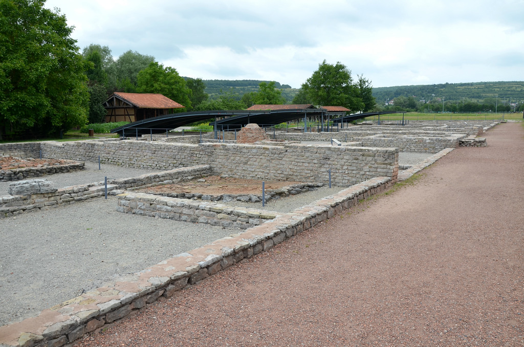
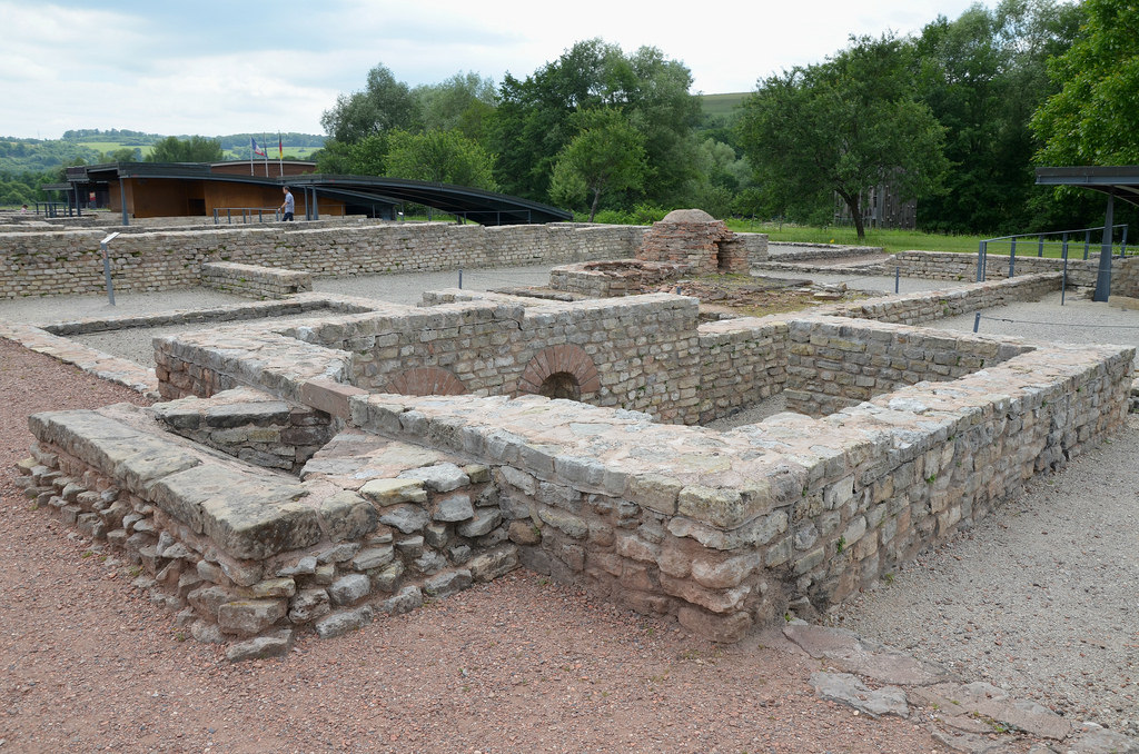
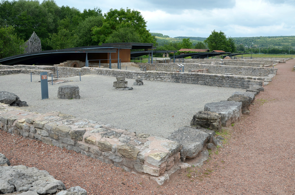
The European Archaeological Park of Bliesbruck-Reinheim (French: Parc archéologique européen de Bliesbruck-Reinheim) is an archaeological park stretching on both sides of the German-French border between the towns of Reinheim (Saarland) and Bliesbruck (Moselle). This cross-border project was created in 1989 and combines excavations and reconstructions of Celtic and Roman finds over an area of more than 70 ha. with exhibition and educational facilities. The grave of the famous Reinheim Celtic Princess was found here and visitors can see an impressive walk-in reconstruction of the burial. On the German side are the foundations of what was once an ornate Roman villa and partially reconstructed outhouses. On the French side are the remains of the small Gallo-Roman town and the partially reconstructed public baths.
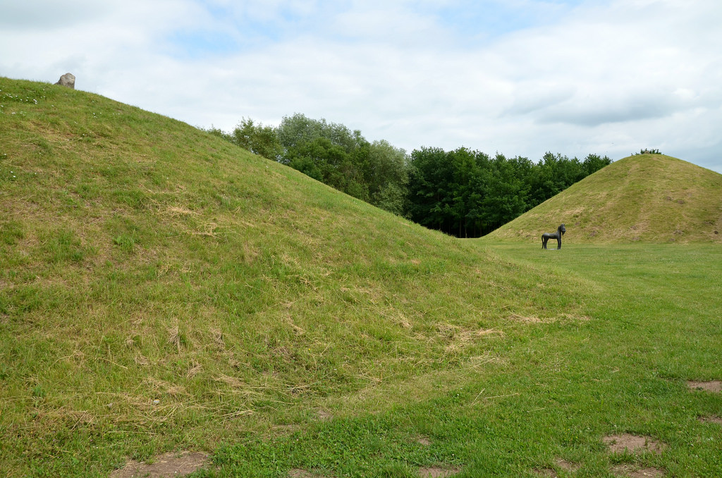
The first excavations on the site took place between 1806 and 1809, then in 1879 in the area of the Roman Villa of Reinheim. In 1954 the tomb of the Celtic Princess of Reinheim was discovered in a sand pit and was excavated. Further investigations in 1956 and 1957 revealed that there had originally been three large burial mounds (tumuli) dating from the 4th century BC, of which the princess’ tomb was just the smallest with a diameter of 20 metres. The other two mounds had diameters of 22 metres and 36.5 metres respectively. All three mounds were surrounded by circular ditches of 0.6 metres and 1.2 metres.
The grave of the Princess of Reinheim is dated to the early La Tène Iron Age period, at the beginning of the 4th century BC. The tomb was filled with exceptionally rich funerary objects: a bronze mirror in figurine form, a complete dinner service consisting of two simple bronze plates, a fine bronze jug and two openwork gold cuffs. The princess wore a gold torque around her neck and a gold bangle on her right wrist, two gold rings on her fingers and three rings of gold and glass around her left forearm. The reconstruction of the Princess of Reiheim’s tomb is approximately 100 metres west of the original burial site. Inside the mound are copies of the artifacts exhibited (the originals are in the Museum of Prehistory and Protohistory in Saarbrücken).
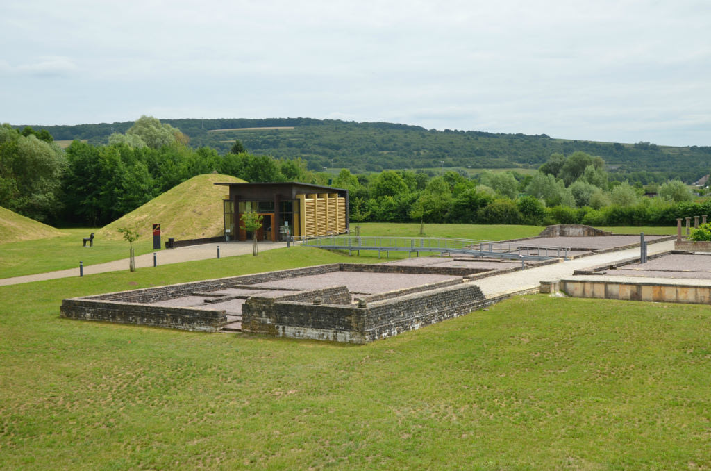
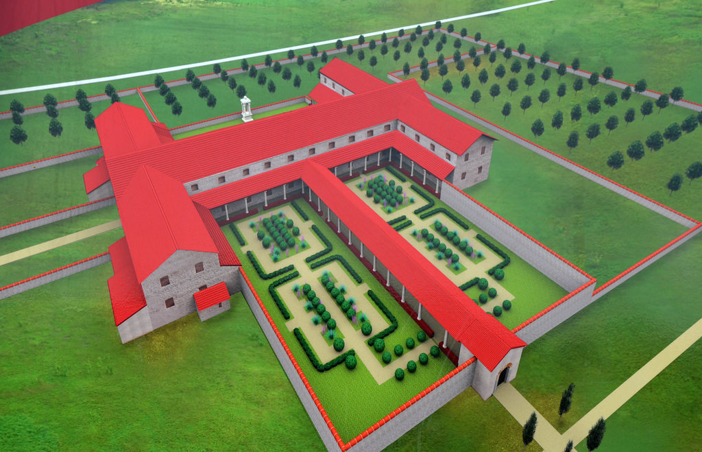
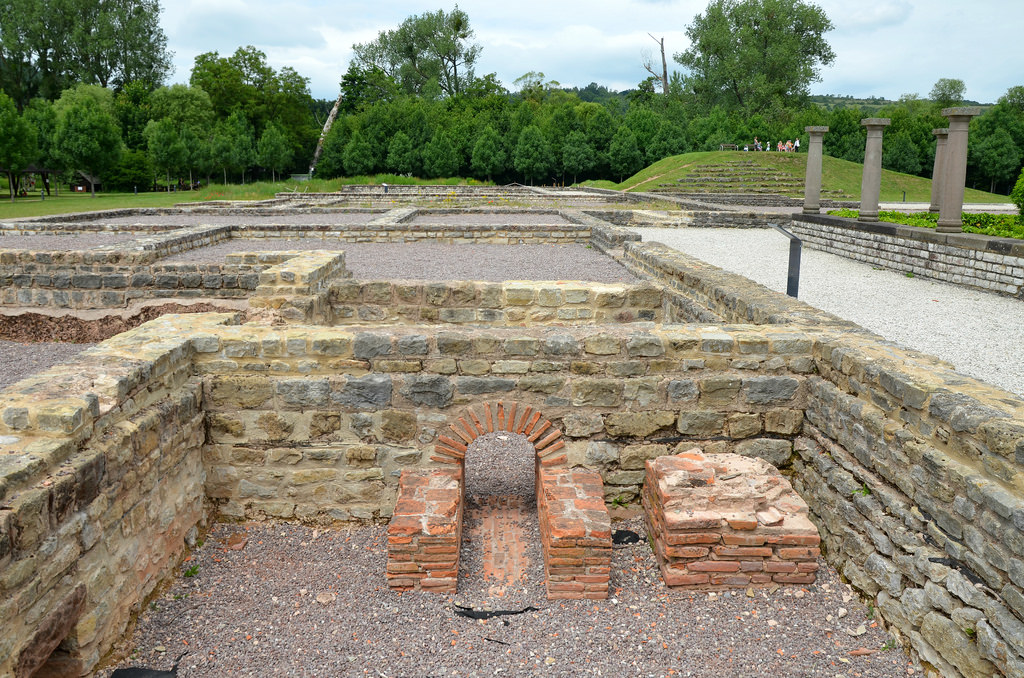
In the Summer of 1987, systematic excavations work provided evidence of a Roman villa complex consisting of a large palatial residence (pars urbana) and an economic area (pars rustica). This complex was constructed in the 2nd half of the 1st century AD and reached its greatest size during the 1st half of the 3rd century AD. The main building of the pars urbana measured 80 metres from east to west and 62 metres from north to south. It had a rectangular middle section with a wing on either side. One portion of the building in the north end of the west wing was the villa’s private thermal baths with an under-floor heating (hypocaust). The pars urbana was a large courtyard enclosing an area 300 metres long and 135 metres wide and surrounded by a wall. Rectangular buildings which served as workshops stood on either side of the courtyard.
A computer reconstruction of the Gallo-Roman villa of Reinheim by Erik Follain. With a total area of 7 hectares, the villa clearly stood out among the common Roman villae rusticae (countryside villas), farmhouse estates in the surrounding areas.
In 2000 an equestrian iron mask with bronze plating was found at the rear of one of the courtyard’s buildings. Used in ceremonial or sporting events, this hinged-visor was attached to a cavalryman’s helmet.
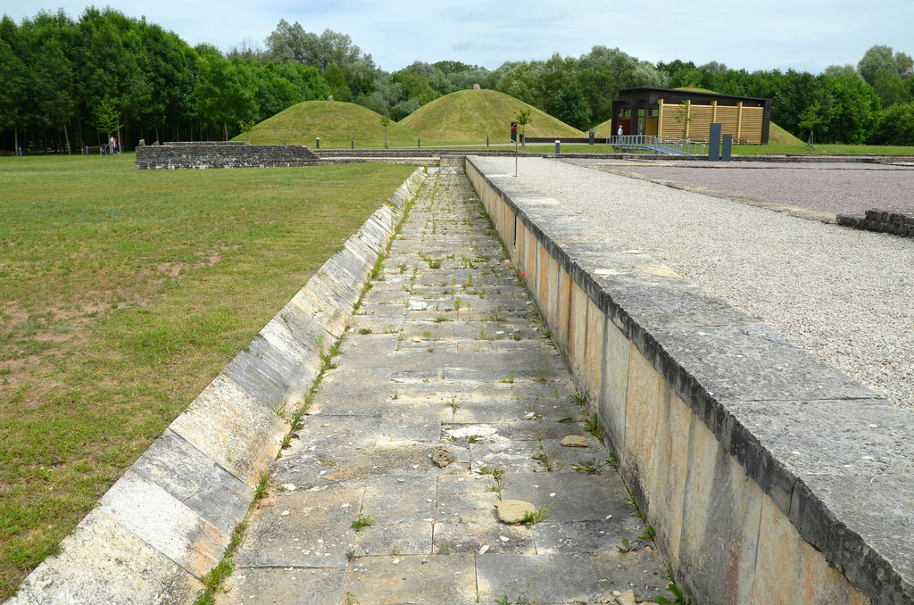
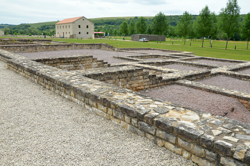
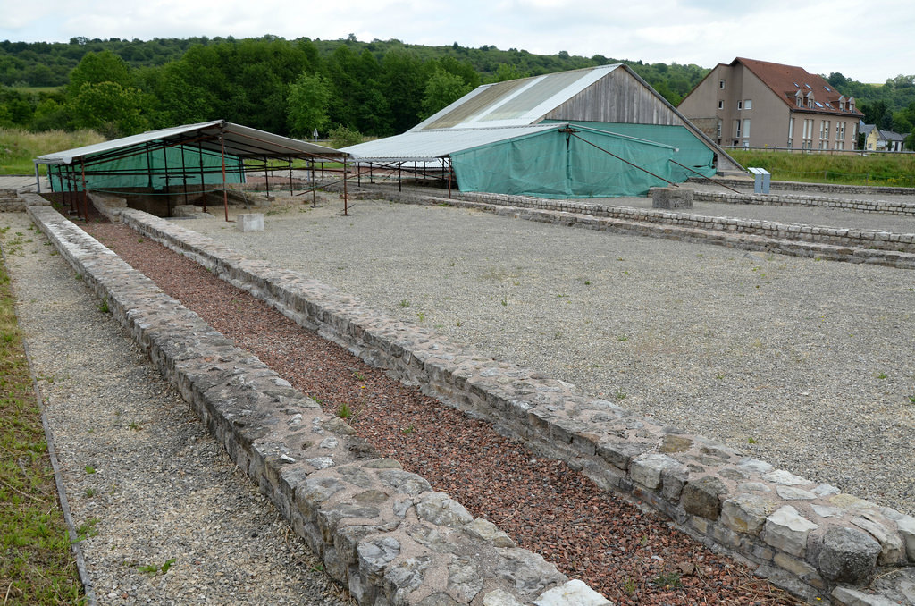
Within 250 metres of the Gallo-Roman villa are the remains of a small settlement or ‘vicus‘ of approximately 20 hectares dating from the middle of the 1st century AD. The excavations revealed that the vicus consisted of a craftsmen’s quarter of 14 terraced-buildings stretching along both sides of a secondary road and used for manufacturing and trade. Here people cooked, baked and produced iron and bronze. The dominant feature of this small city was the monumental public bathhouse complex which has been partially reconstructed and is sheltered by a roof. An eastern artisanal quarter and forum area have yet to be fully excavated. At its peak, the city had more than 100 houses and more than 1,000 inhabitants.
Rendering of the of the Gallo-Roman city by Jean-Claude Golvin.
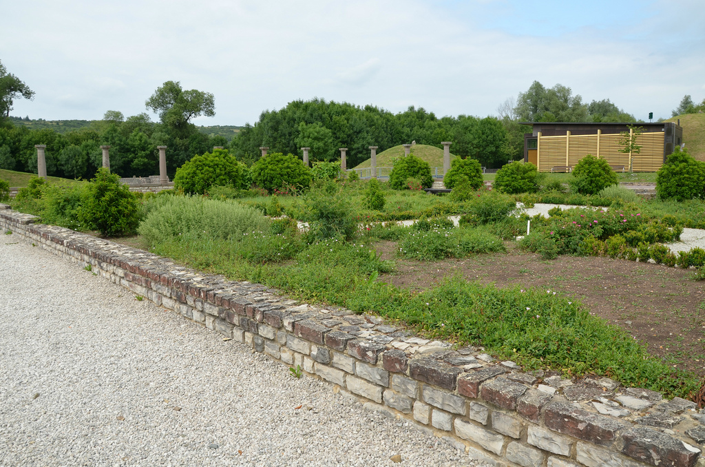
The reconstructed Celtic burial mounds. The museum building displays a recreation of the wooden funeral chamber of the ‘Princess of Reinheim’.A recreation of the wooden funeral chamber of the ‘Princess of Reinheim’. The body was positioned on in a north to south direction in an oak chamber 3.5 m long and at least 3 m wide. Within the wooden funerary chamber were found many bronze and gold objects, including bracelets, rings, neck torques, and a variety of other accessories such as flagons and masks. The grave and its contents indicate that Celtic women were able to attain positions of wealth and honour.Replica of the gilt-bronze spouted flagon found at inside the funeral chamber of the ‘Princess of Reinheim’. The original is in the Museum of Prehistory and Protohistory in SaarbrückenThe reconstructed Celtic burial mounds (tumuli). So far, ten Iron Age burial mounds have been discovered in the area of today’s park.The central hall (or yard) of the large palatial residence (pars urbana) which, due its privileged position and size (33 m x 18 m), must have had a reception, ceremony or banquet function.The East wing of the pars urbana consisting of 7 small rooms symmetrically arranged around a larger central room.View of the East wing of the pars urbana.A computer reconstruction of the pars urbana by Erik Follain.The ornamental basin (40 m x 3 m) made of light coloured limestone slabs. In the 2nd century AD it adorned the north facade of the main building of the pars urbana.View of the West wing of the pars urbana. It consisted of three buildings: a bathing area to the north and residential spaces to the south accessible by colonnaded porticoes as well as functional areas in the center.The northern part of the West wing of the pars urbana constituted the bathing area. It consisted of cold baths (frigidarium) and warm baths (caldarium), a lukewarm resting room and a latrine.The rectangular-shaped cellar in the West wing of the pars urbana which was accessed by wooden steps.The West wing of the pars urbana.The colonnaded portico bordering the garden of the pars urbana located in front of the south facade of the main building.The recreated garden of the pars urbana.Sandstone statue of Fortuna found in the Villa of Reinheim, 2nd – 3rd century AD. On display in the Historical Museum of the Palatinate in Speyer.The pars urbana of the villa extended over a rectangular space of 300 metres long by 135 metres wide.Attached to the long sides of the wall of the pars rustica were five rectangular building, each of different size. They were used as workshops and the function of many of these rooms changed overtime.This reconstructed building had a gateway on each side with ramps. Inside an oven and a small fireplace made of roof tiles were uncovered.The exhibition area in one of the reconstructed rectangular buildings of the pars rustica.Replica of the equestrian iron mask with bronze plating found at the rear of one of the courtyard’s buildings. The original is in the Museum of Prehistory and Protohistory in Saarbrücken.The reconstructed Gatehouse of the pars rustica which served as a prestigious entrance portal. It was reconstructed in 2006 according to the way it would have appeared in the 2nd and early 3rd centuries AD.The western craftsmen’s quarter of the provincial Gallo-Roman settlement (vicus).The northern section of the western craftsmen’s quarter of the vicus consisted of 7 terraced houses used by the artisans. This area was developped in 30/40 AD. Each building had a big central room, a shop at the front opening onto a portico, sometimes with a cellar. Behind were smaller rooms with underfloor heating. Living accommodation was probably on a second floor.A milling and bakery building with a cave at the front and two circular baking ovens, one of which has been restored.Rendering of the bakery-milling by Jean-Claude Golvin.The underfloor heating system in one of the artisan’s buildings.The southern section of the western craftsmen’s quarter of vicus.The shops along the portico facing the street. They were supported by masonry pillars.Rendering of the activity taking place under the portico by Jean-Claude Golvin.The bath-complex is covered under an elegant modern structure. Stairs and walkways take you through the restored baths.A row of porticoed shops were located on each side of the bath-complex. Here bathers could by something to eat while along the covered arcade after their ablutions.The caldarium with heated floor. Its walls were plastered and painted in red.The furnace of the caldarium made of big stone blocks and brick flooring.The foundations of building from the monumental public centre.The eastern craftsmen’s quarter of the provincial Gallo-Roman settlement (vicus).The exhibition centre.Inside the exhibition centre where finds from the vicus are exhibited.
The Saarland and Moselle Valley’s ancient Roman heritage has a lot to offer to tourists and scholars alike. More than 120 antique sights along the Moselle and the Saar rivers, the Saarland and Luxembourg are testament to the Gallo-Roman era north of the Alps (further information here).
Visiting the Archaeological Park of Bliesbruck-Reinheim: The park is open daily from 15th March to 31st October from 10am to 6pm.