Alcántara Bridge

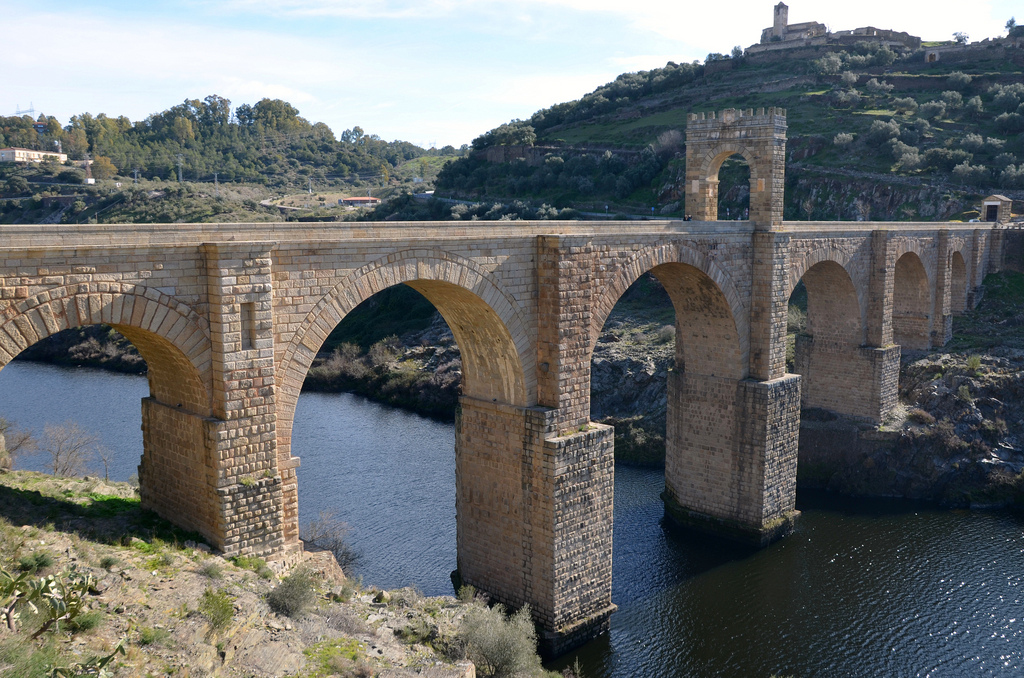
The Roman bridge at Alcántara in Extremadura, Spain, is one of the finest examples of Roman bridge-building and a monumental feat of engineering. It was built over the Tagus River in the ancient Roman province of Lusitania between 104 and 106 AD. It was dedicated to the Roman emperor Trajan on behalf of the local indigenous populations. Built of granite and without mortar, the Alcántara Bridge consists of six semicircular arches supported by five pillars. It spans the river at almost 200 m and rises more than 40 m meters above the water level. The architect of this great masterpiece was a man called Caius Julius Lacer.

The name of the bridge comes from the Arabic “El Kantara”, meaning “bridge”. Its dimensions make it unique among Roman bridges, and it boasts the largest arch span of the peninsular Roman bridges, with an arch of almost 29 m. At its ends, the arches are supported by buttresses.

An honorific arch at the centre of the bridge was dedicated to the emperor Trajan. The inscription found on the attic reads (CIL II 759): Imp(eratori) • Caesari • divi • Nervae • f(ilio) • Nervae / Traiano • Aug(usto) • Germ(anico) • Dacico • pontif(ici) max(imo) / trib(unicia) • potes(tate) • VIII • imp(eratori) • V • co(n)s(uli) • V • p(atri) • p(atriae).

Another inscription from the side of the triumphal arch reveals that the bridge was paid for by eleven Lusitanian municipalities (municipia provinciae Lusitaniae). The inscription also claims that, in addition to contributing funds to the building of the bridge, these local municipalities ‘completed’ the bridge (perfecerunt).

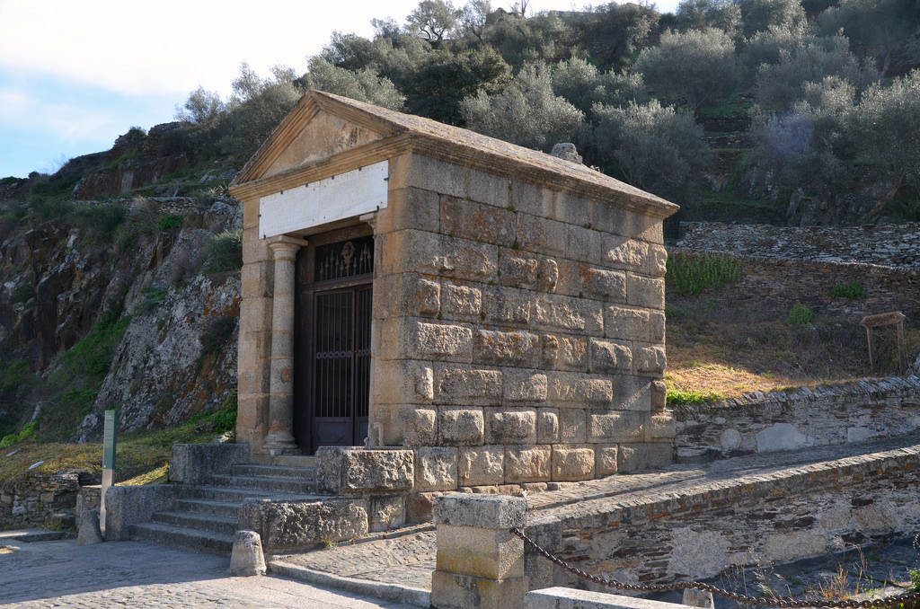
At the southeast end of the monumental bridge are the remains of a small votive temple, distyle in antis, of Tuscan order with a single cella. It was constructed as an offering to Trajan and the gods of Rome. It was designed by the same architect as the bridge and the triumphal arch, Gaius Julius Lacer. The dedicatory inscription (CIL II 761) on the temple (now a reconstruction of the original), cut in a slab of marble, records that the temple was dedicated to Trajan, erected by the bridge’s architect Gaius Iulius Lacer, with the help of his associate and friend Curio Lacone Igaeditano (from the city of Idanha-a-Velha). After the conquest of Cáceres in 1169 by Ferdinand II of Leon, the temple was converted into a chapel of St. Julian, which explains why the building remains so well-preserved. The architect was buried in the temple, and his tomb is still preserved inside.

pontem perpetui mansurum in saecula mundi (a bridge that would last forever)

Over the centuries, the Alcántara Bridge sustained damage in various armed conflicts and environmental events, mainly water-related, which have led to the destruction of part of its structure and degraded it. The bridge was restored during the reign of Isabel II by the engineer Alejandro Millan y Sociats in 1859. It was listed as a Spanish National Monument in 1924 and is in the process of being declared a World Heritage Site by UNESCO.
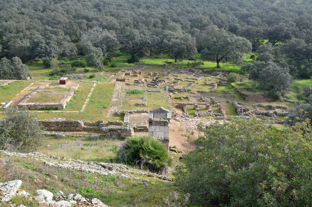
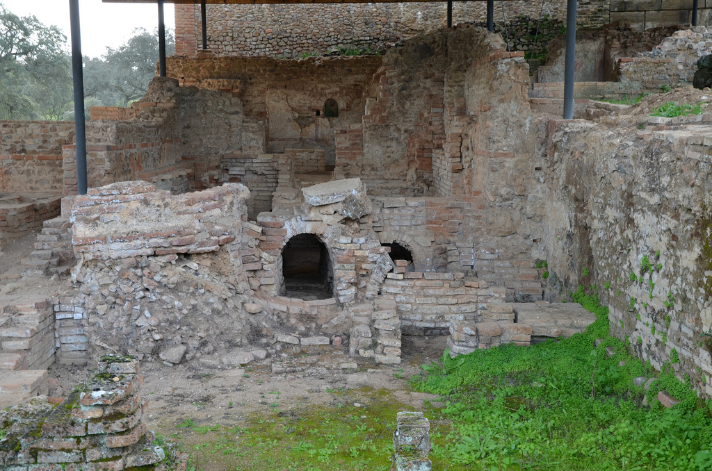
Coordinates: 39° 43′ 21.00″ N 6° 53′ 33.00″ W

PORTFOLIO

View of the Alcántara Bridge looking northwest.
View of the Alcántara Bridge looking northeast.

The honorific arch at the centre of the bridge is dedicated to the emperor Trajan.
View of the Alcántara Bridge looking southeast.
The small votive temple was dedicated to the Roman emperor Trajan and the Roman Gods.
Dedicatory inscription (CIL II 761) on the votive temple honouring Trajan and the Gods for successfully building the bridge.
The entrance is flanked by two Tuscan columns and accessed by an exterior staircase, covered with a gabled roof made of slabs of stone, with a pediment with trim at the edges and a smooth tympanum without decoration.
The interior of the small votive temple.
The Alcántara bridge and the small temple view from the east.
The Alcántara bridge is still used for traffic.

Links:

Munigua

Located in the heart of the Sierra Morena, 8km from Villanueva del Río y Minas in the province of Seville, Munigua is the site of the Roman city of Municipium Flavium Muniguense whose origins go back to the pre-Roman period. Evidence of human occupation extends from the mid-4th century BC to the 8th century AD. During the Romanisation of the province of Baetica, Munigua developed rapidly and received Latin rights from emperor Vespasian and became a municipium in the mid-1st century AD.

Coordinate: 37°42’47.1″N 5°44’25.9″W

Discovered in 1765 by two researchers from the Academy of Letters in Seville, the site was subsequently forgotten until 1956 when the German Archaeology Institute in Madrid once again studied it. At Munigua archaeologists have found temples, sanctuaries, a two-story porticus, residential houses, a forum, public bathhouses, city walls and a vast necropolis. However, the monumental terrace sanctuary located on the slope of the hill was known from 18th-century drawings which refer to it as the “Castle of Mulva”.

18th-century drawing by Tomás de Gusseme depicting the “Castle of Mulva”.

Archaeologists believe that the settlement was established by the Turdetani, an Iberian tribe who occupied the area. The first settlement undoubtedly owed its existence to the mining and metallurgy activities that have long characterised the Sierra Morena, a mountain range rich in copper and iron ore. The copper production was massively increased during the Roman occupation when elaborate ventilated underground galleries, interconnected tunnels and deep shafts were built.

Wealth derived from the mines made possible the construction of a number of monuments, the most remarkable of which was the terraced sanctuary on the slope of the hill. Dominating the city, the imposing structure standing on several tiered terraces was reinforced by 13 buttresses at the rear which gave it the appearance of a fortress and later became known as the castle of Mulva. The building is characterised by its architectural symmetry, with access ramps and stairs neatly paired on either side of the sacred precinct. The plan seems to have been taken from the temple of Fortuna Primigenia at Praeneste or the Temple of Hercules Victor in Tivoli. Nothing is known about the deity worshipped on the site, though it may have been that of Fortuna and Hercules. 

The city developed at the feet of the terraced sanctuary. Between the mid-1st century and the late 2nd century AD, all of the town’s structures were built: the forum, the baths and the houses. Construction activity was boosted by Vespasian’s decision to grant Munigua the Latin right circa AD 73/74, promoting it to municipium status.

Munigua flourished under Hadrian but declined towards the end of the 3rd century AD following an earthquake that hit the town. Another earthquake in late antiquity brought an end to Munigua’s heyday, although today we know that the site was continuously occupied at least until the Almohad period in the 12th century.

The town has yielded numerous archaeological artefacts: some 45 stone sculptures and approximately 160 terracotta pieces. Other noteworthy discoveries include a considerable number of glass objects found in funerary contexts, nearly 1,500 metal artefacts and pieces of jewellery. Finally, more than 80 inscriptions were found at Munigua, including two made of bronze, a tessera hospitalis or hospitality token, and a letter from Emperor Titus.

PORTFOLIO

General view of the Sanctuary of Terraces from the access road.
The northern roadway ascending to the Terraced Sanctuary.
The main facade of the Terraced Sanctuary faced east towards the city.
The cella in the Sanctuary of the Terraces.
View of the Double-height portico with the Terraced Sanctuary in the background.
Virtual reconstruction of Munigua, view from the east. © DAI
View towards the small Temple of Mercury standing in the entrance street leading to the Forum which consisted of the Forum Temple, the Curia, the Tabularium, the Basilica and the Shrine of Dis Pater, the god of miners.
The small Temple of Mercury, located at the southern end of the portico. It included a podium in the form of an exedra as well as an aedicula, with two frontal columns supporting the architraves and pediment. The altar, still in situ, was consecrated by a certain Ferronius to a divinity whose name is indecipherable but another altar found in front of the temple had a dedication to Mercury.
The remains of the large two-tier portico of the forum.
The Forum Temple, surrounded by porticoes on three sides. The divinity to which the temple was dedicated is unknown.
View of the Temple Forum, the small Temple of Mercury and the eastern residential zone.
View of the Podium Temple, a square block structure that was supported by four buttresses on its eastern side. Its walls rested on a podium supporting another smaller podium. It was embellished with marble slabs and reached by a flight of steps preserved in situ. The temple was built in the early 2nd century AD.
The baths with L-shaped floor plan had seven different rooms, including the apsidal hall and the nymphaeum. Judging by their small size (barely 280 m2) and the absence of a palaestra, these facilities were probably balneae rather than thermae.
The bath complex was built during the time of Nero. Later, at the end of the 1st century AD, part of the baths was demolished to make room for the forum.
Detail of the mural paintings in the baths.
View of the eastern residential zone with the Forum and the Terraced Sanctuary in the background.

Links: