Petra is an ancient metropolis carved into a canyon and established by the Nabataeans, a nomadic tribe from Western Arabia skilled in trade and engineering. It was the capital of the Kingdom of Nabatea, strategically located along major ancient trade routes. Sacred sculptures, monuments and around 800 tombs cover the 264 square kilometres of ruins, the most famous of which is the Treasury, believed to have been the mausoleum of Nabataean King Aretas III in the 1st century AD. Petra lay for centuries until it was rediscovered in 1812, and has now become Jordan‘s most popular tourist attraction. Referred to as the “Rose City” because of the colour of the stones used in its buildings, Petra was named a UNESCO World Heritage Site in 1985, and in 200,7 it was named one of the New Seven Wonders of the World.
Some of the earliest settled communities in the world were located in the Petra area. Between 8,500 BC and 5,000 BC, farmers settled intermittently and lived in small villages of stone houses in the surrounding wadis and hillsides of Petra. The remains of the most famous of these villages, Baydha, were excavated in the 1950s, located just north of Petra. During the Bronze Age (c. 3,000 BC to 1,200 BC), there was limited evidence of human activity in the Petra region. The Iron Age (1,200 BC to 539 BC) then brought significant historical events, as the Edomites were thought to have established their kingdom there (Edom). Edom collapsed in the 6th century BC and was destroyed by the Babylonians in 552 BC.
The Nabataeans arrived in the region of modern-day Jordan from the Negev Desert sometime before the 4th century BC. Their empire encompassed southern Jordan and extended eastward to the Sinai Peninsula. They gained their wealth through trade on the Incense Routes, travelling between the Kingdom of Saba in southern Arabia and the port of Gaza on the Mediterranean Sea. Using advanced engineering skills, they eventually created their capital city of Petra, which was half-built, half-carved into the rock. This Nabataean caravan city, situated between the Red Sea and the Dead Sea, became a major caravan centre for the incense of Arabia, the silks of China, and the spices of India, serving as a crossroads between Arabia, Egypt, and Syria-Phoenicia.
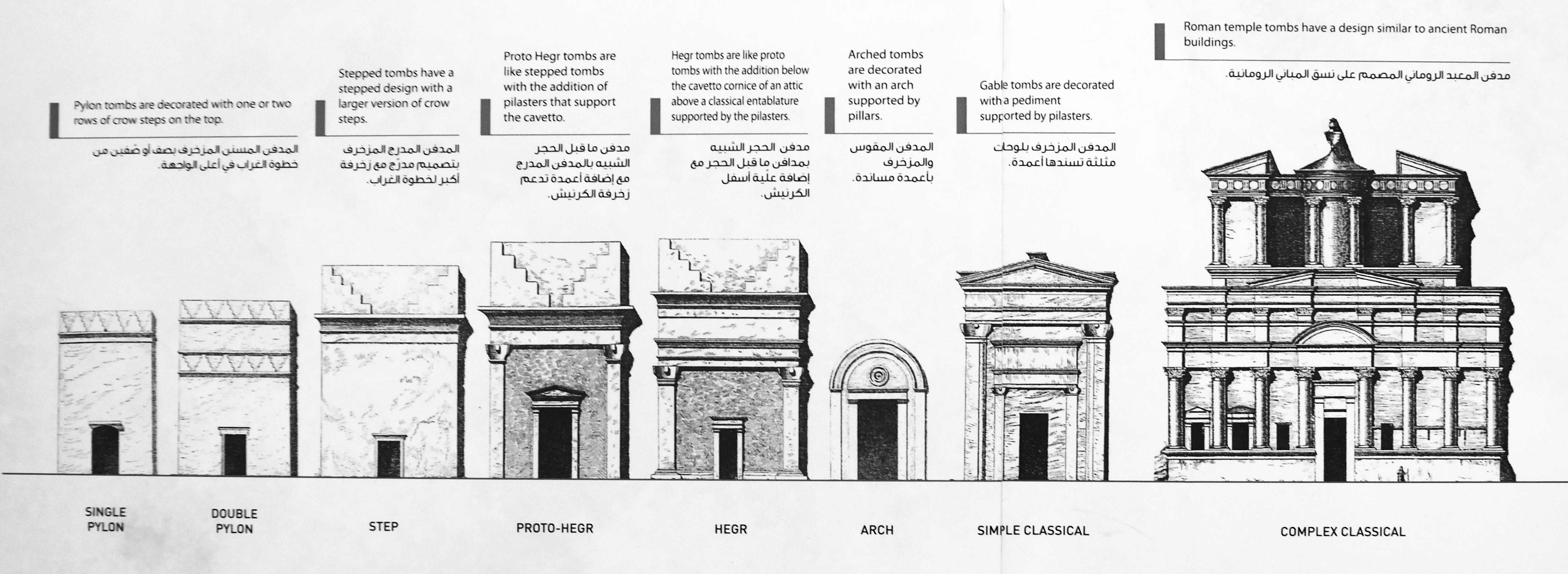
Types of Tomb Facades.
Petra is surrounded by mountains riddled with passages and gorges with an abundance of freshwater. The inventive Nabataeans used water to build their city and became masters in water engineering, creating a highly sophisticated system of reservoirs and irrigation channels. Rain and spring water were collected in individual deposits, from which it was then distributed across the city. The water was sufficient to support a nymphaeum, pools, and elaborate gardens. These irrigation systems are still found throughout the area to this day.
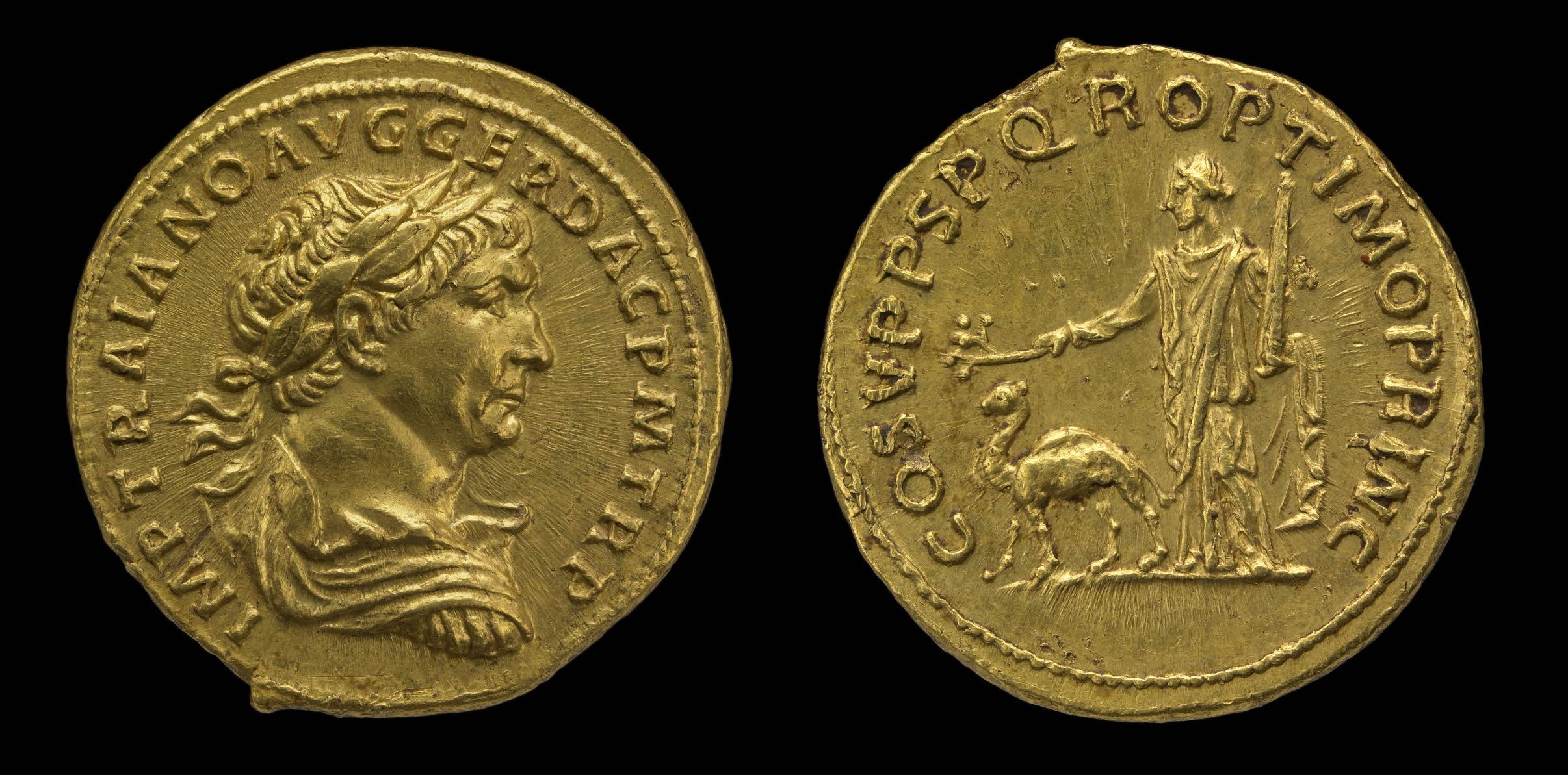
Many of Petra’s incredible monuments were constructed during the reign of King Aretas IV, between 8 BC and AD 40 and may have grown to house 20,000-30,000 people during its heyday. The city reached its height in AD 106 when Emperor Trajan annexed the Nabataean kingdom and turned it into a province, known as Arabia Petraea. Around this time, the Via Traiana Nova, an ancient Roman road, was constructed to link Bostra in the north to the seaport of Aila (present-day Aqaba) in the south. Petra obtained the title of metropolis (chief city) of Arabia from Trajan and was called Hadriana Petra after Hadrian’s visit in AD 129/30. At the beginning of the 3rd century AD, Elagabalus honoured the city with the status of a Roman Colony.
Roman city planning was adopted, and new structures were built, including the colonnaded street, the Roman Soldier Tomb and the Sextius Florentinus Tomb. Petra continued to flourish for more than 250 years until the middle of the 4th century AD, when an earthquake destroyed many of its buildings. The Byzantines eventually took control of the region and governed Petra for some 300 years. Some of Petra’s population converted to Christianity, while others maintained their Pagan beliefs. The city became the seat of a bishopric, indicating its importance during the Byzantine period. Another major earthquake in AD 551 brought further devastation. Then, trade routes shifted, and by the middle of the 7th century, what remained of Petra was largely deserted.
Petra went unentered by outsiders for nearly 600 years. Only the local Bedouin tribes knew of its existence until Swiss explorer Johann Ludwig Burckhardt became the first modern European to lay eyes on the ancient Nabataean city on August 22, 1812. The Scottish painter David Roberts visited Petra in 1839 and returned to England with sketches and stories of his encounter with local tribes. On December 6, 1985, Petra was designated a UNESCO World Heritage Site. In 1989, the city’s carved rose-red sandstone facades were featured in the blockbuster film “Indiana Jones and the Last Crusade”. In a popular poll in 2007, it was also named one of the 7 New Wonders of the World. The Petra Archaeological Park became an autonomous legal entity in charge of managing this site in August 2007.
In the Indiana Jones and the Last Crusade film, the Treasury served as a stand-in for the temple housing the Holy Grail.
Visitors today can see a mix of Nabataean and Graeco-Roman architectural styles in the city’s tombs, many of which were looted by thieves, and their treasures were thus lost. Many people think that Petra begins and ends with Al Khaznah – The Treasury – but there is so much more to explore within this ancient city.
PORTFOLIO
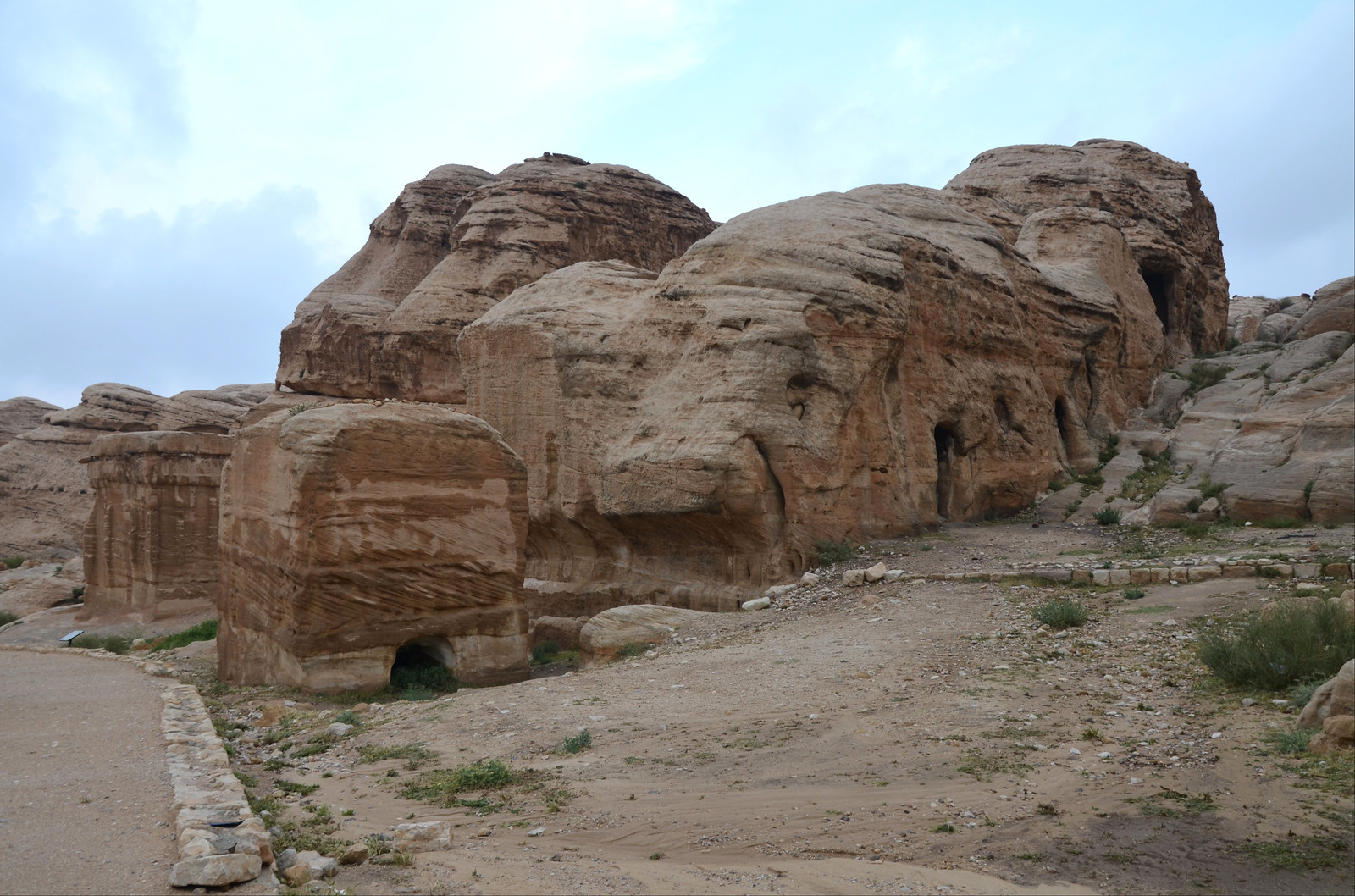
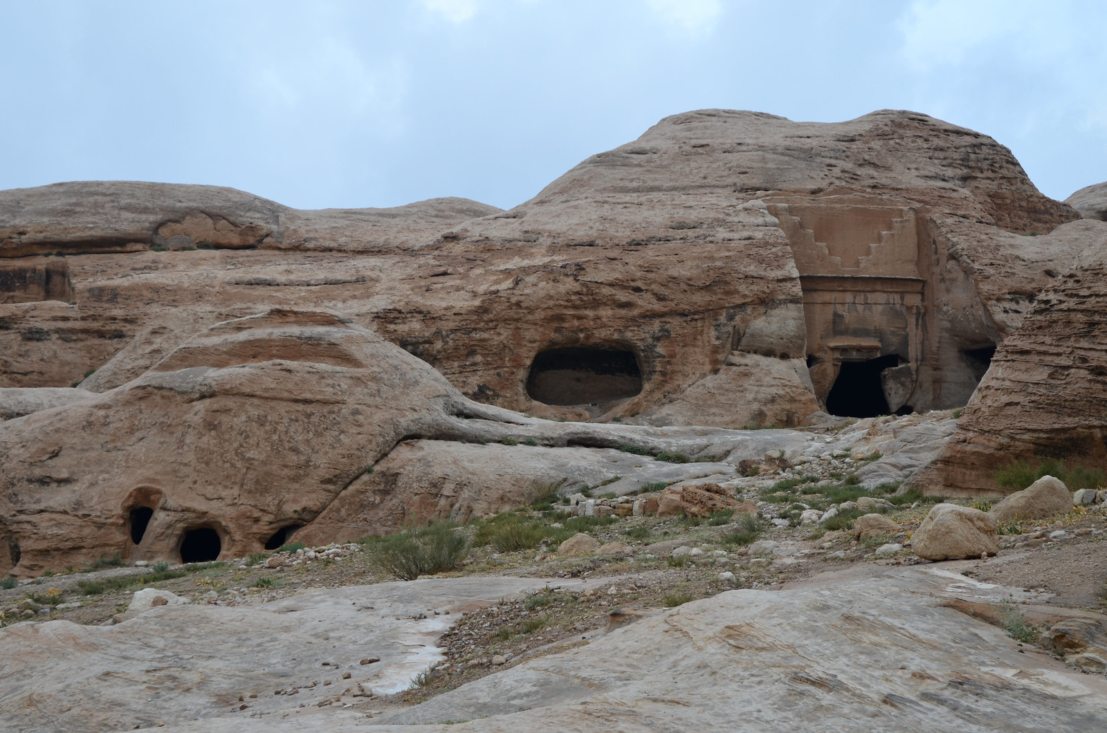
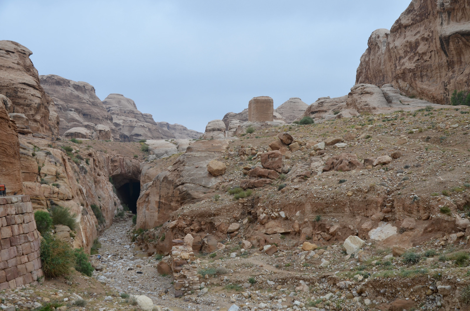
The Bab as-Siq, the gateway to the Siq. This path features several rock-hewn monuments, known as Djinn Blocks or God Blocks, as well as the rock-cut funerary complex of the Obelisk Tomb and the Bab el-Siq Triclinium.These free-standing cube-shaped monuments are known as Djinn Blocks. They were built by the Nabataeans from the end of the 2nd century BC to the 1st century AD and may have served as tombs and memorials to the dead.
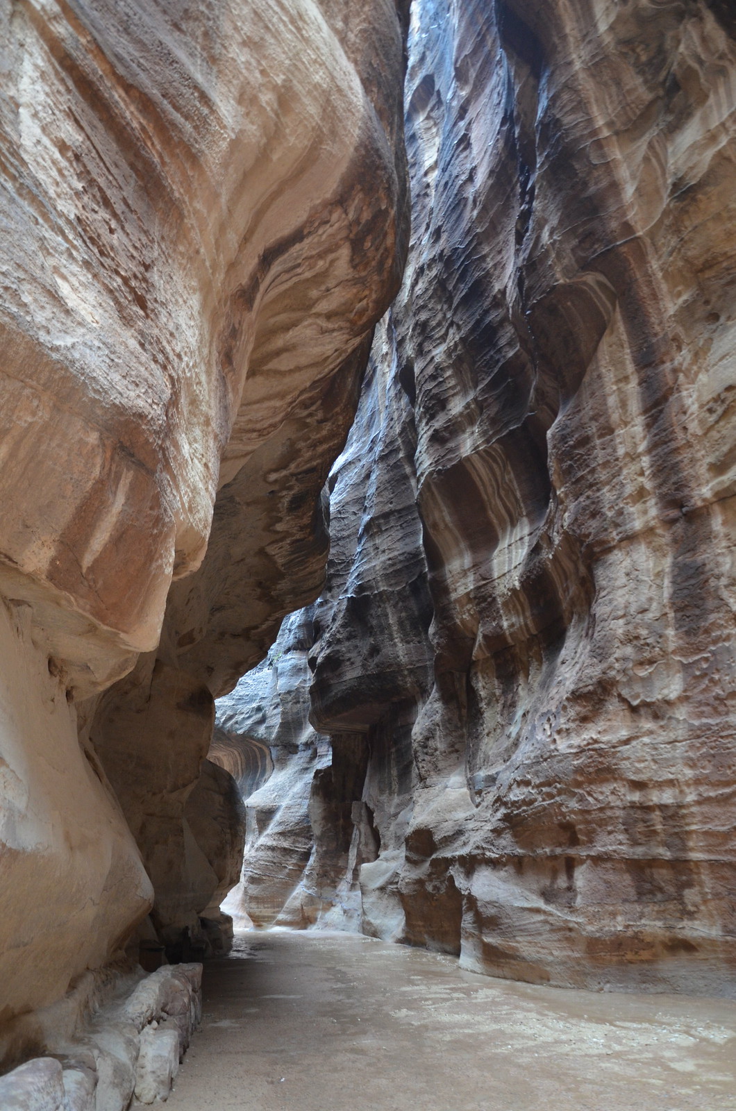
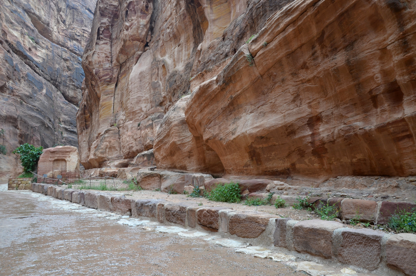
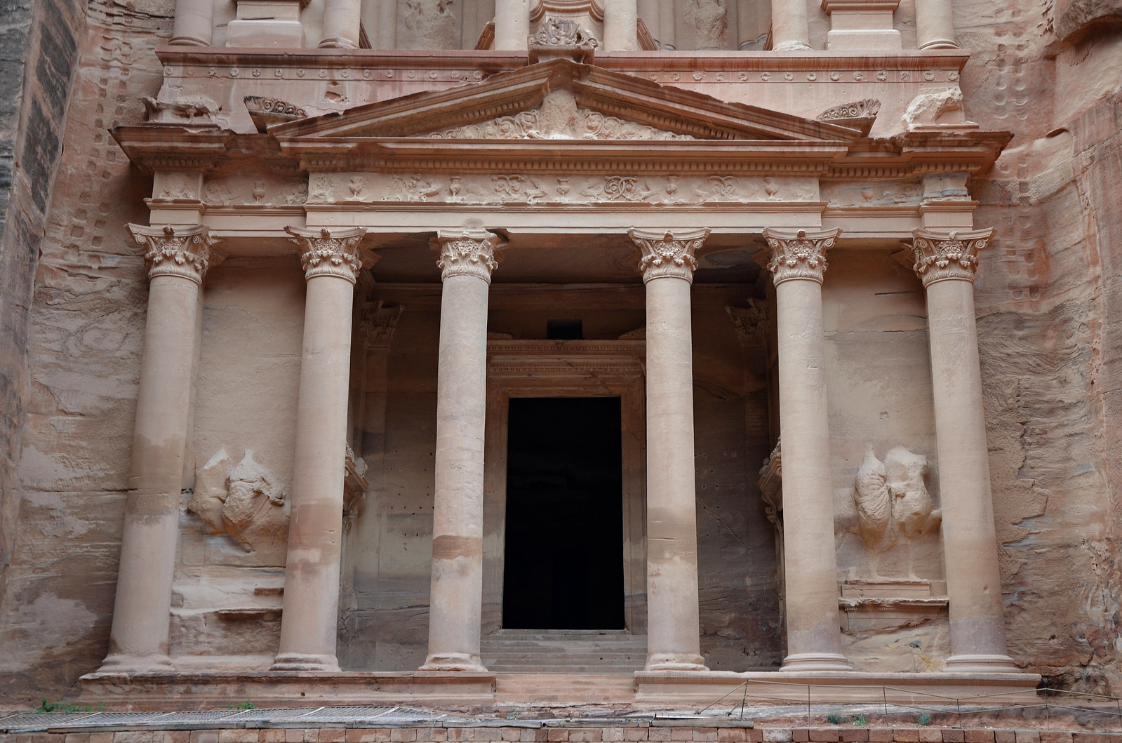
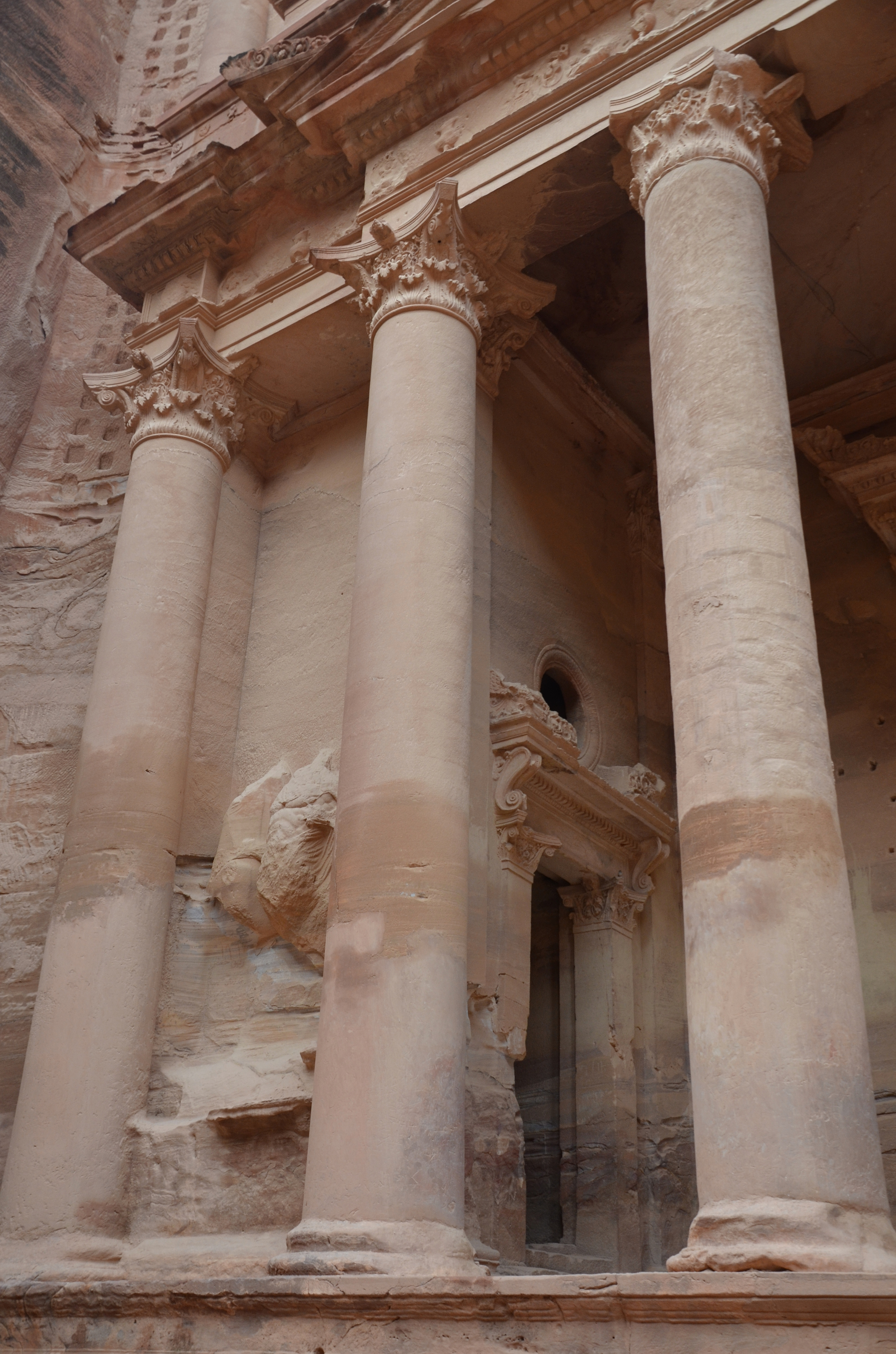
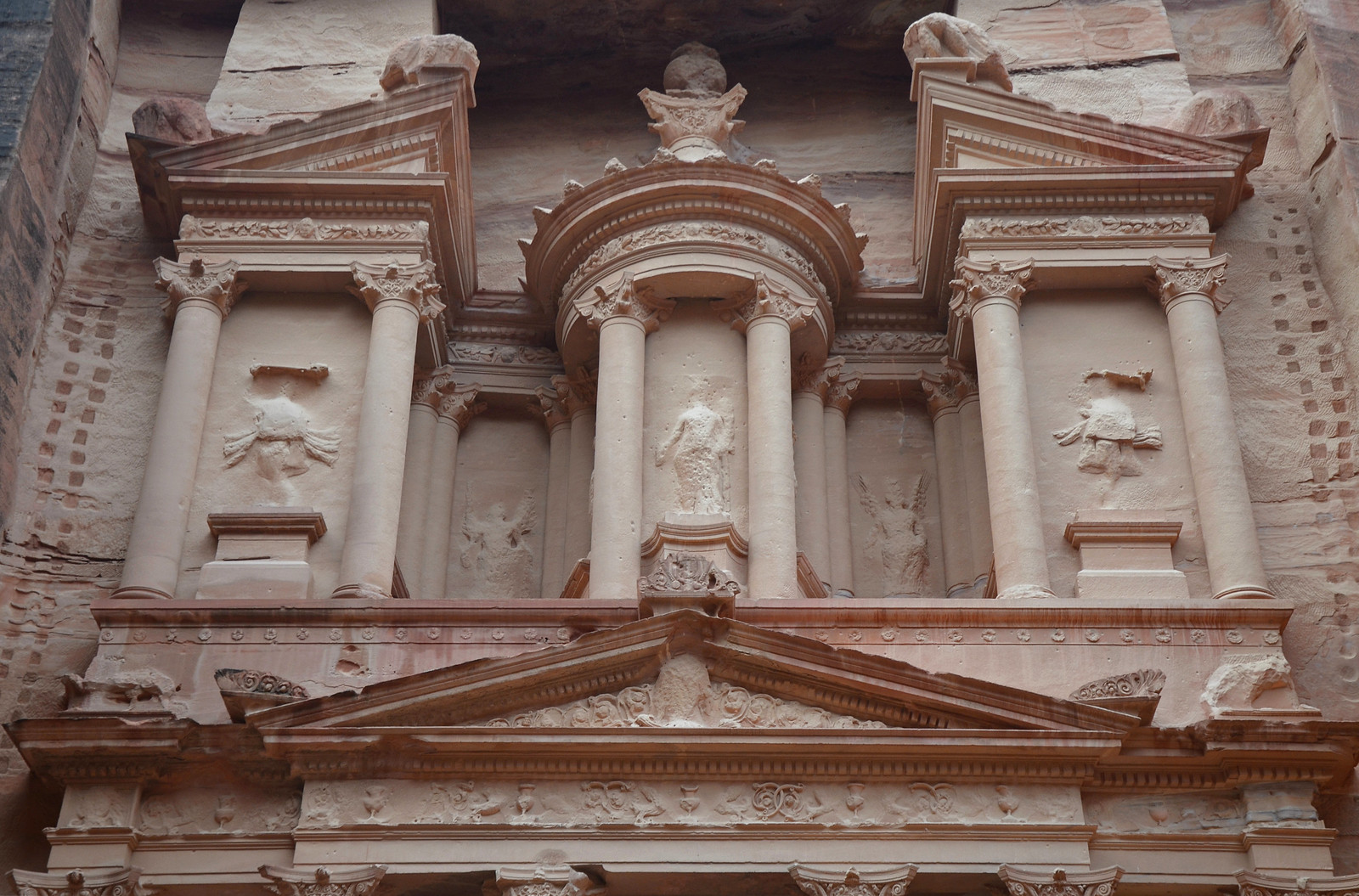
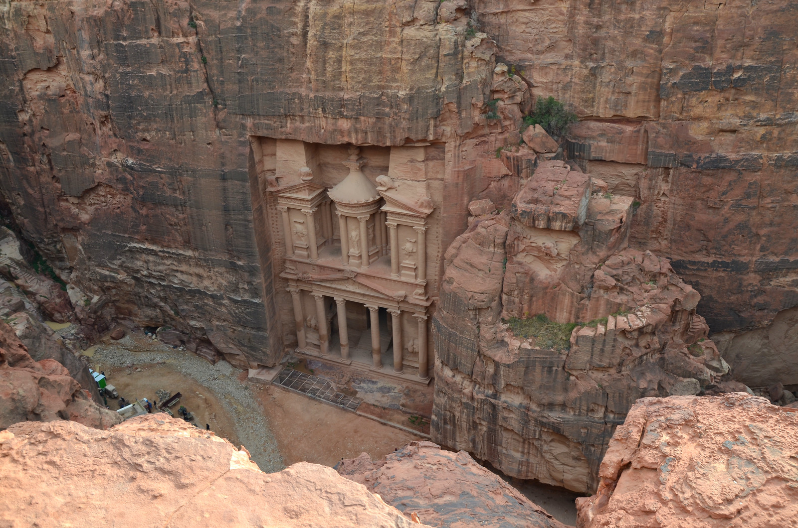
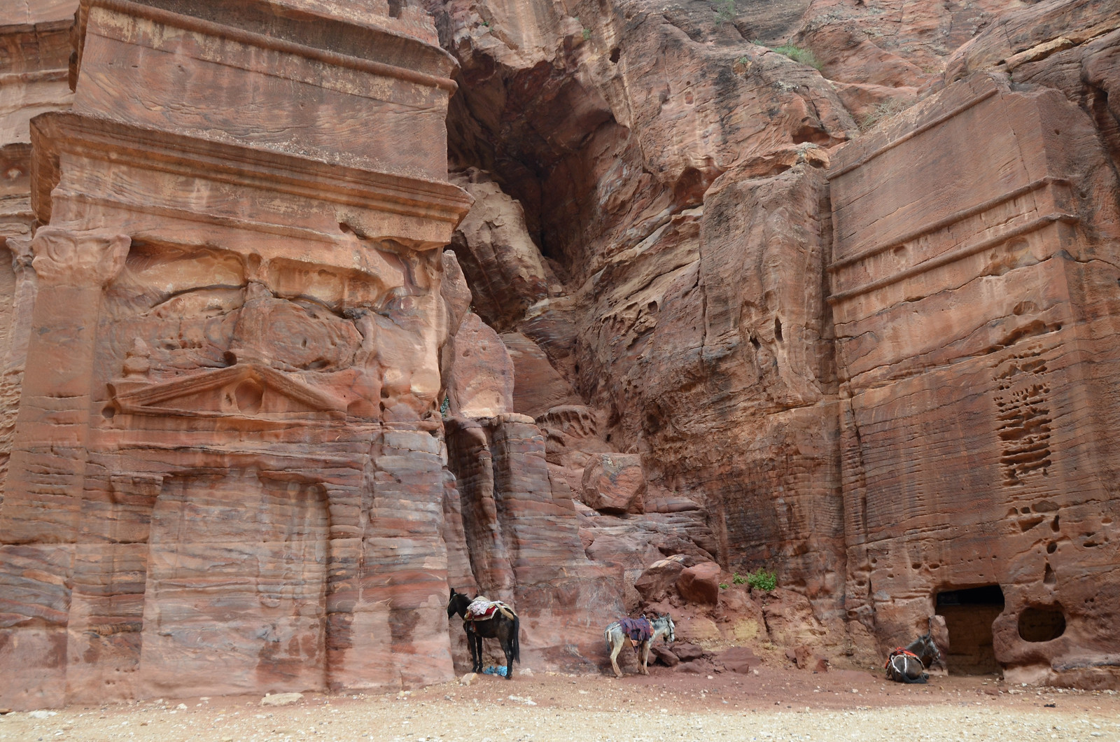
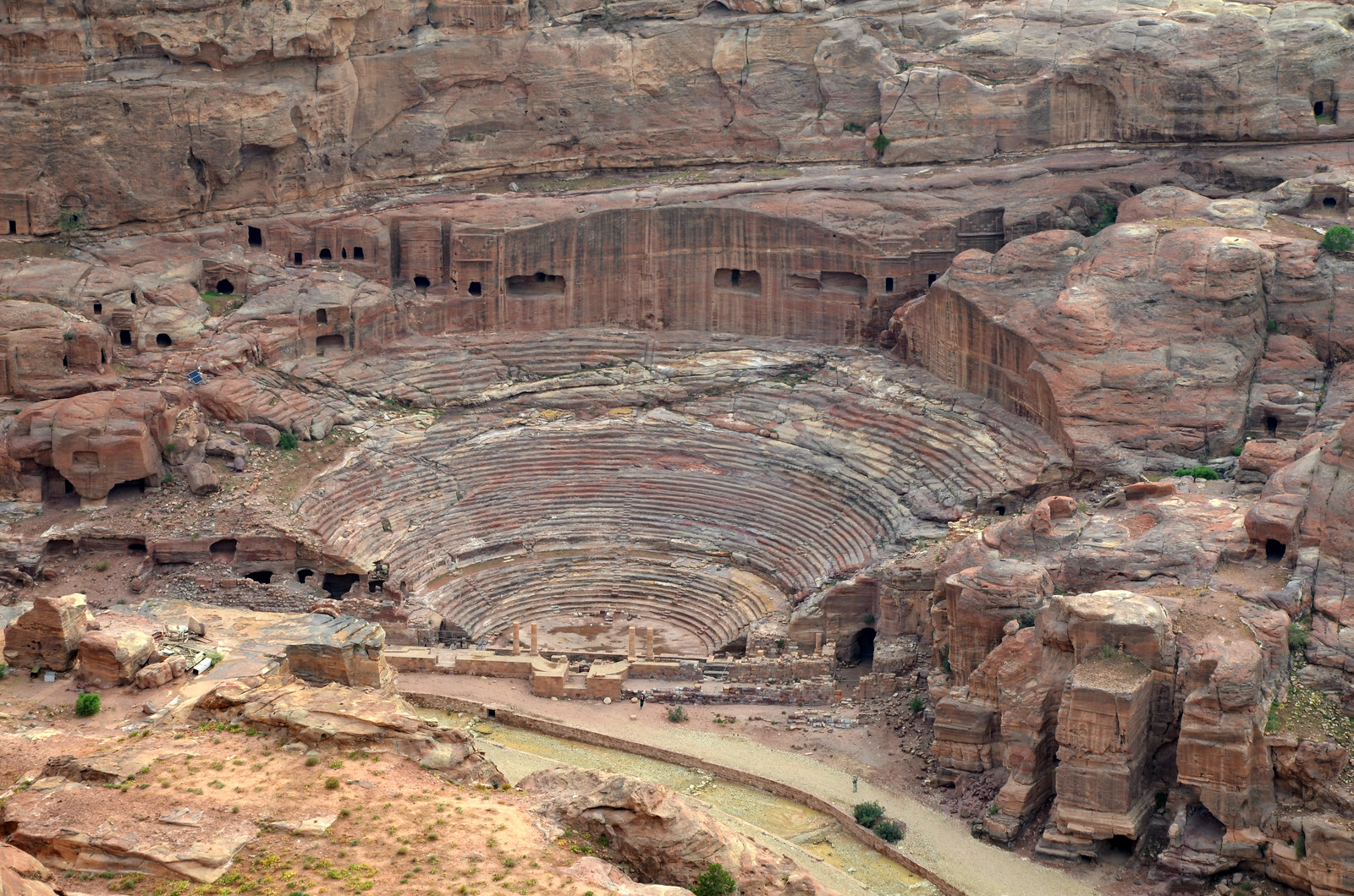
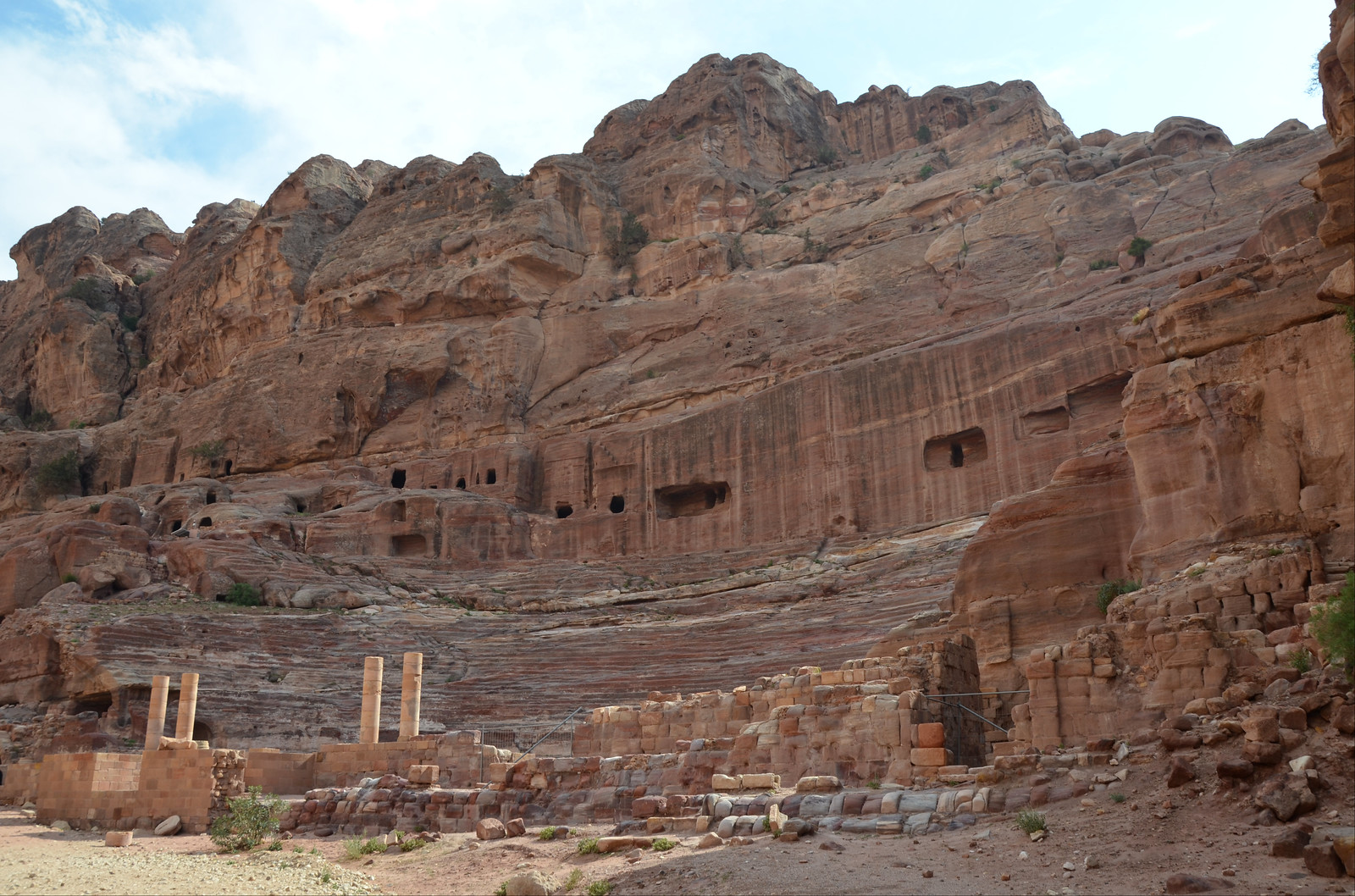
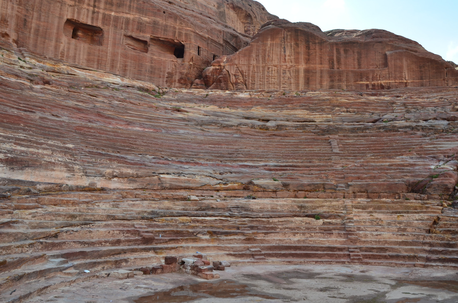
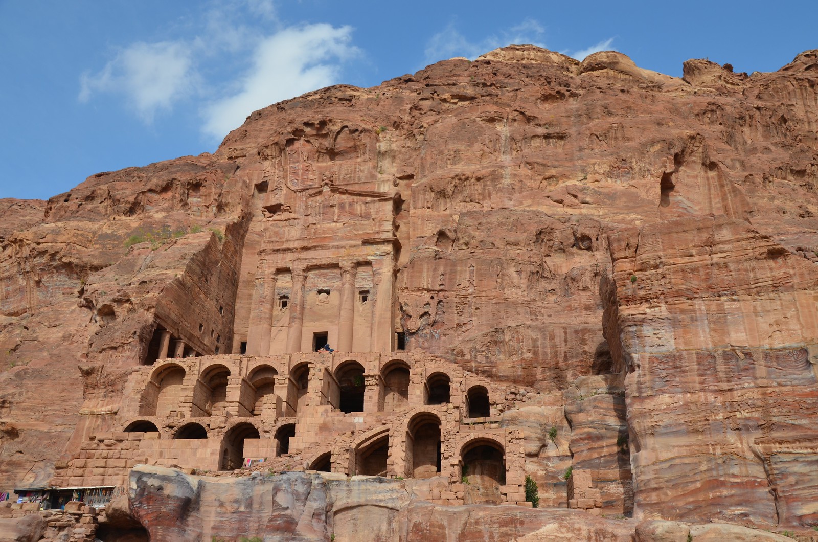
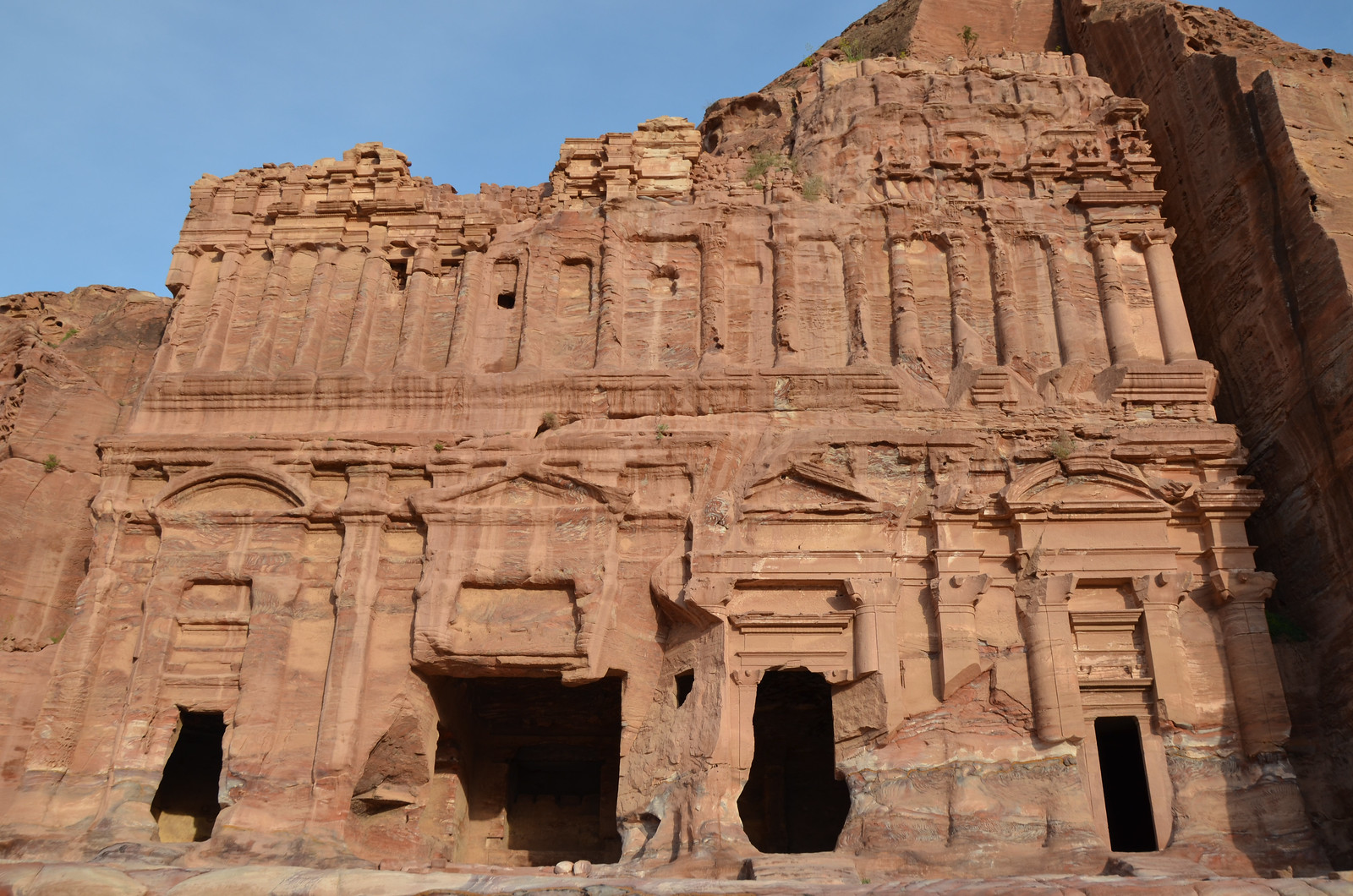
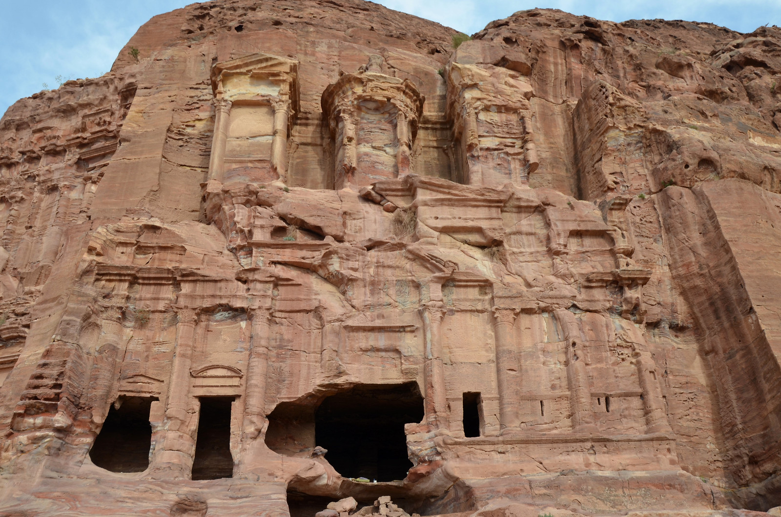
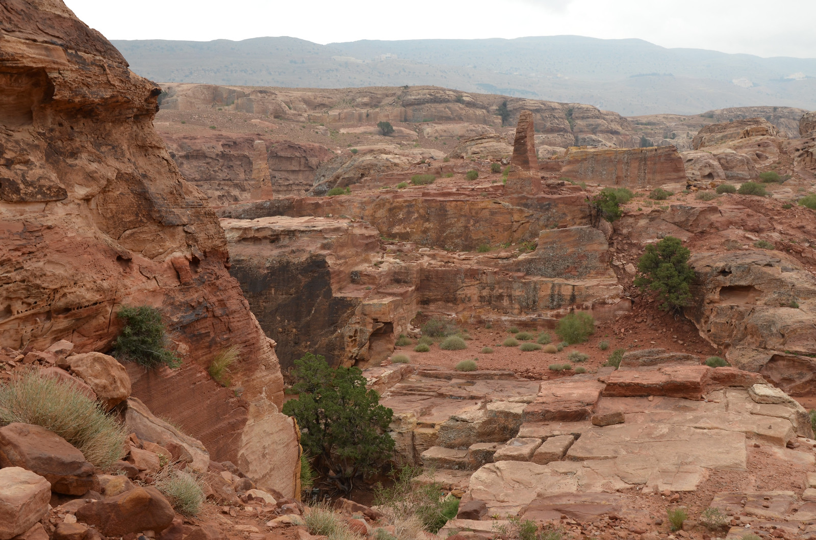
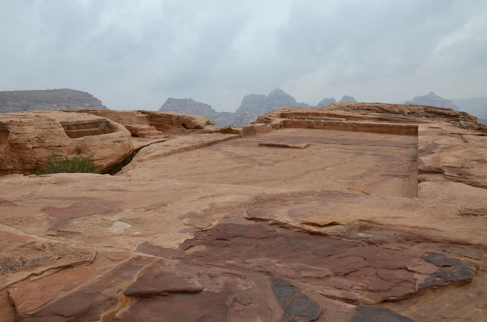
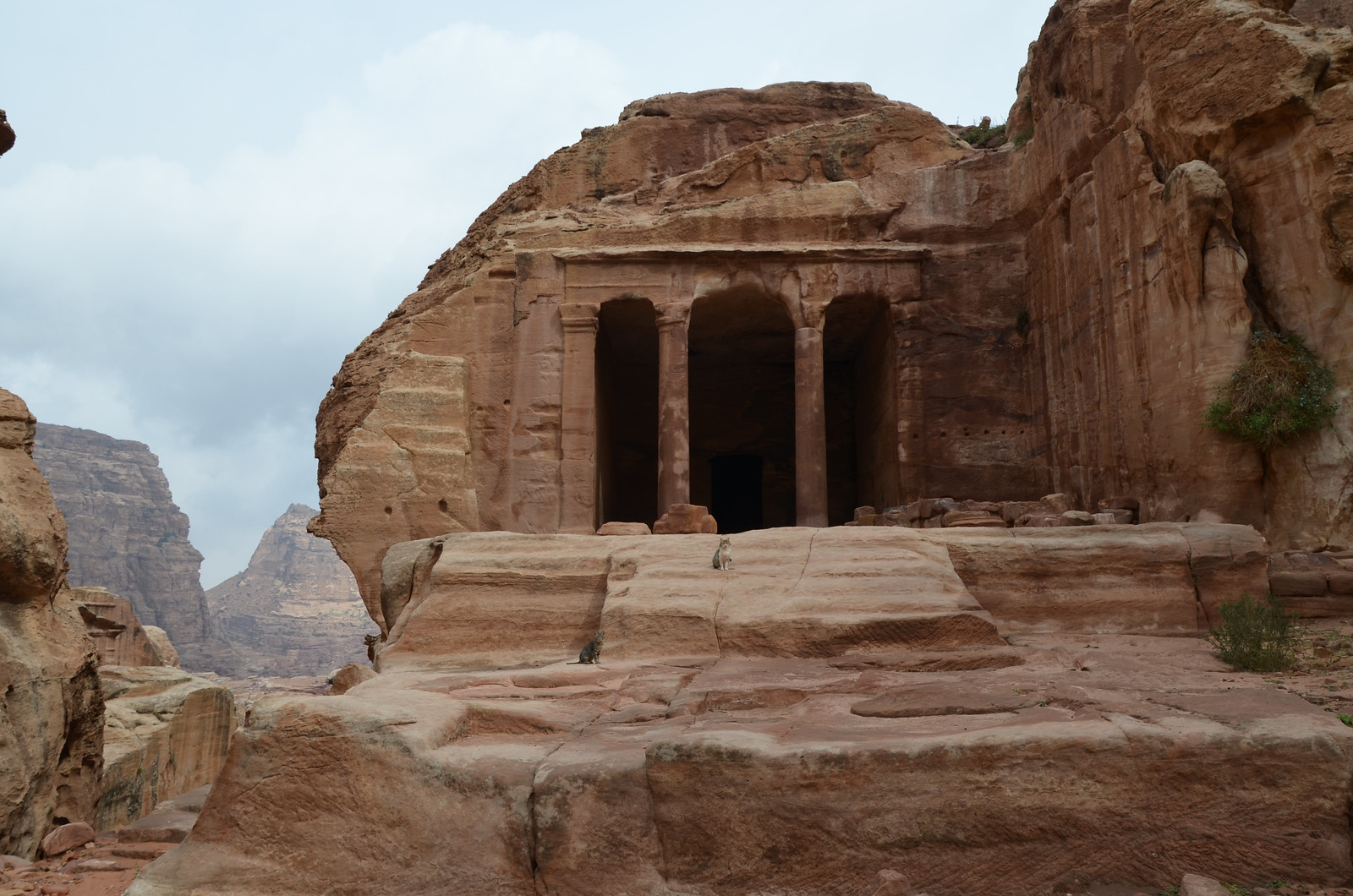
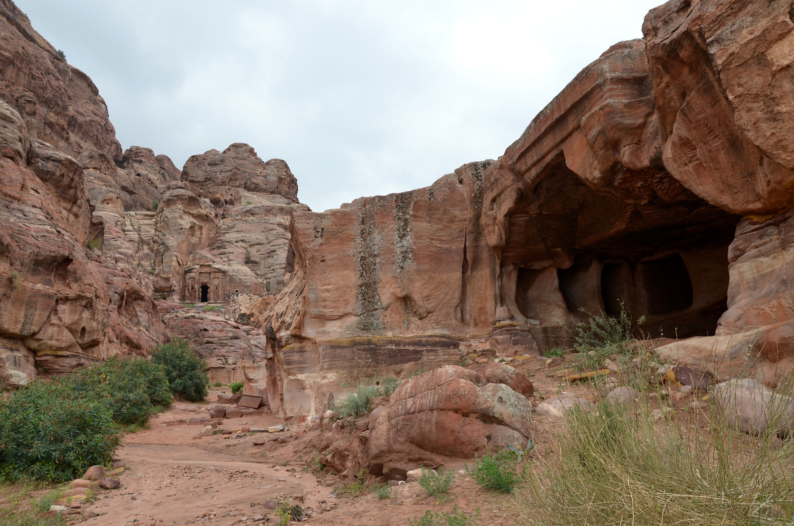
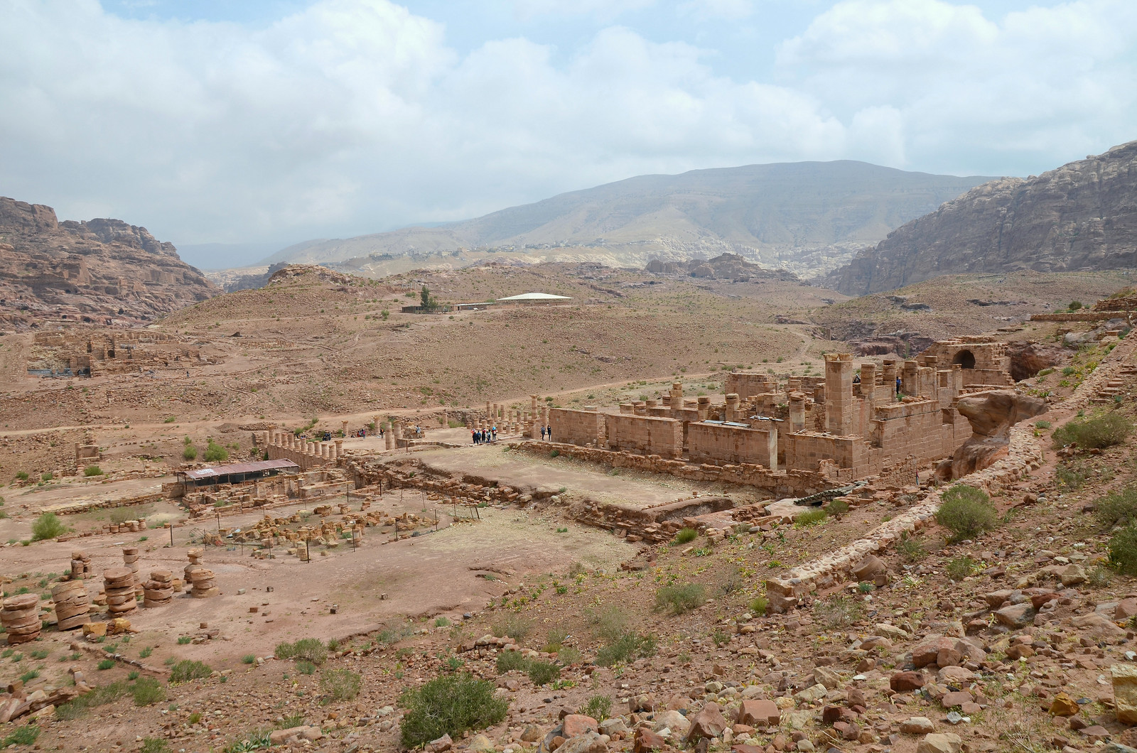
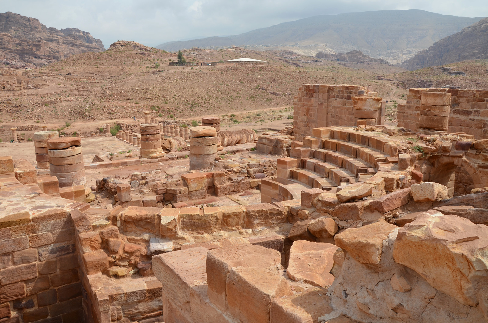
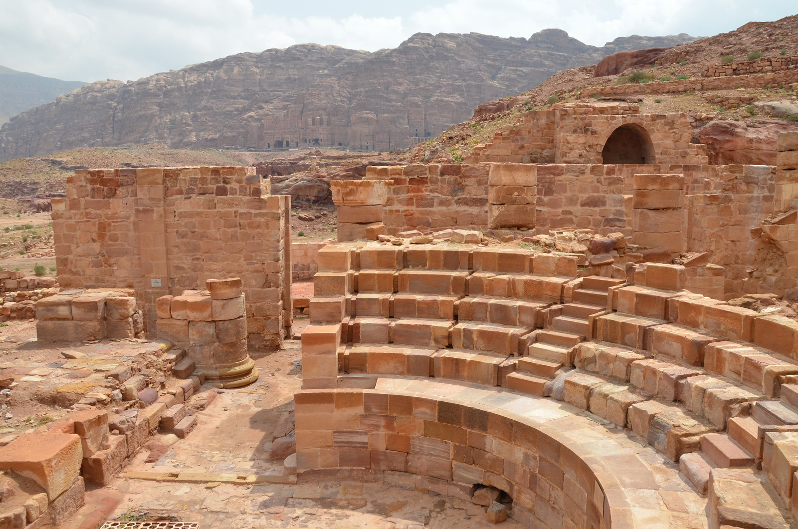
The Obelisk Tomb and Bab as-Siq Triclinium. This burial complex is unique in its design and architecture. It consists of two distinct rock-cut structures, both of which were built between AD 40 and 70. A triclinium is a dining room widely used in Antiquity with three benches (or sofas) on which the guests reclined while feasting. In Petra and across the ancient world, it was customary to hold an annual feast in such places to honour the dead.An 88-metre-long Nabataean tunnel was constructed in the third quarter of the 1st century BC to prevent floodwater from Wadi Musa from flowing through the Siq.The entrance to the Siq. It was once marked by a Nabataean arch. It survived until the end of the 19th century, and some remains can be seen on either side of the entrance.The Siq, with its 200m-high wall, winds over 1.2 km through a cleft in the sandstone massif, which in some places is only 2m wide.The paved road in the Siq. The Nabataeans fortified the former gravel road with a paved road and sidewalks in some places. The road was completed around 30 to 20 BC.Some of the most important rituals of Petra’s spiritual life began as a procession through. At this broad point, there was a shrine designed like a temple gate and framed by pilasters with Nabataean horn capitals.The Sabinos Alexandros Station. Many of the wall niches that are still visible today along the Siq’s walls were designed to hold figures or representations (called baetyls) of the main Nabataean god, Dushara. This cult site in the Siq is named after Sabinos Alexandros, one of the donors mentioned by name.A larger-than-life sandstone relief of a camel caravan was carved into the rock of the Siq. It depicts four camels with their guide entering Petra. Early 1st century BC.On both sides of the path through the Siq, the remains of water conduits can be seen. They were built together with the protection system against flash floods and paved roads in the last decades of the 1st century BC.The first glimpse of Petra’s Treasury (Al-Khazneh) upon exiting the Siq.Another view of the first glimpse of Petra’s Treasury.The Treasury (Al-Khazneh) is the most famous monument in Petra. It is a 39-metre-high mausoleum for a Nabataean king or queen, carved deep into the rock face during the first half of the 1st century AD.The lower level of the Treasury (Al-Khazneh). Four steps lead up to the vestibule, and another seven steps lead to the elevated entrance of the main portal. Of the six columns of the 25 m wide facade, only the middle two are free-standing. The other four remain connected to the background.The lower level of the Treasury has 5 m high reliefs depicting the Dioscuri, the twin brothers Castor and Polydeuces (or Pollux) from the Greek myth. The portals to the two lateral chambers are richly decorated with floral capitals.The upper level of the Treasury (Al-Khazneh). A circular temple structure with columns (monopteros) stands in the middle of an open pediment.View of the Treasury from Jabal al-Khubtha.The road that leads to the centre of Petra and the Street of Facades.The Street of Facades with large tomb facades carved out of rock.The Street of Facades. On the left is Tomb BD 70. A heavily weathered freestanding tower of over 15 m in height, carved out of the rock on three sides.The Theatre Necropolis with tomb facades has been carved out of the northeast face of the Jabal Al-Madhbah in several rows, one above the other.The theatre of Petra was carved into the side of the mountain at the foot of the High Place of Sacrifice.Despite its distinctly Roman vibe, the theatre was actually built before the Romans arrived in Petra.The cavea has about 45 seat rows divided into three horizontal galleries separated by a semicircular walkway and accessed through seven radial stairways. It could seat up to 8,000 spectators.The scaenae or stage building of the theatre was built of ashlar and faced with marble.The “Royal Tombs,” a series of large mausoleums with impressive façades, were sculpted out of the western slope of the Jabal al-Khubtha rock massif.View of the Royal Tombs, from left to right: the Palace Tomb with three distinct stories; the Corinthian Tomb and the Silk Tomb.The most distinctive of the Royal Tombs is the Urn Tomb, recognisable by the enormous urn on top of the pediment. It was built in about AD 70 for King Malichos II (AD 40–70) or Aretas IV (8 BC-AD 40).The Palace Tomb was meant to resemble a palace. It has one of the largest facades in Petra, with part of the upper levels built instead of carved out of the rock.The Corinthian Tomb.The Royal Tombs.View of the Street of Facades from the hiking trail to the High Place of Sacrifice.Two six-metre-high obelisks at Zibb Atuf are entirely carved out of the rock and stand some 30m apart. The mountain has been cleared away, and a flat surface surrounds the obelisks.The ceremonial platform on the High Place of Sacrifice. The High Place is located at the very top of a mountain. The ceremonial platform has remains of a triclinium (benches for festive meals), a circular altar where animals were sacrificed as well as a stone block as the repository of the god statue.Panoramic view from the High Place of Sacrifice.The Lion Monument. A water channel on top of the lion’s head indicates that it has been a fountain figure. In the Nabataean cult, the lion is related to the goddess Al-Uzza.View of Wadi Farasa East with the Garden Hall at the centre.The Garden Hall may have been part of the Nabataean water system, as to the right of the structure, there is an immense retaining wall that creates a natural water reservoir.View from inside the Garden Hall onto the upper part of Wadi Farasa East.A large colourful triclinium in the Wadi Farasa. The hall with three benches for annual banquets in honour of the deceased is approx. 11 x 11 metres big. With its fluted columns and window-like sculpture niches, it is the most richly decorated triclinium in Petra.The Tomb of the Soldier was carved out of red sandstone. Its niches contained male figures dressed in military attire.The Tomb of the Soldier was originally part of a unified complex with a colonnaded courtyard built at the end of the 1st century AD. On the right is the Roman Soldier Tomb, and directly opposite it is the large colourful triclinium.Remains of the colonnaded courtyard of the Tomb of the Soldier.The Renaissance Tomb, with its elegant facade, evokes elements of Italian Renaissance architecture. The tomb was carved around AD 129.View of the Broken Pediment Tomb in the Wadi Farasa.Tombs at the western slope of Zibb Atuf, Petra.View of the Great Temple. The Great Temple is one of the major architectural components of metropolitan Petra.This is a view of the Lower Temenos (sacred courtyard) of the Great Temple. It is paved with hexagonal stones and enclosed on the east and west sides by triple colonnades containing more than 100 columns.View of the Upper Temenos of the Great Temple from the Lower Temenos.The Theatron, a semi-circular place of assembly, used to have 13 seating rows.The Theatron had as many as 20 original courses of seats and a seating capacity of a minimum of 565 and a maximum of 620 persons.
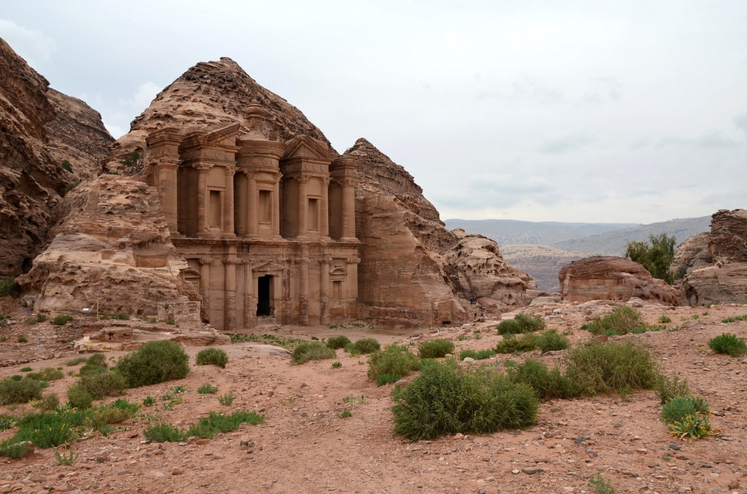
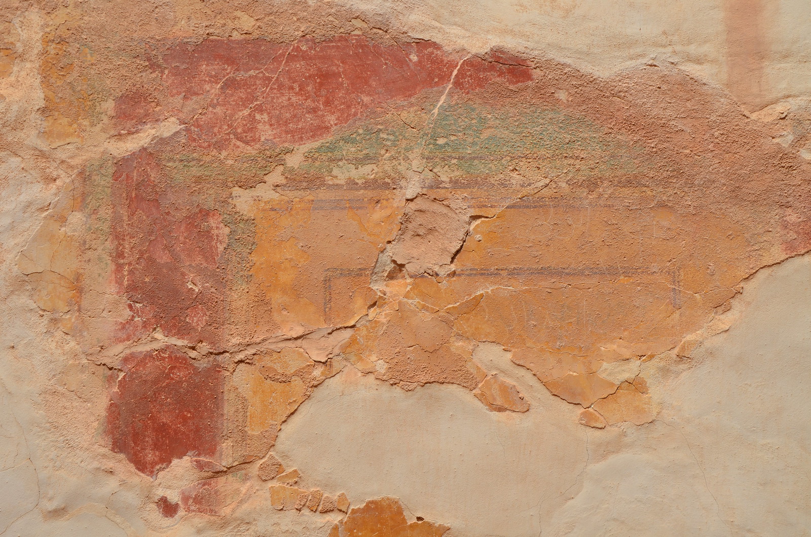
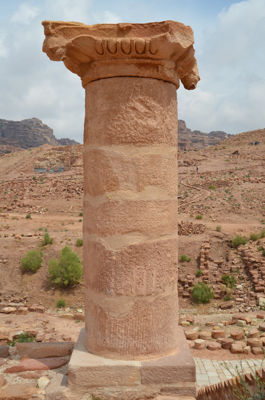
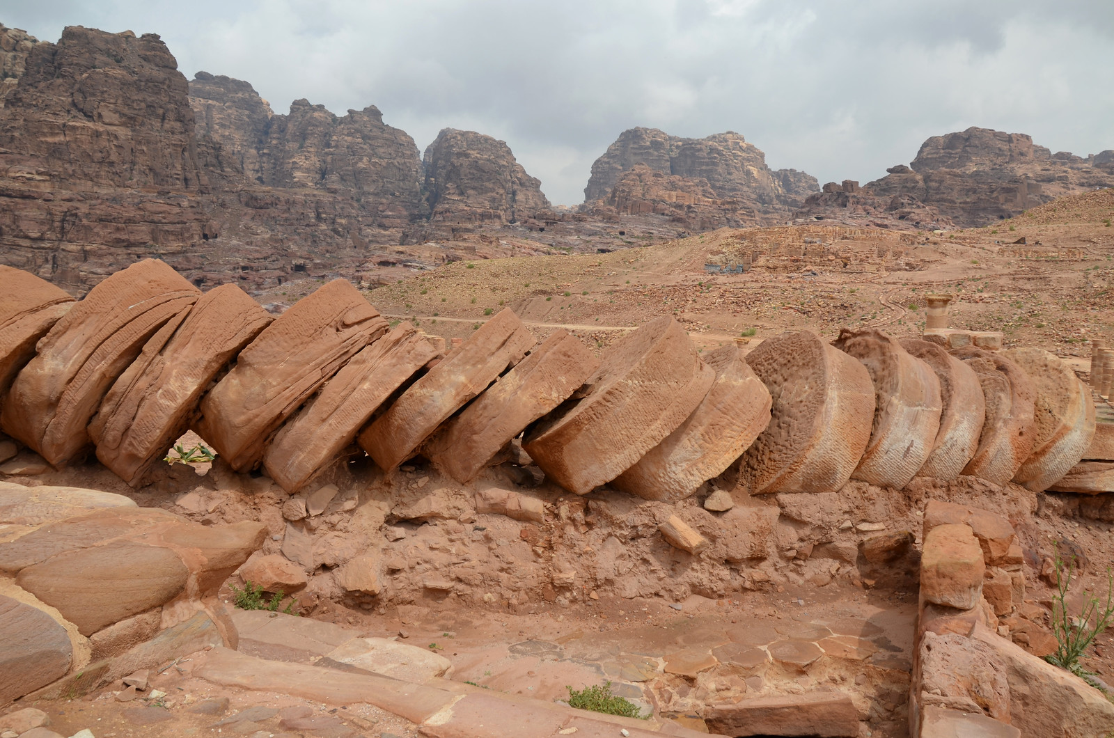
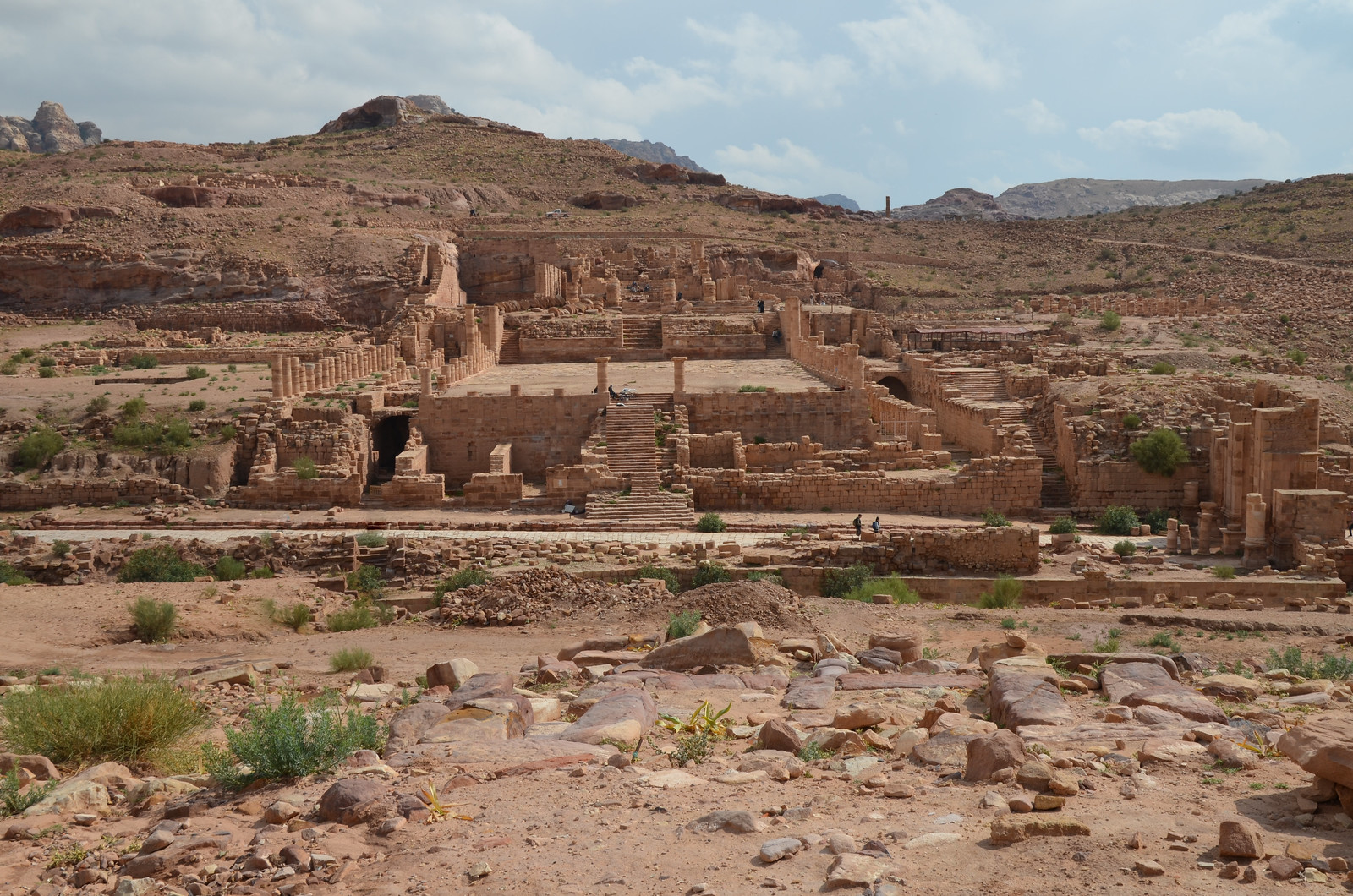
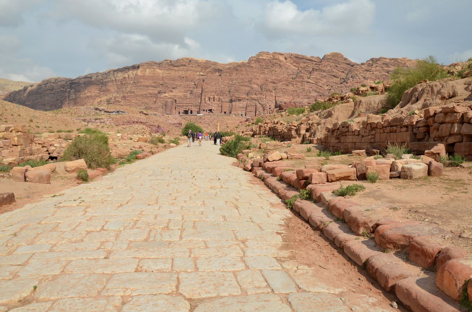
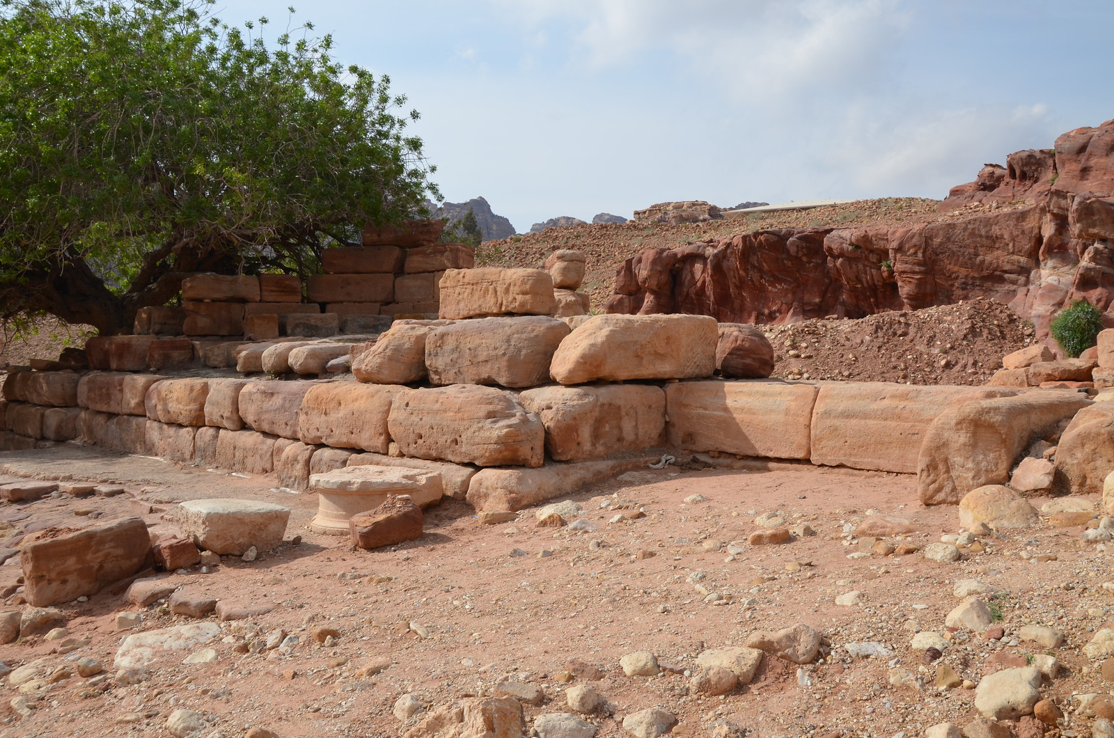
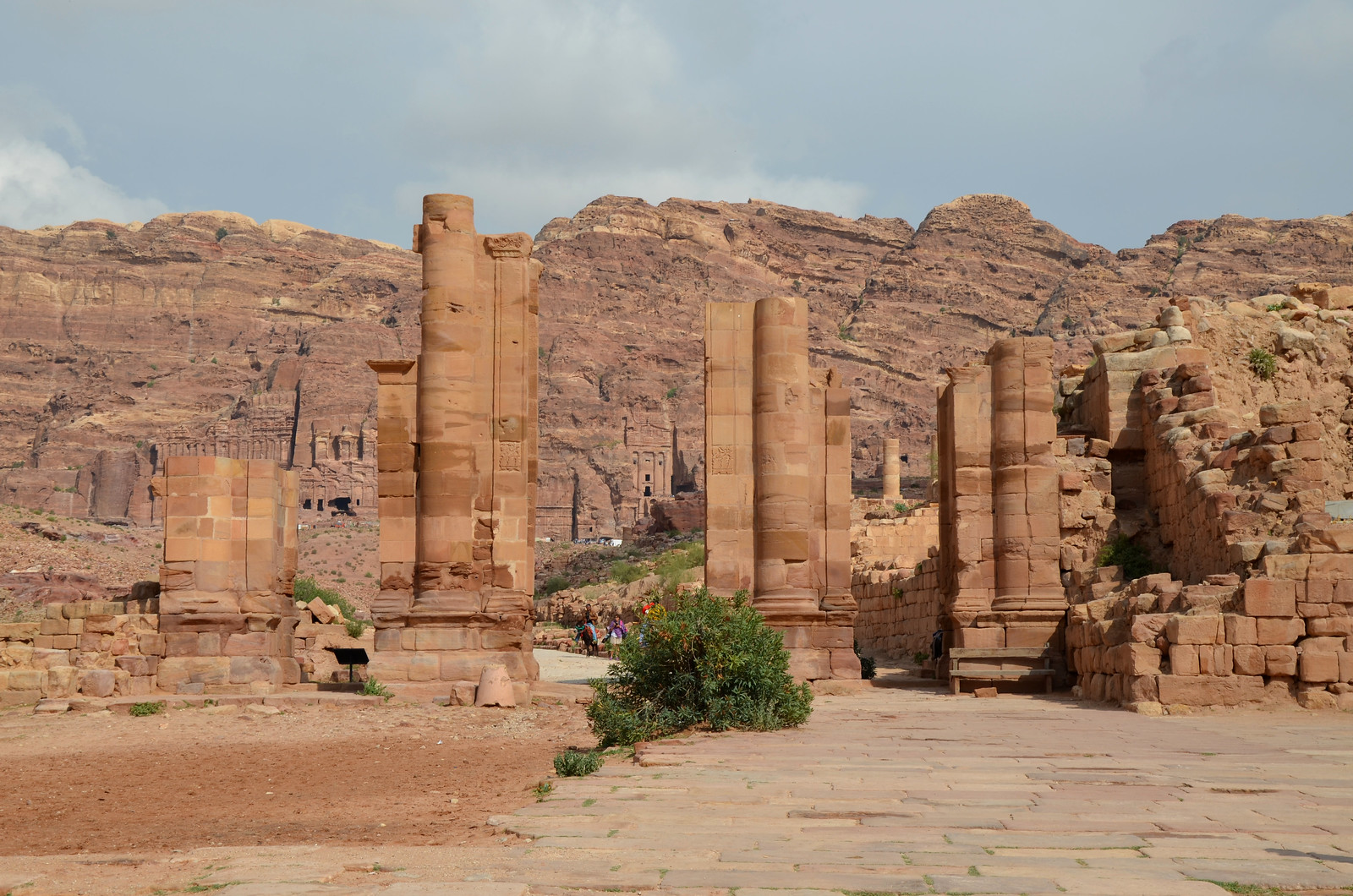
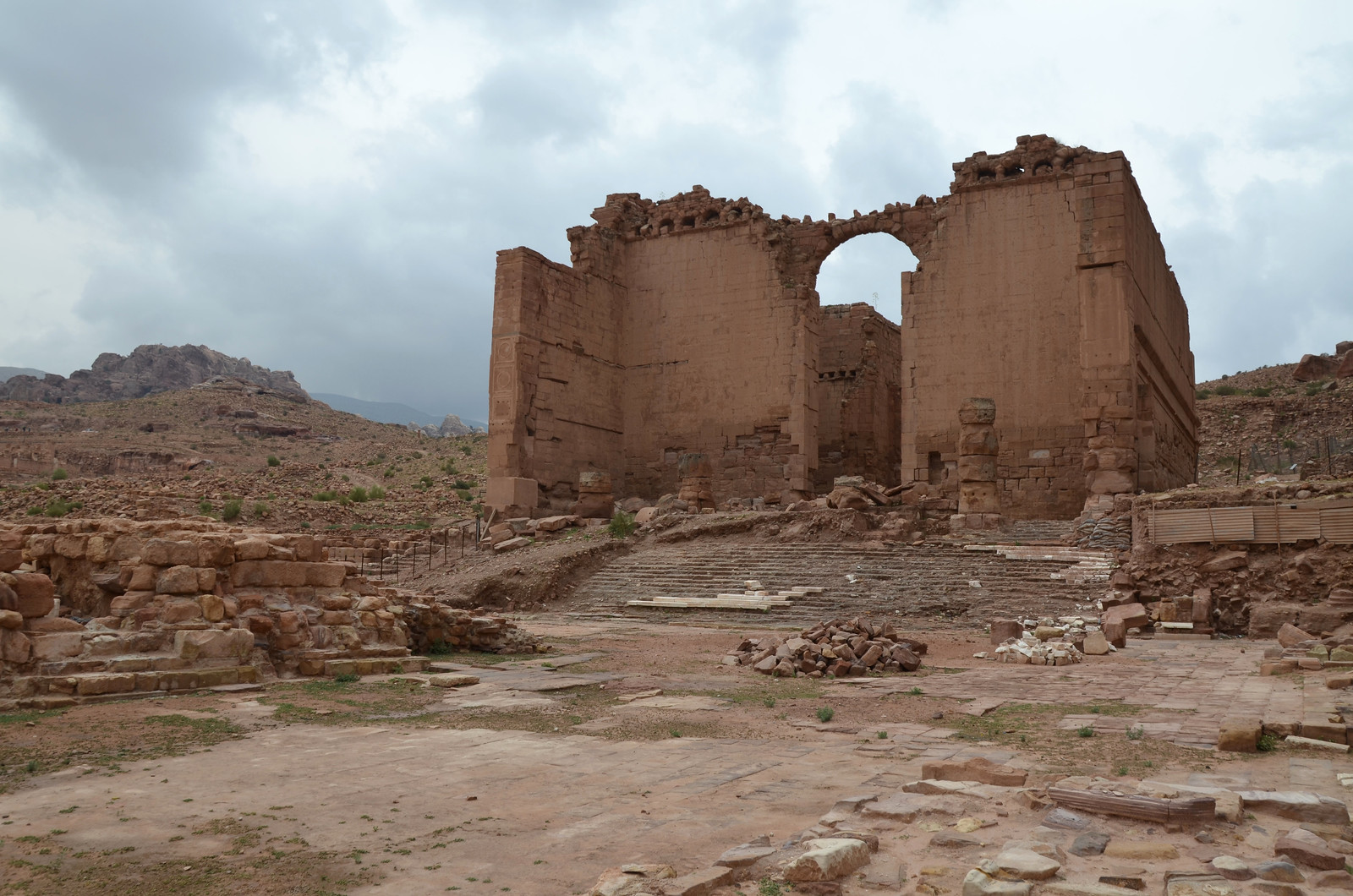
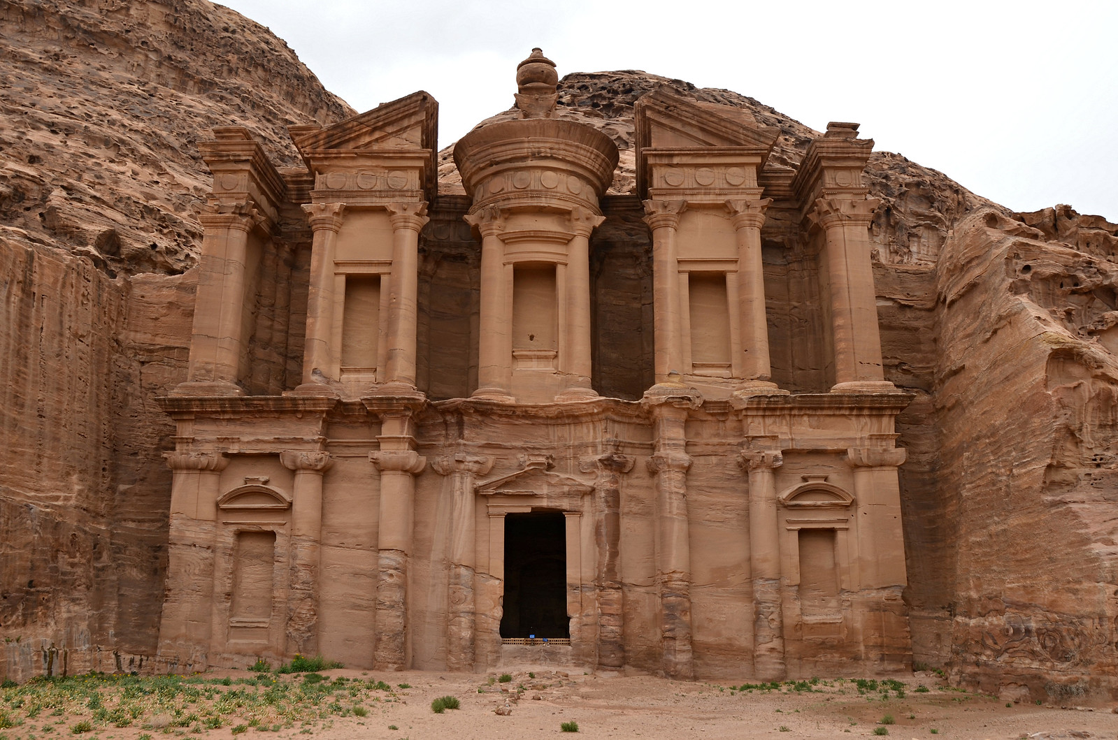
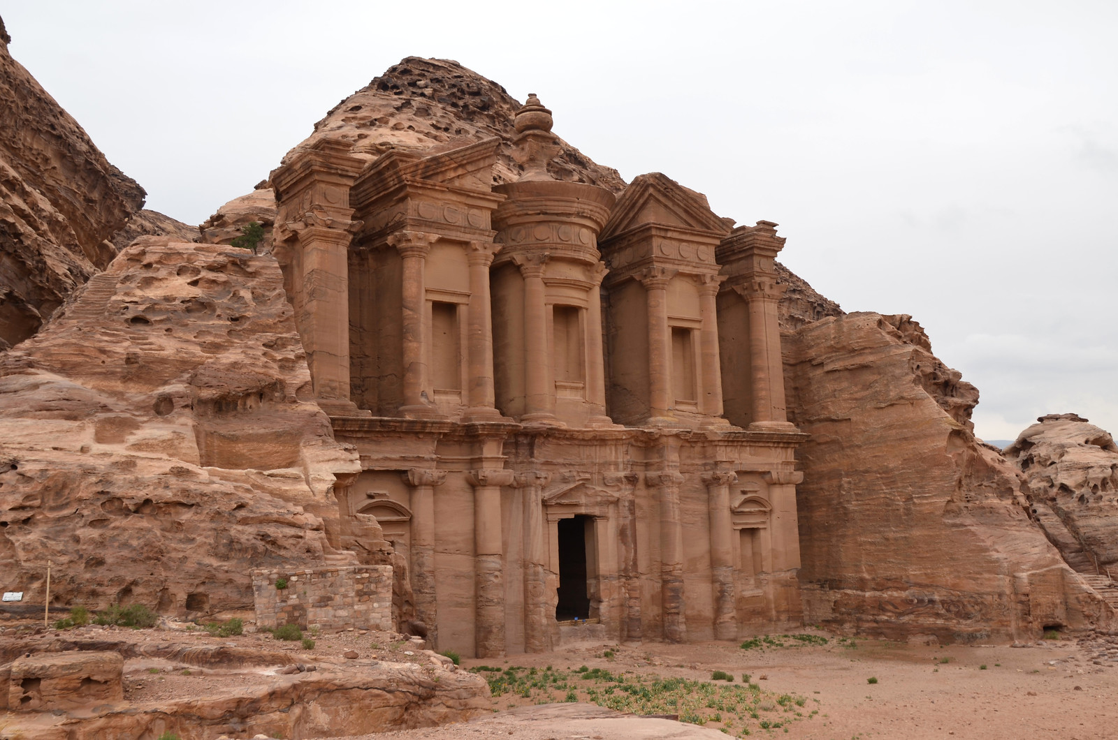
Staircases leading up to the proper temple.Inside the Upper Temenos of the Great Temple.Remains of plaster decoration with original colours inside the Great Temple.The West Exedra of the Great Temple.Column base inside the Upper Temenos of the Great Temple.Corinthian capital inside the Great Temple.A capital decorated with an Asian elephant head inside the Great Temple:The Asian elephant-headed capitals are found in the triple colonnades of the Lower Temenos and are sculpted from limestone.Fallen columns of the Upper Temenos of the Great Temple.The ornamental garden and pool complex of the Great Temple was built during the reign of King Aretas IV.Frontal view of the Great Temple, which rises about 25 m above the Colonnaded Street.The Colonnaded Street that ran through Petra’s city centre was built by the Romans in about AD 106.The remains of a nymphaeum at the eastern end of the Colonnaded Street. Elevated upon a stepped podium, this nymphaeum consisted of a freestanding wall decorated with porticoes and featured a large central exedra that contained the fountain proper, whose waters emptied into a shallow pool below.The Colonnaded Street had a double row of columns and commercial shops on its south side.The Colonnaded Street.At the end of the Colonnaded Street, a monumental triple-arched gate marked the access to the sacred open precinct of the Qasr Al Bint.Built in the 2nd century AD, the monumental triple-arched gate originally had huge wooden doors and side towers.View of the Qasr al-Bint, one of the main temples in Petra located to the northwest of the Great Temple. The temple was probably the cult centre of the city’s patron deity, Dushara (“Lord of the Shara Mountains”).The Qasr al-Bint was used only by priests and dignitaries. It’s especially unusual because it’s the only one built from brick and not carved from red rock.This bust of Zeus-Dushara was discovered in the courtyard enclosure of the Qasr al-Bint. Dushara, the chief deity of Petra and the head of the Nabataean pantheon, was identified with the Greek god Zeus. This massive bust illustrates the meeting of Hellenistic conventions with those of Syrian and Arabian art.The temenos (sacred precinct) of Qasr al-Bint, Petra’s main temple, had an altar in the centre where worshippers made their offerings. The temple itself was accessed through a wide staircase.The hiking trail to the Monastery. The trail to the Monastery takes about 40 minutes.Along the way of the hiking trail to the Monastery are numerous tomb facades, places of worship, and niches.Rock façade tombs along the hiking trail to the Monastery with the Lion Triclinium on the right.The Lion Triclinium was built around the middle of the 1st century AD. The name comes from the two now strongly weathered lions on both sides of the entrance door.The Monastery (Ad Deir) is one of Petra’s most fascinating landmarks. The monumental rock building is 47 m wide and 48 m high.While the Monastery might look like the Treasury, its carvings are less intricate. The upper storey consists of a broken (open) pediment, in the middle of which stands a Tholos (circular structure) with a conic roof.The façade of the Monastery, like most buildings in Petra, was probably covered with a light stucco layer and was painted in several colours.The Monastery is deeply carved into a cliff face in breathtaking scenery.The Petra Church is a triple basilica with three apses to the east and three entrances to the west and accessed from a stone-paved atrium.The Petra Church was built starting in AD 450 in several phases, using stones from Nabataean and Roman buildings that had been destroyed by the 363 AD earthquake.The northern aisle of the Byzantine Church, with 84 medallions arranged in three columns and surrounded by a guilloche border.A mosaic medallion depicting a giraffe is in the Petra Church. Around AD 600, the basilica burned down and was later hit by several earthquakes, burying the floor mosaics, which saved them from iconoclast destruction.Located just above the main church is the Blue Church, named after its impressive columns.The Temple of the Winged Lions, located at the end of the Colonnaded Street, is a sacred complex thought to have been built by the Nabataeans during the 1st century AD.
LITTLE PETRA
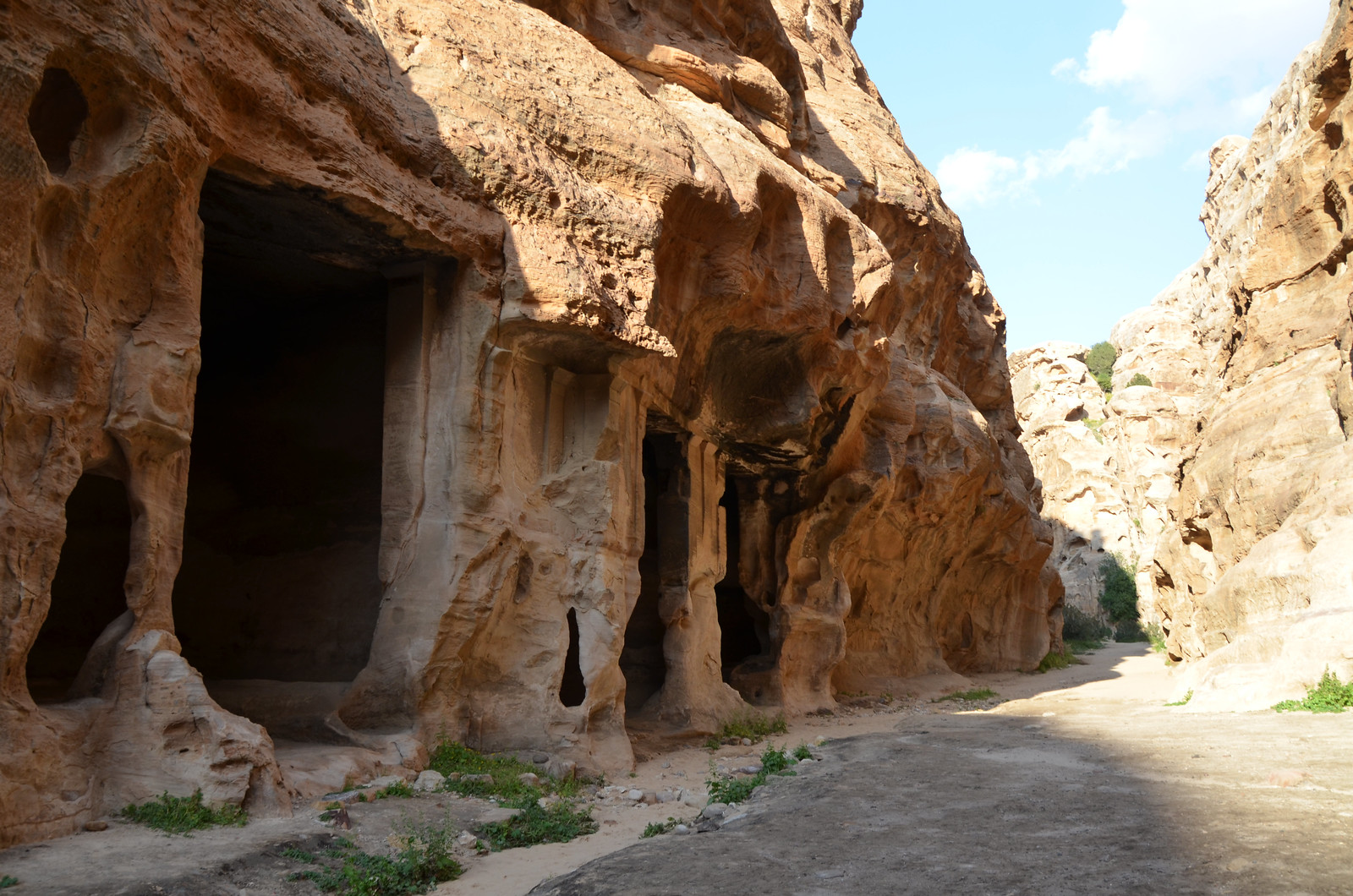
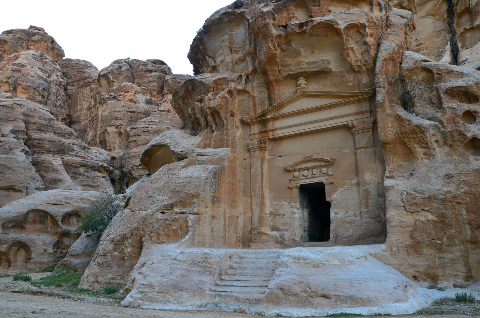
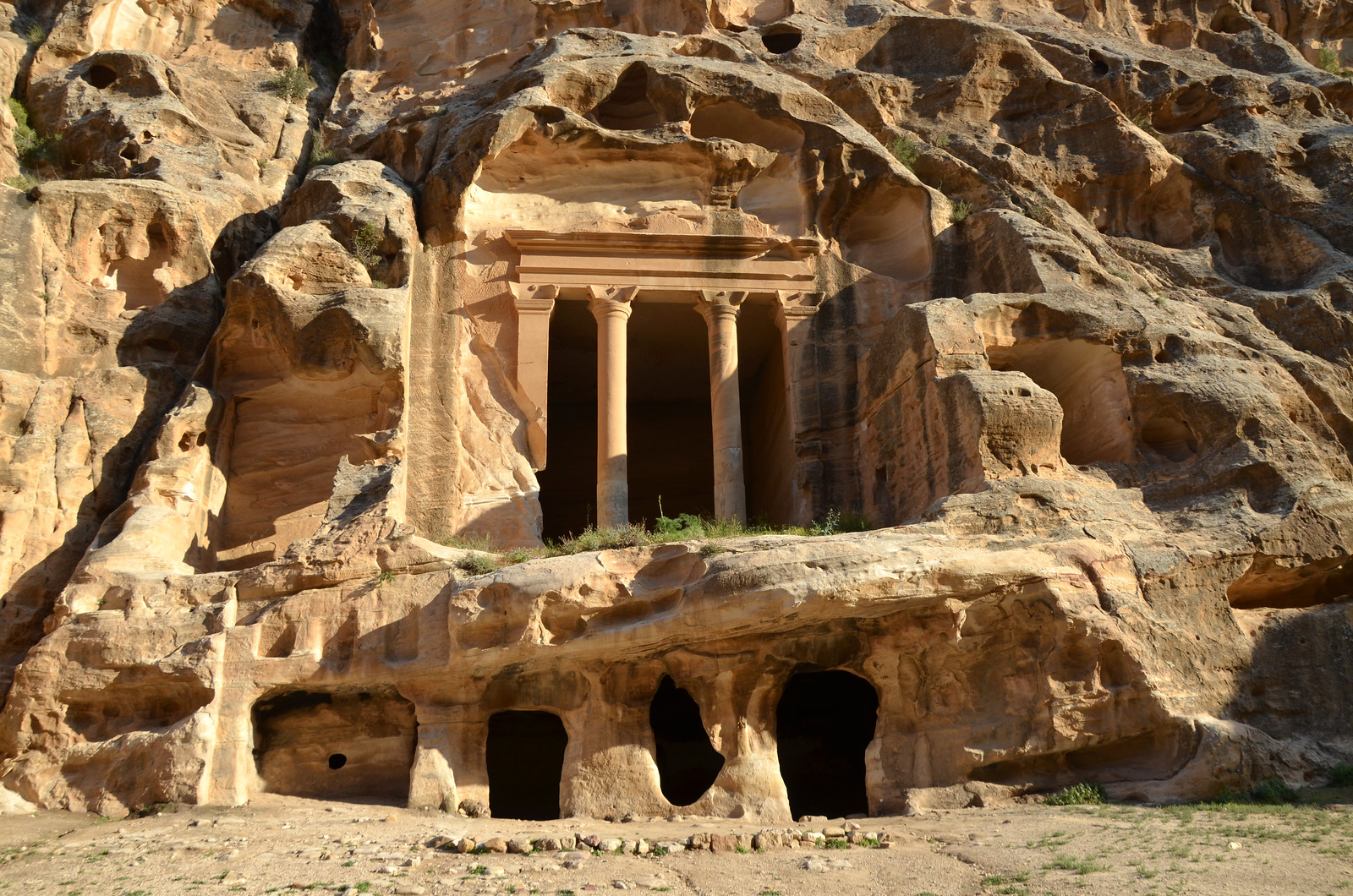
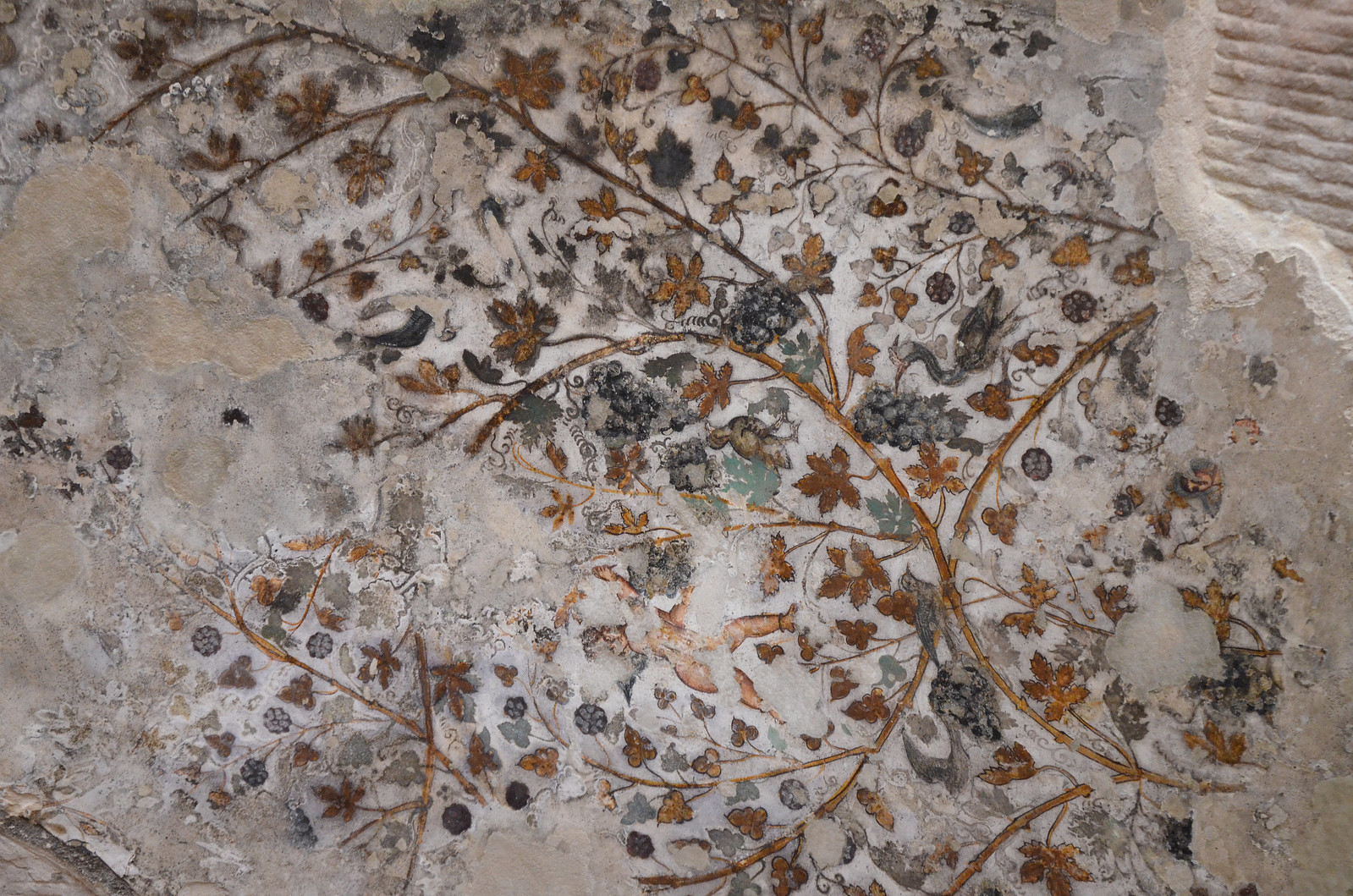
Little Petra lies just 6 km north of the centre of the Nabataean capital. It was thought to have served as an agricultural centre, trading suburb and resupply post for camel caravans visiting Petra.A rock-cut tomb with a classical façade was built between the 1st century BC and the 1st century AD.A Temple above cave rooms.Ceiling painting inside the Biclinium depicting a web of intertwined grape and ivy vines and a Cupid.Little Petra.
Pompeii was a large Roman city in the Italian region of Campania which was destroyed, together with Herculaneum, Stabiae, Oplontis and other communities, by the violent eruption of Mount Vesuvius in AD 79. Buried for centuries beneath tons of volcanic ash and debris, Pompeii was finally re-discovered late in the 16th century, offering an invaluable insight into the Roman world. Pompeii is a UNESCO World Heritage Site and is one of the most popular tourist attractions in Italy, with approximately 2.5 million visitors annually.
Thanks to its strategic position near the Sarno River, Pompeii was an important commercial centre, a trading hub noted for exporting goods such as olives, olive oil, wine and fish sauce (garum). Once home to approximately 12,000 people, the city boasted an assortment of baths, houses, temples, public buildings, markets, brothels, taverns and cafes, and a 20,000-seat arena. Probably originating from an amalgamation of five small towns, Pompeii’s first city plan developed in the 6th century BC when Italic people called the Oscans inhabited the area.
Over the next centuries, the city fell to the Greeks and the Samnites before becoming a Roman colony in 80 BC. Pompeii prospered until it was struck by a massive earthquake in AD 62, damaging most of its buildings. The fatal blow came upon the city in AD 79 when Mount Vesuvius violently erupted.
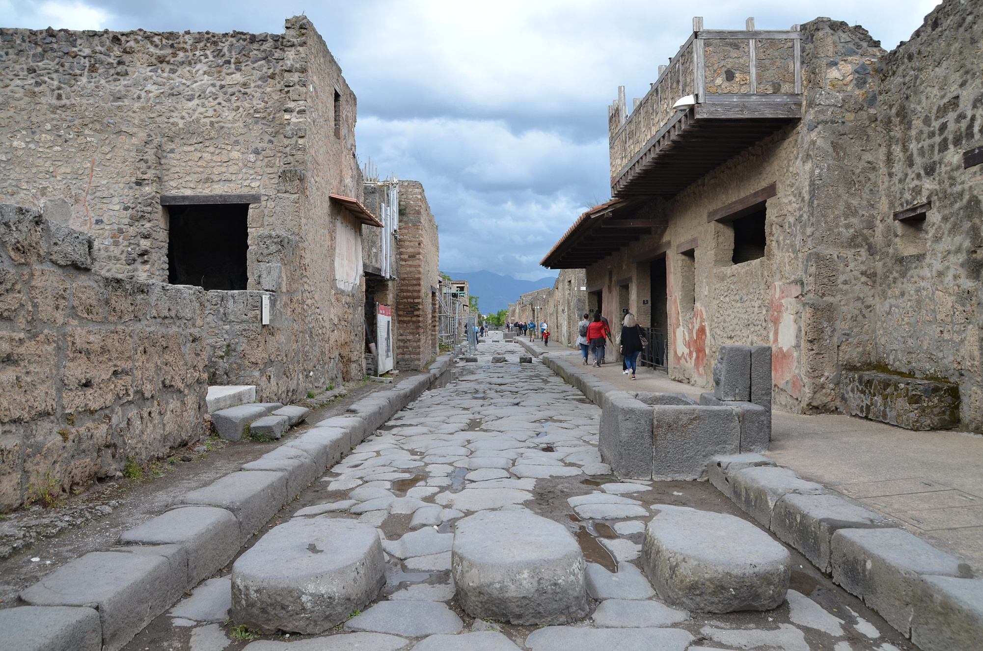
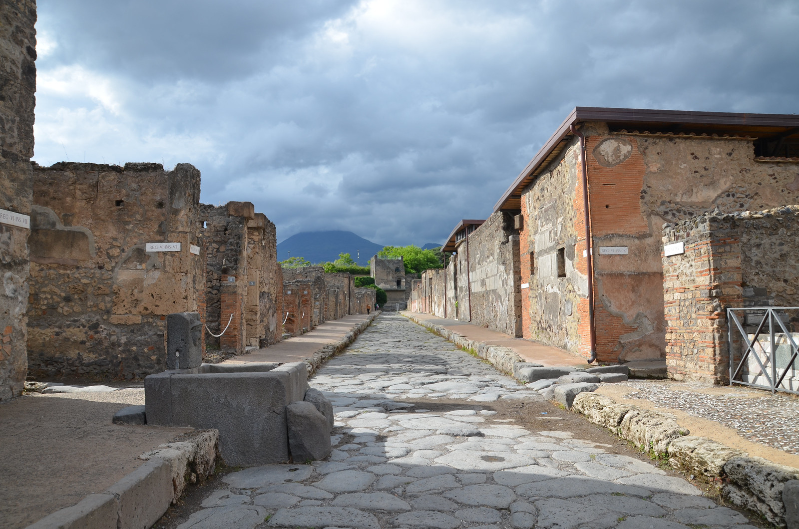
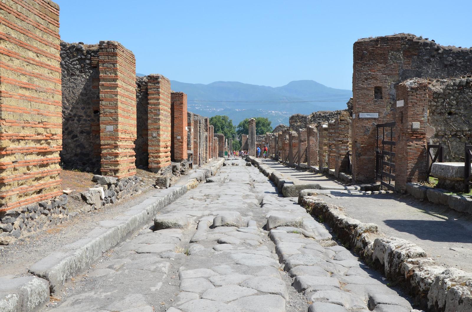
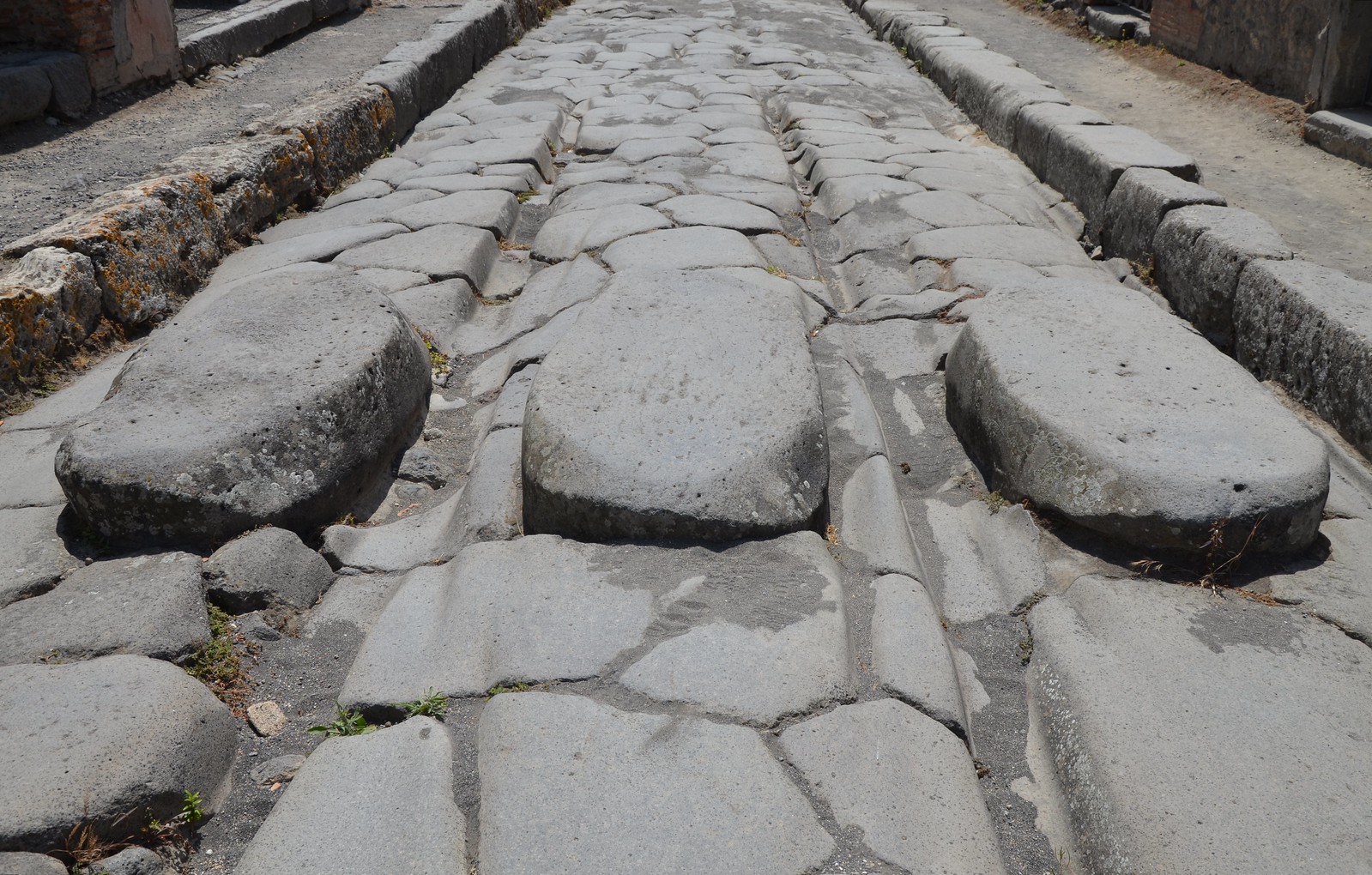
The streets of Pompeii were paved during Roman times with large polygonal blocks of stone. The stepping stones kept Romans’ feet dry and out of the rainwater, slops, and animal waste that would have filled the streets of Pompeii.
The powerful eruption completely smothered the cities on the foothills of Vesuvius. The volcano, which had been dormant for hundreds of years, erupted with tremendous force sending a tall mushroom cloud of rock and gas over 30 km into the sky. The cloud then collapsed and triggered a massive pyroclastic surge down the slopes of Vesuvius, killing everyone who had not yet fled. At Pompeii, most of the houses lay under a blanket of pumice and ash up to 5 metres deep. It would be some 1700 years before these Roman cities were rediscovered by archaeologists, and the extent of their preservation was extraordinary.
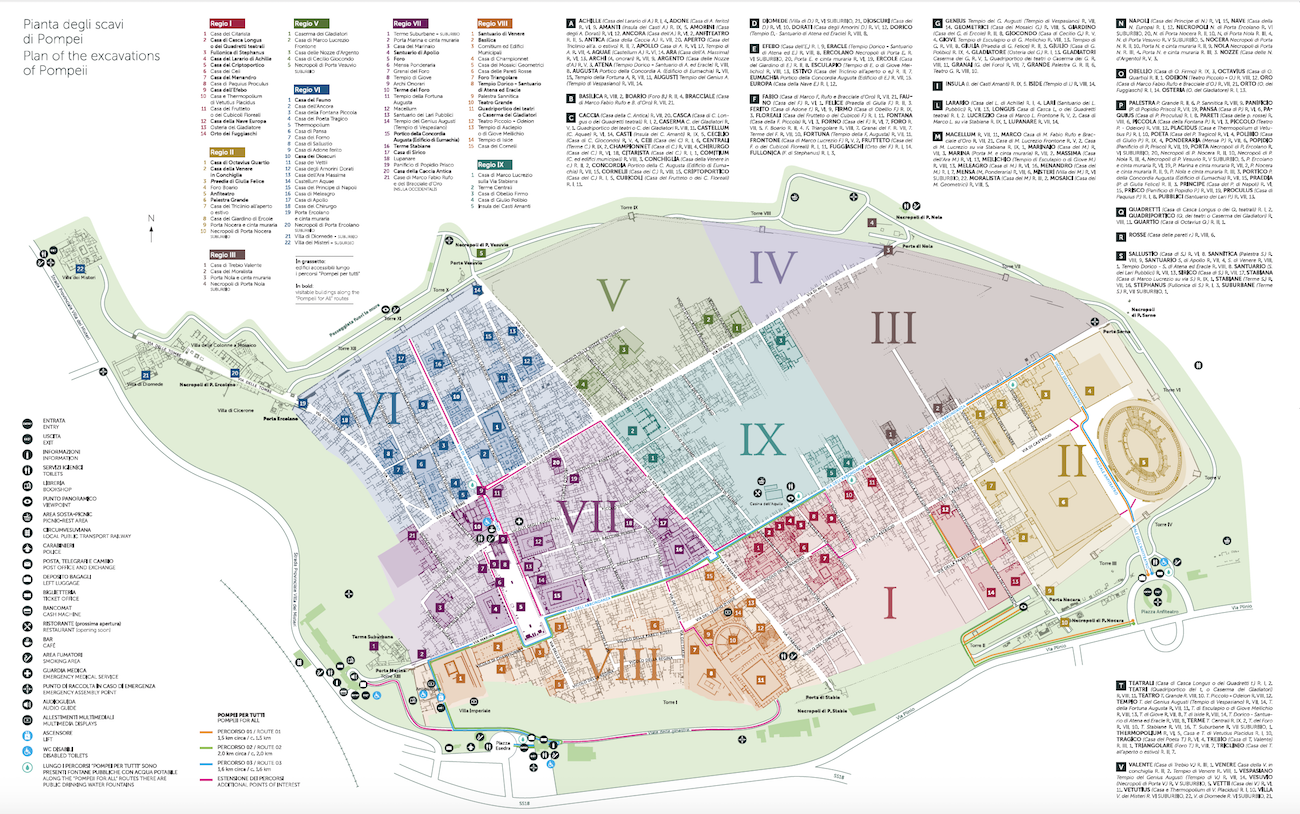
Official map of Pompeii site.
After its catastrophic demise, centuries of history were sealed away until 1594, when an architect stumbled across the ruins while digging a canal. However, it wasn’t until the appointment of archaeologist Guiseppe Fiorelli in 1861 that systematic excavations were undertaken. Fiorelli was responsible for making the famous plaster casts of the victims of the eruption which you can now see around the site. Of Pompeii’s original 66 hectares, 44 have now been excavated, and excavations are continuing to this day.
270 years after the discovery of Pompeii, large scale archaeological excavations have resumed in Pompeii in part of Regio V, an area of over 1,000m² that was still buried under volcanic debris. More than 200 experts and technicians are at work on the Great Pompeii Project, the €105 million conservation, maintenance and restoration program launched in 2012 and largely funded by the European Union. New structures (including a brightly coloured snack bar), colourful frescoes and mosaics of mythological figures, and historic graffiti were among the discoveries emerging from the archaeological dig. Pompeii has come a long way since UNESCO threatened Italy to take it off its World Heritage list. The threat followed several incidents that caused international alarm, including the collapse of the School of Gladiators and several walls in 2010 and 2011.
The School of Gladiators in Pompeii after Restoration.
Another recent discovery was the scrawled piece of text on a wall of a house suggesting that the eruption occurred in October of AD 79, two months later than previously thought. According to Massimo Osanna, the head of the Pompeii site, the correct date of the eruption may, in fact, be 24 October. After almost two millennia, the ruins of Pompeii continue to astound us with its rich archaeological legacy. The new excavation areas are yet to open to the public.
Since the first planned excavations in the mid-18th century, Pompeii has astonished scholars and tourists alike. Its ghostly ruins make for one of the world’s most gripping and exhilarating archaeological experiences.
PORTFOLIO
REGIO I
The Fullonica of Stephanus. It is one of the most important and complete laundries found in Pompeii where the manufactured cloth was washed and stain removed.
Stephanus’ laundry was built just after the earthquake of AD 62, transforming a private house into a modern factory. The building has recently undergone extensive restorations.
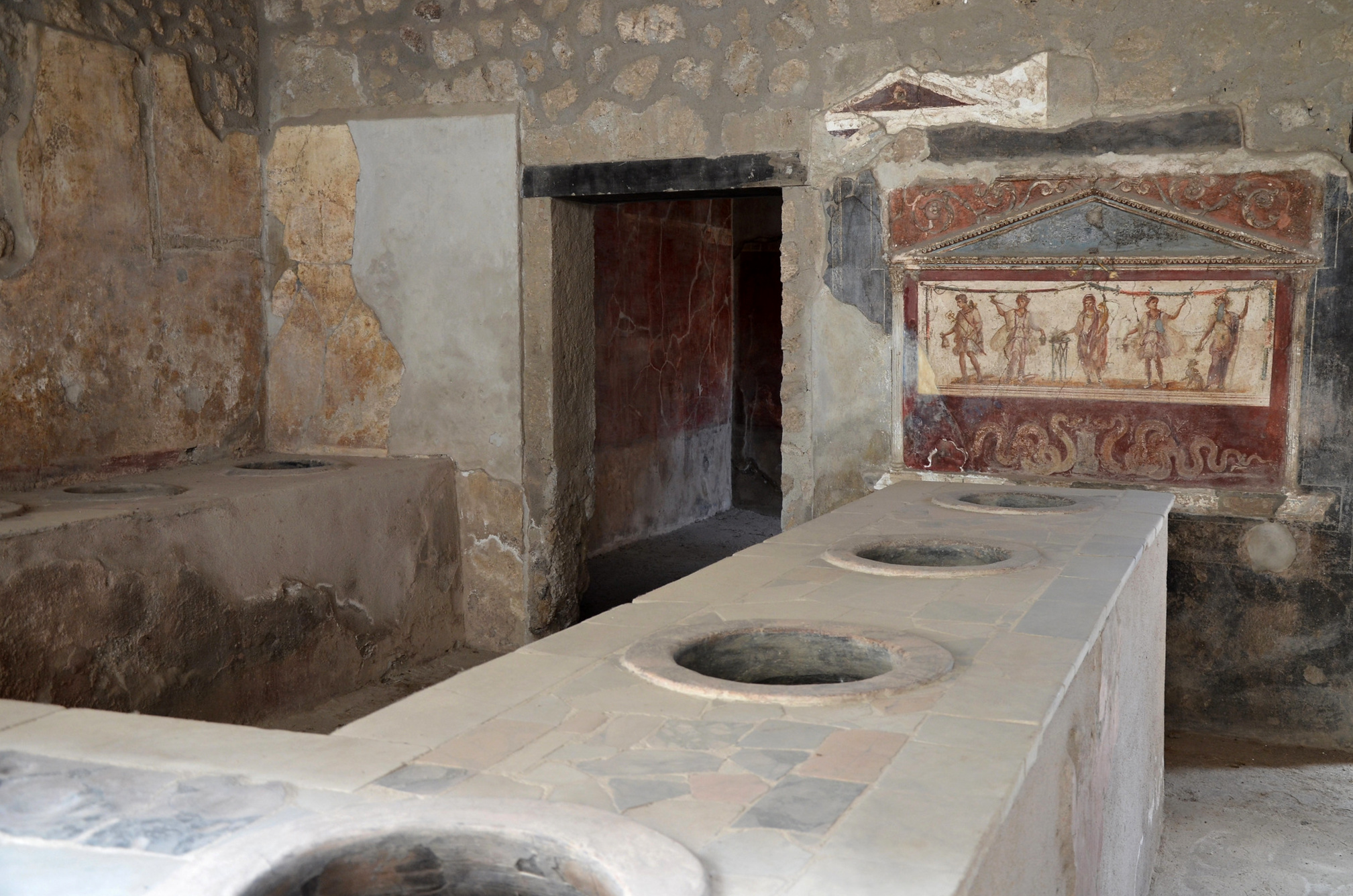
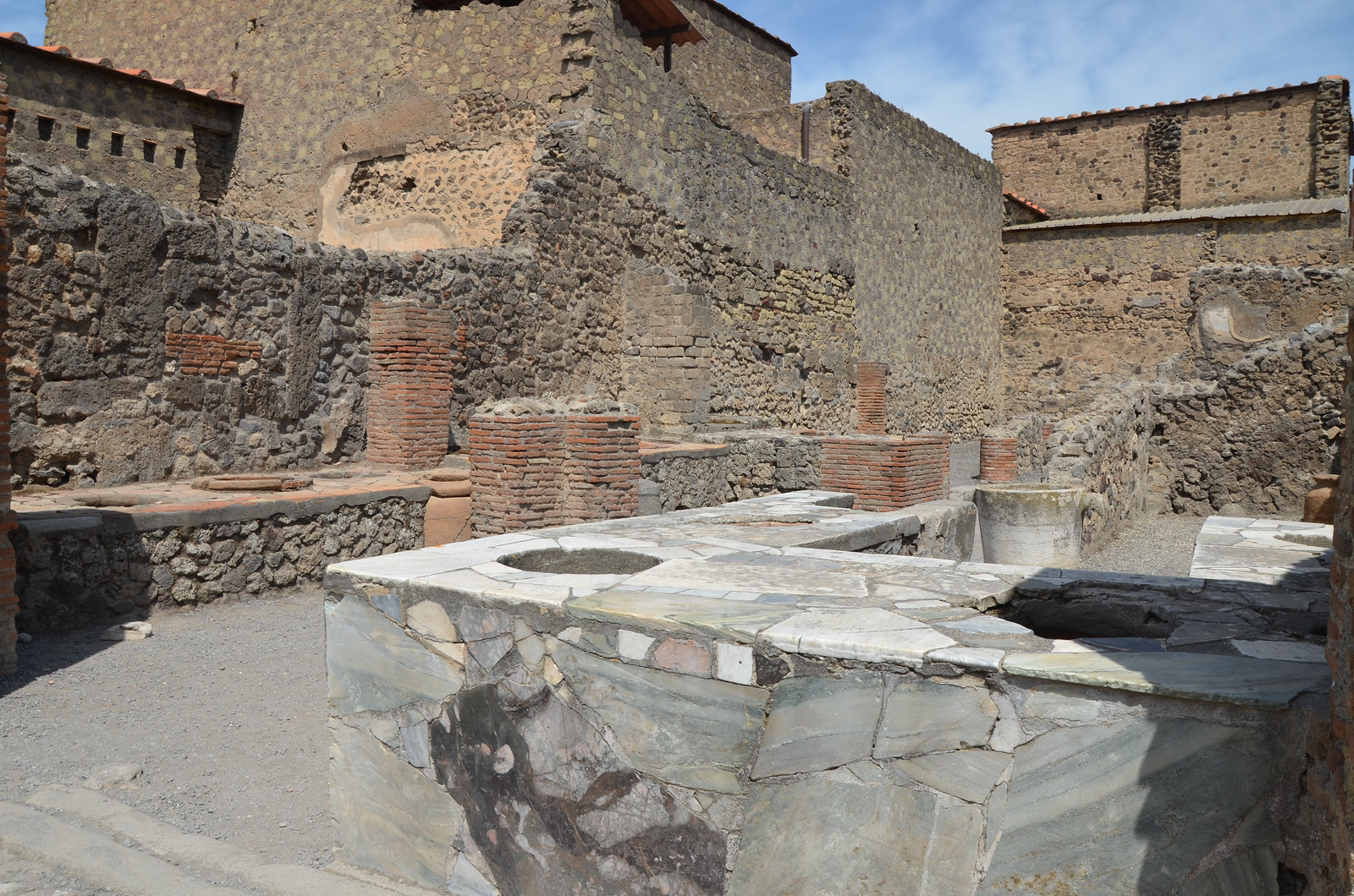
The Thermopolium of Vetutius Placidus. The ‘L’ shaped masonry counter has large storage jars which were used to hold food.
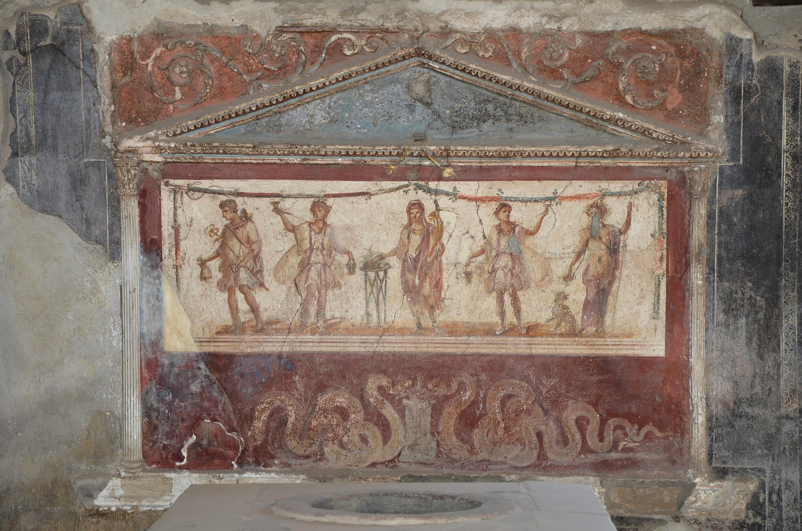
On the rear wall of the Thermopolium of Vetutius Placidus is a painted lararium with a scene depicting the Genius of the household performing a sacrifice over a small folding altar. On the far left side is Mercury, the god of commerce, while on the far right stands Bacchus, the god of wine.
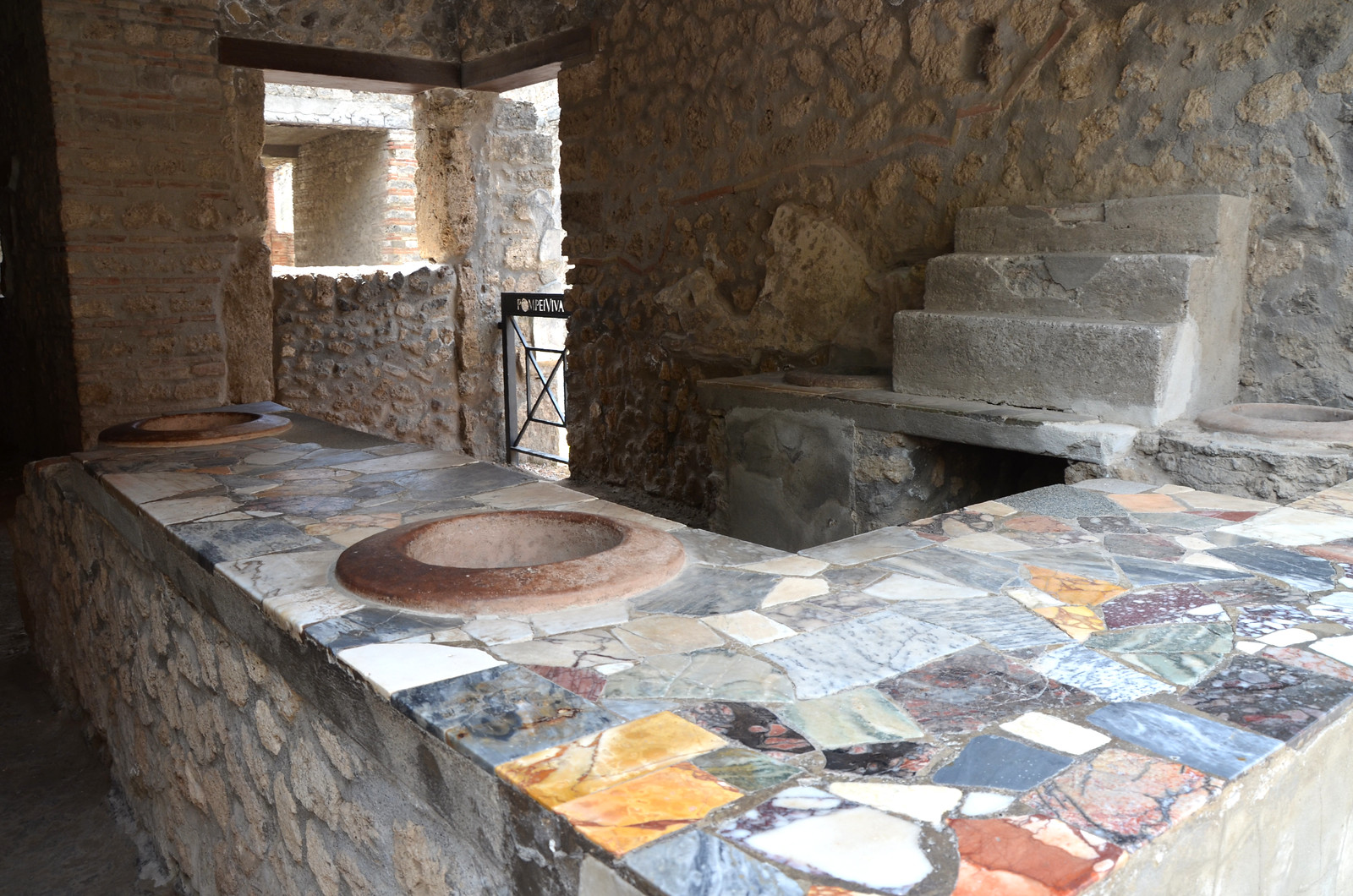
A marble surfaced counter of a thermopolium.
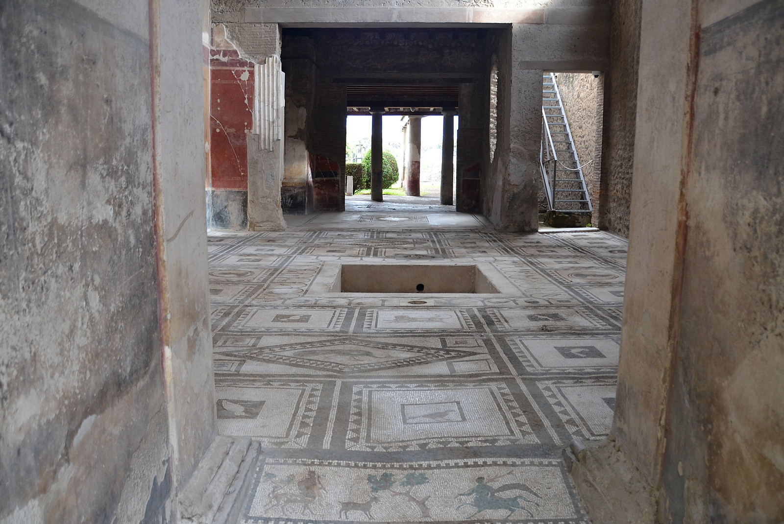
The atrium of House of Paquius Proculus wholly covered with mosaic panels of animals framed with decorative borders.
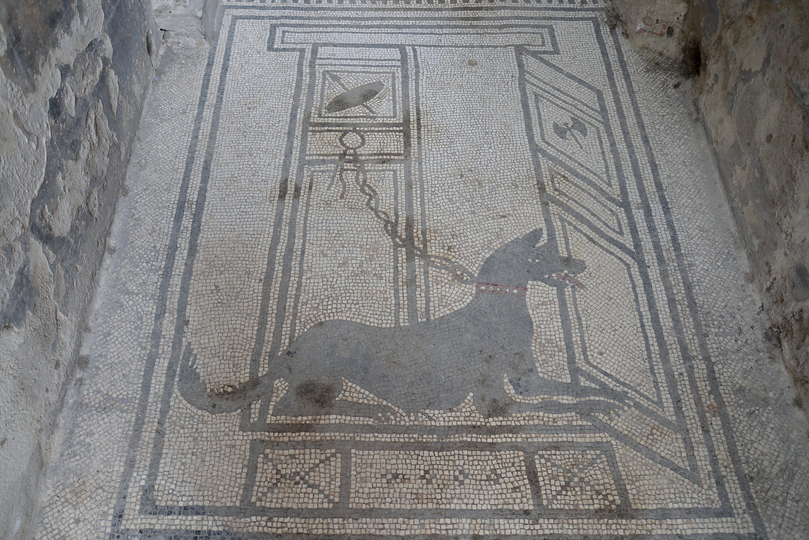
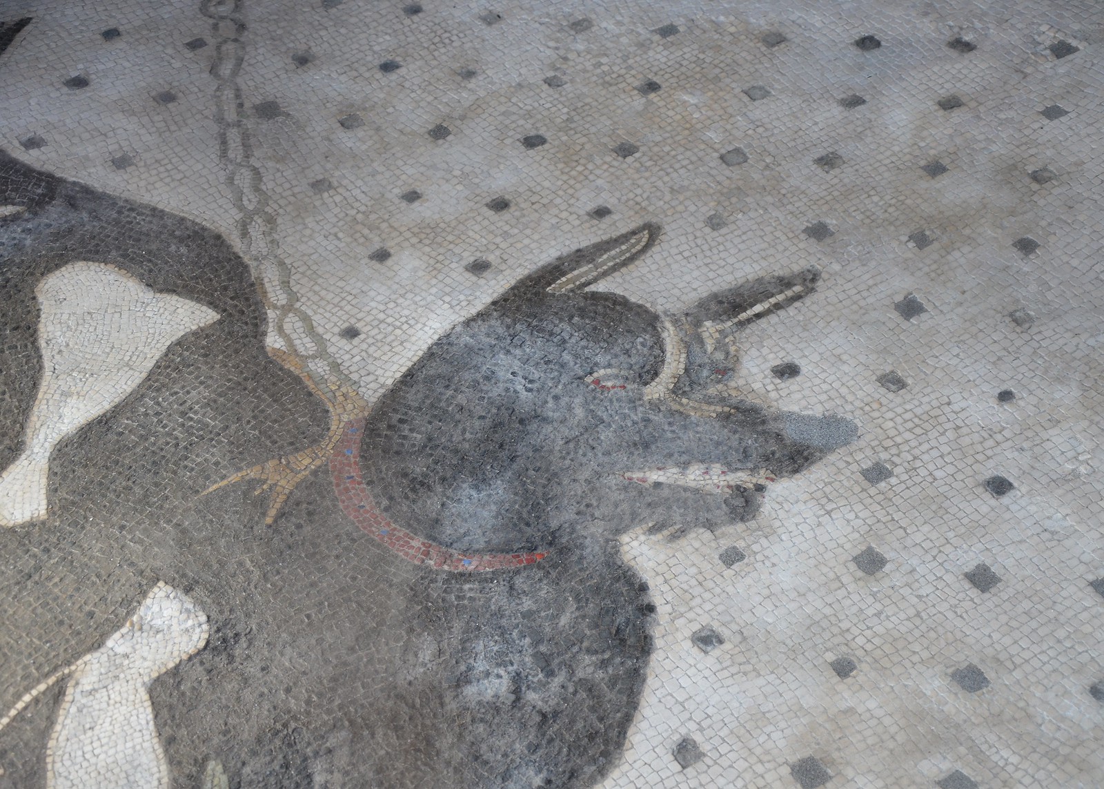
The vestibule floor of the House of Paquius Proculus in Pompeii is paved with a fine mosaic depicting a guard dog chained to a door. The House of Paquius Proculus lies on the south side of the Via dell’Abbondanza.
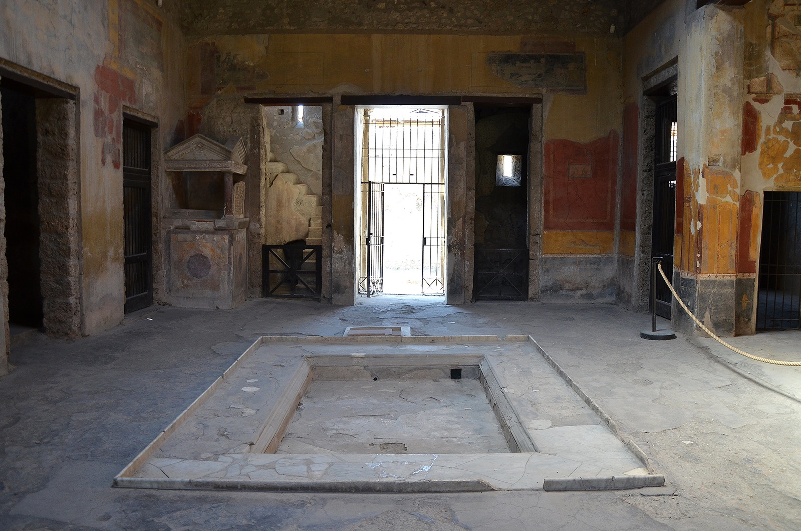
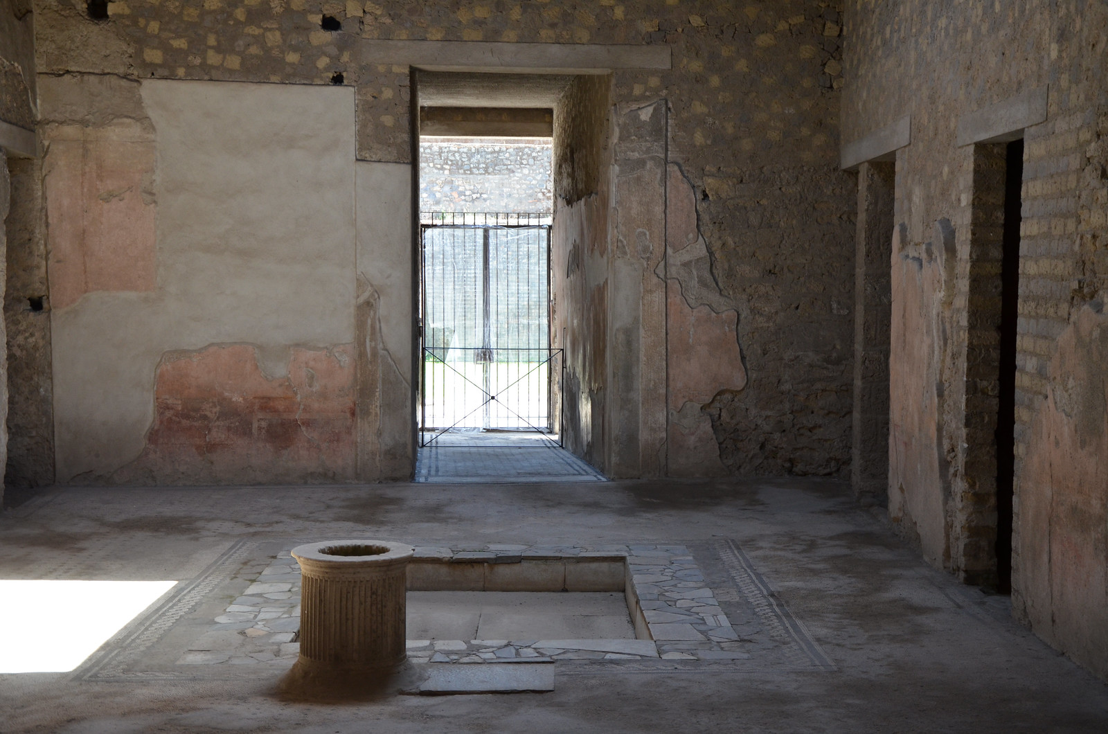
The columned atrium of the House of the Ceii with an impluvium in its centre.
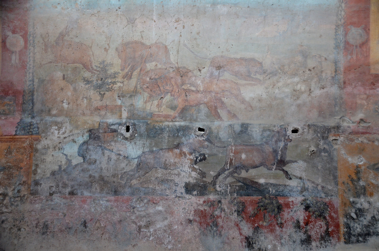
The back wall in the small garden of the House of the Ceii was decorated with a large hunt scene painted in the Fourth Pompeian Style.
The atrium of the House of Menander, one of Pompeii’s most impressive homes.
The small atrium of the House of Menander. The house, extending over 2,000 square metres, was owned by Quintus Poppaeus, possibly a relative of Poppea Sabina, the second wife of Emperor Nero.
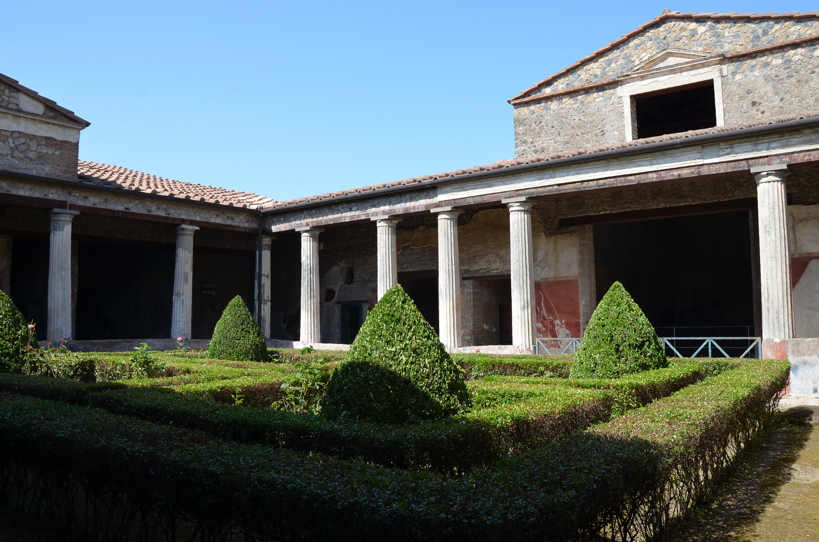
The peristyle of the House of Menander. The peristyle is porticoed on all four sides with twenty-three Ionic columns supporting the inner margins of the roof.
REGIO II
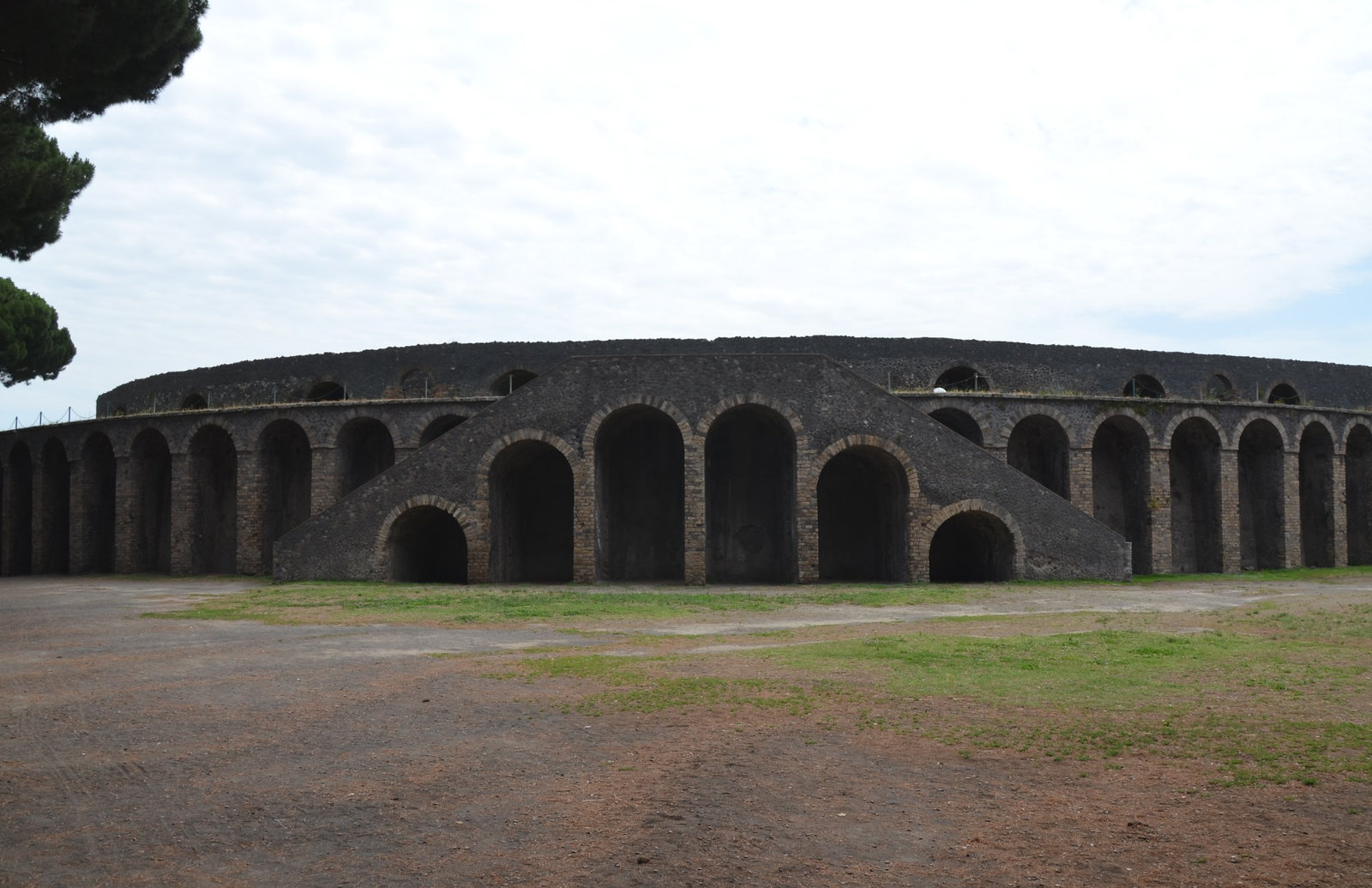
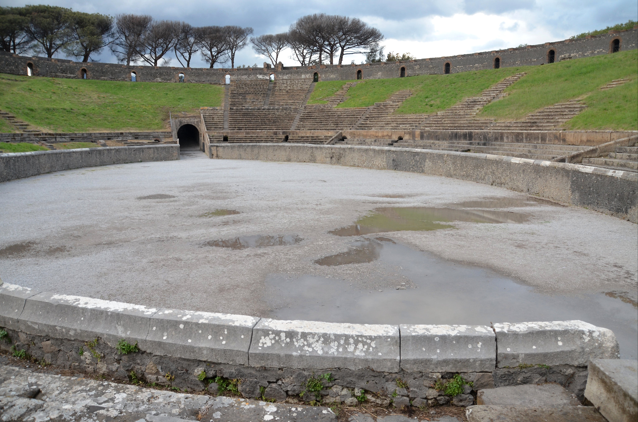
The amphitheatre of Pompeii was used for gladiatorial combat and is the oldest one of its kind in existence.
Built 150 years before the Colosseum in AD 70, the amphitheatre could hold up to 20,000 spectators not only from Pompeii but also from neighbouring towns.
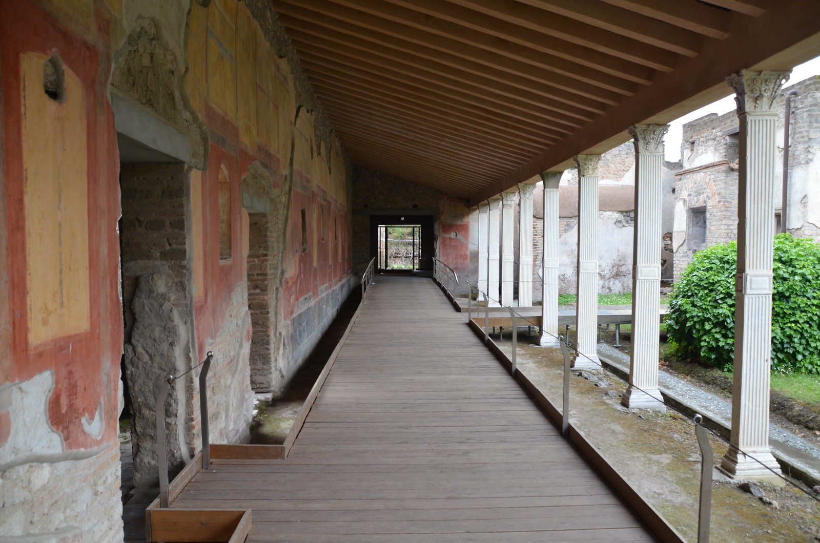
The Praedia of Julia Felix is one of the largest houses in Pompeii. Its owner, Julia Felix, converted portions of it to apartments available for rent and other parts for public use.
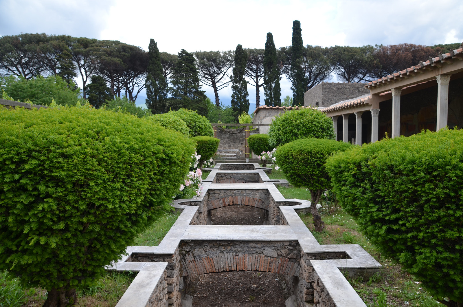
View of the garden area of the Praedia (estate) of Julia Felice.
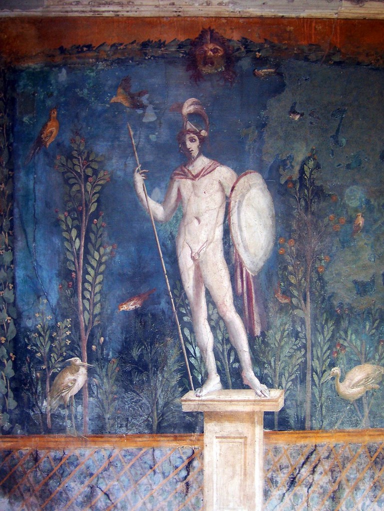
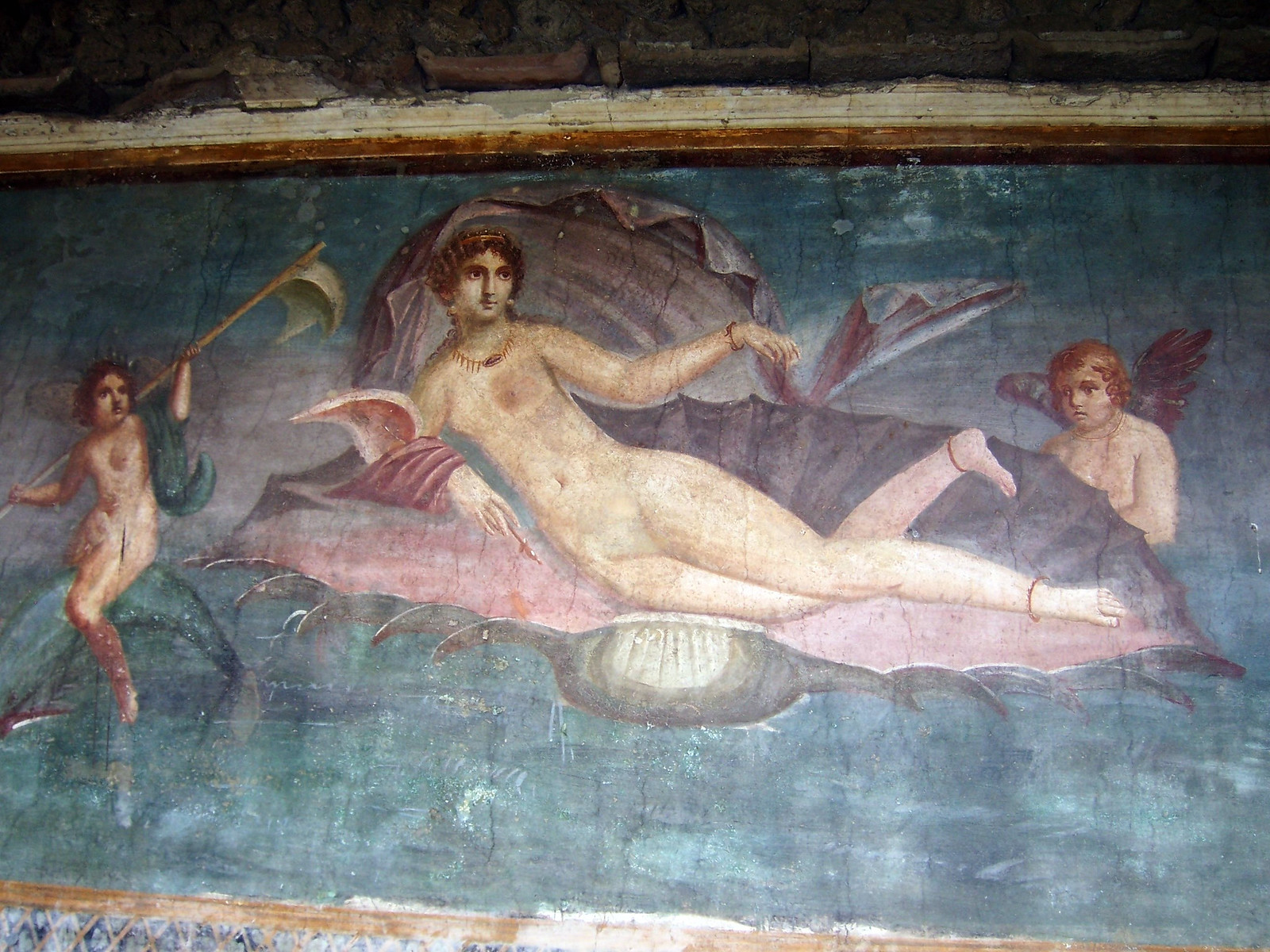
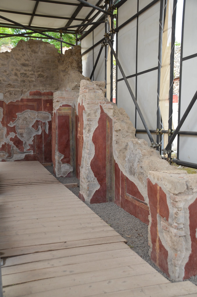
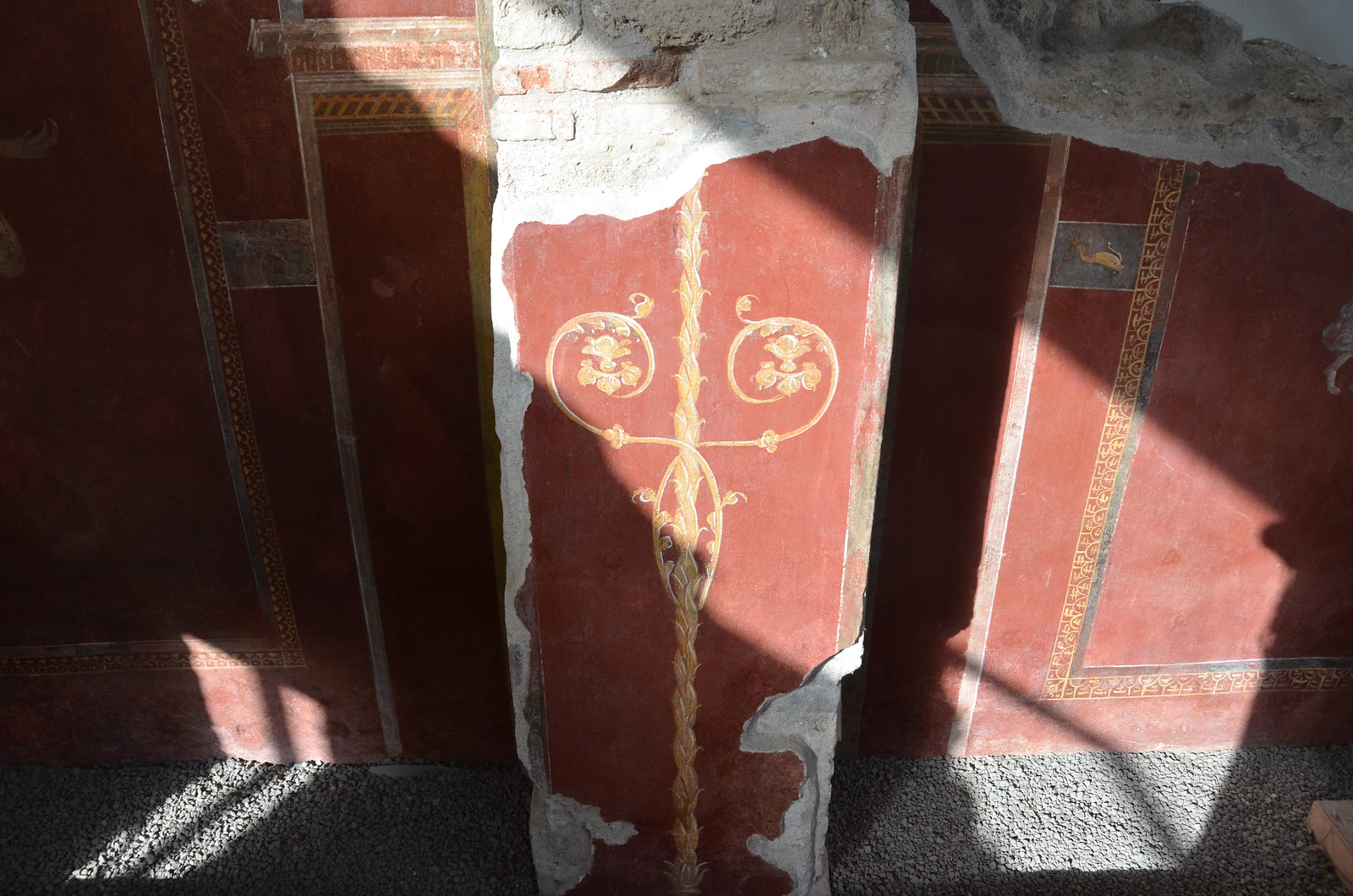
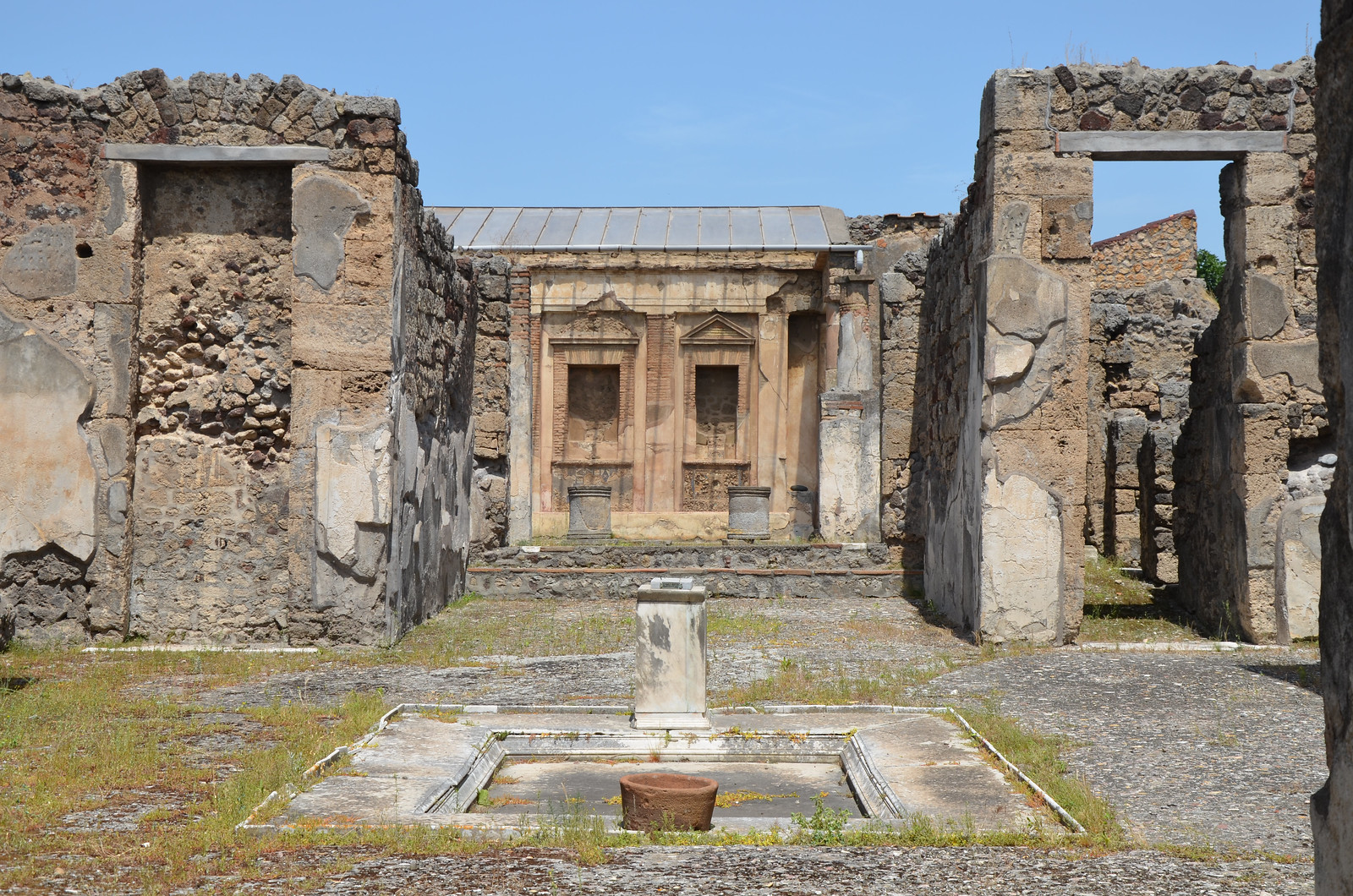
Fresco in the House of Venus in the Shell depicting of a statue of the god Mars standing on a garden plinth. He wears a crested helmet and holds a spear and a shield.
Fresco in the House of Venus depicting Venus reclining naked in the hollow of a cockle shell with a Nereid Nymph and Eros at her side.
REGIO III
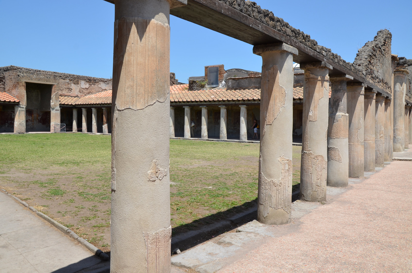
The School of Gladiators (Schola Armaturarum) in Pompeii was probably the headquarters of a military association of gladiators, a place used for meetings and social gatherings.
The School of Gladiators suffered heavy damage from bombing during World War II and caused outcry when it collapsed in November 2010 following heavy rainfall. The restoration interventions began in 2016 and the building reopened to the public in January 2019.
REGIO V
The atrium, tablinum and peristyle of the House of Bronze Bull.
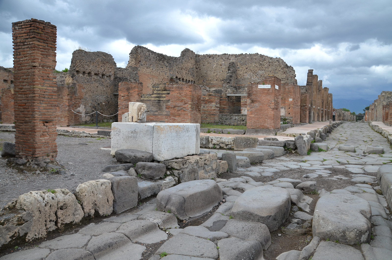
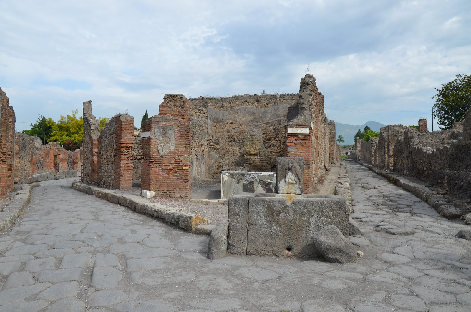
Fountain with a relief of Silenus resting on a wineskin on the corner of Via della Fortuna and Via del Vesuvio.
REGIO VI
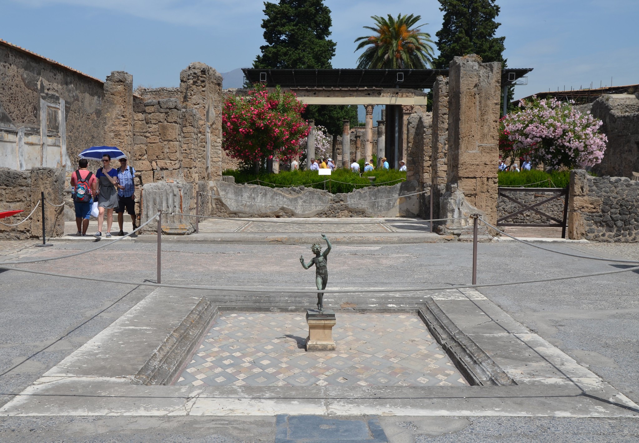
View of the large atrium of the House of the Faun in Pompeii with a central impluvium (rainwater basin) and the bronze statue of the Dancing Faun.
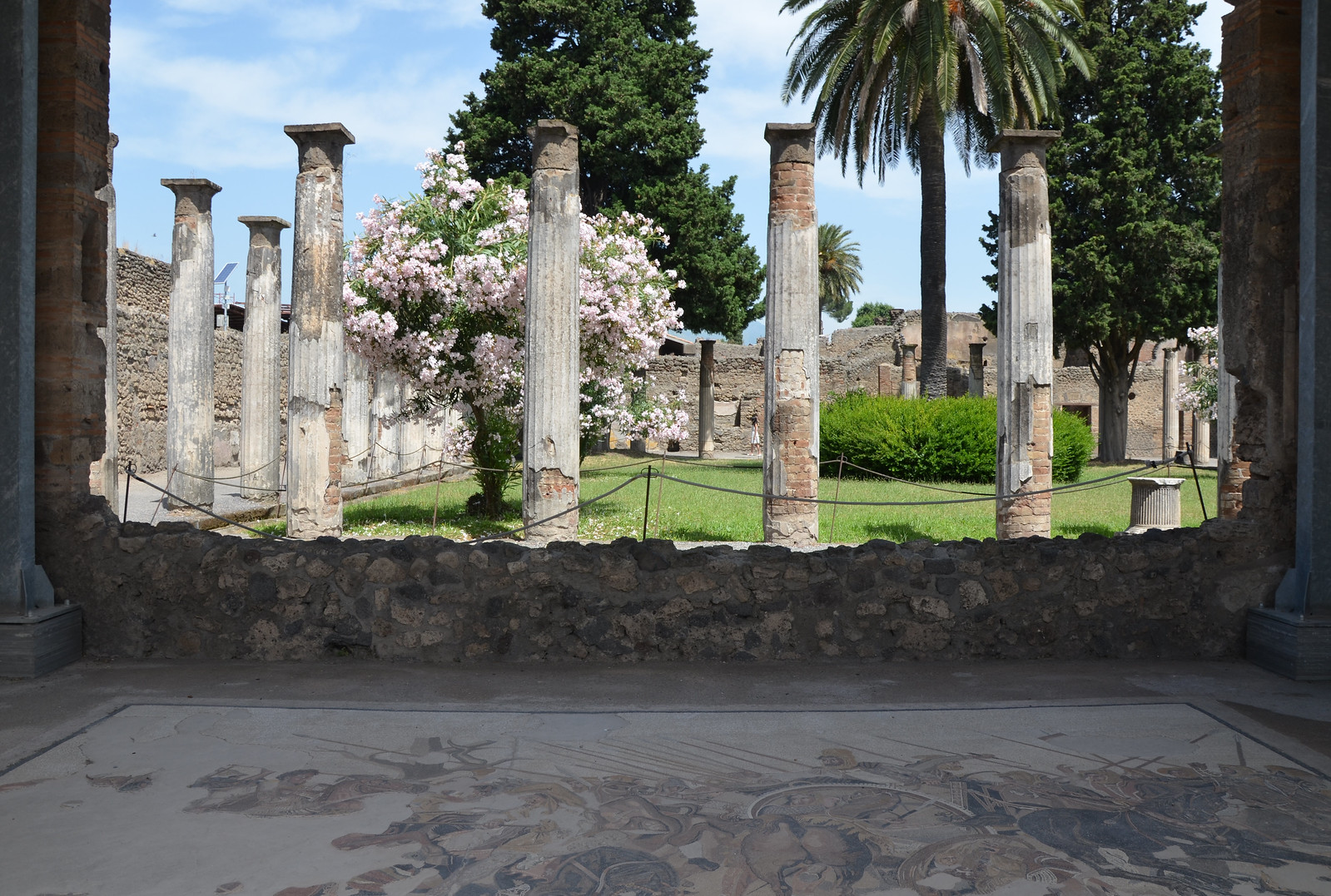
The exedra of the House of the Faun with a copy of the Alexander Mosaic.
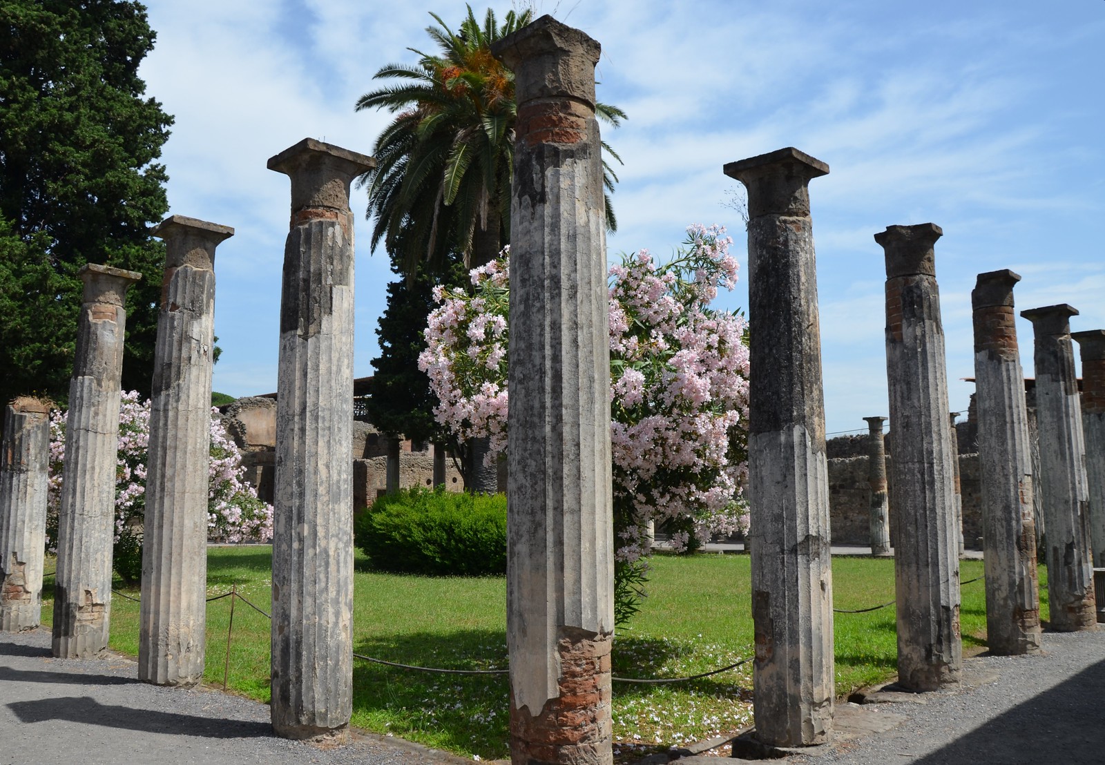
The second peristyle of the House of the Faun which occupied more than a third of the insula.
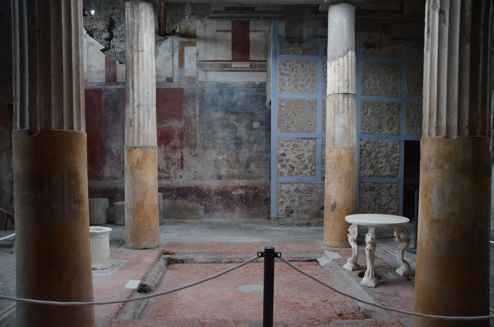
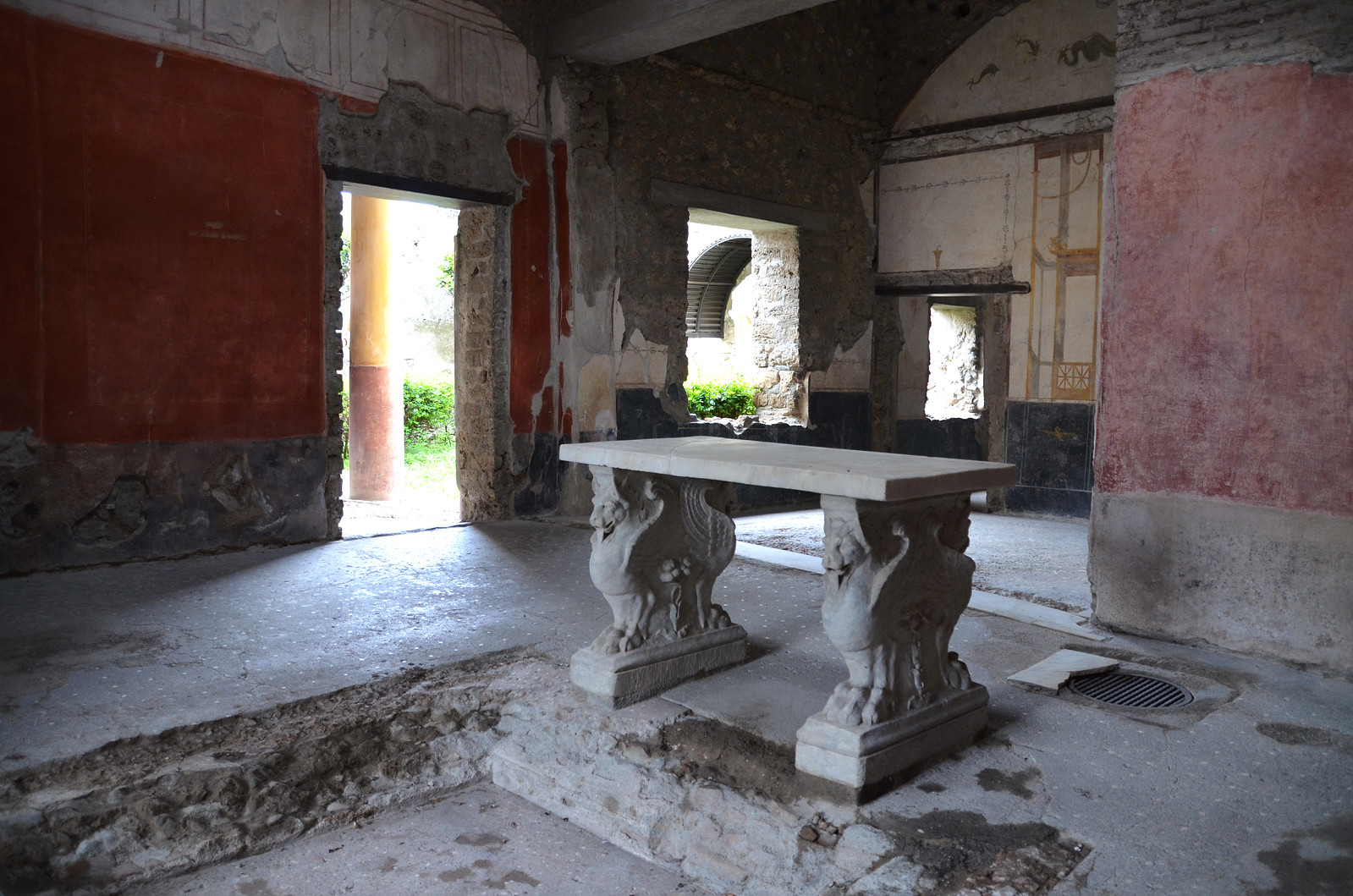
The House of the Prince of Naples. The atrium has an impluvium and a marble table with richly carved supports.
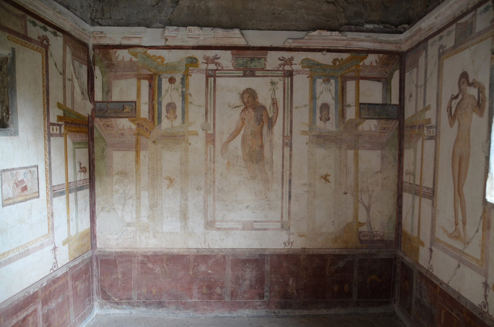
The walls of the House of the Prince of Naples are decorated in the Fourth Pompeian Style with life-size images of Bacchus and Venus painted on the walls of the summer triclinium.
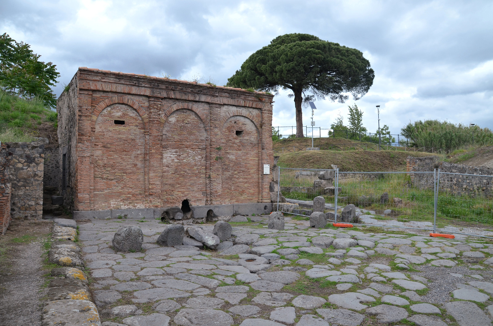
The Castellum Aquae was the water distributor of Pompeii. It guaranteed the water supply to the entire city.
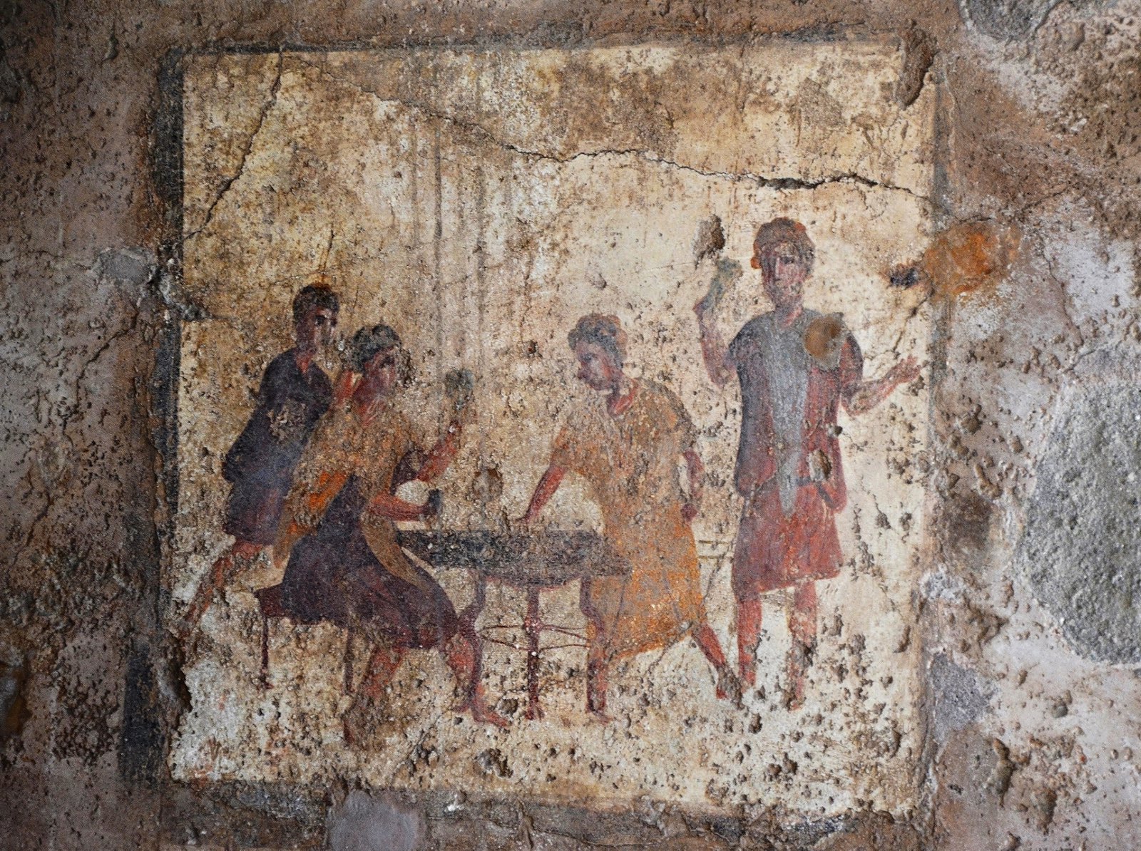
Dice players fresco from the Osteria della Via di Mercurio.
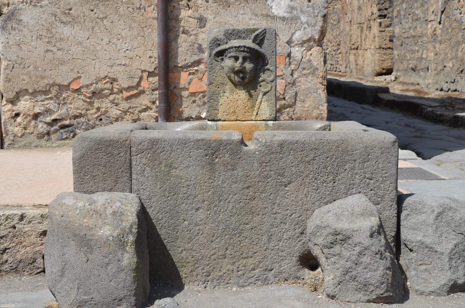
Fountain with a relief of Mercury.
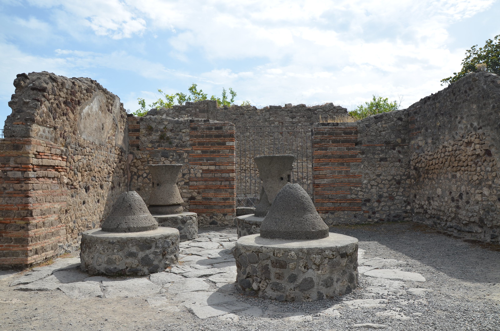
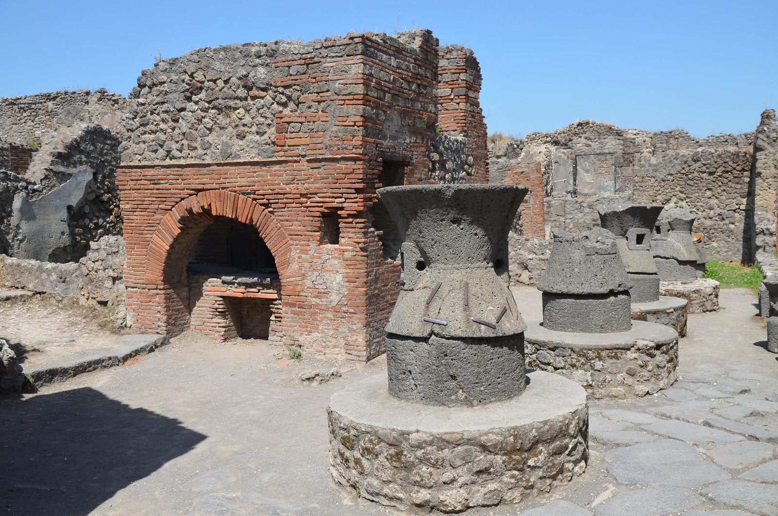
Bakery mills for grinding grain (catullus) from a pistrinum (bakery).
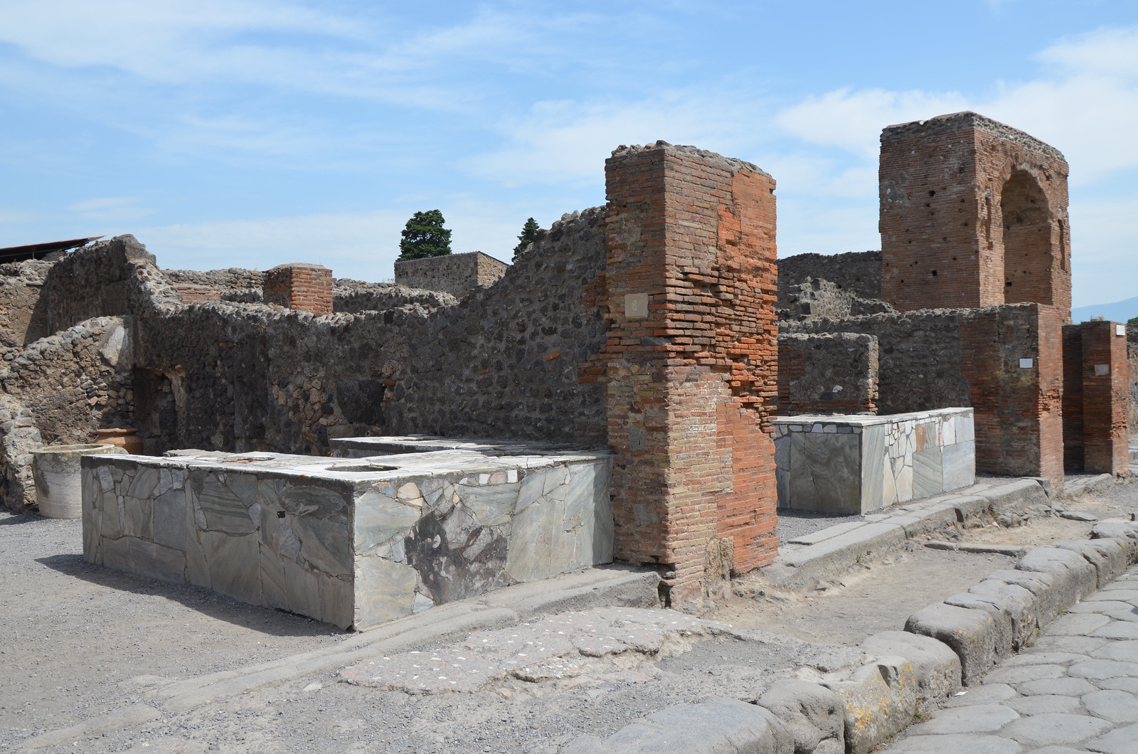
One of the 89 thermopolia, small cook-shops, found at Pompeii. The lower classes frequented such places.
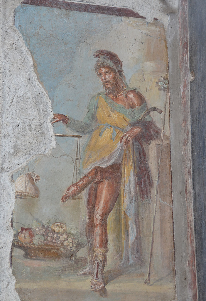
Fresco of the god of fertility Priapus depicted weighing his very large phallus against a bag containing money. Painted to the right of the vestibule of the House of the Vettii in Pompeii, the fresco probably symbolised the economic prosperity of the owners, the Vettii brothers, who became wealthy through trade.
The atrium of the House of the Tragic Poet which was richly decorated with six large frescoes depicting scenes from the Illiad.
Black and white mosaic floor in the House of the Tragic Poet featuring the well-known mosaic of a dog on a chain, bearing the warning cave canem, ‘beware of the dog’.
REGIO VII
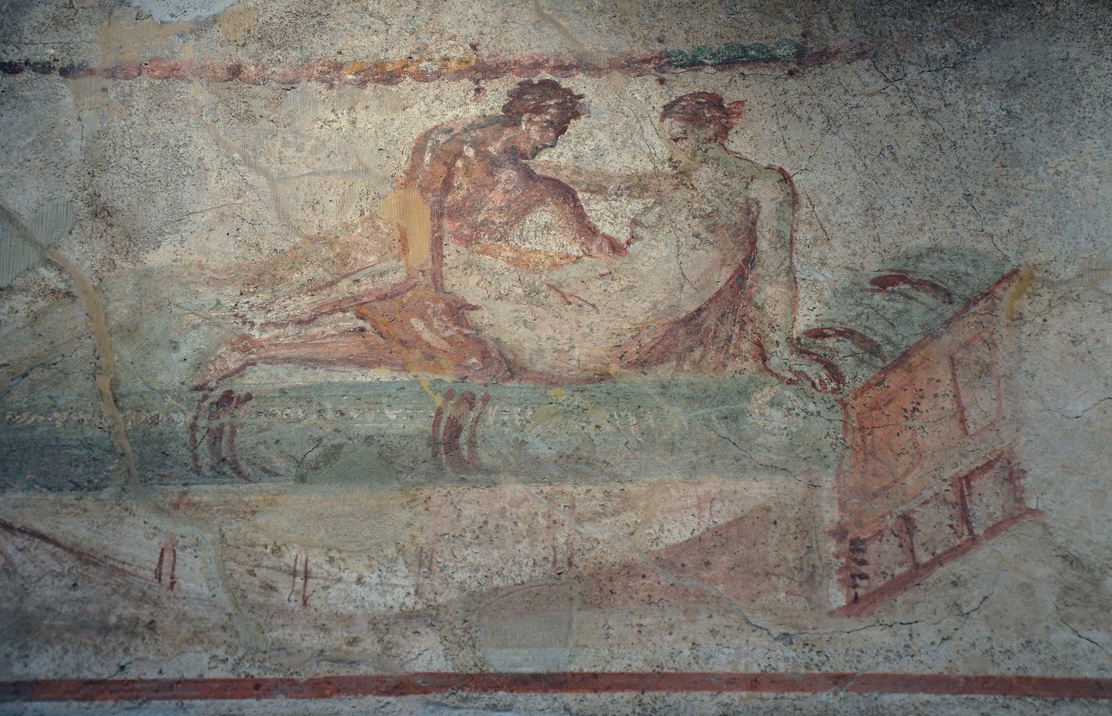
The Lupanar of Pompeii, the most famous brothel in the ancient city.
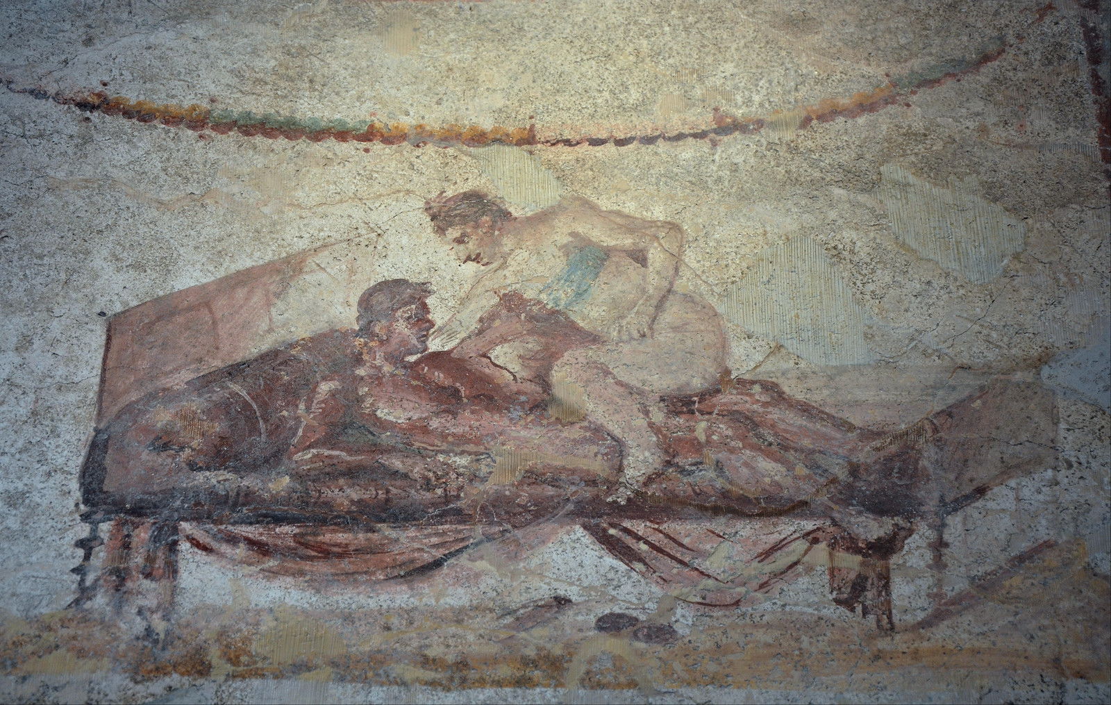
Erotic fresco from the south wall of the Lupanar of Pompeii.
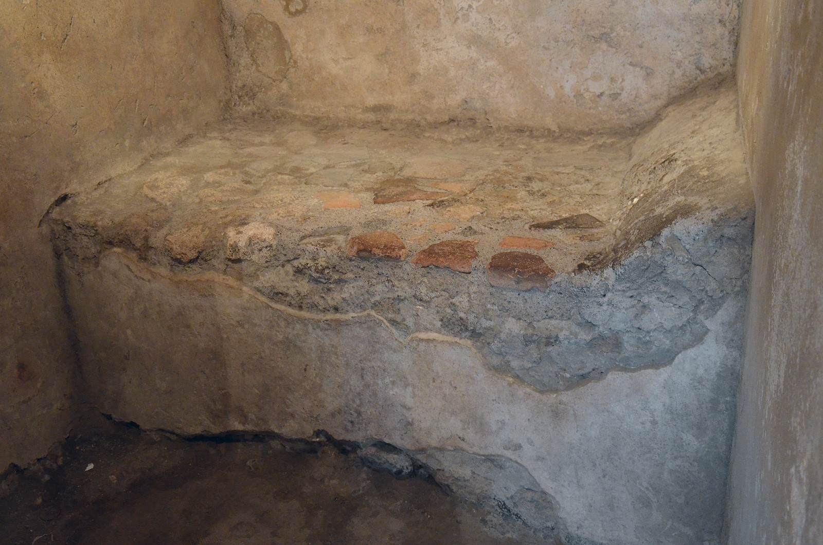
A roughly carved stone bed in one of the rooms of the Lupanar.
In situ wall fresco with an erotic scene in the Lupanar.
The Stabian Baths are the oldest baths in Pompeii.
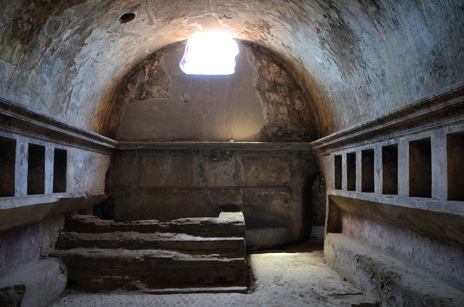
The apodyterium (dressing room) of the Stabian Baths.
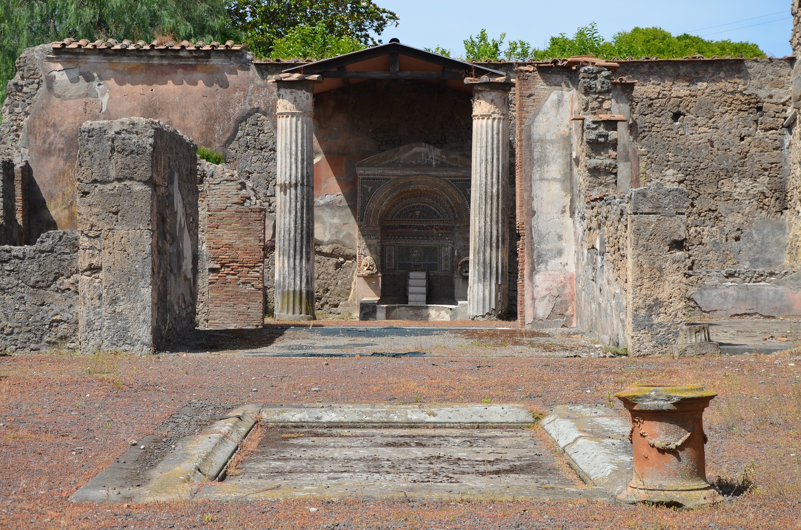
The atrium of the House of the Large Fountain.
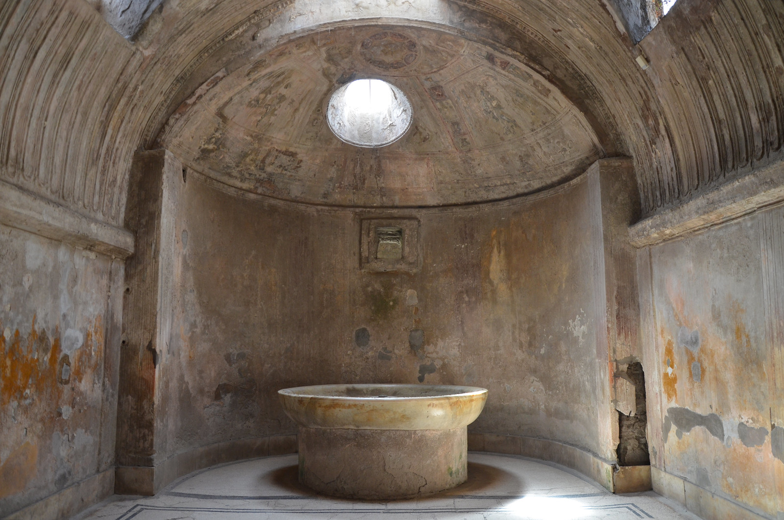
The Forum Baths were also subdivided into men’s and women’s sections, each with their own independent entrance.
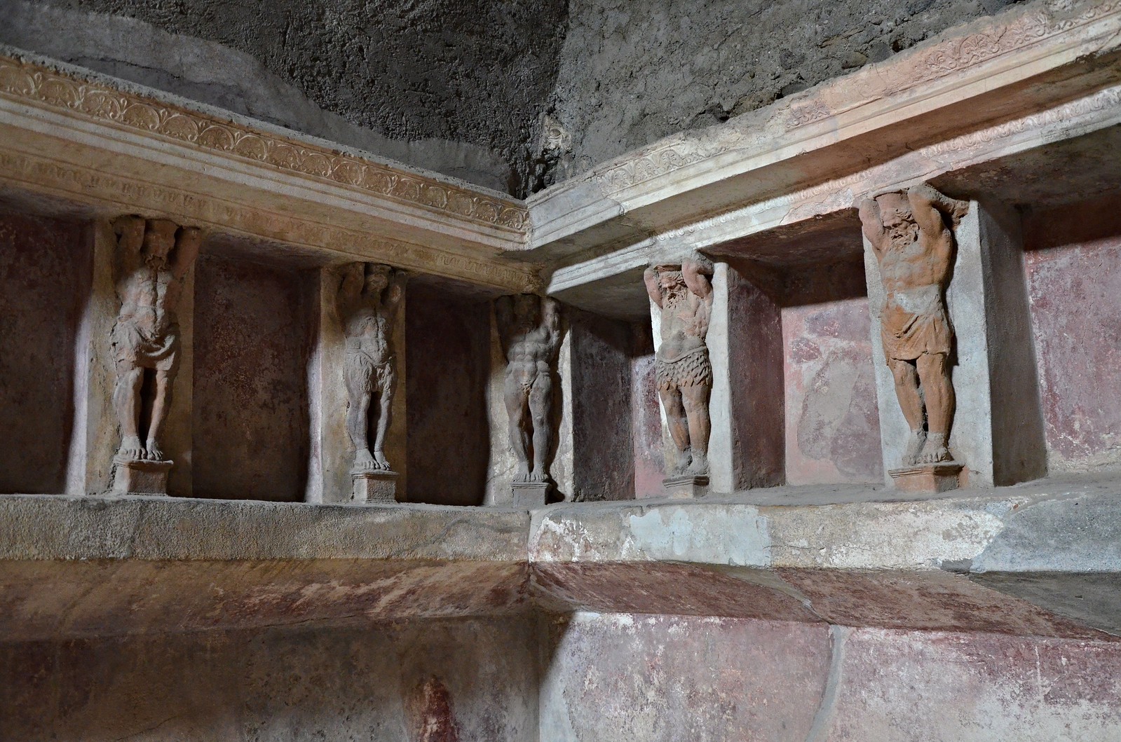
The north wall of the tepidarium (tepid bathroom) of the Forum Baths with telamons separating the niches.
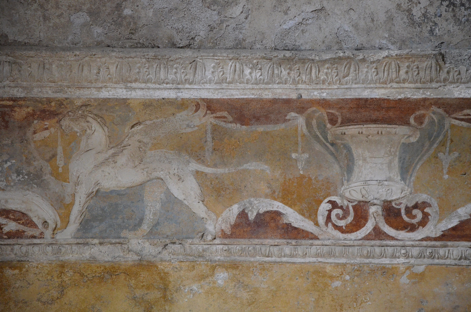
The walls of the Forum Baths are beautifully decorated with frescoes of garden scenes, and the vault ceilings are embellished with stucco friezes.
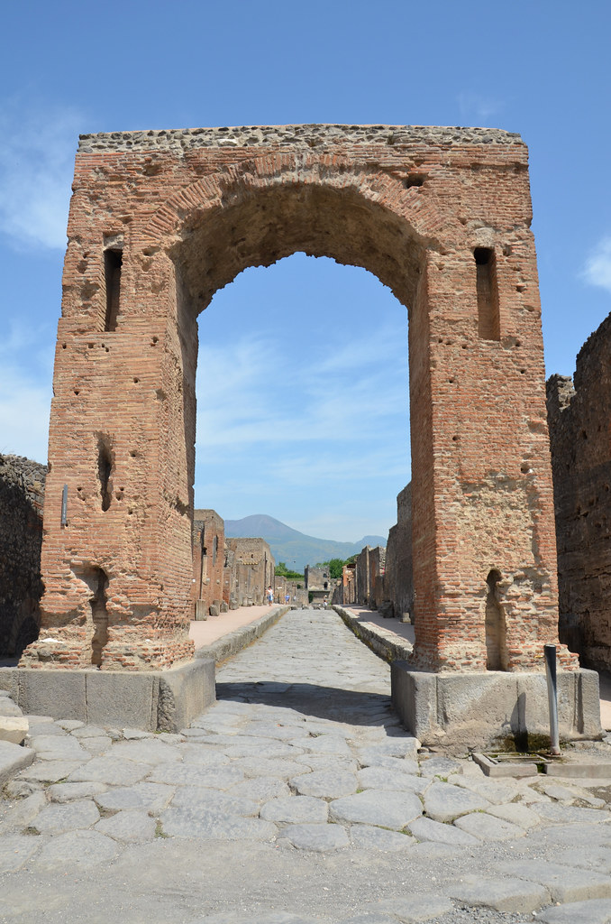
North view of the Arch of Caligula at the start of the Via Mercurio. In the background is Mount Vesuvius.
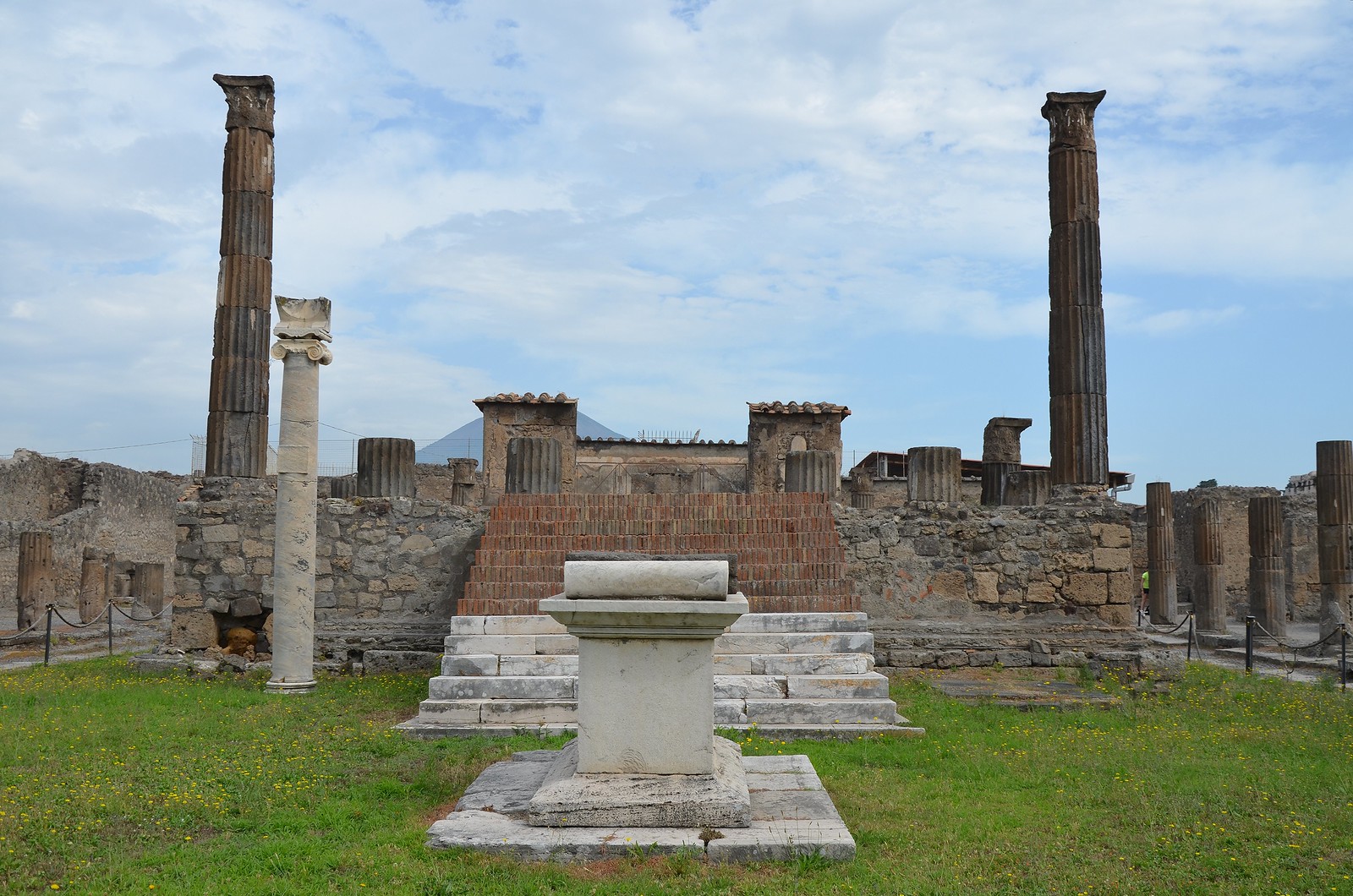
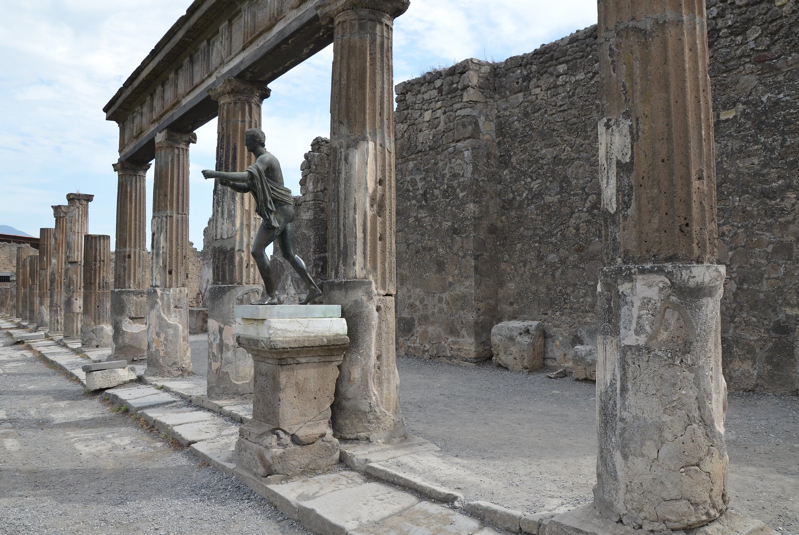
The Temple of Apollo in Pompeii, looking north towards the altar, podium and cella. Etruscan bucchero were found in the area of the temple testifying the existence of the cult of Apollo in Pompeii as early as the 5th century BC.
The ground plan of the Temple of Apollo we see today dates from the 2nd century BC. It was frequently remodelled up until its final restoration after the earthquake of AD.
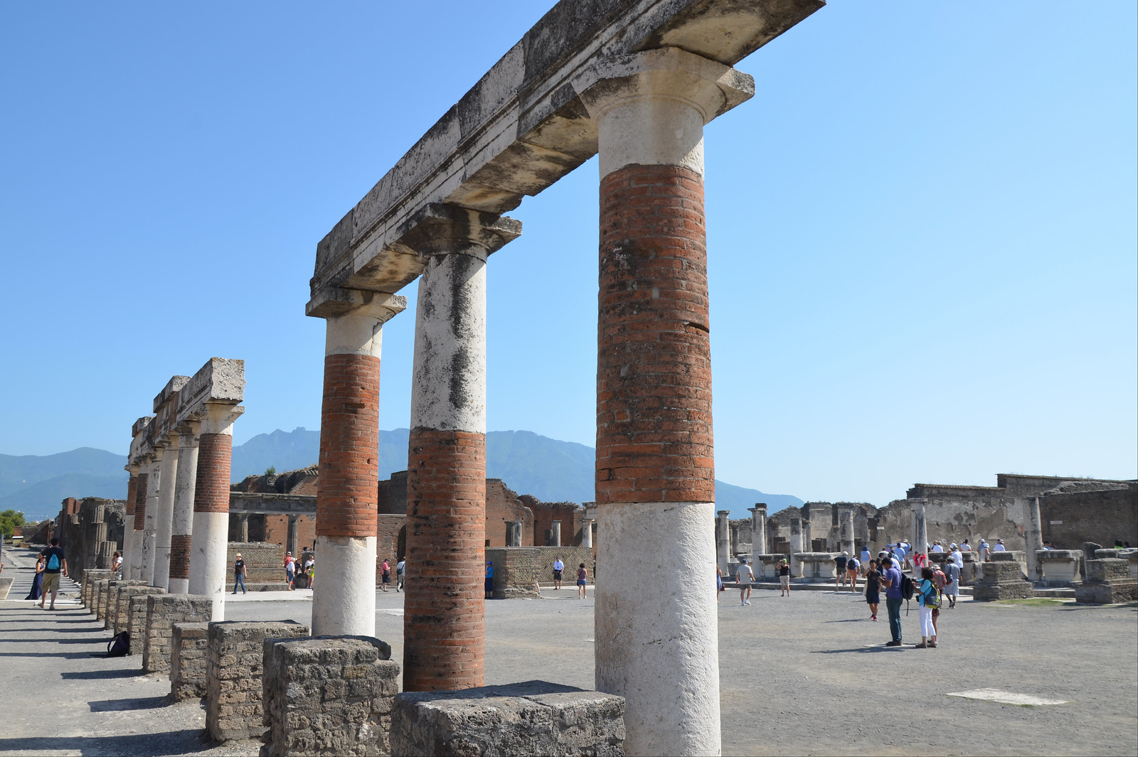
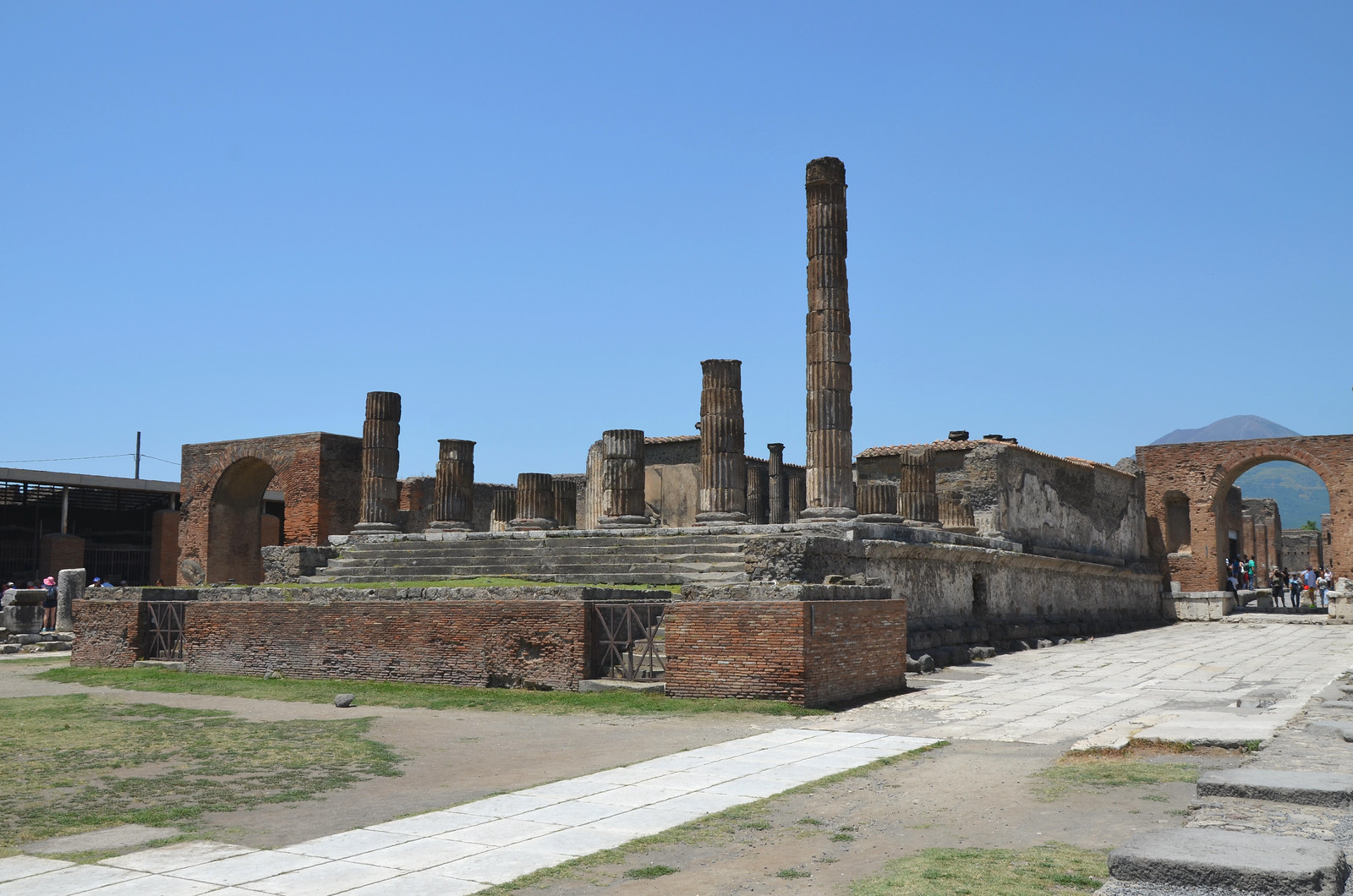
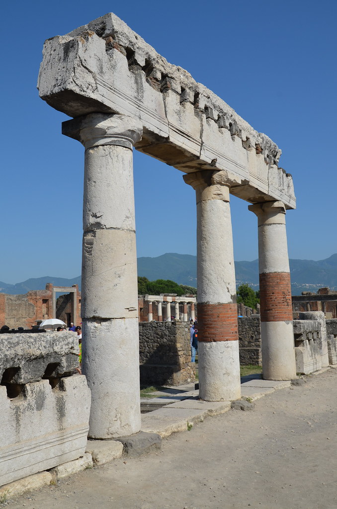
The Forum was the centre of public life, and the oldest part of Pompeii. It was also the site of gladiatorial games before the amphitheatre was constructed.
The Temple of Jupiter dominates the north side of the Forum.
The Forum.
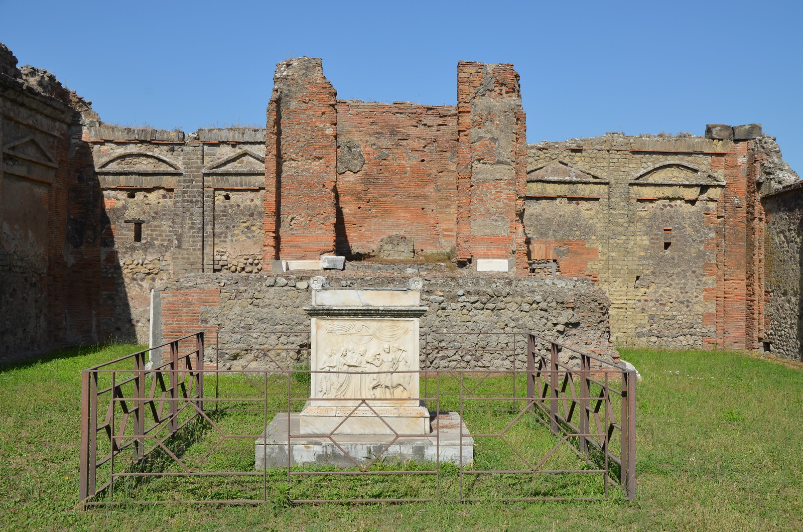
The Temple of Vespasian.
About 35 bakeries have been found, each supplying their local area. The Bakery of Popidius Priscus contains four large millstones, traces of a stable, four storage rooms, and a large oven which was used for baking the bread.
REGIO VIII
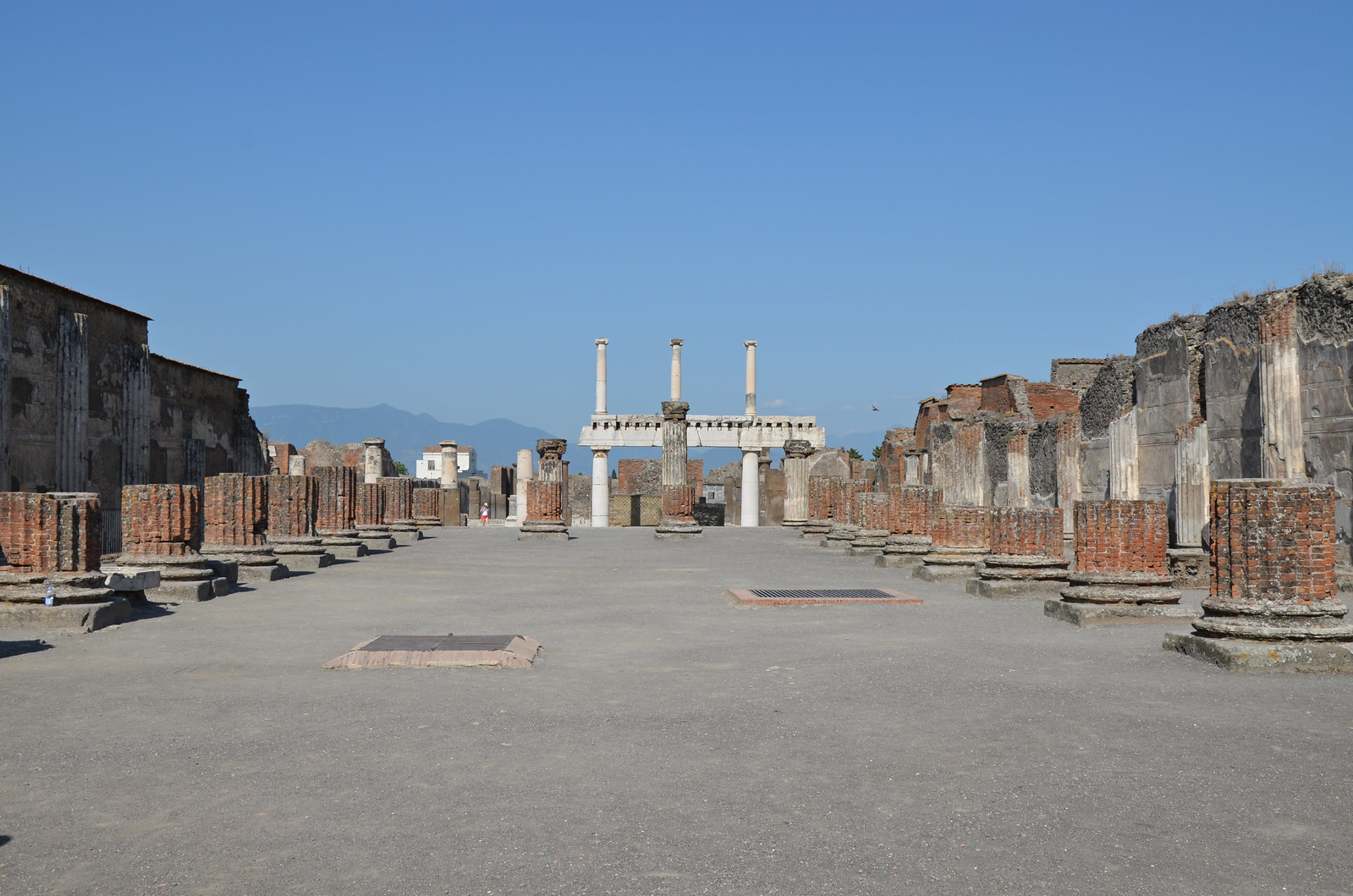
The Basilica stands near the west corner of the Forum and is the oldest and most important public building in Pompeii. It is also one of the oldest examples of this type of building in the entire Roman world.
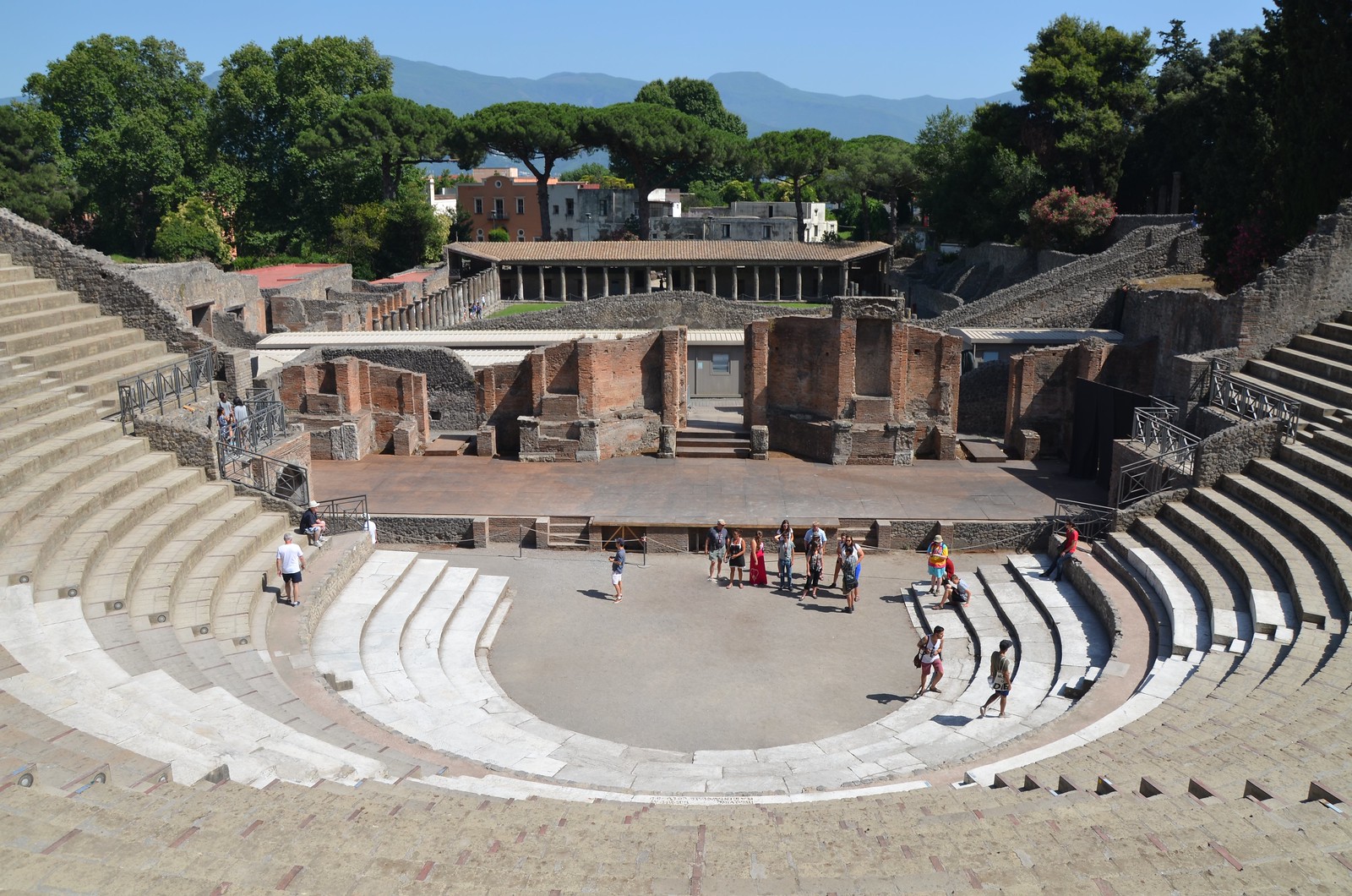
The Large Theatre was a huge 5000-seat theatre built in the Greek type and carved into the natural slope of the hill.
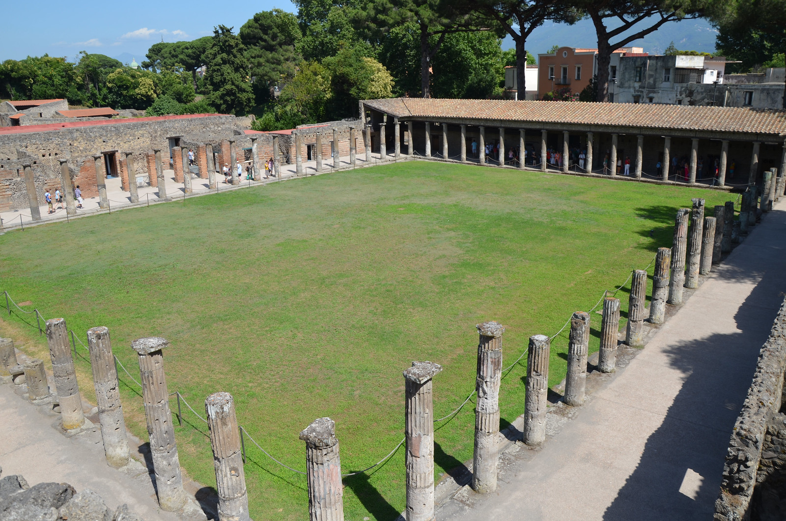
The quadrangular portico located behind the stage of the Large Theatre was originally designed as a space for the audience to stroll in during the intervals of the theatre shows. After the earthquake of 62 CE, the building changed its function and was turned into barracks for the gladiators.
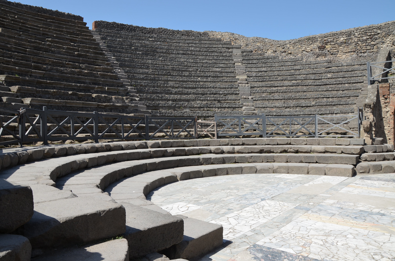
The Small Theatre, a small roofed theatre (odeon) used for musical and singing performances as well as for miming, the most popular theatrical genre at the time. The building had a seating capacity of about 1,500.
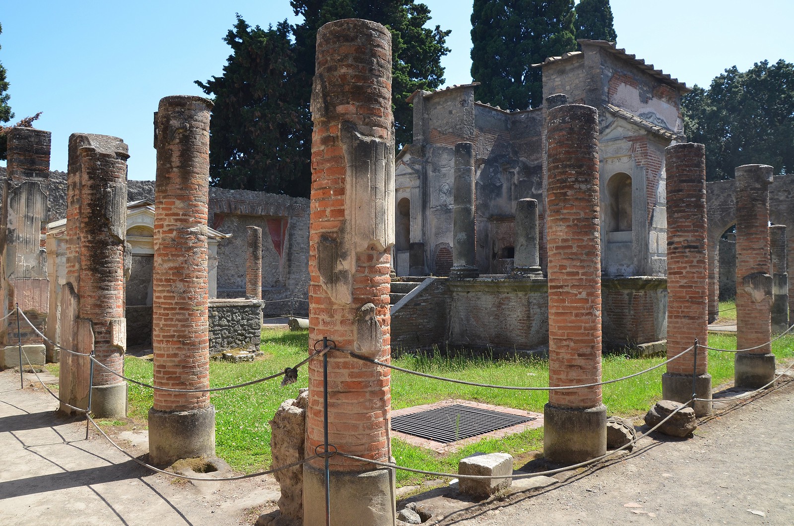
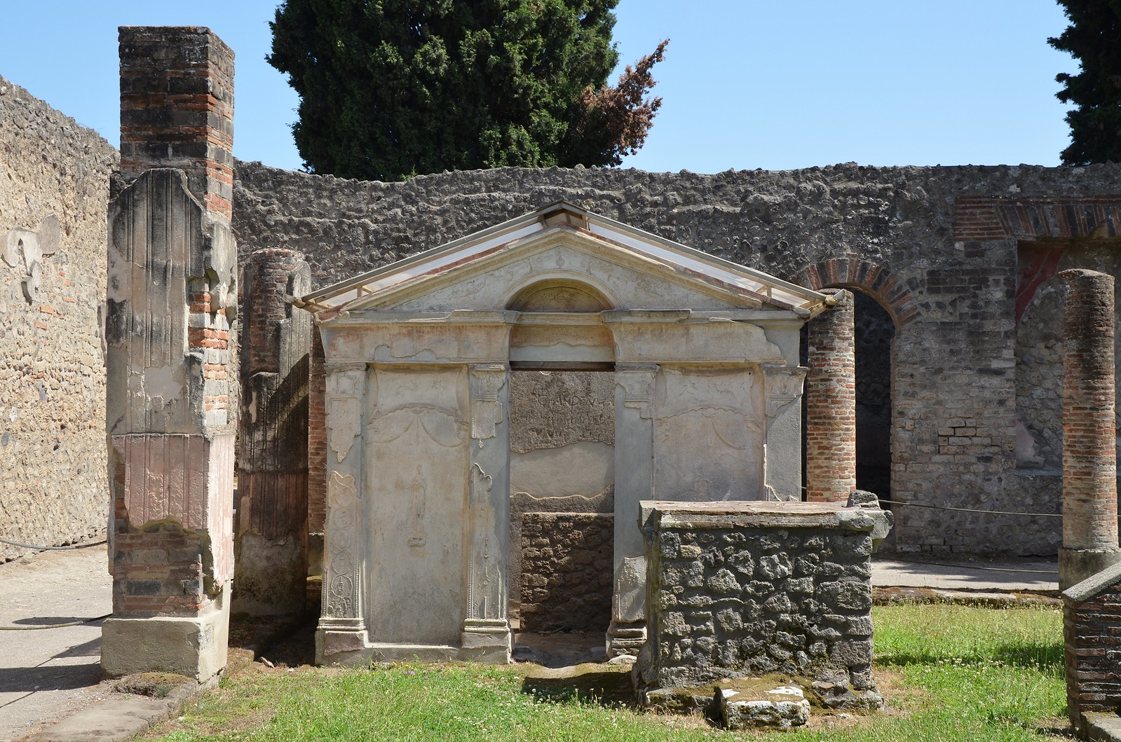
The temple was dedicated to the Egyptian goddess Isis whose cult was widespread throughout the Roman Empire. It is situated in the centre of a porticoed courtyard and stands on a raised podium.
The Purgatorium of the Temple of Pompeii was the place where purification rites were performed.
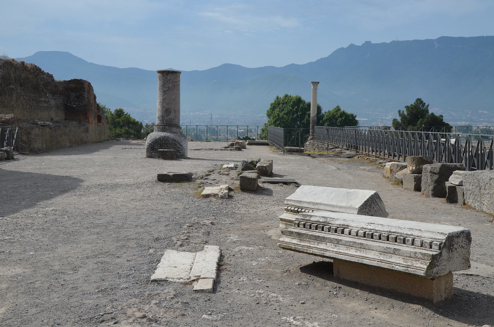
The Sanctuary of Venus overlooked overlooking the bay where the harbour was to be situated. Venus was the patron goddess of Pompeii.
REGIO IX
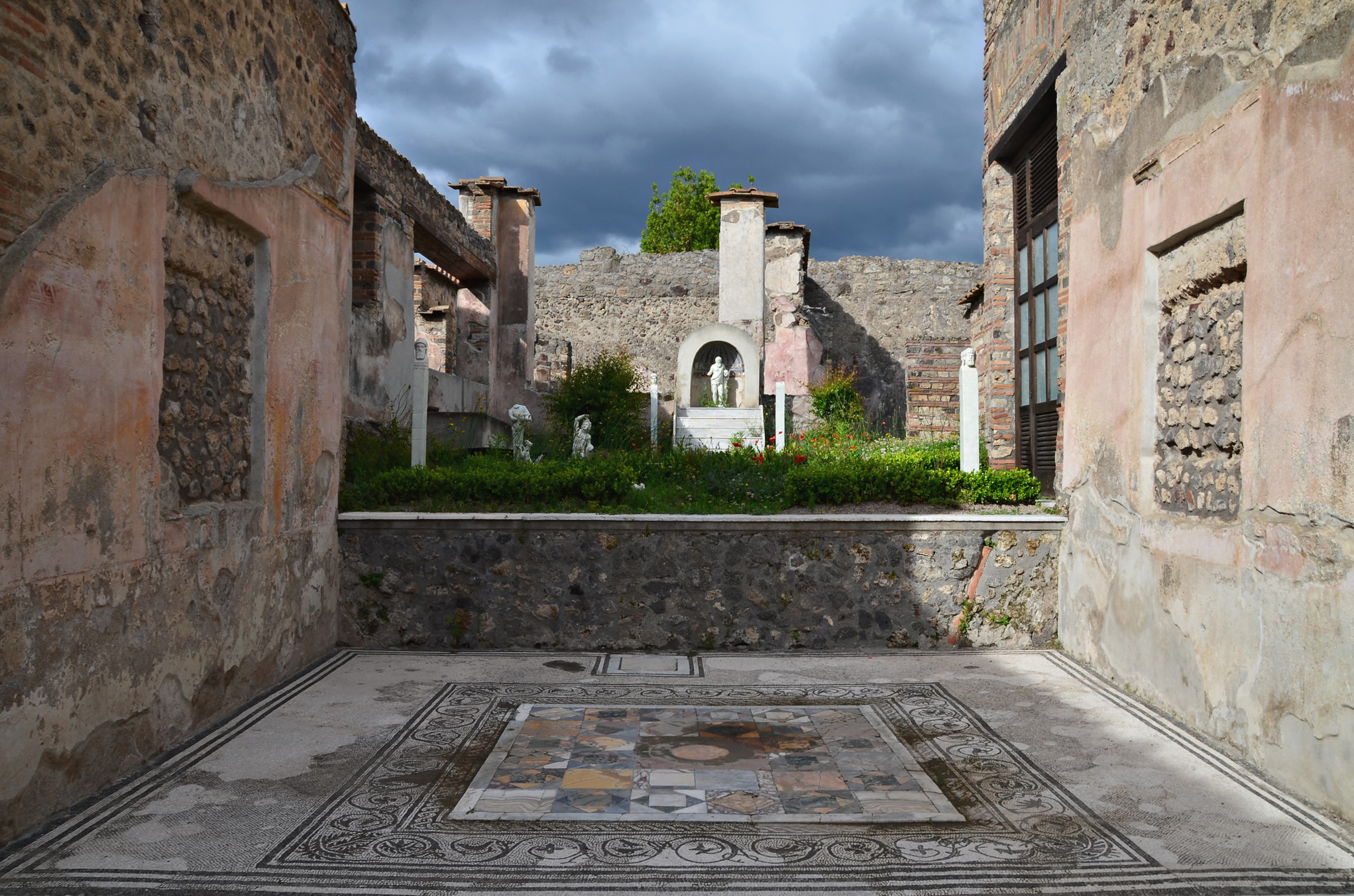
View of the raised garden of the House of Marcus Lucretius in Pompeii. The garden features an elegant fountain supplied by a jet of water that gushed from a statue of Silenus.
Stepping stones for pedestrians to cross the streets without having to set foot on them.
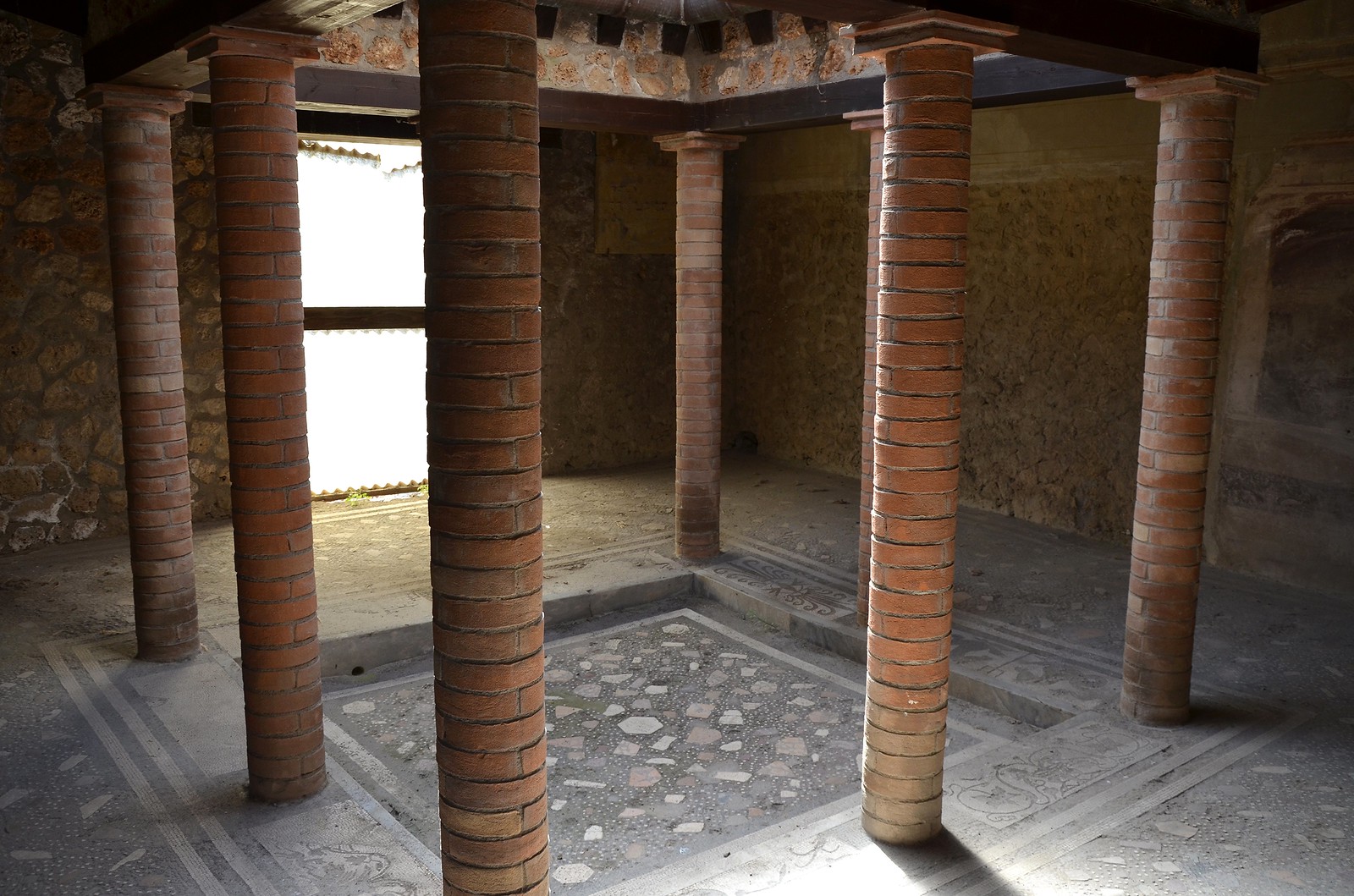
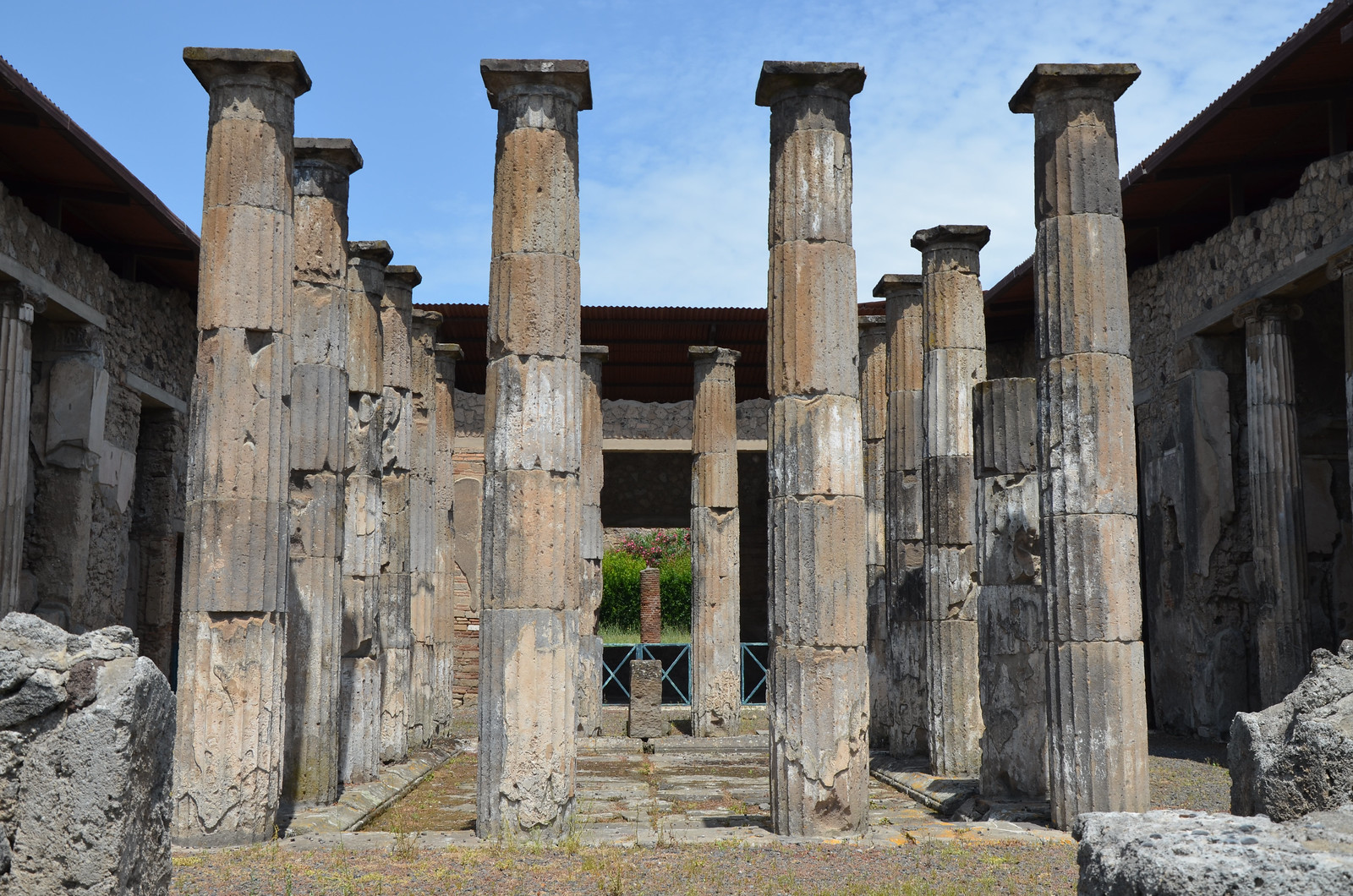
The atrium of the House of the Diadumeni was dominated by 16 Doric columns 4.3m high set around a central impluvium.
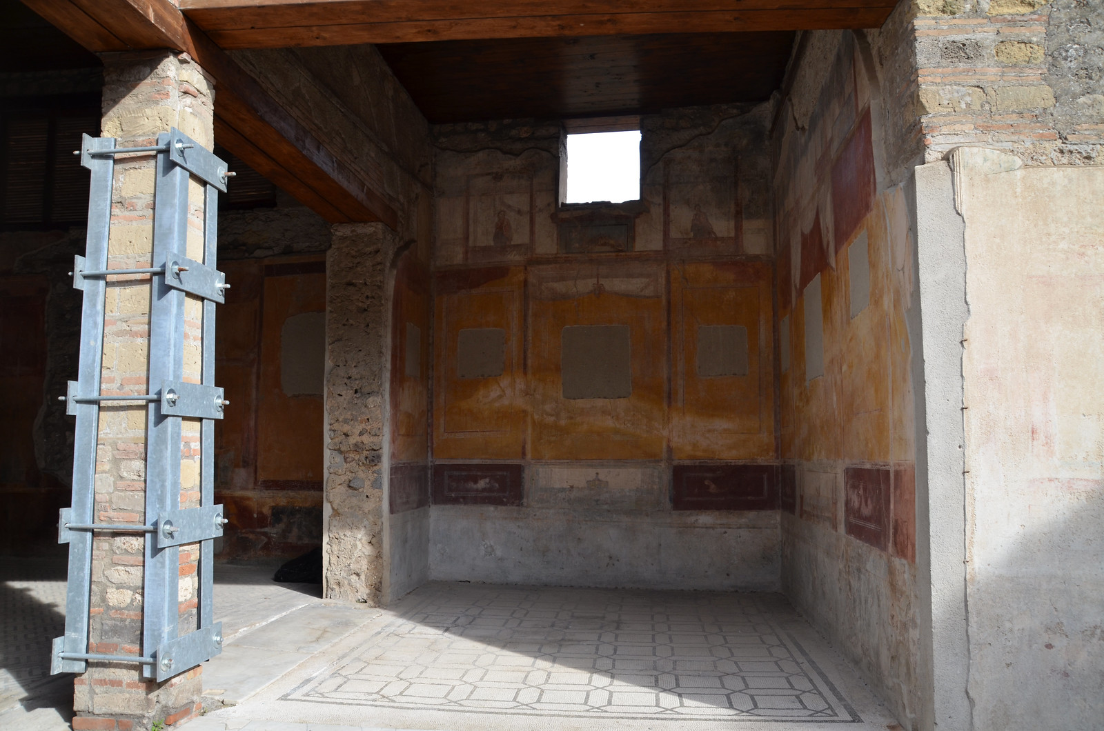
The ala lying on the south side of the atrium of the House of Marcus Lucretius. It is decorated in the fourth style.
Outside the City Walls
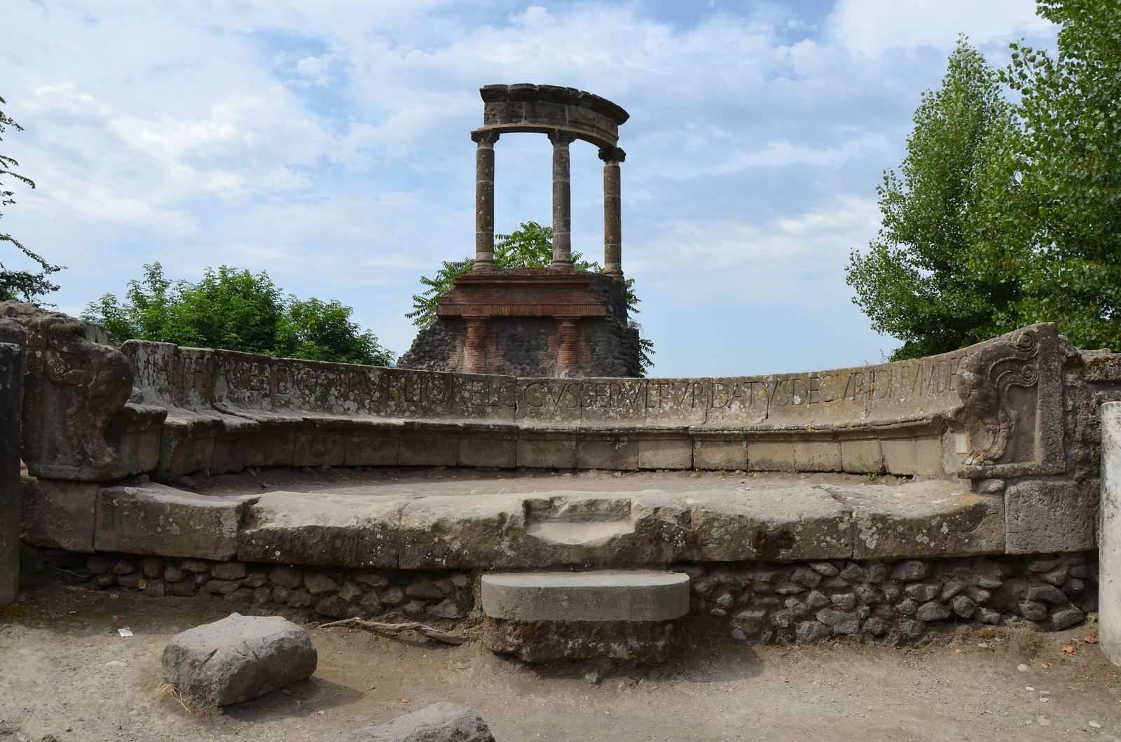
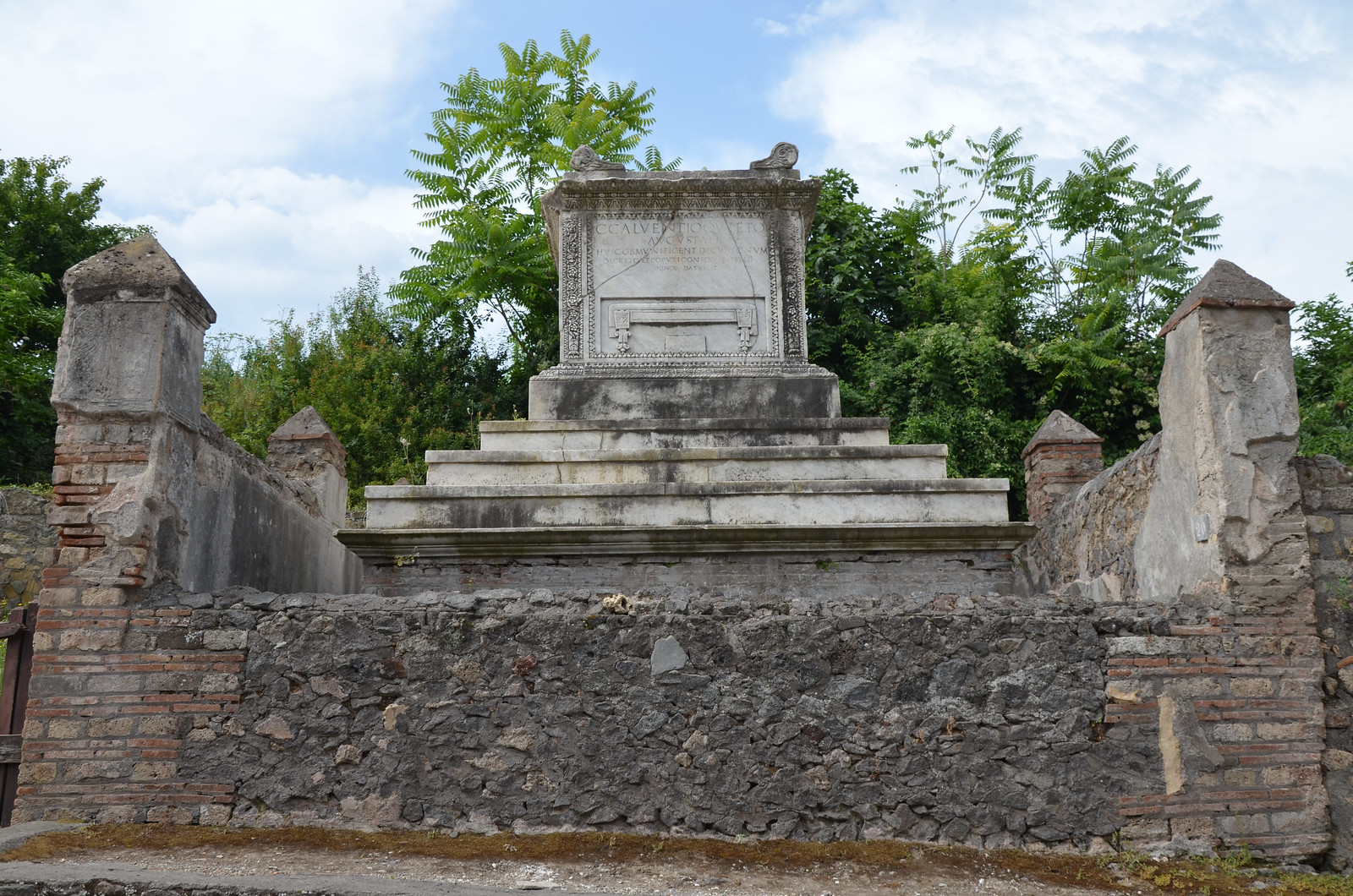
The Exedra tomb in the Necropolis of the Herculaneum Gate.
A tomb in the Necropolis of the Herculaneum Gate.
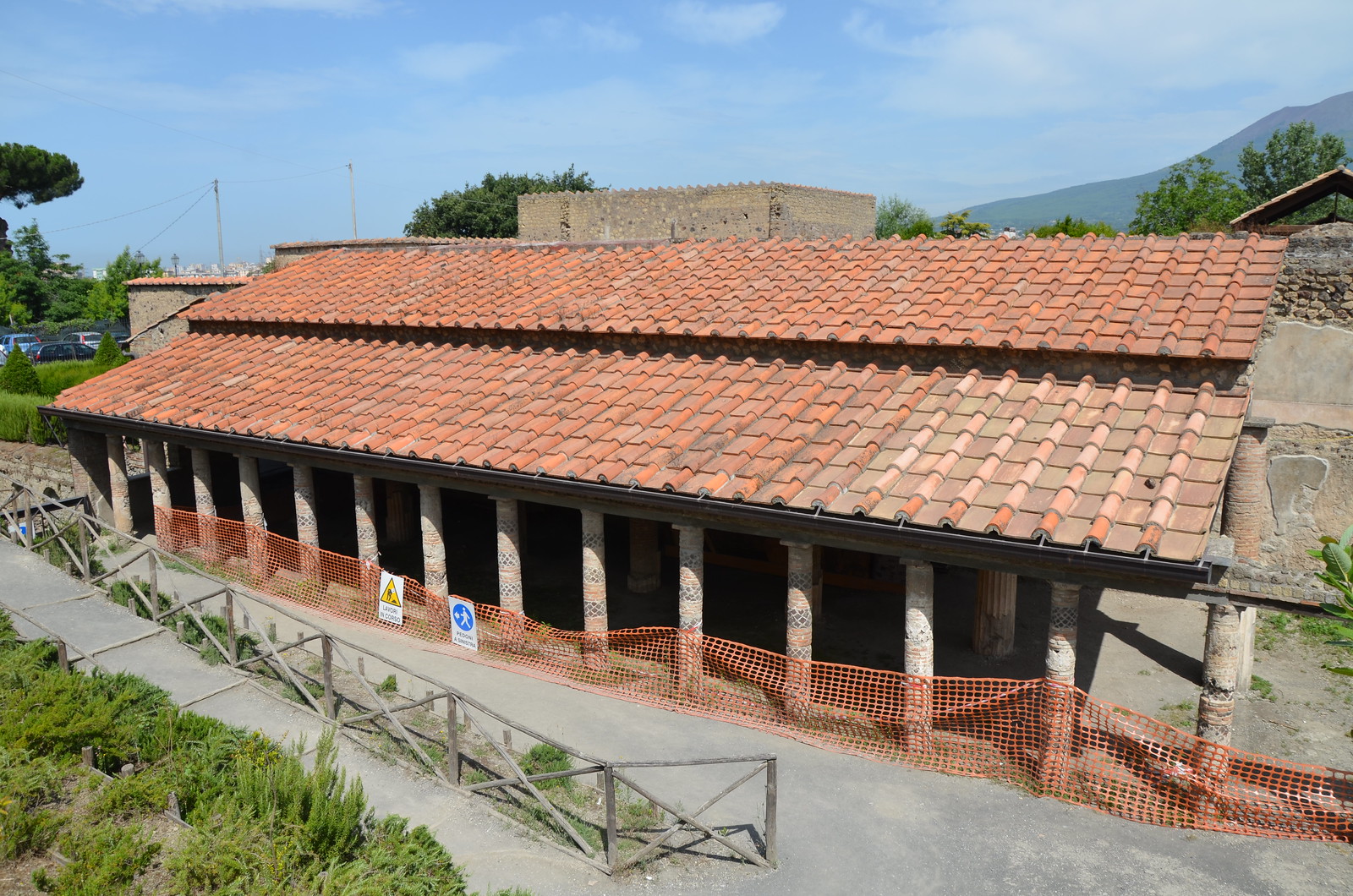
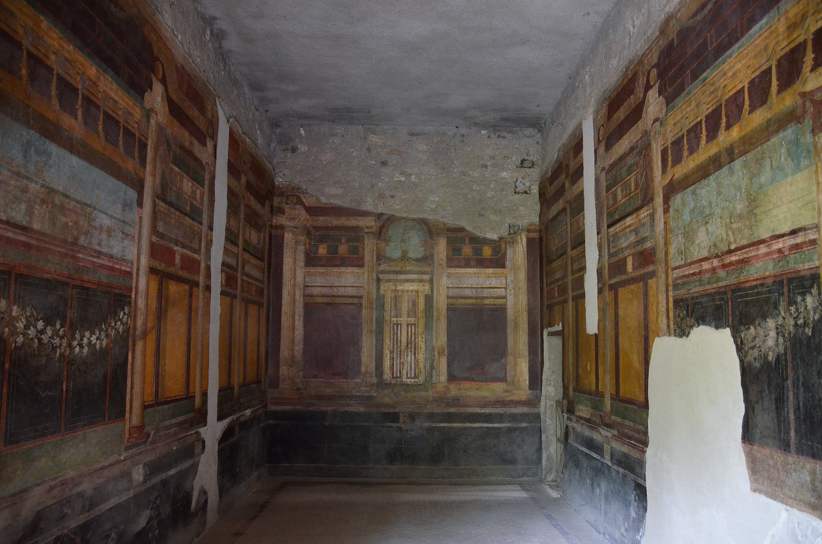
The Villa of the Mysteries is regarded as one of the best-preserved country villas in the area of Vesuvius.
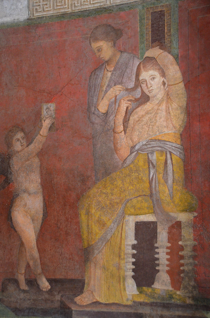
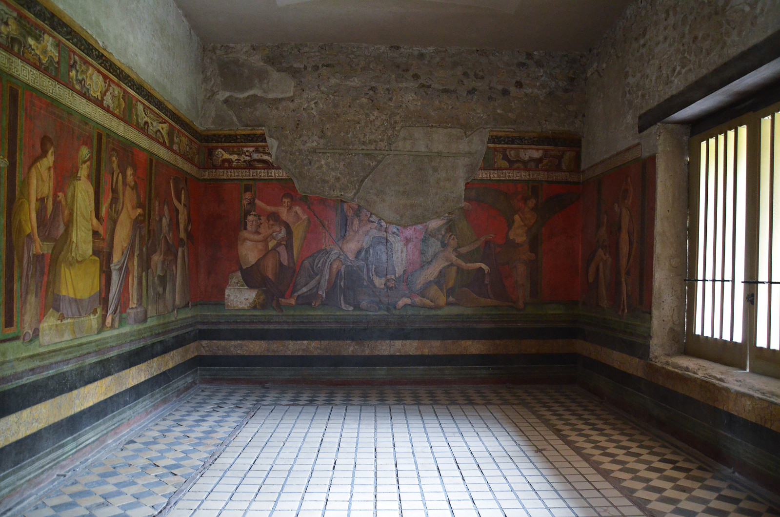
The Villa of the Mysteries owes its fame to the very fine wall paintings that cover the walls of one of its reception rooms.
A mysterious scene with life-size figures in the Second Pompeian Style seems to depict the initiation rite of a young girl into the Dionysian mysteries.
The other rooms of the Villa of the Mysteries also preserve beautiful examples of Second Style wall decoration with imitation marble decoration.