Selinus

Selinus is an ancient city located in the district of Antalya Province on the Mediterranean coast of southern Turkey, 180 km east of the city of Antalya. The history of Selinus goes back to the 6th century BC. Assyrian sources tell us that the city was originally called “Sallune” and was connected by a maritime trade route with the island of Cyprus. Selinus is best known for being the place of death of the Roman Emperor Trajan.

Coordinates: 36°15’40.3″N 32°17’04.2″E

The ancient city of Selinus was established on the River Kestros (today called Hacımusa) in 628 BC, probably by Phoenicians and was then incorporated into the kingdom of Cilicia. The city stood on the slopes and at the foot of a steep hill with a perpendicular cliff on the seaward side and was surrounded by massive fortifications. In 197 BC the area passed into the hands of the Romans.

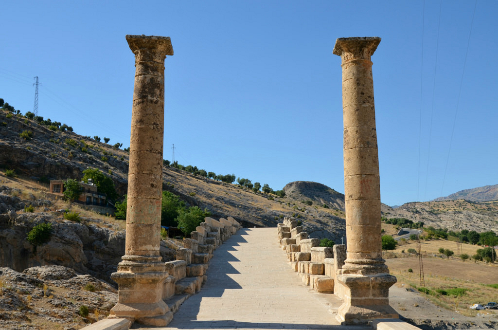
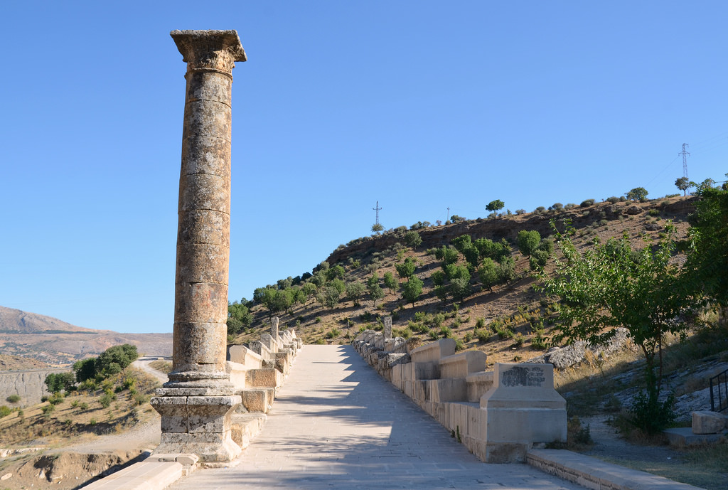
The remains visible today date to the Roman and medieval periods. The most interesting and best-preserved monument in Selinus is a large rectangular building locally know as Şekerhane Köşkü. It is located in a flat area at the foot of the hill, between the agora, bath house and odeon on its western side and the necropolis to the east. The monument has long been thought to have been built as a cenotaph for the Roman emperor Trajan.

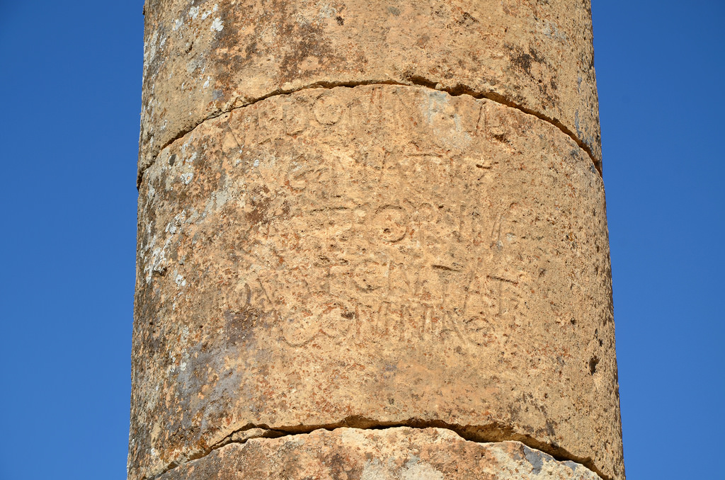
The death of Trajan at Selinus on 8th August 117 AD later prompted the temporary renaming of the city as Trajanopolis. It also received the status of ius Italicum, transforming the provincial solum (land) into Italian solum, a rare privilege for a non-Italian community. A tetrastyle temple inscribed with the name TΡAIANO appeared thereafter on the city’s coins during the late 2nd and 3rd centuries.

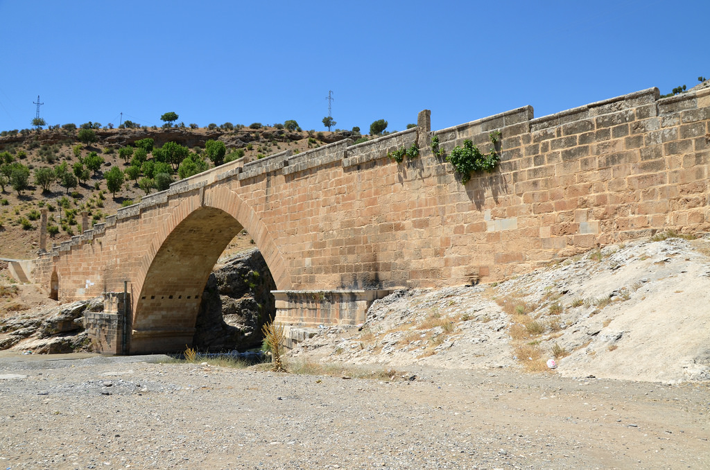
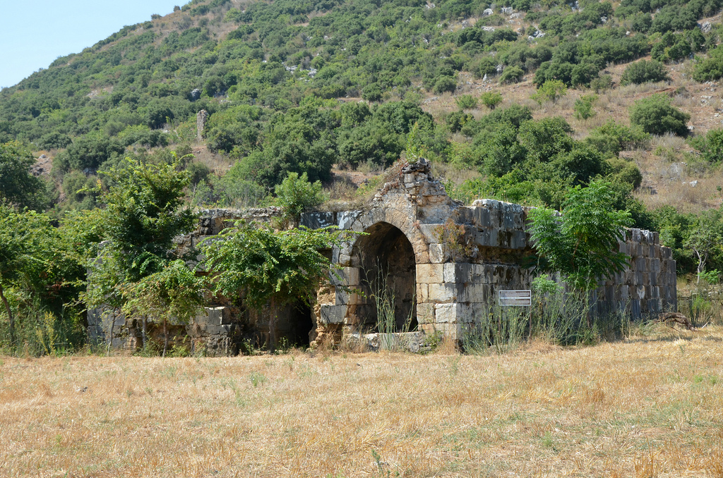
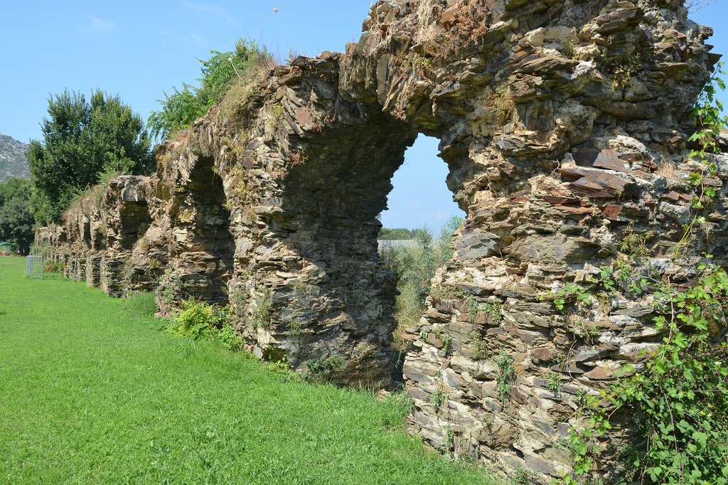
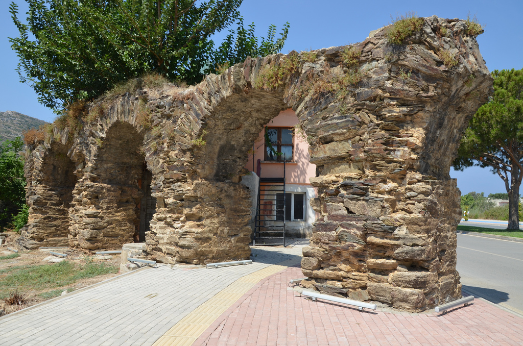
Near Trajan’s cenotaph are the remains of an odeon dating back to the Hellenistic era as well as baths from the Roman period. An aqueduct crosses the marsh near the mouth of the neighboring stream.

At its height, Selinus occupied an area of over 40 hectares and was the largest city in western Rough Cilicia. Selinus later became part of the Byzantine Empire alongside the rest of Cilicia. In the 12th century the Byzantines were succeeded by Armenian refugees who fled the Seljuk Turks invasion of Armenia and founded the Armenian Kingdom of Cilicia. At the end of the 13th century the city was incorporated into the Ottoman Empire.

Archaeological research Selinus has been conducted by a team from Florida State University. The founds are exhibited in the Alanya Archaeological Museum.

PORTFOLIO

The walls of the Acropolis fortress of Selinus and the harbour of Gazipaşa.
Modern stairway going through the gate of the lower fortification walls.
View of the so-called Şekerhane Köşkü from Selinus hill.
The cenotaph of Trajan. The Imperial monument consisted of a central tetrastyle prostyle building (with four columns in front and two on the sides) of the Corinthian order with a cella and pronaos, on a high podium enclosed in a large temenos surrounded on all four sides by porticoes.
The cenotaph of Trajan was remodelled by the Seljuks in the early 13th century using the ancient building materials which altered the monument in a structural way. The name Şekerhane Köşkü refers to the use of the building in Seljuk time as a hunting lodge.
The remains of the Hellenistic odeon.
The remains of the nymphaeum, part of the Large Bath Complex.
The aqueduct of Selinus used to carry a steady supply of water to the bath from its presumed origin only 1,5 kilometres away and over the river.
The remaining arches of the aqueduct.

Links:

Severan Bridge

The Severan Bridge (also known as Cendere Bridge) is a Roman bridge located near the ancient city of Arsameia (today Eskikale), 55 km northeast of Adıyaman in southeastern Turkey. It spans the Cendere River, which was known as Chabines in antiquity. Built by the Sixteenth Roman Legion stationed at Samosata (Samsat) in the last years of the 2nd century AD, it replaced an earlier bridge probably built under the emperor Vespasian (AD 69-79). It is one of the best-preserved Roman stone bridges in Turkey.

Coordinates: 37° 55′ 56.64″ N, 38° 36′ 29.52″ E

The bridge, part of the road to Nemrud Daği, was constructed as a single-vaulted arch spanning two rocks at the narrowest point of the creek. With a span of 34.2 m, the structure is the second-largest extant arch bridge. It is 123 m long and 7.50 m wide.

Inscriptions on the bridge revealed that it was built by the XVI Flavia Firma, a Roman legion stationed in the ancient city of Samosata. The Sixteenth took part in the two campaigns of Lucius Septimius Severus (194 and 197-198), which culminated in the capture of the Parthian capital, Ctesiphon, and the re-establishment of the province of Mesopotamia. The area was reorganised, and the legion’s soldiers deployed there bridged the river Chabinas.

There were originally four columns located at each end of the bridge, erected by the four Commagenean cities (Samasata, Perre, Doliche and Germaniceia). The inscriptions on these columns state that the columns at the southeastern end of the bridge were dedicated to Septimius Severus and his wife Julia Domna, while the columns at the other end of the bridge were dedicated to their two sons, Geta and Marcus Aurelius Severus Antoninus. The latter eventually reigned as Caracalla (211-217), had his brother Geta killed and erased him from history. Geta’s column was, therefore, removed from the bridge after his assassination.

The Severan Bridge is located within one of Turkey’s most important national parks. It contains Nemrut Dağı, with the famous remains of the large statues dedicated by King Antiochus Theos of Commagene. UNESCO declared it a World Cultural Heritage site.

Until recently, cars and small trucks weighing up to 5 tons were allowed to cross the bridge. The bridge was restored in 1997, and another road bridge was built 500 m to the east. The Severan Bridge is now closed to all but pedestrians.

PORTFOLIO

The east side of the Roman bridge at Cendere.
The west side of the Roman bridge at Cendere.
The two columns dedicated to the emperor Septimius Severus and his wife Julia Domna.
Inscription on the column dedicated to Septimius Severus.
The road on the Roman bridge at Cendere.
Inscription on the column dedicated to Julia Domna.
The east side of the Roman bridge at Cendere.
The column dedicated to Marcus Aurelius Severus Antoninus (Caracalla).

CIL 03, 06709
Imp(erator) Caes(ar) L(ucius) Septi/mius Severus Pius / Pertinax Aug(ustus) Ara/bic(us) Adiab(enicus) Parthic(us) / princ[e]ps felic(um) pon/tif(ex) max(imus) trib(unicia) pot(estate) / XII imp(erator) VIII co(n)s(ul) II / proco(n)s(ul) et Imp(erator) Caes(ar) / M(arcus) Aurel(ius) Antoni/nus Aug(ustus) Augusti / n(ostri) fil(ius) proco(n)s(ul) imp(erator) III / et P(ublius) Septimius [[Ge]]/[[ta]] Caes(aris) fil(ius) et fra/ter Augg(ustorum) nn(ostrorum) / pontem chabi/nae fluvi a so/lo restituerunt / et transitum / reddiderunt / sub Alfenum Senecionem / leg(atum) Augg(ustorum) pr(o) pr(aetore) curante Ma/rio perpetuo leg(ato) Augg(ustorum) leg(ionis) / XVI F(laviae) F(irmae)

CIL 03, 06710
Imp(erator) Caes(ar) L(ucius) Septi/mius Seve[r]us [P]i/us Pe[r]tinax Aug(ustus) / Arab(icus) Adiab(enicus) Par/thic(us) princ[e]ps Felix pont(ifex) m(aximus) / t[r]ib(unicia) potest(ate) XII / imp(erator) VIII [c]o[n(sul)] I[I] / proco(n)s(ul) et [Imp(erator)] / Caes(ar) M(arcus) Aurelius An/toninus Aug(ustus) Au/g(usti) n(ostri) f(ilius) proc[o](n)s(ul) / imp(erator) III et [P(ublius)] Septi/mius [Geta] Caes(ar) / [fil(ius)] et frat(er) Augg(ustorum) / nn(ostrorum) pontem Ch/abinae fluvi a so/lo restituerunt / et transitum red/diderunt / [sub Alfeno S]enecione leg(ato) / [Augg(ustorum) pr(o) pr(aetore) cu]rante Mario Per/[petuo leg(ato)] Augg(ustorum) leg(ionis) XVI Fl(aviae) F(irmae)

The east side of the Roman bridge at Cendere.

Links: