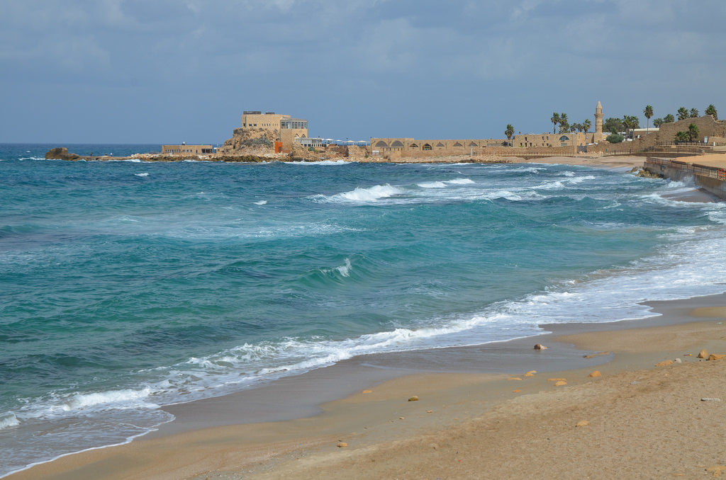
Caesarea Maritima is located on a sandy shore of the Mediterranean, about halfway between Tel Aviv and Haifa. This most fertile area of ancient Judea is the site of one of the most important cities of the Roman World and the capital of the Roman province of Judaea. Caesarea was founded between 22 and 10 BC by Herod the Great (37-4 BC) as an urban centre and harbour on the site of the earlier Strato’s Tower.
Caesarea was first settled by the Phoenicians, who also founded the port cities of Sidon, Tyre and Byblos. In the 4th century BC, the Phoenicians founded Strato’s Tower and used the natural bays and nearby rivers to establish a port that provided essential services for ships and their crews. The city changed hands many times before Roman troops entered Palestine in 63 BC, marching South from Syria under the leadership of Pompey the Great. Some three decades later, Augustusconfirmed Herod the Great’s client rule in Palestine and designated him as the “King of the Jews”.
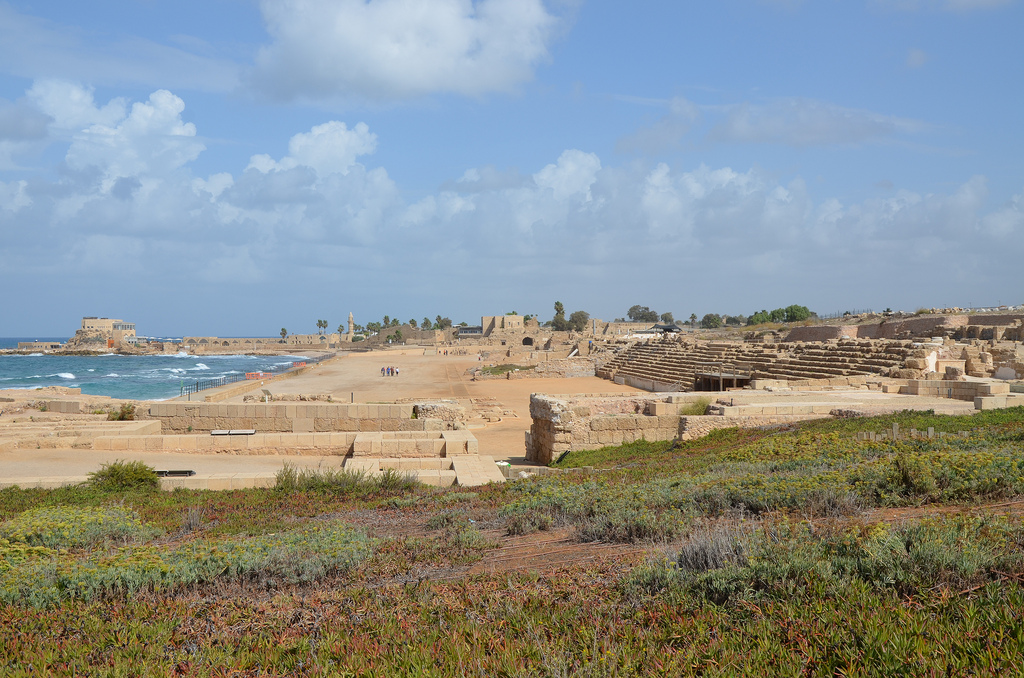
In an ambitious construction project lasting some twelve years, Herod turned Strato’s Tower into the main port of his kingdom. He named the city Caesarea in honour of Augustus. Herod’s building program included broad, collonaded streets, a palace, a temple, public buildings, a theatre, a Hippodrome, an amphitheatre and other entertainment facilities. However, Herod’s port never attained the importance he surely hoped for. Caesarea lost its impact as a royal city when it was absorbed into the Roman Empire. The AD 79 eruption of Mount Vesuvius and the AD 115 Antioch earthquake generated tsunami waves that reached the coast, causing significant damage to the harbour. The city reached the height of its prosperity when it became the Byzantine administrative capital of the country from the 4th to the 6th century AD. The city was later abandoned after the Arab conquest in the 8th century AD. Today, it is a large and beautiful national park and a fascinating place to visit while exploring the Holy Land.
PORtFOLIO
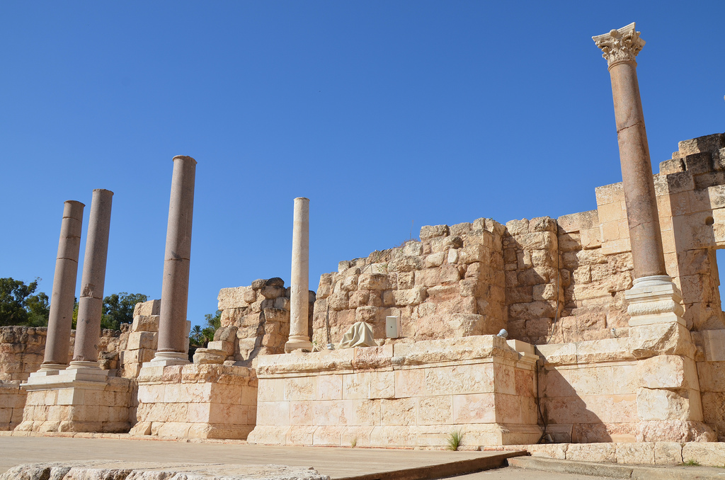
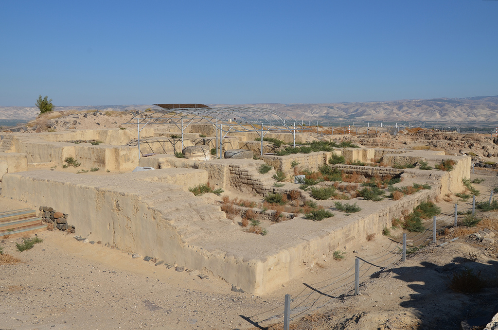
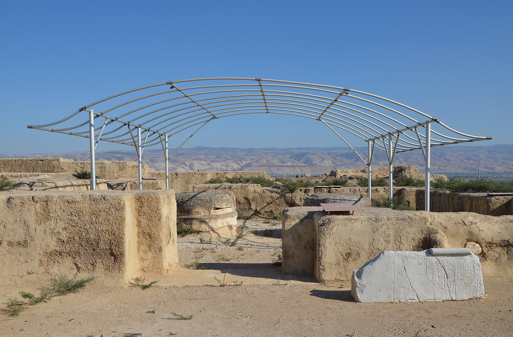
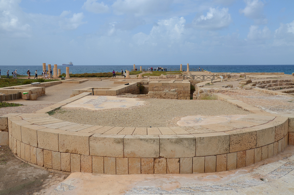
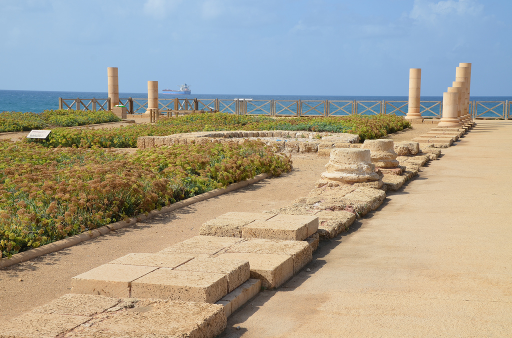
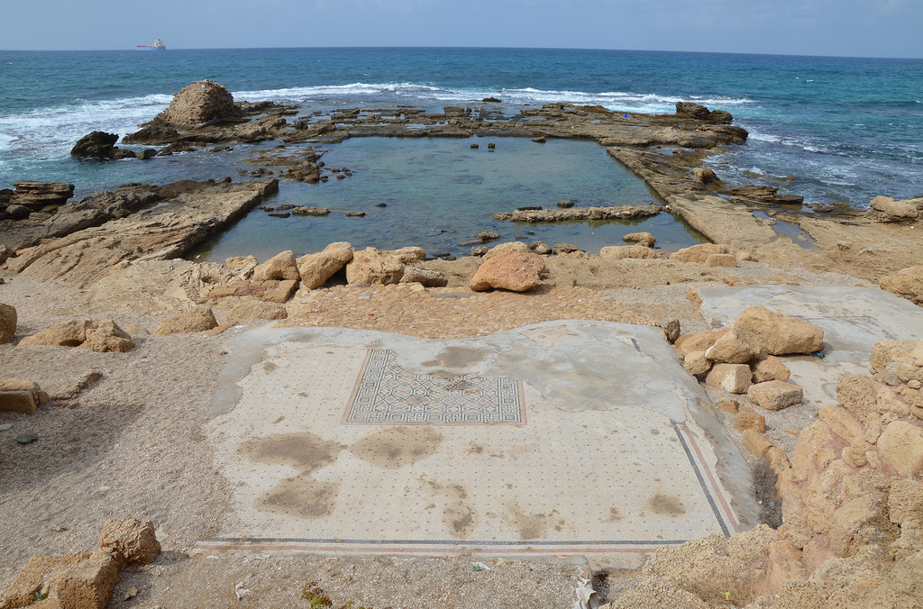
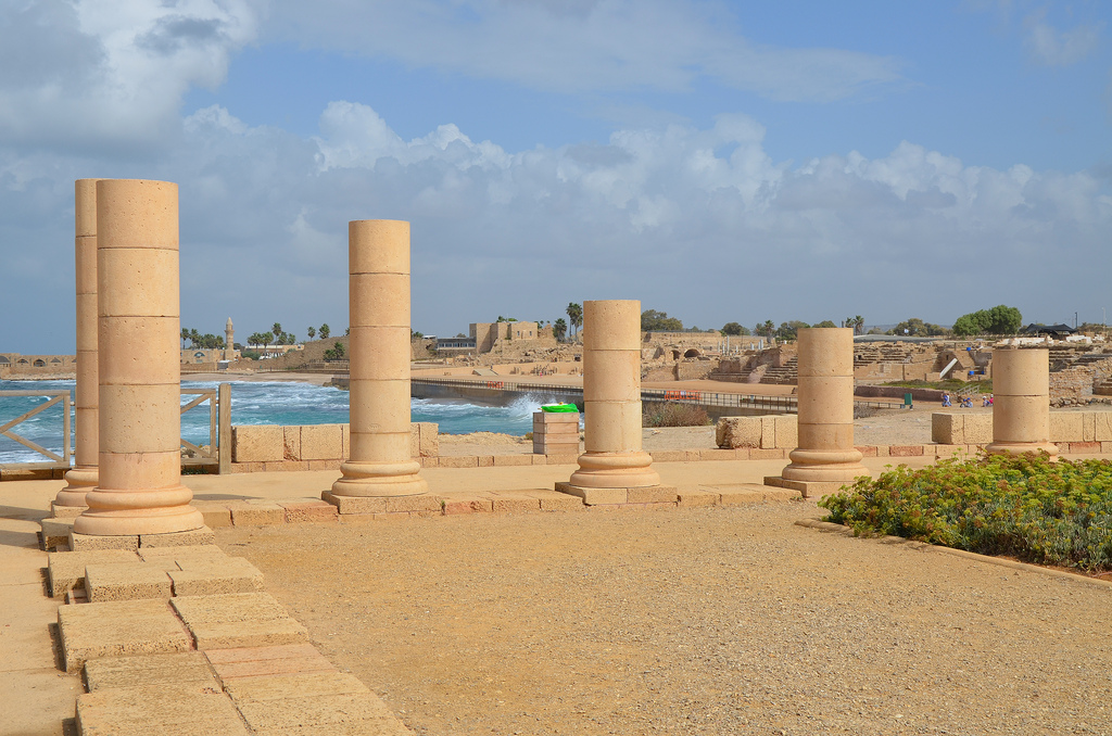
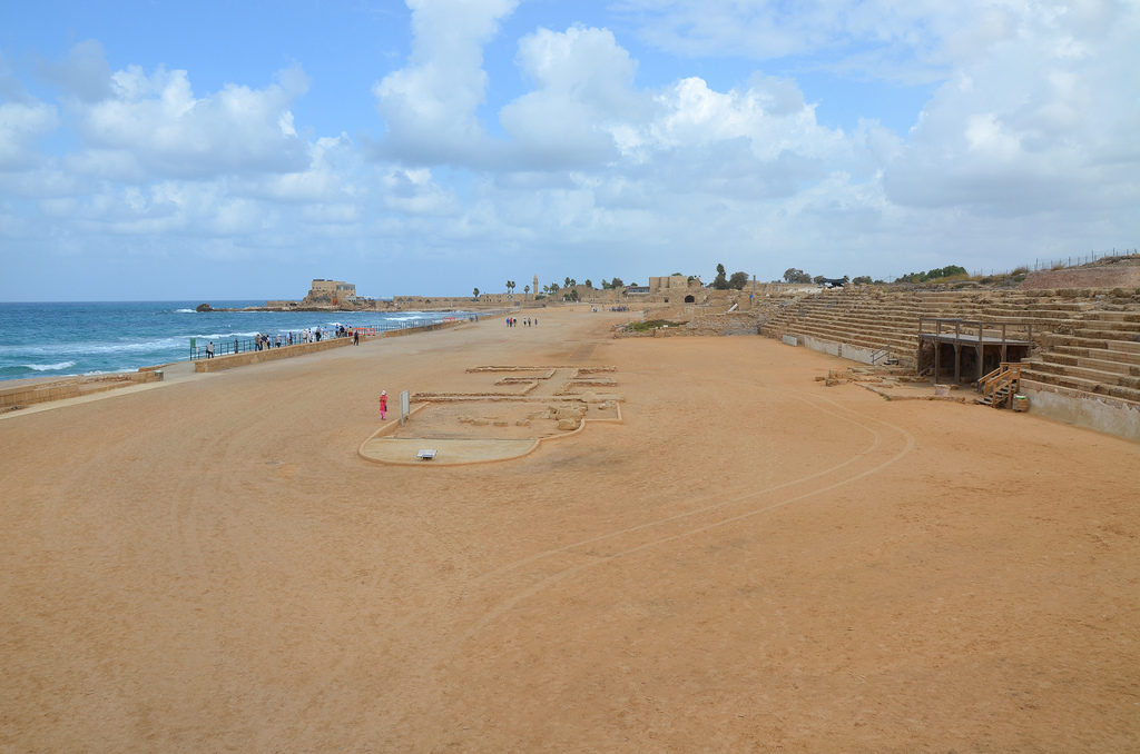
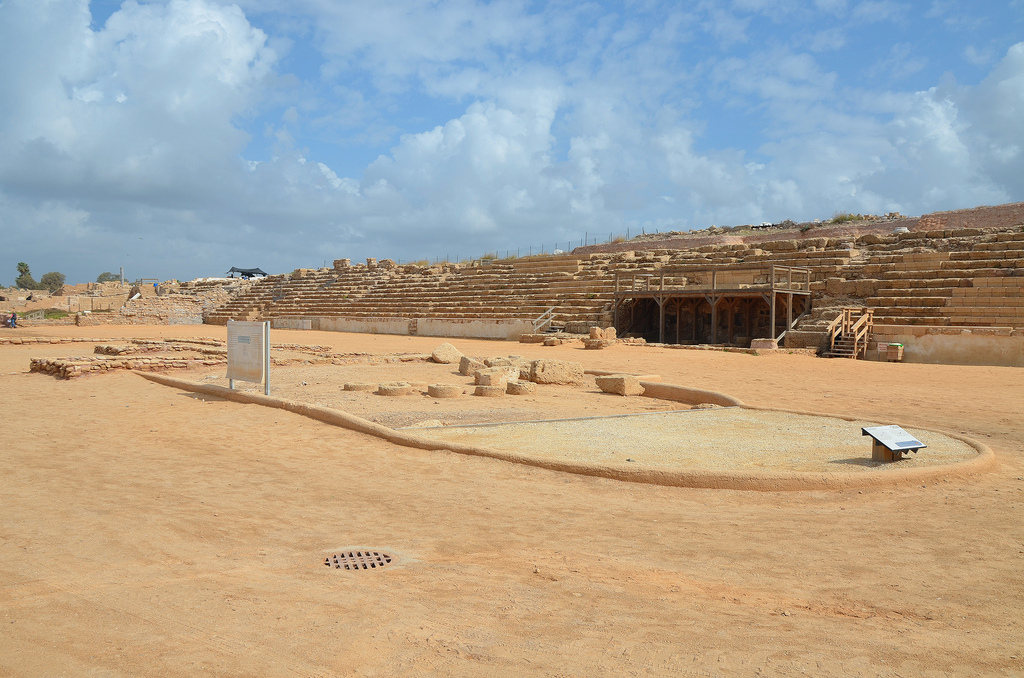
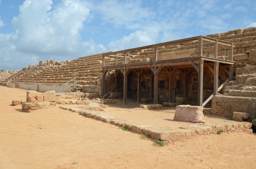
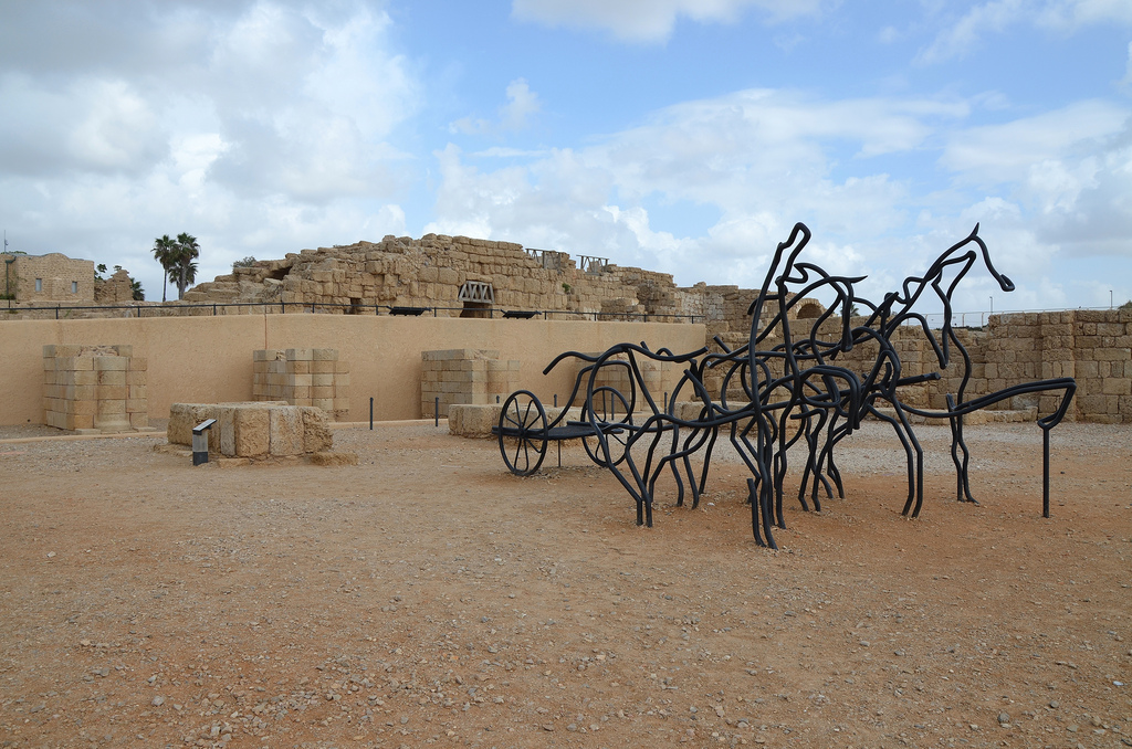
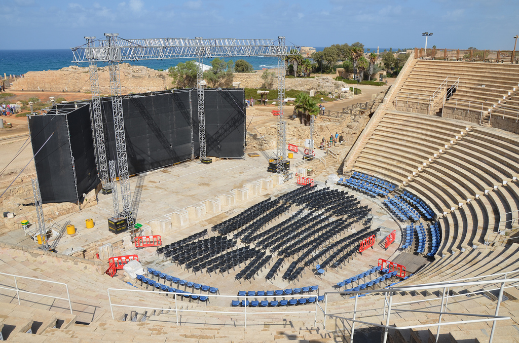
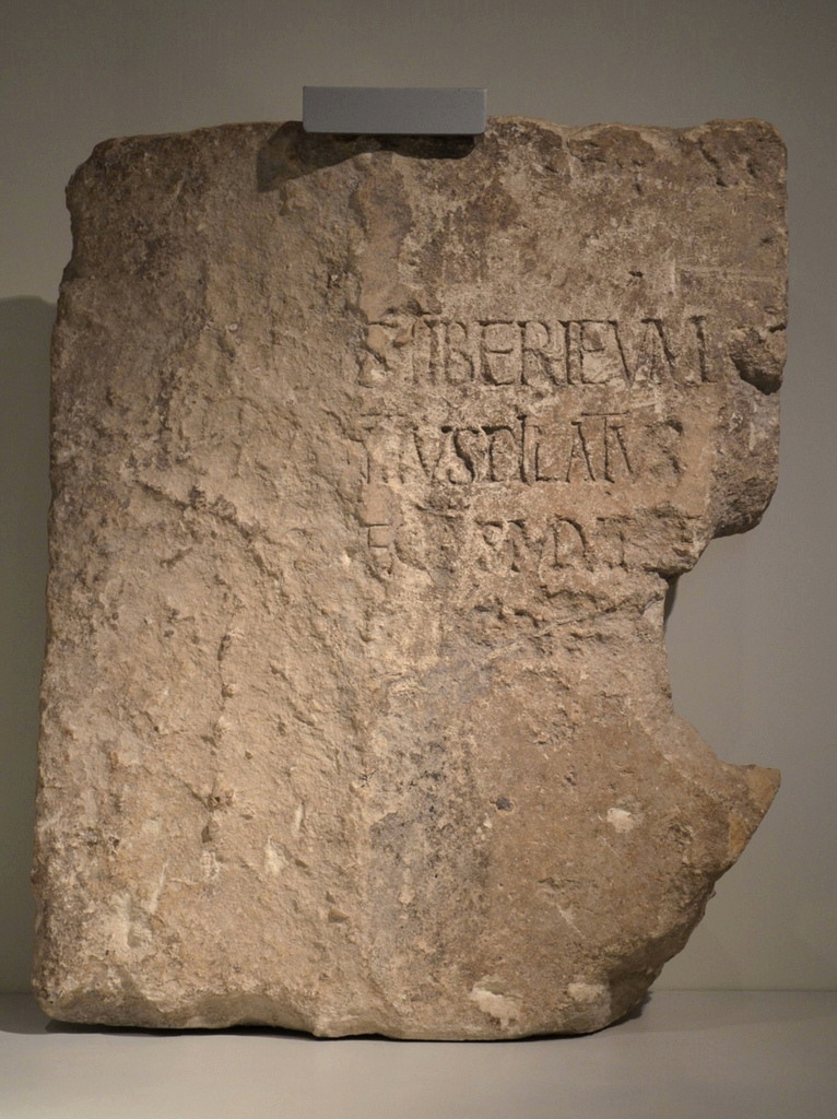
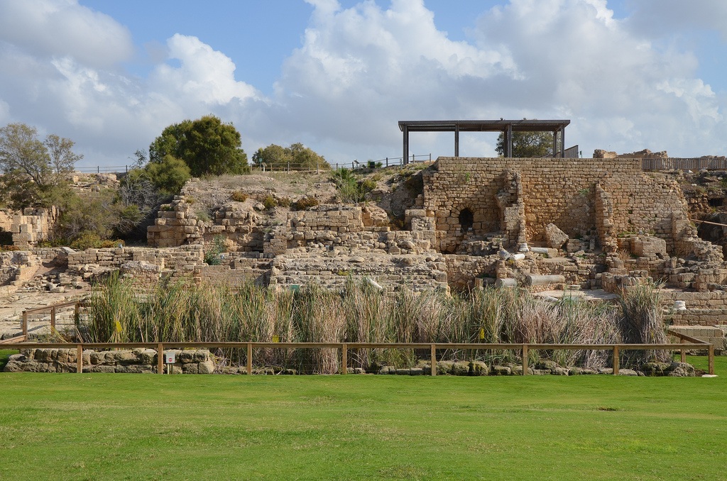
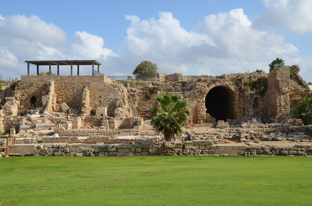
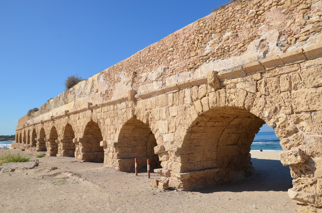
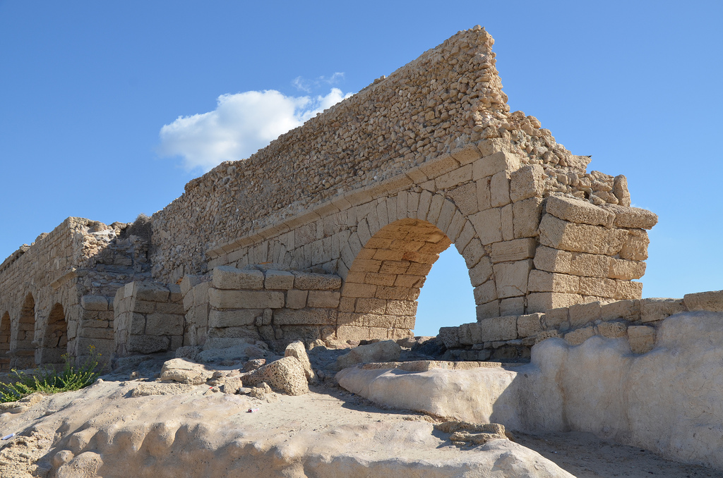
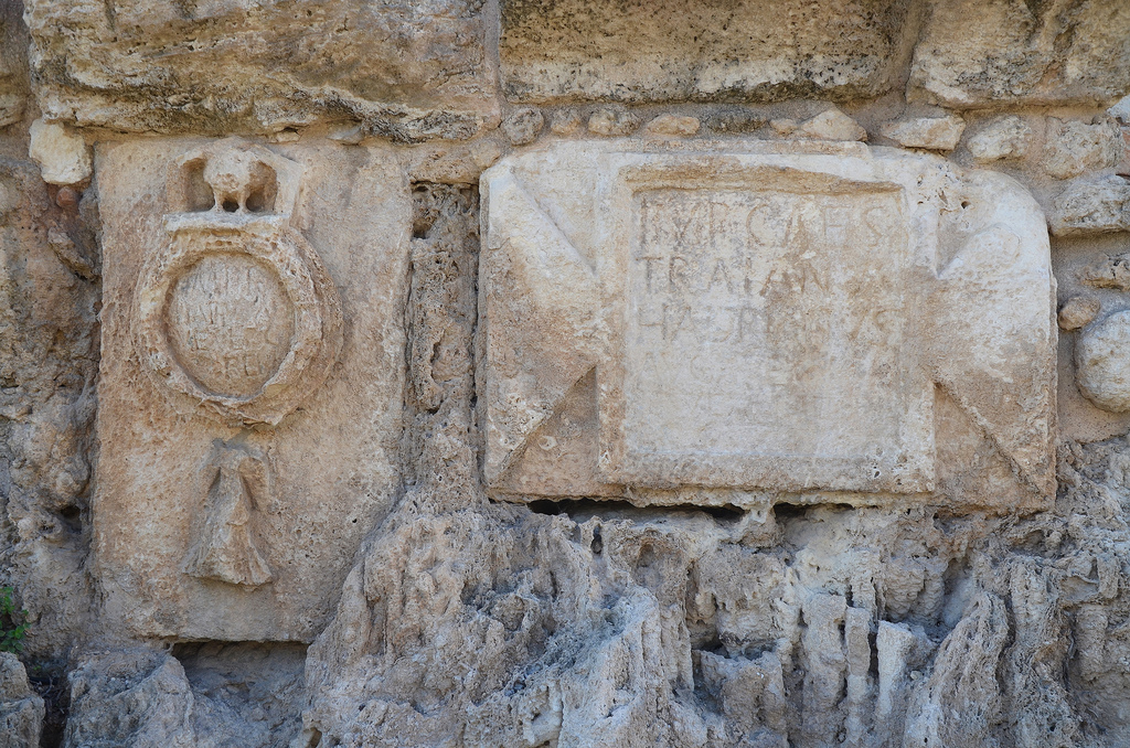
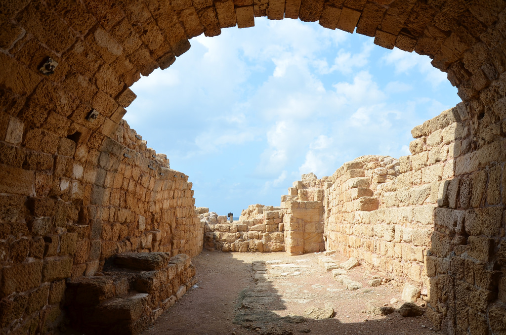
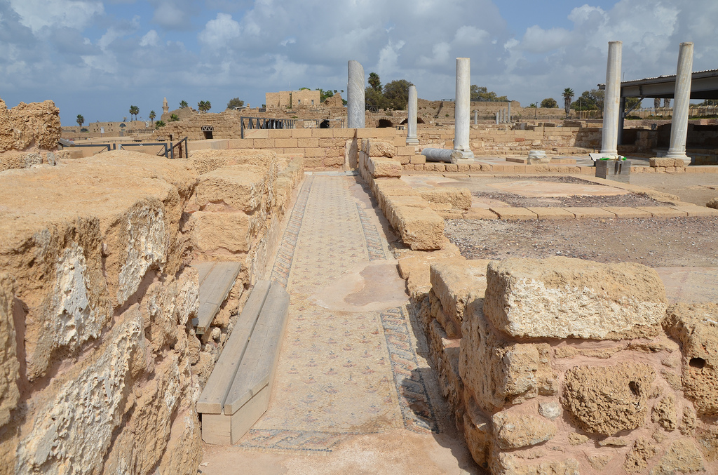
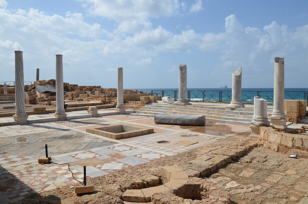
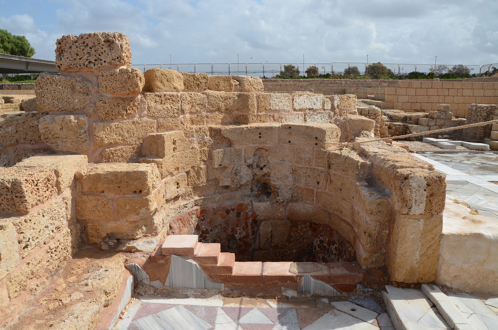
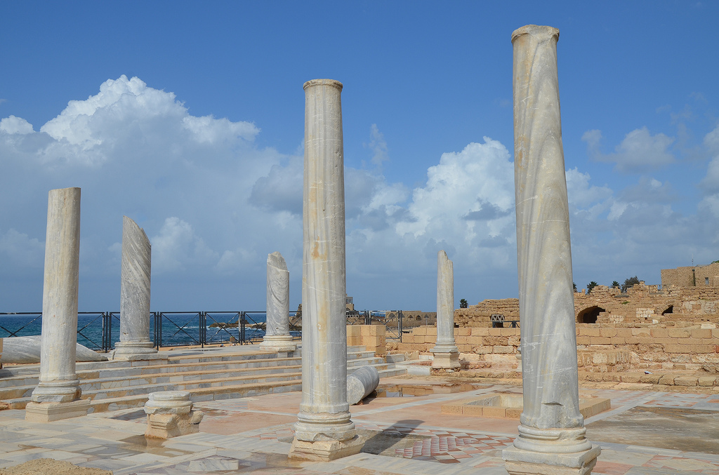
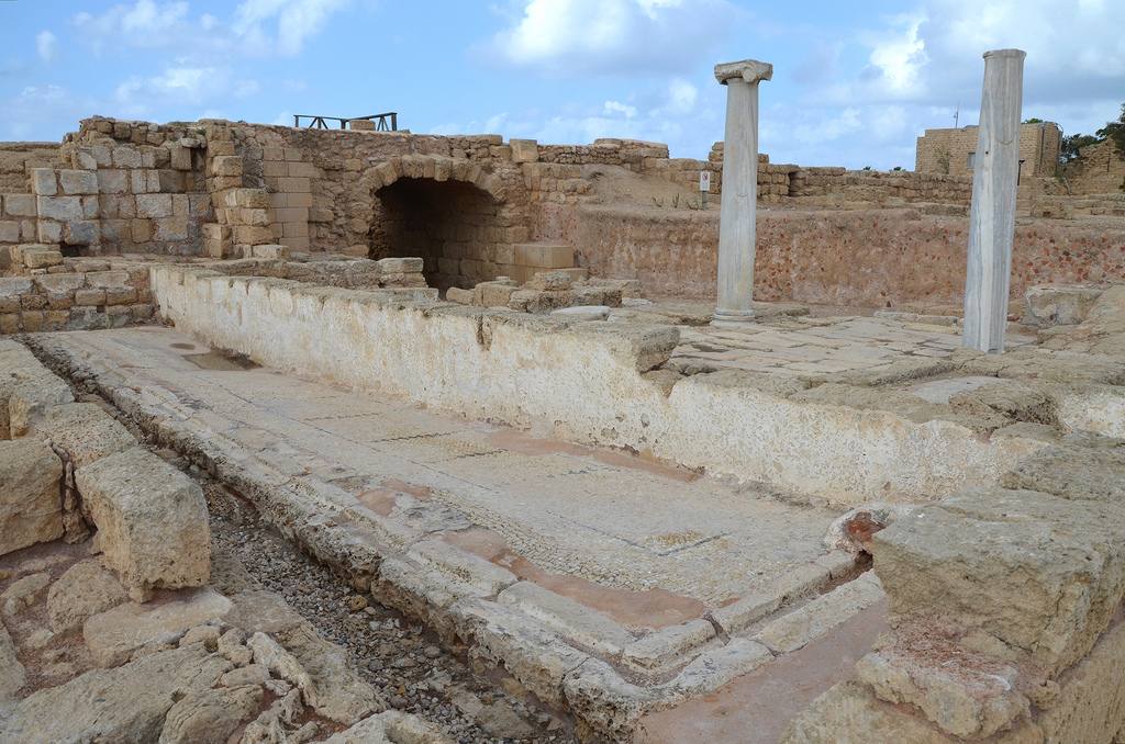
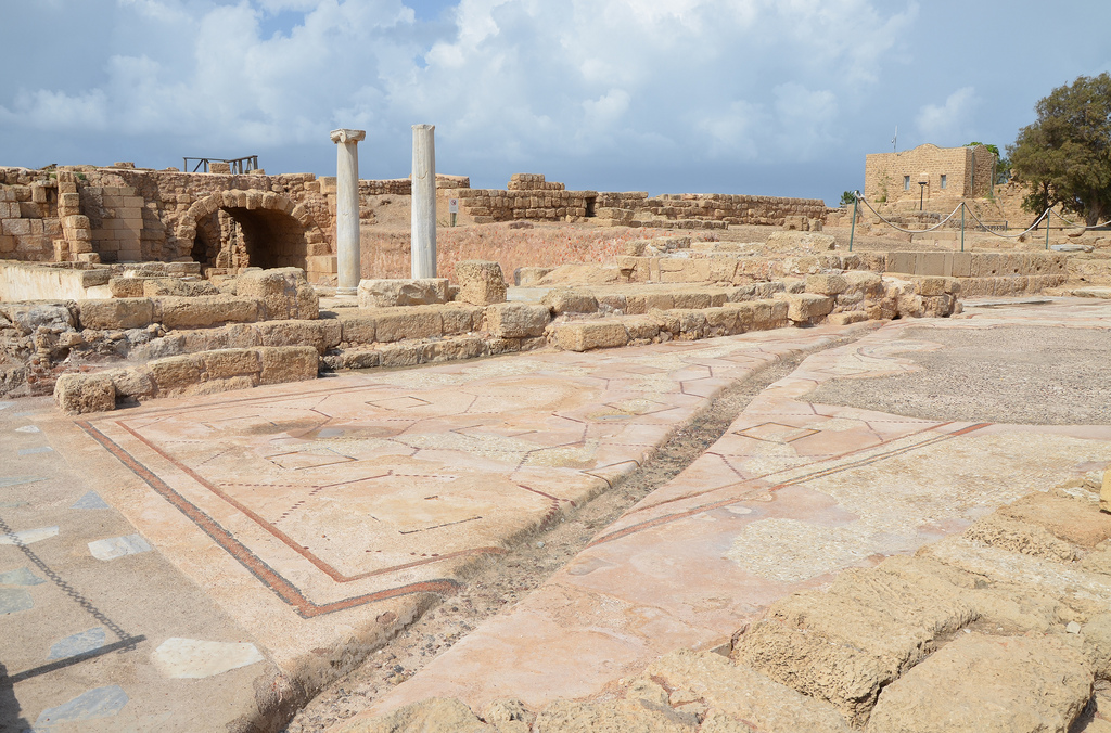
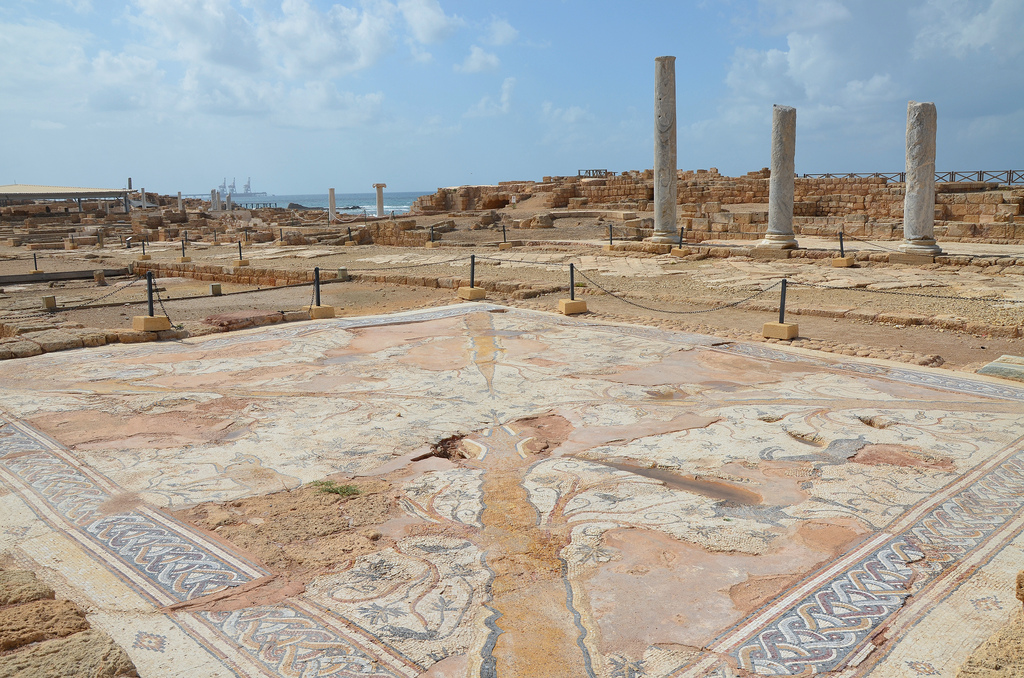
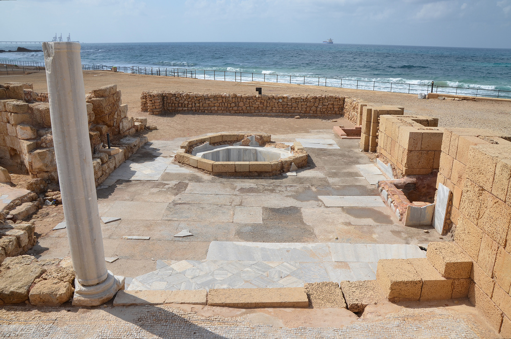
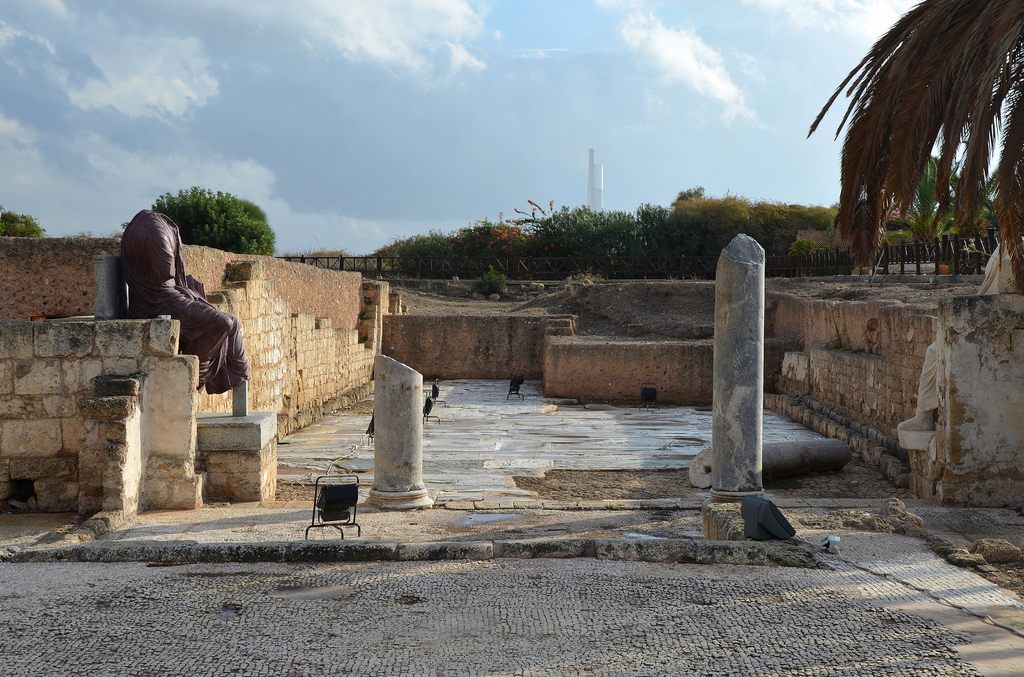
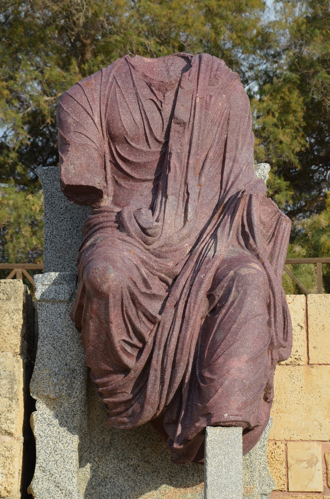
The Promontory Palace of Herod the Great stretches into the sea.The Promontory Palace was the palace’s private section.The lower wing of the Lower Terrace of the Promontory Palace was built around a pool, surrounded by four rooms with mosaic floors.The peristyle of the Upper Terrace of the Promontory Palace of Herod the Great with the Hippodrome in the background.The Hippodrome was built by Herod the Great for the city’s inauguration in 9/10 BC. It was the venue of the Actian Games instituted by King Herod in honour of Emperor Augustus, which were held every 4 years.The Hippodrome was 300 metres long and 50 metres wide and may have had as many as 15,000 seats in Herod’s day.View of the dignitaries’ platform in the Hippodrome.The Hippodrome was intended primarily for horse and chariot competitions. The riders’ chariot, pulled by two or four horses, emerged from compartments on the northern side of the Hippodrome.Herod’s Royal Harbour was known as Sebastos. It was the disembarkation point for visitors to the city.The reconstructed theatre was built by Herod during the city’s early development and was renovated in the 2nd century AD. The seating capacity in its final stage was about 4,000. The theatre is still in use today for concerts and shows.The dedicatory inscription was found reused in the staircase of the theatre of Caesarea. It is the first and only mention of Pontius Pilate’s name ever unearthed (AD 26-36, Israel Museum, Jerusalem) The inscription reads: ” Pontius Pilate, the Prefect of Judea, has dedicated to the people of Caesarea a temple in honour of Tiberius”.Part of the eastern wharf of the inner harbour with the podium of the Temple of Augustus and a series of vaults used as warehouses. The Temple of Augustus was built by Herod and was covered by an octagonal Byzantine church in the 6th century. Only the huge podium and a series of steps are visible today.Part of the eastern wharf of the inner harbour with the podium of the Temple of Augustus and a series of vaults used as warehouses.The high-level aqueduct of Caesarea was built by Herod the Great. Caesarea had no reliable source of fresh water when construction on the city began around 22 BC. King Herod commissioned a raised aqueduct to deliver water from the springs near Shuni, 16 kilometres north-east of Caesarea.A portion of the high-level aqueduct of Caesarea shows the two stages of construction. When Hadrian visited Caesarea in AD 130 on his grand tour of the eastern Roman Empire, the city’s growth required additional water. Hadrian then commissioned extensive repairs and the construction of a new aqueduct. This new section (known as the high-level aqueduct II) was added to the right of the first canal and doubled its capacity.Dedicatory inscription to Hadrian on the high-level aqueduct of Caesarea at Beit Hanania with the emblem depicting the 10th legion.The Mithraeum, a 1st-century grain storage converted into a Mithraeum during the 3rd century AD.The Mithraeum.The Byzantine Bathhouse was built in the 4th century AD.The palaestra of the Byzantine Bathhouse. Before bathing, clients could exercise in the palaestra.A pool in the Byzantine Bathhouse was built in the 4th century AD.The palaestra of the Byzantine Bathhouse.The public latrine was used during the Roman and Byzantine periods. Marble benches were set along the southern and western walls of the latrine. Water flushed through its channels, lay at the bottom of the walls, and connected with the main sewer beneath the decumanus street.The Praetorium, the Byzantine Governor’s Palace, combined administration, financial and judicial functions.The Ibexes Mosaic Hall in the Praetorium, the Byzantine Governor’s Palace.The Governor’s Palace Baths.A section of a Byzantine street paved with opus sectile and mosaics. The statues are older and date to the 2nd and 3rd centuries AD. They originally belonged to Roman temples.The headless porphyry statue of Hadrian is depicted seated, holding a sceptre and an orb (now missing). The statue’s original location was not on Byzantine Street. It may originate from a nearby temple dedicated to Hadrian, which he visited in AD 130 and who endowed it with a new aqueduct.Caesarea.
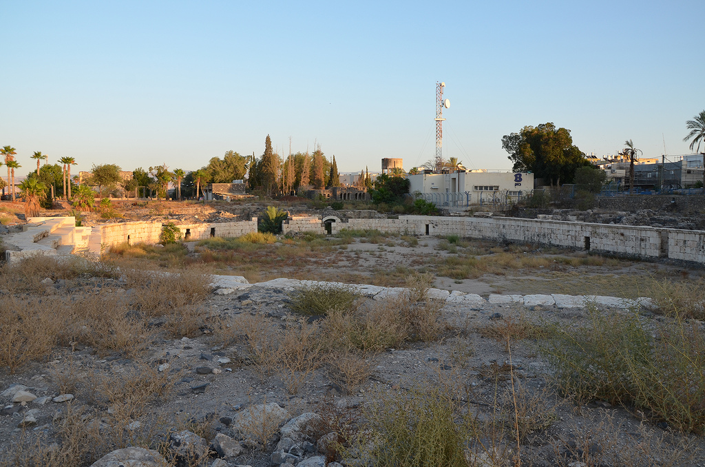
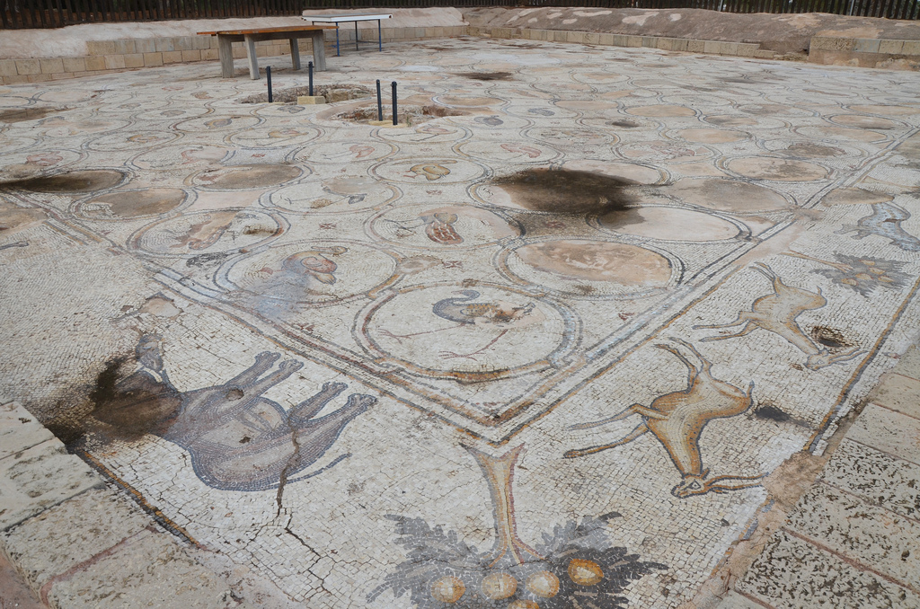
A stunning mosaic floor, known as the “Bird Mosaic,” was accidentally uncovered in 1955 on the outskirts of Caesarea, outside the walls of the ancient settlement. During the 2005 excavations, archaeologists determined that the ‘Bird Mosaic’ was part of a Byzantine palace complex dating to the 6th century AD. During the Byzantine period, the harbour city of Caesarea flourished and expanded as much as 800m inland. This palace complex, covering nearly 1 acre (4,000 sq. metres), was probably owned by a reputable and wealthy family. The “Bird Mosaic” adorned the floor of a large open courtyard, the atrium, with a portico along the western and southern sides.
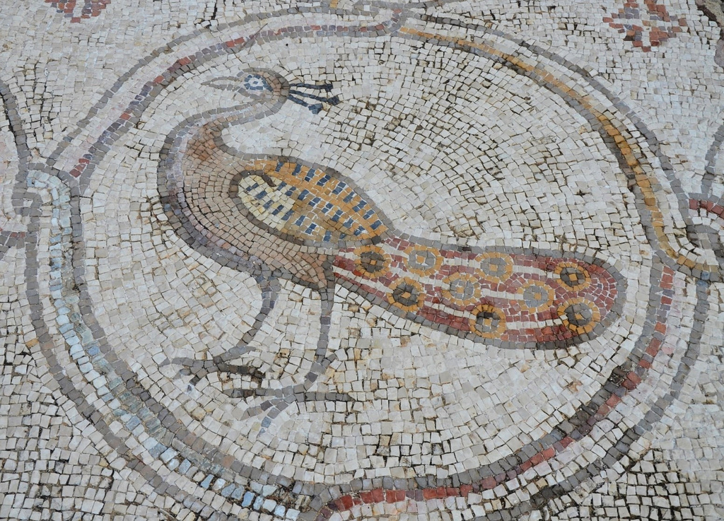
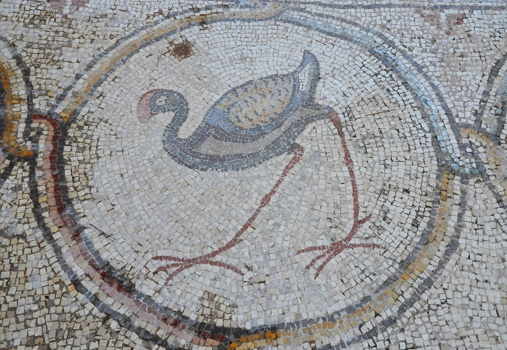
6th-century AD Bird Mosaic that adorned the atrium of a large palace complex outside the city wall of Byzantine Caesarea.A peacock, a detail from the 6th-century AD Bird Mosaic.6th-century AD Bird Mosaic that adorned the atrium of a large palace complex outside the city wall of Byzantine Caesarea.
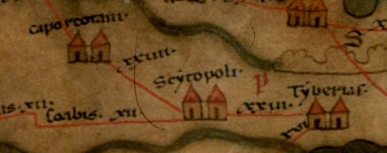
Beit She’an, also known as Scythopolis or Nysa, is one of the oldest cities in Israel. Nestled in the Galilee region, it sits at the convergence of the Harod Valley and the Jordan Valley, a mere 27 kilometres south of the Sea of Galilee and 5 kilometres east of the Jordan River. This unique location has played a pivotal role in the city’s history, making it a fascinating archaeological site with a rich past.
Beit Sh’ean, located at an important crossroads, was first settled in the 5th millennium BC. Its location south of the Harod Stream, in a region with fertile land and abundant water, made it a desirable place to live. During the Late Bronze Age, Beit She’an became the centre of Egyptian rule over Canaan. A basalt tablet dating back to 1290-1279 BC mentions Beit She’an. Later, a Canaanite city was built on top of the Egyptian centre, which was then occupied by the Israelites and the Philistines during the Old Testament period. The Bible mentions Beit She’an several times, and it is most famous for being the place where King Saul and his sons were hanged from the city walls.
Scythopolis later expanded into a large Hellenistic, Roman, and Byzantine town. The city’s name comes from Greek Mythology, which tells us that Dionysos, the god of wine, buried his nurse, Nysa, in the town where he settled with his Scythian personal guards. Scythopolis became the largest city in the Decapolis, a regional alliance. It peaked after the Bar Kochba Revolt under Antoninus Pius (AD 138-161) and Marcus Aurelius (AD 161-180). Many temples, bathhouses, a theatre, an amphitheatre, and other monumental buildings were constructed during this time. Scythopolis continued to prosper from the 4th to the 7th century, but the pagan structures were converted to other uses since the majority of the population was Christian.
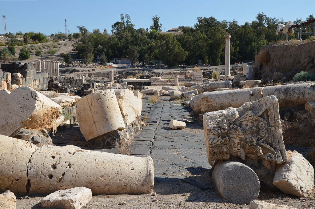
The large city was levelled by a massive earthquake in the 8th century AD and was in ruins until recent archaeological excavations uncovered eighteen layers of remains dating from the Late Neolithic period (4500 BC) through the 12th century AD. The ancient city ruins are now protected within Bet She’an National Park.
PORTFOLIO
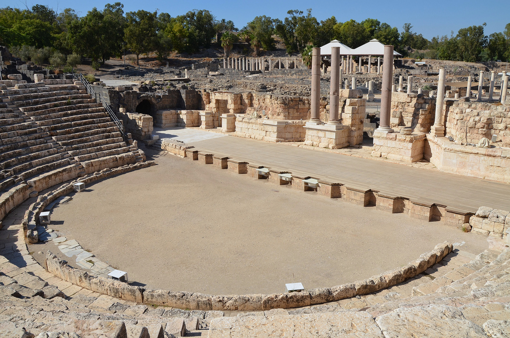
The Roman theatre was built during the Severan era on the remains of a 1st-century AD theatre. It could seat about 7,000 spectators. It is the best-preserved ancient theatre discovered in Israel.
The Roman theatre had eight arched entrances called vomitoria, which led to the seating area.
The reconstructed section of the scaenae frons. The 21-metre high stage building comprised a two-storey structure of white marble columns and two-storey lateral structures of red granite columns.
The Roman theatre was built during the Severan era on the remains of a 1st-century AD theatre. It could seat about 7,000 spectators.
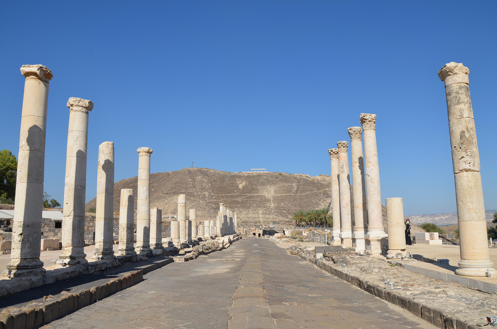
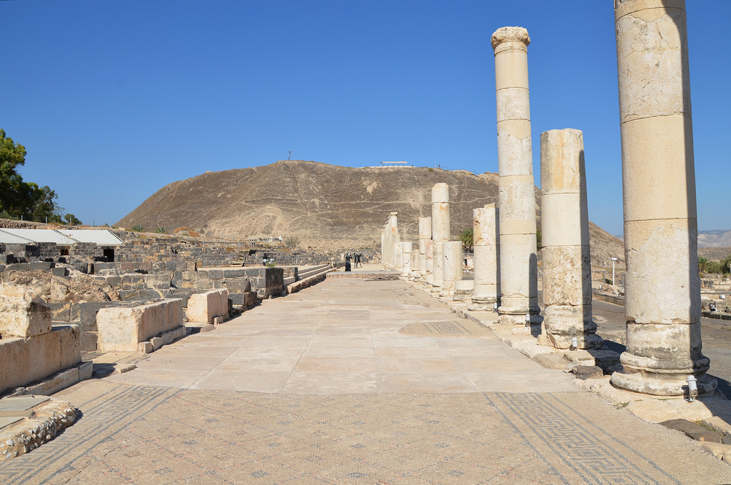
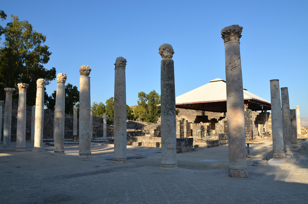
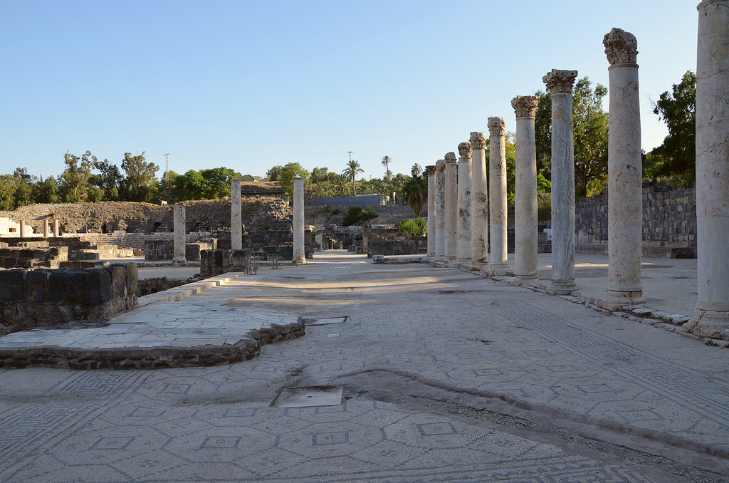
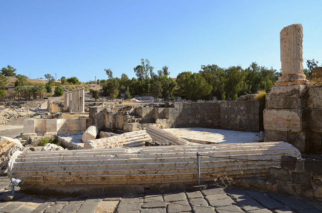
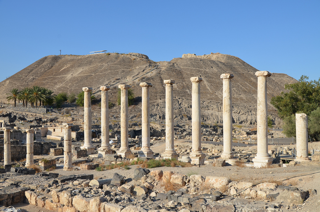
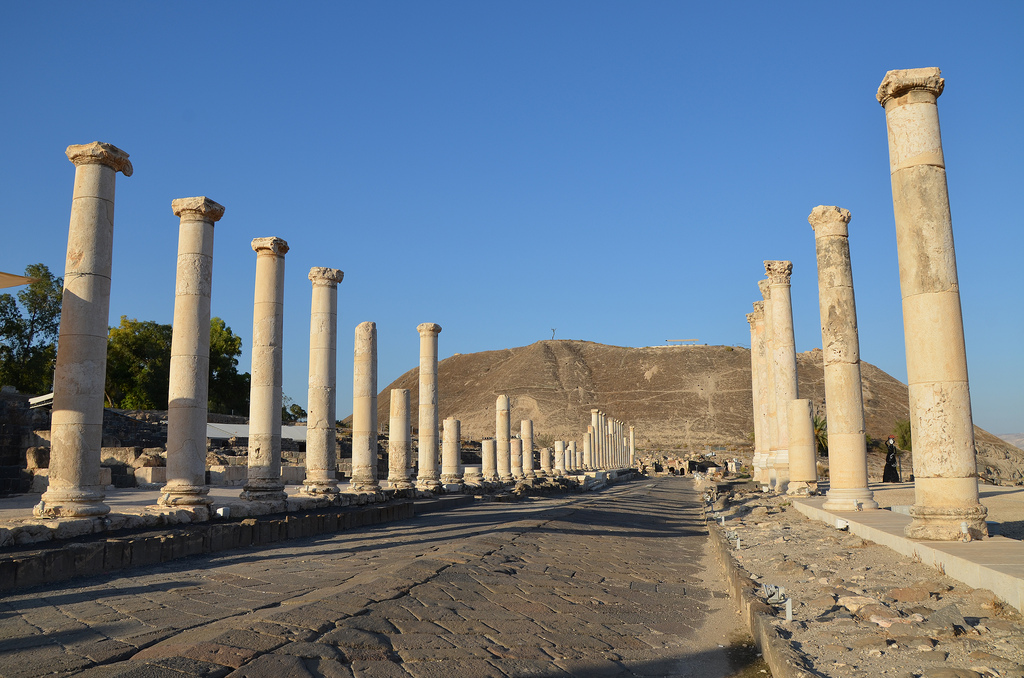
Palladius Street is a 150-metre collonaded street that crosses the city from the slopes of the Tel to the theatre. It was built during the Roman period and renovated at the beginning of the Byzantine period.
The collonaded portico along Palladius Street is paved with intricate mosaics and lined with marble-faced shops.
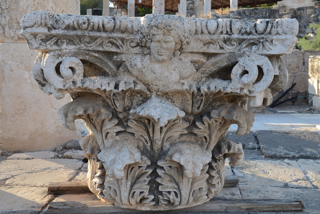
The Corinthian capital bears the head of Dionysus, the god of wine and the patron of the city. According to myth, the city was founded by Dionysus, who lived there. His wet nurse, Nysa, who breastfed him, was buried in the city, so it was named Nysa-Scythopolis.
Statue of Dionysus unearthed at Beit She’an/Scythopolis, 2nd century AD, Israel Museum.
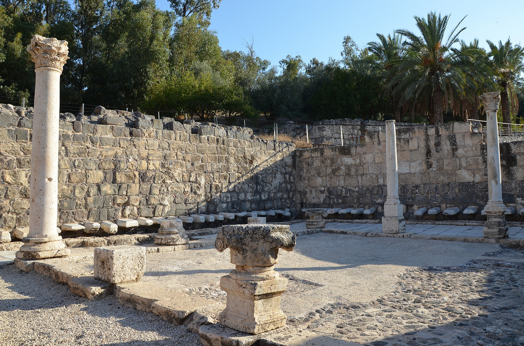
Exedra (semi-circular building) with twelve small rooms and a portico opening onto a courtyard built in the 6th century AD on the western side of Palladius Street.
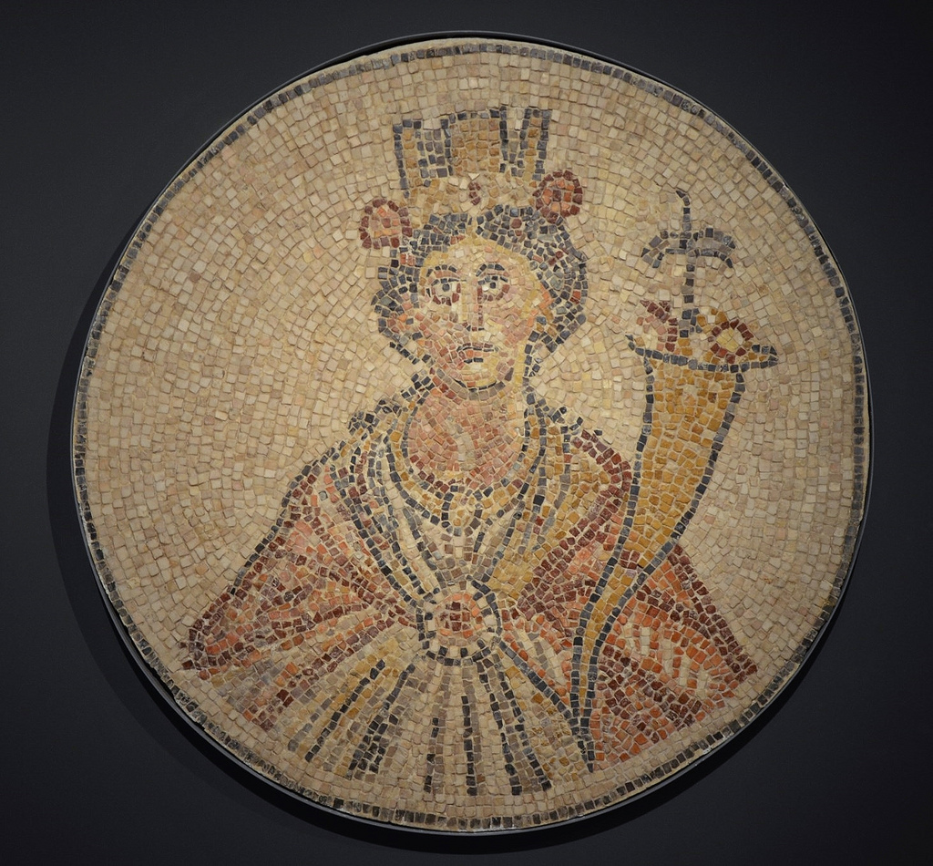
A mosaic with a representation of Tyche, goddess of fortune, is found in the semicircular exedra off Paladius Street at Scythopolis (Beit She’an). Israel Museum, Jerusalem.
Statue of Tyche holding the cornucopia, unearthed in Beit Sh’ean/Scythopolis, 3rd century AD, Israel Museum.
Exedra (semi-circular building) with twelve small rooms and a portico opening onto a courtyard built in the 6th century AD on the western side of Palladius Street.
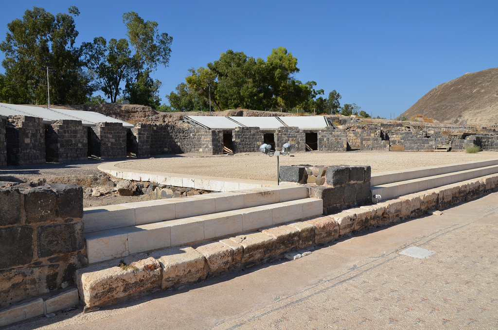
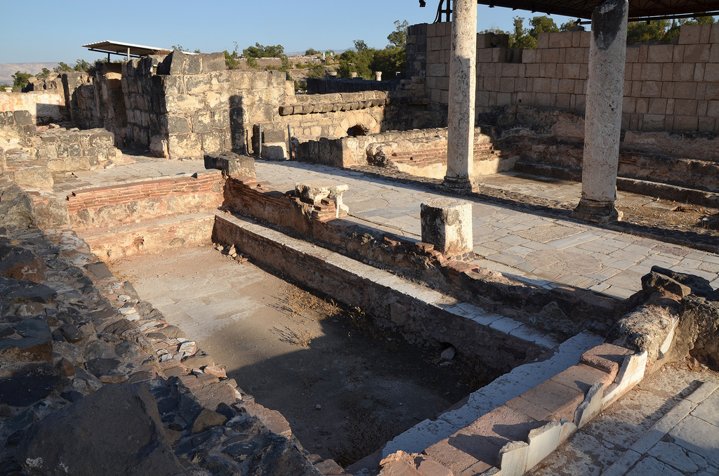
The entrance gateway leads to the Western Bathhouse.
The Western Bathhouse was built in the 4th century AD.
Remains of two pools in the Western Bathhouse, built in the 4th century AD.
The collonaded exercise yard of the Western Bathhouse had a mosaic pavement decorated with geometric patterns.
Scythopolis.
Silvanus Street runs north-south through the city.
The ruins of the Round Temple attest to the ferocity of the 749 AD earthquake. The Temple was perhaps erected for the worship of Dionysus or his wet nurse, Nysa.
The ruins of the Roman Nymphaeum were originally built in the 2nd century AD.
Overview of Silvanus Street.
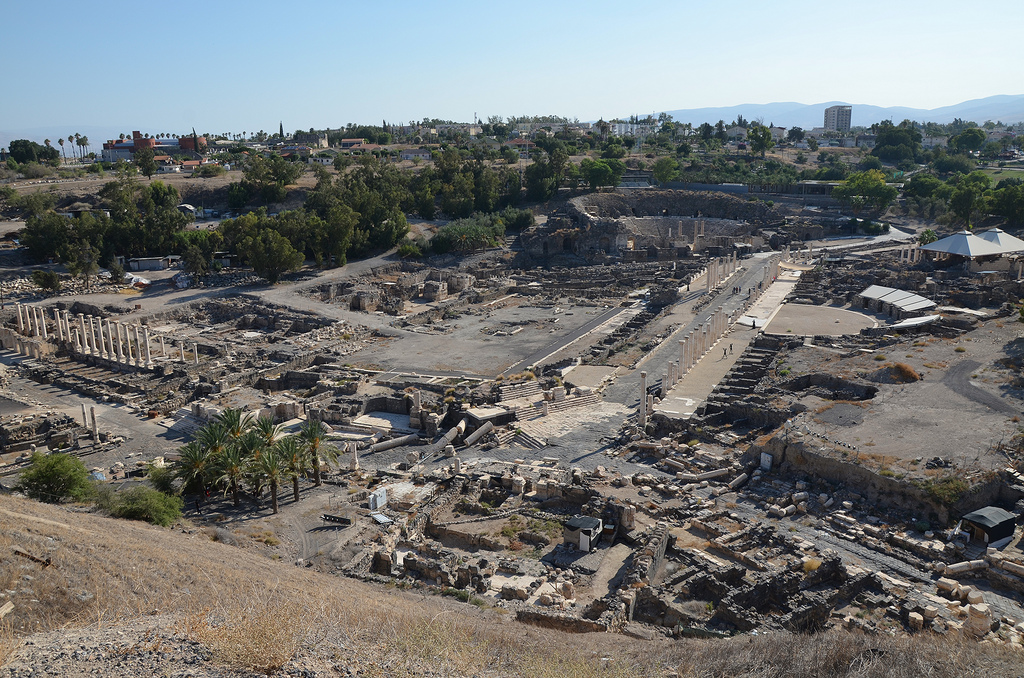
View on the Tel from the Agora.
The public latrines of the Northern Bathhouse have an open courtyard paved with a mosaic floor.
Overview of Scythopolis from the top of the Tell.
At the top of the hill are the ruins of an Egyptian governor’s house dating back to the 12th century BC. During the late Bronze Period and the early Iron Age, the city became a centre of the Egyptian imperial administration in northern Canaan.
The Egyptian governor’s house. Above the door of the house (lintel) was a stone tablet bearing the governor’s name and title: Ramses-User-Khepesh. The image depicts the governor kneeling before the name and attributes of Pharaoh Ramses III.
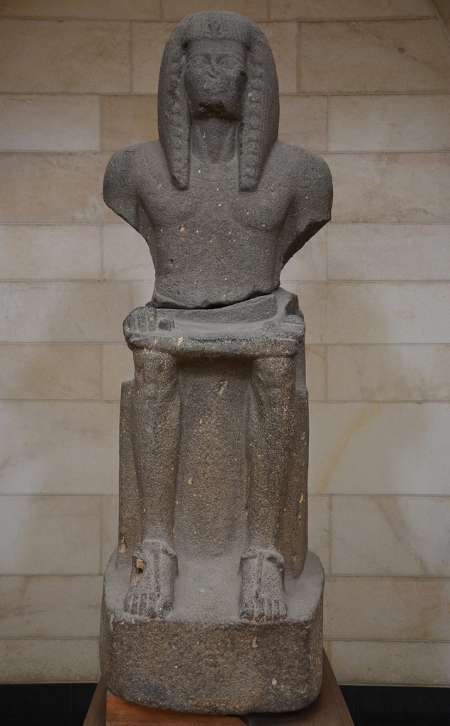
Basalt statue of Ramses III, depicting him seated on his throne, found at Beit She’an, 1184-1153 BC. Rockefeller Museum, Jerusalem.
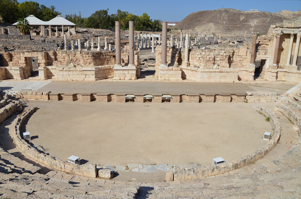
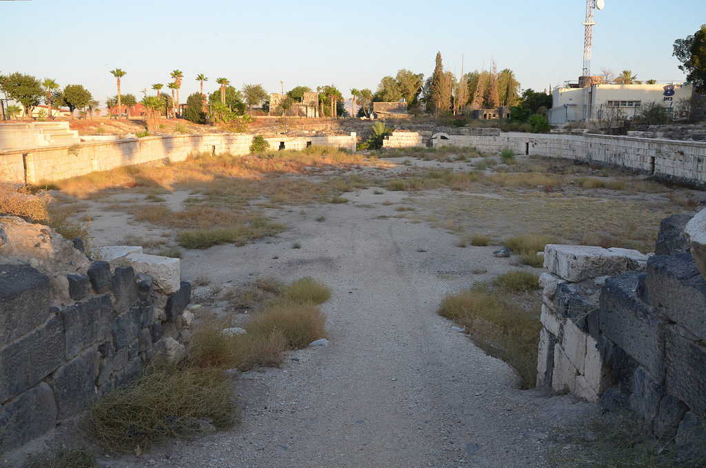
The Hippodrome was constructed in the 2nd century AD and used for horse and chariot races. It was later converted into an amphitheatre, which hosted gladiatorial combats. The amphitheatre ceased to function in the second half of the 4th century AD because the city’s Christians disapproved of its activities.
The Hippodrome/Amphitheatre, situated beyond the city limits, had ten or twelve rows accommodating 5,000-7,000 spectators.
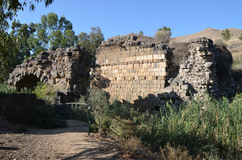
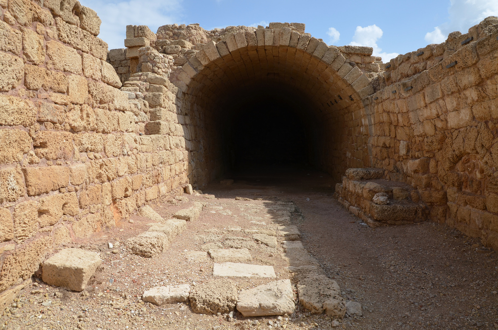
The ruins of the Roman bridge, a triple-arched bridge crossing the Nahal Harod.
 Scythopolis later expanded into a large