Pella lies at sea level in the eastern foothills of the north Jordan Valley, 27 kilometres (17 miles) south of the Sea of Galilee and 130 km (80 miles) northwest of Amman. The first settlers arrived in the region around Pella in the Neolithic period, and the site itself has been continuously occupied from around 8000 BC. Originally called Pihilum, a name derived from Semitic roots and mentioned in Egyptian execration texts from the 19th century BC, Pella was one of the ten cities in the Decapolis founded during the Hellenistic period. Its name was Hellenized to Pella, after the birthplace of Alexander the Great in Macedonia. The Romans settled in ancient Pella in the 1st century AD and developed it into a thriving economic centre. Pella is exceptionally rich in antiquities, and since 1979, the University of Sydney and the Jordanian Department of Antiquities have been conducting excavations in the area.
Pella has a rich history and is located at a significant crossroads of trade routes in the Jordan Valley. Over the past thirty-eight years, excavations have revealed many important discoveries, including a Chalcolithic settlement from the 4th millennium BC, the remains of Bronze and Iron Age temples (such as a Canaanite temple) and administrative buildings, an odeon, baths, and a nymphaeum from the Roman Imperial city. Additionally, Byzantine churches and residential structures, an Early Islamic residential quarter, and a small medieval mosque have also been uncovered.
In 63 BC, the Roman General Pompey captured the city, which was integrated into the Eastern portion of the Empire. Pella became one of the Decapolis cities that would become centres of Greek and Roman culture in a region inhabited by ancient Semitic-speaking peoples (Nabataeans, Arameans, and Judeans). During the 1st century AD, the Romans began constructing temples, theatres, colonnaded streets, and integrating civic architecture and city planning into the existing Greek city layout. According to Eusebius in “History of the Church” (3:5), Jewish Christians from Jerusalem sought refuge in Pella during the First Jewish Revolt against Rome (AD 66-70). Additionally, Pliny the Elder mentions Pella’s famous spring in his work “Natural History” (HN 5.16.70).
Pella reached its peak during the Byzantine era when trade routes strengthened and local industries flourished. Many monasteries were built during this time, and the city had its own Christian bishop as early as AD 451. At its height, the population may have been as large as 25,000. The city was also the site of the Battle of Fahl in AD 635, where Byzantine troops faced invading Muslim forces. Unfortunately, much of the city was destroyed by the devastating Galilee earthquake in 749.
Today, Pella is one of the most important archaeological sites in Jordan.
PORTFOLIO
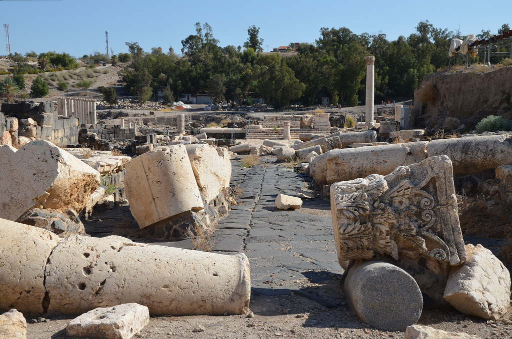
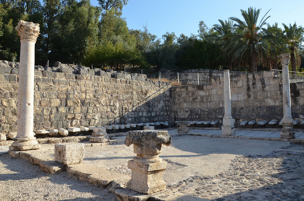
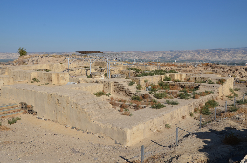
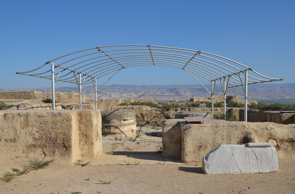
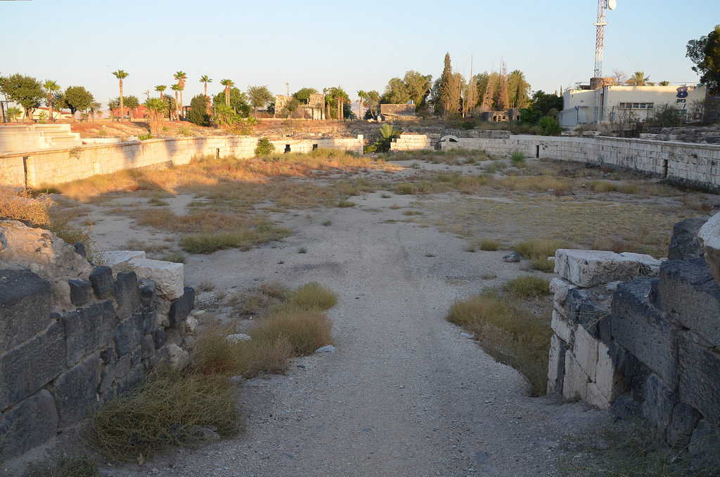
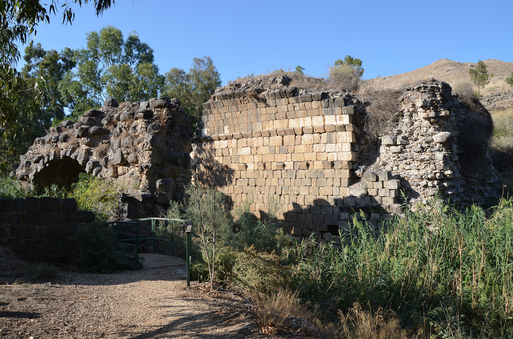
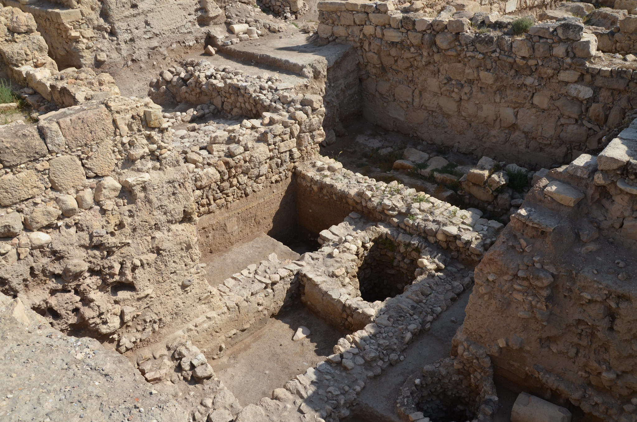
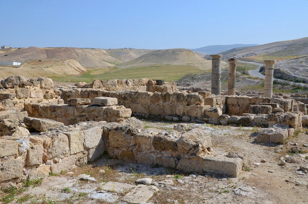
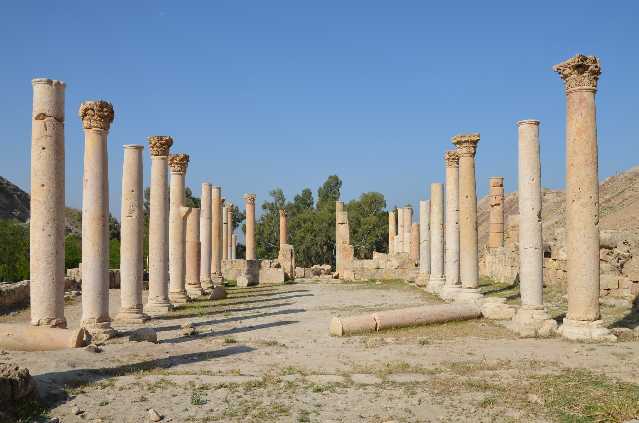
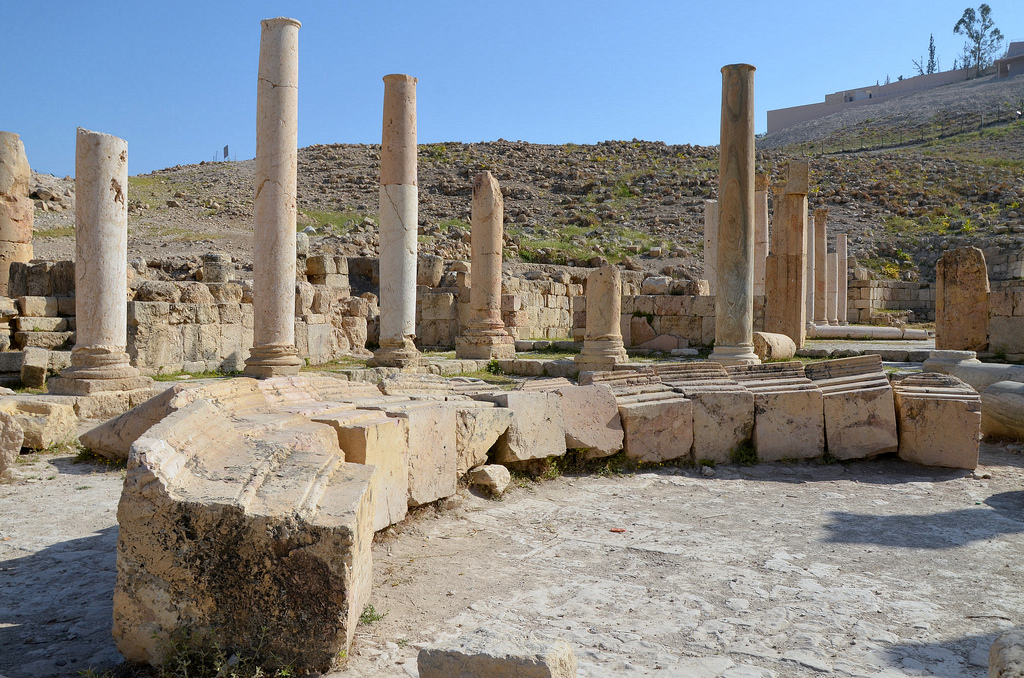
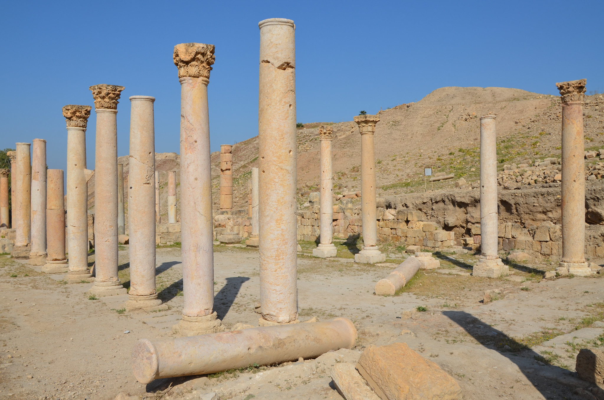
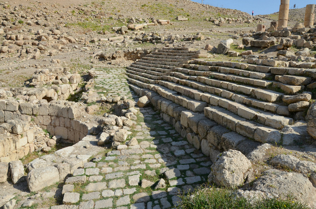
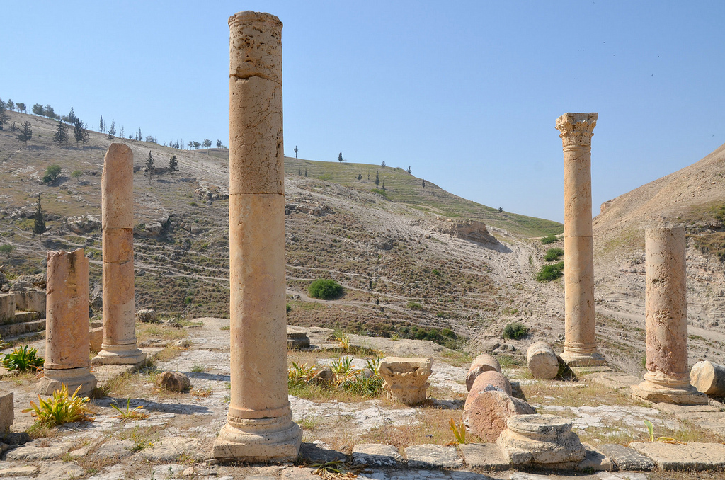
Foundations of the Canaanite Migdol Temple, originally constructed around 1650 BC during the Middle Bronze age with two major rebuilds; the first in 1350 BC during the Late Bronze age and the second in 900 BC.The Canaanite temple was dedicated to the god Baal. Excavation of this structure has shown that this temple is the largest of its type and antiquity yet uncovered in the Levant.Atop the site’s main hill are the ruins of a Umayyad settlement (c. AD 660-750), which consisted of shops, residences and storehouses.The remains of the Umayyad settlement (c. 660-750 AD).The remains of the Umayyad settlement (c. 660-750 AD).The Middle Church was built atop an earlier Roman civic complex in the 5th century AD and expanded in the 6th and 7th centuries.The columns of the Middle Church, which formed the atrium, have been restored to their standing position. The church had three apses, decorated with mosaics and marble.The Middle Church.The Middle Church.In the 7th or 8th century, a monumental staircase was built west of the Middle Church, using the stone seats of the nearby Odeon.The adjacent Odeon, a small theatre used for musical performances, once held 400 spectators.The Odeon with the Middle Church in the background.The East Church was built at the end of the 5th century AD on the lower slope of Tal Abu El Khas overlooking the valley.The East Church had a basilica design with two rows of columns and three apses.The West Church, built in the 6th century AD and used during the Islamic (Umayyad) period.Abbasid domestic houses.An ancient mosque built commemorates the death of one of the Companions of the Prophet Mohammed, who fell in battle here during the Battle of Fahl in January AD 635.
Beit She’an, also known as Scythopolis or Nysa, is one of the oldest cities in Israel. Nestled in the Galilee region, it sits at the convergence of the Harod Valley and the Jordan Valley, a mere 27 kilometres south of the Sea of Galilee and 5 kilometres east of the Jordan River. This unique location has played a pivotal role in the city’s history, making it a fascinating archaeological site with a rich past.
Beit Sh’ean, located at an important crossroads, was first settled in the 5th millennium BC. Its location south of the Harod Stream, in a region with fertile land and abundant water, made it a desirable place to live. During the Late Bronze Age, Beit She’an became the centre of Egyptian rule over Canaan. A basalt tablet dating back to 1290-1279 BC mentions Beit She’an. Later, a Canaanite city was built on top of the Egyptian centre, which was then occupied by the Israelites and the Philistines during the Old Testament period. The Bible mentions Beit She’an several times, and it is most famous for being the place where King Saul and his sons were hanged from the city walls.
Scythopolis later expanded into a large Hellenistic, Roman, and Byzantine town. The city’s name comes from Greek Mythology, which tells us that Dionysos, the god of wine, buried his nurse, Nysa, in the town where he settled with his Scythian personal guards. Scythopolis became the largest city in the Decapolis, a regional alliance. It peaked after the Bar Kochba Revolt under Antoninus Pius (AD 138-161) and Marcus Aurelius (AD 161-180). Many temples, bathhouses, a theatre, an amphitheatre, and other monumental buildings were constructed during this time. Scythopolis continued to prosper from the 4th to the 7th century, but the pagan structures were converted to other uses since the majority of the population was Christian.
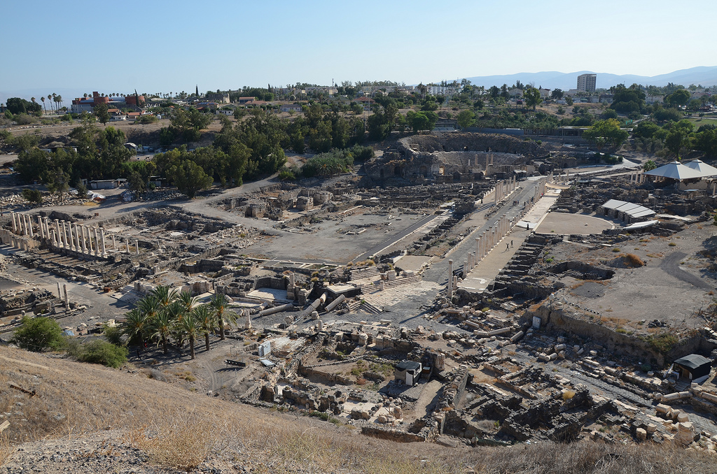
The large city was levelled by a massive earthquake in the 8th century AD and was in ruins until recent archaeological excavations uncovered eighteen layers of remains dating from the Late Neolithic period (4500 BC) through the 12th century AD. The ancient city ruins are now protected within Bet She’an National Park.
PORTFOLIO
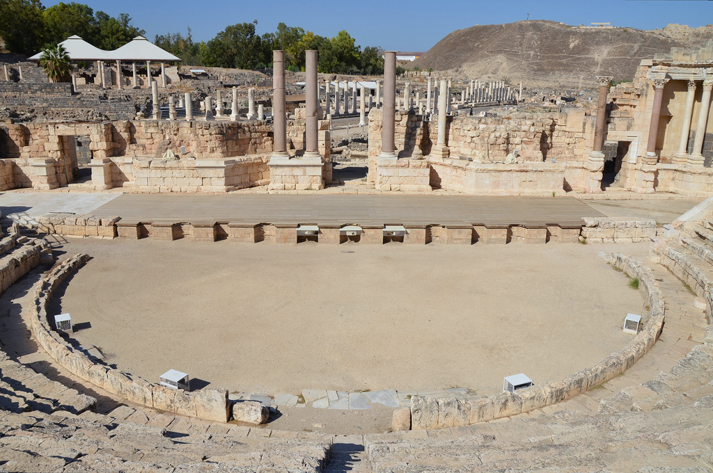
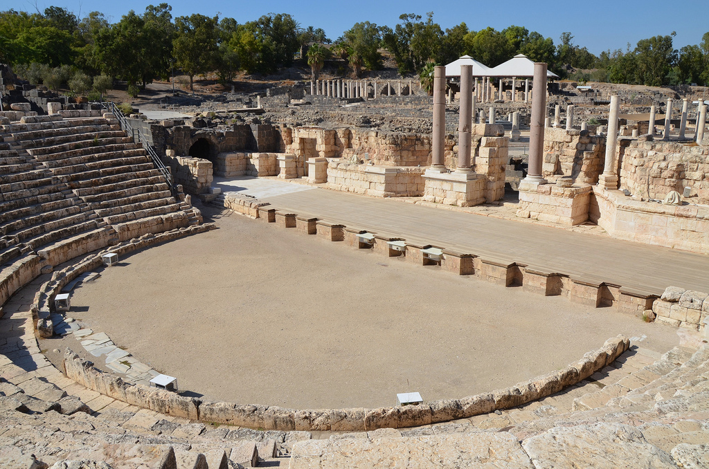
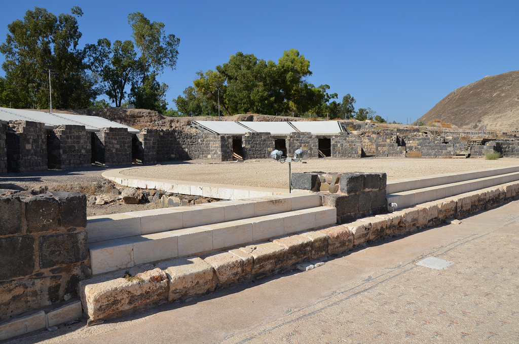
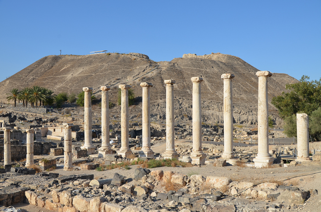
The Roman theatre was built during the Severan era on the remains of a 1st-century AD theatre. It could seat about 7,000 spectators. It is the best-preserved ancient theatre discovered in Israel.
The Roman theatre had eight arched entrances called vomitoria, which led to the seating area.
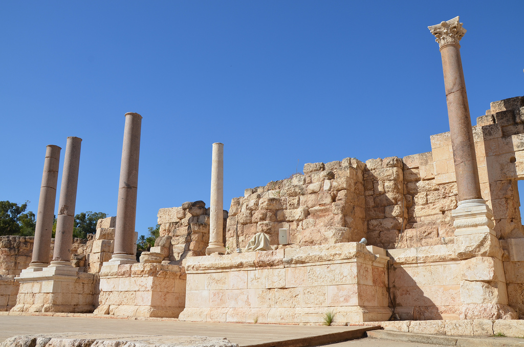
The reconstructed section of the scaenae frons. The 21-metre high stage building comprised a two-storey structure of white marble columns and two-storey lateral structures of red granite columns.
The Roman theatre was built during the Severan era on the remains of a 1st-century AD theatre. It could seat about 7,000 spectators.
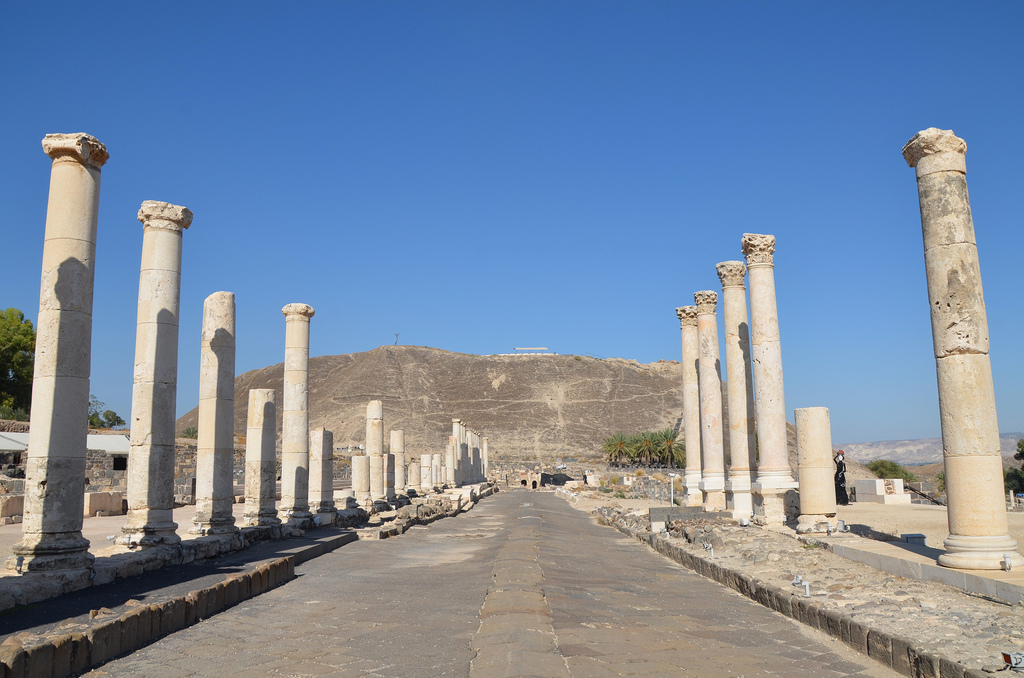
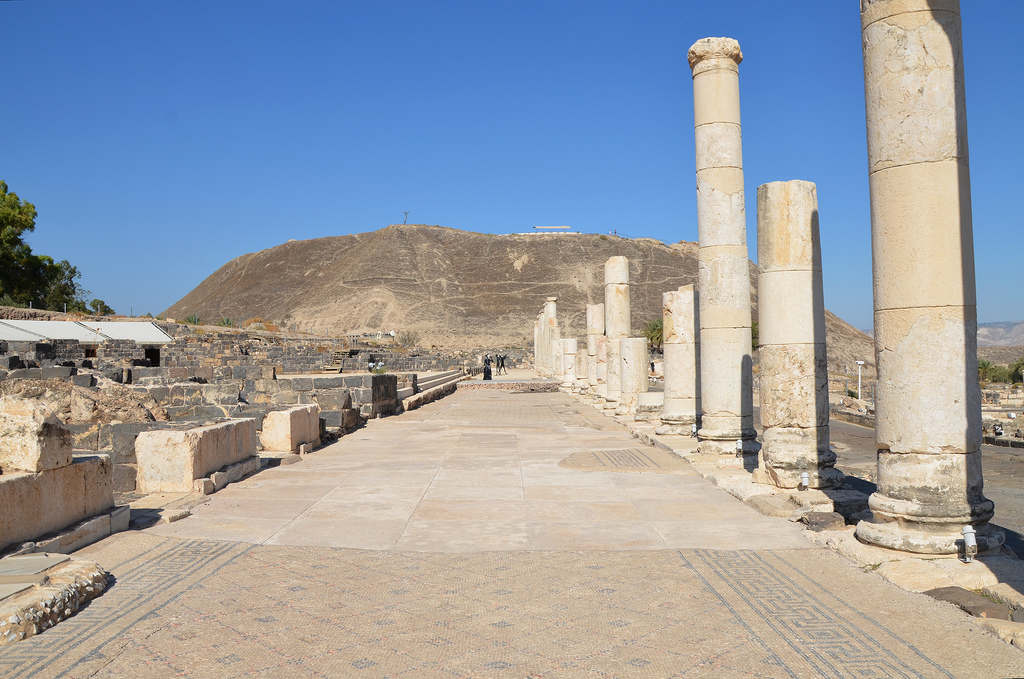
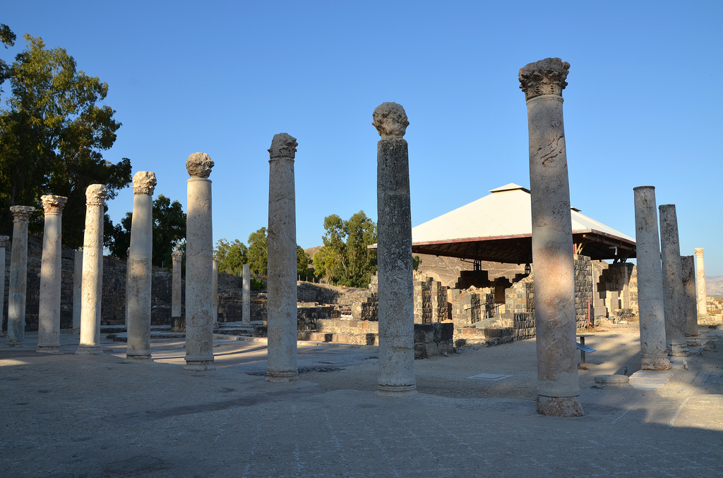
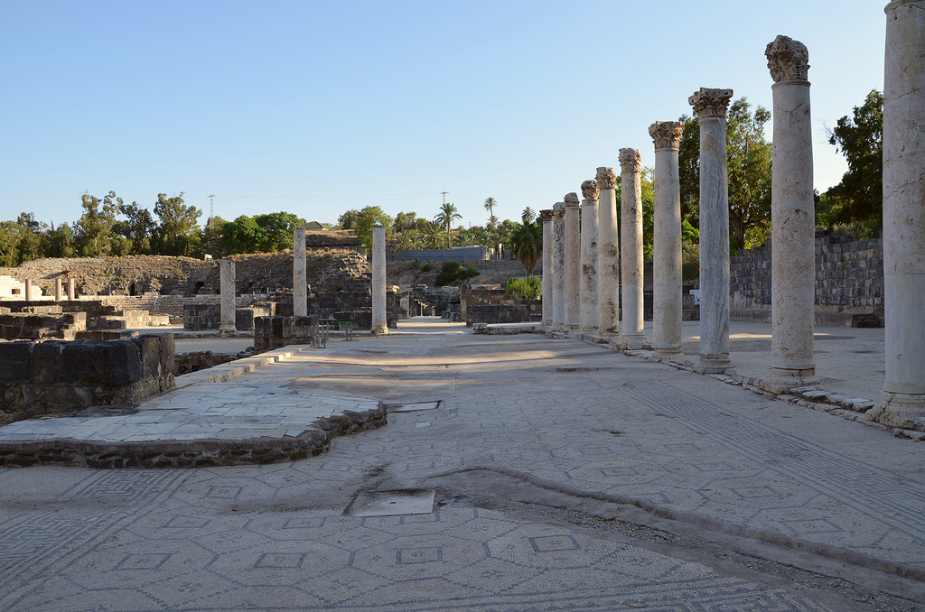
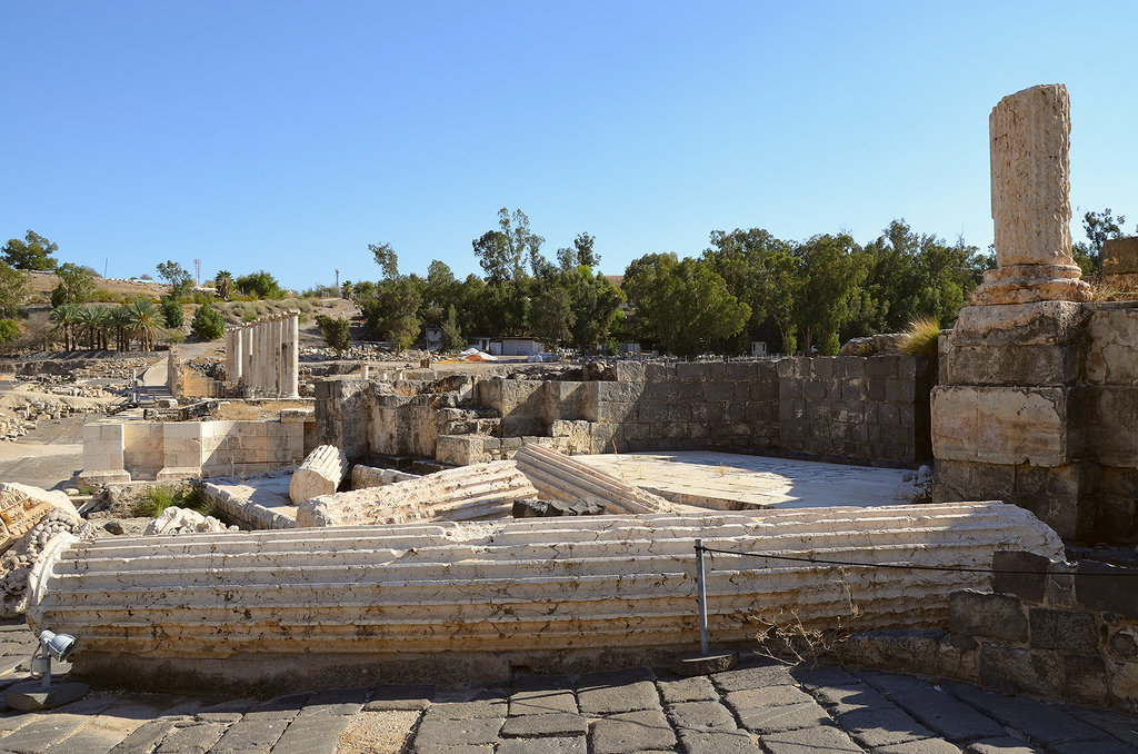
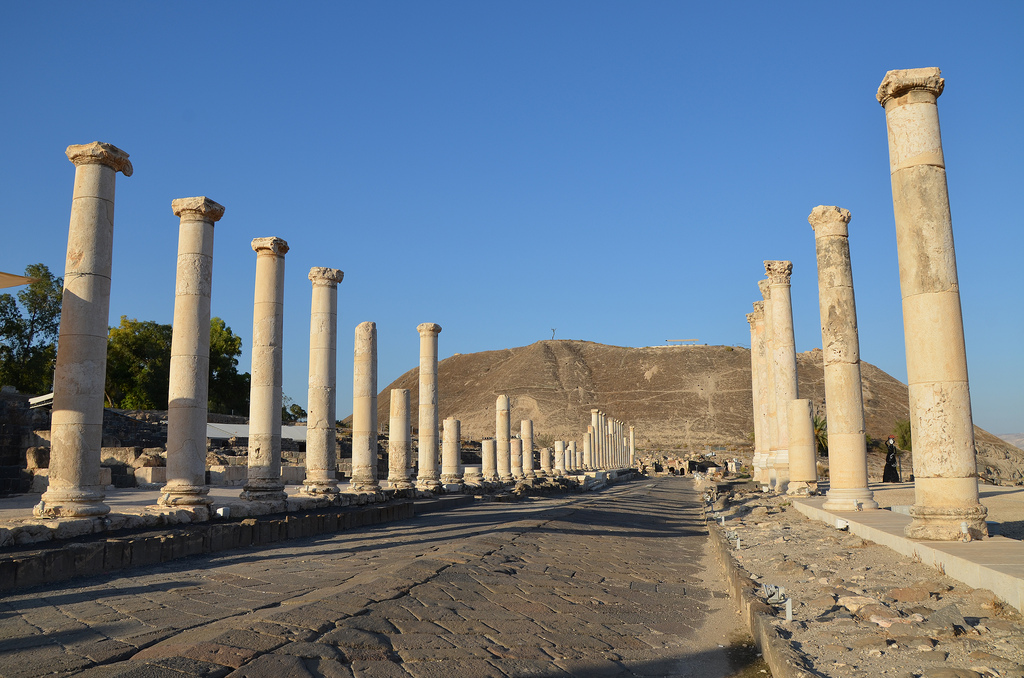
Palladius Street is a 150-metre collonaded street that crosses the city from the slopes of the Tel to the theatre. It was built during the Roman period and renovated at the beginning of the Byzantine period.
The collonaded portico along Palladius Street is paved with intricate mosaics and lined with marble-faced shops.
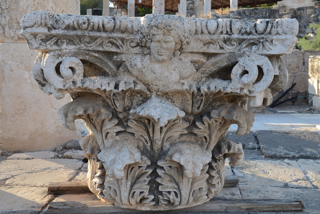
The Corinthian capital bears the head of Dionysus, the god of wine and the patron of the city. According to myth, the city was founded by Dionysus, who lived there. His wet nurse, Nysa, who breastfed him, was buried in the city, so it was named Nysa-Scythopolis.
Statue of Dionysus unearthed at Beit She’an/Scythopolis, 2nd century AD, Israel Museum.
Exedra (semi-circular building) with twelve small rooms and a portico opening onto a courtyard built in the 6th century AD on the western side of Palladius Street.
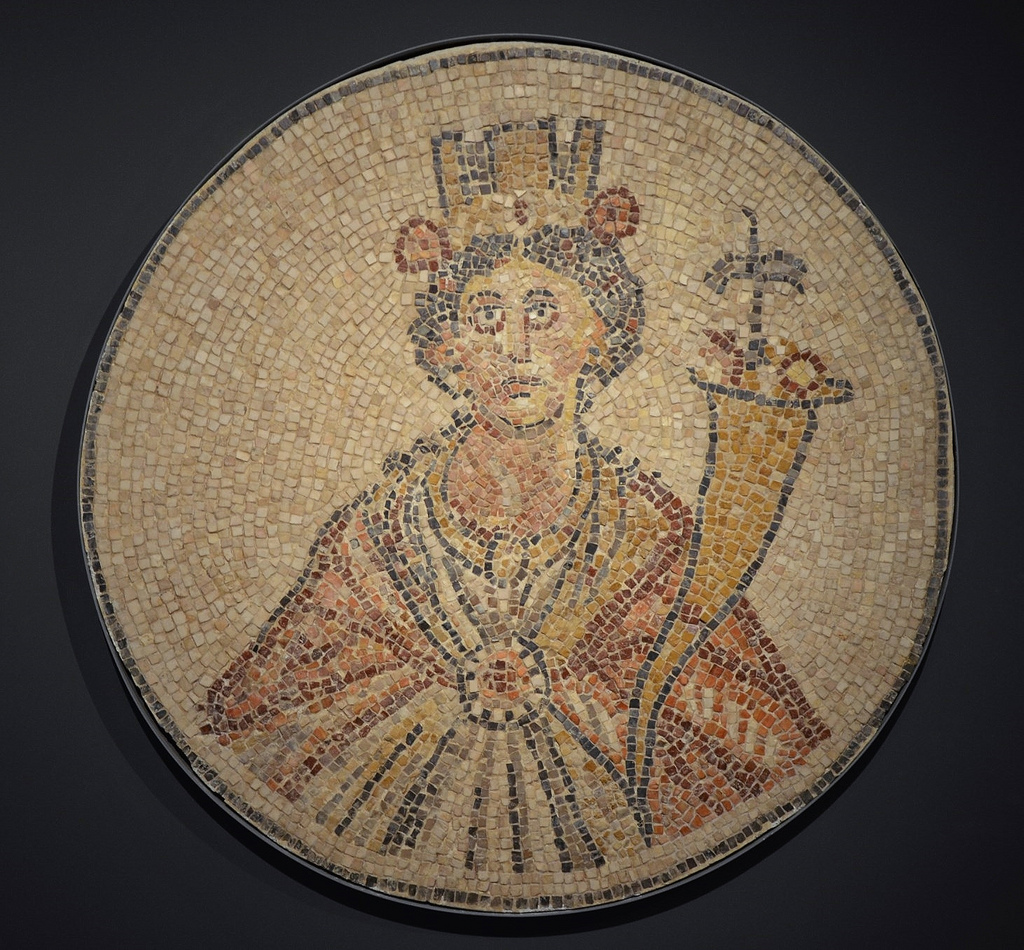
A mosaic with a representation of Tyche, goddess of fortune, is found in the semicircular exedra off Paladius Street at Scythopolis (Beit She’an). Israel Museum, Jerusalem.
Statue of Tyche holding the cornucopia, unearthed in Beit Sh’ean/Scythopolis, 3rd century AD, Israel Museum.
Exedra (semi-circular building) with twelve small rooms and a portico opening onto a courtyard built in the 6th century AD on the western side of Palladius Street.
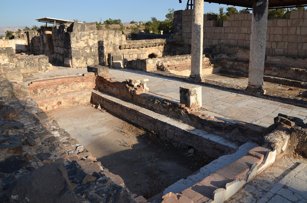
The entrance gateway leads to the Western Bathhouse.
The Western Bathhouse was built in the 4th century AD.
Remains of two pools in the Western Bathhouse, built in the 4th century AD.
The collonaded exercise yard of the Western Bathhouse had a mosaic pavement decorated with geometric patterns.
Scythopolis.
Silvanus Street runs north-south through the city.
The ruins of the Round Temple attest to the ferocity of the 749 AD earthquake. The Temple was perhaps erected for the worship of Dionysus or his wet nurse, Nysa.
The ruins of the Roman Nymphaeum were originally built in the 2nd century AD.
Overview of Silvanus Street.
View on the Tel from the Agora.
The public latrines of the Northern Bathhouse have an open courtyard paved with a mosaic floor.
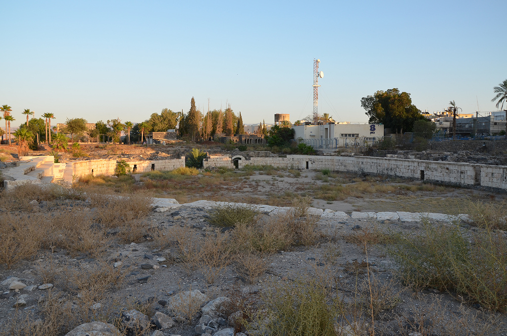
Overview of Scythopolis from the top of the Tell.
At the top of the hill are the ruins of an Egyptian governor’s house dating back to the 12th century BC. During the late Bronze Period and the early Iron Age, the city became a centre of the Egyptian imperial administration in northern Canaan.
The Egyptian governor’s house. Above the door of the house (lintel) was a stone tablet bearing the governor’s name and title: Ramses-User-Khepesh. The image depicts the governor kneeling before the name and attributes of Pharaoh Ramses III.
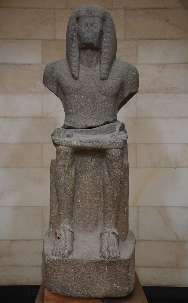
Basalt statue of Ramses III, depicting him seated on his throne, found at Beit She’an, 1184-1153 BC. Rockefeller Museum, Jerusalem.
The Hippodrome was constructed in the 2nd century AD and used for horse and chariot races. It was later converted into an amphitheatre, which hosted gladiatorial combats. The amphitheatre ceased to function in the second half of the 4th century AD because the city’s Christians disapproved of its activities.
The Hippodrome/Amphitheatre, situated beyond the city limits, had ten or twelve rows accommodating 5,000-7,000 spectators.
The ruins of the Roman bridge, a triple-arched bridge crossing the Nahal Harod.


 Scythopolis later expanded into a large