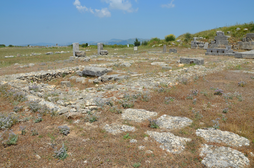
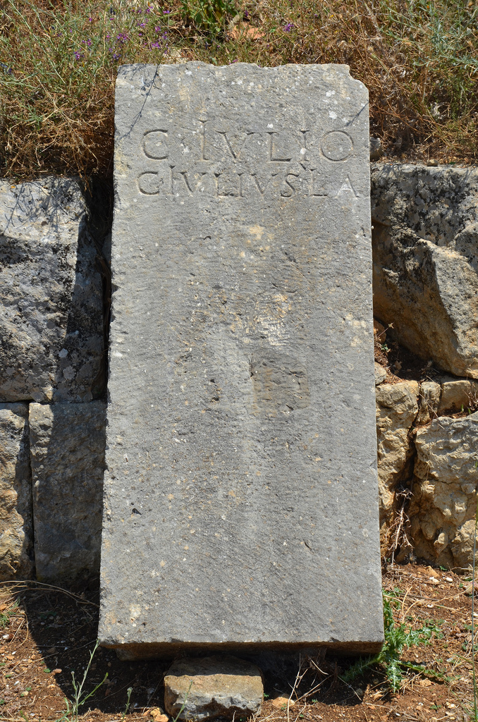
Sala Colonia is an ancient city situated on the outskirts of Rabat, the present-day capital of Morocco. The site contains the ruins of an ancient port city referred to as Sala by the renowned Greek geographer Ptolemy. Built on a trading post used by the Phoenicians, Sala sits on a hill above the fertile plain of the Bou Regreg river, which flows into the Atlantic Ocean. The first excavations undertaken on the site (1929-1930) unearthed the remains of several buildings from the time of Trajan (AD 98-117), including a forum, a monumental fountain, a capitol, a triumphal arch as well as the decumanus maximus (the main east-west-oriented street). Its Roman remains were later incorporated into a medieval necropolis called Chellah.
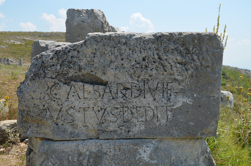
Phoenician traders were the first to settle on the northern Moroccan coast as early as the 8th century BC. They founded several colonies, including the settlement they called Sala on the banks of the Bou Regreg River. Under the Punic influence, Sala became a city-state with diverse commercial relations with the Iberian peninsula and the Mediterranean and issued its own currency. The Phoenicians were later followed by the Carthaginians from the 3rd century BC onwards. The Romans took control of the area in about AD 40 during the reign of Emperor Claudius, and Sala became part of the province of Mauretania Tingitana. It was the most southwestern outpost of the Roman Empire in Africa. The Romans brought Sala to the status of an important port and thriving economic hub. The city witnessed an important urban development, as evidenced by the layout of the Forum, the capitolium and the curia, the octagonal Nymphaeum, the triumphal arch and the thermal baths. An inscription confirms the city’s status as a Roman municipium, enclosed by a wall in AD 144.
In about AD 250, the Romans lost control of the site to native Berber tribesmen, but Sala remained a trading centre and was still linked to the Roman Empire. Archaeological objects of Visigothic and Byzantine origin found in the area attest to the continuing commercial relations between Sala and Roman Europe.
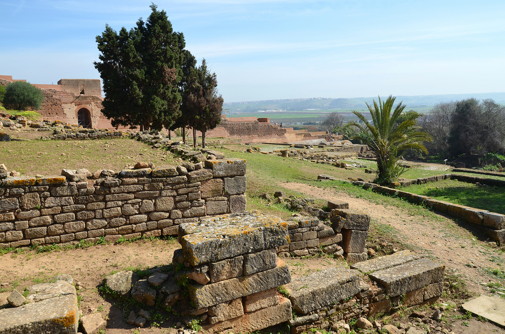
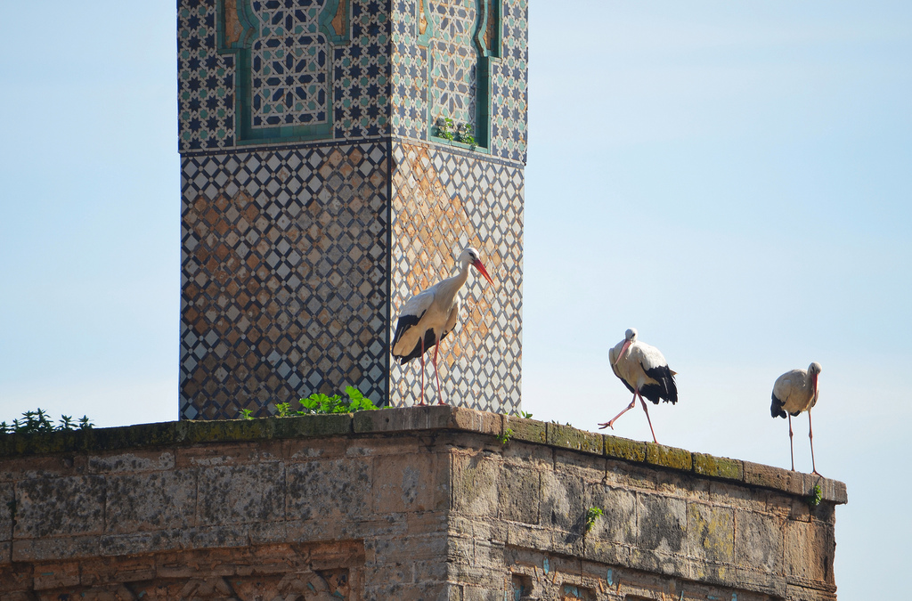
What remained of the ancient city was abandoned in 1154 in favour of nearby Salé. The site of Sala lay deserted until the 14th century when the Merinids built a holy necropolis (or chellah), a mosque and a minaret on top of the Roman site, enclosed by a wall which still marks its boundaries today. If you visit Chellah in winter or spring, you will get additional wildlife as a large colony of storks inhabits the ruins. As part of the metropolitan Rabat, the site was granted World Heritage Status in 2012.
PORTFOLIO
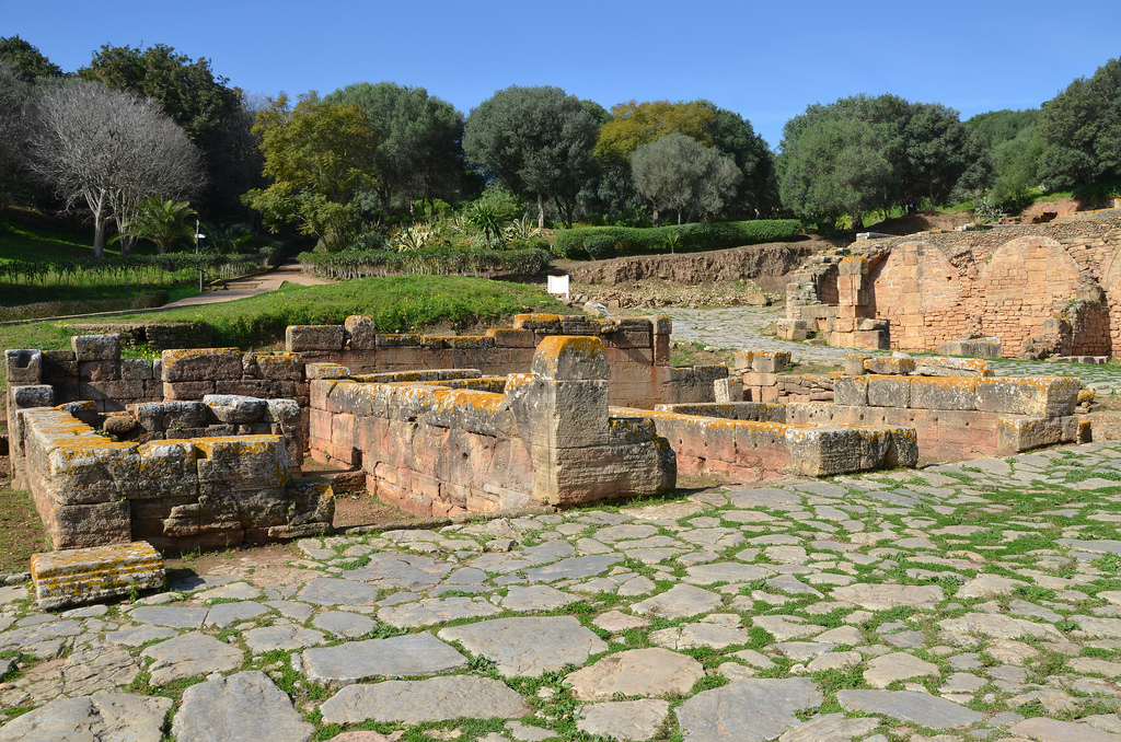
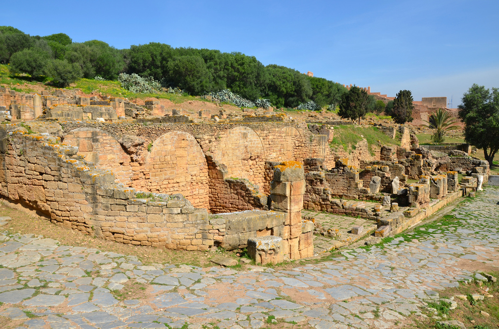
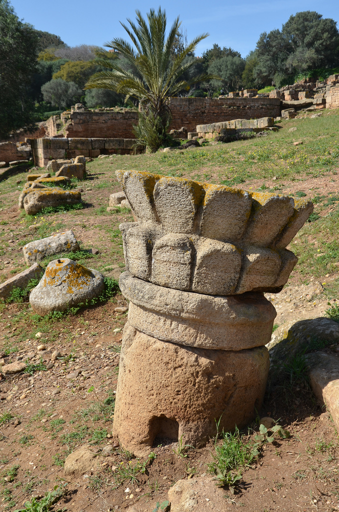
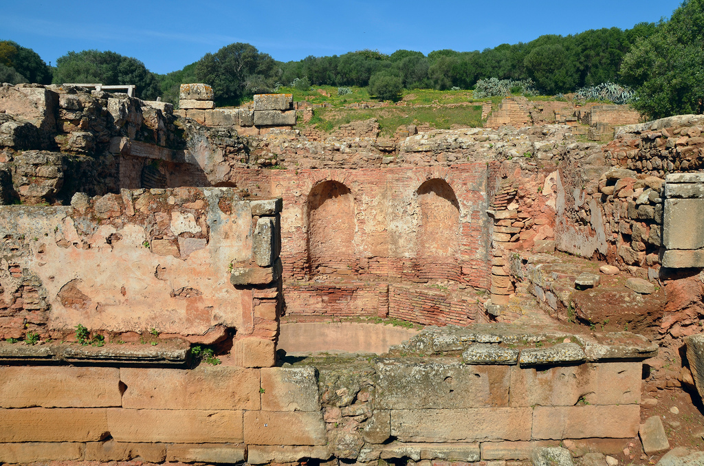
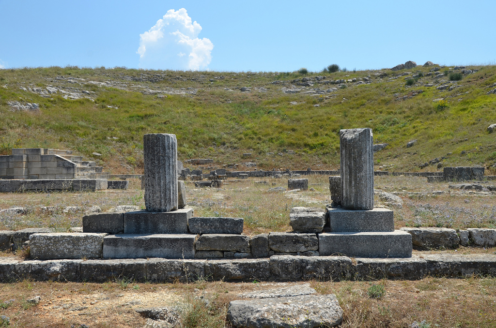
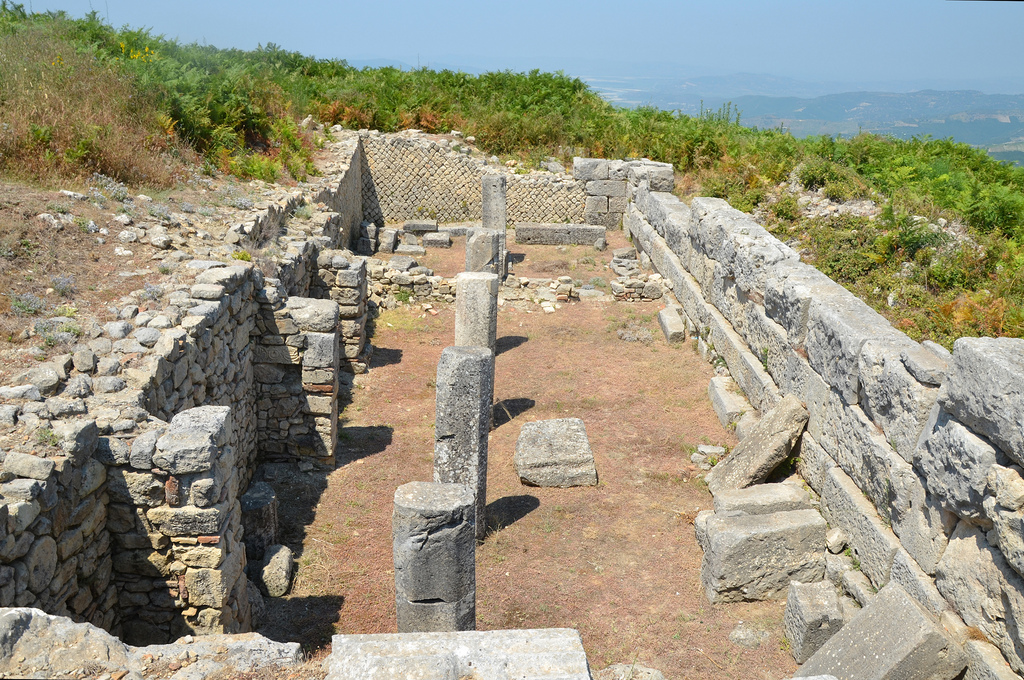
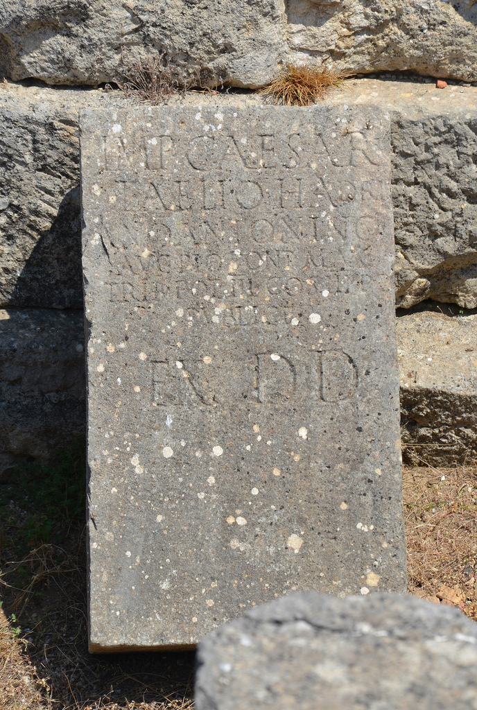
The foundations of the three-bay triumphal arch stood south of the capitolium and faced the Forum. It was built during the reign of Antoninus Pius (AD 138-161).The foundations of the triumphal arch.The Capitolium, the official temple of the Capitoline Triad: Jupiter, Juno and Minerva. It was built in opus africanum on two terraces.Claudius Hosidius Severus, the prefect of a Syrian cavalry squadron of Roman citizens, paid for the Capitolium of Sala. The main building phase of this complex is dated between the end of the 1st century AD to the beginning of the 2nd century AD. It was probably inaugurated at the beginning of Hadrian’s reign in AD 120.The Capitolium was subdivided into several spaces, including a peribolos (a court enclosed by a wall), a covered Corinthian portico, a paved courtyard of blue limestone, an altar, three adjoining rooms preceded by a pronaos with a staircase and a room reserved for the treasury temple.The Capitolium was supported by nine vaulted chambers (tabernae?) opening on the decumanus maximus.The decumanus maximus is bordered on its eastern end by the Forum.View of the Forum with bases of honorary inscriptions dedicated to the emperors and the great magistrates of the city.The lower level of the Forum with six shops, served by a secondary road.The Forum was a trapezoidal structure paved with large blue limestone slabs. This public square was closed by two monumental gates whose foundations remain. It was built during the reign of Trajan.Pseudo-lotus capital outside the Forum.Roman mosaic in one of the workshops in the artisan quarter.An apotropaic phallus is a symbol to avert the evil eye inside a workshop.The ruins of the Curia Ulpia adjoin the basilica. The epithet Ulpia recalls the solicitude of Emperor Trajan, who undoubtedly granted financial aid to the local senate to erect the building.
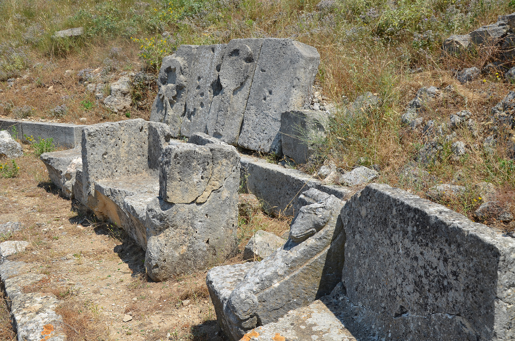
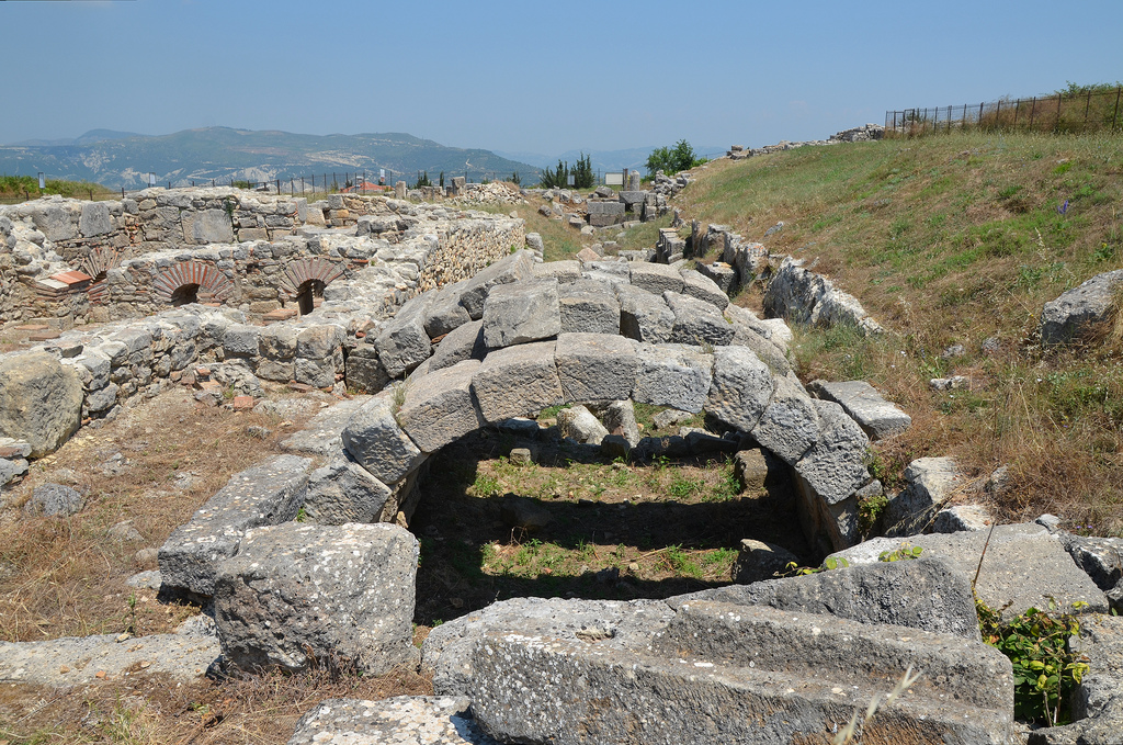
The public baths of Sala are located at the intersection of the decumanus maximus and the cardo maximus.The octagonal Nymphaeum. It formed a water tower and was supplied by an aqueduct.
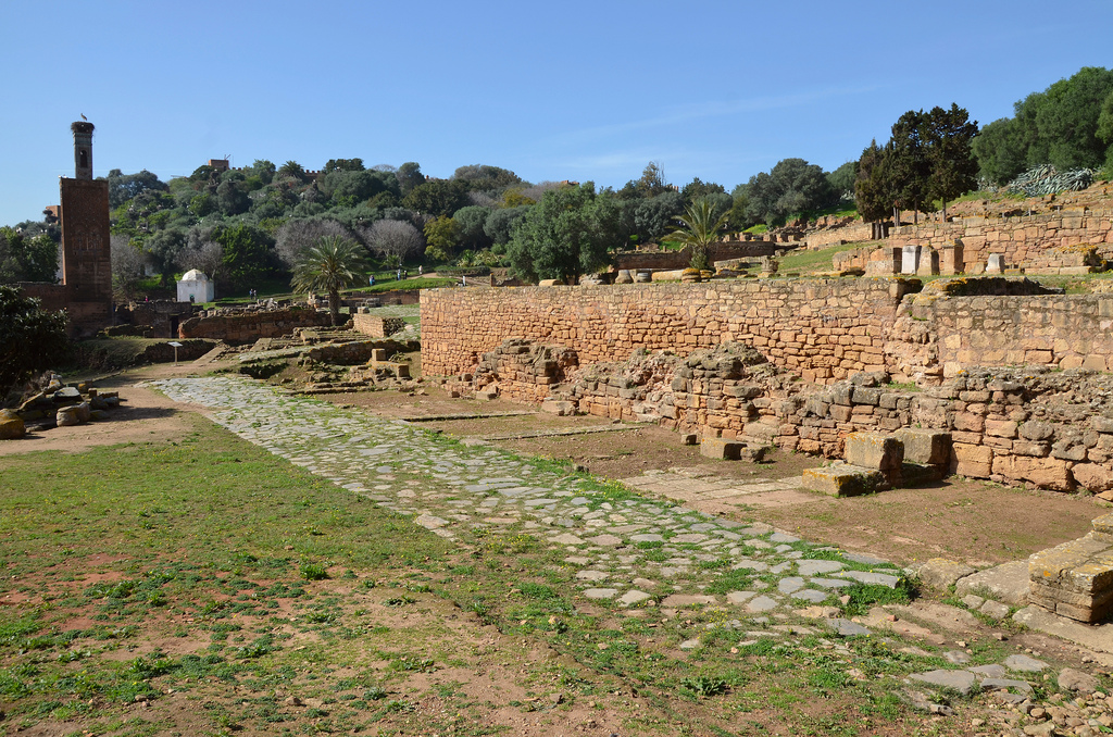
Roman ruins of Sala with 13th-century minaret.Storks nesting on the 13th-century minaret built of stone and zellige tilework.
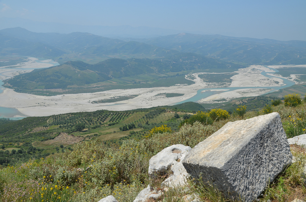
Byllis is a vast archaeological site overlooking the River Vjosa in southern Albania in the Fier County. With its fascinating ruins amid stunning views over the Vjosa valley, the ancient city of Byllis, mentioned by Caesar and Cicero, is one of the numerous hidden treasures of Albania. Founded by the Illyrians in the middle of the 4th century BC, Byllis was the largest city of Southern Illyria and the capital of the League (koinon) of the Bylliones. The remains include an impressive theatre, several Byzantine basilicas paved with outstanding mosaics, Illyrian private houses and Roman public buildings.
The Illyrian settlement of Byllis occupied a dominant position on the summit of a hill 520 meters above sea level, over the road from Apollonia to Epirus and into Macedonia. It became the headquarters of the league of the Bylliones, a Hellenized Illyrian tribe first mentioned around 380 BC by the Greek geographer Pseudo-Scylax. The Bylliones had a sophisticated system of
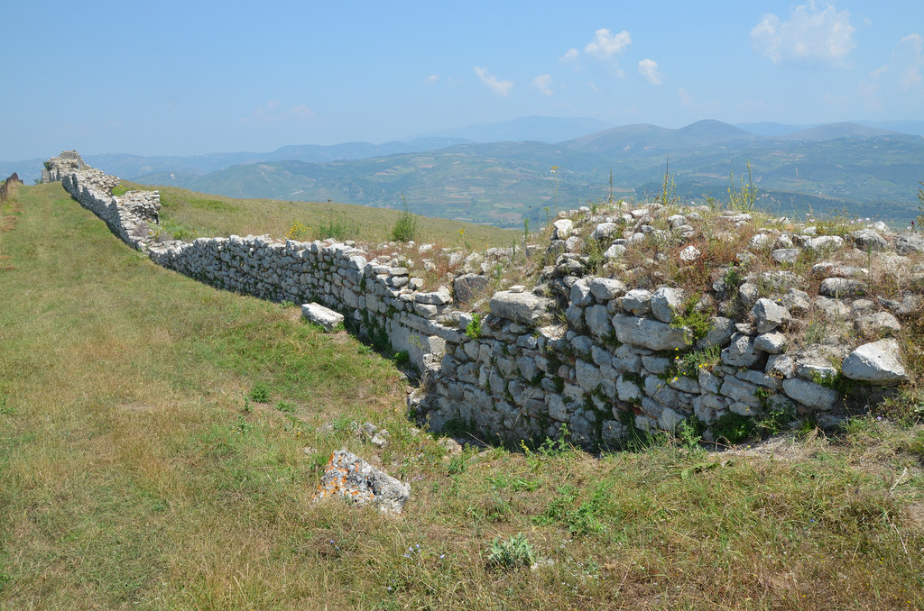
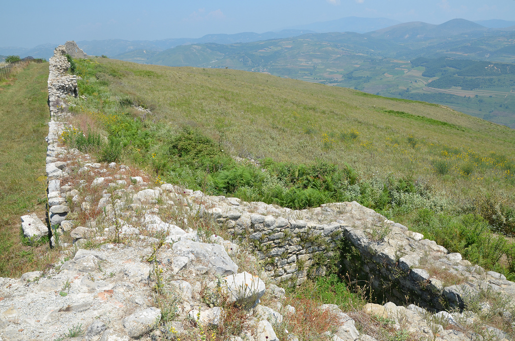
government, minted their own bronze coins (from around 270 BC to 167 BC when the Romans dissolved the koinon) and controlled an area of about 20km². They fortified their capital with a circuit wall around 2 km long, 3.50m thick and 8m to 9m high. Byllis adopted a fully Hellenised regular street plan and buildings, including a theatre, stoas, stadium, gymnasium and temples.
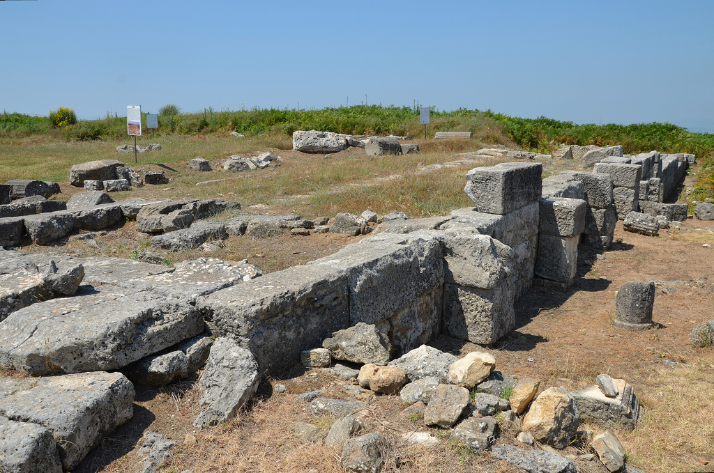
The state of the Bylliones flourished until 229 BC when the Romans landed in Apollonia, and their territory became a field of battle between the Roman and Macedonian armies for the control of Apollonia. In 49-48 BC, during Caesar’s Civil War, Byllis surrendered to Julius Caesar and became a supply base for his army. The city was later turned into a Roman colony, as shown by several Latin inscriptions that referred to the city as Colonia Iulia Augusta, which became part of the province of Epirus Nova. The city walls were rebuilt, the theatre and stoas were reconstructed, and other monuments were erected.
Byllis was attacked and sacked by the Visigoths towards the end of the 4th century AD, but the city was reconstructed under Theodosius II (408-450 AD). The city suffered another attacked by the Sclaveni (a South Slavic tribe) and was again rebuilt under Emperor Justinian I (483-565). During Justinian’s reign, Byllis became an important religious centre and bishopric seat. Several large Palaeo-Christian basilicas were built, all featuring lavishly decorated mosaics. Sadly for the visitors, all the mosaics are covered with protective layers of sand and are not visible. In 586 AD, Byllis was sacked by foreign invaders and was abandoned. The seat of the bishopric was moved to Ballsh, preserving the name of the old city.
PORTFOLIO
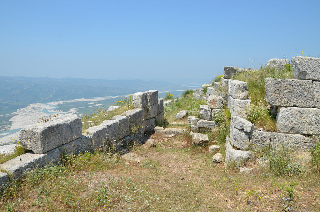
The Gate of the Agora looks towards the Vjosa valley. The city walls were built in the 1st half of the 4th century BC and were reconstructed by the Roman colonists.
Latin inscription dedicated to the emperor Augustus. It was found in front of the entrance gate to the Agora. “Augustus, son of the divine Caesar, permitted it (rebuilding the walls).”
General view of the Agora built in the middle of the 3rd century BC according to a single plan that harmonized the theatre, stoas, stadium and other public buildings. The Agora of the city covered an area of 4 ha.
The Theatre was built against a natural slope and dates from the middle of the 3rd century BC. With its 40 steps of seats, it had a capacity of 7,500 spectators.
The cavea of the theatre with decorated seats.
The remains of the stage building of the theatre (scaenae frons) with architectural parts in the Doric order.
Latin inscription dedicated to Caius Julius, a liberated slave of Augustus, about 30 BC.
View towards the Vjosa valley.
The 190m long stadium with only one ring of nineteen steps. It was built in the 3rd century BC and was accessible to the many citizens who gathered in the Agora during political activities, festivals, theatrical shows and sporting events.
The ruins of the Prytaneion measure 20,10 x 5,80 m. It was the seat of the Prytaneis (executive).
The Arsenal, a building for weapons standing 3m below the adjacent Prytaneion. It was built in the 3rd century BC and rebuilt using the opus reticulatum technique in the 1st century AD.
Inscription dedicated to Antoninus Pius in 140 AD.
The underground cistern under the stadium with a depth of 6m and a capacity of about 1200 m3. Built in the 3rd century BC, it collected water from the roof of the Great Stoa. It was in use until the Byzantine period.
Remains of an Altar located in the middle of the Agora. It is believed that it was the altar of the emperor Augustus when the city had the status of Roman Colonia, 1st century BC.
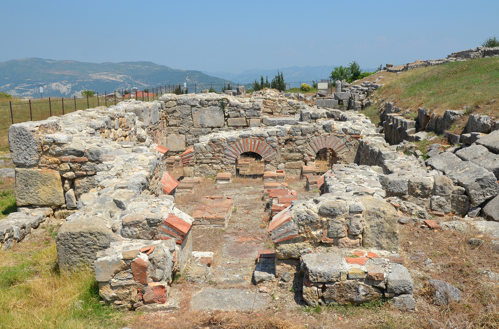
The Baths of Justinian I. Its structure included the apodyterium (dressing room), the frigidarium (cold room), the tepidarium (warm room), the caldarium (hot room) and the sudatio (sweat room).
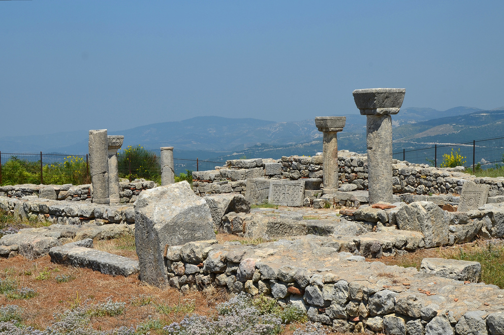
Basilica C, a church of medium size built in 525-550 AD and paved with mosaics.
Basilica C. It had three naves, a narthex covered by a gallery, preceded by a portico and several annexes.
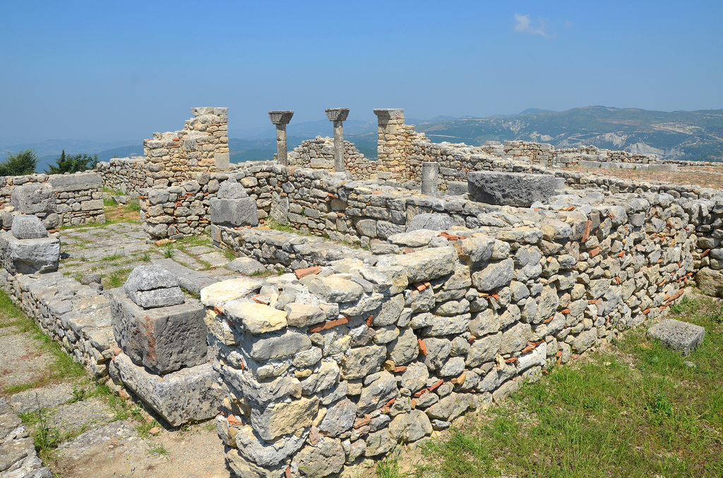
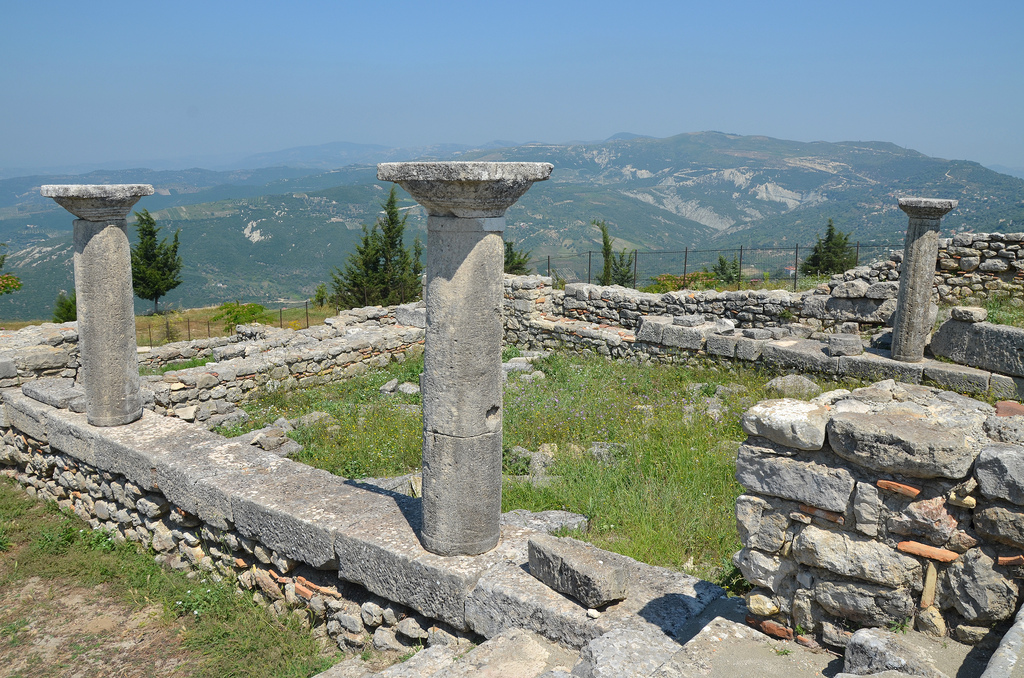
The Cathedral or Basilica B consists of a church, a baptistery and an episcopal palace. It was built at the end of the 4th century or the beginning of the 5th century AD.
The Cathedral (Basilica B) was the city’s largest monument in Late Antiquity. The floor of the exonarthex, the naves, the sanctuary and the northern wing were paved with mosaics, making this the largest surface covered with mosaics so far discovered in Albania.
The Cathedral (Basilica B) was destroyed during the Slavic invasions around 547-551 AD.
The Byzantine City Walls were built in opus incertum by Victorinus after the destruction of the city by the Slavs in 547-551 AD.
The Byzantine City Walls were equipped with towers at regular intervals. This wall reduced the fortified city from 30 to 11ha.