Civitas Tropaensium

Civitas Tropaensium, situated in Moesia Inferior in modern Constanţa County, was a Roman castrum settled by Roman veterans of the Dacian Wars. It received the status of a municipium around 200 AD and became the largest Roman city of the province, covering an area of about 10 hectares. It was located at an important crossroad, almost halfway on the road that connected Durostorum (Silistra, Bulgaria) with Tomis (Constanța, Romania) on the western shore of the Black Sea, and on the road that led from Marcianopolis (Devnya, Bulgaria) to Noviodunum on the Danube. A milestone (CIL 03, 14464), dated to between 128 and 138 AD and discovered south of the site, indicates that Hadrian ordered the repair of the imperial road passing through the settlement.

In 116 AD, the inhabitants, under the name of Traianenses Tropaeenses, dedicated a statue to the emperor Trajan (CIL 03, 12470).
© Constanta – Muzeul National de Istorie si Arheologie, Foto: Ortolf Harl, 2012
Courtesy of Ubi Erat Lupa http://lupa.at

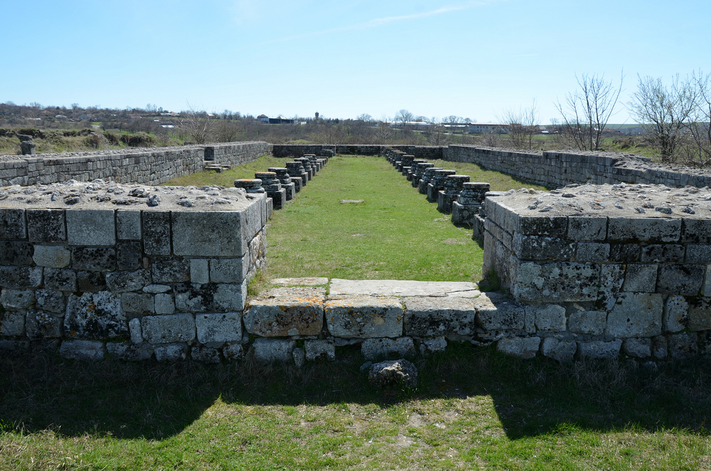
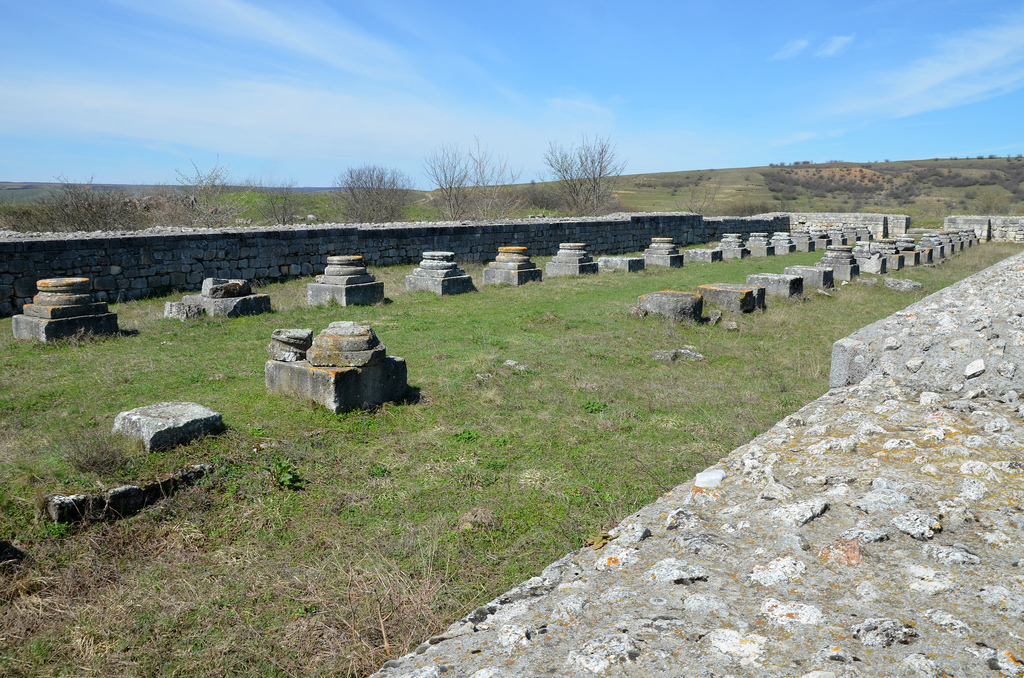
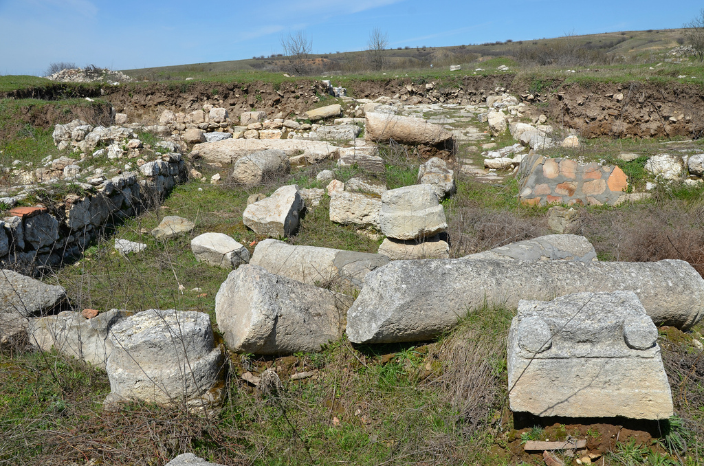
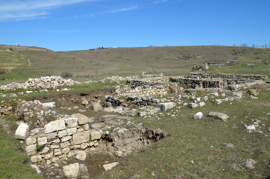
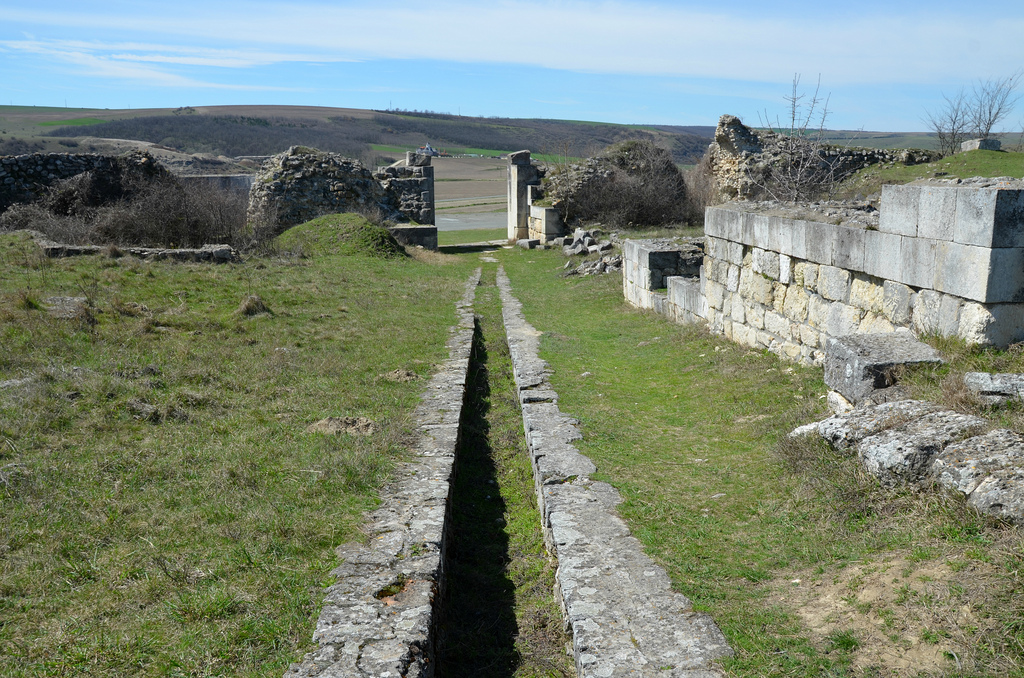
The site was identified by excavations at the end of the 19th century. Four city gates, the main street (via principalis), countryside villas (villae rusticae) and the remains of six basilicas have been uncovered. The life of the site in the 2nd and 3rd century is known particularly through inscriptions reused as building material for the 4th-6th century fortress. The site became a municipium shortly before 170 AD during the reign of Marcus Aurelius.

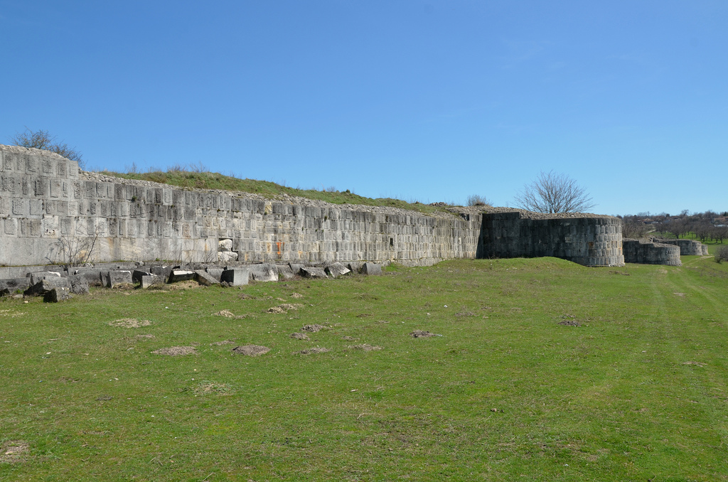
In the course of the 3d century AD, the fortress was repaired under Septimius Severus, Severus Alexander and Gordian, but later the site gradually lost its importance and was destroyed by the Goths. It was rebuilt during the rule of Constantine the Great with improved defensive walls. Civitas Tropaensium survived as an important religious centre and a bishopric until the Avars sacked the settlement in 587 AD. The city was no longer mentioned for seven hundred years.

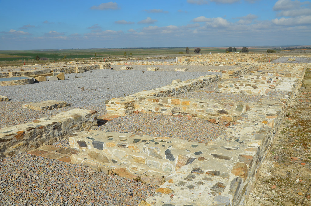
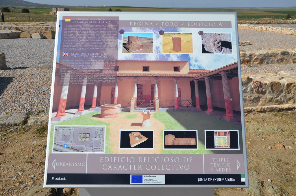
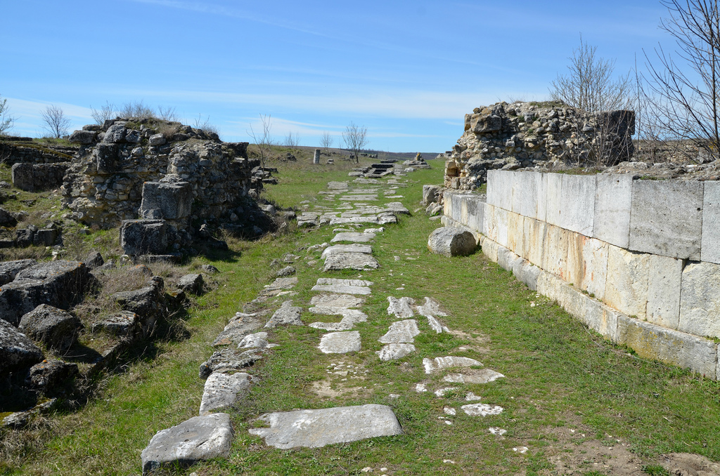
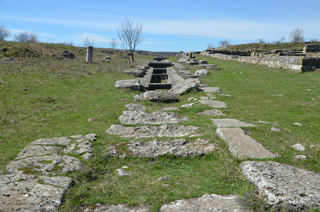
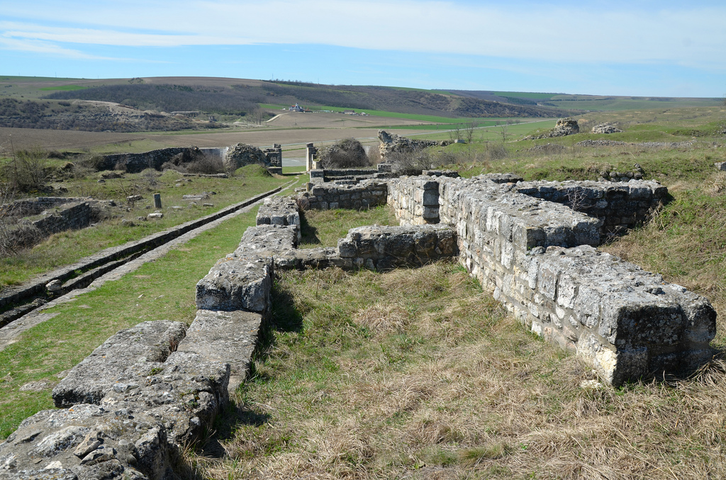
The visible ruins belong to the 4th-6th centuries. The defensive walls were provided with horseshoe-shaped defensive towers (a single one was rectangular). Three gates were unearthed: two on the east and west sides and a smaller one on the south side. The via principalis (ca. 300 m long), lined on both sides with porticoes, linked the east and west gates. A large basilica forensis dated to the 4th century stood in the centre of the fortress, south of the main street. On both sides of the same street, excavations have brought to light the ruins of four Christian basilicas, three of them with crypts, and one with an elegant baptistery. A cemetery basilica stood on the hill north of the fortress.

Nearby stands the Tropaeum Traiani (‘Trajan’s Trophy’), a triumphal monument near Civitas Tropaensium built in 109 AD to commemorate Trajan’s victory over the Dacians in 102 AD, in the Battle of Tapae. Before Trajan’s construction, an altar stood there, on the wall of which were inscribed the names of the 3,000 legionaries and auxiliaries who had died “fighting for the Republic”. The Tropaeum Traiani contained fifty-four separate metopes with sculpted scenes of the Roman campaigns. Most of these metopes are now in the site Museum in Adamclisi.

Coordinates: 44°05’31.7″N 27°56’39.3″E

PORTFOLIO

The eastern entrance to the settlement.
The eastern gate with horseshoe-shaped defensive tower.
The via principalis, lined on both sides with porticoes, linked the east and west gates. Under its pavement lay one of the aqueducts and a drain.
The large basilica forensis. It stood in the centre of the fortress, south of the main street.
The large basilica forensis.

Remains of buildings located on the northern side of the via principalis.
Remains of buildings on the northern side of the via principalis with the reconstructed Tropaeum Traiani in the distance.
View towards the western gate.
The western gate with U-shaped defending towers.
The defensive walls.

The 1977 reconstruction of the Tropaeum Traiani.
Original metopes from the Tropaeum Traiani.

Link:


Regina Turdulorum

Regina Turdulorum is a former Roman city located in southern Extremadura, in the province of Badajoz, just outside Casas de Reina. Pliny (Plin. Nat. 3.14) mentions this town among the ‘oppida non ignobilia’ located in Baeturia Turdulorum, the region extending from the Guadiana and Guadalquivir rivers, which used to be occupied by the Turduli. The city was founded in the 1st century AD along the Roman road that ran from Augusta Emerita (now Mérida) to Corduba (now Córdoba).

Among the reasons for the city’s founding was the mineral wreath of the area and the control of the territory of the Turduli people. The region also had good land for cultivation and was rich in water.

In the beginning, Regina was an oppidum stipendiarium (tributary), which paid tribute to Rome, but under the Flavians, the city was promoted to the status of municipium and was ruled by Roman citizens. It reached the height of its splendour during this time, with the construction of various public buildings. Despite being founded in times of prosperity, archaeological research studies show that Regina was a significant walled city flanked by defensive towers. Within the walls, streets crossing at right angles and flanked by porticoes delimited the blocks or insulae of the monumental centre of the town, with the cardo and the decumanus crossing the forum.

The city’s buildings included houses, several religious temples and civic buildings, an extensive sewage system and at least two necropoleis. The first archaeological exactions took place in the 1970s when the remains of the small theatre were unearthed. The theatre, built in the age of the Flavian emperors, is relatively small (diameter 55 m, wall of the scaena 38 m long) and could accommodate an audience of about 1000 people. Today it is one of the four venues in Extremadura hosting plays during Mérida’s Classic Theatre Festival, which takes place in summer. In 2008, a marble Head of Trajan was discovered inside a well located in the forum (see image here).

Coordinates: 38°12’11.1″N 5°57’13.0″W

PORTFOLIO

The theatre was built in the second half of the 1st century AD into the slope of a hill in the northwest sector of the town.
The scaenae frons was flanked on either side by the proscaenium and the basilica. On the left is the aditus, an arched entrance corridor leading to the Orchestra.
The cavea originally had ten rows of seats, of which the first three, part of the fourth and some of the fifth tier in the central area are preserved. The Orchestra had an almost semicircular diameter (16,40 m).
The theatre.
The ruins of the Macellum, the city’s great commercial centre, covered over 3,000 square meters. To date, only 50% of the building has been excavated.
The ruins of the so-called Building C located in the forum area. It had a small courtyard and could be accessed from the decumanus maximus via a portico. This building was built in the first half of the 1st century AD.
The Temple dedicated to Pietas Augusta was built at the end of the 1st century AD and is located next to the decumanus maximus. An inscription mentioning this temple’s repairs and the emperor Titus gives suggests that this building was dedicated to the imperial cult.

The main part of the Templum Pietatis was the sacred room surrounded by a colonnaded portico.
The Decumanus Maximus.
The foundations of the Capitolium, the three temples dedicated to the Capitoline triad (Jupiter, Juno and Minerva).

The three temples were erected on a podium with a staircase leading to the pronaos, originally surrounded by six marble columns. The statue of the deity would be placed inside the cella.
The foundations of the capitolium.
The foundations of the religious building occupied a prominent place in the sacred area of ​​the city.

The so-called Religious Building had a square floor plan (45×45), a central courtyard and porticoed galleries. The main area of the building was occupied by three rooms open to a courtyard. The central room was the largest where religious meetings and ceremonies were taking place.

Links: