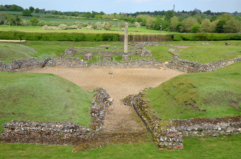
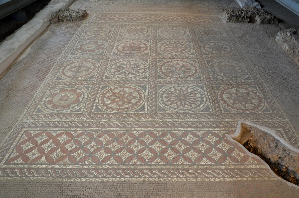
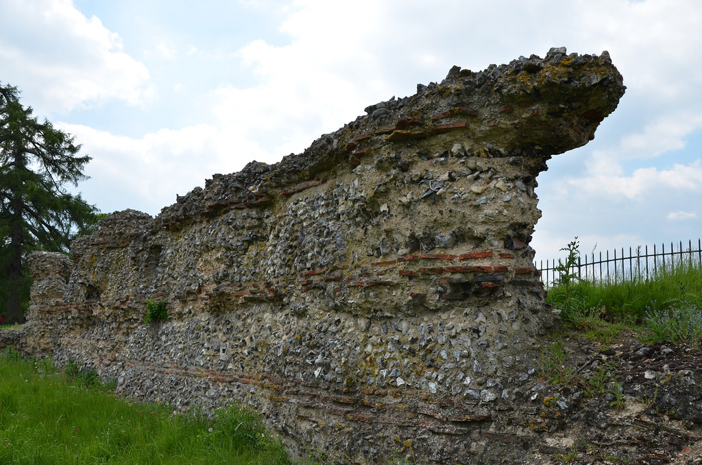
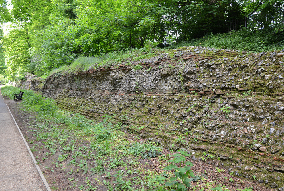
Verulamium was one of the largest towns in Roman Britain. It was established on the location of a late Iron Age settlement and a major centre of the Catuvellauni tribe. Its ruins now stand in the southwest of the modern city of St Albans in Hertfordshire, 33 km northwest of London. The excavations uncovered parts of the city walls and a hypocaust under a mosaic floor, but the Roman theatre was the most spectacular. Since much of the modern city has been built upon the ancient town, a large portion of Verulamium remains unexcavated.
Verulamium was founded on the ancient Celtic site of Verlamion (meaning ‘settlement above the marsh’), a late Iron Age settlement and a major centre of the Catuvellauni tribe. After the Roman invasion of AD 43, the city was renamed Verulamium and became one of the largest and most prosperous towns in the province of Britannia. Around AD 50, Verulamium was granted the rank of municipium, meaning its citizens had “Latin Rights”. It grew into a significant town and, as such, was a prime target during the revolt of Boudicca in AD 61. Verulamium was sacked and burnt to the ground on her orders, but the Romans crushed the rebellion, and the town recovered quickly. In its heyday, Verulamium was the third-largest city in Roman Britain.
By AD 140, the town had doubled in size, covering 100 acres, and featured a forum with a basilica, public baths, temples, many prosperous private townhouses and a theatre. Despite two fires, one in AD 155 and the other around AD 250, Verulamium continued to grow and remained a central Roman town for the next four hundred years until the end of the Roman occupation.
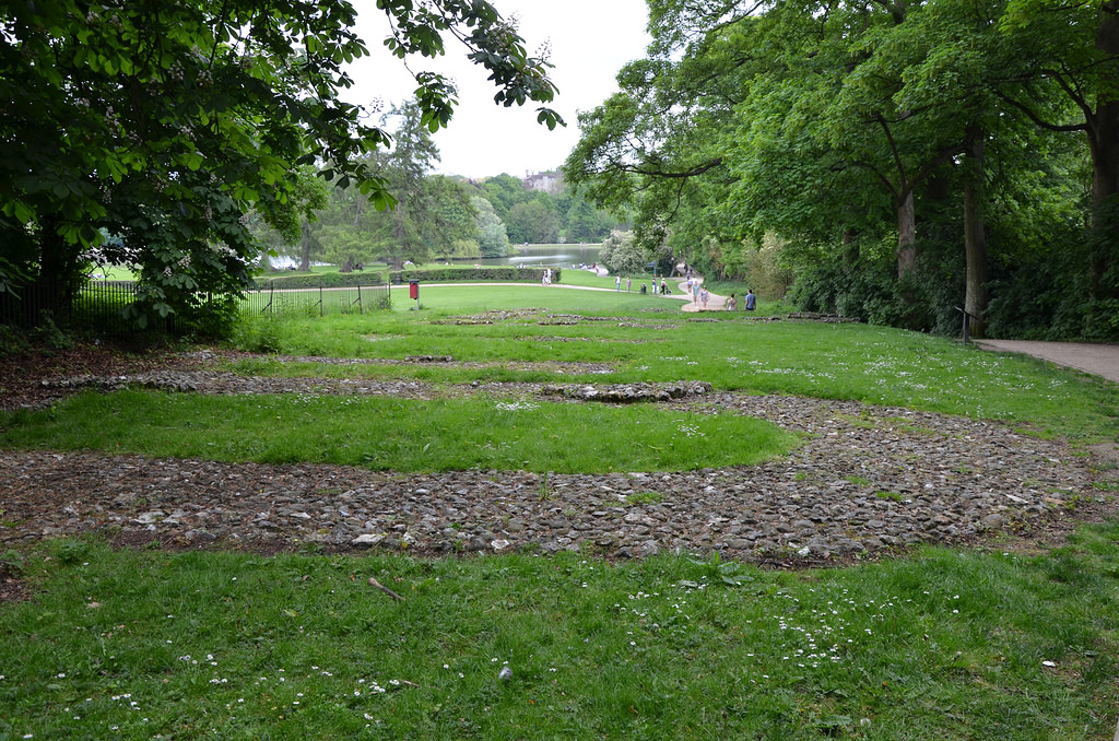
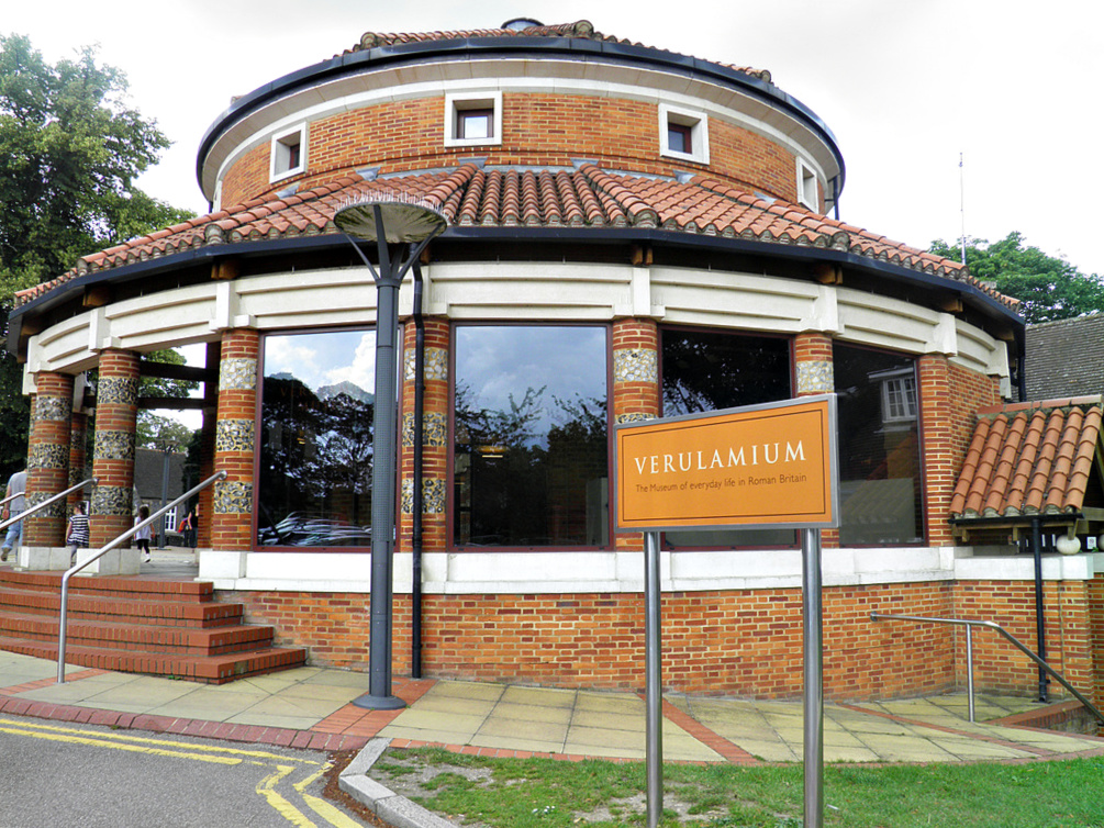
Today the site of Verulamium sits in a beautiful public park. Archaeological excavations were undertaken in the park during the 1930s, during which the 1800-year-old hypocaust and its covering mosaic floor were discovered. Further large-scale excavations uncovered the theatre, a corner of the basilica nearby and some of the best-preserved wall paintings of Roman Britain. On the outskirts of the park is the Verulamium Museum which contains hundreds of archaeological objects relating to everyday Roman life.
PORTFOLIO
The Roman Theatre, built in about 140 AD, is unique. Although several towns in Britain are known to have had theatres, this is the only one visible today.The theatre could accommodate several thousand spectators on simple wooden benches and had an almost circular orchestra in front of the stage where town magistrates and local dignitaries were seated. The theatre was radically altered by AD 160-180, with the stage enlarged.The theatre was built close to the site of an earlier water shrine and was linked to two temples dedicated to Romano-British gods: one stood immediately behind the theatre and the other on the opposite side of the river a short distance outside the town. Today the remains of these temples lie buried.The theatre was lined with shops with storage spaces and sleeping quarters behind the main shop area. When the shops were excavated in the 1950s, broken crucibles and waste metal showed that most of the shops had been occupied by blacksmiths and bronze workers.Around AD 170, a large townhouse was built behind the shops, part of which can still be seen. The house had a hypocaust and an underground shrine.The Hypocaust and Mosaic. During the 1930s excavations, archaeologists uncovered an 1800-year-old underfloor heating system, or hypocaust, which ran under an intricate mosaic floor. This floor is considered part of the reception rooms of a large townhouse built around AD 180.The mosaic is of great size and contains around 200,000 tesserae. The floor comprises a central section with 16 square panels, each having a circular roundel with a geometric design. The borders are bands of single and double interlaces and strips of wide and thin dark and light material.The city walls were constructed around AD 270 and were over 3m thick at foundation level and over 2m high.The walls were built as a complete circuit around Verulamium with a total length of 3.4 km (2.25 miles) and enclosing an area of 82 ha (203 acres).The city walls of Verulamium.The surviving foundations of the London Gate. Large gateways controlled the four main entrances to the town of Verulamium. The best preserved is the London Gate on the south side of the town.Reconstruction drawing of the London Gate.
The Verulamium Museum
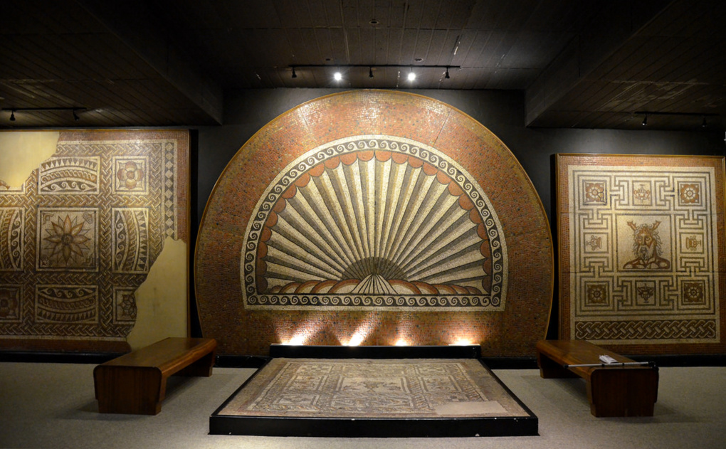
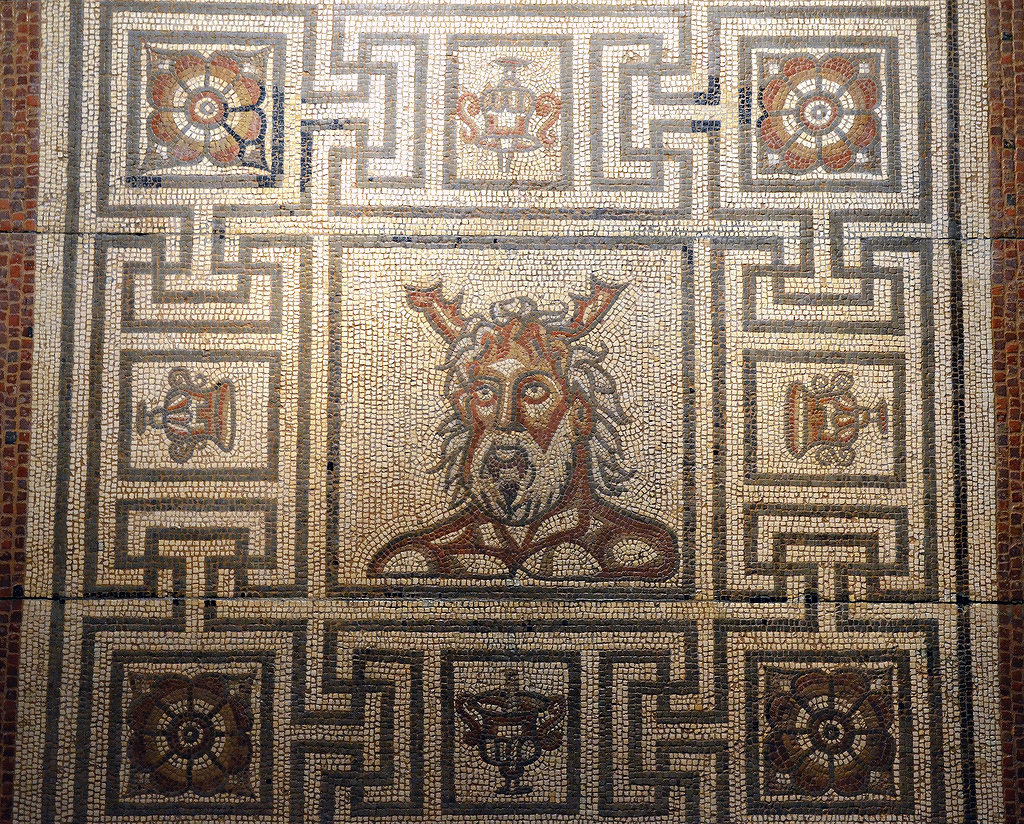
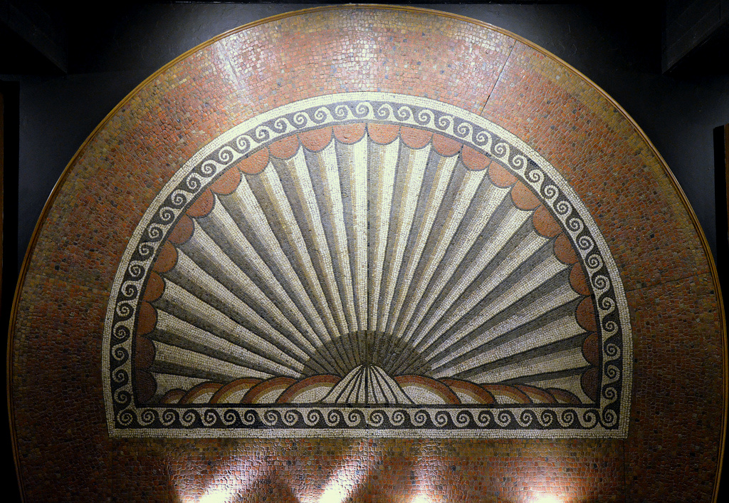
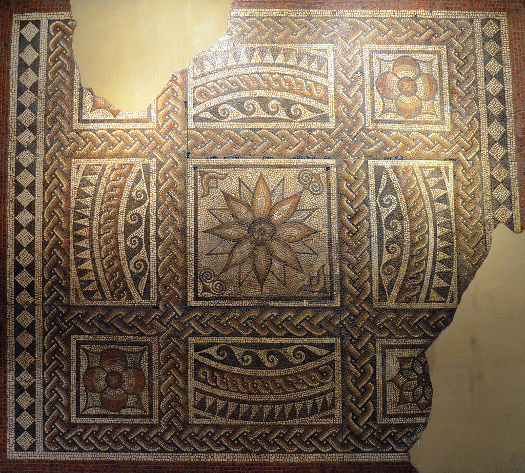
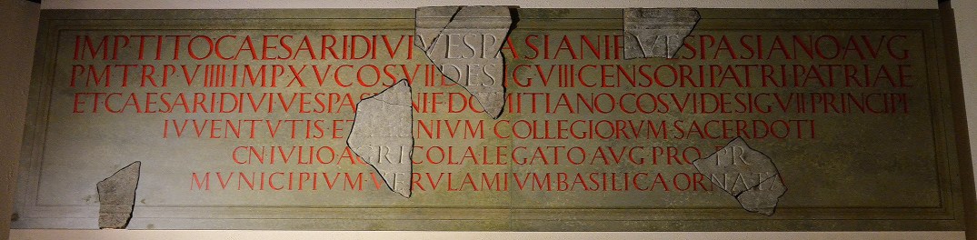
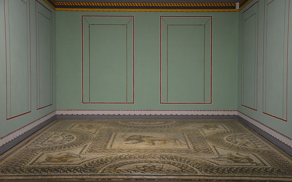
The Verulamium Museum in St Albans. Located in Verulamium park, the Verulamium Museum was established following the 1930s excavations carried out by Mortimer Wheeler and his wife, Tessa Wheeler.The Mosaic Room.The Oceanus Mosaic, AD 160-190. The figure could be the god Oceanus – or it might be Cernunnos, the god of the woods.The Shell Mosaic, dated to c. AD 15.The Dahlia Mosaic with flower motif, AD 175-200.The reconstructed painted plaster walls date to about AD 180.Wall painting with imitation columns and panelling.Verulamium Museum.The reconstructed dedicatory inscription from the Basilica inscription dated to AD 79 or 81. The inscription is notable because it mentions Gnaeus Julius Agricola, the Roman governor of Britain from AD 77-84. He is otherwise known from a biography written by his son-in-law Tacitus.The Lion and Stag Mosaic.
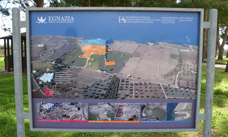
Gnathia (present-day Egnazia) was an ancient city of the Messapii built on the border between the regions of Messapia and Peucezia. It is located near the town of Fasano, on the Adriatic coast of Apulia in southern Italy. The town is mentioned by the Greek geographer Strabo (Strab. 6,3,8) for its privileged geographic location and by the Latin poet Horace who passed through in 38 BC during his famous voyage from Rome to Brindisi (Satire I, 5). In the Roman period, Gnathia became an active centre of trade and commerce along the Via Traiana and became the seat of a bishopric in the Christian period. Only partially excavated, the city preserves vestiges dating back to the Messapian, Roman and Late Roman eras.
The history of ancient Gnathia spans many centuries. The earliest evidence of organised life comes from the Acropolis and dates to the Late Bronze Age (13th-12th centuries BC),with groups of huts scattered along the coast and hinterland. In the 11th century BC, it was invaded by the Iapygians, while the Messapic (another Iapyyg tribe) era of the town began in the 8th century BC. The vitality of the town and its commercial and cultural relationship with other Messapian centres and Taranto (Taras) during the Archaic period are documented by the Peucetian pottery and the pottery imported from Greece.
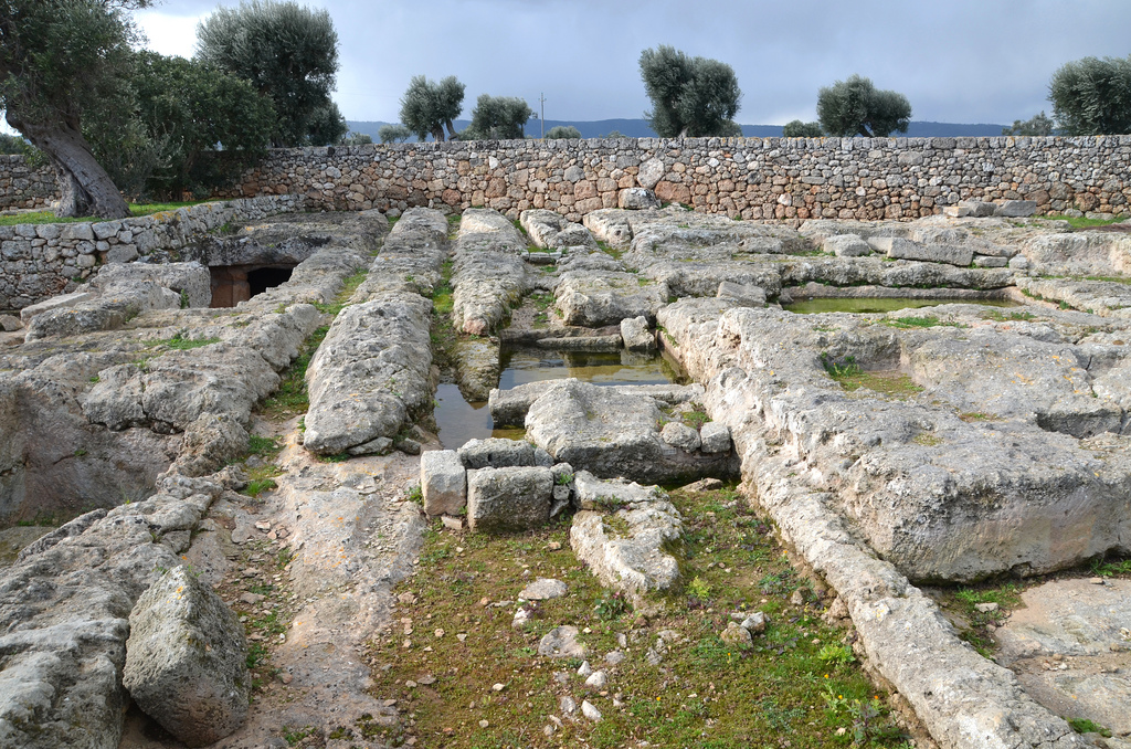
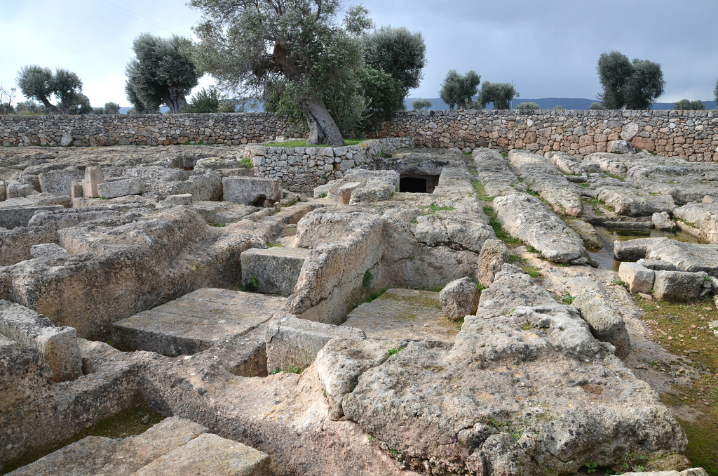
Around the second half of the 4th century BC, a sharp increase in population is recorded in the Messapia. Gnathia took the appearance characteristic of a Messapian city, surrounded by powerful defensive walls made of stone blocks on its three landward sides. They enclosed an area of about 140 hectares. From this period date, the necropolises with monumental chamber tombs often contained painted frescoes and were furnished with valuable vases.
Messapian earthenware found in Egnazia.
The vases attributed to the “Gnathia style” are so termed after the name of the site of Gnathia. Many potteries of this type were discovered in the tombs of Gnathia. Their production began in Apulia around 370/360 BC and consisted of decorating the traditional black glazed pottery with painted patterns, mainly white, red and yellow. The themes depicted include erotes, images from the life of women, theatre scenes and dionysiac motifs. The vases decorated in “Gnathia style” were generally small in size (pelikes, lekythoi, alabastra, and skyphoi).
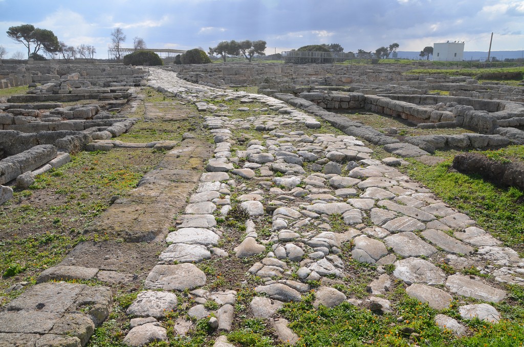
In the Roman period, especially during the Augustan period, the city prospered due to its location on the principal transit route to the Orient. The town underwent a significant modification of its urban space with new public buildings built on either side of the Via Minucia, which crossed the town from the western to the eastern sector. In AD 109, Emperor Trajan improved the old Via Minucia. Starting at Benevento, the Via Traiana gave travellers from Rome to Brindisi a shorter and more comfortable alternative to the old Via Appia.
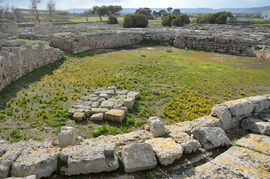
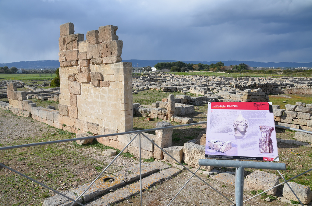
At the heart of the public space, an area was sacred to the Oriental gods. The sanctuary consisted of the temple of Cybele, the sacellum dedicated to Attis and the large elliptical enclosure, the so-called “amphitheatre”, for the performances enlivening the sacred rites.
In the Christian period, the city was the seat of a bishopric. The Acropolis was fortified by the Byzantines and, after the 6th century AD, embraced the settlement within a new surrounding wall. The destruction of the city has been traditionally linked to the invasion of Totila, King of the Goths, in 545 AD.
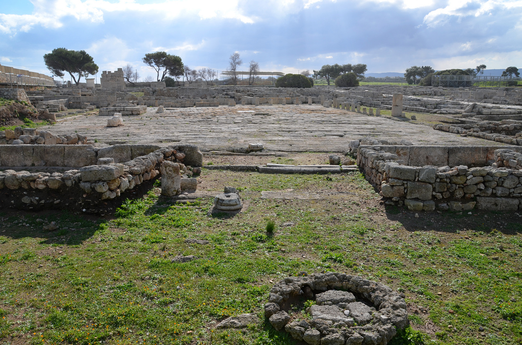
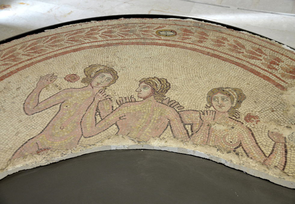
The first systematic excavations were undertaken in 1912 and 1913. Since 2001, a research programme has been carried out by the Department of Ancient and Late Antique Studies of the University of Bari “Aldo Moro”, in close collaboration with the Soprintendenza Archeologia of Apulia. Gnathia is famous for the discoveries made in its tombs. Also worthy of note are some stretches of the Via Traiana, the Basilica with the hall of the Three Graces, the Shrine of Eastern Divinities, the trapezoidal-shaped market square and the Sanctuary of Trajan in the area of the Acropolis. The best-preserved burial chamber is the Tomb of the Pomegranate, which probably belonged to a family of the wealthy class who used it for many generations from the 4th to the 2nd century BC.
The Tomb of the Pomegranate was discovered In 1971 during the museum’s construction. On the walls are some paintings, such as the pomegranate, a symbol of eternity. The Archaeological Museum of Egnazia is set outside the boundary walls. It showcases a permanent didactic exhibition about the history and the topography of ancient Gnathia, including a selection of mosaics and architectural fragments from the inhabited area and the necropolises.
PORTFOLIO
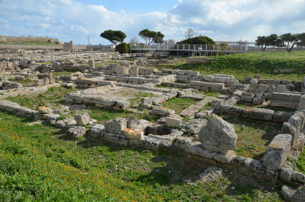
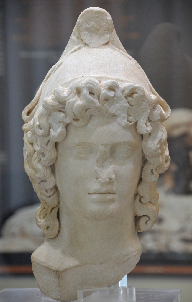
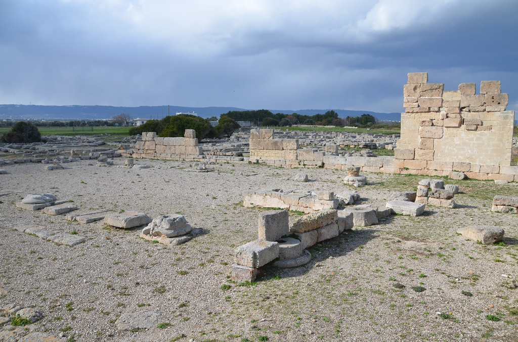
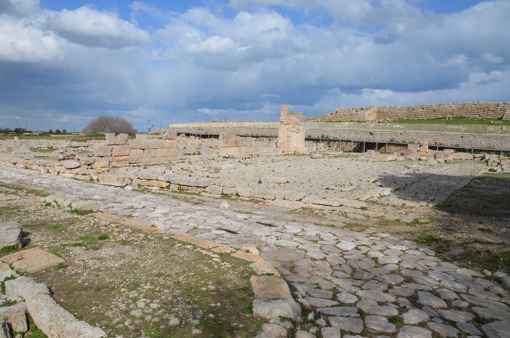
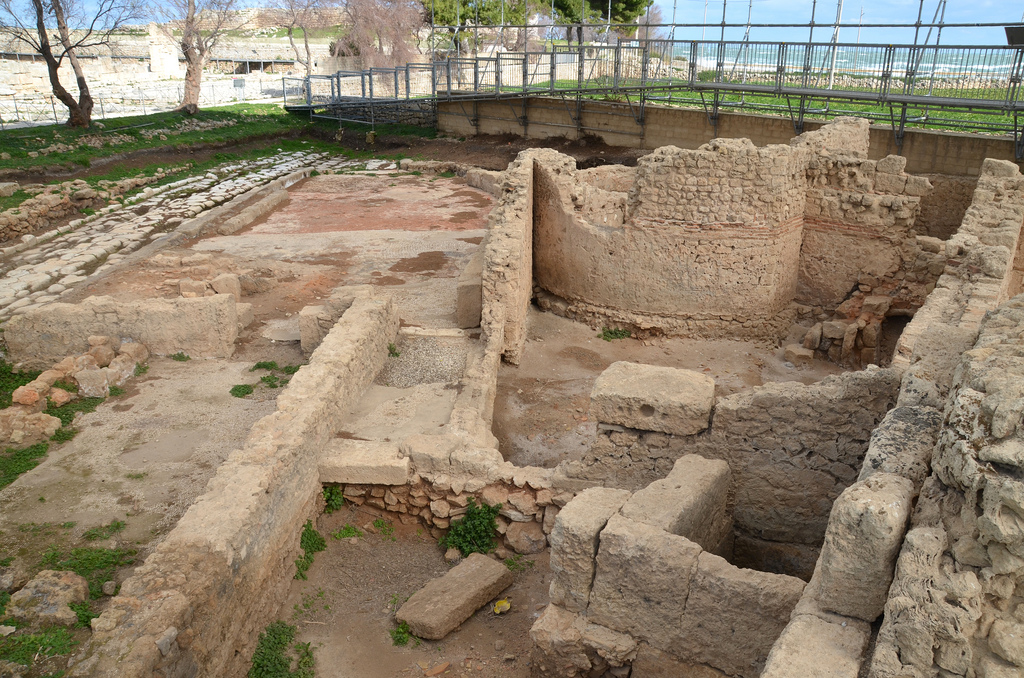
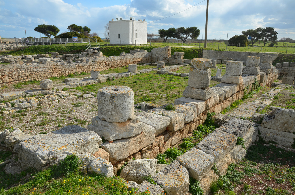
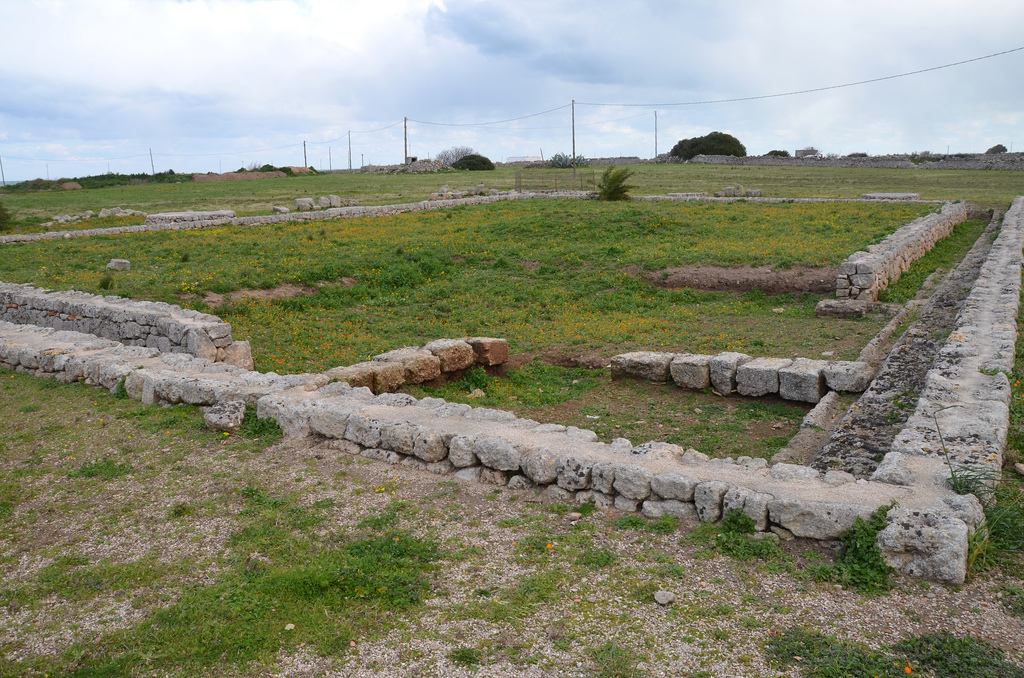
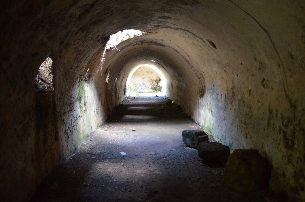
The western necropolis was used from the Messapian period (4th Century BC – 2nd Century BC) through the middle ages. It belonged to the following types: pit graves, semi-chamber tombs and chamber tombs.A chamber tomb in the western necropolis cut into the bedrock. It consisted of a burial chamber accessed through a stepped corridor-like entrance (dromos). The chamber was closed with large doors made of two stone blocks and, in some cases equipped with hinges.The inside of the chamber tomb. The tombs had frescoes reproducing the typical wall decorations of the houses, such as marble slabs on the walls and wooden beams in the covering slabs.Wall painting from a Messapian tomb depicting a young warrior with a horse, 5th century BC.A 5th Century BC old road with ruts crossing the western necropolis. It fell into disuse in the 3rd century BC when it was interrupted by construction of two semi-chamber tombs.The western Acropolis.A domus (private house) south of the forum with an atrium floored with a white mosaic pavement.The residential and production district is located south of the forum.The Via Traiana crosses the town’s urban centre and is partly built upon the route of the former late Republican Via Minucia.The entrance to a trapezoidal-shaped market square. The square was first built in the Messapian period (4th Century BC – 3rd Century BC). It was probably re-organised in the time of Augustus, but the majority of the surviving buildings were built under Trajan when the Via Traiana was established.The market square was paved with regular blocks of tufa and enclosed by a portico with Doric columns.The market square with a small square rostrum.The so-called Amphitheatre is an elliptical enclosure with a monumental entrance leading to the temples of the Cybele and Attis. It may have been used for religious festivals, house performances, and games in honour of the Oriental gods (Cybele, Attis and Dea Syria/Atargatis).The elliptical enclosure was made of Opus Africanum (a form of ashlar masonry characterised by pillars of vertical blocks of stone alternating with horizontal blocks), an uncommon type of masonry in Apulia.The small Temple of Cybele. It had two columns at the front and yielded objects of Cybele’s worship, such as carved lions. It also had a room with a tank, perhaps used to breed fish sacred to Atargatis or purify the believers (lavatio).The Sacellum (shrine) of Attis, opening onto the Via Traiana, occupies a former late Republican portico. It was decorated with frescoes (now lost) and floored with precious marbles. It housed the statue of Attis made of Greek marble, of which the head and part of the hand holding a pan flute (syrinx) are the only remains.The marble head of the god Attis wearing the characteristic Phrygian cap. It is dated to the Hadrianic period based on comparisons with the portraits of Antinous.The sacred area with a copy of the base on which the statue of Attis probably stood. It was decorated with the musical instruments accompanying the ceremonies in honour of Cybele.Statue base bearing the dedication of Flavia Cypare, priestess of Magna Mater and goddess Dea Syria/Atargatis, 2nd century AD (AE 1989, 0192). Flavi[a] C L Cypa[re] sace[rd]os Matris Magn[ae] et Syriae dea[e] ex imp[er]io fecit l[aeta] l[iberris] d[ono] d[edit].The urban stretch of the Via Traiana.The Civil Basilica is used for meetings, administration of justice and business. With its rectangular plan and an inside quadriporticus supported by 4 x 8 columns, it had its main front and entrances on the broader southeast side.Part of the mosaic floor decorating an area connected to the Basilica Civile, 4th century AD.The urban stretch of the Via Traiana with the Civil Basilica in the background.The Forum Baths were built together with the forum in the Augustan age.The urban stretch of the Via Traiana next to the Forum Baths.The production area adjacent to the Forum Baths dates to the 5th century AD.The public and private buildings south of the forum.The Episcopal Basilica was built in the last years of the 5th century AD on the initiative of bishop Rufensius, who signed the acts of the Roman synods of 501 and 502.The Southern Basilica dates to the Late Roman period.The cryptoporticus was built in the southern area in the Augustan period. It was a large underground corridor with a quadrangular plan, likely surmounted by a collonnade and a temple (now gone).The underground tunnel network below the temple complex.The Sanctuary of Trajan in the area of the Acropolis.The Museum










 The vases attributed to the “Gnathia style” are so termed after the name of the site of Gnathia. Many potteries of this type were discovered in the tombs of Gnathia. Their production began in Apulia around 370/360 BC and consisted of decorating the traditional black glazed pottery with painted patterns, mainly white, red and yellow. The themes depicted include erotes, images from the life of women, theatre scenes and dionysiac motifs. The vases decorated in “Gnathia style” were generally small in size (pelikes, lekythoi, alabastra, and skyphoi).