Susa

Susa was among the greatest cities of ancient Persia, and its remains bear exceptional testimony to successive ancient civilisations (Elamite, Persian, Parthian and Sasanian). Located in the southwest of Iran, at the foot of the Zagros Mountains between the Karkheh and Dez Rivers, Susa was the chief city of Elam (Susiana) and one of the capitals of the Achaemenid Empire. The research carried out on the site has uncovered evidence of continual habitation from the late 5th millennium BC until the 13th century AD and has yielded a wealth of archaeological and epigraphic material. Susa was inscribed on UNESCO’s World Heritage List in 2015.

Coordinates: 32° 11′ 26″ N, 48° 15′ 28″ E

Susa began as a farming village in the Neolithic Age, c. 7000 BC, and developed into an urban centre as early as the late 5th millennium BC. Soon after its foundation, the inhabitants erected a monumental mud-brick platform that rose over the flat surrounding landscape. On top of this platform, a temple was erected, and only some wall fragments had survived. The temple was most likely dedicated to the god Inshushinak, the patron deity of Susa. Susa’s earliest settlement, known as the Susa I period (c. 4200–3900 BC), developed around the Acropolis.

Susa in the 5th millennium BC.

The monumental stepped platform was probably burned around 4000 BC and later used as a cemetery. Around two thousand individuals were found in burial pits cut into the mud-brick platform. The graveyard has yielded nearly two thousand finely crafted pottery finds used as funerary gifts.

Painted pottery beakers from the Susa I period, 4300-4000 BC, from the Acropolis mound.
National Museum of Iran, Tehran.

Susa quickly became a commercial, administrative and political hub that enjoyed different cultural influences thanks to its strategic position along ancient trade routes. It came within the Uruk cultural sphere and was integrated into the early Sumerian civilisation of Mesopotamia. This period, extending from 3500 to about 3100 BC, is known as Susa II. It is marked by an accounting system that preceded the slightly later emergence of writing (proto-writing and cylinder seals).

New developments took place during the Susa III period (also known as the ‘Proto-Elamite’ period), extending from about 3100 to 2700 BC. This period is marked by high artistic creativity and a system of proper writing used to record commodity transactions (Proto-Elamite script). During this time, Susa became the capital of the region of Susiana (which occupied approximately the same territory as modern Khūzestān) and the centre of Elam civilisation.

Proto-Elamite kneeling bull holding a spouted vessel, ca. 3100–2900 BC.
Public Domain – The Metropolitan Museum of Art

Susa lost its independence sometime between 2400 and 2200 BC, and its control shifted between Elam, Sumer, and Akkad. It was incorporated into Sargon the Great’s Akkadian Empire in approximately 2330 BC. It became the capital of an Akkadian province until ca. 2100 BC when Puzur-Inshushinak overthrew the Mesopotamians. Puzur-Inshushinak made himself king of Elam and built extensively on the citadel at Susa. However, his attempt at imperial expansion was short-lived, for Susa was overrun by the Neo-Sumerian kings of Ur.

A statue of the goddess Narundi with Elamite and Akkadian inscriptions was dedicated by Puzur-Inshushinak in a temple on the Acropolis of Susa in ca. 2100 BC. Musée du Louvre, Paris.

During the Middle Elamite Period (1500 BC), Susa prospered again and flourished not only as a capital but also as a centre of commerce. A new religious complex, including a ziggurat (or stepped temple tower), was built by King Untash-Napirisha at Chogha Zanbil, 30 km southeast of Susa. Under the Shutrukid dynasty in the last centuries of the second millennium BC, the structures on the Acropolis were rebuilt, replacing mud bricks with baked, inscribed and glazed bricks. A high temple was dedicated to Inshushinak, the great god of the Susian Plain.

Fragments of decoration from the Temple of Inshushinak depicting a bull-man and a palm tree. From Susa, around 1150 BC. Musée du Louvre, Paris.

Around 1175 BC, the Elamites under Shutruk-Nahhunte invaded Mesopotamia, sacked the cities of Sippar and Babylon, and plundered the original stele bearing the Code of Hammurabi, which they carried to Susa. It was found in 1901 by Egyptologist Gustave Jéquier, a member of an expedition headed by Jacques de Morgan. At the end of the 12th century BC, Susa was destroyed by Babylonian armies, and the Elamite civilisation sank into almost total obscurity, a decline that lasted until the 8th century BC (Neo-Elamite period).

In 646 BC, the Assyrian king Ashurbanipal, seeking retribution against the Elamites for their support of his Babylonian enemy, launched his army against Susa and destroyed the city. This defeat marked the dissolution of the Elamite civilisation.

This relief depicts the sack of Susa, triumphantly recording Ashurbanipal’s campaign against the city. Flames rise from the city as Assyrian soldiers topple it with pickaxes and crowbars and carry off the spoils. British Museum.

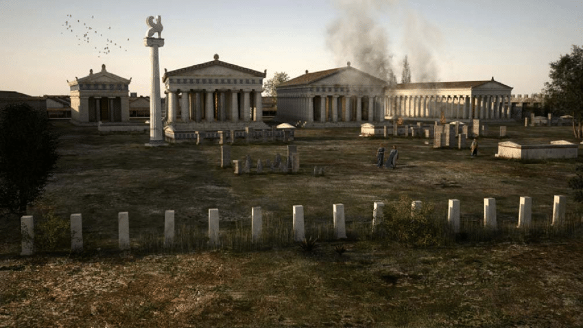
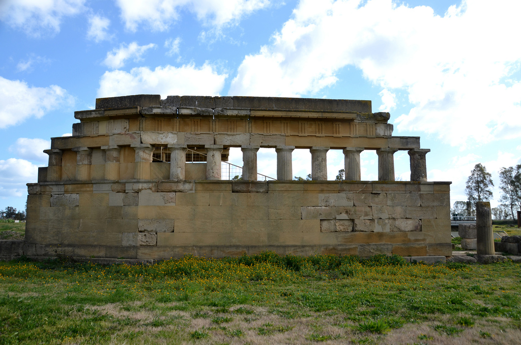
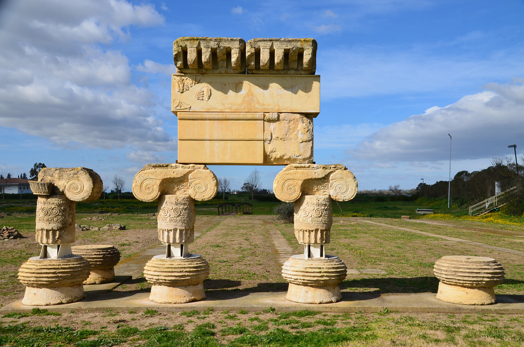
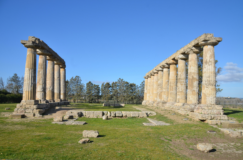
Susa regained prominence in 521 BC when Darius I chose Susa as one of his royal residences. He remodelled the city’s urban centre by constructing a palace complex occupying the northern mound of Susa. The palace, comprising the Apadana and the Residence, occupied 5 hectares on a 12-hectare artificial platform. It was accessed from a monumental gate (Gate of Darius), reminiscent of the Gate of All the Nations at Persepolis. The passage through this gate toward the palace was flanked by a statue of Darius dressed in the Persian robe but in an Egyptian posture. The folds of the dress carry an inscription (known as DSab) in the three cuneiform languages of the empire (Old Persian, Elamite and Akkadian) and in hieroglyphics: “Here is the stone statue which Darius ordered to be made in Egypt so that he who sees it in the future will know that the Persian holds Egypt.”.

A headless, inscribed Egyptian statue of Darius I was discovered in 1972 in Susa, ca. 522-486 BC. Originally intended for use in Egypt, it was found on the west side of the Gate of Darius. National Museum of Iran, Tehran.

The palace was built when Darius built Persepolis and the Royal Road, running from Susa to Sardis in Anatolia. Construction works at Susa continued under Darius I’s son, Xerxes. A century later, Artaxerxes II (404–358 BC) partially restored the palace that had burned under Artaxerxes I fifty years earlier.

This palace which I built at Susa, from afar its ornamentation was brought. Downward the earth was dug, until I reached rock in the earth. When the excavation had been made, then rubble was packed down, some 40 cubits in depth, another (part) 20 cubits in depth. On that rubble the palace was constructed.  Darius I, DSf inscription

The palace survived the city’s fall to Alexander the Great in 331 BC, and indeed, Alexander married the eldest daughter of Darius III at Susa and forced his companions to marry native women. Susa retained its importance under Alexander’s successors. The Seleucids later installed a garrison, and Susa became a Greek city called Seleucia on the Eulaios. Susa lost its rank as the imperial capital and later became a Parthian provincial capital (247 BC-AD 224).

The weddings at Susa, Alexander to Stateira and Hephaistion to Drypetis (late 19th-century engraving).

Devastated by fire during battles between the last of the Sasanians, Susa later became a Sasanian royal residence and a focal point for the Christian community. Susa was then sacked by the Sasanian king Shapur II (r. AD 309-379), who dispersed the population. The city revived, however, and was again prosperous when it was sacked and destroyed by the Arabs in AD 638. The Arab forces are said to have discovered a coffin during the invasion, which was believed to contain the bones of Daniel the Prophet. The tomb of Daniel can still be visited in modern-day Shush. Susa then declined and, from the beginning of the 13th century, deteriorated into no more than a series of crumbling ruins.

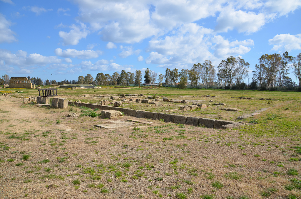
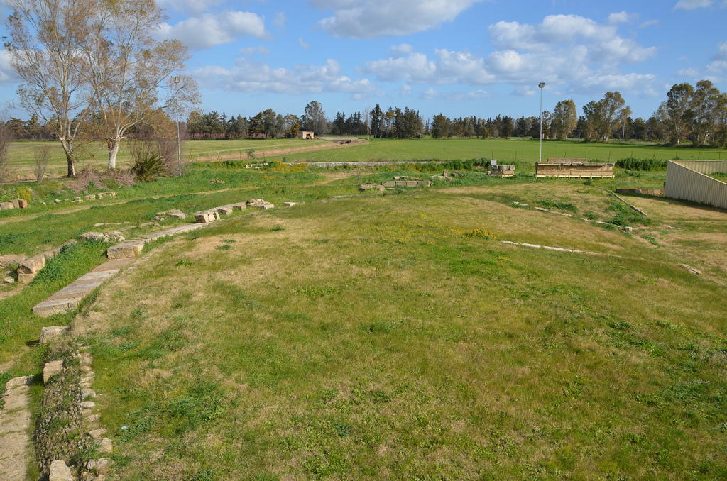
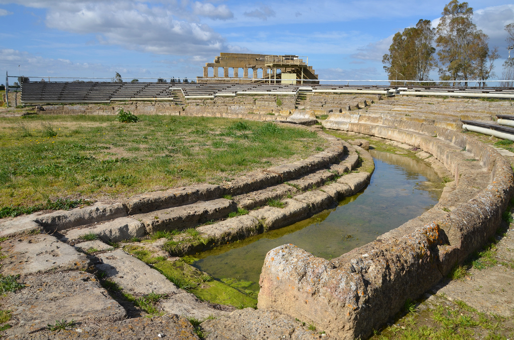
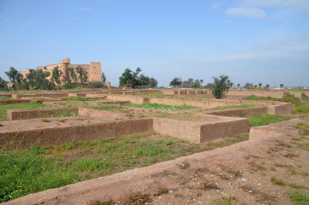
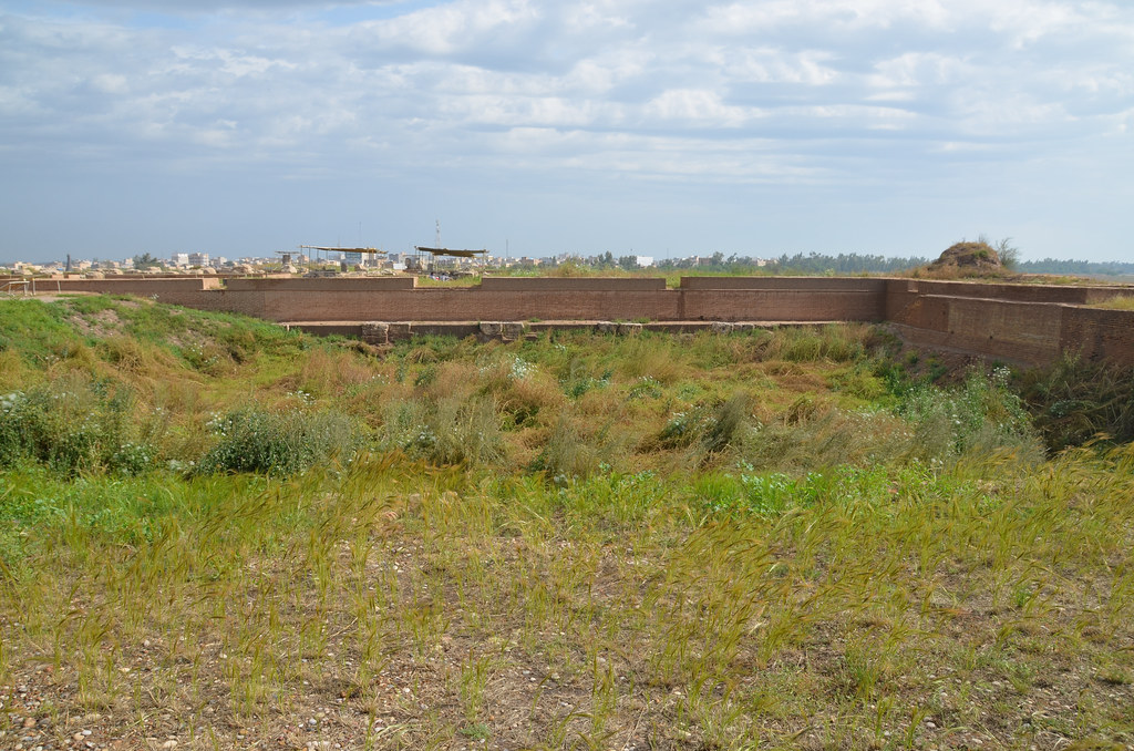
The site now consists of three gigantic mounds, known as the Apadana mound, the Acropolis mound, and the Ville Royale (royal town) mound, occupying an area of about one square kilometre. There is also a small palace (the “Shahur palace”) outside the west wall, near the Shahur River. Another building, the so-called Donjon, at the far southern extremity of the city, is of uncertain date. Much of what can be seen today at the site dates back to Darius’ reign.

The mound of Susa during excavation. Jules-Georges Bondoux (1866-1919), Les fouilles de Suse, 1905. Oil on canvas. Paris, Musee du Louvre.

Susa was identified by British archaeologist W.K. Loftus, who opened the first trial trenches in 1854 on the Acropole, Apadana, and Ville Royale mounds. The famous French archaeologists Marcel and Jane Dieulafoy began systematic excavations in 1885–6. In 1897, Jacques de Morgan headed the first of the annual winter excavations conducted by the French Archaeological Mission. Roman Ghirshman took charge of the Mission Archéologique in 1946, after the end of the war. Together with his wife, Tania Ghirshman, he continued there until 1967. During the 1970s, excavations resumed under Jean Perrot. The finds, including a complete series of glazed brick reliefs, were brought back to France and are now on display in various halls at the Louvre in Paris.

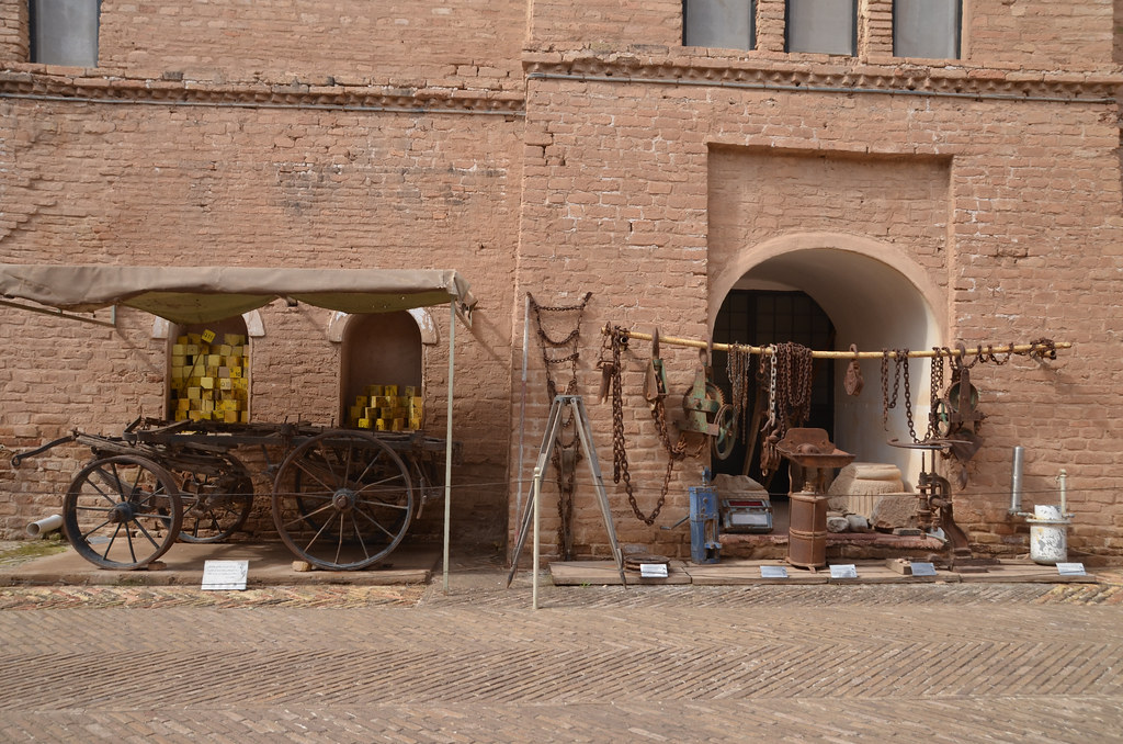
The small museum is set in a garden and contains many objects found in Susa and elsewhere in Khuzestan.

PORTFOLIO

The foundations of the Palace of Darius the Great were laid on a 12-hectare artificial platform founded on the older remains of part of the Elamite city.
The residential palace occupied 3.8 hectares across a vast esplanade. It was organised around three courtyards and surrounding rooms and was modelled after earlier Assyrian and Babylonian palaces. The eastern courtyard carried a lion frieze in enamelled brick on its northern face (now in the Louvre).
The Frieze of Lions is a decorative glazed-brick frieze from the first court of Darius I’s palace. It is one of the rare decorative features of Darius’s palace to have been found more or less in its original place, at the foot of the north wall of the East Court. Musée du Louvre.
The Frieze of Archers is a decorative glazed-brick frieze from Darius I’s palace. Although the technique is different, the frieze was probably inspired by the brick friezes of Babylon. Its exact original location is unknown. Musée du Louvre.
The East Court was the biggest courtyard in Darius’ Palace. It measured 64.50 by 56 m and gave onto long rooms on all four sides. Along the wall to the north, a row of eight stone foundations with circular cavities has been interpreted as shafts or pylons.
The northern part of the King’s Apartment.
The entire palace seen from an artist’s perspective
Archives de la Maison Archéologie & Ethnologie, René-Ginouvès, JP_V03_37
© Mission de Suse. Délégation archéologique française en Iran / Daniel Ladiray.
The West Court is lying in front of the King’s Apartment on the south side.
Frieze of Griffins from the west courtyard of the palace. The griffin has a lion’s head, the ears of a bull, a roaring mouth and two curved goat horns, one pointing forward and the other backward. It has the body of a bull, the forelegs of a lion and hindlegs like the legs of an eagle. Musée du Louvre.
The Apadana was also Darius’s work, but it was rebuilt by Artaxerxes II. It was a large hypostyle room with 36 columns, and its plan and dimensions were very similar to those of Persepolis.

My ancestor Darius [I the Great] made this audience hall [apadana], but during the reign of my grandfather Artaxerxes, it was burnt down; but, by the grace of Ahuramazda, Anahita, and Mithra, I reconstructed this audience hall. Artaxerxes II A²Sa

The Apadana was a square building measuring 109 m on each side. The central room was 58 m per side, and the porticoes were 20 m deep. The columns (72 in total) stood on square bases in the central hall and on round bases in the porticoes and were 21 metres tall.
Reconstruction drawing of the Apadana of Susa.
Image from page 327 of “History of Egypt, Chaldea, Syria, Babylonia and Assyria” (1903).
A bell-shaped column base from the north portico of the Apadana. The base with the large torus is carved from a single block. The first drum of the shaft is fixed onto the base, and the listel is joined with the shaft.
Fragment of a capital with a pair of bull protomes on which a ceiling beam rested.
Detail of the neck on a protome of a bull, a register of rosettes surmounts the curly locks.
This colossal capital from one of the thirty-six monumental columns supported the roof of the Apadana. It was reconstructed from fragments of several columns. Musée du Louvre.
This colossal capital in the Susa Archaeological Museum is one of the 36 monumental columns that supported the roof of the Apadana. It is typical of Achaemenid art to combine elements taken from different civilisations.
The possible location of an Achaemenid throne in the Apadana. Such stone platforms are seen in the reliefs of Persepolis, where the royal throne is located.
The Archaeological Castle of Susa was constructed by French archaeologist Jacques de Morgan in the late 1890s as a secure base for archaeological exploration and excavation. Local craftsmen used bricks taken from the Achaemenian ruins and the Elamite Chogha Zanbil ziggurat to build the structure, which is now a museum.
Mud-brick inscription of the Elamite period applied to the facade of the castle.
The castle exhibits material used by the French archaeologists.
The Archaeological Museum of Susa.
The Achaemenid room of the Archaeological Museum of Susa.
The Parthian room of the Archaeological Museum of Susa.
The Tomb of Daniel in Susa is the traditional burial place of the biblical prophet Daniel.

Links:

Metapontum

Metapontum was an ancient Greek city founded by Achaeans in the late 8th or 7th century BC along the Gulf of Tarentum near the mouth of the Bradano River. It is located in modern Metaponto on the southern coast of the Basilicata region of Italy, 50 kilometres to the west of Taranto. Renowned for the fertility of its farmland, Metapontum thrived on agriculture and trade, and the city became one of the most prosperous colonies in Magna Graecia. Today, the best surviving evidence of Metapontum’s prosperity is an elegant Doric temple of the 6th century BC dedicated to Hera. An archaeological park has remains of temples and buildings which stood in the central sanctuary complex, while the nearby National Museum of Metaponto contains the rich heritage of archaeological materials found in the Greek colony.

Coordinates: 40° 23′ 0″ N, 16° 49′ 28″ E

Founded by an Achaean colony from Sybaris and Croton around 700 BC, Metapontum was part of the wave of Greek colonization from the 8th century BC onwards that spread up along the coast of southern Italy. Fertile farmlands surrounded the ancient coastal city and thus became a prosperous trading colony exporting wheat in exchange for olive oil and wine. The earliest coins from Metapontum were stamped with an ear of wheat and the Metapontines sent to the temple at Delphi an offering of a golden harvest. Metapontum was the last home and burial place of the philosopher Pythagoras.

Silver coin from Metapontum, Lucania, 340-330 BC.
Obverse: Head of Leukippos wearing Corinthian helmet
Reverse: Barley ear of seven grains

In is prime, Metapontum had at least 20,000 inhabitants as well as 10,000 neighbouring farmers. It covered an area of about 150 hectares and was protected by an encircling fortification wall. The city had a rectangular plan and consisted of the sanctuary and the Agora, situated beside each other at the southern extremity of the urban space. The sacred area had some of the city’s most important buildings, including five Archaic temples dedicated to Hera, Artemis, Apollo and Athena, and an ekklesiasterion (assembly place) located in the north-east of the agora. The ekklesiasterion was later transformed into a theatre with a cavea, a semi-circular orchestra, and a free-standing stage building that could seat ca. 7500-8000 people.

3D reconstruction of Metapontum sanctuary.
Gabellone, Francesco. (2015).

The finest surviving temple, however, lies outside the city limits. Known today as the Palatine Tables (Tavole Palatine), this is an elegant Doric temple erected in the late 6th century BC and dedicated to Hera (as indicated by the votive deposits). Fithteen columns of the colonnade (6 x 12 columns) are still standing.

The city declined after 207 BC when its inhabitants, who had supported Hannibal following his victory at the Battle of Cannae, followed the defeated Carthaginian general in his retreat. Spartacus marched on Metapontum with his army in the winter of 73-72 BC and wrecked the city. Archaeology has shown that a stoa (portico) was destroyed during this period. Metapontum was considerably deserted by the end of the 3rd century BC. By Pausanias’ time in the 2nd century AD, the city was in a state of ruin, with little more than its damaged theatre and walls surviving.

Since 1964 Metapontum has been the subject of intensive archaeological research. Excavations and extensive studies have allowed archaeologists to identify and outline the ancient town planning, from its foundation in the 7th century BC until the Roman conquest and the subsequent gradual abandonment in the late imperial age. However, only 2% of the site has been excavated.

PORTFOLIO

View of the southern part of the excavated area with the temenos in the foreground and the ekklesiasterion in the background.
The Ekklesiasterion/theatre, was a monumental building complex intended to host the political and religious assemblies. A primary phase, datable to the final decades of the 7th century BC and composed of simple wooden tribunals, has been documented in the deepest layers.
The remains of the earlier Ekklesiasterion, ca. 625 BC. The ekklesiasterion was a free-standing circular structure which dominated the Agora. It had an estimated seating capacity of ca. 7500-8000 people.


After the Ekklesiasterion had been abandoned for some time, a theatre was built on the same location. The theatre had a small semi-circular orchestra, six row of seats in the lower level, and five in the upper.
Access to the upper part of the cavea was provided by six ramps between the retaining wall and the facade. Part of the external walls of the threatre has been reconstructed.
The outer wall was decorated with columns and frieze of triglyphs and metopes.
View of the cavea, orchestra and stage building of theatre.
Remains of Ionic capitals from the Temple of Artemis (Temple D) situated at the north-east border of the religious sanctuary of the city. The building was constructed towards the end of the 1st quarter of the 5th century BC.
The foundations of the Temple of Artemis (Temple D). The temple was peripteral and was extremely long and narrow with the unusual number of 8 x 20 columns.
The foundations of the Temple of Apollo (Temple B) built in two phases between 570 BC and 530 BC.
The foundations of the Temple of Hera (Temple A). This temple belongs to an early archaic building with an exterior colonnade (8 x 17 columns). The order was Doric.
The foundations of Temple C, the oldest temple in the sanctuary. ca. 600 BC – ca. 475 BC. The name of the divinity to whom the Temple was dedicated is uncertain. It may have been dedicated to Athena, on the basis of an archaic inscription referring to Athena.
A Roman tomb.
The remains of the Doric Temple of Hera at Tavole Palatine. Extramural sanctuary, located ca. 3 km. outside the site, on the right bank of the Bradano River.
The Temple of Hera is dated to ca. 520 B.C. due to the style and profile of the column capitals, and the date of the ceramic and terracotta votive objects from the votive deposit inside the cella.
In plan, the temple is peripteral with 6 x 12 columns surrounding a cella building containing pronaos, naos and adyton, with no propteron.

Links: