Lambaesis is a Roman archaeological site in Algeria, 10 km southeast of Batna and 27 km west of Timgad. It was the headquarters of Legio III Augusta, originally a camp of the legion before becoming the legion’s permanent base in AD 120 during the reign of Hadrian, who visited the North African provinces and inspected the Roman army stationed there. A civilian town developed around a military camp, which later became the capital of the newly created province of Numidia under the Severan dynasty. The town maintained its high status until the 4th century AD, when it was slowly abandoned.
Lambaesis was founded by the Roman military in the province of Africa Proconsularis. The camp of the Third Augustan Legion, Rome’s main military force in North Africa, appears to have been established around AD 81 during the time of Vespasian by a subunit or an auxiliary unit. However, it became a huge military settlement and the legion’s actual military headquarters when Hadrian transferred it from Theveste (Tébessa, Algeria) in 120. The legion was charged with defending the area, controlling traffic, and collecting taxes along the important trade route. It is estimated that the Lambaesis camp could house some six thousand soldiers.
Aerial view of the Lambaesis camp in the 3rd century AD. Watercolor by Jean-Claude Golvin (source).
The layout of the castrum at Lambaesis resembles many other Roman legionary bases of Hadrianic date. Two streets, one running in an east-west direction, the via principals, the other in a north-south direction, the via praetoria, divided the large camp into four parts of unequal size. The legionary base consisted of a vast 24-hectare rectangle surrounded by stone walls (550 x 450 m), strengthened by towers and bastions and pierced by four gates. To the west was an enclosed exercise area measuring 200 square metres, where the cohorts were trained. In the centre stood a 10-square-metre platform surmounted by a Corinthian column erected in AD 128 to commemorate Hadrian’s visit.
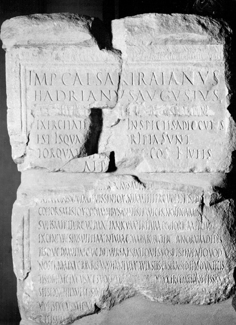
Fragments of an inscription (ILS 2487 and 9133–5) preserved on two pedestals indicate that Hadrian addressed the troops on the parade ground. In the summer of 128, Hadrian observed the legion and the attached auxilia over several days of exercises and addressed different groups of soldiers separately in a speech (aldocutio). He commented on their manoeuvres, praised their skill, and criticized any mistakes, speaking directly to them, unit by unit. On July 13, he praised the Ala I Pannoniorum for their javelin throwing, which they performed while wearing the legionary cuirass. He complimented their prowess, telling them:
“You did everything according to the book. You filled the training ground with your wheelings, you threw spears not ungracefully, though with short and stiff spears. Several of you hurled spears with skill. Your jumping onto the horses here was lively and yesterday swift.” Tr. M. Speidel – Emperor Hadrian’s speeches to the African Army: A new Text (2006)
The inscriptions on the base of Hadrian’s monument contain excerpts from his five speeches to the legion and auxiliaries. They are the only surviving example of a speech from a Roman emperor to his soldiers.
The legionary camp is one of the best-preserved military complexes of its type. However, it was greatly damaged in 1851 when a penitentiary was built in the southwest part, and the village was also built on the ruins.
Roman Rule in North Africa (146 BCE to 395 CE). Hadrian ordered the soldiers of the Third Legion to pave the military road between Carthage and Theveste (CIL VIII 10081) and to construct a road from Rusicada to Cirta (CIL 08 10296). Map created by Simeon Netchev (link)
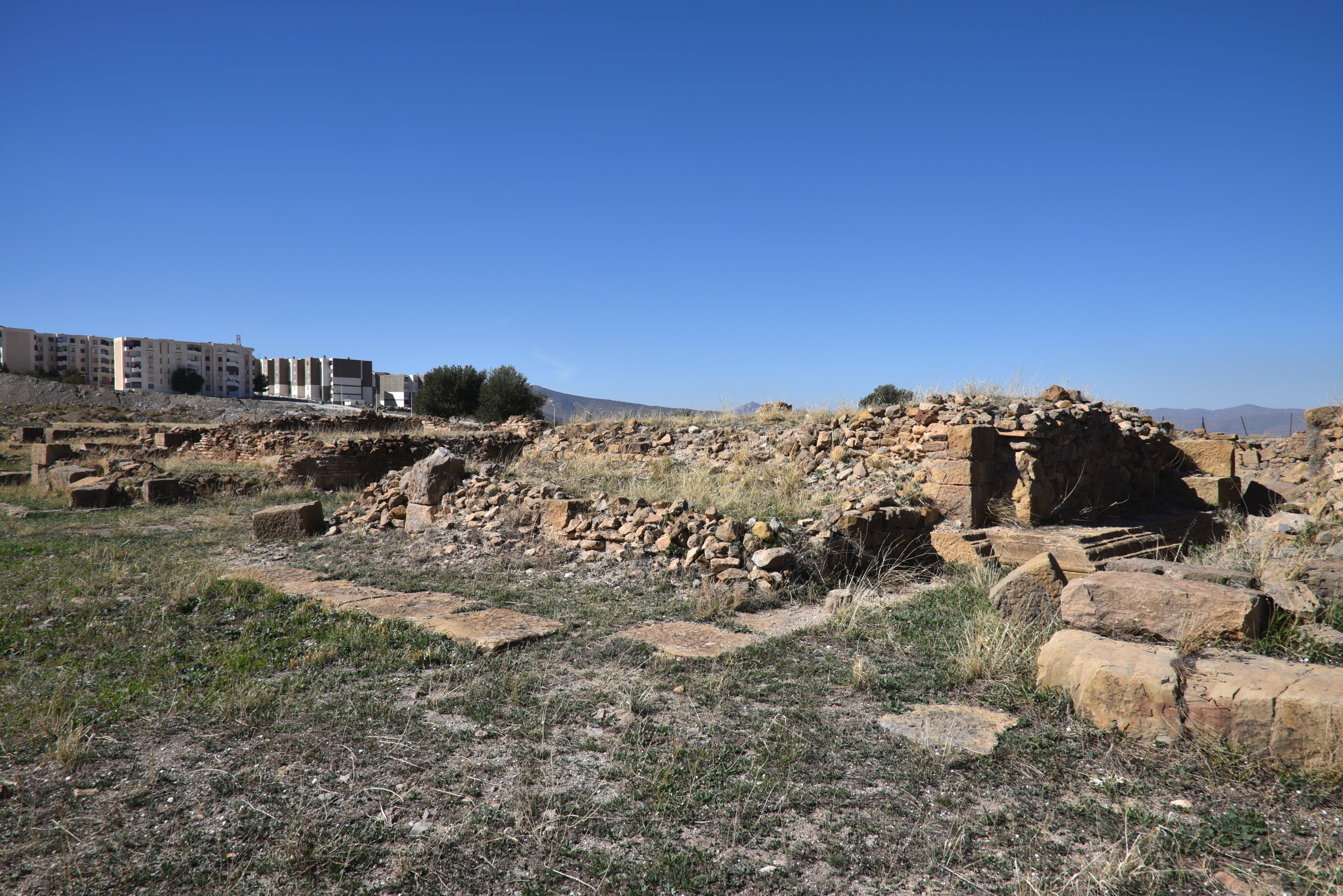
As was often the case, a civil settlement grew around military facilities. The area’s fertile agricultural land and high-quality limestone made it possible to construct a monumental Upper City, which featured public buildings befitting its new status as the capital of the new province of Numidia. The city’s second major period of growth occurred in the first half of the 3rd century AD when its legal status was elevated from that of municipium to that of colonia.
The legion was disbanded in 238, the “Year of the Six Emperors”, and suffered a damnatio memoriae following the troubles which resulted in the elevation of the emperor Gordian III. This act of condemnation saw the legion’s name chiselled out of inscriptions, effectively erasing it from public memory. In 253, Emperor Valerian and his son Gallienus reformed the legion, possibly giving it the new title of Legio III Augusta Valeriana Galliena. This revival enabled the legion to resume its role as the primary Roman military force in North Africa, where it continued to serve for several more decades. With the legion’s departure in 392, the ancient town declined.
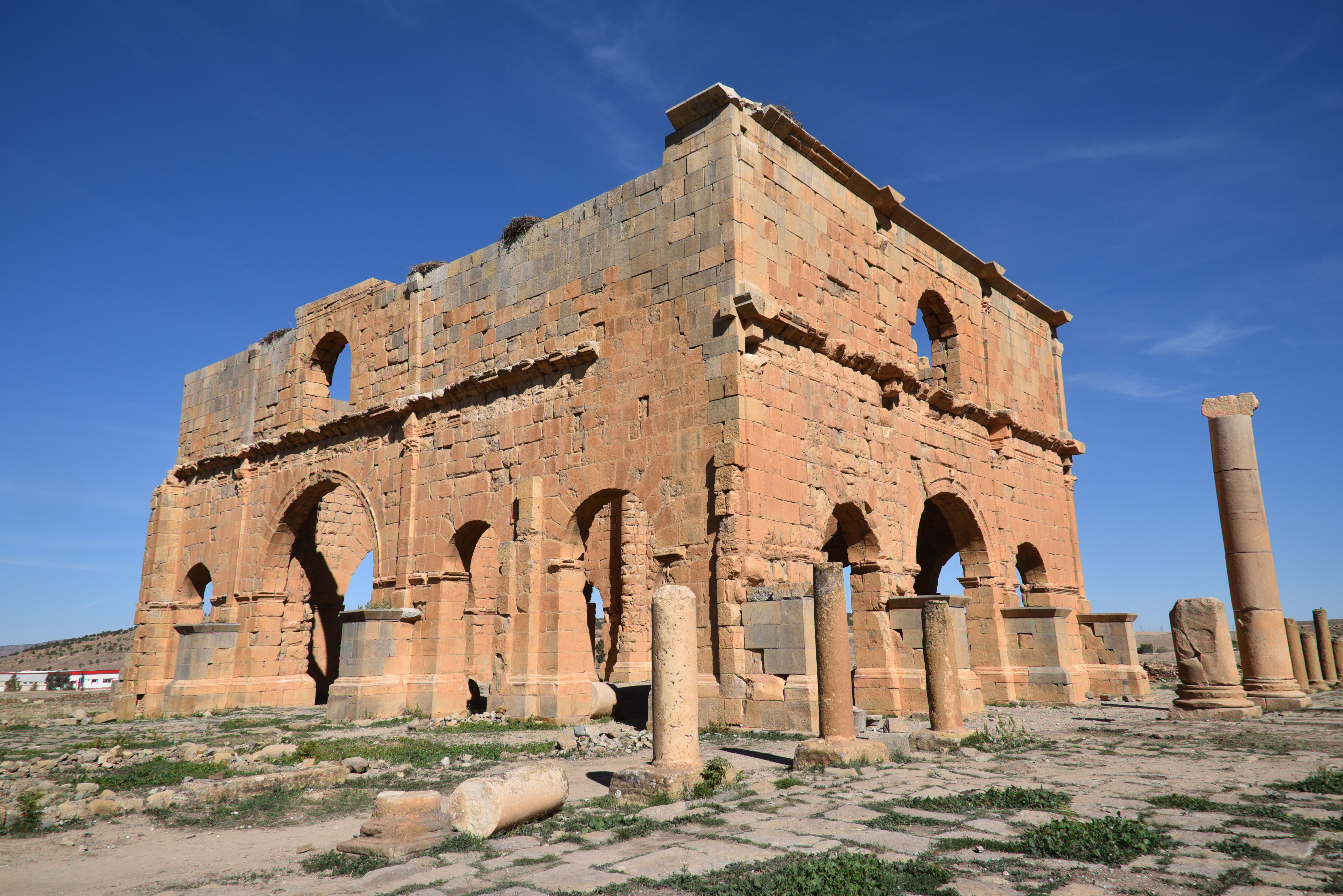
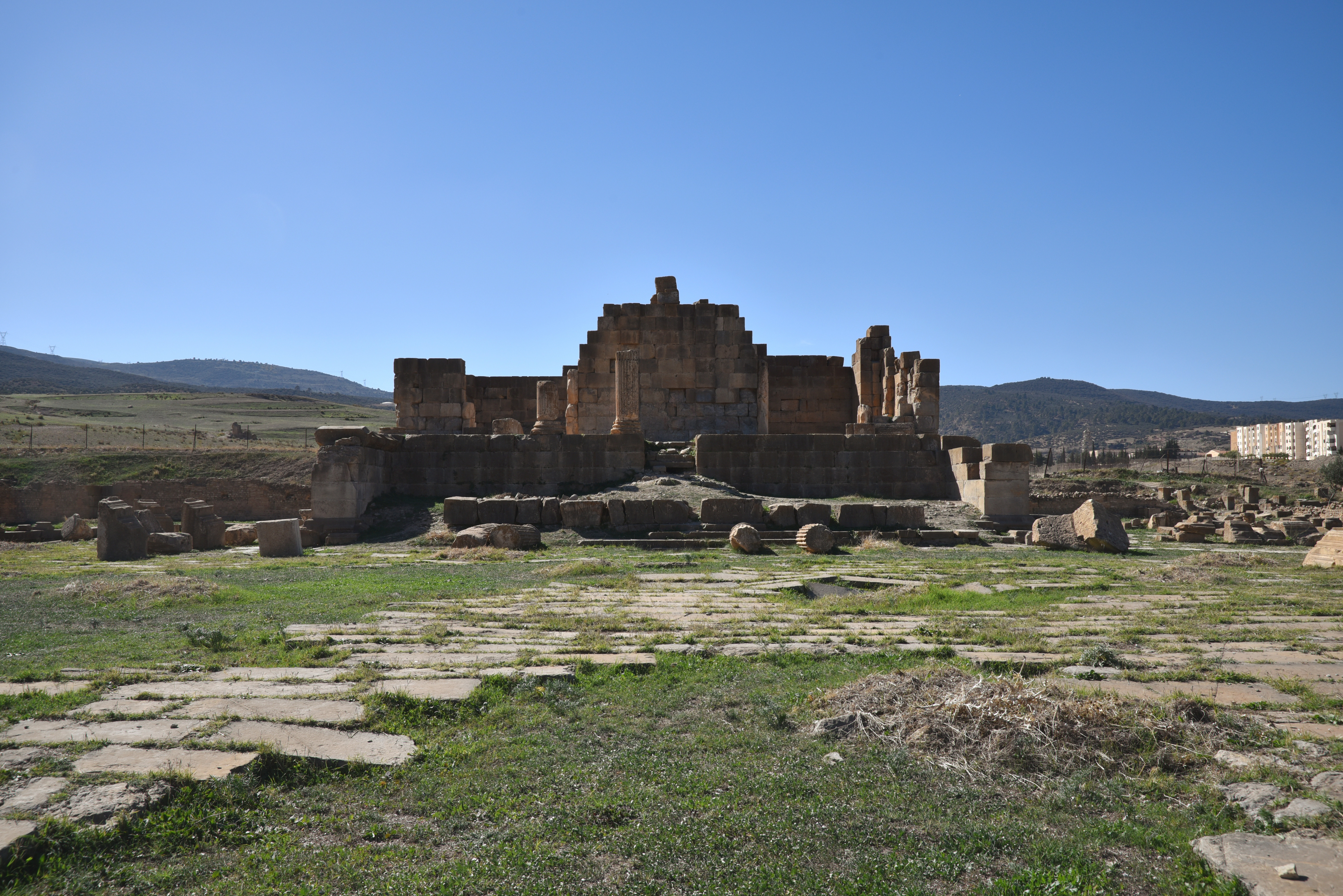
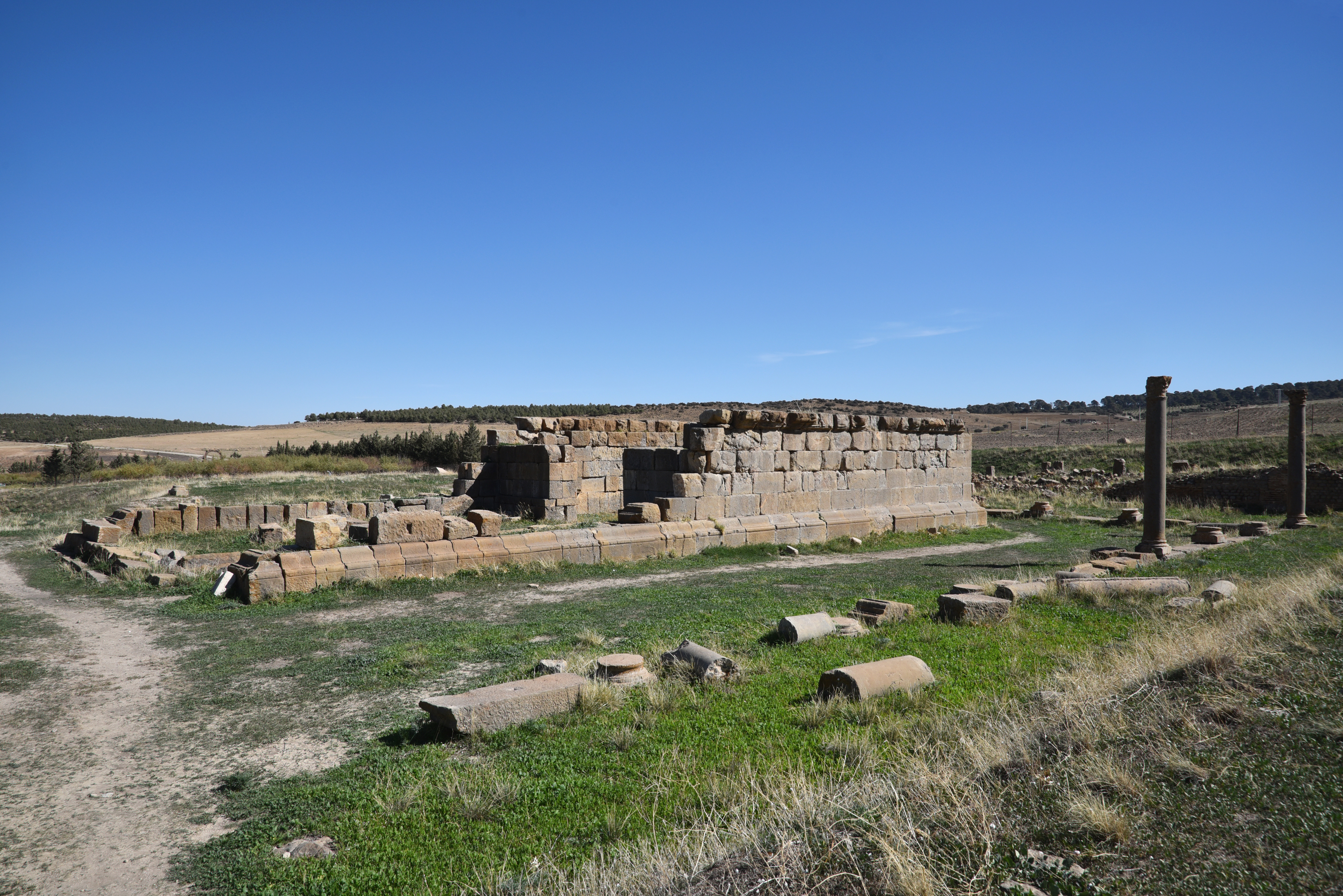
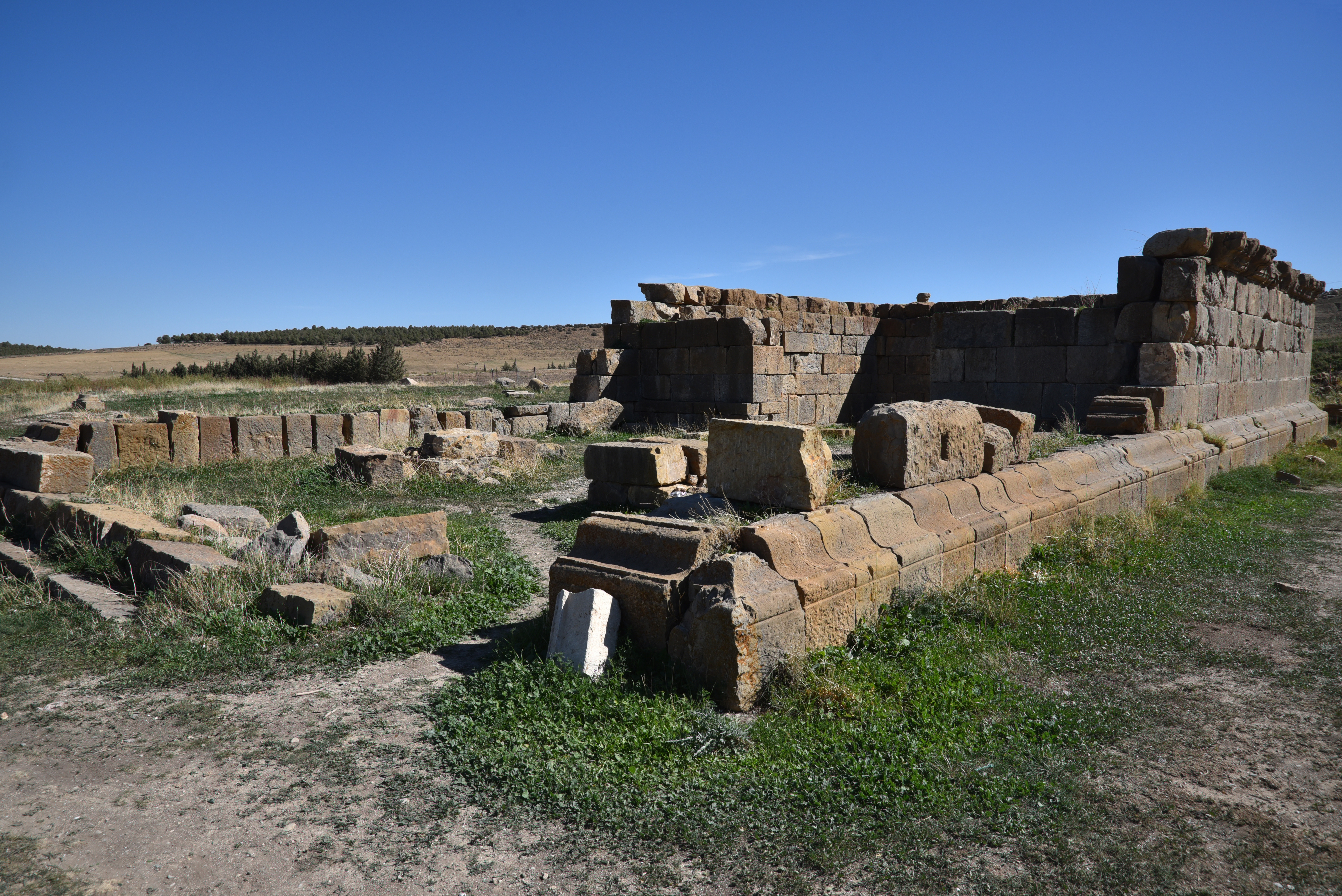
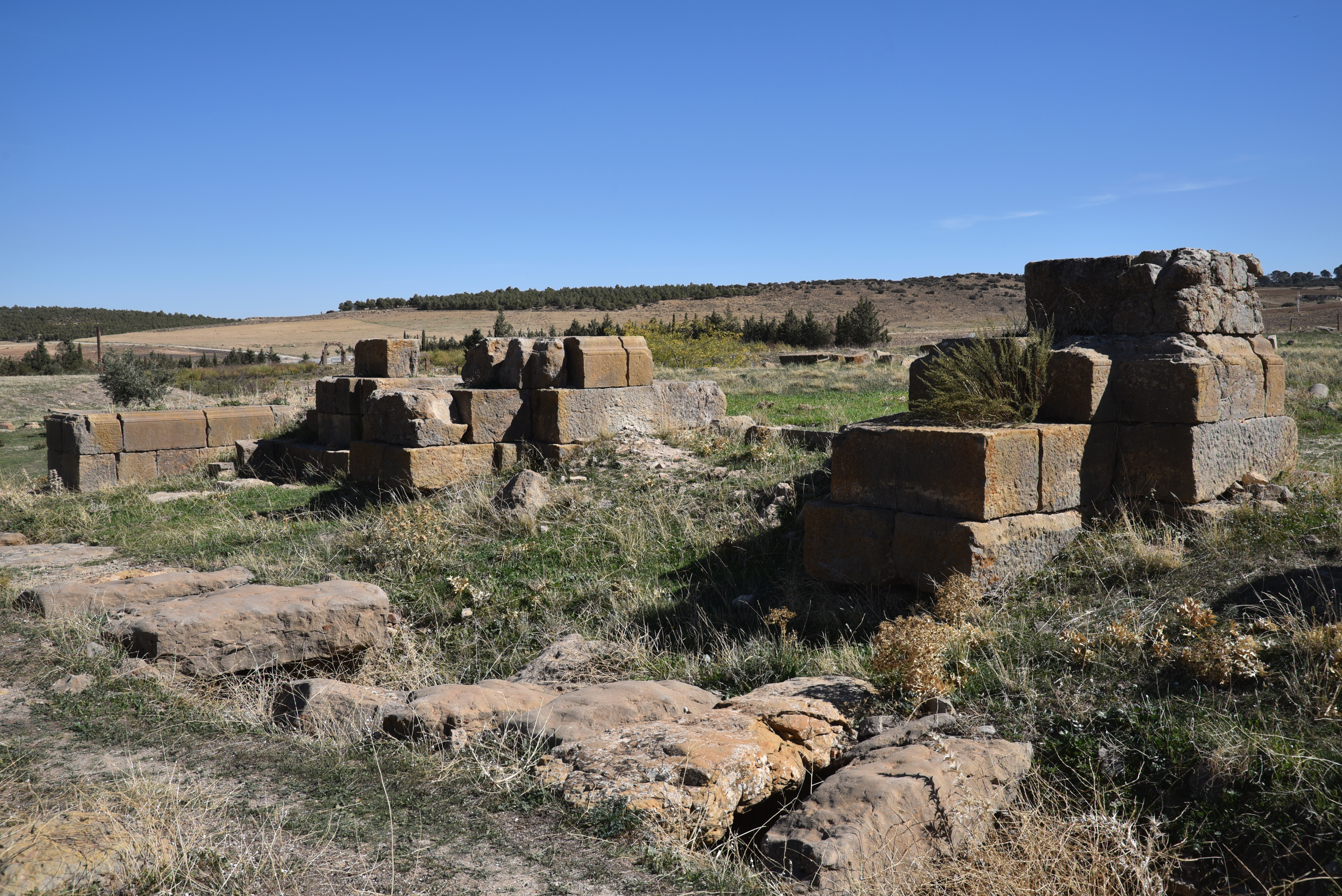
The most prominent remnant of the Roman legionary camp is the four-sided arch, often called the praetorium (the commanding officer’s residence). However, it is actually the groma, which serves as a monumental entrance to the principia (the headquarters building), located at the centre of the camp, at the intersection of the via principalis and the via praetoria. The amphitheatre, 200 metres (656 ft) away, was built in AD 169 under Marcus Aurelius and had a capacity of 12,000. The remains of the town at the edge of the modern village include two triumphal arches (dedicated to Septimius Severus and Caracalla), several Roman temples, including a Capitolium and a sanctuary of Asclepius, baths, and private houses.
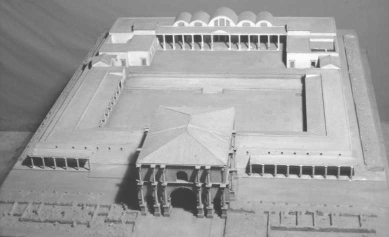
Model of the principia in Lambaesis after modifications in 265 under Emperor Gallienus. Photo: Fridrich Rakob (Negative D-DAI-Rome-NA-RAK – 37875)
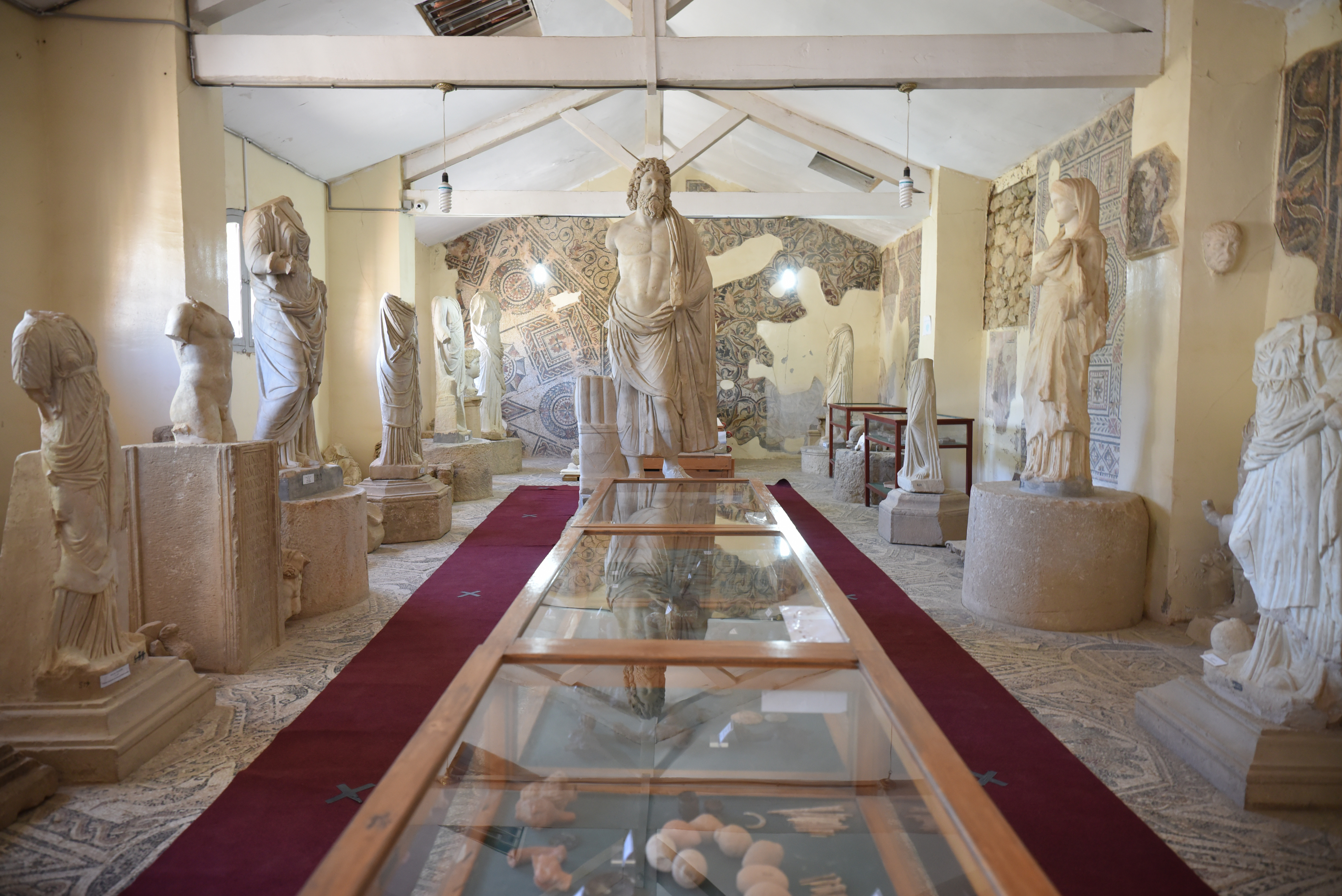
The small museum of Lambaesis in the centre of the modern town of Tazoult contains an exceptional epigraphic collection, providing invaluable information on changes in soldier recruitment. There are also statues of Aesculapius and Hygieia, a fine head of the child Commodus and mosaics.
PORTFOLIO
Hadrianic legionary base
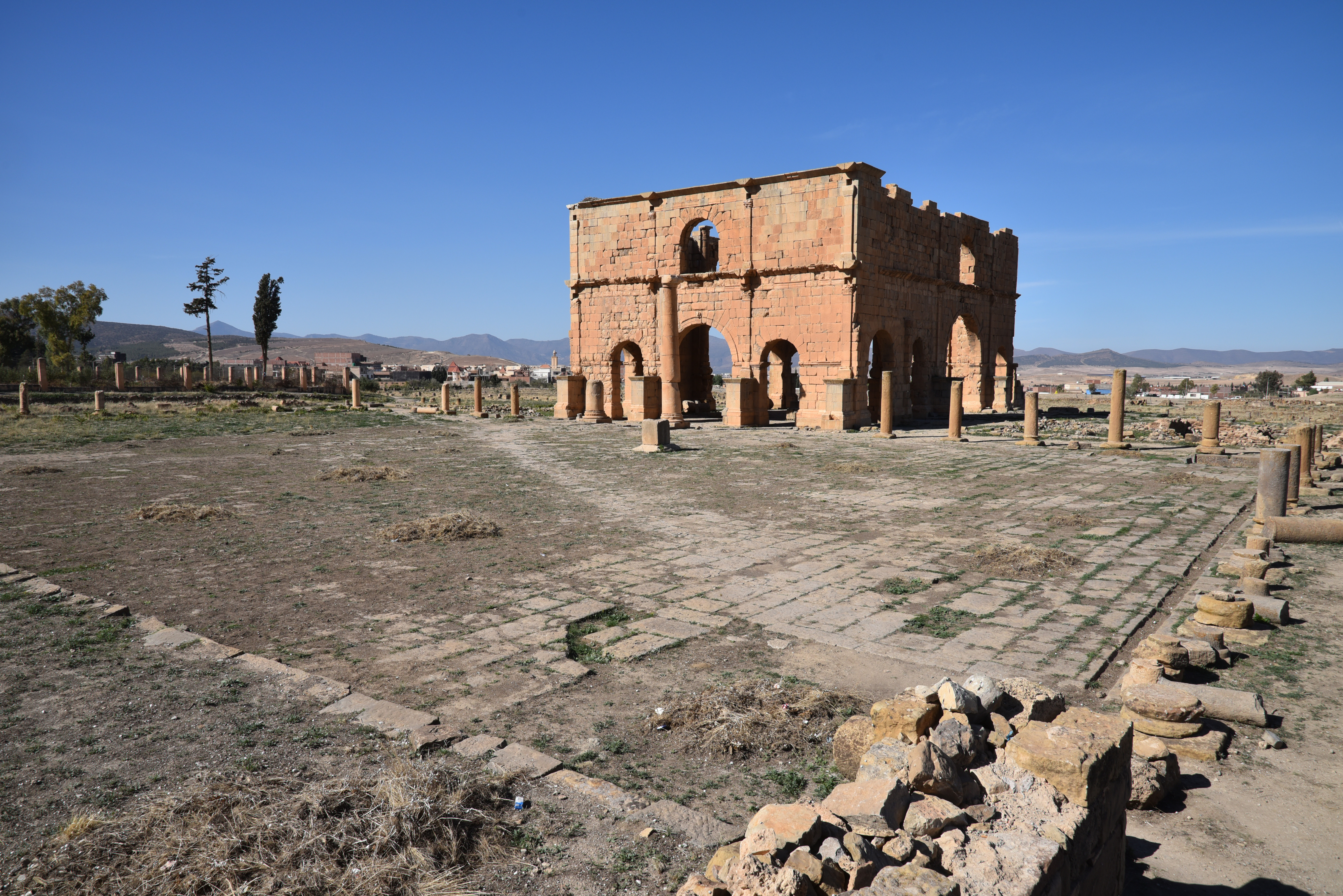
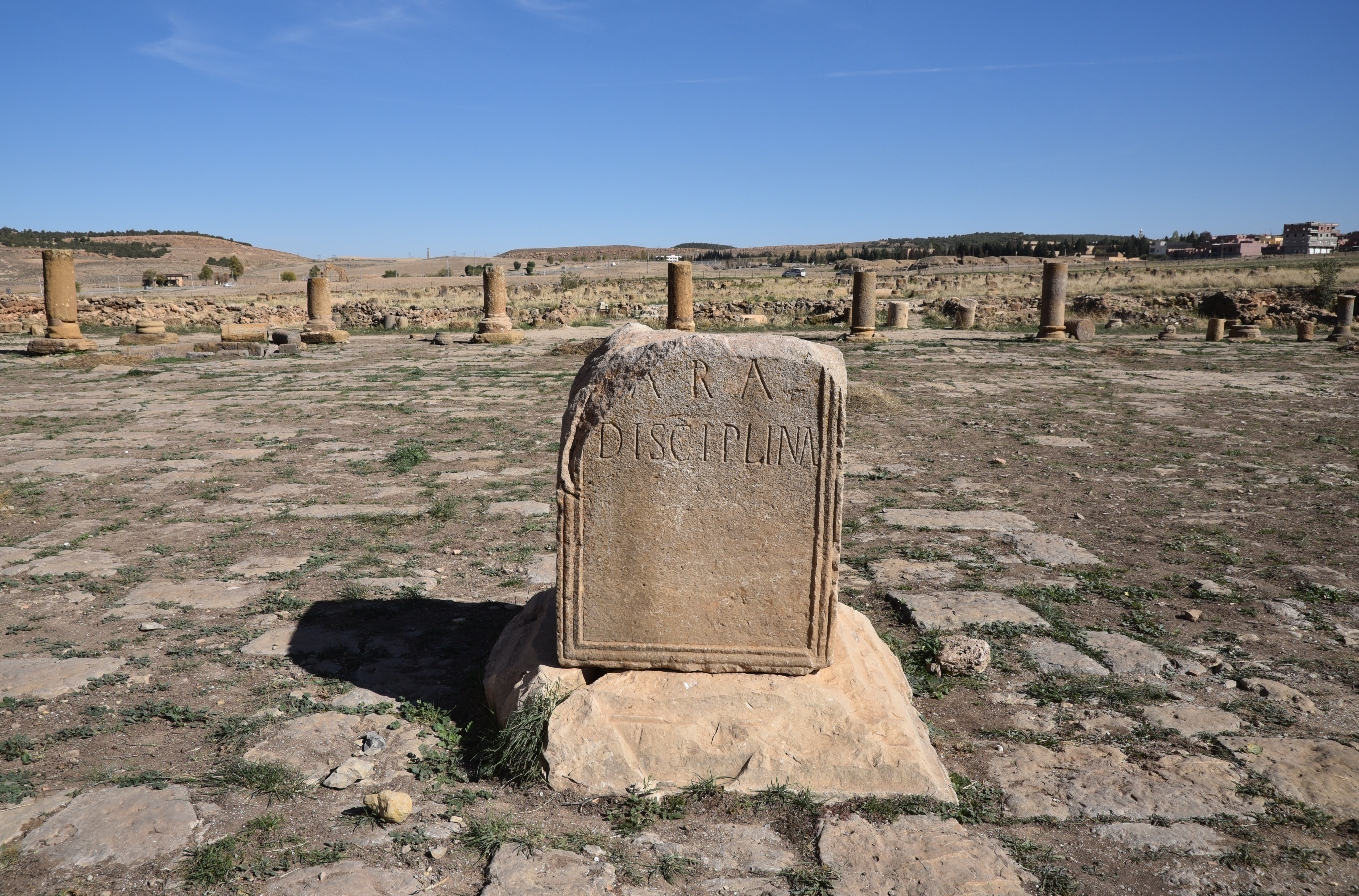
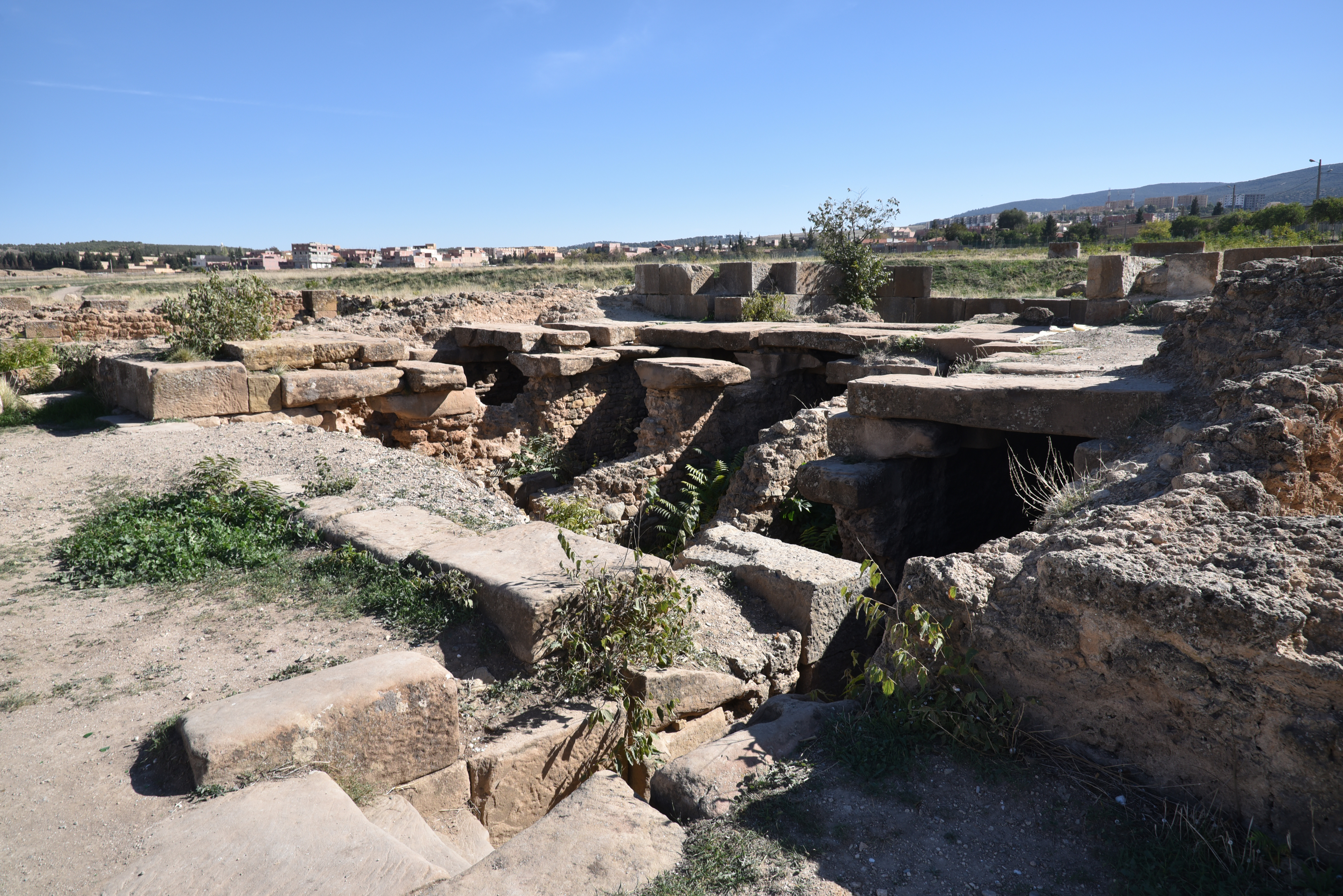
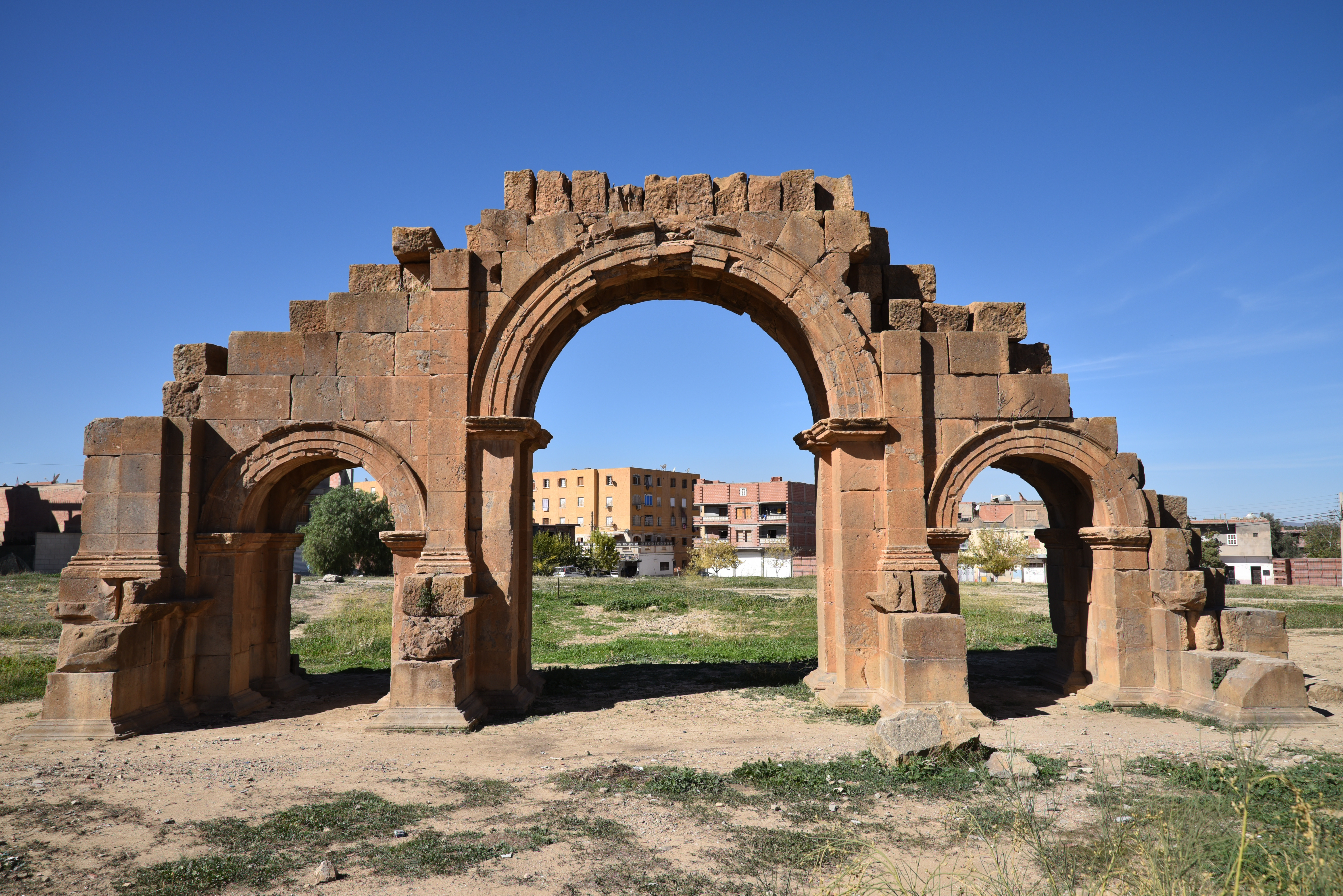
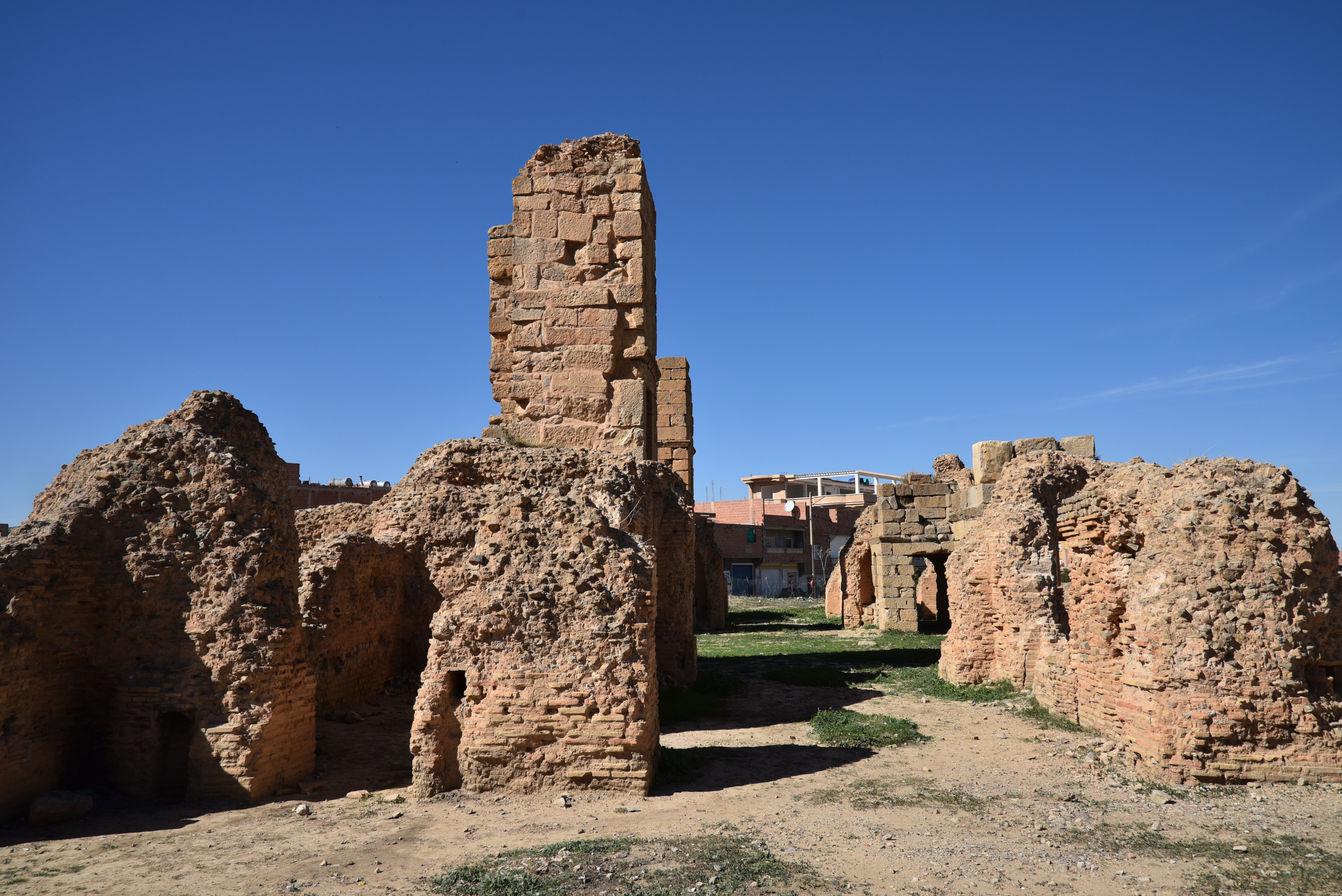
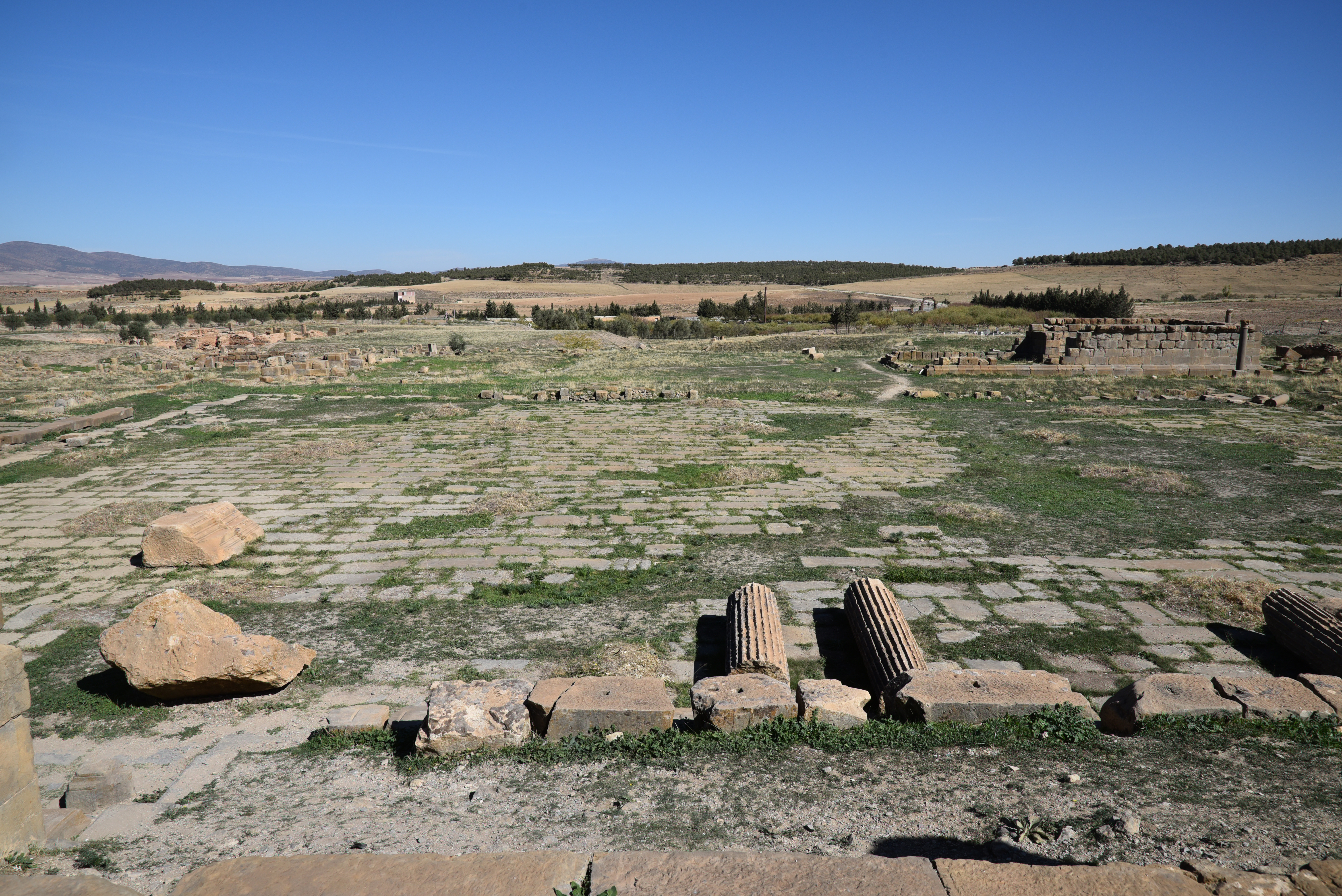
The Via Principalis (looking west) of the Hadrianic legionary base leading to the Groma (entrance building) at the centre of the principia complex. Barracks and dwellings are placed along the street.The Via Principalis was one of the two main colonnaded avenues crossing the Principia in an east-west direction.The Signum of the Legio III Augusta on one of the keystones of the Groma (east side).The Groma (west side) is located at the centre of the camp. It served as the monumental entrance to the principia, the camp’s headquarters. The Groma marked the intersection of the camp’s two primary roads, the Via Principalis and the Via Praetoria. It is named after the surveying instrument (see here).Reliefs of the goddess Victory and a laurel wreath on the keystones of the west side of the Groma.The north side of the Groma. It features a very battered inscription immediately above the central span that records a restoration carried out in 267–8 under Gallienus when the legionary camp was re-commissioned in 253. However, at some point between 286 and 293, the name of the emperor was erased, and the names of Diocletian and Maximian were inserted instead.The south side of the Groma. The building forms a sort of quadruple arch (c. 30 x 23 m; 15 m high) that admitted wheeled traffic, while the side arches were for pedestrian traffic. Windows on the upper story indicate that this structure was also used as a guardhouse.The Groma dates wholly or in part to the 3rd century AD. Beneath the building, the foundations of an older predecessor building from the early 2nd century AD are visible.The Groma from the southeast. On the outside, it is adorned with pilasters and Corinthian columns.South of the Groma extended a large paved courtyard (65 x 37 m). It was enclosed on three sides by a colonnaded portico that opened into a series of rooms. The fourth side facing the entrance was fully taken up by a Basilica/Tribunal.Altar dedicated to the goddess Disciplina (CIL VIII 18058) in the camp courtyard with the Latin text Ara / Disciplinae. Discipline was one of the military virtues and was worshipped as the goddess Disciplina. The goddess Disciplina acquired a cult in the 2nd century AD, and coins from the period featured a reverse with Hadrian leading troops with their standards, accompanied by the legend DISCIPLINA AVG.The peristyle courtyard of the Principia had offices and armouries on the three sides.View of the Principia’s courtyard and the Groma. In the foreground is a column base from the Basilica/Tribunal, a building divided into three naves by two colonnades of 12 columns each. The large south wall of the Basilica/Tribunal was bordered by apses used for cult activities, including a chapel that housed the standards of each cohort (aedes signorum).The Sanctuary of the Standards (aedes signorum), a chapel intended to hold the standards of the legion and the cohorts. Some scholars speculate the five underground chambers beneath the chapel were prison cells. (Letteney, M., & Larsen, M. (2021). A Roman Military Prison at Lambaesis. Studies in Late Antiquity, 5(1), 65–102.)View of the Principia from the northeast.View of the legionary from the northeast. The headquarters building was surrounded by several identifiable facilities. These include barracks for the soldiers, which have dormitories for the recruits and larger accommodations for the centurions. There are also modest houses for the officers, each featuring central courtyards. In addition, the complex includes storage areas, workshops (fabrica), and baths.Outside the camp stood the military amphitheatre, constructed in AD 169 under Marcus Aurelius and restored in 180 and 194.The amphitheatre could seat around 12,000 spectators. Unfortunately, the tiers of seats have disappeared as the French extensively quarried the amphitheatre in 1852 to construct the modern prison.The Arch of Commodus built ca. AD 180-192 east of the legionary camp. It has a single opening adorned with pilasters.The Arch of Septimius Severus, built by the Third Legion Augusta during the reign of Septimius Severus. The arch marked the edge of Lambaesis, a kilometre away from the Hadrianic military base.The Public Baths next to the Arch of Septimius Severus.The Public Baths have not been fully excavated. However, they have yielded a number of mosaics.
Upper Town
The Capitolium, dedicated to Jupiter, Juno, Minerva and Genius of the Colony. It was built in AD 246 and restored in 346-7.The Capitolium had eight columns across its facade.The Capitolium was enclosed by a rectangular porticoed court (mistakenly identified as a forum).The so-called Unidentified Temple, with its foundations standing in a porticoed precinct and facing north (instead of East), possibly serving as a curia.The so-called Unidentified Temple.Inscription dedicated to Victoria Augusta, AE 1916 0022, Marcus Virrius Diadumenus, a veteran of Legio III Augusta, erected a statue of Victory using his own money on the occasion of his promotion to the rank of the perpetual priesthood by his colleagues of the curia Hadriana, which they conferred on him in his absence.
The Severan Septizonium, a monumental nymphaeum built during the reign of Septimius Severus in AD 203 and restored by Alexander Severus. It had seven niches with water flowing down into three basins and was decorated with marble ornament and fluted columns.The road leading to Verecunda, a small market town located between Lambaesis and Thamugadi, features two gates. The nearer gate has three bays and is largely constructed from reused inscriptions. The farther gate, which dates back to the time of Commodus, has only one bay.
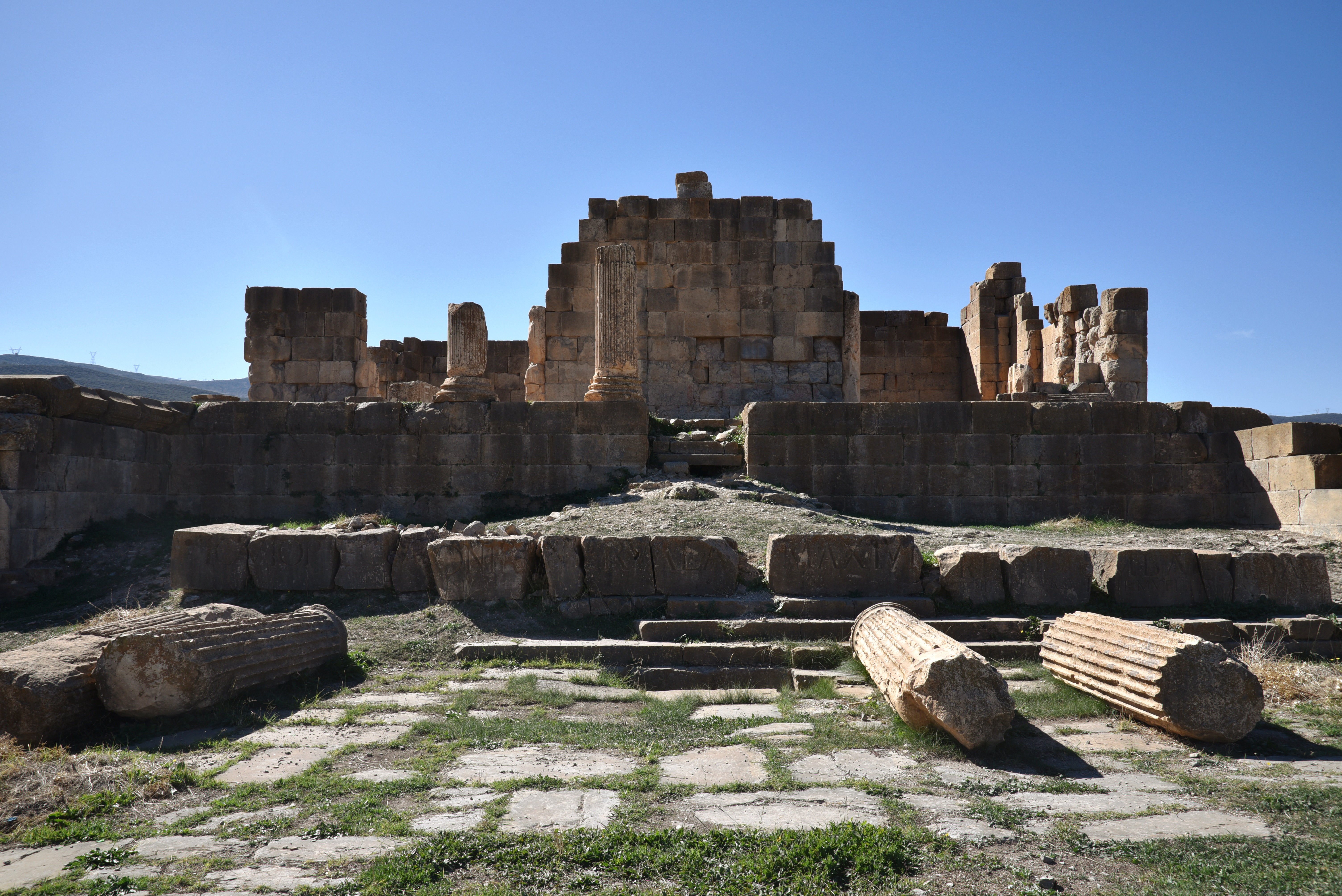
The Sanctuary of Asclepius with the Temple of Asclepius and Salus (left) and the Shrine of Silvanus (Right), a god of woodland associated with the Third Legion.The Shrine of Silvanus in the Sanctuary of Asclepius with the name of the Third Legion partially obliterated following its damnatio memoriae.The Doric Temple of Asclepius, dedicated by the legate of the Legio III Augusta in AD 162 to the worship of Asclepius and Salus (Hygeia, the personification of Health).Small shrines in the Sanctuary of Asclepius dedicated to different local divinities.The Sanctuary of Asclepius with small shrines dedicated to different local divinities.
Local Museum
The interior of the museum building with the statues of Aesculapius and Hygeia from the Sanctuary of Asclepius (Asklepieion).The museum has some fine mosaics from wealthy residences outside the fort.Mosaic of Apollo and the nymph Cyrene, dated to the 2nd or 3rd century AD. Cyrene, who was loved by Apollo, holds a flagon in her left hand, which may symbolize the sacred spring of Cyrene. In her right hand, she holds a reed. Only Apollo’s bare arm is visible to the right, but he can be identified by the quiver on his shoulder.
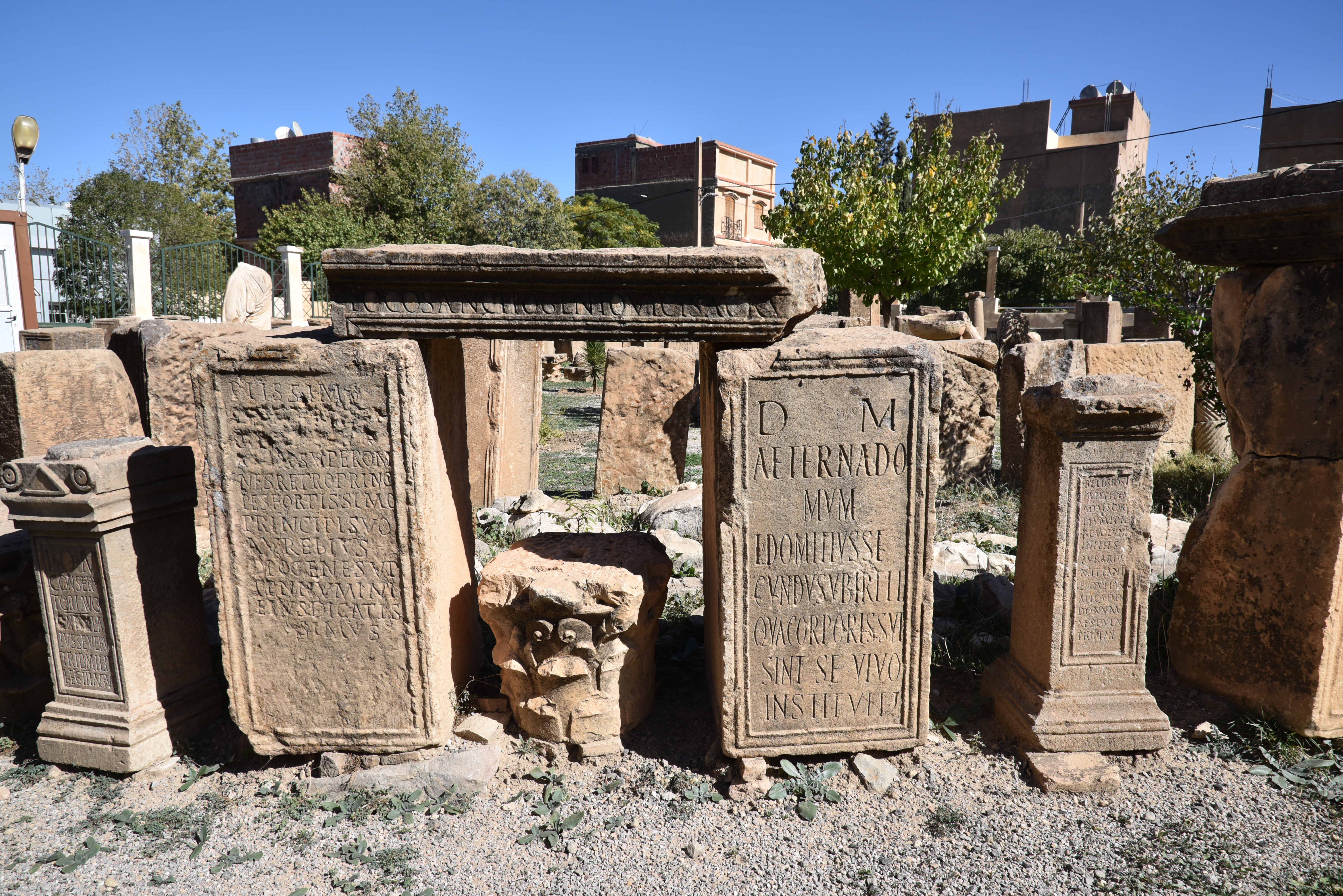
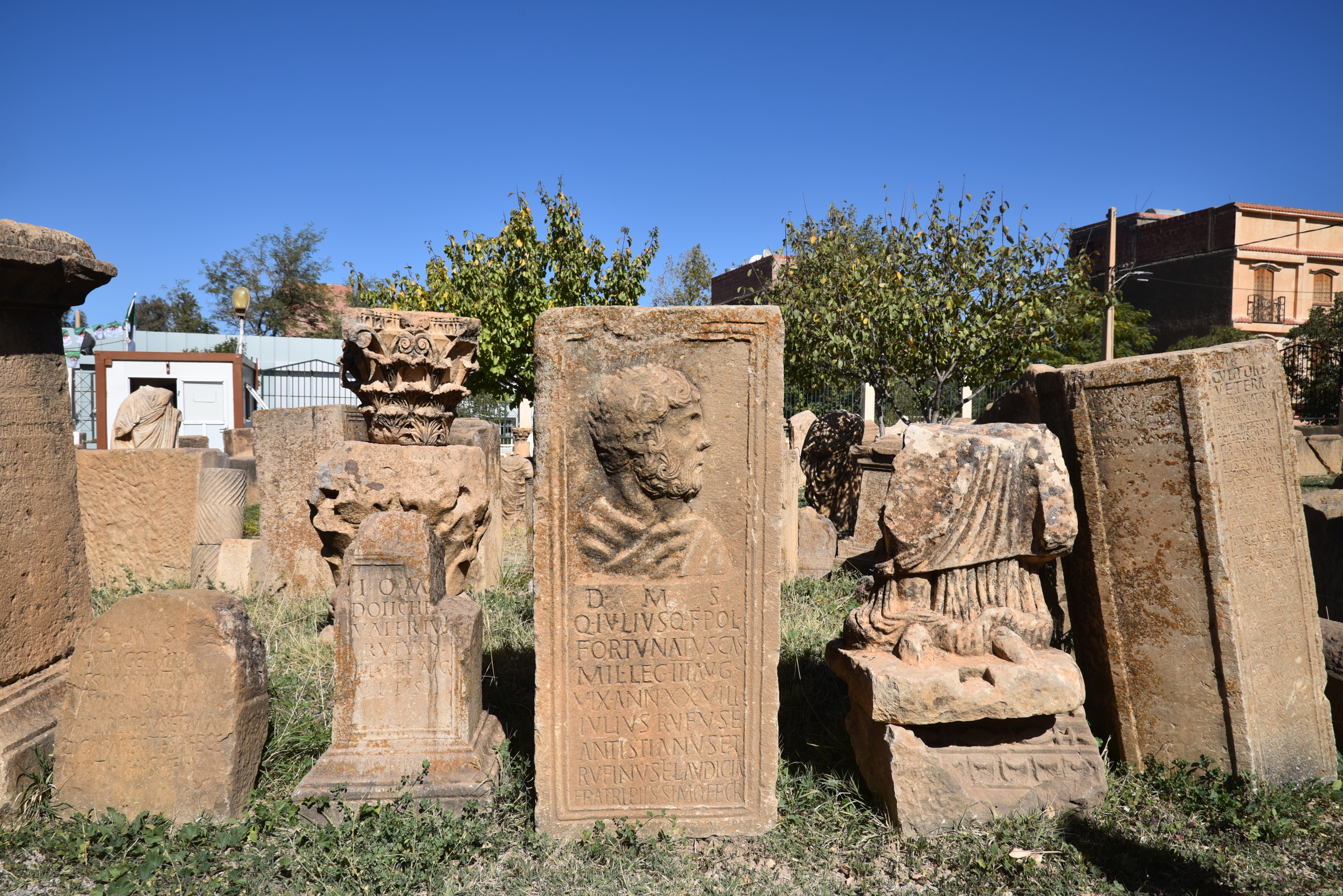
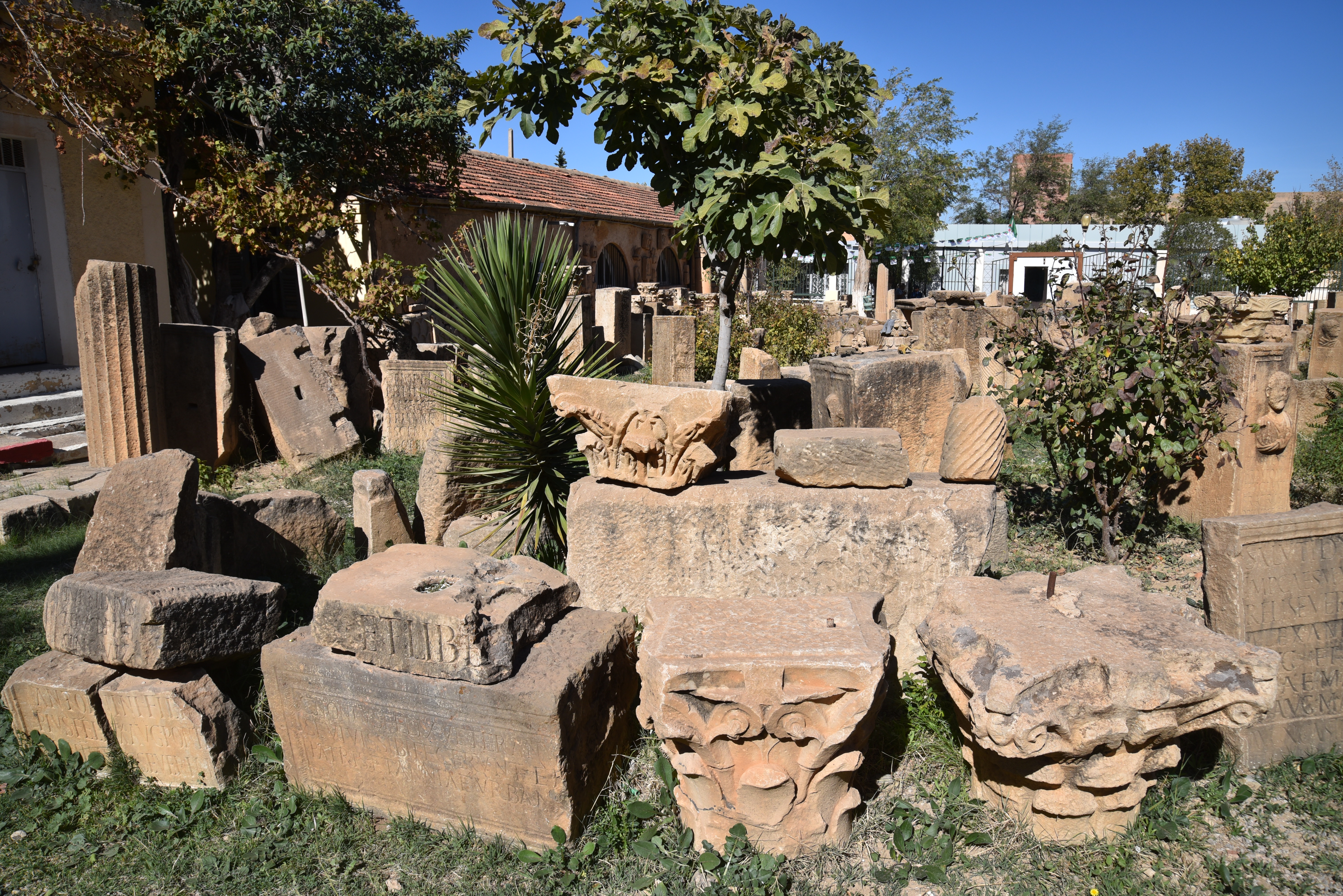
Inscriptions from Lambaesis in the epigraphic garden of the Lambaesis Museum.Inscription from the nymphaeum-septizonium built by Alexander Severus (CIL VIII 2659). Dated AD 222-235. Gift of the Alexandrian waters (the new aqueduct leading to Lambaesis) to the Lambaesitans by Emperor Severus Alexander.Dedication to Aesculapius and Hygia (CIL VIII 2589). Dated AD 247/248.Dedicatory inscription commemorating the repair of an aqueduct called the Aqua Titulensis by Aelius Rufus in collaboration with Severinius Apronianus, the governor of the province of Numidia (CIL VIII 2661). Dated AD 276-282.Inscriptions from Lambaesis (Numidia) in the epigraphic garden of the Lambaesis Museum.Tombstone of Sextus Vettius Geminus, a veteran of Legio III Augusta who served as a signifier (standard-bearer). He lived sixty years.Inscriptions and architectural fragments from Lambaesis in the epigraphic garden of the Lambaesis Museum.
Blas de Roblès, Jean-Marie; Sintes, Claude; Kenrick, Philip. Classical Antiquities of Algeria: A Selective Guide (p. 127). Society for Libyan Studies. pp. 343-373
Lambaesis: the Best-Preserved Legionary Fort YouTube video
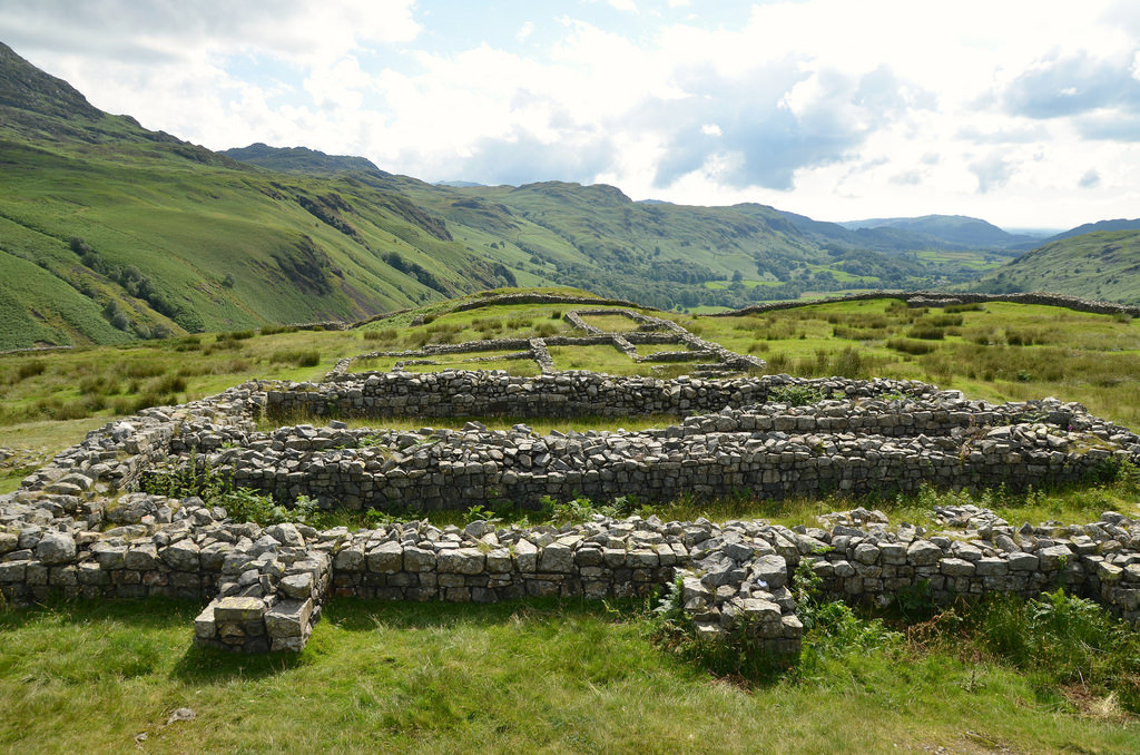
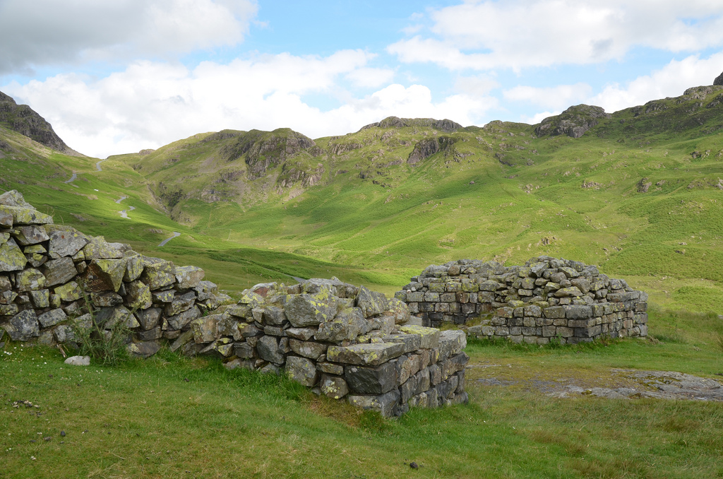
Hardknott Roman Fort is situated on the western side of the Hardknott Pass in the middle of the Lake District National Park in Cumbria. The fort was built during the reign of Hadrian high upon a rocky spur overlooking the River Esk at an altitude of 245 m above sea level. It guarded the Roman road between Ambleside and Ravenglass from invasion by the Picts and the Brigantes. The remains include the fort’s defences and gateways, the headquarters building (principia), the commandant’s house (praetorium), two granaries (horrea), and a bathhouse outside the fort’s southern defences. The fort is owned by the National Trust, part of the Trust’s Wasdale, Eskdale and Duddon property, and maintained by English Heritage.
Hardknott Fort was one of Britain’s most remote and dramatically sited Roman forts. Its construction was contemporaneous with the early phase of Hadrian’s Wall, and coin finds indicate that the fort was initially occupied only briefly from AD 120 to AD 138. It was subsequently evacuated under Antoninus Pius (AD 138-61) when the Antonine Wall was established before being re-occupied under Marcus Aurelius when the frontier returned south twenty years later. It was finally abandoned early in the 3rd century AD.
A fragmentary inscription (RIB 793a), discovered in 1994 near the south gate, records that the fort was erected “for the emperor Caesar Trajanus Hadrianus Augustus” by the Fourth Cohort of Dalmatae (Cohors Quartae Delmatarum).
The Fourth Cohort was an auxiliary infantry regiment of 500 men recruited from the Dalmatian tribes who inhabited the areas bordering the eastern Adriatic coast in the modern countries of Croatia and Bosnia-Herzegovina.
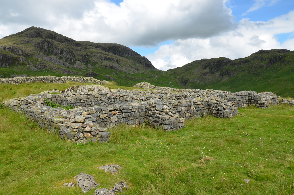
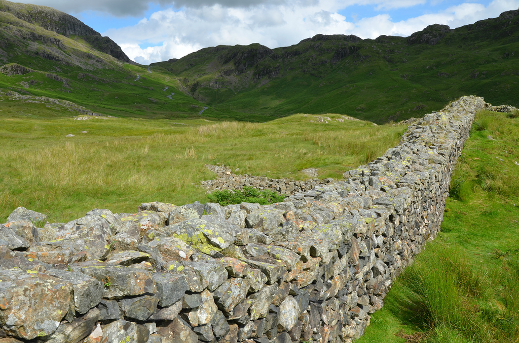
The stone-built fort is square and covers 1.2 hectares. It is flanked by two ditches on the uphill side. It has four gates in the usual position and four rounded corners with internal guard towers. The fort is entered through its main (south) gate, which, like those in the eastern and western walls, had two carriageways; the north gate had just one. Internally, the principia occupies the centre of the fort, which is flanked by the praetorium and two horrea. Timber-framed barracks and workshops occupy the rest of the fort (no traces of these remain).
The bathhouse, lying east of the fort, consists of one circular building containing the furnace and another three rooms with hot, warm and cold baths.
An artificially levelled ground lying on a plateau about 200 metres to the east is believed to be a parade ground where the garrison exercised and practised drill manoeuvres. It has a large ramp of stones leading up to a command platform or tribunal.
In 2015, physics researcher Amelia Carolina Sparavigna found that the gates that led in and out of Hardknott Fort were aligned with the summer and winter solstices (read more here). Sparavigna also suggests that the fort’s construction was designed for the soldiers to worship the sun and pay homage to the solar deities Mithras or Sol Invictus.
PORTFOLIO
The Hardknott Roman Fort is located in the picturesque Hardknott Pass.The Headquarters Building is located in the centre of the fort.The Headquarters Building comprised a courtyard flanked by narrow rooms, possibly used as armouries.The Commanding Officer’s House was large and single-storied, probably with rooms arranged around a central open courtyard.One of the Angle Tower. A square tower was constructed in each of the corners of the fort.The Granaries. These long buildings had thick outer walls which were heavily buttressed, presumably to support the weight of their superstructure and roof.The North-West Gate.The South-East Gate.The remains of a tribunal, a platform from which the Commanding Officer would have given orders for the day and officiated over ceremonial and official occasions.The west side of the Fort.The South-West Gate.The east side of the Fort.The North-East Gate.The South-West Gate.Off the track from the road to the fort lie the remains of a stone bathhouse, which provided facilities for the soldiers’ relaxation. Photo by James Stringer (Flickr-CC BY-NC 2.0)