Tipasa

The archaeological site of Tipasa is located on the Mediterranean coast of Algeria, approximately 70 kilometres west of the capital, Algiers. It is a UNESCO World Heritage Site that showcases an extraordinary mix of ancient cultures, including Punic, Roman, early Christian, and Byzantine influences. Tipasa was originally established as a Punic trading post and later grew into a prosperous Roman colony in the 2nd century AD, situated to the west of ancient Iol-Caesarea (modern-day Cherchell), the former capital of the Roman province of Mauretania Caesariensis. Like other coastal cities in Algeria, Tipasa adopted Christianity in the first half of the 4th century AD. However, following the Arab invasion, the city gradually declined from the 6th century AD onward.

Coordinates: 36°35’35.1″N 2°26’47.0″E

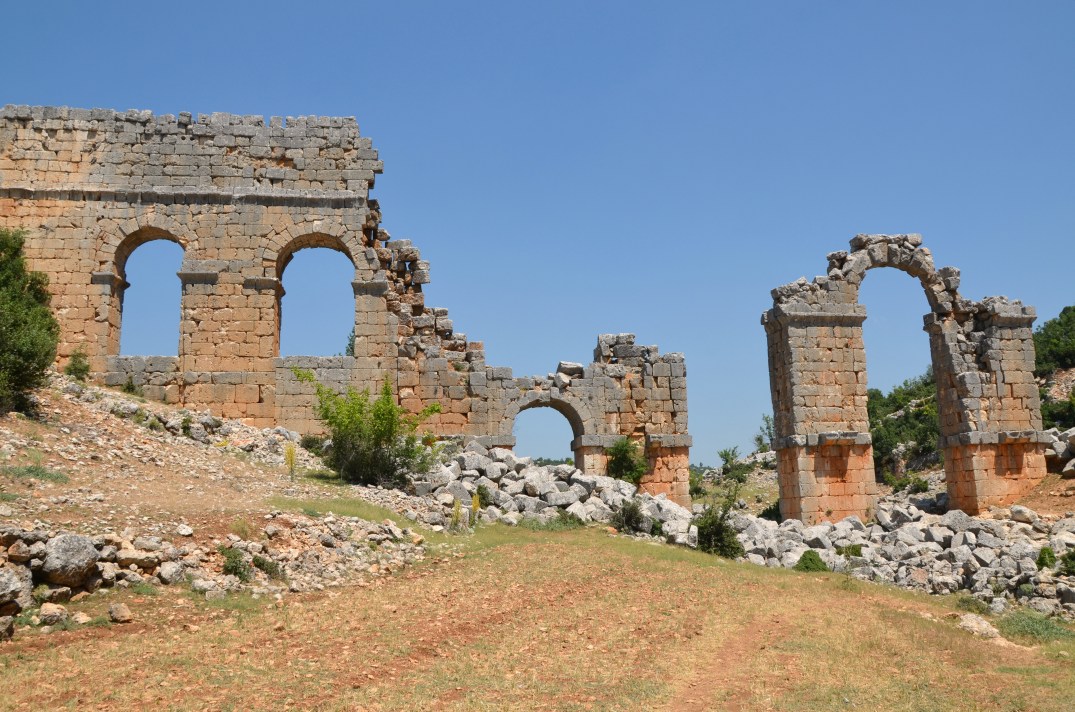
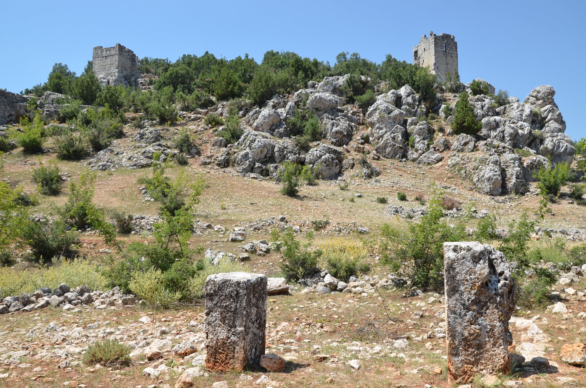
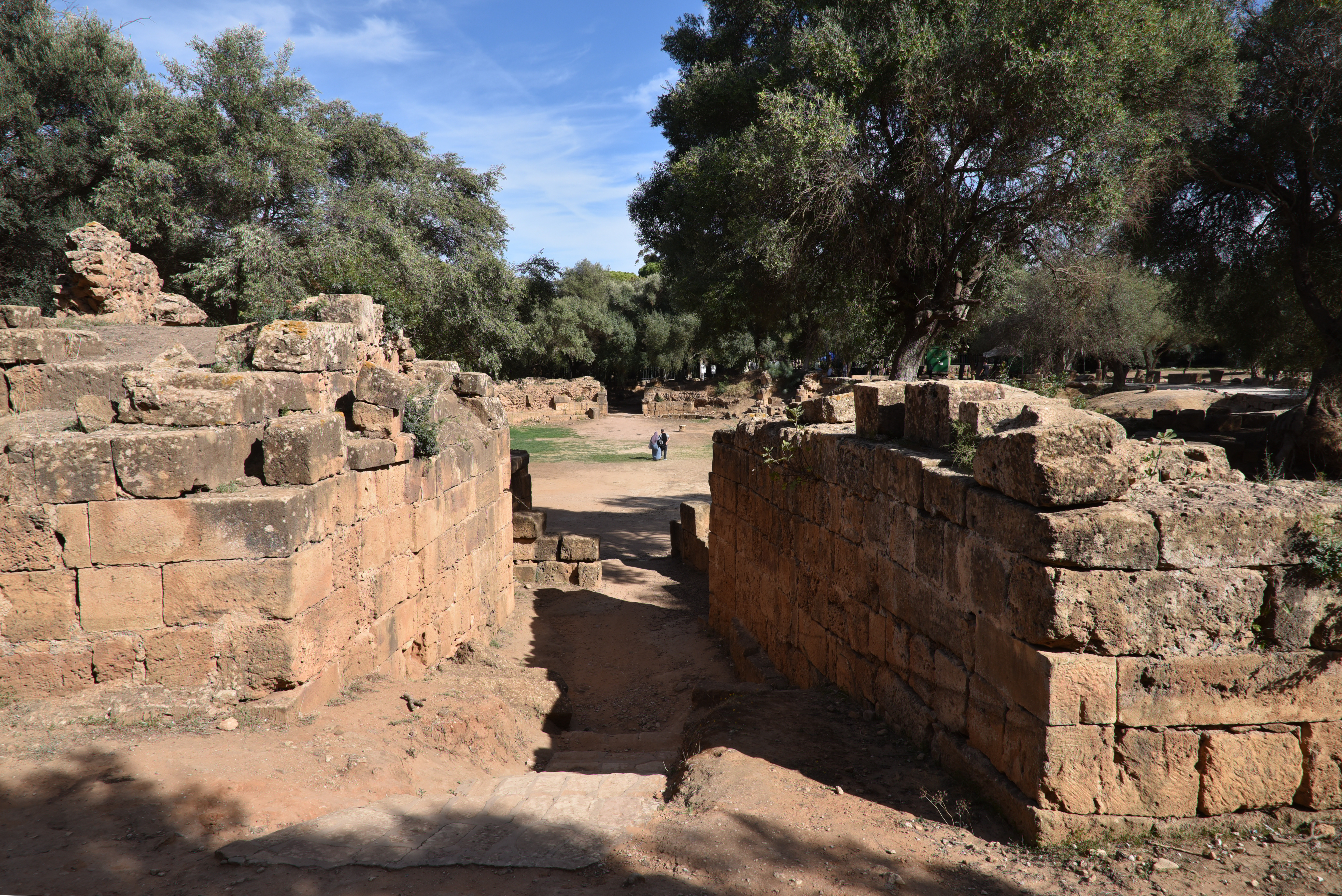
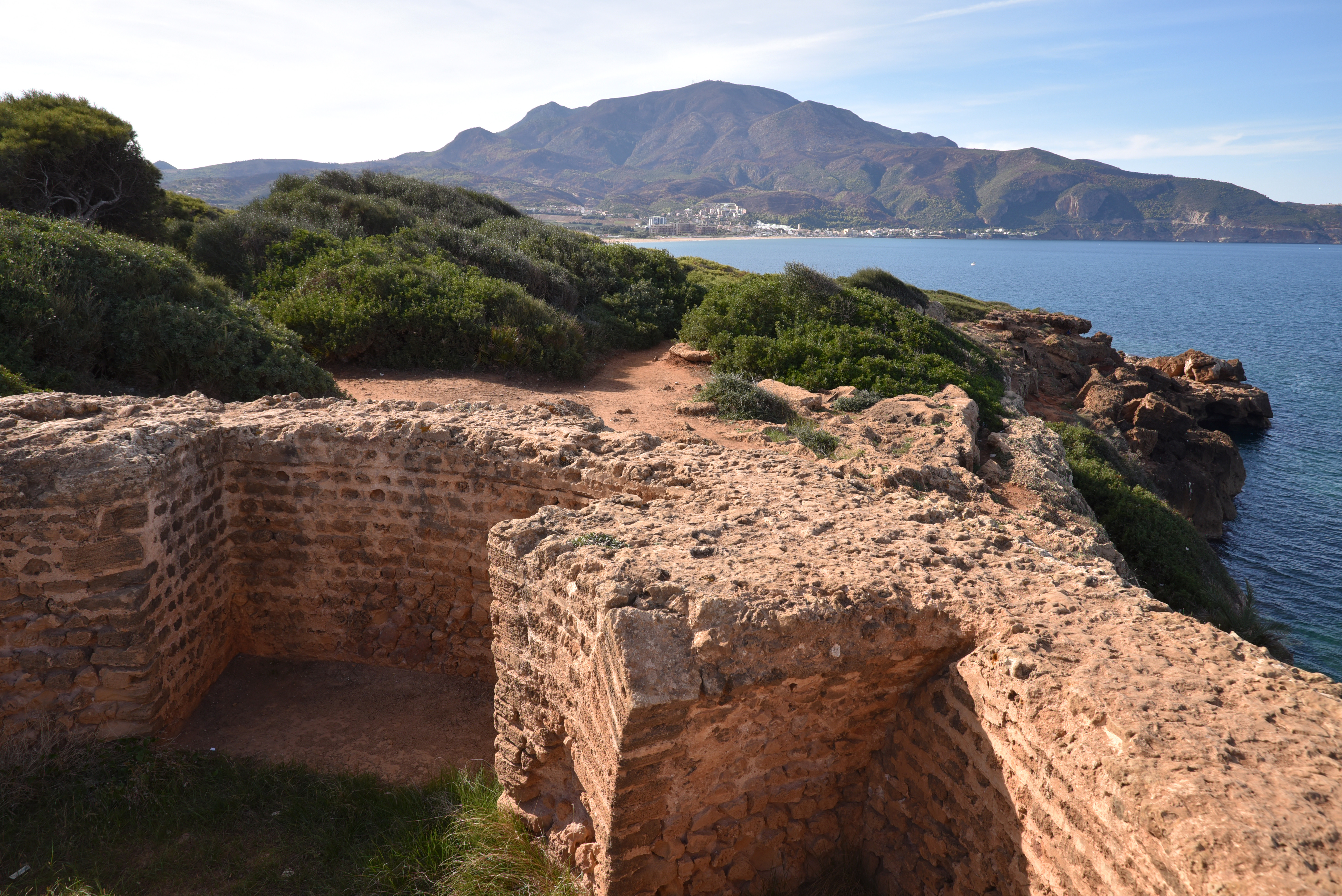
Tipasa was a Punic trading post located along the sea route between Carthage and the Pillars of Hercules (Straits of Gibraltar). Very little remains of the early settlement, except for traces of a necropolis dating back to the 6th or 5th century BC. Rome conquered the city in the 1st century AD, and in AD 46, it was designated as a municipium with Latin rights under Emperor Claudius (Pliny NH 5.2.20). Later, it became a colonia under Emperor Hadrian, bearing the name Colonia Aelia Tipasensium (AE 1958, 129). In the 2nd and 3rd centuries AD, Tipasa enjoyed a time of great prosperity. This period saw the construction of a 2.3 km long enclosing wall that featured 31 towers. Tipasa’s prosperity was primarily driven by trade in the Mediterranean, particularly in oil and garum.

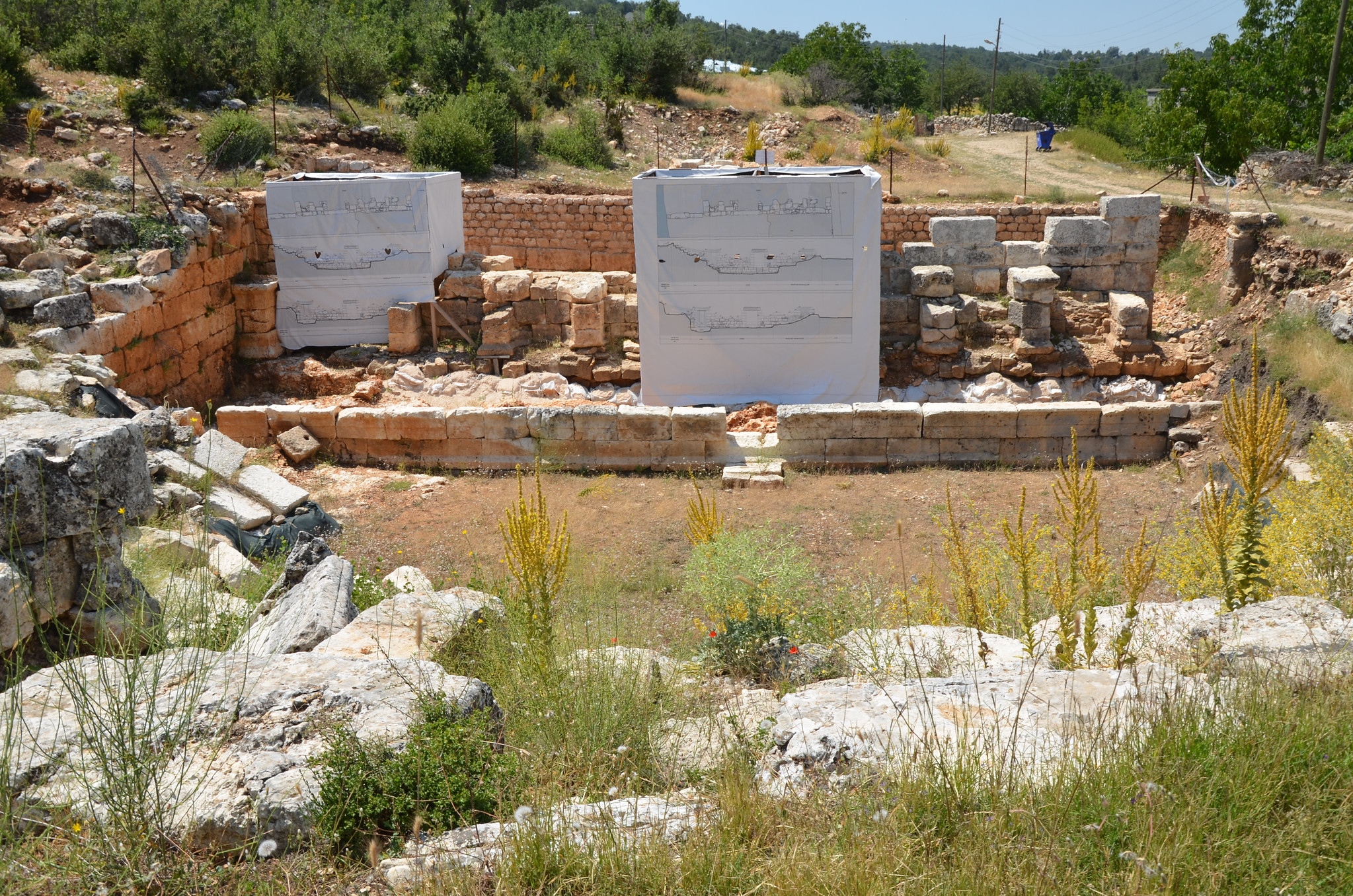
During the reign of the Severan dynasty in the middle of the 3rd century AD, Moorish rebels were held at bay, allowing the cities of Africa to enjoy their greatest period of prosperity. Many of the public buildings that are still visible today were likely constructed during this time. With the ascendance of Christianity in the 3rd and 4th centuries AD, the city’s physiognomy changed and reached a population of 20,000 inhabitants. The older buildings fell out of use or were demolished, and Christian basilicas were built. During the 5th century AD, the city faced challenges due to the Vandals’ annexation of Africa. However, it began to recover under Byzantine control one century later, leading to a modest renaissance characterised by repairs and expansions to several churches. At the end of the 7th century, the city was demolished by Umayyad forces and reduced to ruins.

Map of Tipasa.

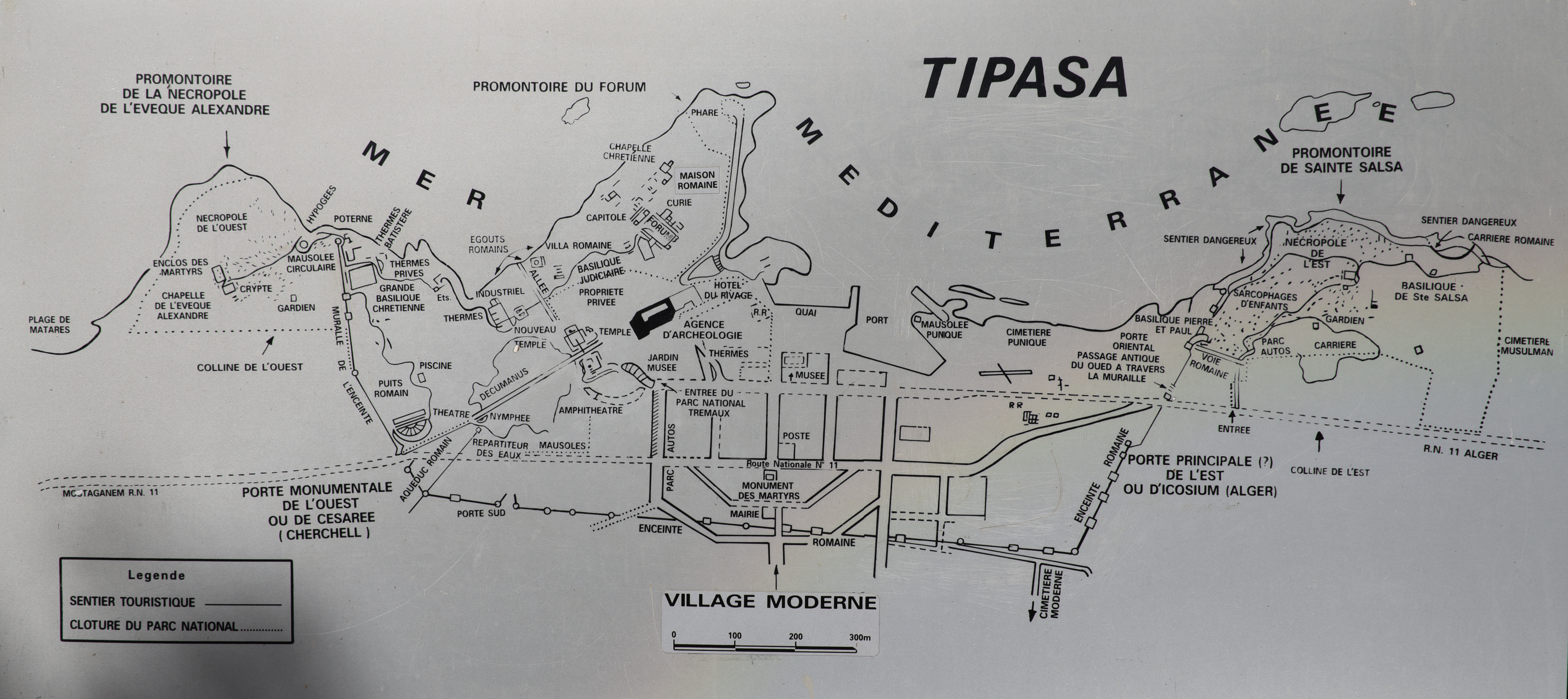
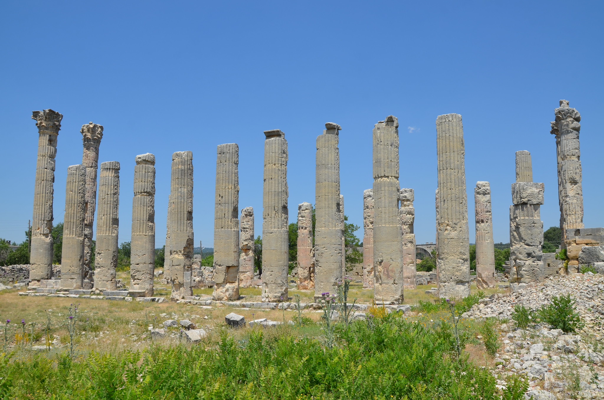
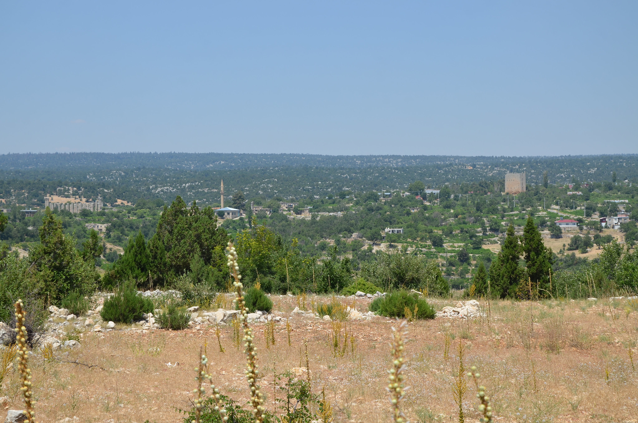
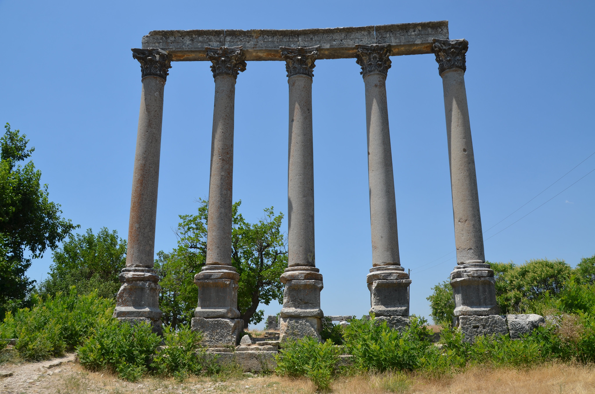
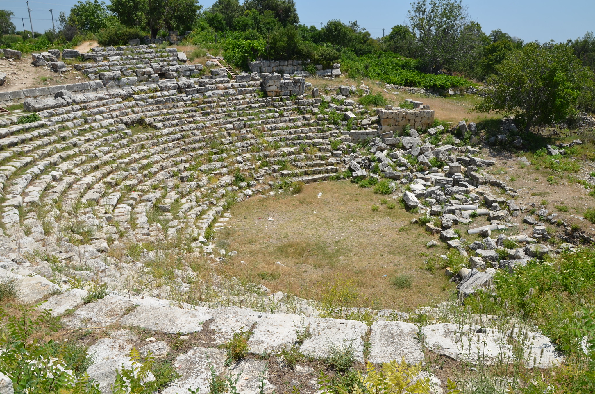
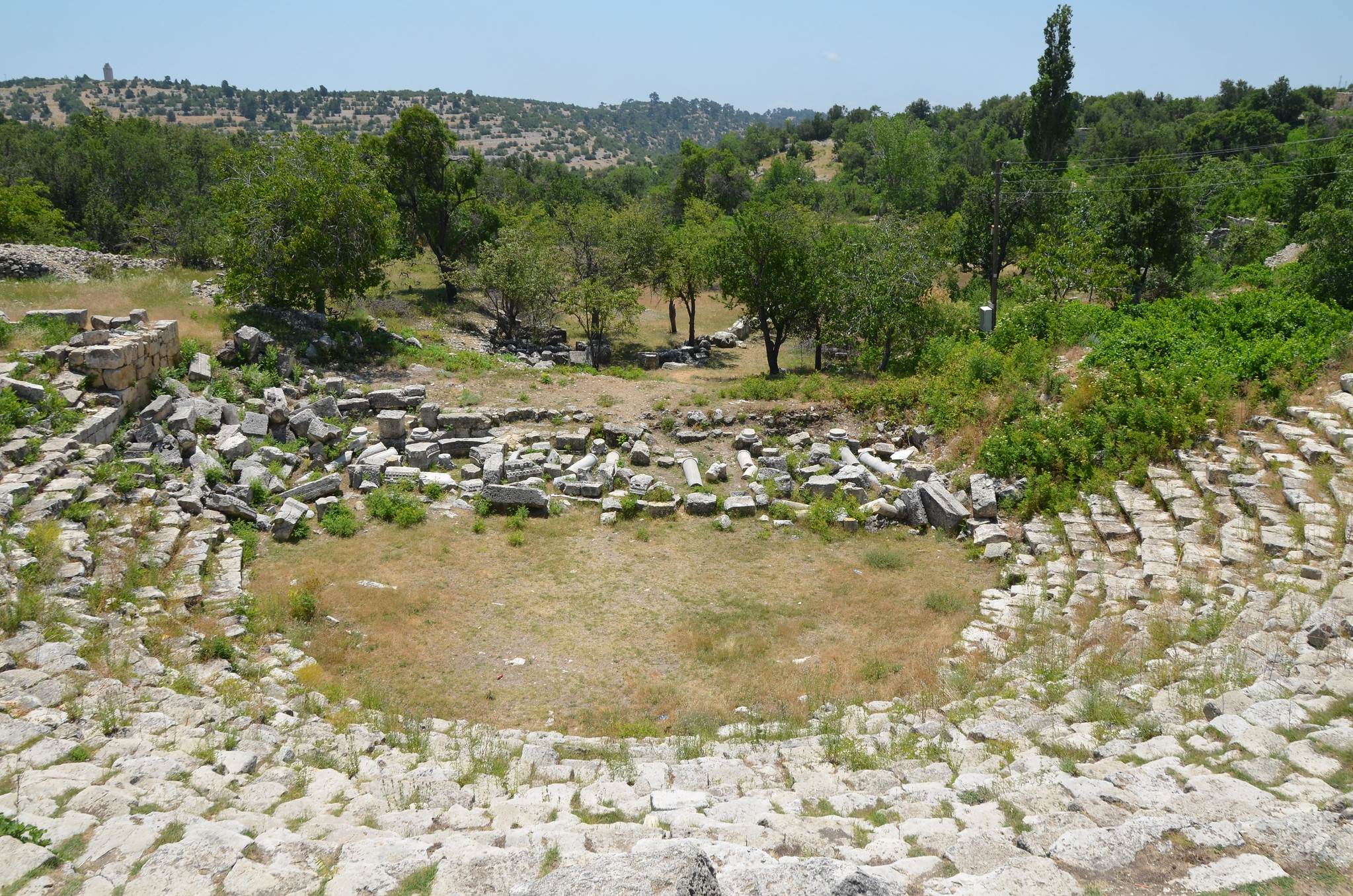
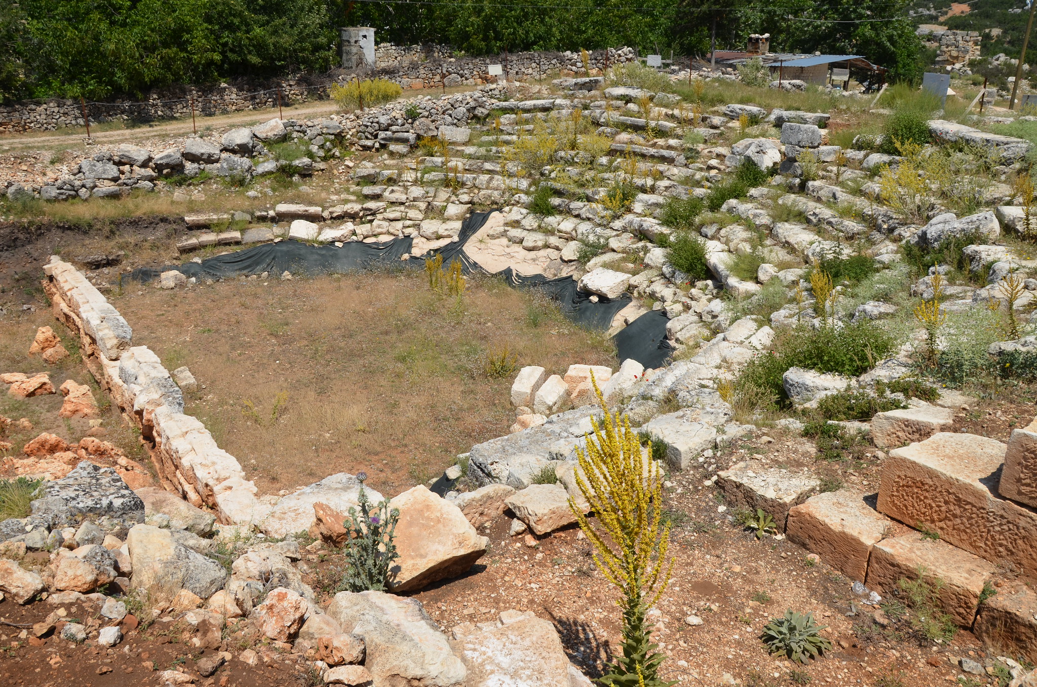
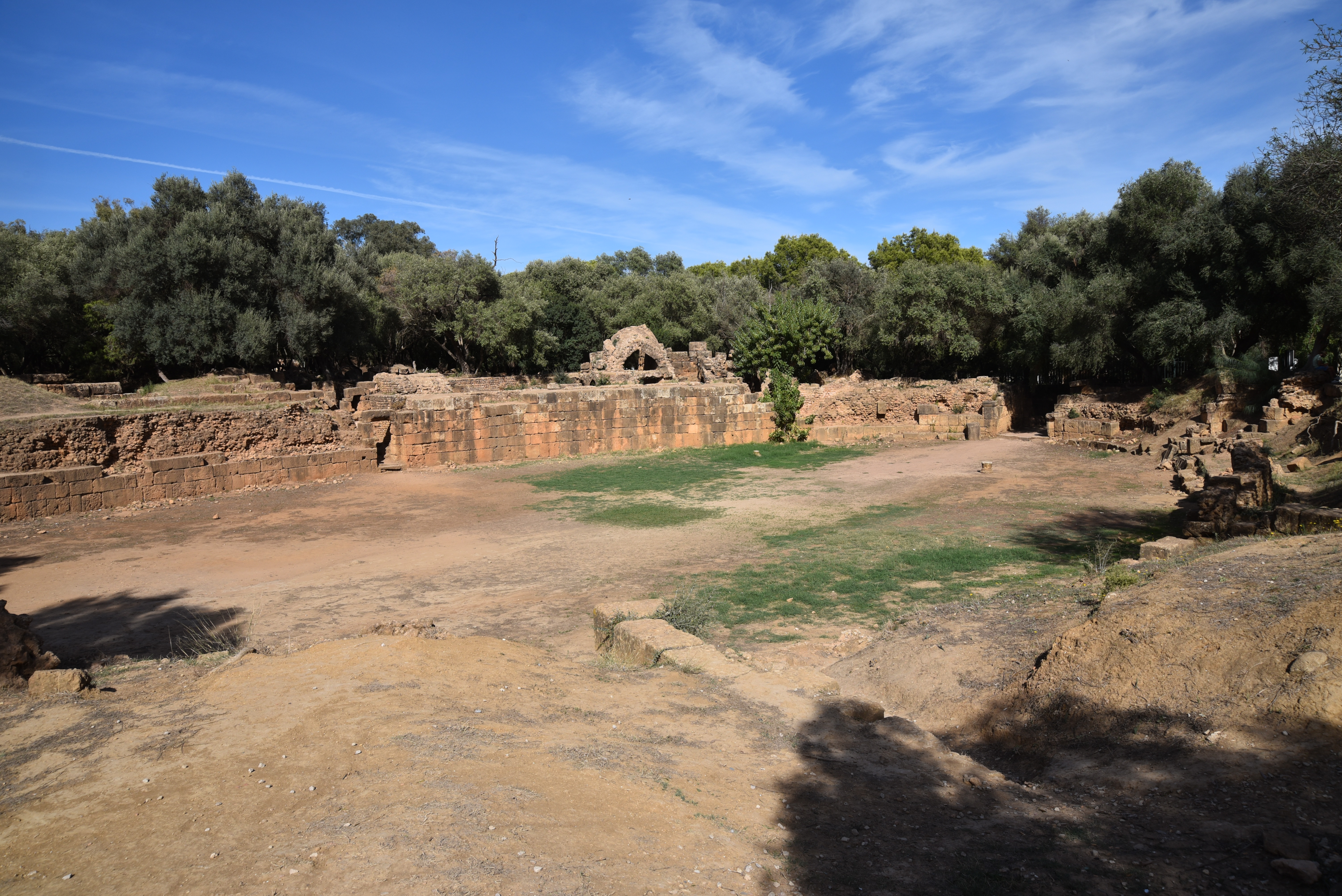
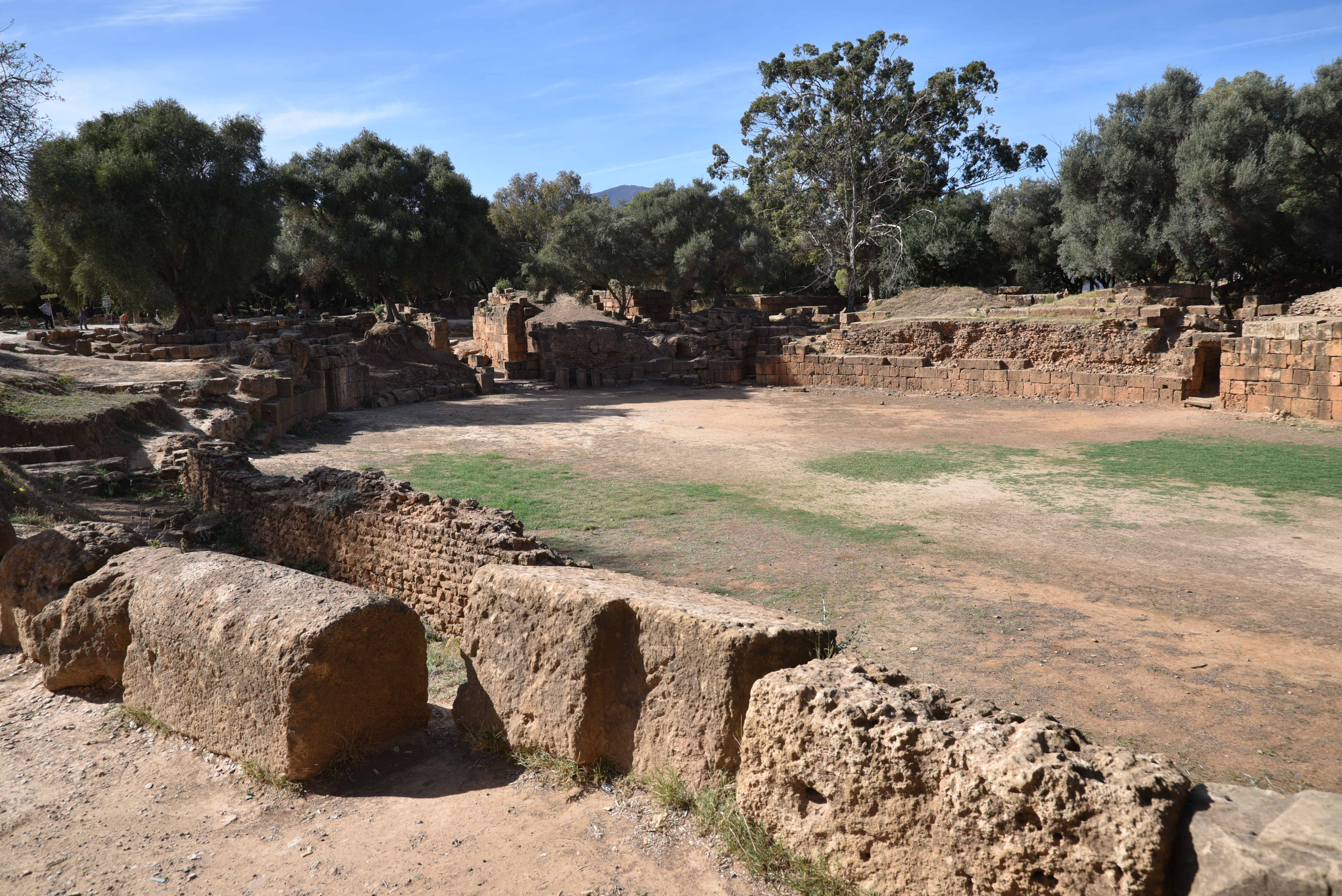
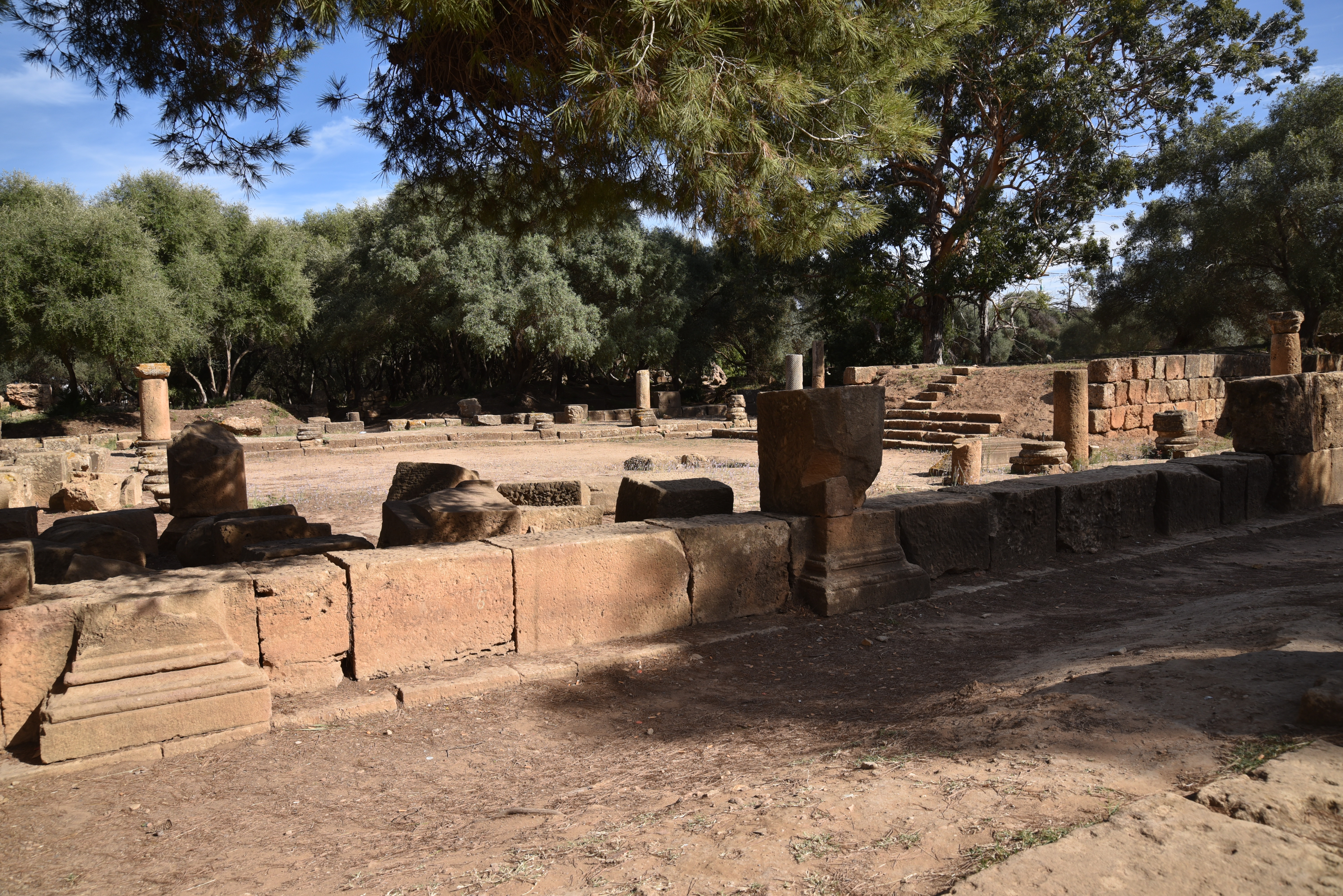
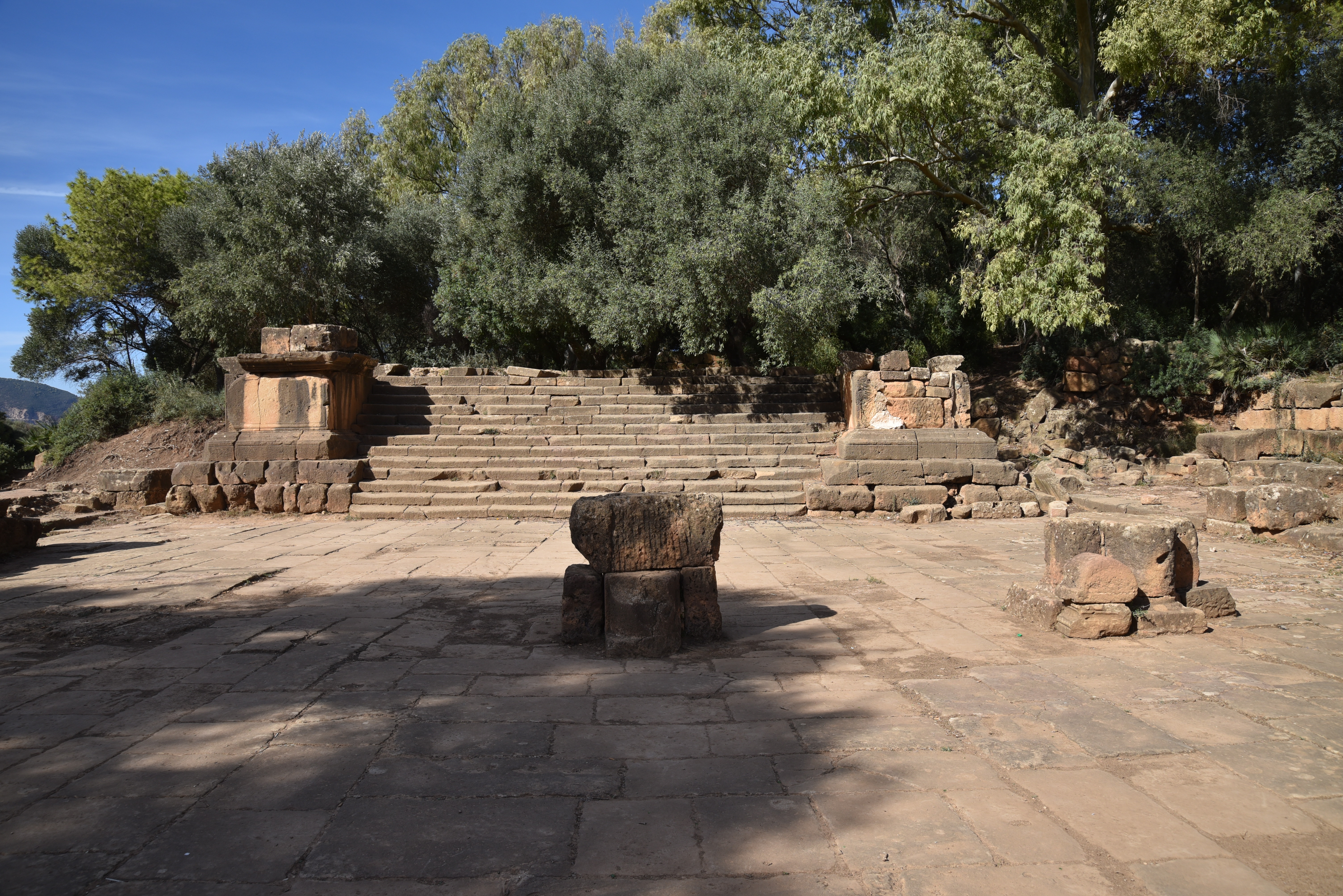
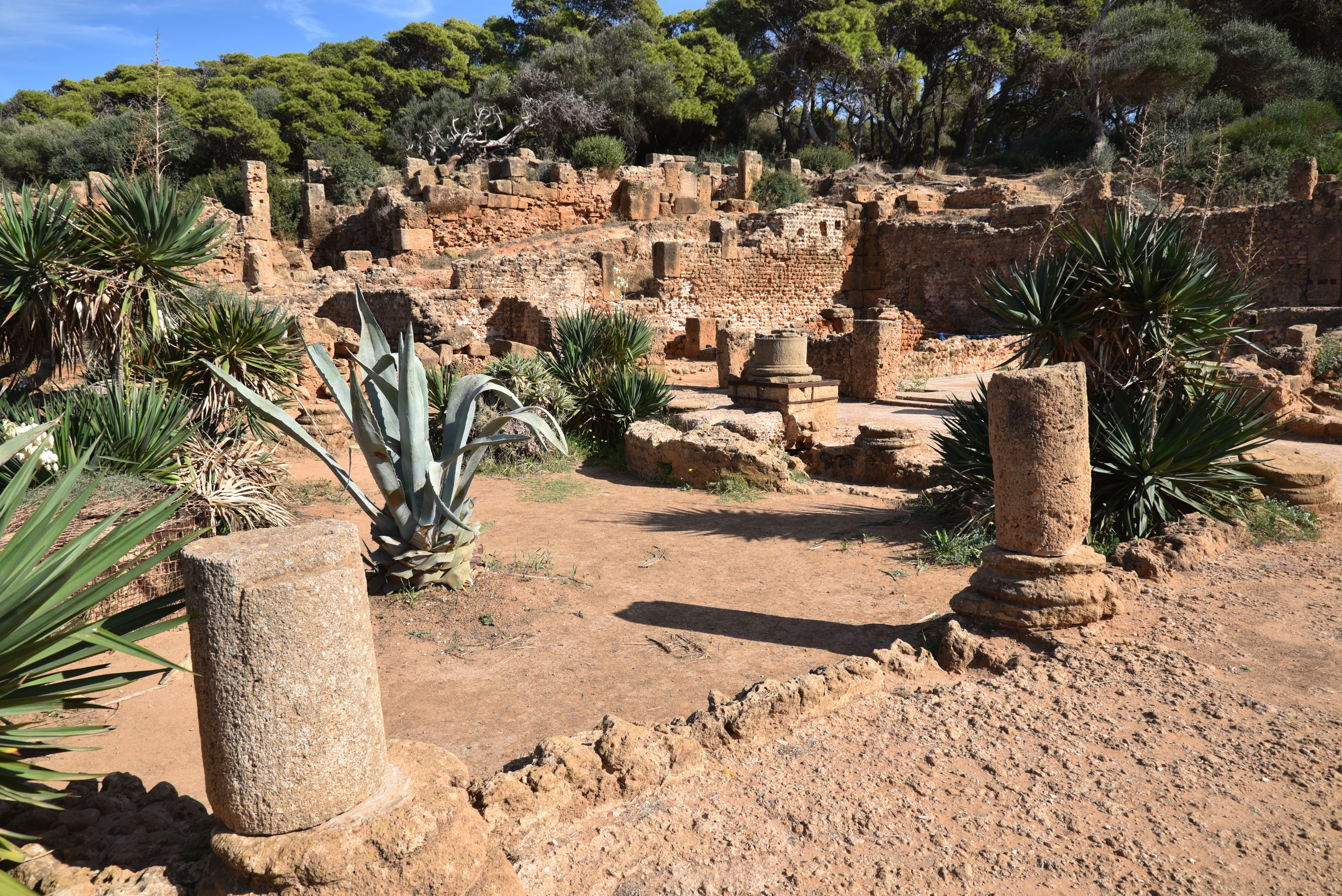
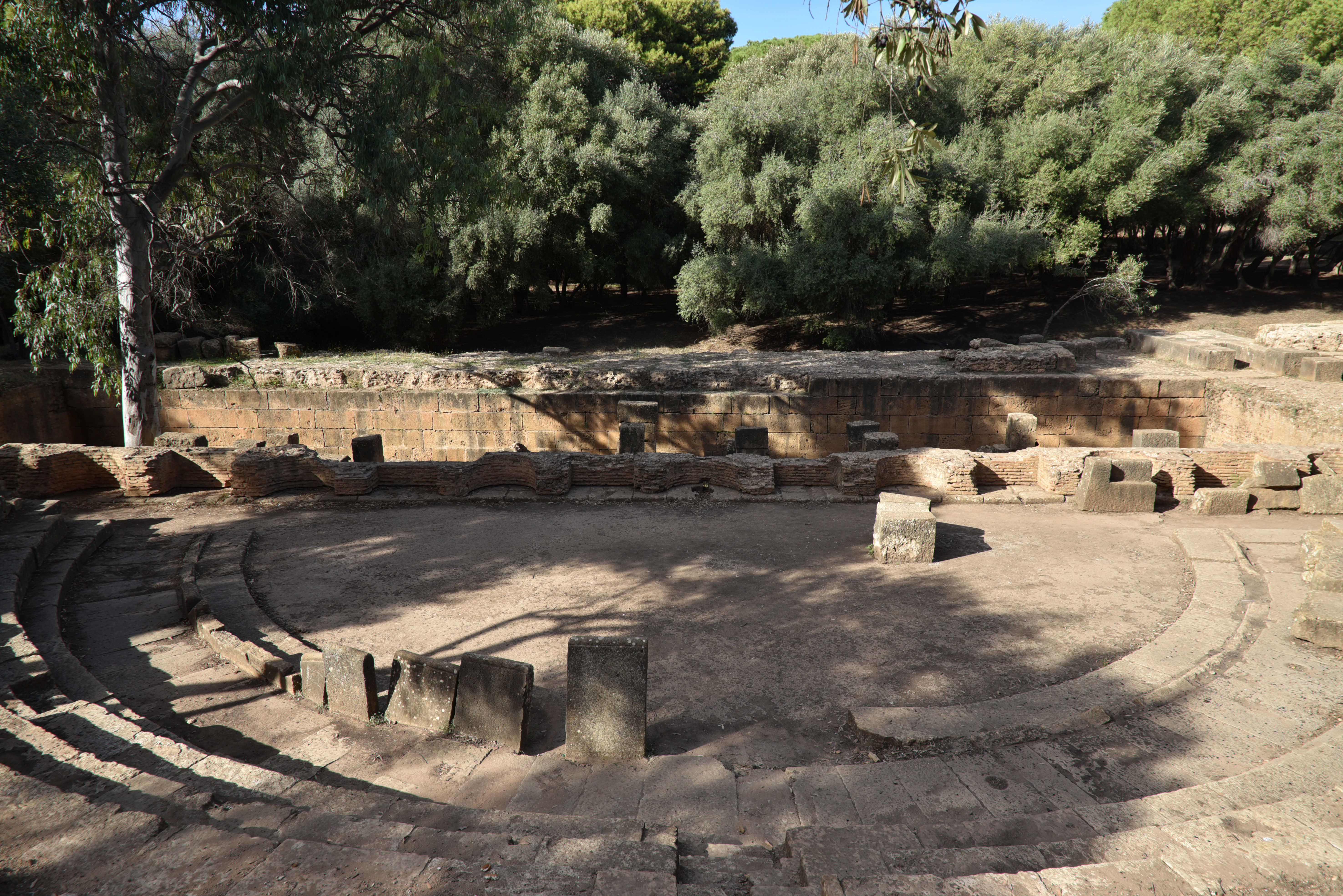
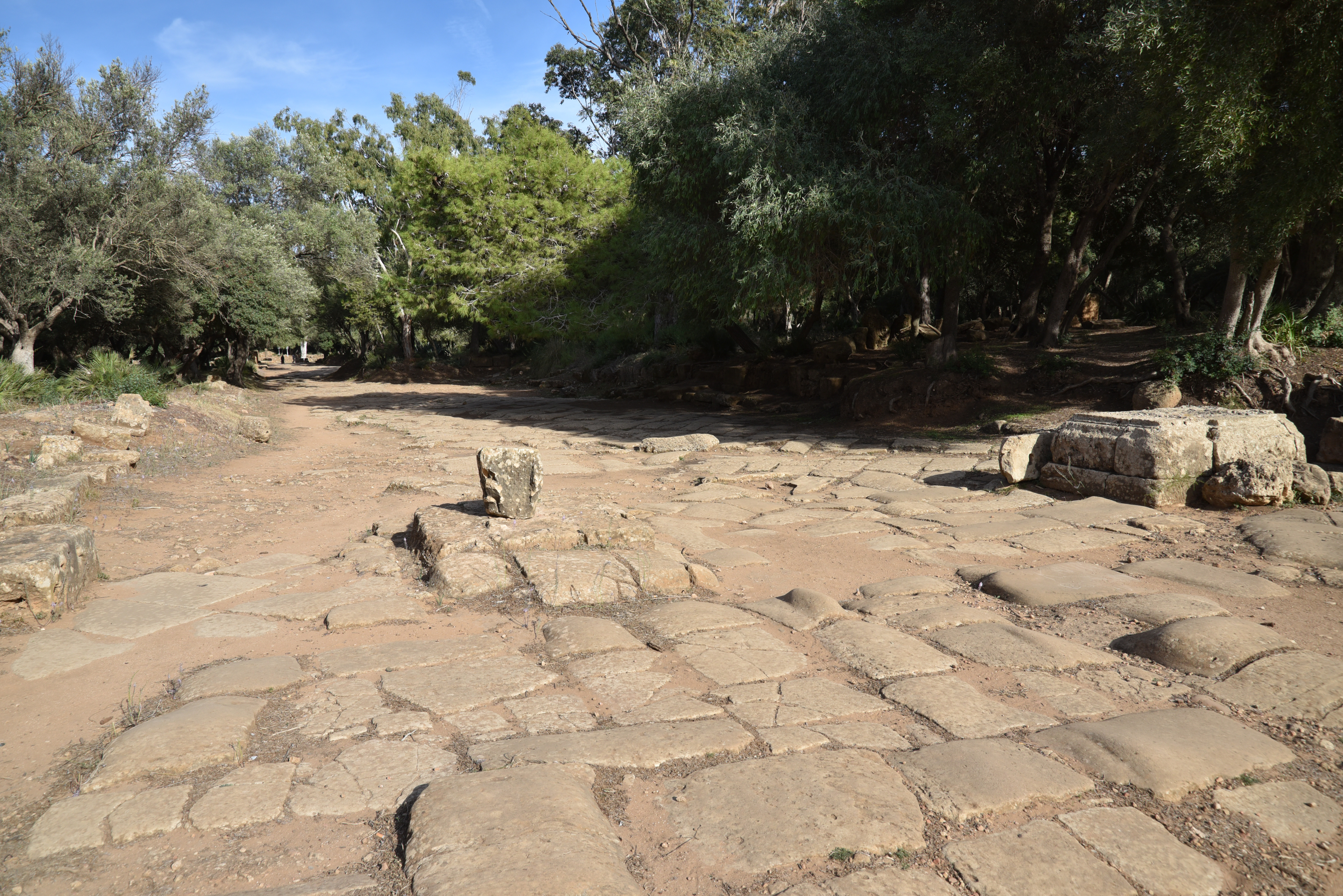
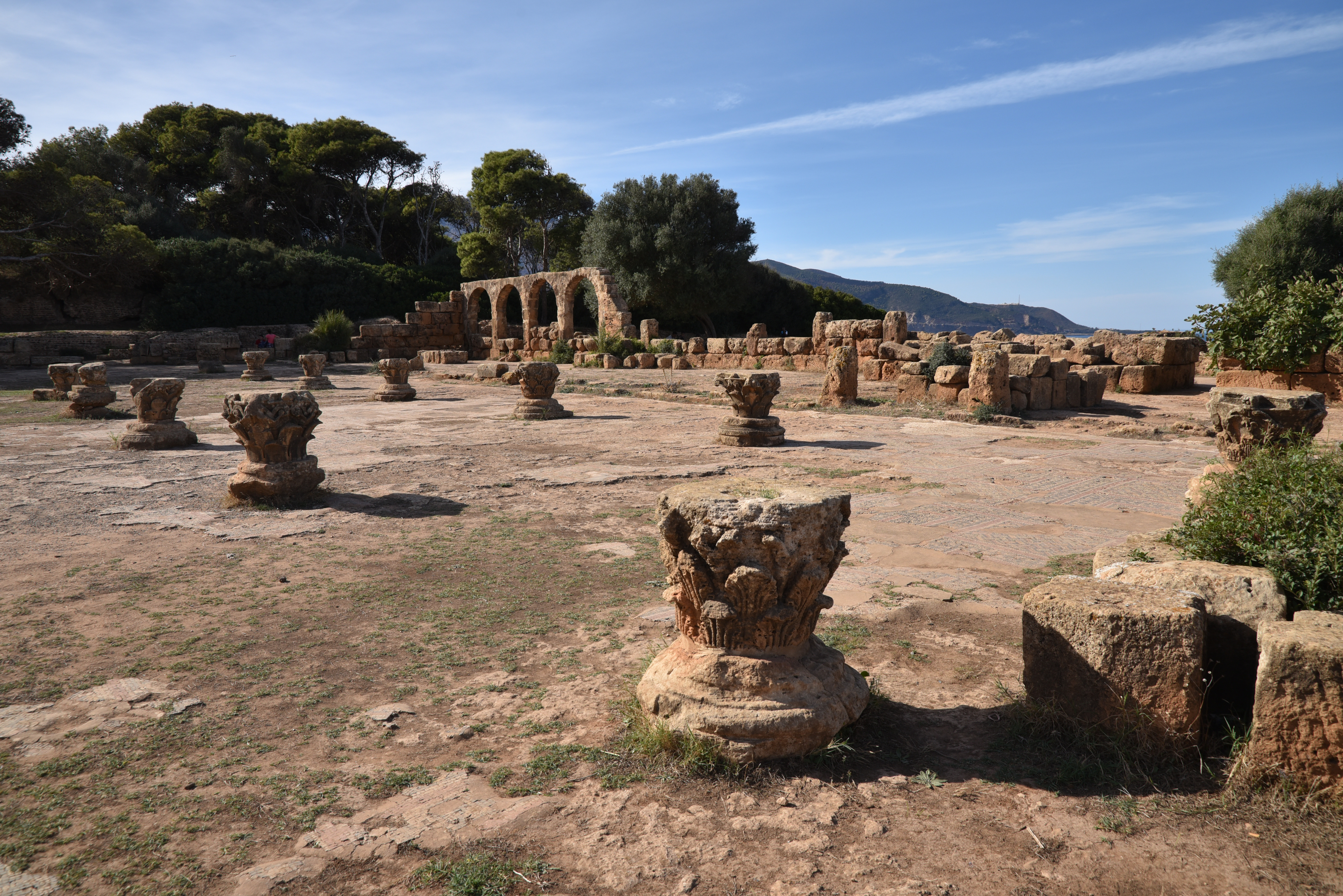
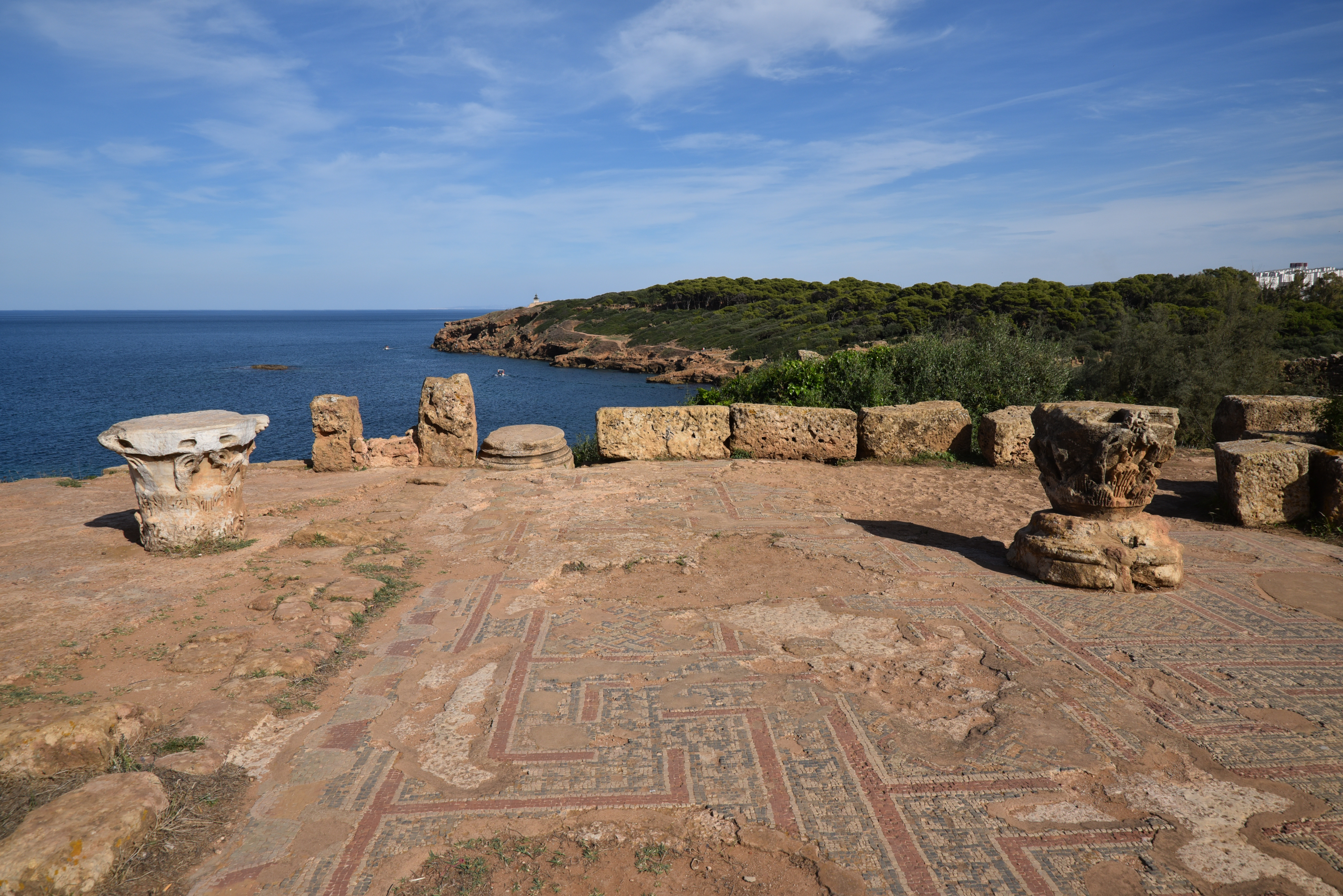
The main site of Tipasa is now a wooded archaeological park covering an area of 70 hectares. The entrance leads to an amphitheatre, and beyond it, a path guides visitors to the heart of the ancient town, where the two main streets, the paved cardo maximus and decumanus, intersect. To the east of the cardo lies the civic centre, including the Forum that originally featured porticoes on three sides, with the capitolium on the fourth side. This area also contains the curia (municipal assembly) and the civil basilica. Along the shoreline are several houses, including the so-called Villa of the Frescoes, a large residence measuring 1,000 square meters built in the mid-2nd century AD. The rooms of this villa open onto peristyles and are often decorated with mosaics and frescoes. Further inland is a theatre and a monumental semicircular fountain on the decumanus.

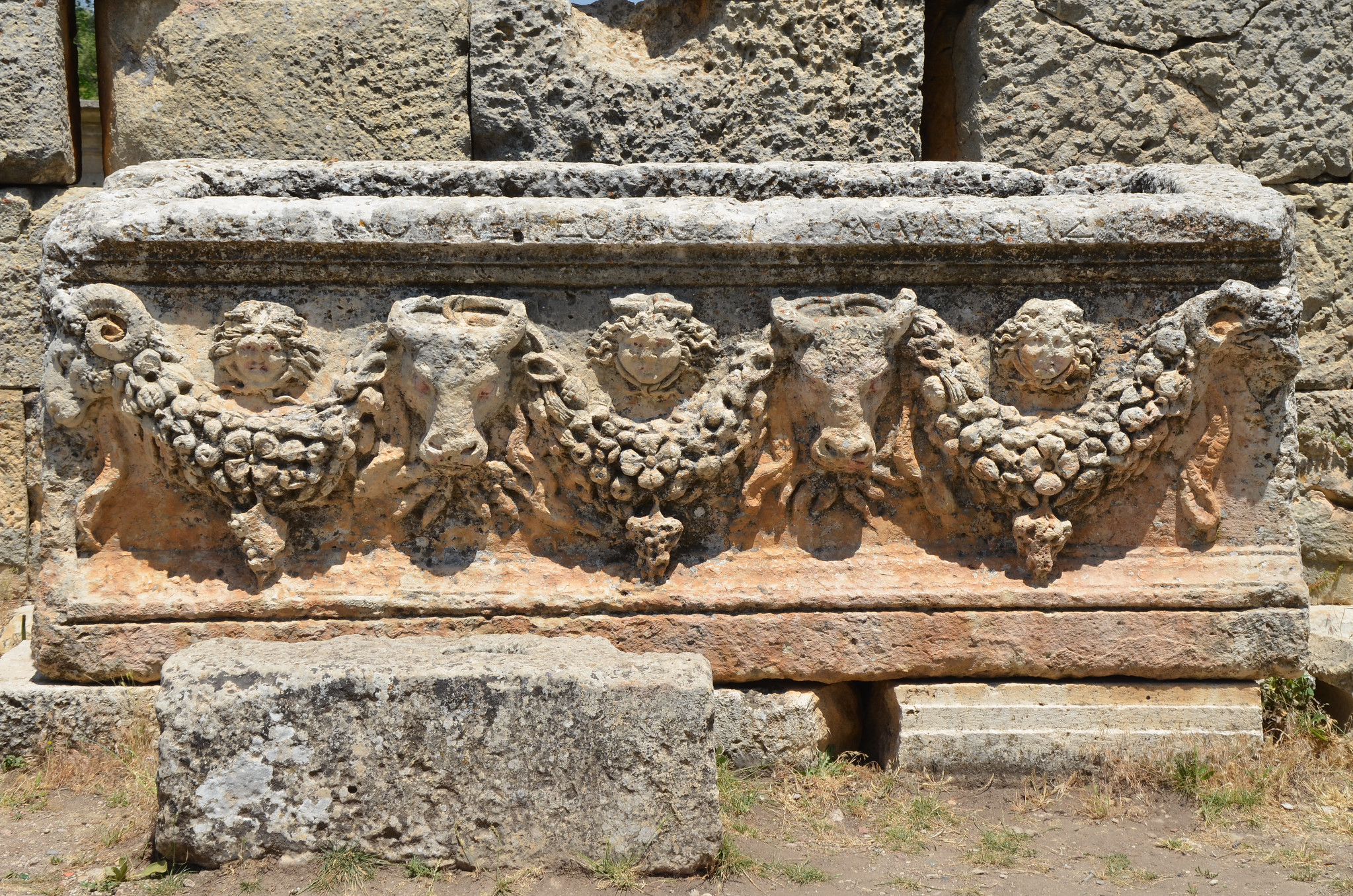
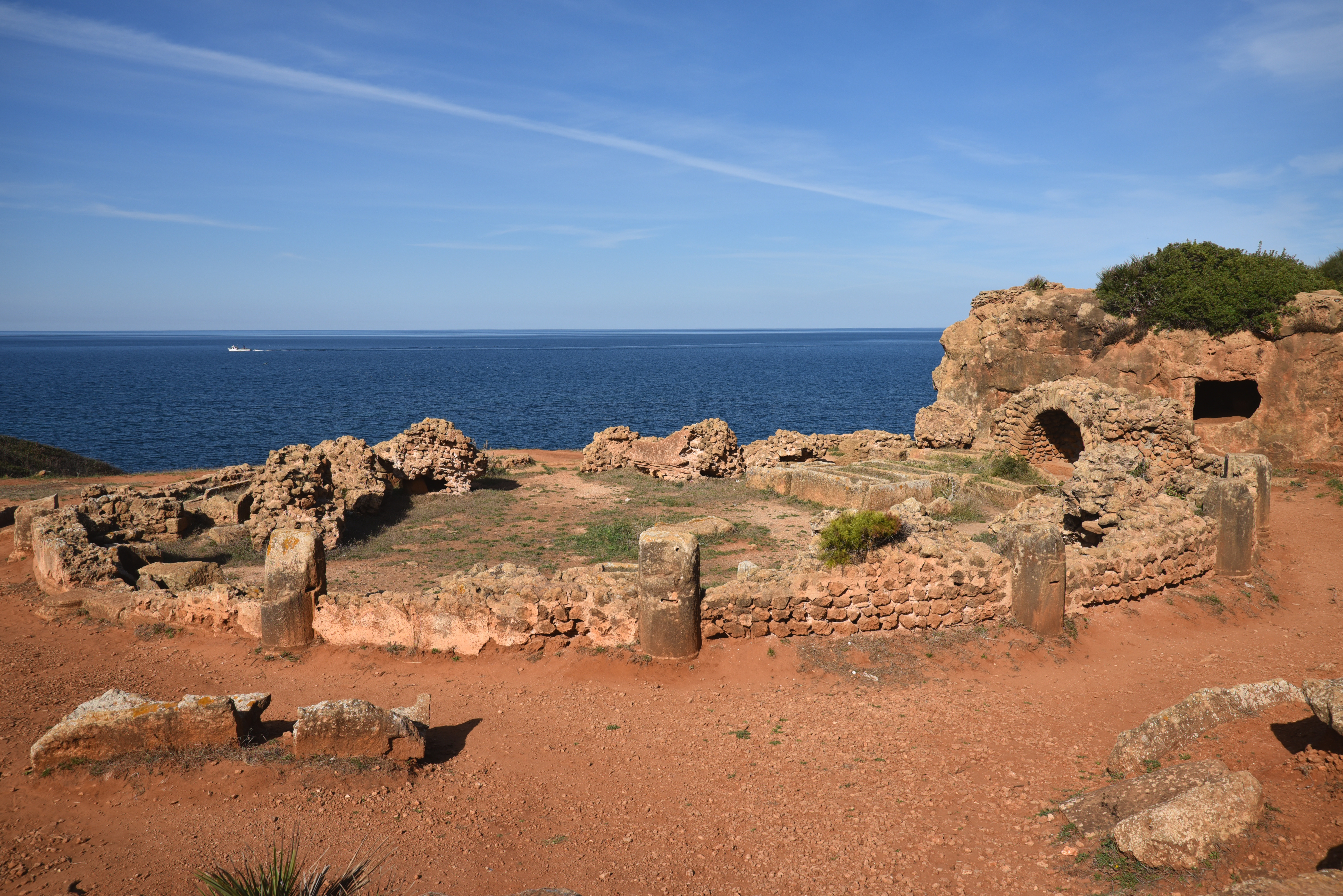
During Late Antiquity, Christians constructed various religious complexes, which included two basilicas, tombs, baths, and an impressive temple dedicated to the local martyr Saint Salsa. The Grand Basilica, featuring seven naves, was the largest Christian structure in North Africa upon its completion in the 4th century AD. The cemetery, adorned with carved tombs and inscriptions, provides valuable insight into the spread of Christianity throughout North Africa during this period.

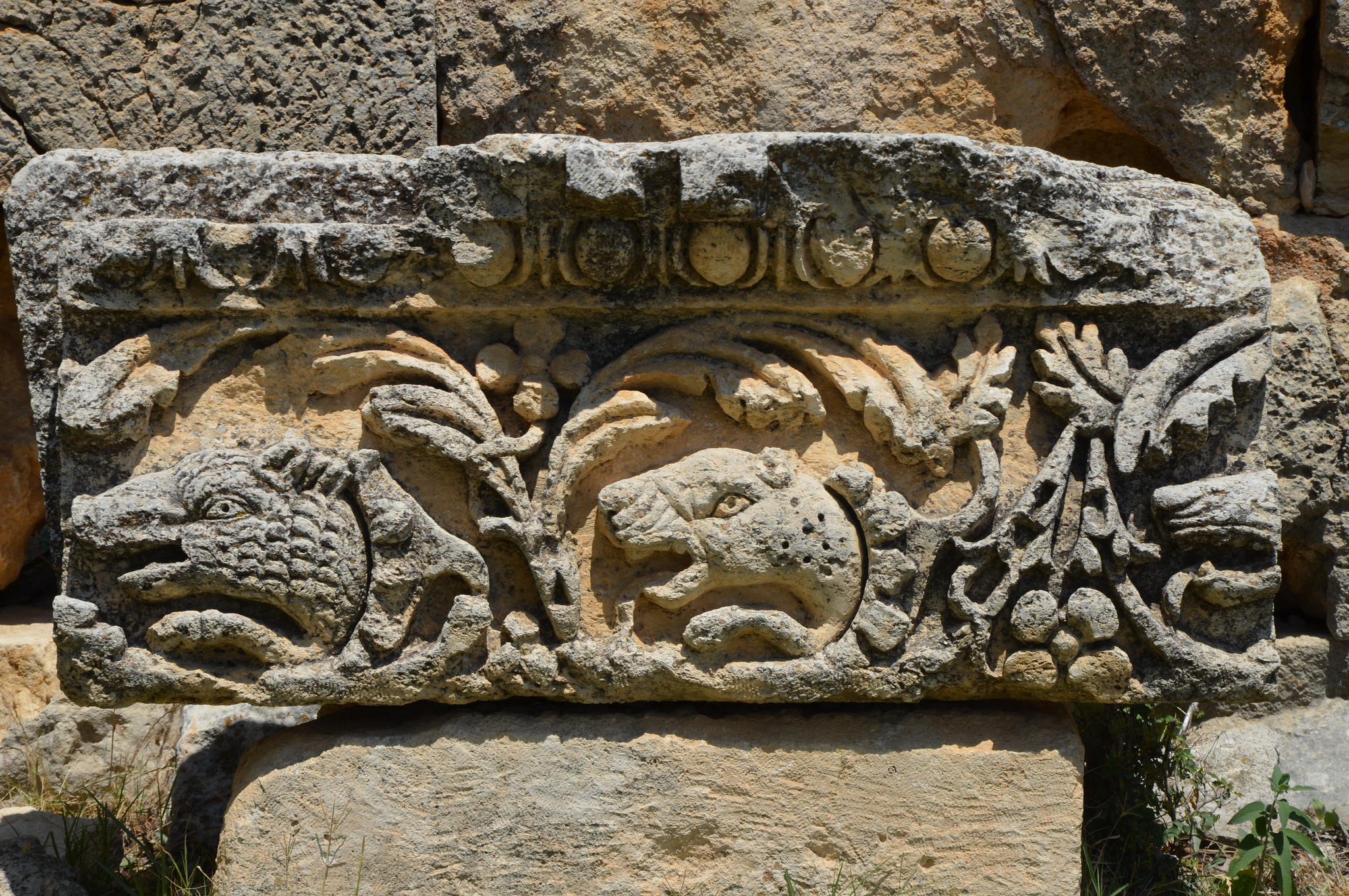
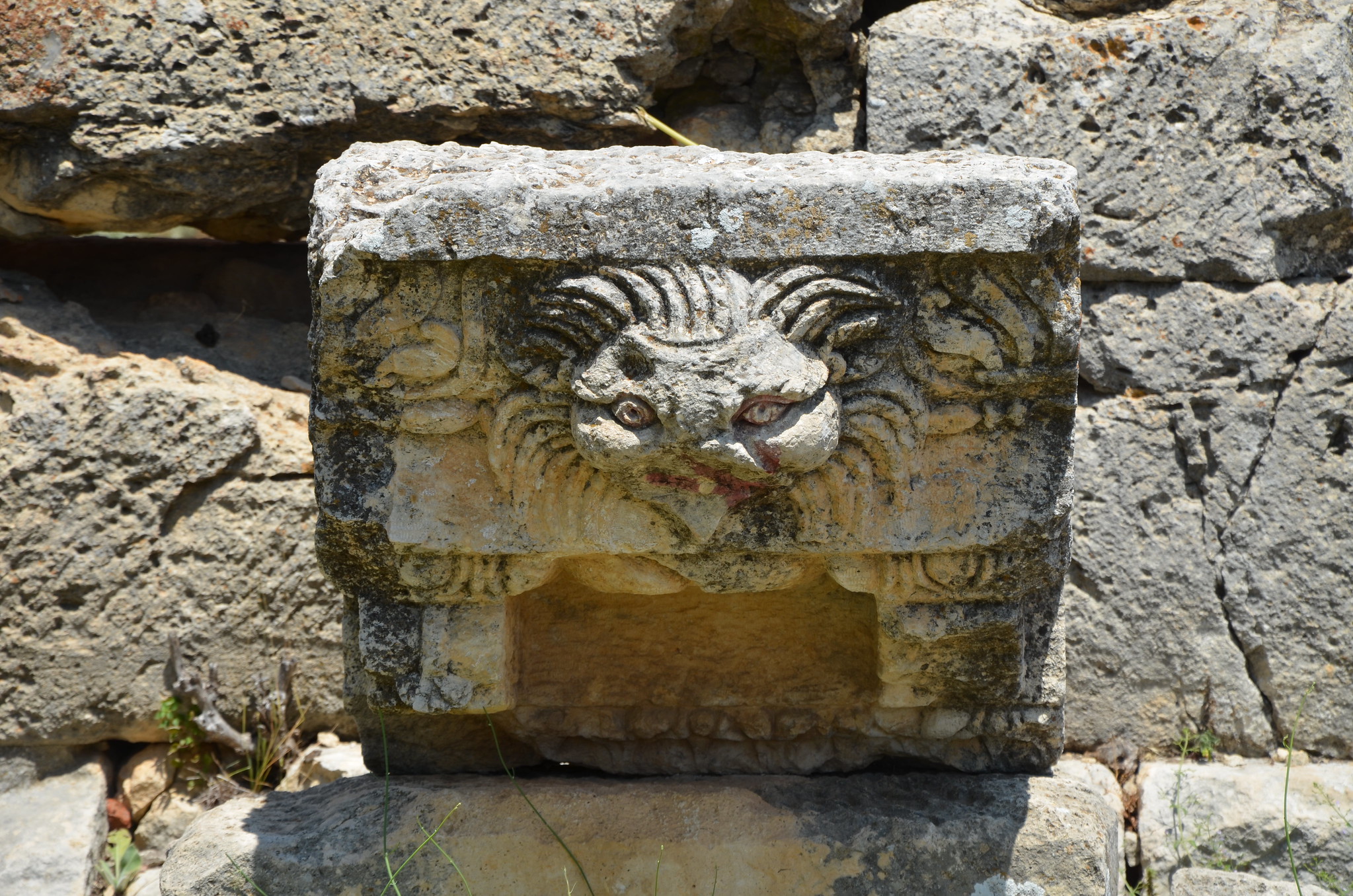
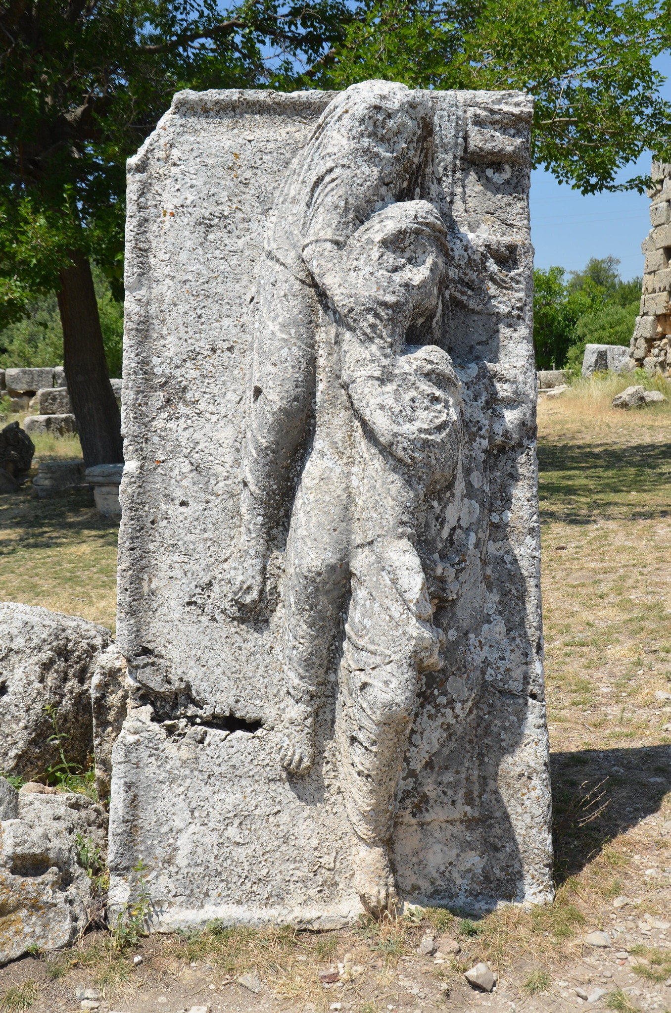
The small museum outside the park showcases a variety of Punic and Christian funerary steles. It also features four tombstones dedicated to foreign cavalrymen who served in the auxiliary forces of the Roman army stationed at Tipasa. The museum also displays mosaics, including one depicting a captive family crouching with their hands bound.

PORTFOLIO

The amphitheatre with an elliptical arena measures 80 metres. It is dated to the Severan period. Only the podium wall and part of the vaulted substructures that once supported the seating remain.
The amphitheatre was built using various re-used materials, including tombstones. One tombstone (now in the onsite museum) was of a cavalryman of the Ala I Ulpia Contariorum (see here). A water channel was perhaps used to flood the arena for mock sea battles (naumachiae).
The eastern entrance to the amphitheatre.
The Unidentified Temple dated to late 2nd century AD or the early 3rd century AD. Only the podium and the frontal stairway leading to the cella survive, as well as the foundations of the sacrificial altar.
The Unidentified Temple stood within a precinct surrounded by a triple portico which opened onto the Decumanus Maximus.
The Decumanus Maximus. The east–west-oriented road was 14 m wide and bordered by raised porticoes.
The Decumanus Maximus.
The New Temple. It is dated to the end of the 2nd century or beginning of the 3rd century AD and stood on a podium within a porticoed precinct.
The Cardo Maximus extended towards the sea. The street was paved and bordered by porticoes supported by rows of piers.
The Cardo Maximus.
The Villa of the Frescoes, a wealthy townhouse of 1,000 sq.m built in the middle of the 2nd century AD.
The Villa of the Frescoes is named for its once splendid wall decorations, of which fragments were discovered during excavation.
Mosaic floor in one of the rooms of the Villa of the Frescoes.
View of the Villa of the Frescoes from the west.
Garum factory with four square tanks for macerating the fish. Garum was a sauce made up of small fish and the intestines of large ones, which were macerated with herbs. It was very popular in Rome and was one of the main exports of the African and Iberian provinces.
The ruins of the Public Baths. They were most probably destroyed following an earthquake and were never repaired.
The Public Baths.
The industrial quarter with the public baths in the background.
The Theatre at Tipasa was built on flat ground and raised upon vaults and piers. It was designed to accommodate 3,000 spectators.
Unfortunately, the theatre has been largely reduced to its foundations. In 1847, the French military dismantled the stage and nearly all of the seating to construct a cholera hospital nearby in Marengo (now known as Hadjout).
The Nymphaeum on the decumanus maximus, dated to between the end of the 3rd and the beginning of the 4th century AD. It was a monumental fountain dedicated to the Nymphs, adorned with statues between the columns.
The Decumanus Maximus.
The cross-section of the Cardo and the Decumanus.
The Great Christian Basilica, built in the 4th century AD on the western hill using elements taken from the Capitolium.
The central nave of the Great Christian Basilica was entirely paved with mosaics.
The Great Christian Basilica of Tipasa is the largest Christian building excavated in Roman Africa. Particularly impressive, the basilica is 58 m long and 42 m wide and includes seven naves with some 700 sq.m of mosaic covering the basilica floor and decorating the central aisles.
The baptistery of the Great Christian Basilica.
The circular tower marking the northwest extremity of the defensive walls built in the middle of the 2nd century AD.
View of Tipasa looking east from the northwest tower.
The Circular Mausoleum, a funerary monument probably dedicated to the cult of a martyr (martyrium) with fourteen vaulted recesses which accommodated the sarcophagi.

MUSEUM

The main hall of Tipaza’s small museum.
Mosaic of the Captives depicting a captive family (a Moorish tribal chief with his wife and son) crouching with their hands bound, surrounded by twelve portraits of Africans. It once occupied the apse of the Civil Basilica, ca. AD 200-300.
The Pax et Concordia Mosaic, a stone mosaic mensa (banqueting table) cover from the Necropolis of Tipasa-Matares. Verse inscription (AE 1979, 682): In Chr(ist)o Deo/ pax et concordia sit/ convivio nostro (“In God (Christ), may peace and concord be on our banquet”).

Links & references:

Olba-Diocaesarea

Olba, later Diocaesarea, is an ancient Seleucid city in Rough Cilicia in Turkey’s rugged Eastern Mediterranean coastline. In the Hellenistic period, the city was the centre of worship of Zeus Olbios, whose sanctuary was located about 4 km to the west.

Coordinates: 36°35’10.5″N 33°57’48.7″E

Erected during the reign of the Seleucids, the temple, Corinthian in style, is the oldest peripteral temple (6×12 columns) in Asia Minor. Other monuments from the Hellenistic period include a 22m-high tower and a mausoleum. The Roman city of Diocaesarea later developed in the 1st century AD around the temple devoted to Zeus Olbios. Its ruins today lie partly within the grounds of the village of Uzuncaburç (Turkish for ‘high tower,’ referring to the Hellenistic tower) and its immediate surroundings.

The most important Roman buildings on the site date from the 1st to the 3rd century AD and include a theatre, a nymphaeum, an aqueduct, and many tombs dug in the rock. The city is entered through a monumental gate, of which five columns have survived. Then a colonnaded street runs alongside the temple of Zeus Olbios and leads to the temple of Tyche. To the northwest, a three-arched Roman gate leads out of town.

PORTFOLIO

  • Diocaesarea
The monumental entrance gate to the city of Diocaesarea was erected at the end of the 1st century AD. It originally had five entrances.
The Temple of Zeus Olbios was erected during the reign of the Seleucids. The monument is peripteral and Corinthian in style.
The Hellenistic Temple of Zeus Olbios.
The Temple of Zeus Olbios was converted into a basilica during the Byzantine era. The cella was removed, and an apse was added at the eastern end.
When the temple was converted into a church, the columns were shaved at the sides and walls were built between them.
An architectural block with a boar and a lion decorated the Temple of Zeus Olbios.
Architectural block from the Temple of Zeus Olbios.
The two-storied Hellenistic mausoleum with a pyramidal roof.

View of Diocaesarea from the Hellenistic mausoleum. The temple of Zeus Olbios is on the left, in the middle is the Roman theatre and on the right stands the 22m-high Hellenistic tower.
A limestone sarcophagus beautifully decorated with vine tendrils and flowers suspended from two ox heads in the middle and two-horned ram heads on each side; over the garlands are three sculpted heads of Medusa.
The Corinthian colonnade of the Temple of Tyche was built in the 1st century AD by Oppius and his wife, Kyria.
The cella (inner cult room) of the Temple of Tyche.
The inscription on the architrave states: “Oppius, the son of Obrimus, and Kyria, the daughter of Leonidus and the wife of Oppius, gave the Tychaeum to the city.”
A sarcophagus lid.
The Roman Nymphaeum was built in the 2nd or 3rd century AD. The structure, 17m long and about 11m wide, stood along the colonnaded street. The water was brought from the Lamus River by using channels and tunnels.
The northern city gate was built in the 2nd century AD and completely restored during the reigns of Arcadius and Honorius (5th century AD).
An abandoned house built among the ruins of the ancient city.
The Roman theatre was constructed during the joint reign of the emperors Marcus Aurelius and Lucius Verus.
The theatre had a capacity of around 2000 spectators.
  • Olba
The acropolis hill of Olba with fortification towers.
The double-tier aqueduct of Olba, commissioned by Septimius Severus in AD 199, was built across the valley of Olba and linked the two hillsides. It is about 150 m long and 25 m high.
The aqueduct underwent repairs during the reign of Byzantine Emperor Justin II in AD 566.
The nymphaeum standing at the western foot of the Acropolis. It was fed by the Lamus River, whose water was brought through tunnels, channels and the aqueduct.
The Roman theatre.
The stage building of the Roman theatre.

Source: Silifke (Seleucia on Calycadnus ) and Environs: Lost Cities of a Distant Past in Cilicia by Celal Taşkıran (Sim Matbaasi, 1993)

Links: