Aquileia is an ancient Roman city in Italy at the head of the Adriatic. Nowadays, the city is small (about 3,500 inhabitants), but in antiquity, it was the fourth Roman town in Italy and the ninth in the whole Empire. Aquileia is one of the main archaeological sites of Northern Italy and has been inscribed on the UNESCO World Heritage List since 1998 for its well-preserved remnants from the early Roman Empire and its Patriarchal Basilica.
Aquileia was founded as a colony by the Romans in 181 BC along the Natiso River. The town protected the territories that bordered areas subject to the influence of the Veneti (faithful allies of Rome) to the west, tribes of the Alpine Gauls to the north and the Histri to the east. In 90 BC, Aquileia obtained Roman citizenship and was used as a base for the military campaigns of Julius Caesar in Gaul and in Illyria. With the administrative reform of Augustus, Aquileia became the capital of the tenth region, “Venetia et Histria”. The town underwent a period of prosperity and soon became a centre of important trade exchanges thanks to the navigable river that crossed it and the efficient network of roads that linked the town to the Po Valley and Central Europe.
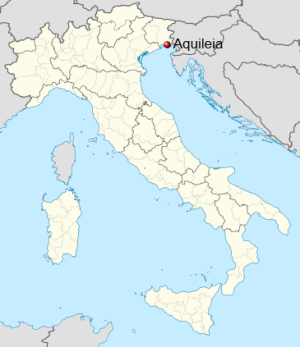
The Roman column in Piazza Capitolino, with the Capitoline She-Wolf donated by the city of Rome in 1919 to mark the twentieth centenary of the foundation of Aquileia. The She-Wolf stands on a section of architrave, a column shaft and a base (all ancient).
Destroyed by Attila in the mid-5th century, Aquileia rose again in the 6th century AD to become a powerful Episcopal seat with one of the most beautiful basilica complexes of Christianity. The Patriarchal Basilican Complex played a decisive role in the spread of Christianity into central Europe in the early Middle Ages.
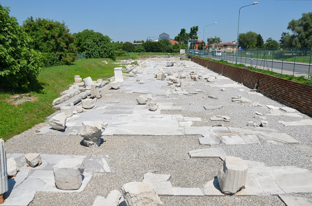
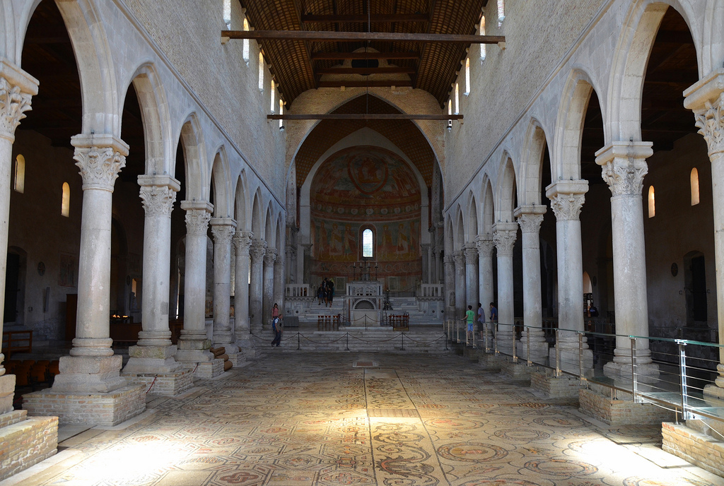
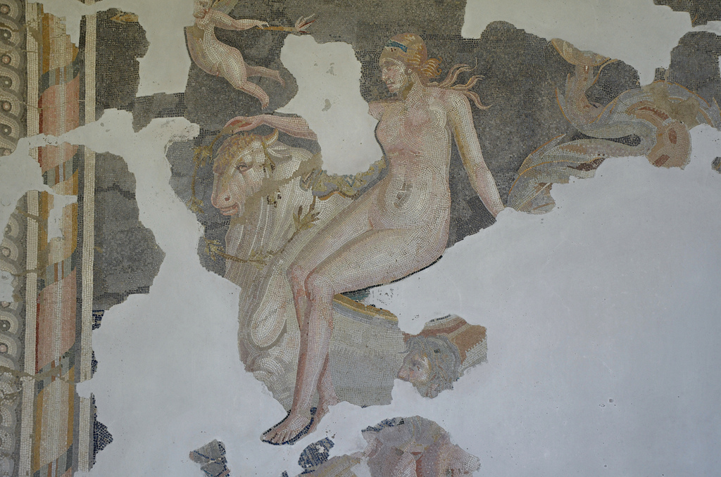
The site of Aquileia is believed to be the largest Roman city yet to be excavated. Excavations, however, have revealed some of the layouts of the Roman town, such as the remains of the Forum, a segment of the decumanus, some impressive funerary monuments, two luxurious residential complexes, baths as well as the former locations of an amphitheatre and of a circus. The most striking remains of the Roman city are those of the river port installations, a long row of warehouses and wharfs that stretched a long distance along the bank of the river. But the dominant feature of Aquileia is the Basilica with its magnificent 4th-century mosaics. The National Archaeological Museum and its lapidary galleries contain over 2,000 inscriptions, statues and other antiquities, mosaics, glasses of local production and a numismatics collection.
PORtFOLIO
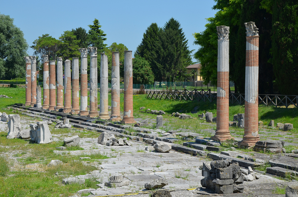
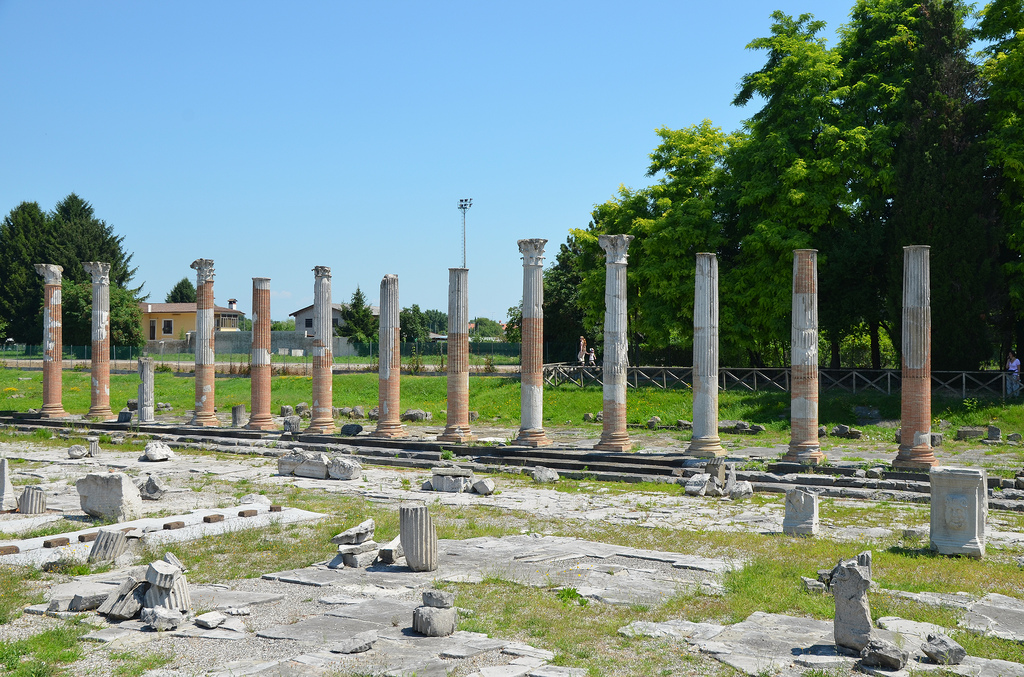
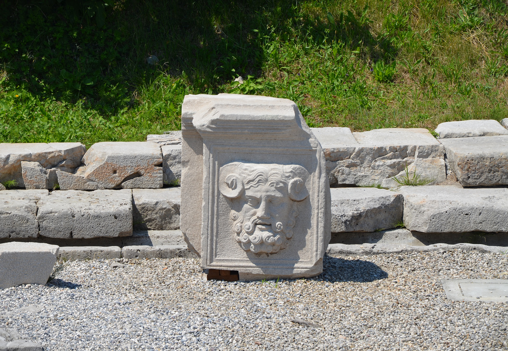
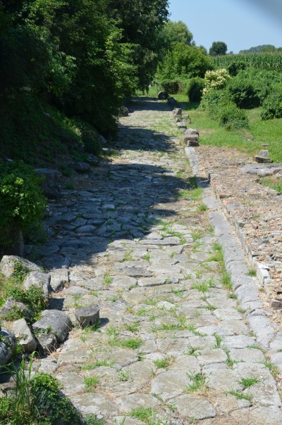
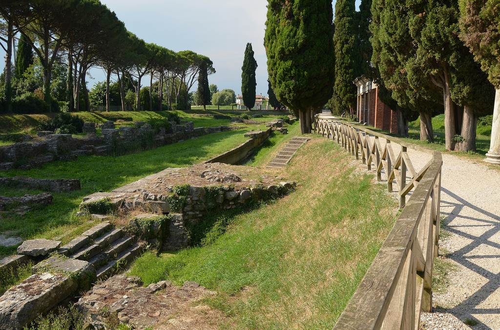
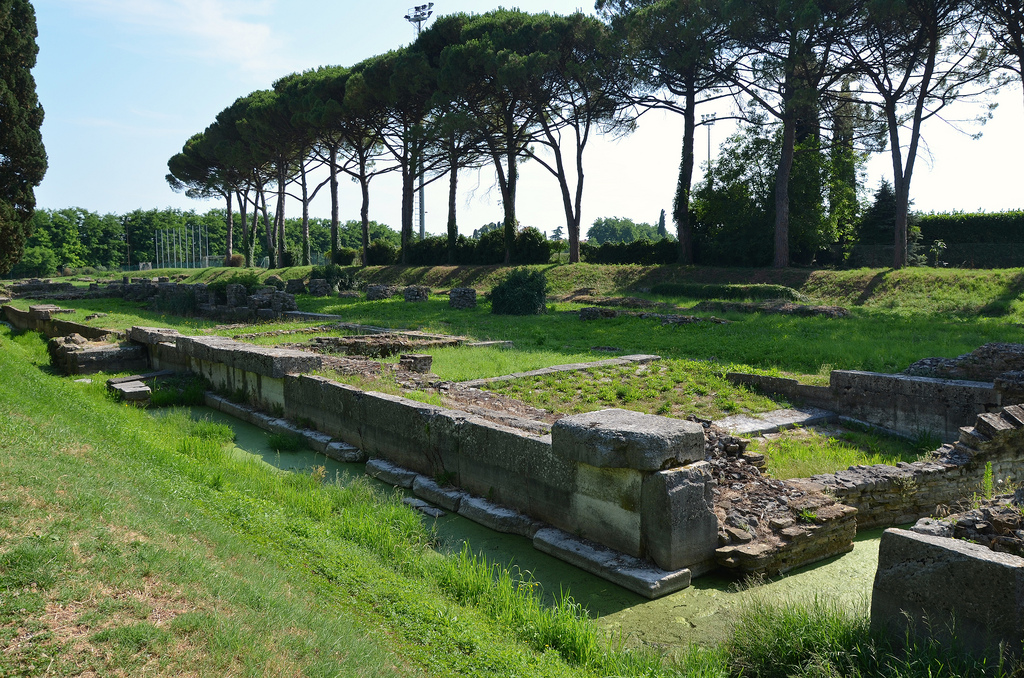
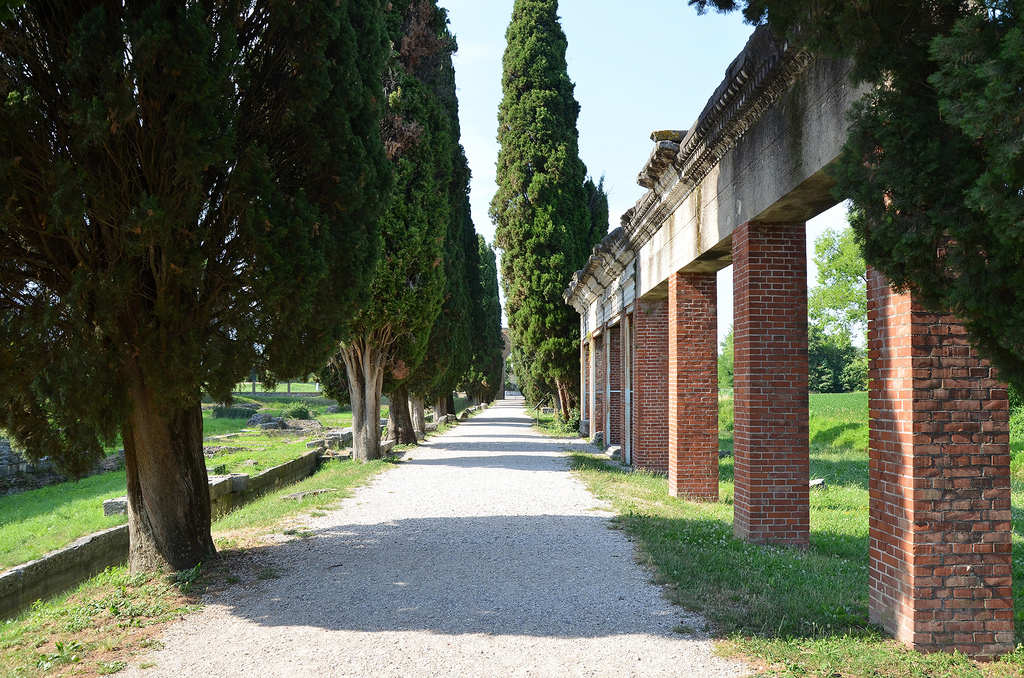
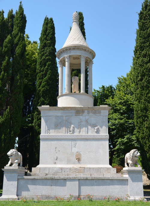
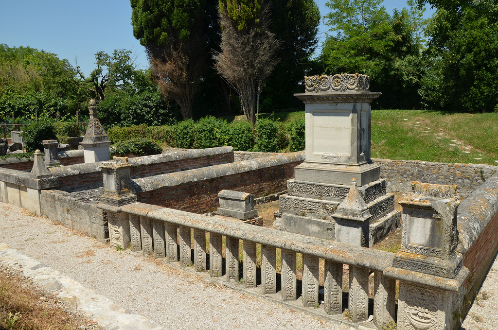
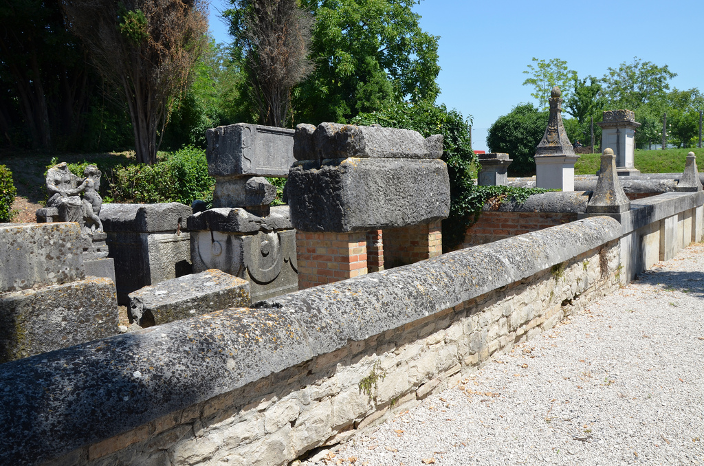
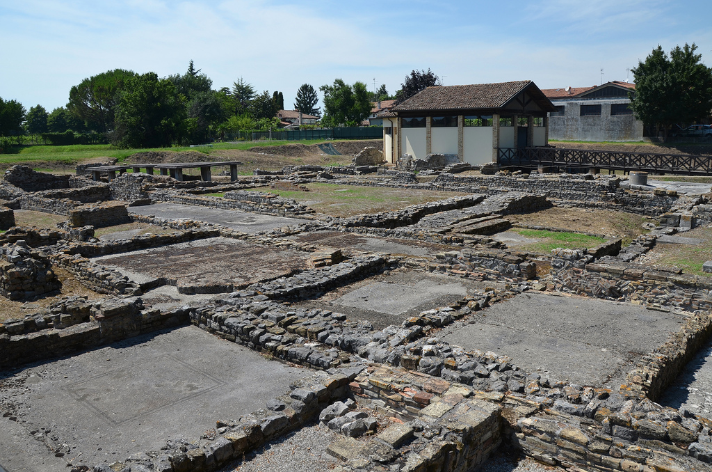
The imperial Forum of Aquileia, the colonnade of the eastern portico of the Forum, was restored and partially reconstructed in 1936-1937.In the first half of the 1st century AD, the Forum was a large rectangular pedestrian area covered in Aurisina limestone and lined by porticoes that led to shops (tabernae) and the Civilian Basilica.Plinth supporting a protome of Jupiter Ammon, it decorated the attic of the Forum’s portico.A stretch of the decumanus, the street goes south of the Forum in an east-west direction.The western side remains of the fluvial port of Aquileia, one of the best-preserved surviving Roman ports. It was rebuilt entirely in the Julio-Claudian age over Republican foundations with a new complex of wharfs and a long warehouse behind that opened onto the river.The western wharf of the river port with a ramp leading up to the storerooms. The wharfs had three ramps that led to port facilities and a long portico. Three paved roads stretched towards the market areas and were used to transport goods.Along the so-called Via Sacra set up in 1934 and which follows the ancient watercourse, remarkable architectural elements and decorations are on display; they belonged to various monuments in the town.The so-called Grand Mausoleum dates back to the Augustan era. It was found on the edge of the town at the end of the 1800s and rebuilt in 1955 (inappropriately) along Via Giulia. It comprises an enclosure protected by two lions, with a high base with relief decorations, surmounted by a circular, temple-like structure that guards the statue of the toga-clad deceased.The Roman necropolis dates to between the 1st and the 3rd century AD. It comprises five burial enclosures of different lengths but equal depths containing numerous cremation and inhumation burials. They belonged to different Aquileian families (Stazius, anonymous, Julius, Trebius and Cestius).In the burial ground owned by the Trebii, a small sculpture (original in the Archaeological Museum) portrays a deceased woman being comforted by Psyche, a very young girl with wings who accompanied the dead to the underworld.The archaeological ruins of the Fondo Cal, one of Aquileia’s residential districts.Inside view of the Basilica with the mosaic floor uncovered at the beginning of the 20th century. The mosaic dates back to the first stage of Christian construction of the Basilica, which started soon after the Edict of Milan in 313 AD. Over 760 square metres, The Bishop Theodore’s mosaic is the largest mosaic floor in the western Roman Empire.
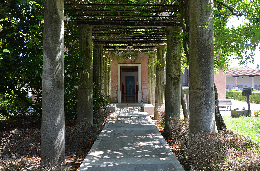
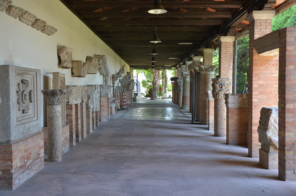
The Museo Archeologico Nazionale di AquileiaThe lapidarium of the Museo Archeologico Nazionale di AquileiaThe lapidarium of the Museo Archeologico Nazionale di Aquileia
The Archaeological Area of Minturnae (Comprensorio Archeologico di Minturnae) is a remarkable yet relatively unknown archaeological site situated along the Appian Way. It is located in the town of Minturno in southern Lazio, approximately 160 kilometres south of Rome and 75 kilometres north of Naples.
Minturnae was originally an Auruncian city, although no archaeological traces of it have been found. It was one of the three towns of the Aurunci, which allied with the Samnites to wage war against Rome in 314 BC. After being defeated, the city suffered severe repression and was burned to the ground. The Romans then settled in the area, recognising its strategic and commercial importance due to its proximity to the sea. They built a castrum along the river Liris, and this military settlement evolved into a Roman colony in 296 BC. Minturnae became an important trading port in the Mediterranean and served as a fortified commercial centre along the Appian Way.
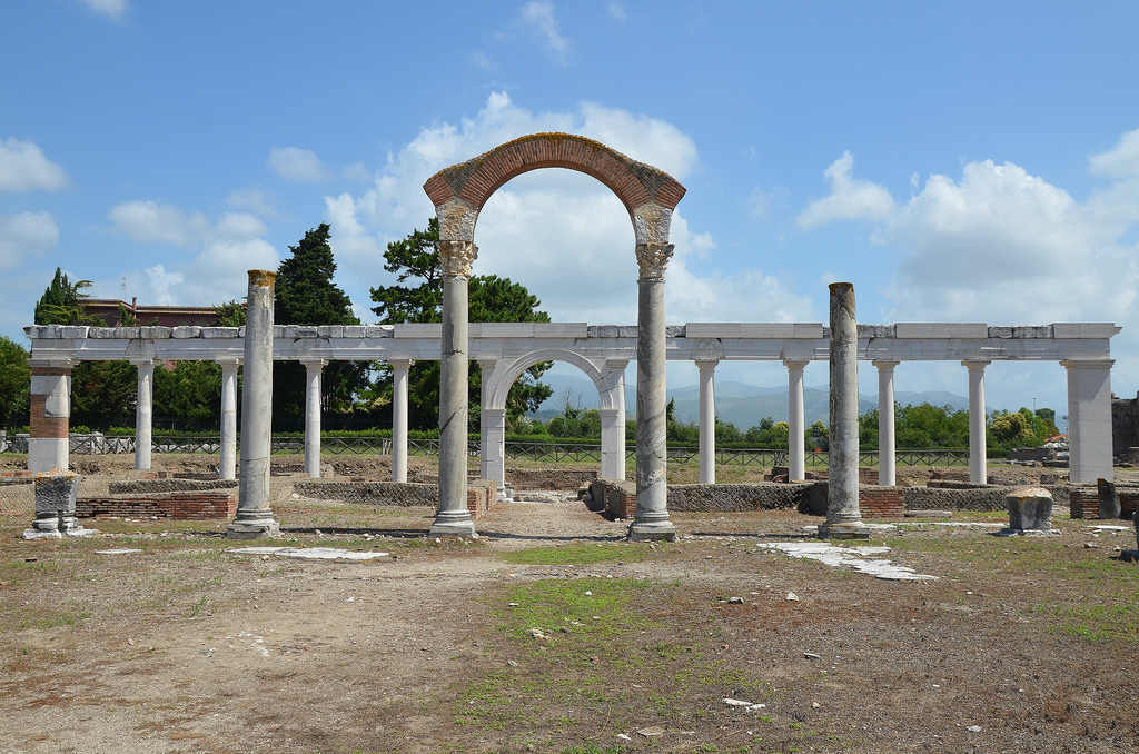
In the 1st century BC, Minturnae was a flourishing city with a Capitolium (temple dedicated to the triad of Jupiter, Juno and Minerva), a forum and a theatre. During the Imperial era, a new forum was built, surrounded by public buildings such as a Basilica, thermal baths, an amphitheatre and a macellum (market).
Today, significant Roman remains are scattered on both sides of the Appian Way.
PORTFOLIO
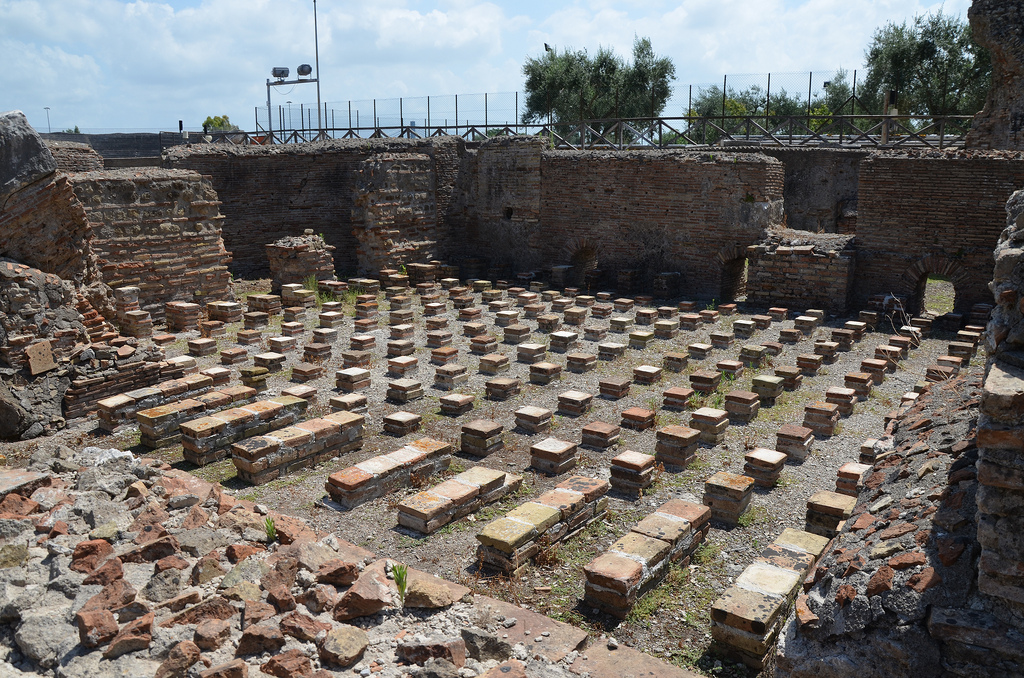
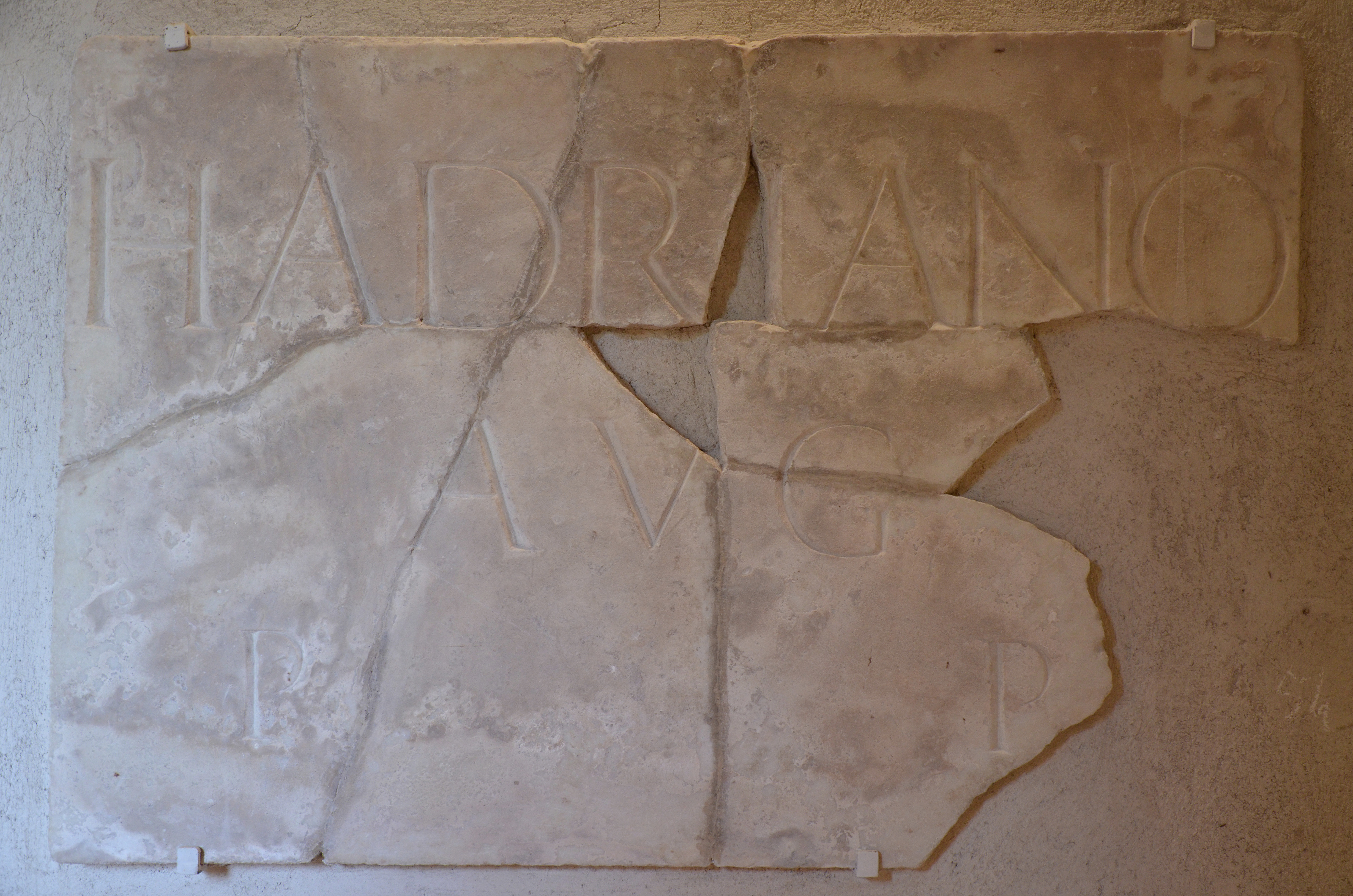
The Republican forum and the Roman theatre were built in the Late Republican era or at the beginning of the Empire.The Roman theatre was built in the Late Republican era or at the beginning of the Empire.The podium of the Temple of Augustus was built at the beginning of the Imperial age, right alongside the Capitolium.The Republican forum and the Temple of Augustus podium.The ruins of the Capitolium (temple dedicated to the triad Jupiter, Juno and Minerva), an Etrusco-Italic type temple built ca. 191 BC.The reconstructed monumental colonnade along the Appian Way with the macellum behind.The Via Appia.The macellum (market) and the tabernae dating to the Hadrianic period (117-138 AD).The macellum (market) and the tabernae dating to the Hadrianic period (117-138 AD).Black & white mosaic in the caldarium of the thermae depicting cupids pressing grapes.The tepidarium, the warm bathroom of the baths complex heated by a hypocaust (underfloor heating system).The ruins of the Hadrianic Basilica of the Imperial Forum.The latrines, located in the Imperial Forum.The Aqueduct near Minturnae, built between the end of the Republic and the beginning of the Empire.Epigraph dedicated to Hadrian as Augustus and Pater Patriae (Father of the Country), attributed to Hadrian in AD 128. Antiquarium of Minturnae.