Alacahöyük

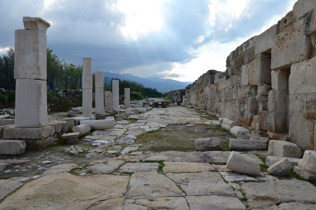
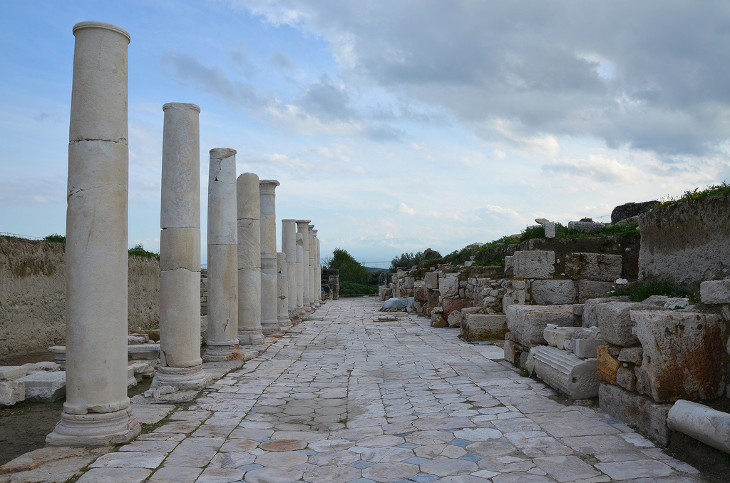
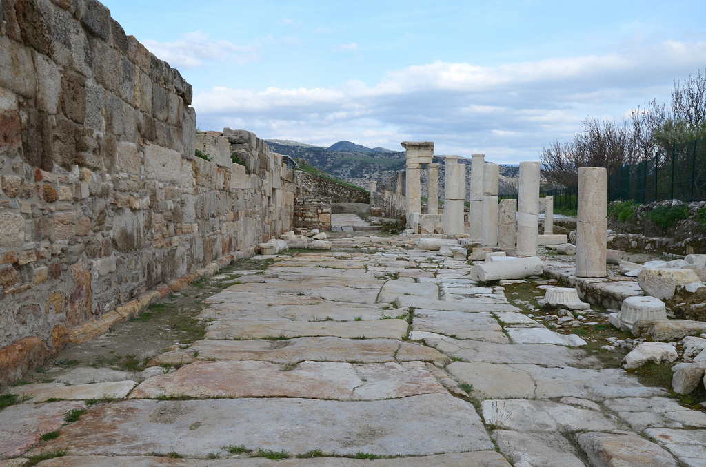
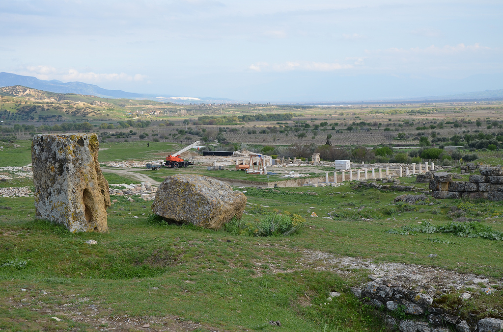
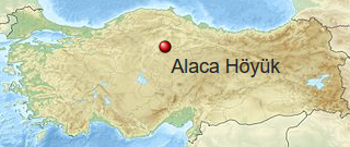
Alacahöyük is the site of an important Neolithic and Hittite settlement in central Turkey in the Çorum province, northeast of the ancient Hittite capital city of Hattusa. The mound (Turkish höyük) at Alacahöyük was inhabited since the Chalcolithic Period (4500 BC) and became the centre of the flourishing Hattian culture during the Bronze Age. It was later occupied by the Hittites, who used the city as their first capital before moving over to Hattusa.

Coordinates: 40° 14′ 4″ N, 34° 41′ 44″ E

Alacahoyuk

Alacahöyük was discovered in 1835 by the English voyager W.G. Hamilton. The first excavations started in 1861 by French archaeologist George Perrot, but more extensive work was initiated by the Turkish Historical Association in 1935 and continued until 1948. Since 1997, the excavations have been carried out by Ankara University under the direction of Prof. Dr Aykut Çınaroğlu.

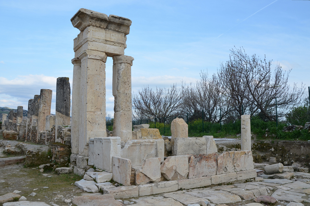
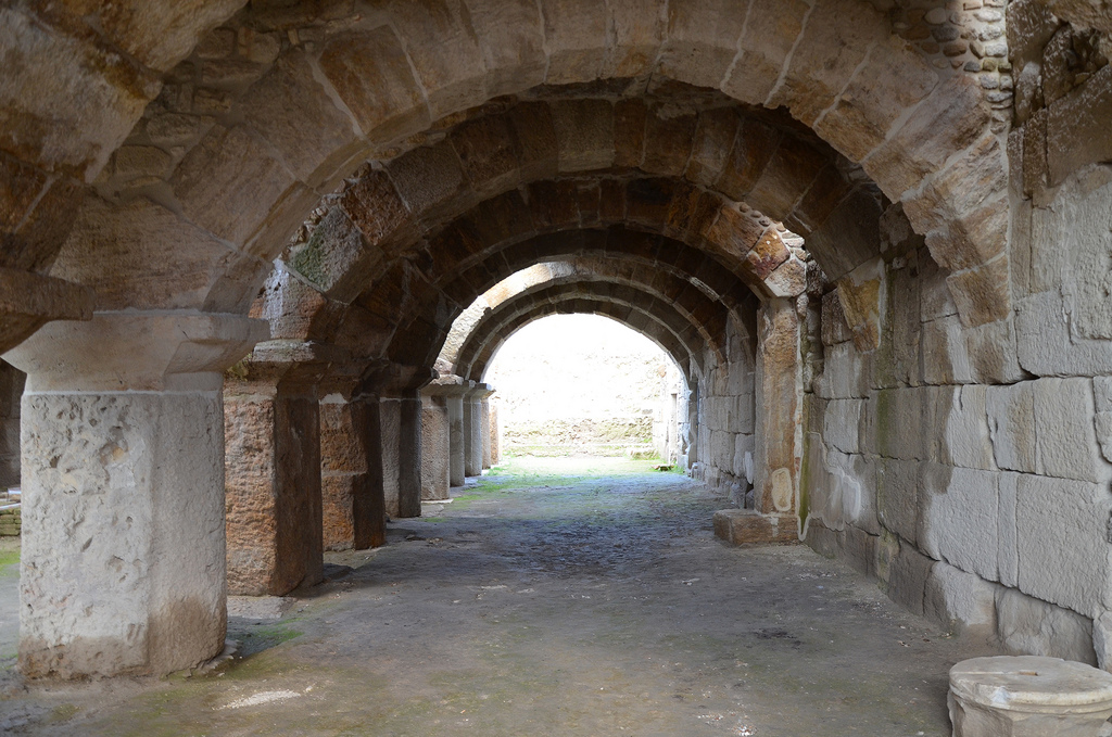
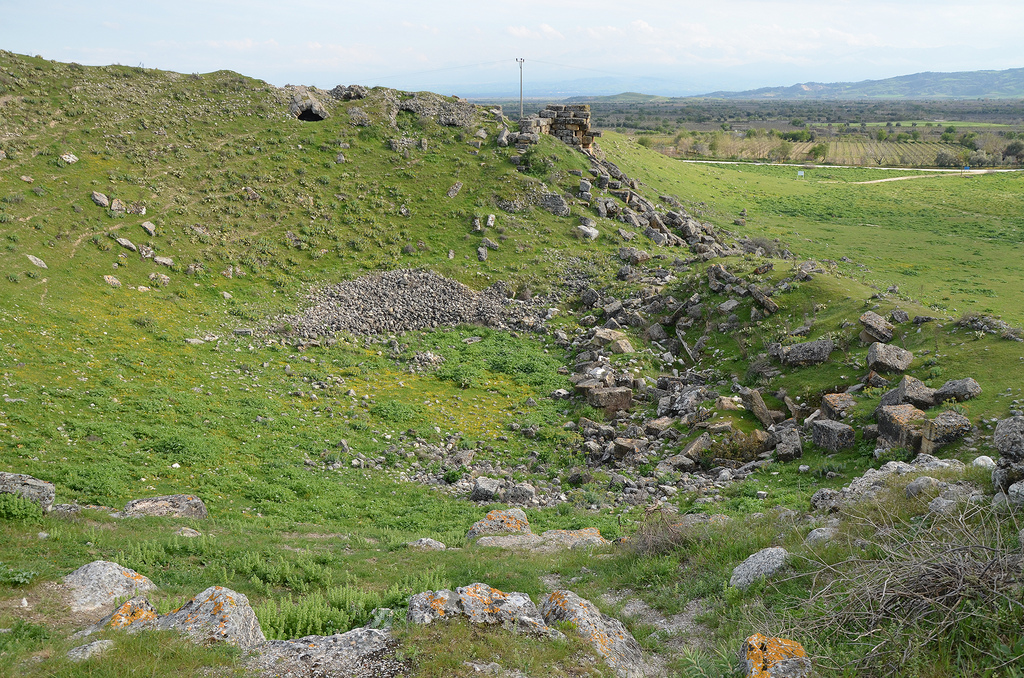
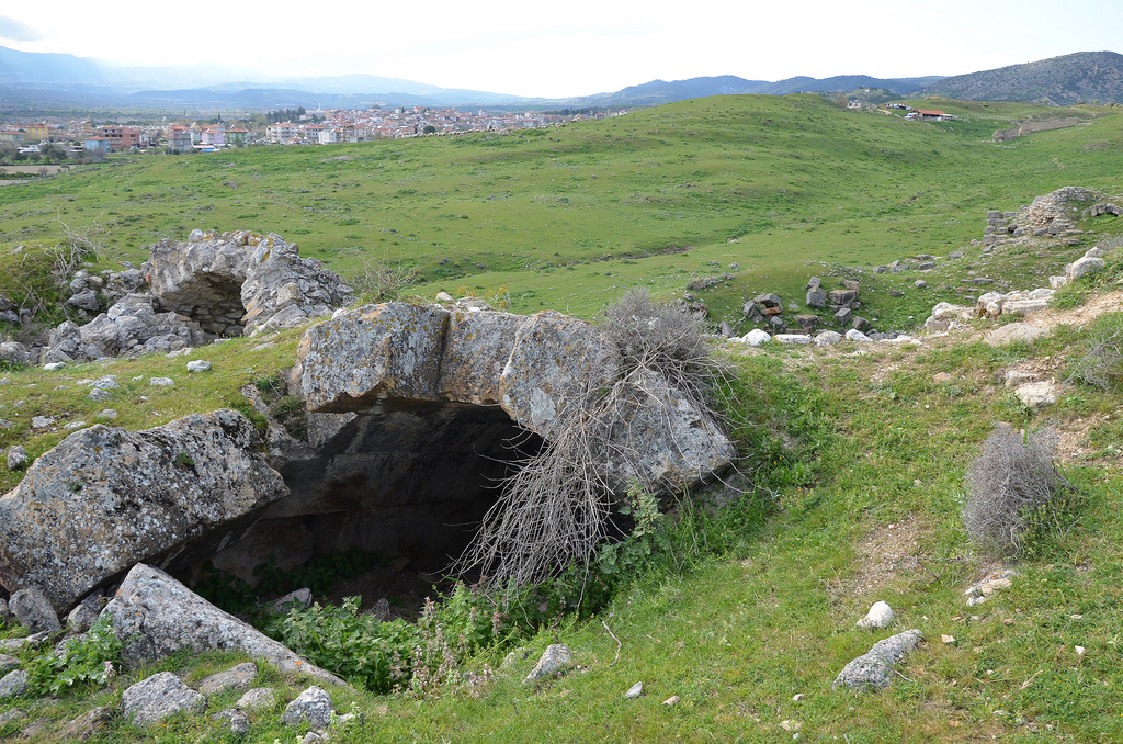
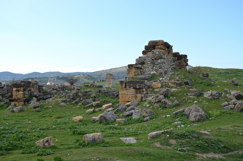
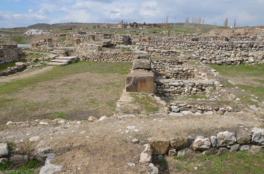
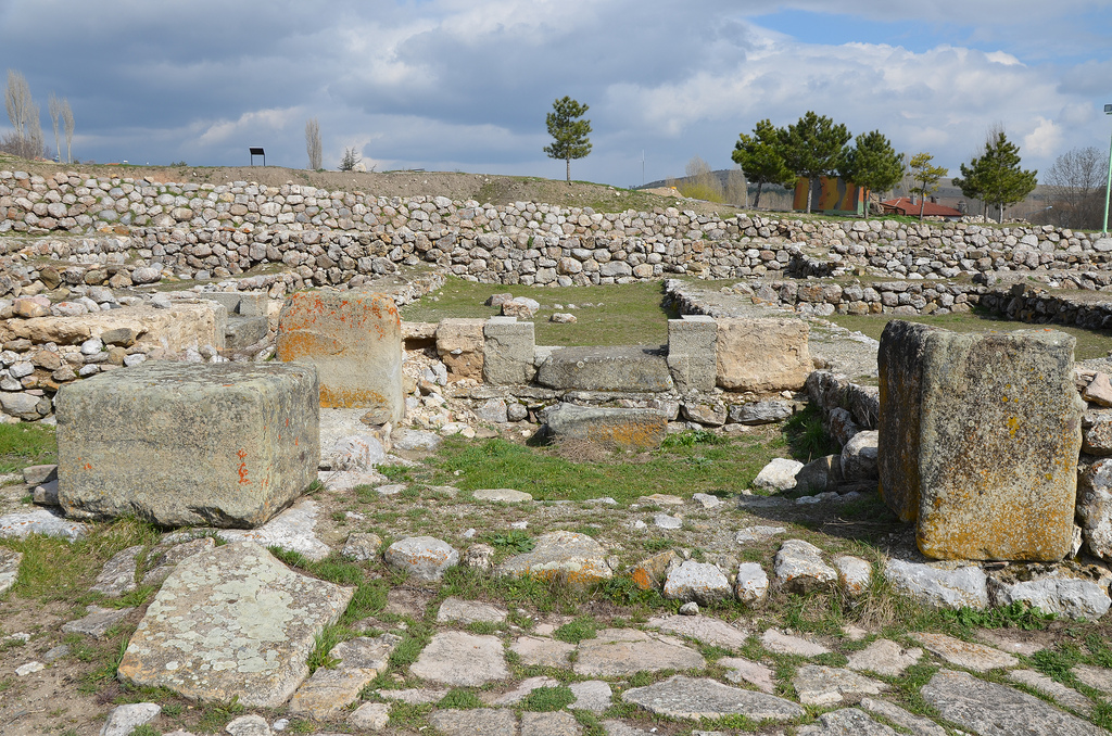
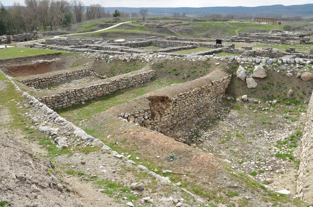
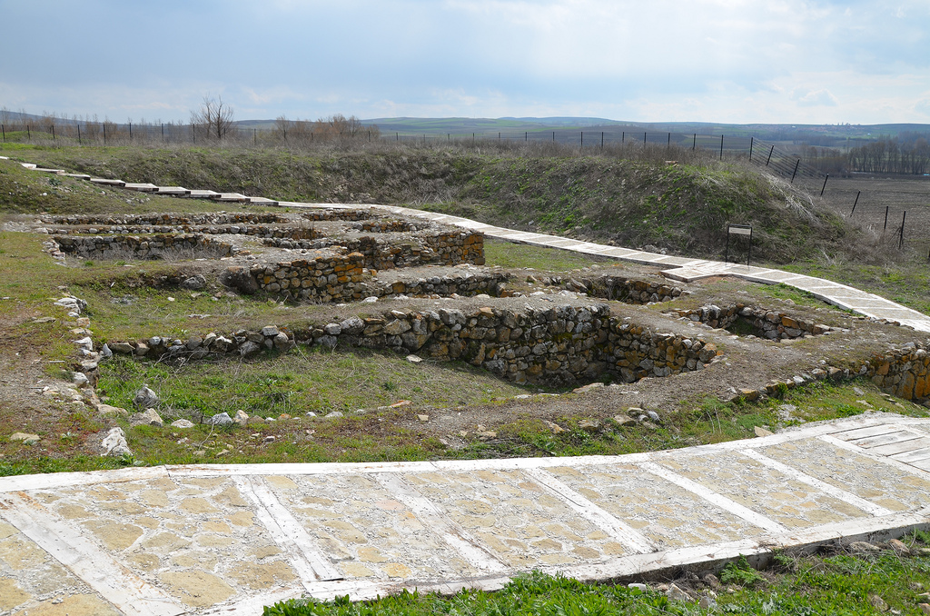
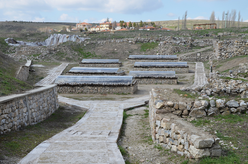
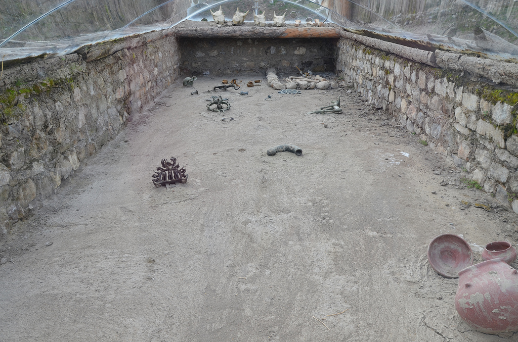
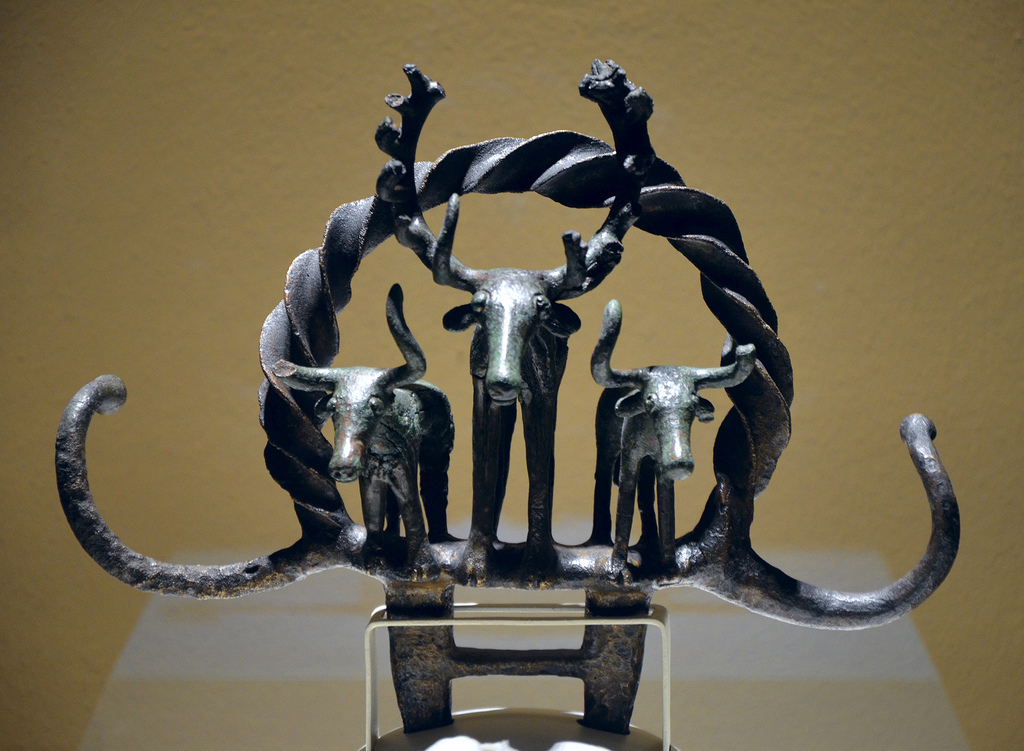
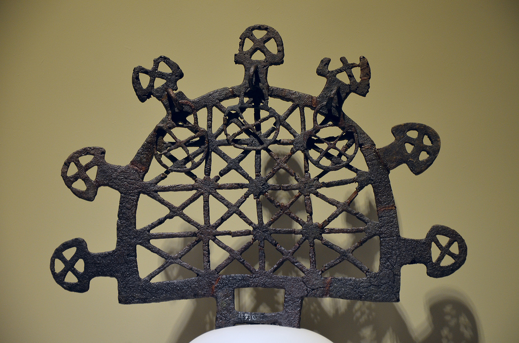
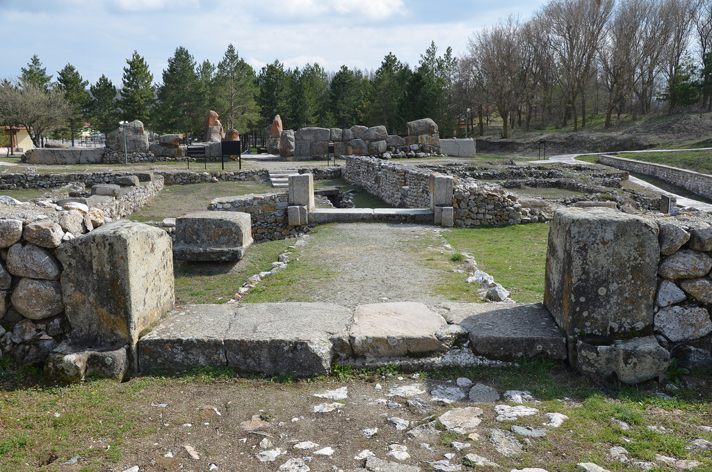
The excavations revealed fifteen layers of a settlement buried under the soil dating back to 5500 BC to 600 BC. The wealthiest and most important layer belongs to the Early Bronze Age. Many treasures have been excavated from the thirteen Hattian royal tombs dating to the 3rd millennium BC. Among these artefacts were bronze sculptures of bulls or deer, ceremonial symbols and sun disks. These artefacts are housed today in the Museum of Anatolian Civilizations in Ankara.

28429305752_e3ee373ee2_b
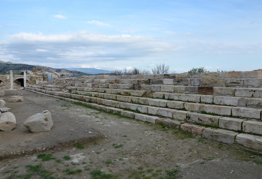
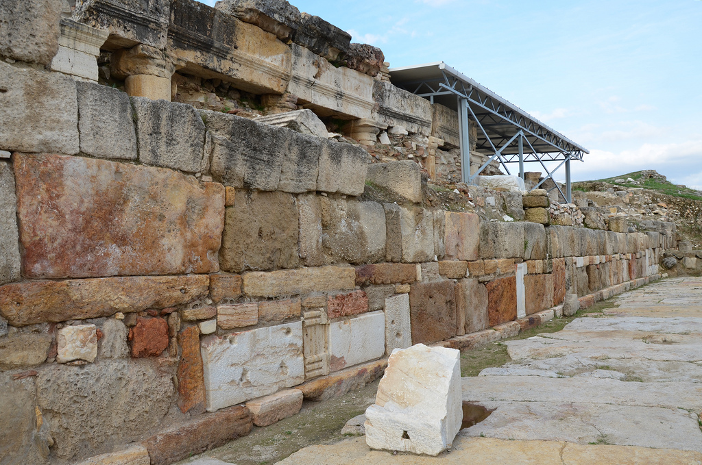
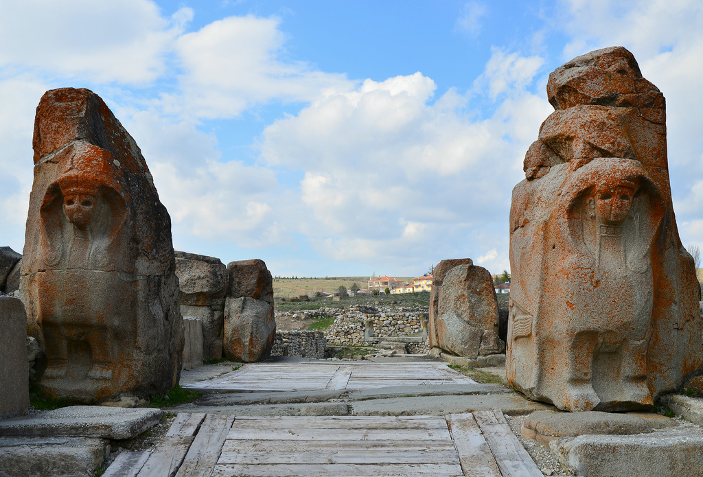
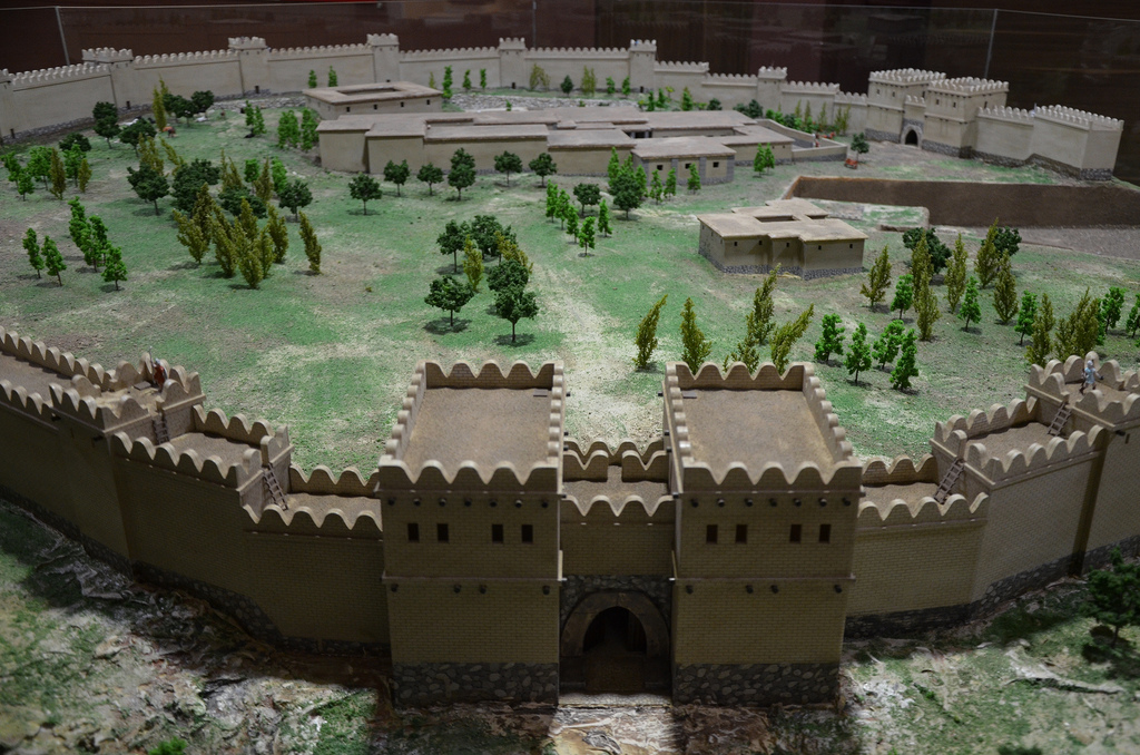
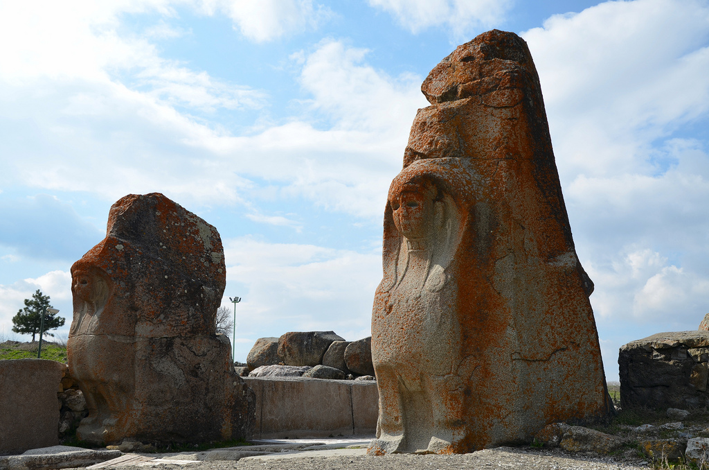
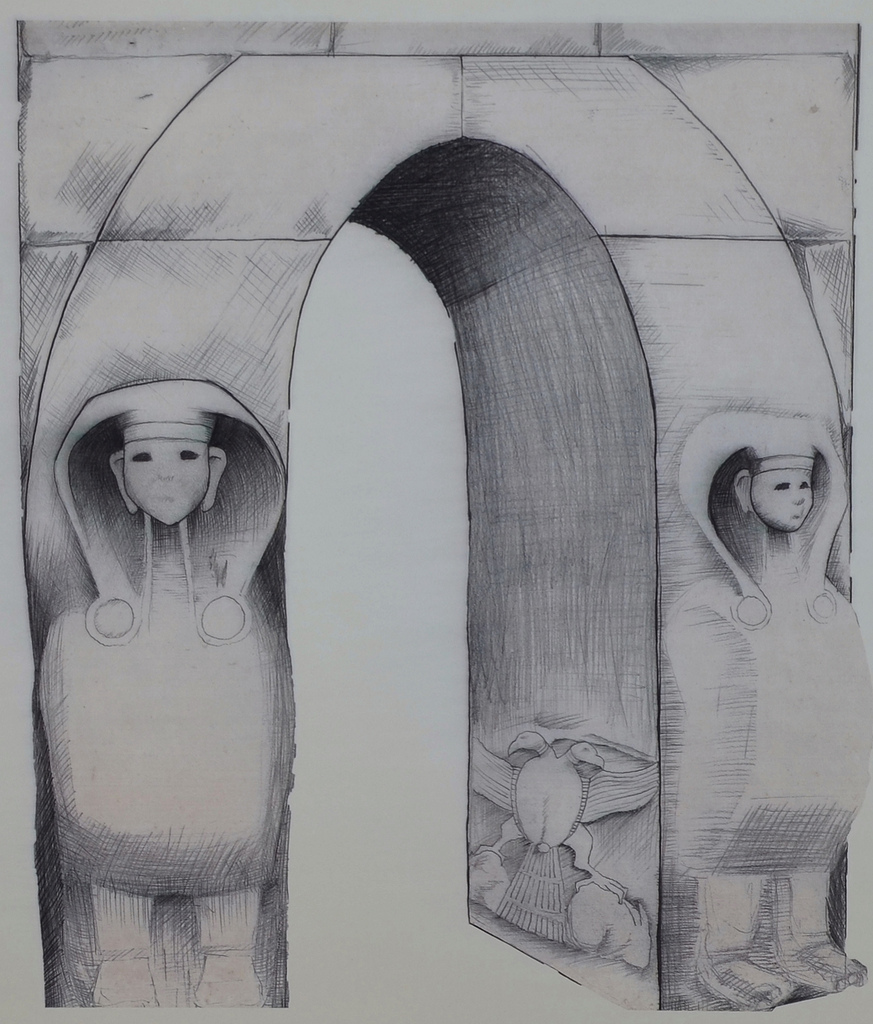
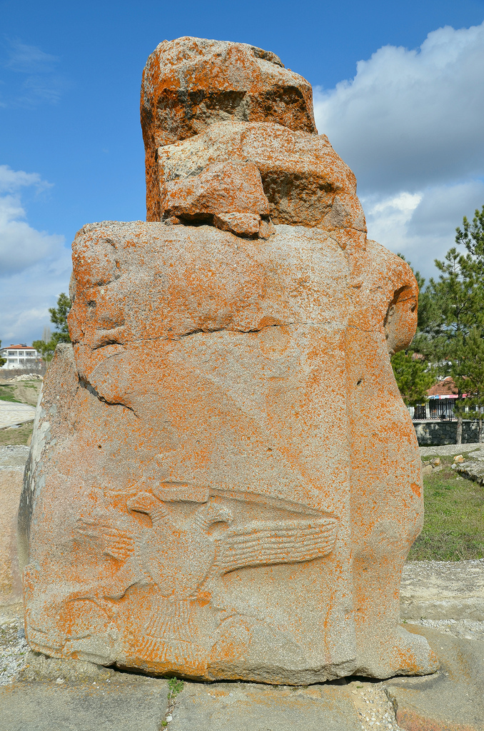
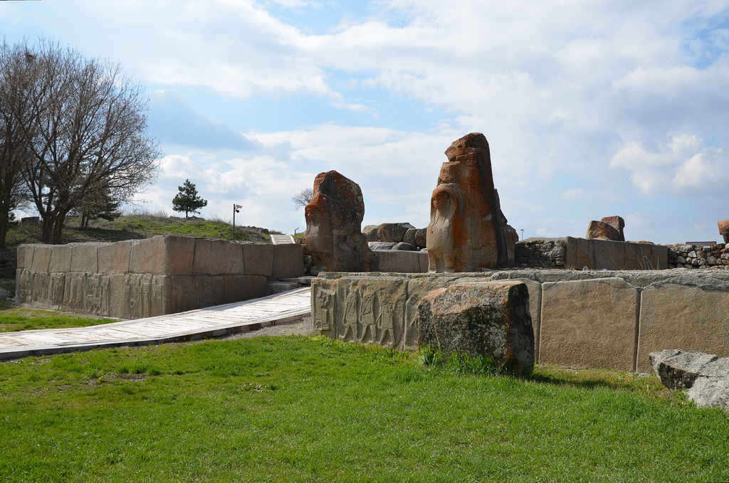
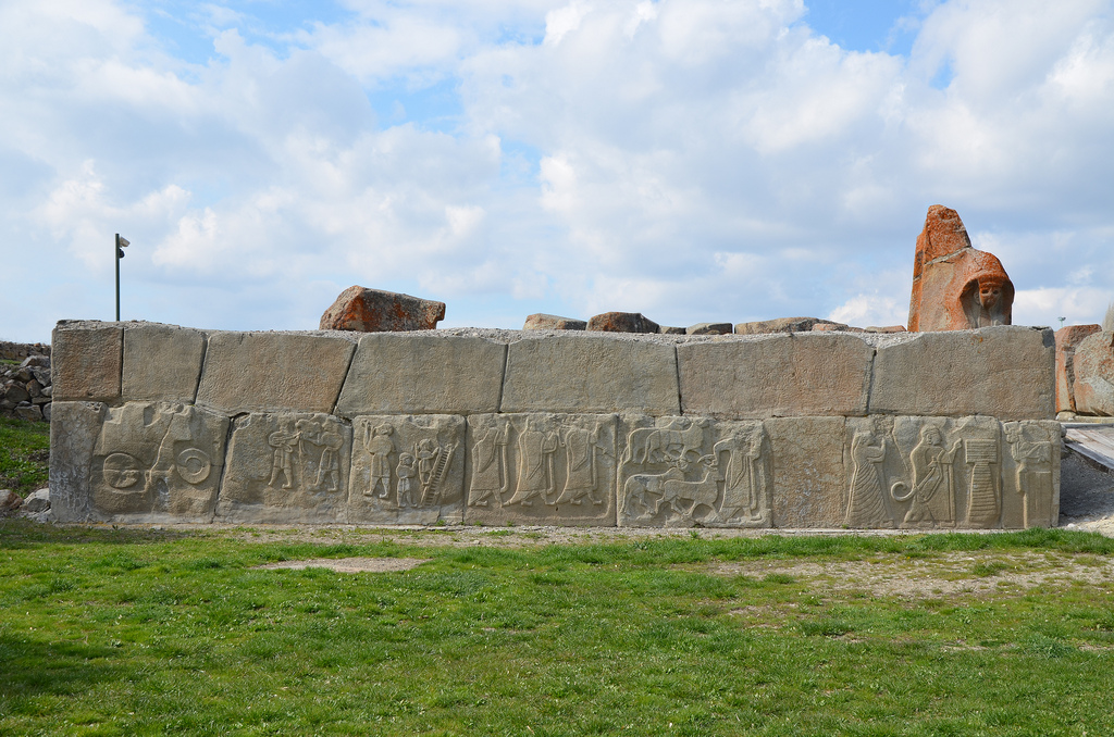
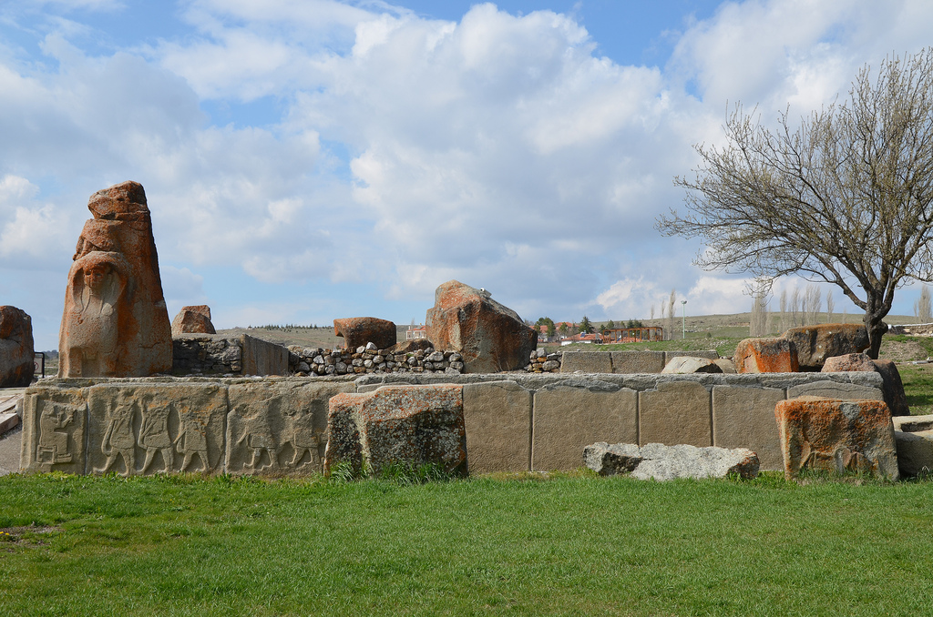
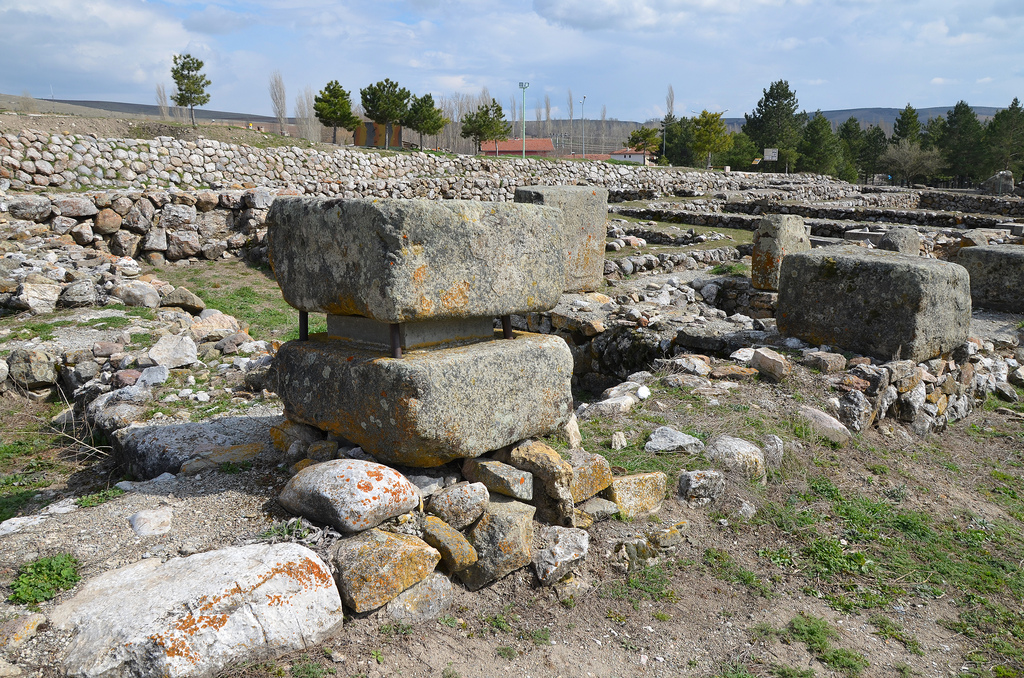
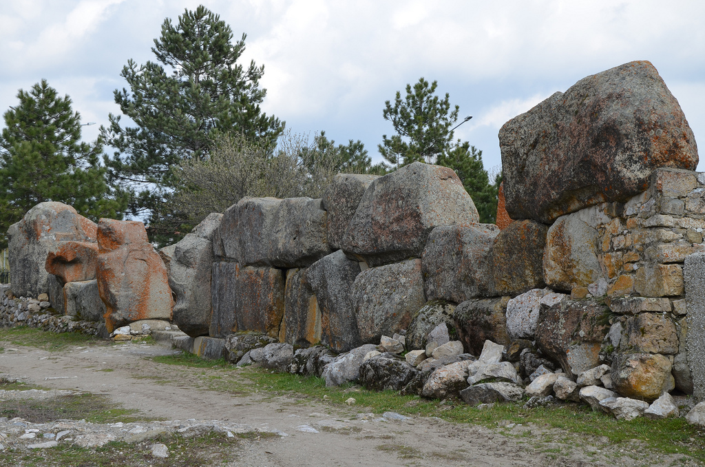
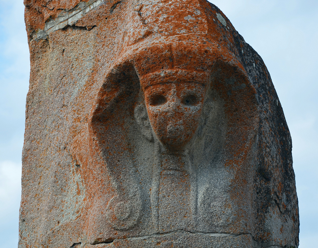
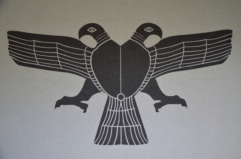
However, most of the standing remains at Alacahöyük, such as the “Sphinx Gate”, date from the Hittite period that followed the Hattians (1460-1200 BC). At that time, the city was surrounded by a mud brick wall with a stone base. The “Sphinx Gate”, fortified with towers, was the city’s main gate. It was flanked by two sphinx protomes with a relief in its inner parts depicting a double-eagle holding rabbits in its claws. These sphinxes were the protectors of the city.

The lower parts of the towers were decorated with orthostat reliefs depicting a religious ceremony, including a king and a queen praying to a bull before an altar, a lion hunt, sacrificed animals, jugglers, and acrobats. These depictions represented an entire ritual set of cult, libation, hunting and entertainment, including a religious ceremony in honour of the Storm God. The original reliefs are displayed in the Museum of Anatolian Civilizations in Ankara. 

Model of Alacahöyük.

A dam dated to 1,240 BC has also survived 1.5 kilometres to the southeast of Alacahöyük. It was one of the numerous dams built against droughts on the order of King Tudhaliya IV in the name of the goddess Hebat. The dam holds about 15,000 cubic meters of water and is Anatolia’s oldest and largest dam. The Alacahöyük dam is still being used today to irrigate fields in the region.

PORTFOLIO

Overview of Alacahöyük.
The Sphinx Gate, built in the 14th century BC, has a 10m width. The exterior faces of the large post blocks flanking the gate entrance were adorned with two-metre-tall sphinx protomes.
Reconstruction drawing of the Sphinx Gate of Alacahöyük.
The inner face of the eastern sphinx protome decorated with a double-headed eagle engraved as a low relief, over the eagle, legs of a goddess walking towards the city can be seen.
The inner face of the eastern sphinx protome is decorated with a double-headed eagle holding rabbits in its claws engraved as a low relief. Over the eagle, the legs of a goddess walking towards the city can be seen.
The Sphinx Gate, 14th century BC.
The internal and external facades of the towers in front of the Sphinx Gate were ornamented with relief-decorated orthostates. It is the only Hittite Imperial Period gate structure whose entrance is flanked by orthostat reliefs.
The external facade of the west tower located in front of the Sphinx Gate ornamented with relief-decorated orthostats (original reliefs in Museum of Anatolian Civilizations).
The external facade of the western tower located in front of the Sphinx Gate is ornamented with relief-decorated orthostates depicting a religious ceremony in honour of the Storm God (original reliefs in the Museum of Anatolian Civilizations).
The external facade of the eastern tower located in front of the Sphinx Gate ornamented with relief-decorated orthostats (original reliefs in Museum of Anatolian Civilizations).
The external facade of the eastern tower in front of the Sphinx Gate is ornamented with relief-decorated orthostates depicting a religious ceremony in honour of the Storm God (original reliefs in the Museum of Anatolian Civilizations).
The foundations of the Temple located to the north of the Sphinx Gate, it covered an area of 5000 square metres & consisted of galleries flanking a paved-stone courtyard, long narrow corridors & a large square hall as well as rooms of various size.
The Temple’s foundations are located north of the Sphinx Gate. It covered an area of 5000 square metres and consisted of galleries flanking a paved-stone courtyard, long narrow corridors, a large square hall, as well as rooms of various sizes.
The area to the south west of the Temple characterised by massive buildings, private houses with front yards and block structures. Narrow but regularly planned streets and small squares delineate the structures.
The area to the southwest of the Temple is characterised by massive buildings, private houses with front yards and block structures. Narrow but regularly planned streets and small squares delineated the structures.
Subterranean silos built to store great amounts of grains without contact with air, wheat and barley were the most important grains produced in the Hittite lands.
Subterranean silos are built to store great amounts of grains without contact with air. Wheat and barley were the most important grains produced in the Hittite lands.
The Postern Gate consisting of two towers, two doors and an entrance, posterns are gate structures with vaulted tunnel-like passages constructed beneath the city walls.
The Postern Gate consists of two towers, two doors and an entrance. The foundations of the gate structures were built of large blocks of calcareous rocks while their inner core was filled with soil.
The Postern Gate consisting of two towers, two doors and an entrance, posterns are gate structures with vaulted tunnel-like passages constructed beneath the city walls.
The postern gates were structures with vaulted tunnel-like passages constructed beneath the city walls.
The area of Royal Tombs built in the Early Bronze Age, 2500-2000 BC.
The Royal Tombs were built in the Early Bronze Age (2500-2000 BC). They had a major role in our understanding of the indigenous Hattian Civilization. Six out of thirteen intramural tombs have been reconstructed to their original appearance.
The interior of the one of the Royal Tombs built in the Early Bronze Age, grave goods consisted of jewellery made of gold and silver as well as weapons, metal & terracotta vessels, sun-disks and bull & deer statuettes.
The interior of one of the Royal Tombs. Grave goods consisted of jewellery made of gold and silver, weapons, metal and terracotta vessels, sun disks and bull & deer statuettes.
Reconstruction drawing of a Hattian funeral ceremony.
Reconstruction drawing of a Hattian burial ceremony.
Bronze sun disk encircled with bull and deer figures, the sacred animals of the Hattians.
Bronze Sun Disk (ceremonial standard), the cult object found in pre-Hittite (Hatti) royal tombs.
Cyclopean stone wall.
Alacahöyük.
Alacahöyük.
The main drainage channel running toward the Sphinx Gate, water drained through a terracotta pipe into the drainage channel.
The main drainage channel runs toward the Sphinx Gate. Water drained through a terracotta pipe into the drainage channel.
A close-up of one of the sphinx protomes.

Links:

Tripolis ad Maeandrum

The ancient city of Tripolis is located in the Denizli province, about 20 km northwest of Hierapolis (Pamukkale). The city was founded on the northern bank of the Maeander, where the borders of Phrygia, Caria and Lydia meet, and on the road leading from Sardes to Laodicea ad Lycum. It was originally known as Apollonia and, for a short time in the 1st century BC, was later renamed Antoniopolis (in honour of Mark Antony). The city took its final name sometime later, becoming known as Tripolis due to its location at the crossroads of these three regions.

Coordinates: 38°02’14.5″ N 28°57’08.2″ E

The earliest mention of Tripolis is by Pliny the Elder, who described it as a Lydian settlement. In the 2nd century AD, Claudius Ptolemy described it as a Carian town, whilst the Byzantine geographer Hierocles called it a Lydian town. Although the city’s history dates back to the Hellenistic period, archaeological excavations have shown that the settlement’s origins can be traced to the 4th millennium BC. Tripolis reached its peak during the Roman period, from the 2nd century AD onwards. New public buildings, such as the city gates, baths, a stadium, a theatre, and a bouleuterion (council hall), were built during this period. During the Byzantine period, Tripolis became an important bishopric centre. A church dating back to the 6th century AD was unearthed during excavations in 2013.

PORTFOLIO

The Late Roman Agora
The Late Roman Agora. Constructed in the 4th century AD, the Agora was bordered by a seven-stepped platform intended for visitors to rest.
The seven-stepped platform in the Late Roman Agora.
The portico of the Late Roman Agora paved with opus sectile made from onyx marble.
The western portico of the Late Roman Agora was paved with opus sectile made from onyx marble.
The 450m long colonnaded street running in a north-southerly direction. in the early 5th century CE, fortification walls were built on its north
The 450m long colonnaded street ran in a north-southerly direction and was constructed in the early Roman period. In the early 5th century AD, fortification walls were built on its northern side.
The Byzantine fortification wall built in the 5th century AD along the Colonnaded Street.
The Byzantine fortification wall was built along Collonaded Street in the 5th century AD.
The 450m long colonnaded street runs in a north-southerly direction.
The Nymphaeum (Orpheus Fountain) built at the crossroads between the Colonnaded Steet and the Hierapolis Street.
The Nymphaeum (Orpheus Fountain) was built at the crossroads between Colonnaded Street and Hierapolis Street.
The Hierapolis Street constructed of travertine blocks running in an east-west direction.
Hierapolis Street is constructed of travertine blocks running in an east-west direction.
The Hierapolis Street.
The Arched Building with cryptoporticus constructed in the late Hellenistic or early Roman period.
The Arched Building with Cryptoporticus was constructed in the late Hellenistic or early Roman period.
The theatre built on the natural hill with a slope of 50 degrees, it had a capacity of 8,000.
The Theatre was built on a natural hill with a 50-degree slope. It had a capacity of 8,000.
The Theatre was probably erected in the 2nd century AD.
The ruins of the Bouleuterion (Council Hall).
The excavations in 2015.

Links: