Lying at the foothills of Mount Tmolus on the banks of the Pactolus River, Sardis was one of the great cities of Asia Minor. Today, its ruins are located about 80 kilometres east of present-day İzmir in western Turkey. As the capital of the flourishing Kingdom of Lydia of the 7th century BC, Sardis achieved fame and wealth, especially under the last Lydian king, Croesus, before succumbing to the Persian conquest in the mid-6th century BC. Sardis fell, in turn, to the Athenians, the Seleucids, and the Attalids until it was conquered by the Romans in 133 BC. The city flourished under Roman peace, became an important centre of Christianity, and was home to a significant Jewish community. Sardis was one of the Seven Churches mentioned in the Book of Revelation.
According to the Greek historian Herodotus, Sardis was the capital of the Kingdom of Lydia in the 7th and 6th centuries BC, when a dynasty of kings from Gyges to Croesus conquered western Anatolia. King Croesus, who ruled Lydia from 560 to 546 BC, was the first person to issue gold and silver coins. Croesus’s legendary wealth led to the expression’ rich as Croesus’.
Sardis was located on a major route connecting the Aegean coast to inland Anatolia. Its wealth and prosperity can be attributed to its strategic location, its ideal location for trade and commerce, and its abundant water and mineral resources, most notably the legendary Pactolus, a small river that contained gold dust. The Persians brought the Lydian monarchy to a final and dramatic end when Cyrus II, King of Persia, invaded Sardis in 547 BC.
Under the Achaemenid Persians (547 – 334 BC), Sardis was the capital of Anatolia’s major satrapy (province). It served as the end station of the Persian Royal Road, which began in Susa, in present-day Iran. During the Persian occupation, the inhabitants of Sardis engaged in industry and commercial trade, making Lydia one of the wealthiest kingdoms of the period. Sardis remained under Persian domination until it surrendered to Alexander the Greatin 334 BC.
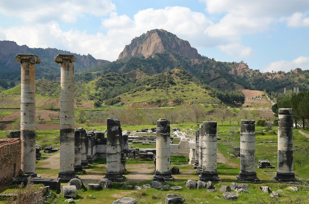
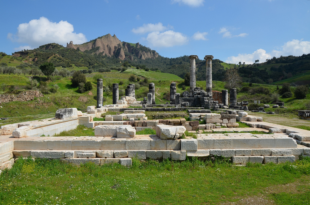
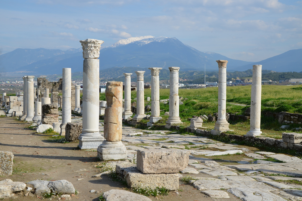
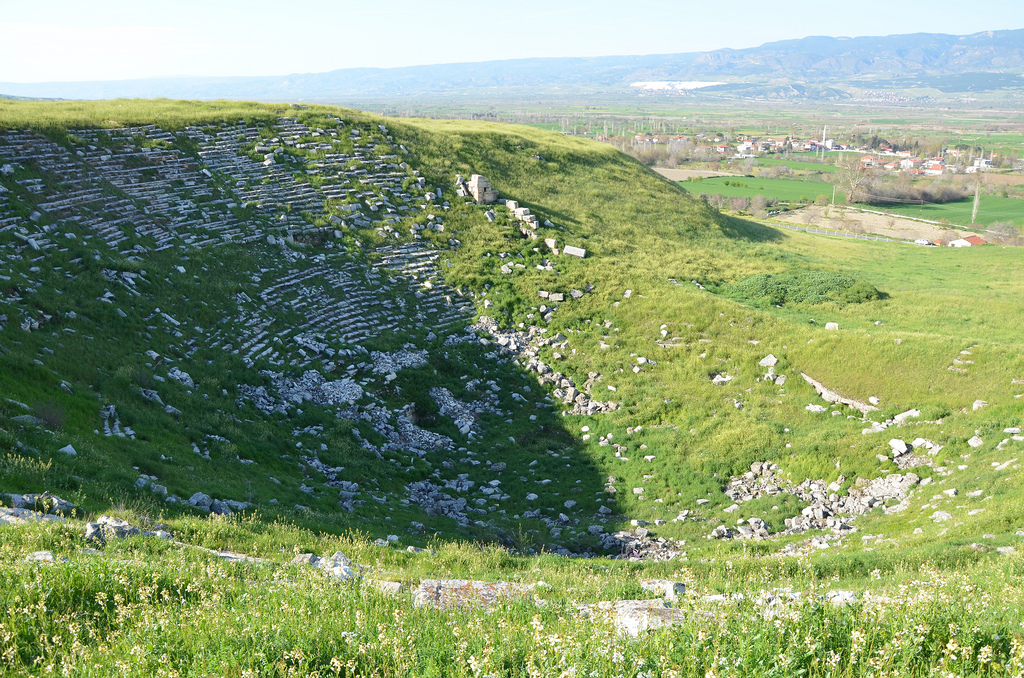
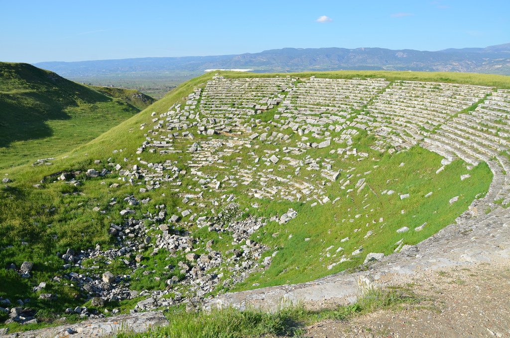
After Alexander the Great’s conquest, Sardis was incorporated into the Hellenistic kingdoms and became the western capital of the Seleucid empire when it was granted status as a Greek city-state. The monumental temple to the goddess Artemis on the site dates to this period. The theatre of Sardis, now sadly in ruins, was also built during this period.
In 133 BC, Sardis came under Roman rule when the last king of Pergamon, Attalus III Philometor, died and bequeathed his kingdom to the Romans. The city became the metropolitan capital and centre of judicial administration of the Roman province of Lydia. The city was rebuilt after being destroyed by an earthquake in AD 17. According to Tacitus (Annals 2.47), Tiberius awarded ten million sesterces for its reconstruction and agreed to waive all taxes due from Sardis and the other cities for five years after the earthquake. Hadrian visited Sardis in AD 123/124 and 128 as “new Dionysos“, whilst an inscription seems to mention a Hadrianeion (Temple of Hadrian).
Excavations in Sardis have uncovered more remains of the Hellenistic, Roman and Byzantine city than of the Lydian town described by Herodotus. Since 1958, Harvard and Cornell universities have sponsored annual archaeological expeditions to Sardis. The major Roman bath-gymnasium complex has been excavated and restored as part of these works. The Synagogue was also discovered in 1962. Some of the important finds from the archaeological site of Sardis are kept in the Archaeological Museum of Manisa in Turkey.
PORTFOLIO
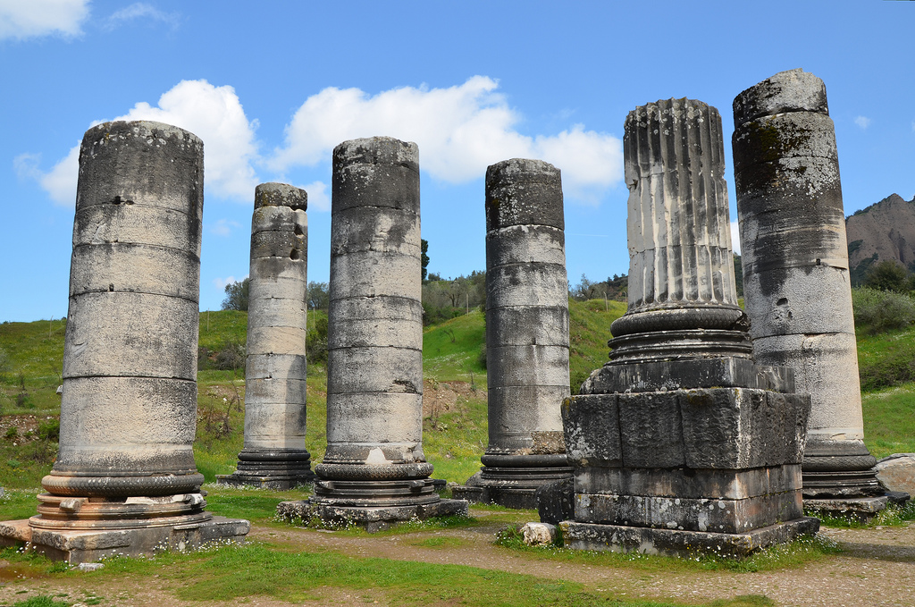
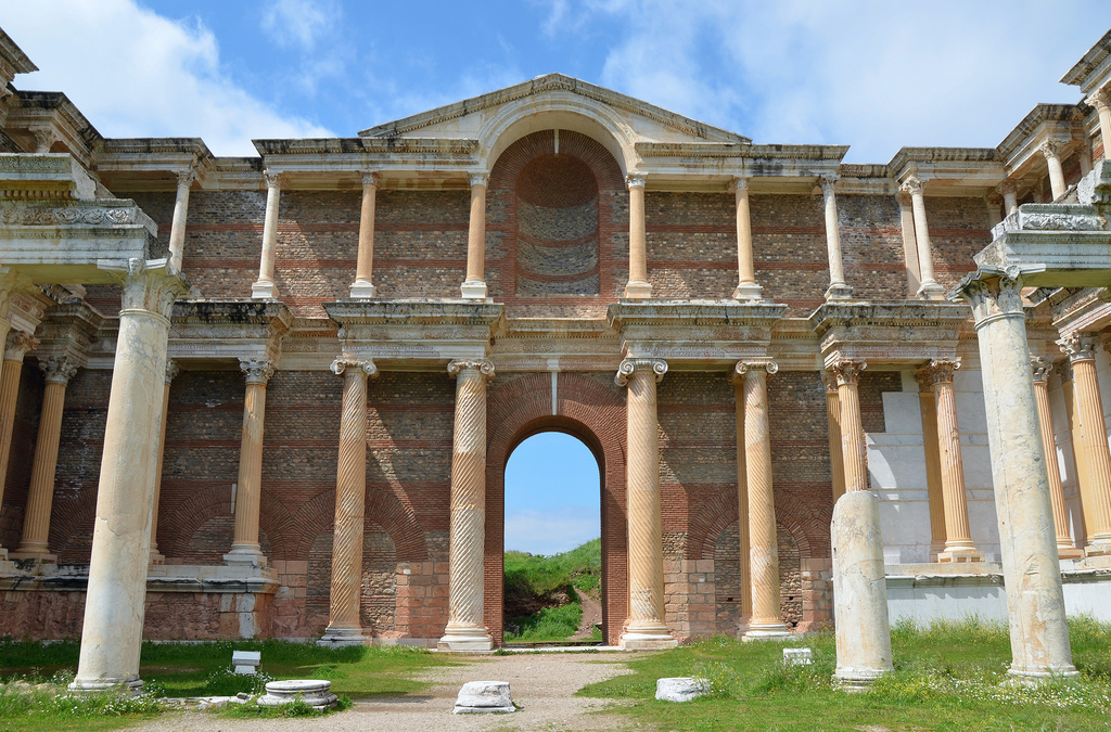
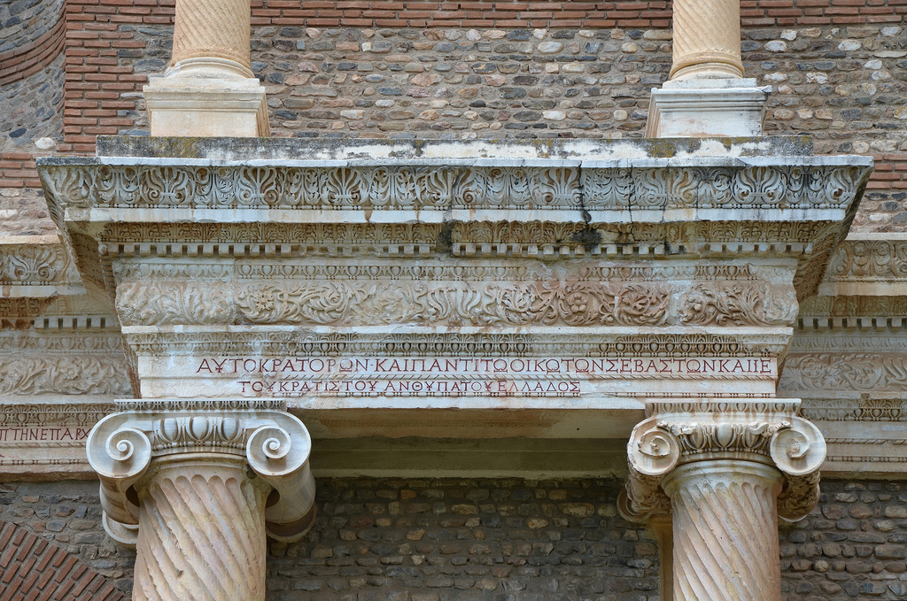
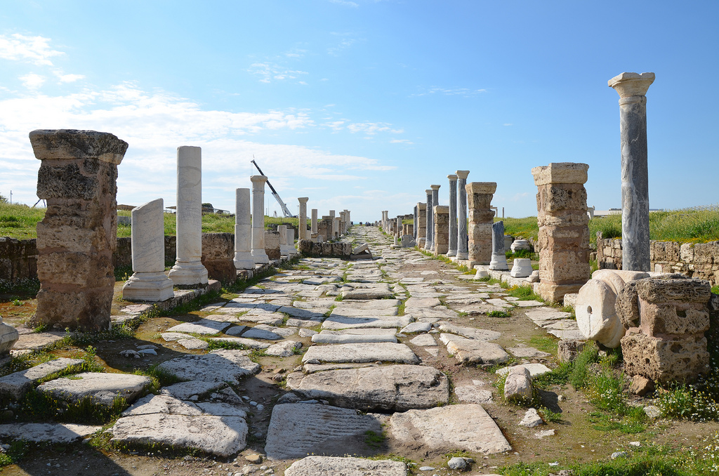
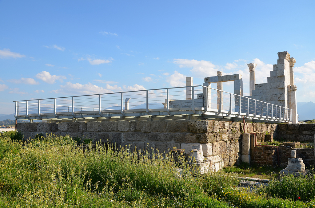
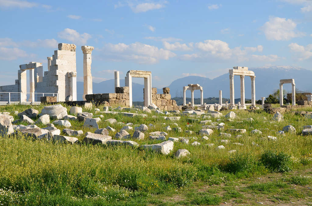
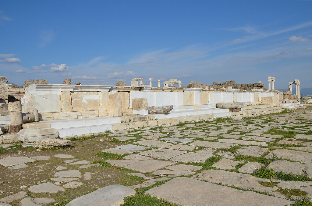
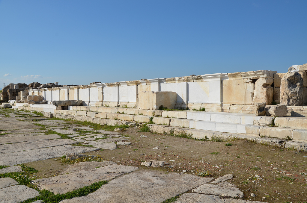
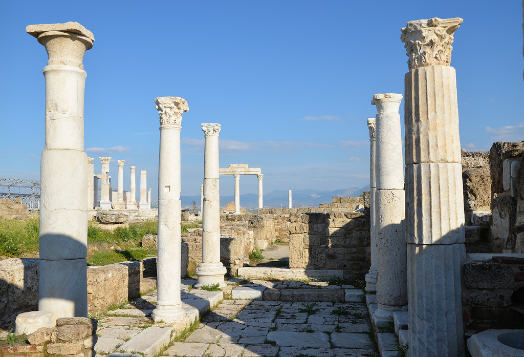
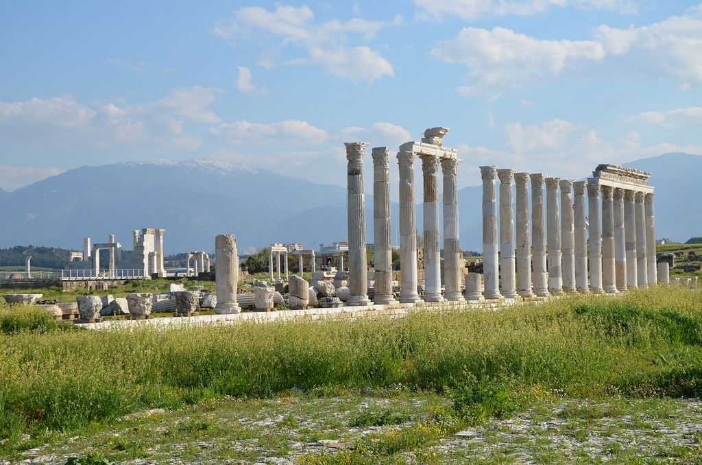
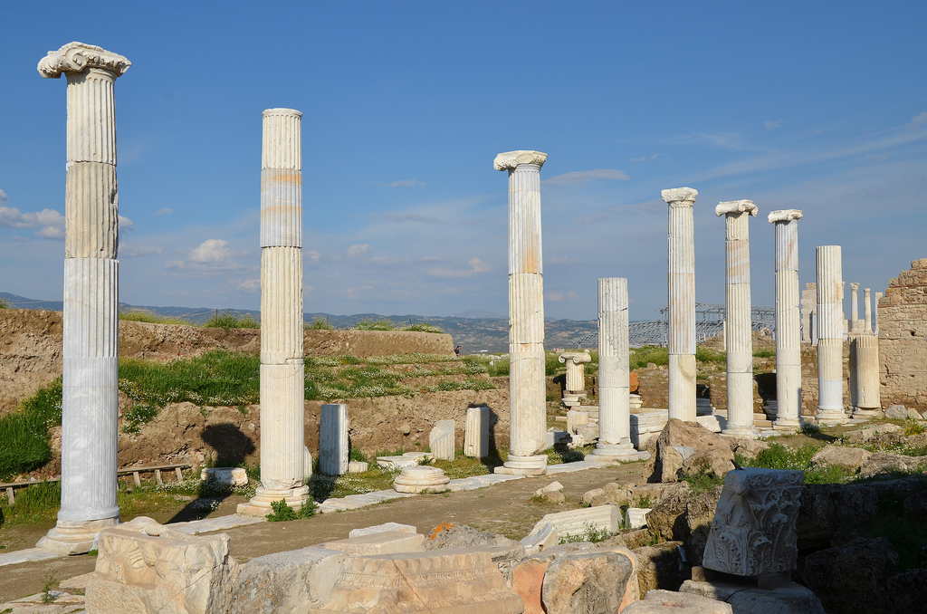
The ruins of the great Ionic Temple of Artemis are one of the largest in the world. Construction of the temple began during the Hellenistic era in the 3rd century BC on the location of a sanctuary of Artemis dating to the late 6th or 5th century BC.The underground foundations of the Lydian Altar of Artemis, the oldest preserved building in the sanctuary of Artemis (500-400 BC), where animal sacrifices, libations, and other offerings were made. The building above, which may have been much more finely made, has been entirely destroyed.View of Lydian Altar and Temple of Artemis.The altar was a stepped limestone tufa foundation. A set of marble stairs across the front of the building led to the higher level. The travertine stair blocks are modern replacements for the original marble stairs, protecting the ancient foundations. The altar was restored in 2010-2012.The Temple of Artemis was renovated in the 2nd century AD by dividing the cella into two equal chambers. The temple incorporated the Imperial Cult. Both shrines were dedicated to Antoninus Pius and his wife Faustina (as Zeus and Artemis). The colossal head from a statue of the empress Faustina the Elder is now part of the British Museum collection.The Temple of Artemis was fronted on each end by eight columns, almost 17.8 m high; twenty such columns were on each side. The extant columns are predominantly Roman replacements.The two complete Ionic columns have stood intact since antiquity and have never been restored. Most columns were unfluted as the Temple was never finished.Hellenistic column base on a Roman pedestal with Greek verse around the bottom of the column.The Temple of Artemis was abandoned with the coming of Christianity, and a small church was erected at the southeast corner.The Bath-Gymnasium complex was probably completed in the late 2nd-early 3rd century AD. This complex is a relatively common architectural type in Asia Minor, combining a Roman bath with vaulted halls and a colonnaded palaestra, such as Ephesus and Ancyra.The two-storey colonnaded Marble Court of the Bath-Gymnasium complex. It was originally separated from the baths and was used for special ceremonies.Southwest corner and west ambulatory of the two-storey colonnaded Marble Court.The first storey of the Marble Court carried Ionic capitals, the second a type known as “acanthus-and-fluting”.The inscription on the first-storey architrave, in red-painted letters, dedicates the Marble Court to the Roman Imperial family: Emperors Caracalla and Geta, and their mother, Julia Domna (Geta’s name is erased). It also records that two prominent citizens, Antonia Sabina and Flavia Pollitta, helped the city to pay the expenses of this project.The Palaestra of the Bath-Gymnasium Complex covers a total area of 6650 m2. It consisted of a large square peristyle court of 100 columns, bordered on the north and south by ranges of rooms.The Frigidarium (cold bath) has a long rectangular pool in its centre. The side walls are articulated by alternating semicircular and rectangular niches containing pools, basins and fountains.The monumental Synagogue was the centre of Jewish religious life in Sardis during the Late Roman period. Discovered in 1962, the building and its decorations have been partly restored.View of the Main Hall of the Synagogue ending in an apse. It was over 50 m long and large enough to hold nearly a thousand people.The Main Hall of the Synagogue with a marble table and lions and three tiers of marble-covered benches which served as seats for the synagogue elders The table and the lions are older than the Synagogue itself; they were moved from their original locations and reused here.The Peristyle Forecourt of the monumental Synagogue. It was roofed along the sides but left open to the sky in the centre.The Peristyle Forecourt of the Synagogue was paved with geometric mosaics, and the walls were covered with painted plaster. Floor mosaics constituted the most extensive part of the Synagogue’s decoration, covering some 1400 square metres.View of the Byzantine Shops and the Bath-Gymnasium Complex.The Byzantine Shops. The streets of Late Roman Sardis were flanked by buildings serving various residential, commercial, and industrial purposes. The shops formed part of a lively commercial district in the 5th-6th centuries.A short segment of the Roman main street paved with marble blocks and flanked by covered porticoes.
Laodicea on the Lycus (Latin: Laodicea ad Lycum) is an ancient city located in present-day western Turkey, near the modern town of Denizli. Founded in the 3rd century BC along the river Lycus by Seleucid King Antiochus II, the city was named in honour of his wife, Laodice. It became one of the most important and prosperous commercial centres in Asia Minor, situated on the trade route from the East, and was well-known for its woollen and cotton textiles. Laodicea is mentioned as one of the Seven Churches in the Book of Revelation (1:11, 3:14-22) and is also referenced in Paul’s letter to the Colossians (4:16). In 2013, the site was added to UNESCO’s World Heritage Tentative List.
Laodicea was built on a high plateau overlooking the Lycus River Valley and covered more than five square kilometres. Excavations have revealed that the town was continuously inhabited from the Chalcolithic Period (around 5500 BC) until the 7th century AD. The settlement was originally known as Rhoas (located on Asopos Hill), then as Diopolis (meaning City of Zeus), and finally as Laodicea (Laodikeia). In 188 BC, the city became part of the Kingdom of Pergamon and later came under Roman control in 133 BC when the last king of Pergamon, Attalus III, bequeathed his entire empire to Rome. Cicero, the renowned Roman orator and statesman, served as the governor of the province, primarily residing in Laodicea. In 60 BC, during Nero’s reign, the city was devastated by a powerful earthquake but was subsequently rebuilt. Laodicea experienced a resurgence during the early 2nd century AD and once again in the 3rd century AD, under the rule of Roman emperors Hadrian and Caracalla.
Laodicea became an important commercial centre thanks to its location on the crossroads of major trade routes: north-south between Sardis and Perga and east-west from the Euphrates to Ephesus. The most important trade was textiles. Besides, marble, grain and livestock commerce also provided an essential income to the city. The land surrounding Laodicea was fertile, providing excellent pastures for large flocks of sheep.
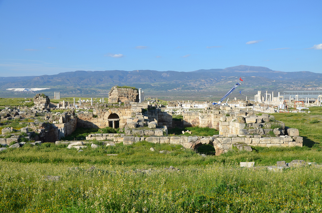
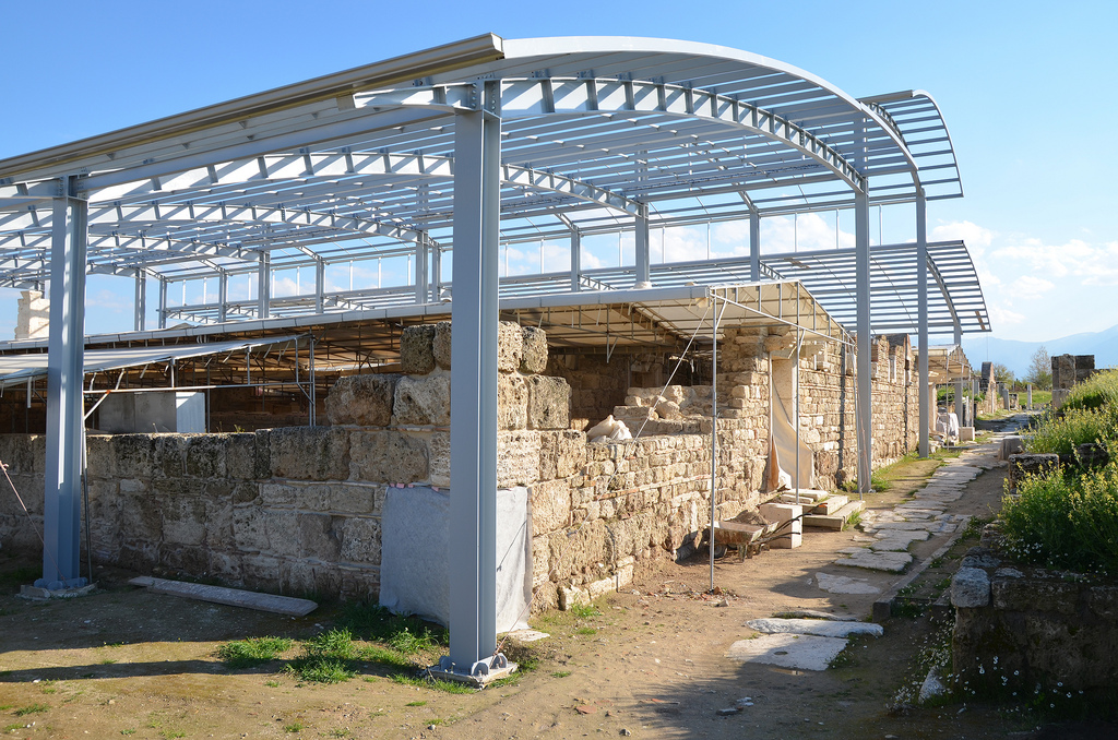
The city gained prominence as a Christian centre and as a place of religious pilgrimage in the Early Byzantine Period. Extant churches among the ruins date from the 4th to the 7th centuries AD. In 2010, a well-preserved church built during the reign of Constantine the Great was discovered using ground-penetrating radar. The excavations and restorations of this large basilica have been nearly completed over the past two years. By the end of the 5th century AD, a powerful earthquake devastated Laodicea, leading to a decline in its importance. The city was never rebuilt, and its inhabitants relocated to nearby cities such as Denizli.
Today, Laodicea boasts impressive remains of the ancient city, including two theatres, the biggest stadium of Anatolia, four bath complexes, five agoras, five nymphaea, temples, churches and monumental colonnaded streets. Over the past seven years, excavation work in the ancient city has uncovered approximately 2,300 artefacts, including the Laodicean Church, the monumental columns of the Sacred Agora, and a marble block inscribed with a “water law” that dates back to AD 114. Restoration of the Western (Hellenistic) Theatre is currently in progress and is expected to be completed by the end of 2020. Additionally, a three-meter-high statue of Emperor Trajan was discovered in 2019. The statue depicts Trajan in full military regalia, towering over a much smaller figure of a prisoner.
PORTFOLIO
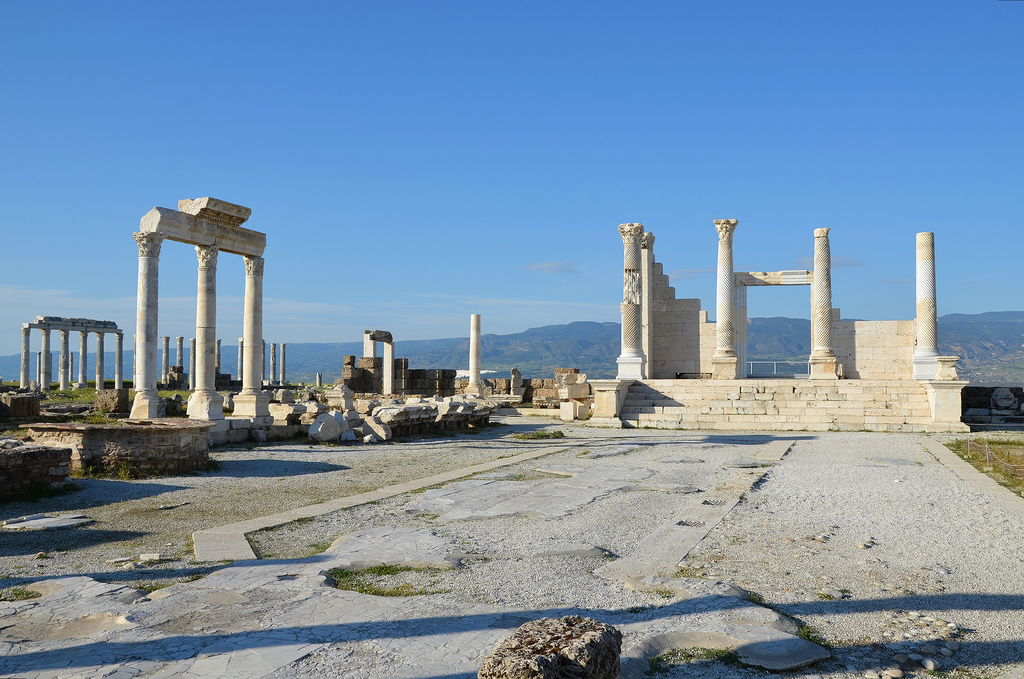
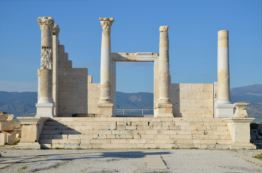
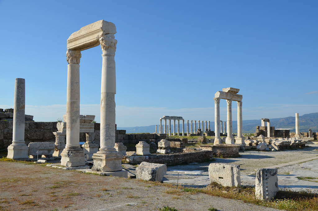
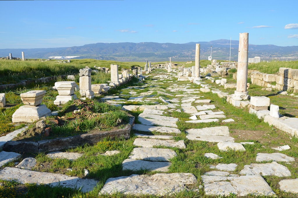
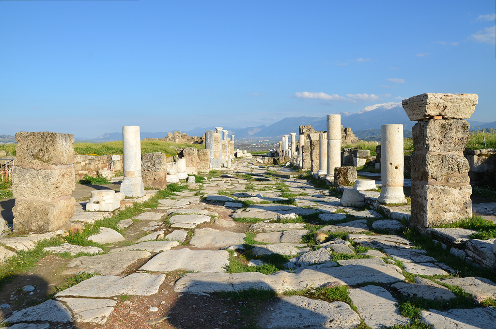
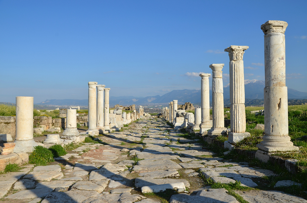
Syria Street was the main street of Laodicea, stretching nearly one kilometre. It was built in the Doric order in AD 84-85 during the proconsulship of S. Iulius Frontinus. It was later repaired using the Corinthian order.The courtyard of the reconstructed Temple A was built in the 2nd century AD during the Antonine period. Located to the north of Syria Street, the prostyle temple of the Corinthian order was surrounded by porticoes.Temple A. The naos rises on a high platform built with travertine blocks and faced with marble. A stairway of seven steps, bounded by marble bannisters on both sides, leads up to the naos. The temple was dedicated to Apollo, Artemis and Aphrodite, as well as the imperial cult. It was heavily renovated in the reign of Emperor Diocletian (284-305 AD).3D reconstruction of Temple A.The courtyard of Temple A.The podium of Temple A.
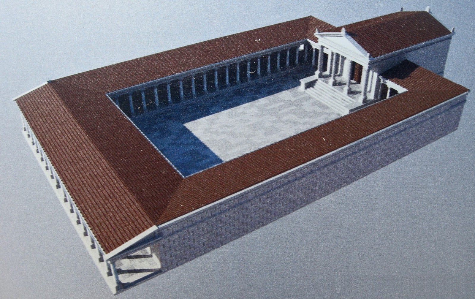
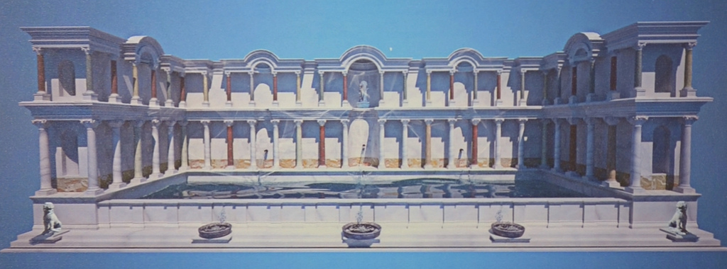
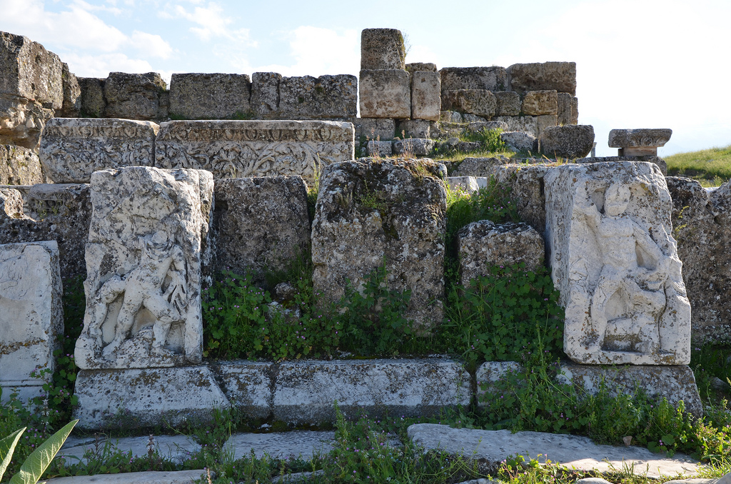
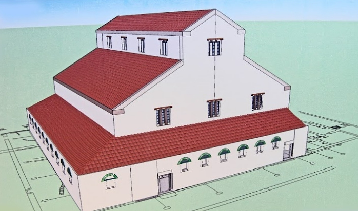
The monumental nymphaeum dedicated to Septimius Severus.3D reconstruction of the monumental nymphaeum dedicated to Septimius Severus.The monumental nymphaeum is dedicated to Septimius Severus. It consisted of a rectangular water basin with a two-storey colonnade on three sides.The Clubhouse of the Greens, a chariot rider club. The building complex had three interconnected rooms and is dated to the Early Byzantine period.The North (Sacred) Agora.The big theatre dating to the Hellenistic period.The small theatre dating to the Roman period.The North (Sacred) Agora located between the West and North Theatres and covering an area of 265×128 m.The Central Bath Complex is located to the south of the Central Agora. The complex occupied four insulae and comprised four main halls: apodyterium (changing hall), frigidarium (cold hall), tepidarium (lukewarm hall), and caldarium (hot hall), and a training ground (palaestra).Stadium Street, the North-South Street extending south from the western end of Syria Street. The street was paved with large travertine blocks. The porticoes along both sides of Syria Street were roofed over in order to protect the people from the sun in the summer and rain in the winter.View of Syria Street toward the two towers of the East Byzantine Gate.The Nymphaeum of Caracalla was built on the occasion of Caracalla’s visit to the city in 215 AD and dedicated to him. The reliefs depict scenes with Heracles and the Abduction of Ganymedes by Zeus.The Church of Laodicea was built during the reign of Constantine the Great and is best known for being one of the Seven churches of Asia addressed by name in the Book of Revelation. It was uncovered in 2010.Reconstruction drawing of the Church of Laodikeia.