Munigua

Munigua is the site of the Roman city of Municipium Flavium Muniguense, located in the Sierra Morena, 8 km from Villanueva del Río y Minas in the province of Seville. Its origins date back to the pre-Roman period, and evidence of human occupation can be traced back from the mid-4th century BC to the 8th century AD. During the Romanisation of the province of Baetica, Munigua prospered rapidly. It received Latin rights from Emperor Vespasian and was recognised as a municipium, which further strengthened its importance as a centre of commerce, culture, and administration in the region.

Coordinate: 37°42’47.1″N 5°44’25.9″W

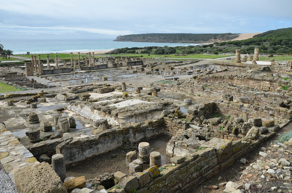
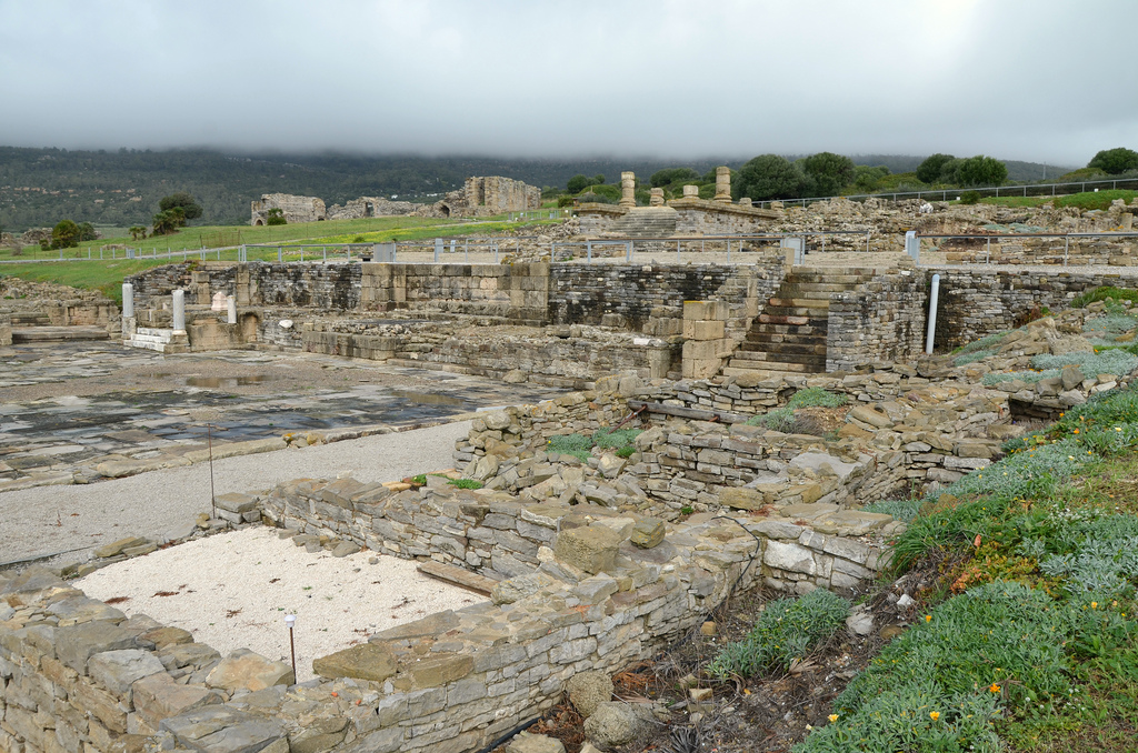
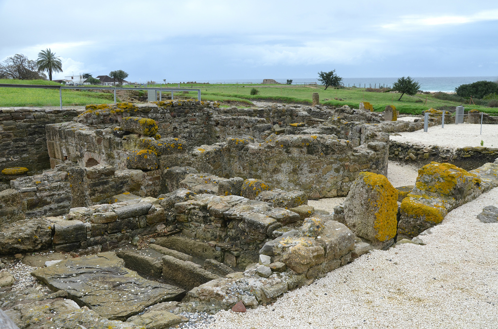
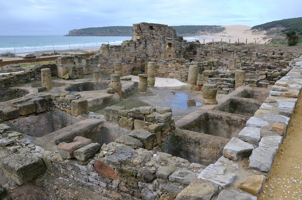
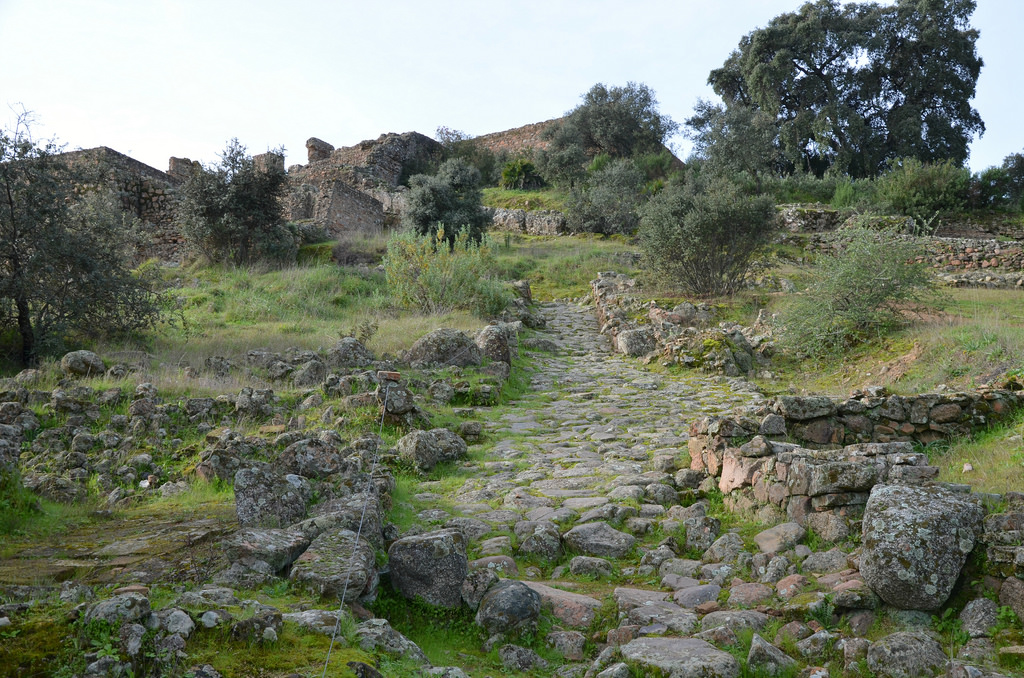
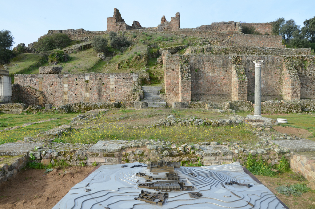
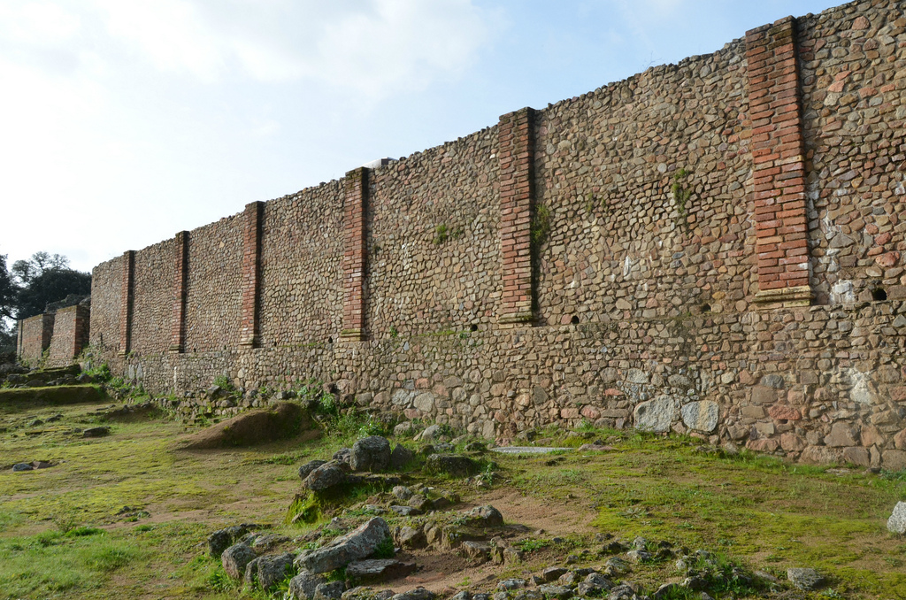
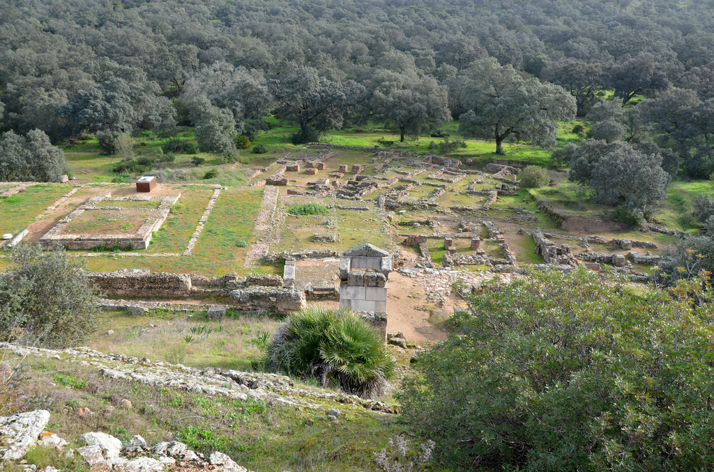
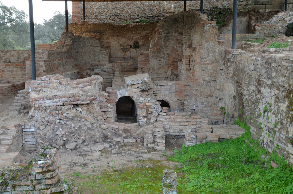
The site of Munigua was first discovered by two researchers from the Academy of Letters in Seville in 1765. However, it was later forgotten until 1956, when the German Archaeology Institute in Madrid studied it once again. Archaeologists have discovered many interesting things here, such as temples, sanctuaries, a two-story porticus, residential houses, a forum, public bathhouses, city walls, and a vast necropolis. The site also features a monumental terrace sanctuary on the slope of the hill, known from 18th-century drawings referred to as the “Castle of Mulva”.

18th-century drawing by Tomás de Gusseme depicting the “Castle of Mulva”.

According to archaeologists, the settlement in Sierra Morena was founded by the Turdetani, an Iberian tribe who lived in the region. The first settlement owed its existence to the mining and metallurgy activities that have long characterised the Sierra Morena, a mountain range rich in copper and iron ore. During the Roman occupation, copper production increased significantly, and the Romans built elaborately ventilated underground galleries, interconnected tunnels, and deep shafts to facilitate mining activities.

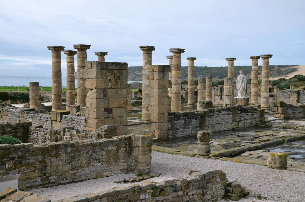
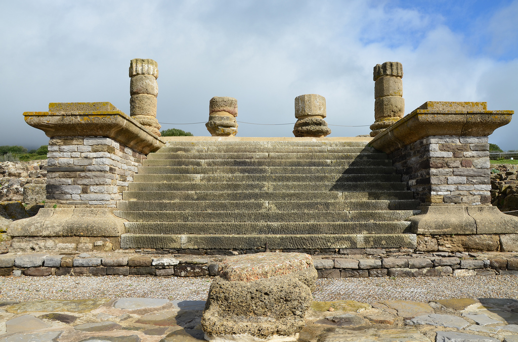
Thanks to the wealth derived from the mines, several monuments were constructed. One of the most remarkable structures was a terraced sanctuary located on the slope of a hill, which dominated the city. The impressive building stood on multiple-tiered terraces and was reinforced by 13 buttresses at the back, giving it the appearance of a fortress. This structure later became known as the Castle of Mulva. The building is characterised by its architectural symmetry, with access ramps and stairs neatly paired on either side of the sacred precinct. The plan seems to have been inspired by the Sanctuary of Fortuna Primigenia at Praeneste or the Temple of Hercules Victor in Tivoli. However, it’s not known which deity was worshipped on the site, though it’s speculated that it may have been Fortuna and Hercules.

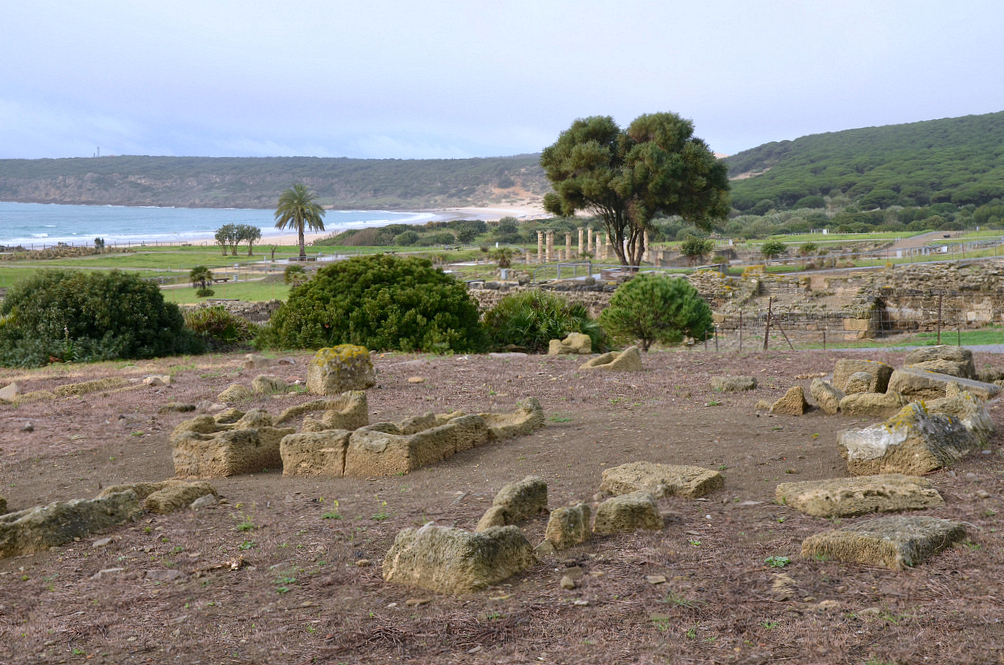
The city developed at the feet of the terraced sanctuary. Construction work was accelerated when Vespasian granted Munigua the Latin right around AD 73/74, elevating its status to municipium. Between the mid-1st century and the late 2nd century AD, all the town’s structures, including the forum, the baths, and the houses, were constructed.

Munigua flourished during the reign of Hadrian, but its prosperity declined towards the end of the 3rd century AD due to an earthquake that struck the town. Later, another earthquake during the late antiquity period marked the end of Munigua’s golden era. However, it is known that the site was continuously inhabited, at least until the Almohad period in the 12th century.

The town has yielded numerous archaeological artefacts: some 45 stone sculptures and approximately 160 terracotta pieces. Additionally, a significant number of glass objects have been found in funerary contexts, along with almost 1,500 metal artefacts and various items of jewellery. Over 80 inscriptions have been uncovered at Munigua, including two made of bronze, a tessera hospitalis (which was a hospitality token), and a letter from Emperor Titus.

PORTFOLIO

General view of the Sanctuary of Terraces from the access road.
The northern roadway ascending to the Terraced Sanctuary.
The main facade of the Terraced Sanctuary faced east towards the city.
The cella in the Sanctuary of the Terraces.
View of the Double-height portico with the Terraced Sanctuary in the background.
Virtual reconstruction of Munigua, view from the east. © DAI
View towards the small Temple of Mercury standing in the entrance street leading to the Forum, which consisted of the Forum Temple, the Curia, the Tabularium, the Basilica and the Shrine of Dis Pater, the god of miners.
The small Temple of Mercury, located at the southern end of the portico. It included a podium in the form of an exedra as well as an aedicula, with two frontal columns supporting the architraves and pediment. The altar, still in situ, was consecrated by a certain Ferronius to a divinity whose name is indecipherable but another altar found in front of the temple had a dedication to Mercury.
The remains of the large two-tier portico of the forum.
The Forum Temple, surrounded by porticoes on three sides. The divinity to which the temple was dedicated is unknown.
View of the Temple Forum, the small Temple of Mercury and the eastern residential zone.
View of the Podium Temple, a square block structure that was supported by four buttresses on its eastern side. Its walls rested on a podium supporting another smaller podium. It was embellished with marble slabs and reached by a flight of steps preserved in situ. The temple was built in the early 2nd century AD.
The baths with an L-shaped floor plan had seven different rooms, including the apsidal hall and the nymphaeum. Judging by their small size (barely 280 m2) and the absence of a palaestra, these facilities were probably balneae rather than thermae.
The bath complex was built during Nero’s reign. Later, at the end of the 1st century AD, part of the baths was demolished to make room for the forum.
Detail of the mural paintings in the baths.
View of the eastern residential zone with the Forum and the Terraced Sanctuary in the background.

Links:

Baelo Claudia

Baelo Claudia is an ancient Roman city lying on the shores of the Strait of Gibraltar in southern Spain. It was settled at the end of the 2nd century BC, and its history and subsequent development are closely associated with the salting industries and its maritime communication with North Africa. The ruins of Baelo Claudia, with its theatre, temples, forum and basilica, and especially its large fish-salting factory, testify to the city’s glory as an important and successful trading centre.

Coordinates: 36° 5′ 23″ N, 5° 46′ 29″ W

The Roman army landed on the shores of the Iberian Peninsula towards the end of the 3rd century AD in an attempt to halt the advancing Carthaginians, with whom they were engaged in a dispute for the control of the Western Mediterranean. The Roman victory at the Battle of Ilipa in 206 BC signified the end of the Second Punic War (218-202). The whole area was annexed under Augustus and became the most Romanised province in the Peninsula.

According to the oldest archaeological finds on this site, the prosperous city of Baelo Claudia was founded towards the end of the 2nd century BC. As shown in the legends of its Republican coins, the city was first known as Bailo. The abundance of fish in the Strait of Gibraltar facilitated the settlement of the coast and the exploitation of resources from the sea. During this period, the fish salting industries were established, and the city’s strategic position facing the North African coast led to its expansion as a trading centre.

Around the dawn of the new era, the city experienced a period of urban expansion while the first salting industries were rebuilt and made larger. Its strongest development was under the rule of Emperor Claudius (41-54 AD), who raised the city to the level of a Roman municipium with Roman rights. It was also at this time that Baelo received the name of Claudia. During this time, the city acquired a large forum with monumental public buildings, three aqueducts guaranteeing water supply to the population and two factories for the production of garum (fish sauce). The city walls that had been built a few years before during the reign of Augustus were also completely rehabilitated. The economic peak was maintained well into the 2nd century AD.

Model of Baelo Claudia.

However, economic activity started to decline at the beginning of the 3rd century AD, perhaps due to a major earthquake that occurred at the time and that may have destroyed most of the city. Also, the general socio-economic crisis that occurred in the empire during the 3rd century may have affected trade and commerce. The city experienced a slight recovery later in the century, but by the 7th century, the town was abandoned.

The excavations at Baelo Claudia have revealed the most comprehensive remains of a Roman town in the Iberian Peninsula. The site contains all the representative elements of a Roman city: the forum, temples, basilica, administrative buildings such as the curia, the marketplace, theatre, baths, industrial zone, and aqueducts. A modern Visitor Centre showcases many artefacts and offers a comprehensive introduction to the site.

PORTFOLIO

The Decumanus Maximus maintains its original flagstone paving. Along its length were shops, the public market building and the south side of the Forum. There were porticoes on either side.
View of the Forum, the vital centre where administrative, political, judicial and religious activities were taking place. The Forum occupied a rectangular area of 115 x 87 metres.
Although the original forum in Baelo dates back to the Augustan period, the nucleus of the forum area that we see today was remodelled between the years 50 and 70 AD (reigns of Claudius and Nero). The Forum is in very good condition and is the only completely excavated forum in Hispania.
The Forum had porticoes on the east and west sides, with shops in the east part and administrative buildings in the west. To the south was the basilica, and to the north was a monumental fountain and a staircase leading to the Capitolium.
The Basilica was one of the most important buildings in Baelo Claudia. It was built between 50 to 70 AD and was located in the main area where the city’s public life took place.
The Basilica was built of ashlars and masonry walls, which were painted and stucco applied. A peristyle of twenty columns made up the inside space. It had two floors, the ground floor was of Ionic order and the top floor was of composite.
The city of Baelo Claudia erected a colossal statue of Emperor Trajan and placed it in the Basilica on a pedestal clad with marble. The original statue is on display in the Museum of Cádiz.
The South Square of the Forum. Behind the plaza are the Basilica, the Forum and the Capitolium.
View of the Curia and the Macellum (the marketplace).
The three temples of the Capitoline Triad are dedicated to Jupiter, Juno and Minerva. The Capitolium was constructed in the 1st century AD over a broad terrace that dominated the Forum.
The Capitolium.
The Temple of Jupiter was part of the Capitolium, the three tetrastyle temples dedicated to the Capitoline Triad (Jupiter, Minerva, Juno). The temples were separated by narrow corridors of similar dimensions. A share altar was in front of each temple.
The podium of the Temple of Jupiter with 12 steps at the front and Corinthian columns.
The thermal baths date to the end of the 1st century or the beginning of the 2nd century AD. They were in use until the end of the 4th century AD.
The baths were accessed from the Decumanus Maximus. They included a “caldarium” (hot room), a “tepidarium” (tepid room) and a”frigidarium” (cold room).
The industrial area is dedicated to the salting of fish and the production of the famous fish sauce, “garum”.
The most valued and expensive product made in these factories was a fish sauce known as “garum”. A similar product, of a lower quality, was “liquamen”. These sauces could accompany all types of meals as a dressing or seasoning. It stimulates the appetite, and doctors usually recommend it due to its nourishing and curing properties.
These are the large basins dug into the ground where the pieces of fish were piled up to be salted. The fish and salt were positioned in successive layers, taking approximately twenty days before the salting process was completed.
The Theatre was constructed on a natural slope in the 1st century AD, around 70 AD. At the end of the 2nd century, it was no longer in use.
The Theatre.
The defensive walls were built during the Augustan period and were repaired and renovated with the same layout during the second half of the 1st century AD.
Within the walls were the main entrances to the city.
The Necropolis.
The remains of the arches of the North aqueduct that supplied water to the buildings located in this area.

Links: