Beit She’an, also known as Scythopolis or Nysa, is one of the oldest cities in Israel. Nestled in the Galilee region, it sits at the convergence of the Harod Valley and the Jordan Valley, a mere 27 kilometres south of the Sea of Galilee and 5 kilometres east of the Jordan River. This unique location has played a pivotal role in the city’s history, making it a fascinating archaeological site with a rich past.
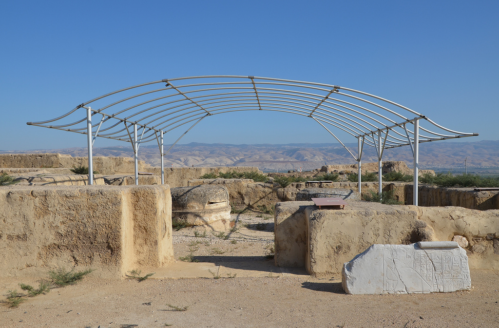
Beit Sh’ean, located at an important crossroads, was first settled in the 5th millennium BC. Its location south of the Harod Stream, in a region with fertile land and abundant water, made it a desirable place to live. During the Late Bronze Age, Beit She’an became the centre of Egyptian rule over Canaan. A basalt tablet dating back to 1290-1279 BC mentions Beit She’an. Later, a Canaanite city was built on top of the Egyptian centre, which was then occupied by the Israelites and the Philistines during the Old Testament period. The Bible mentions Beit She’an several times, and it is most famous for being the place where King Saul and his sons were hanged from the city walls.
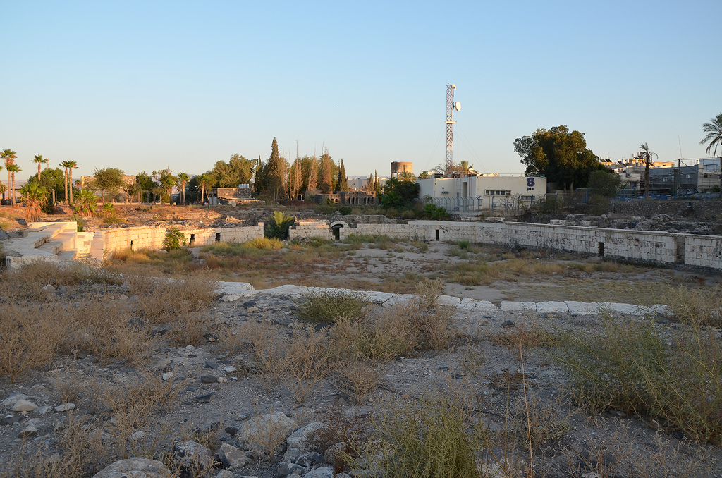
Scythopolis later expanded into a large Hellenistic, Roman, and Byzantine town. The city’s name comes from Greek Mythology, which tells us that Dionysos, the god of wine, buried his nurse, Nysa, in the town where he settled with his Scythian personal guards. Scythopolis became the largest city in the Decapolis, a regional alliance. It peaked after the Bar Kochba Revolt under Antoninus Pius (AD 138-161) and Marcus Aurelius (AD 161-180). Many temples, bathhouses, a theatre, an amphitheatre, and other monumental buildings were constructed during this time. Scythopolis continued to prosper from the 4th to the 7th century, but the pagan structures were converted to other uses since the majority of the population was Christian.
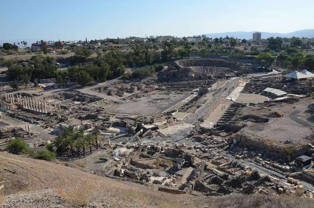
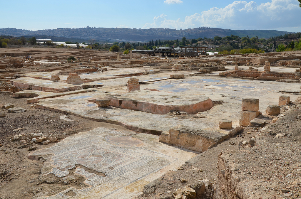
The large city was levelled by a massive earthquake in the 8th century AD and was in ruins until recent archaeological excavations uncovered eighteen layers of remains dating from the Late Neolithic period (4500 BC) through the 12th century AD. The ancient city ruins are now protected within Bet She’an National Park.
PORTFOLIO
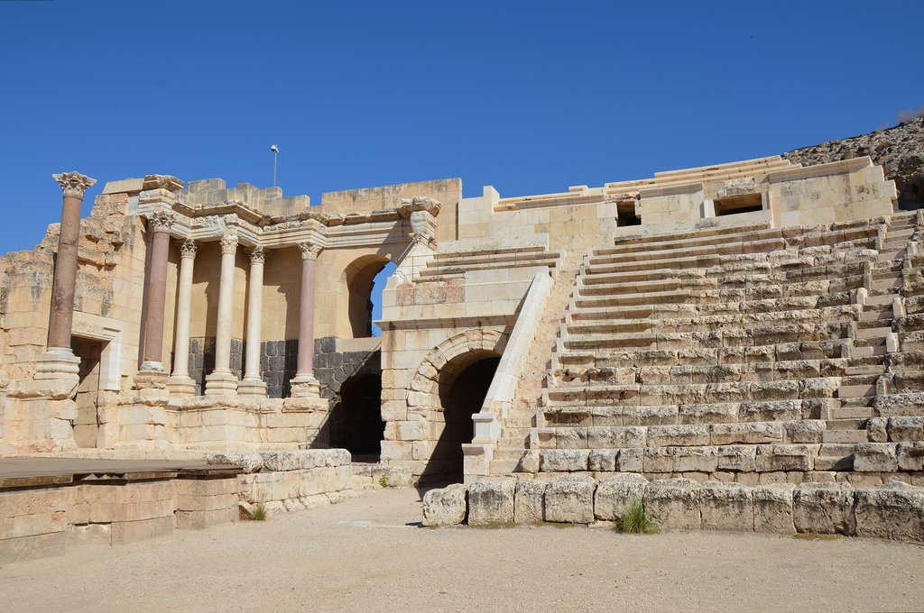
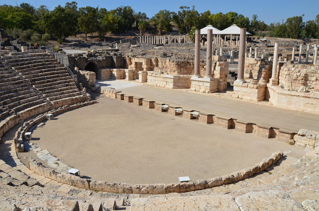
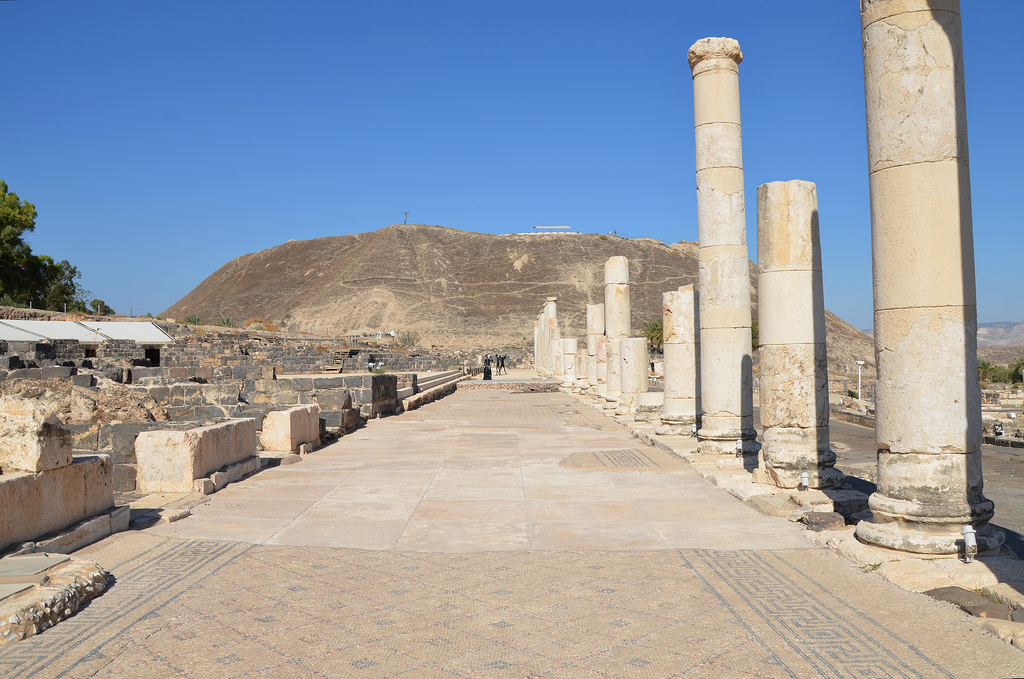
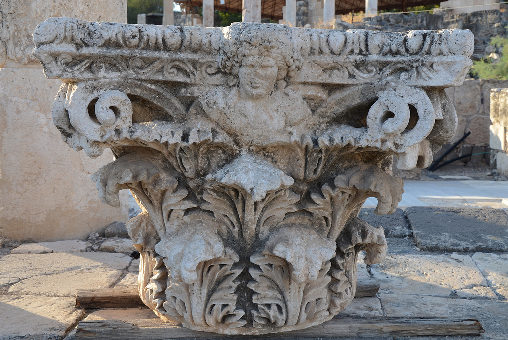
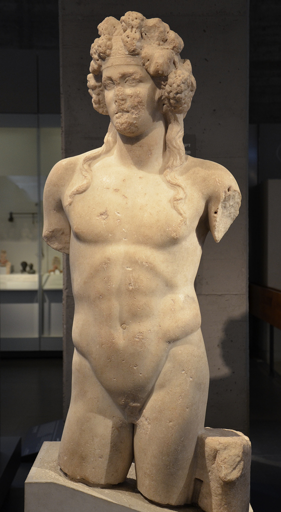
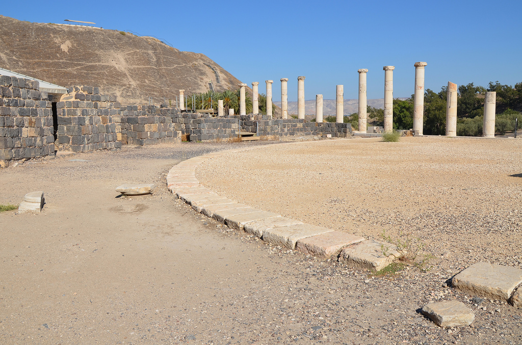
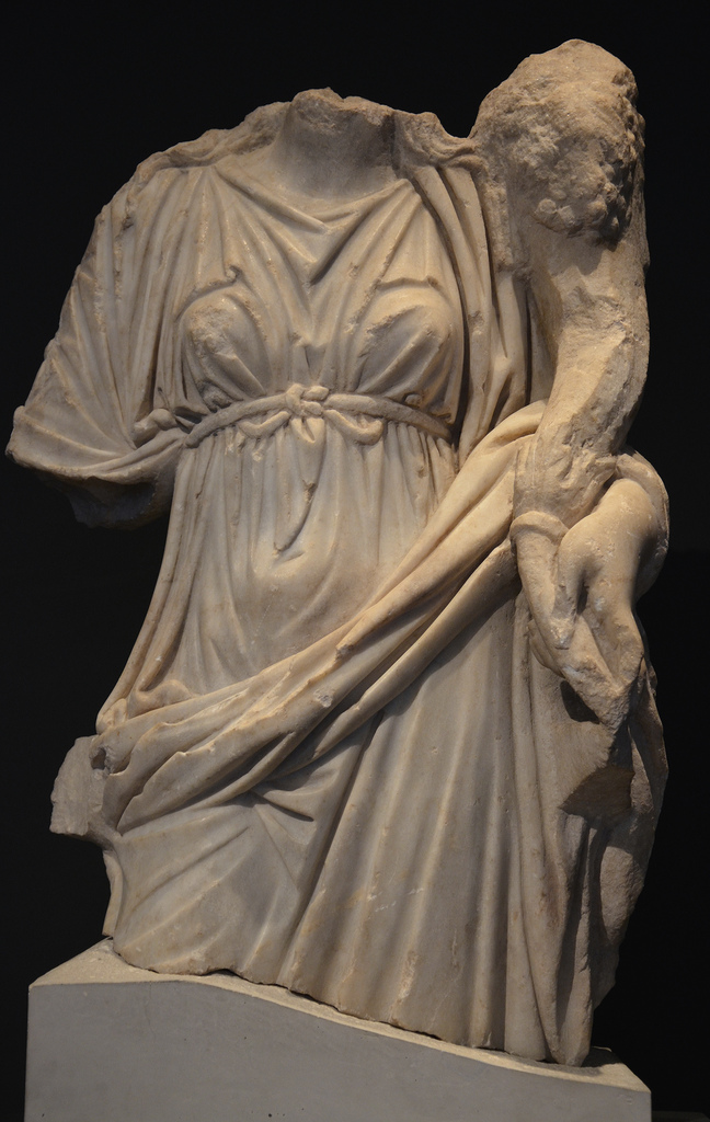
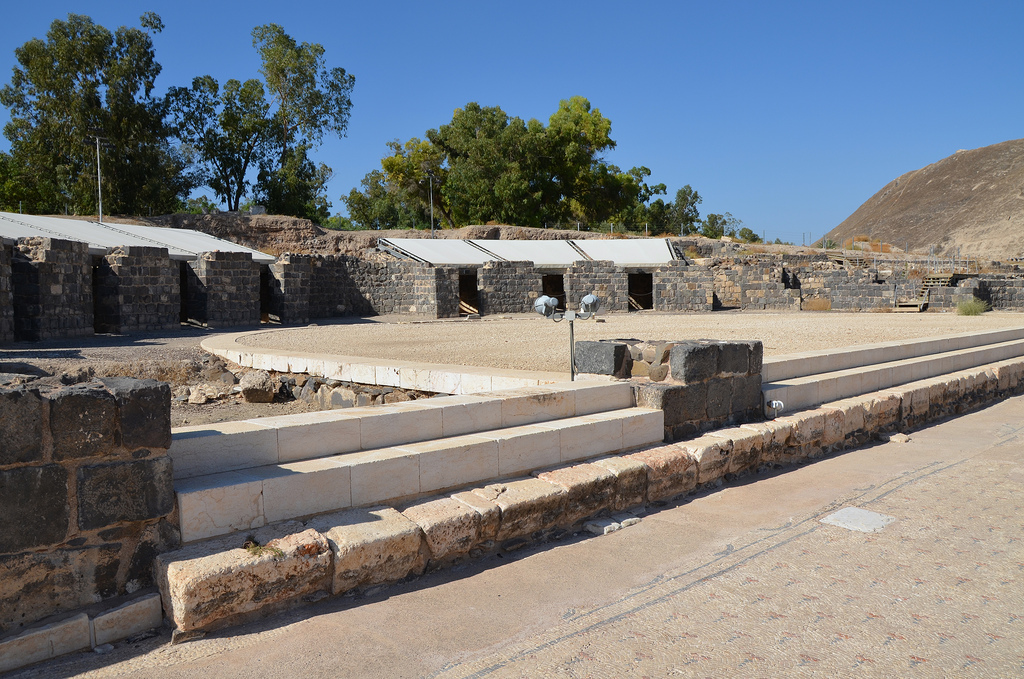
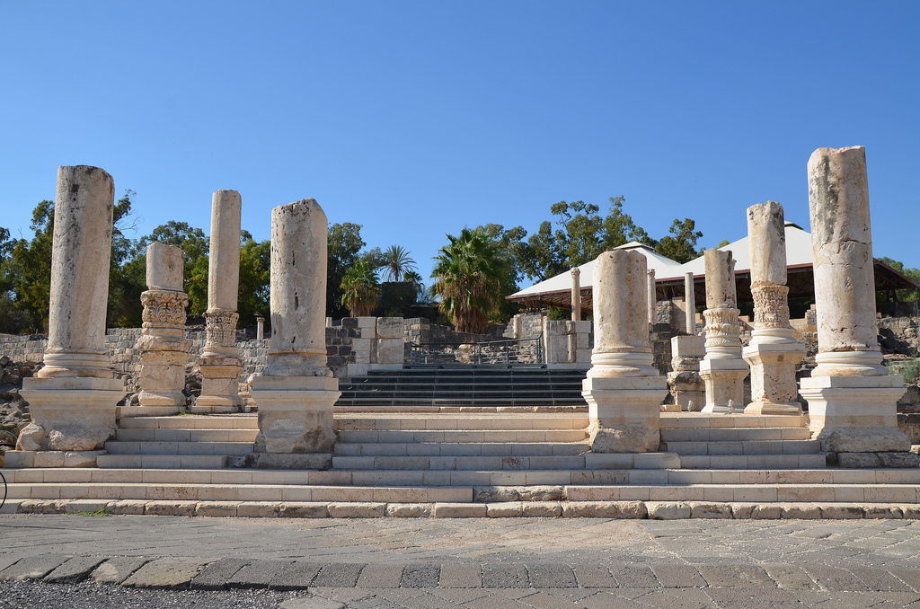
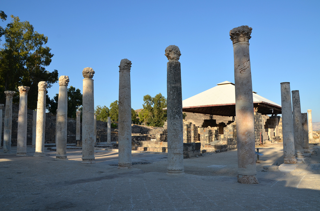
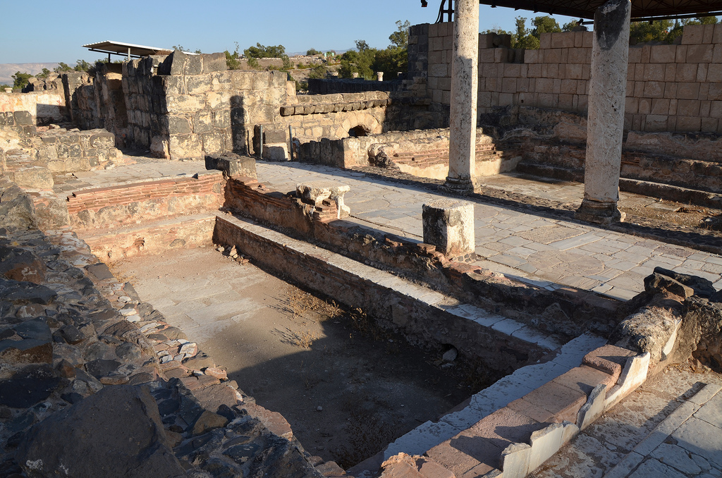
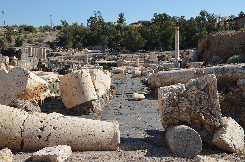
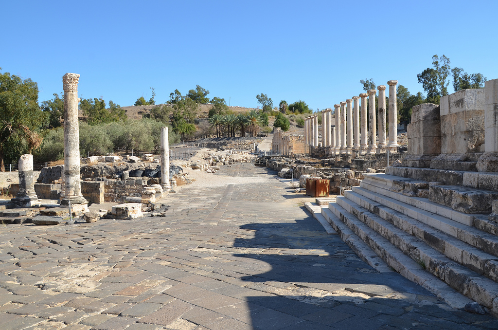
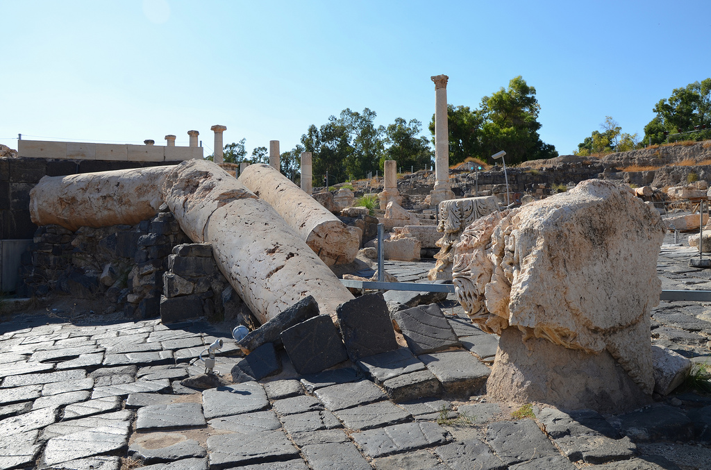
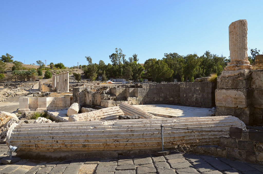
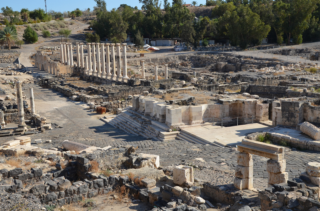
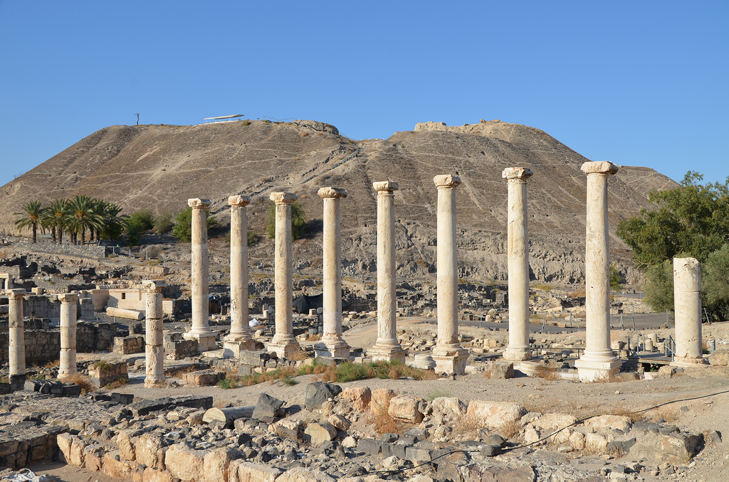
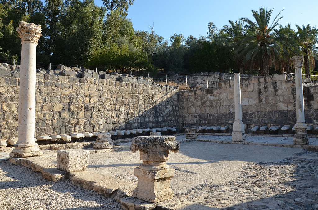
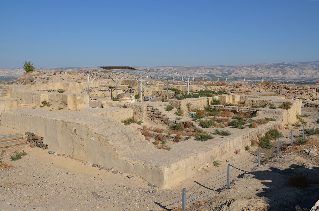
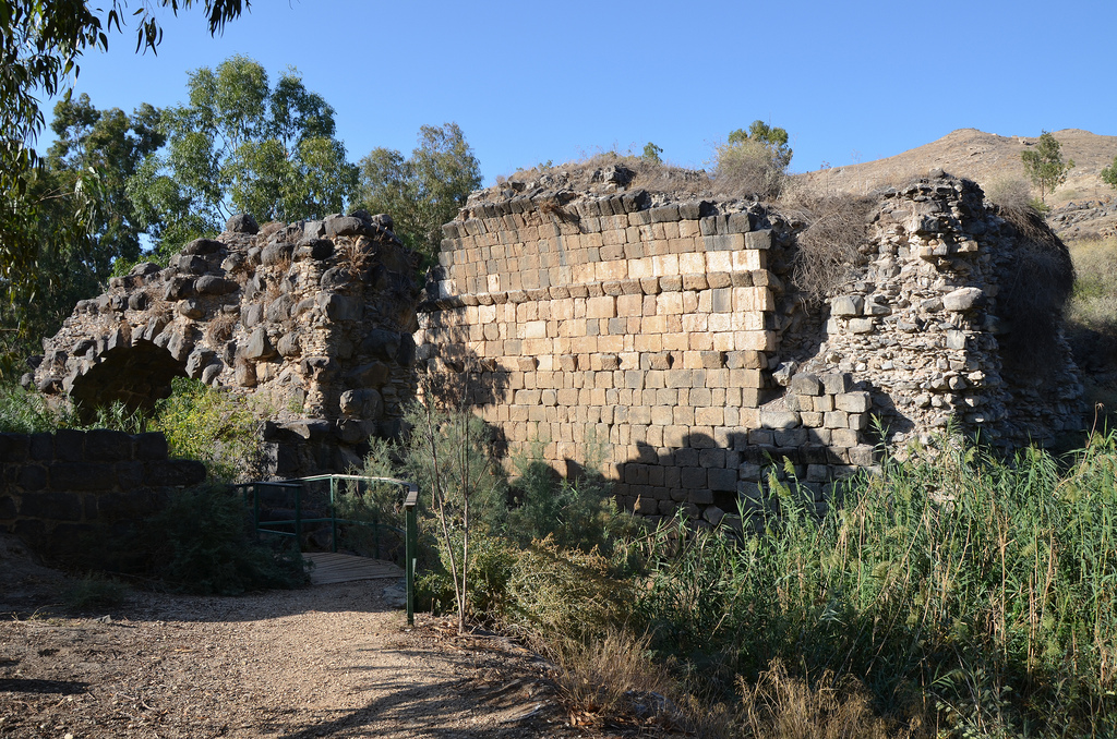
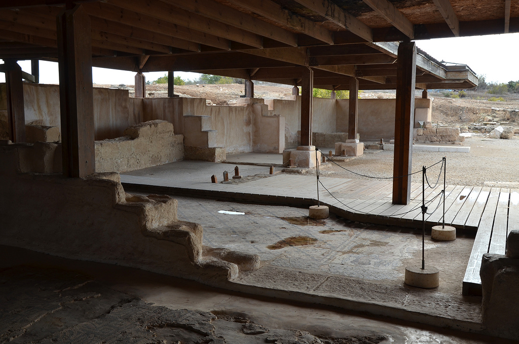
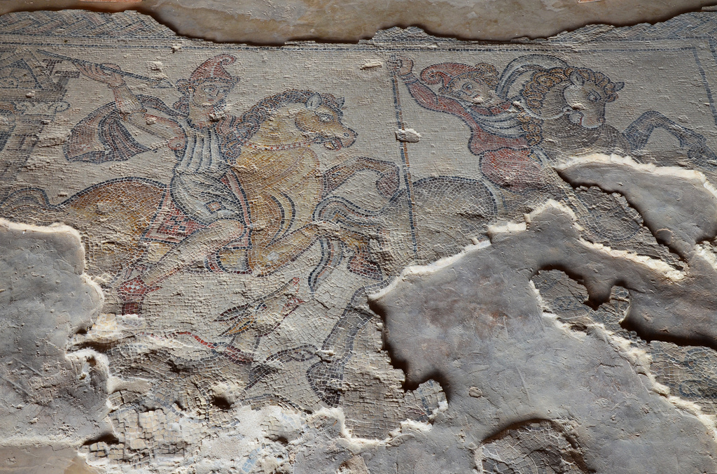
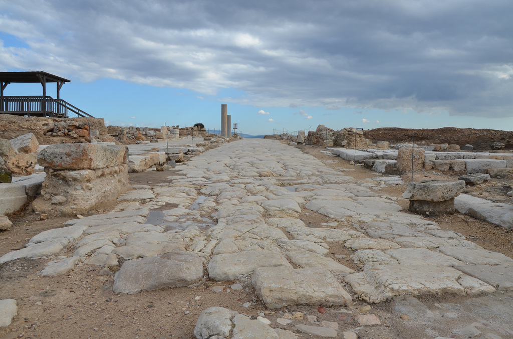
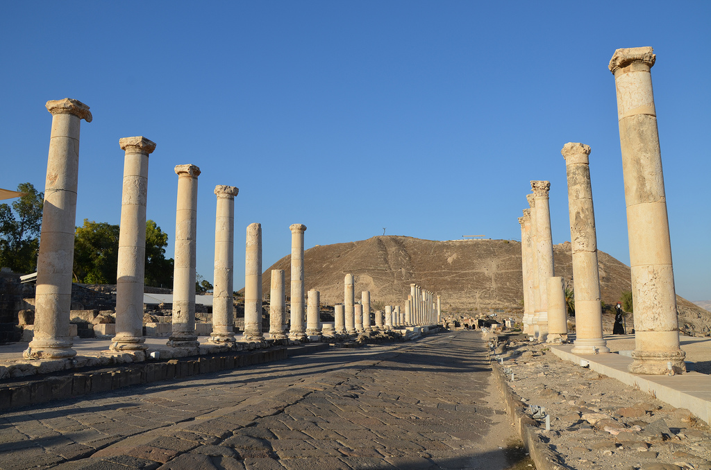
The Roman theatre was built during the Severan era on the remains of a 1st-century AD theatre. It could seat about 7,000 spectators. It is the best-preserved ancient theatre discovered in Israel.The Roman theatre had eight arched entrances called vomitoria, which led to the seating area.The reconstructed section of the scaenae frons. The 21-metre high stage building comprised a two-storey structure of white marble columns and two-storey lateral structures of red granite columns.The Roman theatre was built during the Severan era on the remains of a 1st-century AD theatre. It could seat about 7,000 spectators.Palladius Street is a 150-metre collonaded street that crosses the city from the slopes of the Tel to the theatre. It was built during the Roman period and renovated at the beginning of the Byzantine period.The collonaded portico along Palladius Street is paved with intricate mosaics and lined with marble-faced shops.The Corinthian capital bears the head of Dionysus, the god of wine and the patron of the city. According to myth, the city was founded by Dionysus, who lived there. His wet nurse, Nysa, who breastfed him, was buried in the city, so it was named Nysa-Scythopolis.Statue of Dionysus unearthed at Beit She’an/Scythopolis, 2nd century AD, Israel Museum.Exedra (semi-circular building) with twelve small rooms and a portico opening onto a courtyard built in the 6th century AD on the western side of Palladius Street.A mosaic with a representation of Tyche, goddess of fortune, is found in the semicircular exedra off Paladius Street at Scythopolis (Beit She’an). Israel Museum, Jerusalem.Statue of Tyche holding the cornucopia, unearthed in Beit Sh’ean/Scythopolis, 3rd century AD, Israel Museum.Exedra (semi-circular building) with twelve small rooms and a portico opening onto a courtyard built in the 6th century AD on the western side of Palladius Street.The entrance gateway leads to the Western Bathhouse.The Western Bathhouse was built in the 4th century AD.Remains of two pools in the Western Bathhouse, built in the 4th century AD.The collonaded exercise yard of the Western Bathhouse had a mosaic pavement decorated with geometric patterns.Scythopolis.Silvanus Street runs north-south through the city.The ruins of the Round Temple attest to the ferocity of the 749 AD earthquake. The Temple was perhaps erected for the worship of Dionysus or his wet nurse, Nysa.The ruins of the Roman Nymphaeum were originally built in the 2nd century AD.Overview of Silvanus Street.View on the Tel from the Agora.The public latrines of the Northern Bathhouse have an open courtyard paved with a mosaic floor.Overview of Scythopolis from the top of the Tell.At the top of the hill are the ruins of an Egyptian governor’s house dating back to the 12th century BC. During the late Bronze Period and the early Iron Age, the city became a centre of the Egyptian imperial administration in northern Canaan.The Egyptian governor’s house. Above the door of the house (lintel) was a stone tablet bearing the governor’s name and title: Ramses-User-Khepesh. The image depicts the governor kneeling before the name and attributes of Pharaoh Ramses III.Basalt statue of Ramses III, depicting him seated on his throne, found at Beit She’an, 1184-1153 BC. Rockefeller Museum, Jerusalem.The Hippodrome was constructed in the 2nd century AD and used for horse and chariot races. It was later converted into an amphitheatre, which hosted gladiatorial combats. The amphitheatre ceased to function in the second half of the 4th century AD because the city’s Christians disapproved of its activities.The Hippodrome/Amphitheatre, situated beyond the city limits, had ten or twelve rows accommodating 5,000-7,000 spectators.The ruins of the Roman bridge, a triple-arched bridge crossing the Nahal Harod.
Sepphoris, also known as Diocaesarea, lies 289 metres above sea level on a hill in the heart of the Galilee province, about 5 kilometres west of Nazareth. Its history can be traced back to the Persian period (ca. 539-332 BC), but the city grew during the Hellenistic period. Herod the Great built a royal palace here, and after his death in 4 BC, his son, Herod Antipas, made Sepphoris the capital of his government. The city may have derived its name from the Hebrew word tzippori, a variant of tsippor, meaning “bird”. A passage in the Talmud seems to confirm this theory, as the city is described as “perched on the top of a mountain, like a bird”.
Flavius Josephus, the 1st-century AD Romano-Jewish historian, said that Sepphoris was the largest city in Galilee and stood as a powerful fortress during the First Jewish Revolt in AD 66. Sepphoris was one of the cities that remained loyal to Rome. It refused to take part in the revolt and was spared destruction. After the suppression of the revolt in AD 70, the city was transformed from a Galilean town into a Roman polis boasting governmental institutions and public buildings. Sepphoris even minted coins bearing the legend Eirenopolis, “City of Peace”, in honour of Vespasian.
Sepphoris reached its peak of 15,000-20,000 inhabitants in the 2nd century AD. Over the years, public and private dwellings embellished with colourful mosaics sprang throughout the Roman city, including a temple, a forum, bathhouses, a theatre and a large water reservoir. Hadrian renamed Sepphoris to Diocaesarea (city of Zeus and Caesar), probably in AD 120. He built a new road leading from Caparcotna and its military base, Legio, to Diocaesarea (as recorded on milestones dated to AD 120 and 130).
Diocaesarea continued to prosper in the following years, while the city’s population included pagans and Christians living alongside the Jewish population. Several churches were built in the Byzantine period, and Talmudic sources mention 18 synagogues (although only one, built at the beginning of the 5th century AD, has been discovered).
Diocaesarea retained its urban plan throughout late antiquity and continued to flourish until the decline in the Early Arab period in the 7th century AD. In Crusader times, sections of the city and the fortress were rebuilt. The town was renamed “Le Sephorie” to preserve its ancient name.
Sepphoris was first excavated in 1931 by Leroy Waterman of the University of Michigan, and major excavations were conducted from 1983 to 2003. Today, the ancient site is a National park (Zippori National Park) and, even in ruins, a highly recommended archaeological site.
PORTFOLIO
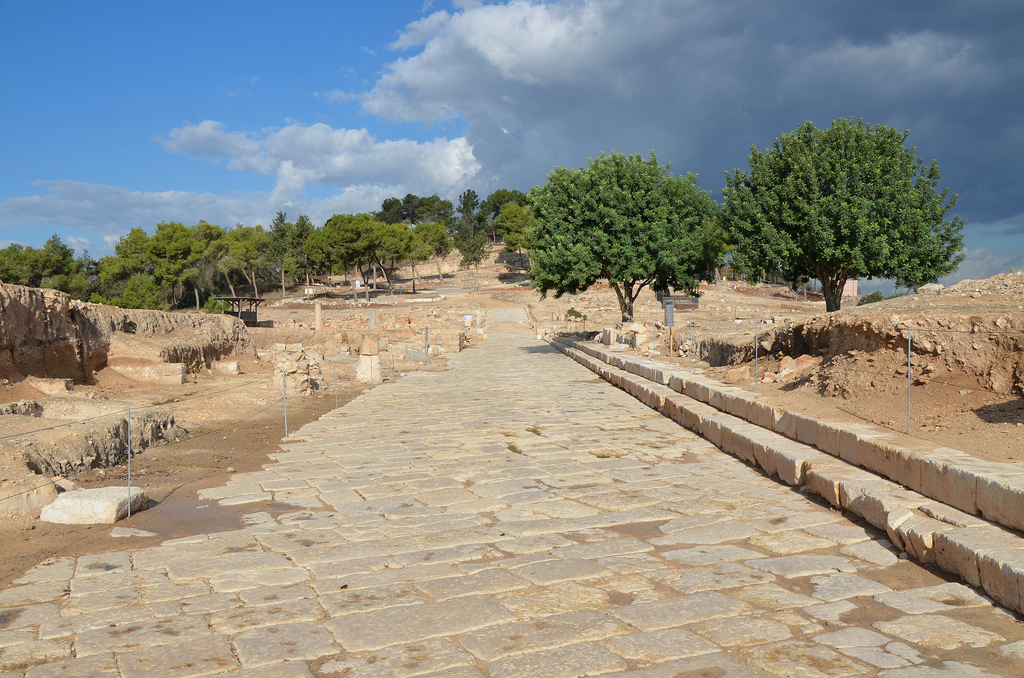
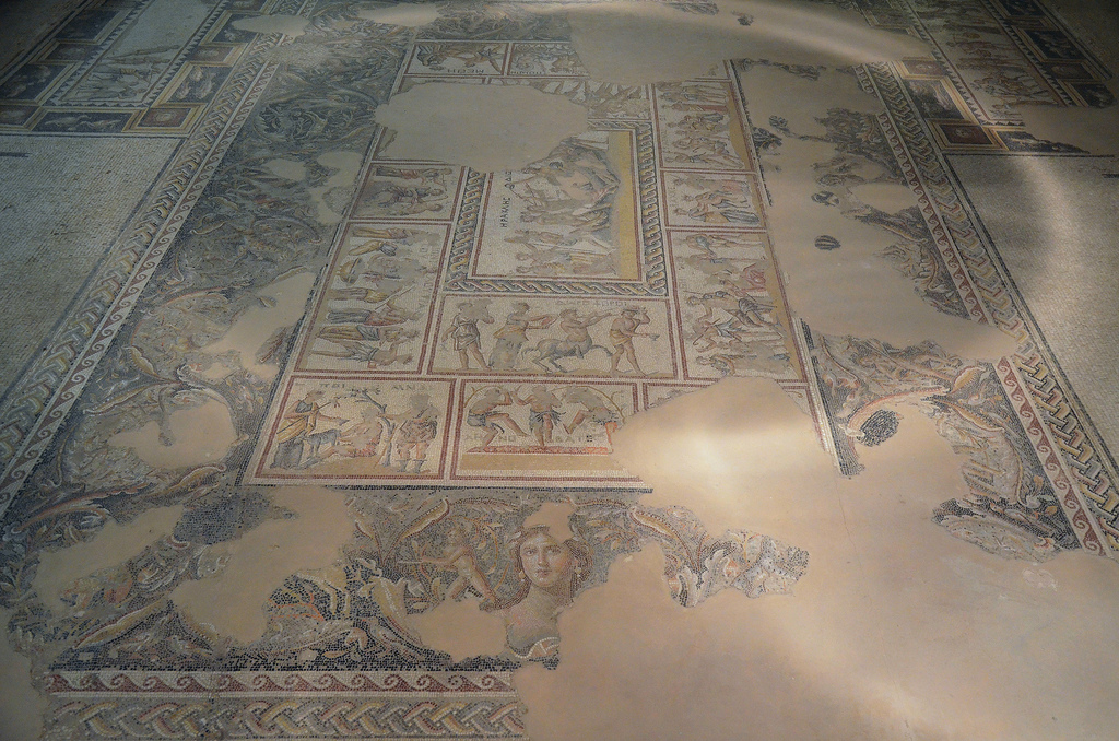
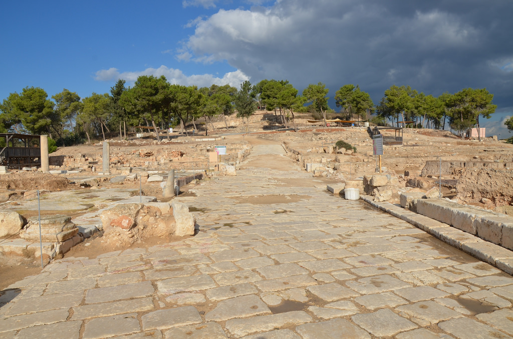
View of the Cardo marked with ruts made by carriage wheels. It was the main road to the city, which runs north to south.View of the Cardo with porticoes along both sides adorned with geometrical mosaics.The Forum was a large public building constructed in the Severan era (ca. AD 200). It contained a peristyle courtyard surrounded by rooms adorned with colourful mosaics.
The floor of the large hall of the Forum was decorated with an overall geometric pattern of interlocking circles forming curvilinear squares, with a partially preserved square panel near the centre of the pavement. The entire mosaic features a variety of motifs, including birds, fish, a shallow basket filled with fruit, a hare nibbling grapes, and flowers and pomegranates.The Nile Festival House, located on the city’s south side and east of the Cardo, was built in the 5th century AD, and the entire building was paved with mosaics.The Nile Mosaic, which depicts the Nile, is dated to the 5th century AD. It is composed of several scenes, each depicting a different event.Early 5th century AD mosaic pavement in the Nile Festival House depicting hunting Amazons.Mosaic pavement depicting a Centaur draped in an animal-skin cloak and holding a shield or a dish with the Greek inscription “Helpful God”.Geometric mosaic in the Nile Festival House.Geometric mosaic in the Nile Festival House.Early 5th century AD mosaic pavement depicting a hunter holding a spear in the Nile Festival House.View of the Cardo.A T-shaped mosaic in The House of Orpheus triclinium contains four colourful panels. The larger panel depicts Orpheus, the divine musician, while the three others depict scenes from daily life: a banquet, two men embracing, and two men rolling dice.The Roman Theatre was built in the early 2nd century AD on the hill’s northern slope. It could seat 4,500 spectators.The stage building of the Roman Theatre and the stage itself are almost entirely destroyed, yet its foundations remain.View over the Theatre built on the northern slope of the hill in the early 2nd century AD.Dionysus Mosaic depicting scenes from the life of Dionysus and his cult, around AD 200.The “Mona Lisa of the Galilee” (possibly Venus). Detail of the mosaic in the House of Dionysos depicting scenes from the life of Dionysos and his cult.Residential houses around the Crusaders’ fortress. These are dwellings from the Hellenistic to Byzantine periods.The subterranean water reservoir was constructed in the 1st century AD. Water entered the reservoir via a channel and a lead pipe through which the water flowed into a tunnel having six vertical shafts.View of the Decumanus, which functioned as the main artery by which one entered the city from the east.
 Scythopolis later expanded into a large Hellenistic, Roman, and Byzantine town. The city’s name comes from Greek Mythology, which tells us that Dionysos, the god of wine, buried his nurse, Nysa, in the town where he settled with his Scythian personal guards. Scythopolis became the largest city in the Decapolis, a regional alliance. It peaked after the Bar Kochba Revolt under Antoninus Pius (AD 138-161) and Marcus Aurelius (AD 161-180). Many temples, bathhouses, a theatre, an amphitheatre, and other monumental buildings were constructed during this time. Scythopolis continued to prosper from the 4th to the 7th century, but the pagan structures were converted to other uses since the majority of the population was Christian.