Artaxata

Founded by King Artaxias I (the founder of the Artaxiad dynasty) in 176 BC, Artaxata served as the capital of the Kingdom of Armenia until AD 120. The city’s strategic position in the Ararat Valley on the Silk Road soon made Artaxata a centre of bustling economy and trade and a focal point of Hellenistic culture. The city was adorned with fine bronze statues of Greek gods while the inhabitants enjoyed Greek tragedies in Armenia’s first theatre. Throughout its 300-year history, Artaxata was attacked multiple times by Roman armies until the royal court eventually moved to Dvin. Today, the remains of Artaxata consist of two mounds located just south of Armenia’s modern capital, Yerevan.

Coordinates: 39° 53′ 6″ N, 44° 34′ 35″ E

According to the accounts given by Strabo and Plutarch, Artaxata is said to have been chosen on the advice of the Carthaginian general Hannibal. However, the Armenian historian Movses Khorenatsi of the 5th century attributes the city’s founding exclusively to the desire of the new king. Artaxata was built on twelve hills at the confluence of the Araxes and Metsamor rivers, overlooking the fertile Ararat plain. On the largest of the twelve hills, excavation uncovered a large Urartian fortress abandoned for over four hundred years, indicating that Artaxias I built his city upon the remains of an old Urartian settlement. Artaxata occupied about 400 hectares of territory in its heyday and had a population of around 150,000, making it one of the largest cities in the Hellenistic world. Strabo and Plutarch describe Artaxata as a large and beautiful city and call it the “Armenian Carthage“.
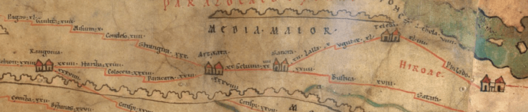
Artaxata on the Peutinger Map, illustrating how the Armenian capital was connected to several trade cities in the world, among them the Eastern-Mediterranean cities.

The Acropolis of Artaxata had a palace, administrative buildings, a military garrison, and an arsenal. The citadel was double-walled and well-protected (it was later named Khor Virap and gained prominence as the location where Saint Gregory the Illuminator was to be imprisoned by Tiridates the Great). The remains of the palace, located at the crest of the hill, occupied an area of 2,750 sq. metres. As described by Strabo and Tacitus, Artaxata’s fortress walls ran over 10,000 metres, of which 5,000 metres have been excavated. The walls, with round towers of 13 to 15 meters in diameter, surrounded the whole city, including the hills, the Acropolis, and the lower city. Five of the city’s gates were discovered, each with a pair of towers. The town had running water, a sewage system, and public baths.

3D model of the Acropolis of Artaxata.
By Franck Devedjian – CC BY-SA 4.0

A temple dedicated to Tir-Apollo and a 10-room bathhouse were discovered on the left bank of the Arax River in 2012. A previous complex of temples (189/188 BC) was destroyed at the beginning of the 1st century during the campaign led by the Roman general Corbulo. A new temple was built on the ruins of the former one during the reign of Tiridates I of Armenia in the 1st century AD. Six large steps (4.85 m) led to the eastern entrance to the temple. The walls were decorated with low-relief sculptures. The new temple was destroyed after adopting Christianity as the state religion. The public baths (see image here) were located northeast of the temple and built between the end of the 2nd century and the beginning of the 3rd. Some of the rooms were covered with mosaic floors.

3D reconstruction attempt of the temple of Tir Apollo located in the lower town, near the Aras River.
By Franck Devedjian – CC BY-SA 4.0.

Artaxata was captured by Corbulo in AD 58 and was razed to the ground the following year. However, Emperor Nero recognized Tiridates I as king of Armenia in AD 66 and granted him 50 million sesterces to help reconstruct the ruined city. According to Roman writers, the city was temporarily renamed Neronia in honour of its sponsor, Nero.

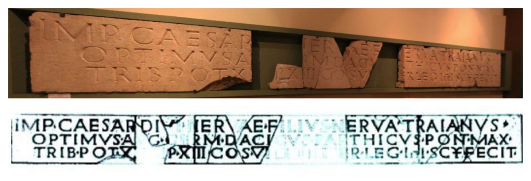
Artaxata was again taken in AD 114 by Roman emperor Trajan, who deposed the Armenian king Partamasiri and ordered the annexation of Armenia to the Roman Empire as a new province. Trajan stationed two army divisions in Armenia and built a fort at Artaxata to ensure Armenia stayed a Roman province and did not become absorbed into the Persian empire. A stone inscription of the Fourth Scythian Roman Legion survives from this period and lists the various honorary titles of Trajan. The 8 m long inscription was found north of the city, outside the walls and is now displayed in the History Museum of Armenia at Yerevan.
Artashat was sacked again in AD 166 by Roman troops who established a garrison at nearby Vagharshapat, which shortly afterwards replaced Artaxata as the Armenian capital, at least for a time. Artaxata was destroyed in the 5th century and rapidly declined as the Armenian capital became fixed at nearby Dvin, with its stones taken to build the new capital. It is also believed that the changing course of the Araxes River led to the permanent abandonment of the site.

Although the entire site has been elaborately mapped, only two of the twelve hills have been excavated completely: hill 1, which seems to have been a military barrack and outpost, and hill 8, which consists of domestic quarters with private baths. Four hills were destroyed by intensive blasting for marble quarrying in the Soviet period, and the remaining hills have been investigated only partially or not at all.

PORTFOLIO

View of Hill II, the largest hill of Artaxata, coming at a height of 70 metres. It included the palace of the kings of Armenia, a military garrison, an arsenal and administrative buildings.
Hill II was protected by a colossal double-wall system. The second wall of the citadel was Urartian. It was rebuilt according to the demands of Hellenistic military art.
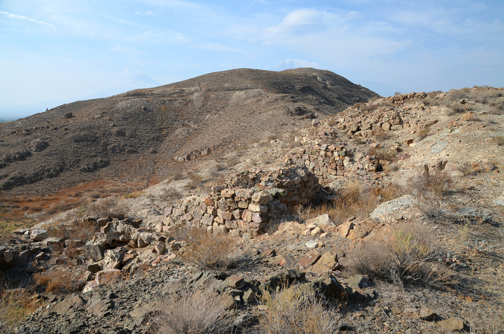
View of Hill I, the best-preserved part of the archaeological site and the only one completely excavated. Hill I was the military stronghold of Artaxata, where the fortress once stood.
Foundations of building on Hill I. The buildings include residential structures and blacksmith-arsenal workshops.
Hill I was protected by a triangular set of large walls.
Discovered on Hill I, where 3,000 arrowhead spears, swords, daggers, a marble statue and fragments, pottery, glasswork, ornamental metal pieces and other artefacts.
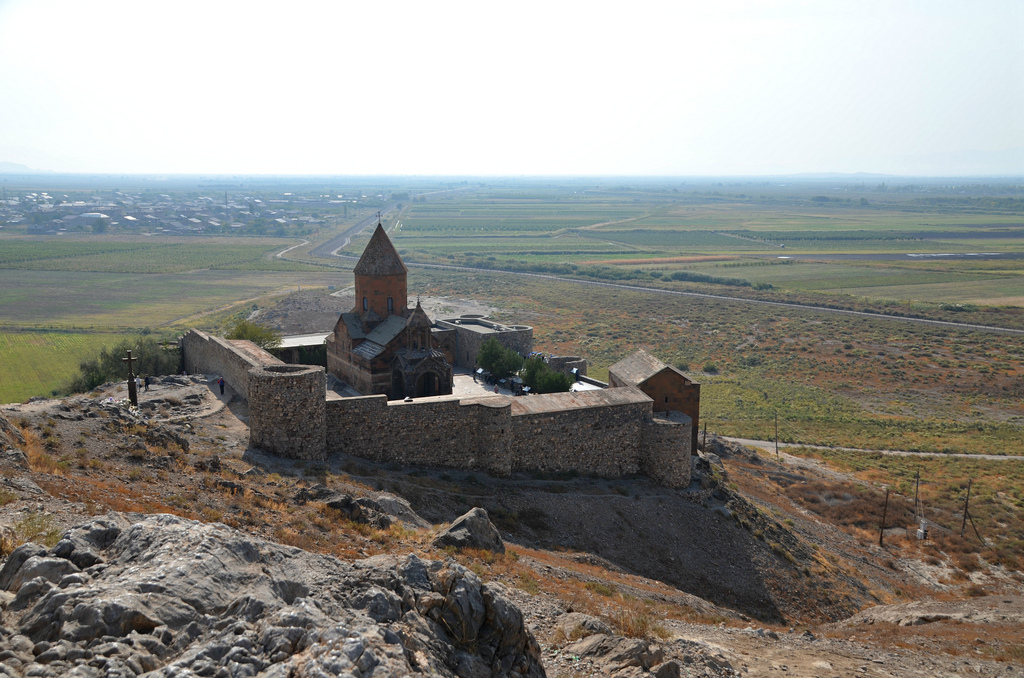
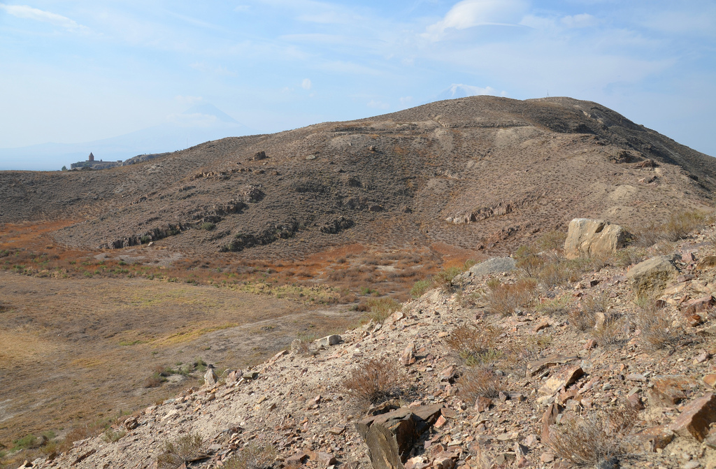
The monastery of Khor Virap is now located in the temple area (Hill VI). Khor Virap’s notability as a monastery and pilgrimage site is attributed to the fact that Gregory the Illuminator was initially imprisoned here for 13 years by King Tiridates III of Armenia.
The area of ​​houses and craftsmen (Hills VII & VIII). Hills 7 and 8 were inhabited by ordinary and middle-class citizens and traders. Evidence of pottery, lime, metal and glass workshops has been discovered.
View of Mount Ararat from the hills of Artaxata.

Links & sources:

Ocriculum

The archaeological area of Ocriculum is located in the southern tip of Umbria, where the ancient Via Flaminia once crossed the river Tiber to enter Roman Umbria, the Sexta Regio (“6th Region”) of the division of Italy made by Augustus. Allied with Rome in 308 BC after the Battle of Mevania, Ocriculum played a strategic and commercial role as a border town between Umbria and Sabine territory and as a point of exchange between the fluvial and terrestrial roads along the Flaminian Way.

Coordinates: 42°24’40.6″N 12°28’01.5″

The original pre-Roman settlement dates back to the Early Iron Age and stood on a hill. It was destroyed during the Social war (91–88 BC) as the town sided with the Italics. At this time, the city was probably moved from the hill to the river plain, was reorganized and then inscribed in the tribus Arnensis. It later became a municipium and was assigned to Regio VI.

The Flaminian Way and the river traffic on the Tiber allowed the city to flourish considerably in the Imperial Age and contributed significantly to the development of trade and the economy. Its river port, known as the “Porto dell’Olio” (Oil Port), was used until the end of the 18th century, mainly for shipping agricultural products and locally made handcrafts.

Ocriculum was famous for its landscape and surrounding nature’s beauty and was a vacation destination for some Roman patricians. Titus Annius Milo, a friend of Cicero and a prominent politician in the 1st century BC, had a villa in Ocriculum, as well as Pliny the Younger‘s mother-in-law Pompeia Celerina.

The city was destroyed between AD 569 and 605 during the Lombard invasion, and by the 13th century, the community had transferred itself back to its more defensible hilltop.

Jupiter of Otricoli.

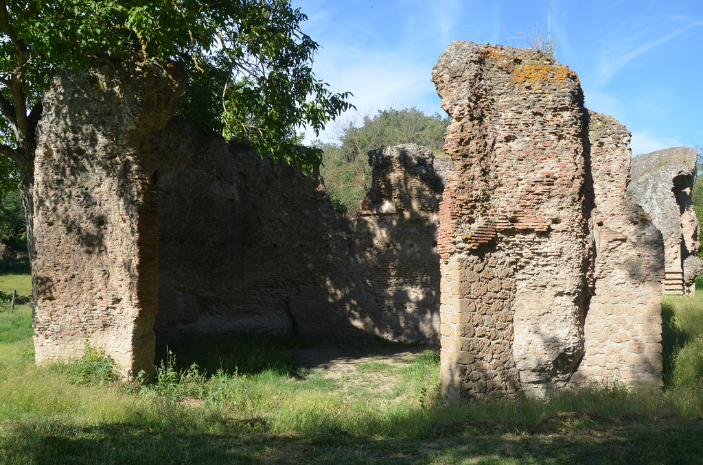
Today the archaeological area of the ancient city of Ocriculum is one of the most important in Umbria, with its amphitheatre, baths, theatre, forum area, funerary monuments and other public buildings. Ocriculum was partly excavated in the 18th century by the Vatican under the patronage of Pope Pius VI. As a result, many finely crafted statues, including portraits of members of the Julio-Claudian family and of Jupiter and Venus, are on display in the galleries of the Vatican Museum. The octagonal mosaic pavement in the Sala Rotonda of the Vatican comes from Ocriculum. Other artefacts of great value are exhibited in the Otricoli Municipal Antiquarium.

Since 2012, a three-day Roman Festival –Ocriculum AD 168– has brought visitors back to AD 168 for a spectacular journey through time when Marcus Aurelius and Lucius Verus were reigning. The event, held annually, offers an exciting full immersion in history, art, cuisine and historical re-enactment that relive the daily life in the flourishing river-port of the ancient city.

PORTFOLIO

The first monument found when entering the ancient city of Ocriculum is the so-called Niche Tomb from the Imperial age. It was constructed in concrete (opus caementicium) and had a brick facing, of which only some parts remain.
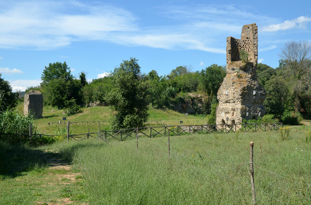
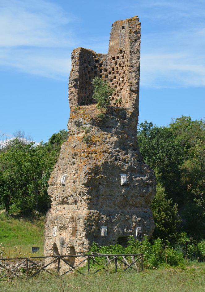
The so-called Tower Tomb overlooks the excavated part of the Via Flaminia with a public fountain along its eastern side.
The so-called Tower Tomb has a square plan and is surmounted by a circular body. This type of tomb, prevalent in the East, follows some Hellenistic prototypes from Asia Minor.
This stretch of the Via Flaminia was brought to light in 1992-94. It is about 6 m wide and 25 m long and is made of large leucite slabs coming from the nearby ancient Borghetto quarries.
The public fountain opens onto the Via Flaminia. Behind it stands a drum-type mausoleum dating to the early Augustan period (ca. 27 BC). An inscription reveals that it belonged to Lucius Cominus Tuscus, son of Caius, of the Arnensis tribe.
In front of the Via Flaminia stands a circular funeral monument with a drum and a huge square podium built in concrete.
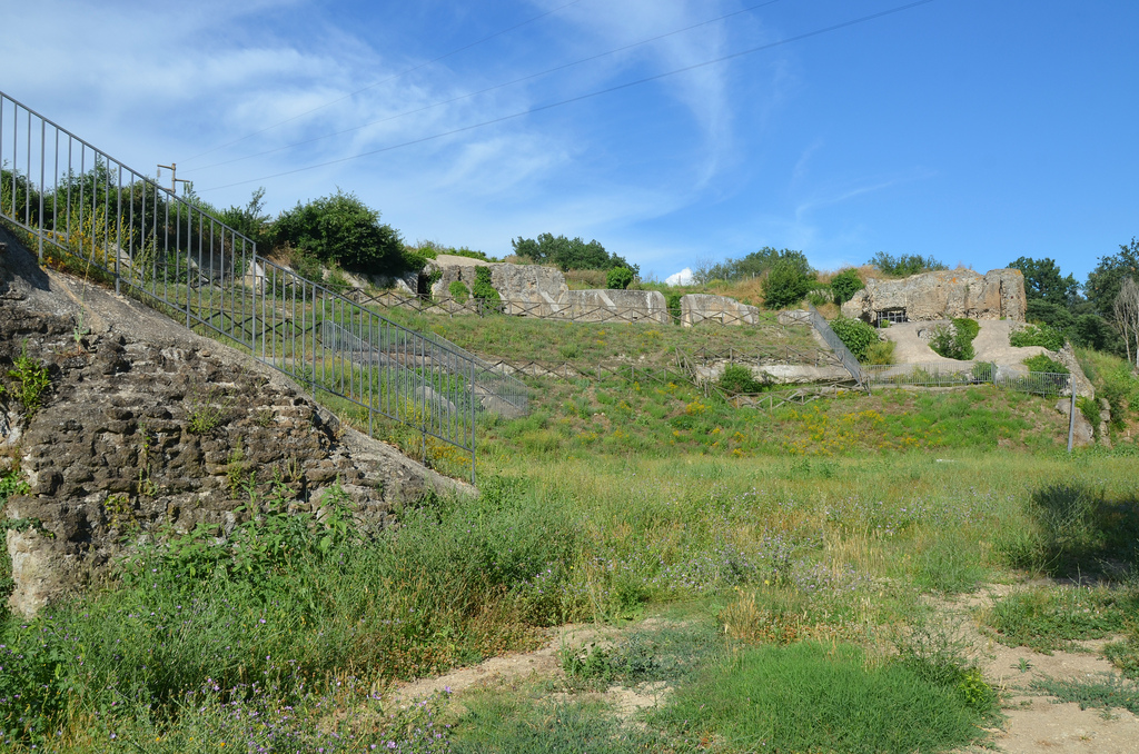
The Amphitheatre, excavated in 1958, is located on the left side of Via Flaminia and is one of the most imposing monuments of Ocriculum. It was built in opus reticulatum and measured approximately 128 x 98 m. The structure can be dated to the first half of the 1st century AD.
The thermal bath complex is the only ancient monument of the city recorded in epigraphic sources. Constructed around the second half of the 2nd century AD by Iulius Iulianus, it occupies a vast area suitably flattened just for this purpose.
The so-called “octagonal room” of the thermal bath complex. The polychrome mosaic floor (4th century AD?) adorned this room is now preserved in the Sala Rotonda of the Vatican Museums. The scenes depict the battle between the Greeks and the centaurs with the head of Medusa in the middle.
These imposing substructures consist of twelve vaulted rooms on two levels supporting a large terrace probably belonging to a grand sanctuary of which no traces are left.
The theatre dates to the late 1st century BC / early 1st century AD. Most of the surviving structure is in opus reticulatum and was originally faced in marble.
The Tiber river. Unfortunately, there are no visible traces of the so-called “Port of Oil”, the ancient river port on the Tiber.

Links: