![]() A unique Gallo-Roman sanctuary of Hercules was discovered by chance in 1974 in a field on the outskirts of the city of Deneuvre (Meurthe-et-Moselle in eastern France) when a local farmer looked for a source of water for his flock. He called on a local dowser, Gilbert Hellé, who advised him on where to start digging. They soon realised that there was more than just a spring under the earth when a Roman column came to light.
A unique Gallo-Roman sanctuary of Hercules was discovered by chance in 1974 in a field on the outskirts of the city of Deneuvre (Meurthe-et-Moselle in eastern France) when a local farmer looked for a source of water for his flock. He called on a local dowser, Gilbert Hellé, who advised him on where to start digging. They soon realised that there was more than just a spring under the earth when a Roman column came to light.
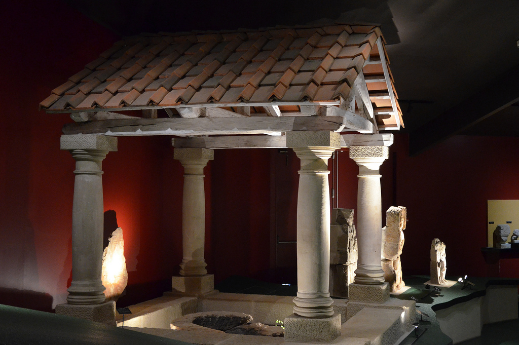
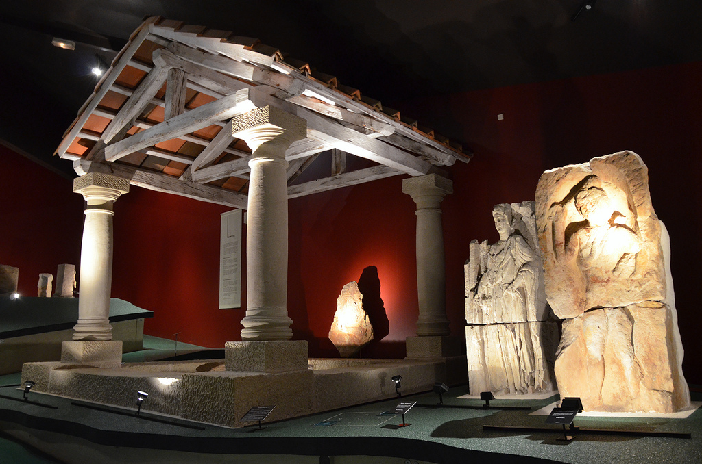
This rare spring sanctuary, which has no equivalent in Roman Gaul, is organised around two sources dedicated to Hercules. Indeed, traces of hundred of carved representations of Hercules were unearthed in Deneuvre, making it the largest concentration of such representations in the Roman West. After twelve years of extensive excavations led by Gérard Moitrieux, a dedicated museum was built in the centre of the city. It was designed around a scale re-creation (400m²) of the sanctuary as it was in the middle of the 4th century AD. The museum officially opened its doors in 1996.

The spring sanctuary was established in 150 AD. At this time the sanctuary consisted of only a few wooden basins installed to capture the water sources with a network of pipes. Quickly the sanctuary grew in wealth and at the end of the 2nd century the wood basins were gradually made of stone. It is also at this time that roofs were raised above the basins and that the first stelae carved in the effigy of Hercules were erected. The end of the 2nd century saw the sanctuary reach its heyday after which came alternating periods of almost total abandonment and rebirth. The sanctuary was destroyed around 375 AD, probably by the first Christian community in Deneuvre. The sources were blocked, the statues were destroyed and sometimes mutilated (severed heads, hammered faces).
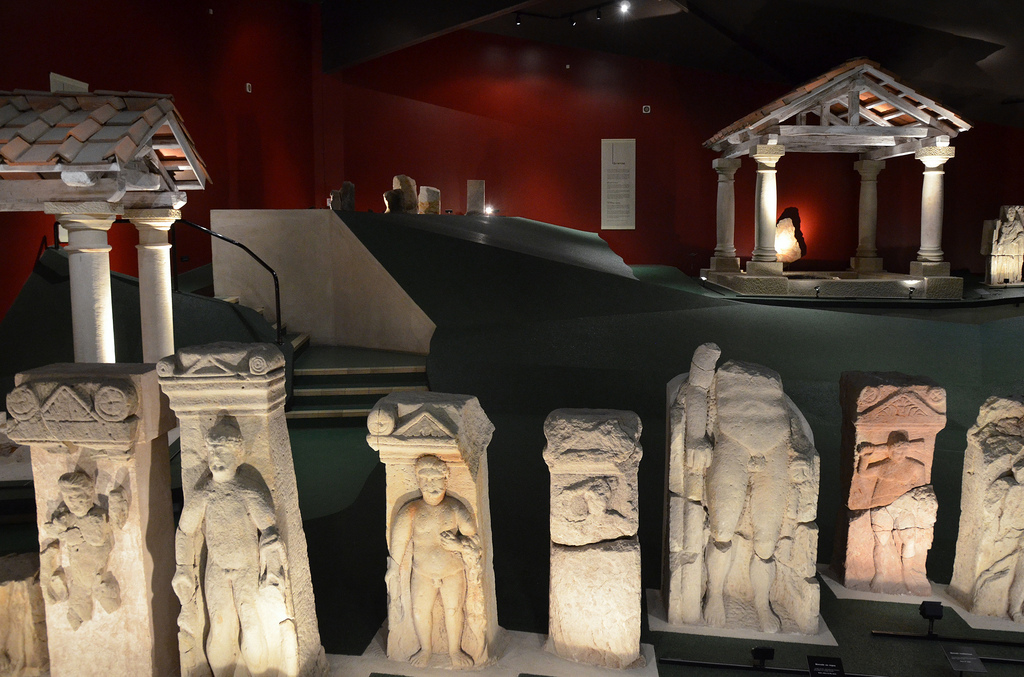
At Deneuvre, Hercules is mainly depicted in three different attitudes. Hercules at rest, leaning on his club. Hercules the fighter, brandishing his club behind his head in a threatening way. Finally, Hercules walking, the rarest attitude of the three, with the club on his shoulder. All the statues found in the sanctuary are made of the same stone, the Voltzia Sandstone, a stone quarried locally. They were carved between the end of the reigns of Antoninus Pius (138-160 AD) and Valentinian I (364-375 AD).


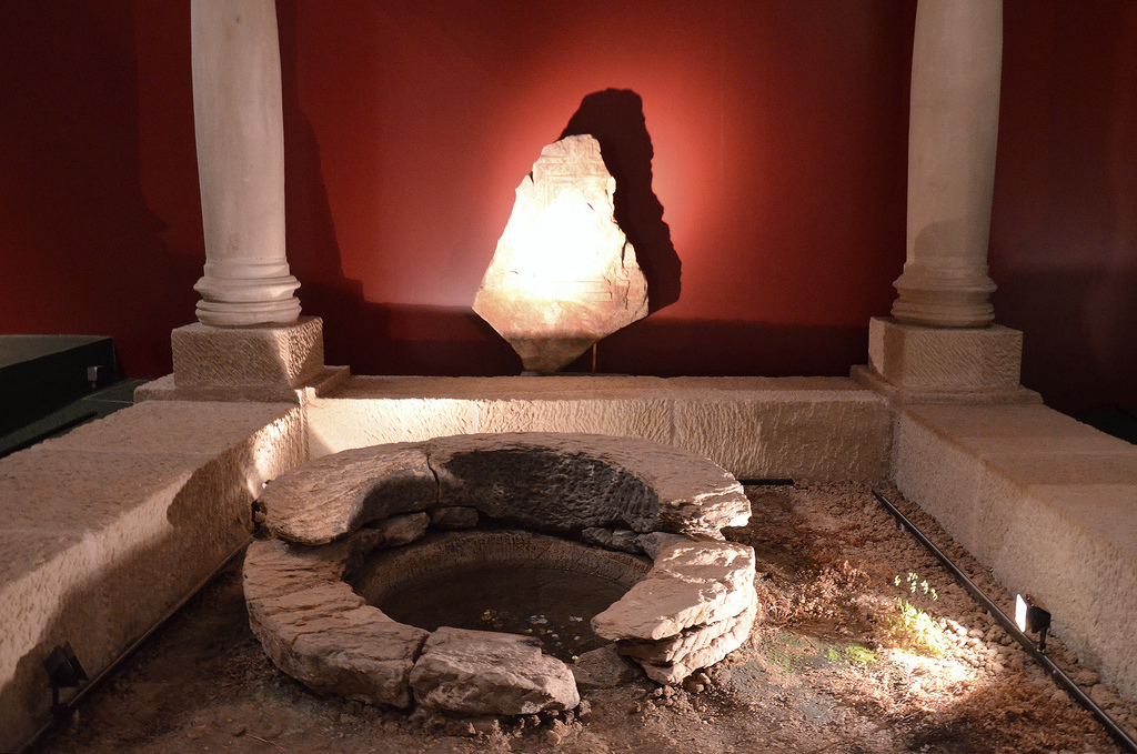
The springs were channeled using wooden pipes and organized into three pools; two of these were protected with roofs, each supported by four columns.


At Deneuvre, pilgrims were making vows to Hercules. People came seeking a healing cure for their illnesses, success in trade, a good war booty or a good harvest. They came from all over the region and beyond, as far as from the Limes along the Rhine. Archaeological finds show that pilgrims cleansed and purified themselves using pottery bowls before making an offering.

The offerings were not necessarily significant, some coins or a little food could do the trick. They were placed on the altars. Then the pilgrim waited patiently for the vow to be fulfilled. If the wish of the pilgrim was granted, a second gift was offered to the God in gratitude. These gifts could take many forms depending on the wealth of the pilgrim. The richest gave a stone statue, a stela or an altar on which a dedicatory inscription was engraved to give thanks for the request fulfilled. The poorest gave smaller ex-voto like stones or pieces of tiles on which they expressed their thanks. Pilgrims also left offerings of food, white clay figurines, money and jewellery. Votive offerings are attested by the phrase Votum Solvit Libens Merito (“He willingly and deservedly fulfilled his vow”),commonly abbreviated to VSLM, which was found on some of the altar’s inscriptions.
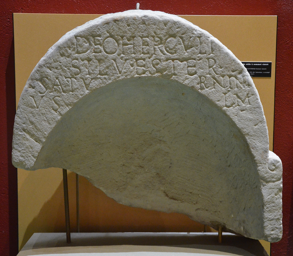
DEO HERCVLI/SILVESTER/SATVRNINI/ V(otum) S(olvit) L(ibens) M(erito).
To the god Hercules; Silvester, (son of) Saturninus, willingly and deservedly fulfilled his vow.
The springs of Deneuvre were thought to be sacred and pilgrims purified their bodies with water (however recent chemical analysis have shown that the water had no special mineral properties and was unsafe for human consumption due to its high level of acidity). The water was also used as libation, by pouring out water into the fire on the altar.

The village of Deneuvre is rich in archaeological remains and the site of the sanctuary has not yet been fully excavated. Archaeologists are hoping to find a temple dedicated to Jupiter, other religious sanctuaries as well as pottery workshops.
Information
Musée Les Sources d’Hercule
1 Place Jean Marie Keyser
54120 Deneuvre
France
Official website: http://www.museehercule.com/
Opening hours
Closed from 1 November to 28 February.
From 1 May to 30 September: daily from 10 am to 12 am and 2 pm to 6 pm.
From 1 March to 30 April and from 1 to 31 October: weekends, public holidays and school holidays from 2 pm to 5 pm.
Prices
Adult: 3.50 € (2.10 € reduced price)
Groups: all year by appointment (1.50 € for school groups).


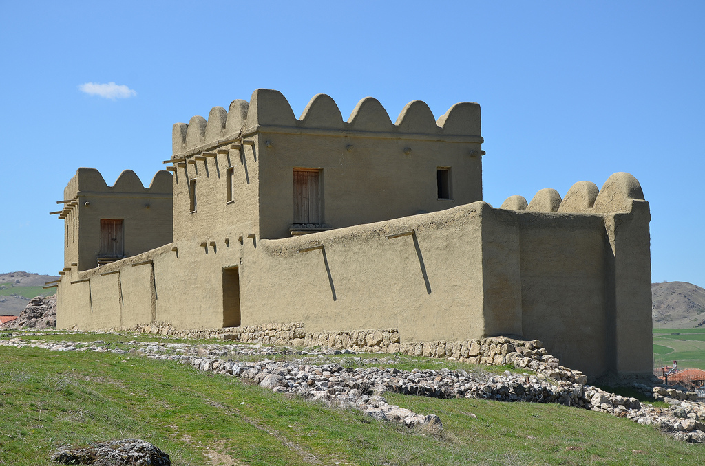
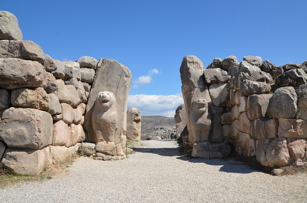
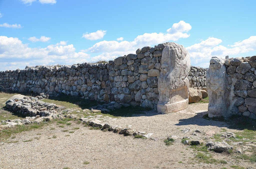
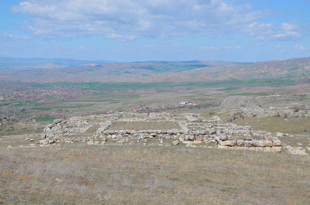
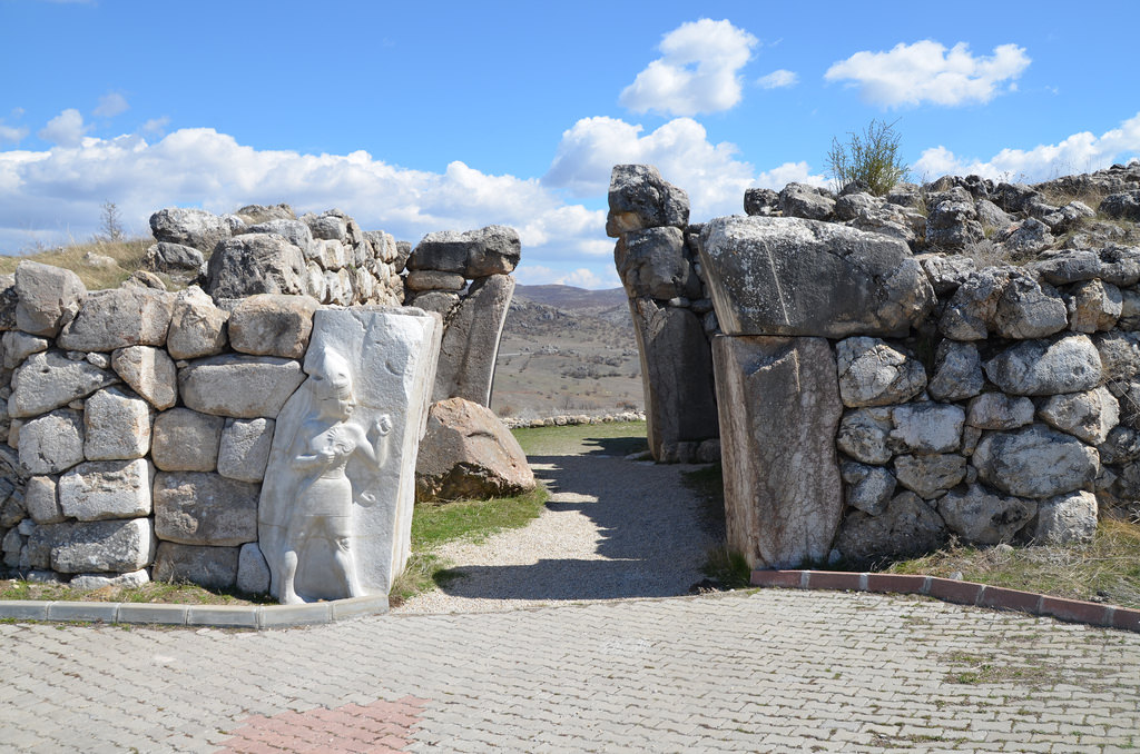
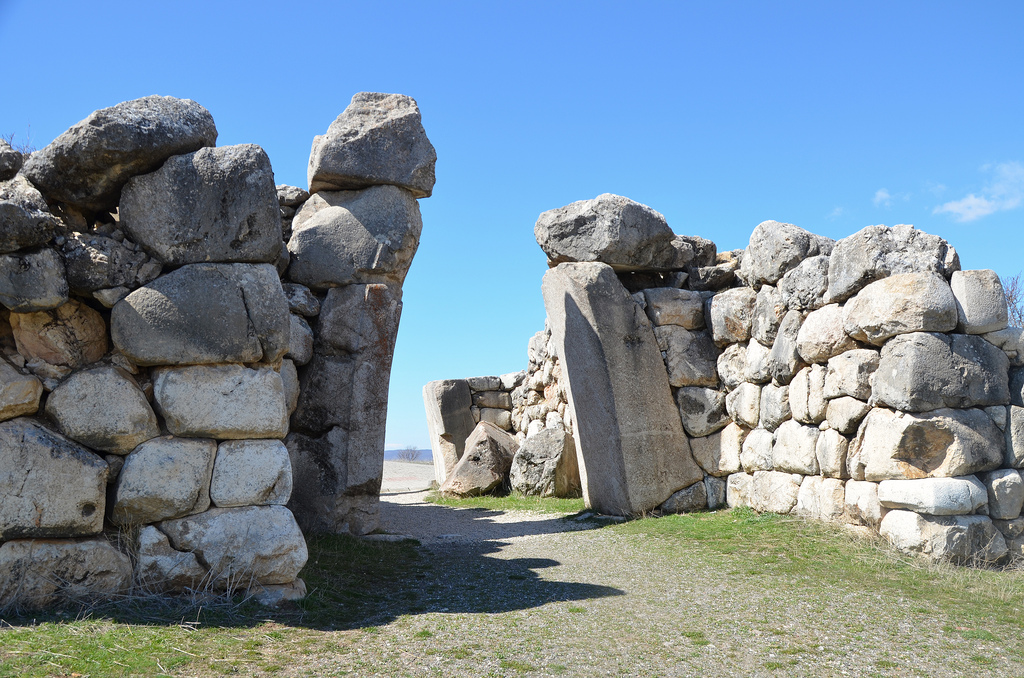
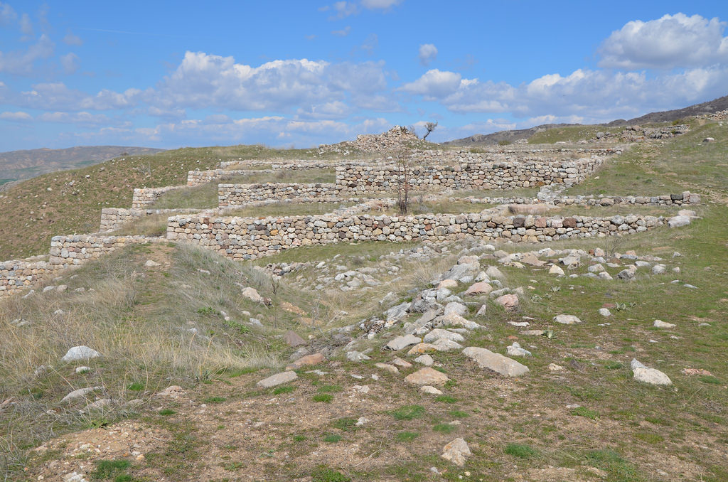
 The site was discovered on July 28 1834, by Charles Texier, but the first systematic excavations in Hattusa began in 1893-1894 under the guidance of Ernest Chantre, who published the first cuneiform tablets from Hattusa. Since 1907, the German Archaeological Institute has carried out archaeological work. The city consisted of two separate districts: the Lower City, the Hittite Old City, where the main Temple was located, and the Upper City, a newer part of the city with a fortified palace complex surrounded by massive walls.