The ancient city of Sagalassos, located in southwestern Turkey, is situated 109 kilometres north of Antalya, near the town of Ağlasun in Burdur Province. The ruins are located on the southern slopes of the Ağlasun Mountains, part of the Western Taurus range, at an altitude of approximately 1,490-1,600 meters. Its strategic location and access to water sources contributed to the city’s prosperity and made it a natural stronghold. Sagalassos gained prominence after being conquered by Alexander the Great in 334 BC, eventually becoming an important city within the Seleucid Kingdom and later the Kingdom of Pergamon. During the Roman Empire, it experienced a period of significant prosperity, characterised by extensive construction and cultural development. Largely forgotten until its rediscovery in the 17th century, it has since been the subject of various archaeological studies and excavations that have revealed its historical significance.
Sagalassos has a rich history that extends deep into prehistory. Human activity in the area dates back to around 10,000 BC, with permanent settlements appearing in the Late Neolithic by approximately 6,500 BC. These early communities practised agriculture, produced ceramic wares, and formed networks of small settlements, each controlling its own territory. Over time, the region experienced waves of cultural and political change, coming under the influence of Indo-European groups such as the Hittites and Luwians, then the Phrygians and Lydians, and eventually the Persians. Together, these phases shaped the early foundations of what would later become Sagalassos.
From the 6th century BC onward, the city increasingly absorbed Greek cultural influences. This process accelerated after the campaigns of Alexander the Great and continued through the Hellenistic and early Roman periods. Sagalassos developed into a true polis, adopting the political and urban characteristics of ancient Greek city-states, often more rapidly than neighbouring settlements in Pisidia. By this time, it had established itself as an important regional centre.
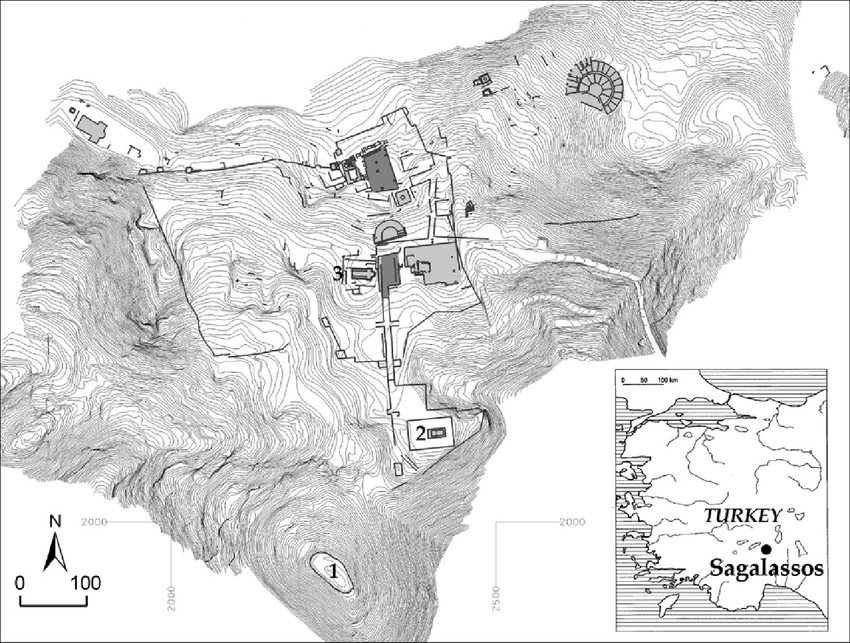
Site plan of Sagalassos: (1) Alexander’s Hill; (2) Temple of Hadrian and Antoninus Pius; (3) Temple of Apollo Klarios (source)
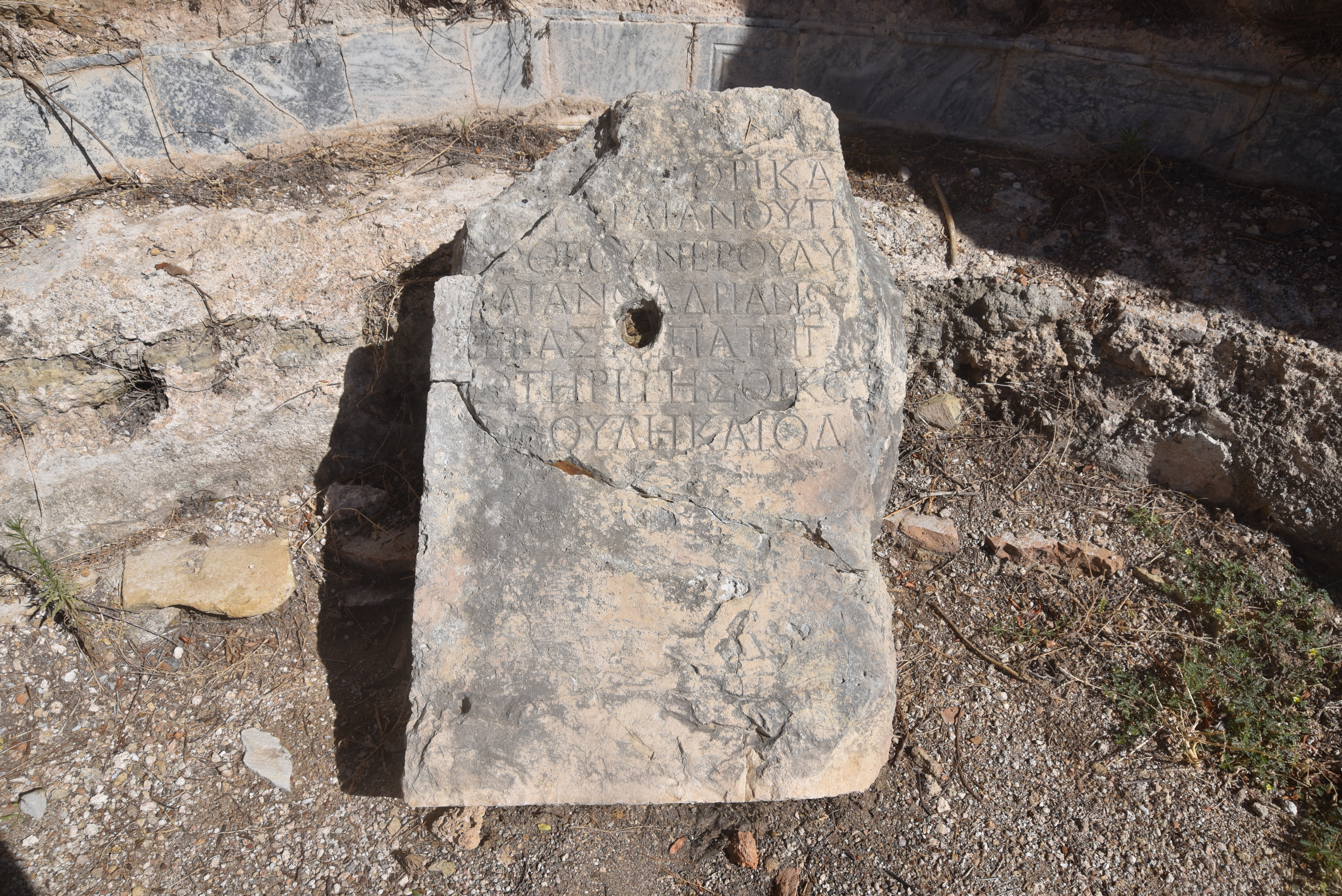
The Roman era marked the height of Sagalassos’ prosperity. In 25 BC, Augustus incorporated the kingdom of Galatia, including Pisidia, into the Roman Empire. During his reign, Sagalassos underwent a complete metamorphosis. In addition, political stability, economic reforms, improved infrastructure, and favourable climatic conditions encouraged agricultural expansion and population growth. The city entered a golden age in the 2nd and early 3rd centuries AD, particularly under Hadrian. The Emperor declared Sagalassos the official centre of the imperial cult for the sub-province of Pisidia. This launched the city’s “golden age” and a period of intensive construction. Hadrian also gave Sagalassos the honorary title of “first city of Pisidia, friend and ally of the Roman” which was proudly displayed on the city’s 3rd-century AD coinage (RPC IX, 945).
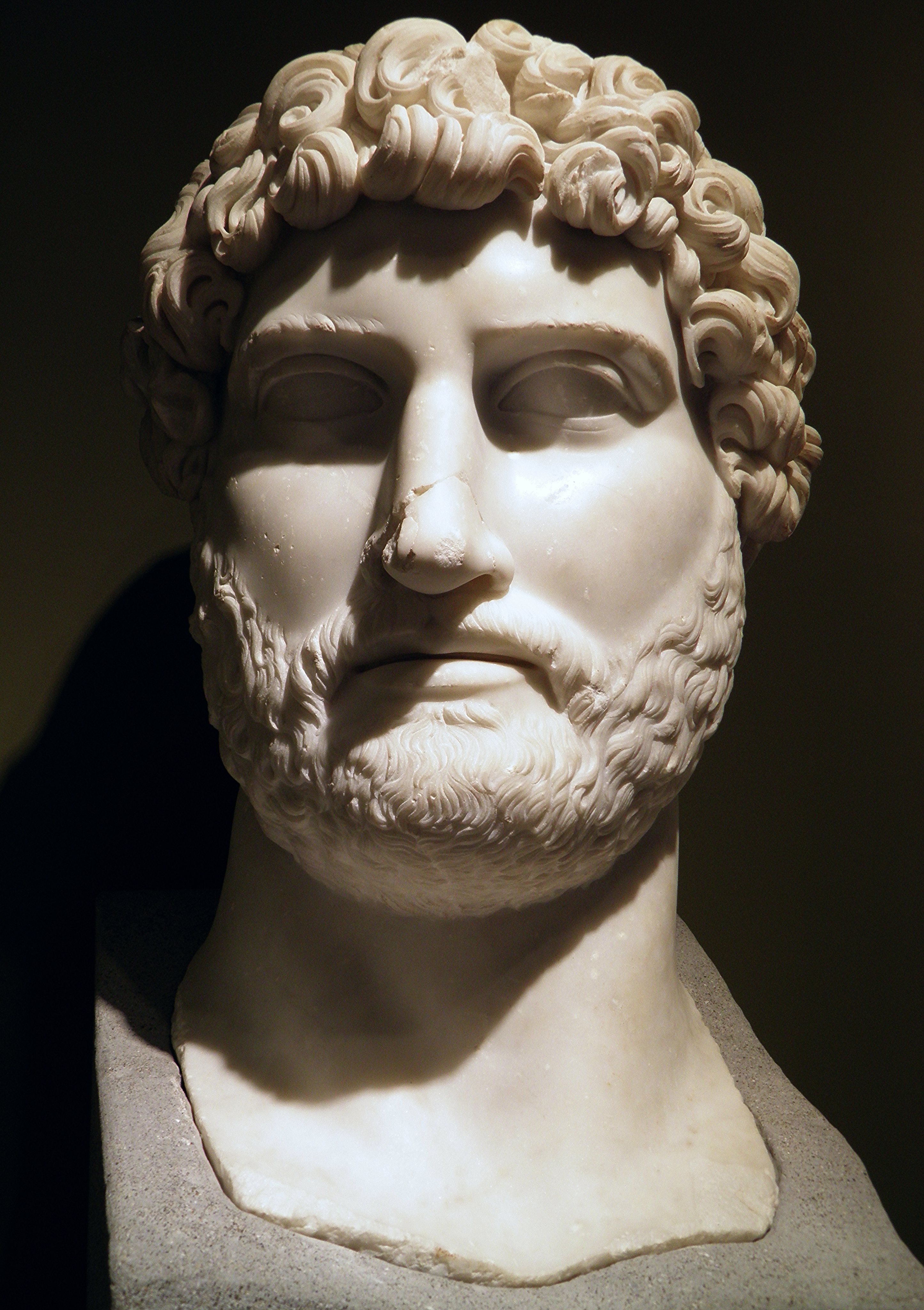
Colossal portrait head, belonging to an acrolithic statue of Hadrian, sculpted c. AD 120–125 and at that time perhaps displayed in the “marble room” of the Imperial Baths.
Decline came gradually rather than abruptly. A series of earthquakes in the 6th and early 6th centuries, followed by the devastating plague of AD 541–542, severely weakened the city. Although Sagalassos remained inhabited for centuries afterwards, urban life diminished as the population increasingly relied on agriculture. After centuries of abandonment, Sagalassos was rediscovered in 1706, though it faded in and out of scholarly attention until the 19th century, when its identification as the ancient city of Sagalassos was confirmed in 1824 by Francis Vyvyan Jago Arundell, a British clergyman and antiquarian. Systematic archaeological research at Sagalassos began in 1990 when the late Marc Waelkens from the Katholieke Universiteit Leuven in Belgium obtained full excavation rights.
Waelkens, a Belgian archaeologist, became director of the Sagalassos Archaeological Research Project in 1990 after first visiting the site in the early 1980s. He launched large-scale excavations that would redefine the understanding of the city and its surrounding landscape. Waelkens championed a strongly interdisciplinary approach, bringing together specialists from a wide range of scientific fields to study not only monumental architecture but also environmental data, material culture, and everyday life. Under his leadership, Sagalassos became a model for modern archaeological research, demonstrating how a city’s history can be reconstructed in depth by integrating archaeology, natural sciences, and historical analysis.
Many of the remarkable statues and artefacts uncovered during these excavations are now preserved and displayed in the Burdur Museum (although Hadrian’s portrait is now in the Istanbul Airport Museum).
PORTFOLIO
Upper City
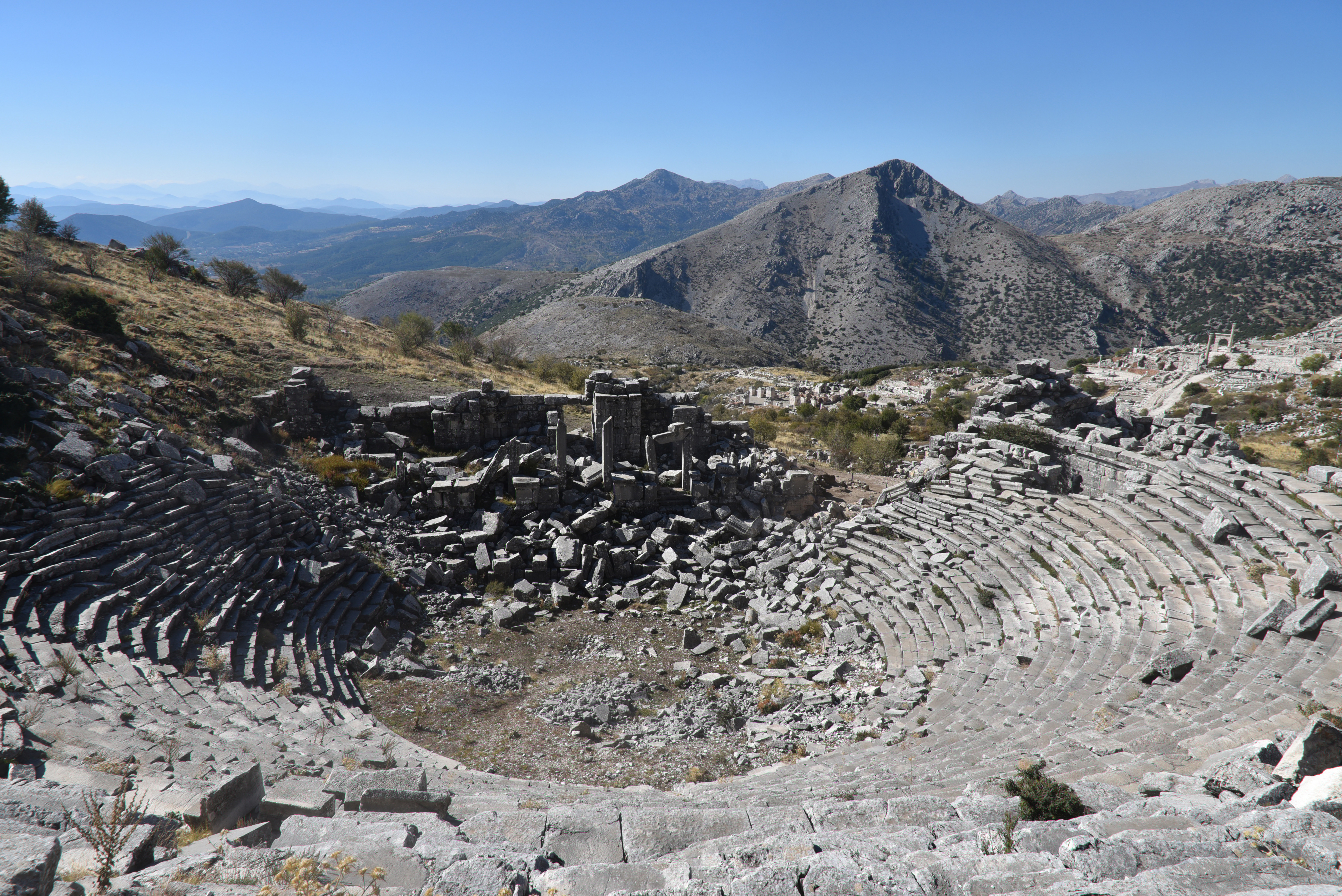
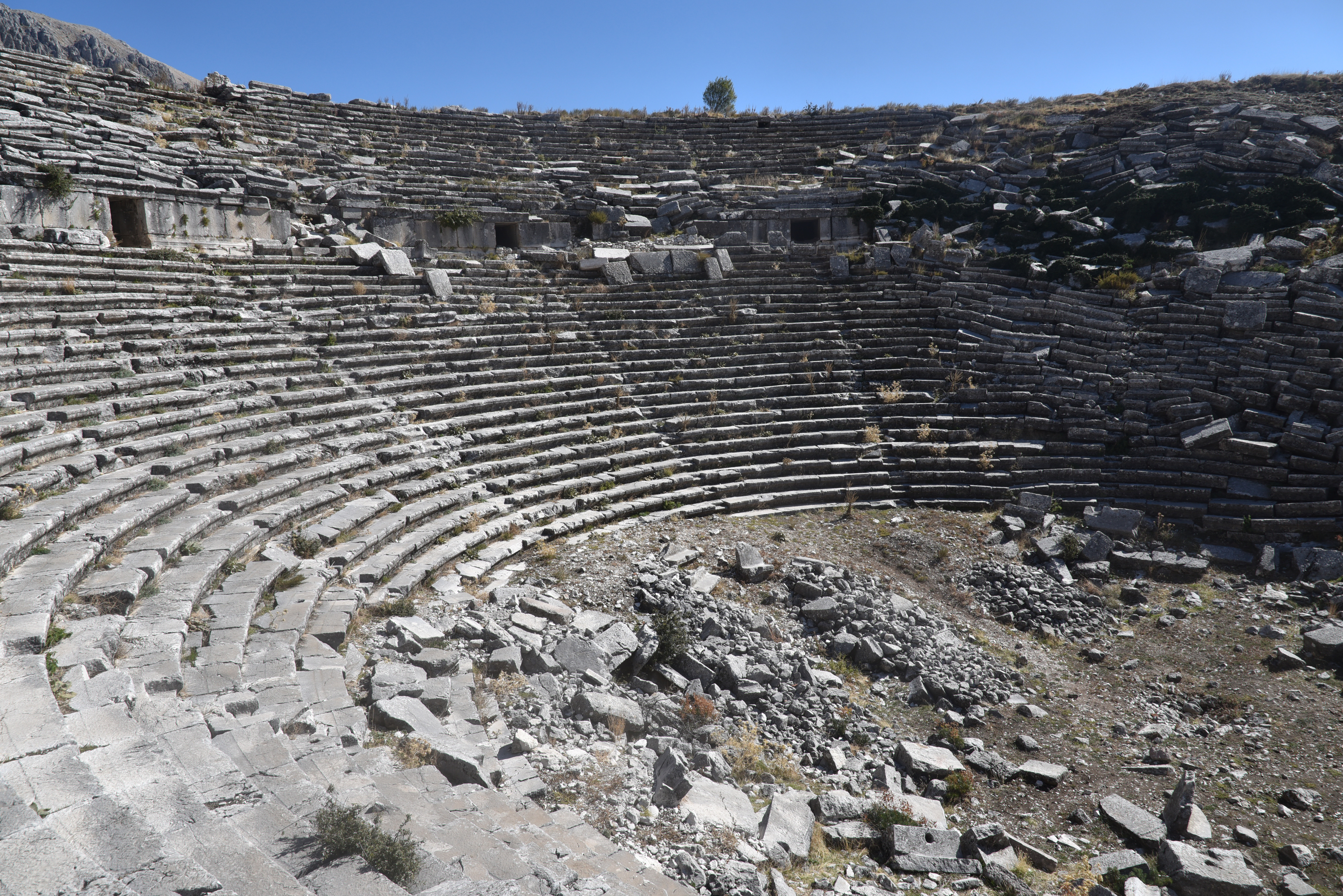
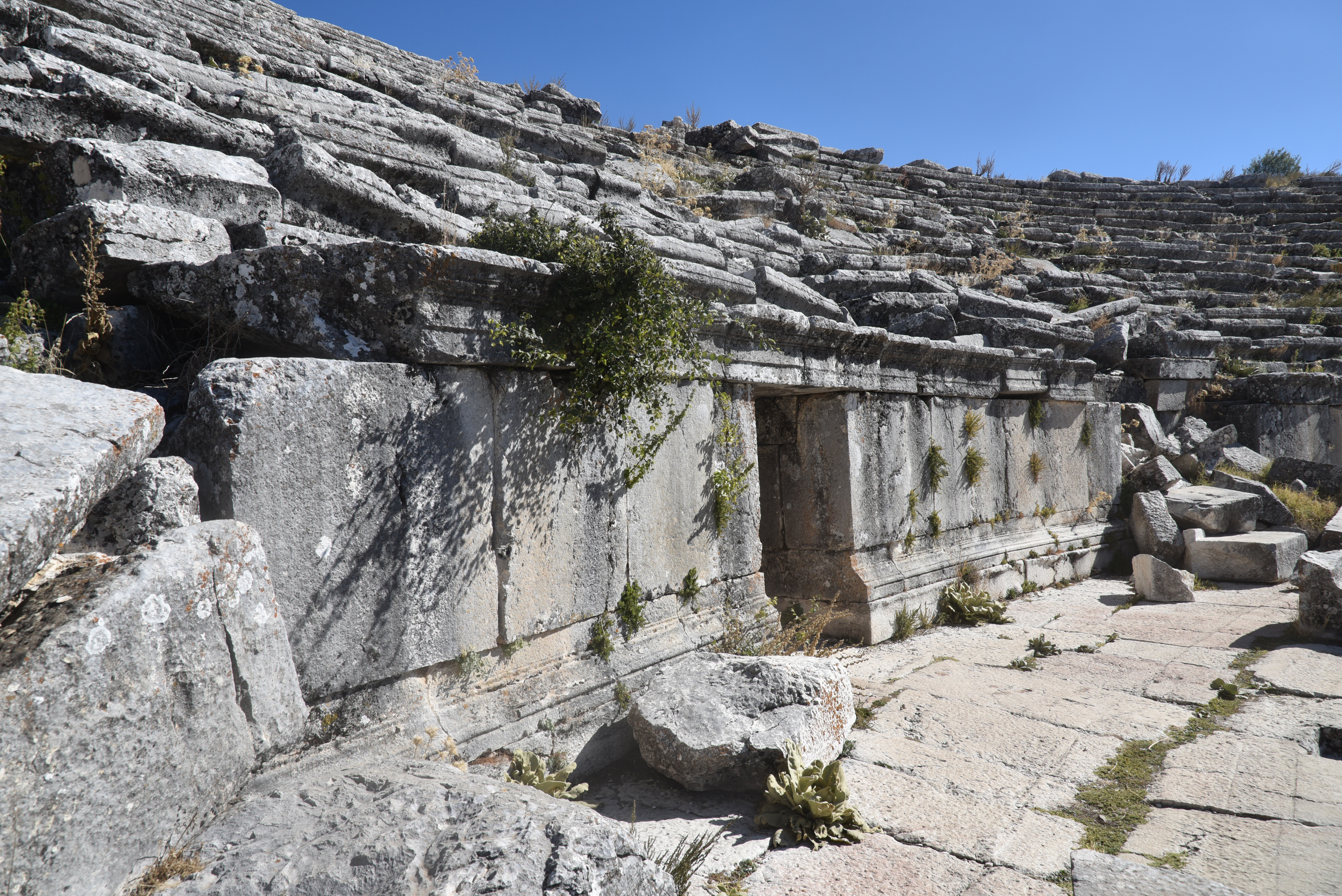
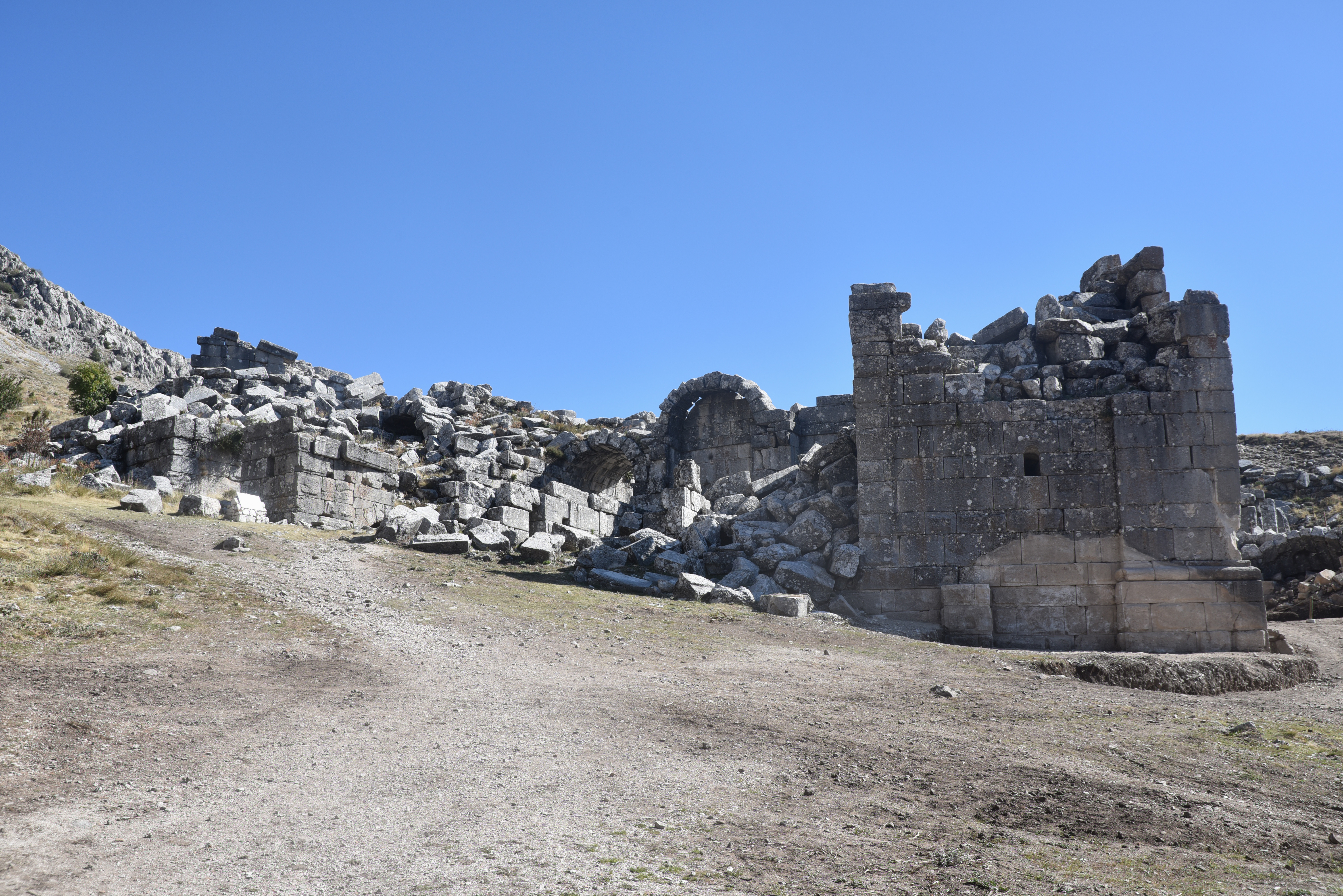
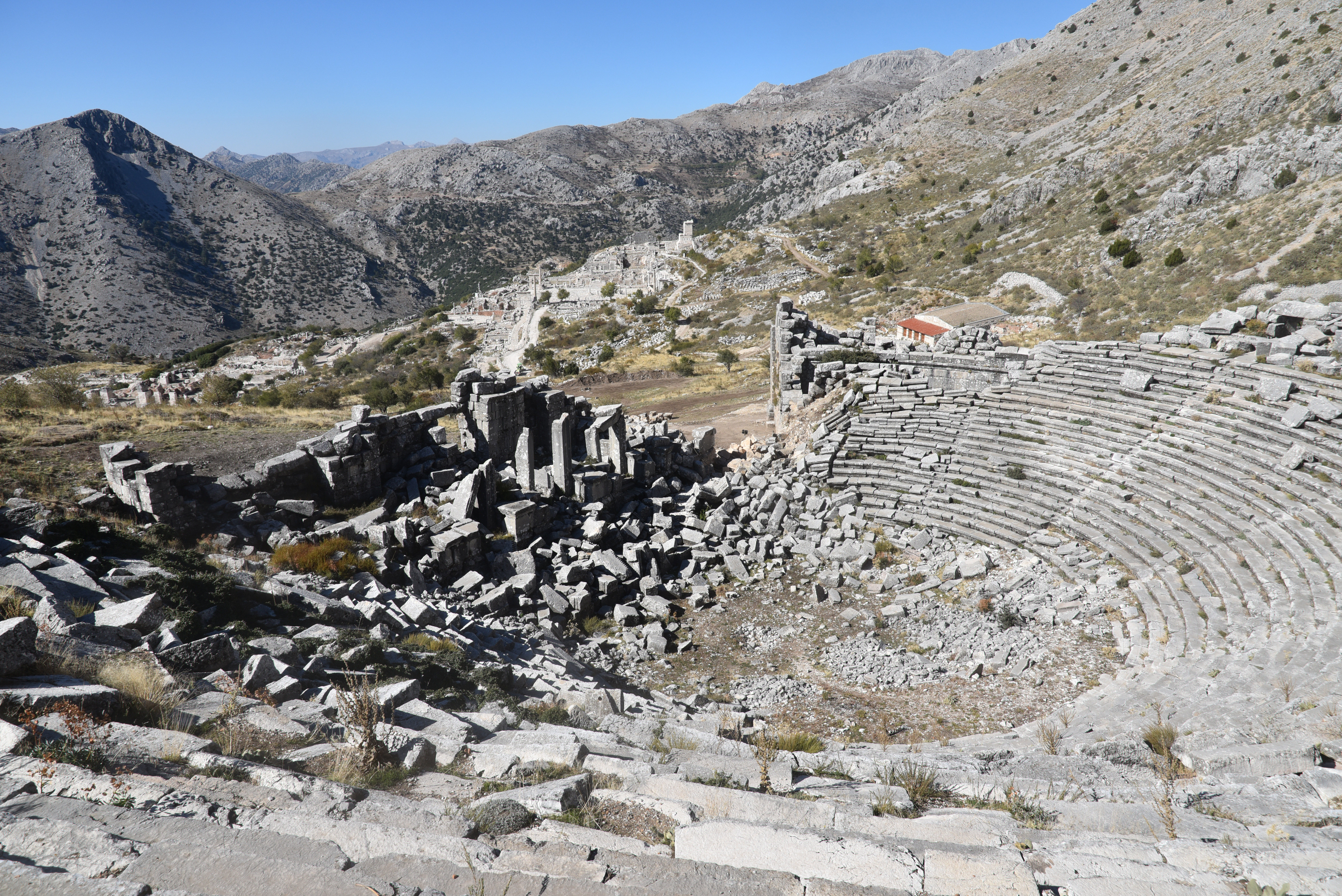
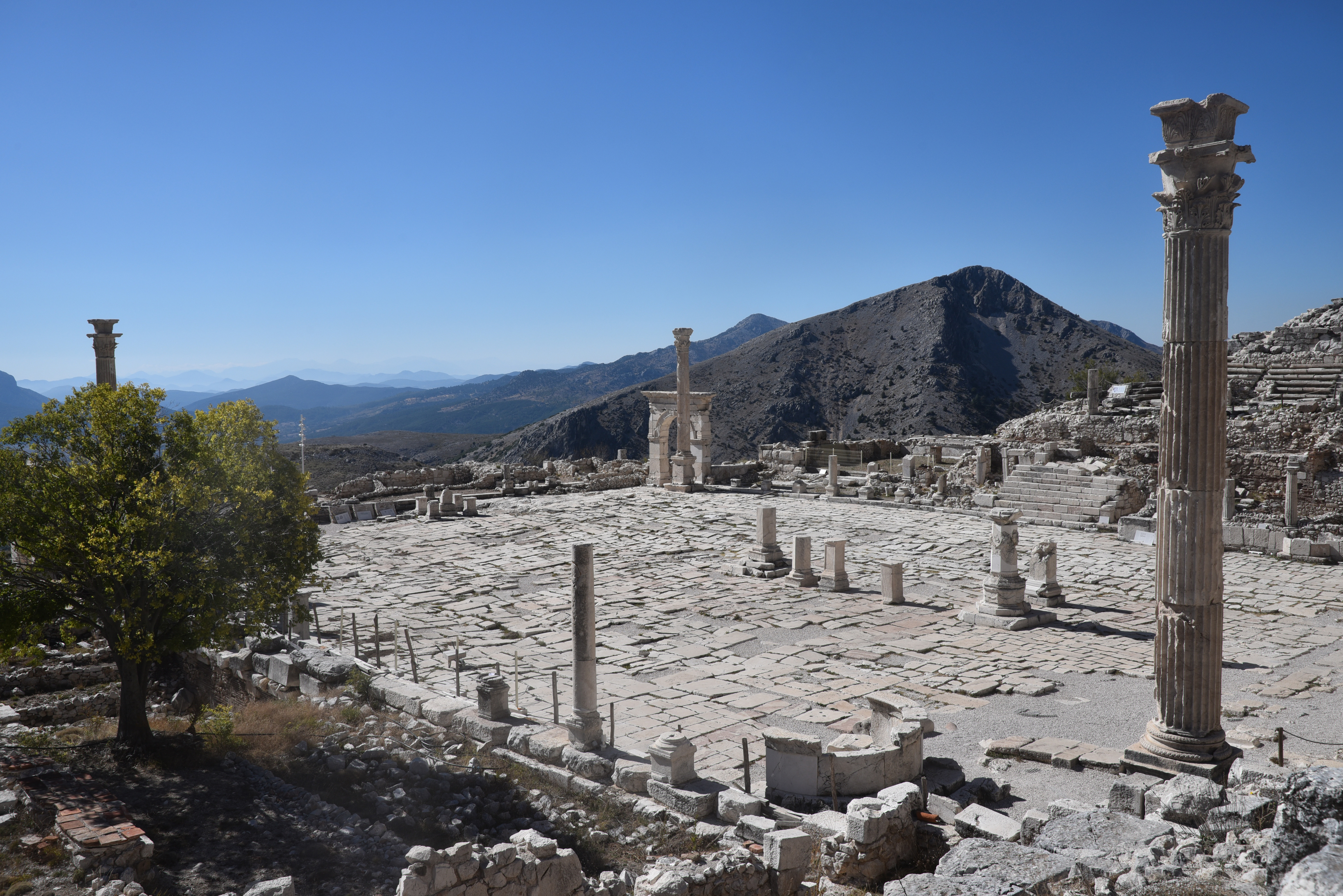
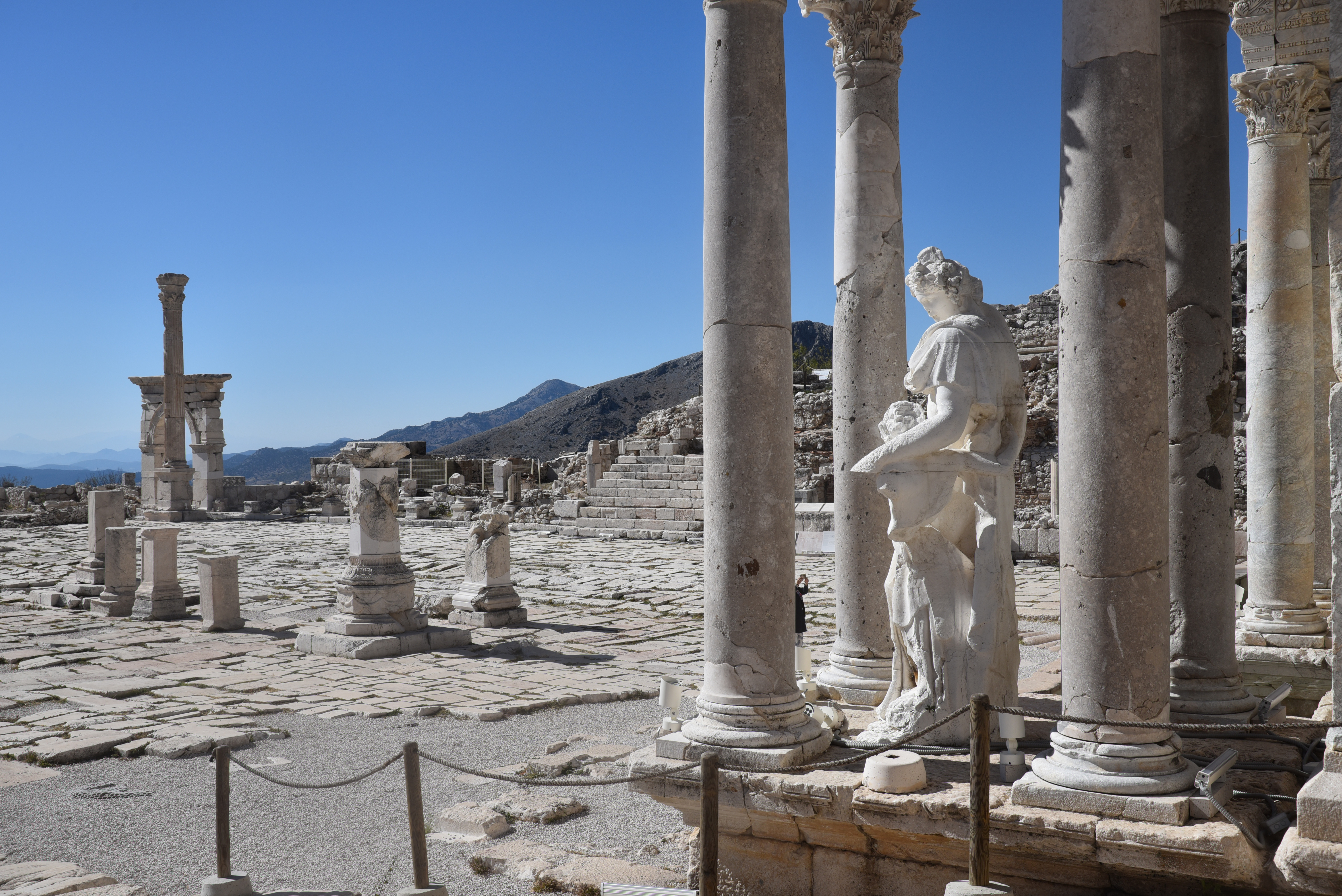
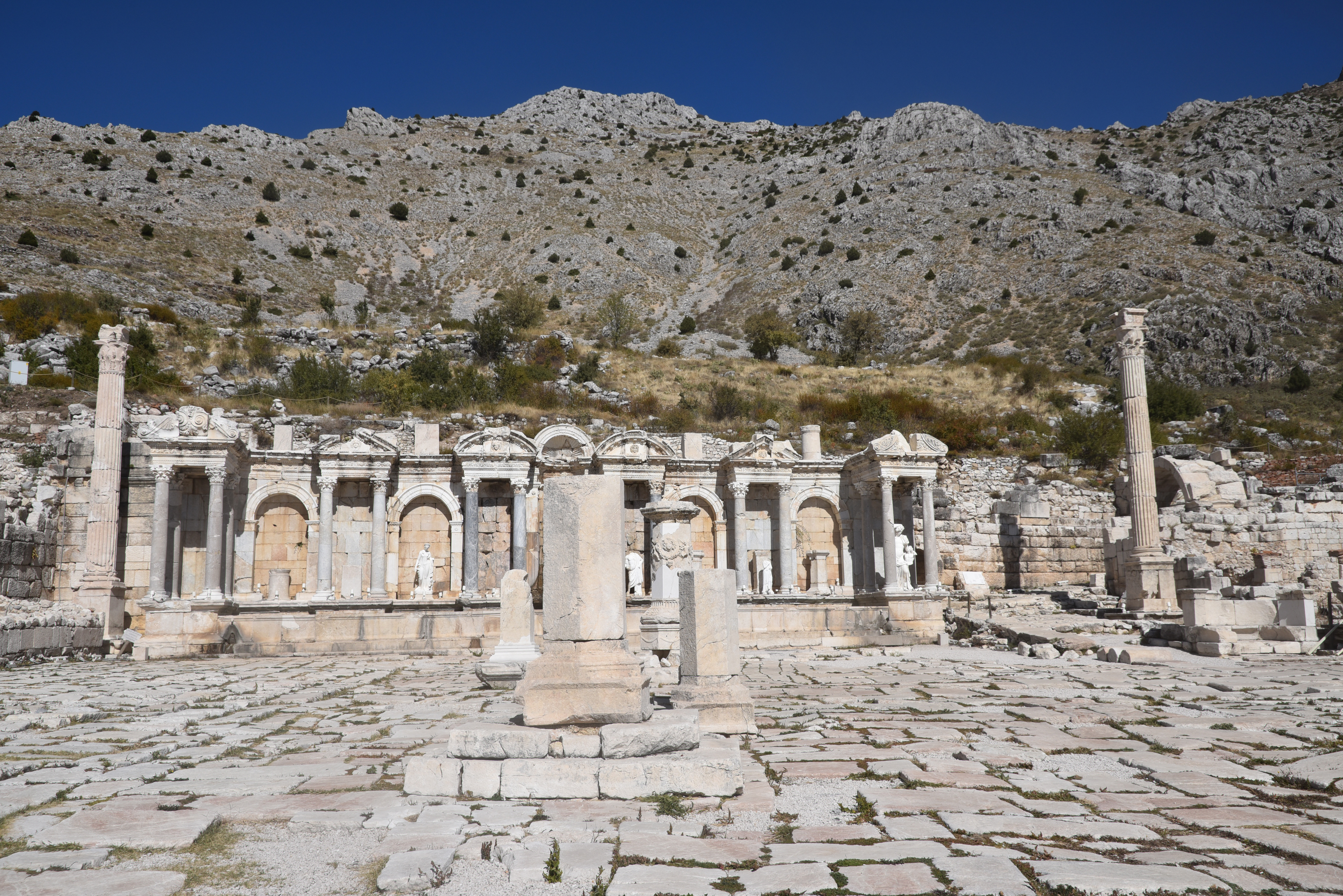
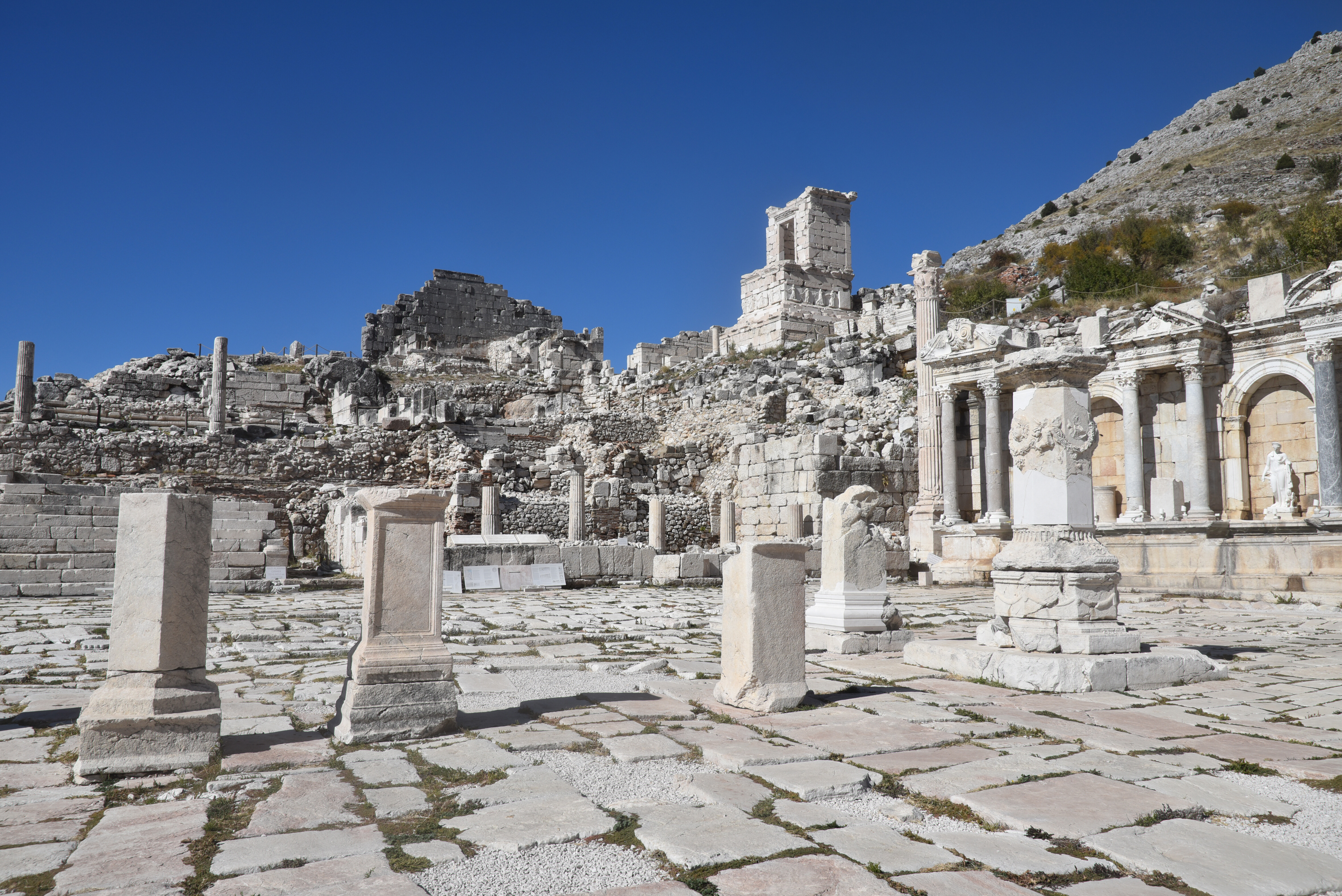
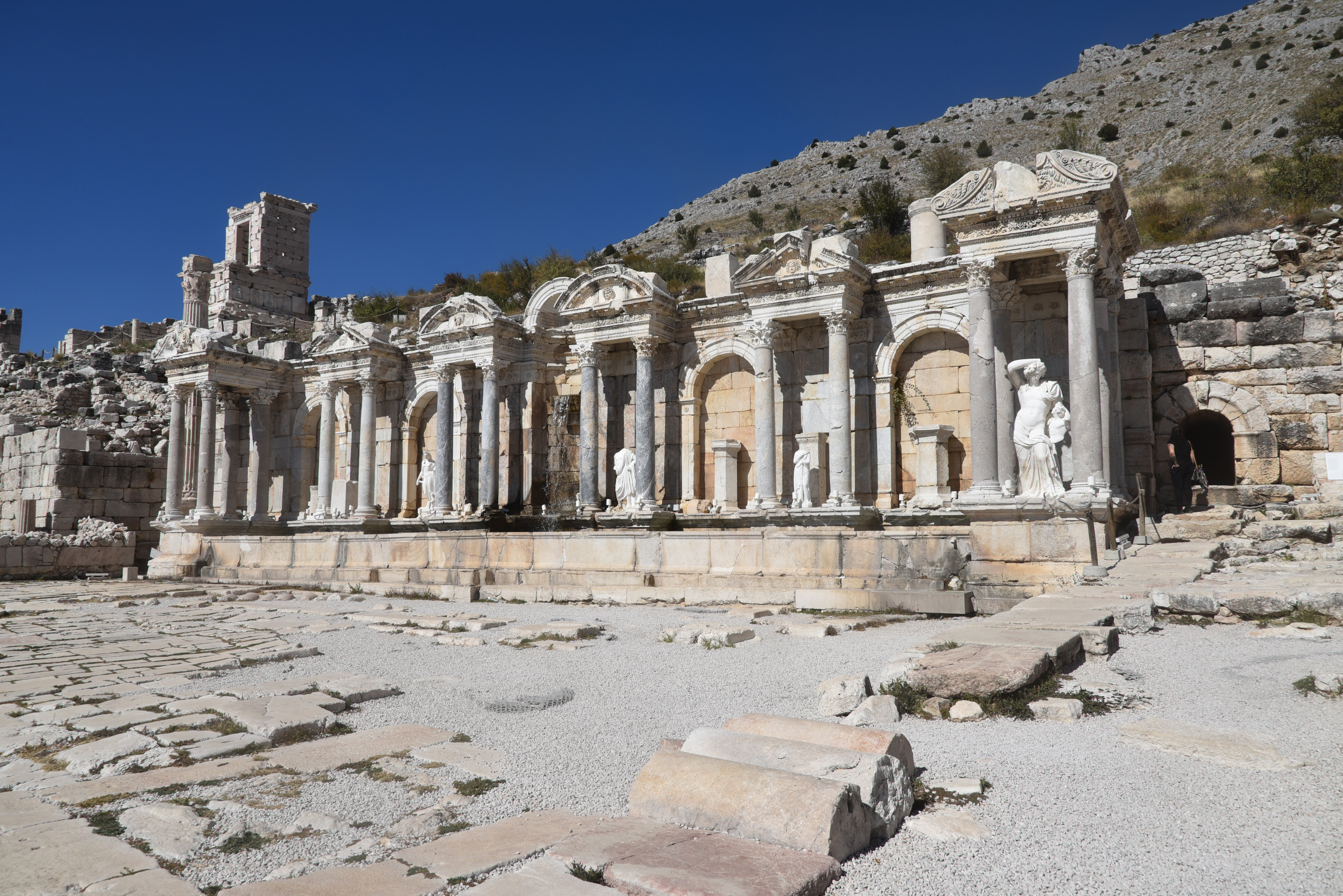
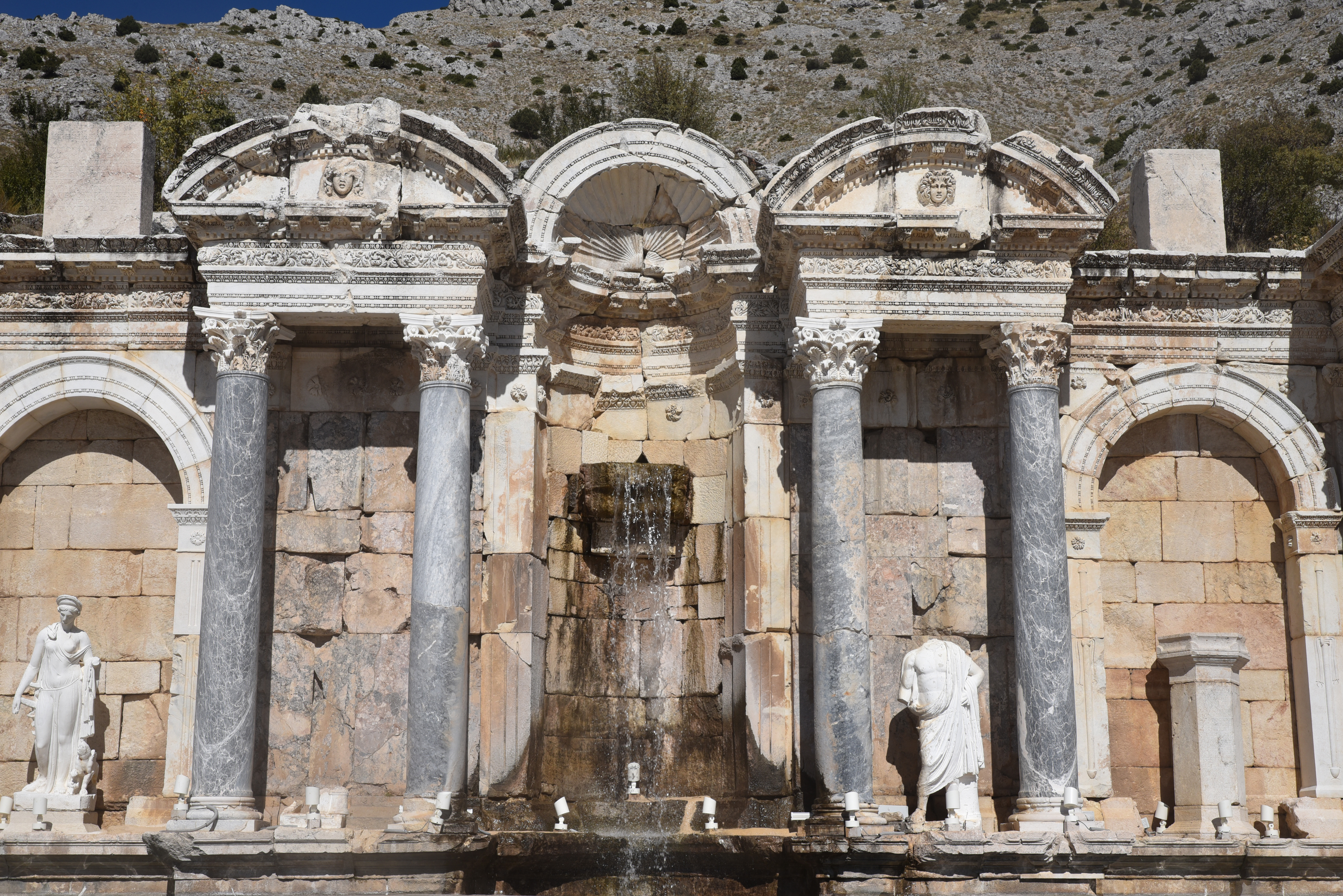
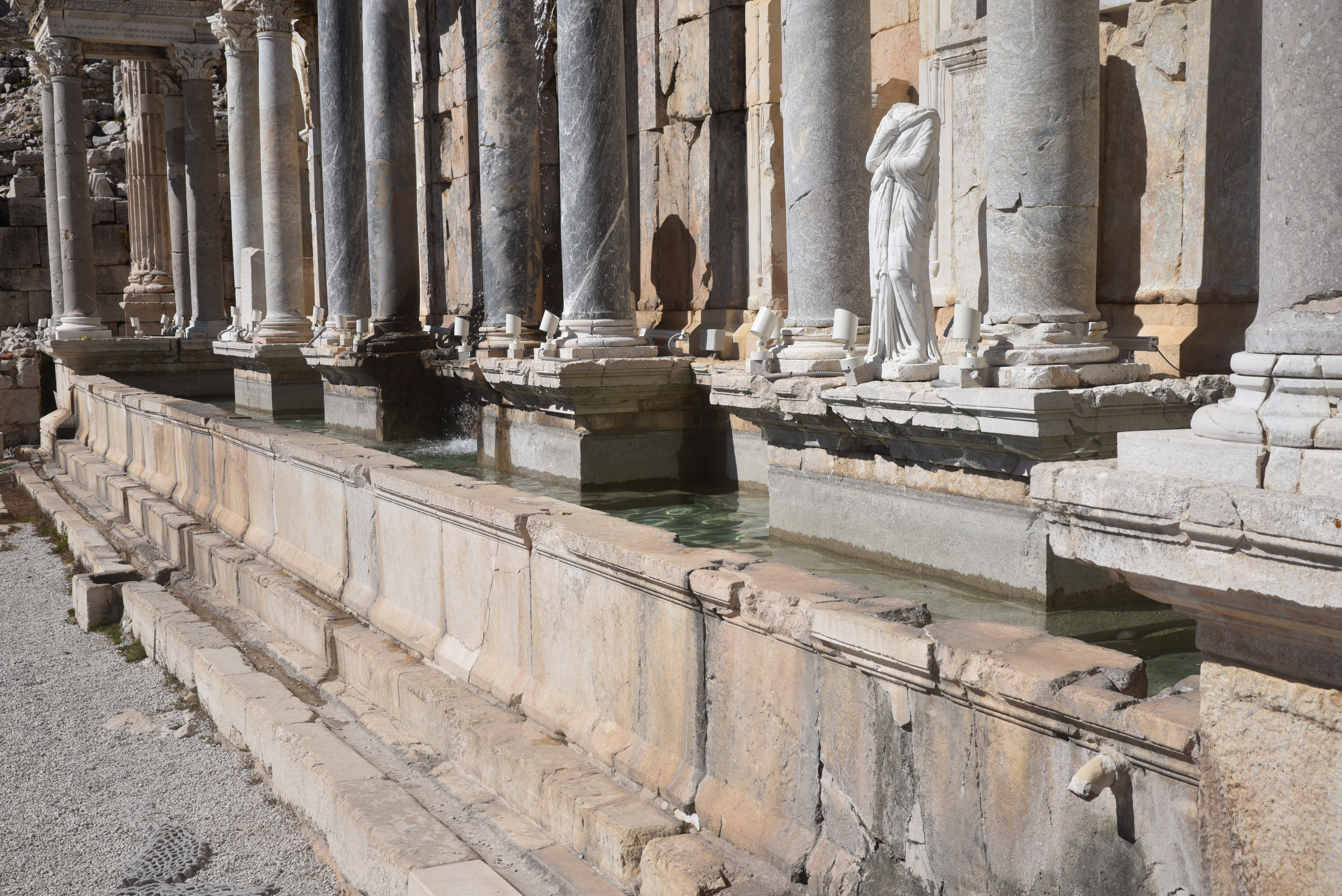
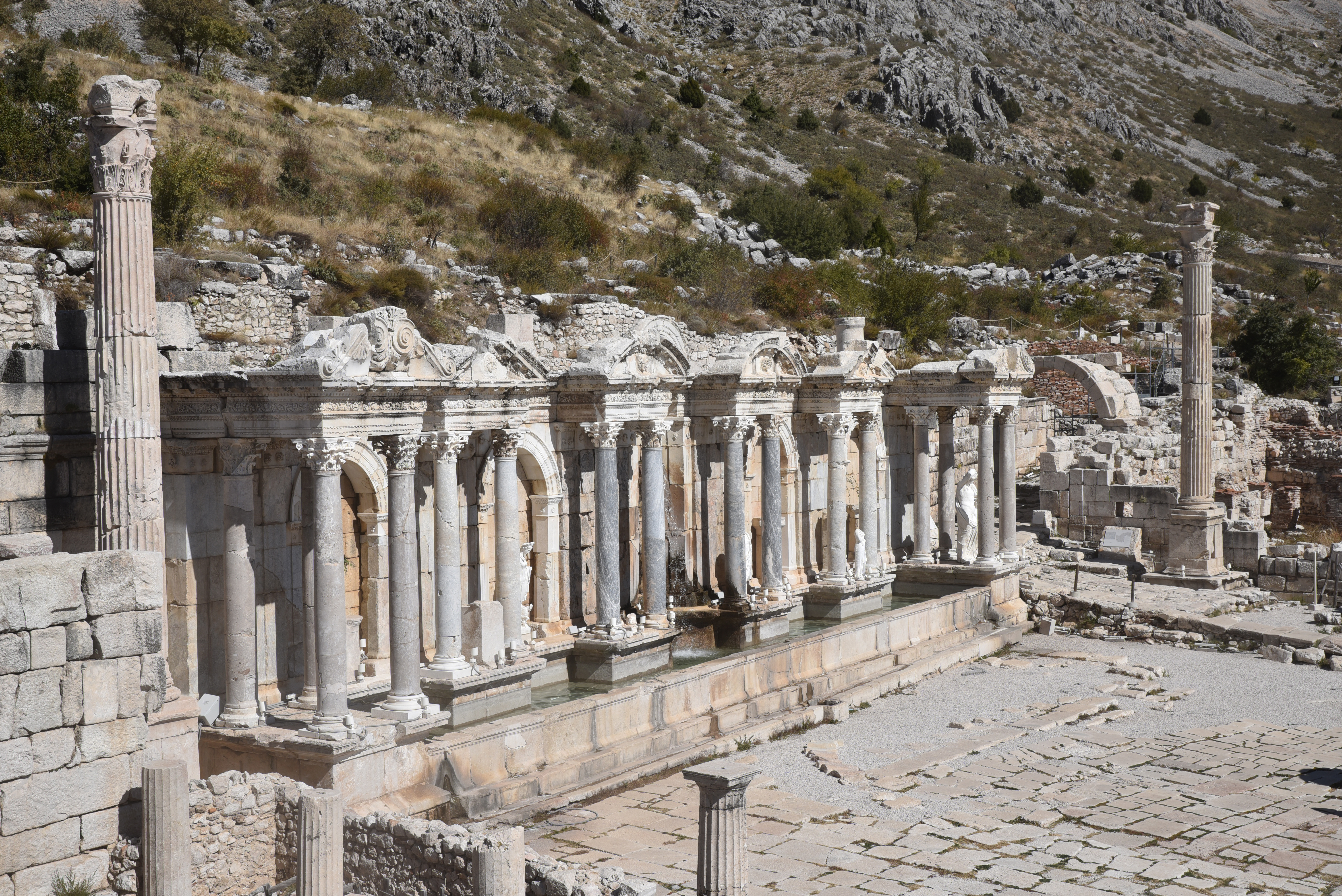
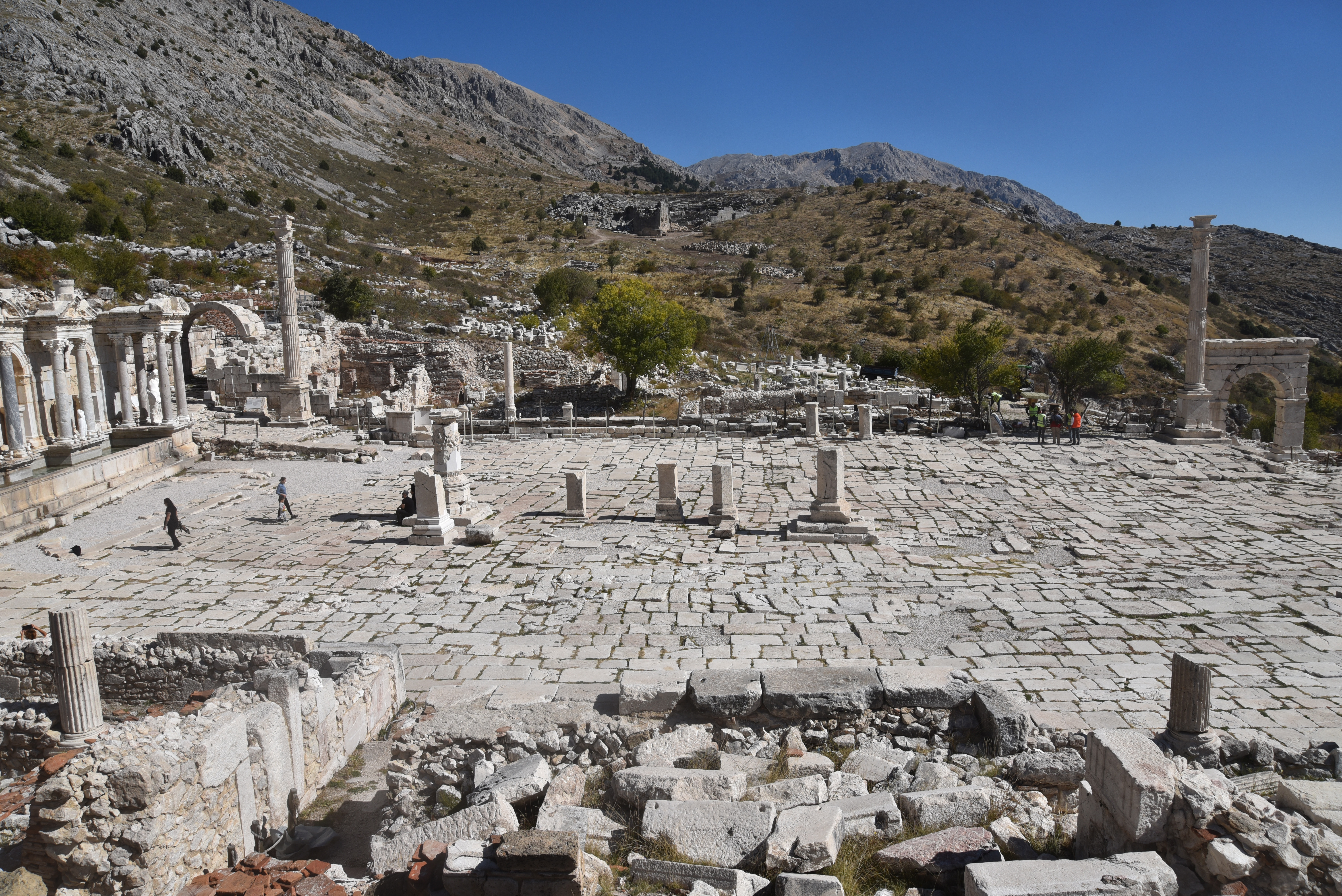
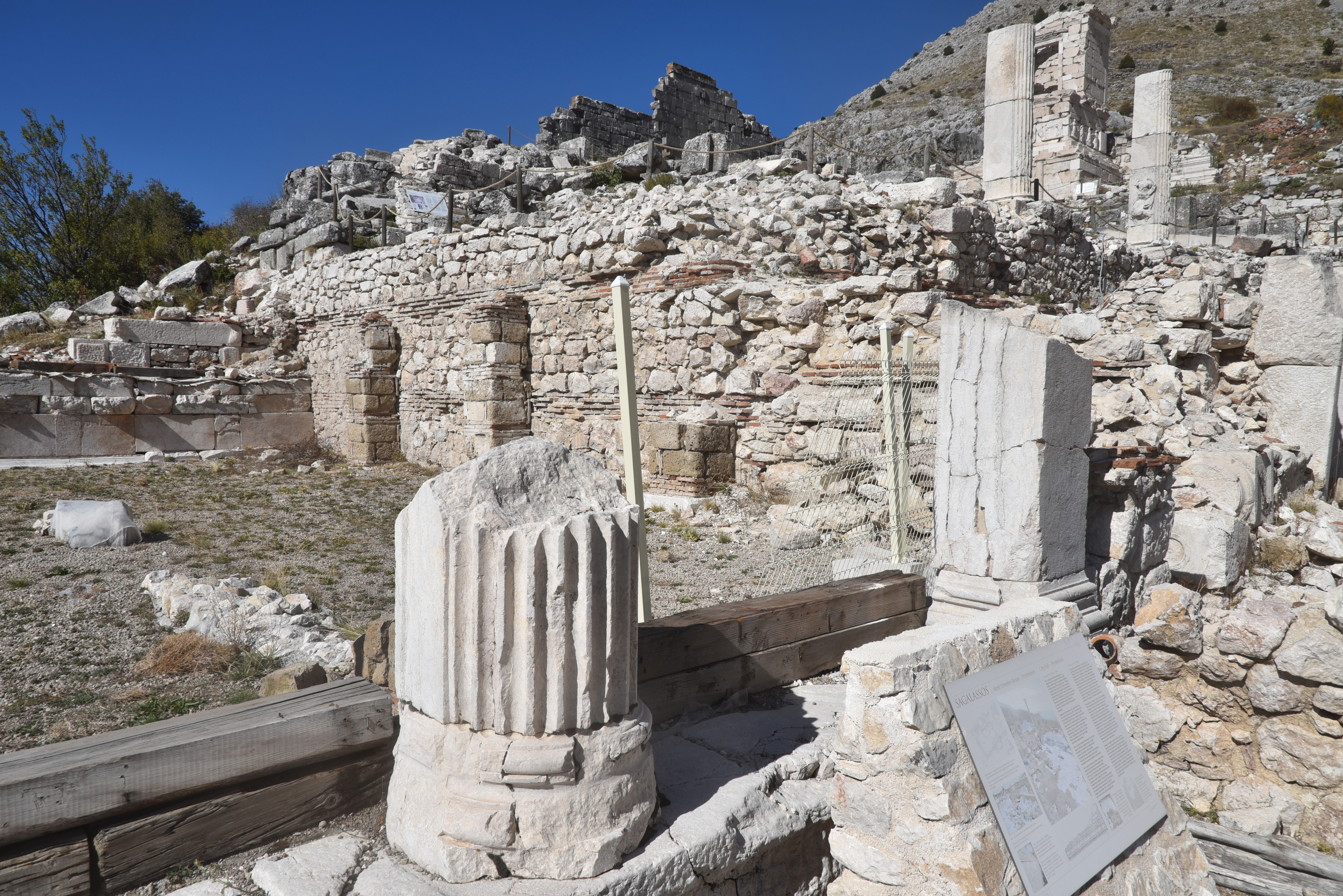
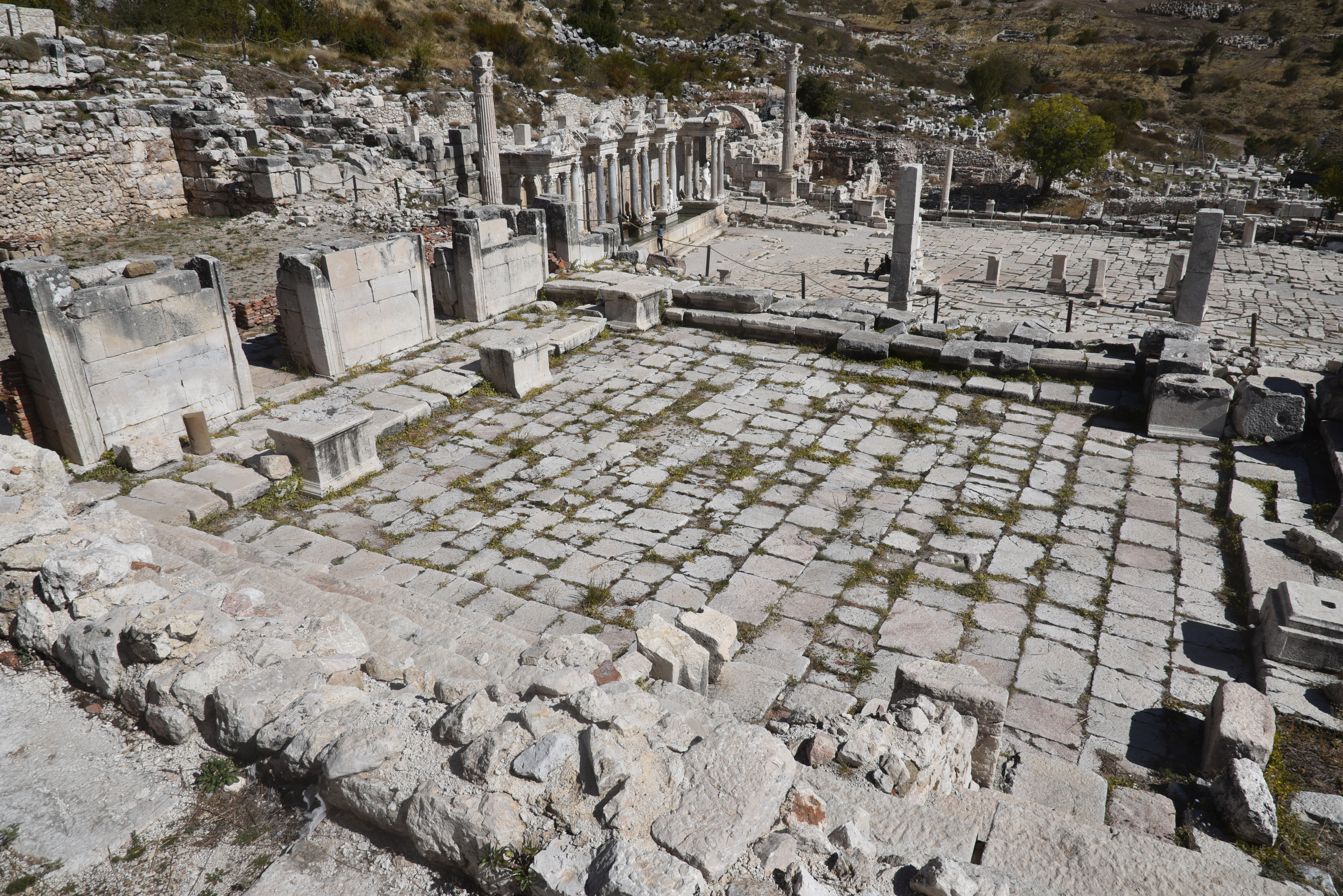
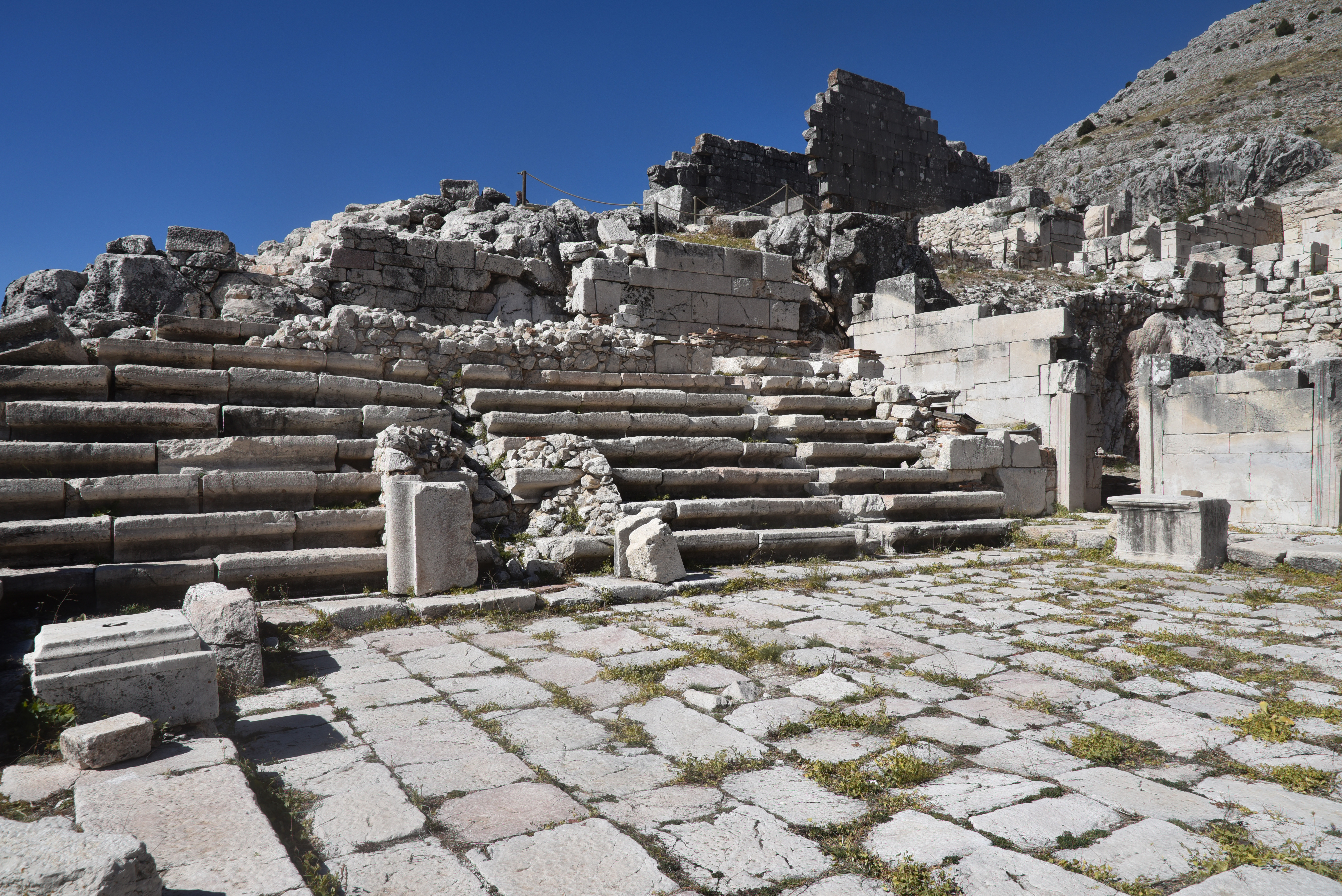
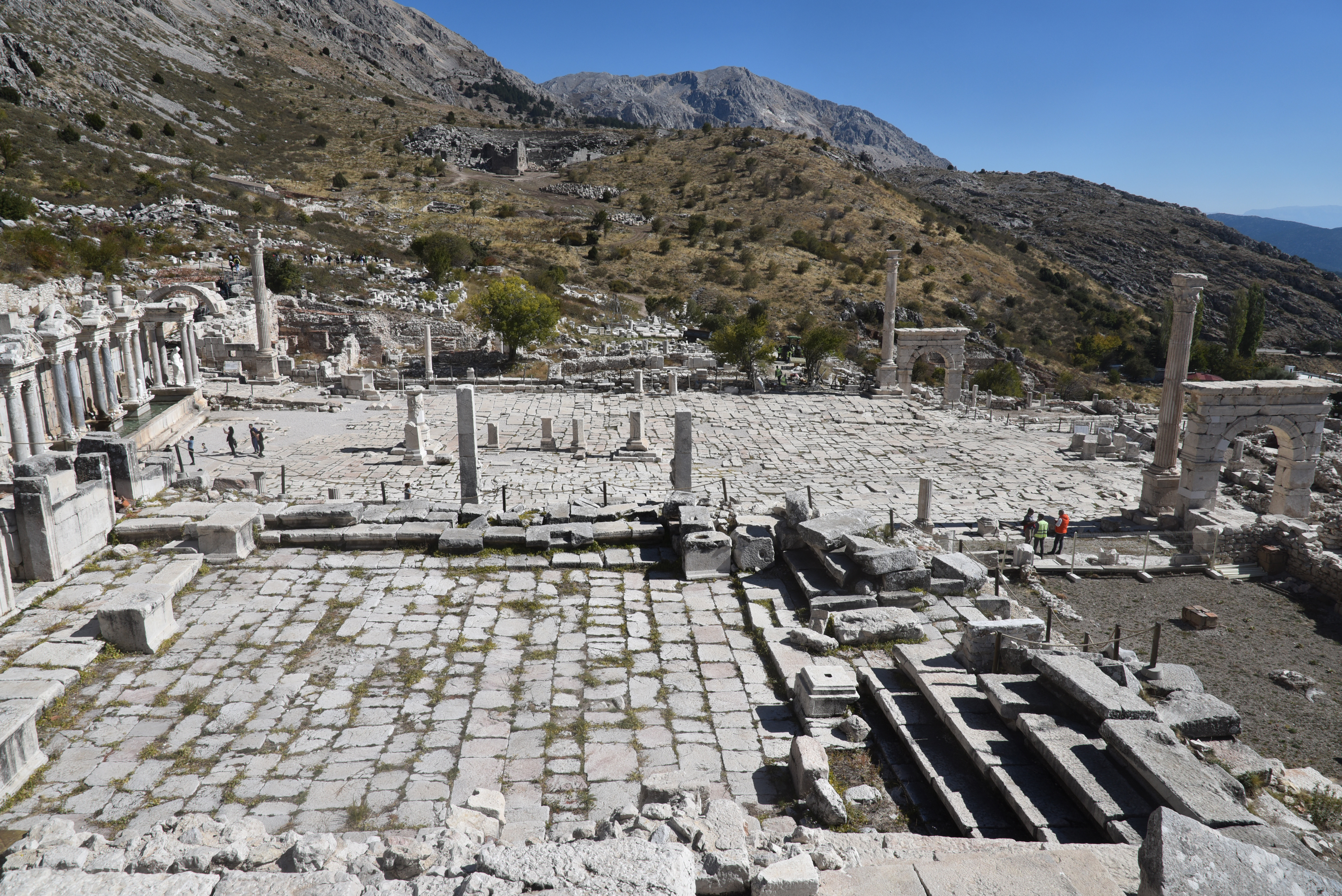
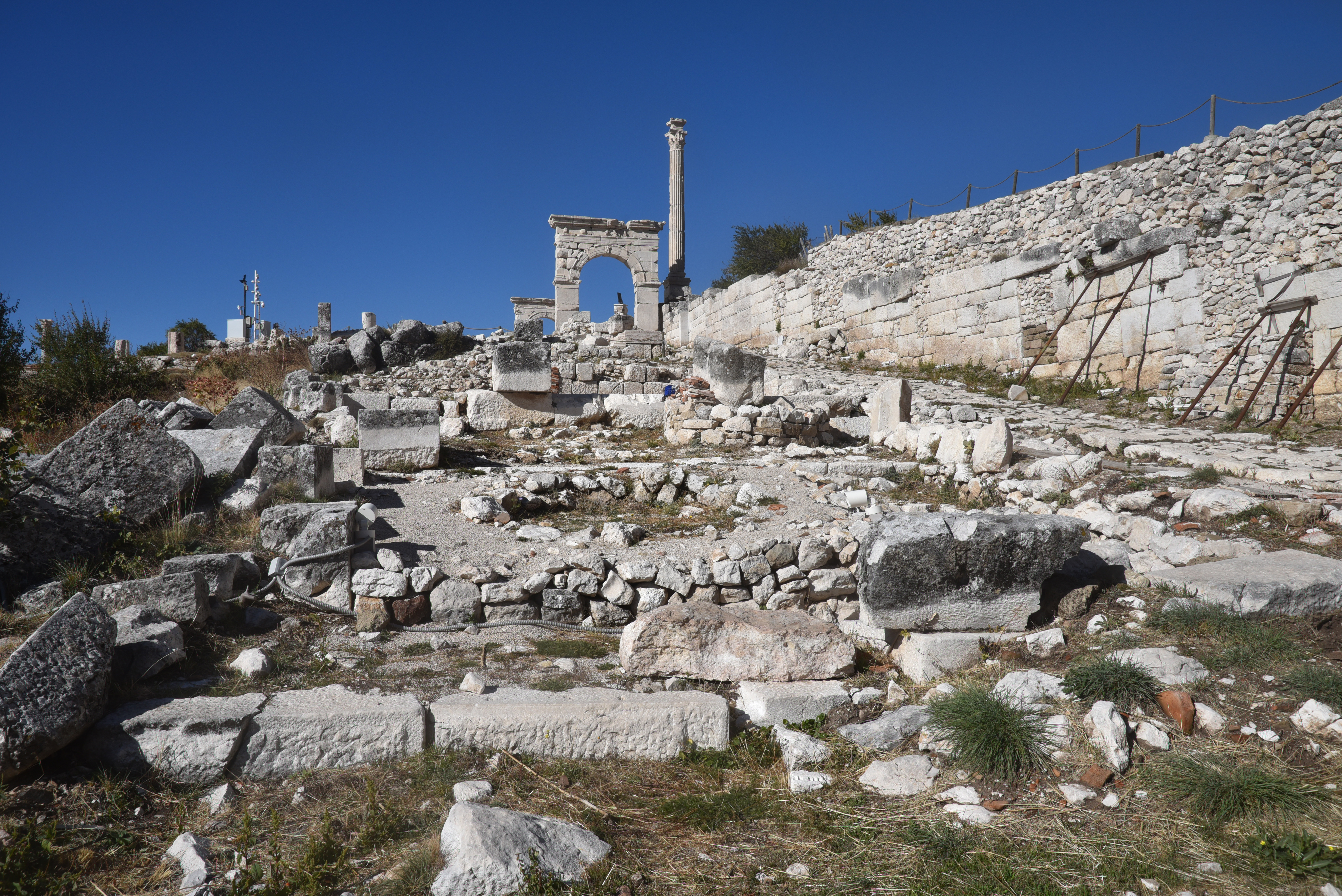
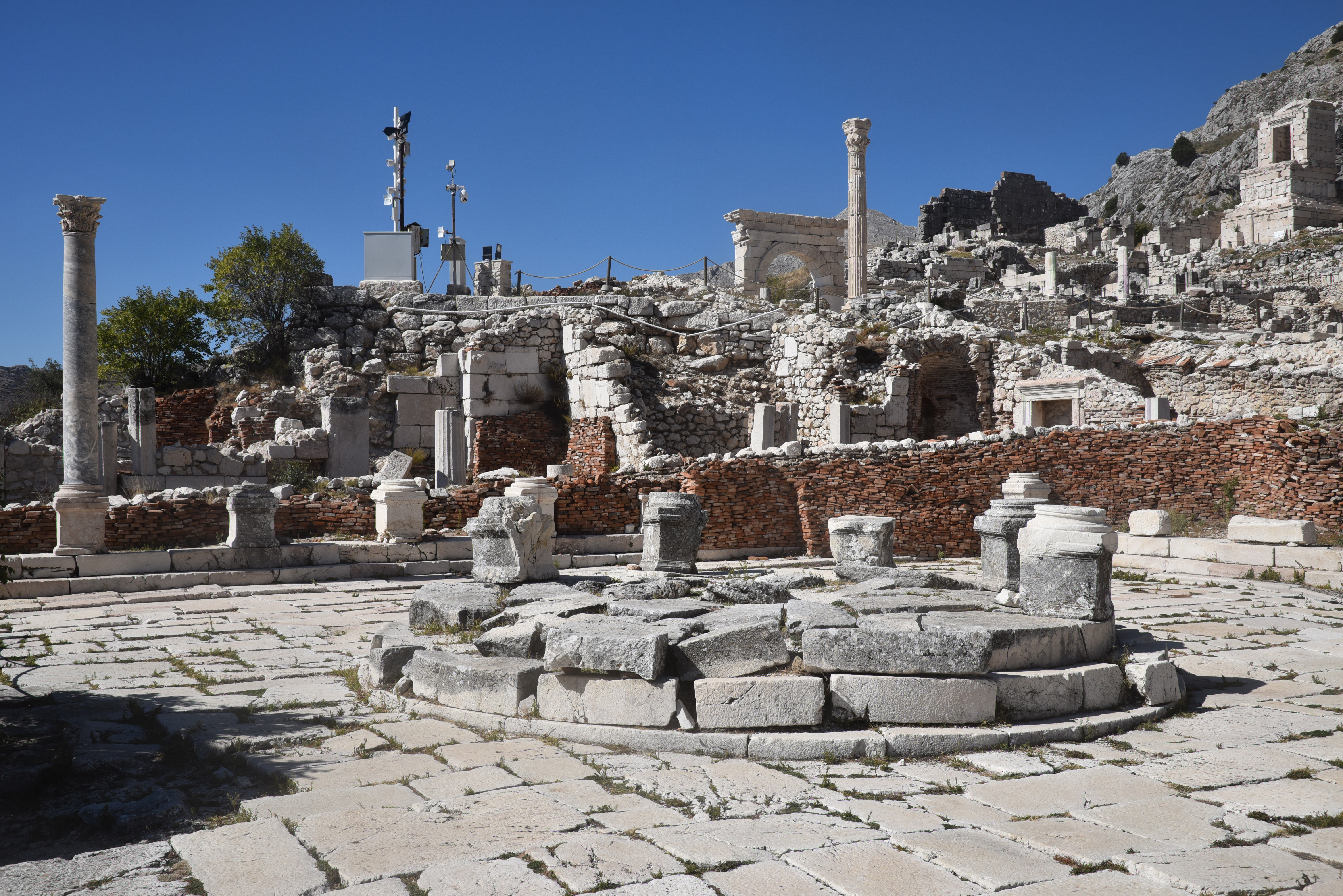
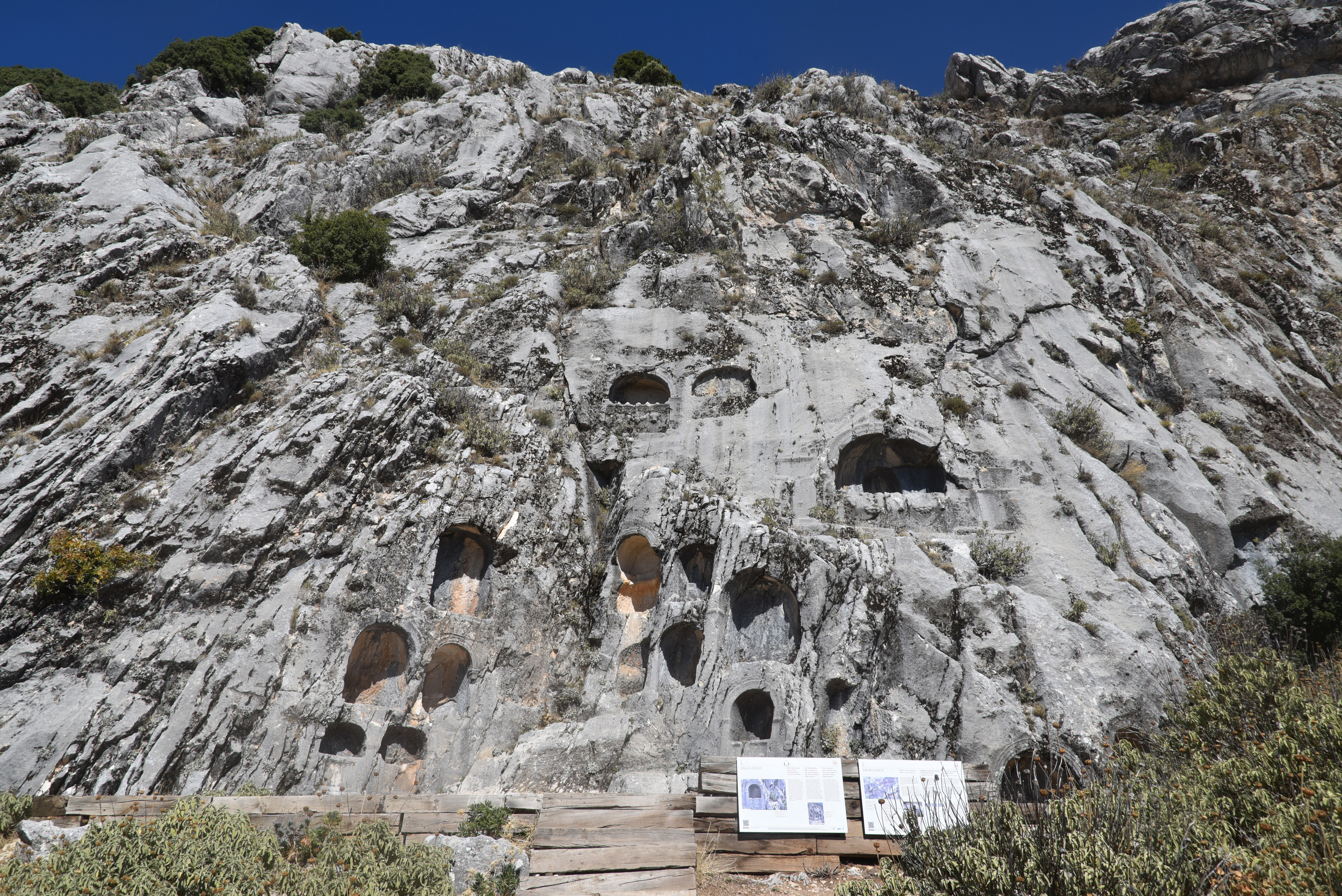
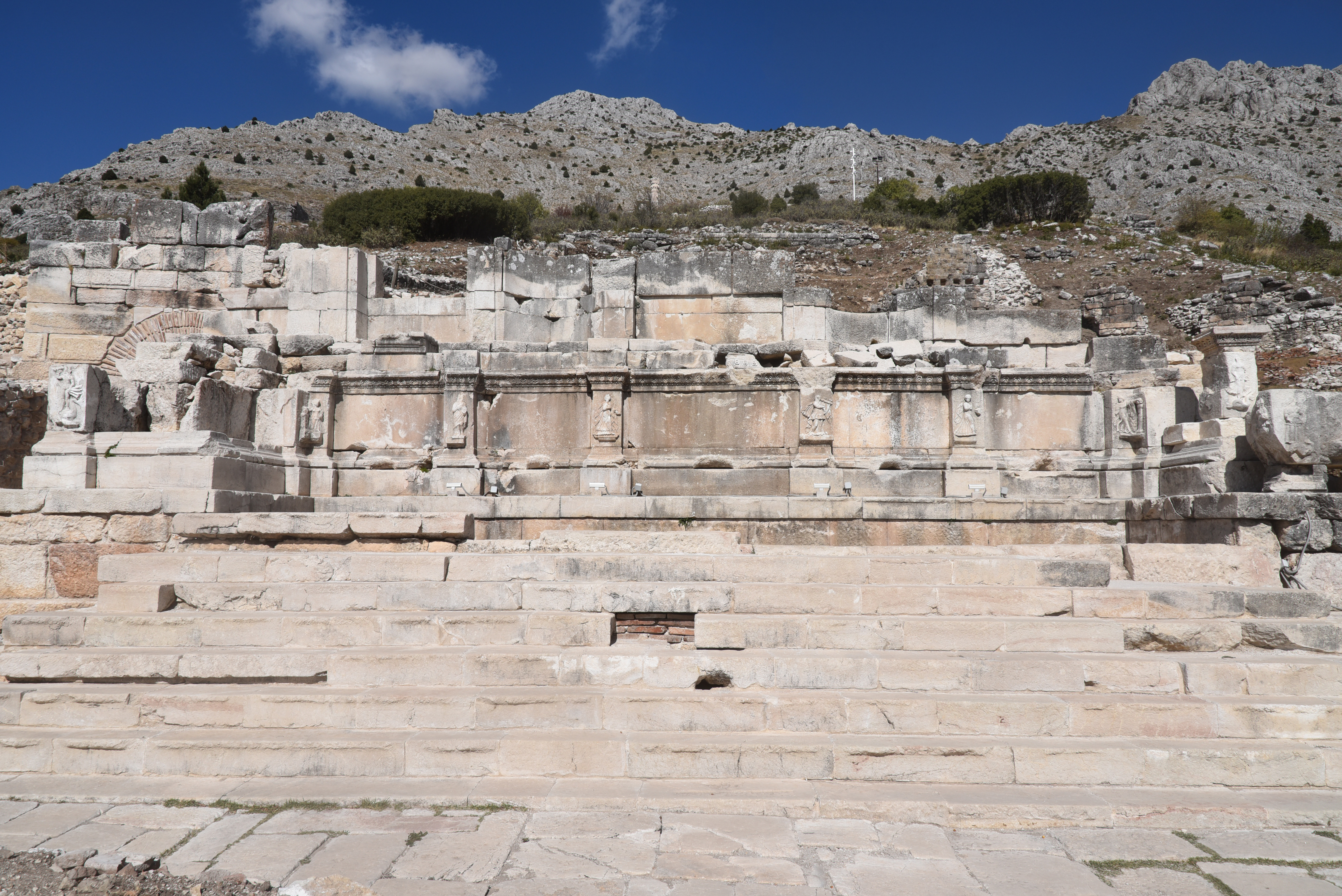
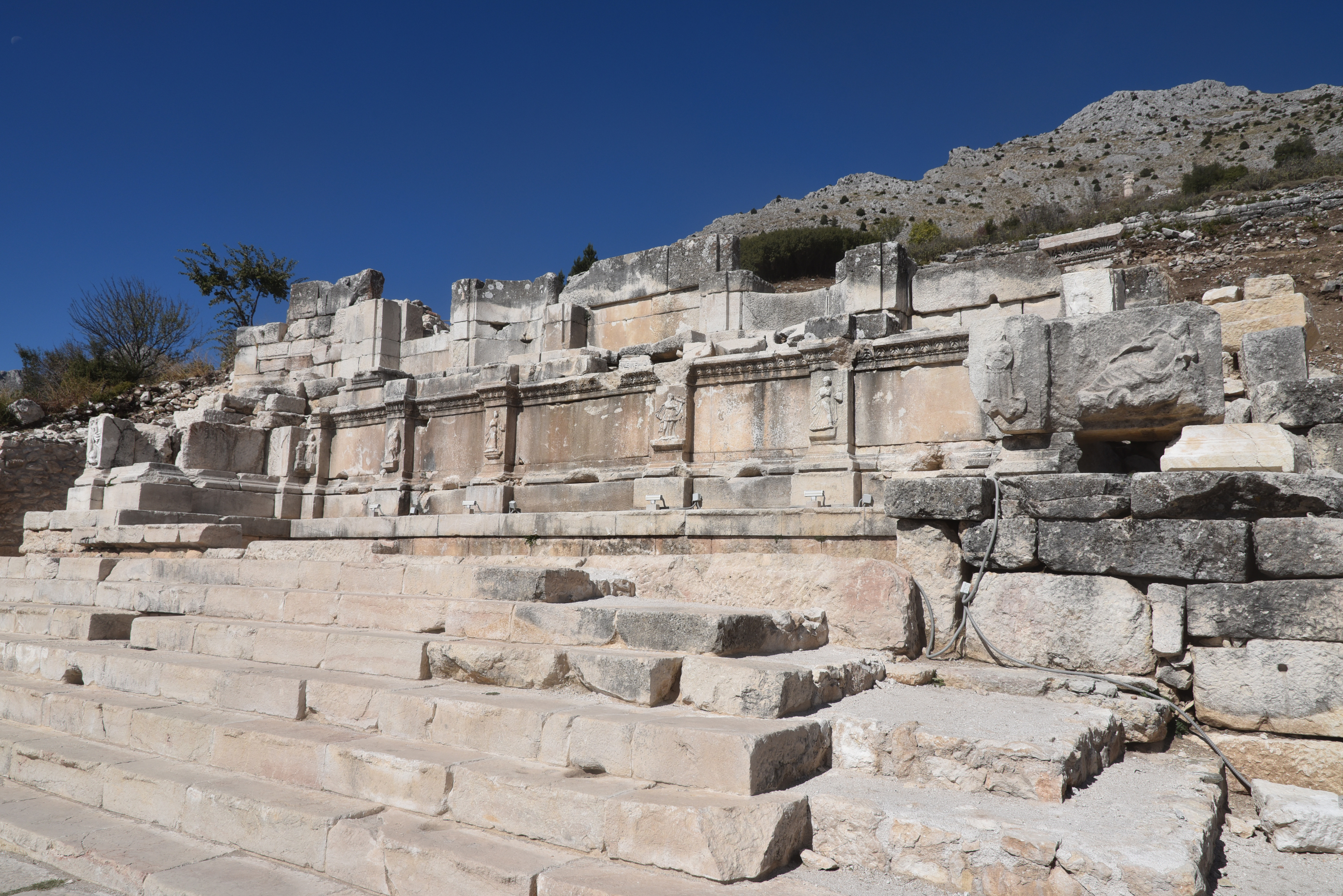
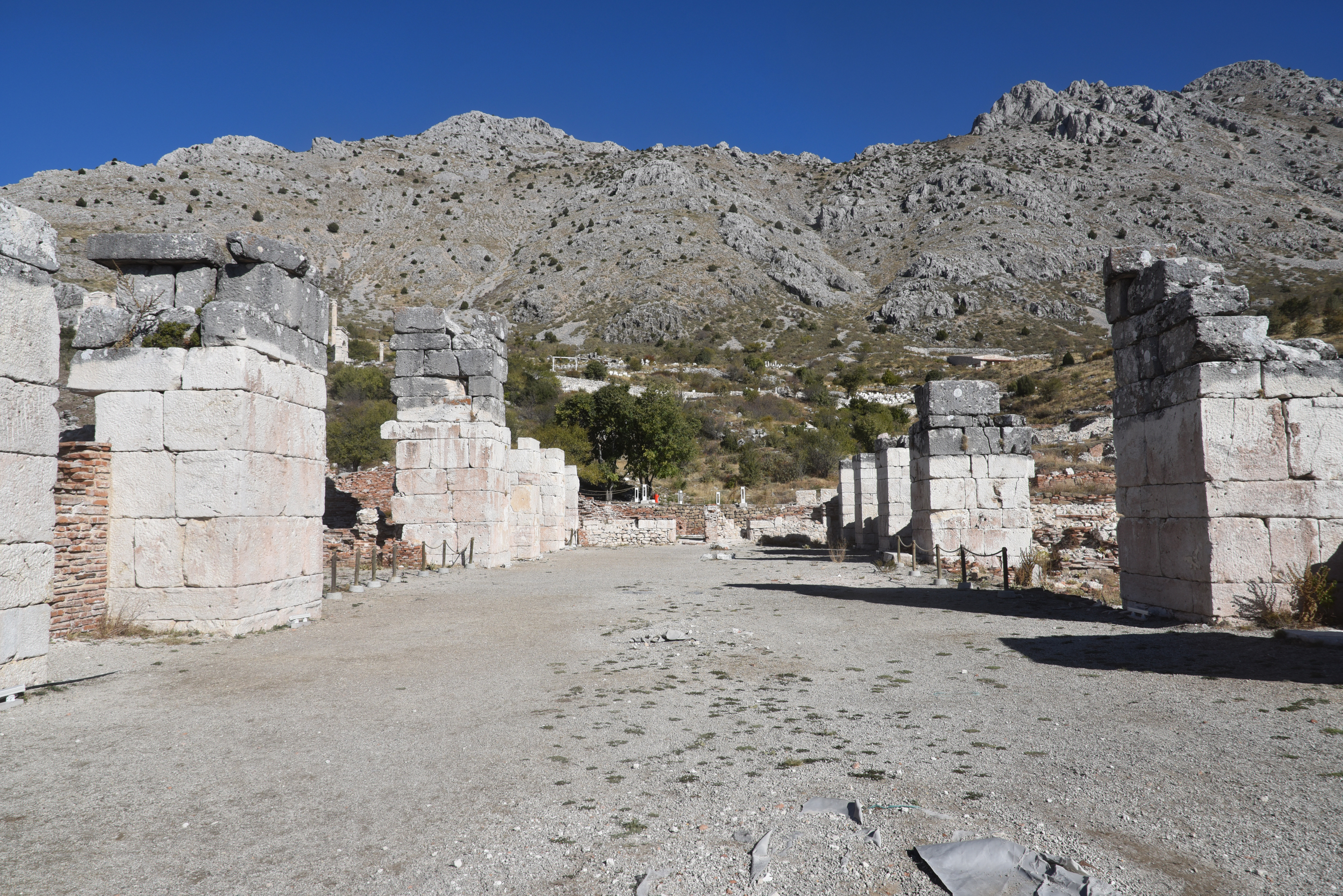
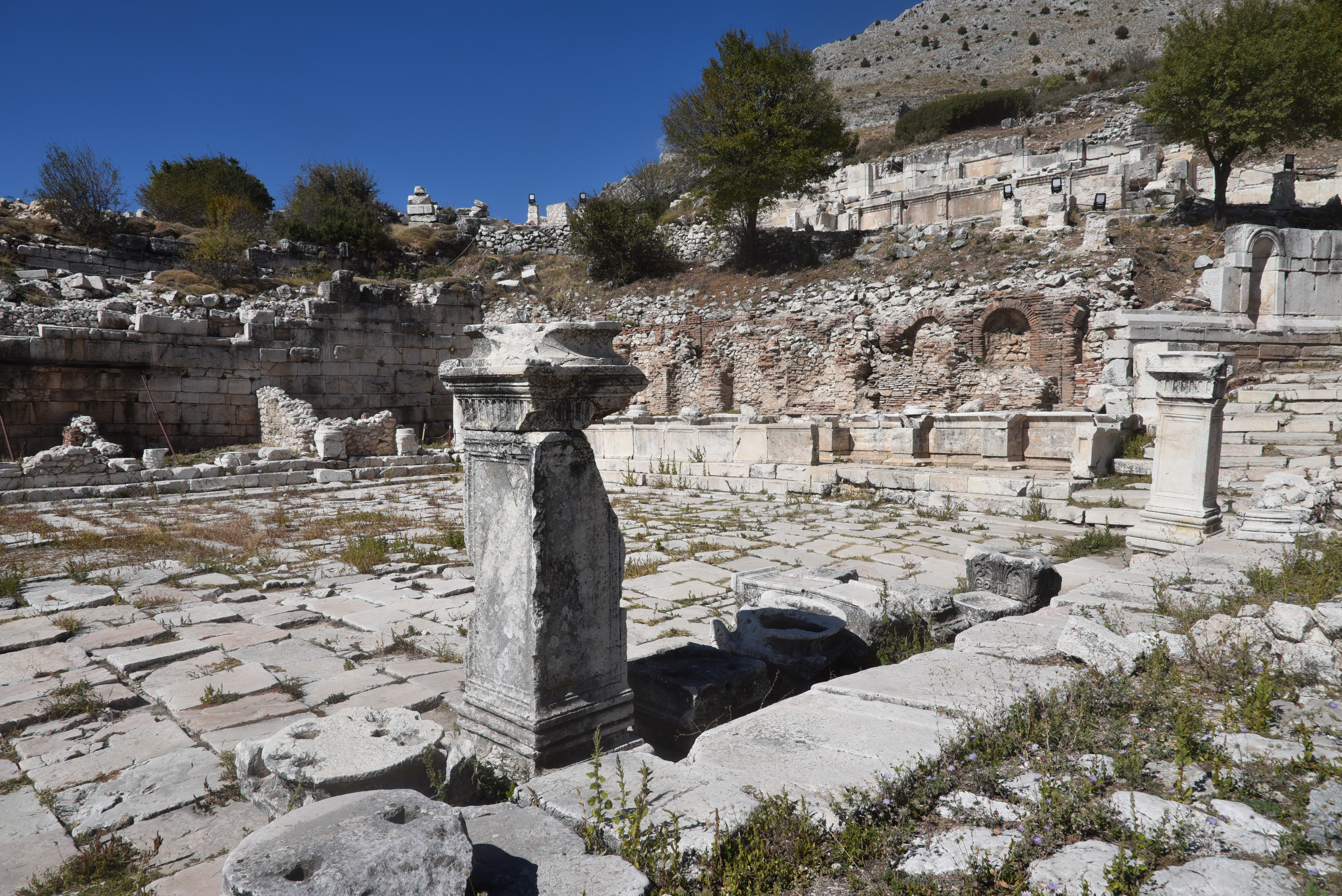
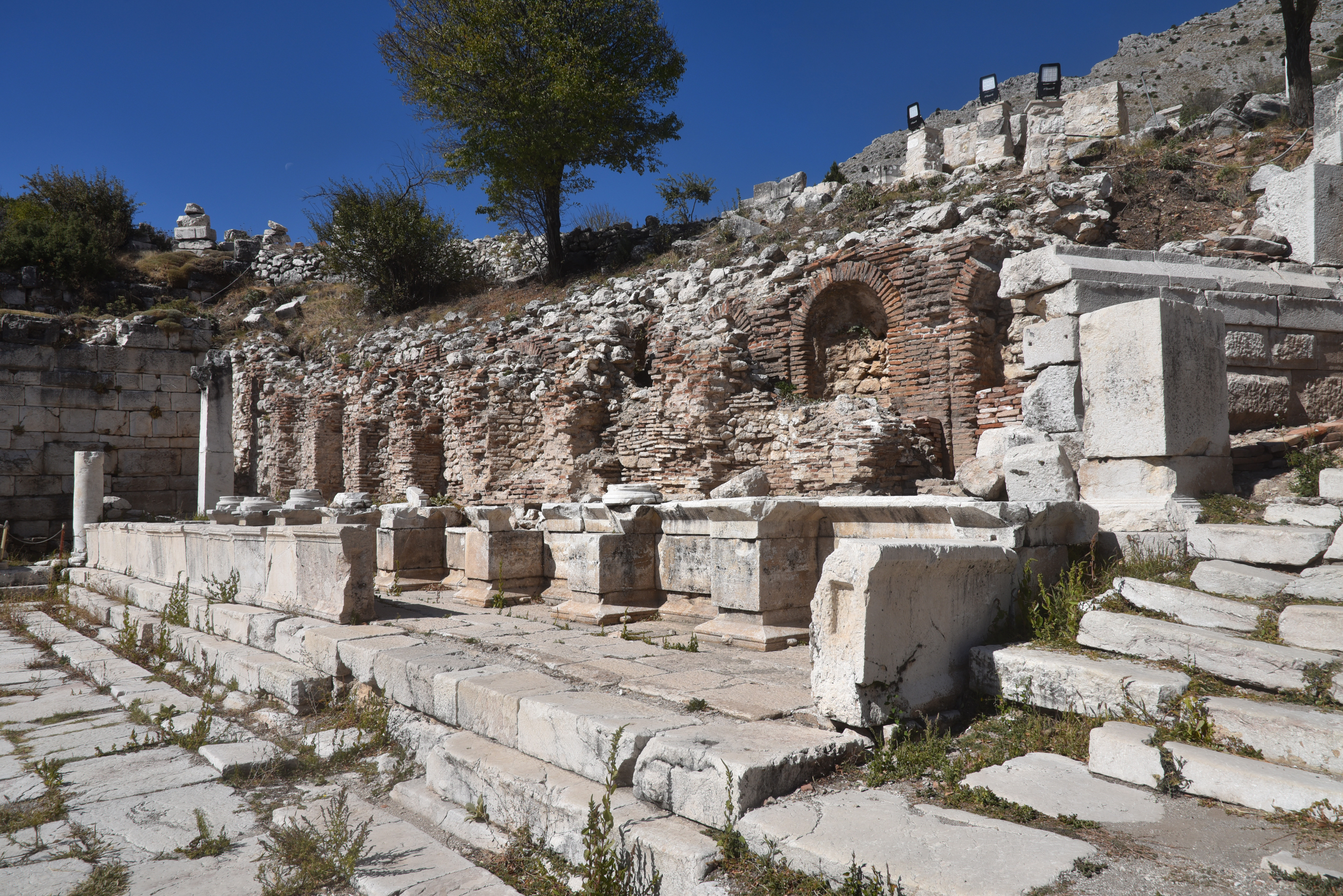
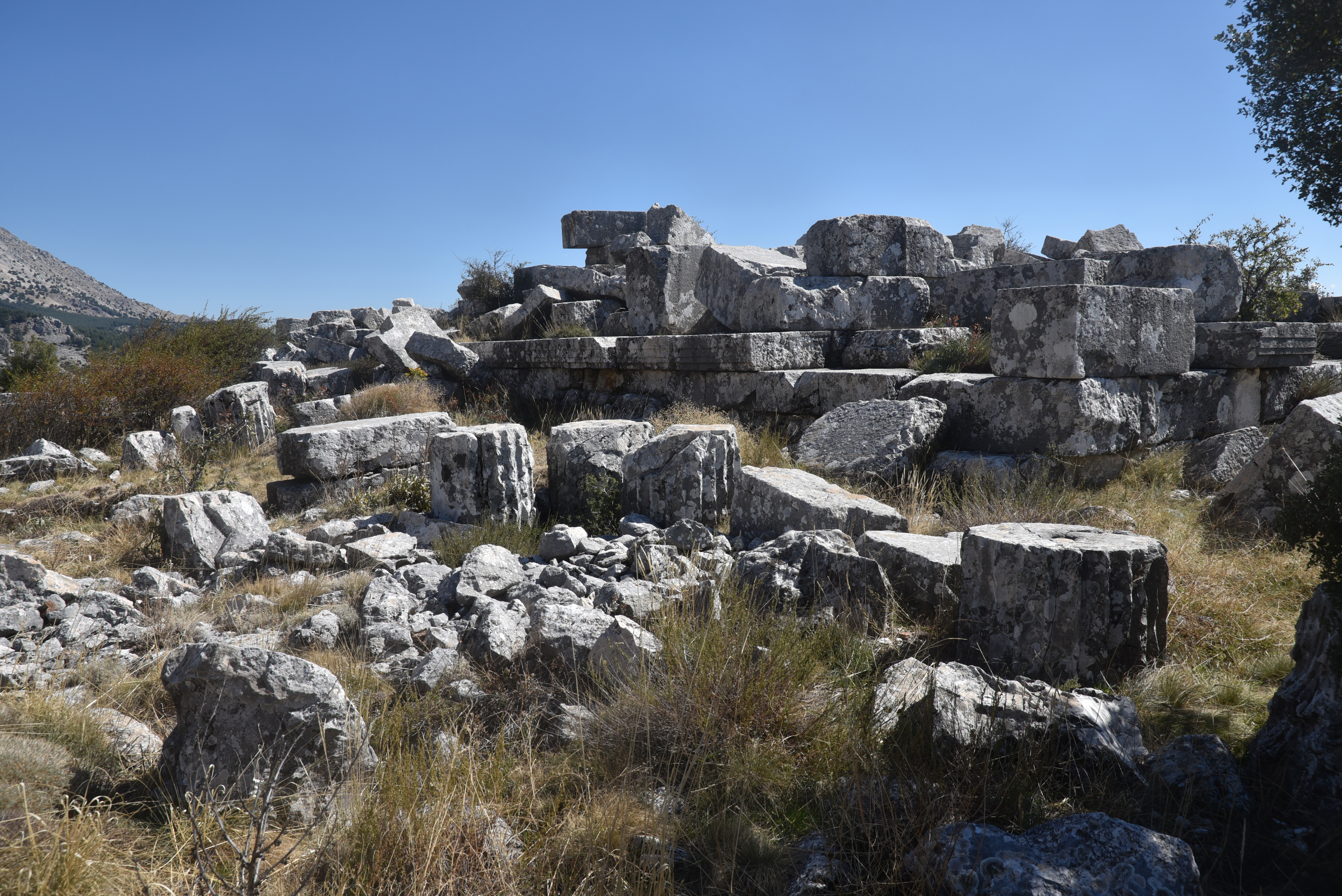
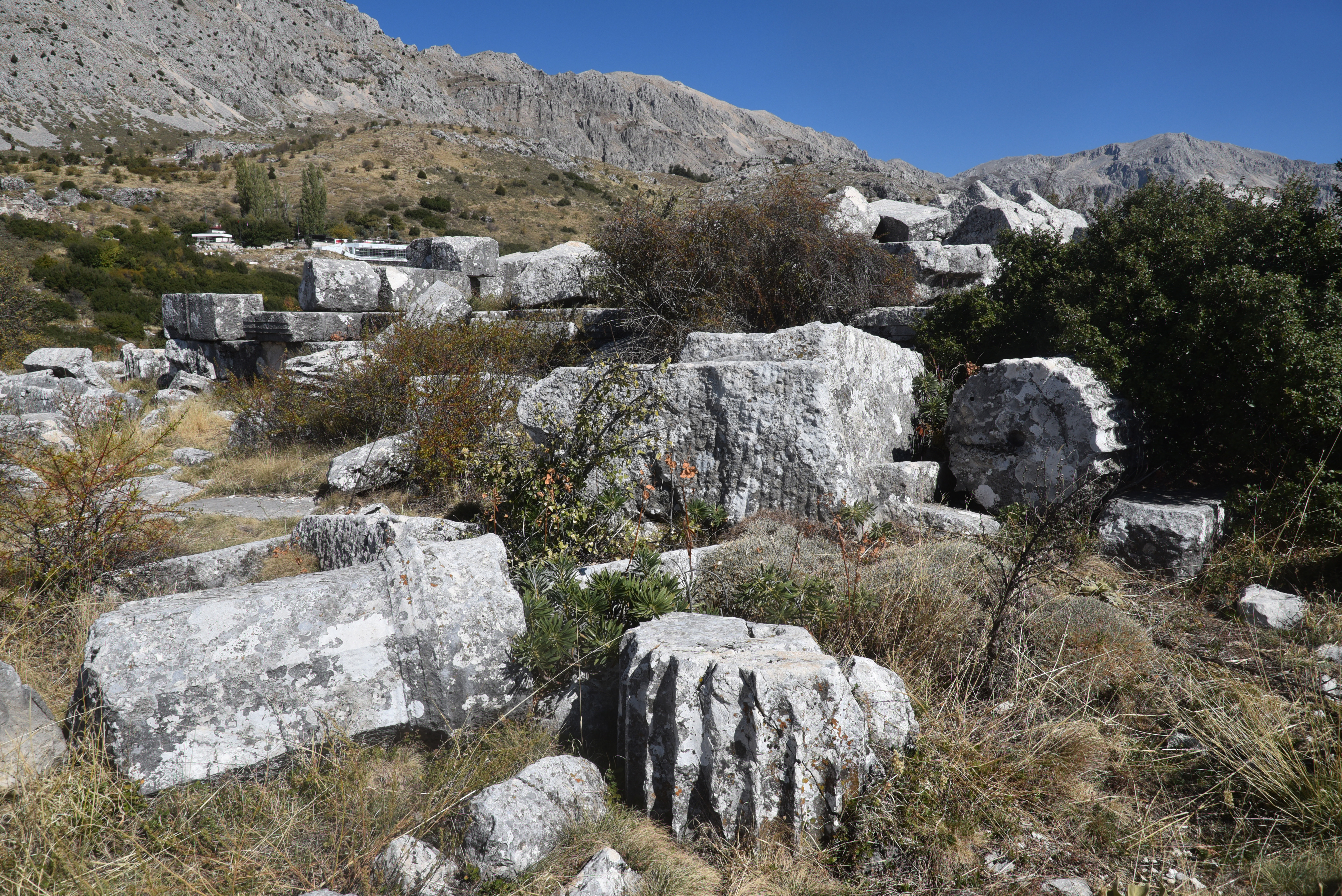
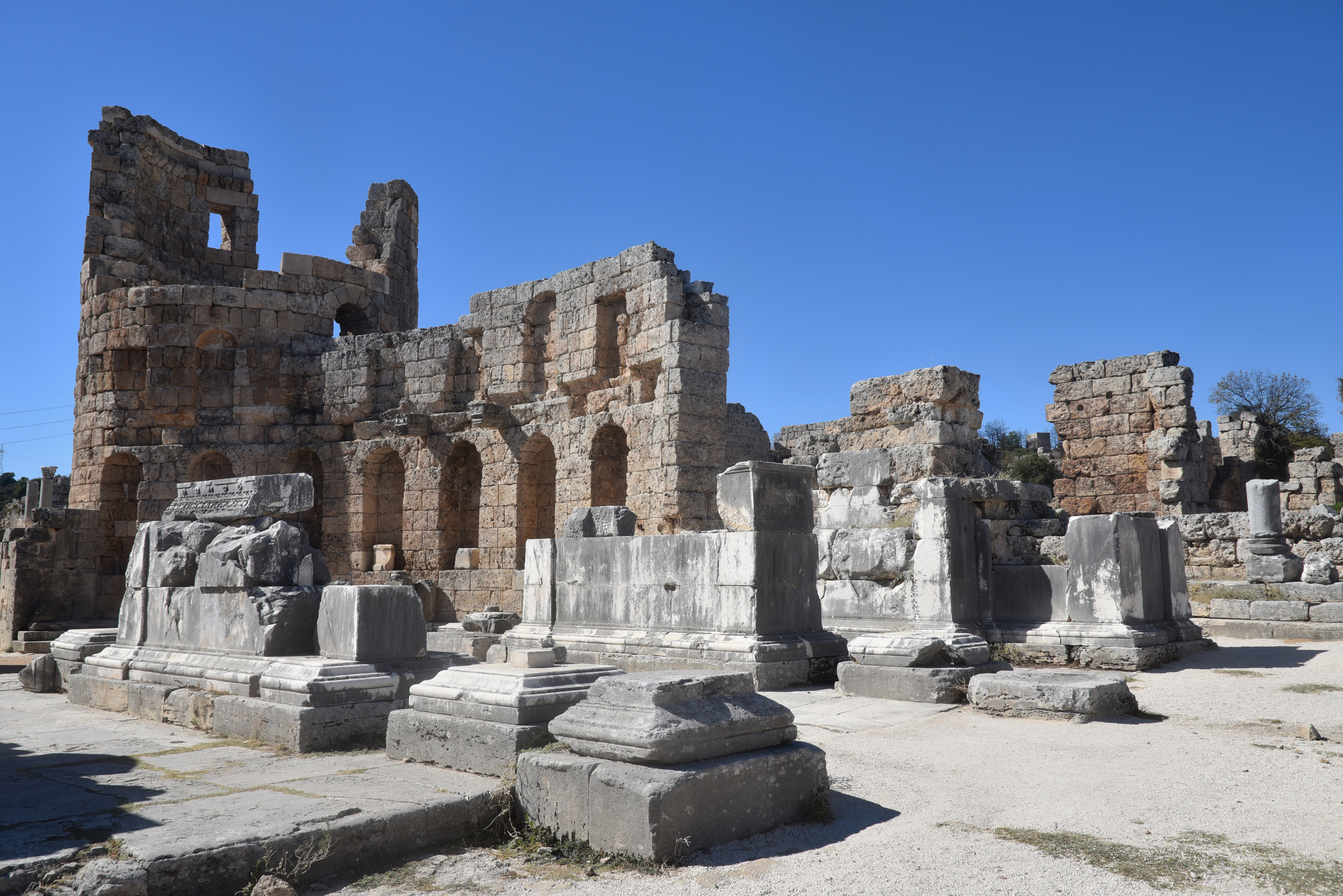
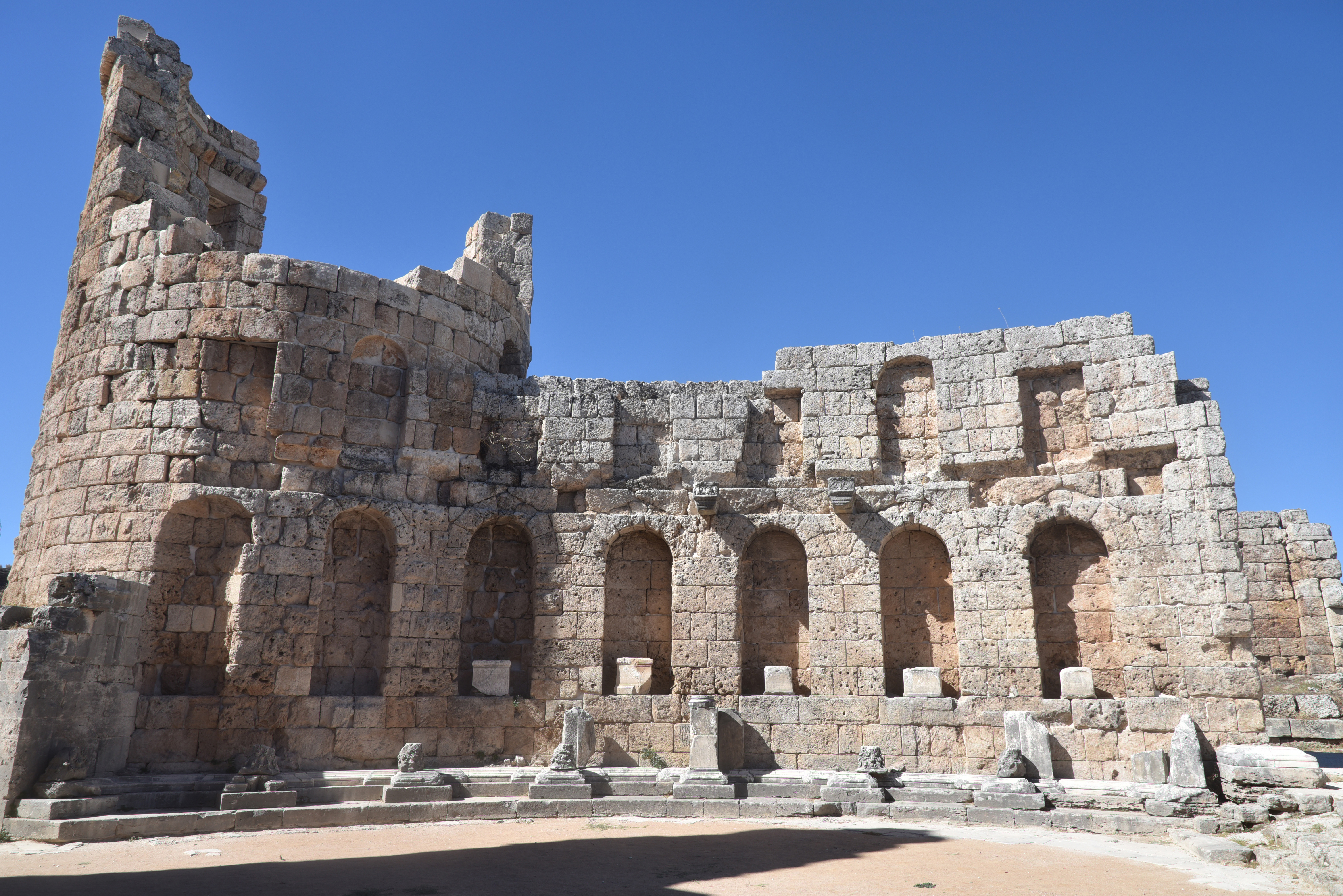
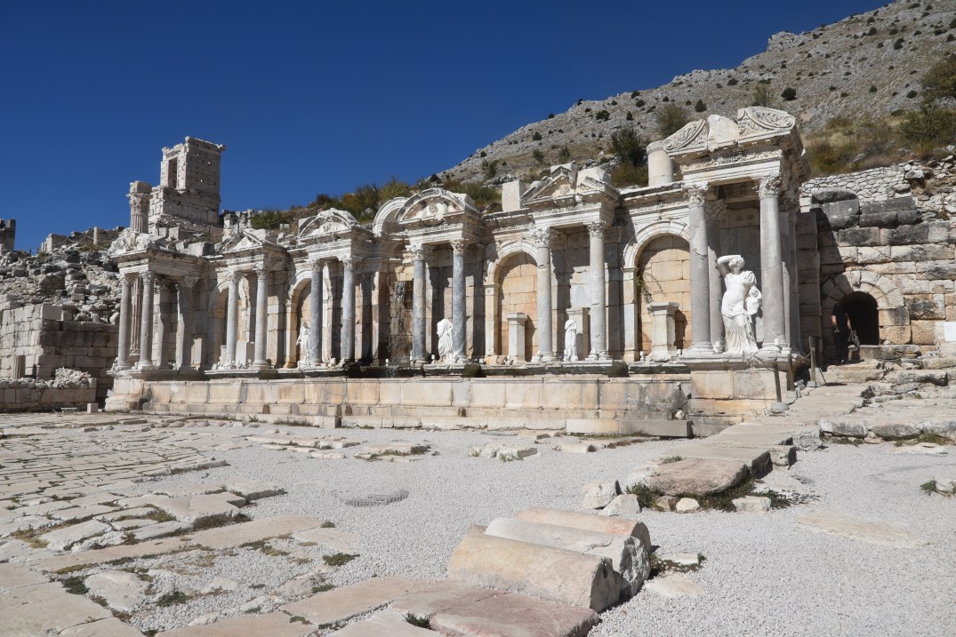
The Roman Theatre, built at an altitude of 1574 metres on a sloping plane between AD 120 and 200 over the remains of a smaller predecessor.The seating area (cavea) of the Roman theatre is divided into wedges (cunei). Above the first part of the cavea, the “belt” (diazoma) is clearly visible, and above it, a second seating area.The walkway (diazoma) that runs around the length of the cavea. The wall and its openings lead to a vaulted pedestrian passageway.The stage area (skene) of the Roman theatre was designed to be one story high, providing the audience with an exceptional view of the scenery, dominated by Alexander’s Hill.Largely built on a natural slope, the south-western part of the cavea rests on radially situated vaulted rooms, with the main entrance in one of them.The Roman theatre with the Upper Agora in the background.The Late Hellenistic fountain house, built during the 1st century BC as a U-shaped portico.View of the Upper Agora from the Roman Theatre.View of the Upper Agora from the northeast. The Upper Agora was a trapezoidal square covering approximately 2,380 m², featuring honorific columns and statue pedestals.The Upper Agora with the Antonine Nymphaeum along its northern edge.The Upper Agora, looking north.The Upper Agora looking west towards the early Imperial bouleuterion.The Antonine Nymphaeum is one of the most remarkable monuments of the city. It is an elaborately decorated and single-storied fountain of aedicula type with projecting side wings, dating to the reign of Marcus Aurelius. It replaced an Augustan Doric stoa-like fountain.The Antonine Nymphaeum was elaborately decorated with Corinthian columns and sculptures, including two large groups of Dionysos and a satyr in the lateral aediculae (side wings). The façade is articulated with niches, columns, and entablatures.At the base of the Antonine Nymphaeum, there was a broad water basin that was continuously supplied by Sagalassos’s sophisticated aqueduct system.The nymphaeum was significantly renovated in the 6th century AD after an earthquake. It was transformed into a dynastic monument for the family of its original builders, with added Christian elements in its design.The Upper Agora, looking east towards the Roman Theatre.The Prytaneion in the southwest corner of the Upper Agora, a significant public building built during the reign of Claudius (AD 41-54) that served as the office for city magistrates.The early Imperial Bouleuterion, the meeting place for the city council, where civic decisions and administrative matters were discussed and resolved.The Bouleuterion featured a U-shaped seating arrangement that accommodated approximately 220 council members.The Upper Agora with the early Imperial Bouleuterion in the foreground.The Upper Agora, looking southeast.The eastern side of the Upper Agora with a semi-circular seating bench (exedra) dated to the 1st half of the 1st century AD.The southeast access to the Upper Agora with the southeast honorific arch, dedicated to Claudius in AD 43–46, and the adjoining southeast honorific column.The southeast access to the Upper Agora with the southeast honorific arch, dedicated to Claudius in AD 43–46, the adjoining southeast honorific column, and the arch erected by Kallikles for Caligula in the background.View from the north of the central courtyard and tholos-shaped water basin of the Macellum (food market), financed by the city.The Macellum featured a central courtyard paved with stone and a tholos-shaped fountain built in the middle. The surrounding porticoes were funded by a high priest of the emperor cult during the reign of Commodus (AD 182–192) to commemorate an imperial victory.The Macellum operated as a food market until the second half of the 6th century, although parts of it were later used for waste disposal and craft activities, such as antler and bone working. In the early 6th century, the north portico of the macellum was rebuilt, and the market continued to function until the early 7th century AD.The southeast access to the Upper Agora.The Northwest Heroon, built during the reign of Augustus and believed to have honoured a young aristocrat.The Northwest Heroon.Based on its decoration, the Northwest Heroon may have been associated with the introduction of the Dionysus cult or the initiation of a Dionysiac festival in the city.The Northern Necropolis with arched recesses carved into the rock (arcosolia) dated to the 1st and 2nd centuries AD.The Urban Mansion, an expansive and luxurious urban palace built around AD 400. It consisted of more than 90 spaces spread across nine different levels, divided into public and private wings.The Urban Mansion featured palatial elements such as mosaic floors, wall paintings, and statuary, showcasing the wealth and social status of its owner, likely a member of the emerging super-elite composed of “principals,” “honorati,” and bishops.The Roman Odeon, constructed during the early Imperial period. It could accommodate around 2,500 people.The two-storey late Hadrianic Nymphaeum, a monumental fountain built during the reign of Hadrian and completed by his successor, Antoninus Pius.Hadrianic Nymphaeum was located on a plaza above and behind the Lower Agora. It featured a straight rear wall with two superposed rows of nine niches each and was adorned with a two-storey columnar screen of isolated columns, creating a grand and elaborate architectural display.During the Severan dynasty, the undecorated upper structure of the nymphaeum was replaced with an elaborately decorated entablature featuring small Victories, likely commemorating the Parthian victories of the Severan emperors.The Odeon and the Hadrianic Nymphaeum.
Lower City
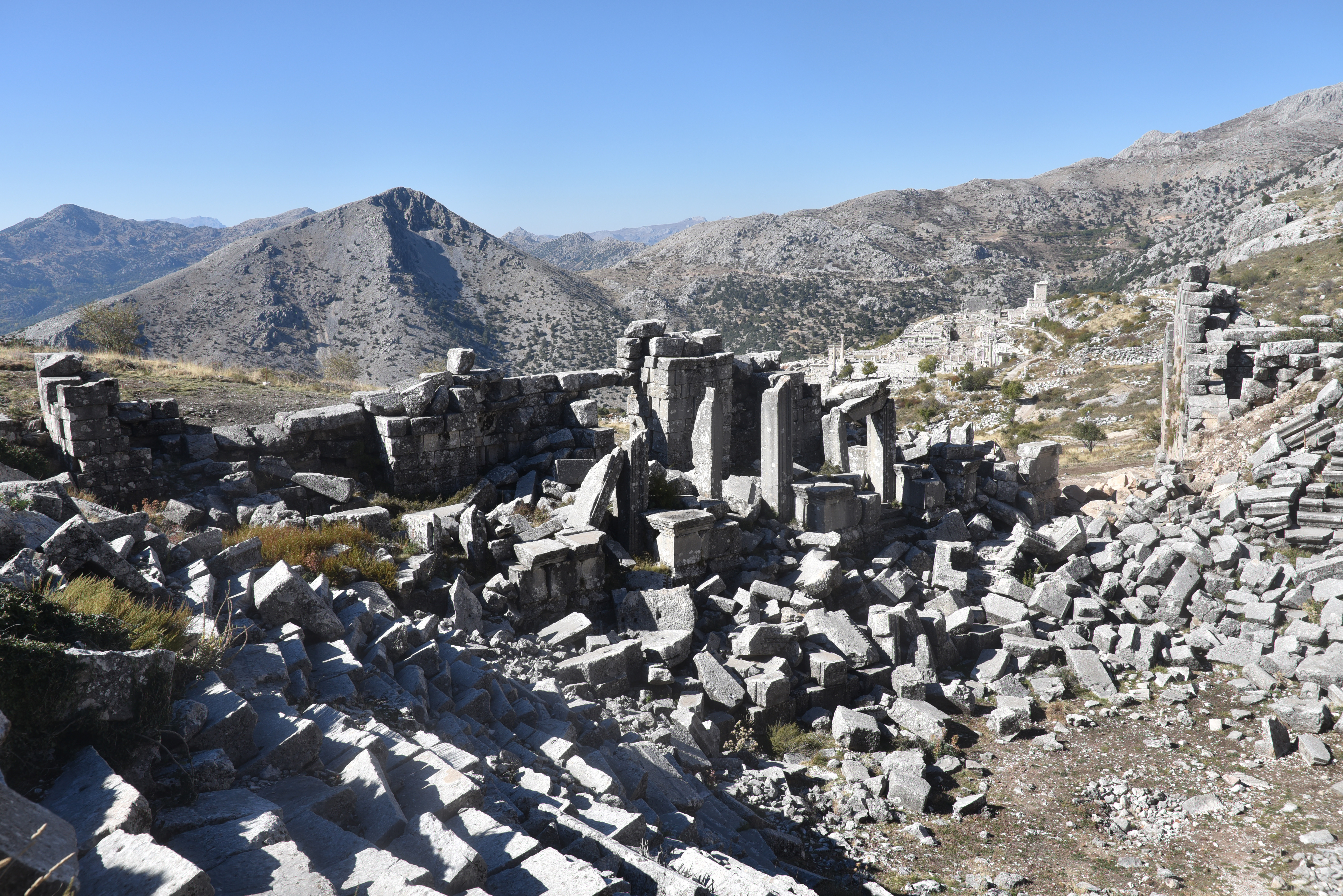
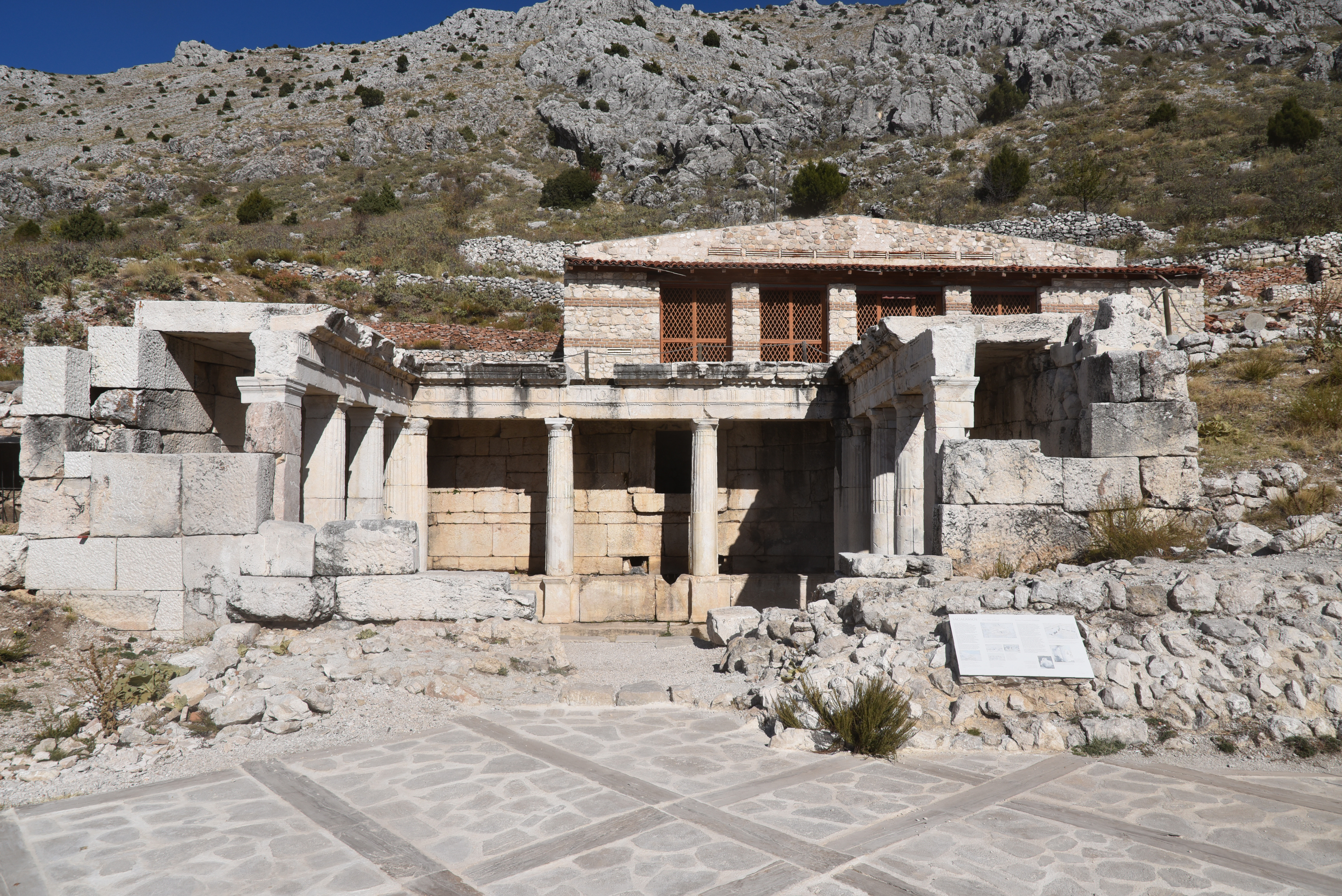
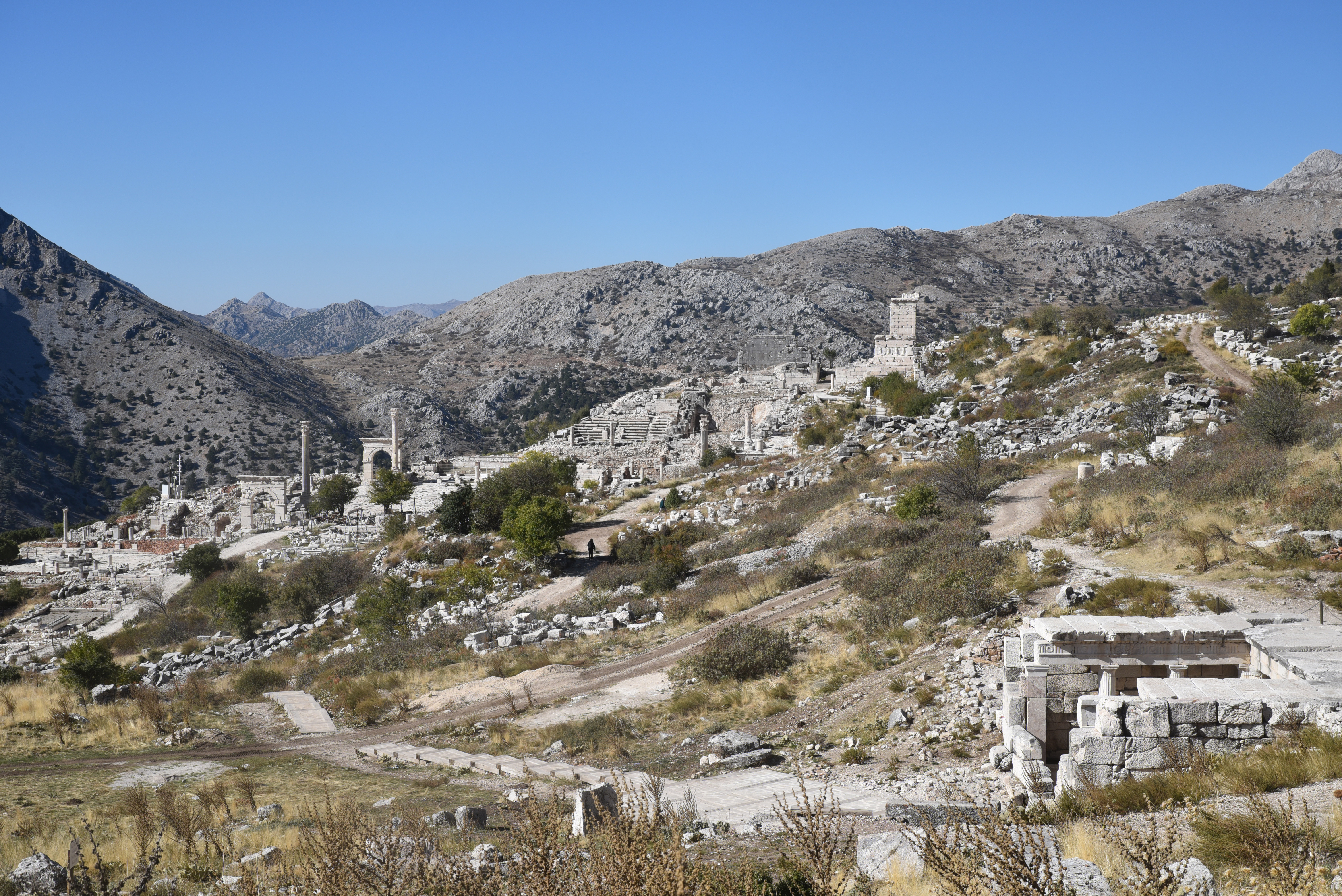
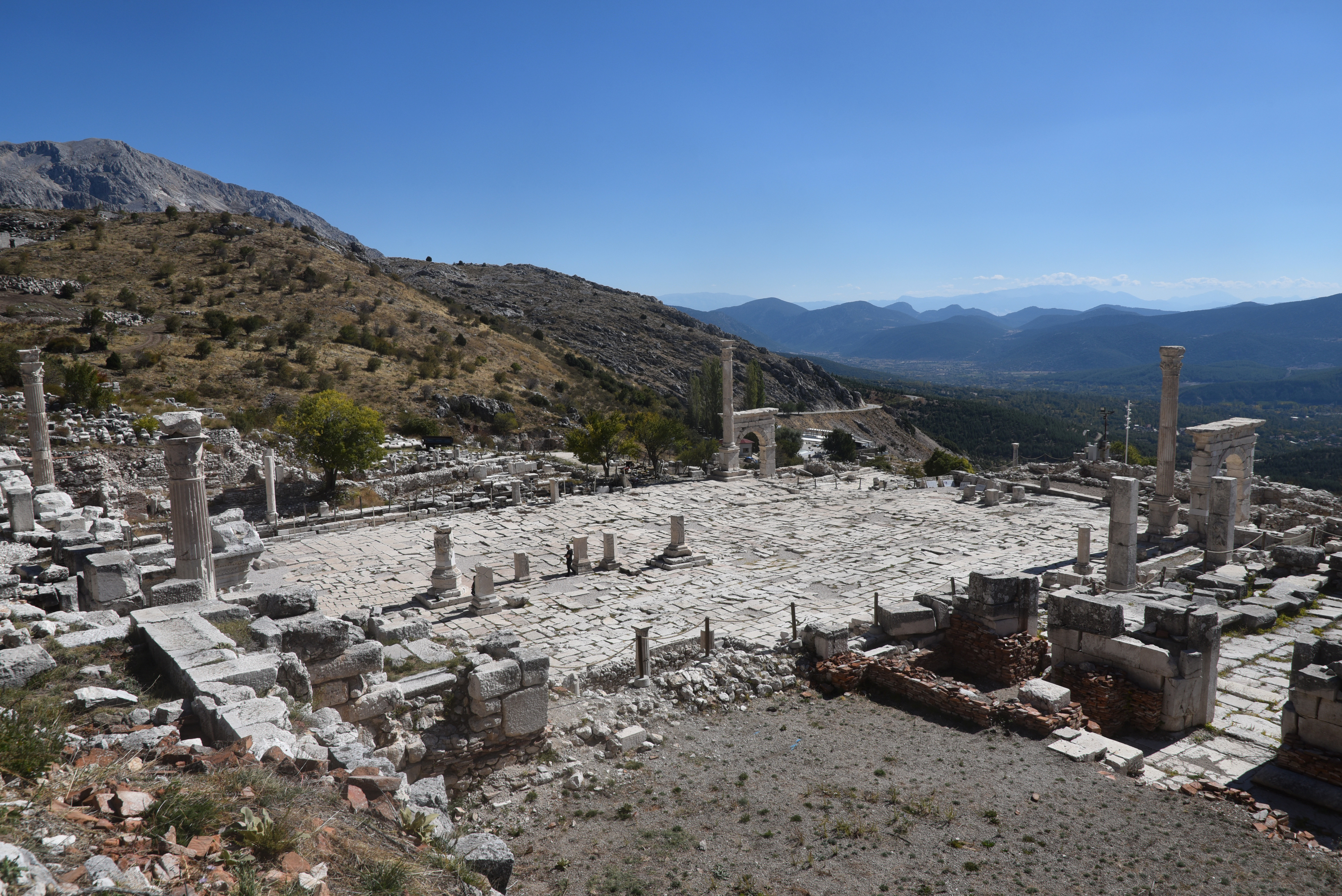
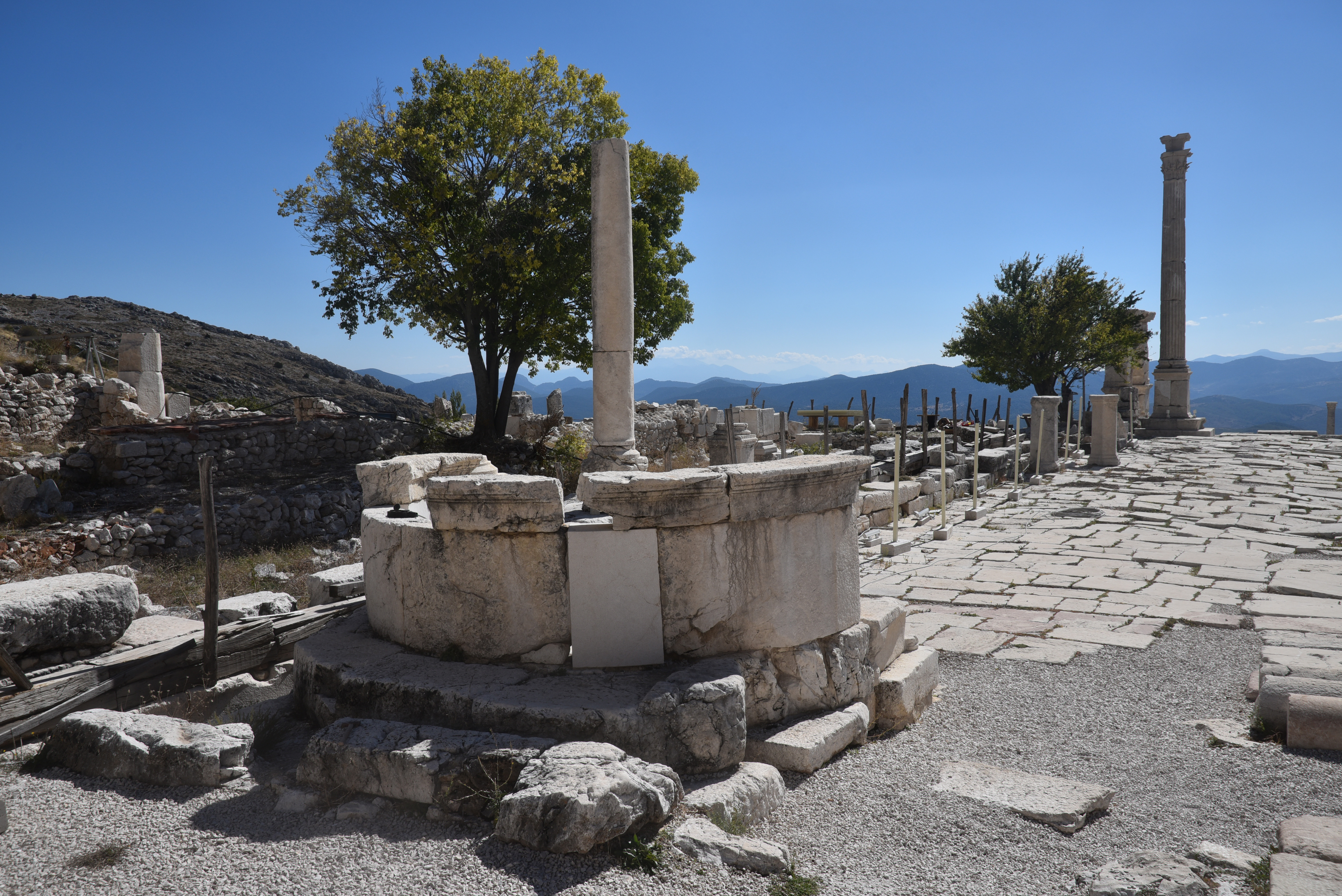
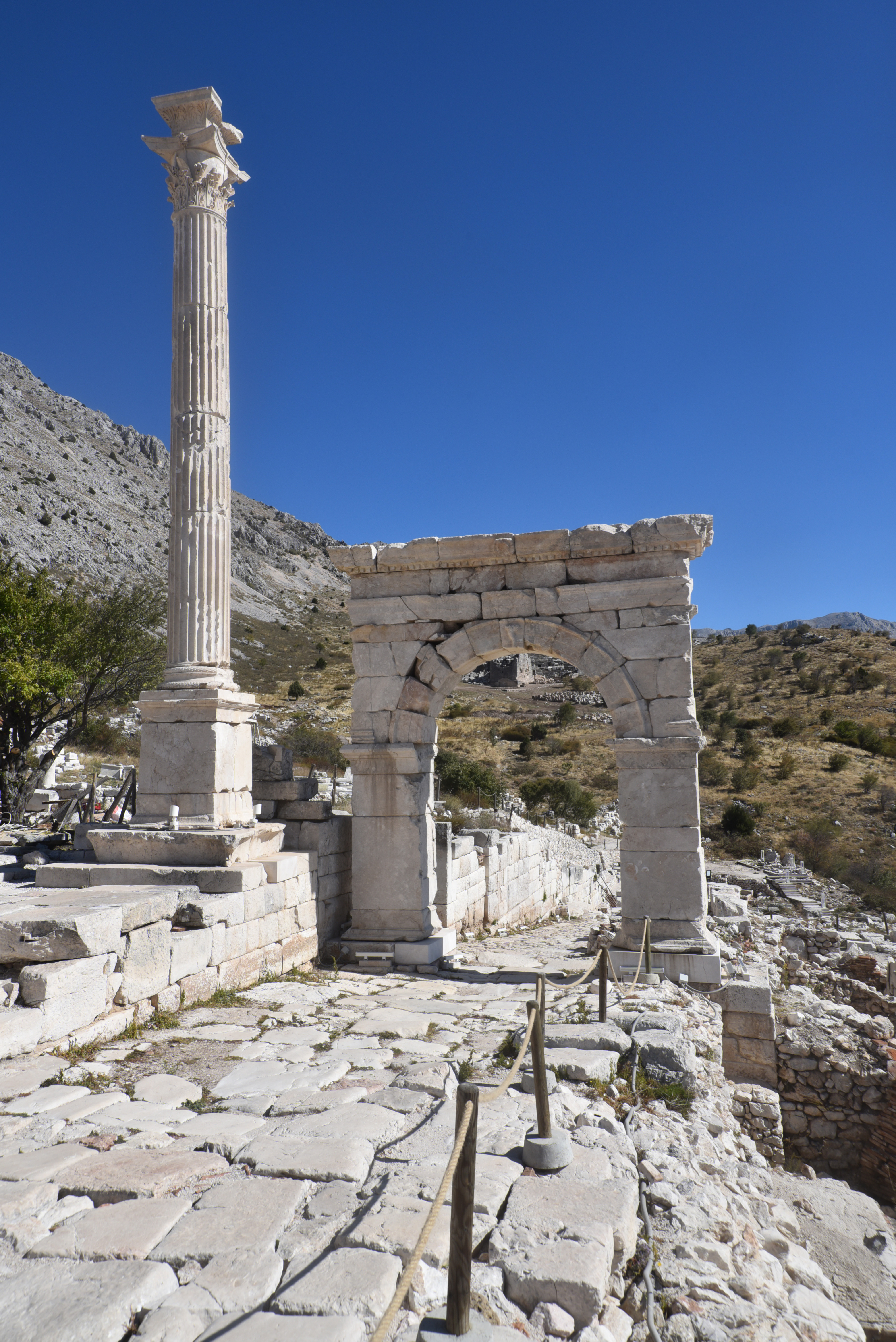
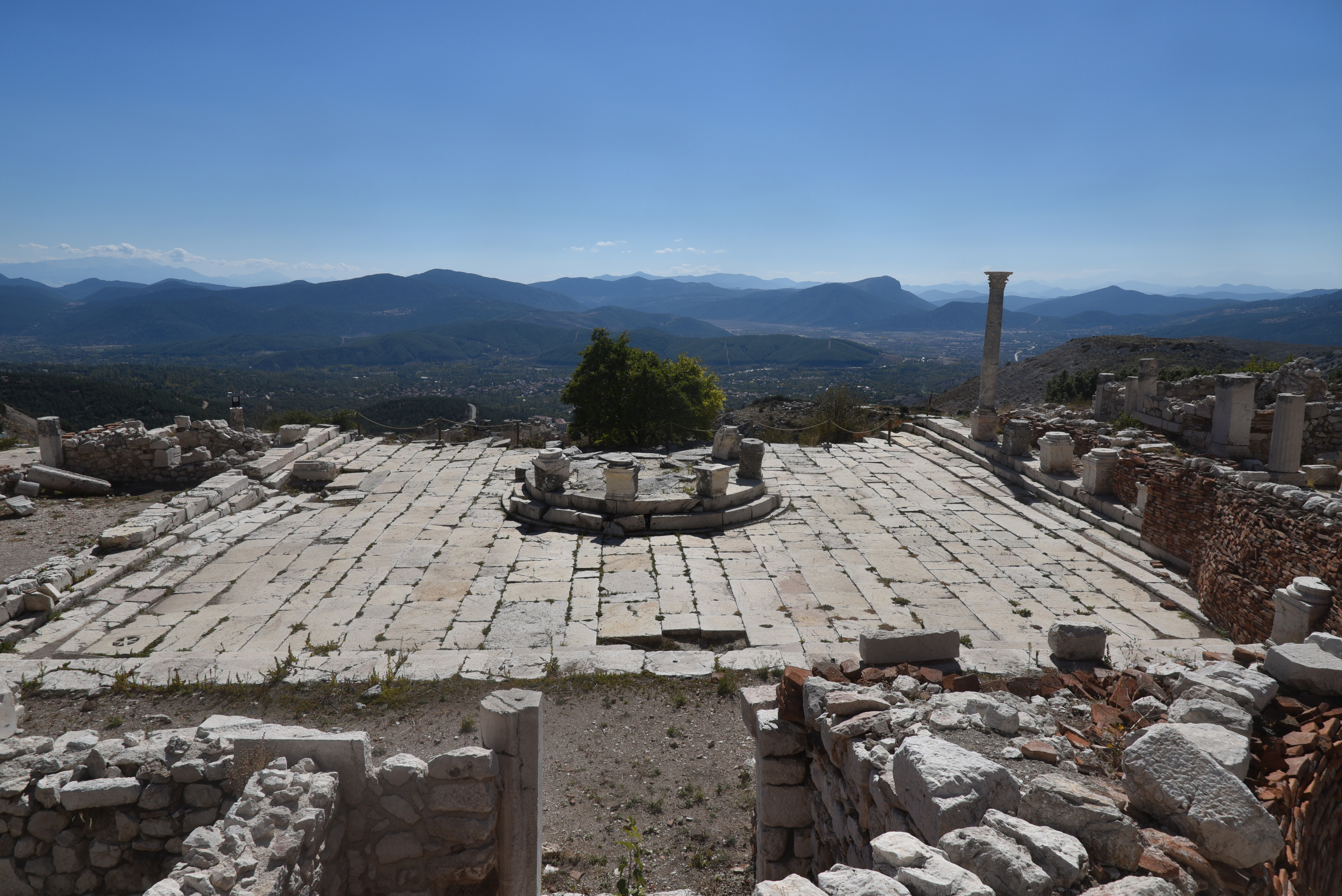
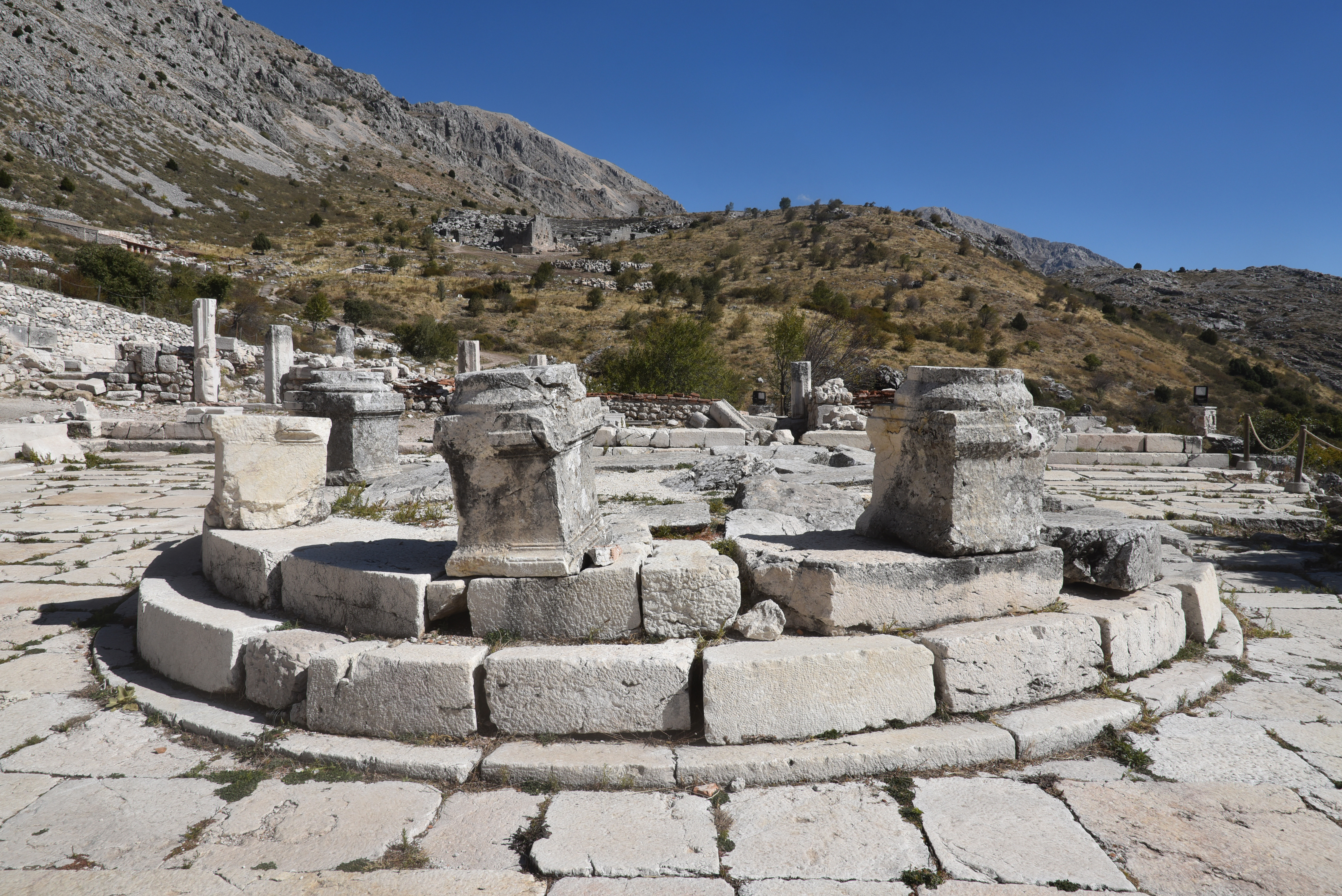
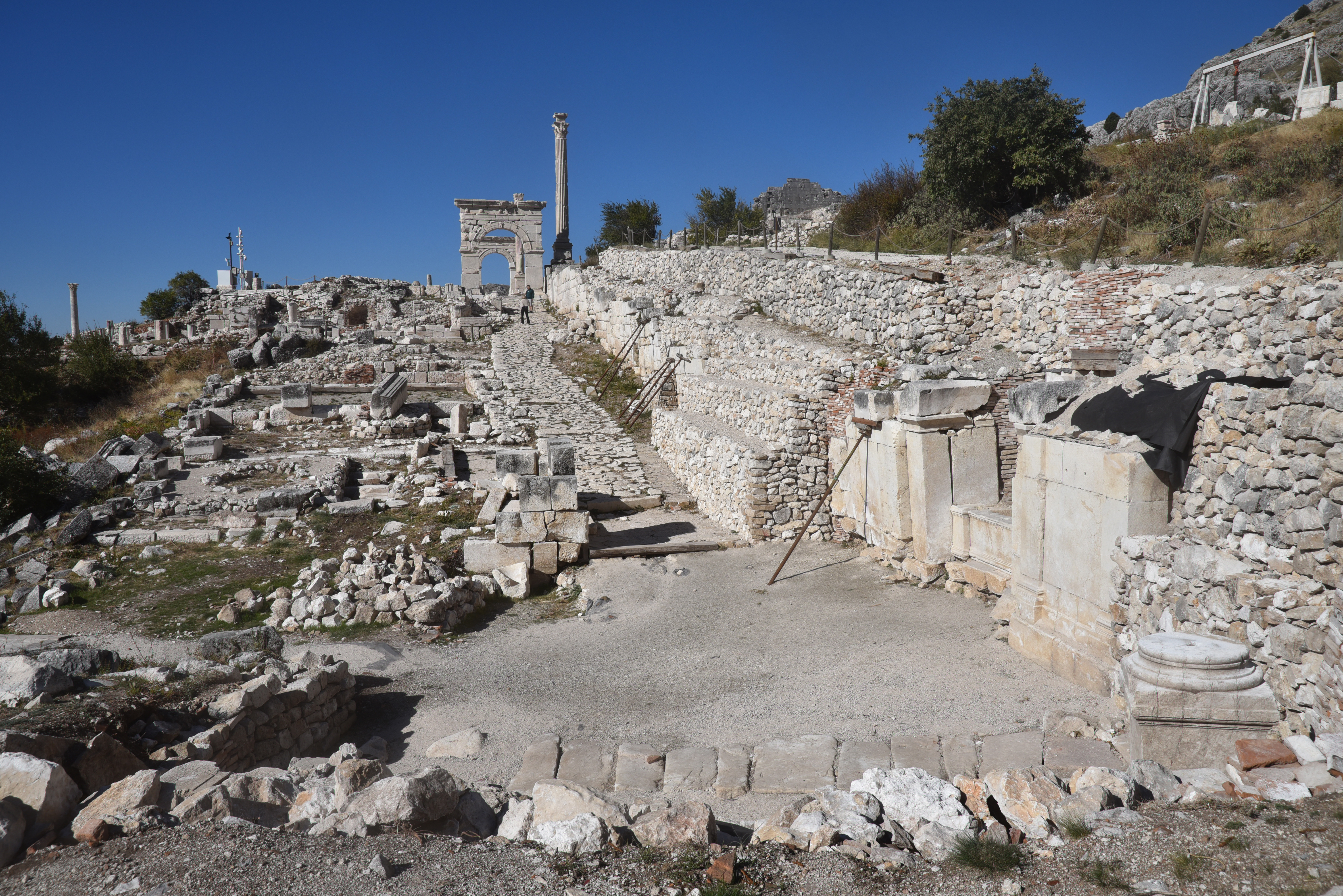
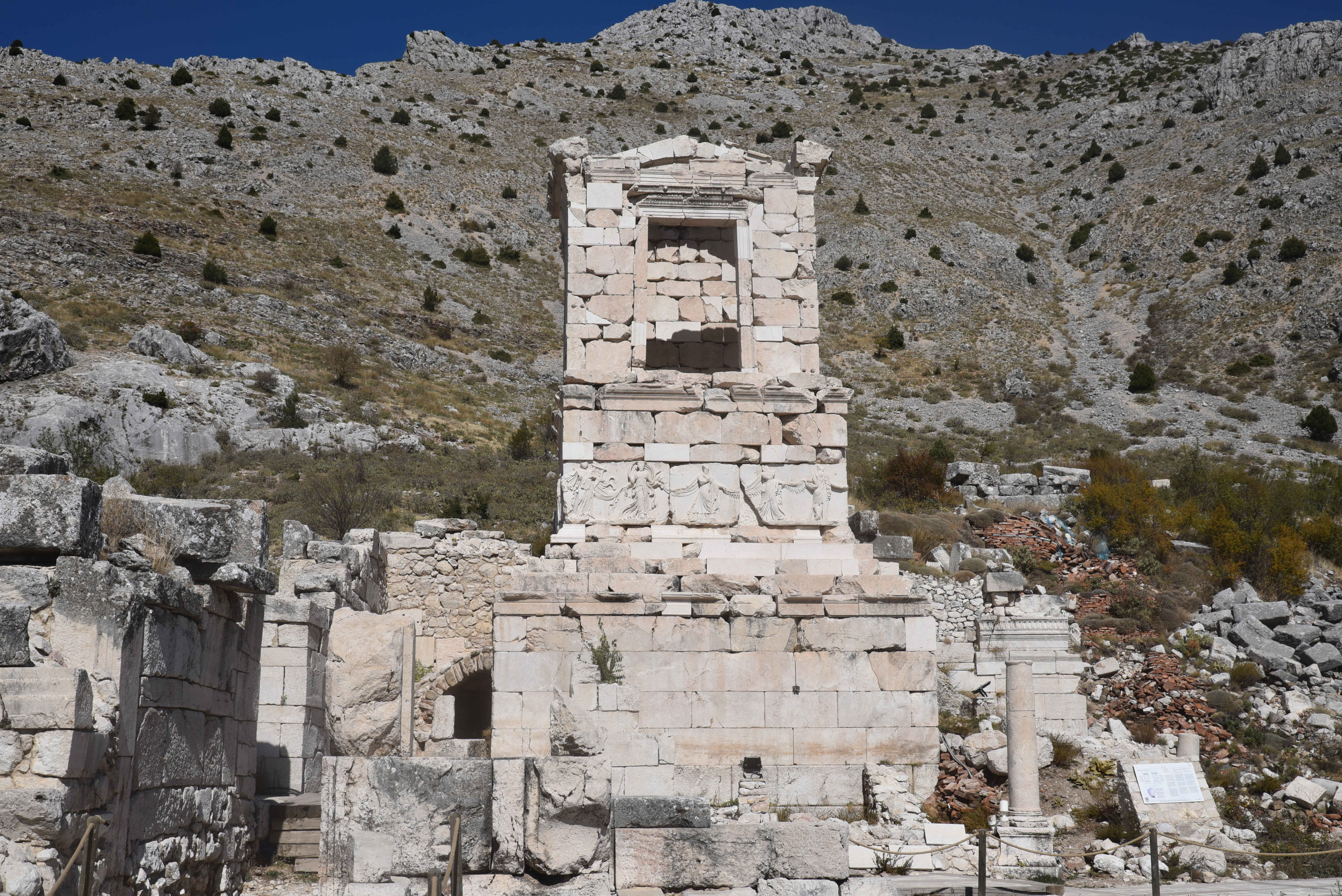
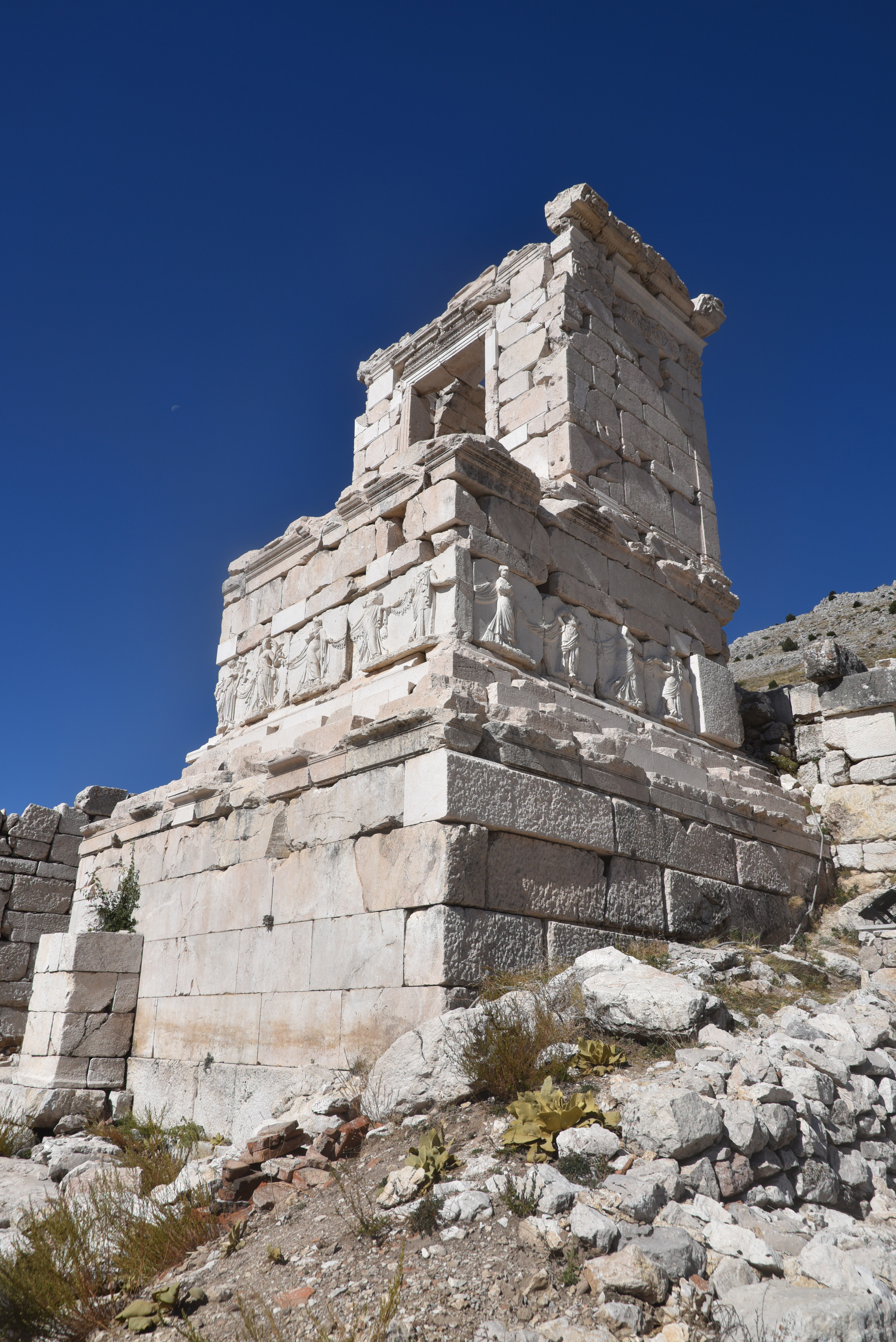
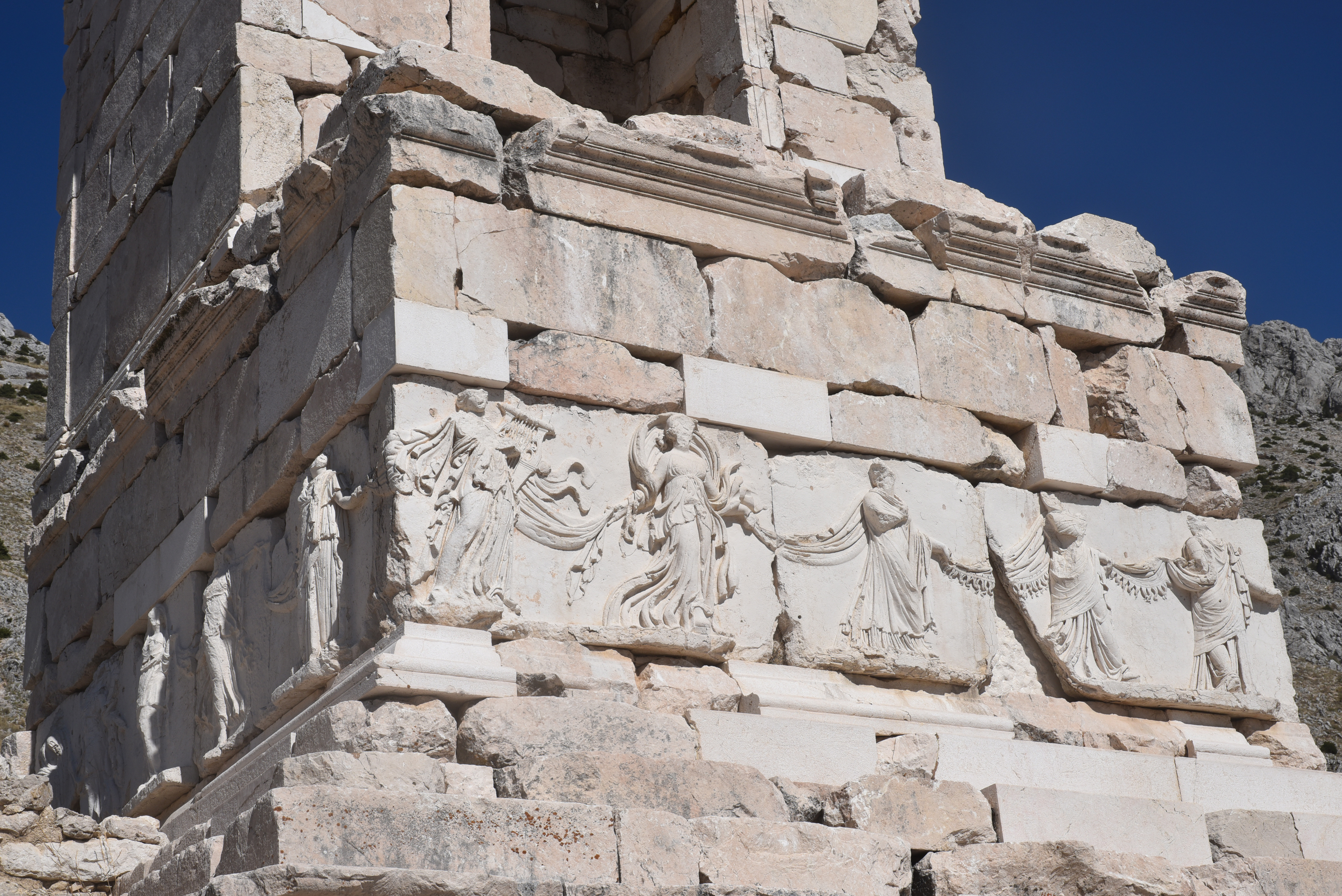
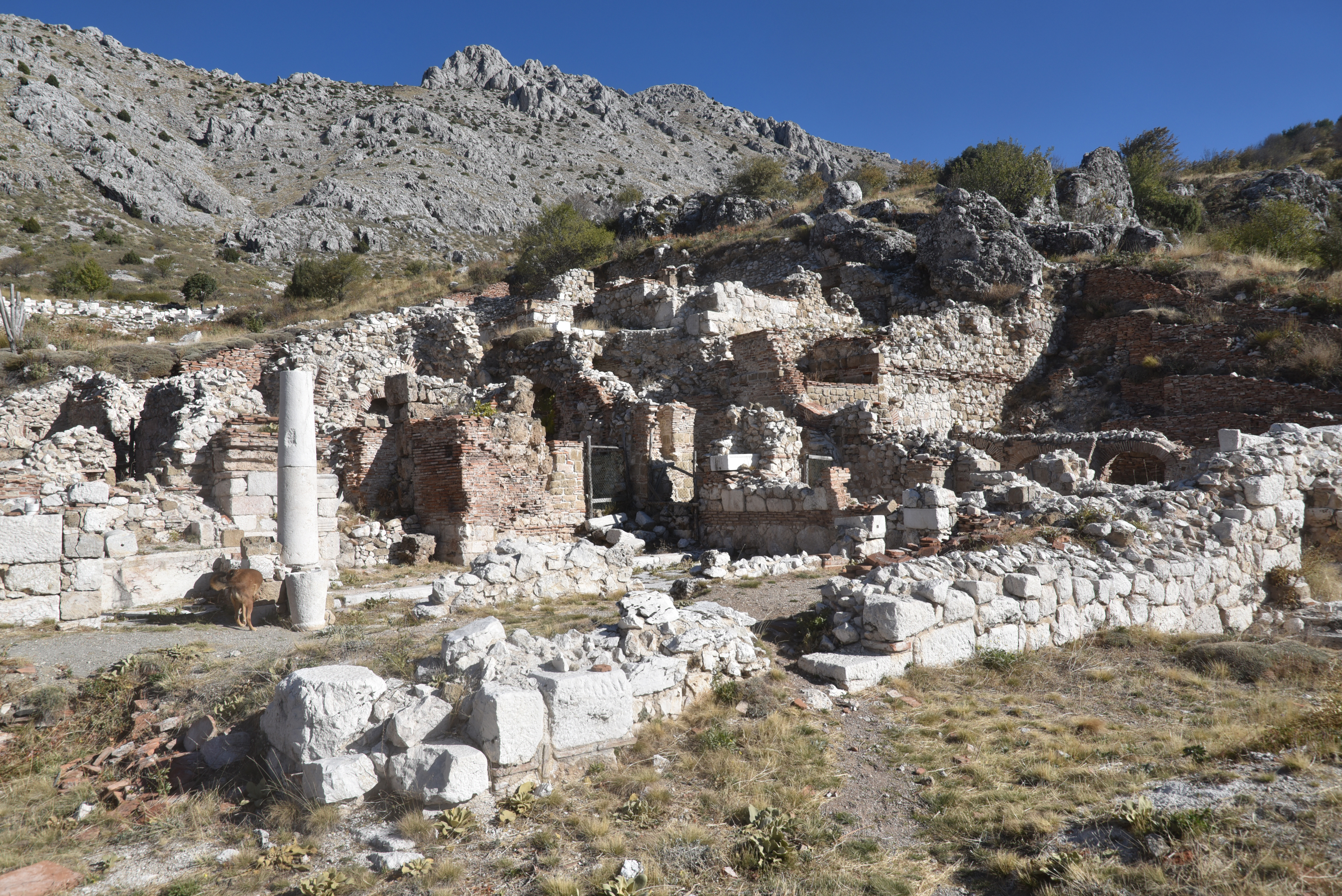
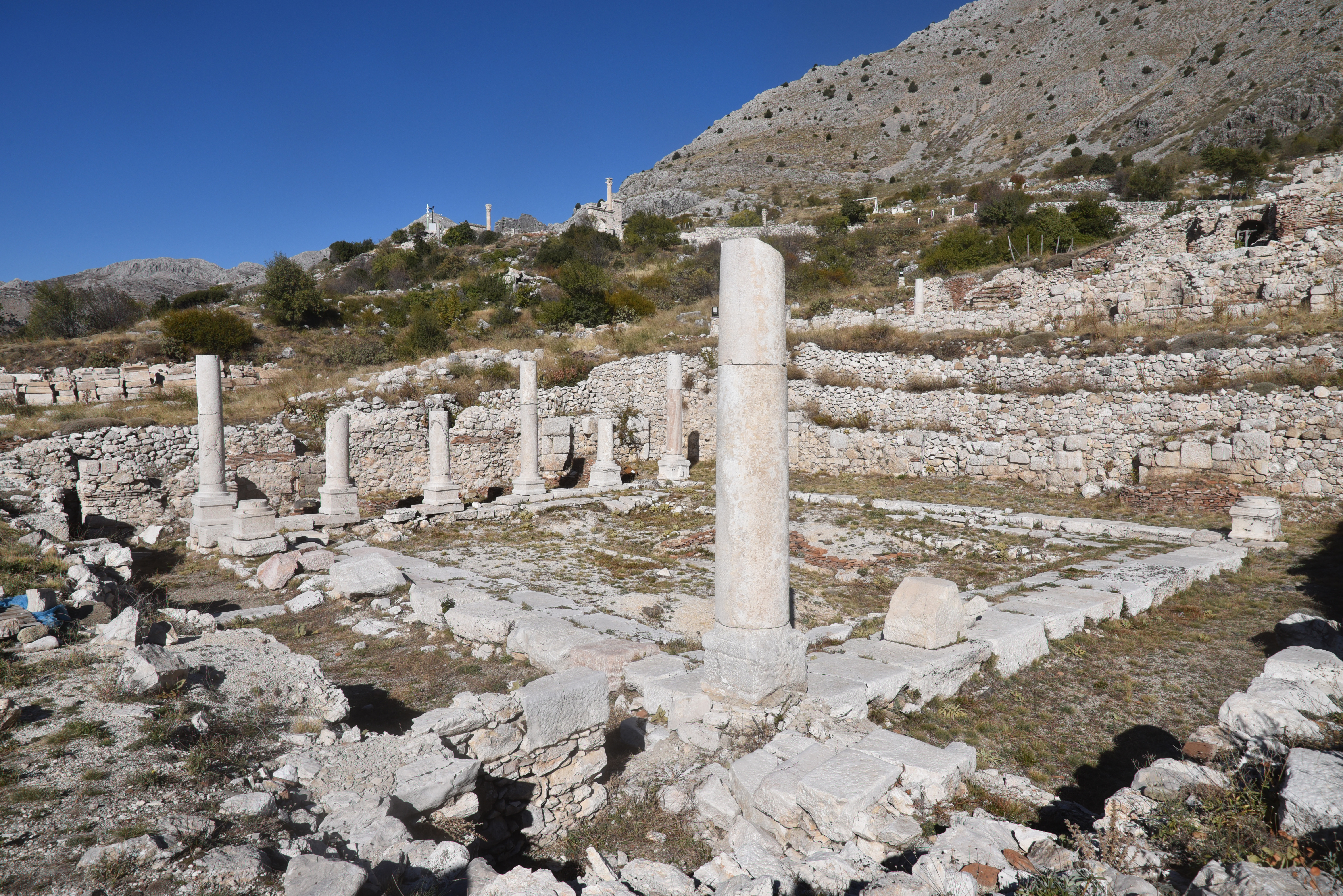
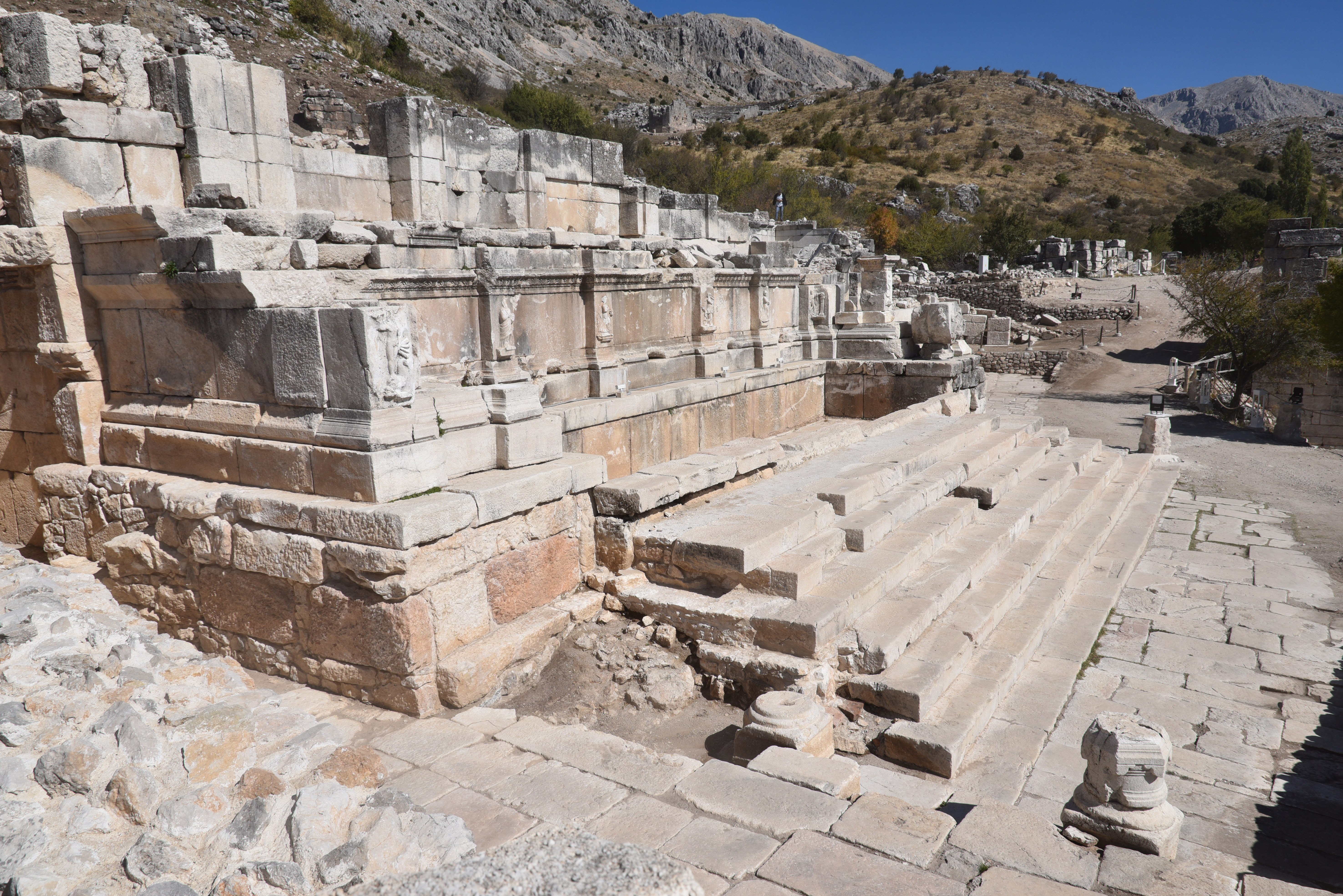
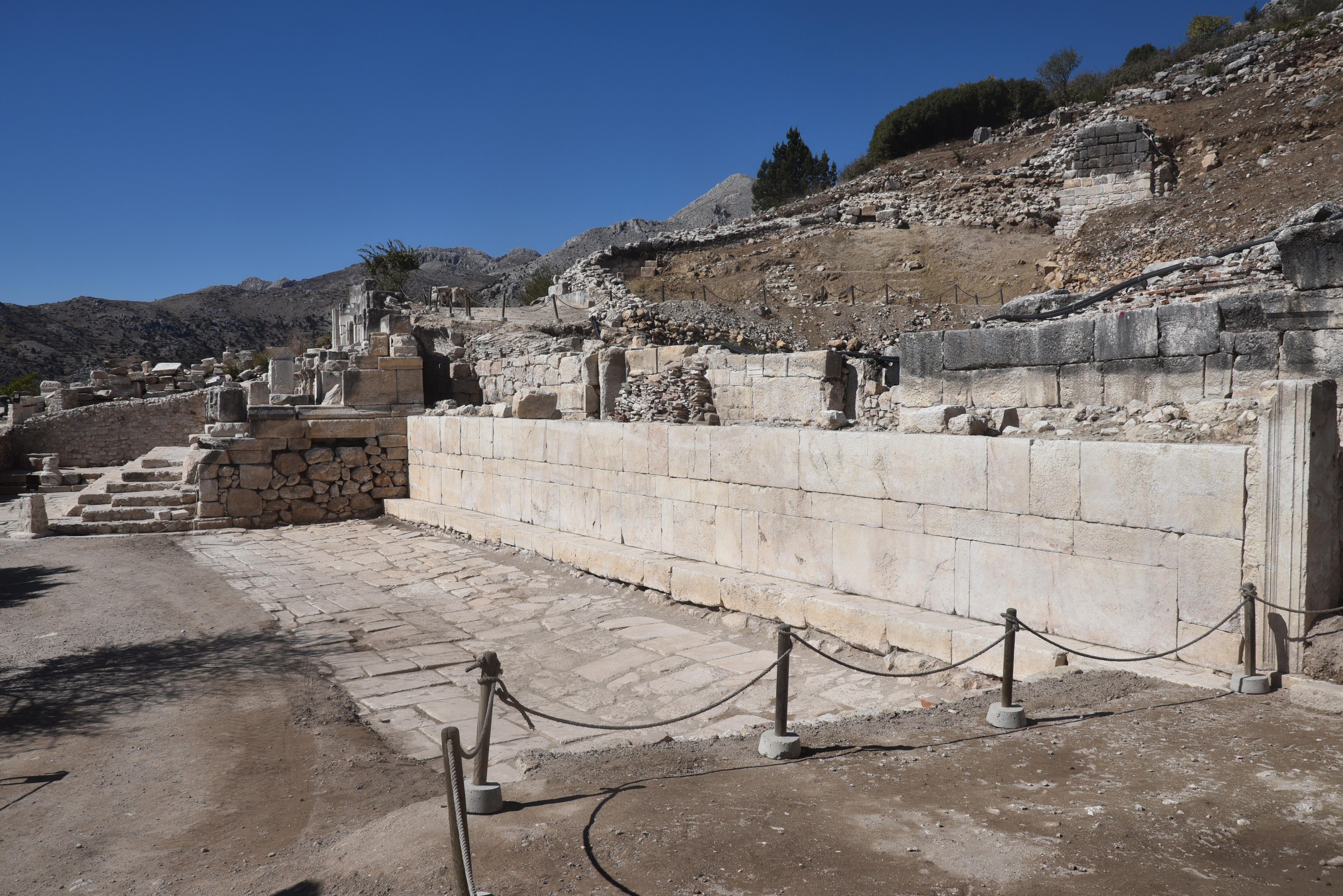
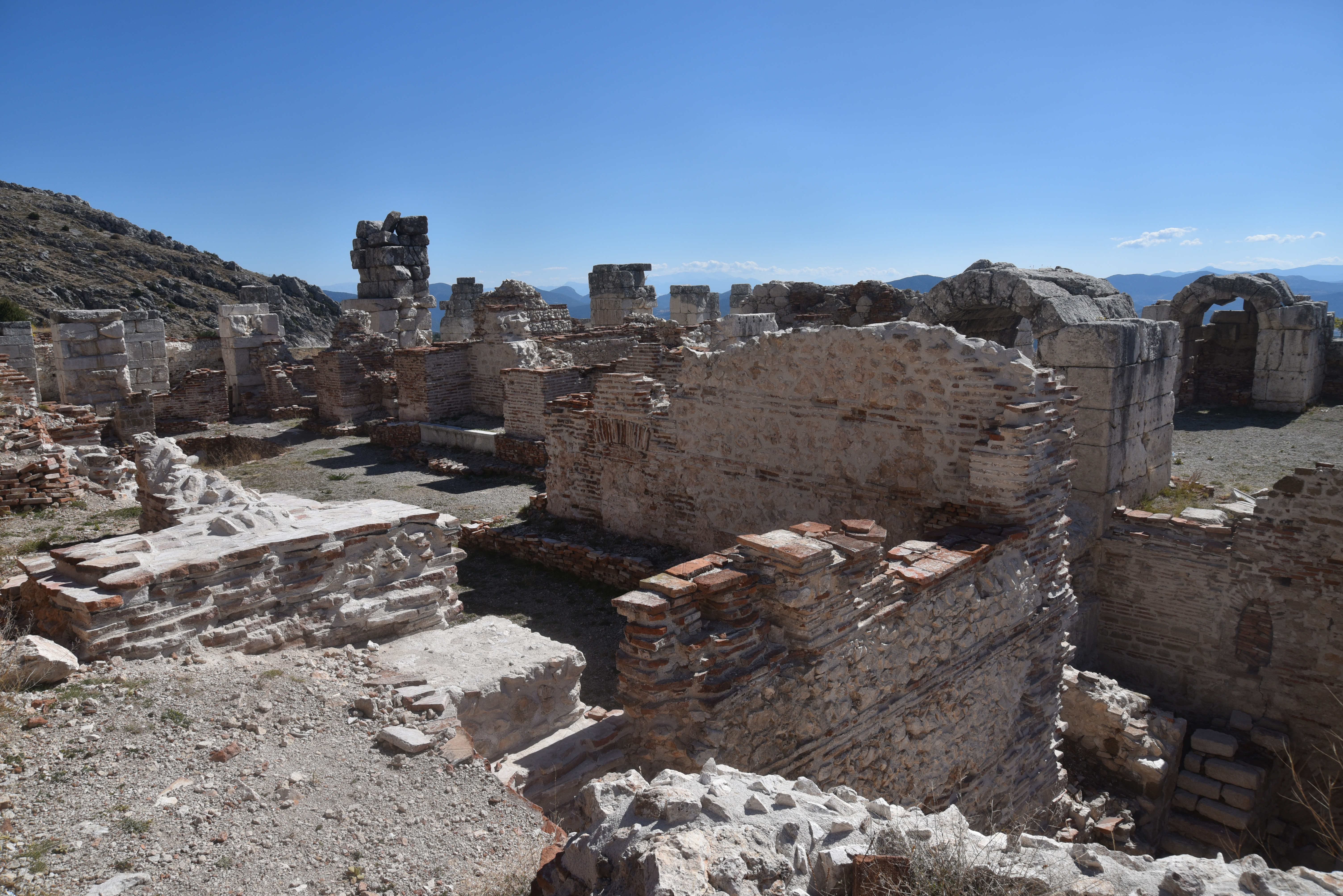
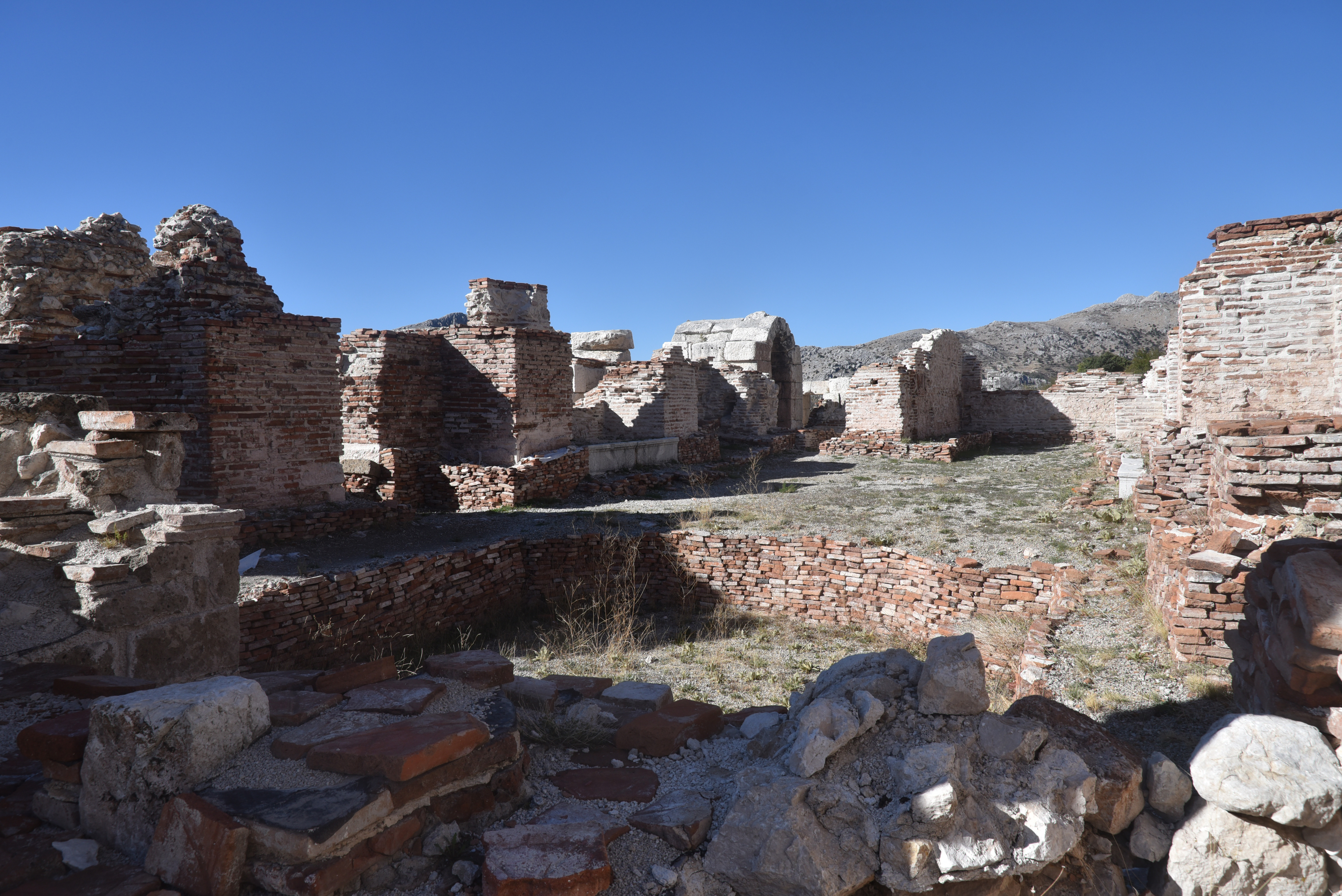
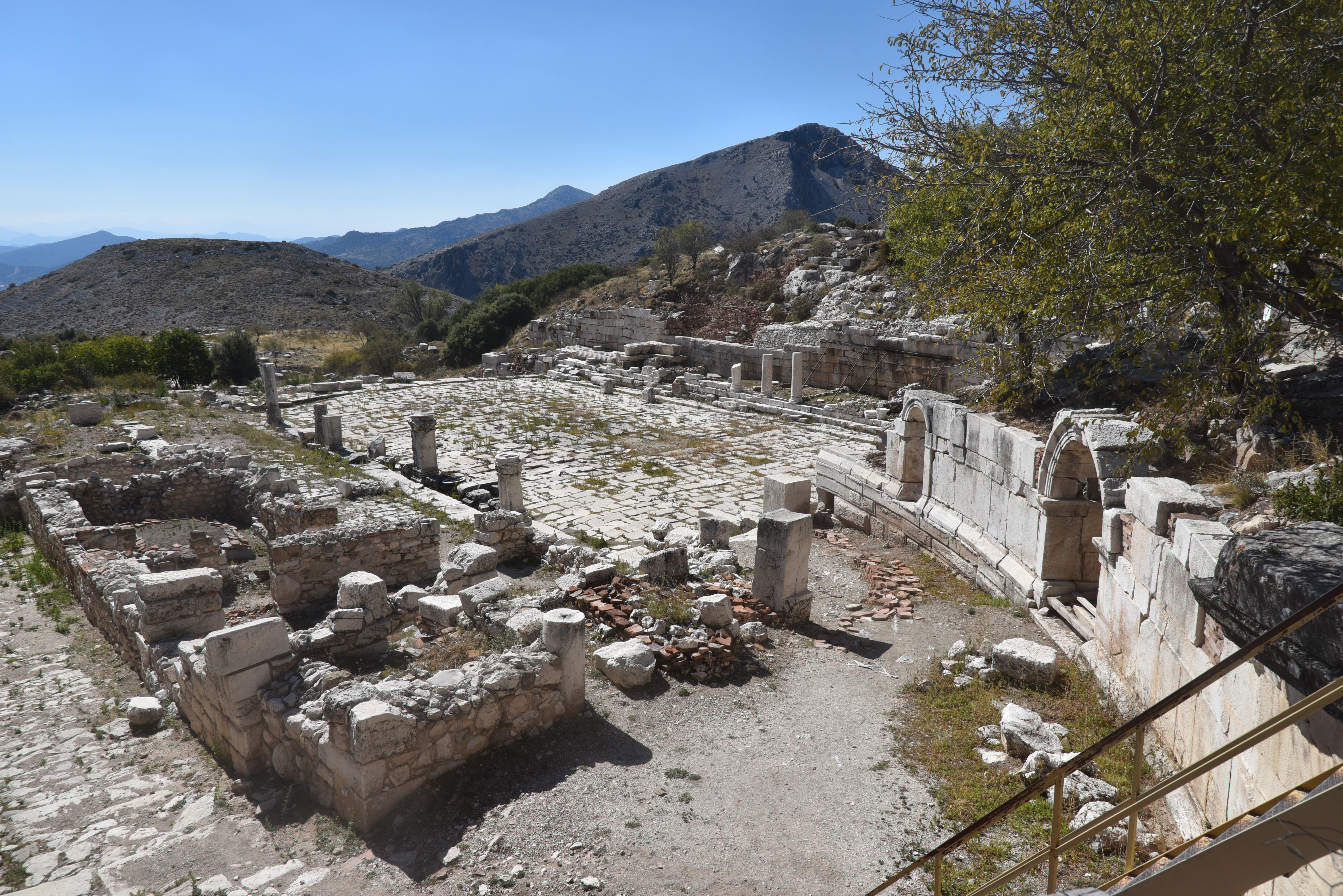
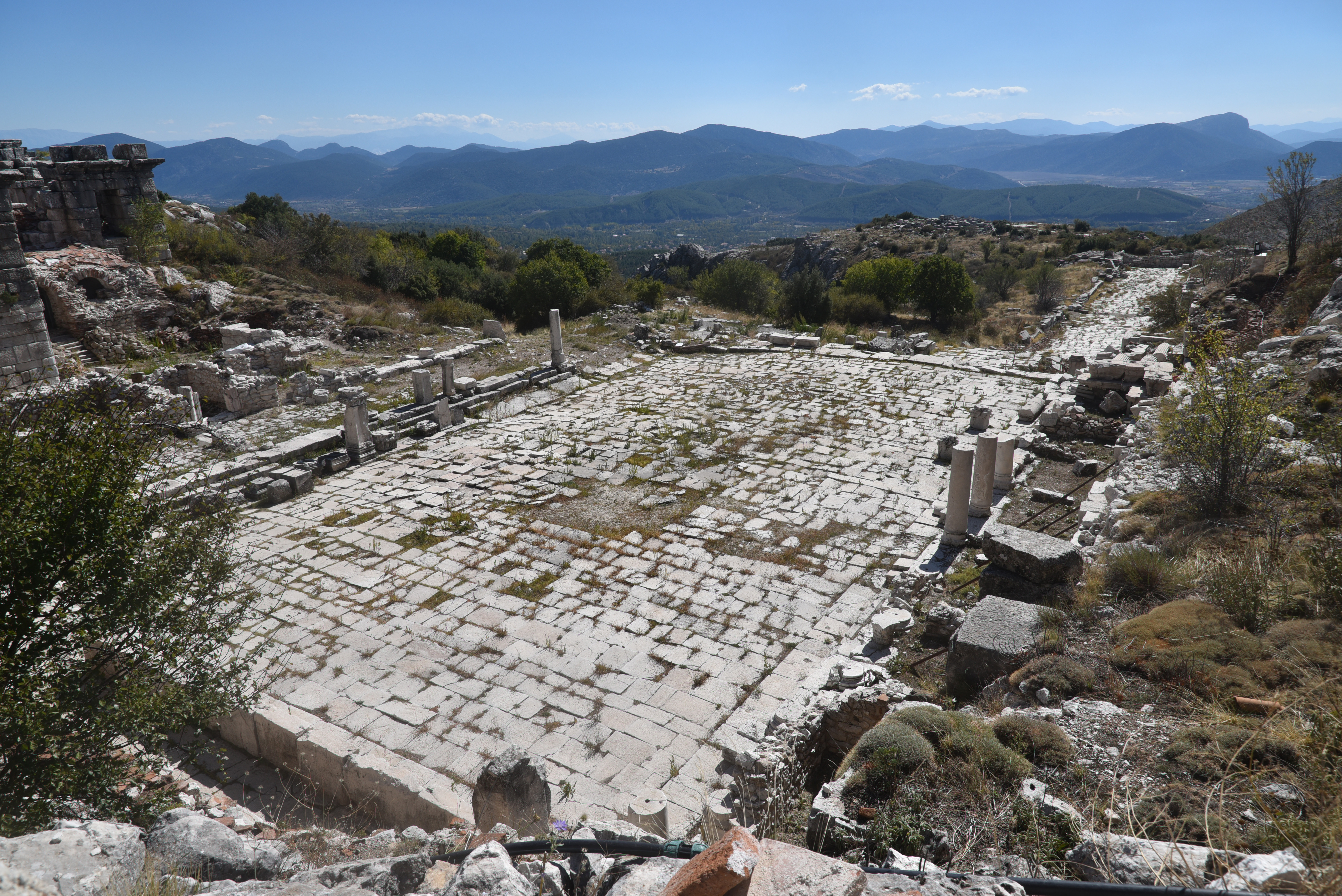
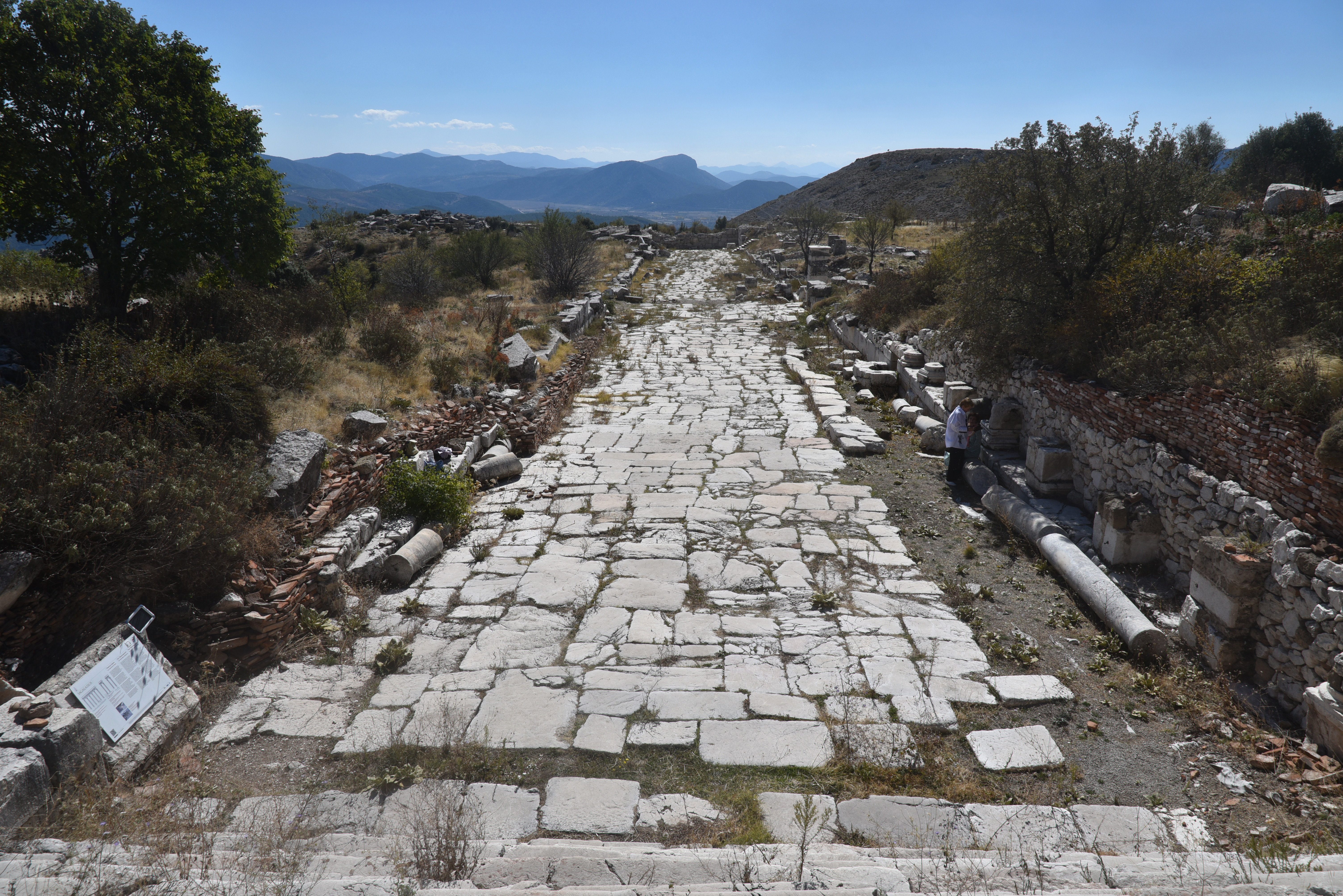
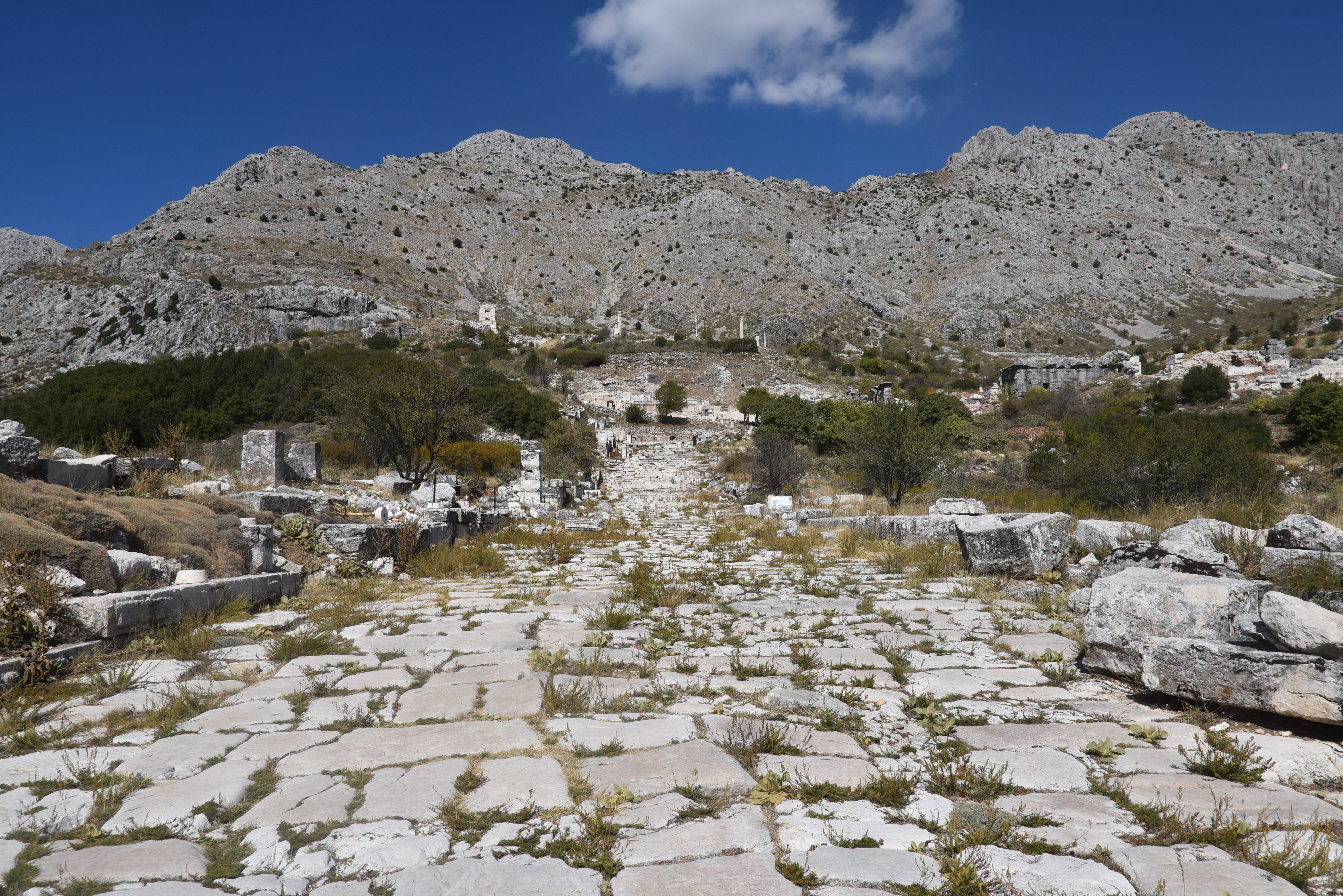
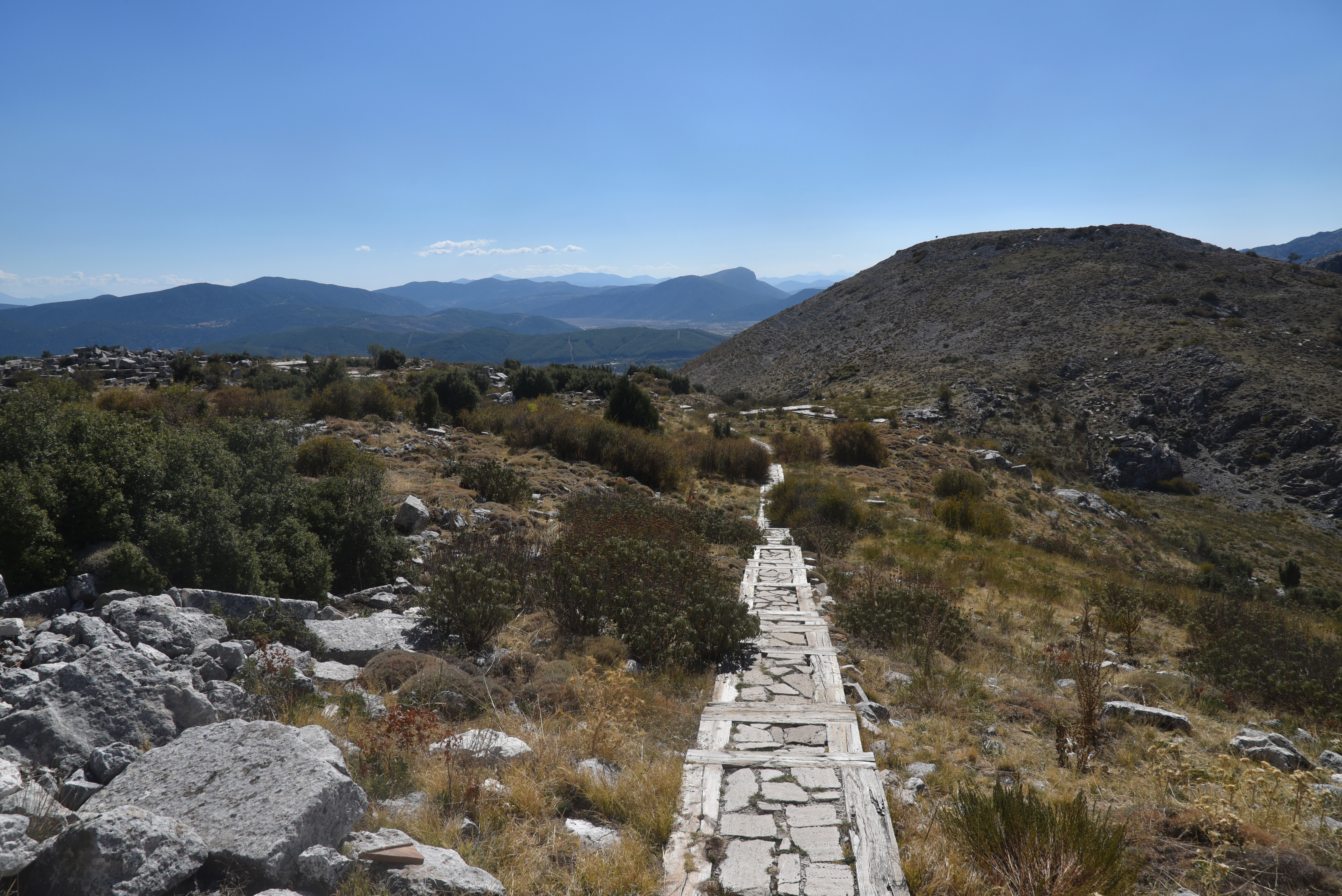
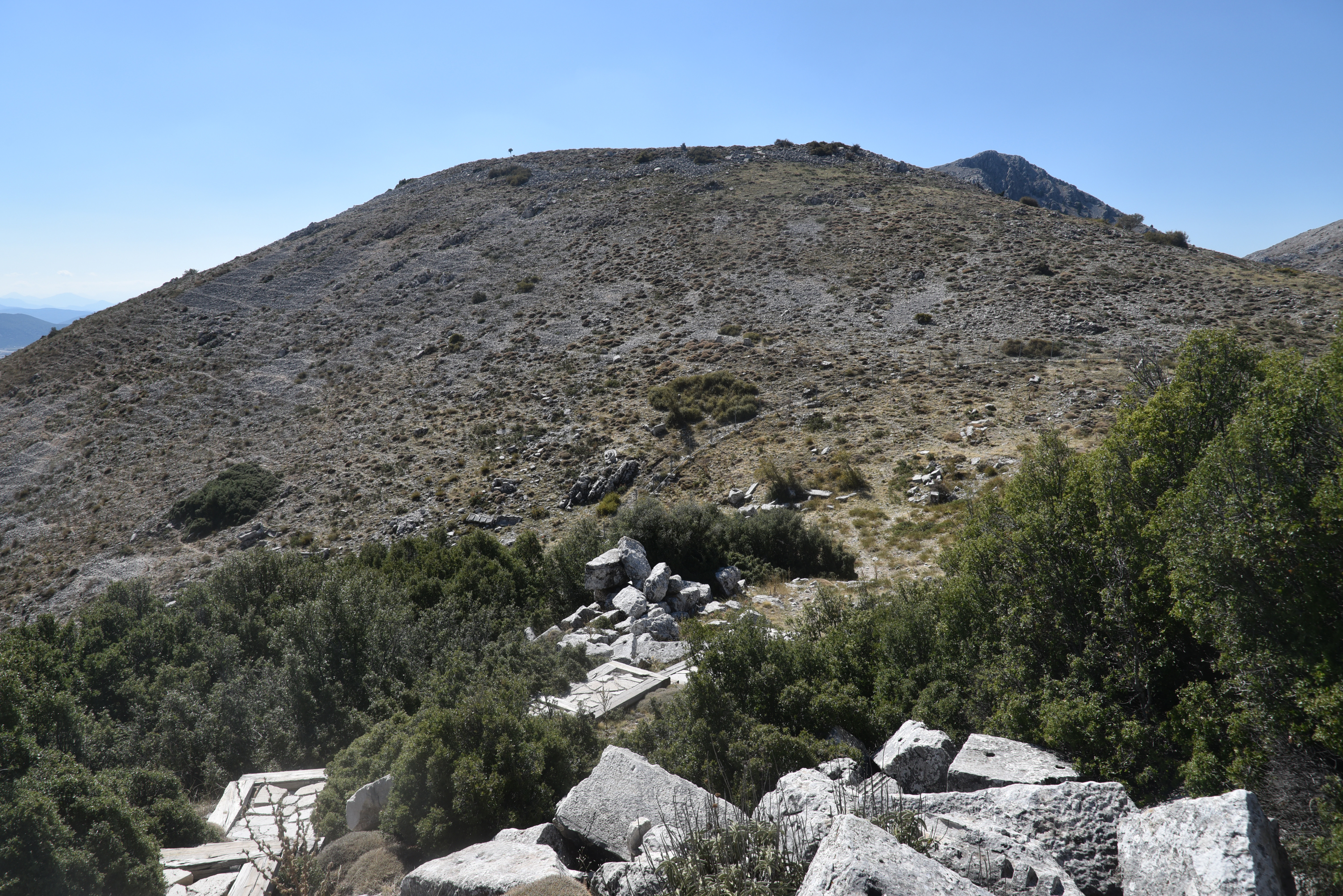
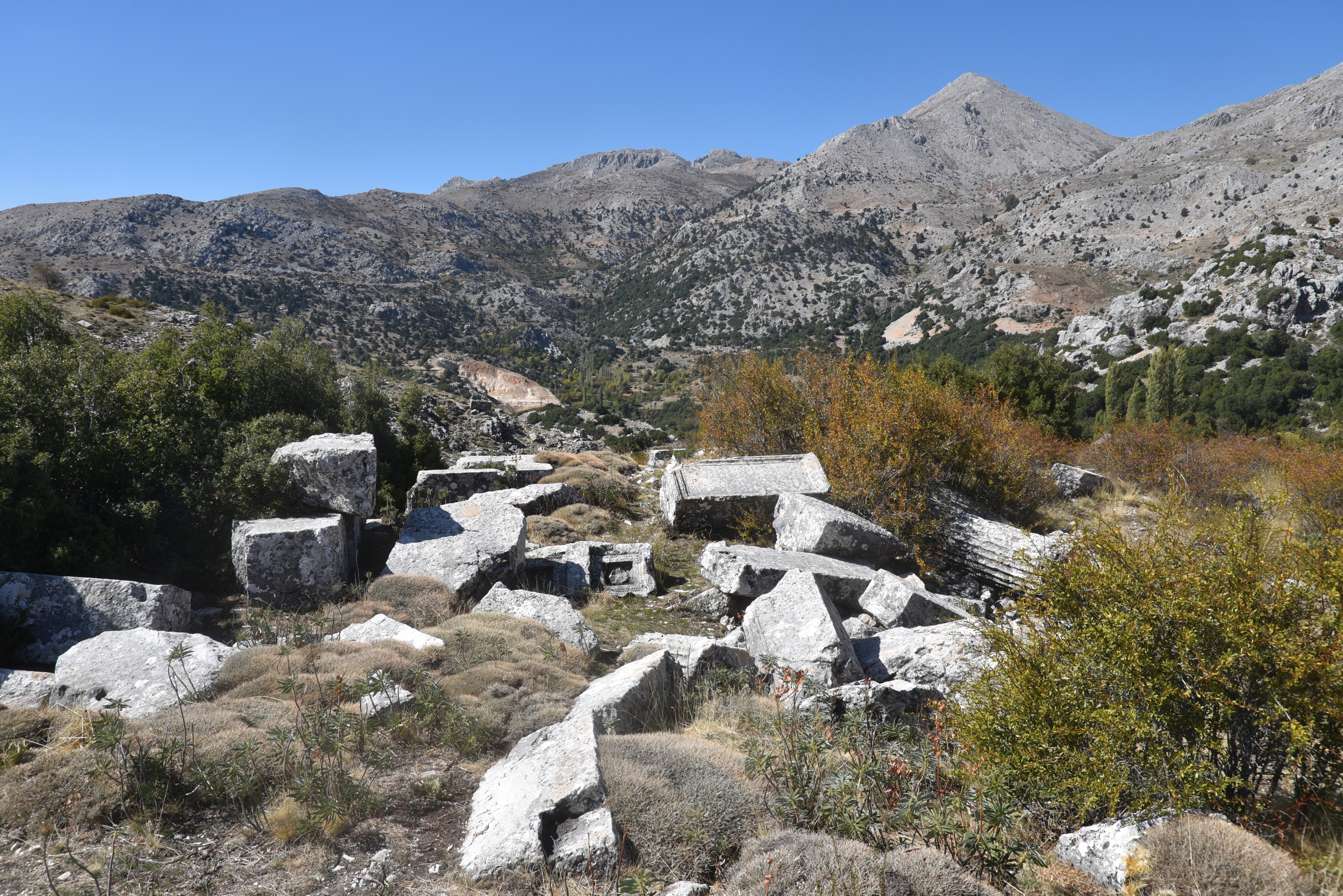
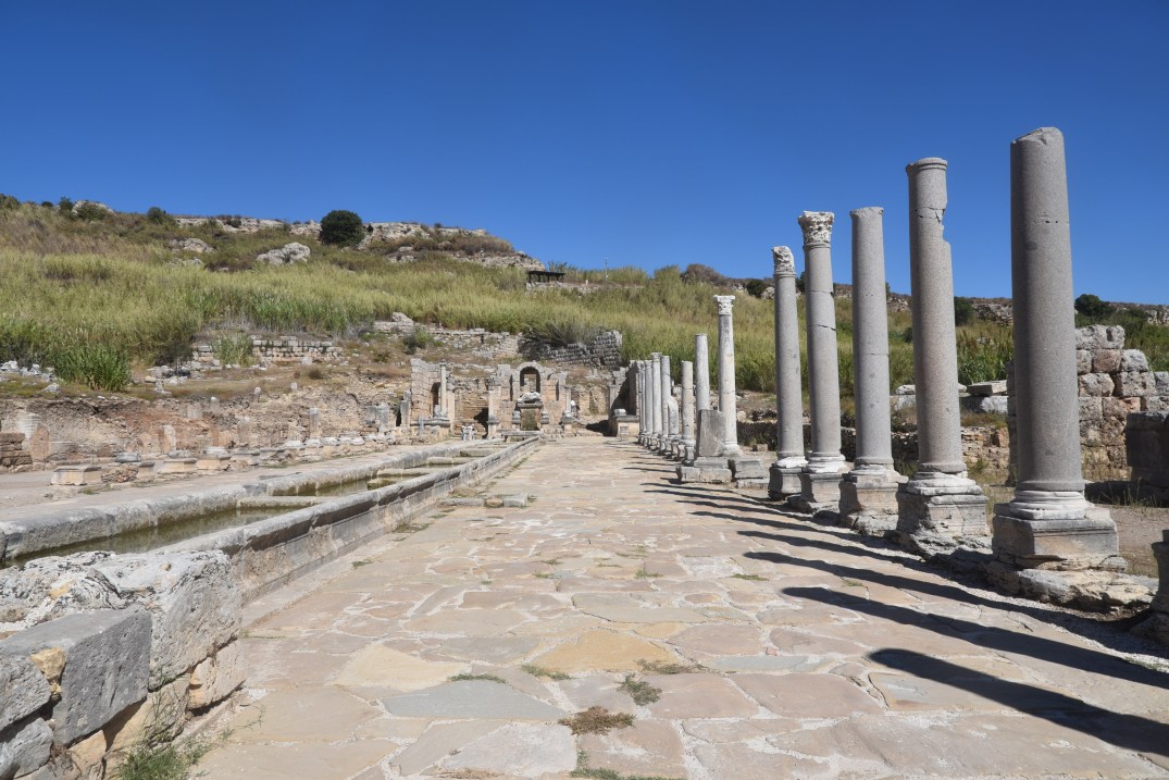
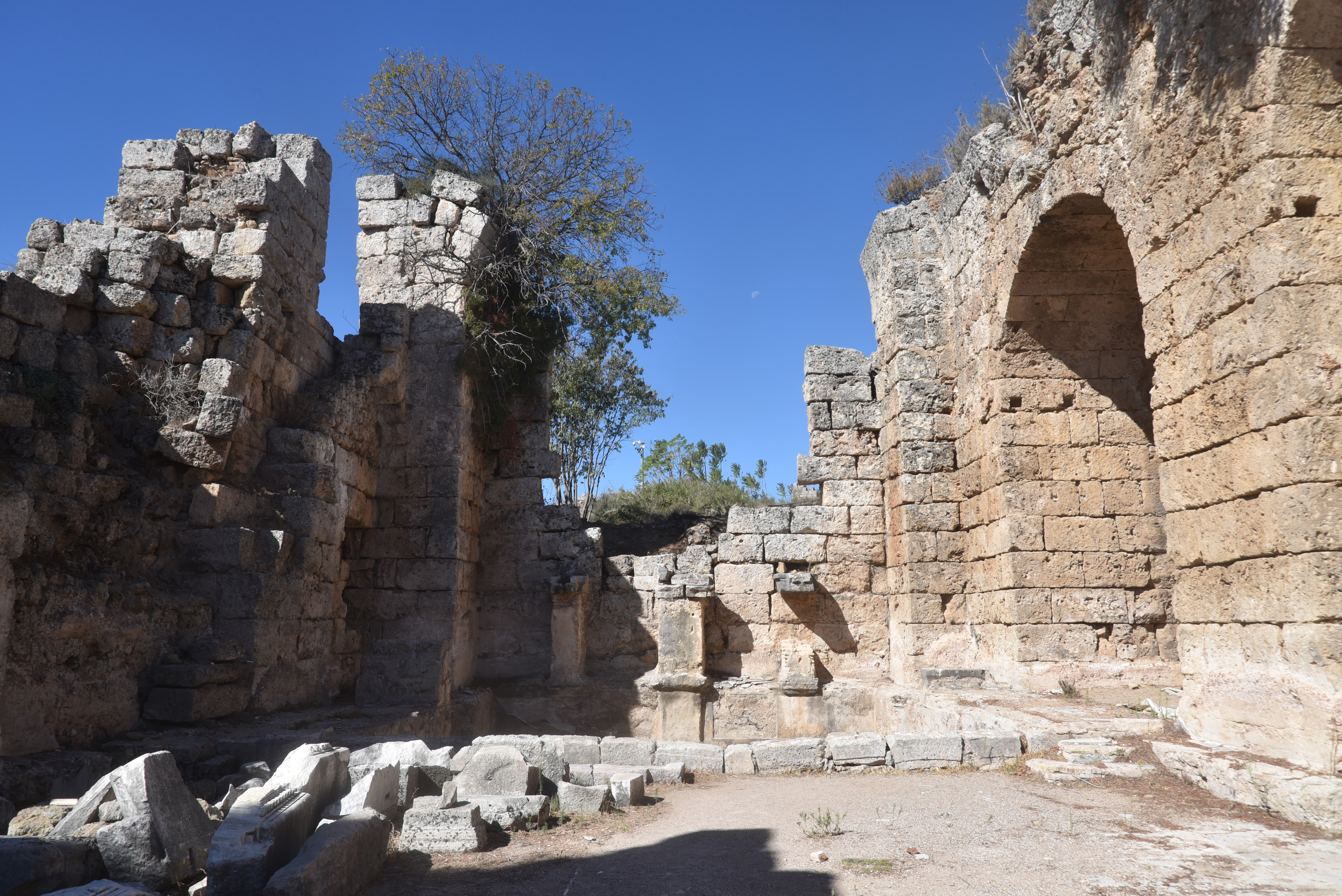
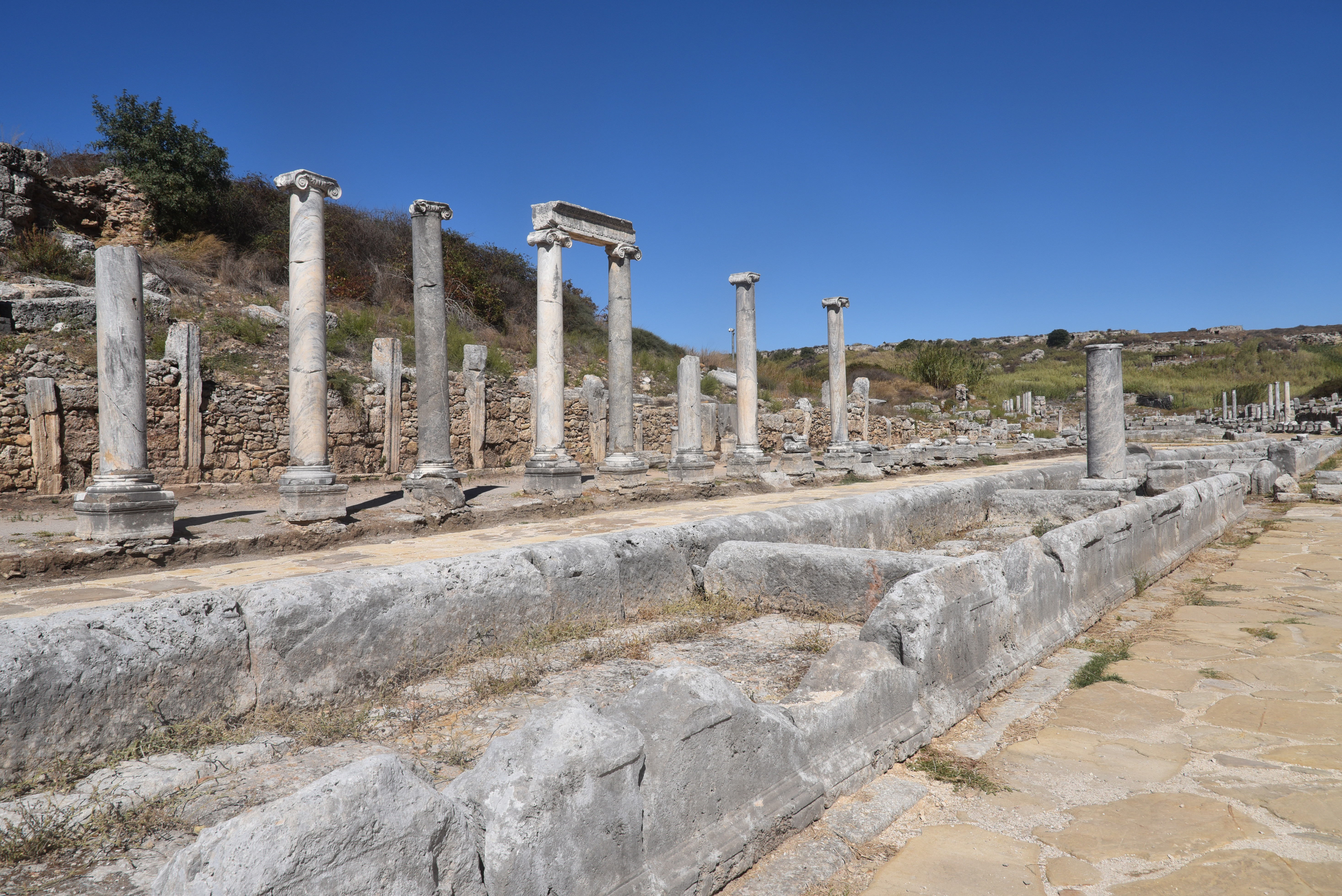
The Imperial Baths, a monumental bath complex covering c. 5,542 m² and built during the High Roman Imperial Period.The Imperial Baths included various sections, such as a large open-air palaestra, a “marble room,” and separate bathing circuits for men and women.The “marble room” of the Imperial Baths which originally displayed colossal acrolithic statues of Emperor Hadrian, his successors Antoninus Pius and Marcus Aurelius, and their spouses.The Lower Agora, constructed during the reign of Augustus and further monumentalized during late Flavian–Trajanic times.The Lower Agora covered approximately 1,550 square meters and was oriented differently from the Upper Agora, aligning with the rectangular street pattern of the new southern urban quarters.The square of the Lower Agora was adorned with a small Ionic “distyle in antis” temple dedicated to Apollo Klarios, which overlooked the agora from the west. This temple later became associated with the municipal emperor cult. A monumental fountain was added along the north side of the agora during Trajanic times, further enhancing its appearance.The Trajanic Nymphaeum, constructed during the reign of Emperor Trajan in the northern side of the Lower Agora.The Colonnaded Street connecting the Lower Agora with the South Gate of the city. It was constructed during the reign of Emperor Tiberius (AD 14–37).The Colonnaded Street was approximately 9.6–10 meters wide and 290 meters long. It was paved during the Julio-Claudian period, covering a dense water-supply network beneath it, flanked by porticoes and adorned with decorative monuments, including statues and inscriptions.The Lower City looking south towards Alexander’s Hill, the scene of the battle in 333 BC by which Alexander conquered the city. The landmark was named by the late Marc Waelkens.The ruins of the Temple of Antoninus Pius, constructed on a prominent location in the southeast part of the city, on a raised promontory. It was built to accommodate the cult of the emperor.The Temple of Antoninus Pius was of the Corinthian peripteral type, characterised by a rectangular layout surrounded by a colonnade of Corinthian columns.Alexander’s Hill. The Roman historian Arrian recorded that Alexander, in 333 BC, took Sagalassos by storm after breaking local resistance on a steep, conical hill south of the settlement (Anabasis, I.28.2).The southern necropolis.
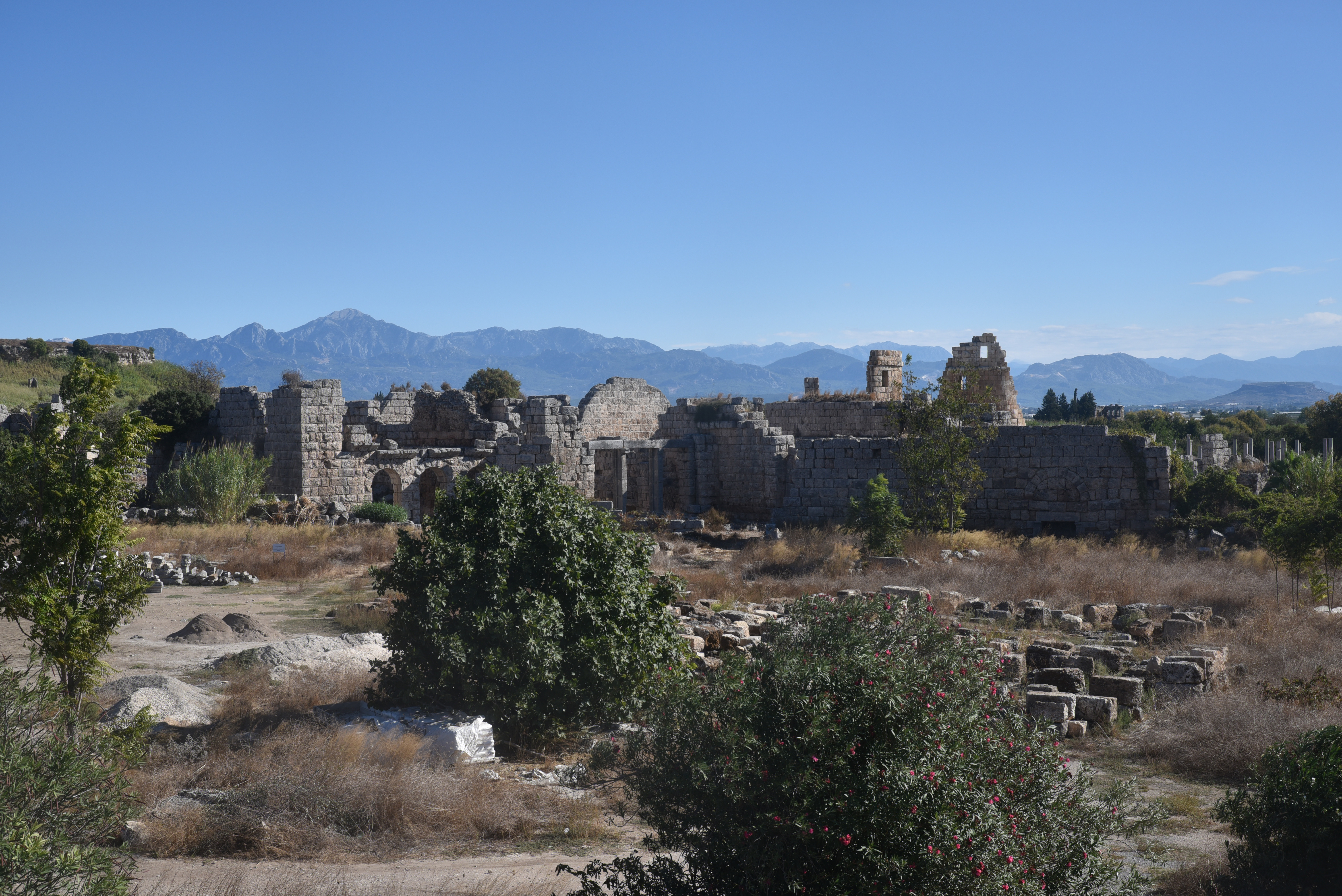
Perge, one of the most powerful cities of ancient Pamphylia, is located in southeastern Turkey, approximately 15 km from modern-day Antalya. The city thrived due to its strategic position in the fertile Pamphylian valley, near the River Kestros, which facilitated trade and transportation. Perge experienced its heyday during the Roman Imperial period, becoming a major commercial and cultural hub adorned with monumental architecture, including baths, a stadium, a theatre, and nymphaeums. Renowned for its cult of Artemis Pergaia, Perge also played a significant role in the spread of Christianity, hosting early Christian communities and bishops. Today, Perge stands as an important archaeological site, attracting visitors from around the world.
Perge’s history spans from the late 4th millennium BC to late antiquity. Initially under Hittite control in the 13th century BC, it was later settled by Achaeans after the Trojan War, according to mythological tradition. In the 7th century BC, colonists from Rhodes arrived, and the city came under Lydian control in the 6th century BC. After the Lydians were defeated, Perge became part of the Persian Empire in 547 BC. It joined the Delian League in 425 BC but returned to Persian control after the Peace of Antalcidas in 387 BC. Alexander the Great subjugated the city in 334 BC, and it later became contested between the Seleucids and Ptolemies.
Following the Peace of Apamea in 190 BC, Perge came under the Kingdom of Pergamon and, in 133 BC, under Roman rule. During the Roman Imperial period, Perge flourished, becoming a major economic and cultural centre. However, the city faced challenges, including piracy and Roman exploitation, which led to its decline in late antiquity. By the 7th century AD, most inhabitants had left, and the city eventually fell under Seljuk and Ottoman control.
View of the colonnaded Cardo Maximus and Decumanus from the Acropolis.
Plancia Magna, a prominent and influential figure in Perge during the Roman Imperial period, made considerable contributions to the city. A member of a noble family, she was the wife of Roman senator Julius Cornutus Tertullus and daughter of Marcus Plancius Varus, a consul and provincial commander. Known for her generosity, she funded major construction projects in Perge during Hadrian’s reign, including monumental additions to the Hellenistic gate. She held prestigious titles, including supreme archon, priestess of Artemis Pergaia, and high priestess of the imperial cult, and was honoured with statues and inscriptions throughout the city.
The architectural monuments and unique design choices made by Plancia Magna set a trend that influenced other wealthy women, including Aurelia Paulina, during the late 2nd and early 3rd centuries AD. She built and inaugurated a monumental nymphaeum and its ornamentation at her own expense, which she dedicated to Artemis Pergaia and the reigning emperor, Septimius Severus, along with his wife, Julia Domna, and his sons, Caracalla and Geta (IK Perge 196). The monument stood near one of the main entrances to the city of Perge, a prime location that ensured it received significant attention from both local citizens and visitors entering the city. Like Plancia Magna’s courtyard, it borrowed from the theatrical scaenae frons design with a marble colonnaded facade and niches displaying statues, to highlight her links with the gods and the imperial family.
The city was divided into four quarters by two main colonnaded streets, the decumanus maximus and cardo maximus, which featured arcades, shops, and a central water channel. Key structures include the Hellenistic gate with monumental towers and marble-clad walls, the northern baths, the agora with a central tholos, and the northern nymphaeum adorned with statues. The city also housed a stadium seating 12,000 spectators, one of the best-preserved in Asia Minor, and a theatre with a capacity of 15,000, featuring intricate reliefs depicting mythological scenes.
PORTFOLIO
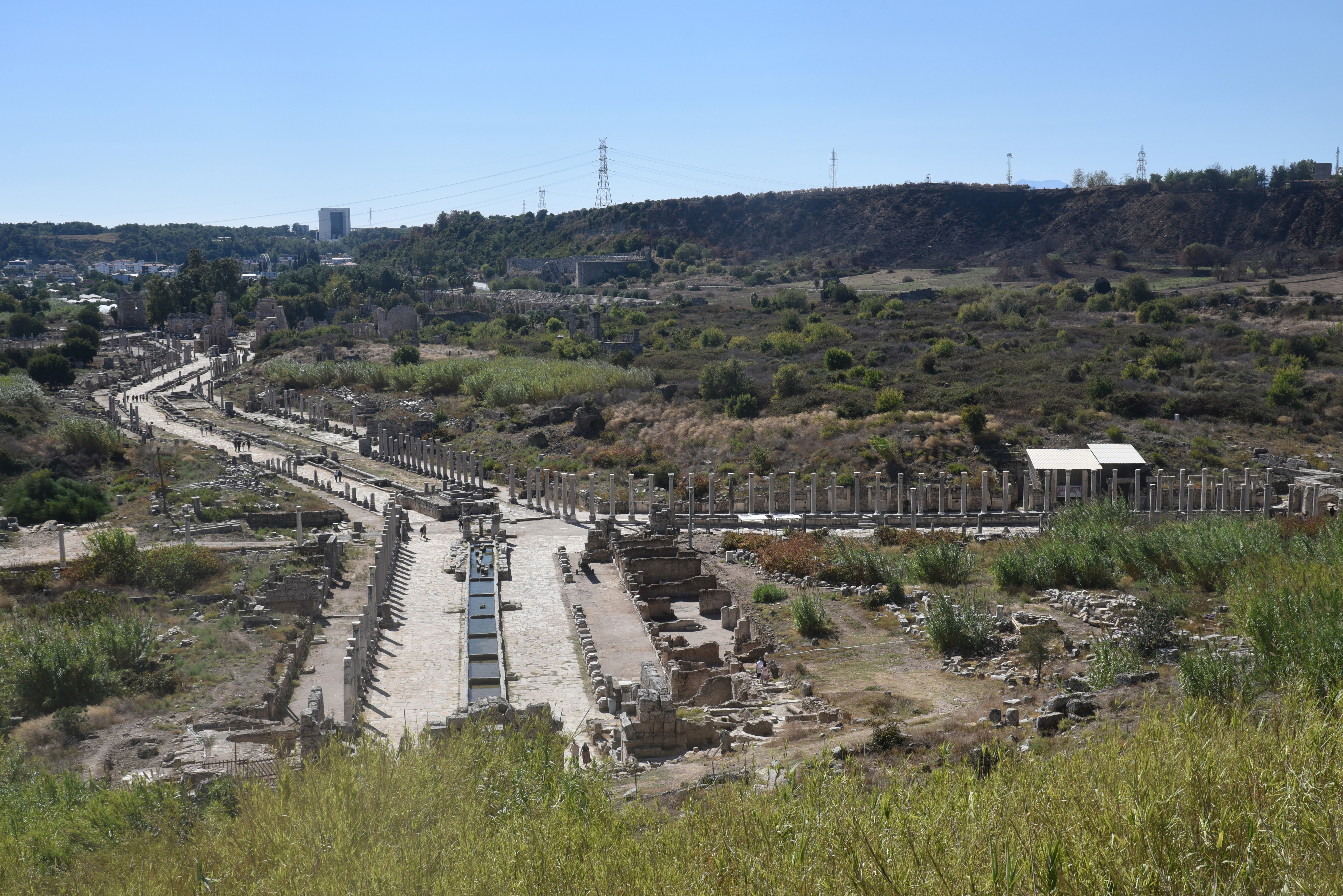
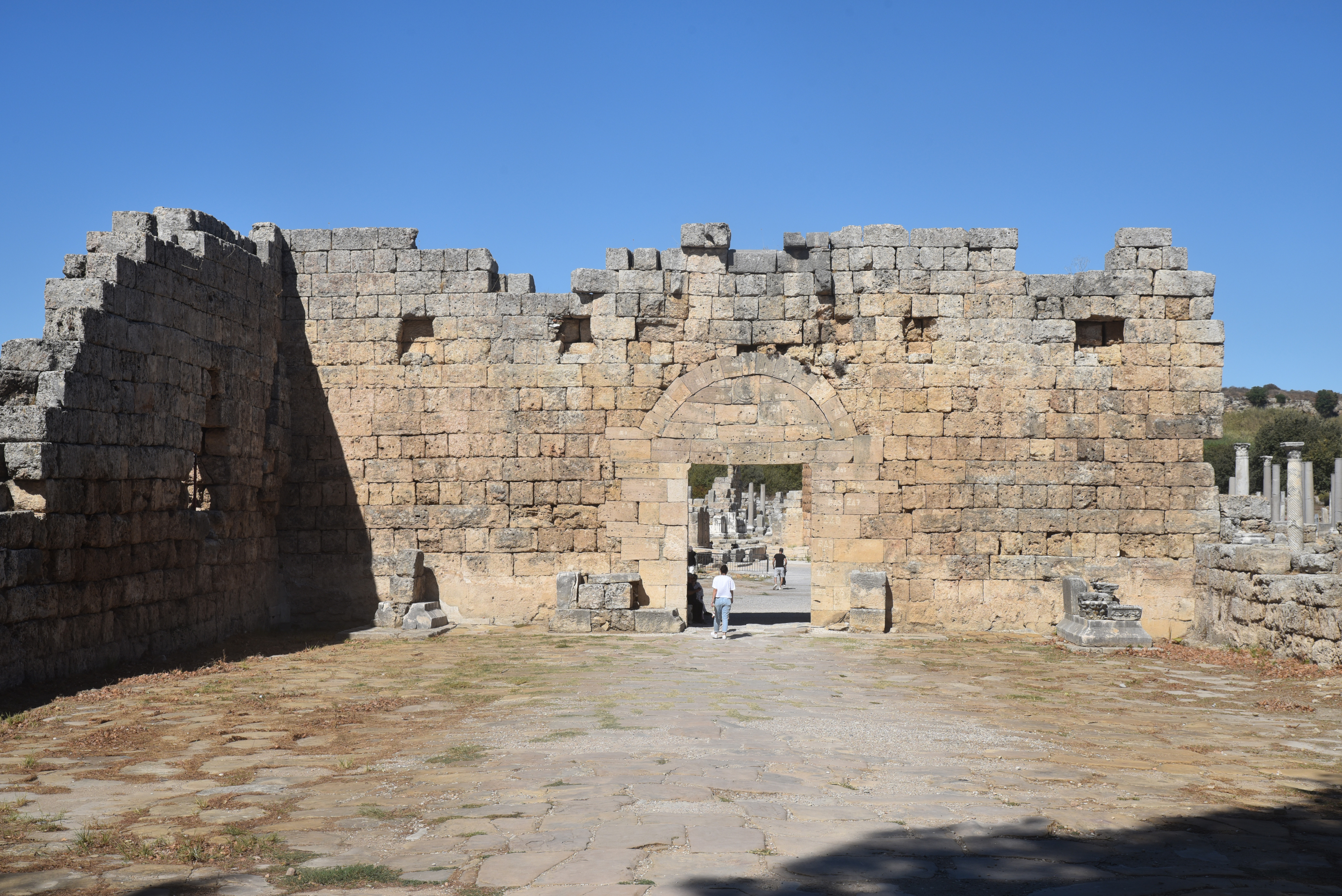
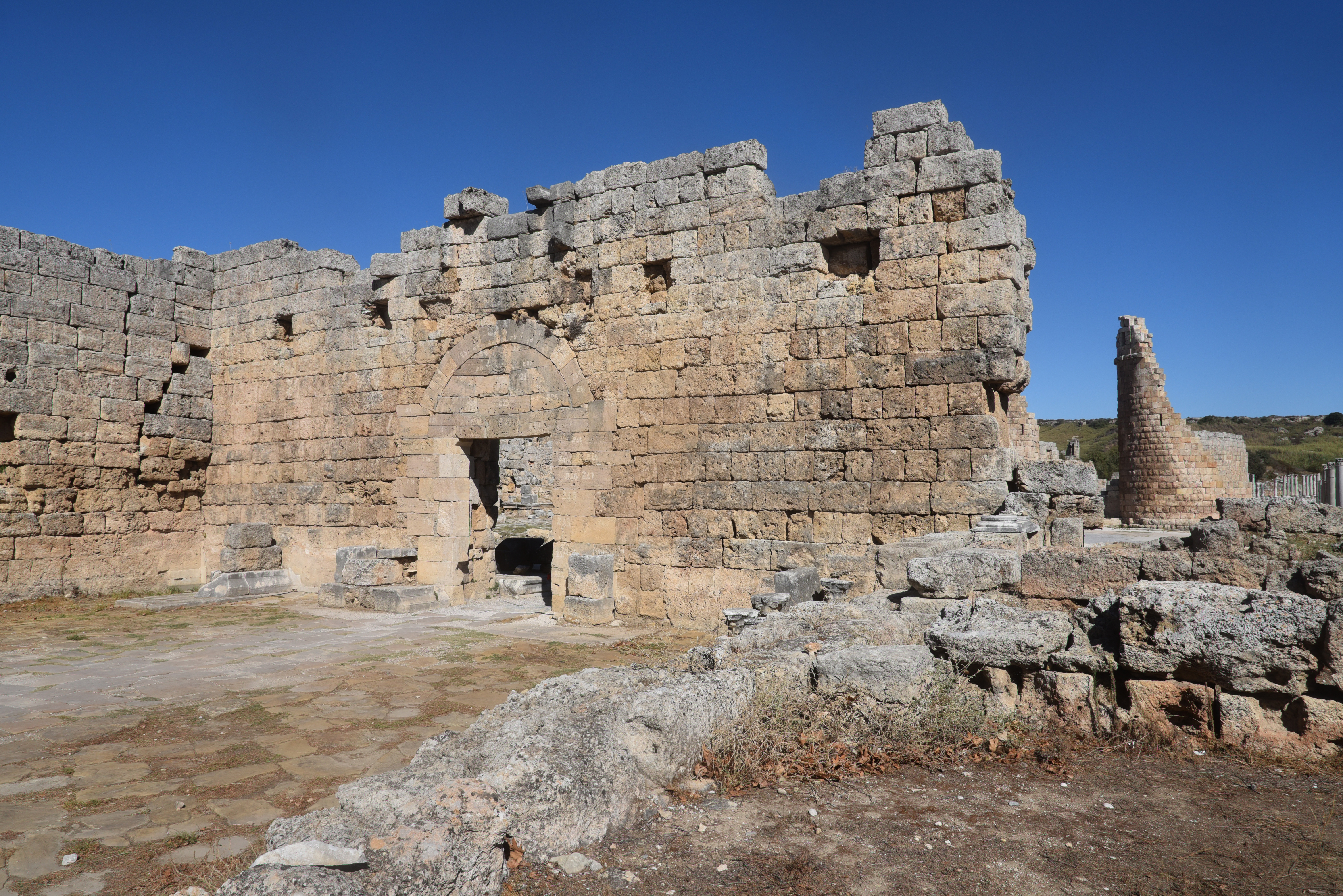
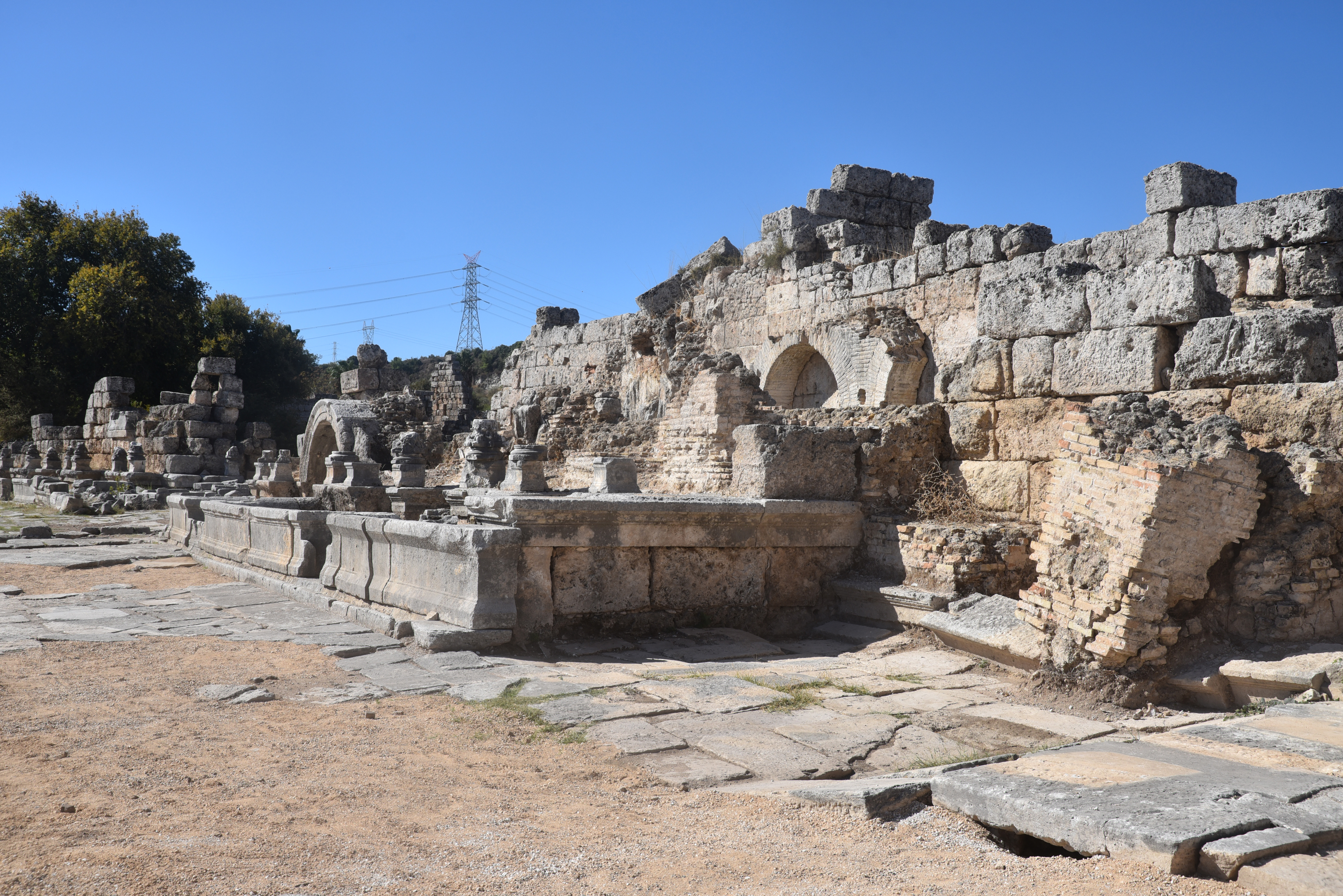
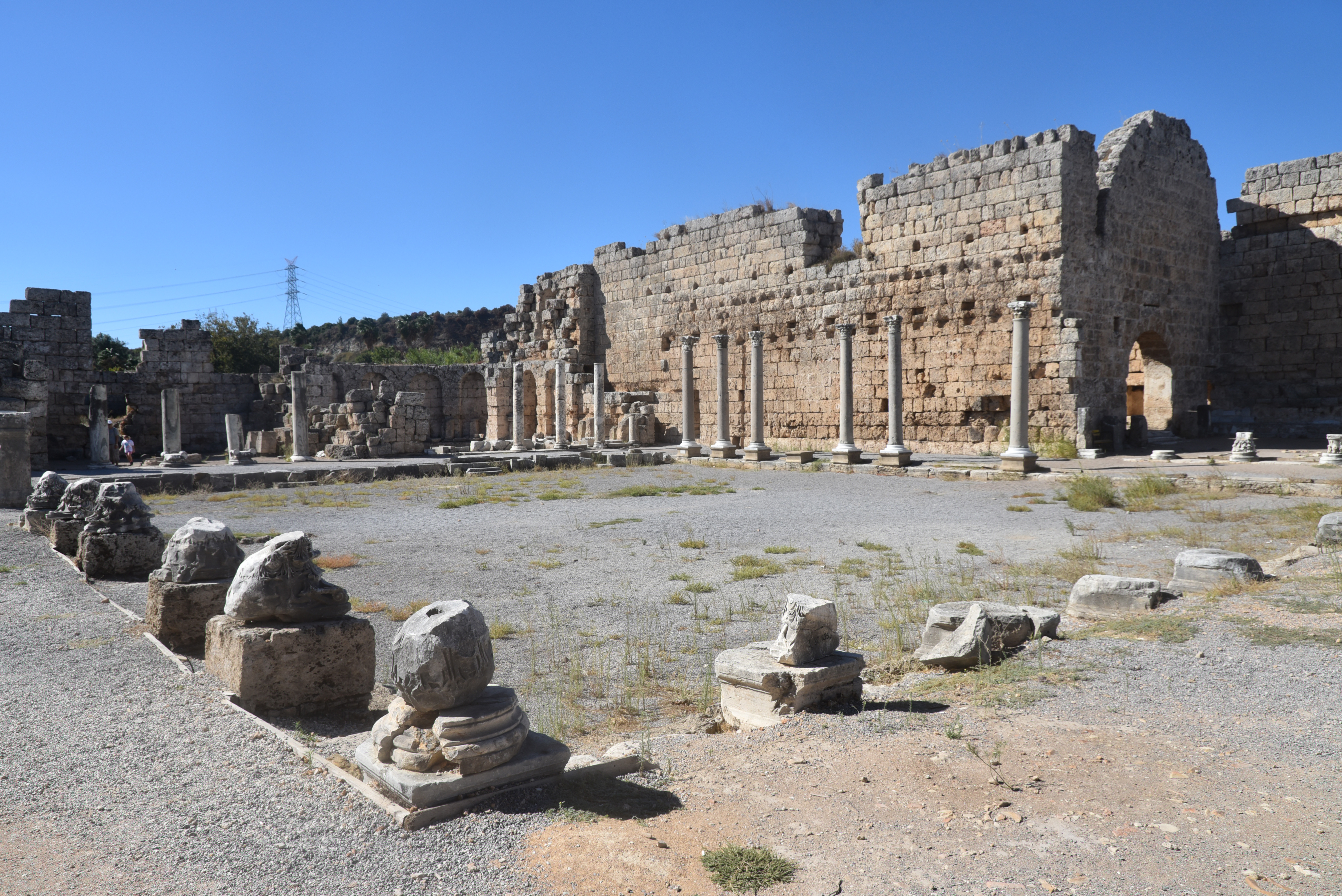
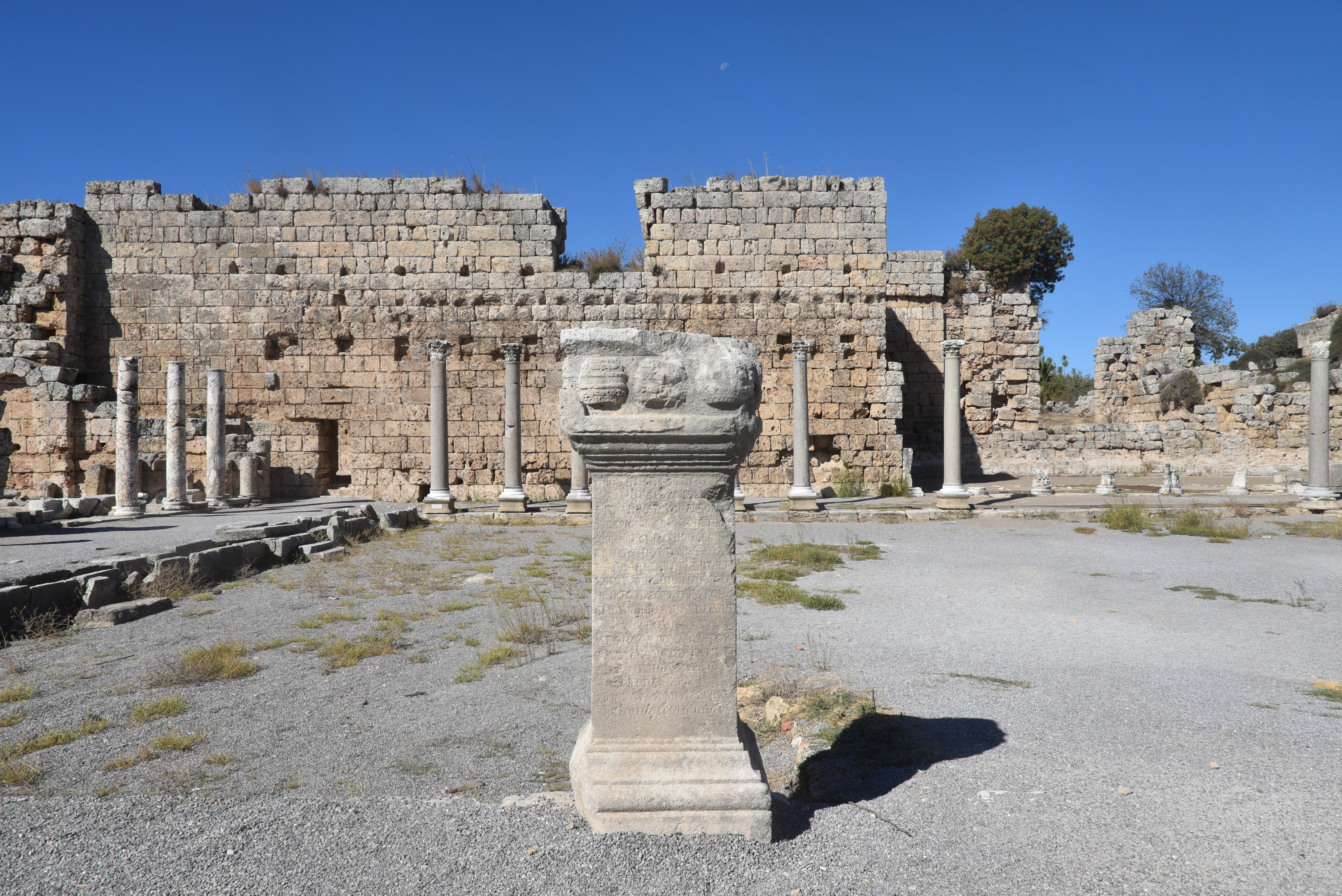
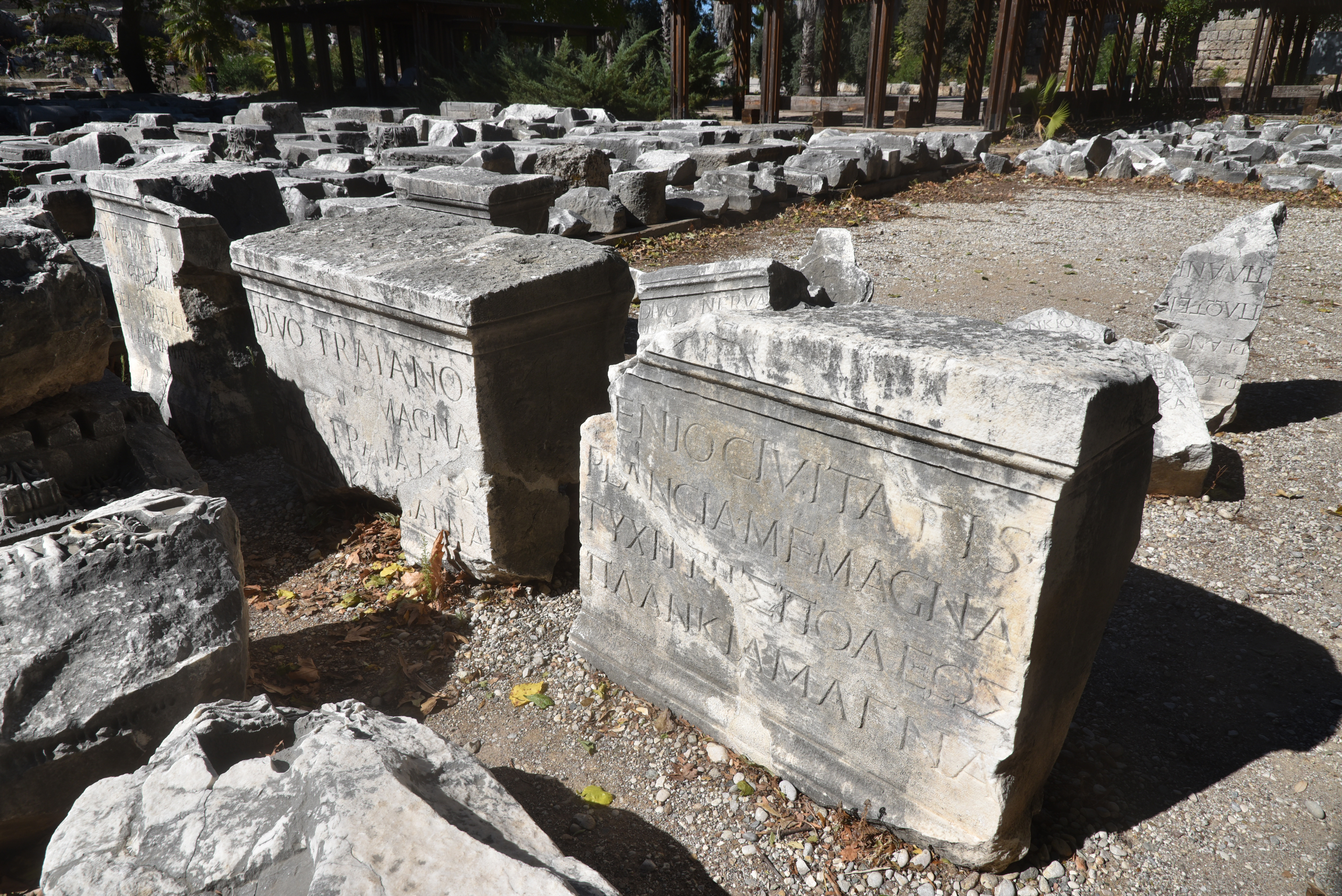
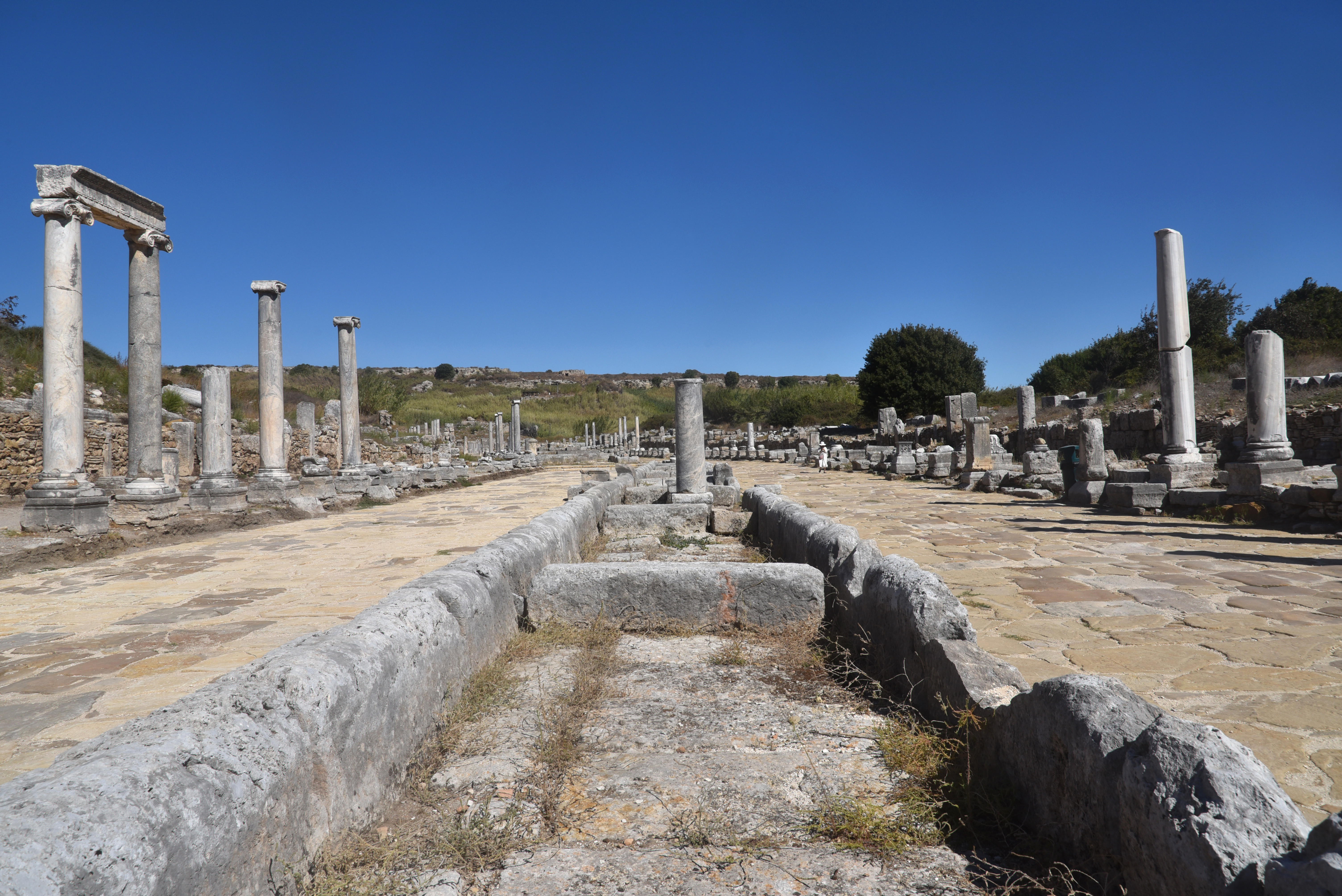
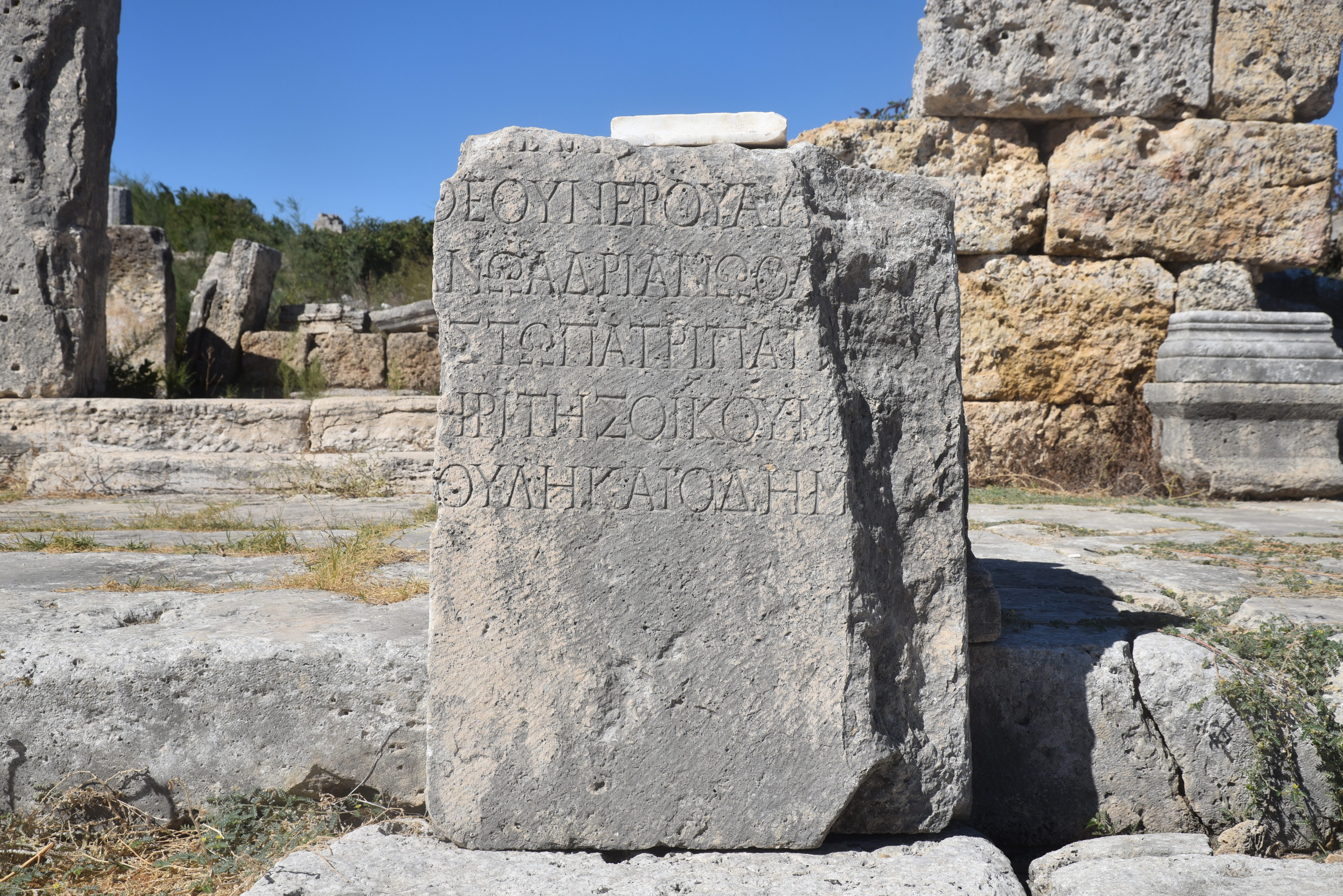
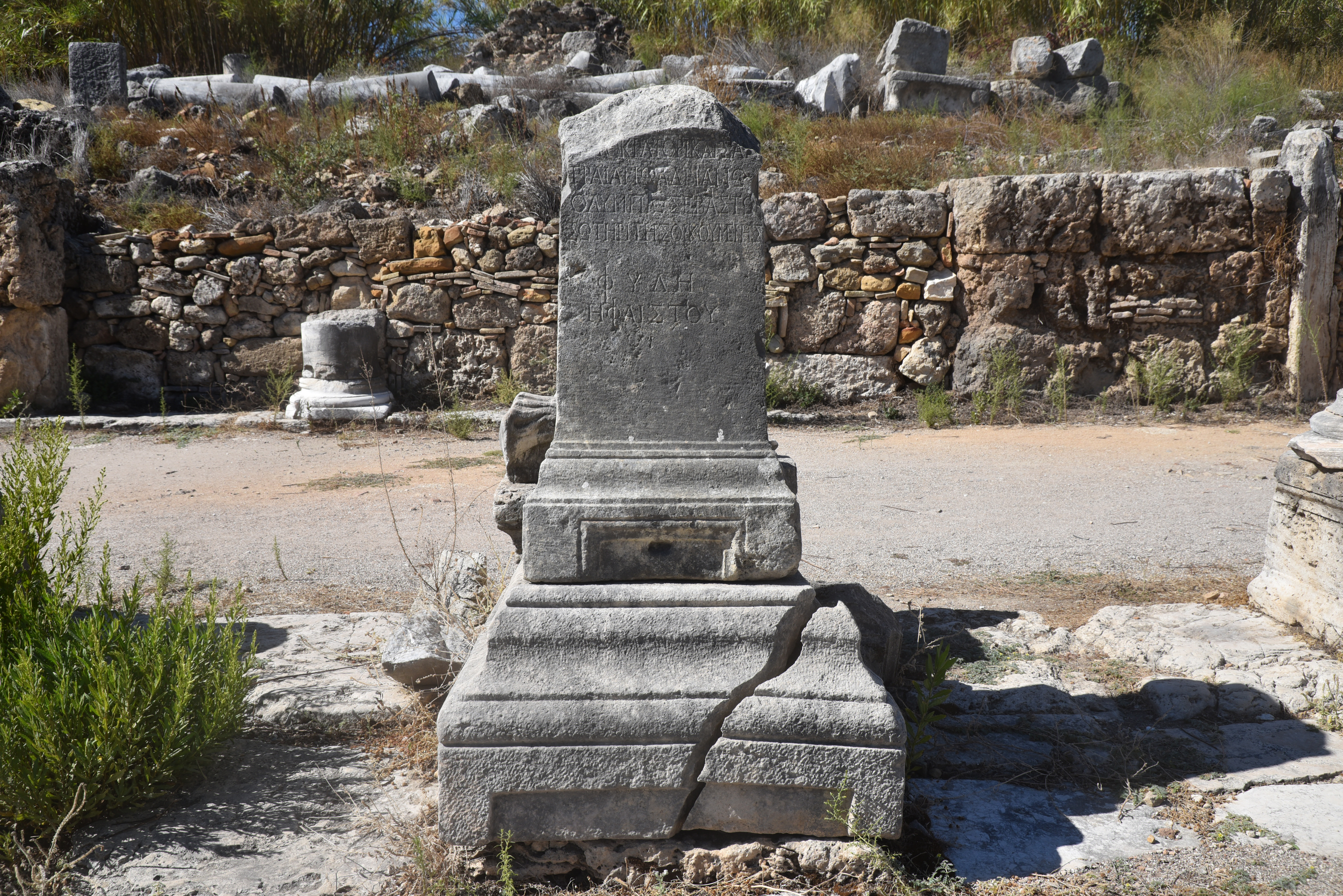
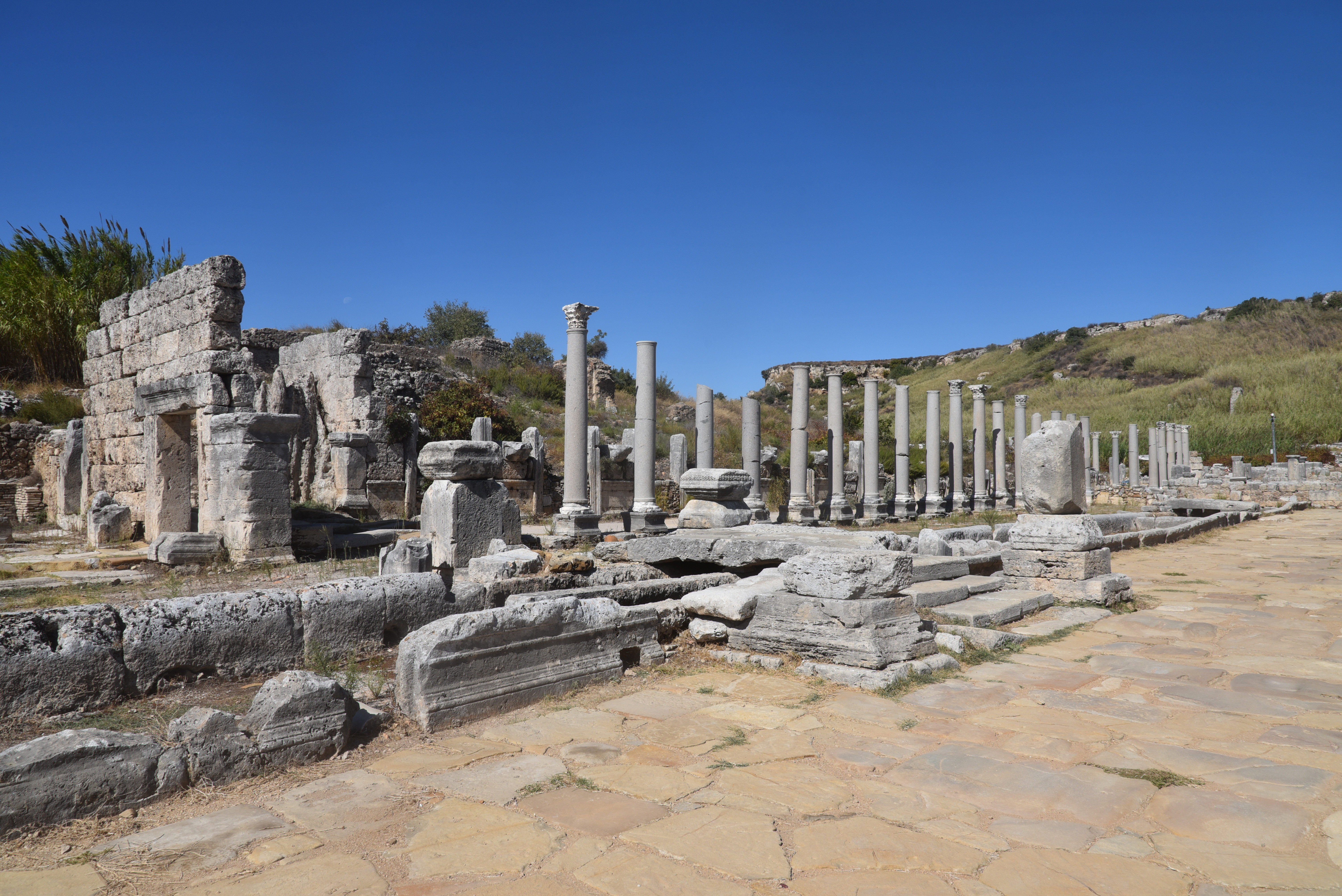
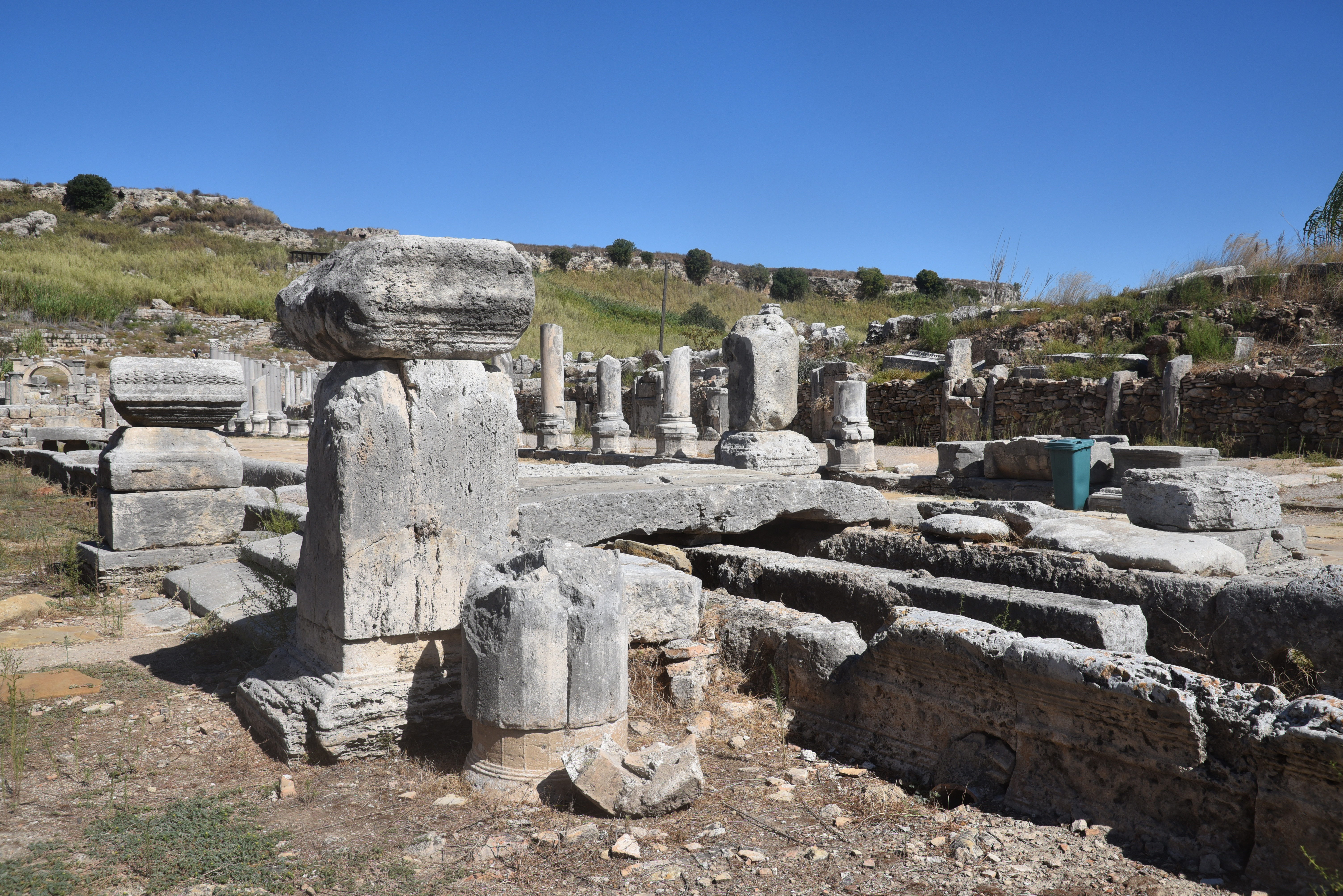
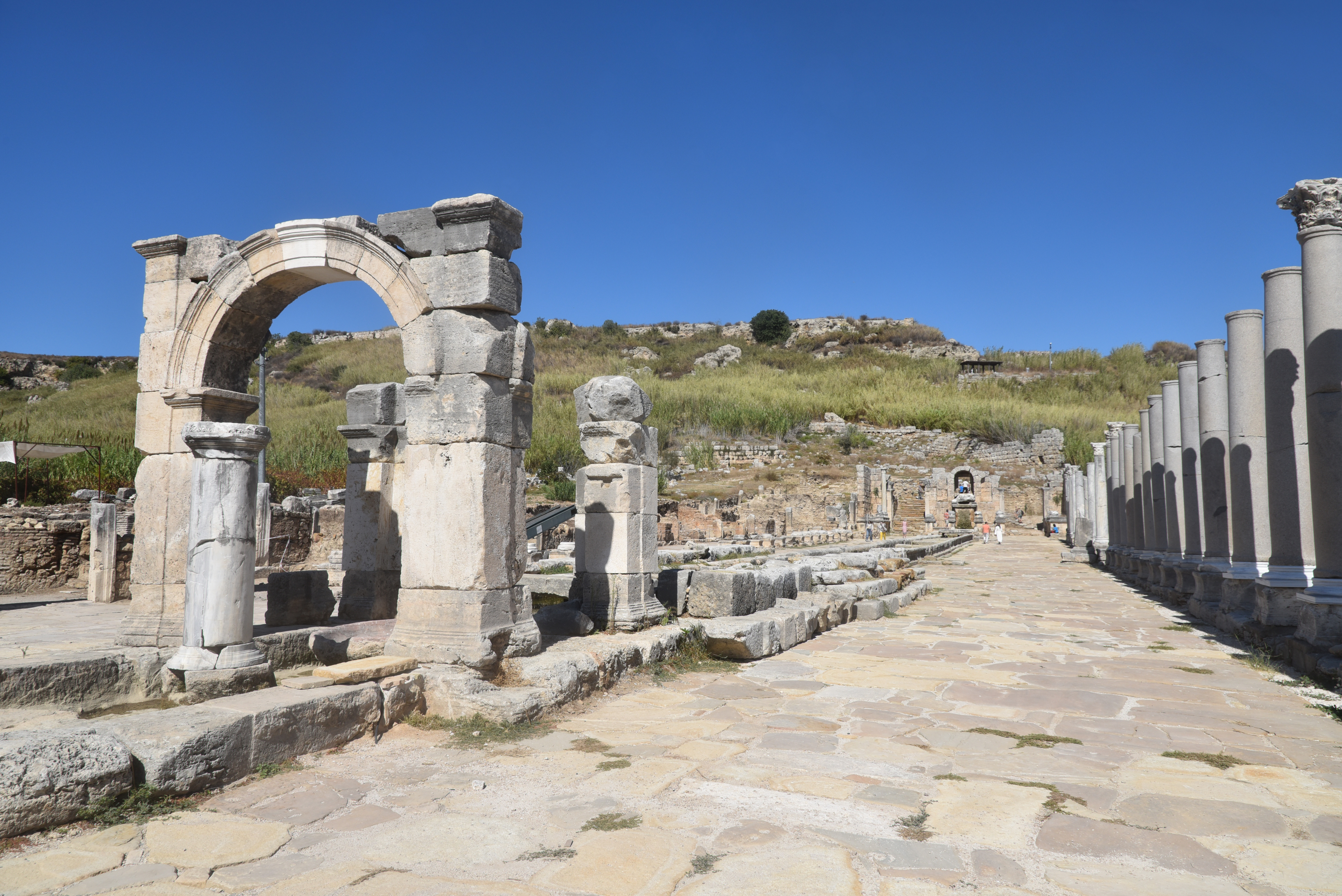
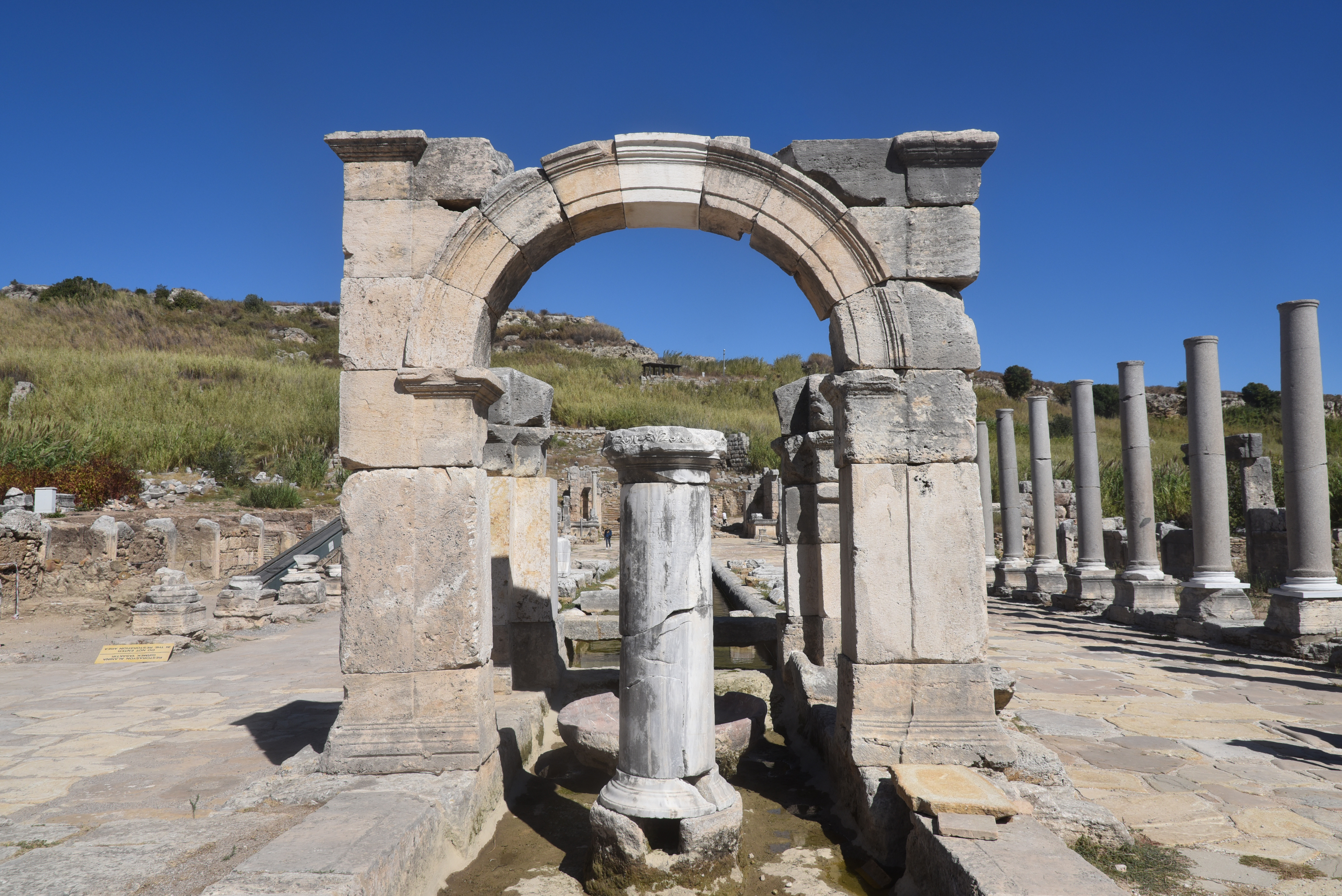
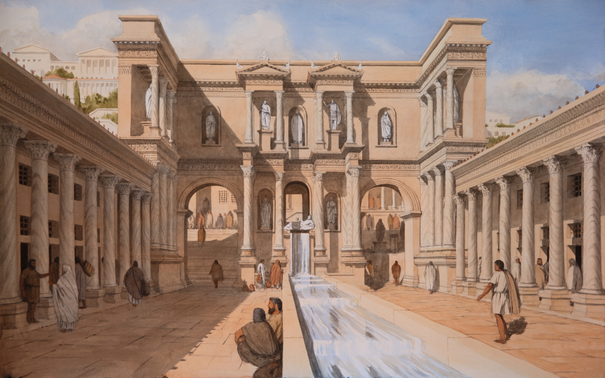
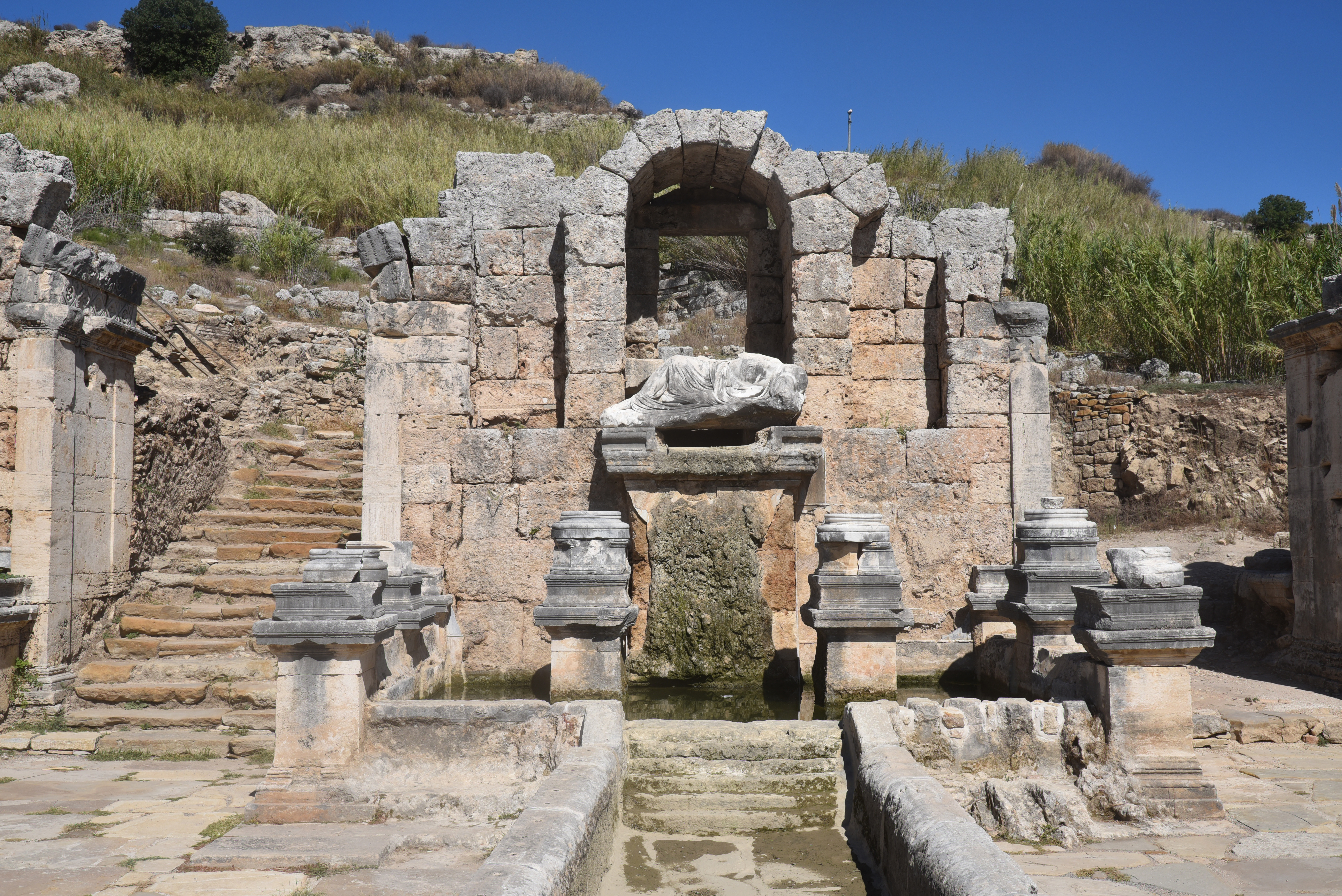
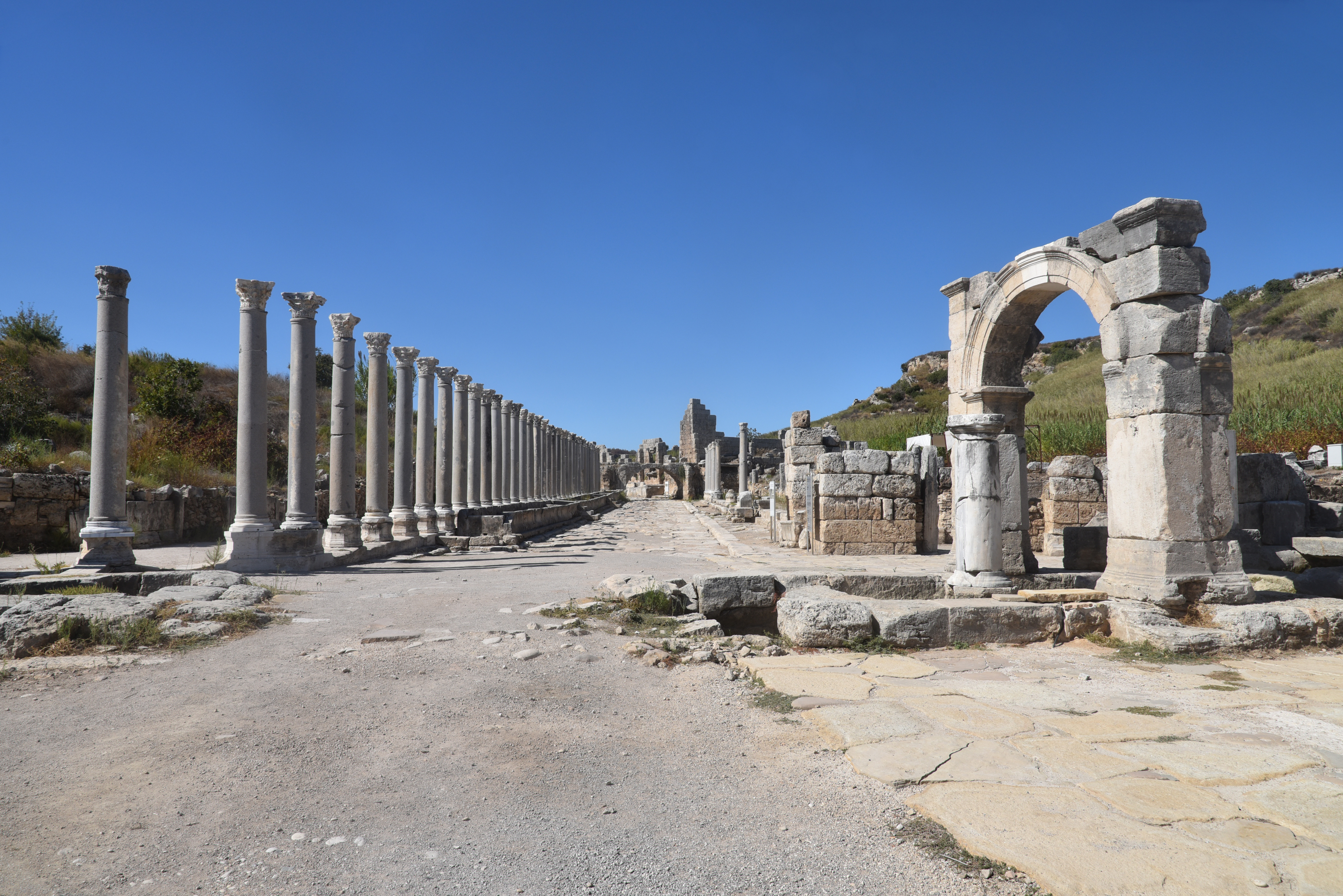
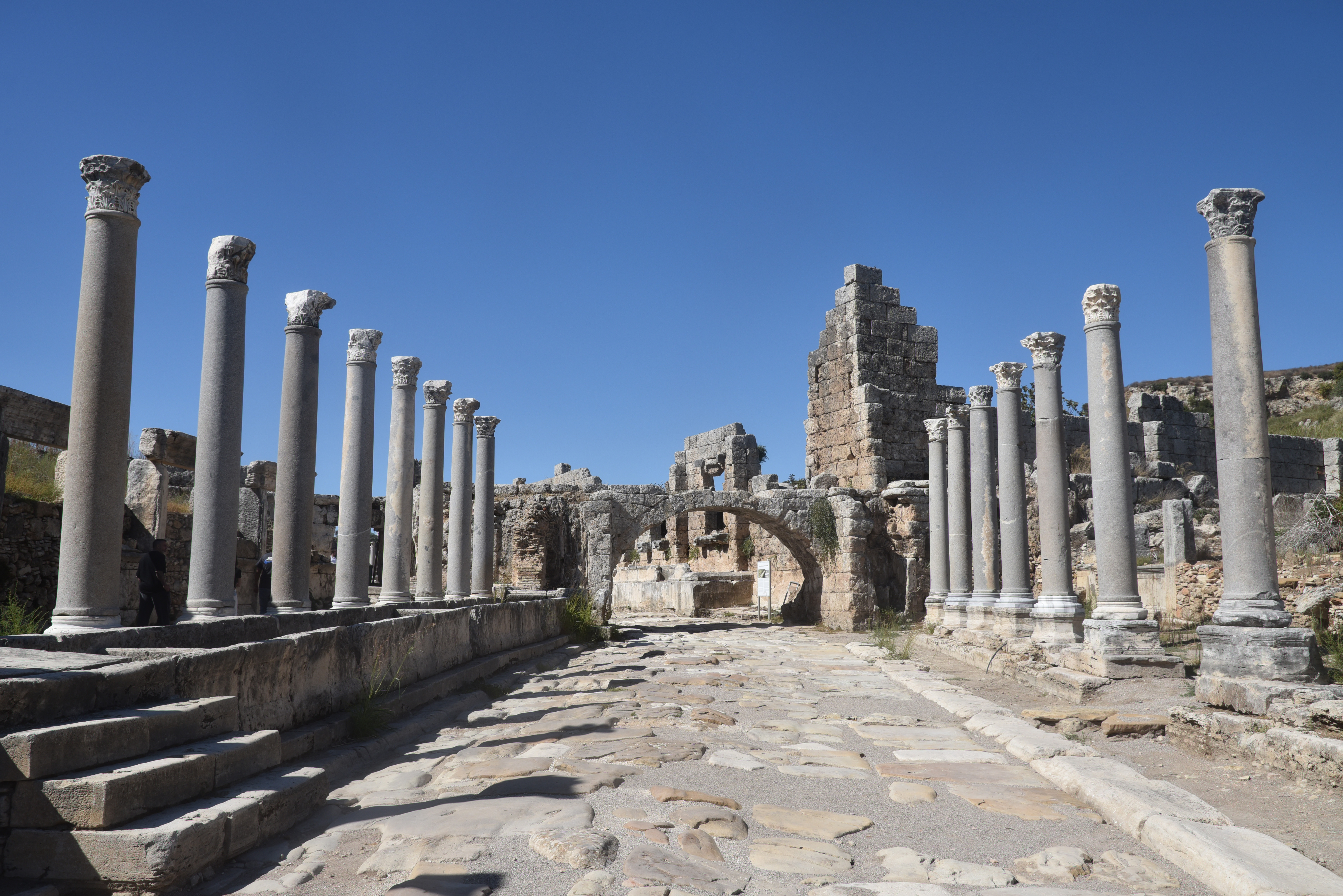
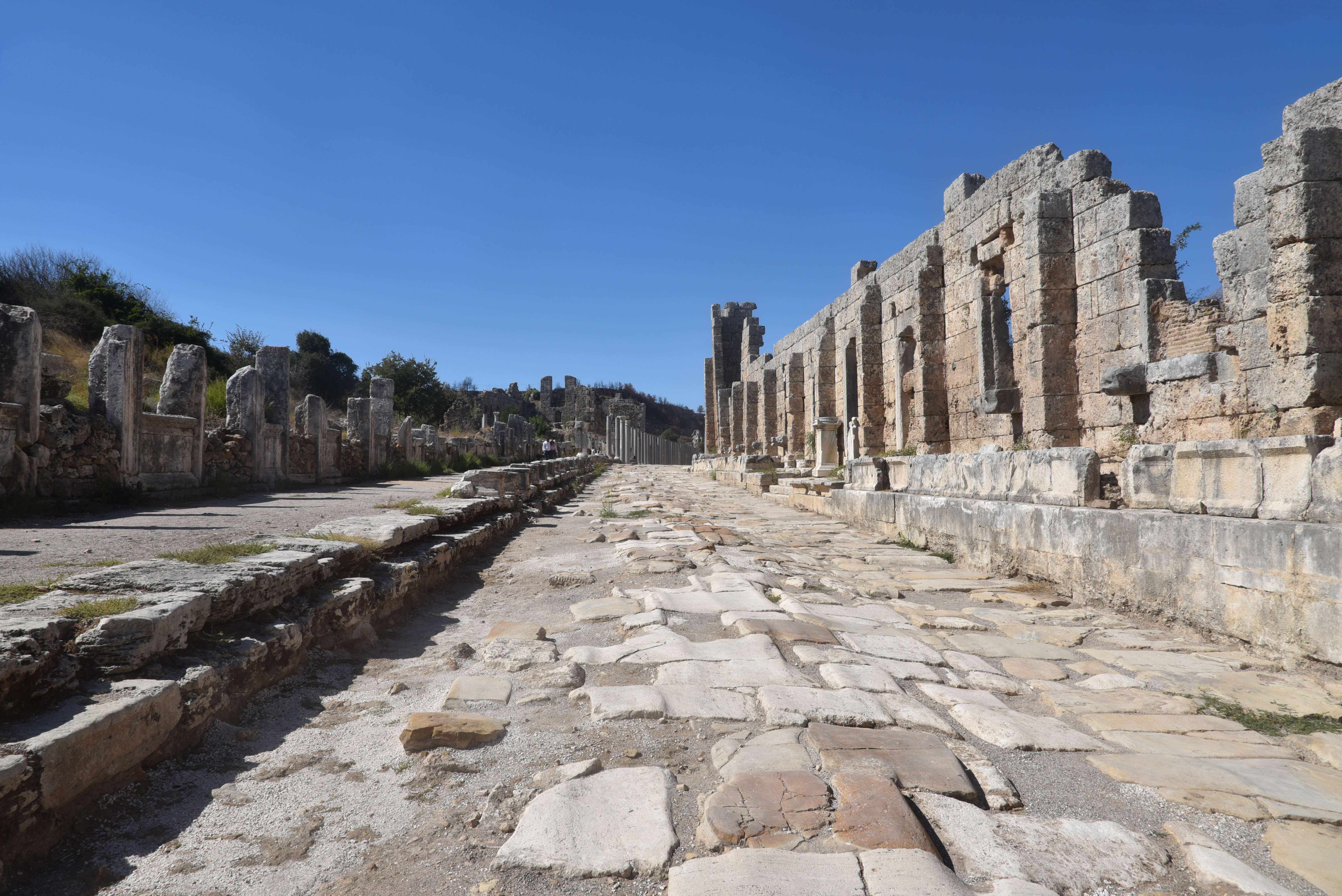
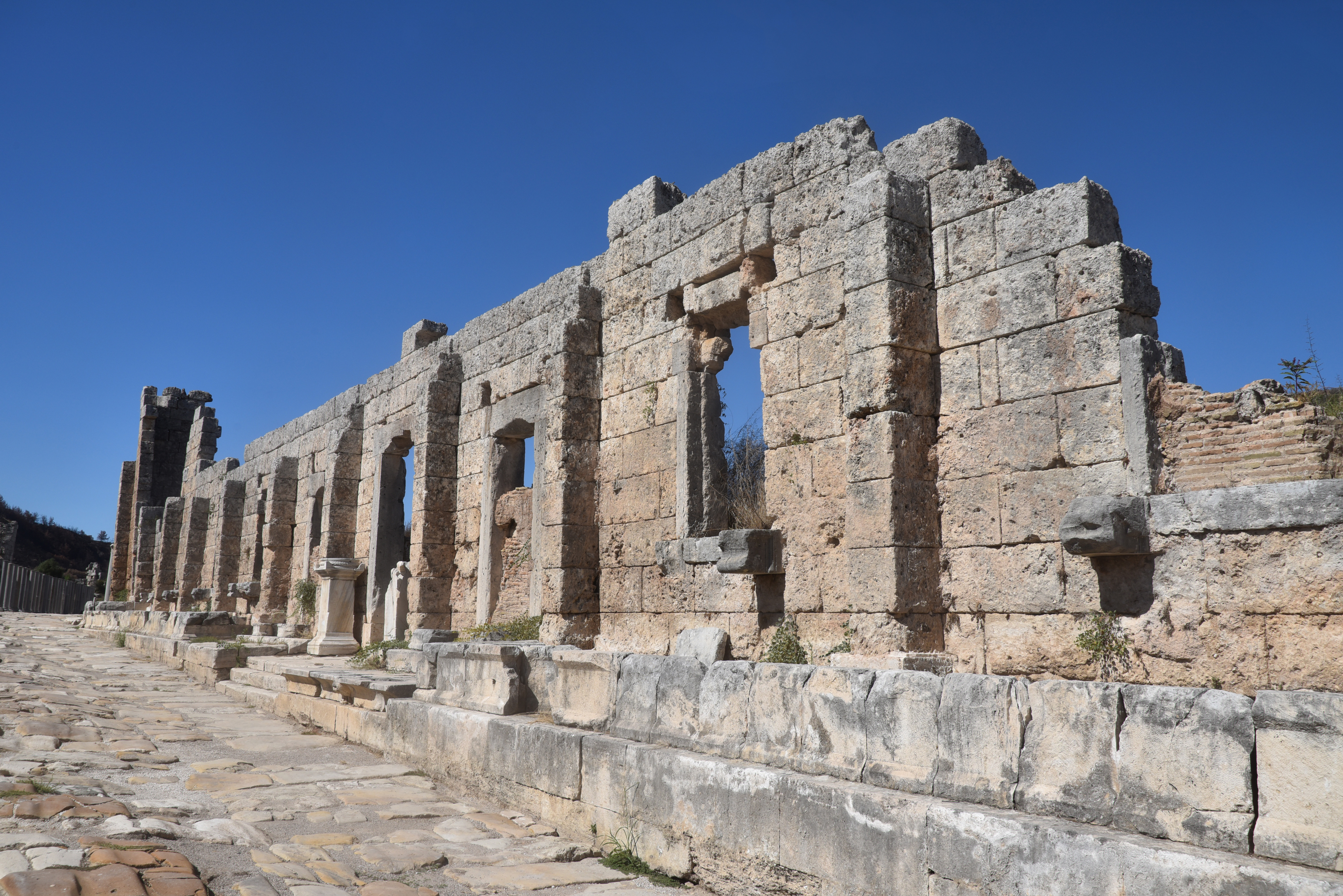
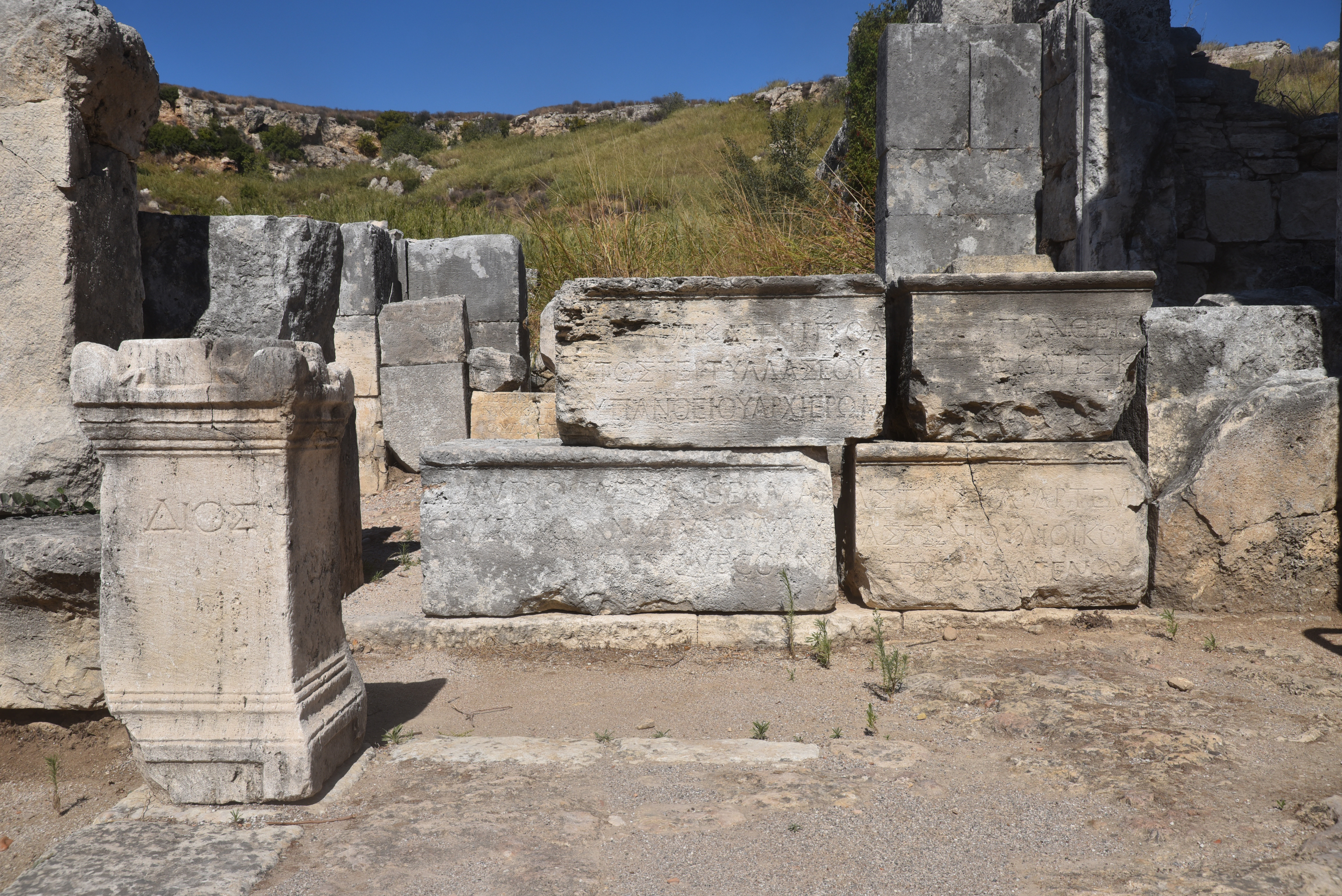
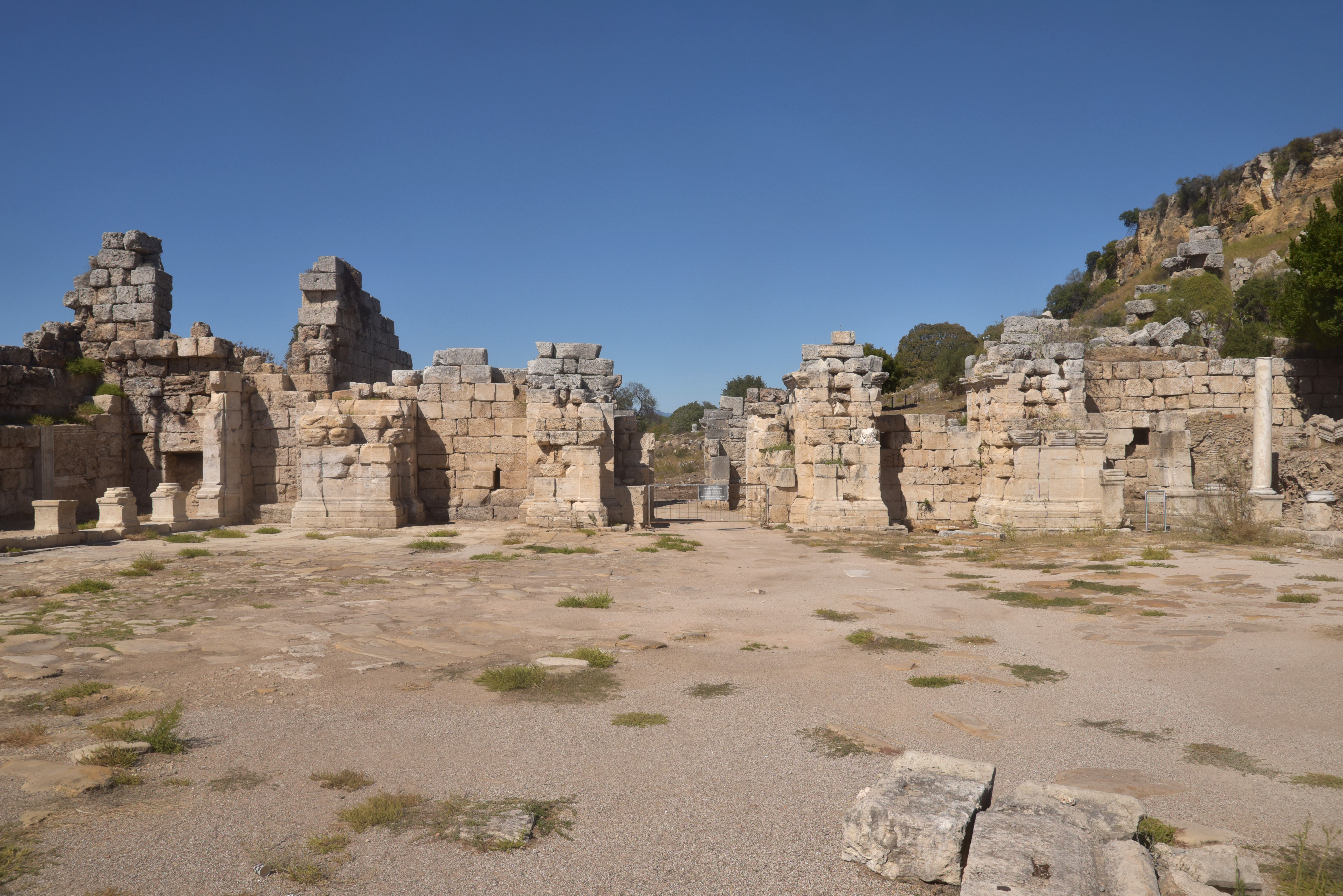
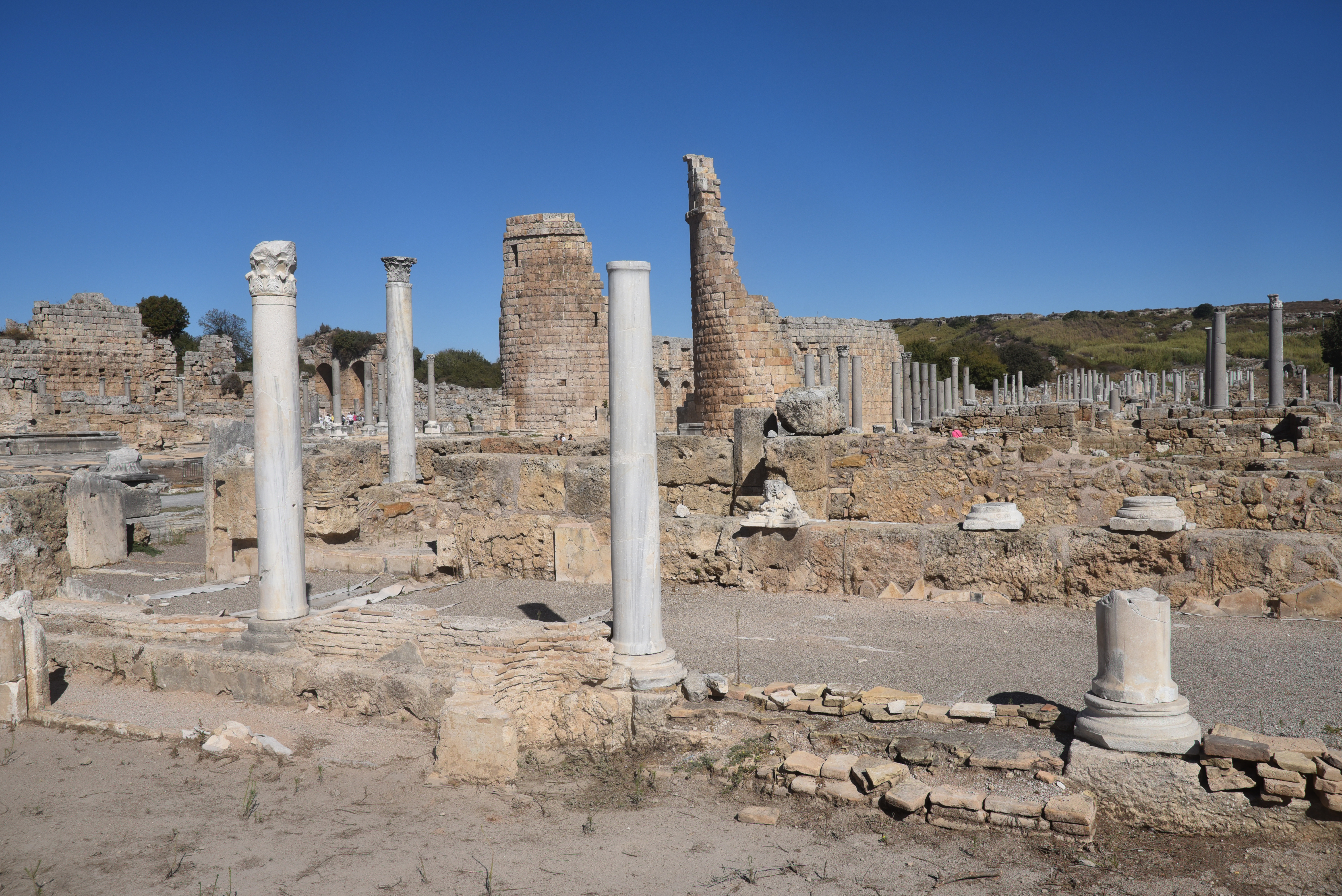
The outer gate, built during the reign of Emperor Septimius Severus in the 4th century AD. Both sides of the gate were protected by high towers.The gate opens into a courtyard, also constructed during the reign of Septimius Severus, and the city beyond.The Southern Nymphaeum (fountain), built on the orders of Aurelia Paulina between AD 198 and 211 in the courtyard of Septimius Severus.The monumental nymphaeum was dedicated to Artemis Pergaia (the local goddess of Perge) and the imperial family of Septimius Severus.Τhe central courtyard (palaestra) with Ionic colonnade of the South Baths. This monumental baths complex dates to the reigns of Trajan (98-117) or Hadrian (117-138) and was reconstructed in the reign of Septimius Severus (193-235).The palaestra of the South Baths, used for the physical exercise of the young.Room IV of the South Baths with a swimming pool (natatio), measuring 20×13 m. It was functionally connected with the palaestra.The Tepidarium (Room II) of the South Baths, measuring with a system for the circulation of hot air (hypocausts) running under the marble floor of the room.Inscribed statue base dedicated to Hadrian in Southern Baths, IK Perge 112, dated AD 131-132.The South Baths.The Hellenistic City Gate with two circular towers, dating to the 3rd century BC, was later renovated by Plancia Magna in the 2nd century AD.Monumental triple arch commissioned by Plancia Magna, a local elite woman and prominent benefactress, during the early reign of Hadrian.The interior horseshoe-shaped courtyard of the Hellenistic city gate, reconstructed in the early 2nd century AD by Plancia Magna, with niches where statues once stood, Perge.Artist reconstruction of the cardo maximus with the Hellenistic gate complex and the honorific arch. Balage Balogh / archaeologyillustrated.comStatue bases of Hadrian’s imperial family set up by Plancia Magna and placed on the monumental triple arch commissioned by her during the early reign of Hadrian.The colonnaded Cardo Maximus, the main north-south street running through the heart of the city.The Cardo Maximus is flanked on both sides by impressive marble columns, which once formed covered porticoes or walkways for pedestrians, providing shade and shelter for shoppers and citizens.A unique feature of Perge’s main street is a narrow water channel running down the middle. Water from the northern nymphaeum (monumental fountain) flowed through this channel, supplying fresh water to the city and adding to the street’s grandeur.The Cardo Maximus was paved with large stone slabs, and ruts worn by thousands of chariots are still visible in the original flagstones. Numerous shops and public buildings, some with mosaic floors, lined the street, making it the city’s primary commercial and social artery.Inscribed statue base along the Cardo Maximus dedicated to Hadrian, IK Perge 113, dated AD 131-132.Inscribed statue base along the Cardo Maximus dedicated to Hadrian, IK Perge 115, dated AD 131-132.The northern section of the colonnaded Cardo Maximus.
The northern section of the colonnaded Cardo Maximus and the Arch of Demetrius and Apollonius, a monumental Roman arch built around AD 80 and located at the intersection of the city’s two main colonnaded streets.The so-called Arch of Demetrius and Apollonius, a monumental Roman arch built around AD 80. This single-arched gate stood nearly 11 meters tall, but today only the square pylon legs remain.The northern section of the colonnaded Cardo Maximus.
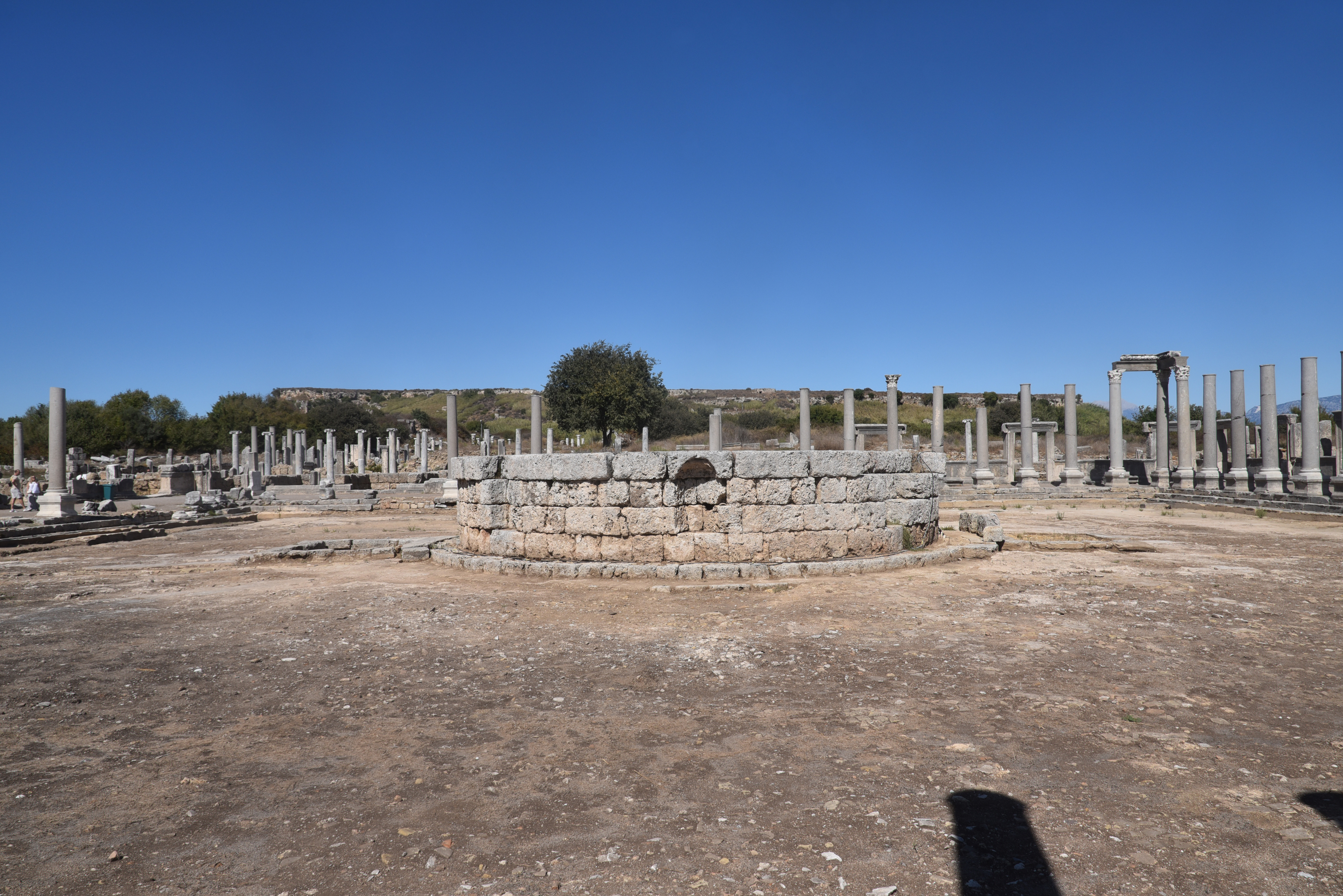
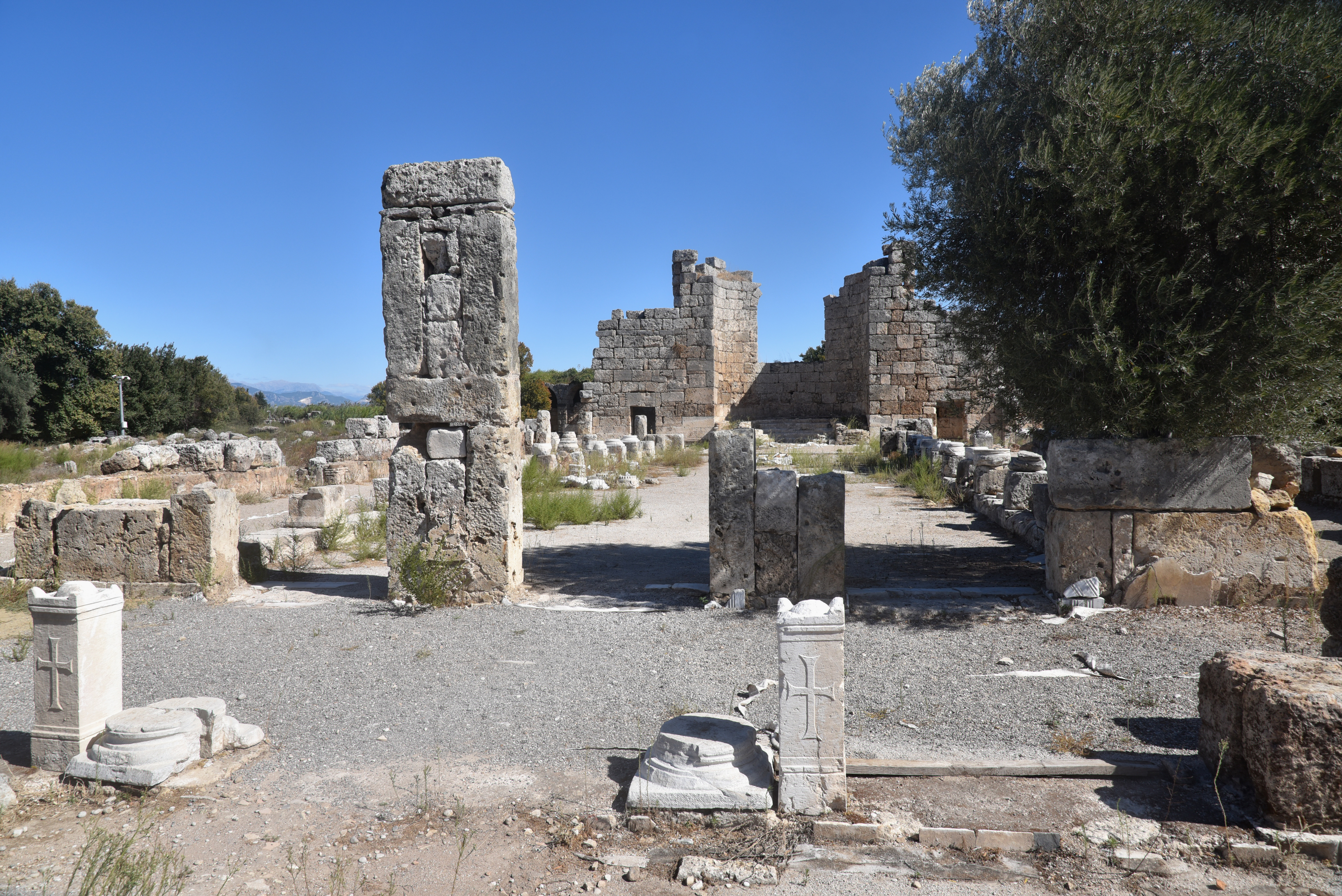
The North Nymphaeum, located at the northern end of the Cardo Maximus. It is dated to the Hadrianic period.Artist reconstruction of North Nymphaeum. It was a double-storied pi-shaped nymphaeum, with two projecting side wings fronted by columnar façades. Balage Balogh / archaeologyillustrated.comThe statuary display of the North Nymphaeum included two life-sized portraits of Hadrian, one cuirassed and the other heroically nude (see here).The Western Colonnaded Street (Decumanus Maximus), one of the city’s two main arteries.The Western Colonnaded Street, one of the city’s two main arteries, is a roughly 460-meter-long, 8-meter-wide thoroughfare that runs from the main street intersection toward the Palaestra and Northern Baths.Lined with Corinthian or Ionic columns, the porticoes of the Western Colonnaded Street provided pedestrians with shaded walkways and served as a location for shops.The Western Colonnaded Street (Decumanus Maximus) with the gymnasium-palaestra complex donated by C. Iulius Cornutus Bryoninus, Iulia Tertulla and Iulia Severa and dedicated to the Emperor Claudius. The building was erected of travertine on a square plan, with sides measuring 76 meters.The facade of the gymnasium-palaestra complex.Inscriptions along the Western Colonnaded Street (Decumanus Maximus).North West City Gate, Perge, the monumental entrance gate at the western end of the Decumanus Maximus.The Caracalla Nymphaeum, a semi-circular monumental fountain located at the end of the Decuman Maximus. It was constructed on a raised podium and embellished with statues of gods and goddesses, as well as of Emperor Caracalla.The Agora/Macellum, a square-shaped (51m x 51m) surrounded by colonnades and shops built in the 4th century AD.The northern side of the Agora/Macellum.The circular structure in the centre of the Agora/Macellum served as a fountain.
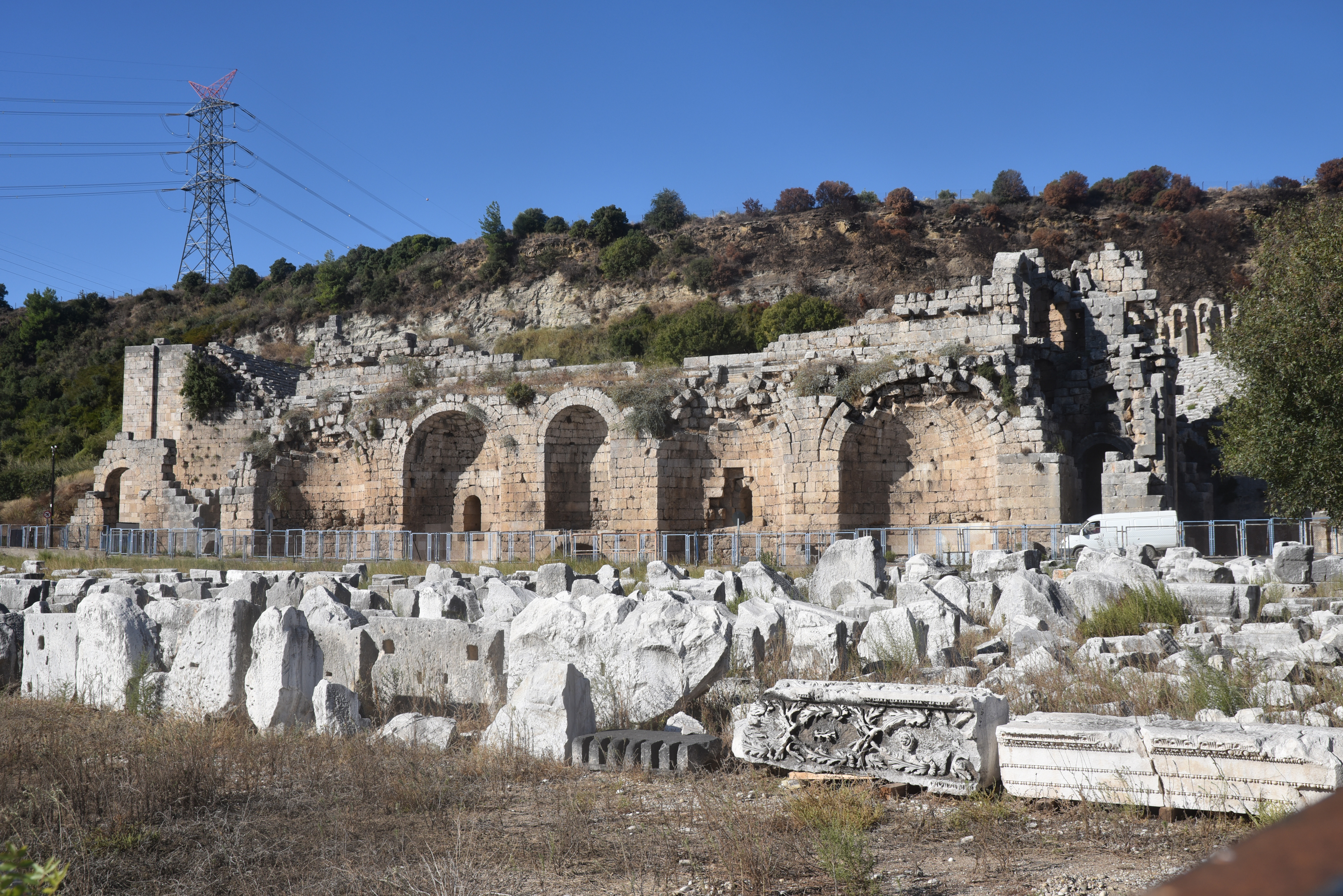
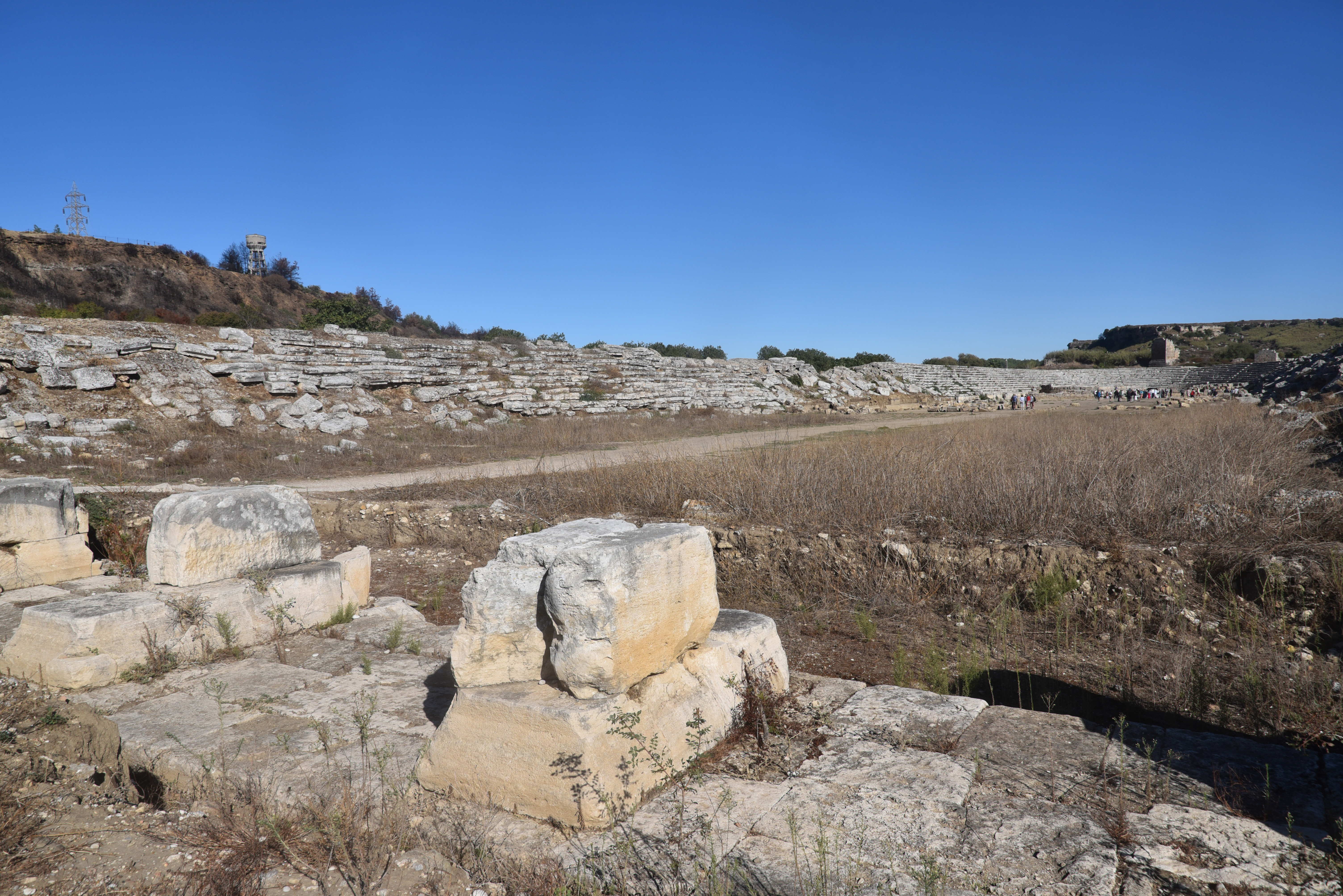
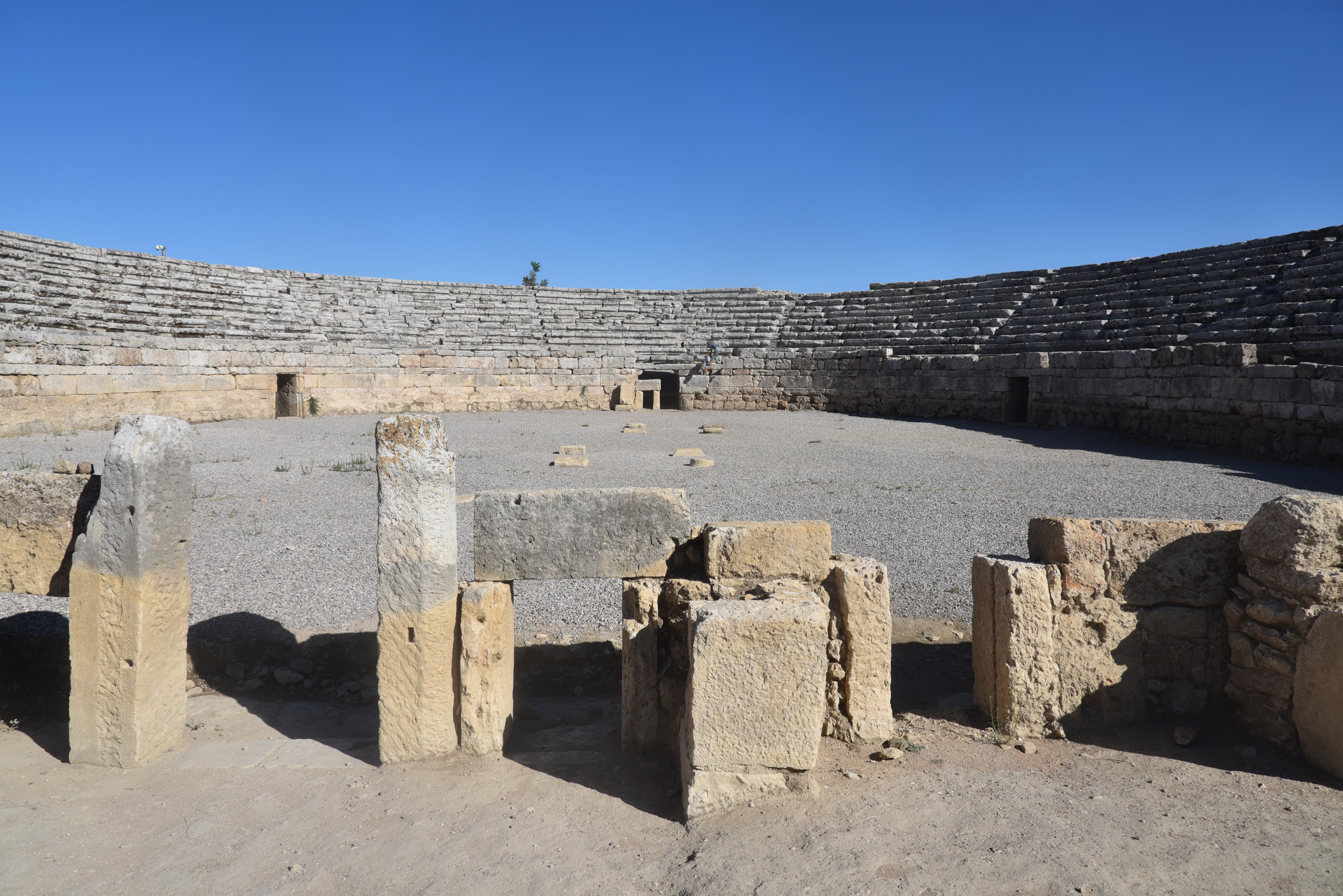
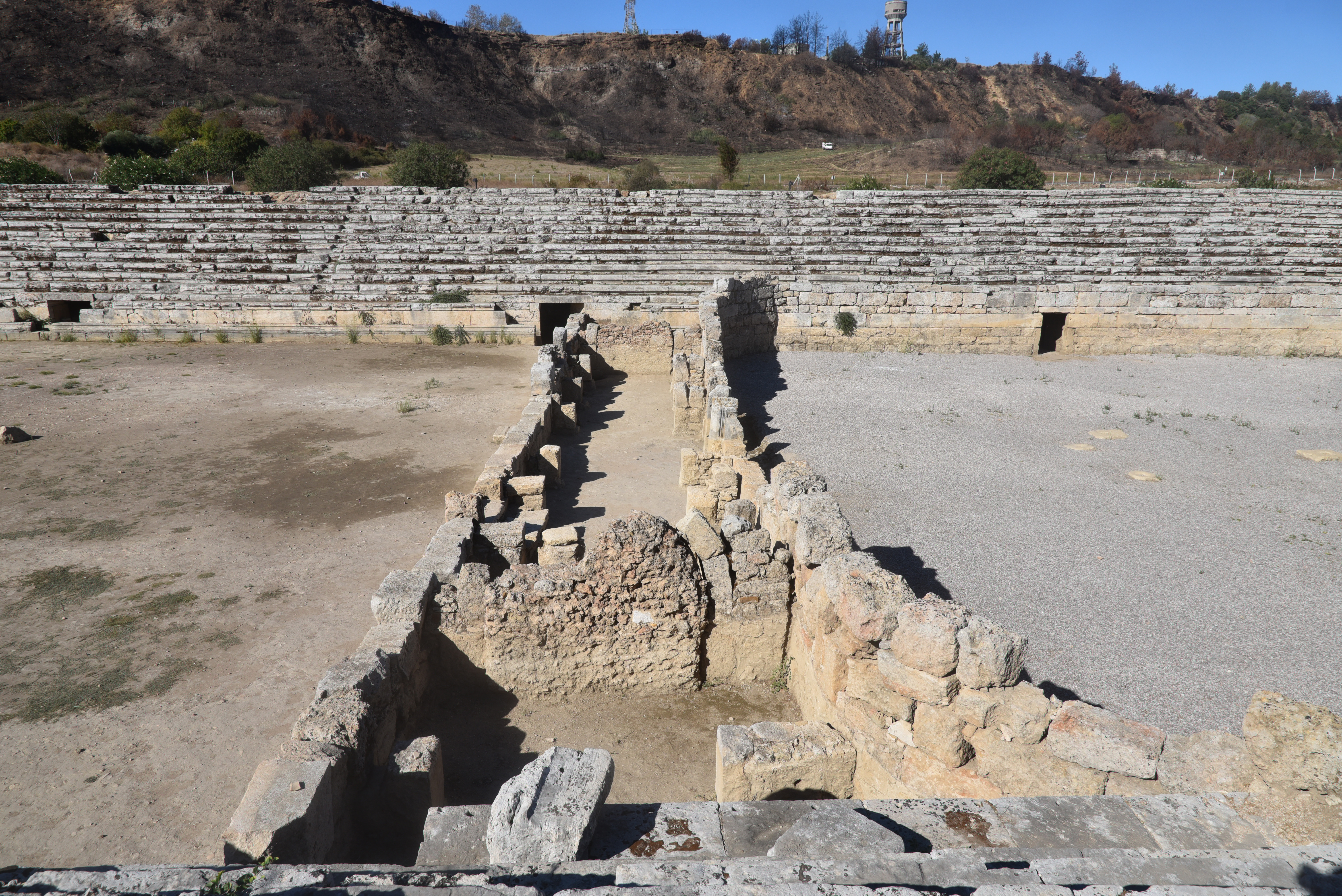
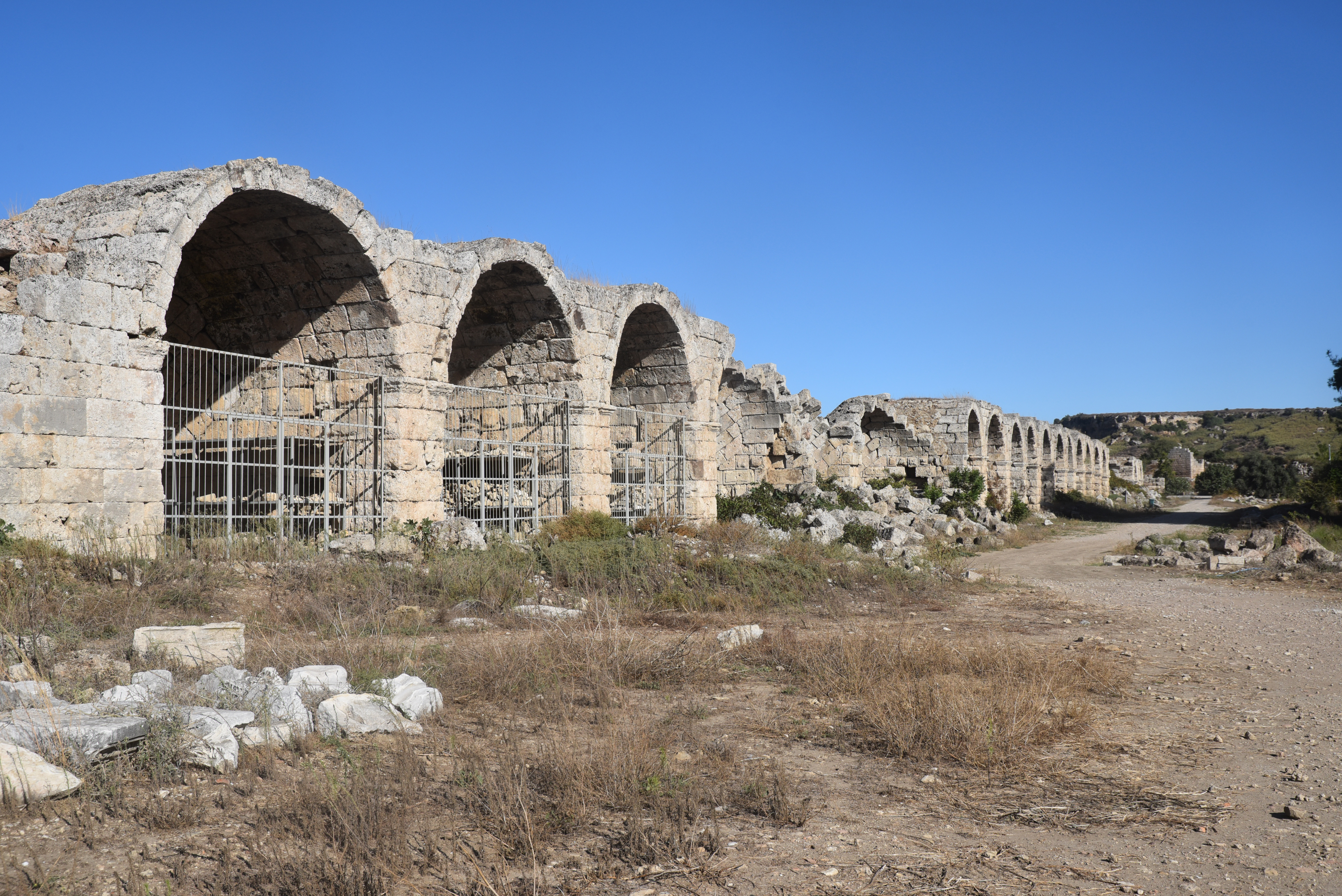
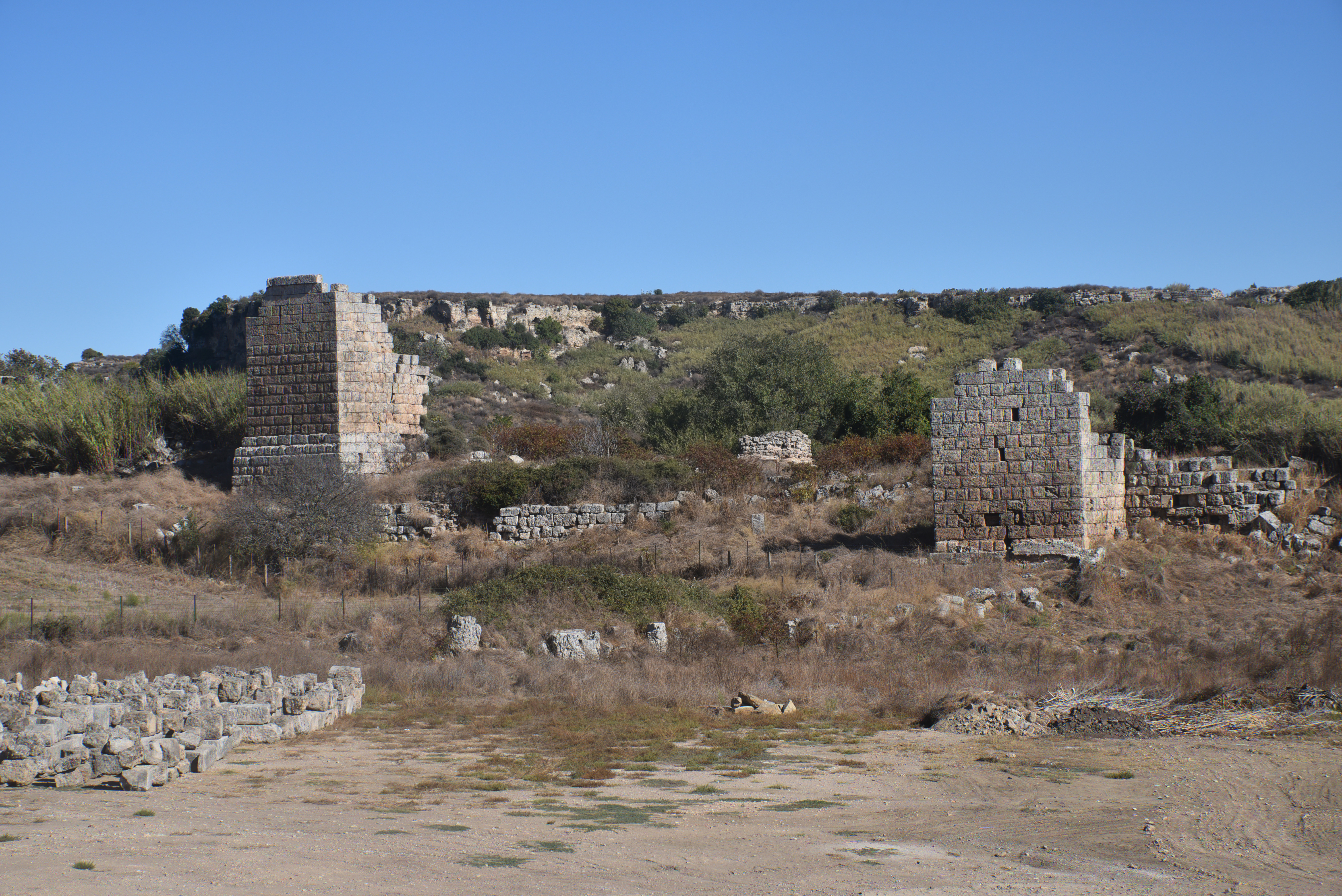
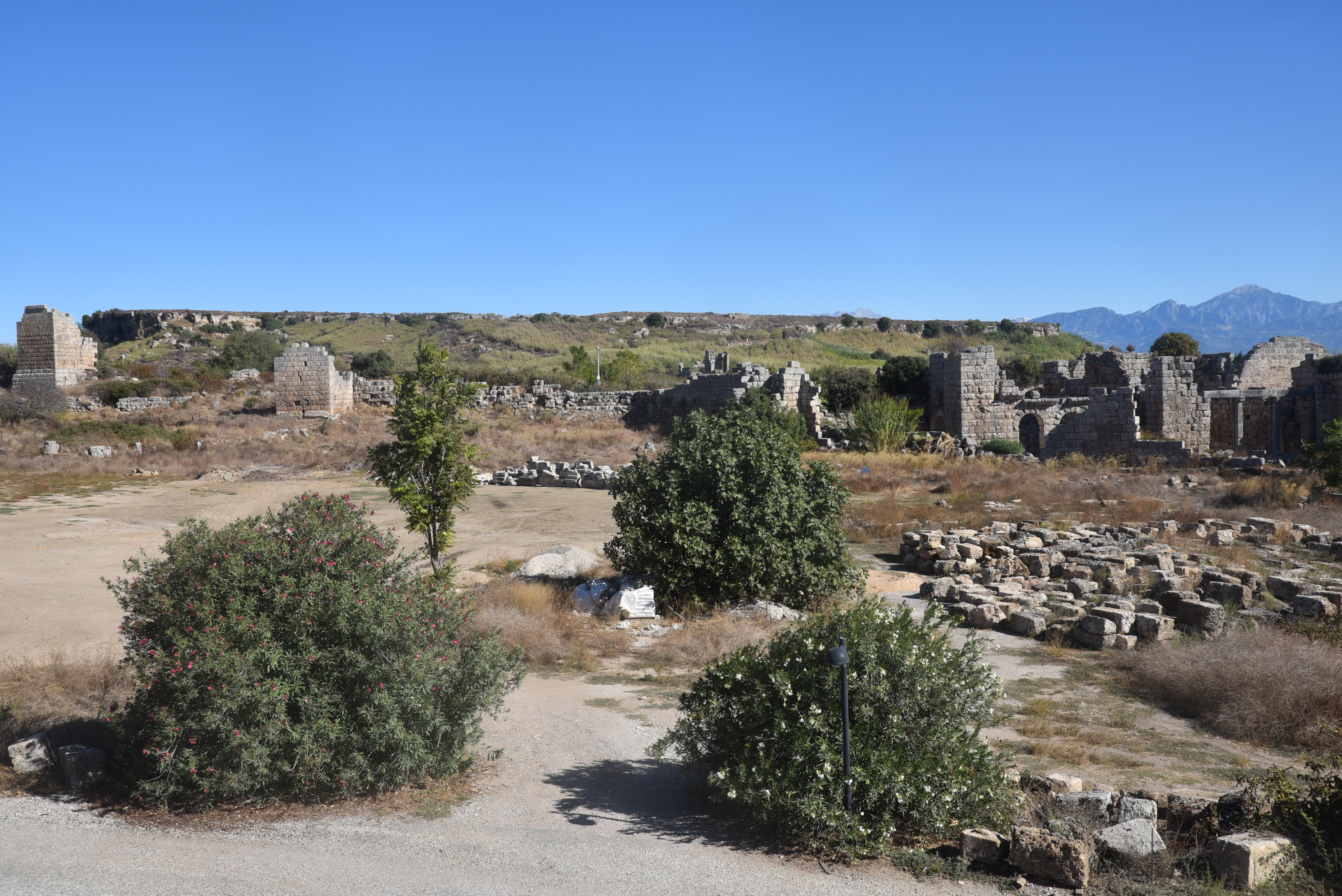
View of the Theatre, located outside the city walls on the western side, was closed to the public in October 2025. Probably built around 120 AD, could accommodate approximately 15,000 spectators.The Stadium. Built in the second half of the 1st century AD, it could accommodate 12,000 spectators.The stadium of Perge is one of the best-preserved ancient stadiums in Asia Minor. Constructed in the latter part of the 1st century AD, it measures 234 meters in length and contains twelve rows of seating.The northern end of the Stadium where bloody gladiator fights took place.The Stadium.The Stadium features barrel-vaulted construction with 30 vaults on the longer side and 9 on the northern end.View of the South Baths from the top of the Stadium.View of the fortification walls and towers from the top of the Stadium.View of the fortification towers and the South Baths from the top of the Stadium.The Southern Basilica has three naves and a narthex, dating to the 6th century AD.
 Waelkens, a Belgian archaeologist, became director of the Sagalassos Archaeological Research Project in 1990 after first visiting the site in the early 1980s. He launched large-scale excavations that would redefine the understanding of the city and its surrounding landscape. Waelkens championed a strongly interdisciplinary approach, bringing together specialists from a wide range of scientific fields to study not only monumental architecture but also environmental data, material culture, and everyday life. Under his leadership, Sagalassos became a model for modern archaeological research, demonstrating how a city’s history can be reconstructed in depth by integrating archaeology, natural sciences, and historical analysis.