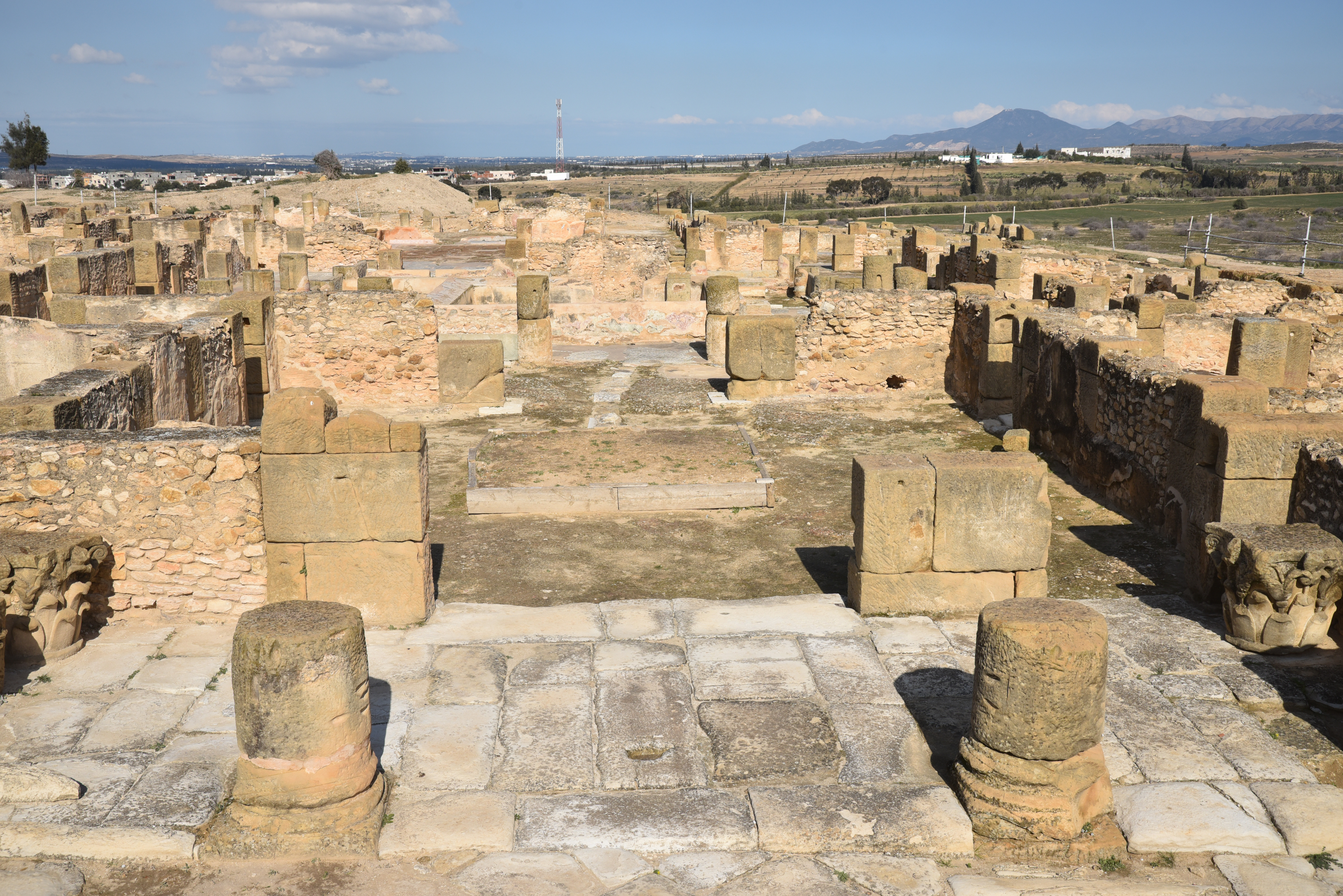
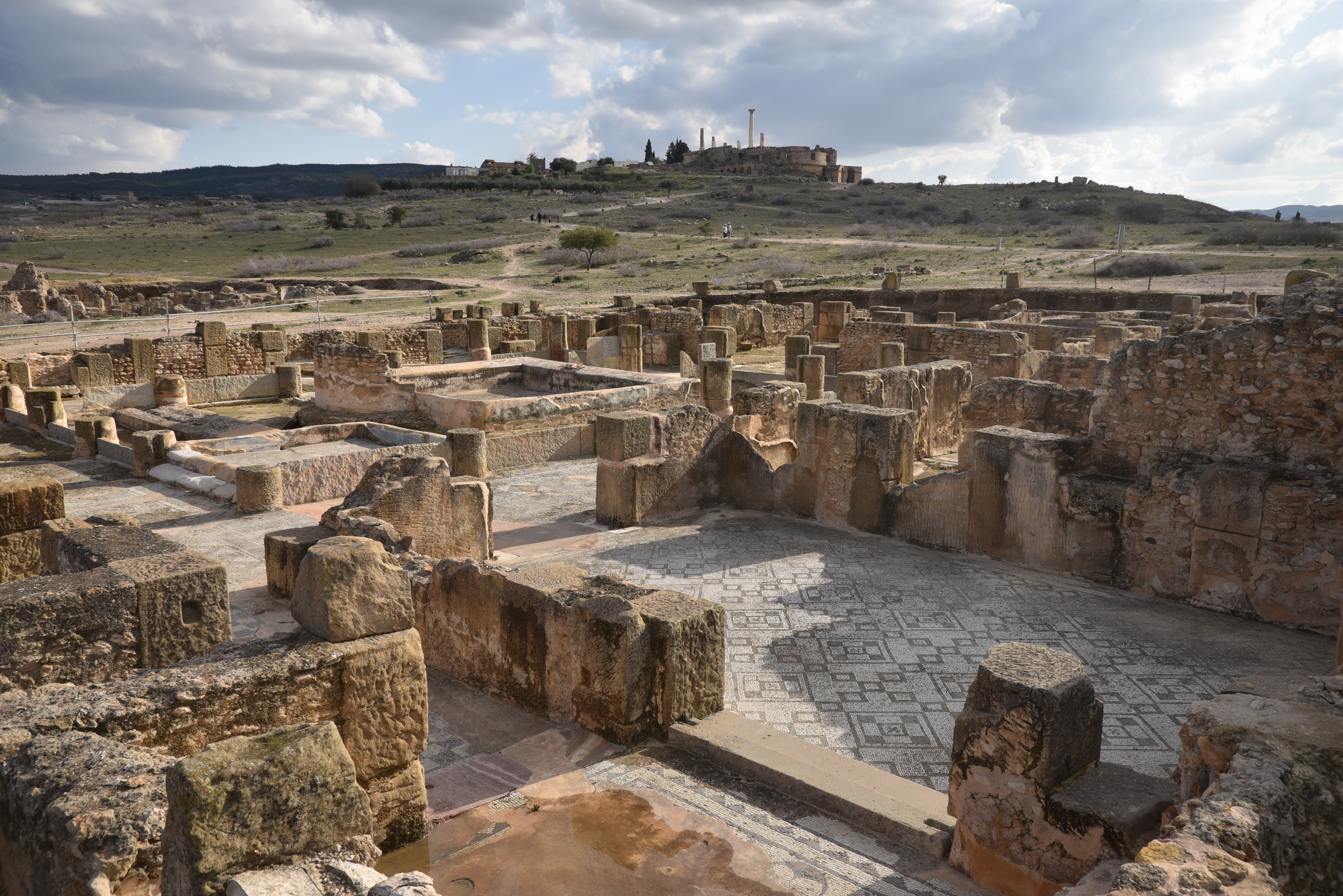
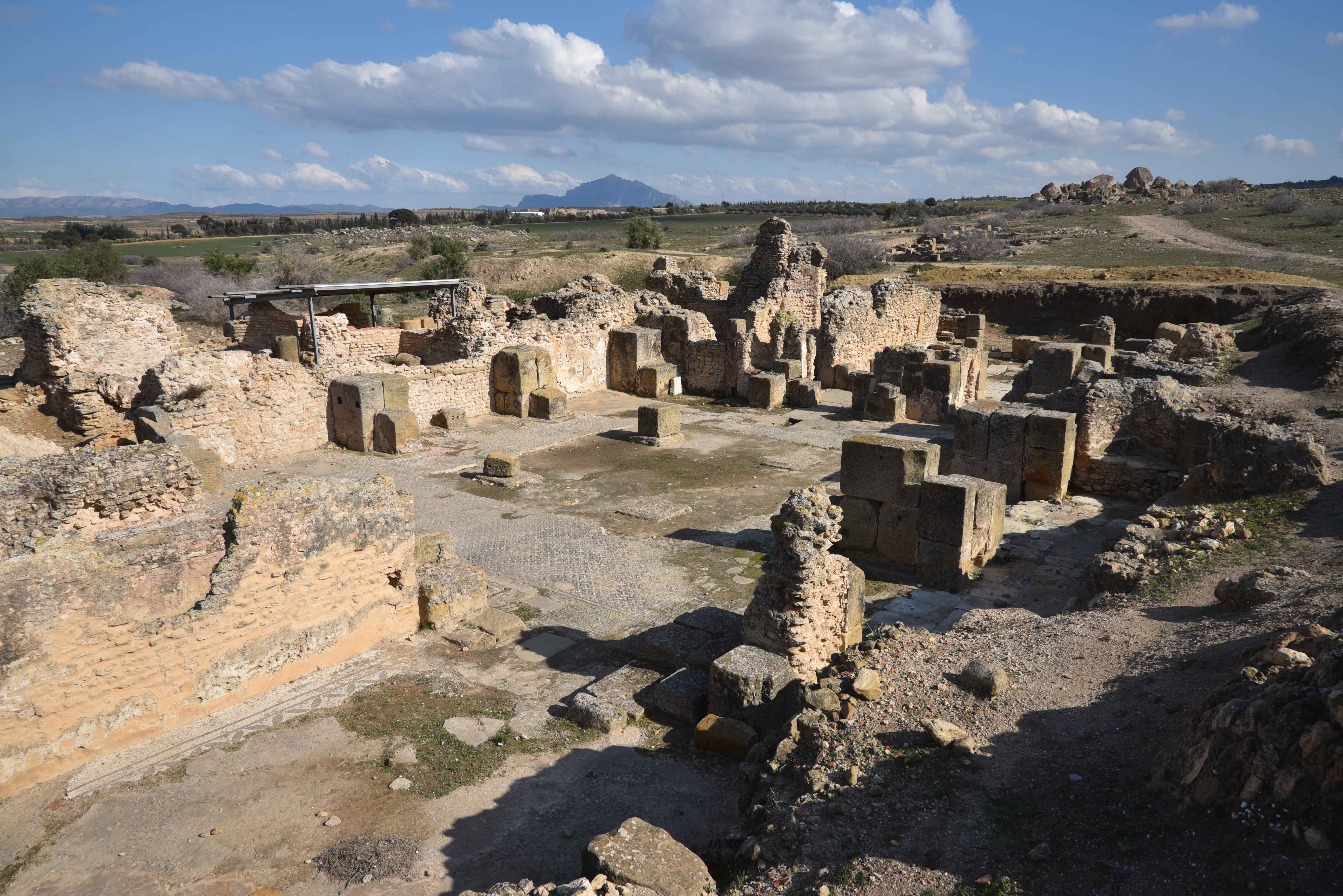
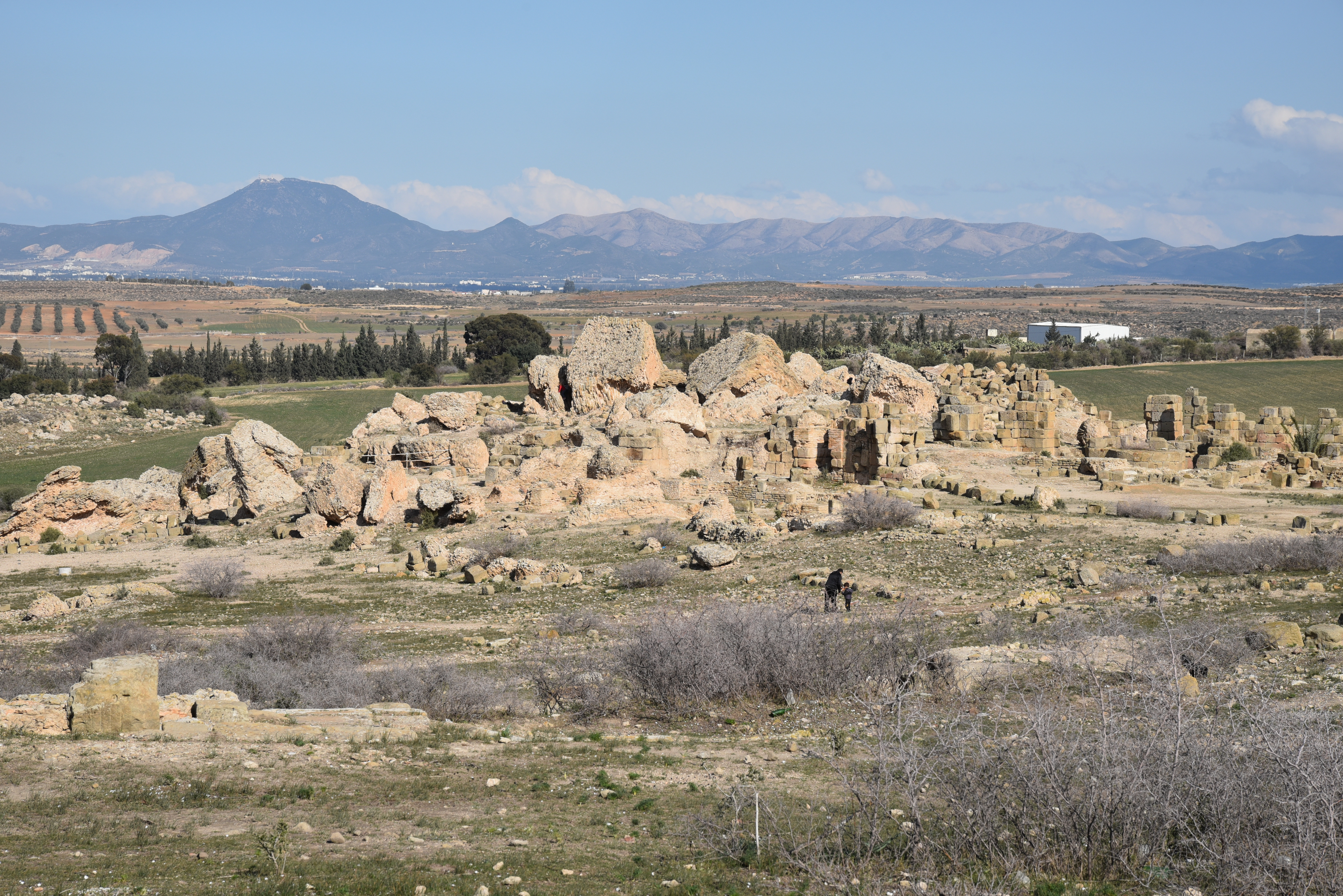
The site of Oudhna, ancient Uthina, lies southwest of Tunis in the fertile Wadi Meliane plain. Founded as Colonia Iulia Tertiadecimanorum Uthina by veterans of Augustus’ 13th Legion, it prospered from the 1st to the 3rd centuries AD, reaching its zenith in the 2nd century AD, during which significant constructions took place, including an amphitheatre, a Capitol building, public baths, and private residences housing mosaics.
Uthina, a former Berber settlement, is one of the oldest Roman colonies in Africa. It was founded during the reign of Augustus, who granted the town and the surrounding land to the veterans of Legio XIII Gemina as a reward for their services. It earned the prestigious title of Colonia Iulia Tertiadecimanorum Uthina and flourished during the Antonine and Severan dynasties, with the construction of its principal monuments, including an amphitheatre, a capitol, and large public baths.
Christianity began to emerge in Uthina as early as AD 217, when Tertullian referenced its bishopric. In the centuries that followed, the city’s urban development declined, leading to the abandonment or disuse of several major structures. This decline became more pronounced during the Arab-Muslim period; however, ceramics found in the area indicate that people continued to inhabit the region.
In modern times, part of the site was acquired in the late 19th century by the French lawyer L. Ducroquet, who built his residence on top of the Capitol. After Tunisia gained independence, Oudhna fell into neglect. However, systematic excavation, restoration, and development resumed in 1993 under the direction of the National Heritage Institute and the Agency for Heritage Development and Cultural Promotion.
PORTFOLIO
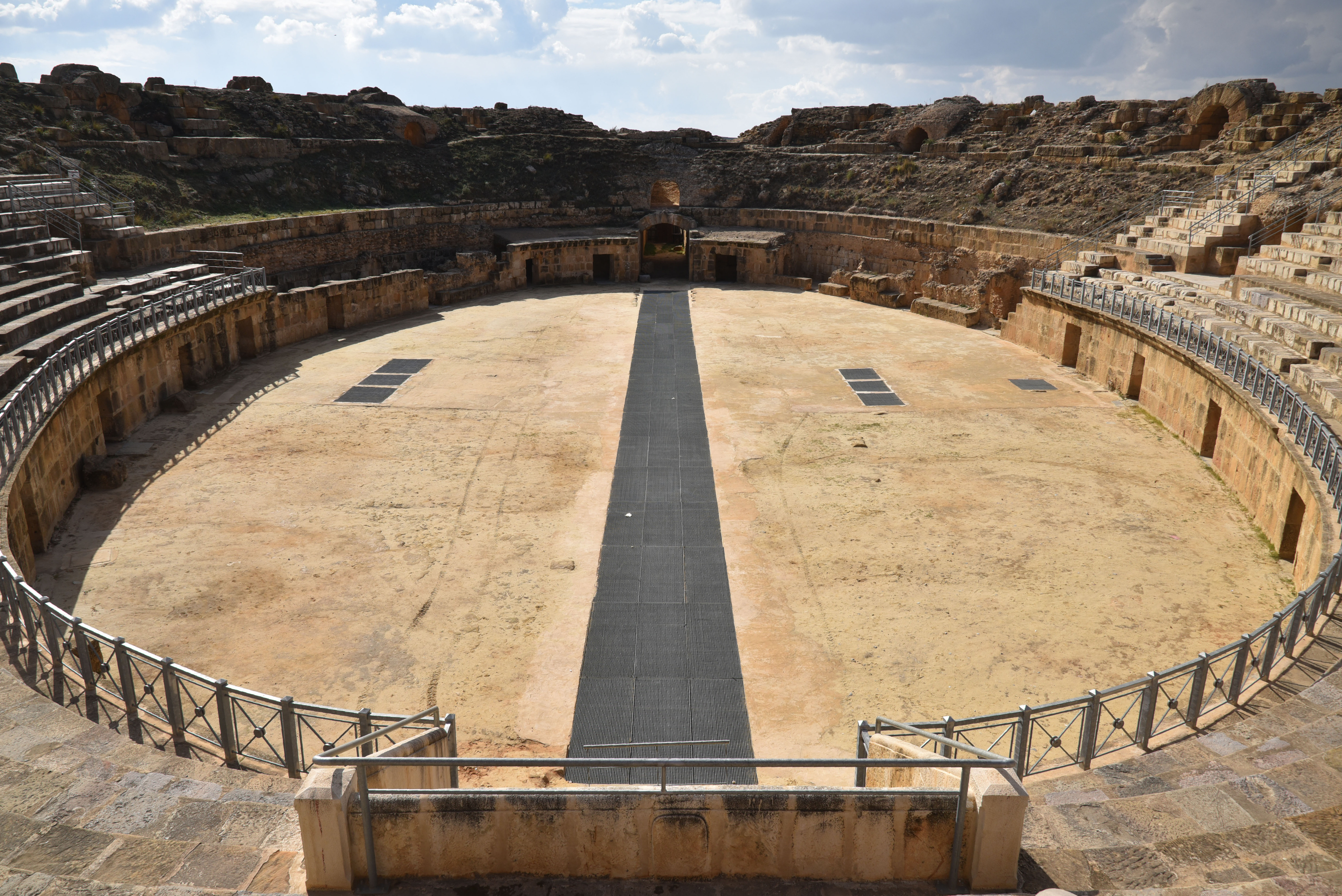
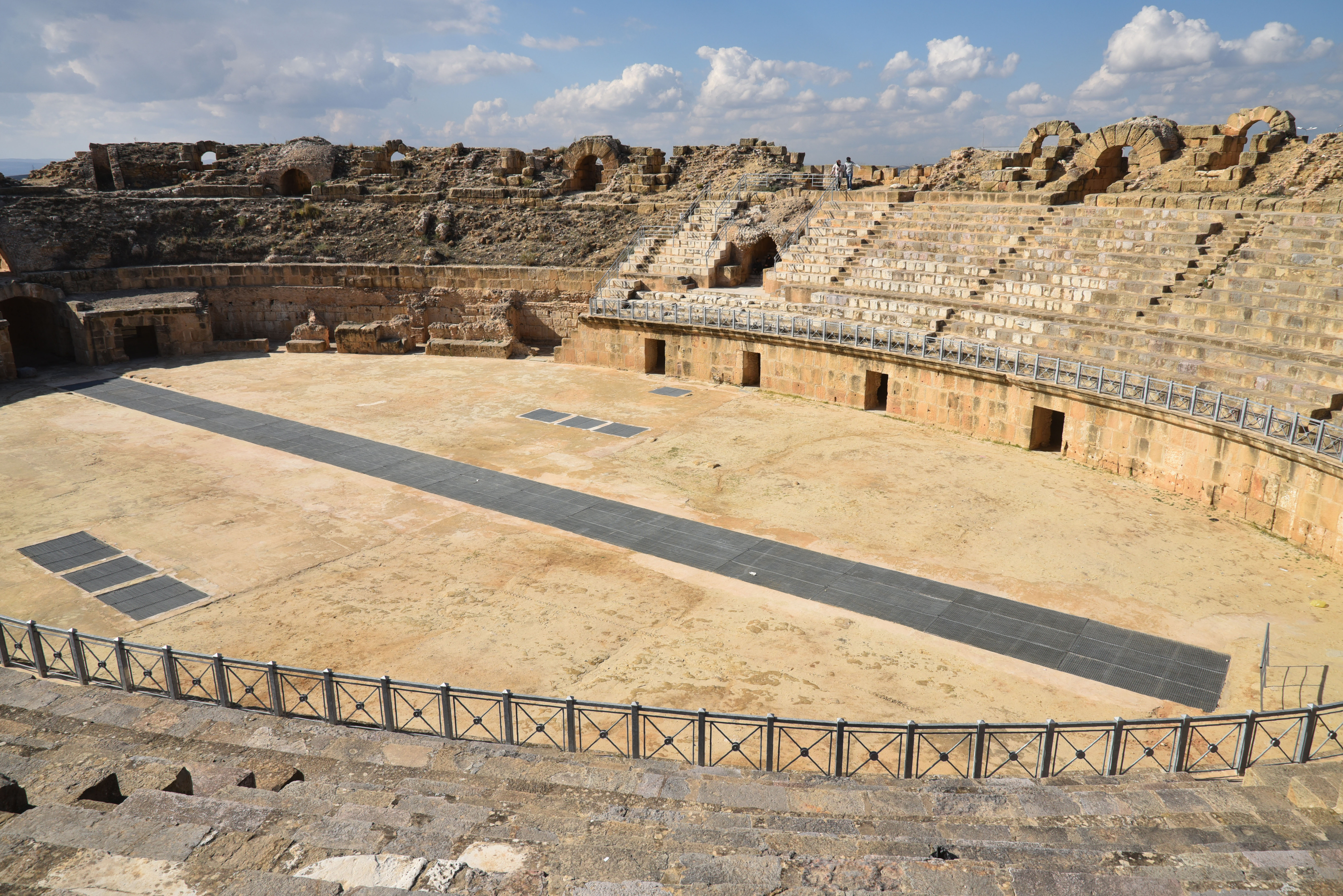
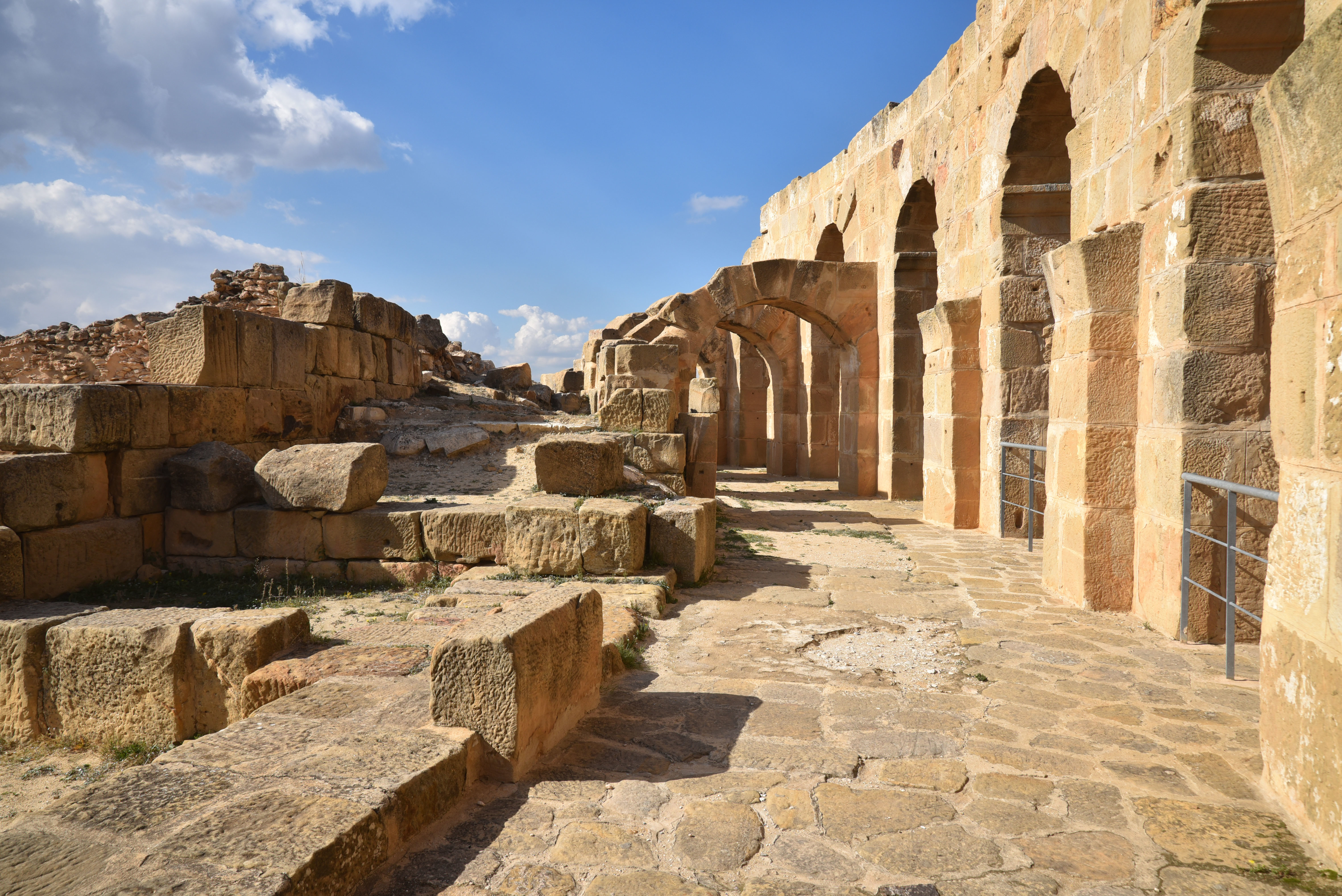
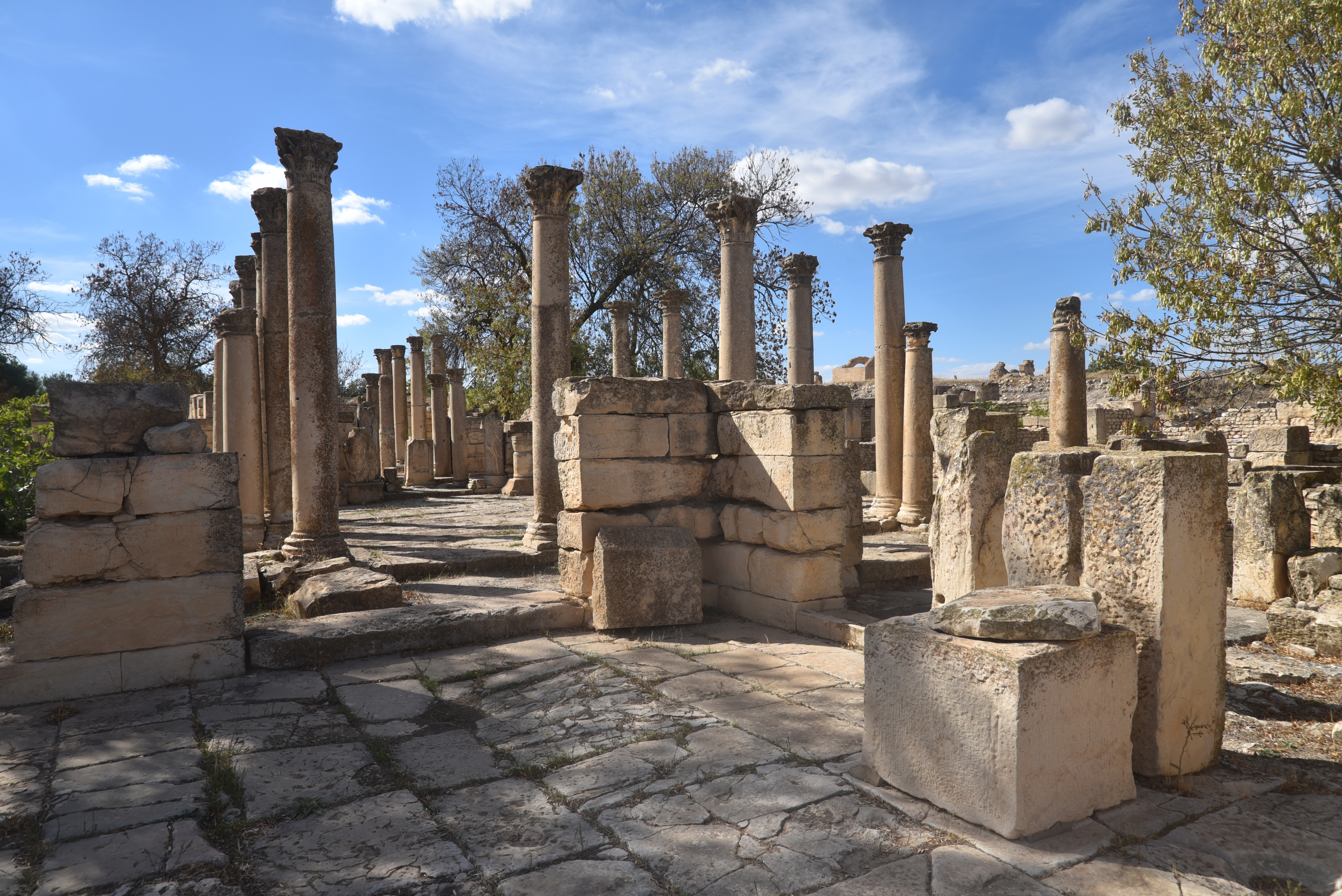
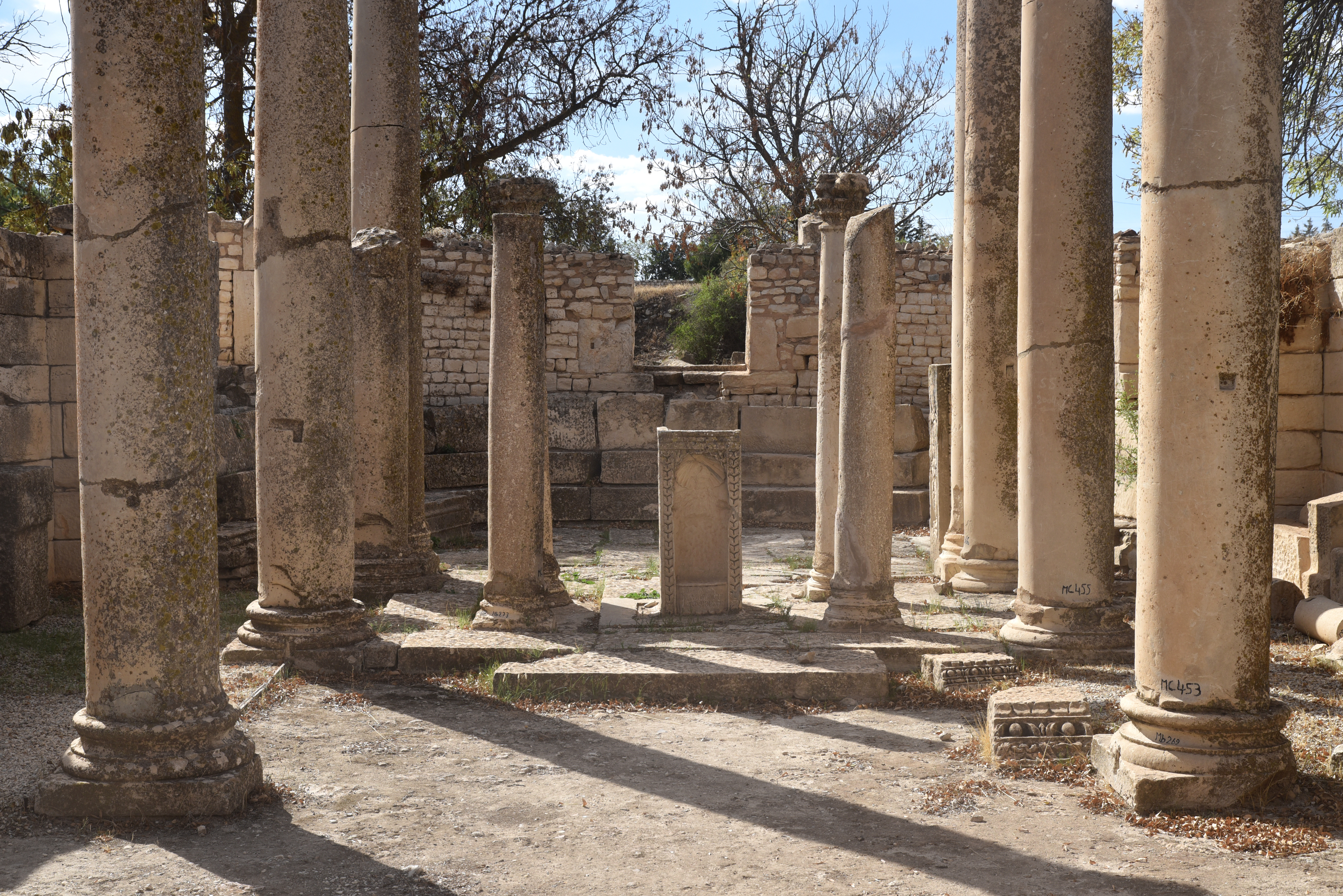
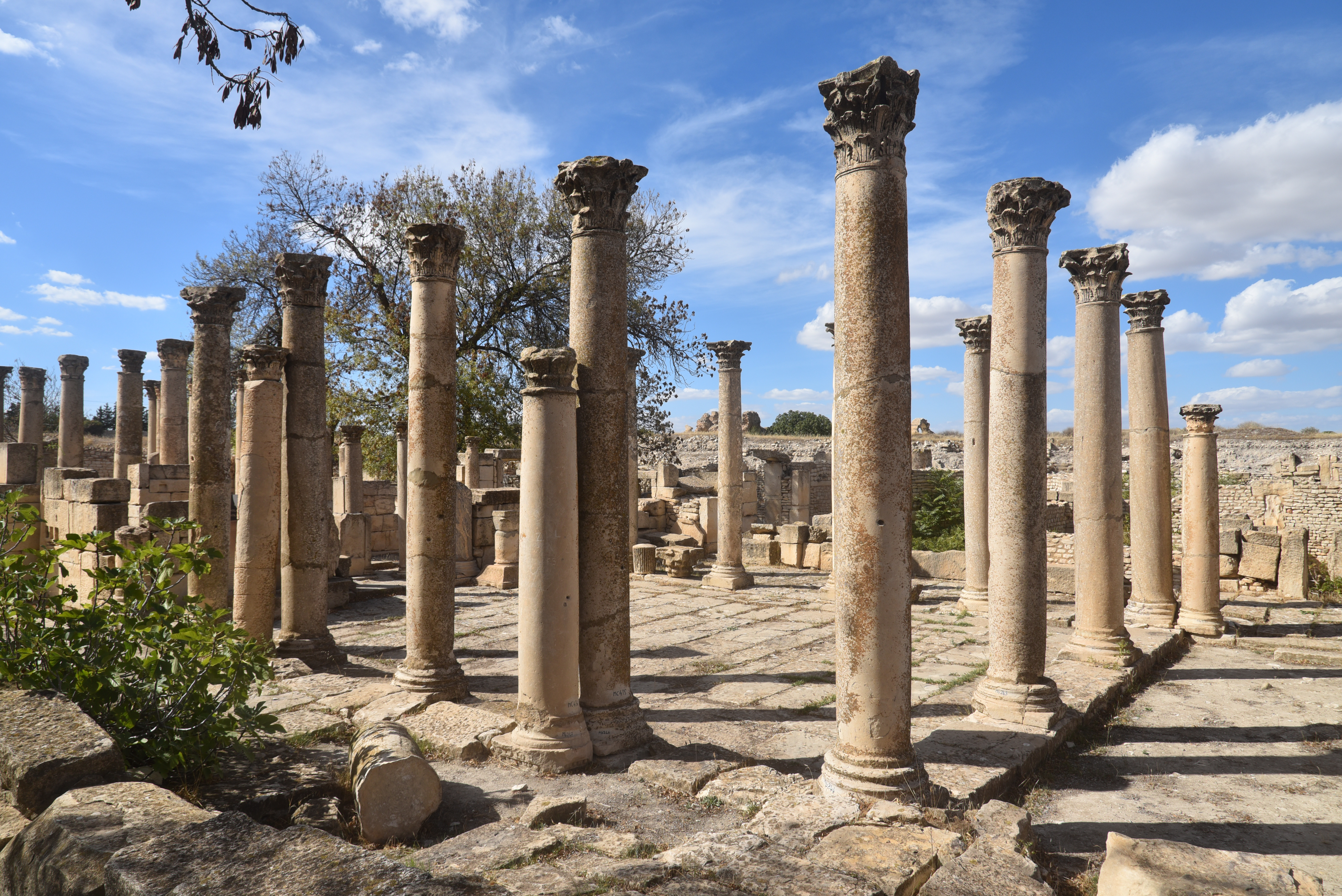
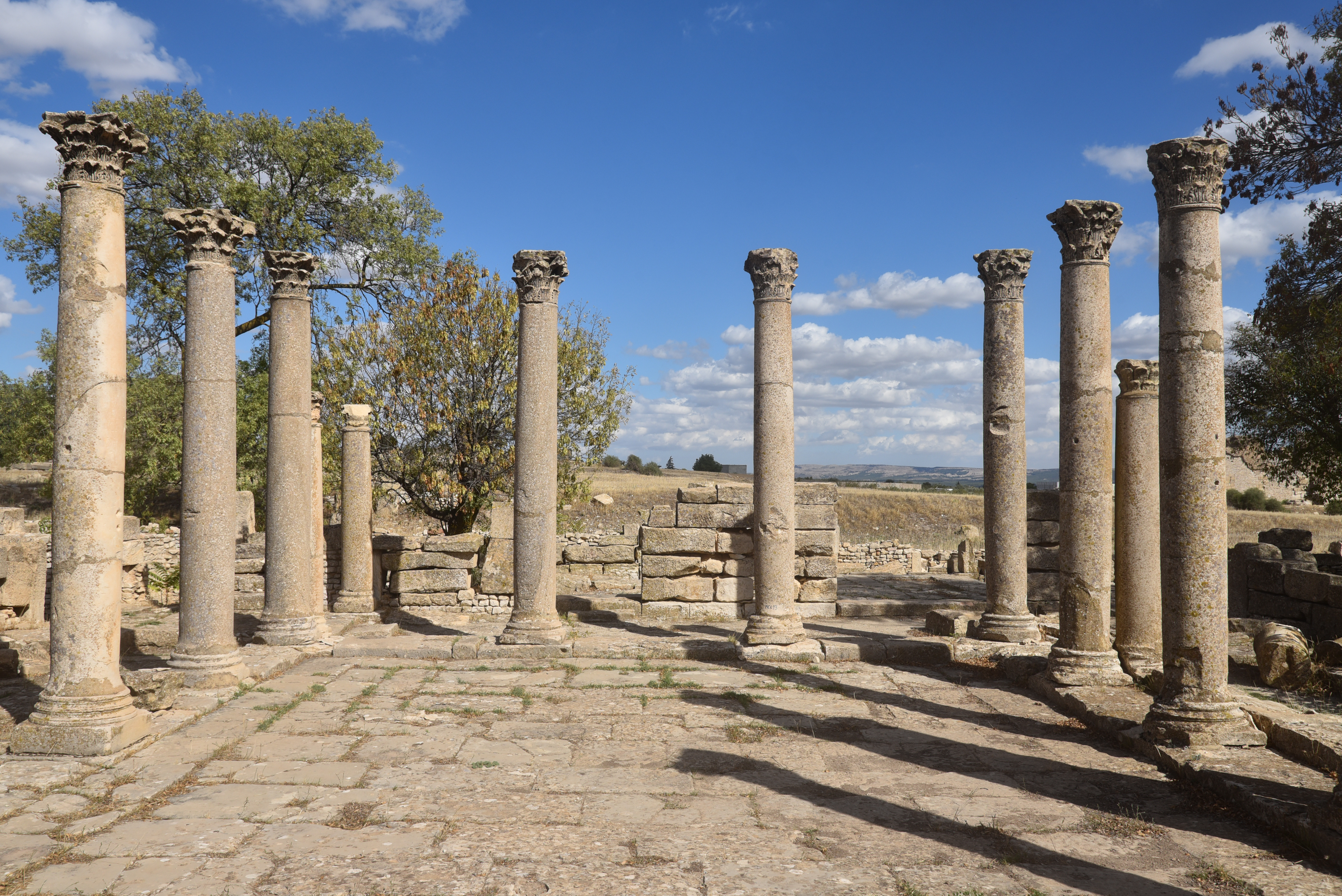
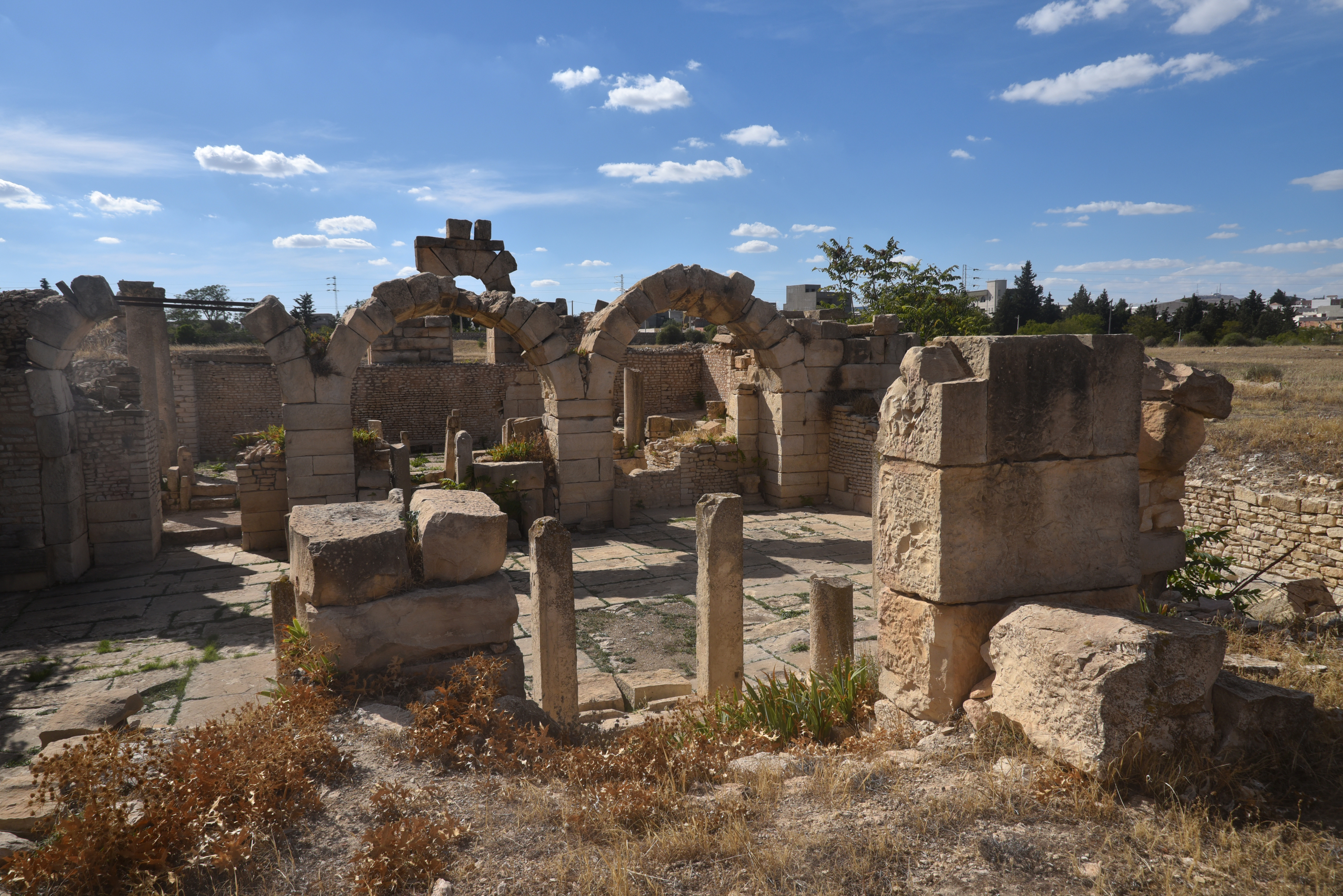
Inscription by soldiers of the legion XIII Gemina at the entrance to the archaeological site.The amphitheatre of Uthina, with a capacity of around 16,000 spectators, was the third-largest theatre in Tunisia after those at Carthage and El Djem. The central arena measures 58mx35m.The nearly fully restored amphitheatre, situated on the northern edge of Uthina, dates to the reign of Hadrian (AD 117-138).An underground vaulted gallery, aligned along a major axis, provides access to the amphitheatre’s basement, featuring symmetrical vaults and rooms beneath the central arena.The Baths of the Fishing Angels, constructed in the 2nd century AD. The baths are named after the well-preserved mosaic depicting the mythical “Fishing Angels” (Erotes) fishing in a stream.The Baths of the Fishing Angels.The Baths of the Fishing Angels.The finely decorated communal latrines in the Baths of the Fishing Angels.The House of the Laberii. Built towards the end of the 3rd century AD, the house features numerous rooms and spans approximately 1600 m².Copy of the mosaic in the House of the Laberii depicting Dionysus donating the grapevine to King Ikarios. The original mosaic is in the Bardo Museum in Tunis.The Baths of The Laberii. The Baths of the Laberii derive their name from an inscription found on a mosaic depicting Orpheus charming the animals, now housed in the Bardo Museum in Tunis.The Baths of the Laberii were constructed in the 3rd century AD by the Laberii, the wealthiest family in Uthina.The partly reconstructed Capitolium on the acropolis of Uthina. This impressive structure was erected under Emperor Hadrian and was dedicated to the Capitoline Triad of Roman gods: Jupiter, Juno, and Minerva.The Capitolium was built on a high podium, made possible by constructing an artificial terrace at the hill’s edge, which allowed it to be seen from a distance.The partially reconstructed columns of the Capitolium.The Capitolium stood in the Forum, at the top of the hill. It must have had a porticoed square, a basilica and other public buildings.Floor mosaic with Solomon’s knots near the Capitolium.The urban section of the aqueduct. Uthina was supplied with water by an aqueduct that captured water from three springs located to the south-east of the town, spanning a total length of 10 km.A cistern next to the urban section of the Aqueduct of Uthina. The water was stored in cisterns, which supplied the Great Baths with a steady supply of water. The aqueduct and cisterns were constructed in the 2nd century AD, alongside the town’s other main public monuments.
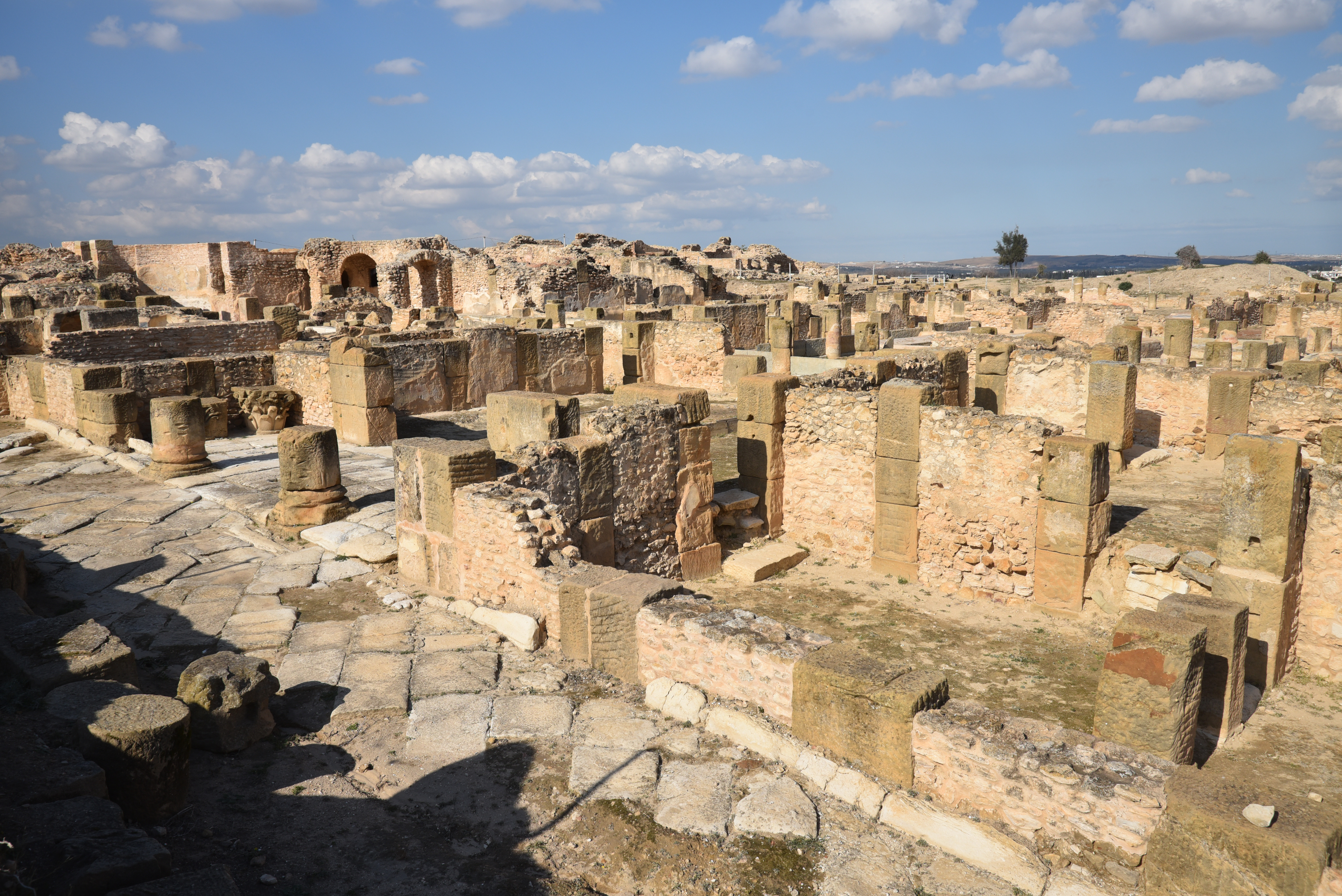
View over the Great Baths, built in the mid-2nd century AD in the eastern part of the town.The imposing ruins of the Great Baths. Only the underground level of this 12,000 m² structure remains today.
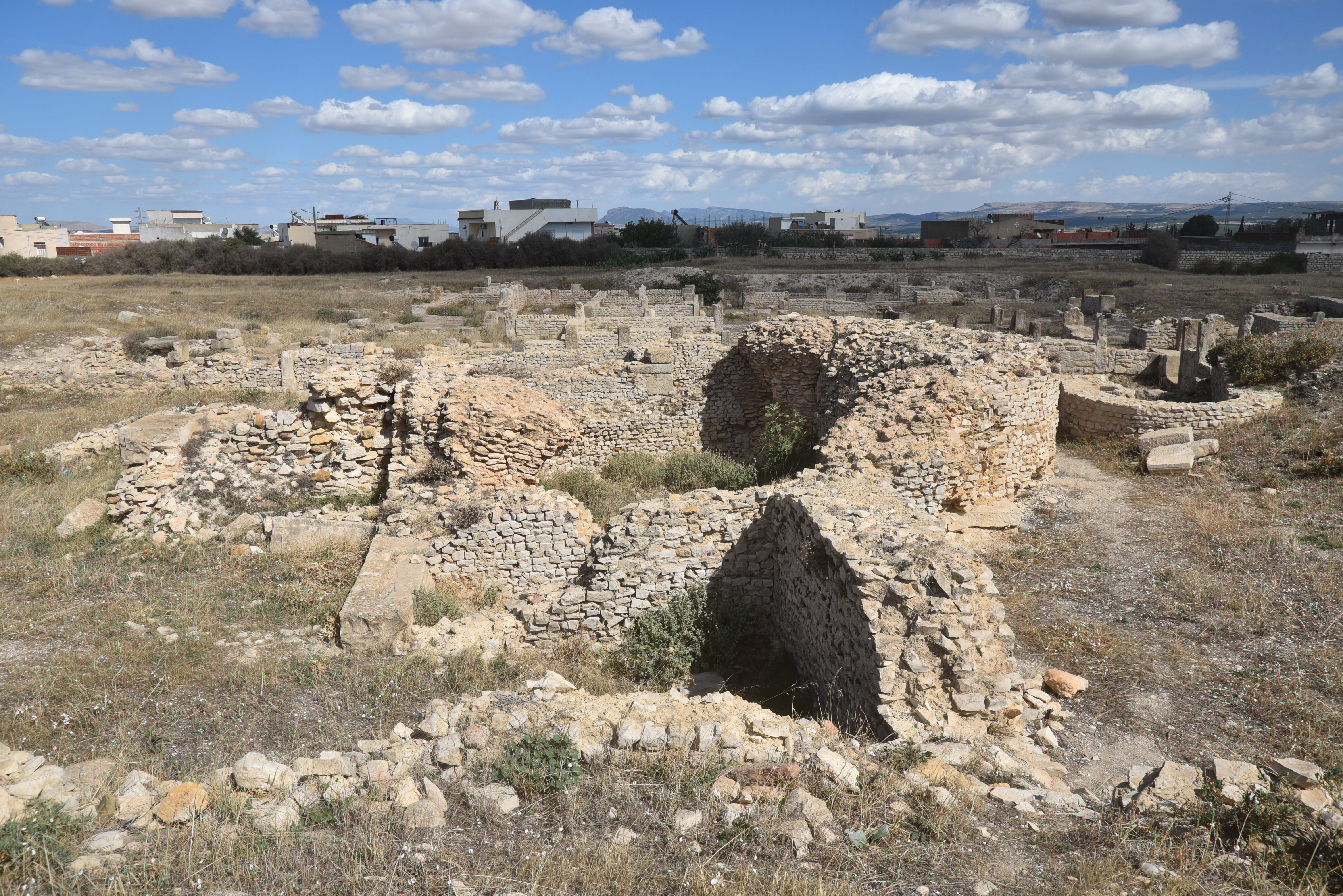
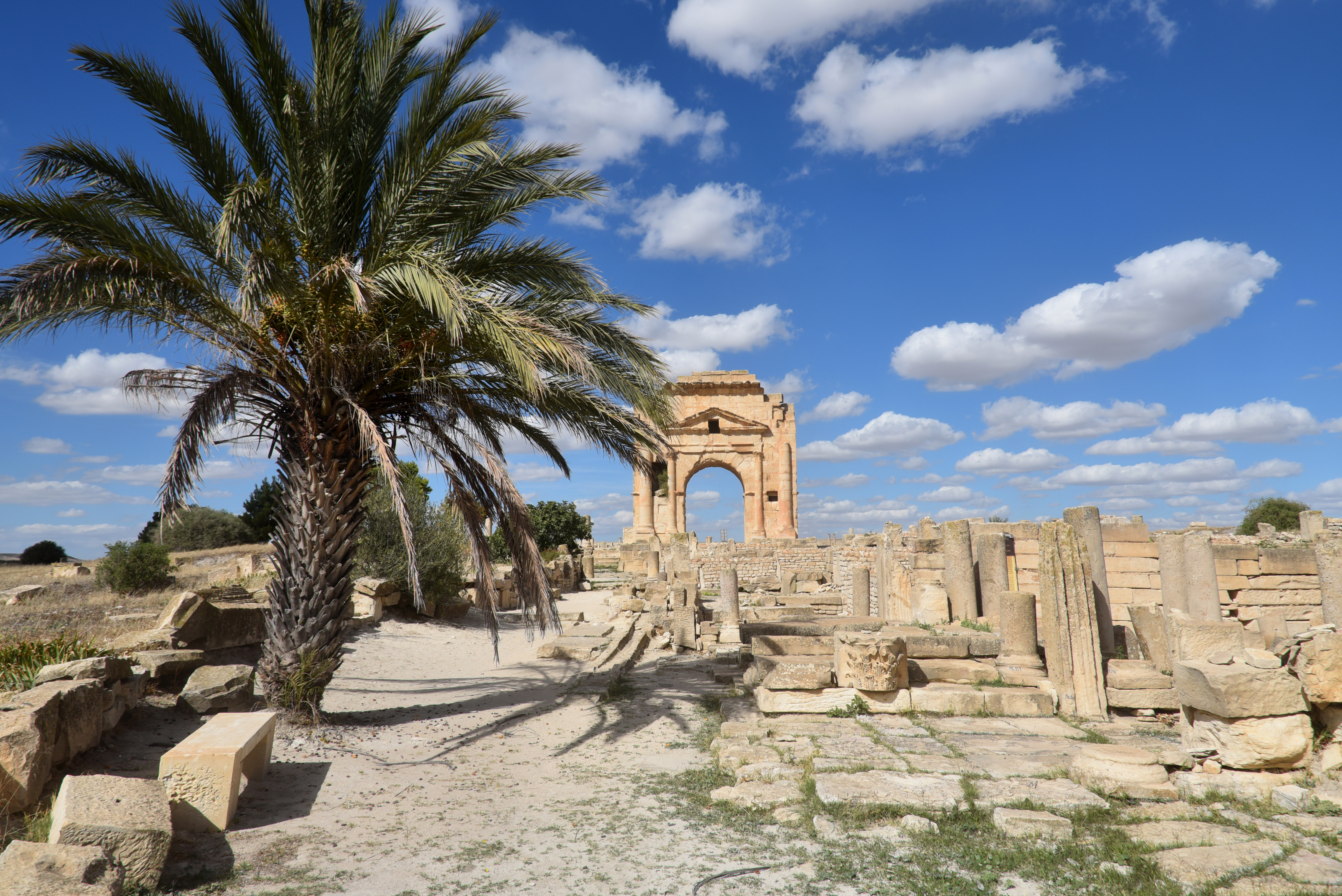
The archaeological site of Makthar (Mactaris) is situated on a high plateau in central western Tunisia, on the northern edge of the Tunisian ridge. Originally a 5th-century BC Numidian settlement, it evolved into a well-preserved Roman city, featuring a forum, baths, and a triumphal arch. Later, it became a Byzantine fortress and bishopric, but experienced a decline in the 11th century. Today, the site showcases its Punic-Numidian, Roman, and Byzantine history through visible ruins and a local museum containing various artefacts.
Mactaris was built on the edge of a plateau at an altitude of 900 meters between the Ouzafa and Saboun wadi valleys. Its location on an easily defensible site illustrates its primitive military vocation. The presence of Libyan and Punic inscriptions proves that Mactaris was already a very substantial city before the arrival of the Romans. Following the fall of Carthage in 146 BC, many Punic refugees arrived here, as the town lay beyond the borders of Roman Africa. However, in 46 BC, it was incorporated into the newly established Roman province of Africa Nova. The Punic and Roman populations coexisted peacefully, and the process of Romanisation took about 200 years to complete.
The city flourished during the 2nd century AD, particularly beginning in the reign of Trajan, at a time when Mactaris was still a civitas. It was later elevated to the status of municipium under Antoninus Pius and became a colony between 176 and 180 under the joint reign of Marcus Aurelius and his son Commodus. This status granted Roman citizenship to its inhabitants. An inscription from AD 198 (AE 1949, 0047) identifies the settlement as Colonia Aelia Aurelia Mactaris. In the 3rd century AD, the city became the centre of a Christian bishopric and experienced the Donatist schism in the 5th century AD. During Diocletian’s reorganisation of the empire, Mactaris was incorporated into the province of Byzacena.
The decline of Mactaris began with the Vandal invasions, which started in AD 439. During the reign of Justinian, forts were built in existing structures, including the Great Baths. The city’s decline was ultimately sealed in the 11th century with the arrival of the Hilalian tribes.
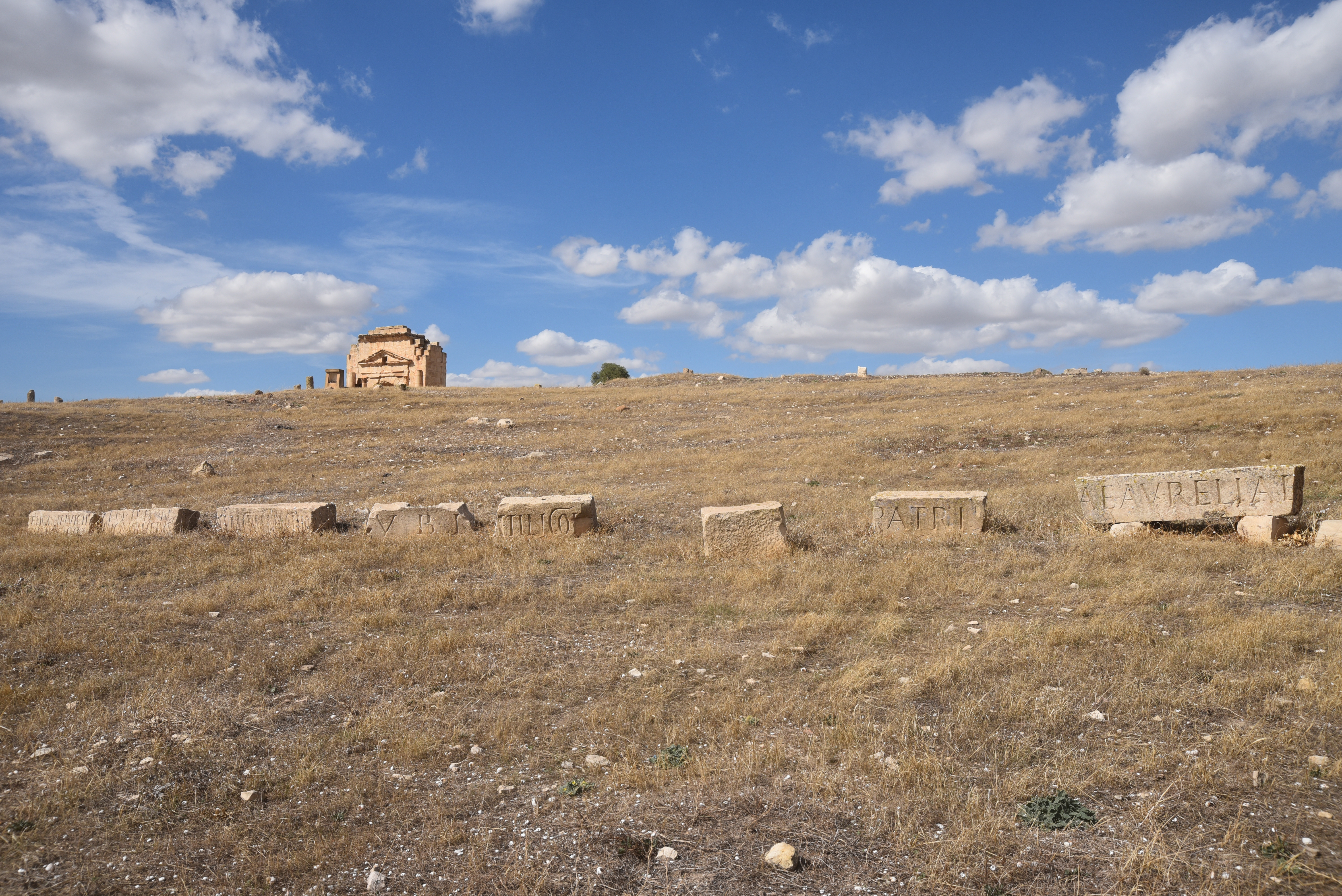
The site is one of the largest in Tunisia and contains a significant portion that has yet to be explored archaeologically. Similar to Bulla Regia, the region’s relative remoteness and the challenges in integrating into communication networks may have contributed to this lack of exploration. A small museum on-site displays various archaeological artefacts that have been discovered there, including Neo-Punic funerary stelae (1st–3rd century BC) and a . Outside the archaeological park are a Punic pyramidal mausoleum, similar to the mausoleum of Atban at Dougga, as well as the Temple of Apollo.
PORTFOLIO
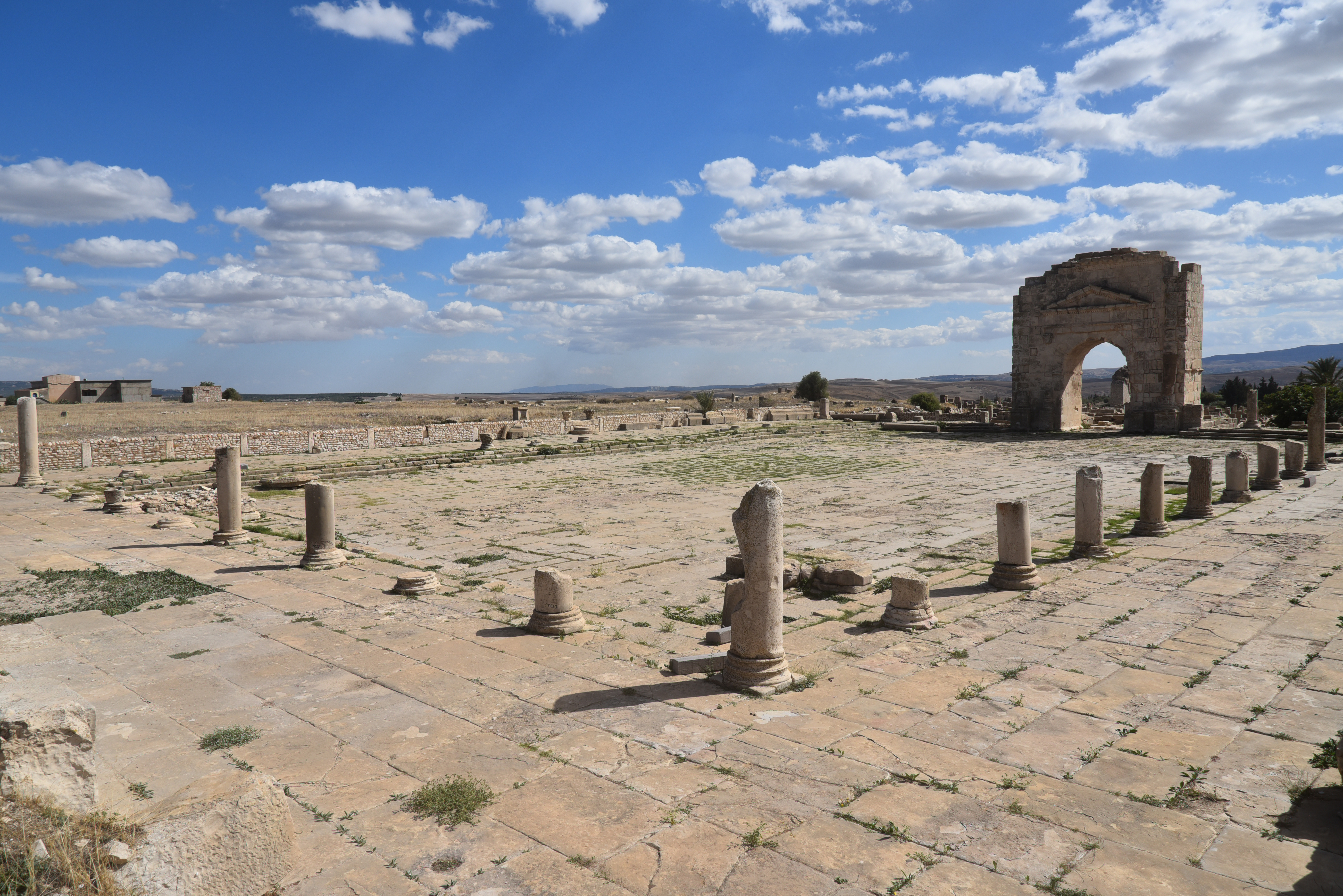
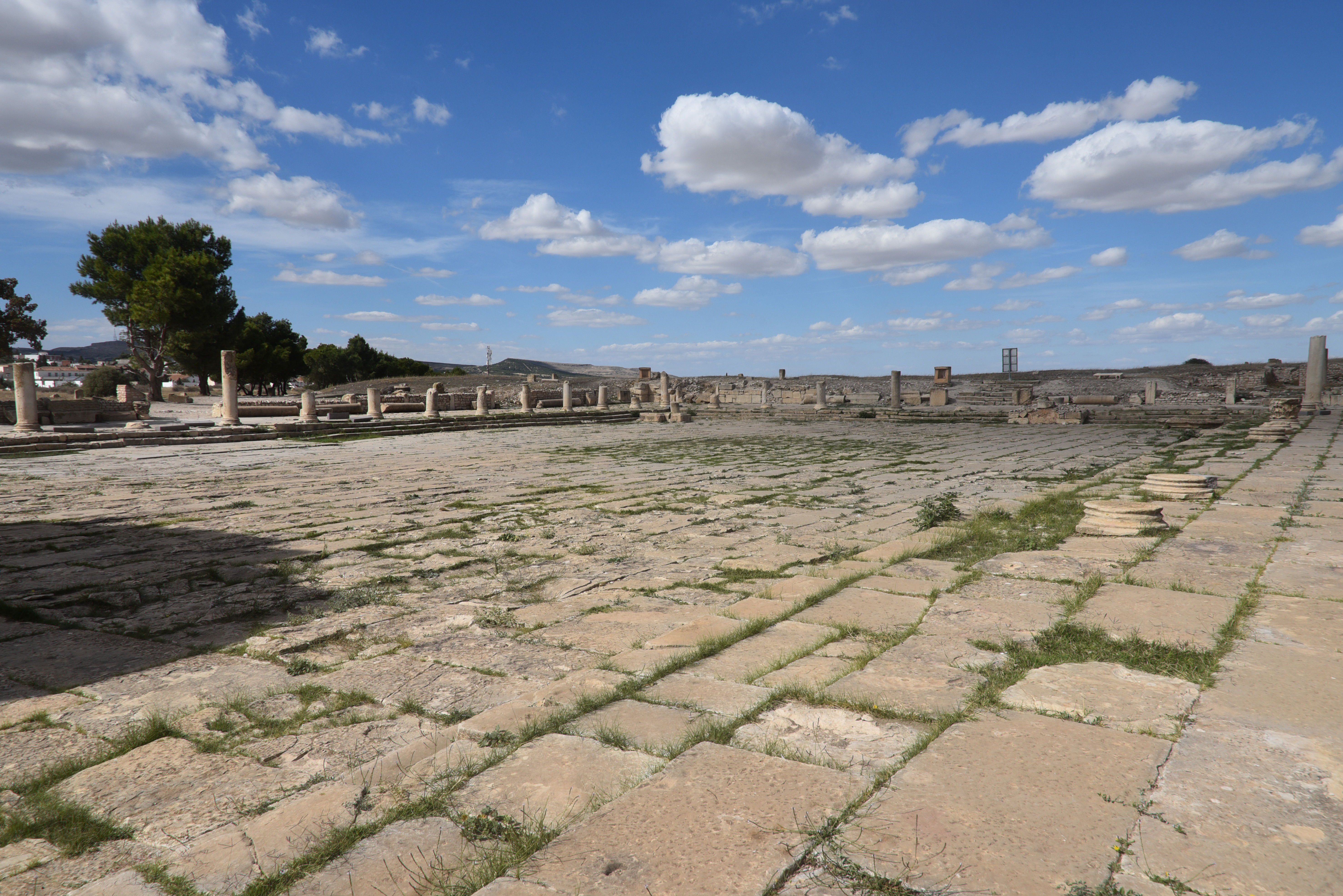
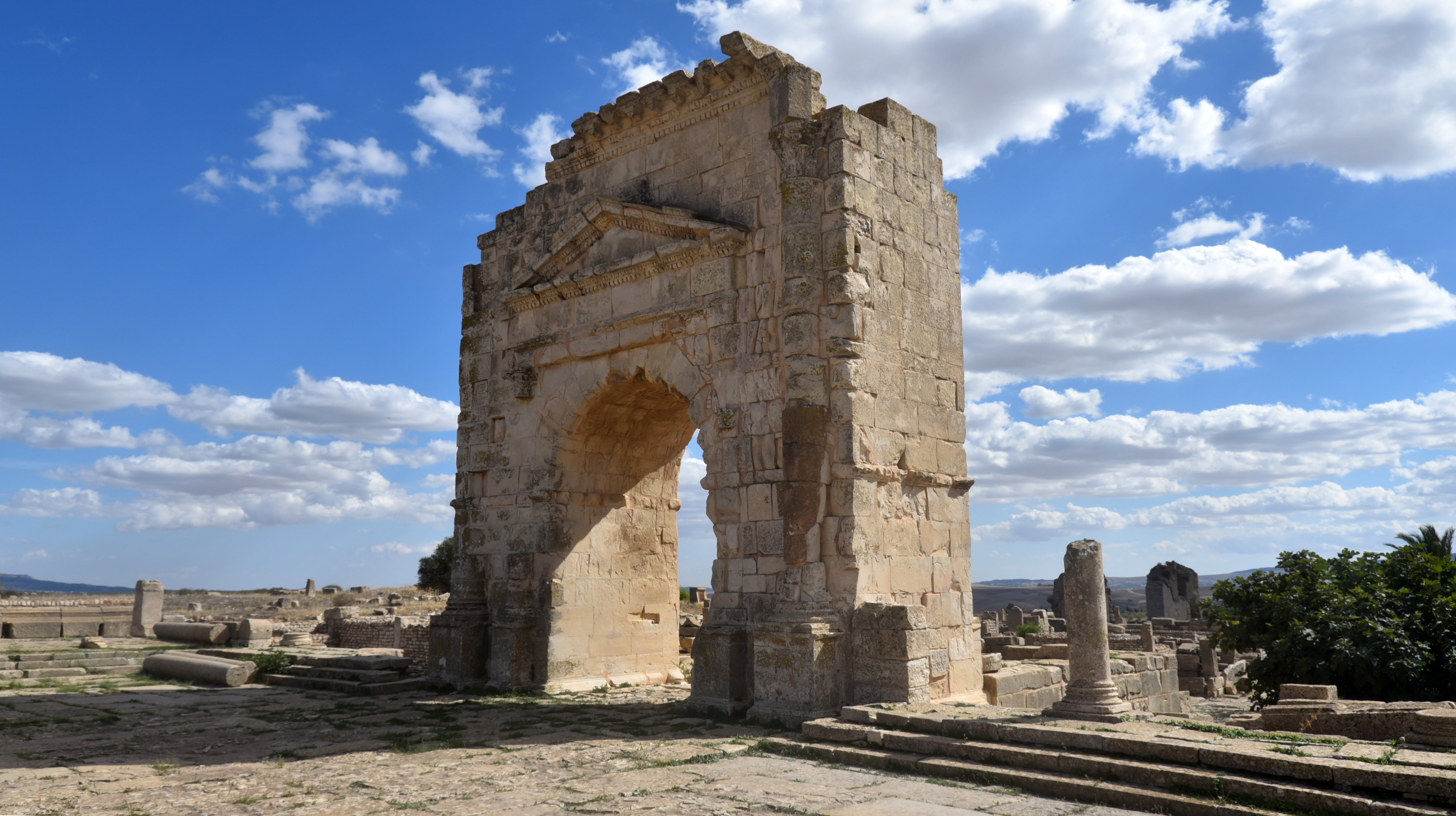
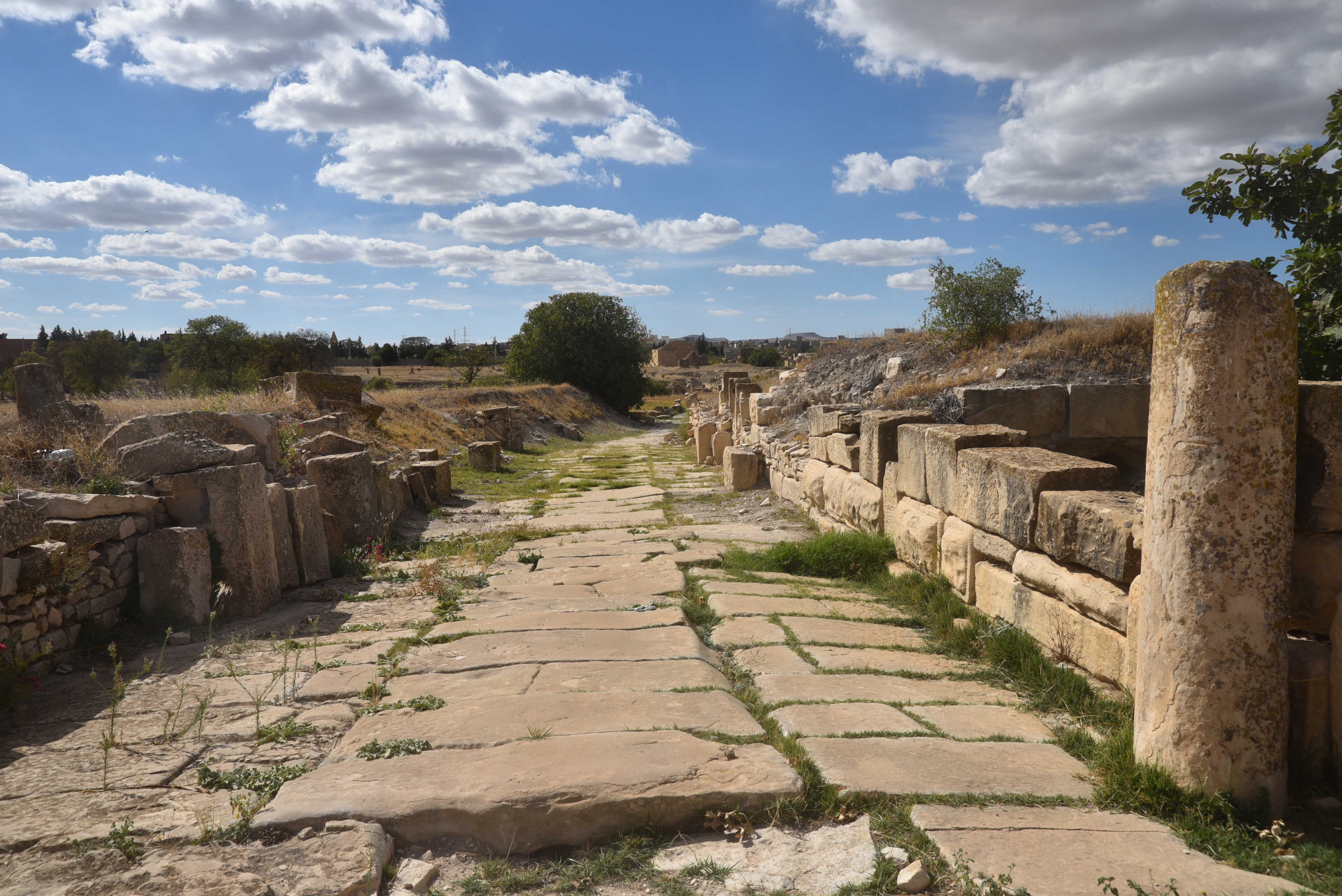
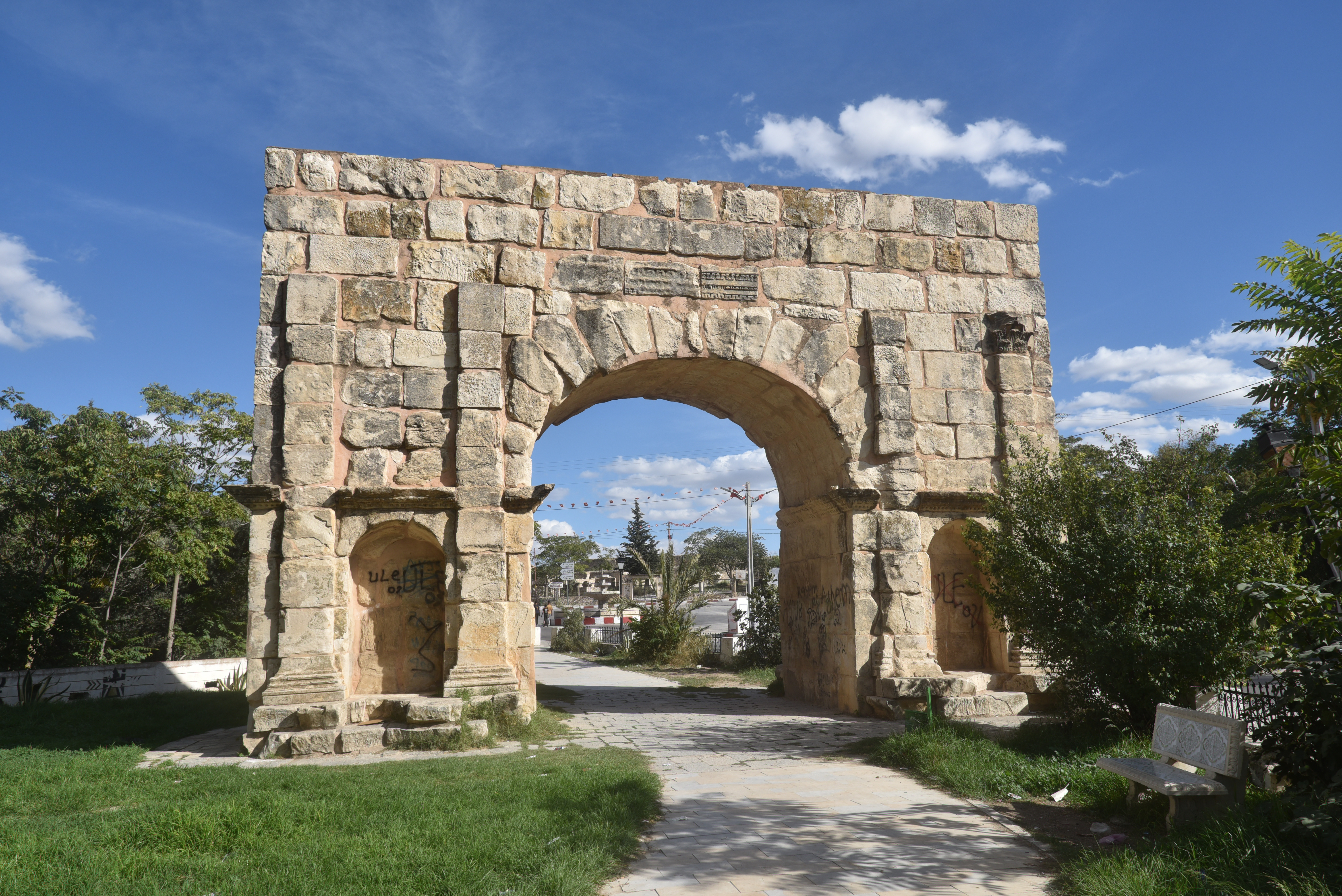
The Christian Basilica of Rutilius, constructed on the site of a sanctuary dedicated to Saturn.The partially restored amphitheatre, built in the 2nd century AD. None of the seating has survivedThe Temple of Hathor Miskar, a local divinity originally taken from the Egyptian pantheon of gods. It was first erected in the 1st century BC and then reconstructed in the 2nd century AD. It contained Neo-Punic inscriptions listing the 32 generous patrons who paid for the temple.The House of Venus, a Roman villa, named after the mosaic found here, which is now housed in the site’s museum.The House of Venus.The town’s market (macellum), which also has an altar to Mercury, the Roman god of shopkeepers and merchants.The New stone-paved Forum, laid out in the 2nd century AD and located at the intersection of the decumanus and cardo.The 1,500 m2 forum square was surrounded by porticoes on three sides. The Forum is enclosed by a single-arch built in 116 and dedicated to Emperor Trajan. The arch formed the entrance to the New Forum.The New Forum.The Arch of Trajan, a single-arch Roman triumphal arch built in 116 in honour of Emperor Trajan.The Arch of Trajan formed the entrance to the forum. It was erected by the proconsul of Africa, but it was paid for by the local community.On the south side of the arch, a Latin inscription is still partially legible, celebrating the conquest of the ‘Germans, Armenians and Parthians’. CIL 08, 00621
“To the Emperor Caesar Nerva Traianus, son of Divus Nerva, the best Augustus, conqueror of the Germans, Armenians and Parthians, Pontifex Maximus, who received the tribunician power for the twelfth time and the imperial acclamation for the twelfth time and was consul for the sixth time, (this arch) was donated by the Proconsul Caecilius [F]austinus by decision of the decurions from public funds (…) .”
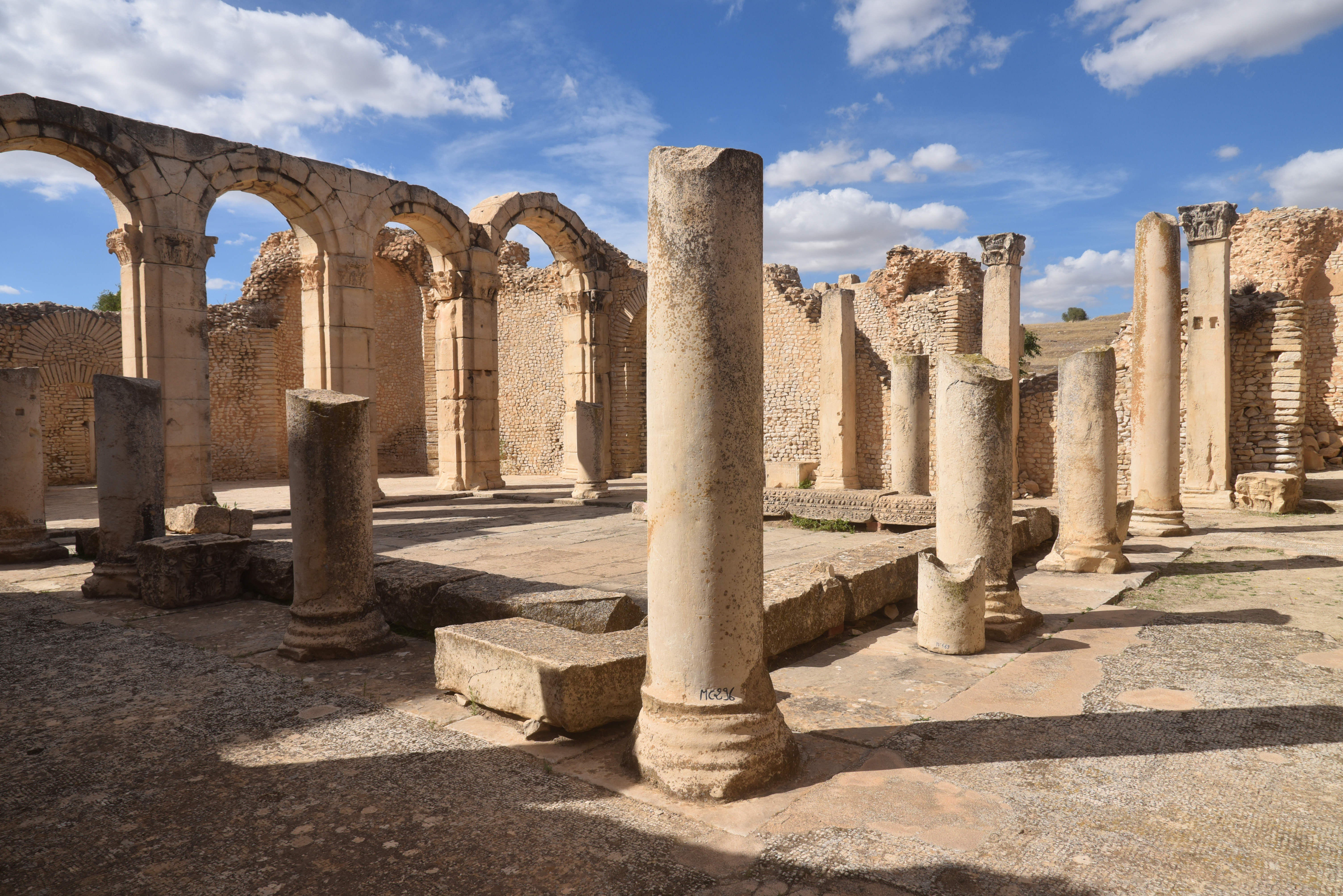
The 5th-century AD Vandal Basilica of Hildeguns with three naves and Byzantine tombs. It was named after one of their kings.The paved road leading to the Old Forum and the Western Baths.The Great Southern Baths, inaugurated in AD 199 during the reign of Emperor Septimius Severus, were later converted into a Byzantine fortress. The baths covered a total area of approximately 4,400 m², with 225 m² dedicated to the sole frigidarium.The northern colonnaded hall of the Great Southern Baths, adorned with a labyrinth mosaic.The northern colonnaded hall of the Great Southern Baths.Fragments of a large inscription in front of the Great Southern Baths.Dedication to Antoninus Pius (CIL VIII, 622), dated AD 157 (trib pot XX) in front of the Great Southern Baths.The Schola Juvenum, a well-preserved building from the Severan period interpreted as the meeting place of the city’s juvenile college, a kind of clubhouse and training school for young men found in Roman cities.The interior of the Schola Juvenum. The building was financed by Julius Piso and constructed on the site of a Flavian sanctuary dedicated to Mars. The remains include a courtyard with porticoes, rooms for worship to the north, sanitary facilities to the east, and a meeting room to the west.The layout of the Schola Juvenum follows the Hellenistic tradition of the quadrangular palestra with peristyle.The Schola Juvenum was modified several times and turned into a pagan basilica where funerary rites were performed, and two gravestones from the nearby necropolis were utilised as altars. Eventually, in the 4th century AD, it was turned into a church during the reign of Diocletian.The intersection of two paved roads.The paved road leading to the Old Forum from the west.The Western Baths, built in the 2nd century AD during the reign of Marcus Aurelius and later converted into a church.The interior of the Western Baths.The paved road leading to the New Forum from the west.
The ruins outside the archaeological park
The Arch of Septimius Severus.The ruins of the Temple of Apollo.The Neo-Punic mausoleum.
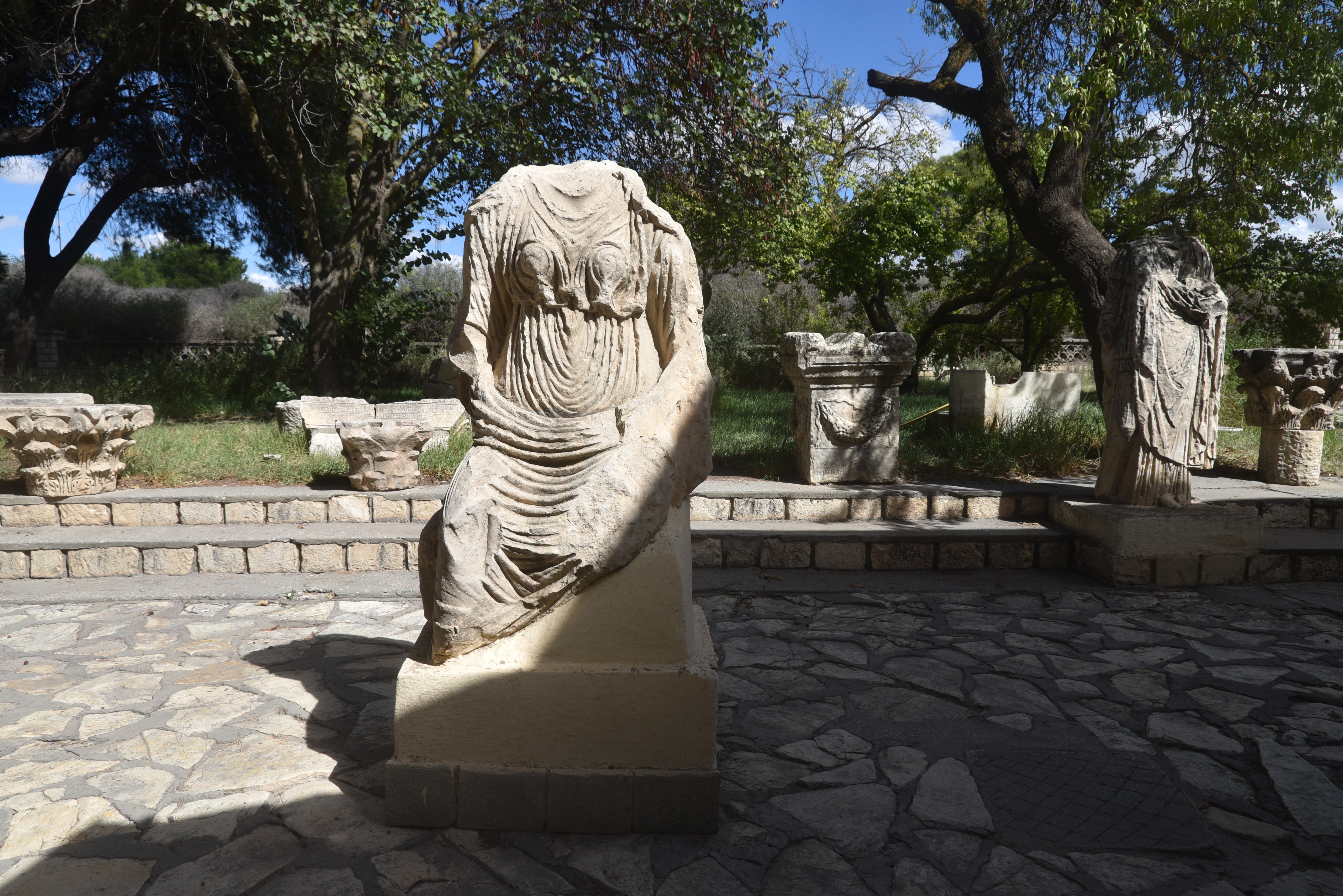
The Makthar Museum
Roman mosaic adorned with numerous animal motifs and Punic and Neo-Punic ex-votos and funerary stelae.Makthar Museum’s garden.Makthar Museum’s garden.