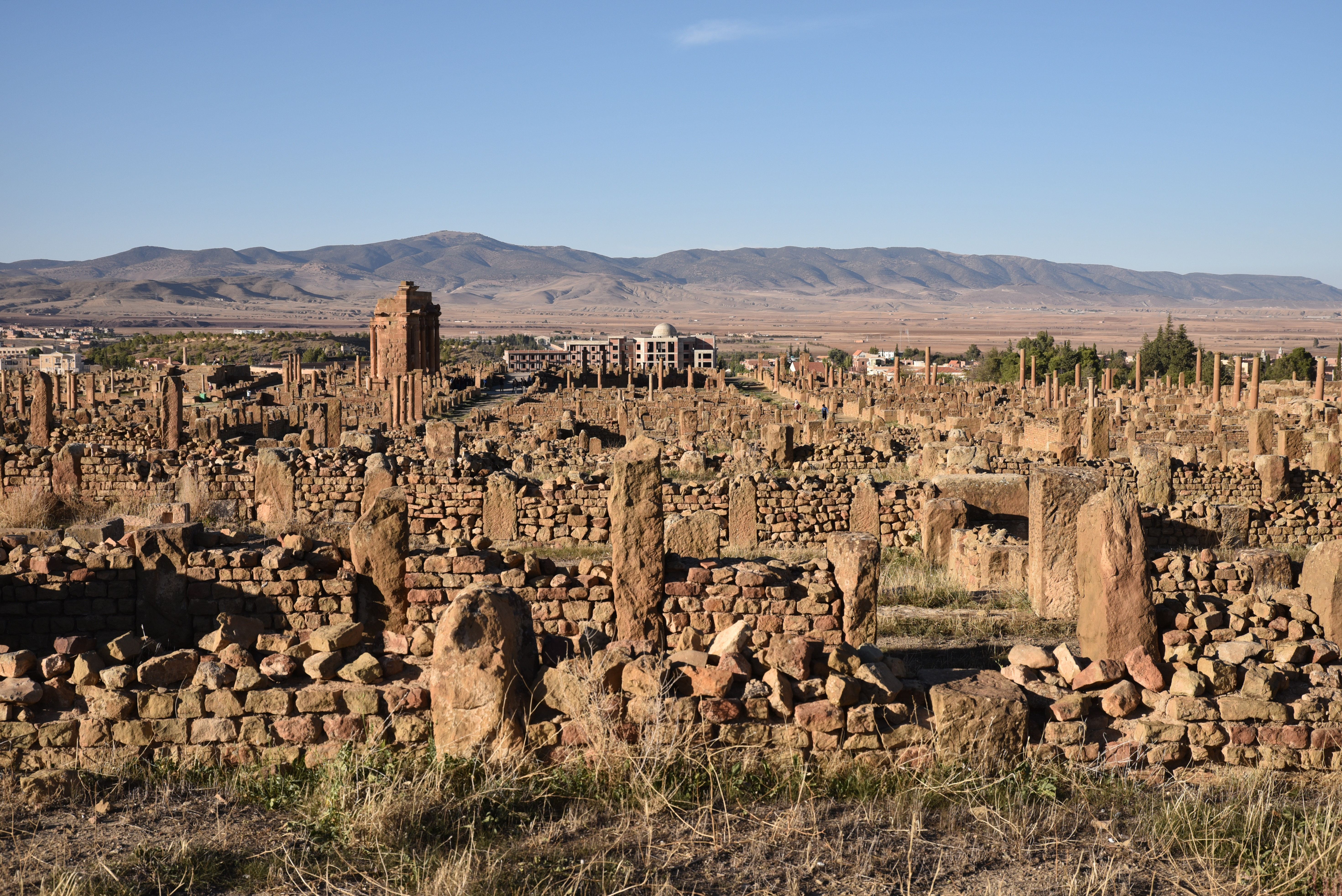
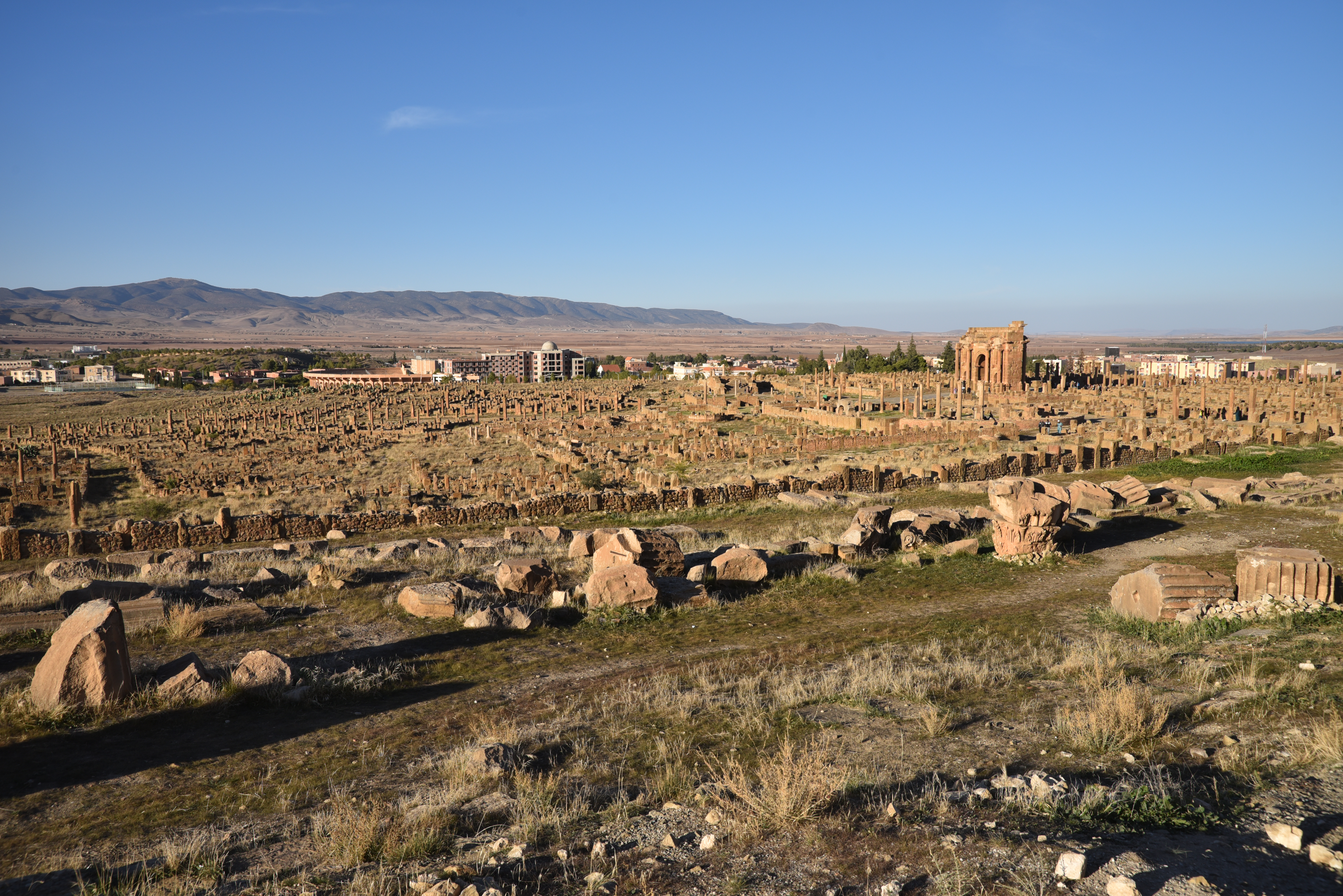
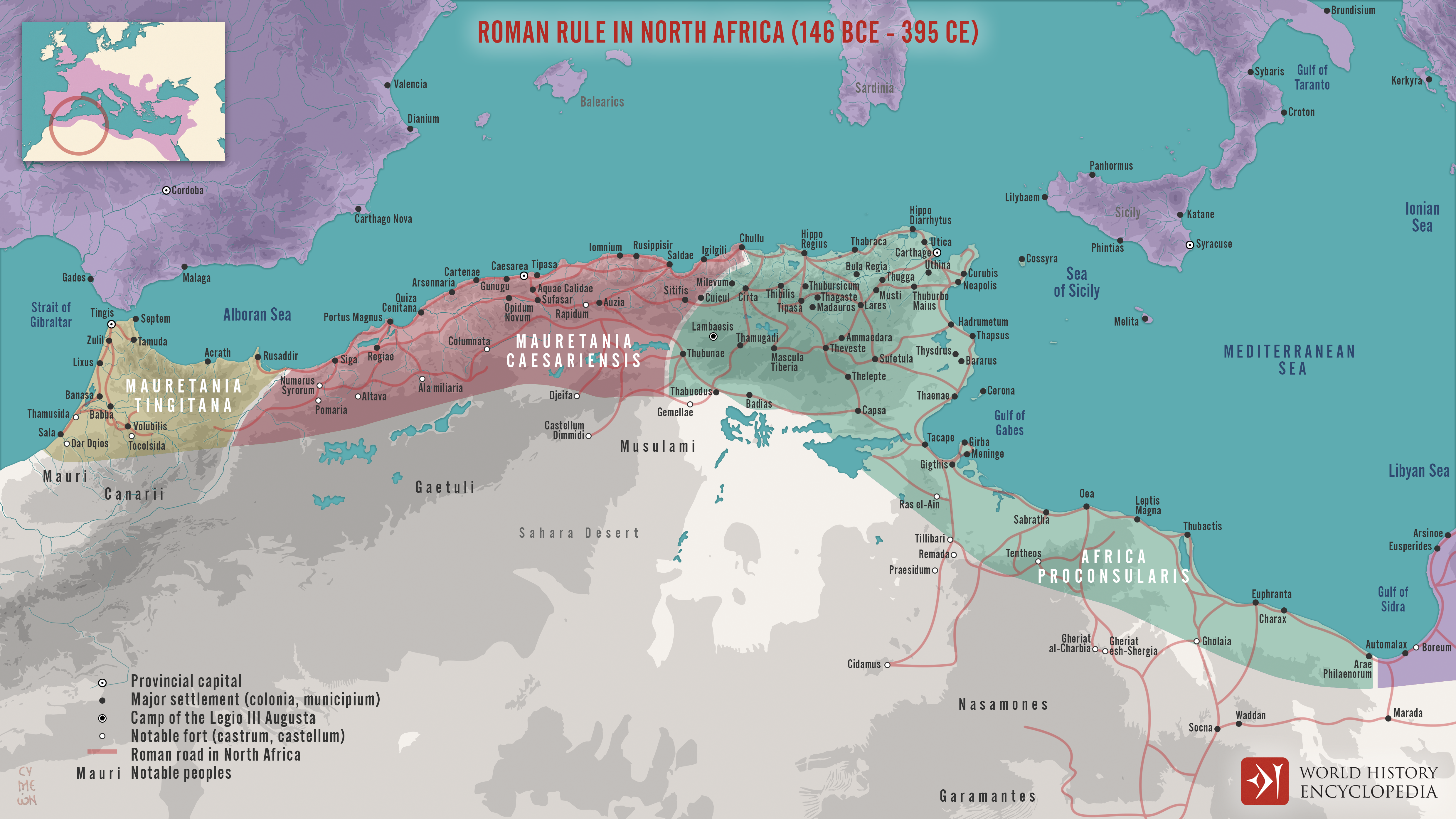
The remains of the ancient Roman city of Thamugadi, also known as Timgad, are located northeast of present-day Algeria, in the Batna province. Originally called Colonia Marciana Ulpia Traiana Thamugadi, it was founded as a Roman military colony around AD 100, during the reign of Emperor Trajan. Often described as Africa’s Pompeii, this UNESCO World Heritage Site is considered one of the best urban examples from Roman times, featuring all the elements of a large Roman town, including an orthogonal grid plan, two main oriented streets, a large forum, baths, markets, a library, a theatre, and an imposing Capitol.
The founding of Thamugadi was closely linked to the presence and activities of Legio III Augusta, which had been stationed at Lambaesis since AD 81. Under the command of the legatus augusti pro praetore Lucius Munatius Gallus, the Third Augustan Legion received orders from Trajan to establish a colony for its veterans. The new city lay on the road coming north from Cirta (Constantine), and on the west-east road stretching from Lambaesis to Theveste (Tébessa), then north-east to Ammaedara (Haïdra) and Carthage. The city was named after Trajan’s sister, Ulpia Marciana (AD 48-112), and the name Thamugadi likely originated from the Berber word for the location where the city was established.
The Emperor Caesar Nerva Trajan Augustus Germanicus, son of the Divine Nerva, High Pontiff, holding the Tribunician power for the fourth time, Consul for the third time, Father of the Country, founded the Colonia Marciana Trajana of Thamugadi, through the efforts of the Third Augustan Legion (under the command of) L. Munatius Gallus, Imperial Propraetorian Legate. Dedication marking the founding of the city, AD 100
Together with Lambaesis, Diana Veteranorum and Mascula, Thamugadi formed part of a network of military settlements responsible for monitoring and controlling the military routes through the mountains.
Roman Rule in North Africa (146 BCE to 395 CE). Hadrian ordered the soldiers of the Third Legion to pave the military road between Carthage and Theveste (CIL VIII 10081) and to construct a road from Rusicada to Cirta (CIL 08 10296). Map created by Simeon Netchev (link)
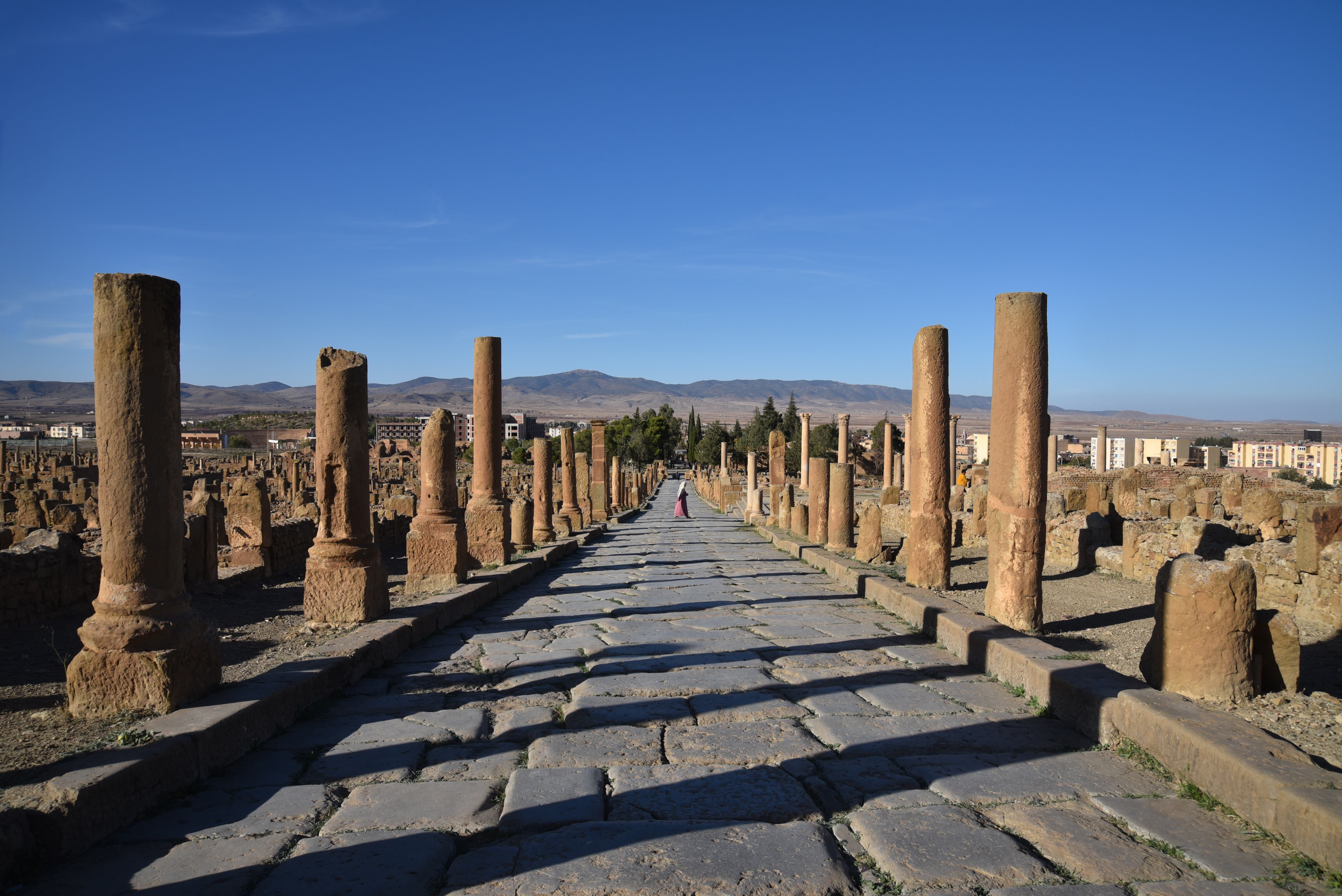
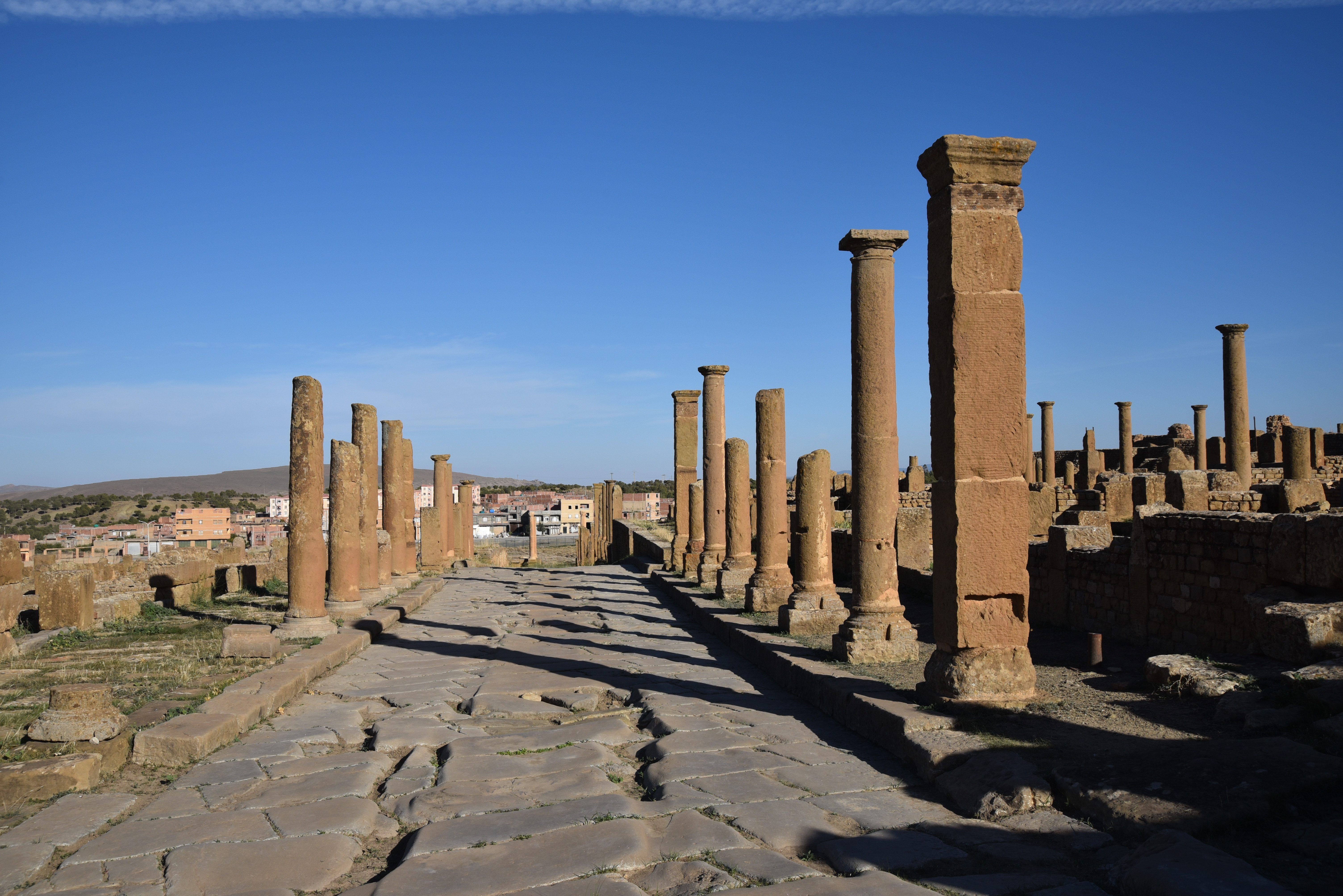
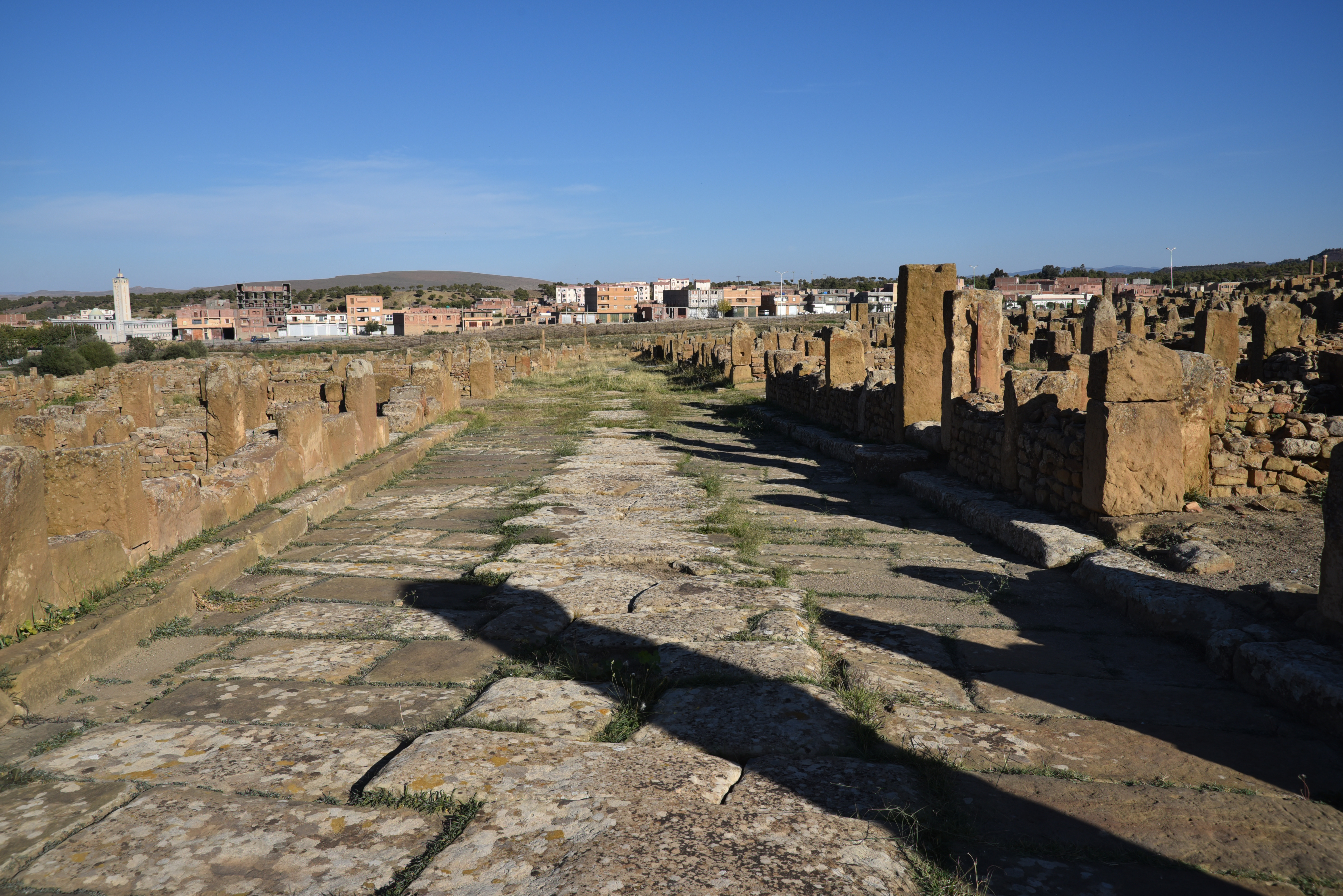
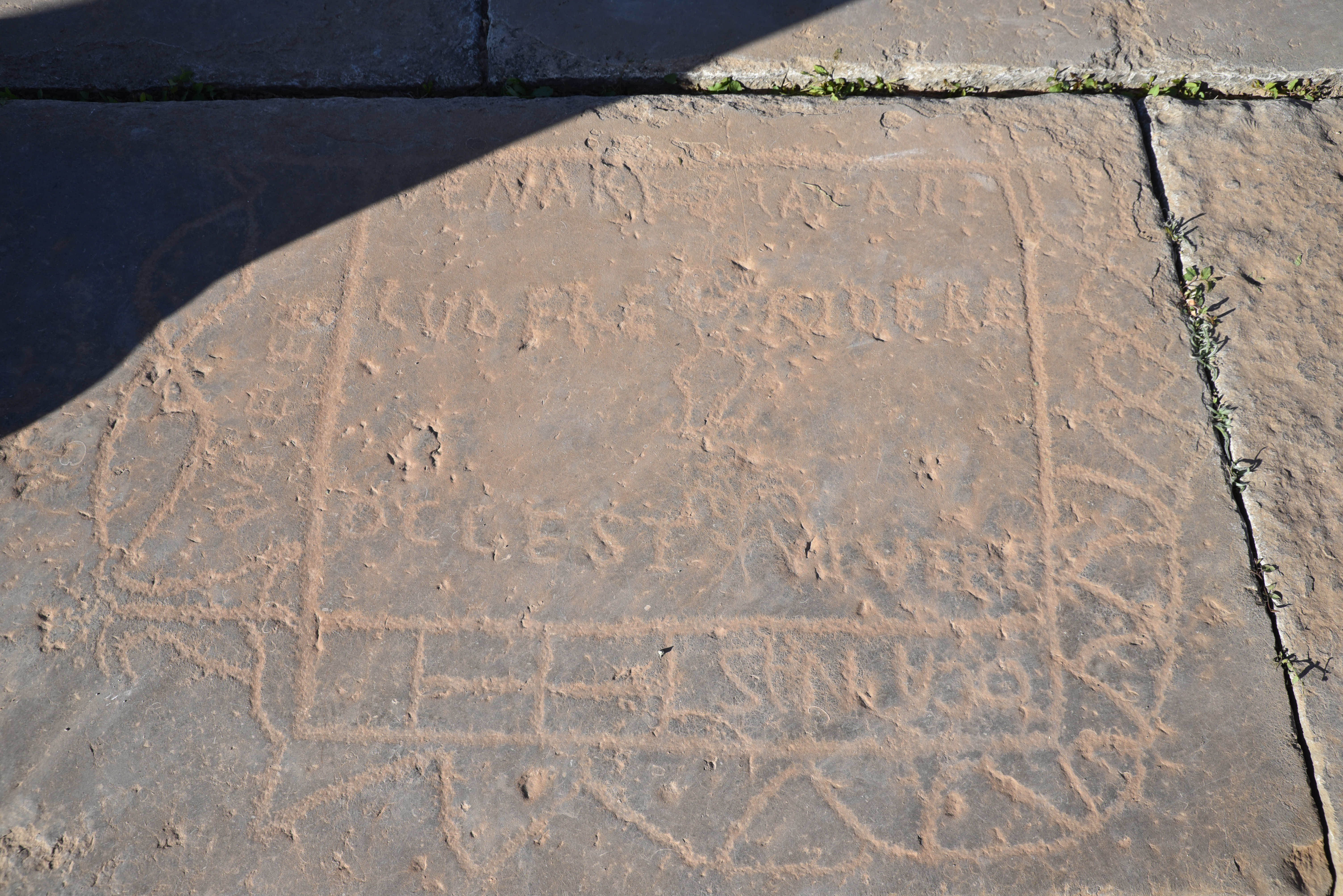
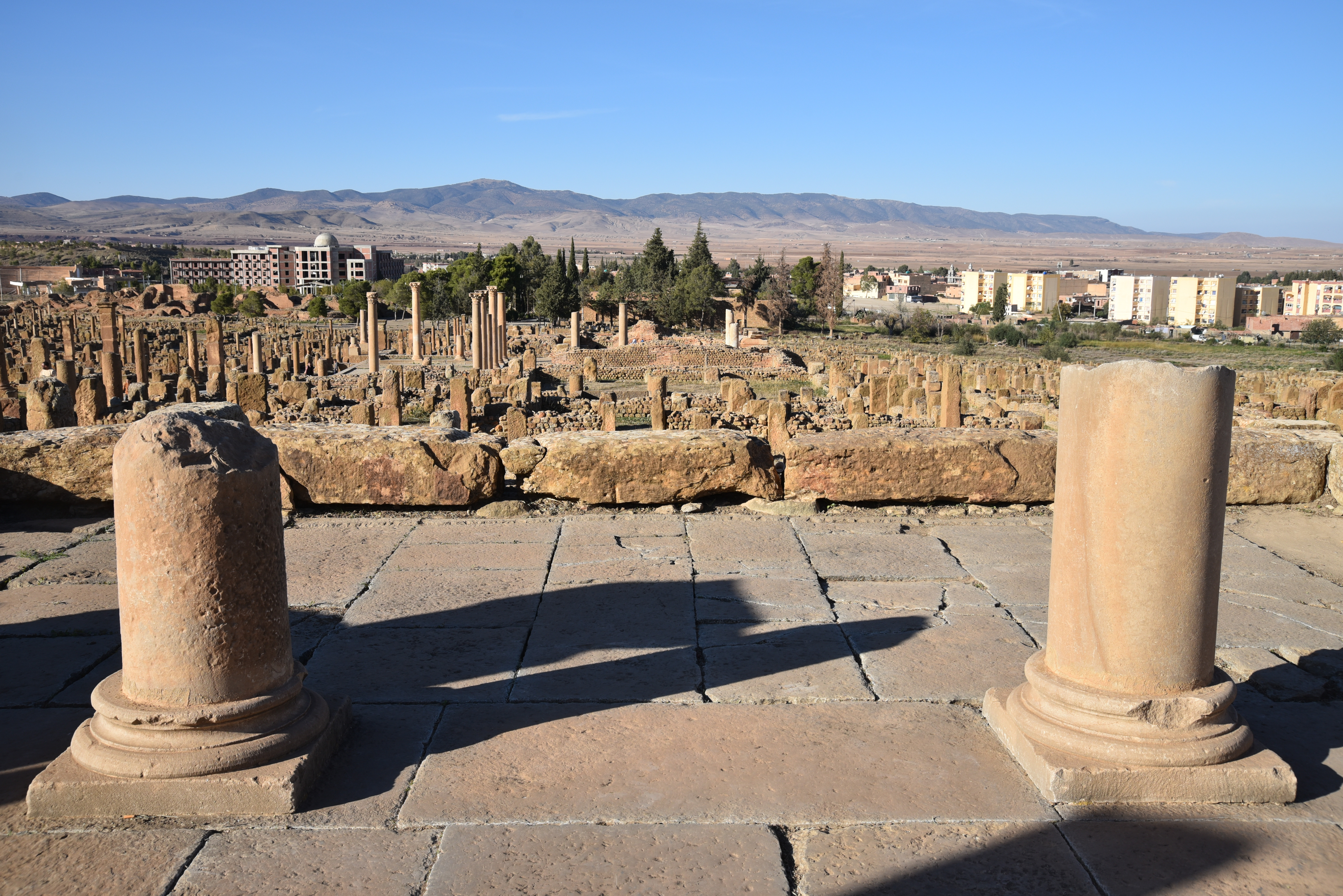
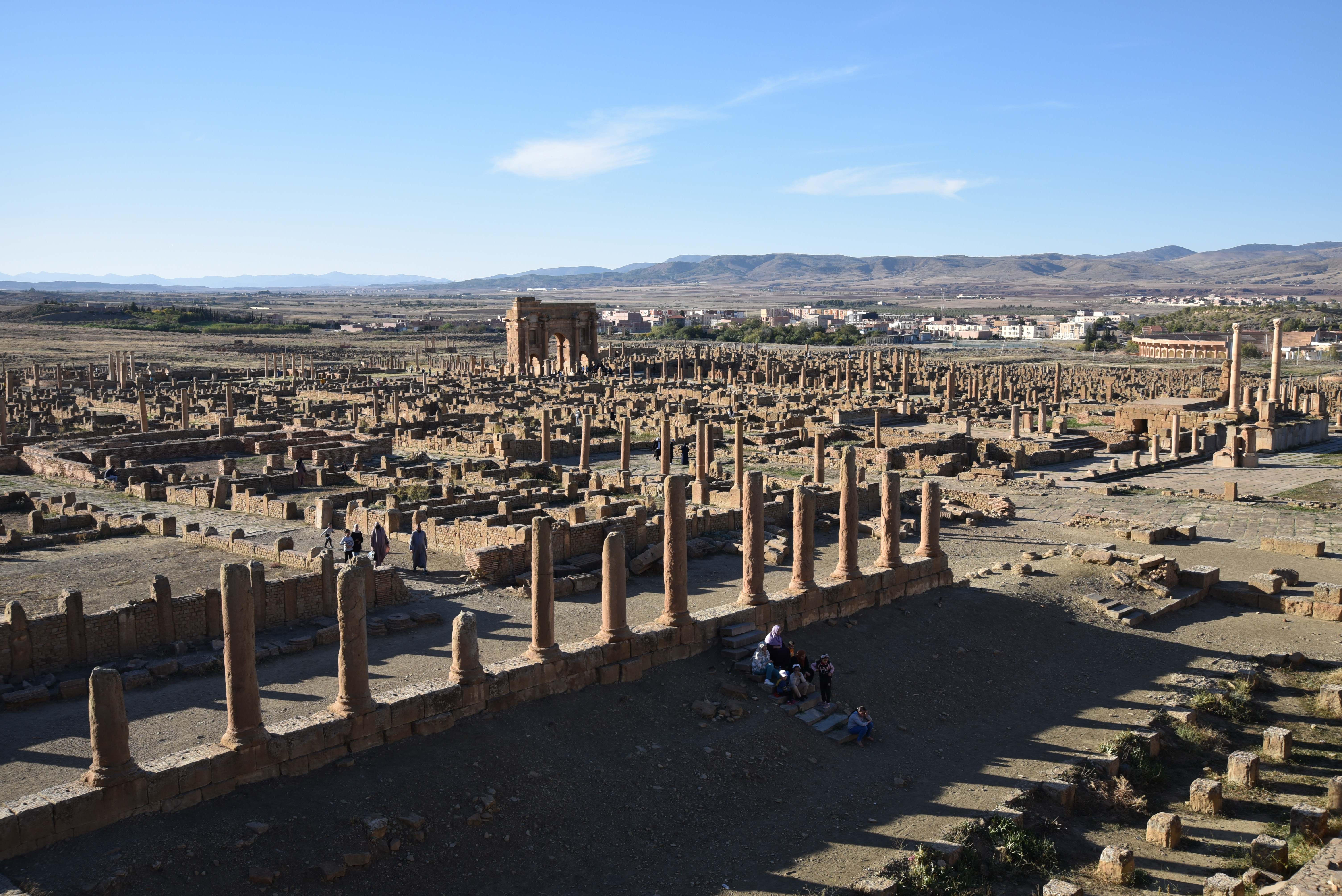
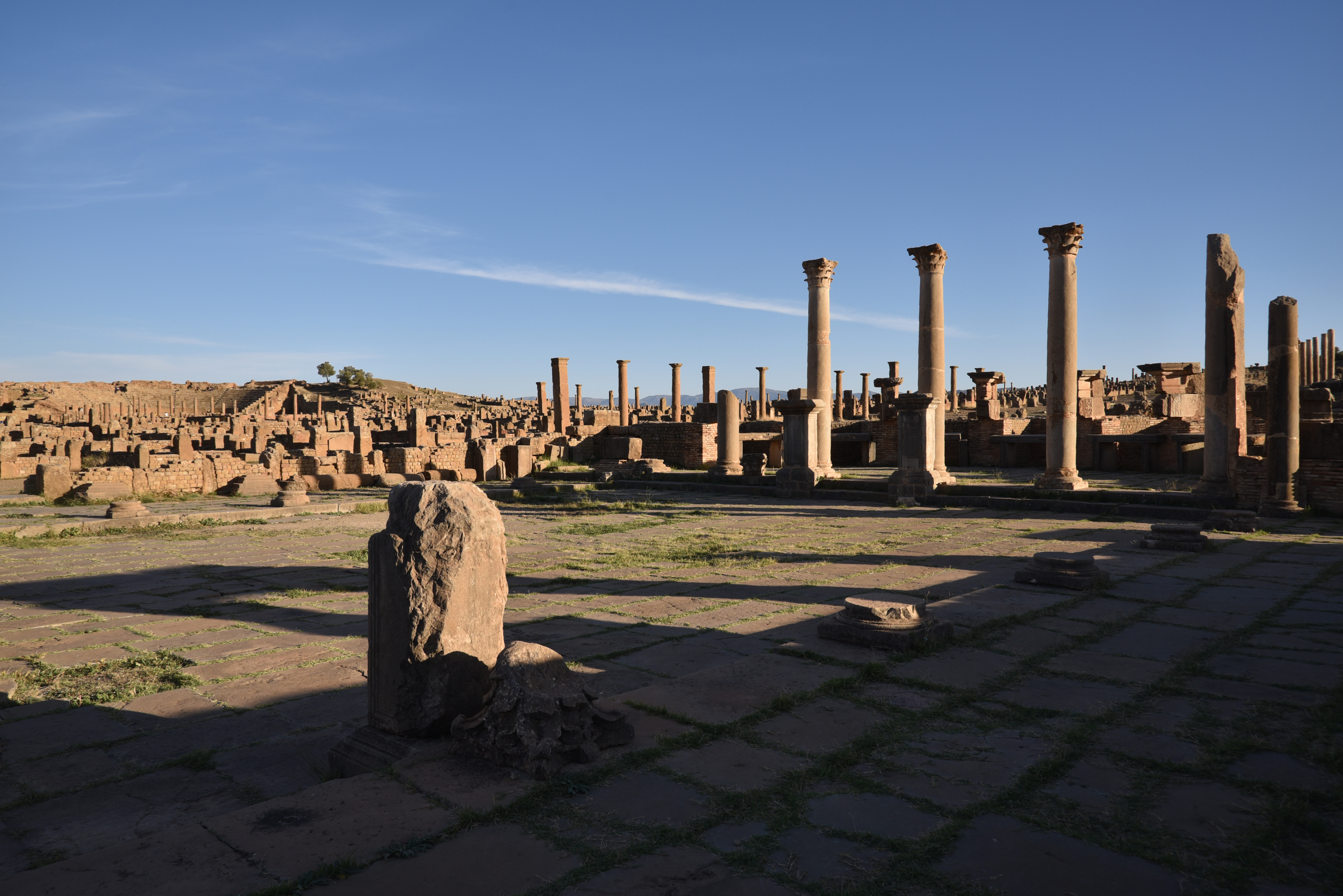
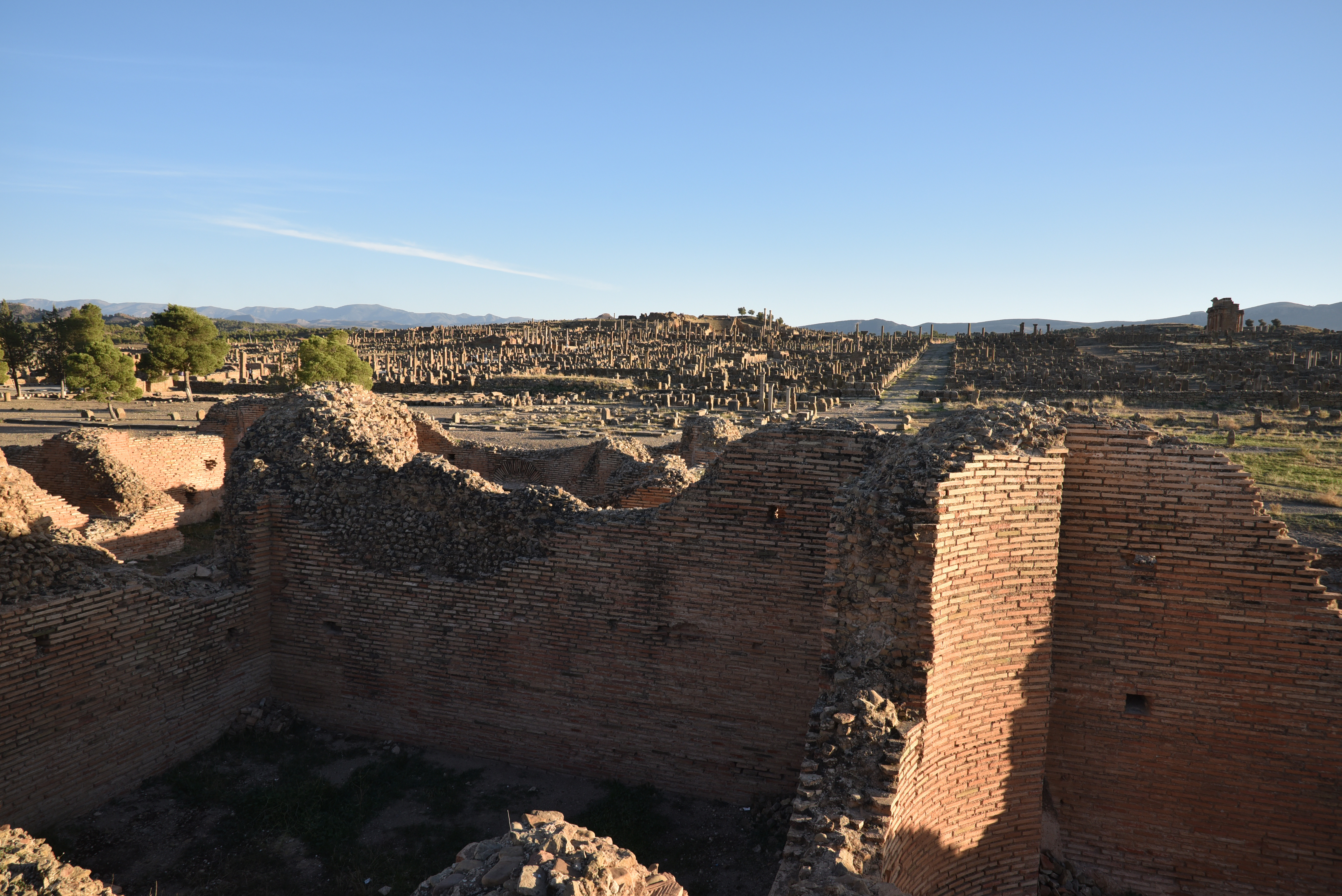
Initially, Thamugadi occupied an area of 12 hectares. Its regular grid, inscribed in a square with sides of 355 meters, was divided into four parts by two intersecting main streets that run north–south (cardo maximus) and east–west (decumanus maximus). Over the next 300 years, the city expanded beyond the original grid, increasing from 12 hectares to 50 hectares, and added new quarters, totalling 111 blocks (insulae), each measuring 20 meters square. At its peak, the city’s population reached 15,000. An inscription in the forum sums up life in Timgad: “venari lavari ludere ridere occ est vivere” (“to hunt, to go to the baths, to play, to laugh: this is to live”).
Christianity prevailed in Thamugadi in the 4th century AD, and it was one of the most prominent centres of the Donatist movement, a Christian sect that challenged the Catholic Church and the Roman Empire. The Vandals destroyed the city in 430. Some years later, in 484, it suffered attacks from the Mauri, causing the population to leave. The Byzantines recaptured and rebuilt the city, integrating it into Byzantine North Africa until the Arab invasion devastated the region. By the 8th century AD, Thamugadi had become uninhabited.
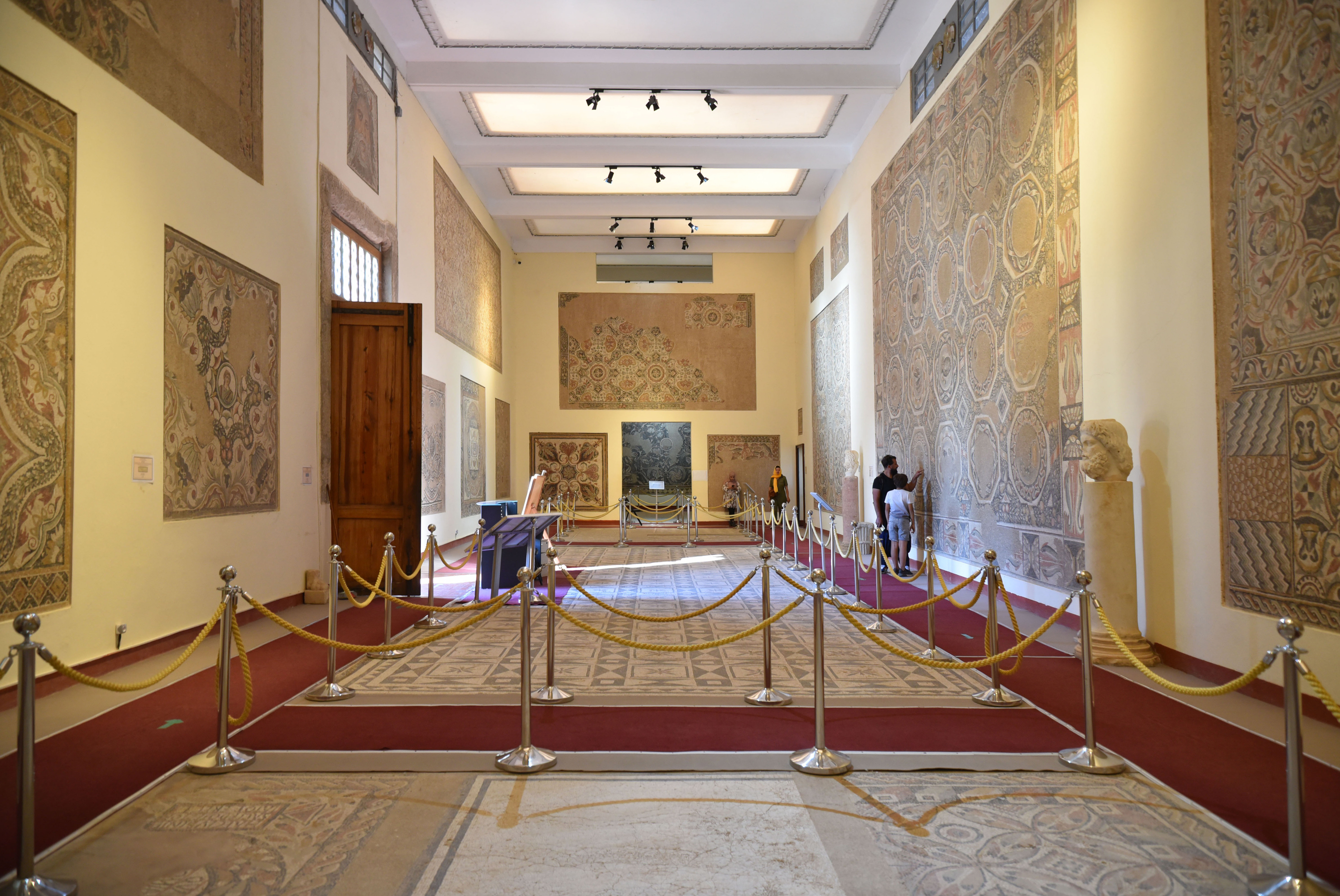
The museum, located at the site’s entrance, features a collection of over 80 mosaics, including the mosaic of Neptune on his chariot, Artemis and Actaeon, and Venus riding on the back of a marine centaur.
PORTFOLIO
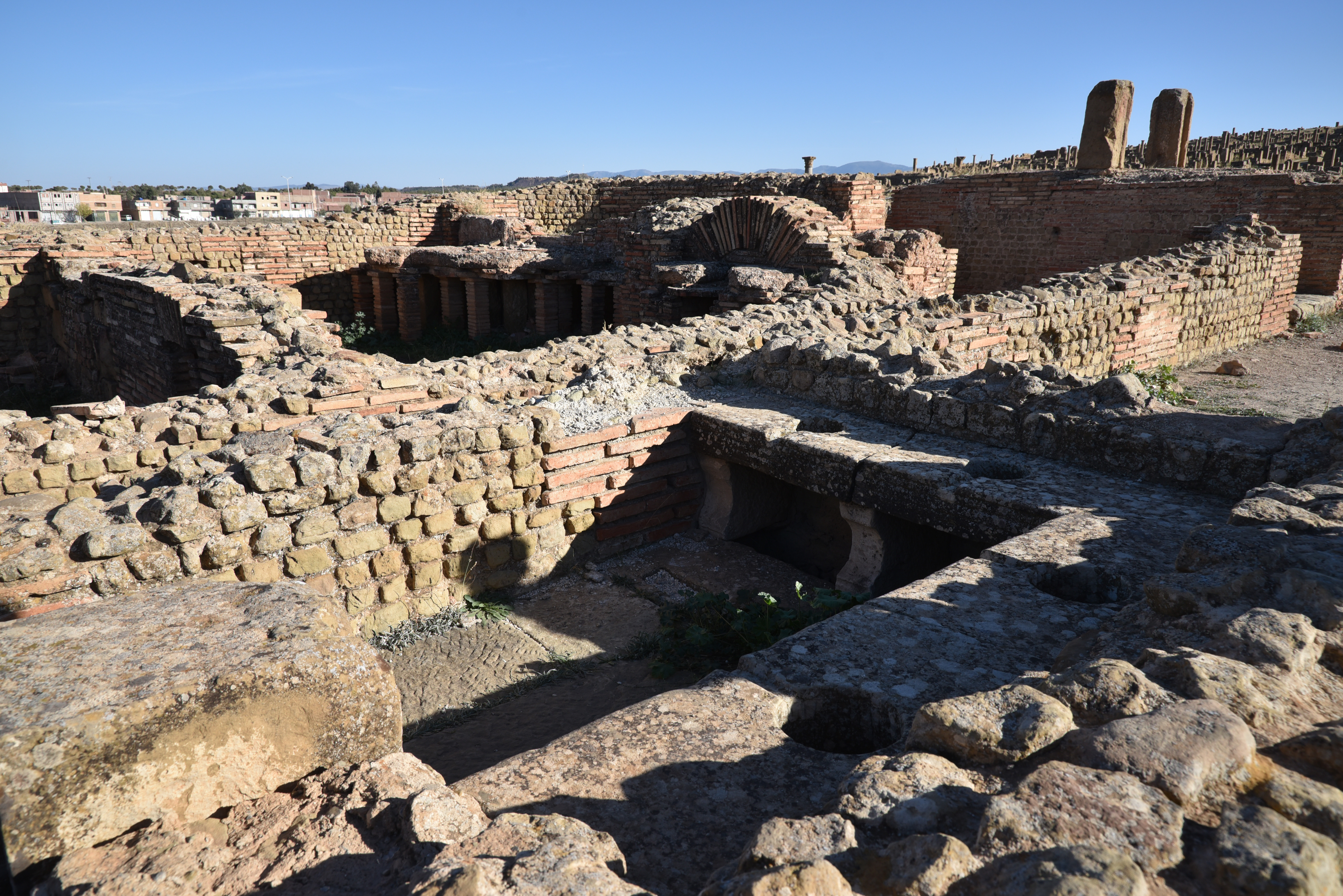
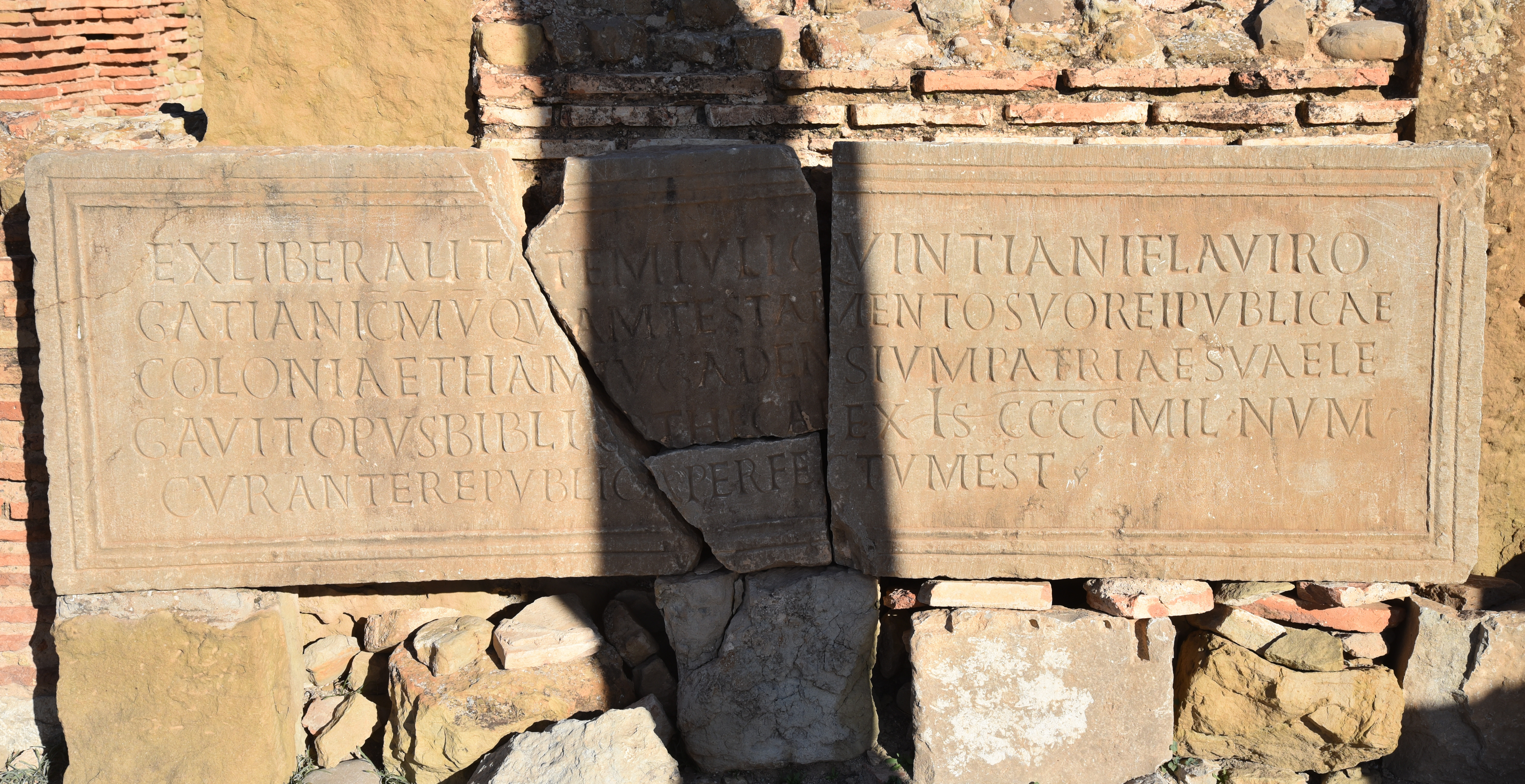
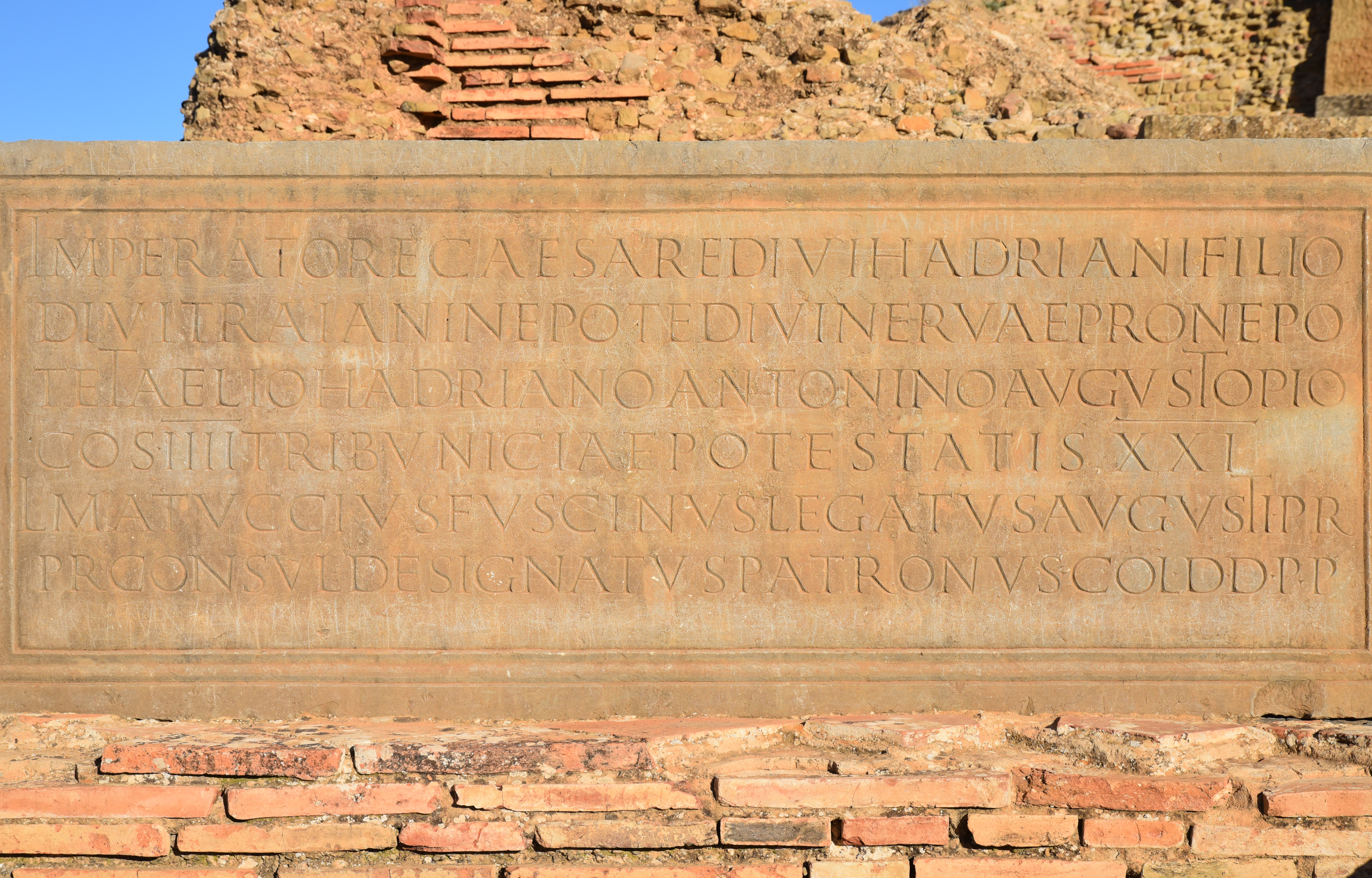
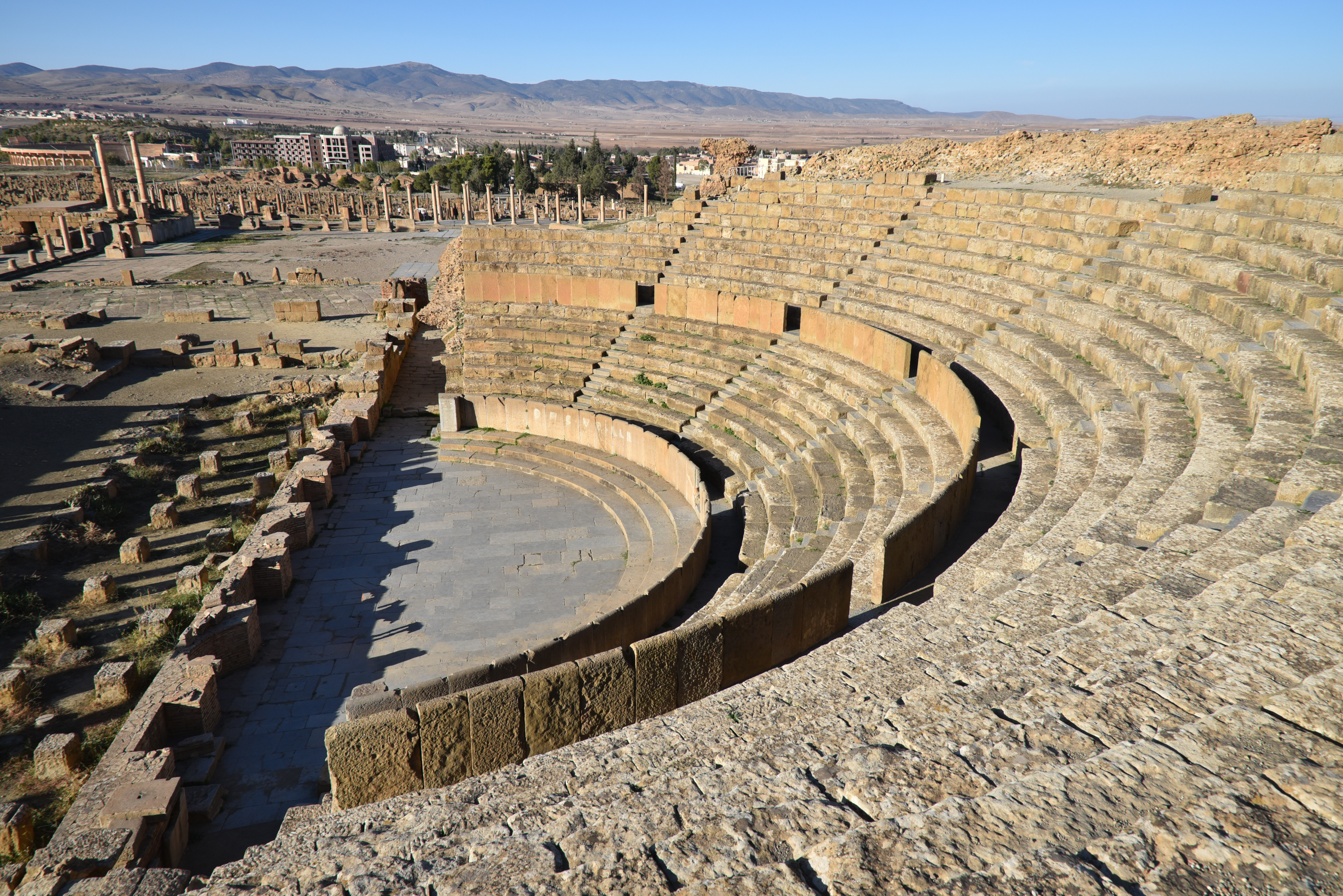
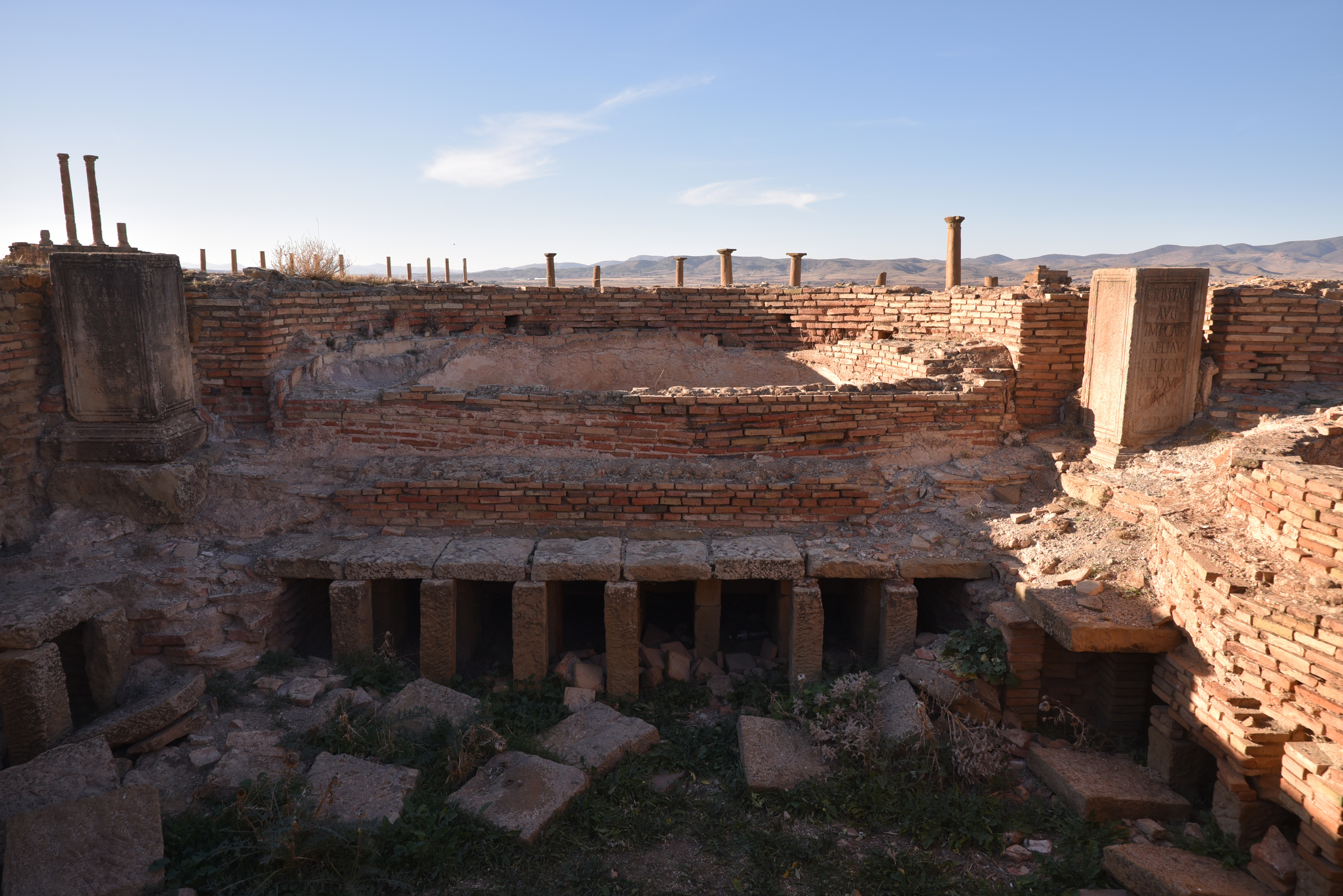
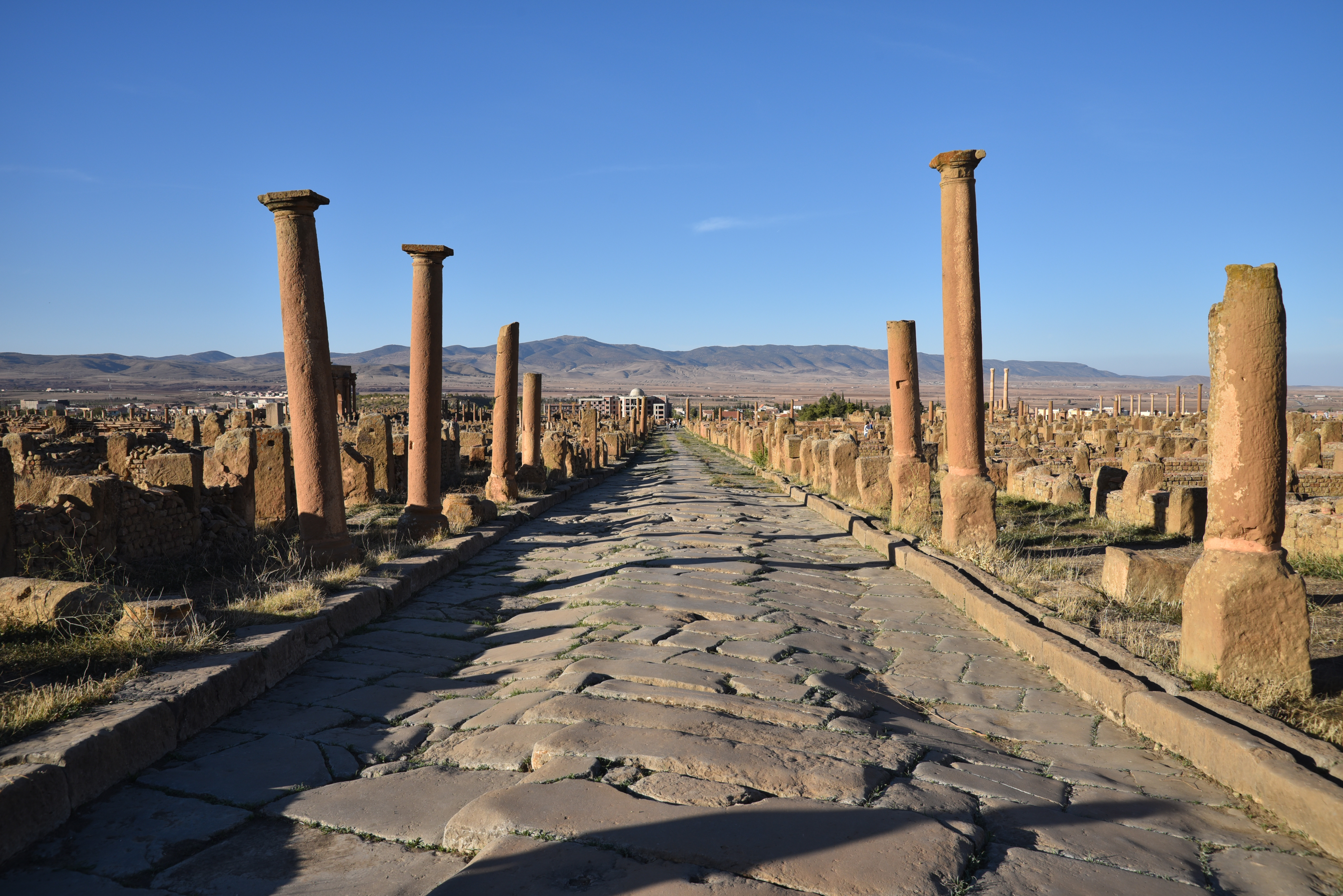
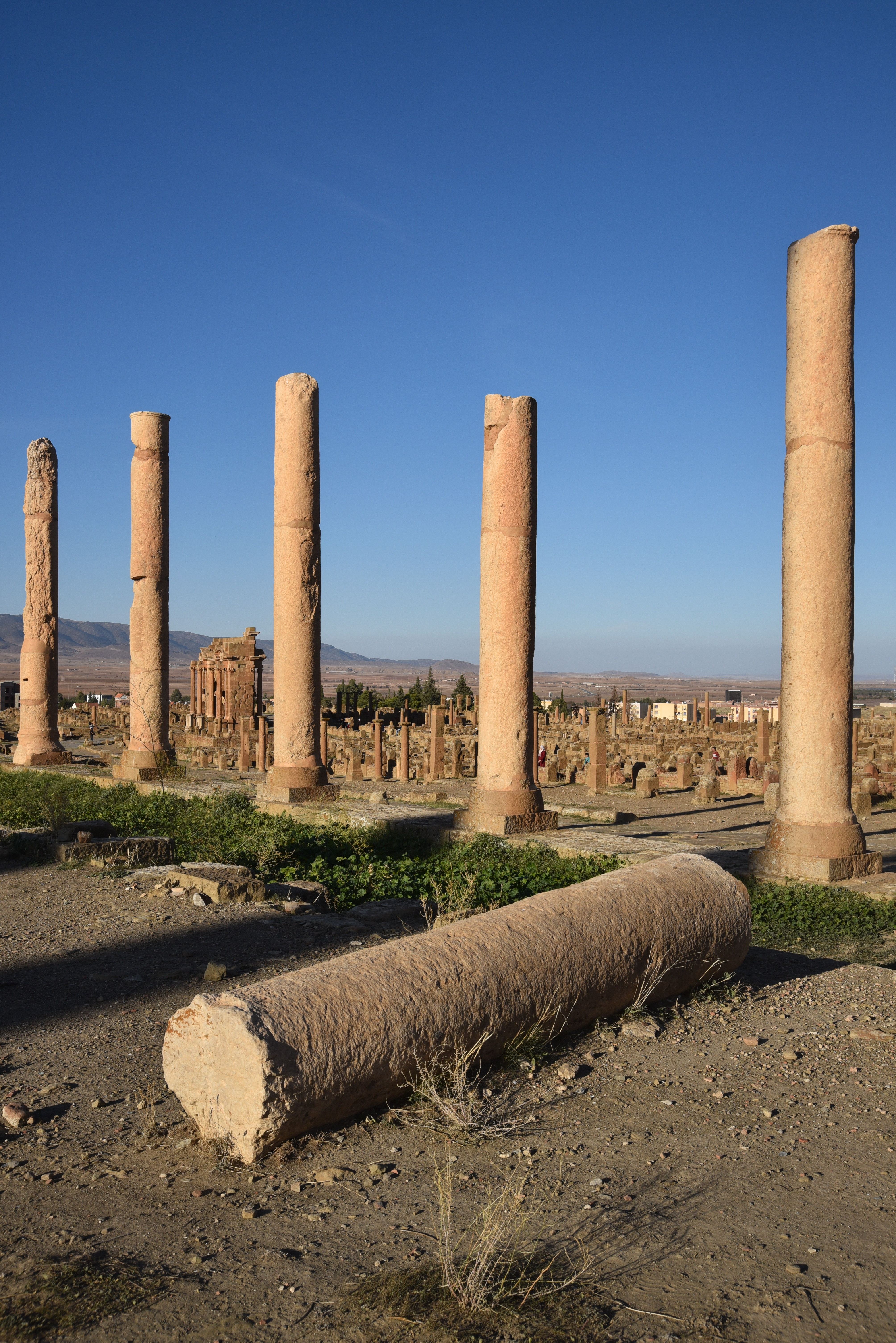
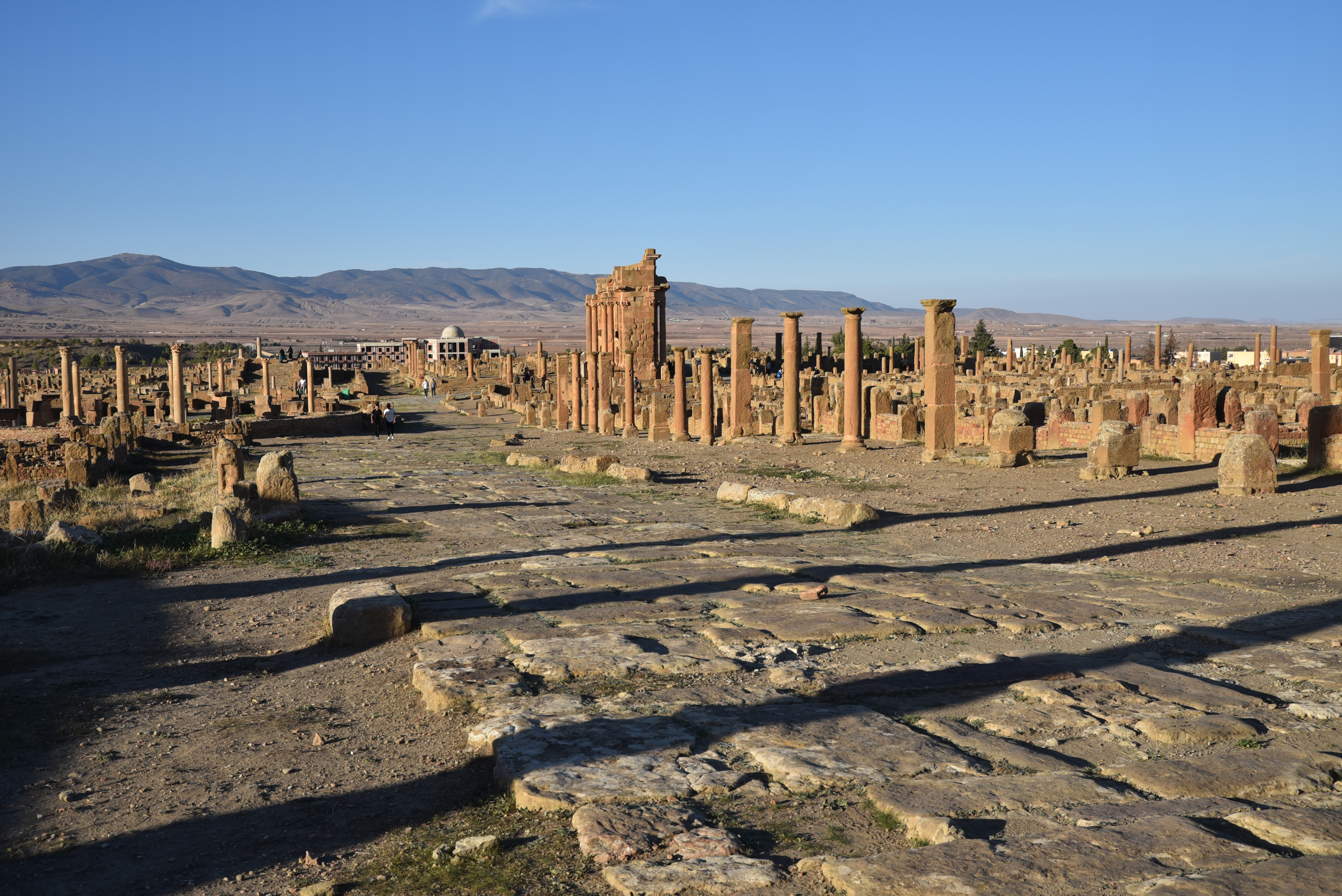
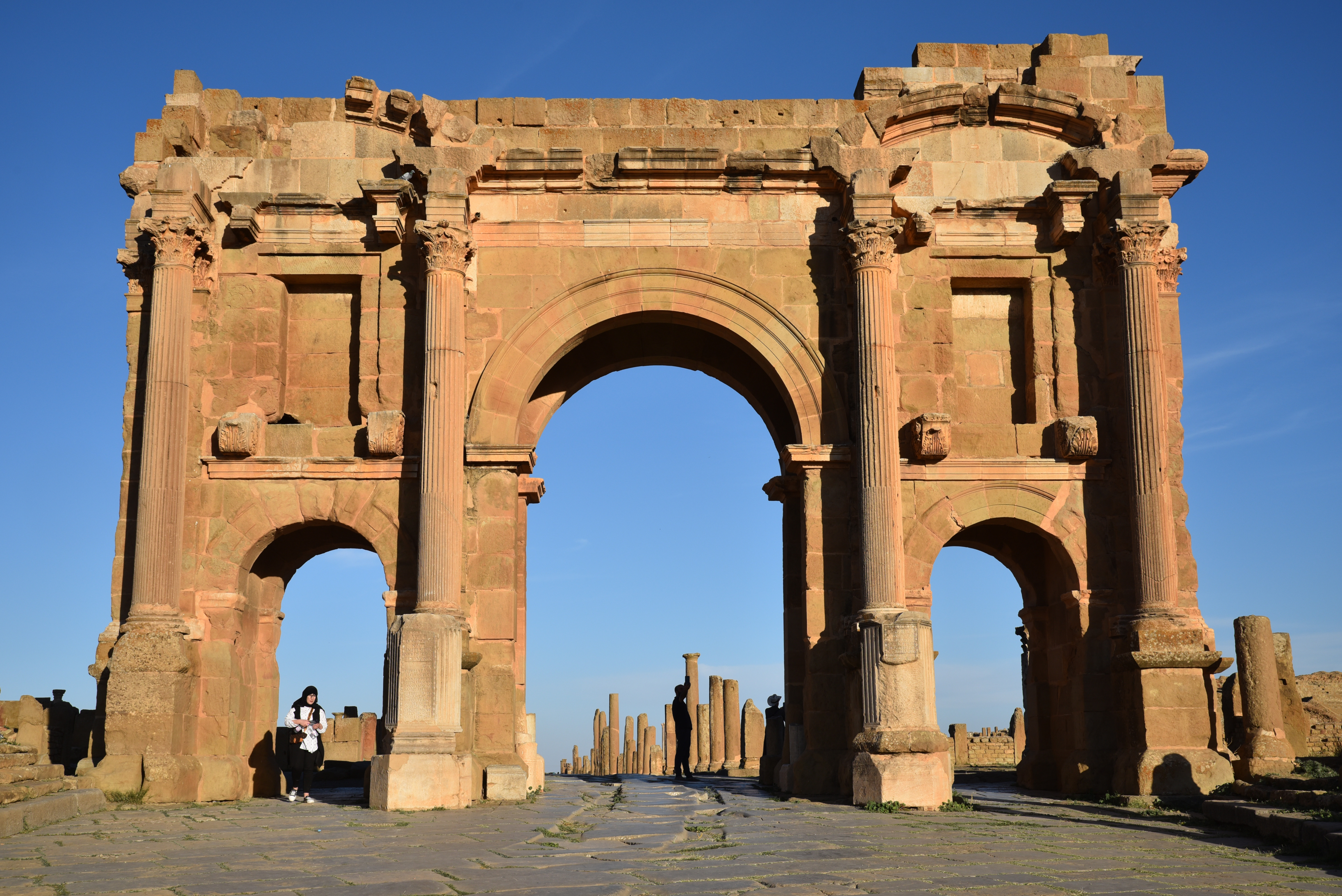
The Cardo Maximus (north–south-oriented street), looking towards the North Gate. The Cardo Maximus was 180 m long and 5 m wide. It was paved with slabs of bluish limestone and lined with porticoes.Side street with wheel ruts.The Small Northern Baths, one of the fourteen public bathing establishments which have been identified in the city.The Public Library, built in the late 3rd century or early 4th century AD on the site of a pre-existing private house.A certain Marcus Julius Quintianus Flavius Rogatianus donated 400,000 sesterces to his hometown to fund the Public Library.Inscription recording that M. Quintianus Flavius Rogatianus left the sum of 400,000 sesterces in his will for the construction of the Public Library. (AE 1908, 0012). The inscription, which once surmounted the entrance to this building, now lies against the rear wall of the courtyard.One of the small city blocks measuring 20 square metres.A secondary street separating two small city blocks near the Forum.A very well-preserved public latrine next to the Forum with seat armrests carved in the form of dolphins.The Forum, a vast square (50 × 43 m), paved with blue limestone and surrounded on all four sides by Corinthian colonnades raised two steps above the central area.Laid out when the colony was founded, the construction of the Forum took place progressively during the first half of the 2nd century AD. In the Forum were important buildings such as the curia, a basilica and a small tetrastyle temple dedicated to Victoria.Board game carved into the pavement with Latin inscription Venari, lavari, luderi, rideri, occ (=hoc) est vivere (to hunt, to bathe, to play, to laugh, that is life). CIL VIII 17938.The Forum was full of statues, of which a number of bases remain in position.Statues in the Forum included those of the gods Mercury, Marsyas, Fortuna Augusta, Victoria Augusta, Concord, as well as several statues of emperors, including those of Trajan, Antoninus Pius, Septimius Severus, and Caracalla.Building/dedicatory inscription in the Forum dedicated to Antoninus Pius and set up by consul designatus Lucius Matuccius Fuscinus, dated AD 158/9.The East Market lining the decumanus maximus with an internal courtyard featuring two intersecting semicircles, each adorned with its own portico.The peristyle, featuring Corinthian porticoes, of the House of the Raised Flower-Beds, which was accessed from the decumanus maximus adjacent to the Forum.View from the Forum looking south.The Theatre, located south of the Forum. Cut into the side of a natural hillock, it had a capacity of 3,500 to 4,000 spectators.The lower part of the cavea of the theatre is reasonably well preserved, as is the orchestra. Nothing, however, remains of the stage building (scaenafrons).View of the city from the theatre with the so-called Arch of Trajan in the background.One of the small city blocks with the Capitolium and the so-called Arch of Trajan in the background.The Great South Baths, founded in the 2nd century AD and enlarged in AD 198 by decree of the decurions.The caldarium of the Great South Baths with the remains of the hypocaust underfloor heating system. Twelve statues decorated the baths, including portraits of the emperors Valerian and Gallienus (left statue base) and Crispina, the wife of Commodus (right statue base).Semi-circular latrine in the Great South Baths. It had 28 seats and was originally paved with a fine mosaic of aquatic creatures.The Great South Baths, located at the intersection of four roads, featured a fountain at the corner where the southbound cardo curves to the west.One of the streets running parallel to the Cardo Maximus.View of Thamugadi looking north with the so-called Arch of Trajan on the west side.The road leading towards the Capitolium and the so-called Arch of Trajan.The ruins of the Capitolium, dedicated to the Capitoline triad of Jupiter, Juno and Minerva, built outside of the Forum in the mid-2nd century AD. The temple was not part of the original city layout.The Capitolium stood on a massive podium (53 × 23 m in plan and 6.7 m high) approached by a flight of 38 steps. The cella (17 × 11 m), of which only the foundations remain, was surrounded on three sides by columns 14 m high, on top of which were huge Corinthian capitals (in two parts) 1.6 m high.View of Thamugadi from the area of the Capitolium, looking north.Columns from the east portico of the Capitolium.View of Thamugadi from the area of the Capitolium, looking north.View of Thamugadi from the area of the Capitolium, looking northeast.Market of Sertius, built in the beginning of the 3rd century AD.The rectangular peristyle court of the Market of Sertius terminating in an apse. Three permanent stalls with stone counters stood on either side of the entrance at the north end, while nine more were arranged around the apse.Shop counters in the apse of the Market of Sertius. The roof of the apse was supported by the columns of the main portico, extending across the diameter and around the hemicycle, via engaged colonettes and architraves, which were in turn supported by elaborately carved console brackets.The rectangular peristyle court of the Market of Sertius with the theatre in the background.Temple dedicated to the Genius of the Colony, built in AD 169 under Marcus Aurelius.The so-called Arch of Trajan, a triple arch built on the Decumanus Maximus at the beginning of the 3rd century AD during the reign of Septimius Severus, on the site of the West Gate of the Trajanic colony. Its modern appellation is the result of an erroneous interpretation of an inscription at the beginning of the twentieth century.The so-called Arch of Trajan was 12 metres high and had three arches, with the central one used for wheeled traffic, while those on the side were for pedestrians.View from the Decumanus Maximus towards the Forum and the Theatre.The Great North Baths.View of the city from the Great North Baths.
Timgad Museum
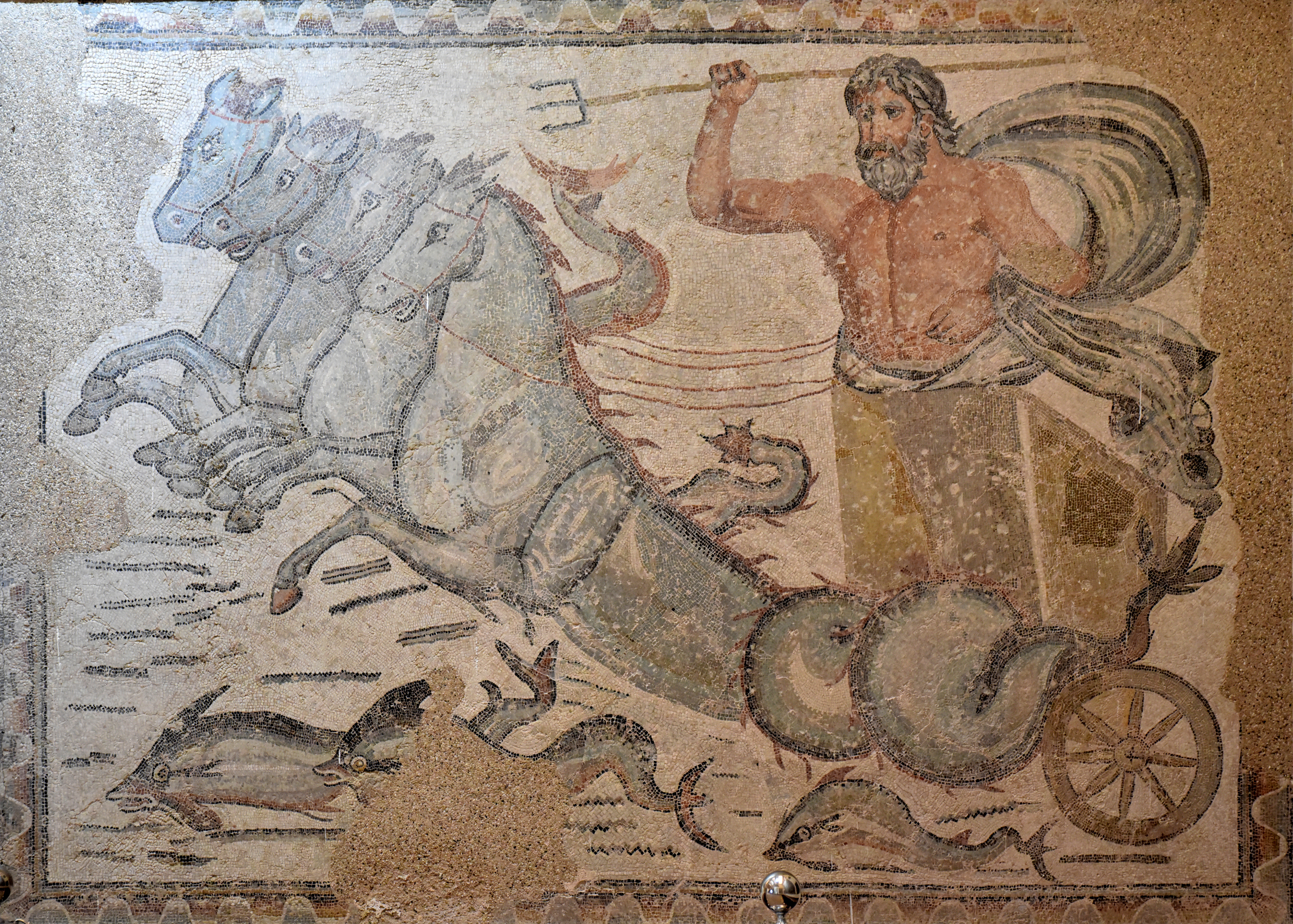
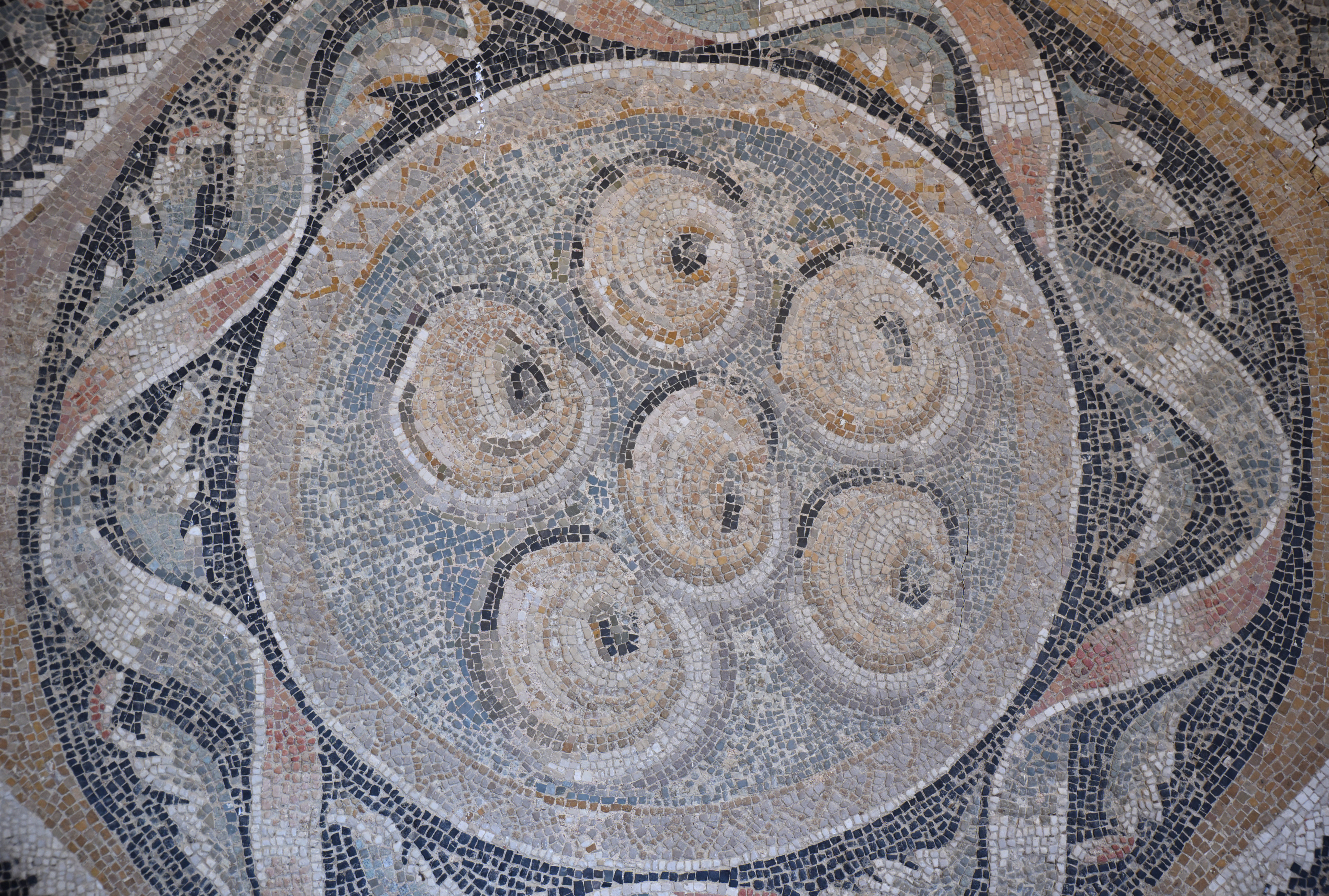
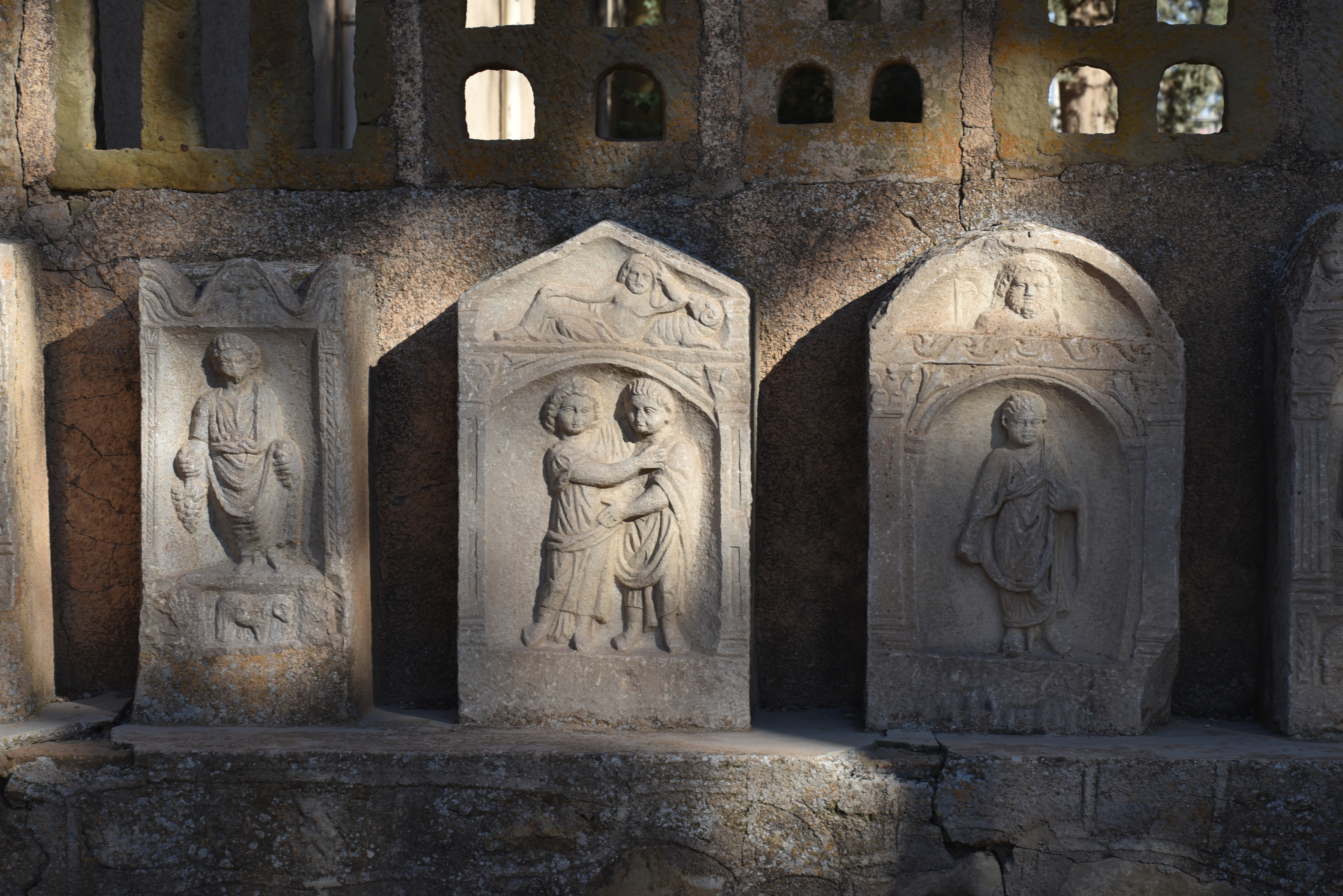
The museum of Timgad is located at the entrance of the site. It features a particularly impressive collection of over 80 mosaics and other significant artefacts discovered at the site.Mosaic of the Philadelphi. The central panel depicts the pursuit of Antiope (represented as a Maenad) by Zeus, disguised as a satyr, and bears the inscription “FILADELFIS VITA” (Long life to the Philadelphians). Dated early 3rd century AD.Neptune in his chariot, from the East Baths of Thamugadi. The god brandishes his trident as he stands in his chariot, which is drawn by four sea horses. Dated 3rd century AD.Artemis and Actaeon Mosaic, from a private house in Thamugadi. Dated 3rd century AD.Mosaic with vegetal and floral designs.Museum of Timgad.Marine Venus mosaic, depicting the goddess as naked, seated on the back of a marine centaur, accompanied by another sea centaur. From a private house in Thamugadi. Dated 3rd century AD.Mosaic with vegetal and floral designs.Mosaic with fruits.Funerary stelai dedicated to Saturn.Carved offering table from a stele dedicated to Saturn.
Blas de Roblès, Jean-Marie; Sintes, Claude; Kenrick, Philip. Classical Antiquities of Algeria: A Selective Guide (p. 127). Society for Libyan Studies. pp. 375-444
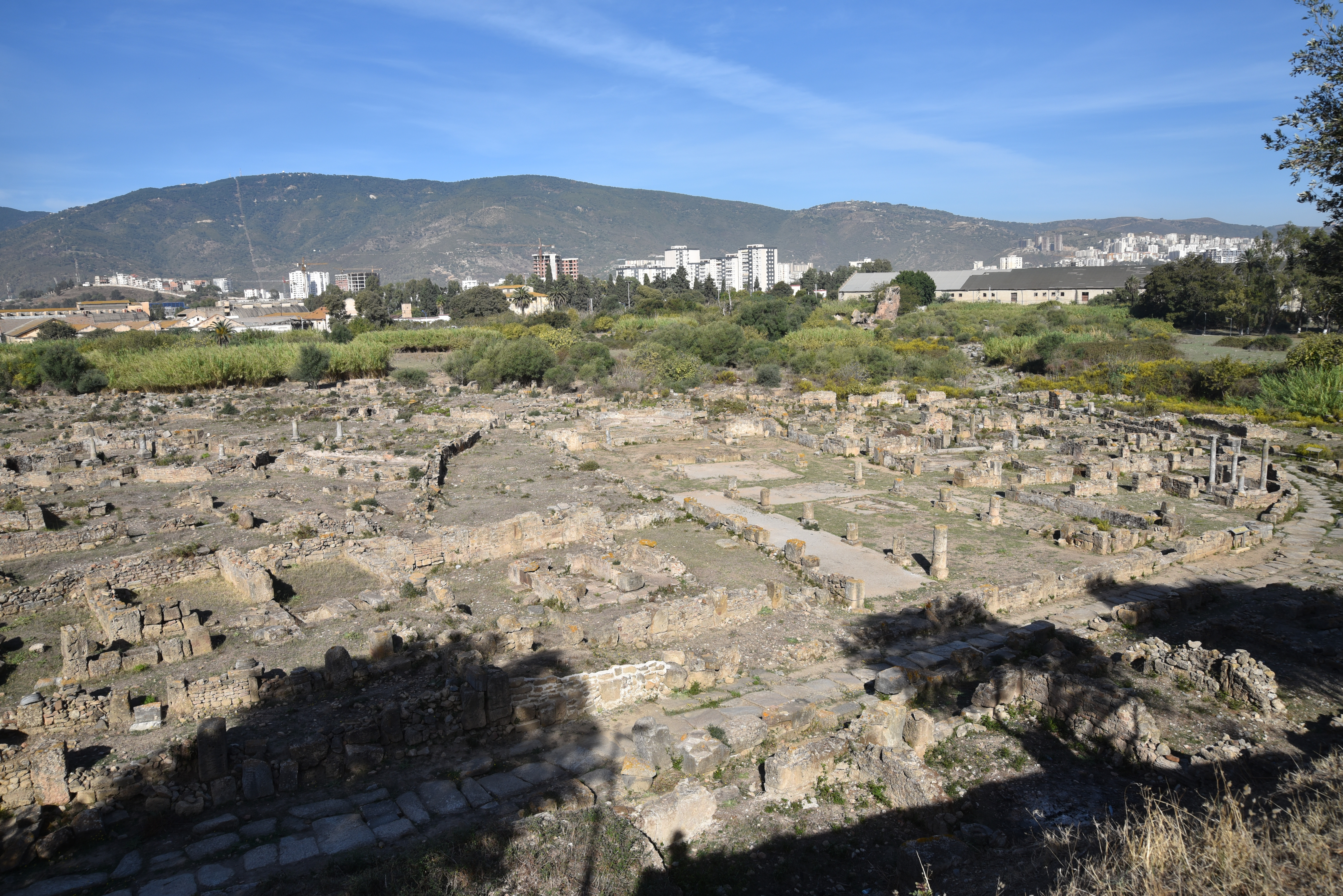
Hippo Regius was an ancient port located on the coast of North Africa, near the modern town of Annaba in northeastern Algeria. Its natural harbours and defences, proximity to fresh water, and fertile hinterland attracted the Phoenicians and ensured the city’s continuing prosperity. Throughout its history, various groups—including the Numidians, Romans, Vandals, Byzantines, Arabs, Ottomans, and French—have been drawn to the site. Hippo enjoyed great wealth and splendour, eventually emerging as one of the largest cities and most significant markets in Roman Africa.
Hippo Regius was originally a Phoenician settlement established in the 10th century BC. It later became a prosperous Punic city allied with Carthage and the Numidian metropolis of King Massinissa in the 3rd century BC. Following the defeat of Juba I, an ally of Pompey, in 46 BC, Hippo was not annexed to the Roman province of Africa Nova, created by Julius Caesar. Hippo Regius flourished most under the Romans, becoming a municipality under Augustus and elevated to a colony under Trajan. It developed into a vital commercial hub, exporting wheat that fed Rome.
In the 5th century AD, Hippo became the home of Christianity under the episcopate of St. Augustine, who was bishop of the town from 396 AD until his death in 430 AD. Hippo Regius later fell to the Vandals and became the capital city of the Vandal Kingdom from 435 to 439. Hippo Regius passed to the Byzantine emperor Justinian in 533, and about two centuries later, it was overcome by Arabs. The settlement was moved to its present site of Annaba.
Roman rule in North Africa. Map created by Simeon Netchev (CC BY-NC-SA 4.0).
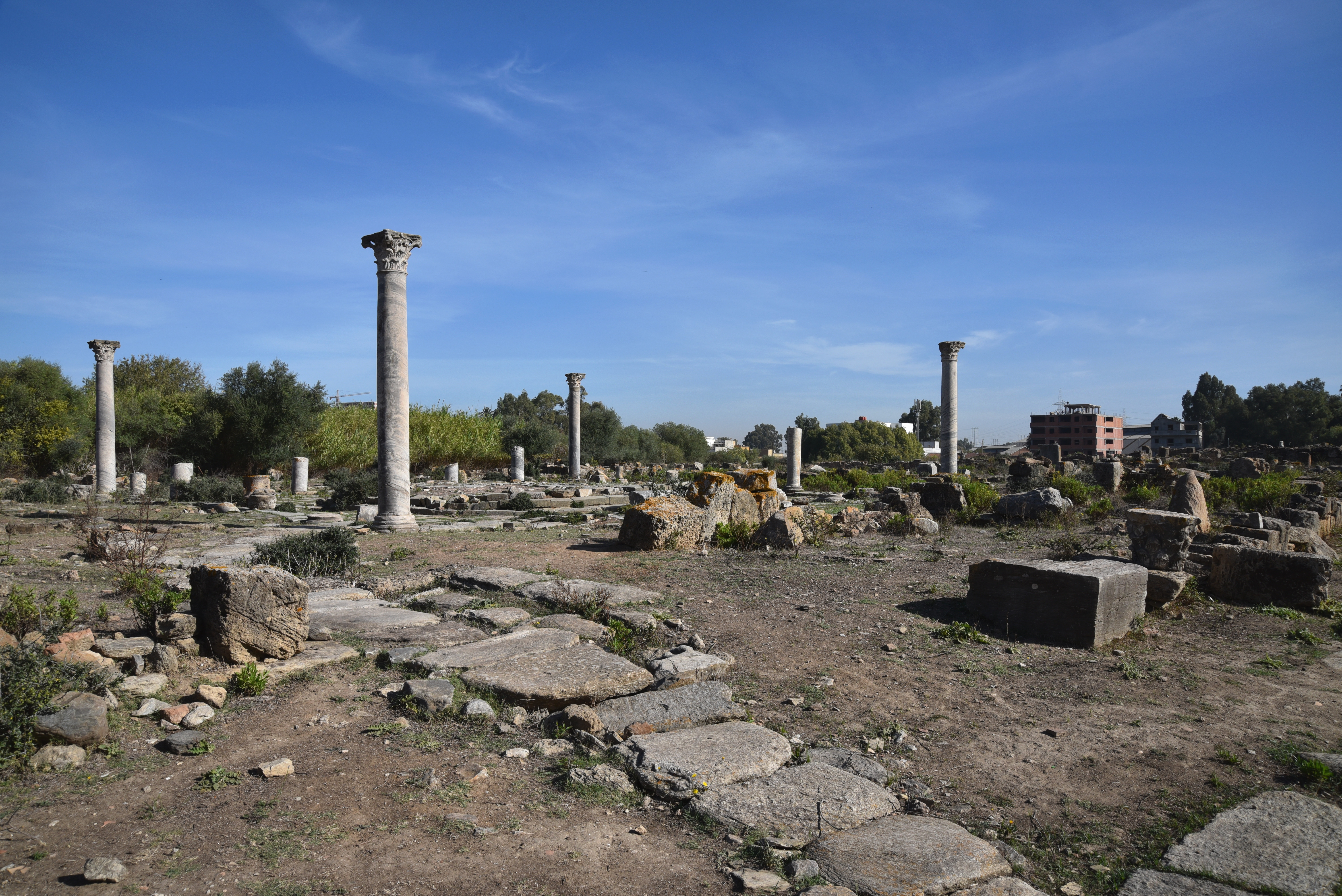
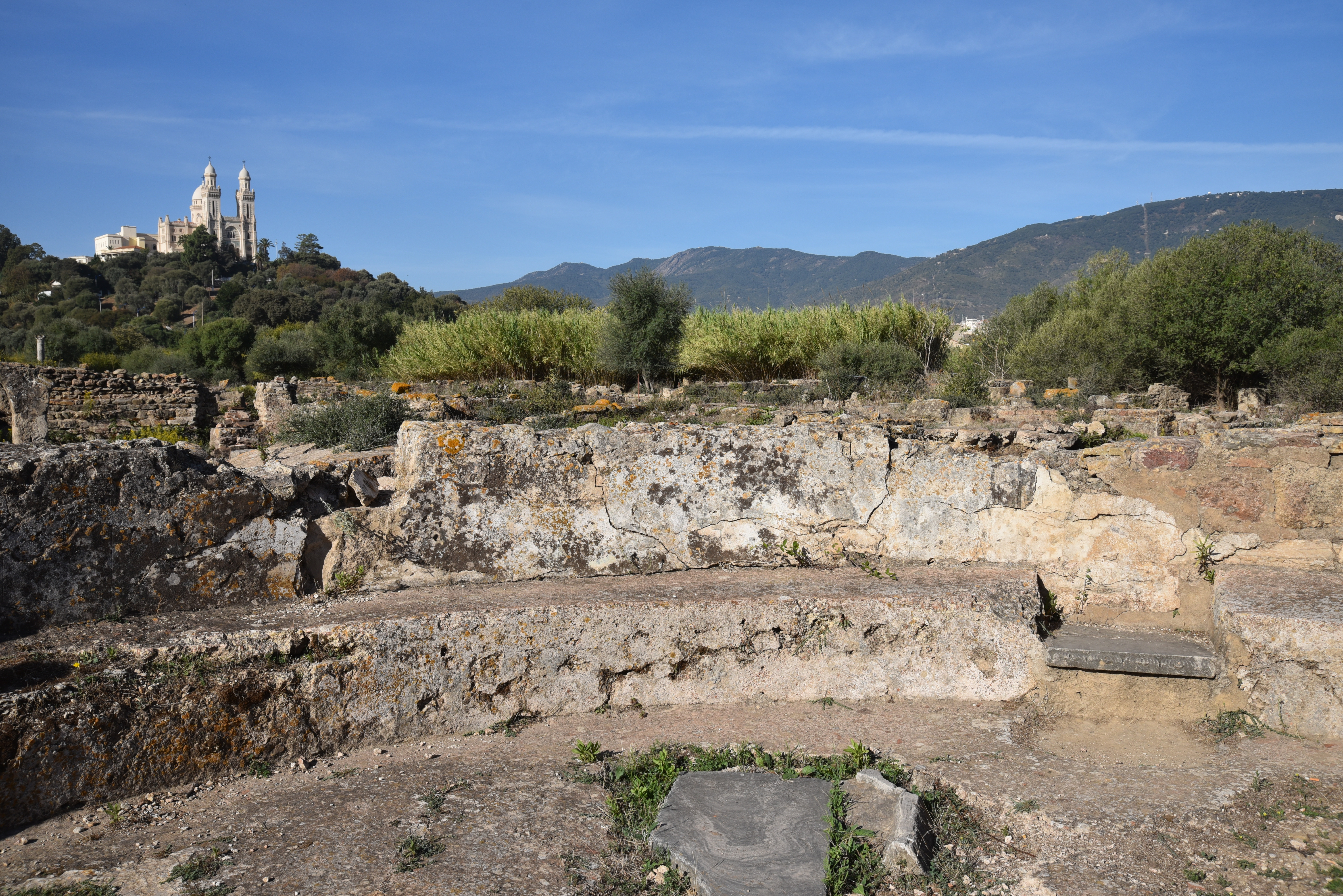
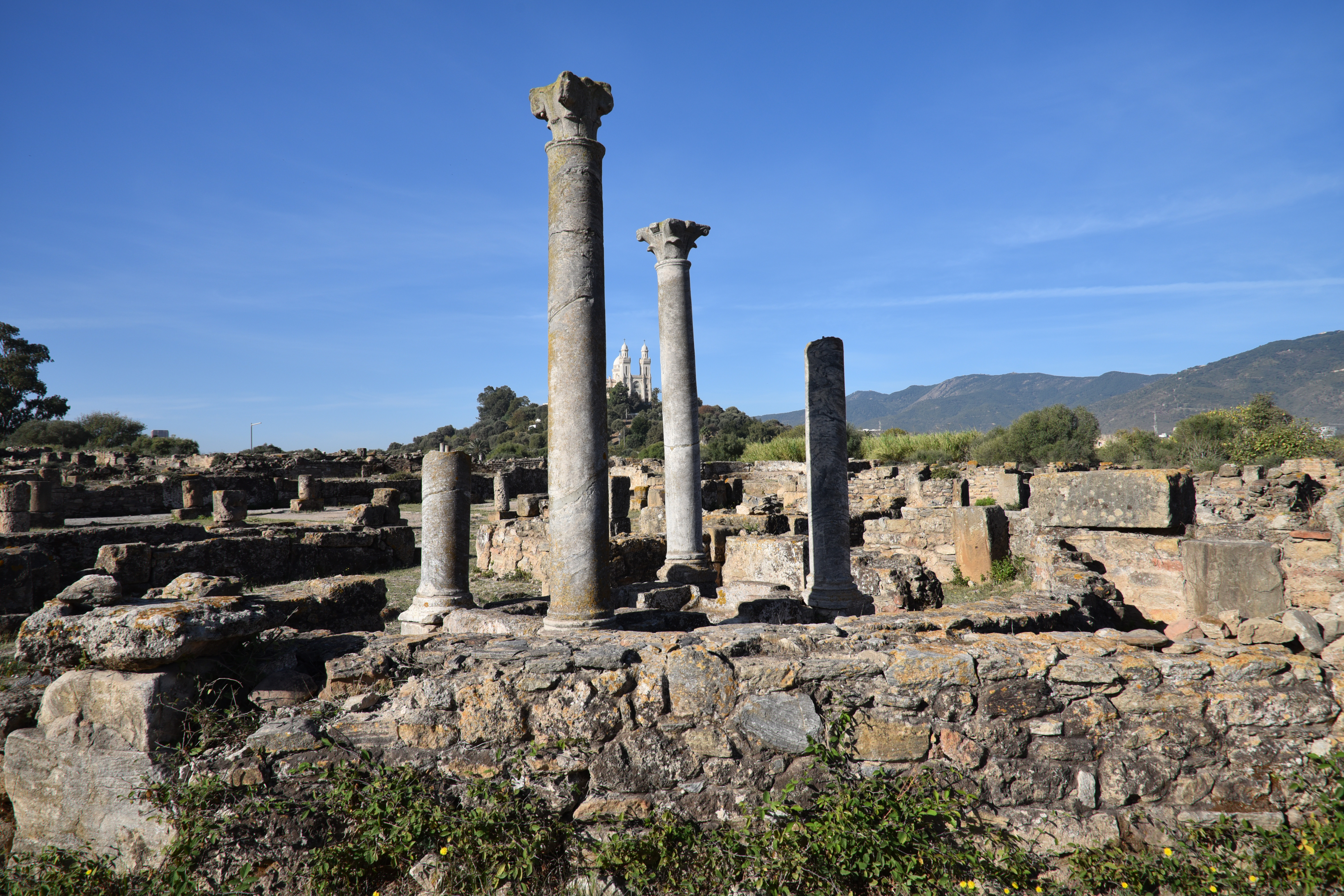
The ruins of Hippo Regius, overlooked by the imposing colonial-era Basilica of St. Augustine, are among the most evocative in Algeria. The forum is one of North Africa’s largest. It features an inscription extending over two lines across its entire width. In the Christian quarter stands a 42-metre-long (131-ft) basilica still covered with mosaics. This may have been the basilica where St. Augustine served as the renowned bishop.
The Musée d’Hippone is located on the hill of Gharf el-Atran, overlooking the archaeological site of Hippo. Built in 1968, the museum houses over 20,000 works from Roman antiquity and later periods. It includes ancient sculptures, ceramics, coins, jewellery, bronze and fired clay vases, statuettes of Numidian, Punic, and Roman goddesses, marble busts, pottery, and Roman mosaics. The centrepiece is a bronze trophy about two meters high, commemorating the victory of Julius Caesar over King Juba I. This representation of a breastplate on a trunk was discovered on the forum of Hippo Regius.
PORTFOLIO
General view of the site.
Forum Quarter
The paved Decumanus leading to the Forum.The Forum of Hippo Regius, a rectangular paved area measuring 76 x 43 m, is one of the largest in North Africa.The Forum was paved in marble and surrounded by Corinthian porticoes.A long inscription, originally filled with bronze letters, extends across the entire width of the Forum. The text records that the paving was dedicated by Gaius Paccius Africanus, pontifex, consul, proconsul, and patron of the municipium of Hippo Regius.
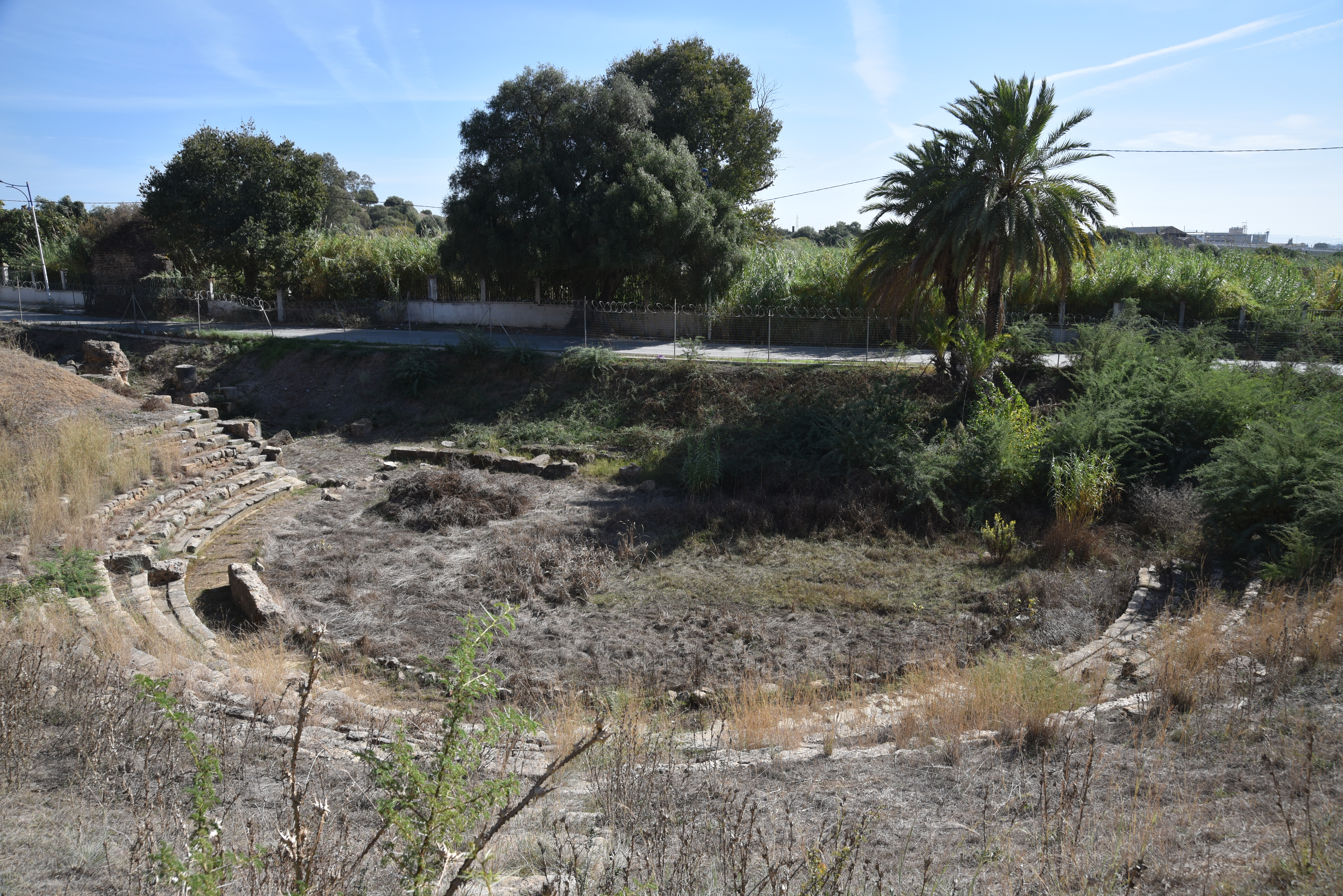
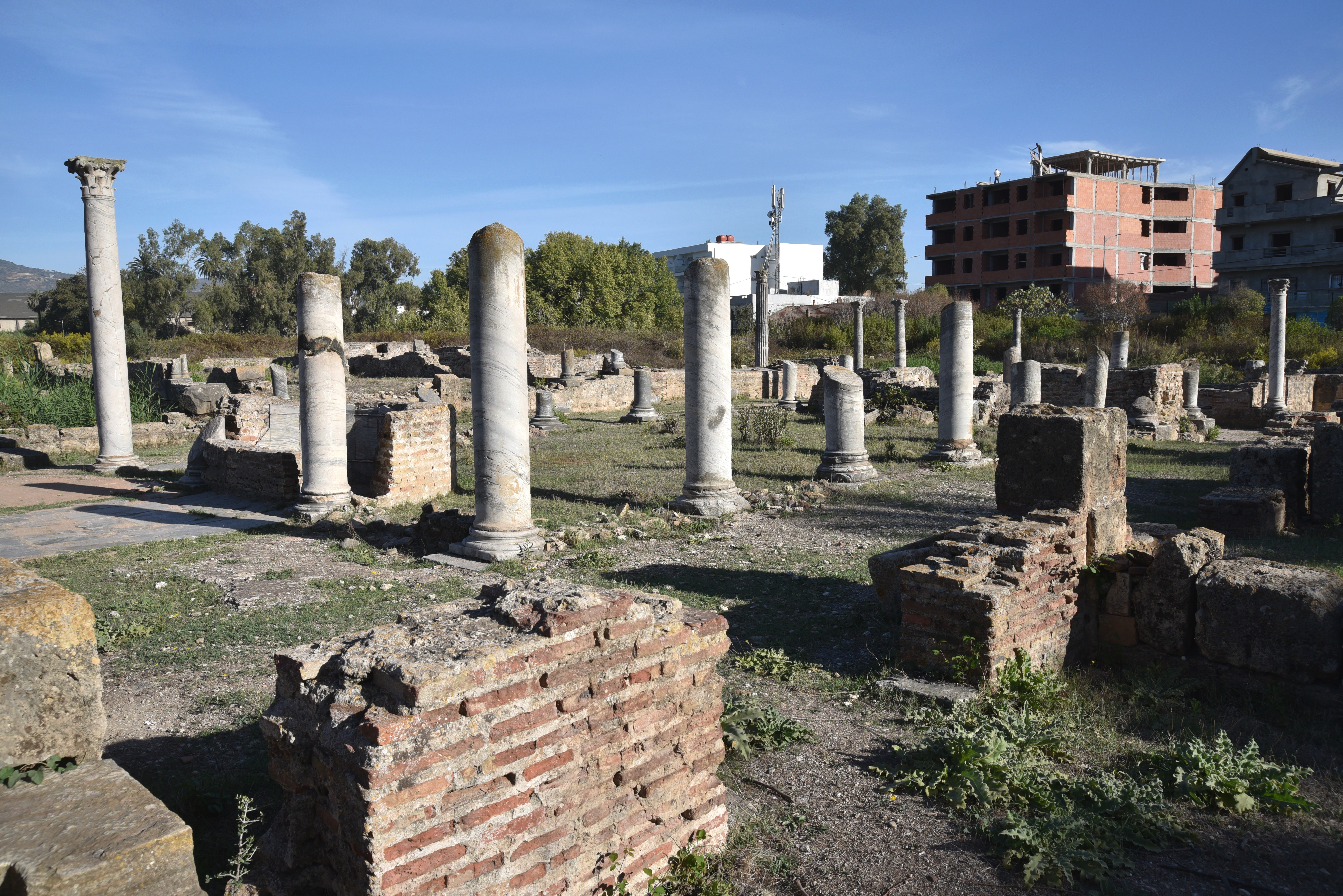
The Macellum (market). It consisted of a rectangular peristyle court (37 x 11 m) paved with black-and-white mosaics and a second court (16 x 16 m) with shops on three sides and a central tholos.The building was constructed in the 1st century AD and refurbished in the 4th century AD.The Theatre, possibly built in the 1st century AD. Its stage building, at 40 × 14 m, was one of the largest in Africa.
Quarter of the Villas
The peristyle of the Villa of the Hunt with fountains.The Villa of the Hunt.Mosaic pavement in one of the houses of the Quarter of the Villas.
Christian Quarter
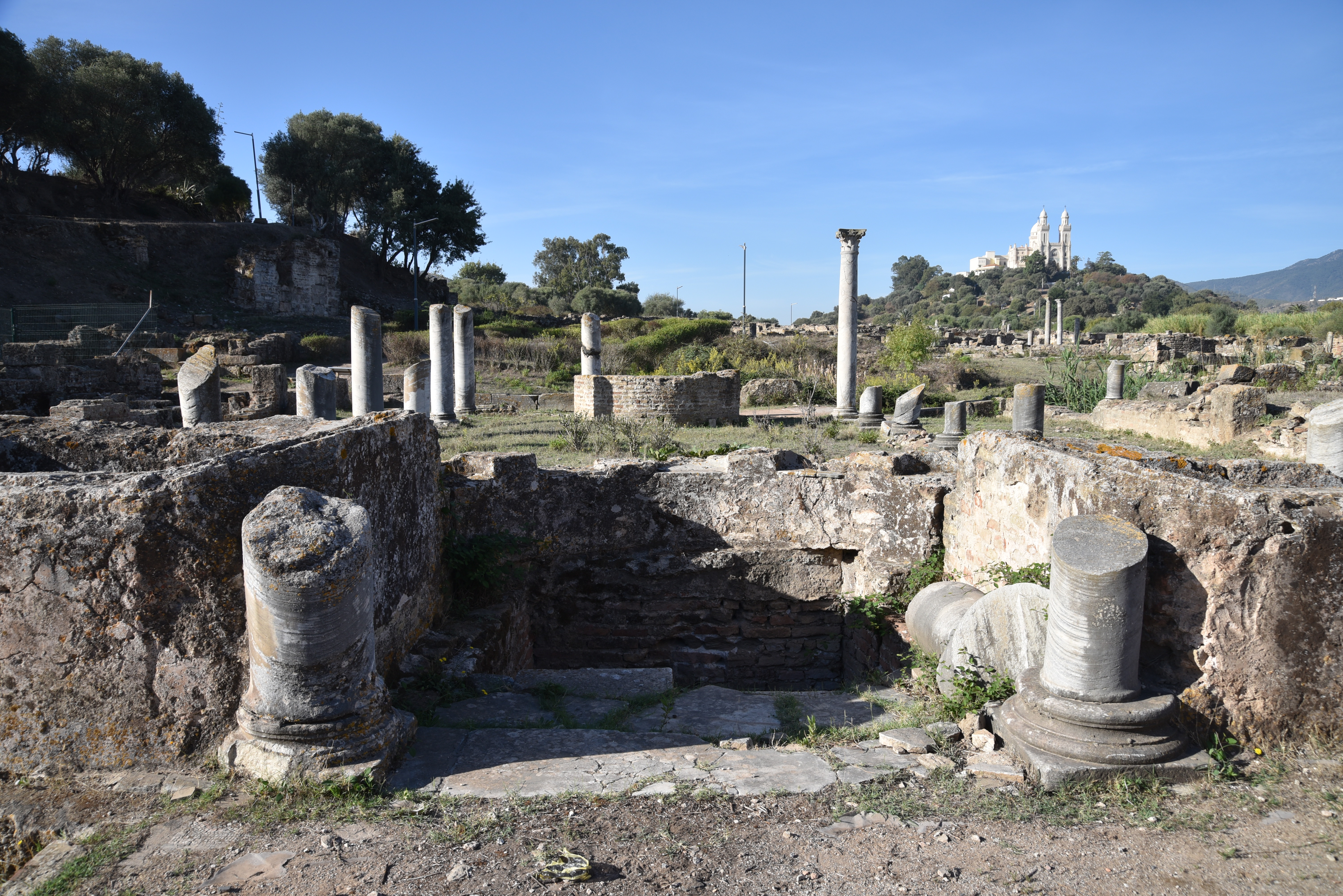
General view of the Christian Quarter.View of the main Basilica. It measured 42x20m and was divided into a nave and two aisles by rows of columns on plain square bases. The basilica floor was covered with mosaics in its centre nave and aisles. This basilica is commonly known as the Basilica of Peace. During Augustine’s time, it was also referred to as the Church of Saint Stephen because he placed the relics of that martyr in it in the year 424.The apse of the main Basilica.The apse of the main Basilica and seat of Augustine of Hippo (?) with the new Basilica in the background.An apsed chapel, probably the consignatorium, associated with the adjoining baptistery.The Baptistery.
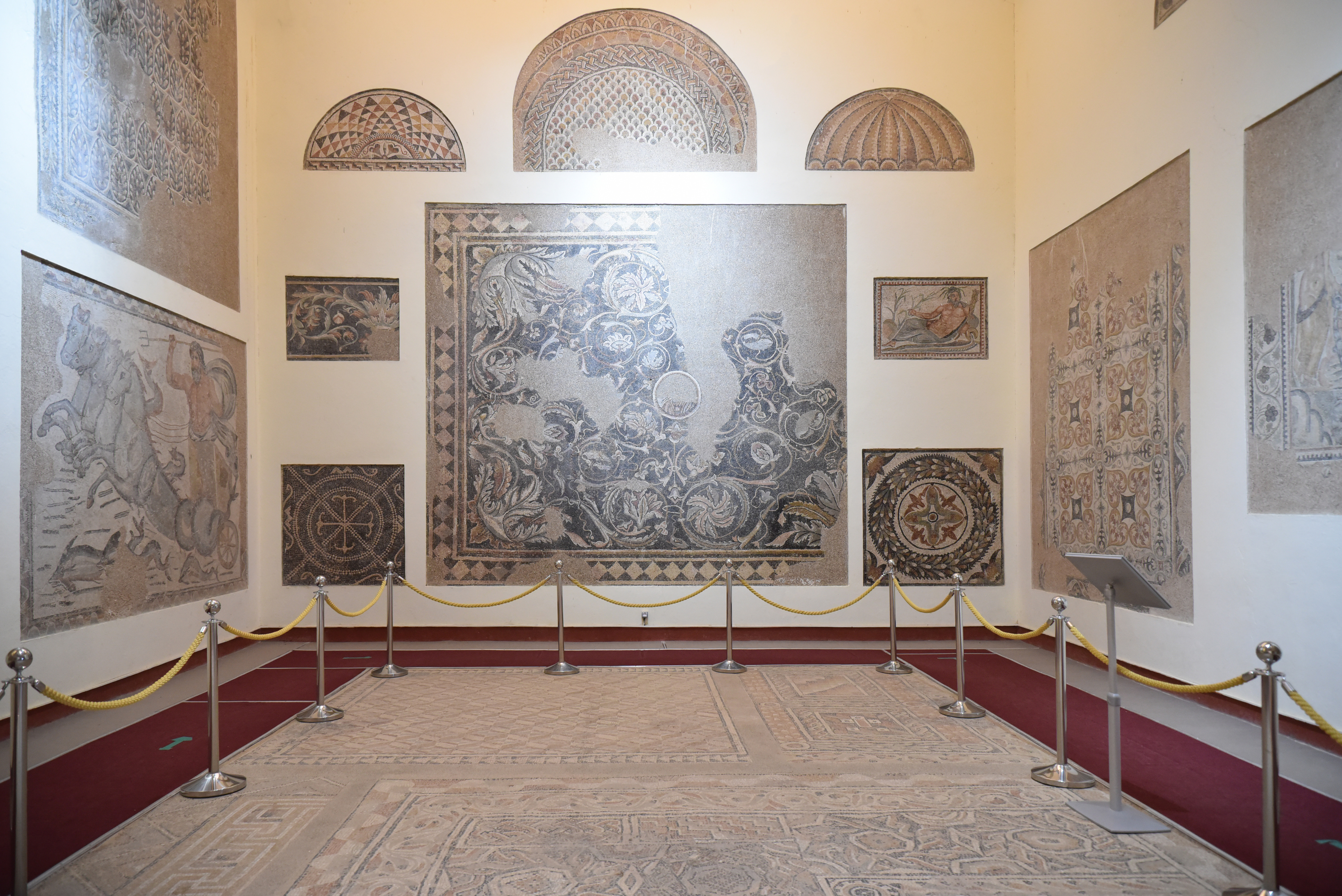
The Museum
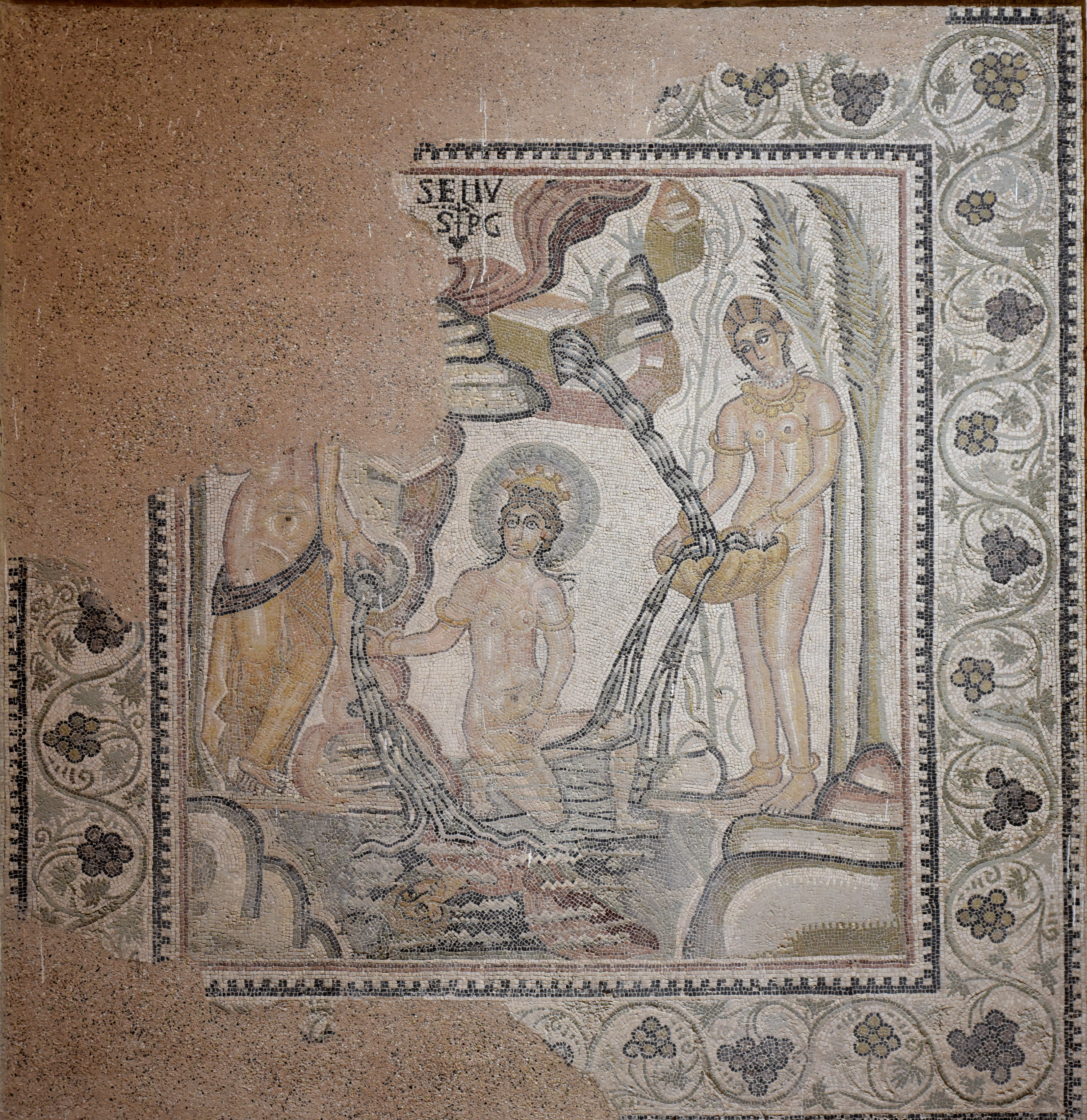
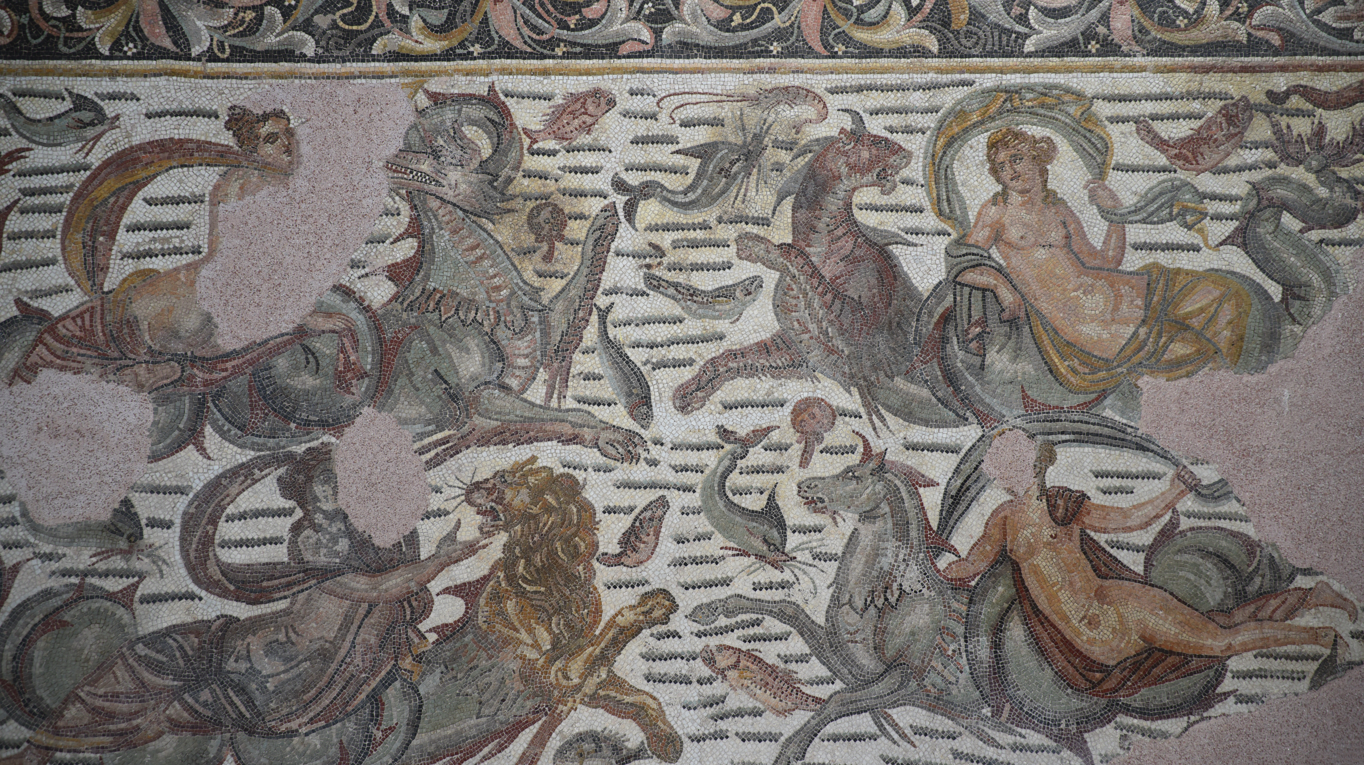
The room of the mosaics.The Hunt Mosaic from the Quarter of the Villas. It depicts a hunting scene in which lions, leopards and antelopes are chased into a trap. The wild animals are being rounded up for transport to games in the arena. Dated to the early 4th century AD.Mosaic of the Nereids. Four nereids are riding on various marine monsters. Dated to the first half of the 4th century AD.Bronze Trophy (tropaeum), a military monument that may commemorate Caesar’s victory over Juba I at the battle of Tapsus in 46 BC. This trophy measures 2.44 metres high and weighs 240 kg. It depicts a tree trunk with a cape and military armour draped over it.
Blas de Roblès, Jean-Marie; Sintes, Claude; Kenrick, Philip. Classical Antiquities of Algeria: A Selective Guide (p. 127). Society for Libyan Studies. pp. 232-521