The archaeological site of Makthar (Mactaris) is situated on a high plateau in central western Tunisia, on the northern edge of the Tunisian ridge. Originally a 5th-century BC Numidian settlement, it evolved into a well-preserved Roman city, featuring a forum, baths, and a triumphal arch. Later, it became a Byzantine fortress and bishopric, but experienced a decline in the 11th century. Today, the site showcases its Punic-Numidian, Roman, and Byzantine history through visible ruins and a local museum containing various artefacts.
Mactaris was built on the edge of a plateau at an altitude of 900 meters between the Ouzafa and Saboun wadi valleys. Its location on an easily defensible site illustrates its primitive military vocation. The presence of Libyan and Punic inscriptions proves that Mactaris was already a very substantial city before the arrival of the Romans. Following the fall of Carthage in 146 BC, many Punic refugees arrived here, as the town lay beyond the borders of Roman Africa. However, in 46 BC, it was incorporated into the newly established Roman province of Africa Nova. The Punic and Roman populations coexisted peacefully, and the process of Romanisation took about 200 years to complete.
The city flourished during the 2nd century AD, particularly beginning in the reign of Trajan, at a time when Mactaris was still a civitas. It was later elevated to the status of municipium under Antoninus Pius and became a colony between 176 and 180 under the joint reign of Marcus Aurelius and his son Commodus. This status granted Roman citizenship to its inhabitants. An inscription from AD 198 (AE 1949, 0047) identifies the settlement as Colonia Aelia Aurelia Mactaris. In the 3rd century AD, the city became the centre of a Christian bishopric and experienced the Donatist schism in the 5th century AD. During Diocletian’s reorganisation of the empire, Mactaris was incorporated into the province of Byzacena.
The decline of Mactaris began with the Vandal invasions, which started in AD 439. During the reign of Justinian, forts were built in existing structures, including the Great Baths. The city’s decline was ultimately sealed in the 11th century with the arrival of the Hilalian tribes.
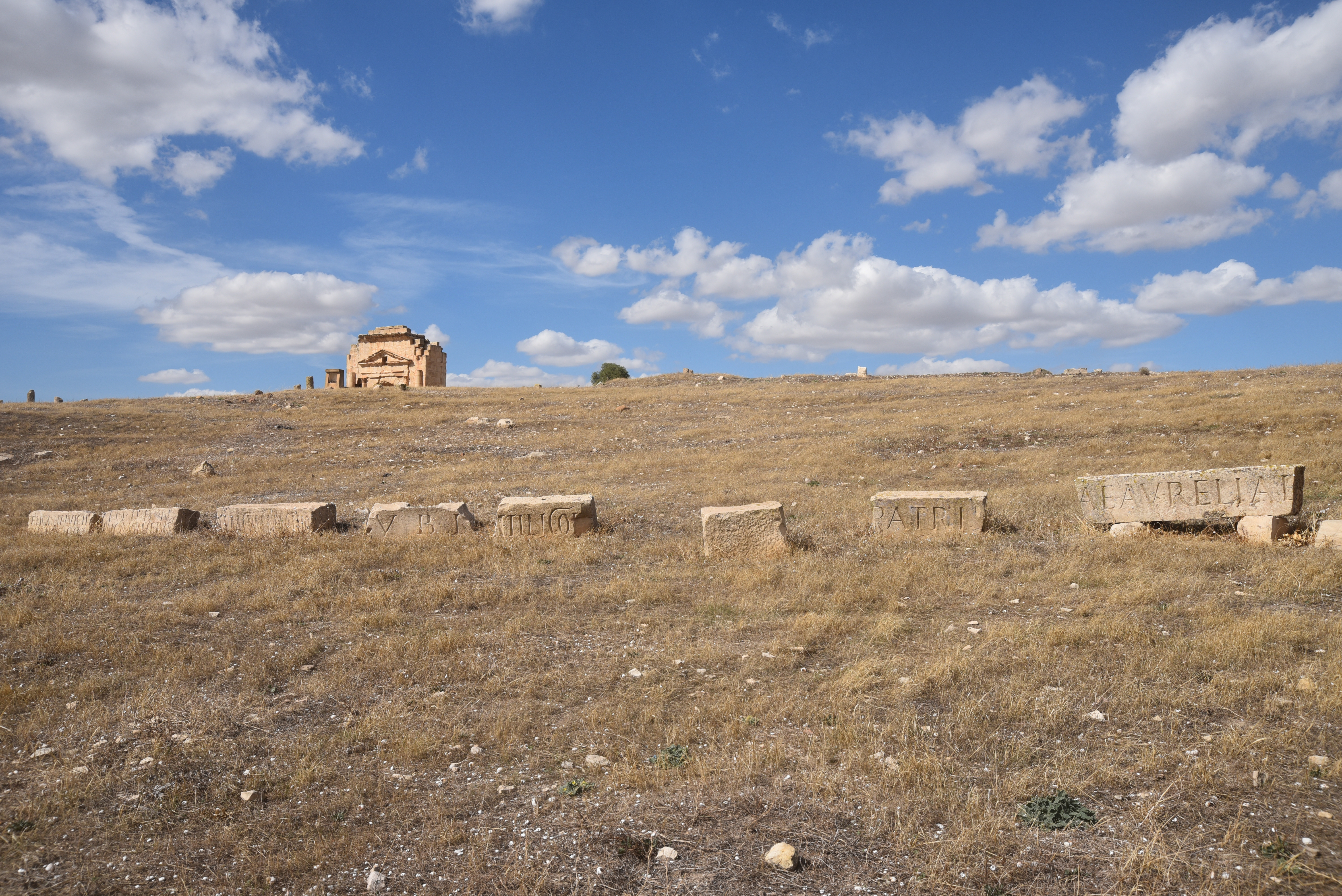
The site is one of the largest in Tunisia and contains a significant portion that has yet to be explored archaeologically. Similar to Bulla Regia, the region’s relative remoteness and the challenges in integrating into communication networks may have contributed to this lack of exploration. A small museum on-site displays various archaeological artefacts that have been discovered there, including Neo-Punic funerary stelae (1st–3rd century BC) and a . Outside the archaeological park are a Punic pyramidal mausoleum, similar to the mausoleum of Atban at Dougga, as well as the Temple of Apollo.
PORTFOLIO
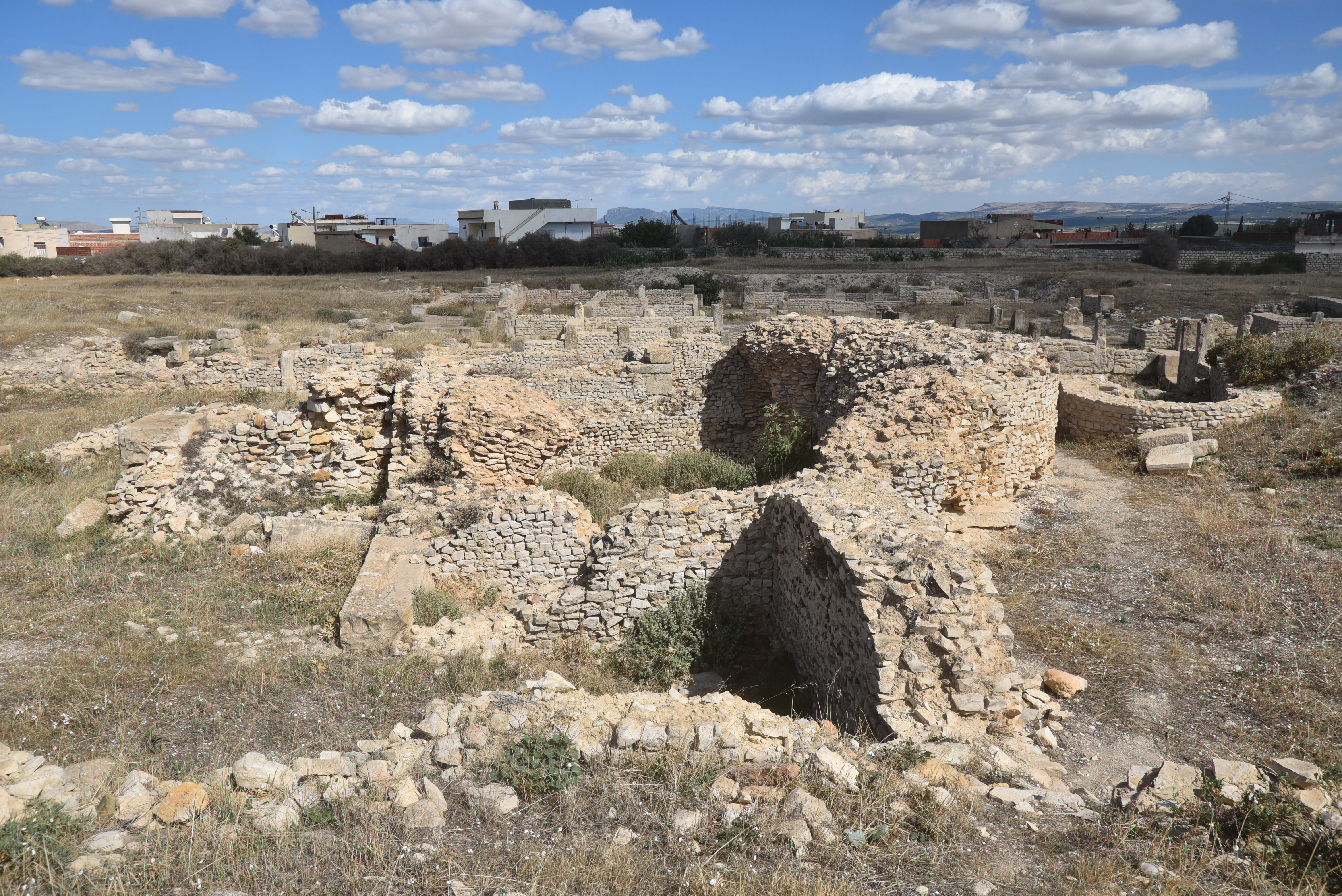
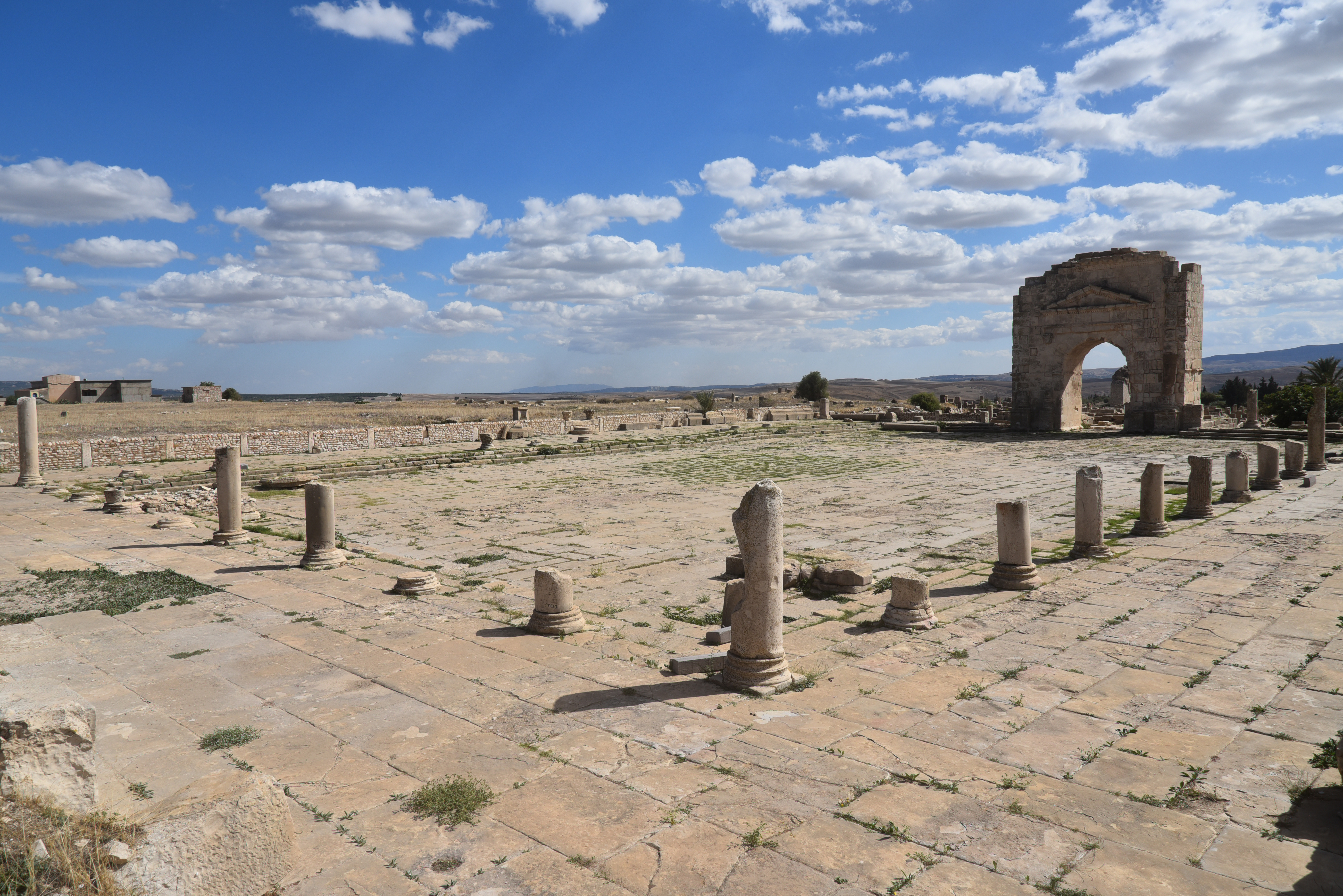
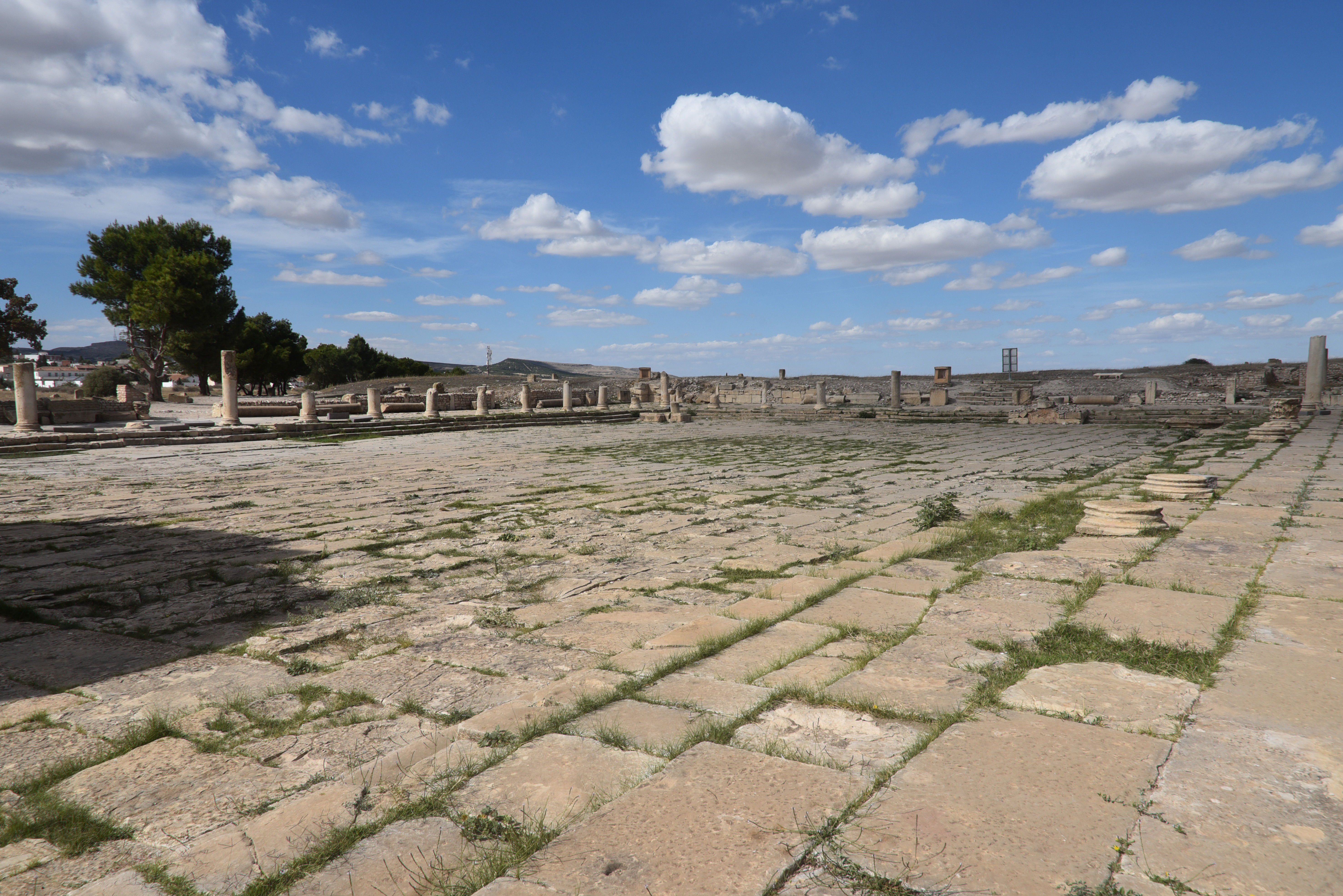
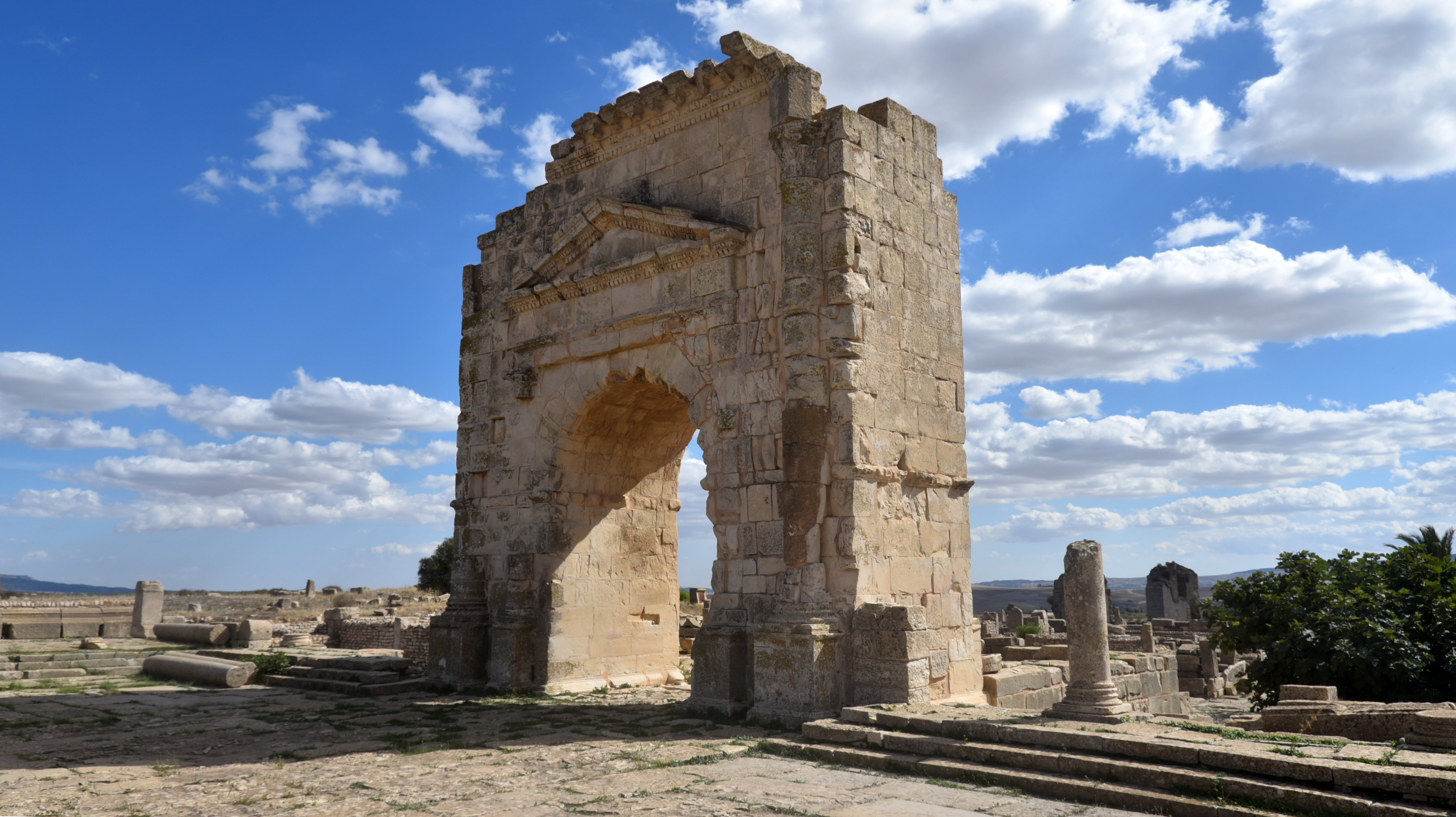
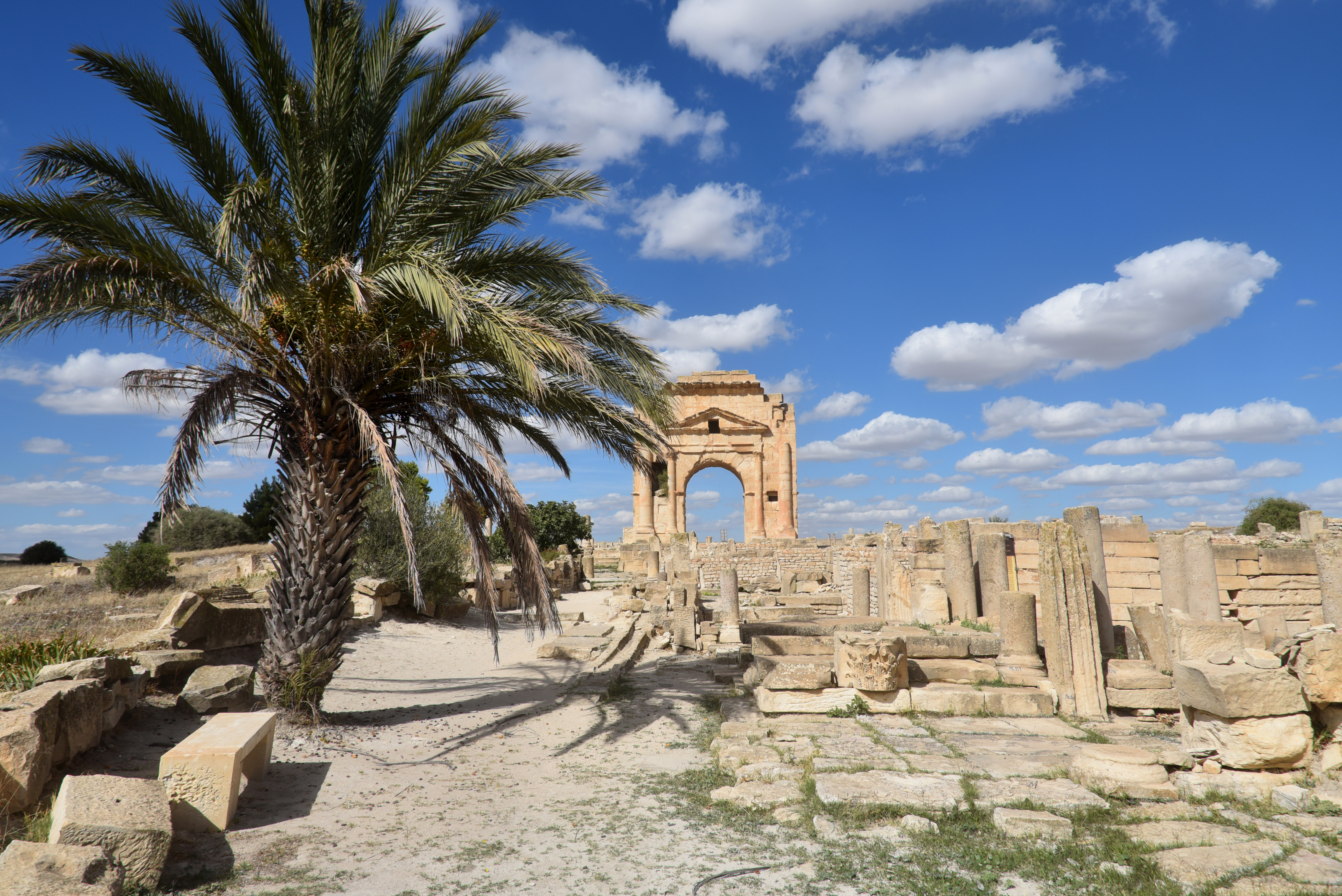
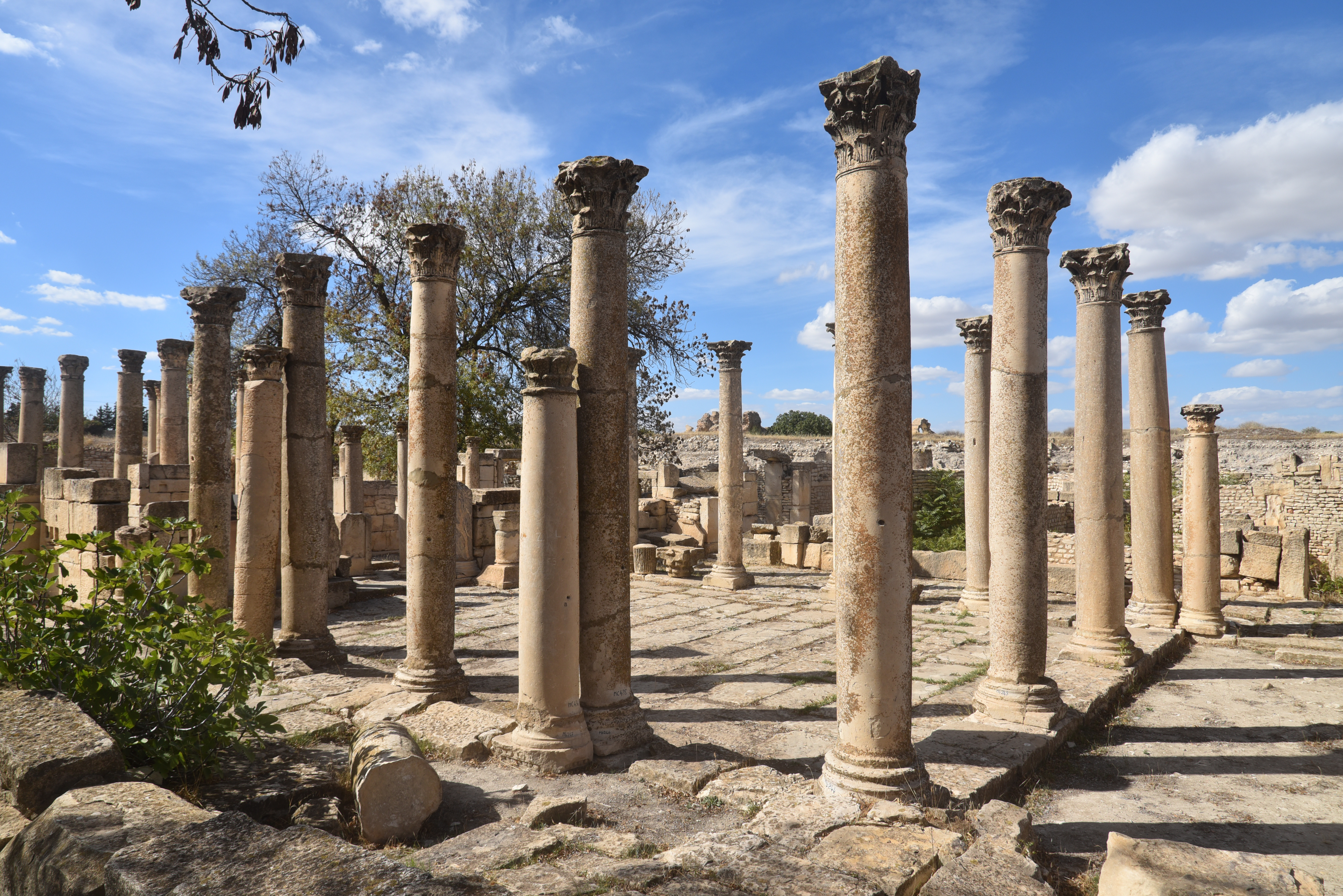
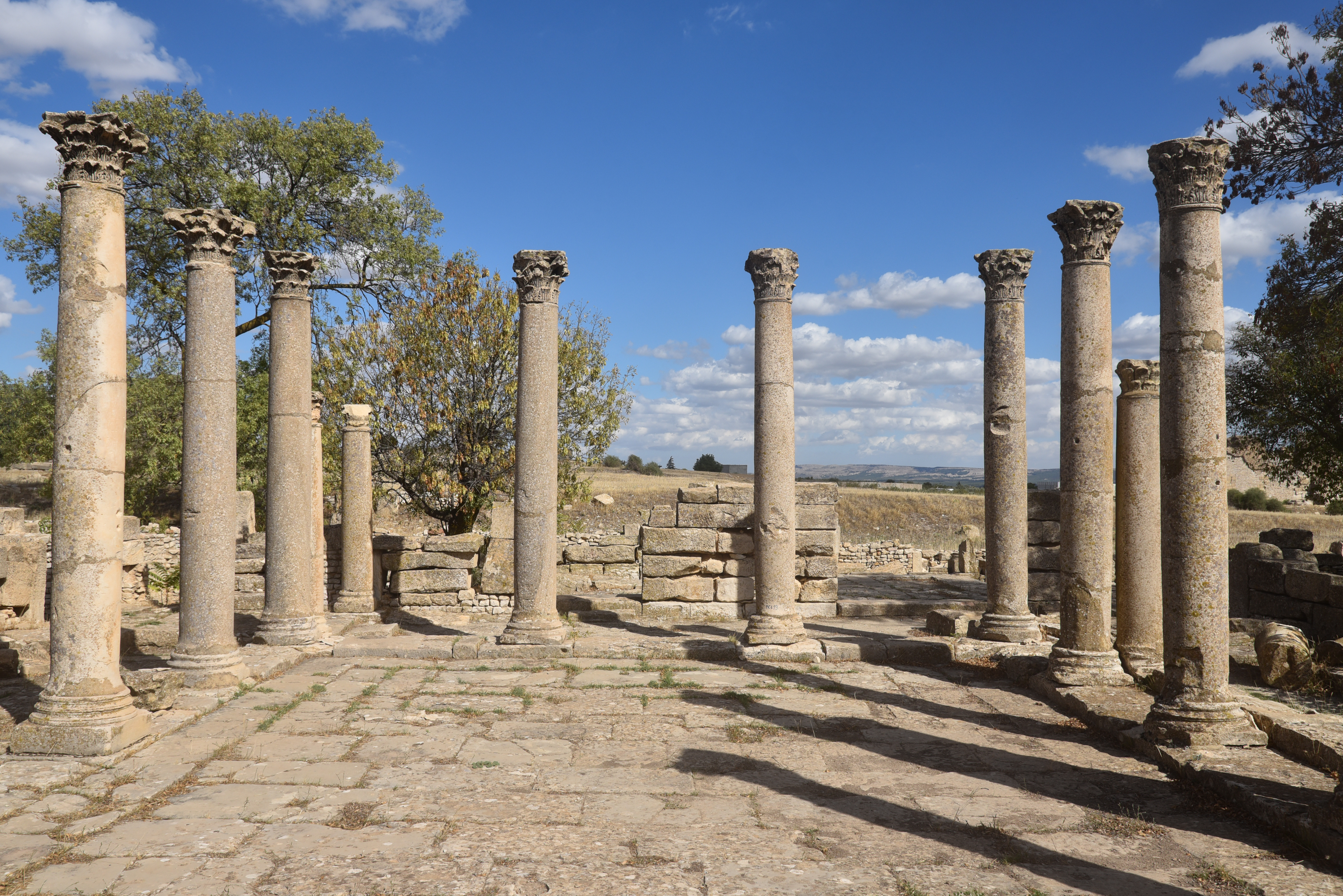
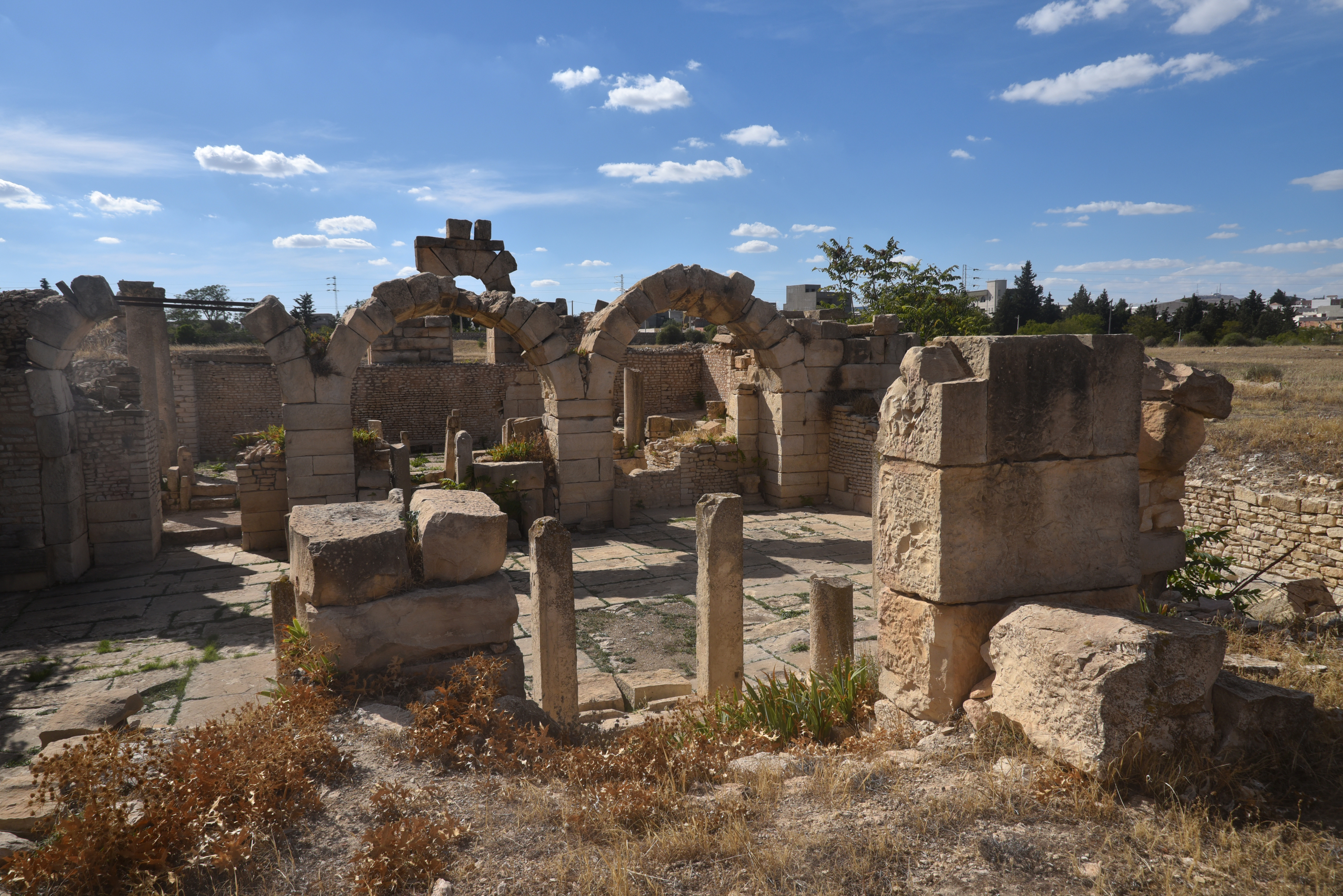
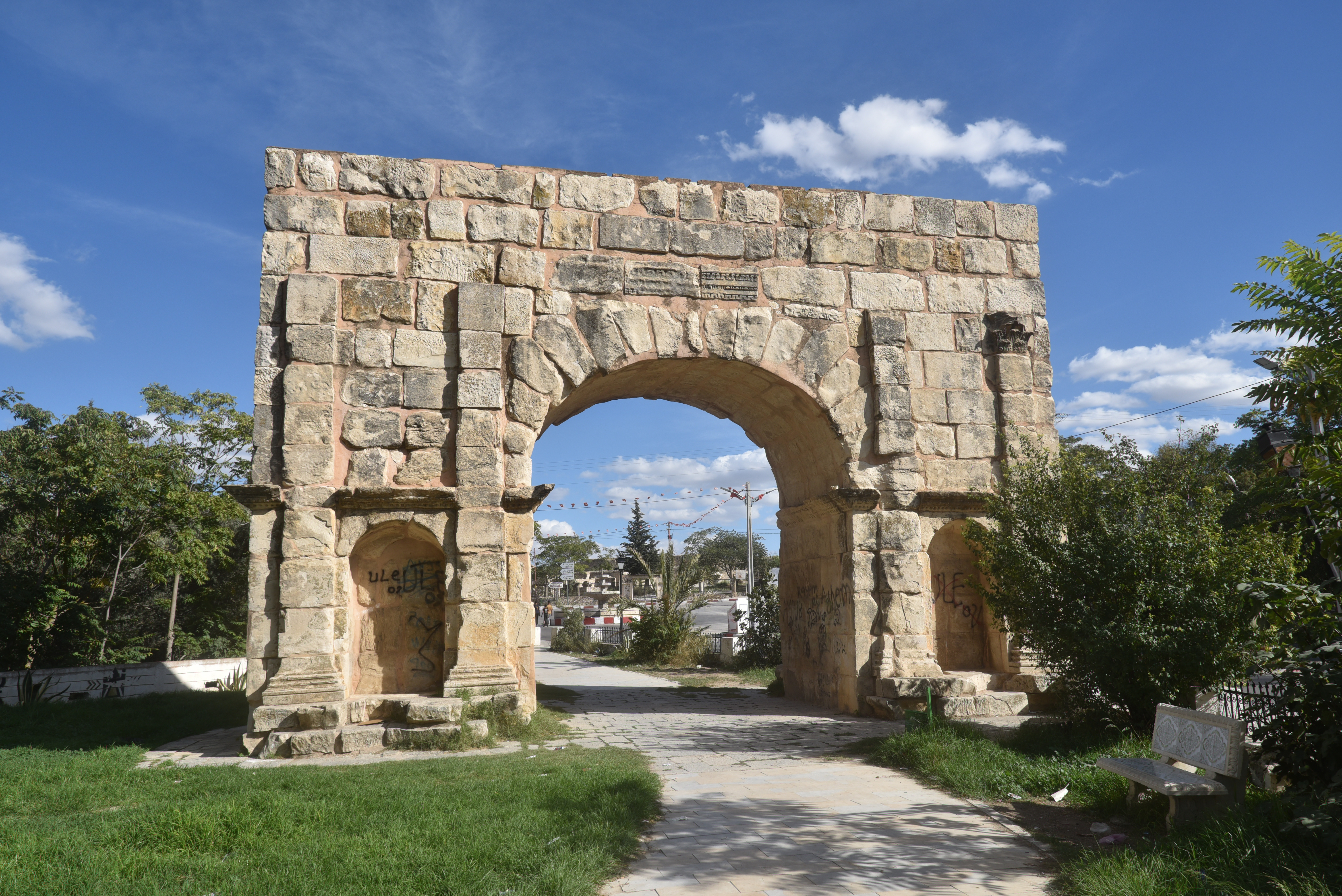
The Christian Basilica of Rutilius, constructed on the site of a sanctuary dedicated to Saturn.The partially restored amphitheatre, built in the 2nd century AD. None of the seating has survivedThe Temple of Hathor Miskar, a local divinity originally taken from the Egyptian pantheon of gods. It was first erected in the 1st century BC and then reconstructed in the 2nd century AD. It contained Neo-Punic inscriptions listing the 32 generous patrons who paid for the temple.The House of Venus, a Roman villa, named after the mosaic found here, which is now housed in the site’s museum.The House of Venus.The town’s market (macellum), which also has an altar to Mercury, the Roman god of shopkeepers and merchants.The New stone-paved Forum, laid out in the 2nd century AD and located at the intersection of the decumanus and cardo.The 1,500 m2 forum square was surrounded by porticoes on three sides. The Forum is enclosed by a single-arch built in 116 and dedicated to Emperor Trajan. The arch formed the entrance to the New Forum.The New Forum.The Arch of Trajan, a single-arch Roman triumphal arch built in 116 in honour of Emperor Trajan.The Arch of Trajan formed the entrance to the forum. It was erected by the proconsul of Africa, but it was paid for by the local community.On the south side of the arch, a Latin inscription is still partially legible, celebrating the conquest of the ‘Germans, Armenians and Parthians’. CIL 08, 00621
“To the Emperor Caesar Nerva Traianus, son of Divus Nerva, the best Augustus, conqueror of the Germans, Armenians and Parthians, Pontifex Maximus, who received the tribunician power for the twelfth time and the imperial acclamation for the twelfth time and was consul for the sixth time, (this arch) was donated by the Proconsul Caecilius [F]austinus by decision of the decurions from public funds (…) .”
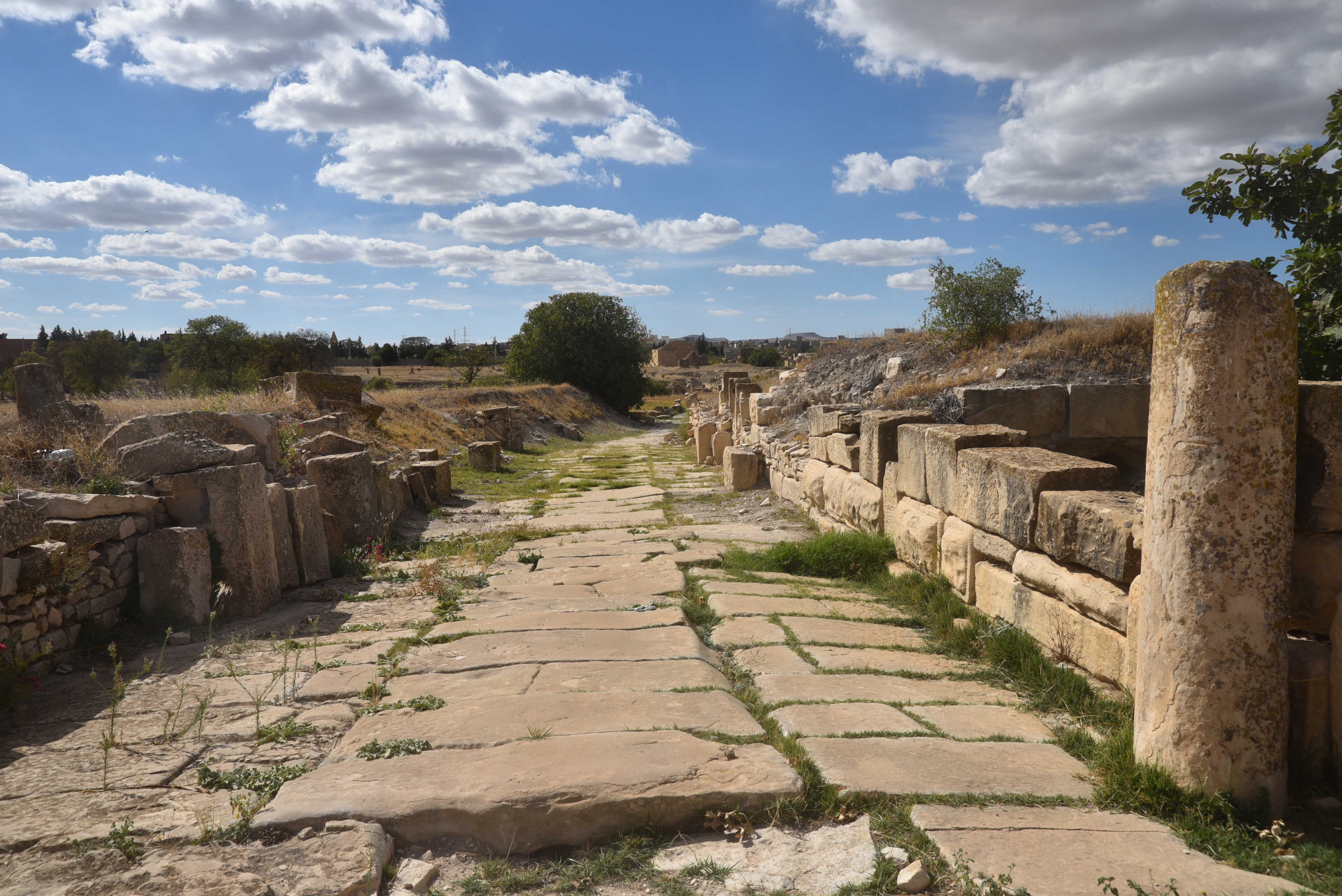
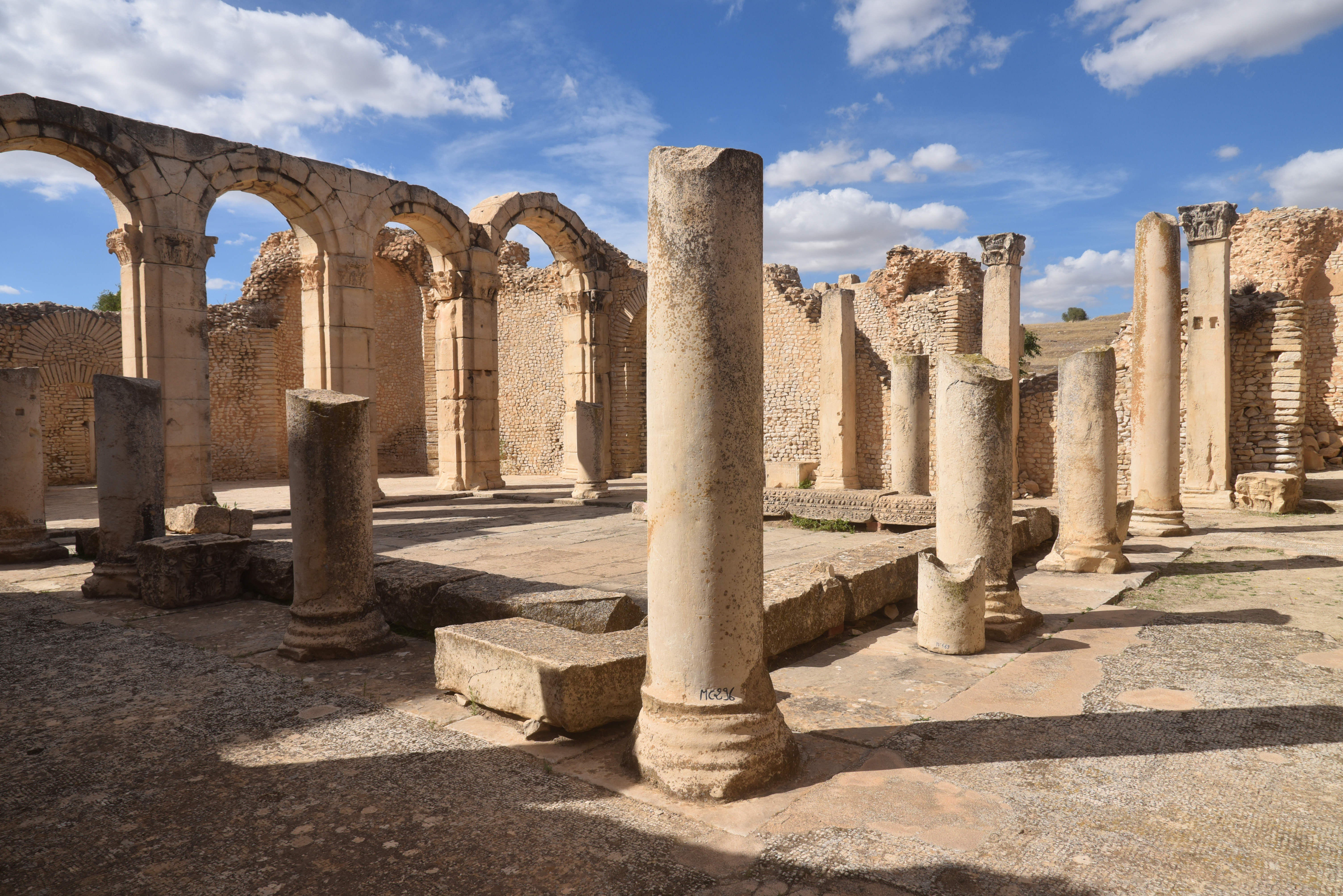
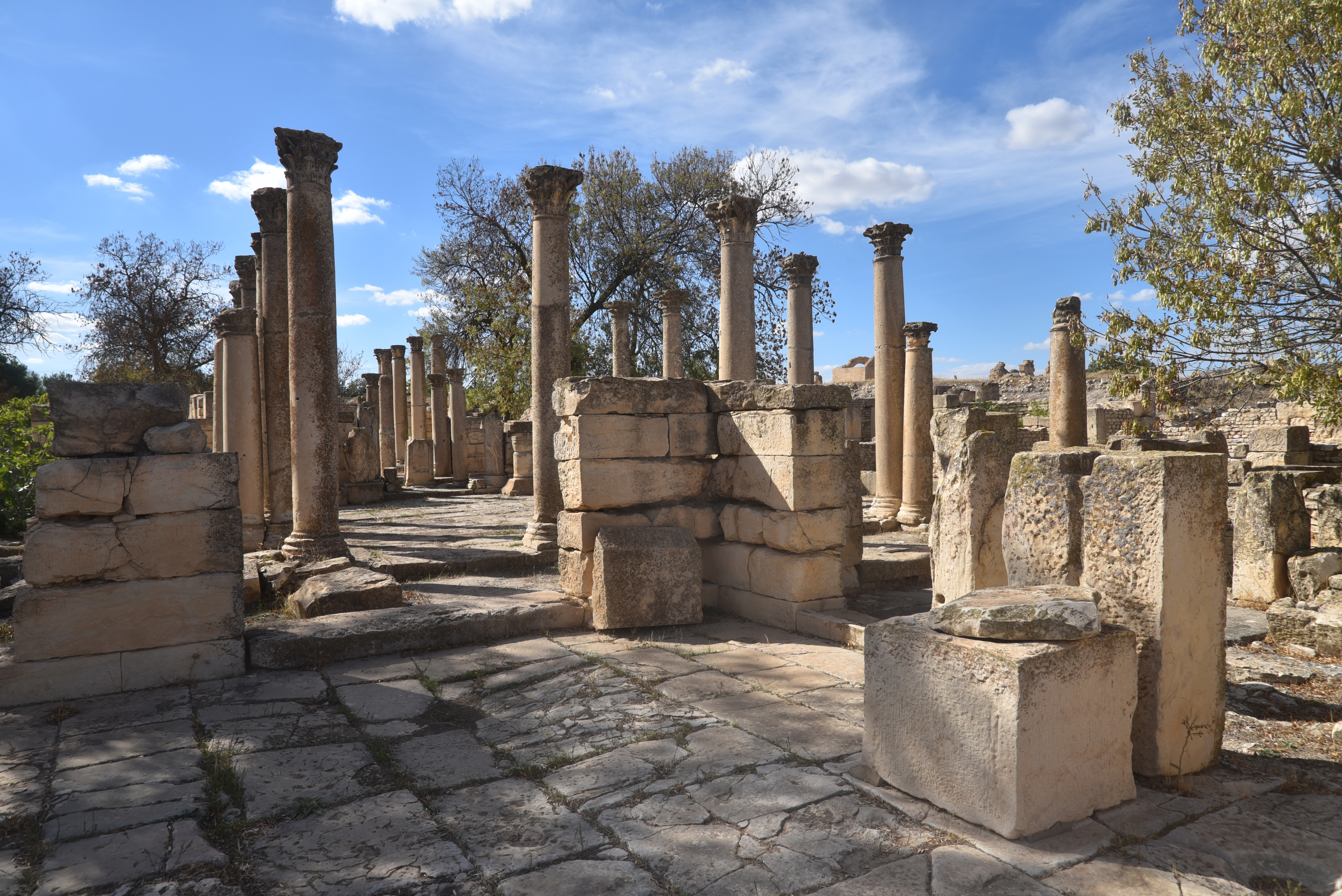
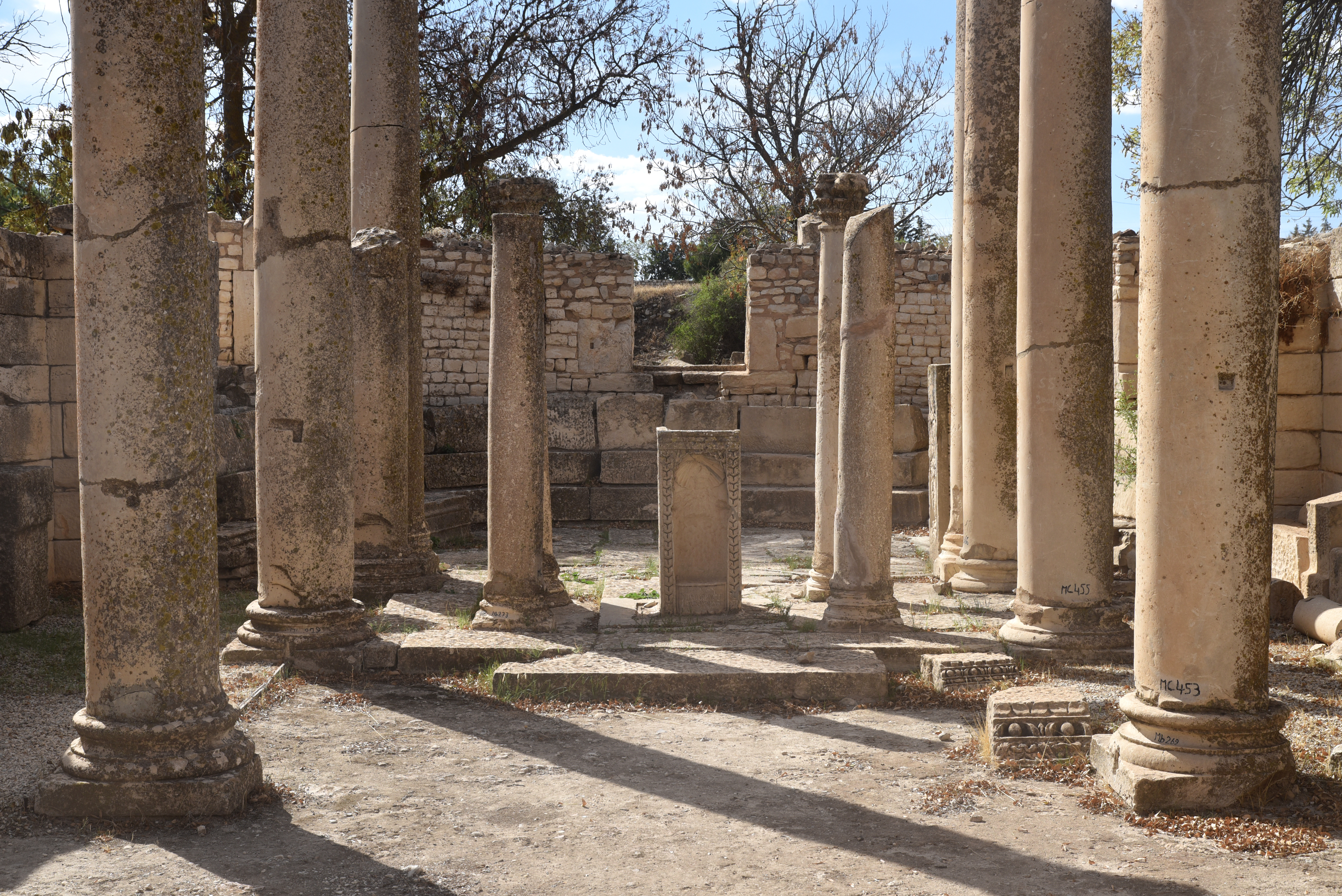
The 5th-century AD Vandal Basilica of Hildeguns with three naves and Byzantine tombs. It was named after one of their kings.The paved road leading to the Old Forum and the Western Baths.The Great Southern Baths, inaugurated in AD 199 during the reign of Emperor Septimius Severus, were later converted into a Byzantine fortress. The baths covered a total area of approximately 4,400 m², with 225 m² dedicated to the sole frigidarium.The northern colonnaded hall of the Great Southern Baths, adorned with a labyrinth mosaic.The northern colonnaded hall of the Great Southern Baths.Fragments of a large inscription in front of the Great Southern Baths.Dedication to Antoninus Pius (CIL VIII, 622), dated AD 157 (trib pot XX) in front of the Great Southern Baths.The Schola Juvenum, a well-preserved building from the Severan period interpreted as the meeting place of the city’s juvenile college, a kind of clubhouse and training school for young men found in Roman cities.The interior of the Schola Juvenum. The building was financed by Julius Piso and constructed on the site of a Flavian sanctuary dedicated to Mars. The remains include a courtyard with porticoes, rooms for worship to the north, sanitary facilities to the east, and a meeting room to the west.The layout of the Schola Juvenum follows the Hellenistic tradition of the quadrangular palestra with peristyle.The Schola Juvenum was modified several times and turned into a pagan basilica where funerary rites were performed, and two gravestones from the nearby necropolis were utilised as altars. Eventually, in the 4th century AD, it was turned into a church during the reign of Diocletian.The intersection of two paved roads.The paved road leading to the Old Forum from the west.The Western Baths, built in the 2nd century AD during the reign of Marcus Aurelius and later converted into a church.The interior of the Western Baths.The paved road leading to the New Forum from the west.
The ruins outside the archaeological park
The Arch of Septimius Severus.The ruins of the Temple of Apollo.The Neo-Punic mausoleum.
The Makthar Museum
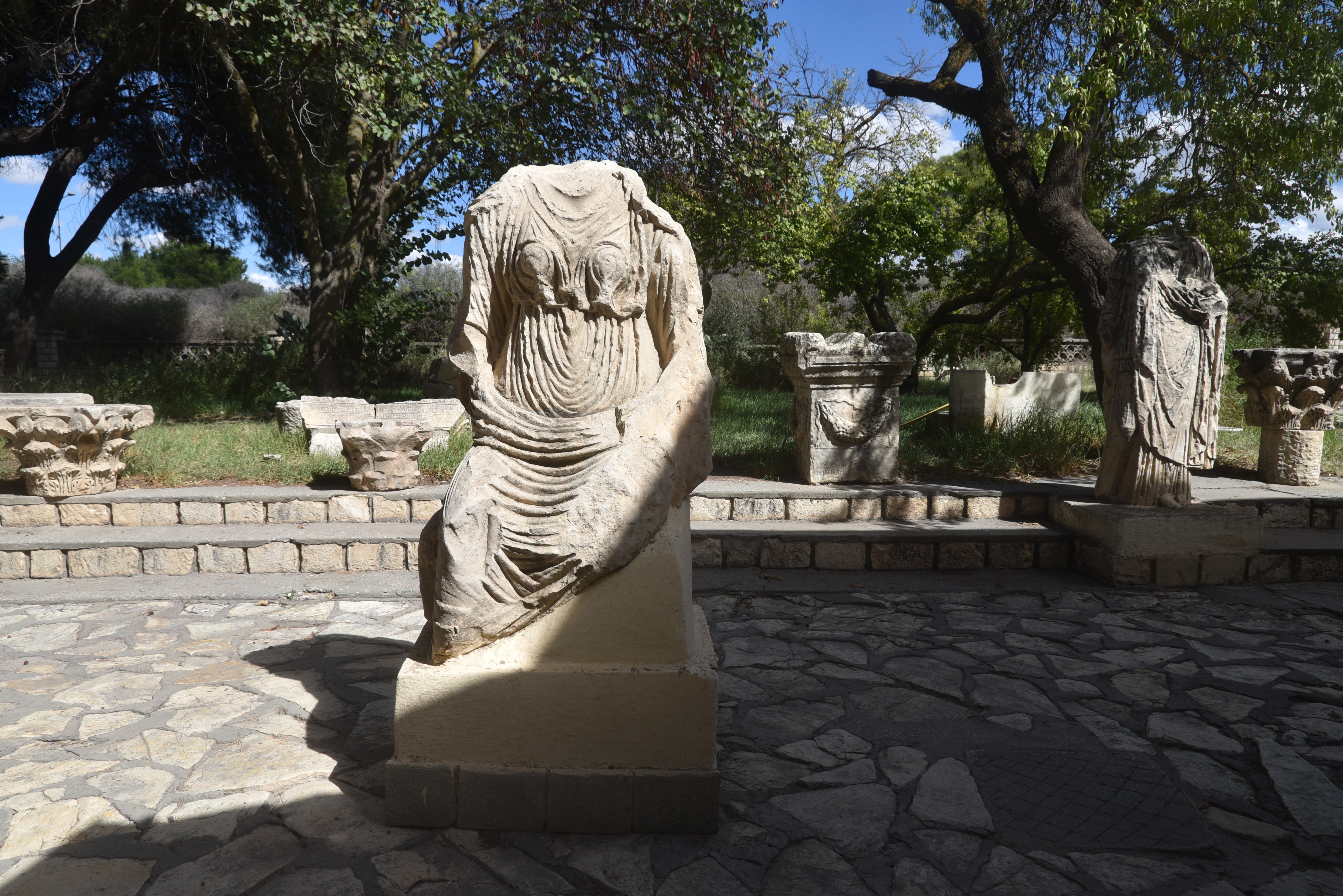
Roman mosaic adorned with numerous animal motifs and Punic and Neo-Punic ex-votos and funerary stelae.Makthar Museum’s garden.Makthar Museum’s garden.