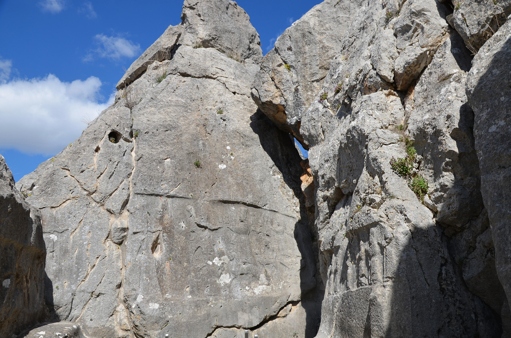
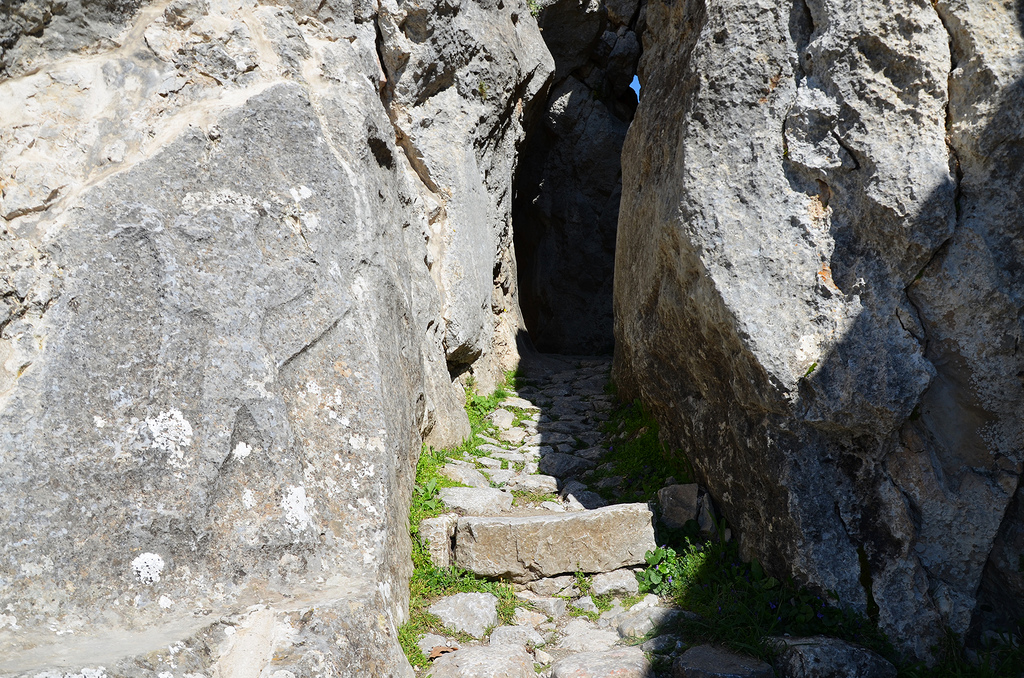
Yazılıkaya (“Inscribed Rock”) is a Hittite rock sanctuary located about 1.5 kilometres northeast of Hattusa, the capital city of the Hittite Empire. It is the largest known Hittite rock monument. The sanctuary consisted of a temple-like building and two open-air chambers cut into the bedrock.
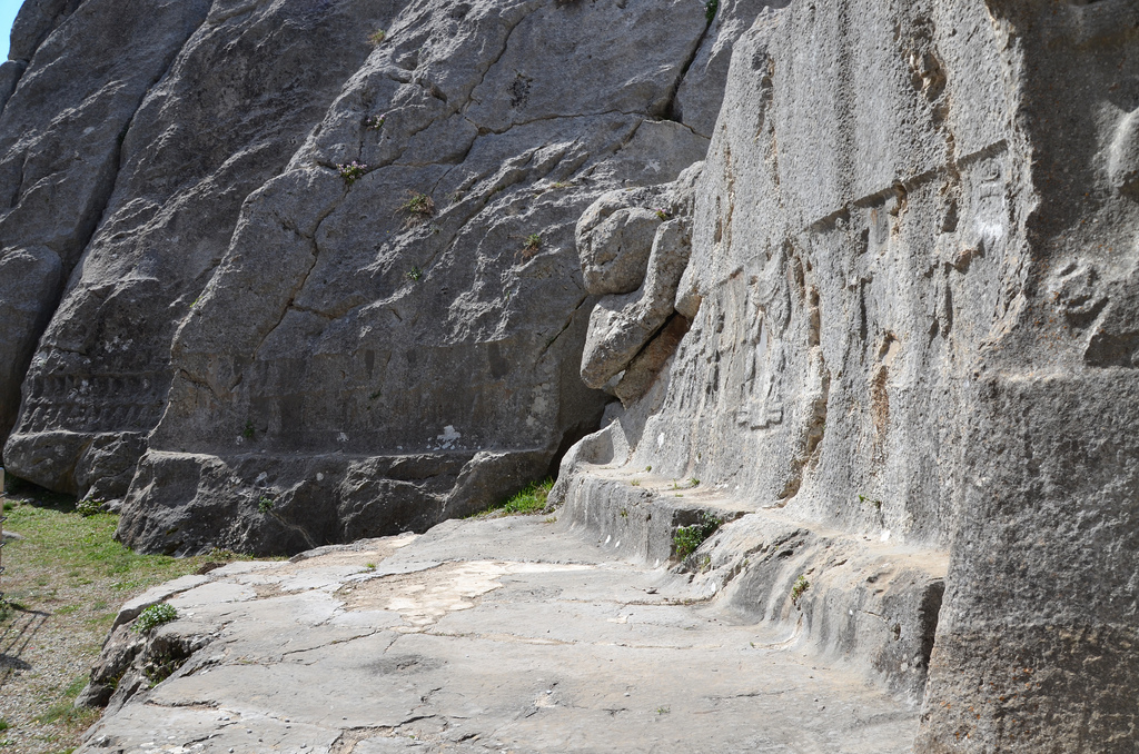
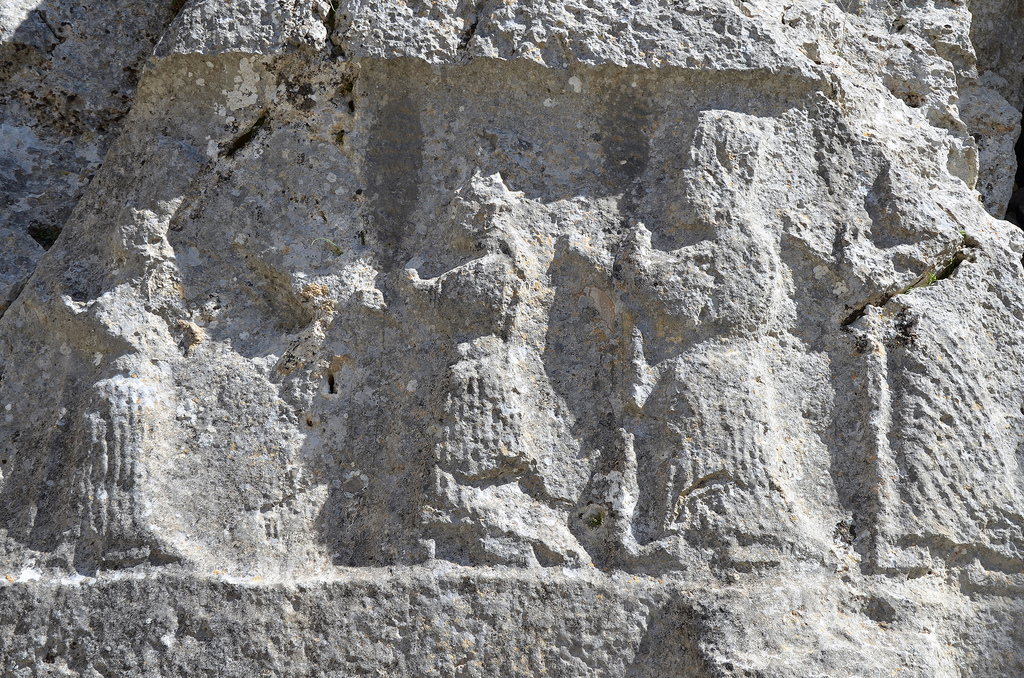
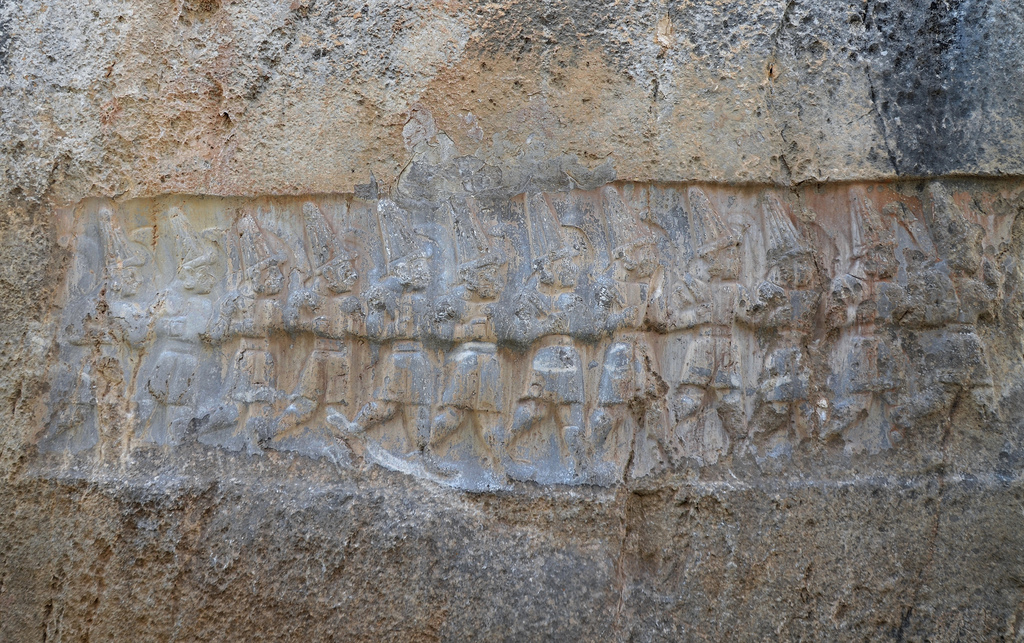
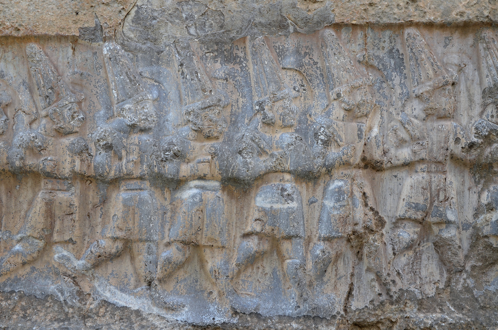
The Yazılıkaya sanctuary served as a place for the celebration of the arrival of the New Year each spring. These ceremonies took place in the open air in front of the Hittite Pantheon. The sanctuary was made of two rock chambers, later labelled Chamber A and Chamber B, by archaeologists. The walls of each chamber were covered with the richest and most striking samples of Hittite relief art. They featured gods and goddesses and the figures of the Great King Tudhaliya IV (ca. 1237 – 1209 BC). There are a total of 83 images, 66 in Chamber A and 17 in Chamber B.
Human activity on the site probably began in the 16th century BC, although what we see today is probably the result of modifications made in the late 13th century BC, not long before the Hittite Empire began its steep and mysterious decline.
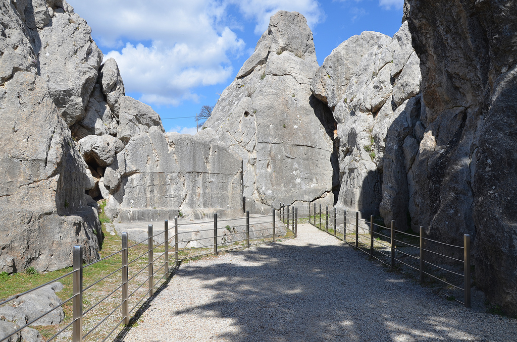
The entrance to Yazılıkaya sanctuary.
Chamber A, the largest of two chambers, is 30 metres long and about 20 metres wide. Its walls are almost entirely decorated with reliefs running horizontally. The deities are aligned in two rows, perhaps in procession, with male figures on the left wall (with two female attendants) and female figures on the right wall. The name of each deity is given in Luwian hieroglyphs above their raised hands, but due to natural deterioration, some parts of these names have disappeared. These two rows are directed towards the main scene in the middle, where the Storm God Teshup and the Sun Goddess Hepat meet.
Engraving from a relief at Yazilikaya by French archaeologist Charles Texier (1882).
Engraving from reliefs at Yazilikaya by French archaeologist Charles Texier (1882).
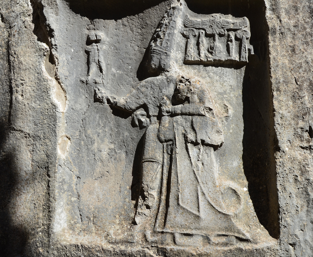
Engraving from a relief at Yazilikaya by French archaeologist Charles Texier (1882). Teshub stands on two deified mountains (depicted as men) alongside his wife Hepatu, standing on the back of a panther. Behind her, their son, daughter and grandchild are carried by a smaller panther and a double-headed eagle.
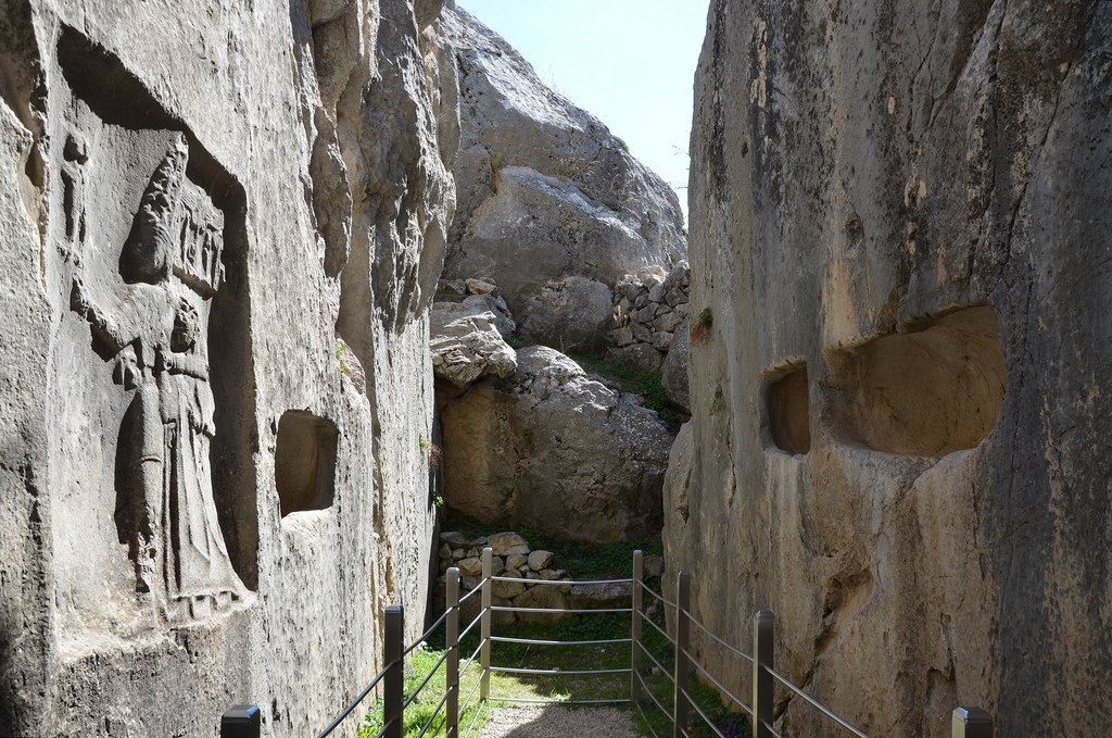
Chamber B is accessible via a narrow passage with winged demons on both sides. Chamber B was believed to have been built as a memorial chapel for Tudhaliya IV, dedicated by his son Suppiluliuma II at the end of the 13th century BC. Buried until the mid-19th century, the reliefs on the walls are much better preserved than those in Chamber A. A line of gods of the Underworld is pictured on the wall immediately to the right of the entrance. On the opposite wall is a representation of Nergal, the God of the Sword and the Underworld. To the left of this relief, a cartouche with the name of Tudhaliya IV is visible, and this same king is shown embracing the Thunder God Teshub on the right side.
PORTFOLIO
Chamber A
Overview of Chamber A.Chamber A, rock relief depicting a procession of male deities.In Chamber A, two bullmen stand between male gods on the hieroglyphic symbol of the earth and supporting the sky.The left wall of Chamber A depicts male gods.Chamber A, main scene in the middle of the chamber where Teshup and Hepat meet and female goddesses in procession on the right wall.Chamber A, goddesses in procession.Chamber A, main scene depicting (left to right) the God Kumarbi (chief god of the Hurrians), the weather and storm god Teshuba, the earth goddess Hepat, Sharumma (son of Teshuba & Hepat) and Alanzu (daughter of Teshup Hepat).Chamber A, relief depicting the sanctuary’s founder, King Tudhaliya IV, standing on two mountains.
Chamber B
Entrance to Chamber B with the relief of a winged, lion-headed demon.Chamber B. The narrow gallery is thought to be a memorial chapel for Tudhaliya IV, dedicated by his son Suppiluliuma IIChamber B, the niches were probably used for offerings.The west wall of Chamber B depicts the twelve Gods of the Underworld.The east wall of Chamber B has a depiction of Negal, the Sword God, and the God of the Underworld.Chamber B, cartouche showing the name and title of King Tudhaliya IV.The East wall of Chamber B depicts in a niche the God Sharruma (son of the Thunder God Teshub) embracing King Tudhaliya IV. The god has his left arm over the king’s shoulders while holding the king’s right wrist. The god wears a short tunic and has pointed shoes. The king wears a long coat and carries a sword and a lituus.The west wall of Chamber B depicts the twelve Gods of the Underworld.
Hattusa, the capital city of the Hittites in the late Bronze Age, is located in the Boğazkale District of the Çorum Province, 150 kilometres east of Ankara. It was the head of an empire that stretched across the broad lands of Anatolia and northern Syria, from the Aegean in the west to the Euphrates in the east. The ruins of the city walls, gates, temples, and palaces, awaiting visitors today, provide a comprehensive picture of the Hittite capital in the 13th century BC.
The earliest traces of settlement on the site are from the 6th millennium BC. During the 19th and 18th centuries BC, the Hattians and the Assyrian Trade Colonies settled in the area. Hattusa, then known as Huttush, was one of the Karu (trading posts) established by the merchant colonies of Assyria. Hattush came to an end around 1720 BC when Anitta, King of Kussara (of the dynasty that would form the Old Hittite Kingdom), sacked the city. A generation later, another king of Kussara decided to make the city his capital. A new town was planned and built on the ruins of the old one, and the Hittite language was introduced to the region. Hattush became the Hittite city of Hattusa, and the King took the name of Hattusili I, the “one from Hattusa”. Over the next few hundred years, Hattusa remained the capital of the Hittite empire.
At its peak, the population of Hattusa is estimated at 40,000-50,000 inhabitants. The city was large, covering 1.8 km² with massive defensive walls over 6km long and huge watchtowers and secret tunnels.
The site was discovered on July 28 1834, by Charles Texier, but the first systematic excavations in Hattusa began in 1893-1894 under the guidance of Ernest Chantre, who published the first cuneiform tablets from Hattusa. Since 1907, the German Archaeological Institute has carried out archaeological work. The city consisted of two separate districts: the Lower City, the Hittite Old City, where the main Temple was located, and the Upper City, a newer part of the city with a fortified palace complex surrounded by massive walls. The site also boasts a number of hieroglyphic inscriptions bearing traces of the so-called “Luwian” script.
The city was destroyed, together with the Hittite state itself, around 1200 BC as part of the collapse of the Late Bronze Age kingdoms. Excavations at the site determined that Hattusa was invaded and burned early in the 12th century BC after many of Hattusa’s residents had abandoned the city. The site was subsequently abandoned until 800 BC, when a modest Phrygian settlement appeared in the area. Today, the whole tour of the ancient city can be completed along the concrete path, which is 3-4 kilometres long, on foot or by car.
PORTFOLIO
The Lower City
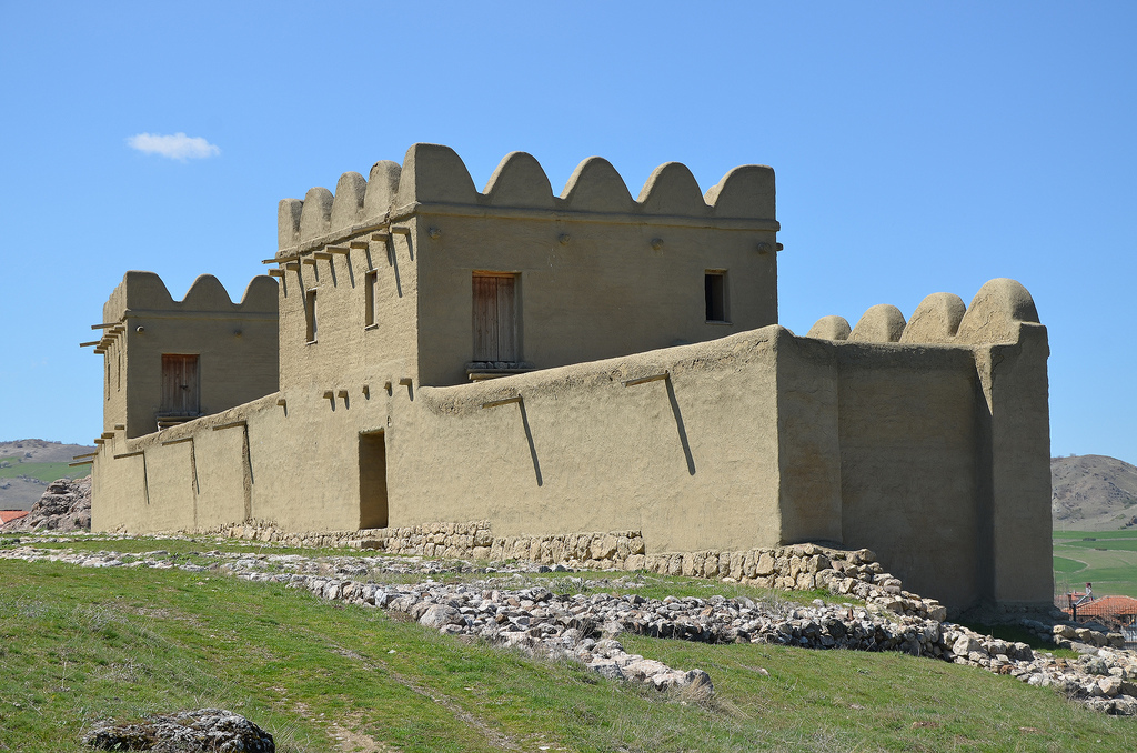
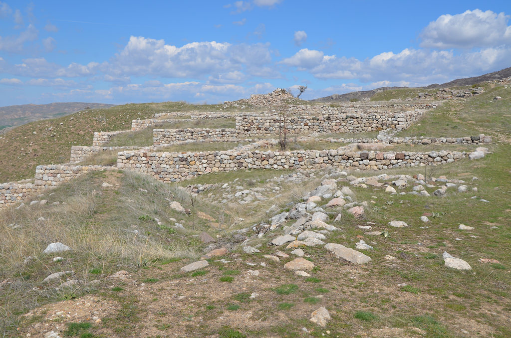
Modern reconstruction of a 65m long section of the city wall made of mud brick with defence towers built at 20-25 metres intervals. The reconstructed part rests on top of the original Hittite foundations. The inner city wall shielded the area of the Great Temple and adjacent settlements.Terracotta tower-shaped vessel fragment used as a cult vessel. Tower-shaped vessels were used as the model for reconstructing the Hittite city walls. Museum of Anatolian Civilizations, AnkaraResidential quarters from the Assyrian Trade Colonies (19-18th centuries BC) included ruins of houses and offices of Assyrian merchants.The gateway to the Temple complex. The complex comprises a massive precinct of some 14,000 square metres, with the Temple itself measuring 42×65 metres. The Temple may have been built by or on the order of the Great King Hattusili III, who ruled during the mid-13th century BC.The paved Street of the Temple surrounding the central temple building.The Great Temple’s main entrance was through a massive gate with three doors, sills, and small cubicles on either side. The Temple was built for the Hattian God of the Sky and the Sun Goddess Arinna. It was the largest Temple in the city.Reconstruction of the three main parts of the Great Temple complex: red: The Temple proper yellow: the storage rooms green: the southern district with the “House of Operations”The area of the Great Temple has storerooms surrounding the Temple proper.Storerooms along the northwest side of the Great Temple, some two-storey high. They housed equipment and offerings of cult practices, foodstuffs and archives of clay tablets inscribed in cuneiform. Massive clay vessels up to 2,000 litres in volume stored wine, oil and grain.Large monolithic thresholds marking the position of doorways between the storage rooms.The green stone lying in one of the storerooms of the Temple complex. It is a block of green nephrite-type stone common in the region’s geology. It may have played a role in some religious cults.The Lion Basin, originally 5.5m long, once featured crouching lions at all four corners. It probably had a role in cult rituals.
The Upper City
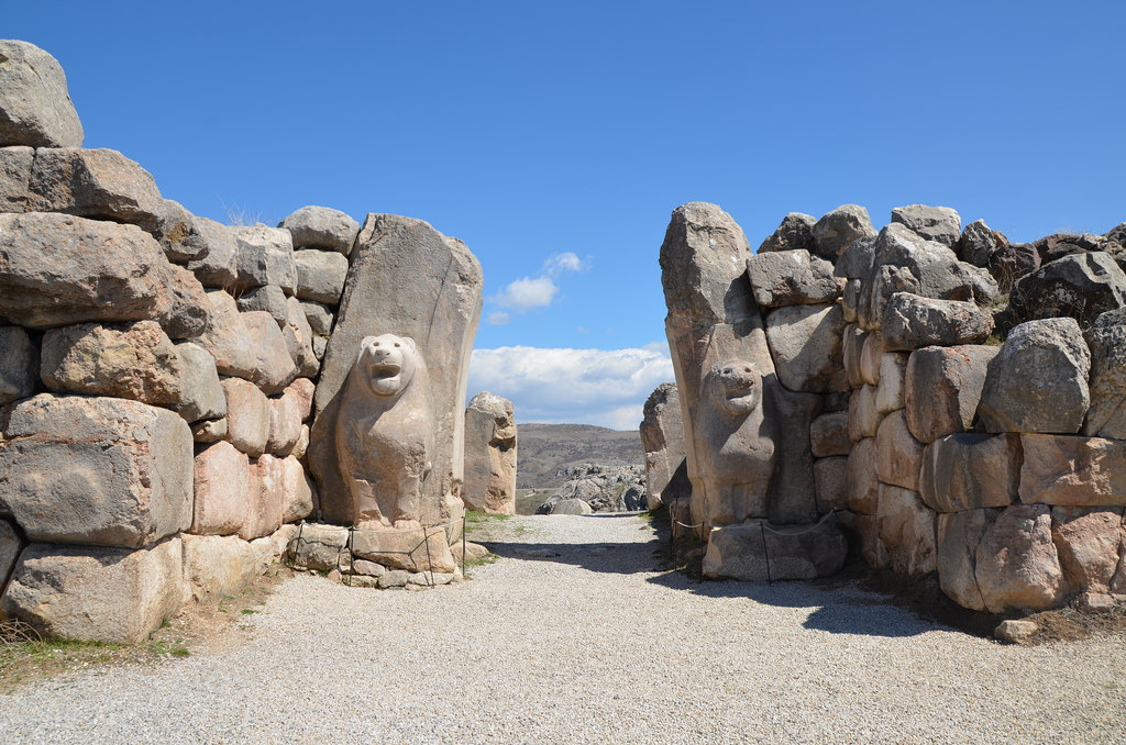
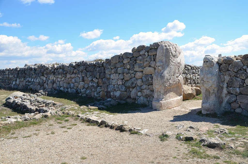
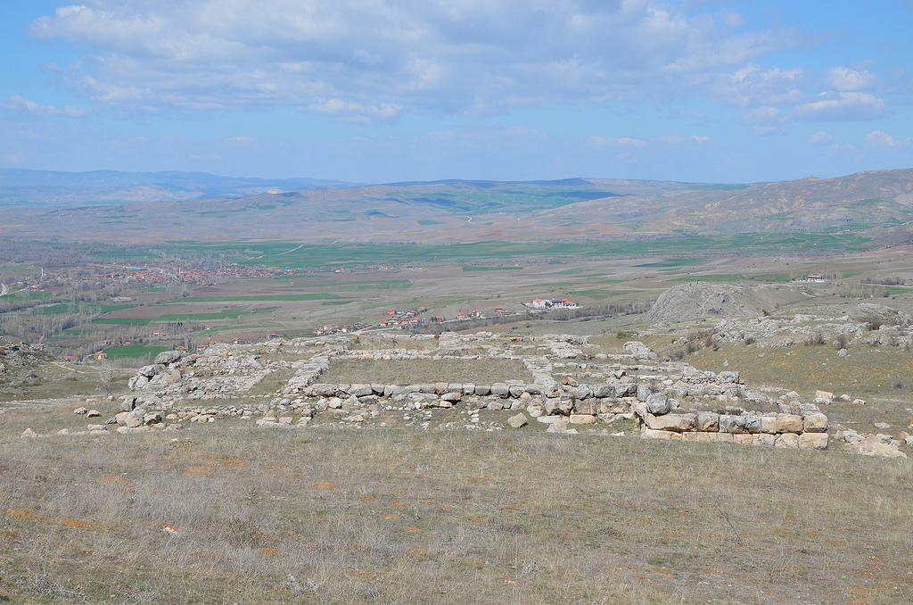
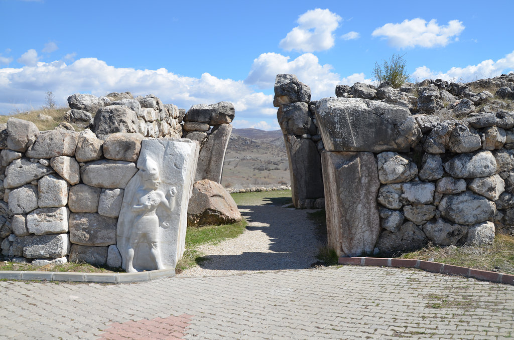
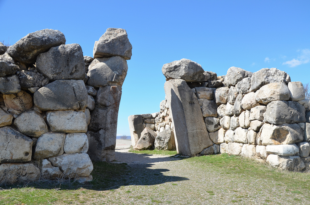
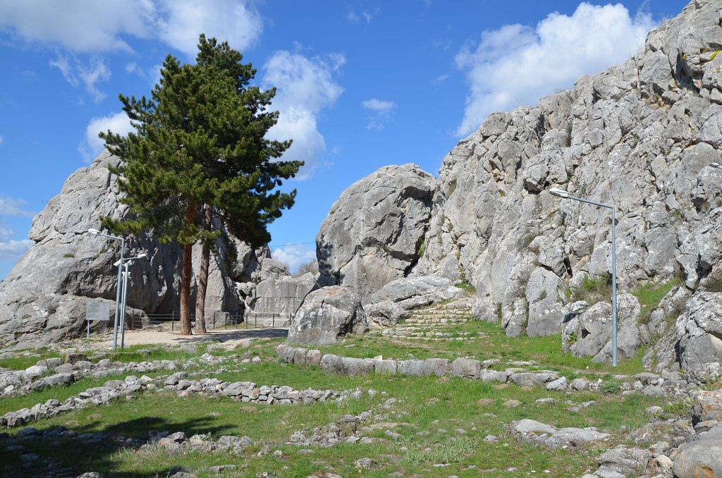
The asphalt road leading to the Upper City of Hattusa.The Lion Gate is one of the two grand entrances of the Upper City. It was flanked by two rectangular towers and had an inner and an outer doorway, both parabola-shaped and once furnished with pairs of wooden doors.Detail of the sculpted lion to the right of the gate showing the mastery of the carving. Lions were popular figures of protection and ornament at doorways throughout the Near East. Lions were put at the entrance of the city to ward off evil.The Lion Gate was built in polygonal masonry employing massive limestone blocks.The Yerkapi Rampart was an artificial rampart, 80 metres wide, 15 metres high, and 250 metres long, paved with limestone blocks.The entrance to the 70 m long tunnel running under the Yerkapi Rampart. It connected the city to the land outside.Inside the 70 m long tunnel running under the Yerkapi Rampart.The Sphinx Gate standing above the Yerkapi Rampart. Unlike the Lion Gate, the Sphinx Gate was not flanked by towers but led through a tower. All four door jambs bore representations of Sphinxes. Only one original sphinx remains in place, while two others are kept in the local museum.The Sphinx Gate showing the only original sphinx remaining in position. The Hittites must have adopted the sphinx from Egypt, where the sphinx represented the King.The Temple District in the Upper City. 24 different sacred buildings have been identified, varying greatly in dimensions.The ruins of one of the biggest temples of the Temple District.The King’s Gate is situated southeast of the city fortifications with a sculpture of the God of War in high relief measuring 2.25m. The original relief can be seen today in the Museum of Ancient Civilizations in Ankara.The exterior of the King’s Gate.The Hieroglyph Chamber, perhaps representing a symbolic entrance to the Underworld. The chamber was adorned with reliefs depicting the Sun God and Suppiluliuma II, the last of the famous Great Kings of Hattusa.The six-line Luwian hieroglyph inscription was commissioned by the Great King Suppiluliuma II on the right-hand wall of the chamber. The text describes the invasions and successes of King Suppiluliuma II, noting that, with the help of the gods, he invaded several lands, including that of Tarhuntassa.The 8.5m long inscription in Luwian hieroglyphs on the side of the cliff has become badly weathered, and the content of the text has only been partly deciphered.The ruins of the Royal Castle, the residence of the Kings.Reconstruction of the palace complex.The ruins of the Royal Castle.The gate in the Postern Wall at the southwest of the Royal Castle.


 The site was discovered on July 28 1834, by Charles Texier, but the first systematic excavations in Hattusa began in 1893-1894 under the guidance of Ernest Chantre, who published the first cuneiform tablets from Hattusa. Since 1907, the German Archaeological Institute has carried out archaeological work. The city consisted of two separate districts: the Lower City, the Hittite Old City, where the main Temple was located, and the Upper City, a newer part of the city with a fortified palace complex surrounded by massive walls.