Lambaesis is a Roman archaeological site in Algeria, 10 km southeast of Batna and 27 km west of Timgad. It was the headquarters of Legio III Augusta, originally a camp of the legion before becoming the legion’s permanent base in AD 120 during the reign of Hadrian, who visited the North African provinces and inspected the Roman army stationed there. A civilian town developed around a military camp, which later became the capital of the newly created province of Numidia under the Severan dynasty. The town maintained its high status until the 4th century AD, when it was slowly abandoned.
Lambaesis was founded by the Roman military in the province of Africa Proconsularis. The camp of the Third Augustan Legion, Rome’s main military force in North Africa, appears to have been established around AD 81 during the time of Vespasian by a subunit or an auxiliary unit. However, it became a huge military settlement and the legion’s actual military headquarters when Hadrian transferred it from Theveste (Tébessa, Algeria) in 120. The legion was charged with defending the area, controlling traffic, and collecting taxes along the important trade route. It is estimated that the Lambaesis camp could house some six thousand soldiers.
Aerial view of the Lambaesis camp in the 3rd century AD. Watercolor by Jean-Claude Golvin (source).
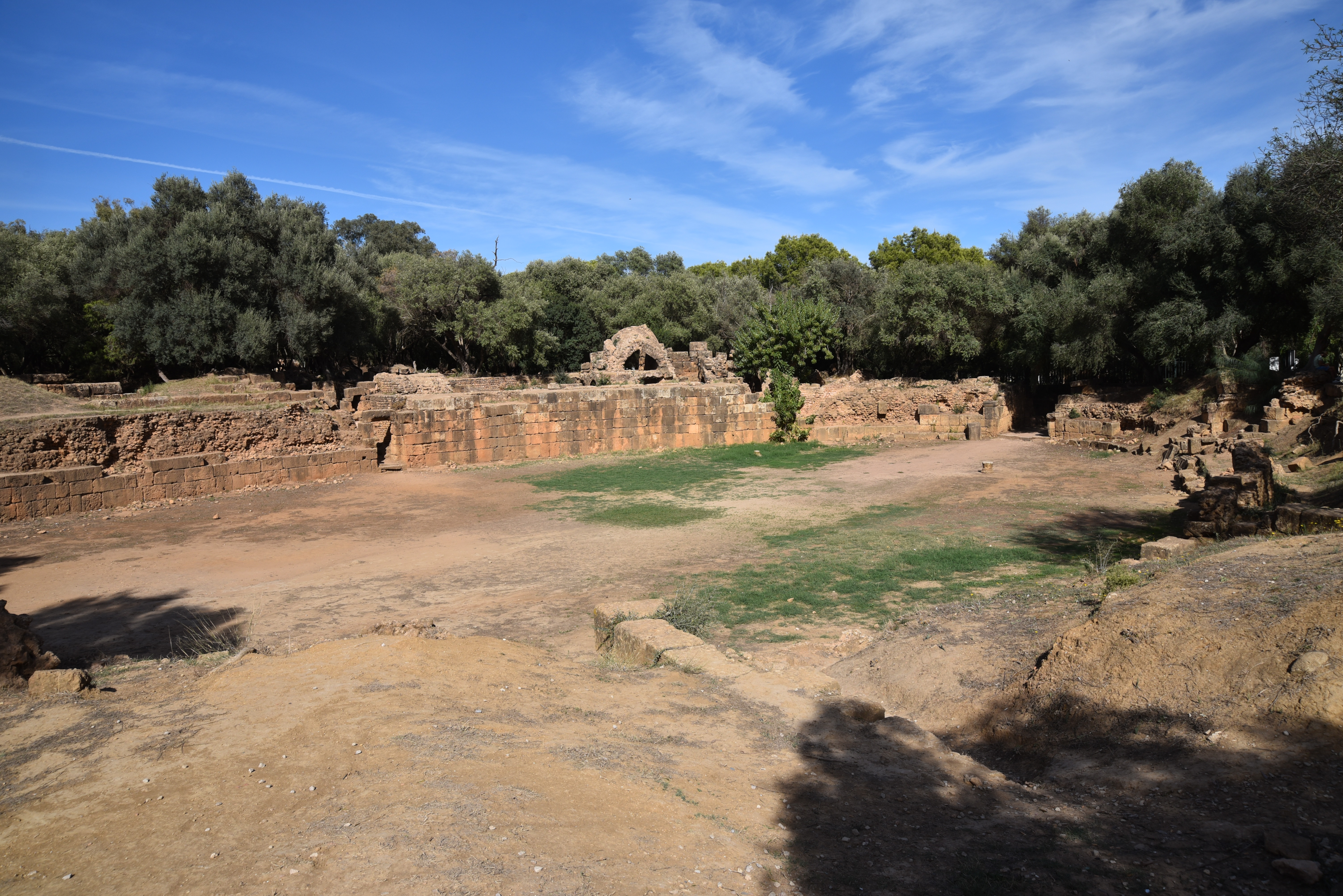
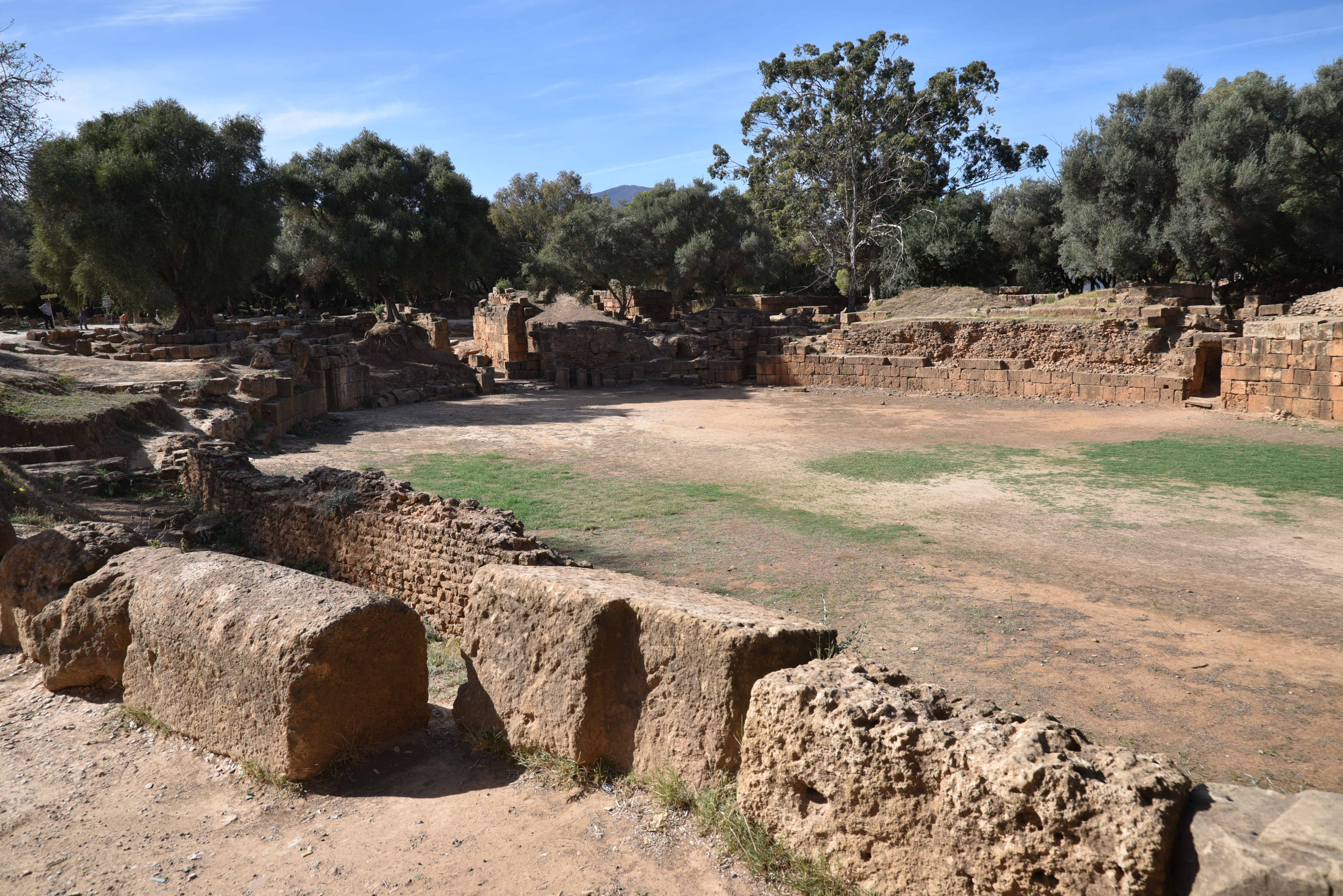
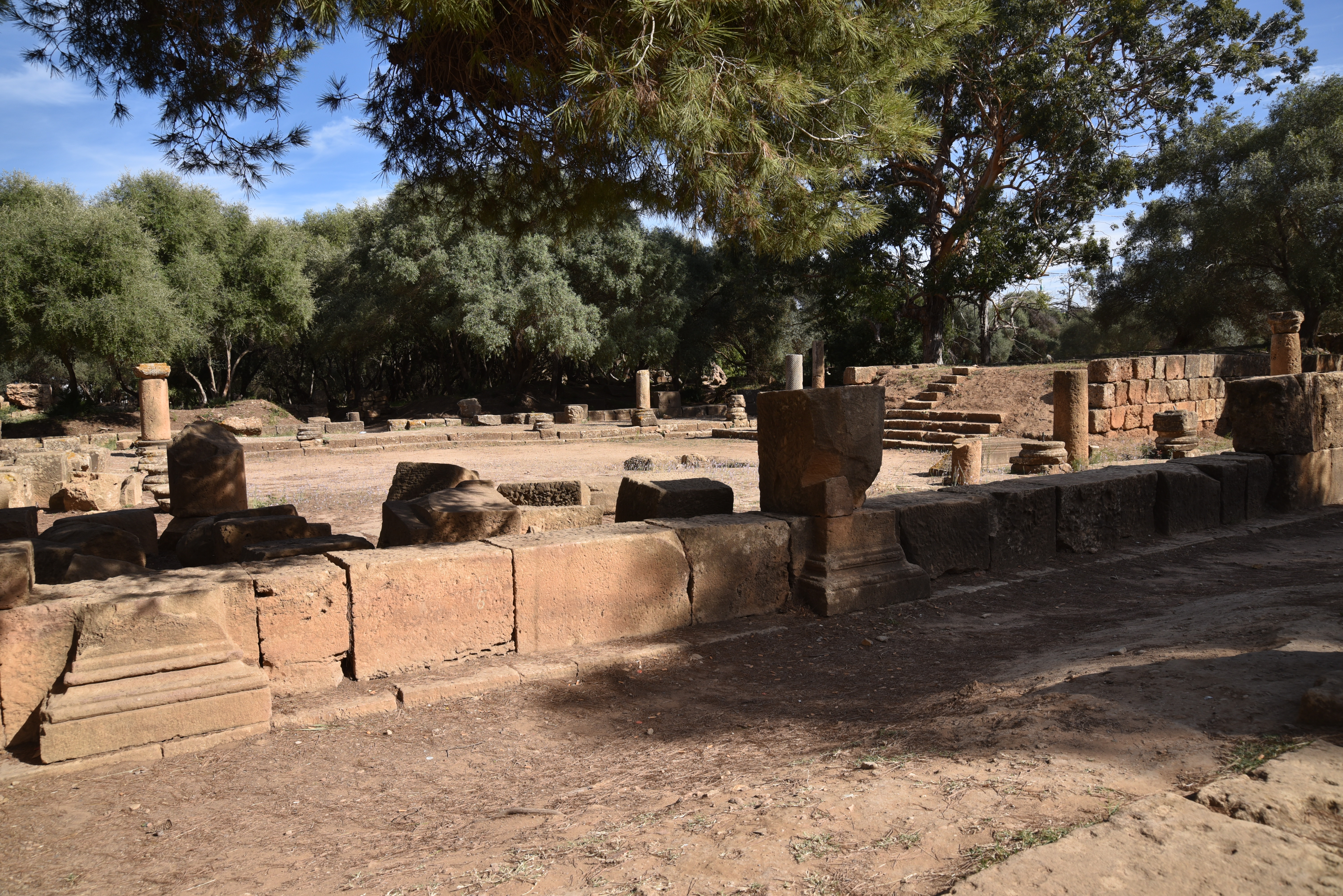
The layout of the castrum at Lambaesis resembles many other Roman legionary bases of Hadrianic date. Two streets, one running in an east-west direction, the via principals, the other in a north-south direction, the via praetoria, divided the large camp into four parts of unequal size. The legionary base consisted of a vast 24-hectare rectangle surrounded by stone walls (550 x 450 m), strengthened by towers and bastions and pierced by four gates. To the west was an enclosed exercise area measuring 200 square metres, where the cohorts were trained. In the centre stood a 10-square-metre platform surmounted by a Corinthian column erected in AD 128 to commemorate Hadrian’s visit.
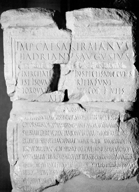
Fragments of an inscription (ILS 2487 and 9133–5) preserved on two pedestals indicate that Hadrian addressed the troops on the parade ground. In the summer of 128, Hadrian observed the legion and the attached auxilia over several days of exercises and addressed different groups of soldiers separately in a speech (aldocutio). He commented on their manoeuvres, praised their skill, and criticized any mistakes, speaking directly to them, unit by unit. On July 13, he praised the Ala I Pannoniorum for their javelin throwing, which they performed while wearing the legionary cuirass. He complimented their prowess, telling them:
“You did everything according to the book. You filled the training ground with your wheelings, you threw spears not ungracefully, though with short and stiff spears. Several of you hurled spears with skill. Your jumping onto the horses here was lively and yesterday swift.” Tr. M. Speidel – Emperor Hadrian’s speeches to the African Army: A new Text (2006)
The inscriptions on the base of Hadrian’s monument contain excerpts from his five speeches to the legion and auxiliaries. They are the only surviving example of a speech from a Roman emperor to his soldiers.
The legionary camp is one of the best-preserved military complexes of its type. However, it was greatly damaged in 1851 when a penitentiary was built in the southwest part, and the village was also built on the ruins.
Roman Rule in North Africa (146 BCE to 395 CE). Hadrian ordered the soldiers of the Third Legion to pave the military road between Carthage and Theveste (CIL VIII 10081) and to construct a road from Rusicada to Cirta (CIL 08 10296). Map created by Simeon Netchev (link)
As was often the case, a civil settlement grew around military facilities. The area’s fertile agricultural land and high-quality limestone made it possible to construct a monumental Upper City, which featured public buildings befitting its new status as the capital of the new province of Numidia. The city’s second major period of growth occurred in the first half of the 3rd century AD when its legal status was elevated from that of municipium to that of colonia.
The legion was disbanded in 238, the “Year of the Six Emperors”, and suffered a damnatio memoriae following the troubles which resulted in the elevation of the emperor Gordian III. This act of condemnation saw the legion’s name chiselled out of inscriptions, effectively erasing it from public memory. In 253, Emperor Valerian and his son Gallienus reformed the legion, possibly giving it the new title of Legio III Augusta Valeriana Galliena. This revival enabled the legion to resume its role as the primary Roman military force in North Africa, where it continued to serve for several more decades. With the legion’s departure in 392, the ancient town declined.
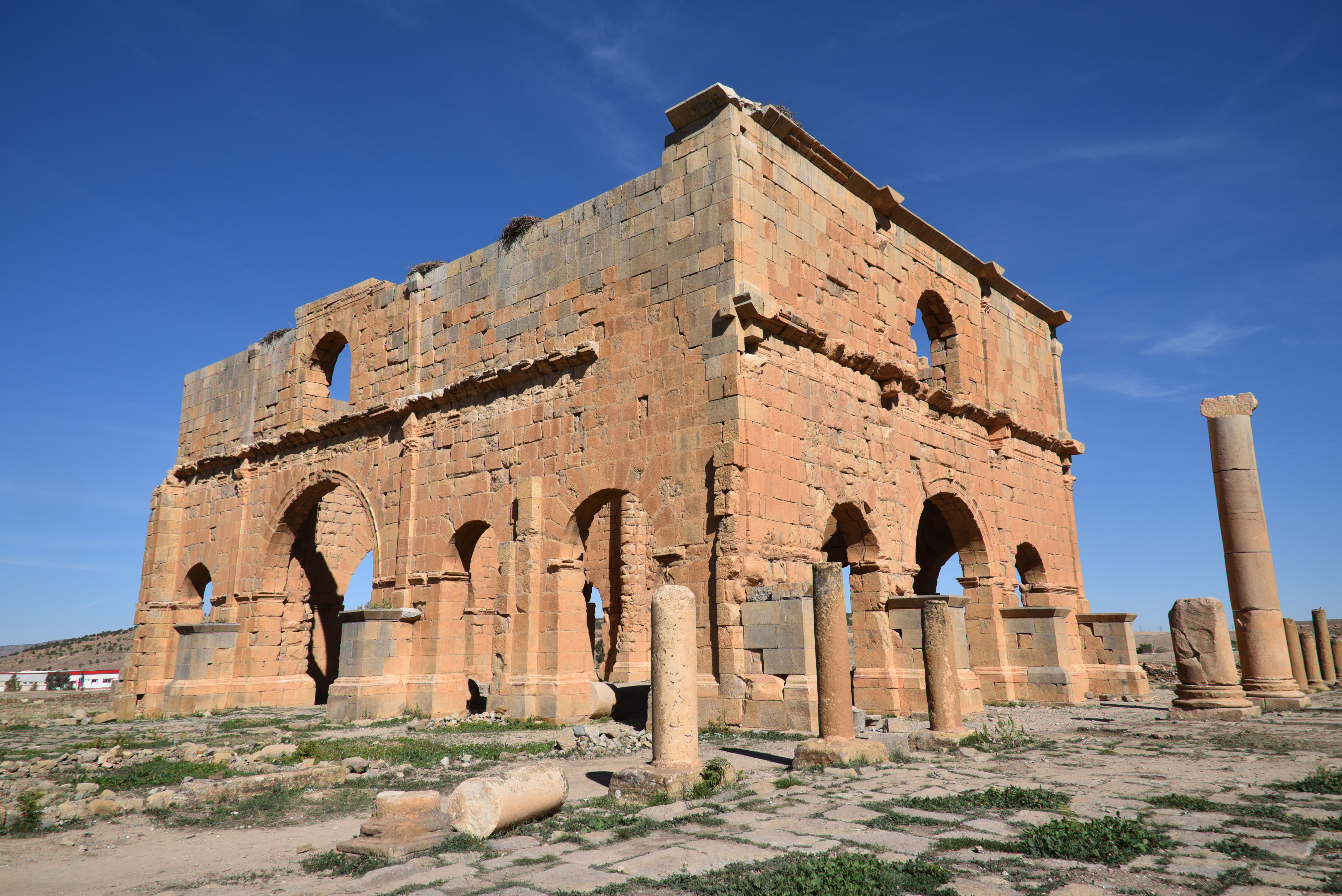
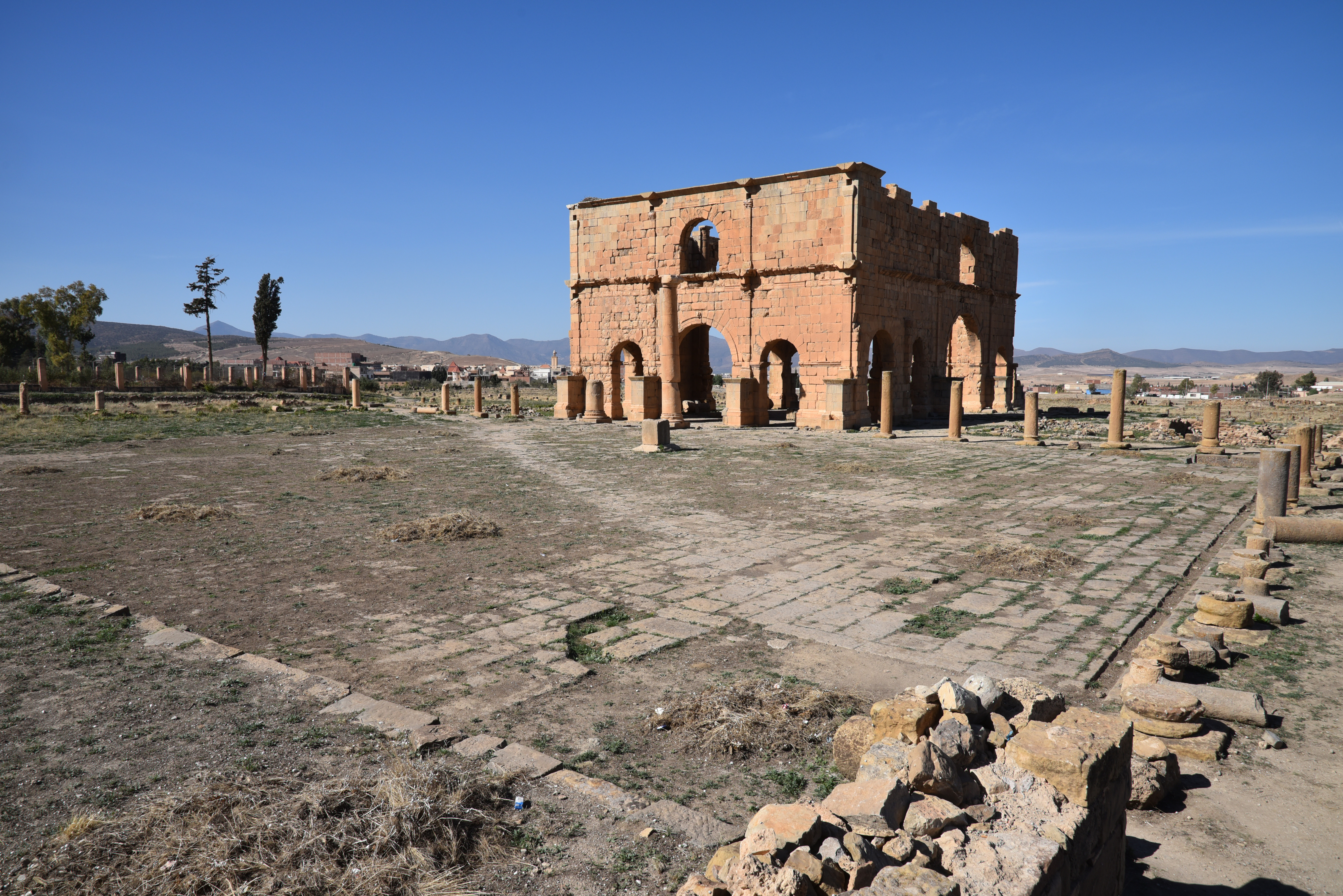
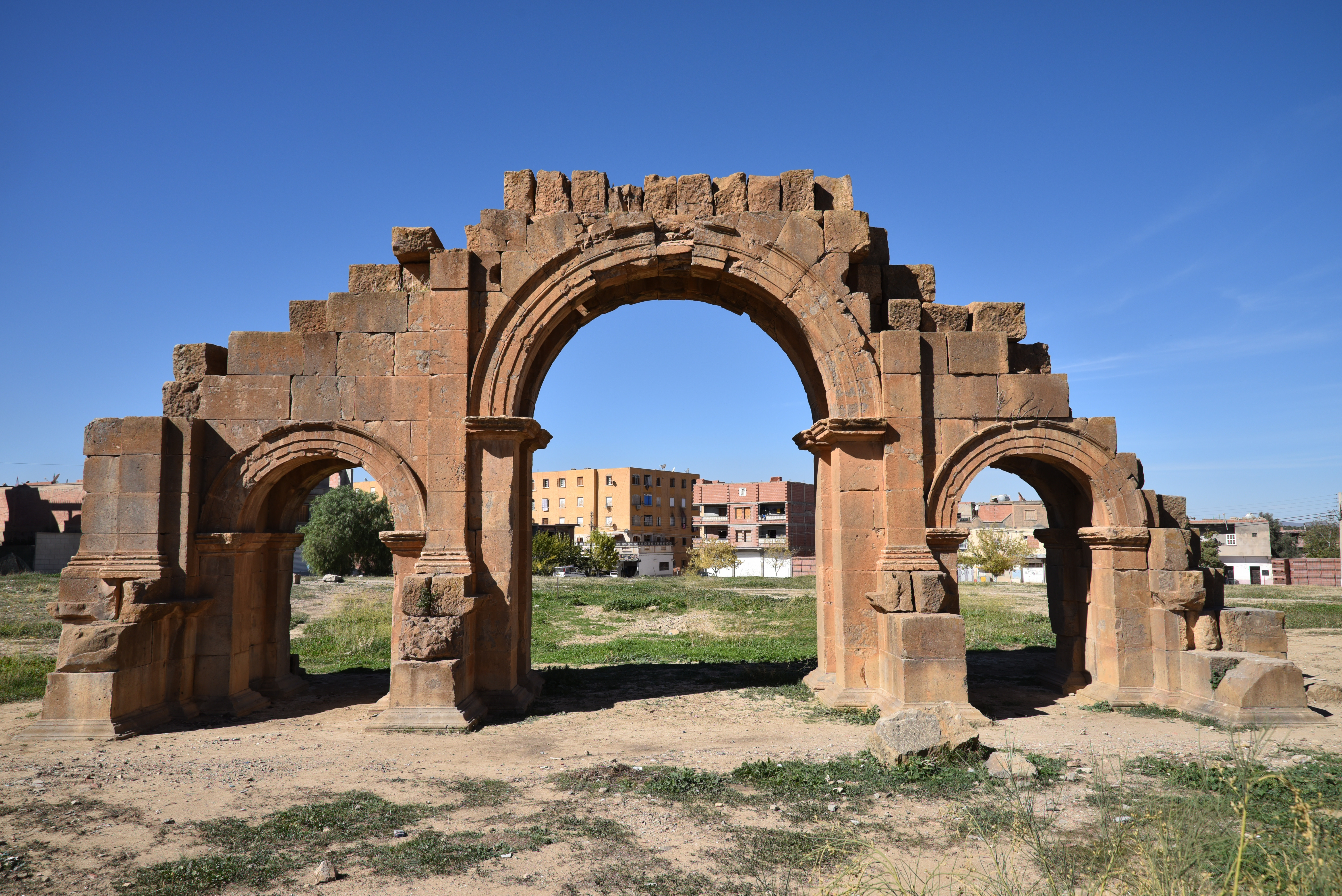
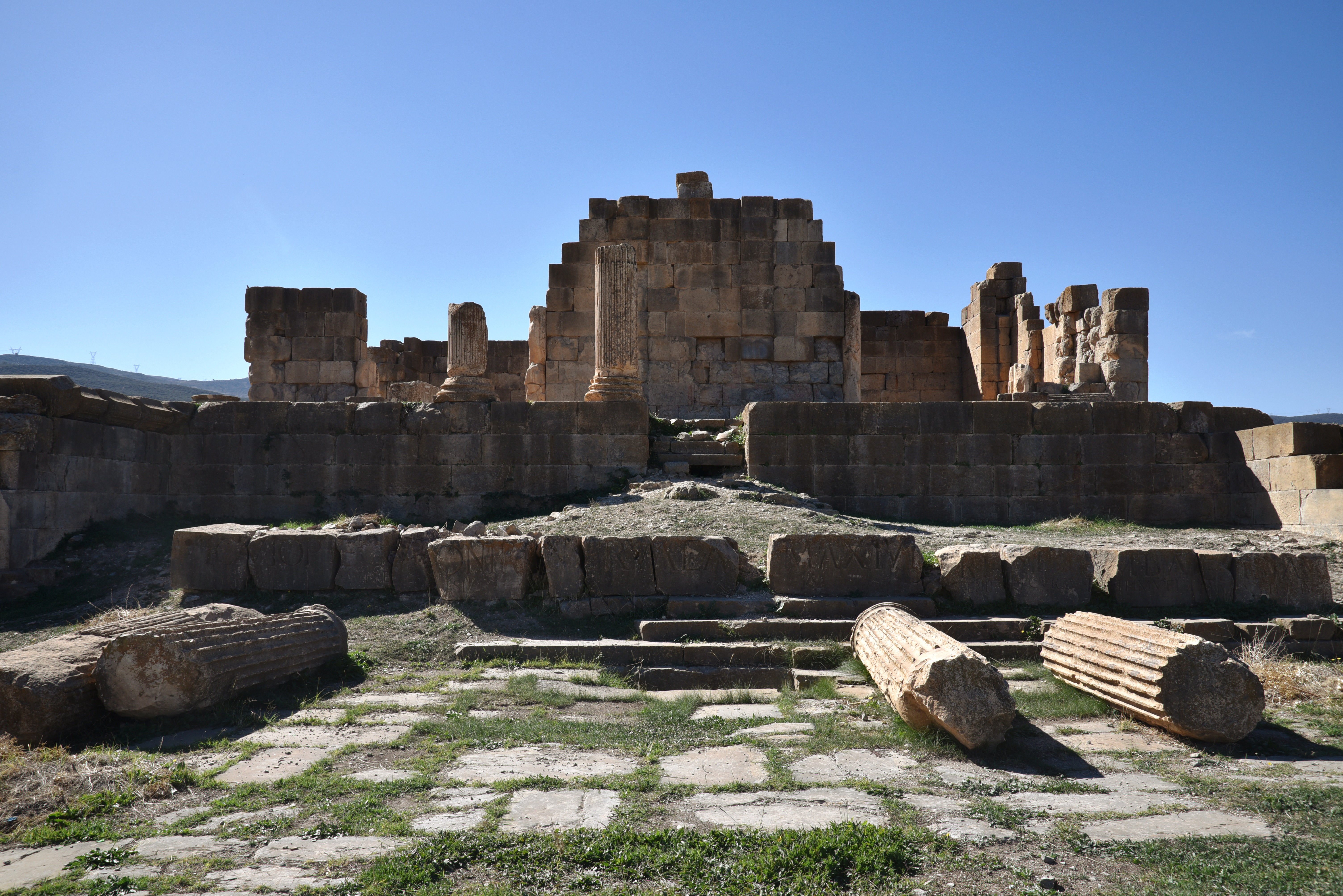
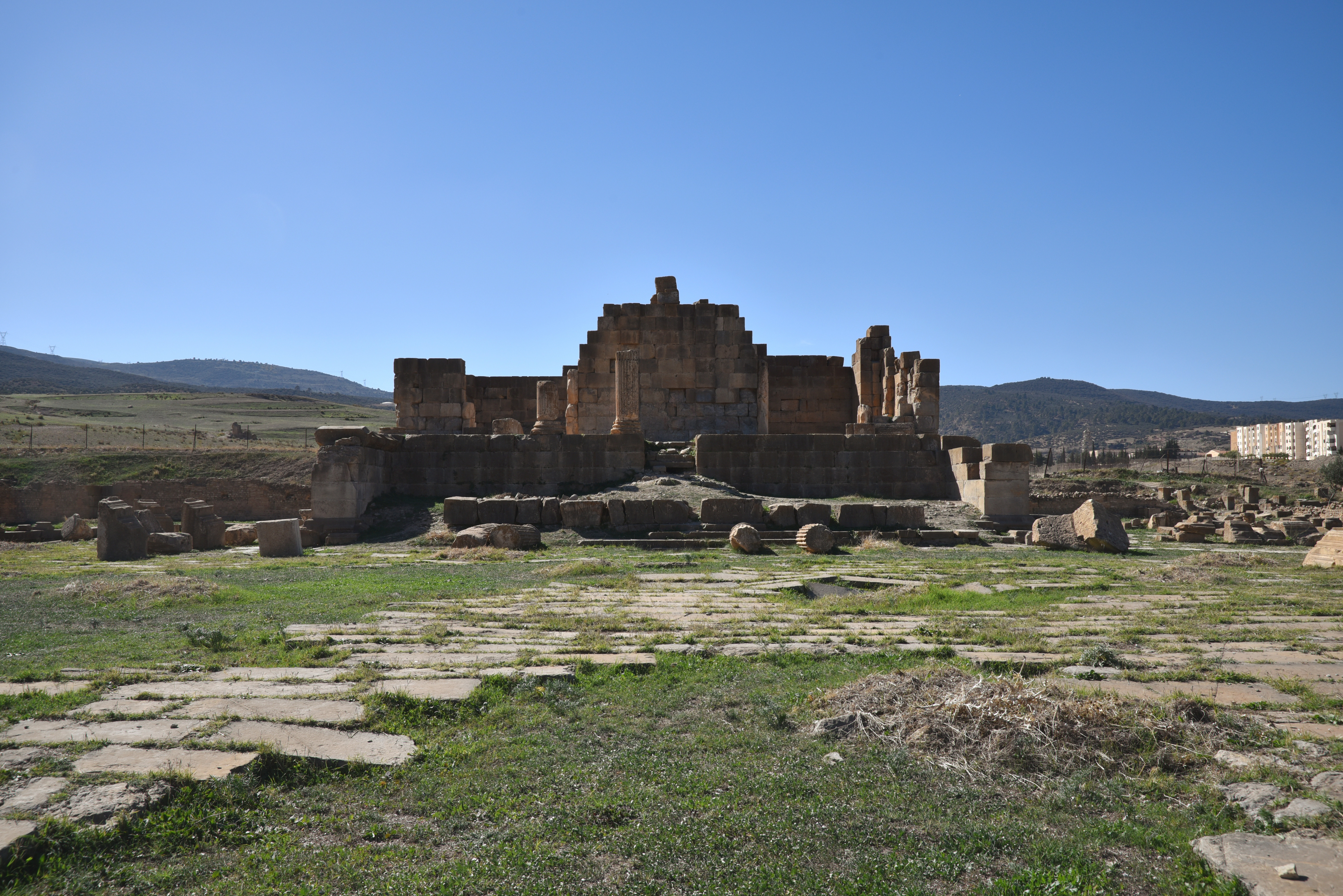
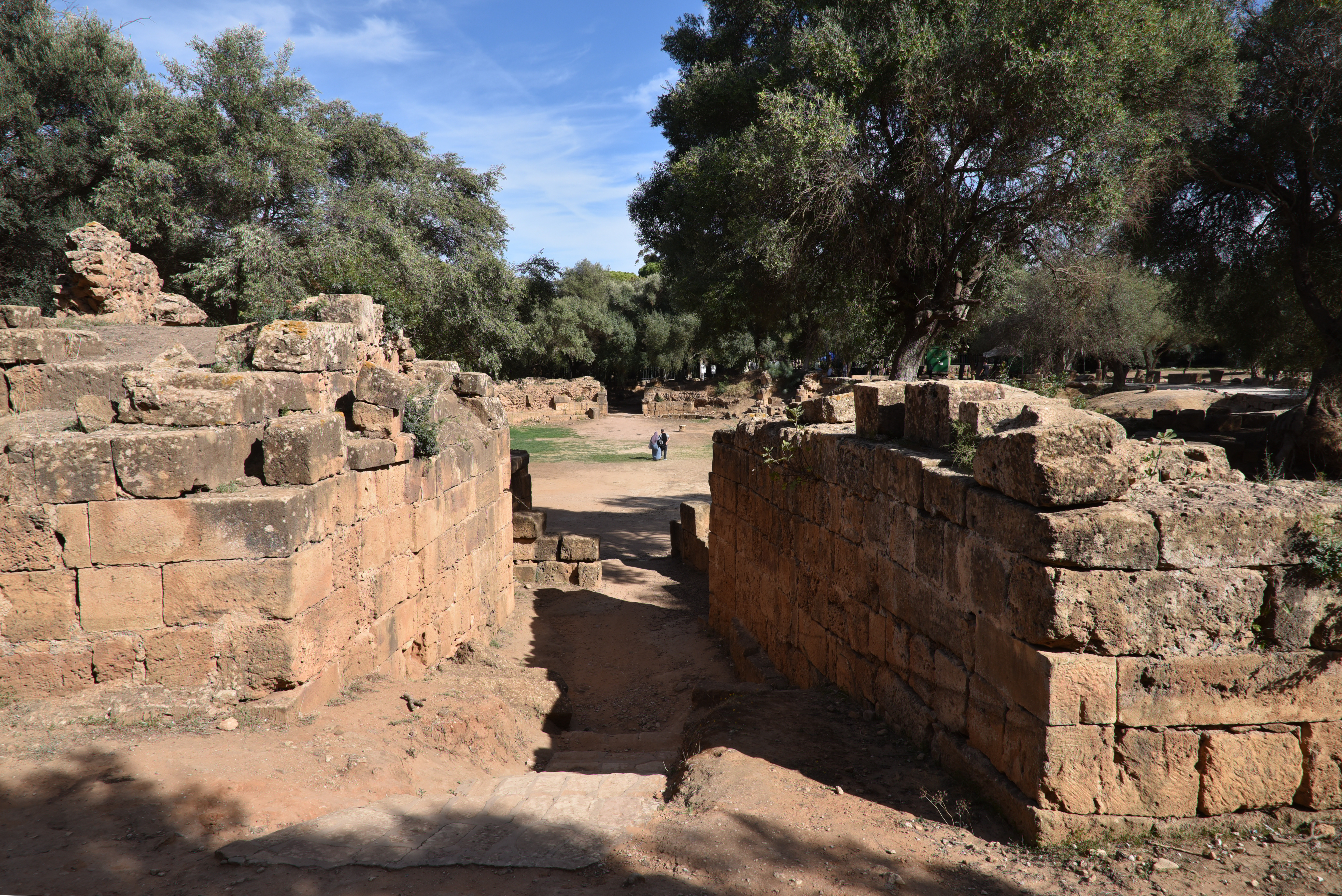
The most prominent remnant of the Roman legionary camp is the four-sided arch, often called the praetorium (the commanding officer’s residence). However, it is actually the groma, which serves as a monumental entrance to the principia (the headquarters building), located at the centre of the camp, at the intersection of the via principalis and the via praetoria. The amphitheatre, 200 metres (656 ft) away, was built in AD 169 under Marcus Aurelius and had a capacity of 12,000. The remains of the town at the edge of the modern village include two triumphal arches (dedicated to Septimius Severus and Caracalla), several Roman temples, including a Capitolium and a sanctuary of Asclepius, baths, and private houses.
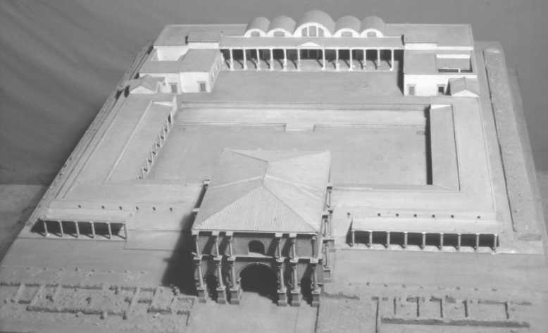
Model of the principia in Lambaesis after modifications in 265 under Emperor Gallienus. Photo: Fridrich Rakob (Negative D-DAI-Rome-NA-RAK – 37875)
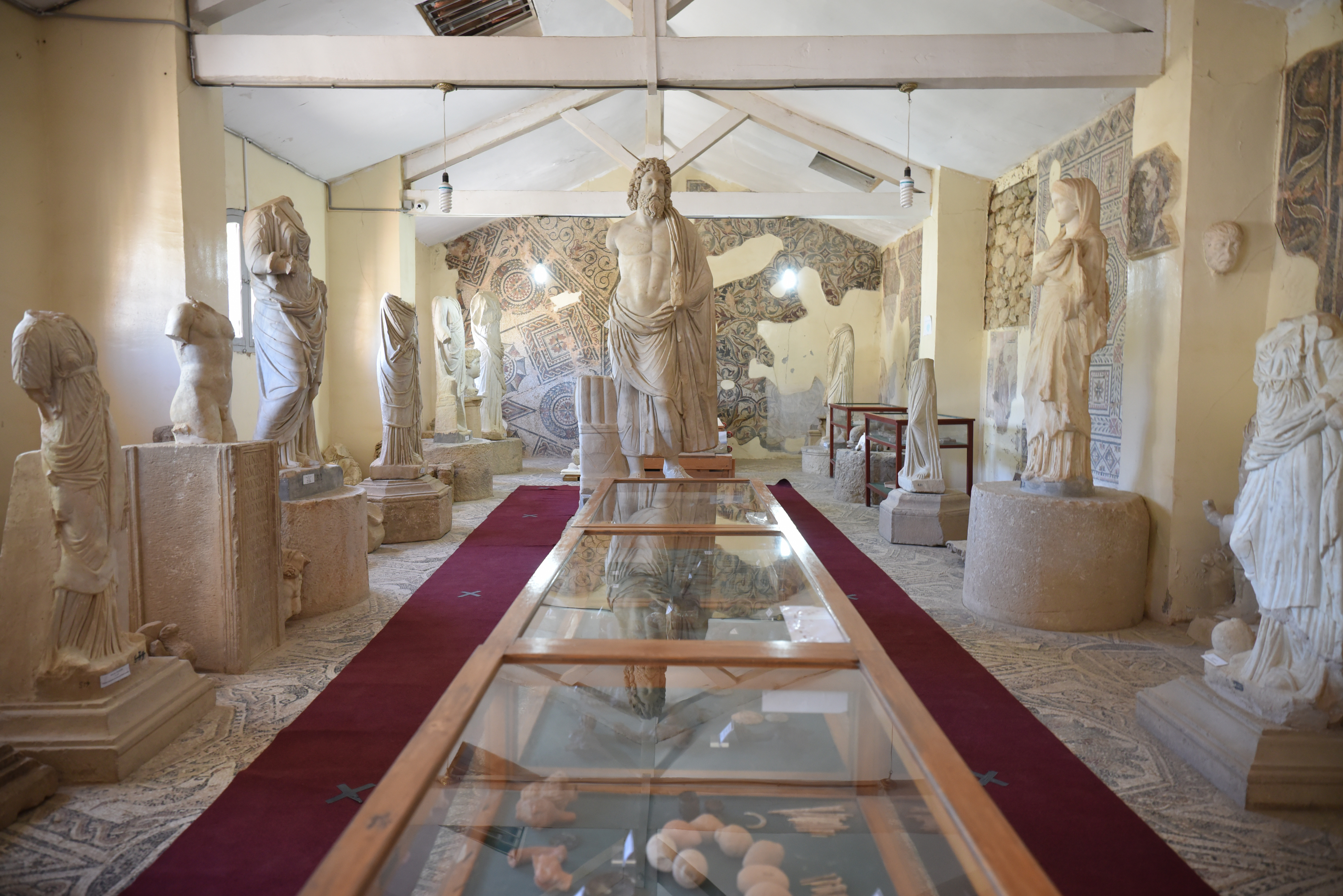
The small museum of Lambaesis in the centre of the modern town of Tazoult contains an exceptional epigraphic collection, providing invaluable information on changes in soldier recruitment. There are also statues of Aesculapius and Hygieia, a fine head of the child Commodus and mosaics.
PORTFOLIO
Hadrianic legionary base
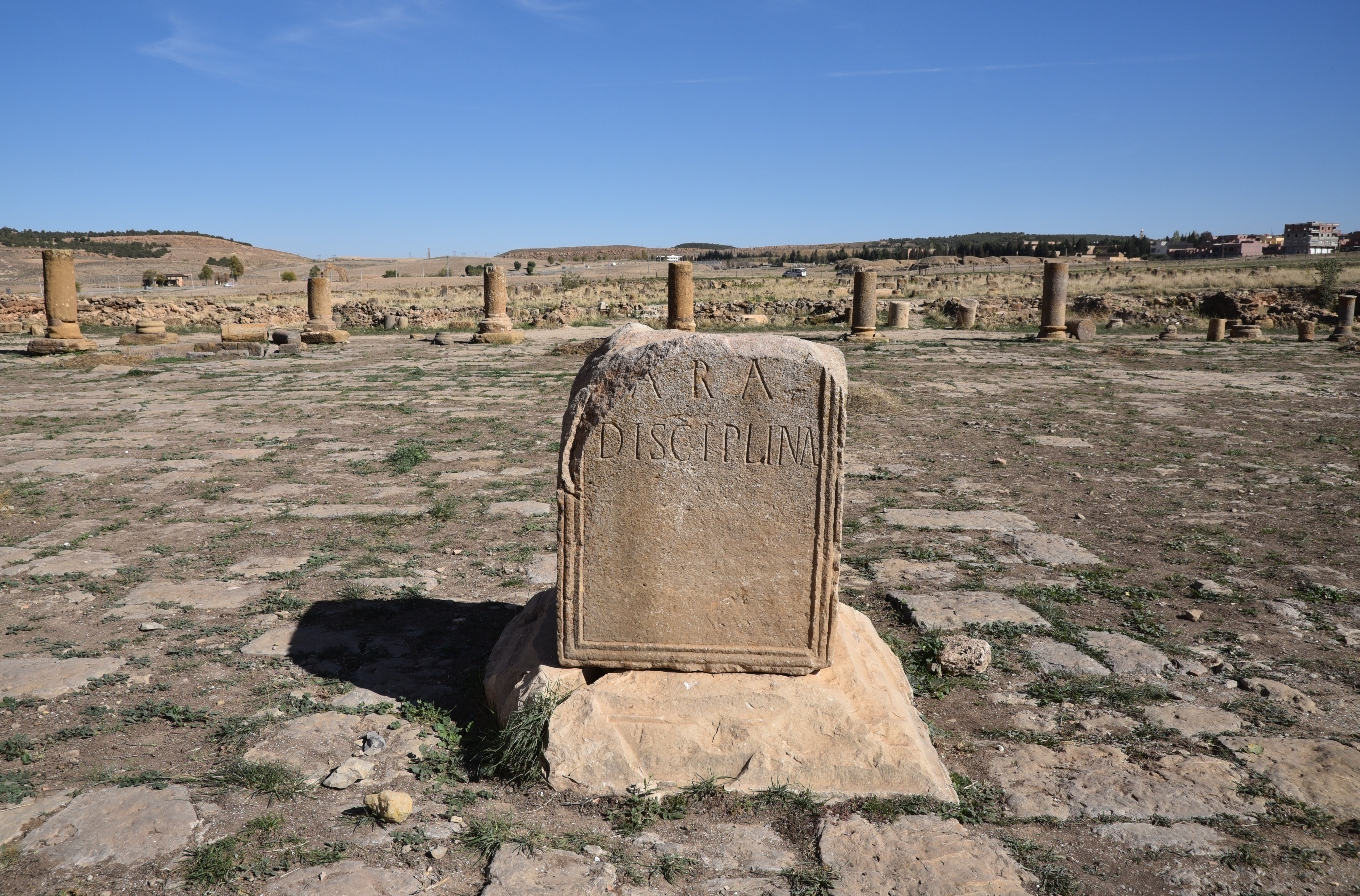
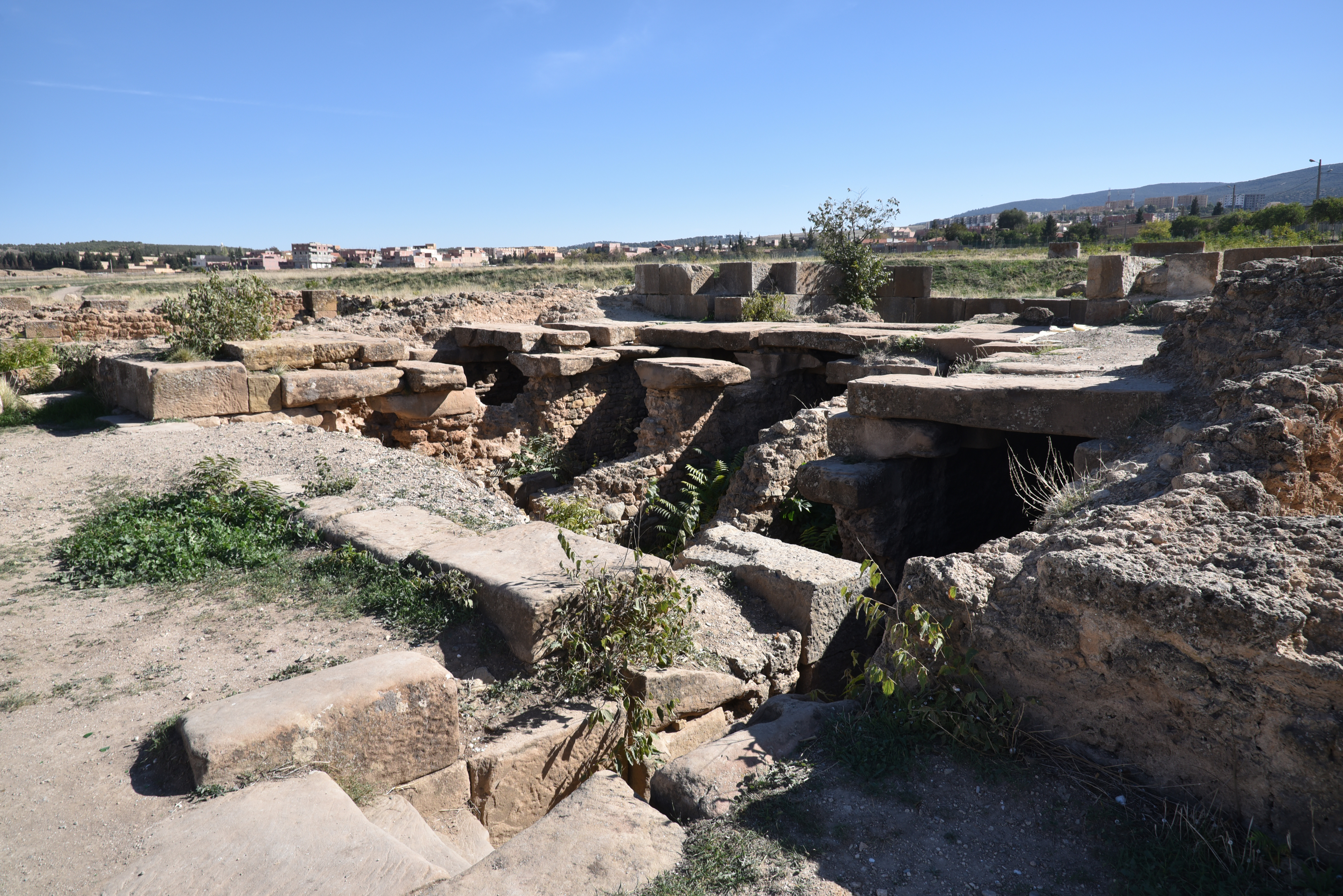
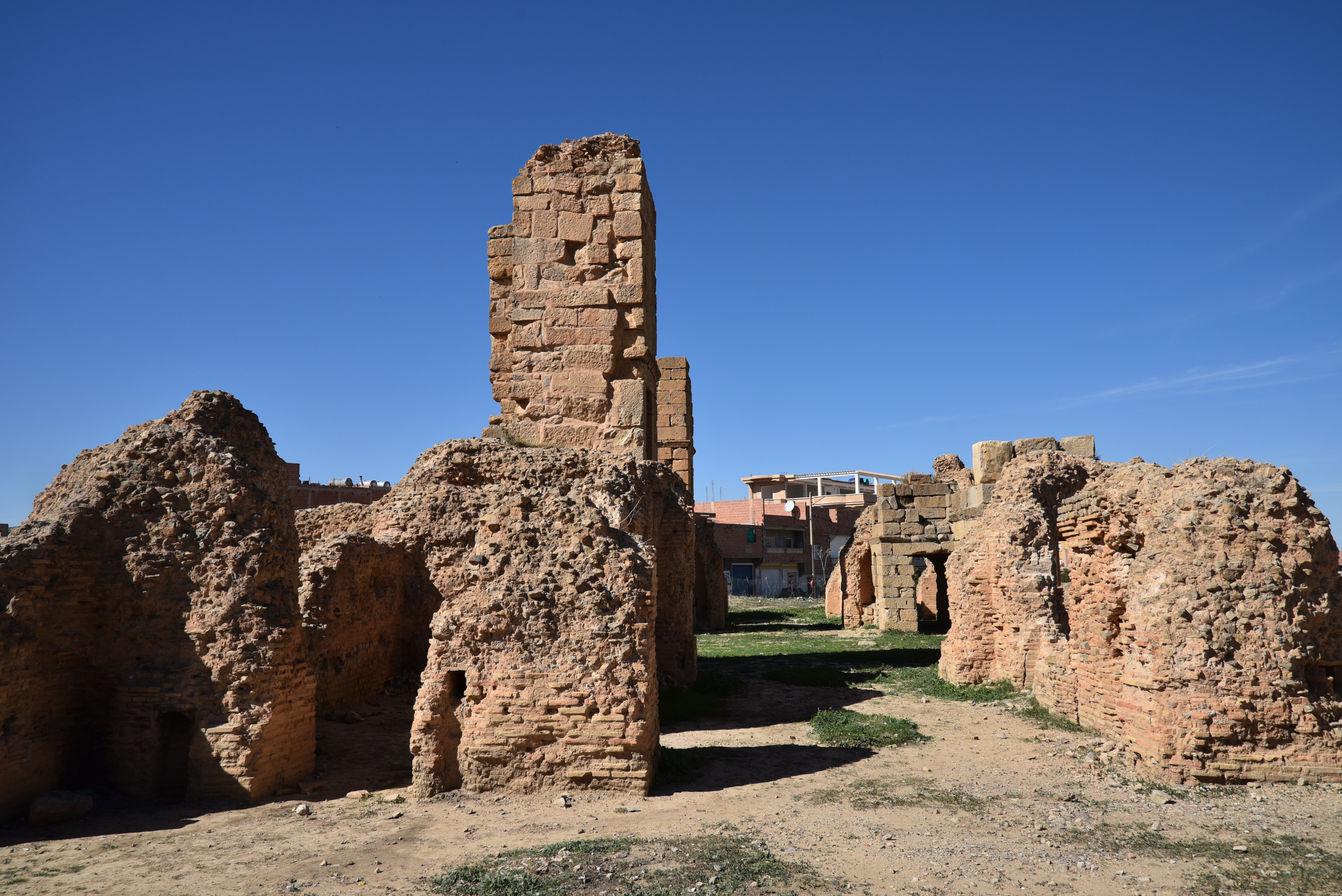
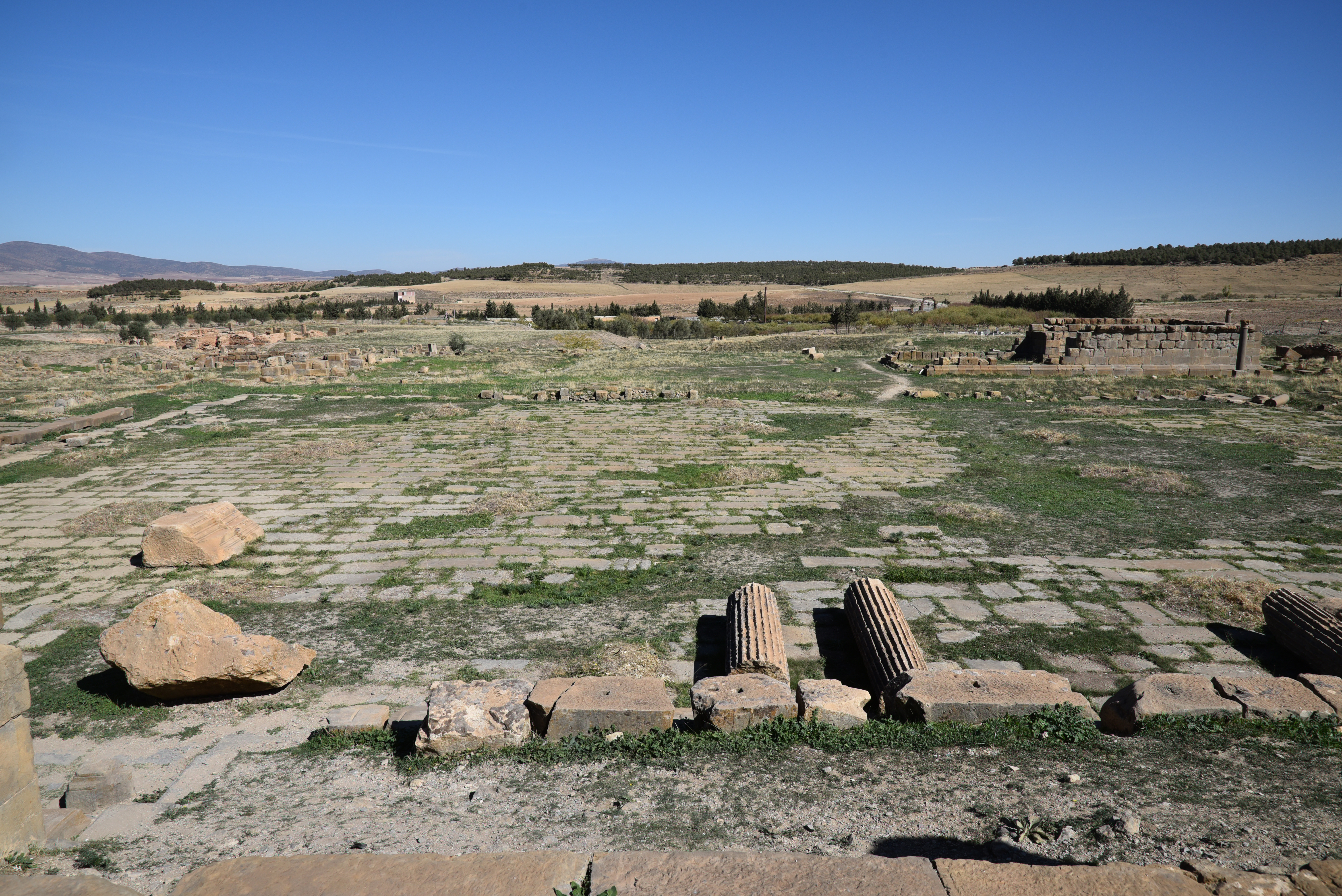
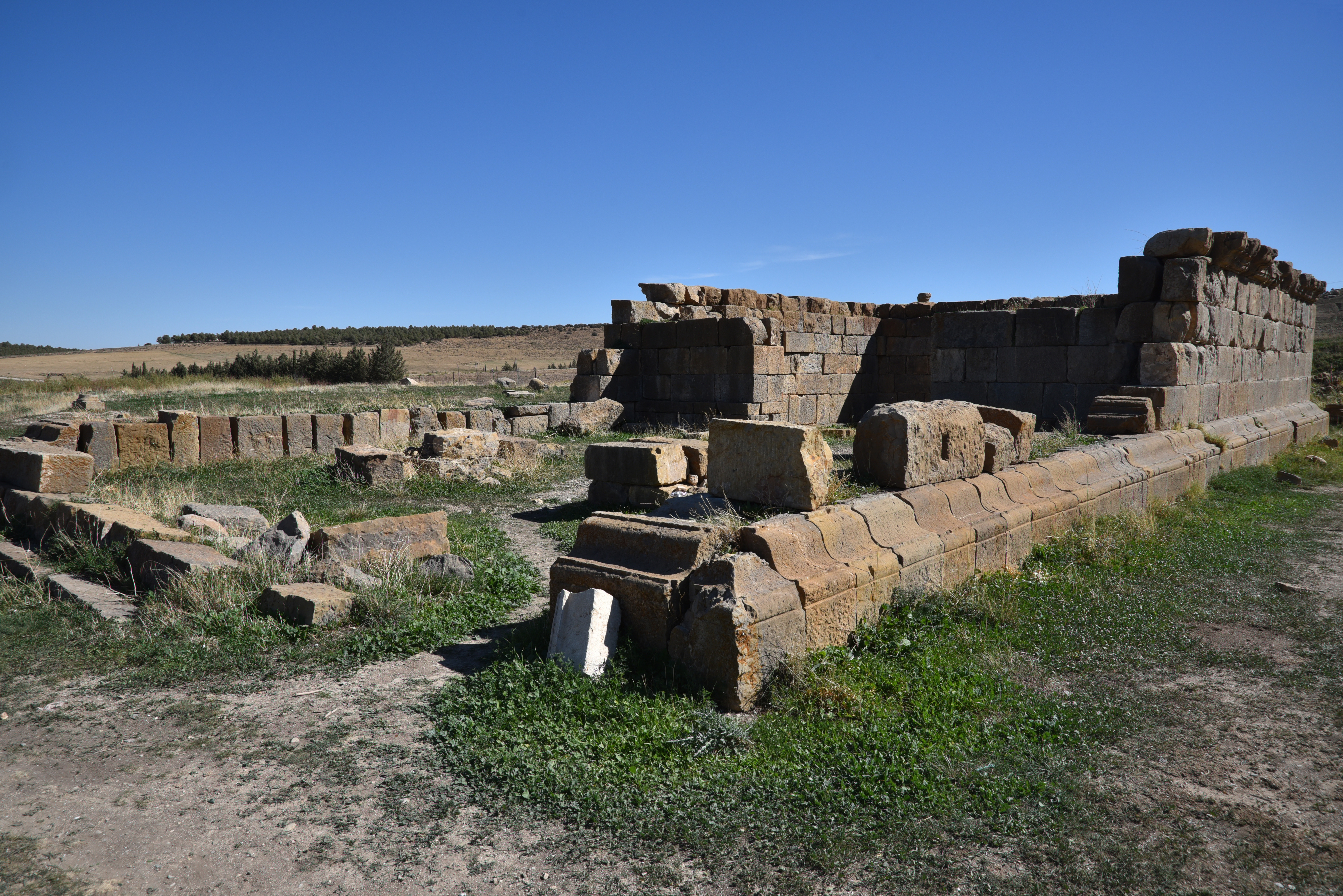
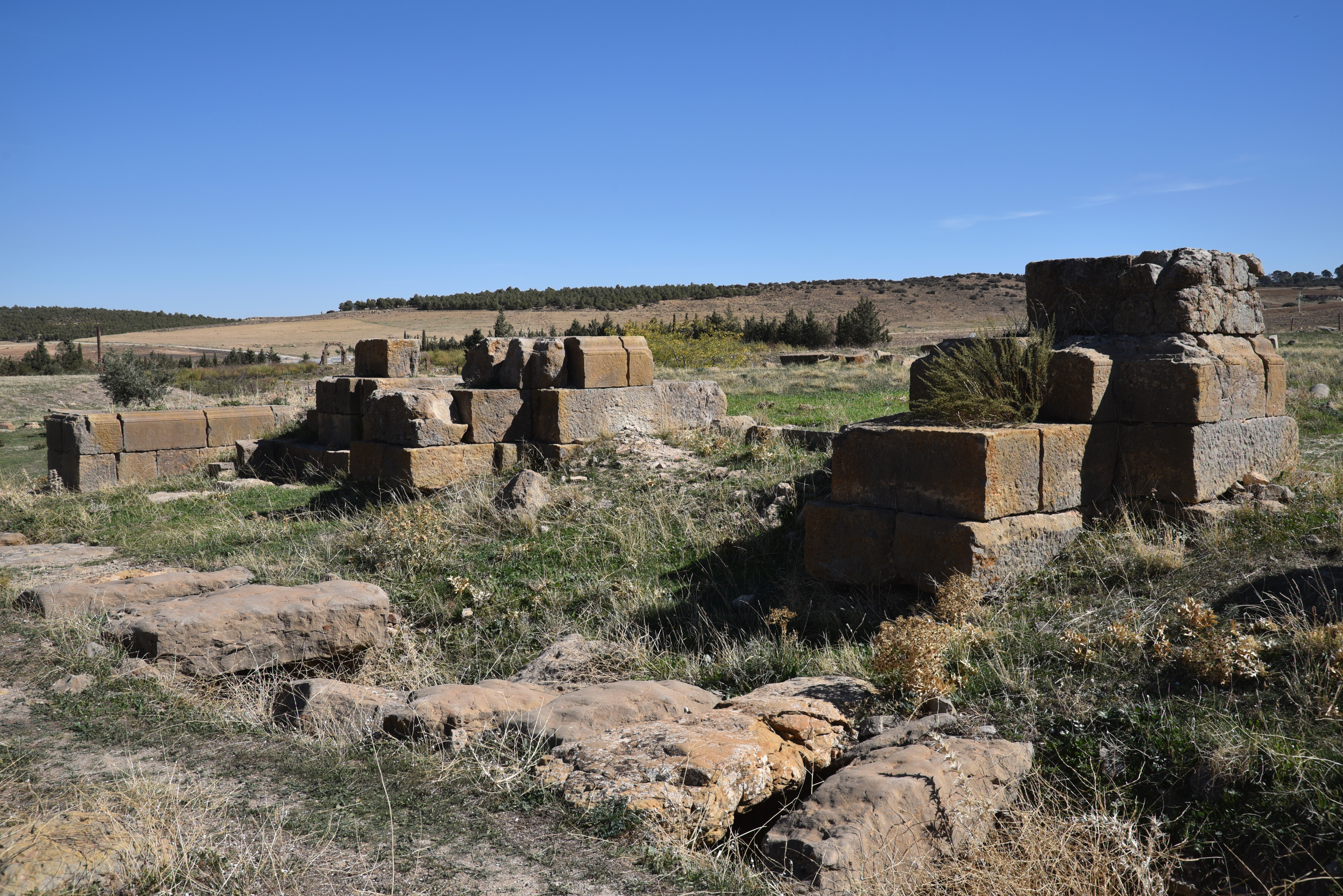
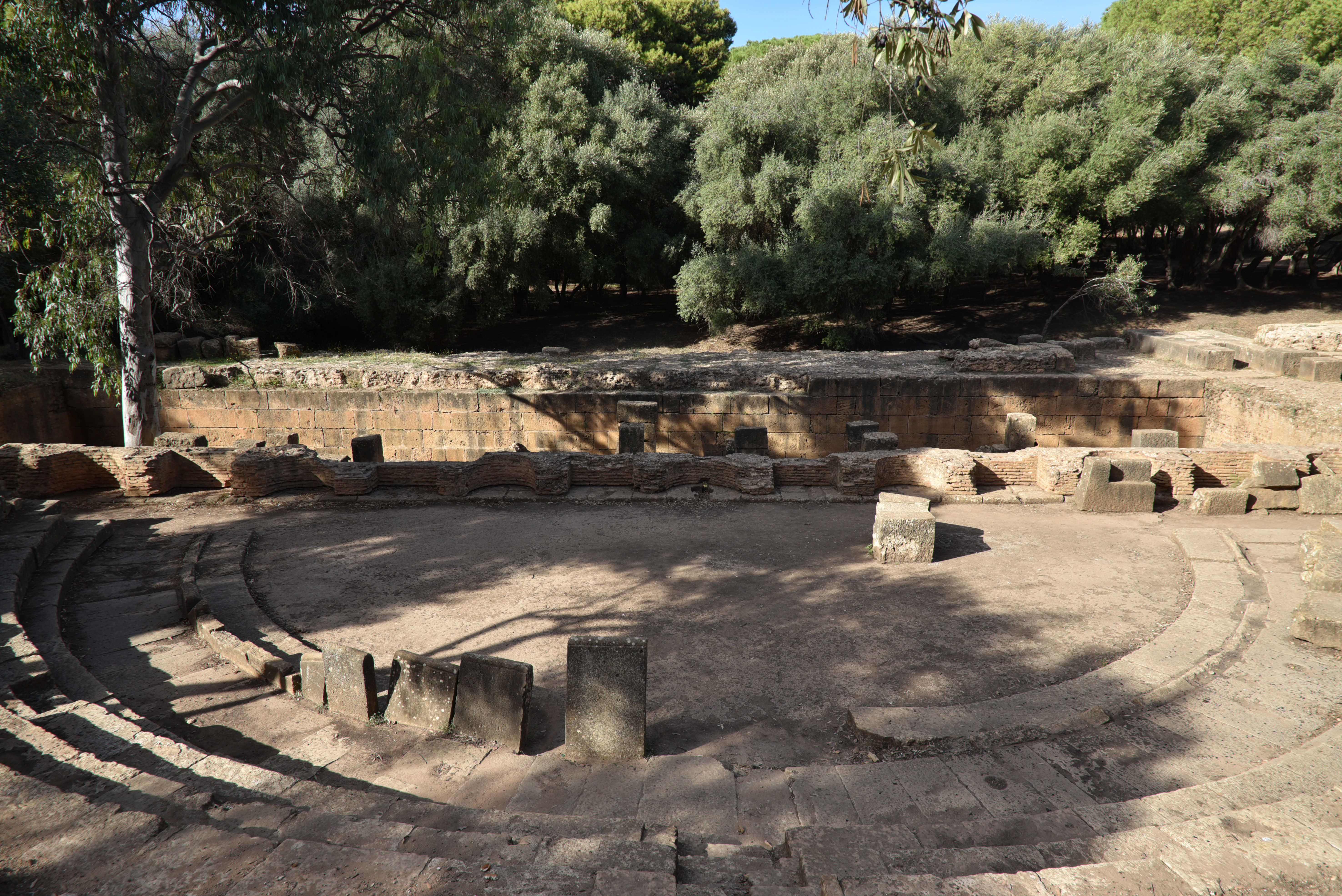
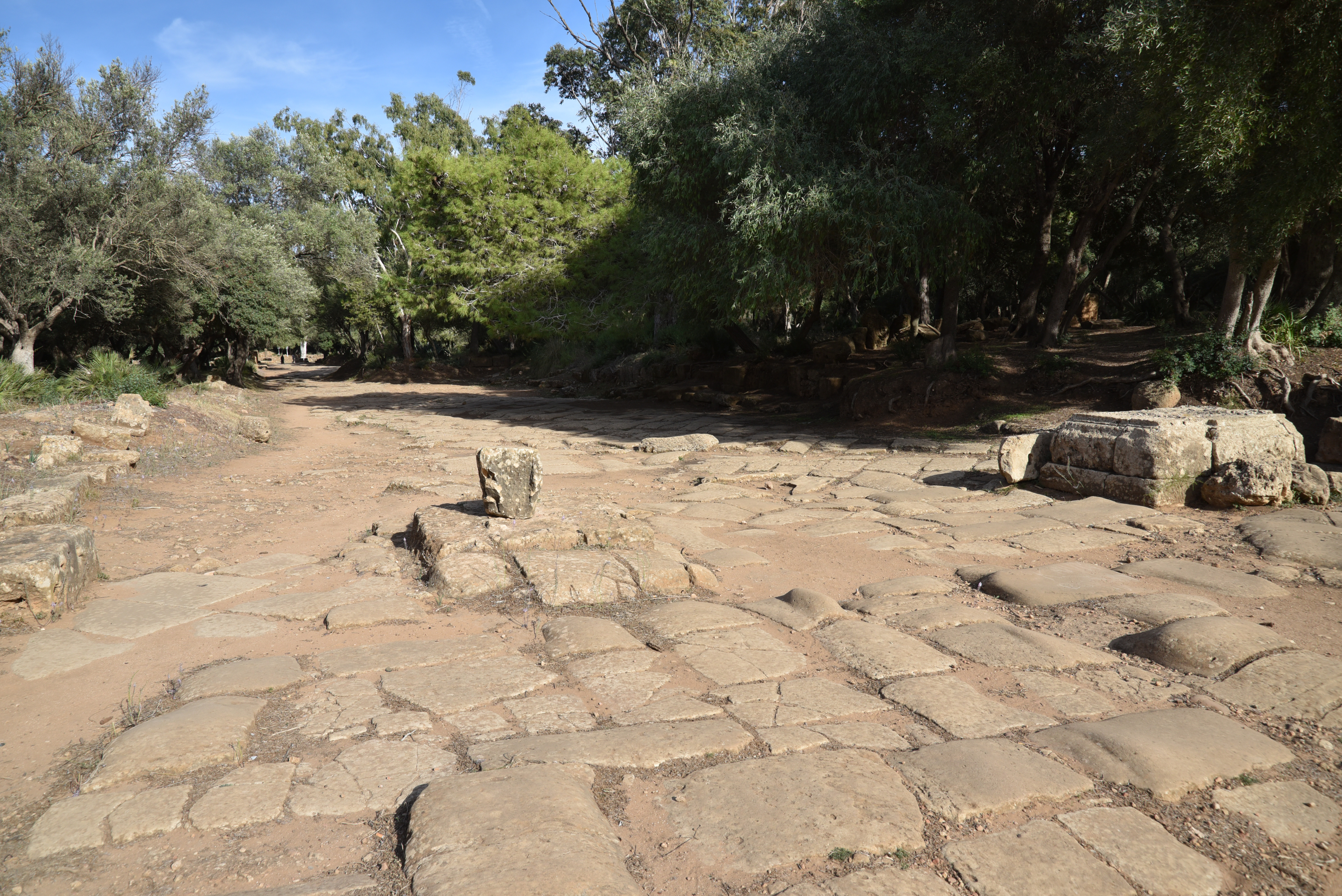
The Via Principalis (looking west) of the Hadrianic legionary base leading to the Groma (entrance building) at the centre of the principia complex. Barracks and dwellings are placed along the street.The Via Principalis was one of the two main colonnaded avenues crossing the Principia in an east-west direction.The Signum of the Legio III Augusta on one of the keystones of the Groma (east side).The Groma (west side) is located at the centre of the camp. It served as the monumental entrance to the principia, the camp’s headquarters. The Groma marked the intersection of the camp’s two primary roads, the Via Principalis and the Via Praetoria. It is named after the surveying instrument (see here).Reliefs of the goddess Victory and a laurel wreath on the keystones of the west side of the Groma.The north side of the Groma. It features a very battered inscription immediately above the central span that records a restoration carried out in 267–8 under Gallienus when the legionary camp was re-commissioned in 253. However, at some point between 286 and 293, the name of the emperor was erased, and the names of Diocletian and Maximian were inserted instead.The south side of the Groma. The building forms a sort of quadruple arch (c. 30 x 23 m; 15 m high) that admitted wheeled traffic, while the side arches were for pedestrian traffic. Windows on the upper story indicate that this structure was also used as a guardhouse.The Groma dates wholly or in part to the 3rd century AD. Beneath the building, the foundations of an older predecessor building from the early 2nd century AD are visible.The Groma from the southeast. On the outside, it is adorned with pilasters and Corinthian columns.South of the Groma extended a large paved courtyard (65 x 37 m). It was enclosed on three sides by a colonnaded portico that opened into a series of rooms. The fourth side facing the entrance was fully taken up by a Basilica/Tribunal.Altar dedicated to the goddess Disciplina (CIL VIII 18058) in the camp courtyard with the Latin text Ara / Disciplinae. Discipline was one of the military virtues and was worshipped as the goddess Disciplina. The goddess Disciplina acquired a cult in the 2nd century AD, and coins from the period featured a reverse with Hadrian leading troops with their standards, accompanied by the legend DISCIPLINA AVG.The peristyle courtyard of the Principia had offices and armouries on the three sides.View of the Principia’s courtyard and the Groma. In the foreground is a column base from the Basilica/Tribunal, a building divided into three naves by two colonnades of 12 columns each. The large south wall of the Basilica/Tribunal was bordered by apses used for cult activities, including a chapel that housed the standards of each cohort (aedes signorum).The Sanctuary of the Standards (aedes signorum), a chapel intended to hold the standards of the legion and the cohorts. Some scholars speculate the five underground chambers beneath the chapel were prison cells. (Letteney, M., & Larsen, M. (2021). A Roman Military Prison at Lambaesis. Studies in Late Antiquity, 5(1), 65–102.)View of the Principia from the northeast.View of the legionary from the northeast. The headquarters building was surrounded by several identifiable facilities. These include barracks for the soldiers, which have dormitories for the recruits and larger accommodations for the centurions. There are also modest houses for the officers, each featuring central courtyards. In addition, the complex includes storage areas, workshops (fabrica), and baths.Outside the camp stood the military amphitheatre, constructed in AD 169 under Marcus Aurelius and restored in 180 and 194.The amphitheatre could seat around 12,000 spectators. Unfortunately, the tiers of seats have disappeared as the French extensively quarried the amphitheatre in 1852 to construct the modern prison.The Arch of Commodus built ca. AD 180-192 east of the legionary camp. It has a single opening adorned with pilasters.The Arch of Septimius Severus, built by the Third Legion Augusta during the reign of Septimius Severus. The arch marked the edge of Lambaesis, a kilometre away from the Hadrianic military base.The Public Baths next to the Arch of Septimius Severus.The Public Baths have not been fully excavated. However, they have yielded a number of mosaics.
Upper Town
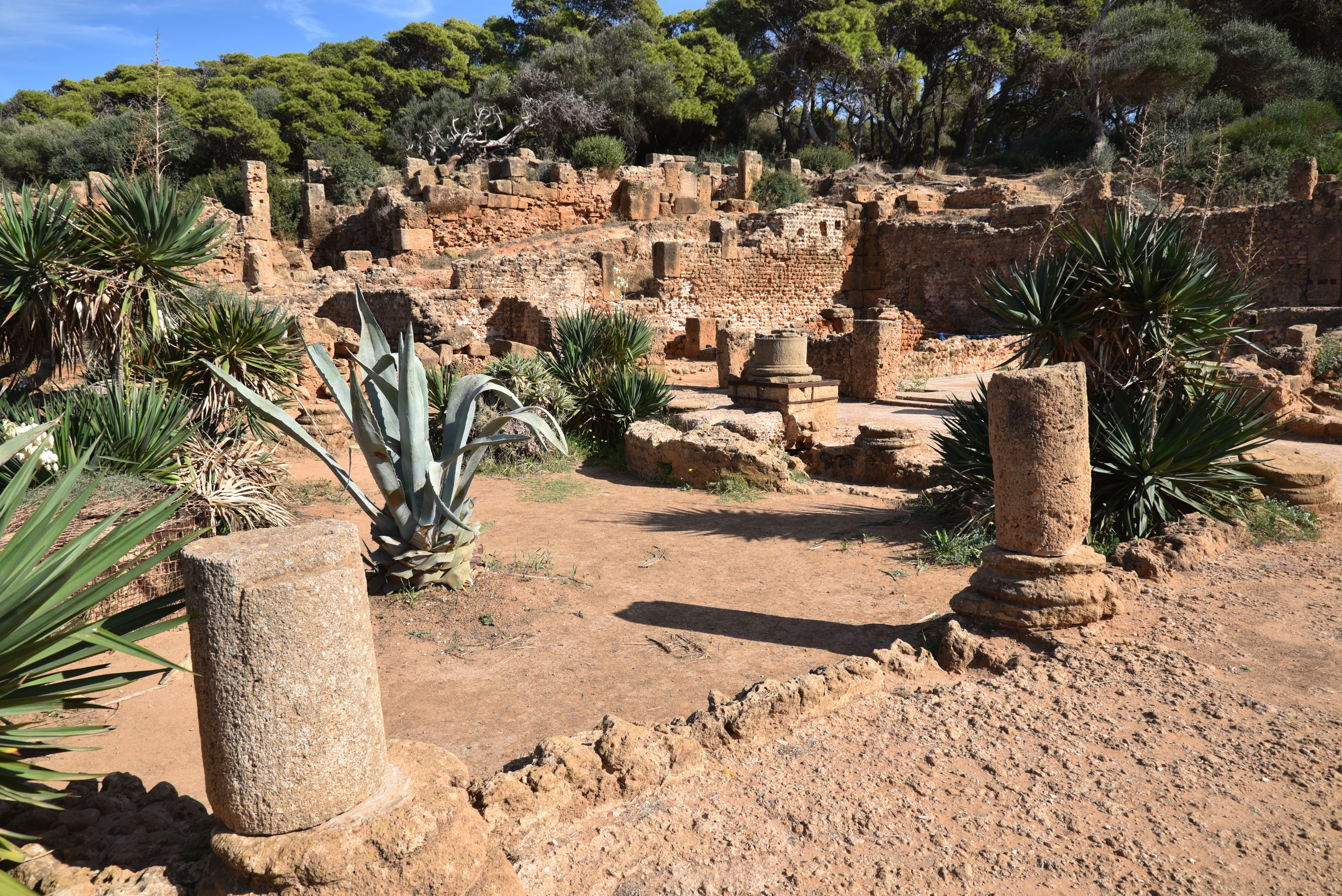
The Capitolium, dedicated to Jupiter, Juno, Minerva and Genius of the Colony. It was built in AD 246 and restored in 346-7.The Capitolium had eight columns across its facade.The Capitolium was enclosed by a rectangular porticoed court (mistakenly identified as a forum).The so-called Unidentified Temple, with its foundations standing in a porticoed precinct and facing north (instead of East), possibly serving as a curia.The so-called Unidentified Temple.Inscription dedicated to Victoria Augusta, AE 1916 0022, Marcus Virrius Diadumenus, a veteran of Legio III Augusta, erected a statue of Victory using his own money on the occasion of his promotion to the rank of the perpetual priesthood by his colleagues of the curia Hadriana, which they conferred on him in his absence.
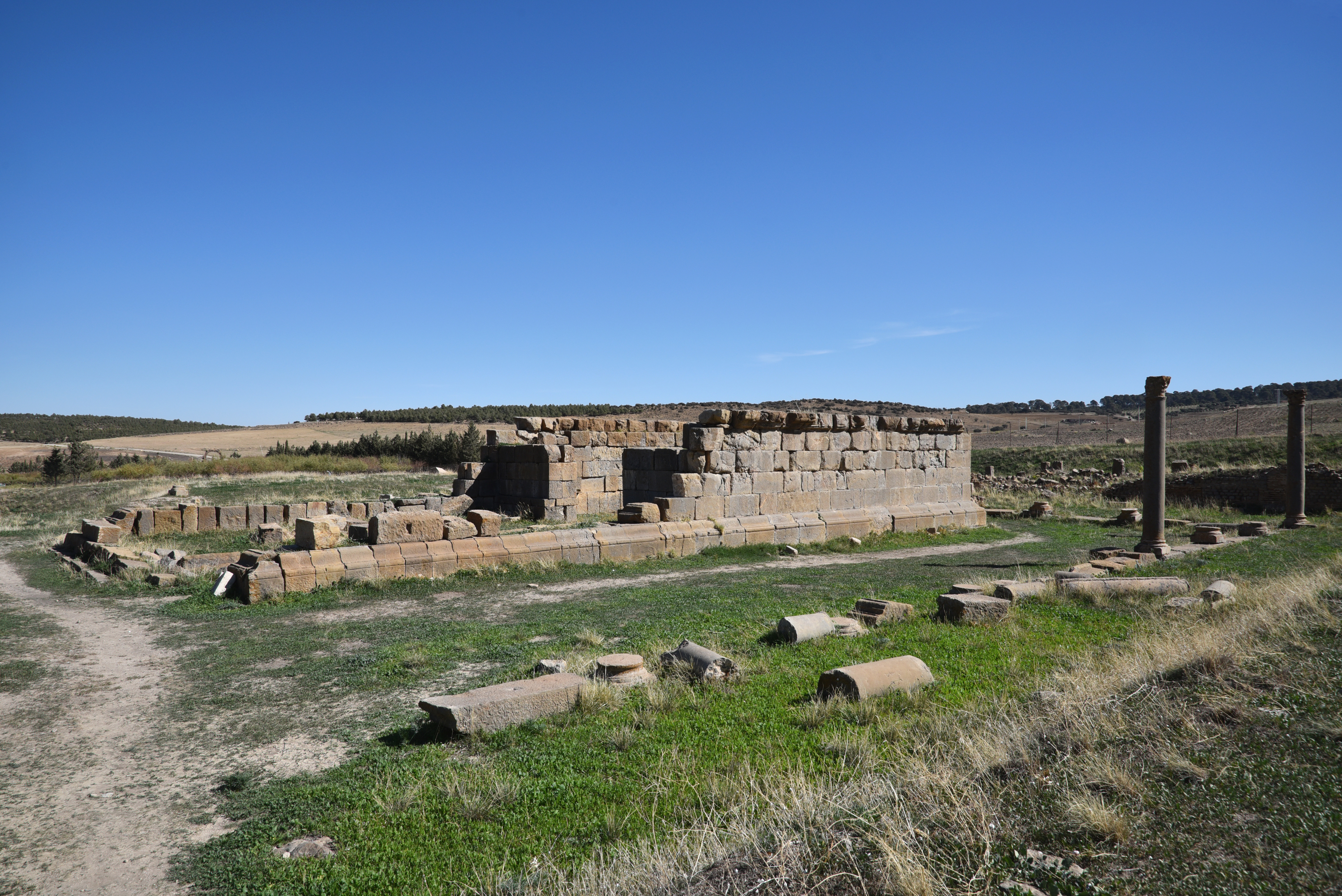
The Severan Septizonium, a monumental nymphaeum built during the reign of Septimius Severus in AD 203 and restored by Alexander Severus. It had seven niches with water flowing down into three basins and was decorated with marble ornament and fluted columns.The road leading to Verecunda, a small market town located between Lambaesis and Thamugadi, features two gates. The nearer gate has three bays and is largely constructed from reused inscriptions. The farther gate, which dates back to the time of Commodus, has only one bay.
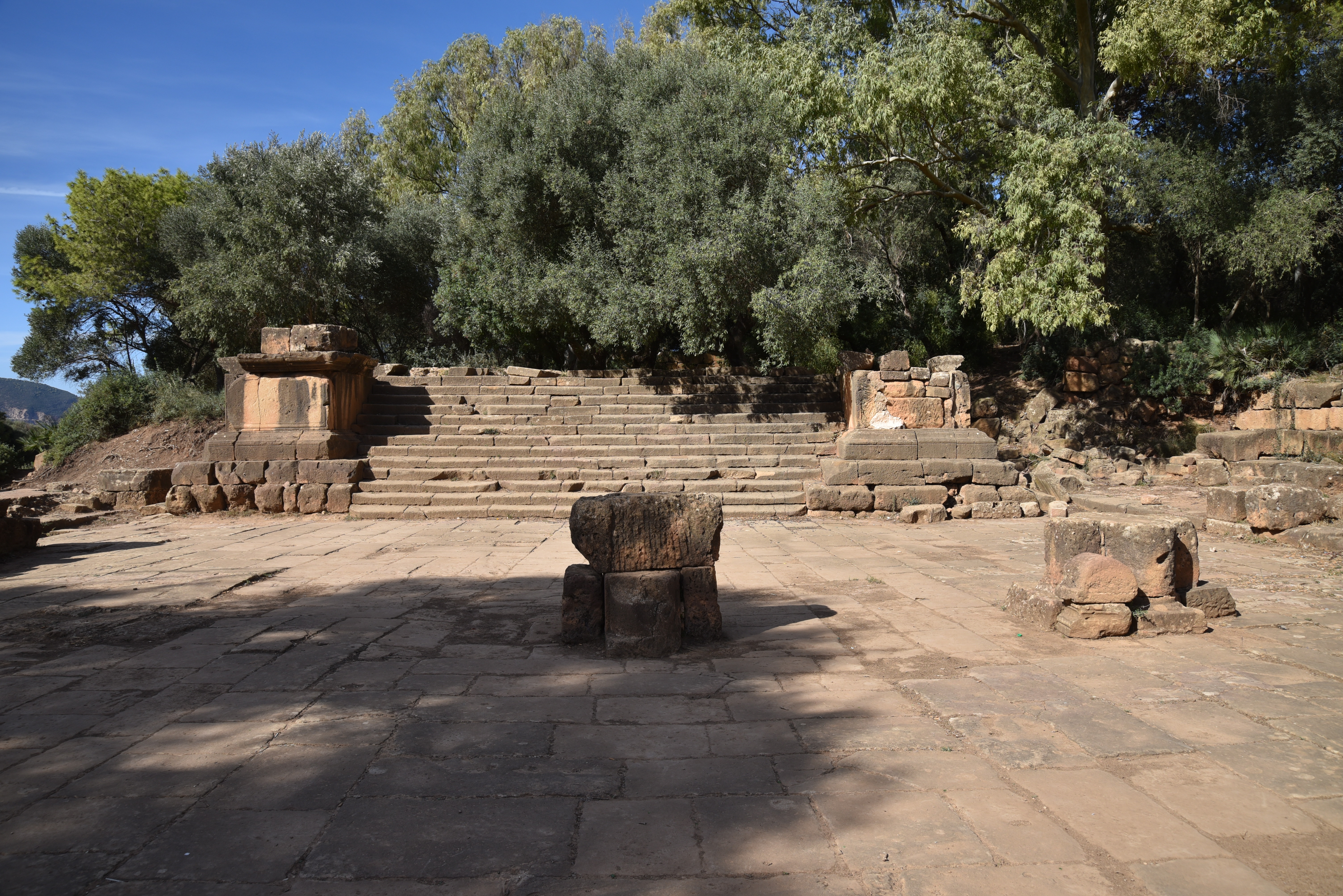
The Sanctuary of Asclepius with the Temple of Asclepius and Salus (left) and the Shrine of Silvanus (Right), a god of woodland associated with the Third Legion.The Shrine of Silvanus in the Sanctuary of Asclepius with the name of the Third Legion partially obliterated following its damnatio memoriae.The Doric Temple of Asclepius, dedicated by the legate of the Legio III Augusta in AD 162 to the worship of Asclepius and Salus (Hygeia, the personification of Health).Small shrines in the Sanctuary of Asclepius dedicated to different local divinities.The Sanctuary of Asclepius with small shrines dedicated to different local divinities.
Local Museum
The interior of the museum building with the statues of Aesculapius and Hygeia from the Sanctuary of Asclepius (Asklepieion).The museum has some fine mosaics from wealthy residences outside the fort.Mosaic of Apollo and the nymph Cyrene, dated to the 2nd or 3rd century AD. Cyrene, who was loved by Apollo, holds a flagon in her left hand, which may symbolize the sacred spring of Cyrene. In her right hand, she holds a reed. Only Apollo’s bare arm is visible to the right, but he can be identified by the quiver on his shoulder.
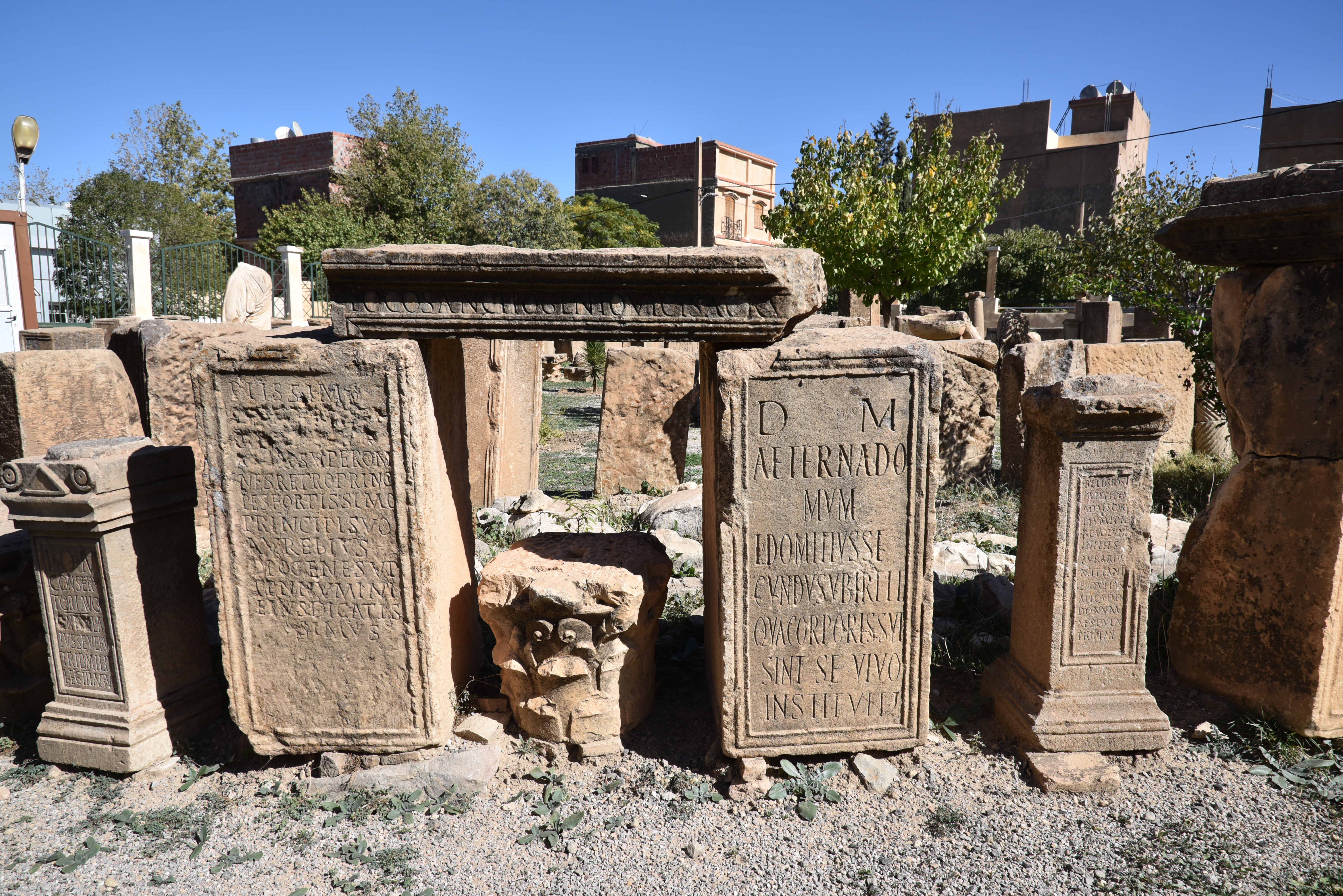
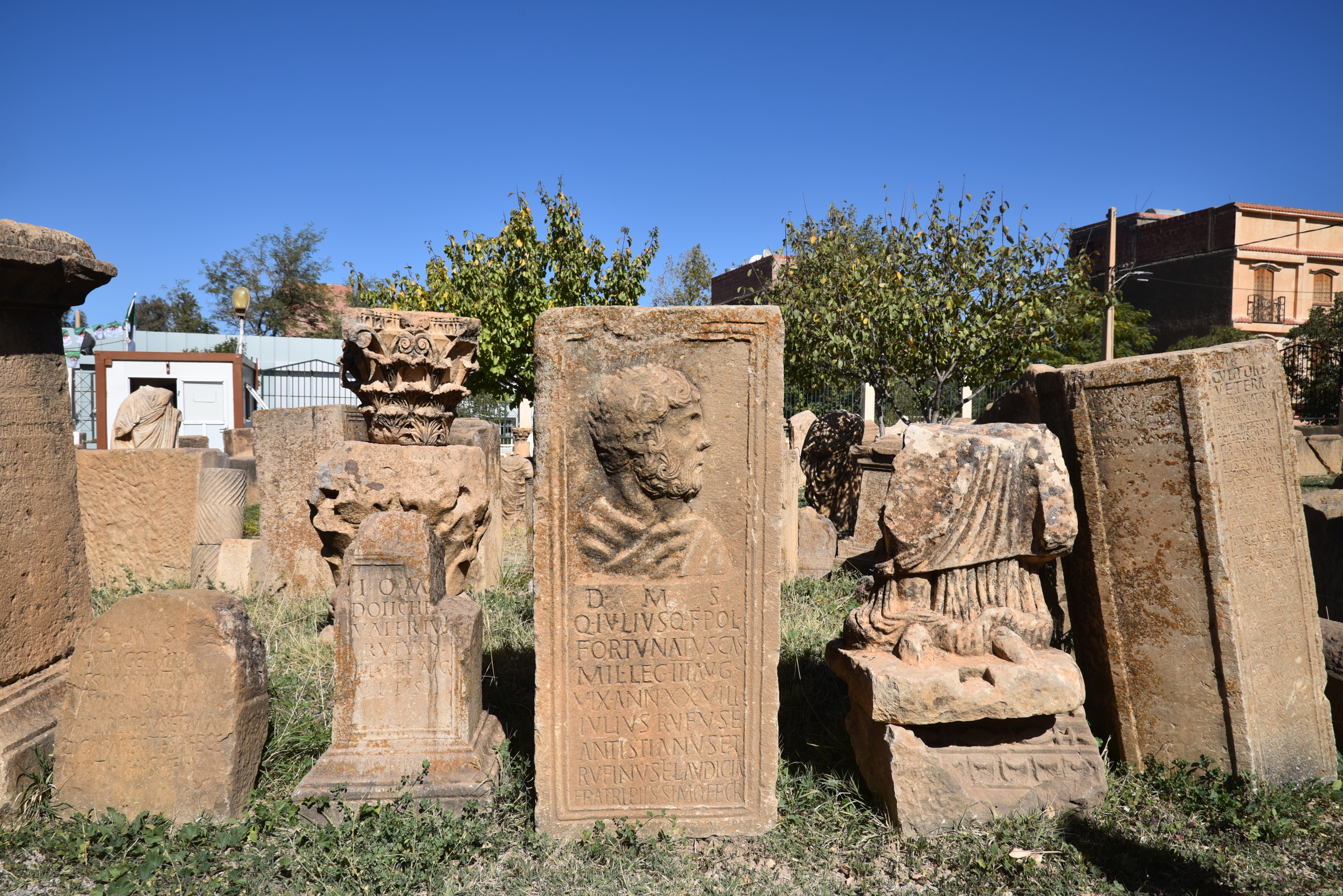
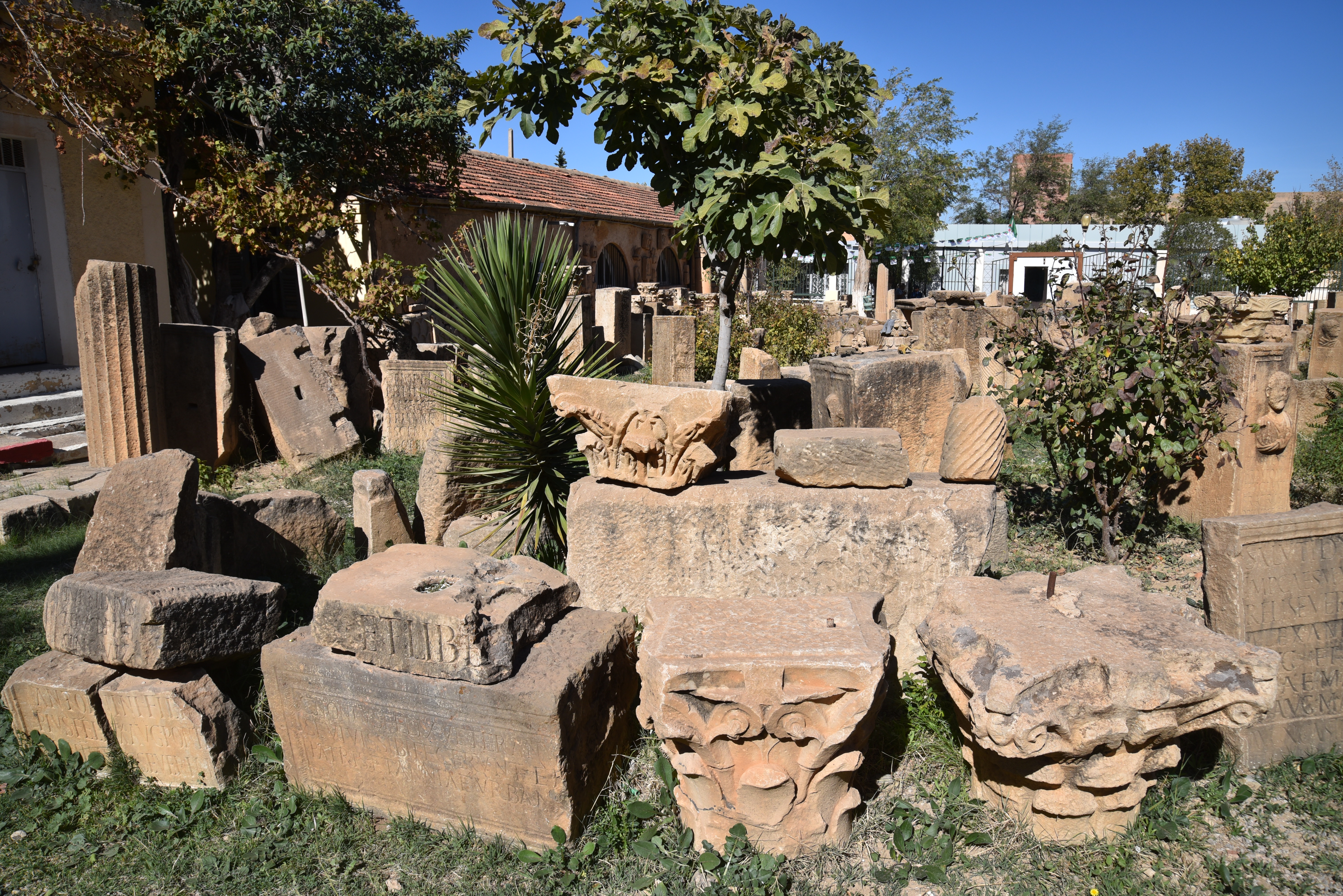
Inscriptions from Lambaesis in the epigraphic garden of the Lambaesis Museum.Inscription from the nymphaeum-septizonium built by Alexander Severus (CIL VIII 2659). Dated AD 222-235. Gift of the Alexandrian waters (the new aqueduct leading to Lambaesis) to the Lambaesitans by Emperor Severus Alexander.Dedication to Aesculapius and Hygia (CIL VIII 2589). Dated AD 247/248.Dedicatory inscription commemorating the repair of an aqueduct called the Aqua Titulensis by Aelius Rufus in collaboration with Severinius Apronianus, the governor of the province of Numidia (CIL VIII 2661). Dated AD 276-282.Inscriptions from Lambaesis (Numidia) in the epigraphic garden of the Lambaesis Museum.Tombstone of Sextus Vettius Geminus, a veteran of Legio III Augusta who served as a signifier (standard-bearer). He lived sixty years.Inscriptions and architectural fragments from Lambaesis in the epigraphic garden of the Lambaesis Museum.
Blas de Roblès, Jean-Marie; Sintes, Claude; Kenrick, Philip. Classical Antiquities of Algeria: A Selective Guide (p. 127). Society for Libyan Studies. pp. 343-373
Lambaesis: the Best-Preserved Legionary Fort YouTube video
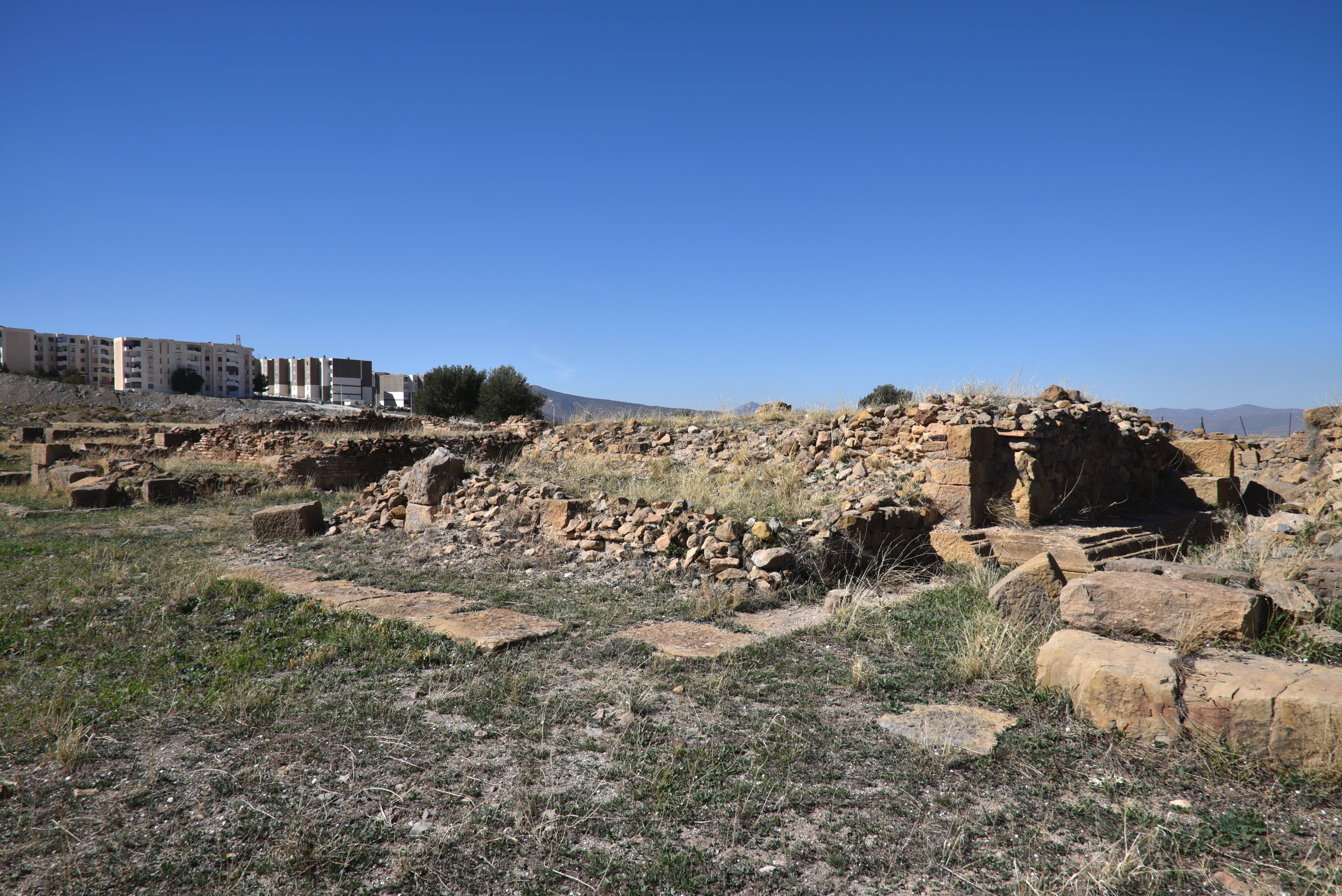
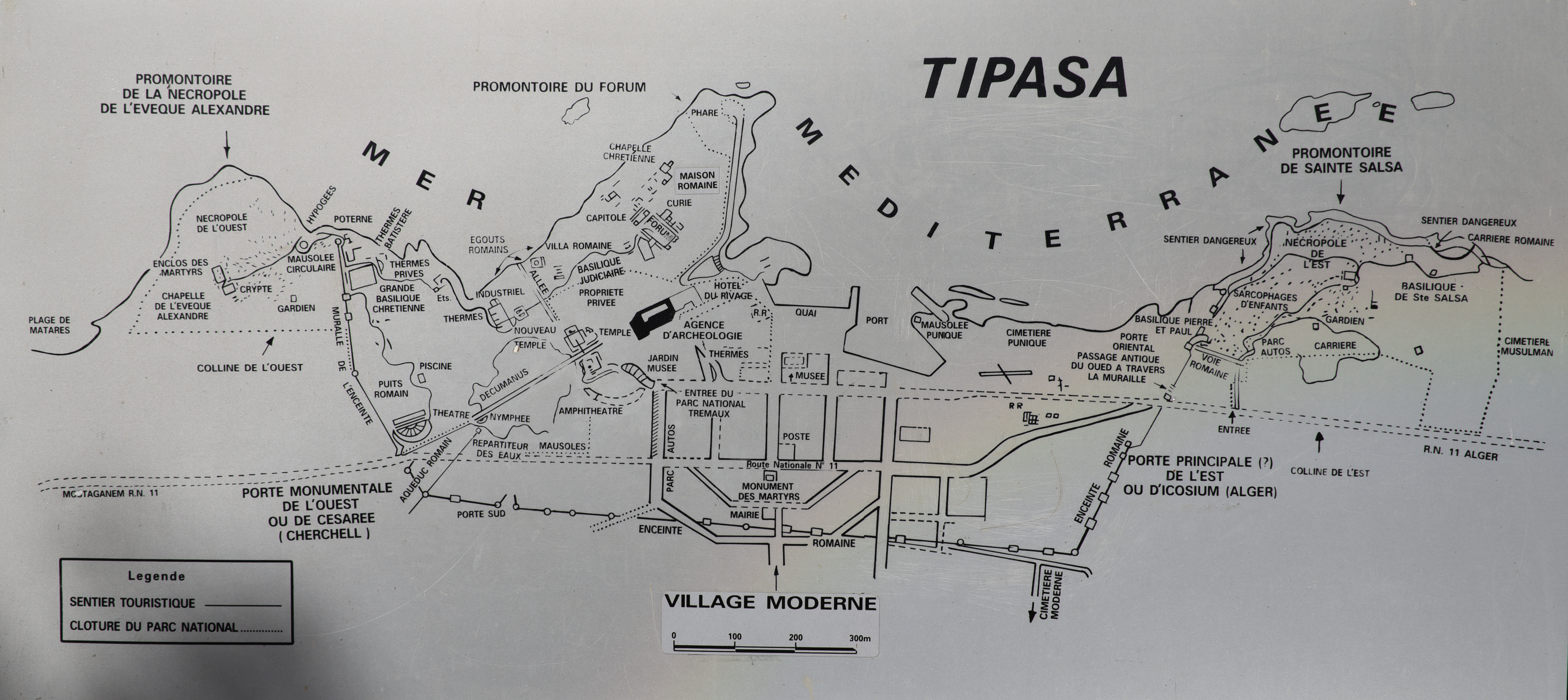
The archaeological site of Tipasa is located on the Mediterranean coast of Algeria, approximately 70 kilometres west of the capital, Algiers. It is a UNESCO World Heritage Site that showcases an extraordinary mix of ancient cultures, including Punic, Roman, early Christian, and Byzantine influences. Tipasa was originally established as a Punic trading post and later grew into a prosperous Roman colony in the 2nd century AD, situated to the west of ancient Iol-Caesarea (modern-day Cherchell), the former capital of the Roman province of Mauretania Caesariensis. Like other coastal cities in Algeria, Tipasa adopted Christianity in the first half of the 4th century AD. However, following the Arab invasion, the city gradually declined from the 6th century AD onward.
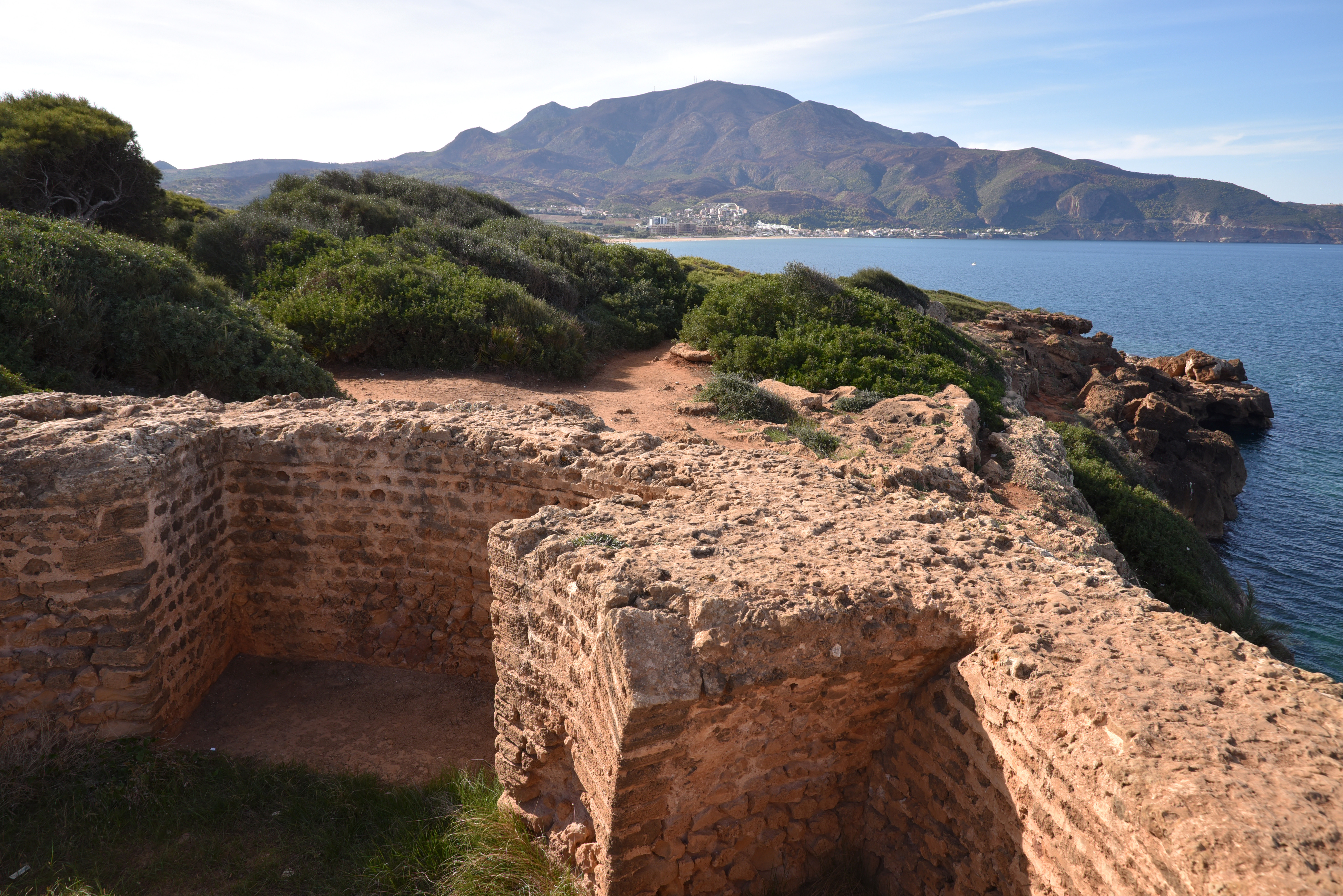
Tipasa was a Punic trading post located along the sea route between Carthage and the Pillars of Hercules (Straits of Gibraltar). Very little remains of the early settlement, except for traces of a necropolis dating back to the 6th or 5th century BC. Rome conquered the city in the 1st century AD, and in AD 46, it was designated as a municipium with Latin rights under Emperor Claudius (Pliny NH 5.2.20). Later, it became a colonia under Emperor Hadrian, bearing the name Colonia Aelia Tipasensium (AE 1958, 129). In the 2nd and 3rd centuries AD, Tipasa enjoyed a time of great prosperity. This period saw the construction of a 2.3 km long enclosing wall that featured 31 towers. Tipasa’s prosperity was primarily driven by trade in the Mediterranean, particularly in oil and garum.
During the reign of the Severan dynasty in the middle of the 3rd century AD, Moorish rebels were held at bay, allowing the cities of Africa to enjoy their greatest period of prosperity. Many of the public buildings that are still visible today were likely constructed during this time. With the ascendance of Christianity in the 3rd and 4th centuries AD, the city’s physiognomy changed and reached a population of 20,000 inhabitants. The older buildings fell out of use or were demolished, and Christian basilicas were built. During the 5th century AD, the city faced challenges due to the Vandals’ annexation of Africa. However, it began to recover under Byzantine control one century later, leading to a modest renaissance characterised by repairs and expansions to several churches. At the end of the 7th century, the city was demolished by Umayyad forces and reduced to ruins.
Map of Tipasa.
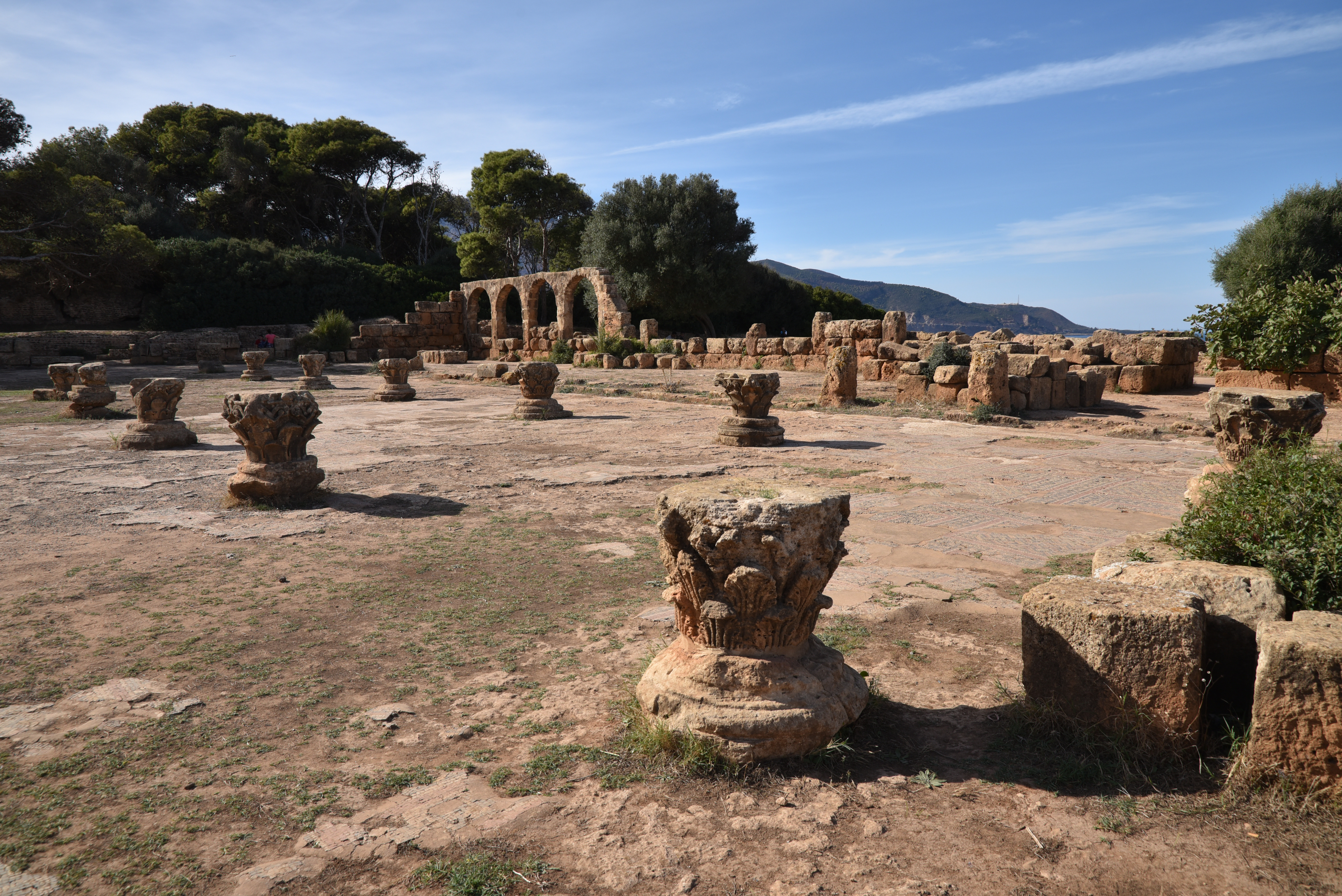
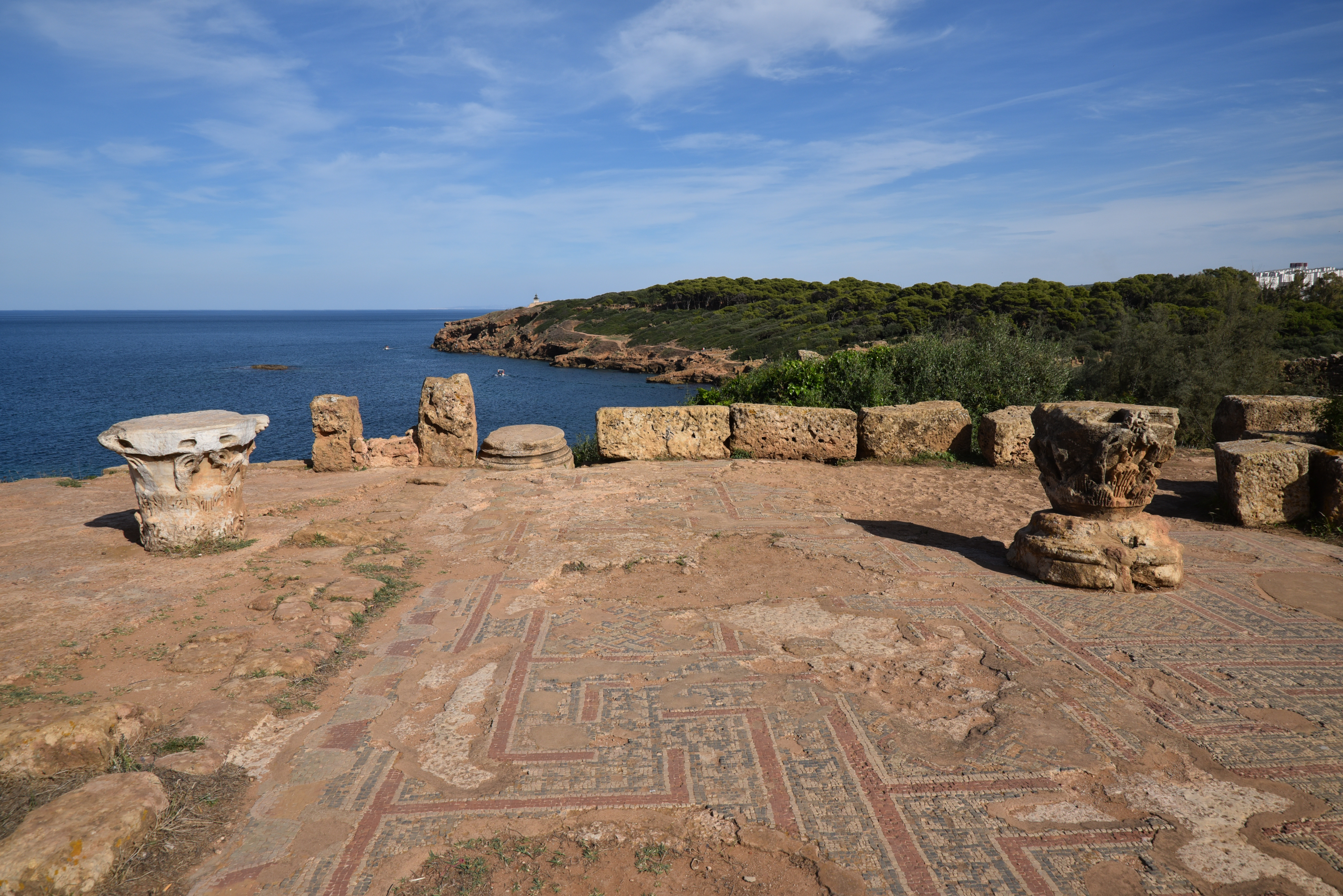
The main site of Tipasa is now a wooded archaeological park covering an area of 70 hectares. The entrance leads to an amphitheatre, and beyond it, a path guides visitors to the heart of the ancient town, where the two main streets, the paved cardo maximus and decumanus, intersect. To the east of the cardo lies the civic centre, including the Forum that originally featured porticoes on three sides, with the capitolium on the fourth side. This area also contains the curia (municipal assembly) and the civil basilica. Along the shoreline are several houses, including the so-called Villa of the Frescoes, a large residence measuring 1,000 square meters built in the mid-2nd century AD. The rooms of this villa open onto peristyles and are often decorated with mosaics and frescoes. Further inland is a theatre and a monumental semicircular fountain on the decumanus.
During Late Antiquity, Christians constructed various religious complexes, which included two basilicas, tombs, baths, and an impressive temple dedicated to the local martyr Saint Salsa. The Grand Basilica, featuring seven naves, was the largest Christian structure in North Africa upon its completion in the 4th century AD. The cemetery, adorned with carved tombs and inscriptions, provides valuable insight into the spread of Christianity throughout North Africa during this period.
The small museum outside the park showcases a variety of Punic and Christian funerary steles. It also features four tombstones dedicated to foreign cavalrymen who served in the auxiliary forces of the Roman army stationed at Tipasa. The museum also displays mosaics, including one depicting a captive family crouching with their hands bound.
PORTFOLIO
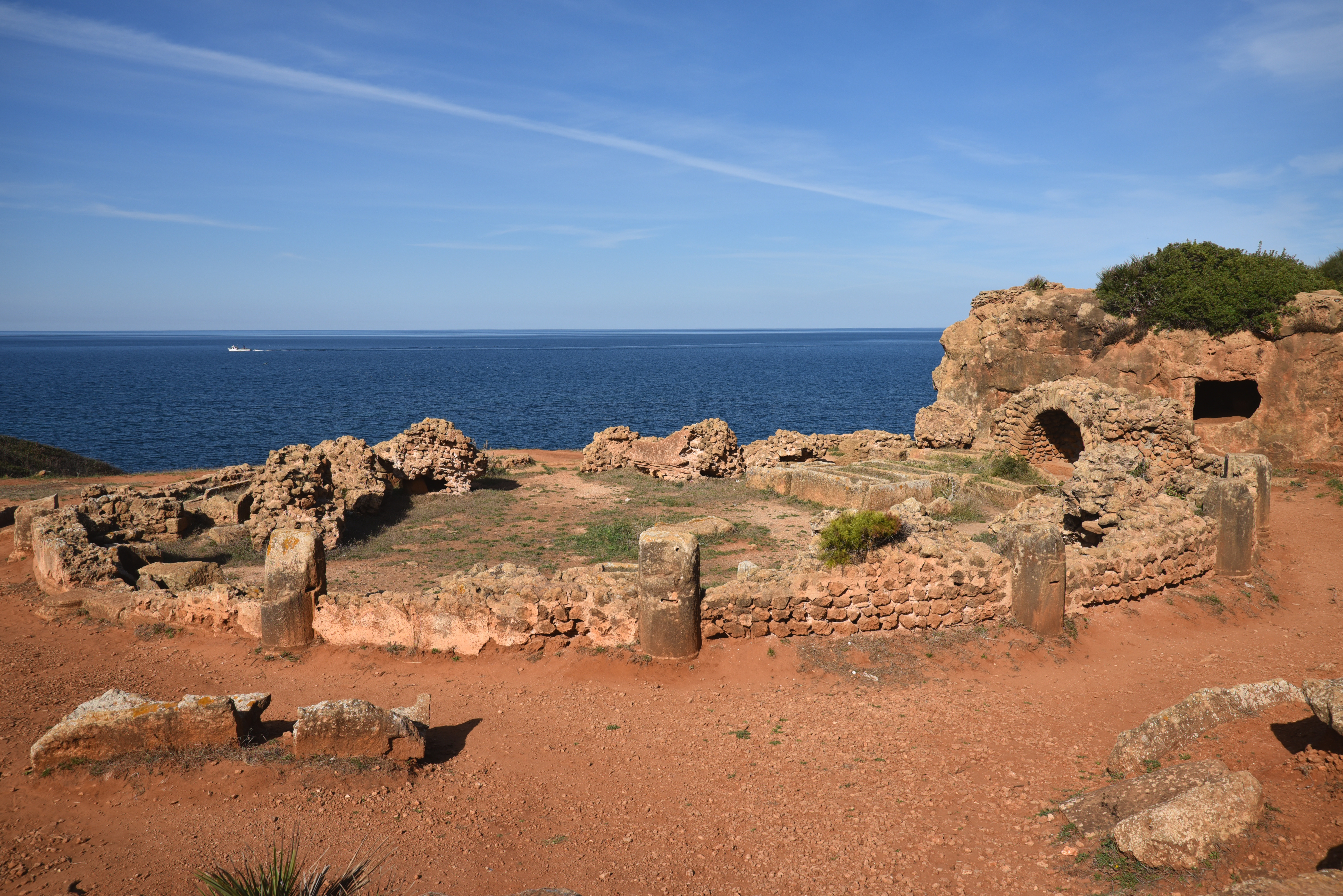
The amphitheatre with an elliptical arena measures 80 metres. It is dated to the Severan period. Only the podium wall and part of the vaulted substructures that once supported the seating remain.The amphitheatre was built using various re-used materials, including tombstones. One tombstone (now in the onsite museum) was of a cavalryman of the Ala I Ulpia Contariorum (see here). A water channel was perhaps used to flood the arena for mock sea battles (naumachiae).The eastern entrance to the amphitheatre.The Unidentified Temple dated to late 2nd century AD or the early 3rd century AD. Only the podium and the frontal stairway leading to the cella survive, as well as the foundations of the sacrificial altar.The Unidentified Temple stood within a precinct surrounded by a triple portico which opened onto the Decumanus Maximus.The Decumanus Maximus. The east–west-oriented road was 14 m wide and bordered by raised porticoes.The Decumanus Maximus.The New Temple. It is dated to the end of the 2nd century or beginning of the 3rd century AD and stood on a podium within a porticoed precinct.The Cardo Maximus extended towards the sea. The street was paved and bordered by porticoes supported by rows of piers.The Cardo Maximus.The Villa of the Frescoes, a wealthy townhouse of 1,000 sq.m built in the middle of the 2nd century AD.The Villa of the Frescoes is named for its once splendid wall decorations, of which fragments were discovered during excavation.Mosaic floor in one of the rooms of the Villa of the Frescoes.View of the Villa of the Frescoes from the west.Garum factory with four square tanks for macerating the fish. Garum was a sauce made up of small fish and the intestines of large ones, which were macerated with herbs. It was very popular in Rome and was one of the main exports of the African and Iberian provinces.The ruins of the Public Baths. They were most probably destroyed following an earthquake and were never repaired.The Public Baths.The industrial quarter with the public baths in the background.The Theatre at Tipasa was built on flat ground and raised upon vaults and piers. It was designed to accommodate 3,000 spectators.Unfortunately, the theatre has been largely reduced to its foundations. In 1847, the French military dismantled the stage and nearly all of the seating to construct a cholera hospital nearby in Marengo (now known as Hadjout).The Nymphaeum on the decumanus maximus, dated to between the end of the 3rd and the beginning of the 4th century AD. It was a monumental fountain dedicated to the Nymphs, adorned with statues between the columns.The Decumanus Maximus.The cross-section of the Cardo and the Decumanus.The Great Christian Basilica, built in the 4th century AD on the western hill using elements taken from the Capitolium.The central nave of the Great Christian Basilica was entirely paved with mosaics.The Great Christian Basilica of Tipasa is the largest Christian building excavated in Roman Africa. Particularly impressive, the basilica is 58 m long and 42 m wide and includes seven naves with some 700 sq.m of mosaic covering the basilica floor and decorating the central aisles.The baptistery of the Great Christian Basilica.The circular tower marking the northwest extremity of the defensive walls built in the middle of the 2nd century AD.View of Tipasa looking east from the northwest tower.The Circular Mausoleum, a funerary monument probably dedicated to the cult of a martyr (martyrium) with fourteen vaulted recesses which accommodated the sarcophagi.
MUSEUM
The main hall of Tipaza’s small museum.Mosaic of the Captives depicting a captive family (a Moorish tribal chief with his wife and son) crouching with their hands bound, surrounded by twelve portraits of Africans. It once occupied the apse of the Civil Basilica, ca. AD 200-300.The Pax et Concordia Mosaic, a stone mosaic mensa (banqueting table) cover from the Necropolis of Tipasa-Matares. Verse inscription (AE 1979, 682): In Chr(ist)o Deo/ pax et concordia sit/ convivio nostro (“In God (Christ), may peace and concord be on our banquet”).
Blas de Roblès, Jean-Marie; Sintes, Claude; Kenrick, Philip. Classical Antiquities of Algeria: A Selective Guide (p. 127). Society for Libyan Studies. pp. 120-163