Tarsus

Tarsus, an ancient city with roots dating back to the Bronze Age, is one of the oldest continually inhabited settlements in history. Located on the western part of the Cilician plain along the Cydnus River, Tarsus boasts a rich cultural and historical tapestry renowned for its contributions to philosophy, education, and trade. During the Roman Empire, Tarsus was the capital of the province of Cilicia. It was the scene of the first meeting between Mark Antony and Cleopatra and the birthplace of Paul the Apostle.

Coordinates: 36°55’03.2″N 34°53’34.3″E

Tarsus has a storied history spanning several millennia. Archaeological evidence suggests human habitation in the region dates back to the Neolithic period, in the 8th millennium BC. The city gained prominence during the Bronze Age and flourished under Hittite control. Tarsus became a significant player in the eastern Mediterranean trade network in antiquity, fostering connections with various civilisations, including the Assyrians and Persians. The Hittites called the region Kizzuwatna and made Tarsa their capital. The city’s strategic location contributed to its prosperity, as it served as a bridge between the Anatolian plateau and the coastal regions.

During the Hellenistic Period, Tarsus was known as Antiochia on the Cydnus and thrived as a centre for learning and philosophy. Tarsus also played a role in Alexander the Great’s military campaigns in 333 BC. As Alexander marched through Asia Minor, he reached Tarsus, which was then under Persian control. Whilst at Tarsus, Alexander fell seriously ill after swimming in the Cydnus. The city was eventually taken by Alexander, marking a key victory in his conquest of the Persian Empire. Tarsus then became a base for his further expeditions into the Levant and beyond.

Pompey brought Tarsus under Roman rule in 67 BC after crushing the feared Cilician pirates. It became the capital of the Roman province of Cilicia. To flatter Julius Caesar, it was briefly named Juliopolis. In 41 BC, the city was the scene of the first meeting between Mark Antony and Cleopatra. Tarsus reached its zenith during this period, experiencing economic prosperity and cultural flourishing. Dio Chrysostom calls the city “the greatest of all towns in Cilicia and a metropolis from the start” (Oration 34.7).

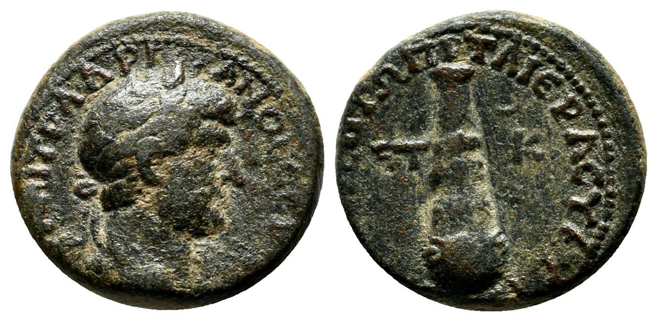
Hadrian visited Tarsus in AD 117 at the beginning of his reign while travelling back to Rome from Antioch (read here). Following the Emperor’s visit, Tarsus took the name Hadriane, and the Hadrianeia Olympia games were established, linked with the city’s new status as neokoros (temple warden). Tarsus also minted coins with obverses of Antinous as hero wearing the hemhem crown, issued sometime after his death in Egypt in 130. At Tarsus, Antinous received the epithets and attributes of both Dionysos and Apollo and was probably also assimilated to the local river god Kydnos.

Cilicia’s first koinon temple was built at Tarsus, most probably for the cult of Hadrian, which made the city neokoros for the first time. Tarsos’ first known use of neokoros is on coins with
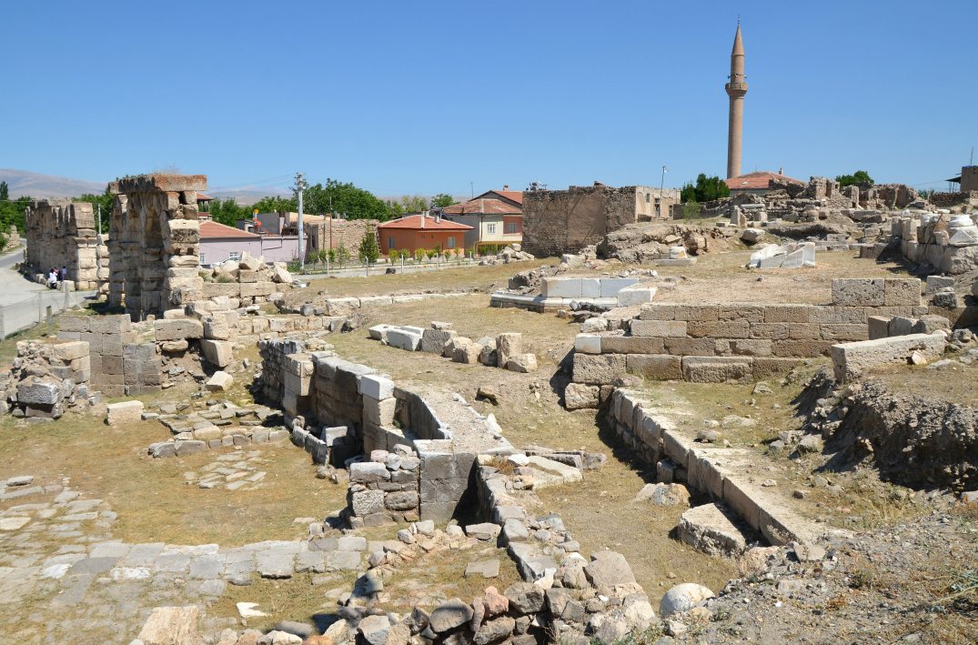
obverses of Antinous (RPC III, 3289), while the temple appears on reverses issued from the time of Hadrian to that of the young Commodus. Tarsus became twice neokoros under the reign of Commodus, whose city’s association with Heracles attracted his attention. The decastyle temple of Commodus at Tarsos may have been found at the site known as Donuktaş”, where foundations of a massive temple podium (ca. 106,80 m long and 50,70 m wide) have been identified to the east of Tarsus. Tarsus’ third neokoria was granted by Valerian and Gallienus around AD 253-260.

Coin of Hadrian minted in Tarsus showing a decastyle temple with the legends ΑΔΡΙΑΝΩΝ ΤΑΡϹΕΩΝ ΜΗΤΡΟΠΟΛΕΩϹ (Hadriane Tarsus, the metropolis of Cilicia) and ΚΟΙΝΟC ΚΙΛΙΚΙΑC (Koinon Cilicia) on the architrave. (RPC III, 3274).
Restitution of the Great Temple of Tarsus in Cilicia.
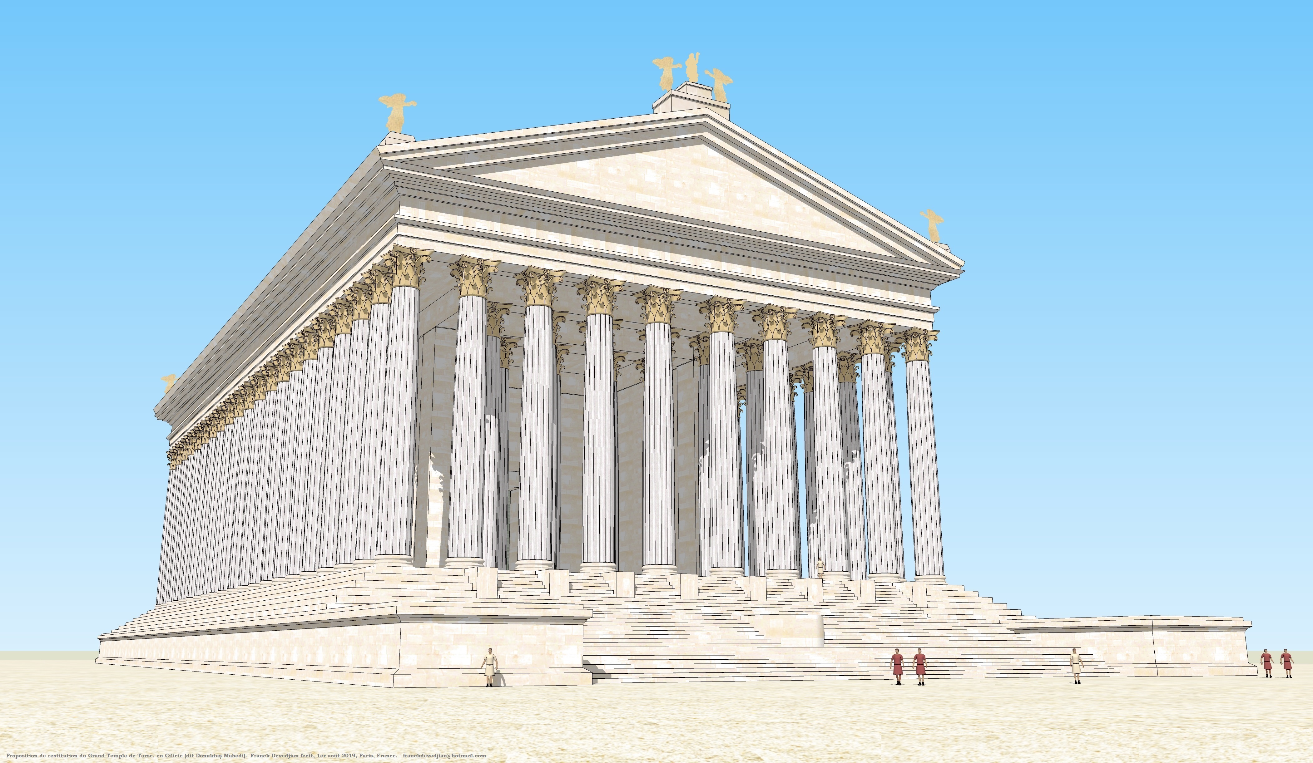
Author: Franck Devedjian (Wikimedia)

According to the Acts of the Apostles, Saul, the future Saint Paul, was born in Tarsus, a Roman citizen, although he was sent to study in Jerusalem and became a prominent member of the Jewish community there. Tarsus’ significance persisted into the Byzantine era, with the city remaining an important centre for trade and commerce. However, like many ancient cities, Tarsus faced challenges from invasions and shifting power dynamics. The Arab conquest in the 7th century AD and subsequent Seljuk Turkish rule marked transformative periods for Tarsus. The city eventually became part of the Ottoman Empire in the 16th century.

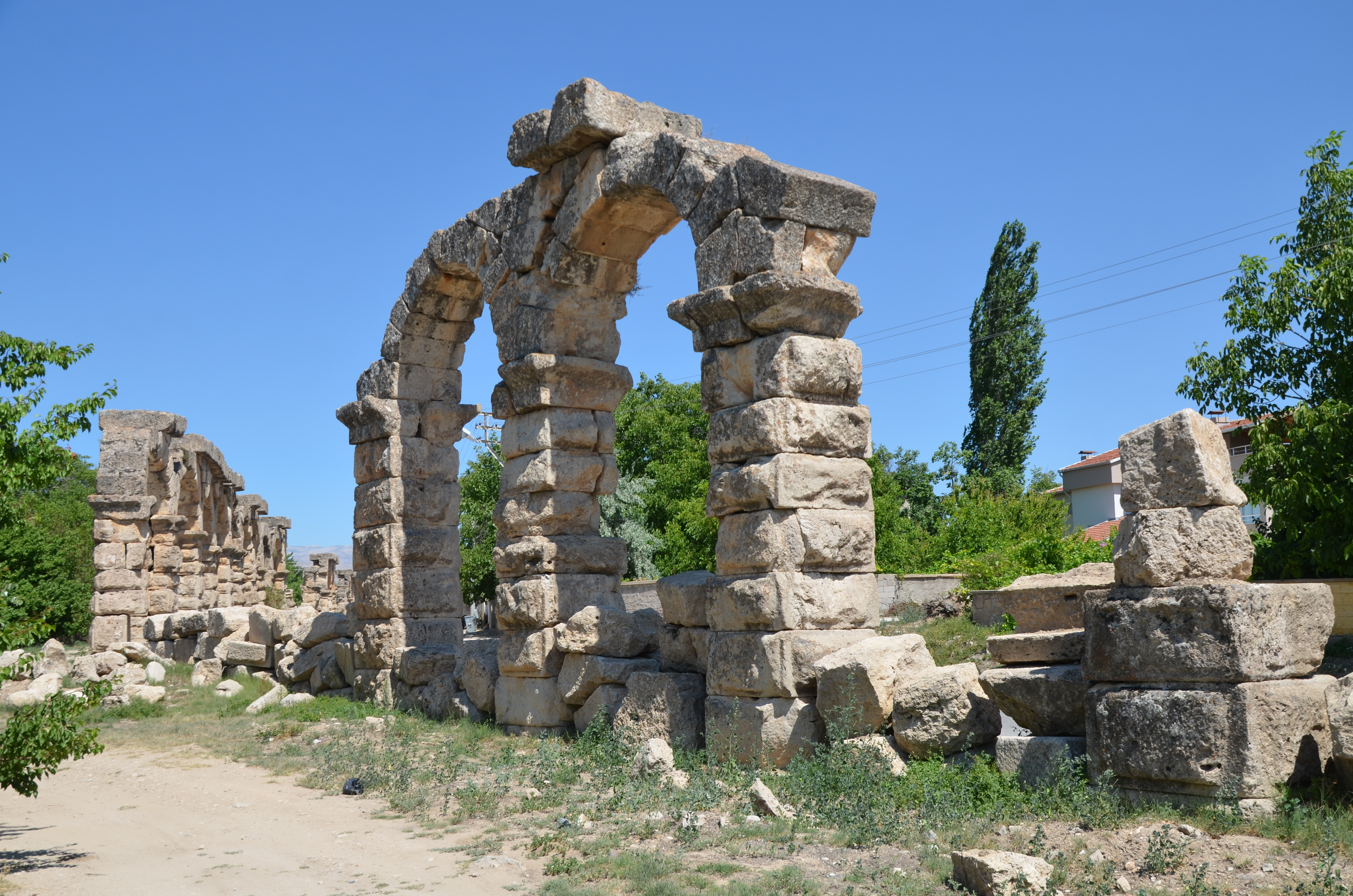
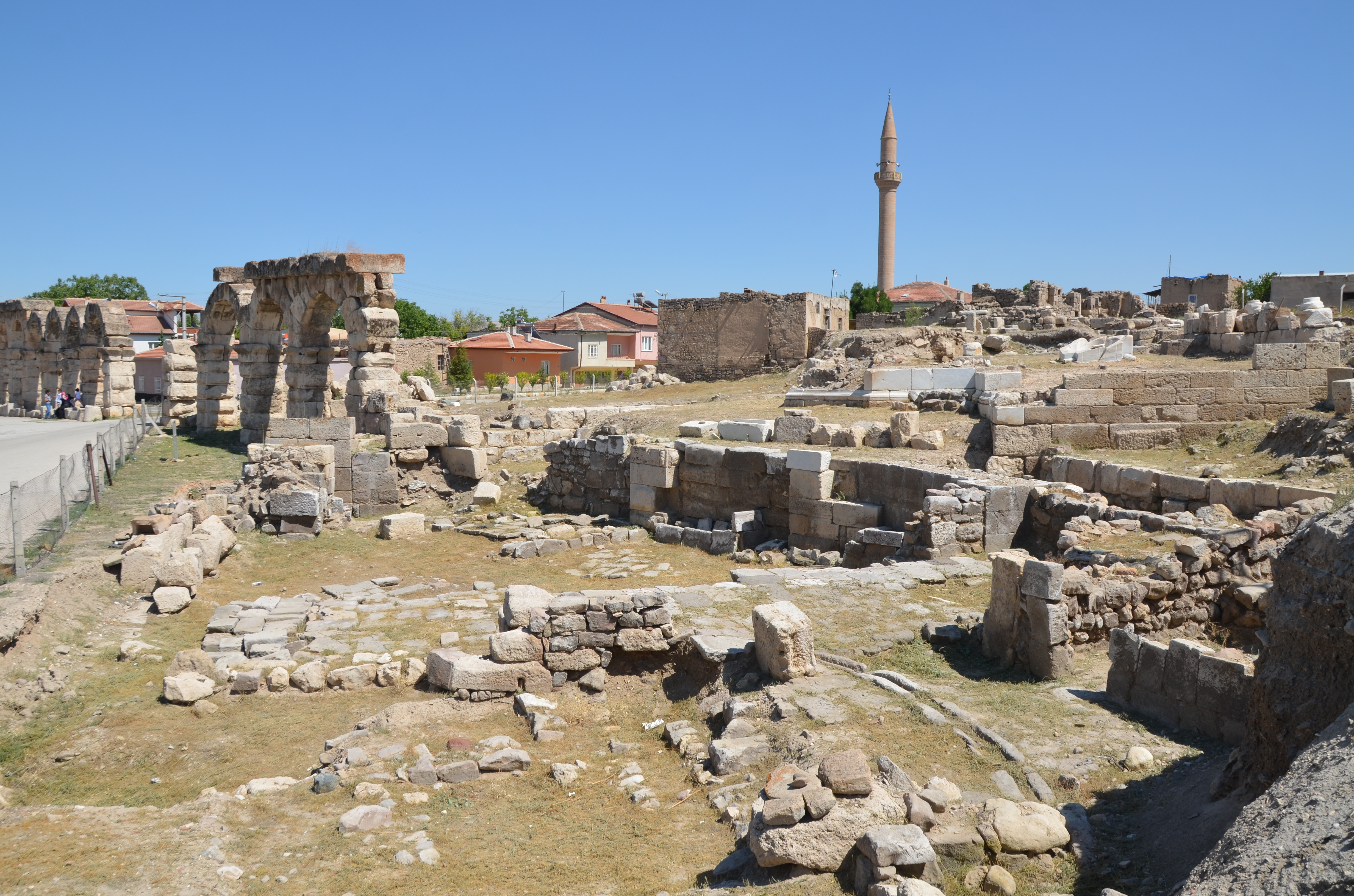
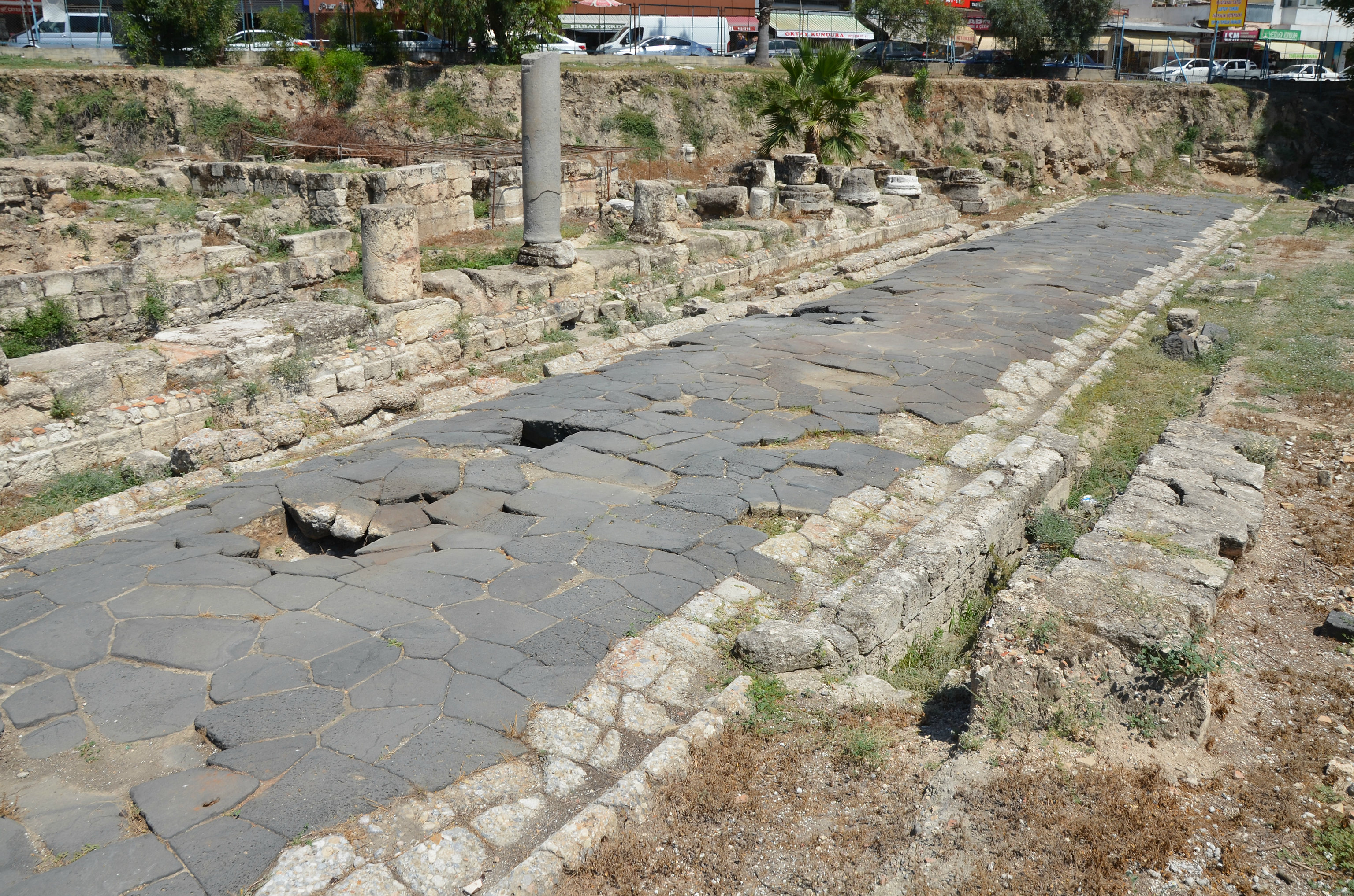
Classical Tarsus lies deep beneath the modern city, and recent excavations have revealed its ancient urban plan. A paved, collonaded street running east-west with shops and other buildings was unearthed in the heart of modern Tarsus in 1993. The road is about 6.5 m wide and paved with polygonal black basalt blocks, some 2 m wide. The street appears to have been built in the middle of the 2nd century BC during the Seleucid period, but the collonaded portico that flanked the street was built between the 2nd and 4th centuries AD.

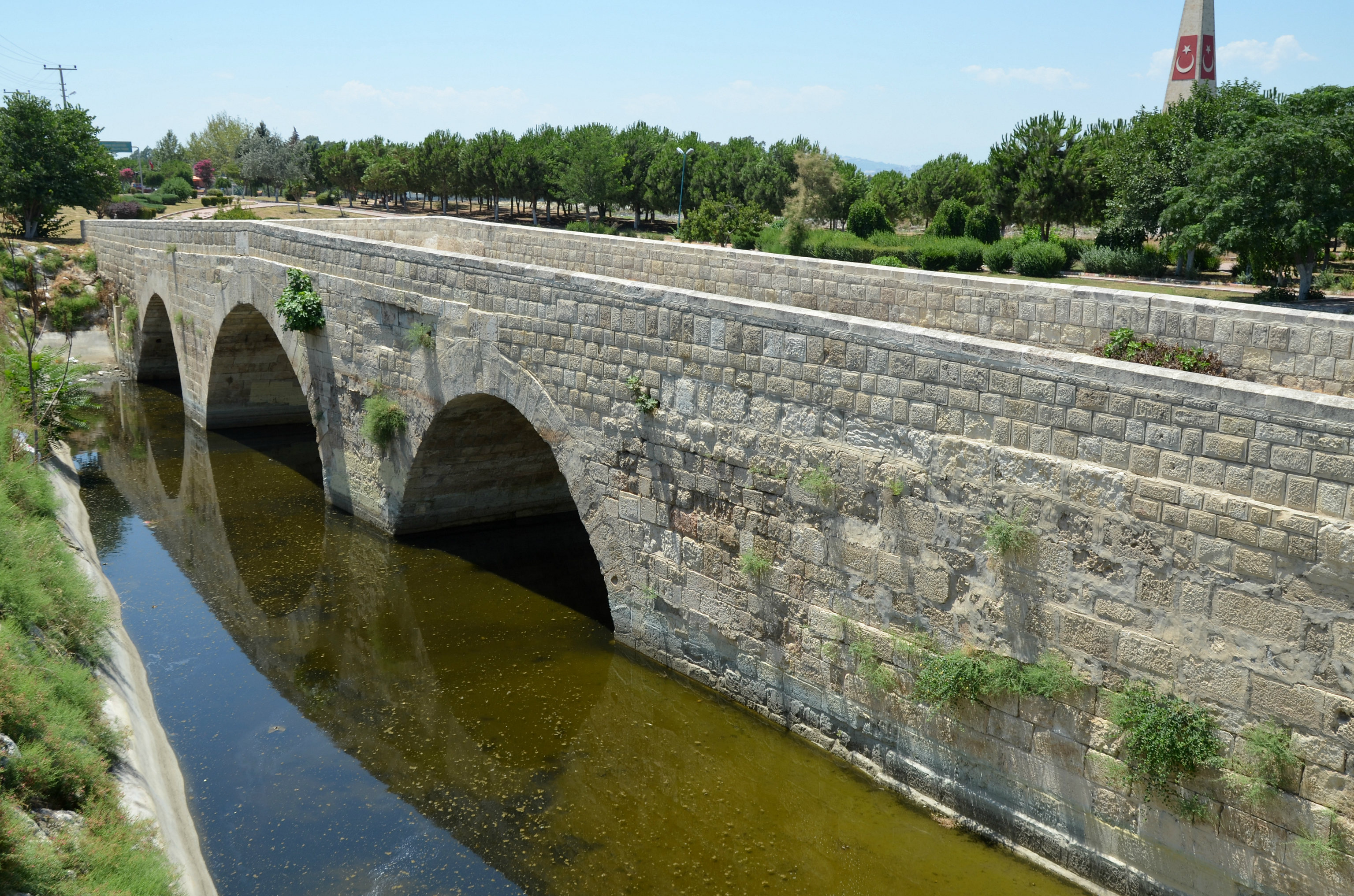
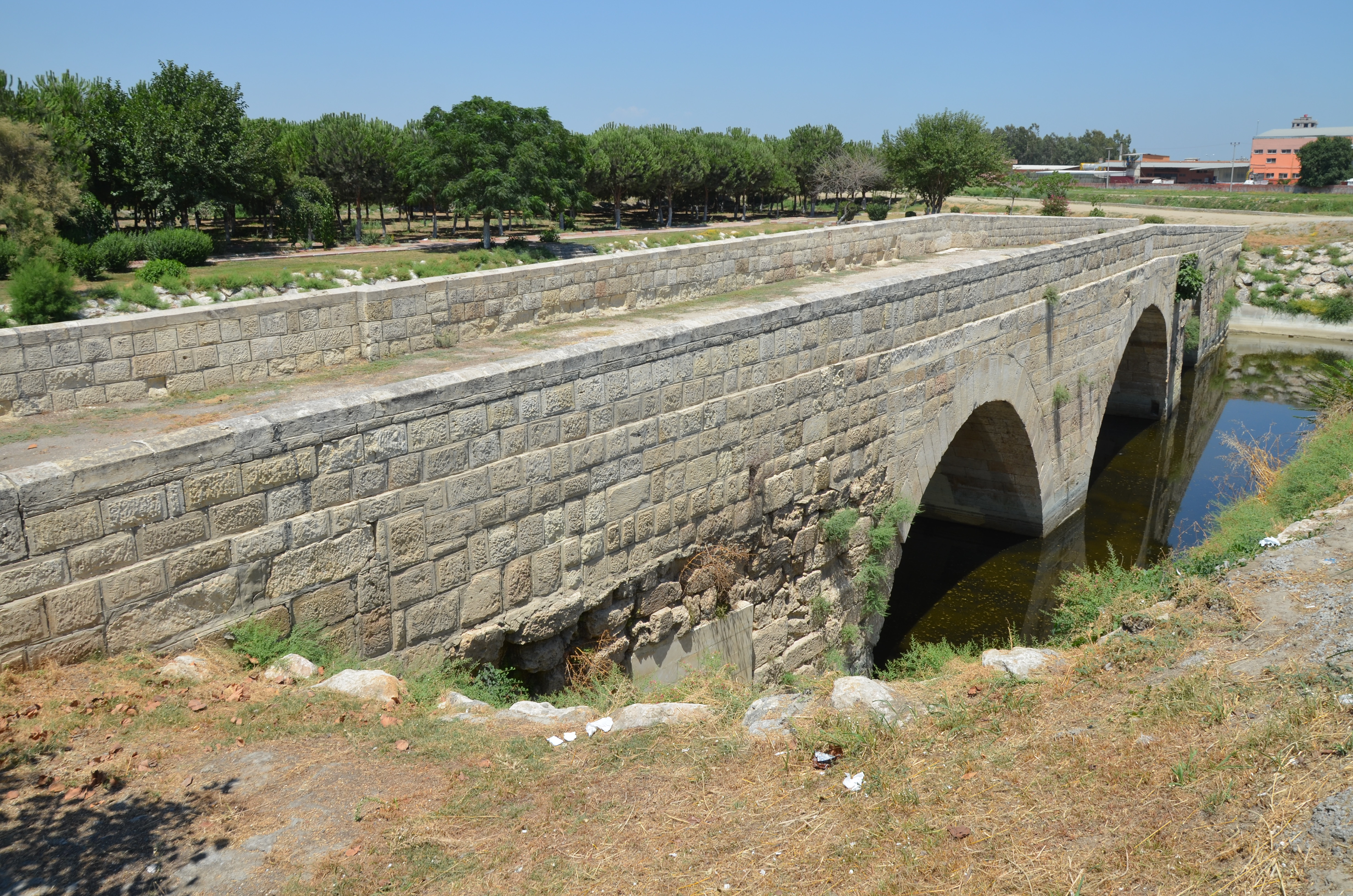
A long stretch of the Via Tauri between Tarsus and the Cilician Gates (known locally as Roma Yolu) can still be seen today, 12 miles north of the city near the village of Saglikli. The road was paved with polygonal limestone slabs and bordered with curbs. Caracalla repaired the Via Tauri in AD 217 by widening the tracks after the road collapsed. The repairs were done during Caracalla’s eastern expedition against the Parthians.

PORTFOLIO

The colonnaded street runs in an east-west direction, with shops and other buildings on both sides.
The road is about 6.5 m wide and paved with polygonal black basalt blocks, some 2 m wide.
The street appears to have been built in the middle of the 2nd century BC during the Seleucid period, but the colonnaded portico that flanked the street was built between the 2nd and 4th centuries AD.
The conglomerate foundations of a massive temple podium (ca. 106,80 m long and 50,70 m wide), today called “Donuktaş”. It probably dates to the time of Commodus when the city became twice neokoros.
The massive Temple of Tarsus was one of the largest and most important in antiquity. It was a Corinthian temple facing northeast, large enough to have had ten columns along the facade (49.60 m long) and twenty-one along the flank (105.30 m). Set on a podium 11.57 m high.
The Justinian “Cleopatra’slt by “the Byzantines in the 6th century AD over the earlier course of the Cydnus River (today’s Berdan River).
The Justinian Bridge.
Cleopatra’s Gate is a city gate named after the Egyptian queen Cleopatra VII. It was built in either the Byzantine or the Abbasid period on the site of an earlier gate.
The popular name of the Gate was Kancık Kapı (feminine Gate) during the late Ottoman period. However, in the early 20th century, the name Cleopatra kapısı (“Cleopatra’s Gate”) replaced the former name.
The so-called Saint Paul’s Well is a water well made of mostly rectangular-cut stone. It measures 1.15 metres (3 ft 9 in) in diameter at the top and has a depth of 38 metres (125 ft).
Saint Paul’s Church. According to tradition, the Saint Paul Church was built in 1102, but the present structure, a domeless basilica, was built (or rebuilt) much later, in 1862.
The Interior of Saint Paul’s Church features ceiling frescoes of Jesus in the middle and of Matthew, Mark, Luke, and John on the two sides.
The Via Tauri between Tarsus and the Cilician Gates.
The Via Tauri.

Links:

Tyana

Tyana is an ancient town in southern Cappadocia, located in Turkey in the village of Kemerhisar (“castle of the aqueduct”), ten miles south of Nigde. The city has a rich history dating back to the Hittites in the 2nd millennium BC. It gained prominence during the Hellenistic Period and became part of the Roman Empire. In the 1st century AD, Tyana was associated with the celebrated philosopher Apollonius of Tyana. Later, the city fell under Byzantine rule, followed by Arab and Seljuk invasions, before declining in the medieval period.

Coordinates: 37°49’32.0″N 34°34’26.4″E

Tyana was one of the most important cities of Central Anatolia for centuries and was known by several names. It was first reported in the Hittite archives under the name of Tuwanuwa and Tawuna in the Assyrian sourcesXenophon, who visited the city and described it as a “worldwide, big and blessed city” (Anabasis 1.2.20), mentions it under the name of Dana.

The name Tyana was first reported on coins minted by the Cappadocian ruler Αriaramnes (c. 255-220 BC) when it became the second most important city of the Cappadocian Kingdom. According to Strabo, the town was later renamed “Eusebeia near the Taurus” by King Ariarathes IV in the 2nd century BC. The new name remained in use until the Cappadocian Kingdom became a Roman province in AD 17, when the former name of Tyana was restored and established.

Coin of Hadrian minted in Tyana with the club of Herakles on the reverse. AD 117-138.
Coin from the author’s collection.

Tyana gained prominence during the Hellenistic Period but experienced significant development and prosperity under Roman rule. Due to its location, the city controlled the route from central Anatolia to the Cilician Gates and the Mediterranean. Several Roman Emperors, whose benefactions contributed significantly to Tyana’s development, visited the city on their way to the East. Hadrian‘s visits to Tyana in AD 117 and 129 further highlighted the city’s importance (read here).

One notable figure associated with Tyana in the Roman period is the philosopher Apollonius of Tyana, who lived in the 1st century AD. His teachings and reputed supernatural abilities elevated Tyana’s status, and the city became a centre for philosophical and religious activity. Hadrian’s interest in Tyana and its philosopher underscored the town’s cultural and intellectual significance in the Roman world. In AD 213, Tyana was renamed Colonia (Aureliana) Antoniana Tyanorum when Caracalla made the city a Roman colony, perhaps due to the Emperor’s admiration for the native philosopher and orator.

Coin bearing the image of Apollonius of Tyana.

Tyana continued to thrive through the later Roman period. In AD 372, Emperor Valens split the province of Cappadocia into two, and Tyana became the capital and metropolis of Cappadocia Secunda. The first Christian bishop is attested in AD 325. Tyana became a frontier city after the Muslim conquest of Cilicia, but lost much of its former importance and fell into decline in the 10th century AD.

Today, the ruins of Tyana are noteworthy, and the chief surviving monument is the Roman aqueduct, with many of its arches still standing. The aqueduct was built during the reign of the emperors Trajan and Hadrian. It brought fresh water to the city from a spring four miles east of Tyana. The site is currently being excavated, and public baths and an early Christian baptistery have been identified. In 2020, during excavations, a 1,600-year-old octagonal church and 4th-century AD coins were discovered (see here).

PORTFOLIO

The aqueduct of Tyana stretches along Tyana Caddesi for nearly 1.5 km from the town centre to the East.

The Roman aqueduct brought fresh water to the city from a spring four miles east of Tyana.

Arches of the Roman aqueduct.

Water was transported via subterranean clay pipes for 2.5 km and then along the aqueduct for the final 1.5 km.

Tyana archaeological site.

Tyana archaeological site.

Tyana archaeological site.

The water reservoir is a rectangular basin (23m x 66m x 2.5m) decorated with marble.

The water reservoir.

Links: