
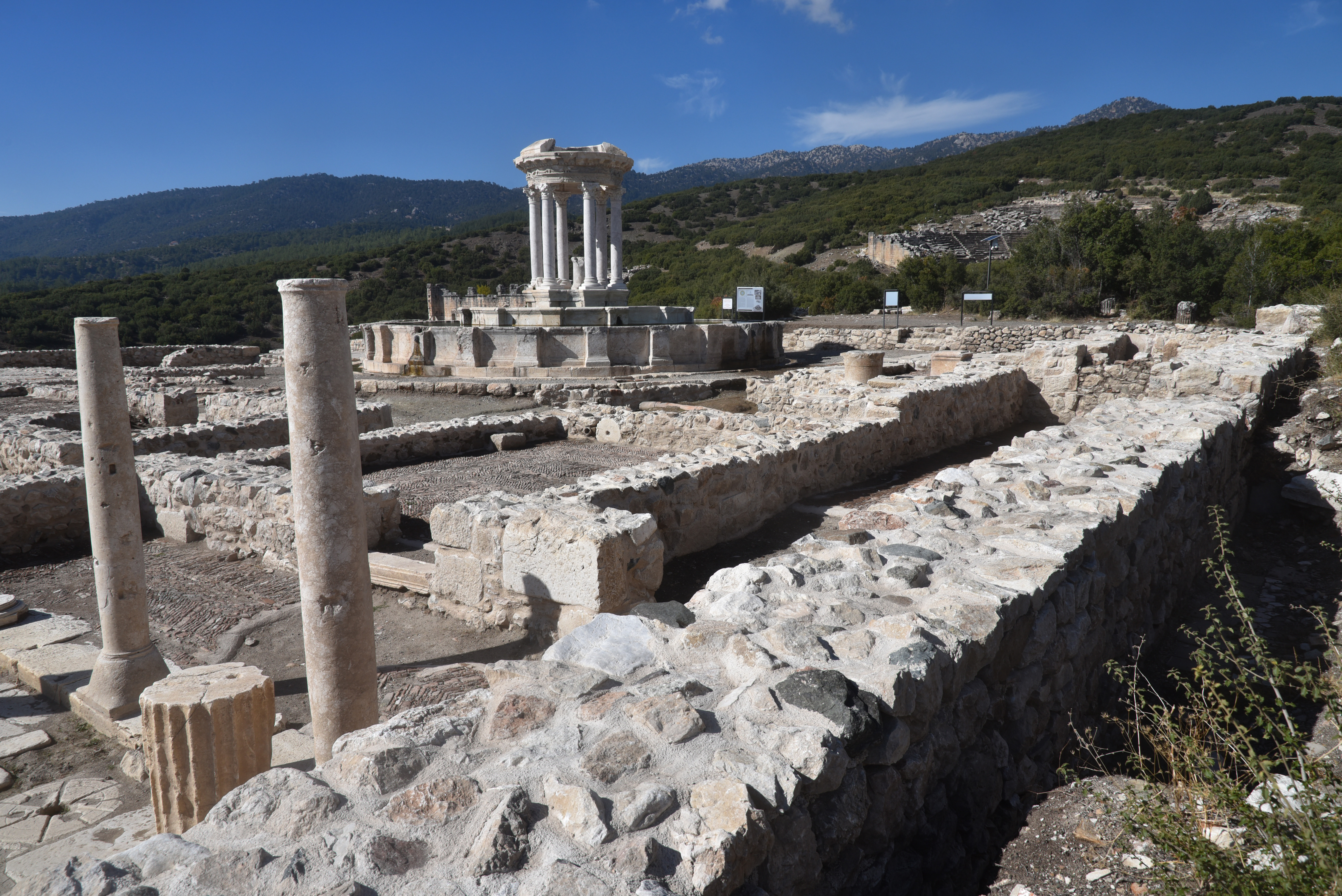
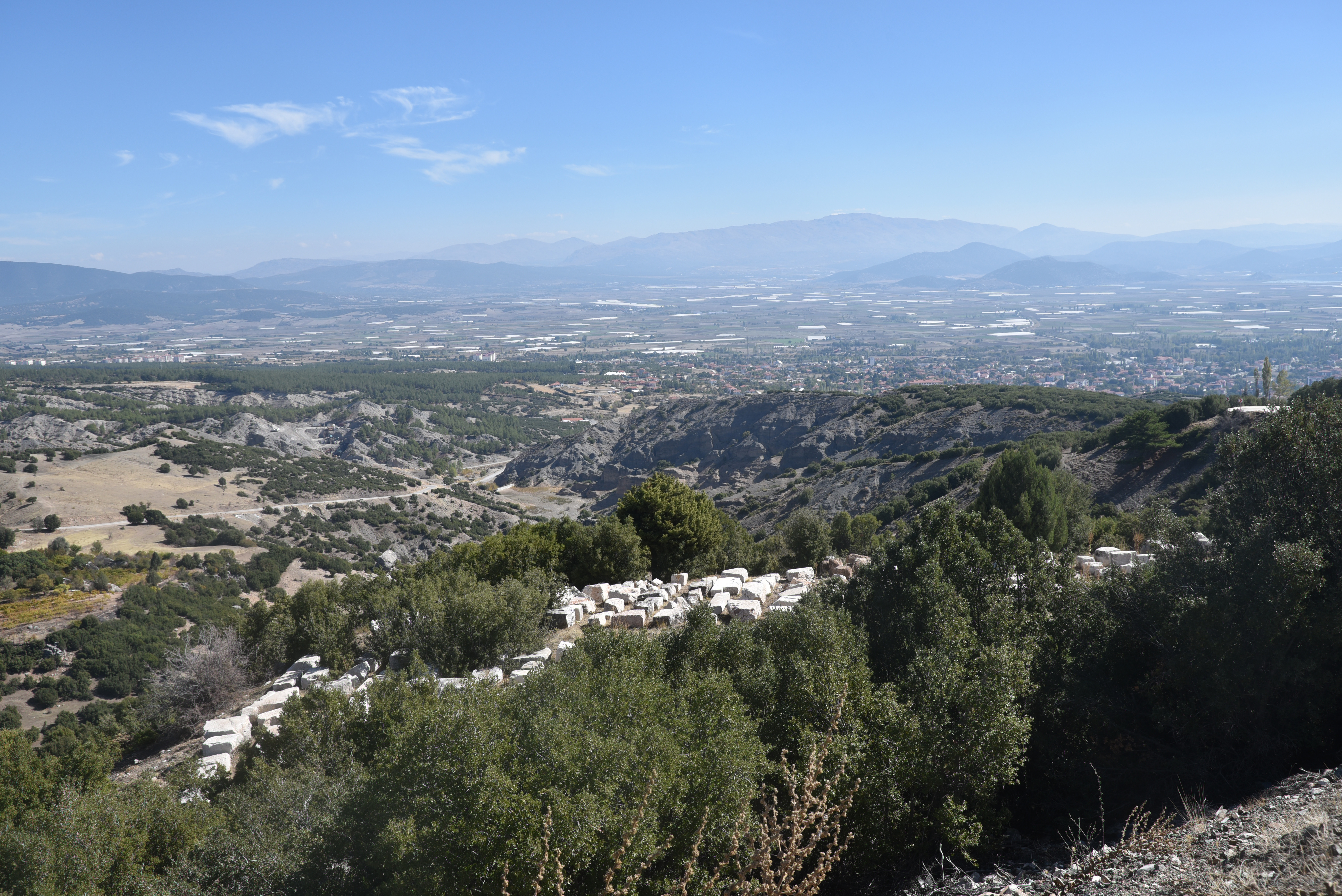
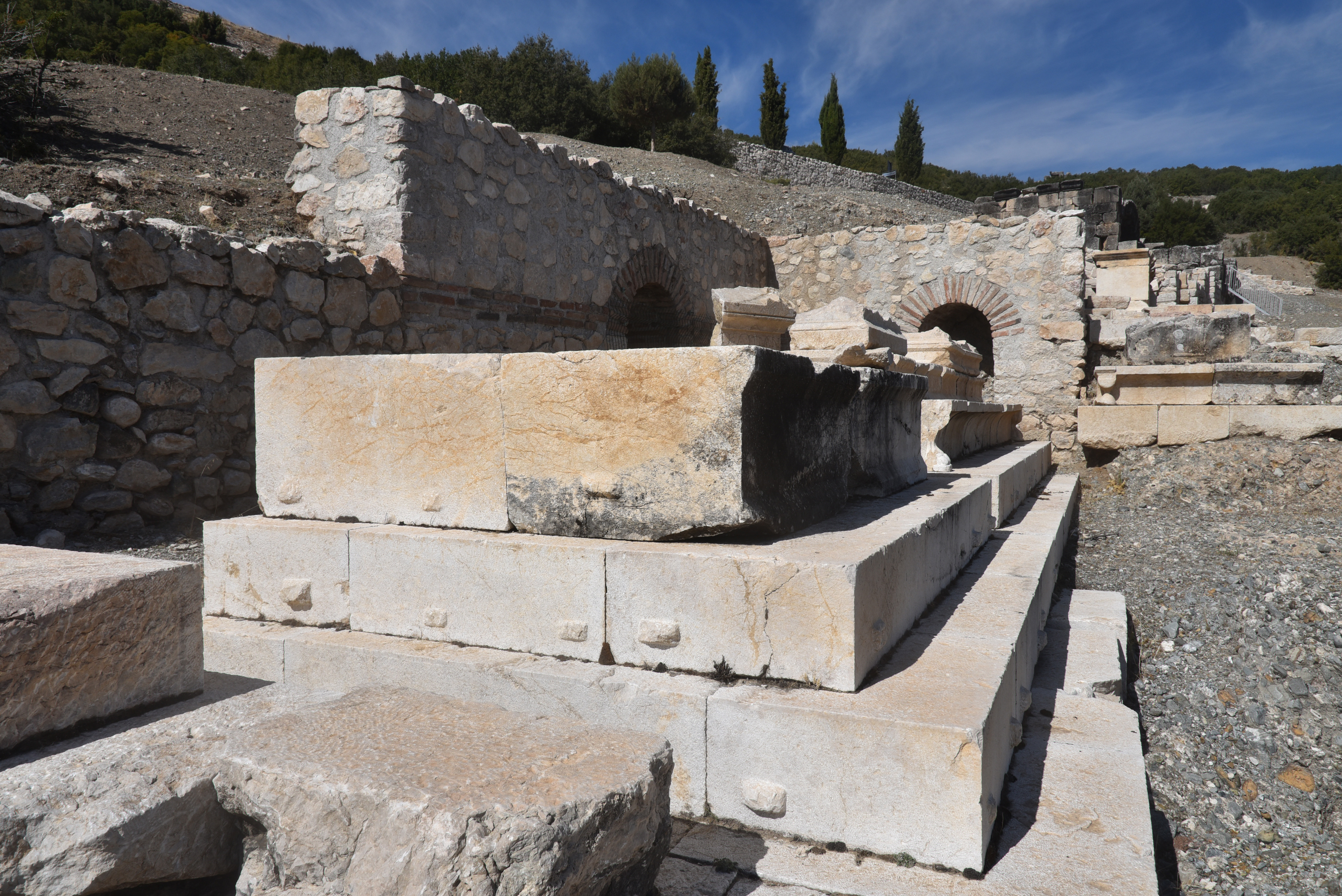
Kibyra was an ancient city located on a mountainous site, spanning three prominent hills, southwest of modern-day Gölhisar, approximately 110 kilometres from Burdur in southwestern Turkey. It was important in the ancient world due to its strategic location at the intersection of the cultural regions of Lycia, Caria, Pisidia, and Phrygia, and at the crossroads of important north–south and east–west commercial routes. The city prospered and developed during the second half of the 2nd century BC, becoming the political centre of the Kabalia or Kibyriatis region. Most of the buildings standing today were constructed in Roman times, following the city’s destruction by an earthquake in AD 23.
Coordinates: 37°09’36.4″N 29°29’21.1″E
Geographer Strabo (13.4.17) first mentions Kibyra in ancient sources, noting that the city was founded by the Lydians and that its inhabitants spoke four languages: Pisidian, Solymian, Greek, and Lydian. Initially established near Uylupınar Lake, it was relocated to its current site in the 3rd century BC, likely for security reasons. Geographically, Kibyra lies within the Kabalis region (later known as Kibyratis), a cultural crossroads where Lycia meets Pisidia, Caria, Lydia, and Phrygia. The population of Kibyra was ethnically and linguistically diverse. Archaeological and epigraphic evidence from nearby mounds, such as Yusufça and Sorgun, shows that the area has been continuously occupied since the Late Chalcolithic and Early Iron Ages.
Kibyra rose to prominence during the Hellenistic period, coming under the control of the Kingdom of Pergamon in the early 2nd century BC under Eumenes II. Shortly thereafter, it became the leading member of a tetrapolis, known as the Kabalian League, a federation of four cities: Kibyra, Boubon, Balboura, and Oenoanda. The league was dissolved by the Roman commander L. Licianus Murena in 82 BC. Following this, Kibyra was incorporated into the Lycian League and became the administrative centre of the Roman province of Asia. After a devastating earthquake in AD 23, Emperor Tiberius provided financial aid and tax exemptions for its recovery, leading to the city being renamed Kaisareia Kibyra.
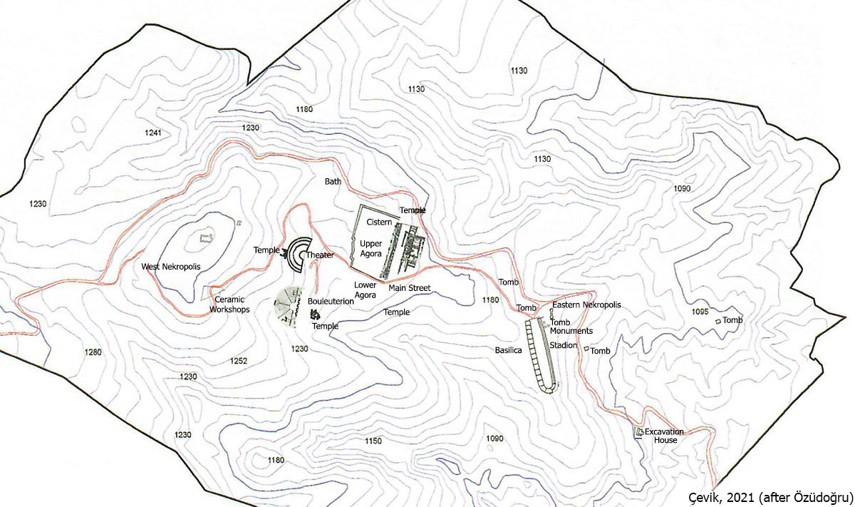
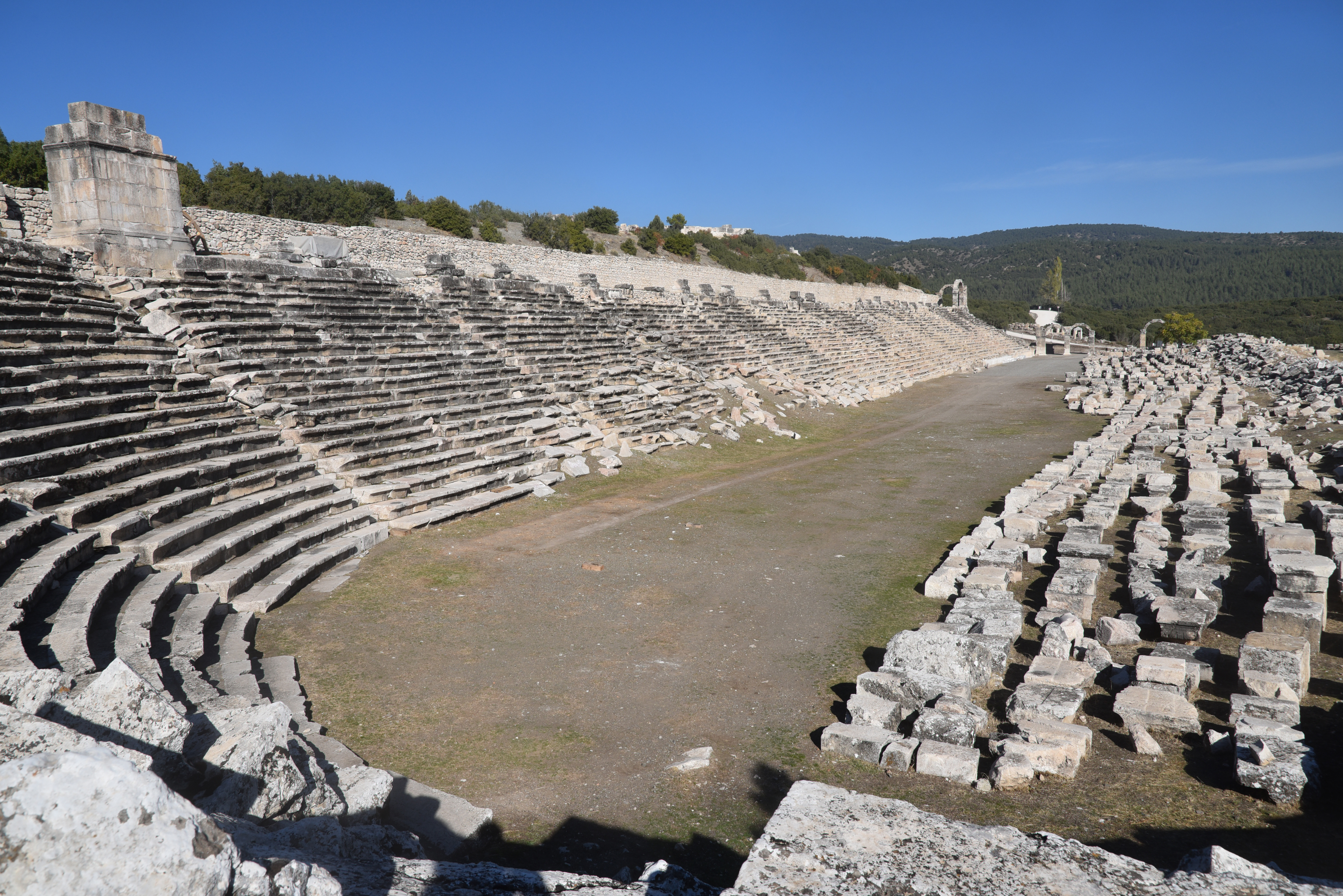
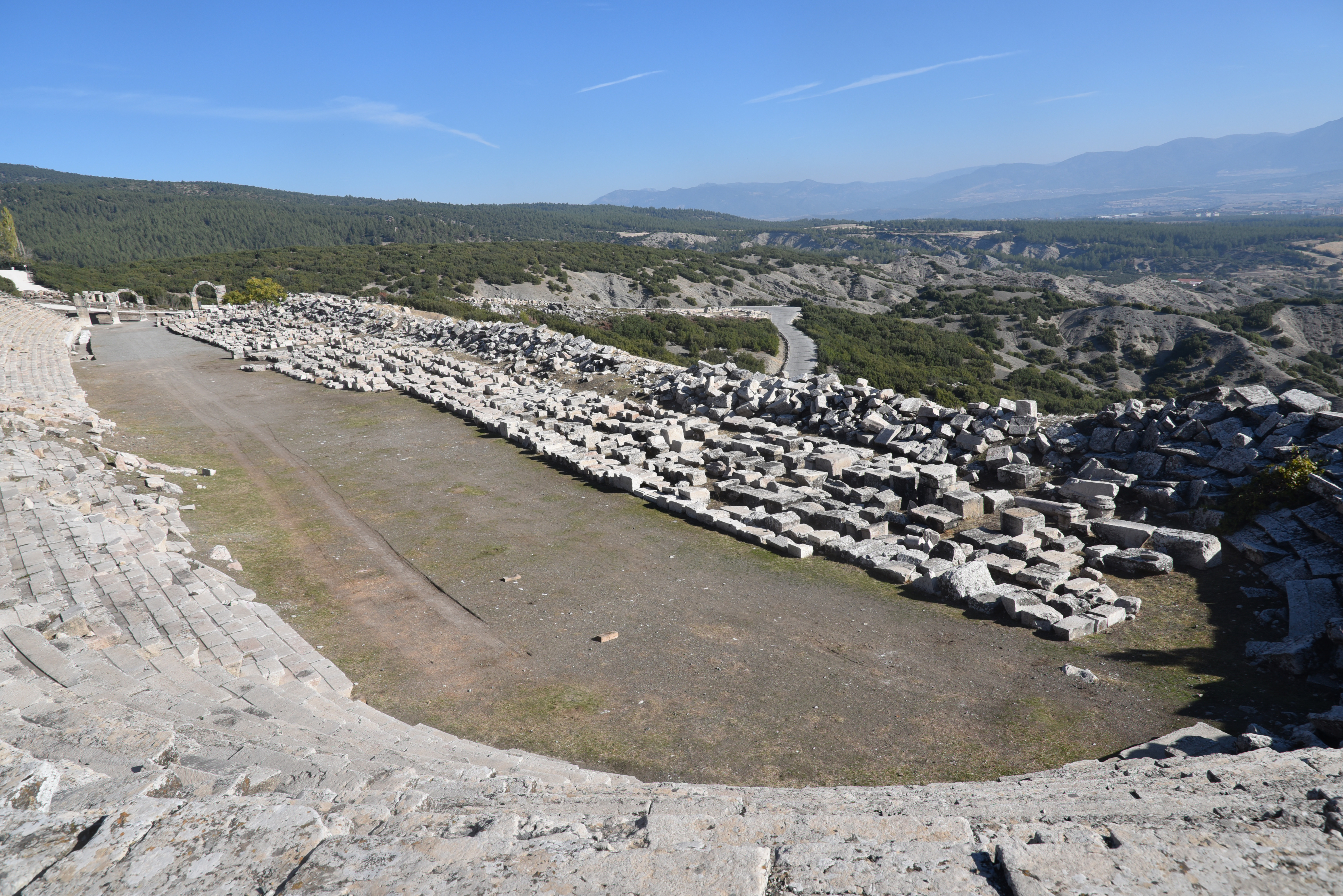
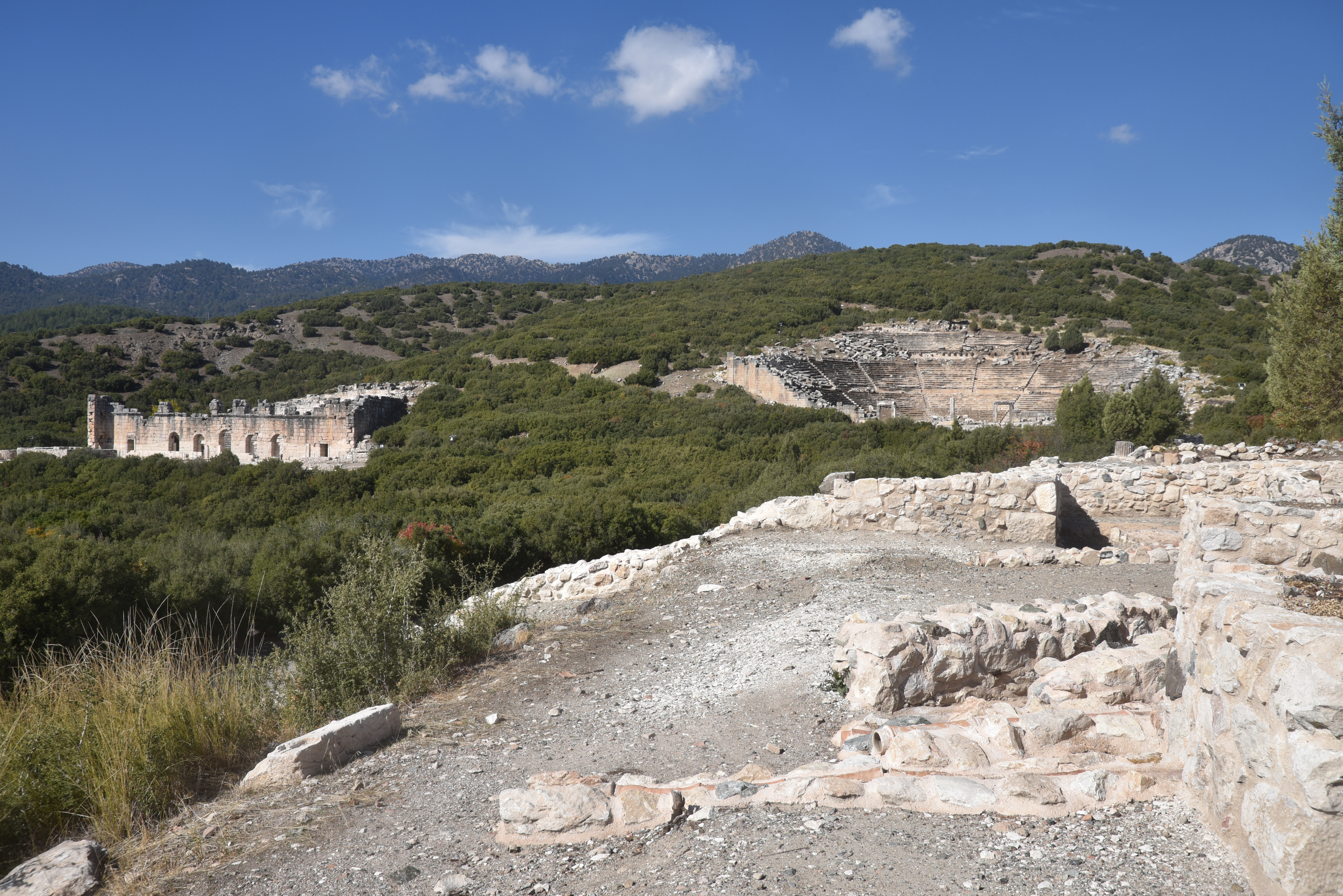
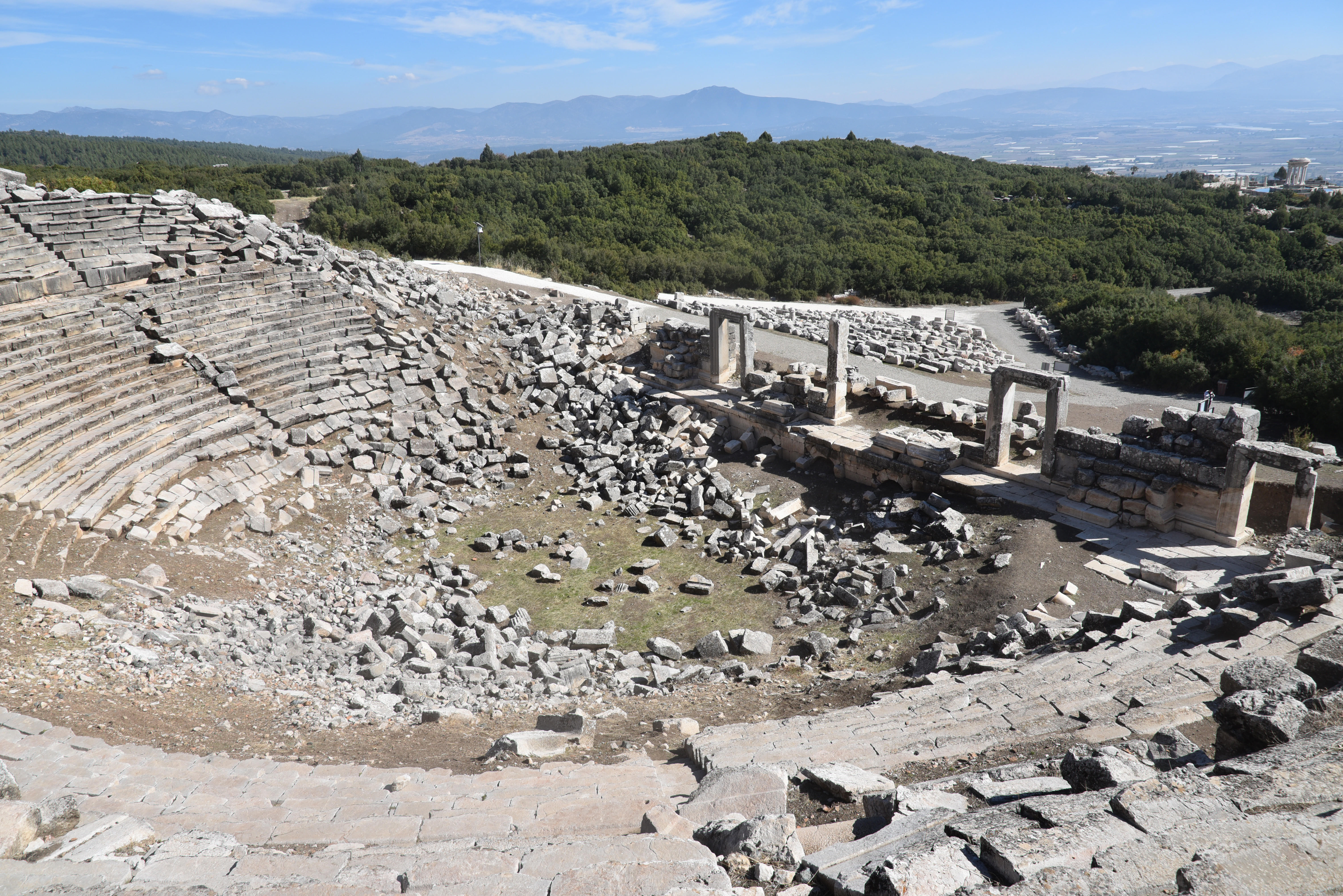
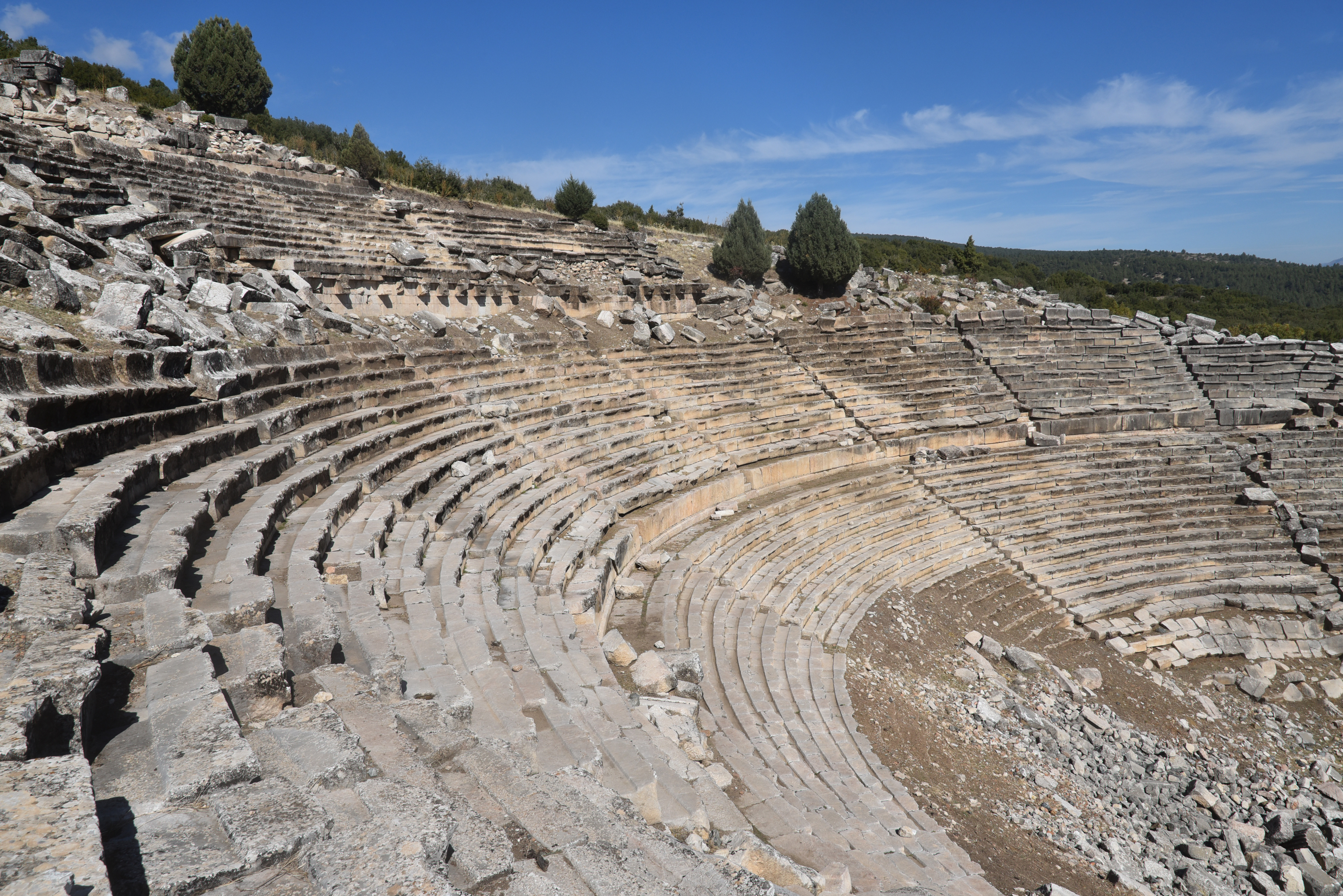
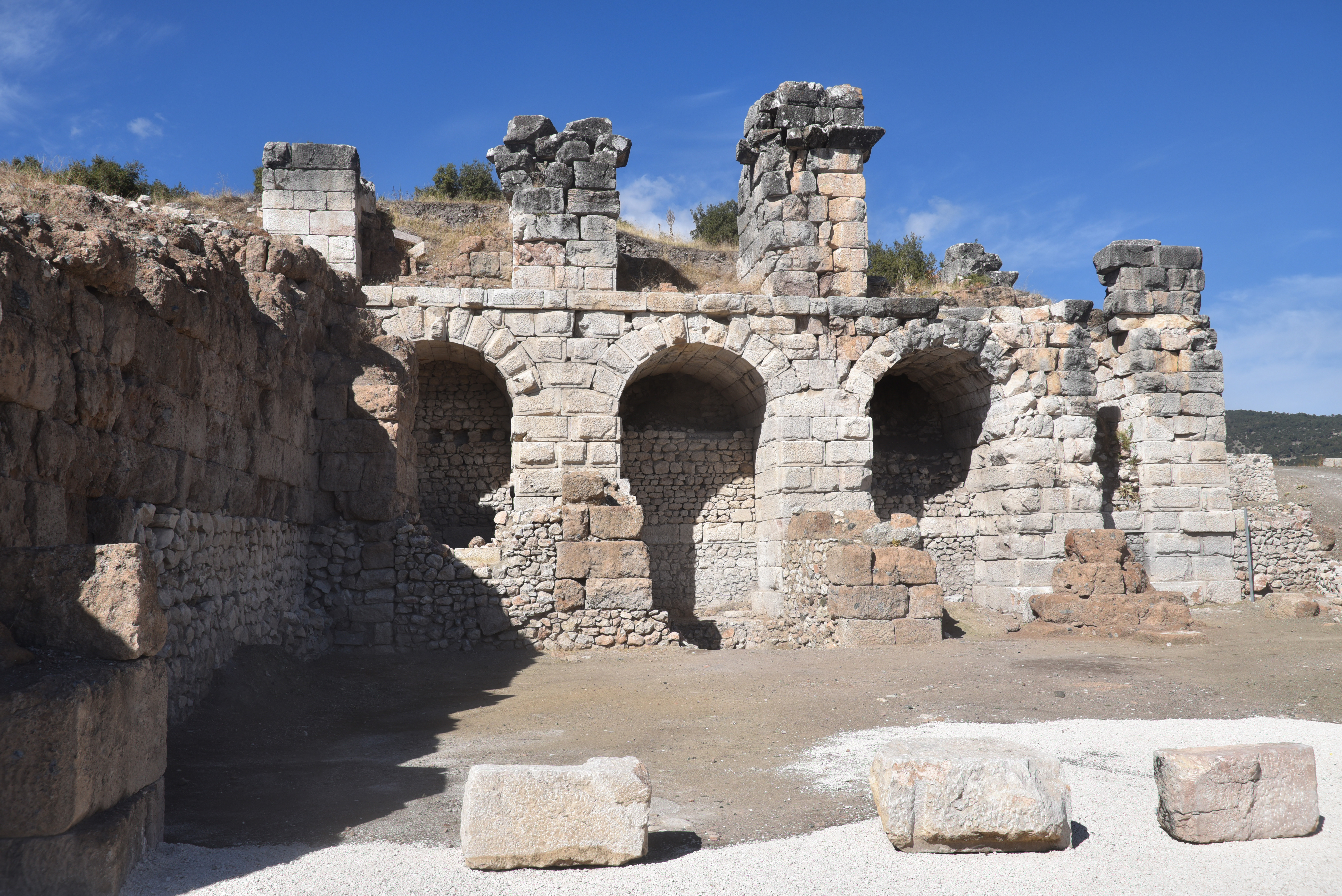
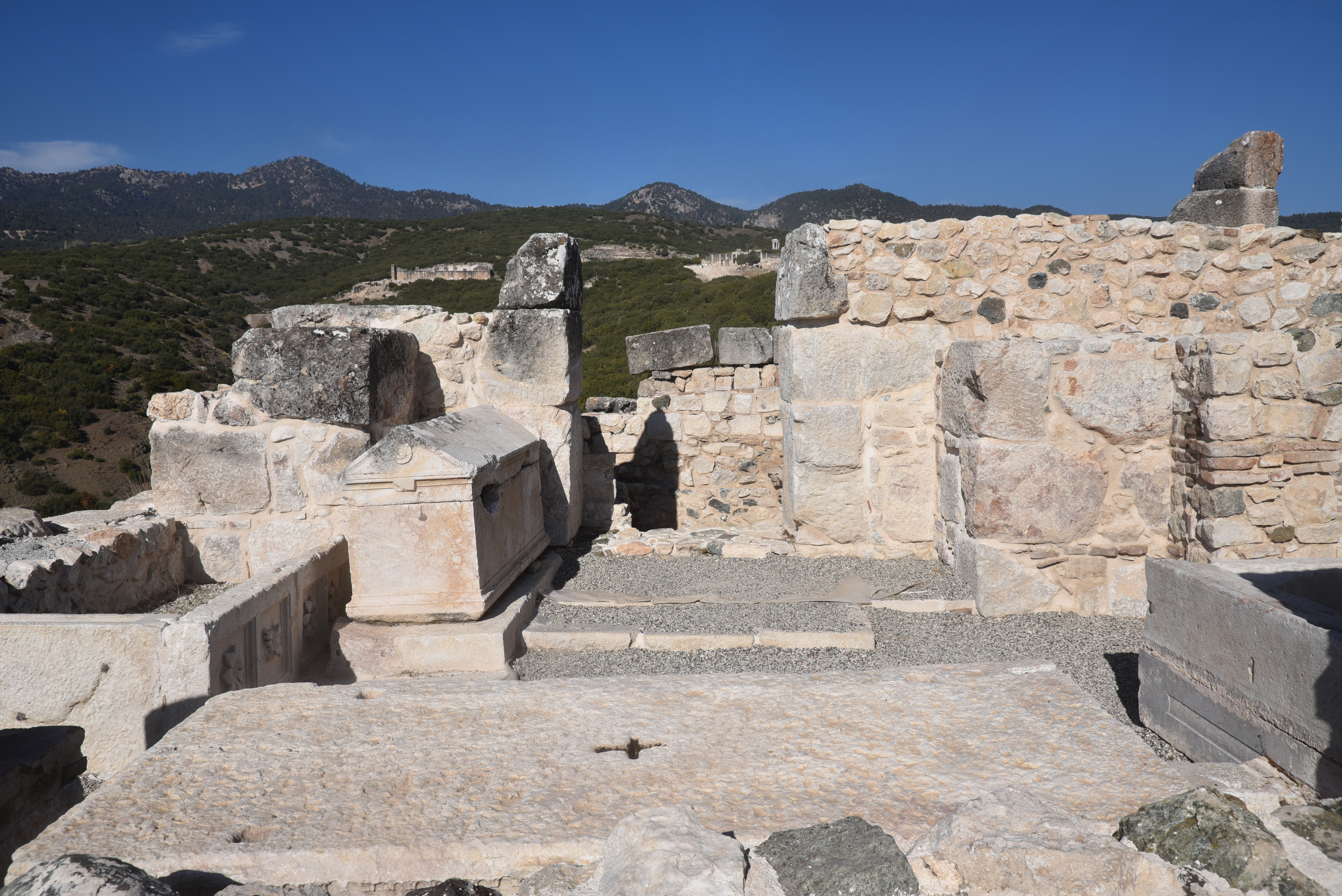
Under Roman rule, Kibyra reached its peak of prosperity. It became well-known for its agriculture, animal husbandry trade, and, particularly, its skilled production of ironwork, leather, and pottery. Kibyra was architecturally impressive, built across three hills and featuring monumental structures that highlighted its wealth and significance. Among these structures was a stadium measuring 185 meters in length, capable of accommodating around 10,000 spectators. The theatre, partially hewn into a hillside, had seating for about 9,000 people and showed evidence of a velarium and inscriptions referring to local clans and economic exchange rates. Adjacent to the theatre stood the Odeon, a multifunctional indoor theatre and council hall seating approximately 3,600. This venue was beautifully decorated with coloured marble, statues, and a distinctive Medusa mosaic in opus sectile on its orchestra floor. It is considered one of the best-preserved civic structures in Lycia. Additionally, nearby Byzantine baths featuring hypocaust systems demonstrate the region’s continuous urban development.
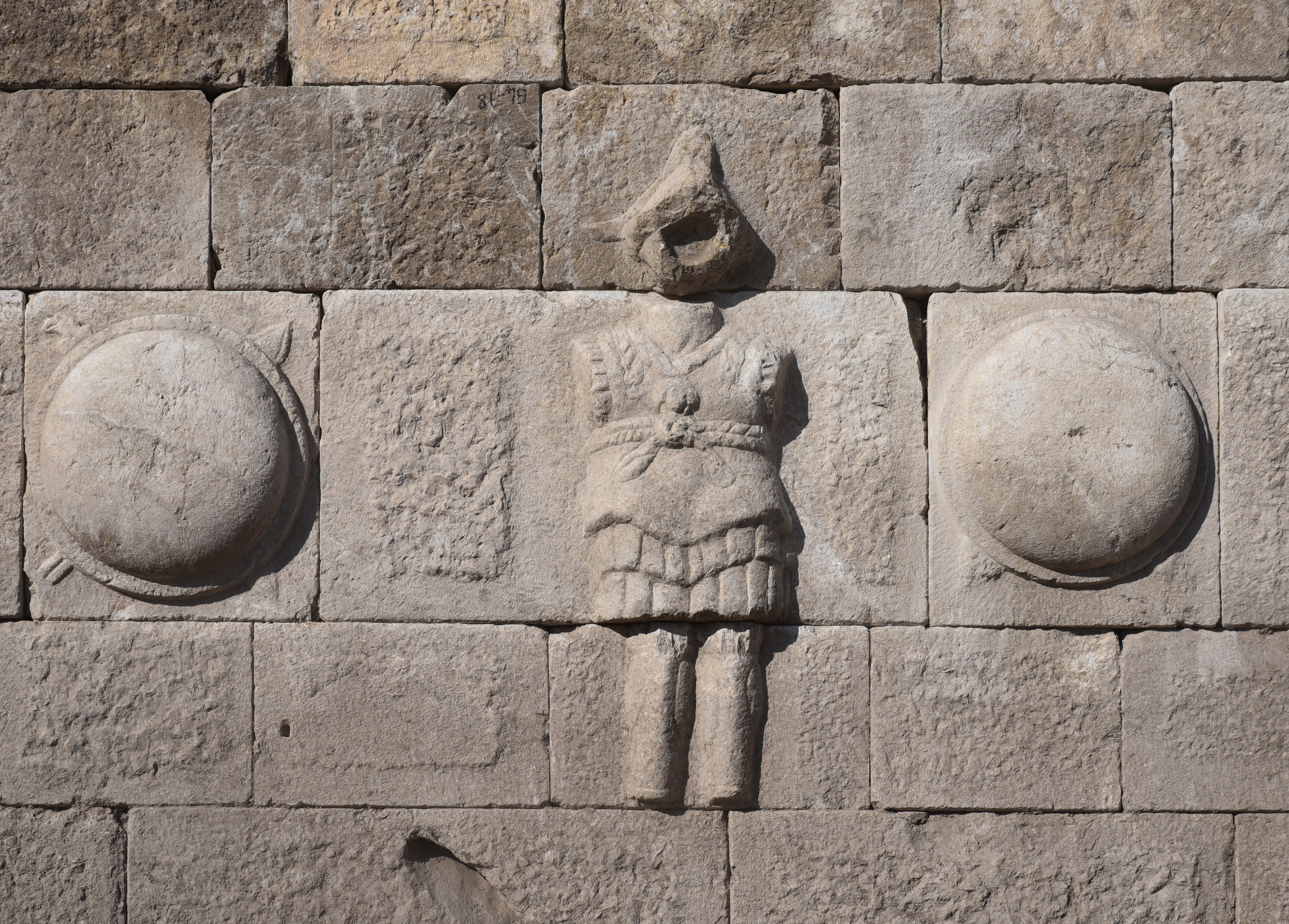
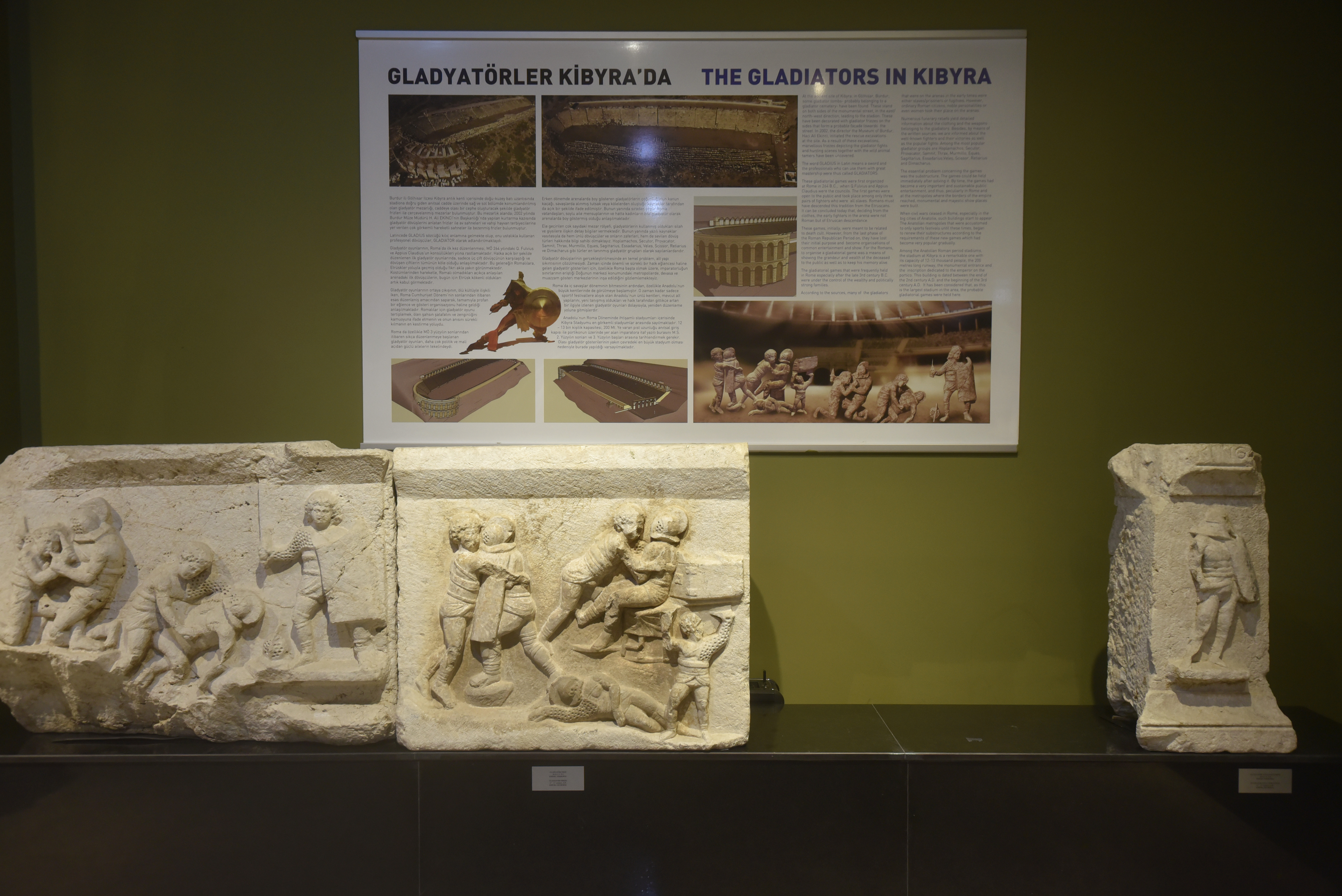
The most important finds in Kibyra are a body of architectural reliefs and stelae depicting gladiatorial contests, discovered during excavations by the Burdur Museum on the road to the necropolis east of the stadium. These friezes, which belonged to three different monumental tombs of munerarii, depict various aspects of gladiatorial games, including duels between gladiators and the hunting of animals. Along with reliefs on locally produced oil lamps, these friezes indicate that gladiators played an important role in the social life of Kibyra and that the stadium was used not only for athletic competitions but also for gladiatorial fights and venationes.
PORTFOLIO


Links:
- KIBYRA MAIOR (Horzum [Gölhisar]) Phrygia, Turkey – The Princeton Encyclopedia of Classical Sites
- Turkish Archaeological News
- Ancient city of Kibyra – UNESCO
Bibliography:
- Berns, C., & Ekinci, H. A. (2015). Gladiatorial games in the Greek East: a complex of reliefs from Cibyra. Anatolian Studies, 65, 143–179. http://www.jstor.org/stable/24878381
- Kileci, Senkal & Önen, Nihal. (2024). Restoration Works in Kibyra during the Claudian Period: New Inscriptions, τὰ σεβαστὰ ἔργα of the Lycian Governor Quintus Veranius and New Inscriptions Concerning His Family.
- Dökü, F. Eray, and M. Can Kaya. “The Architecture and Function of the Stadium of Kibyra”. Adalya, no. 16 (June 2013): 177-201.
- Karabacak, Volkan & Yönlü, Önder & Dökü, Eray & Kıyak, Nafiye & Altunel, E. & Özüdoğru, Şükrü & Yalciner, Cahit Caglar & Akyuz, H. Serdar. (2013). Analyses of Seismic Deformation at the Kibyra Roman Stadium, Southwest Turkey. Geoarchaeology. 28. 531-543. 10.1002/gea.21456.
