Perge, one of the most powerful cities of ancient Pamphylia, is located in southeastern Turkey, approximately 15 km from modern-day Antalya. The city thrived due to its strategic position in the fertile Pamphylian valley, near the River Kestros, which facilitated trade and transportation. Perge experienced its heyday during the Roman Imperial period, becoming a major commercial and cultural hub adorned with monumental architecture, including baths, a stadium, a theatre, and nymphaeums. Renowned for its cult of Artemis Pergaia, Perge also played a significant role in the spread of Christianity, hosting early Christian communities and bishops. Today, Perge stands as an important archaeological site, attracting visitors from around the world.
Perge’s history spans from the late 4th millennium BC to late antiquity. Initially under Hittite control in the 13th century BC, it was later settled by Achaeans after the Trojan War, according to mythological tradition. In the 7th century BC, colonists from Rhodes arrived, and the city came under Lydian control in the 6th century BC. After the Lydians were defeated, Perge became part of the Persian Empire in 547 BC. It joined the Delian League in 425 BC but returned to Persian control after the Peace of Antalcidas in 387 BC. Alexander the Great subjugated the city in 334 BC, and it later became contested between the Seleucids and Ptolemies.
Following the Peace of Apamea in 190 BC, Perge came under the Kingdom of Pergamon and, in 133 BC, under Roman rule. During the Roman Imperial period, Perge flourished, becoming a major economic and cultural centre. However, the city faced challenges, including piracy and Roman exploitation, which led to its decline in late antiquity. By the 7th century AD, most inhabitants had left, and the city eventually fell under Seljuk and Ottoman control.
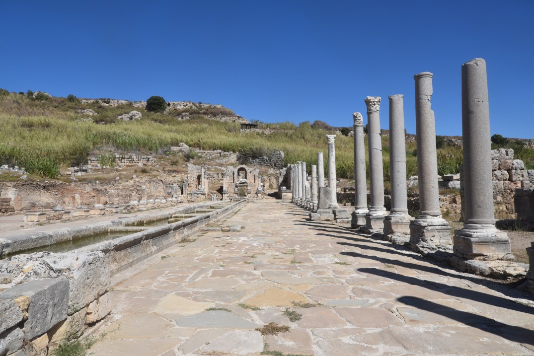
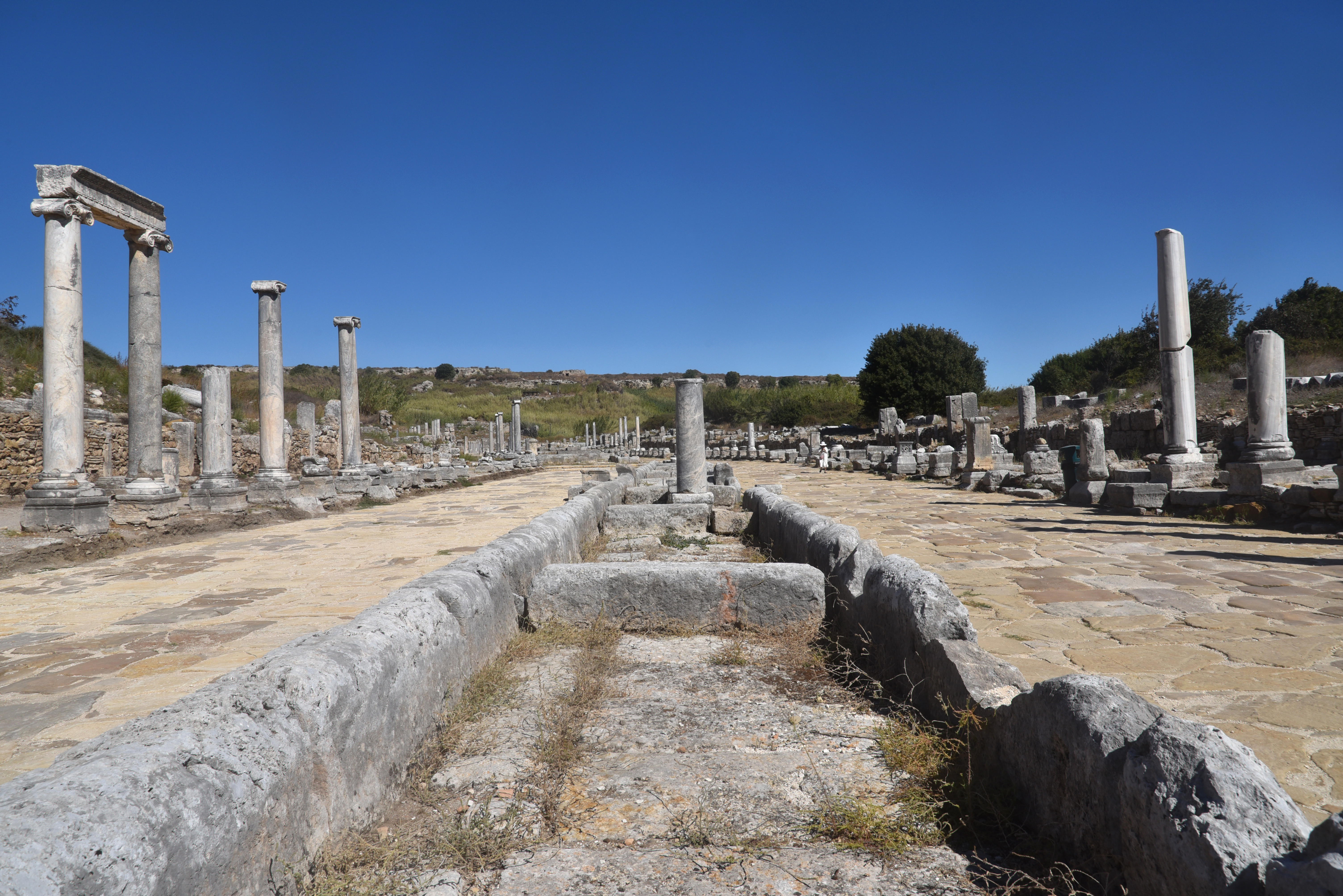
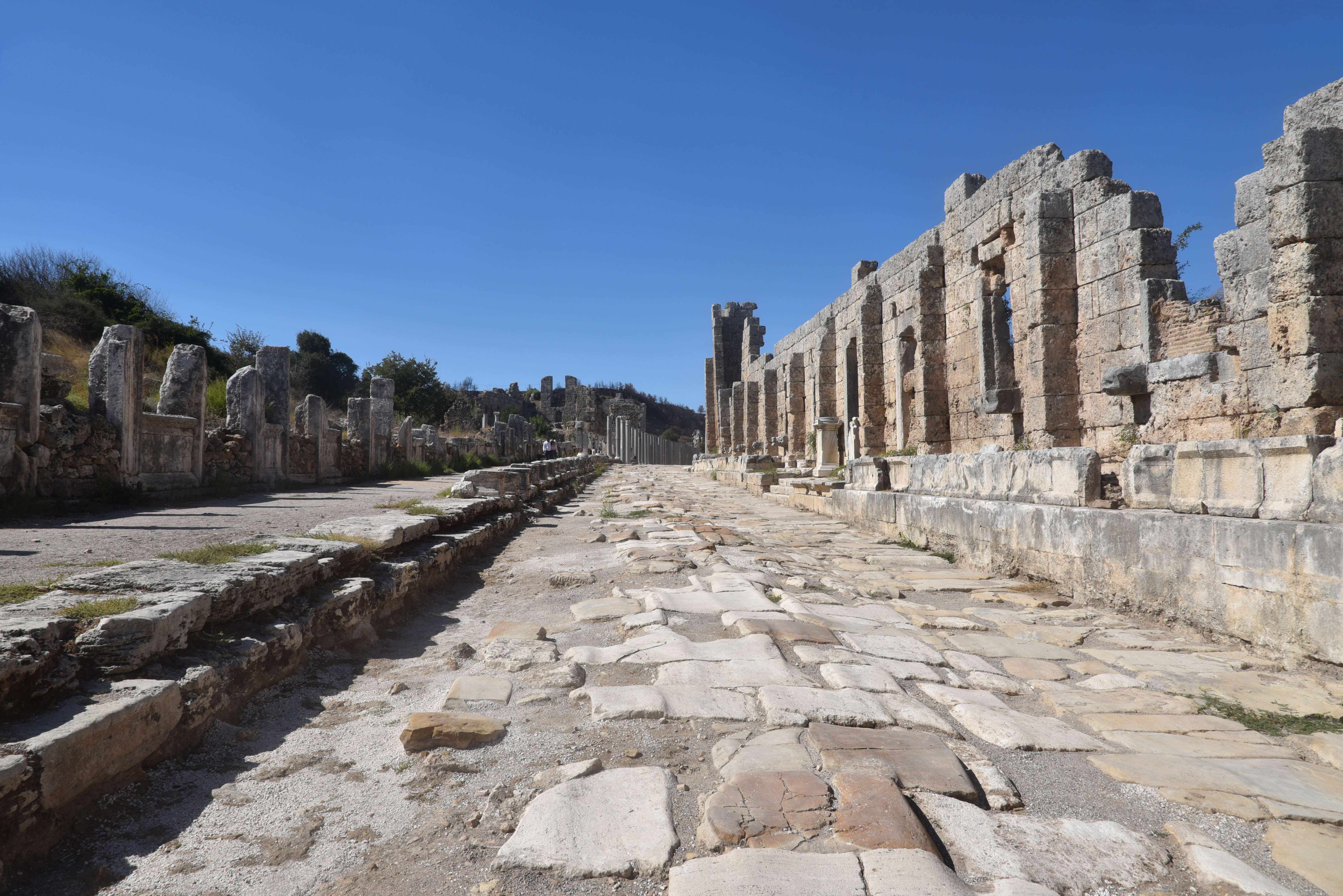
View of the colonnaded Cardo Maximus and Decumanus from the Acropolis.
Plancia Magna, a prominent and influential figure in Perge during the Roman Imperial period, made considerable contributions to the city. A member of a noble family, she was the wife of Roman senator Julius Cornutus Tertullus and daughter of Marcus Plancius Varus, a consul and provincial commander. Known for her generosity, she funded major construction projects in Perge during Hadrian’s reign, including monumental additions to the Hellenistic gate. She held prestigious titles, including supreme archon, priestess of Artemis Pergaia, and high priestess of the imperial cult, and was honoured with statues and inscriptions throughout the city.
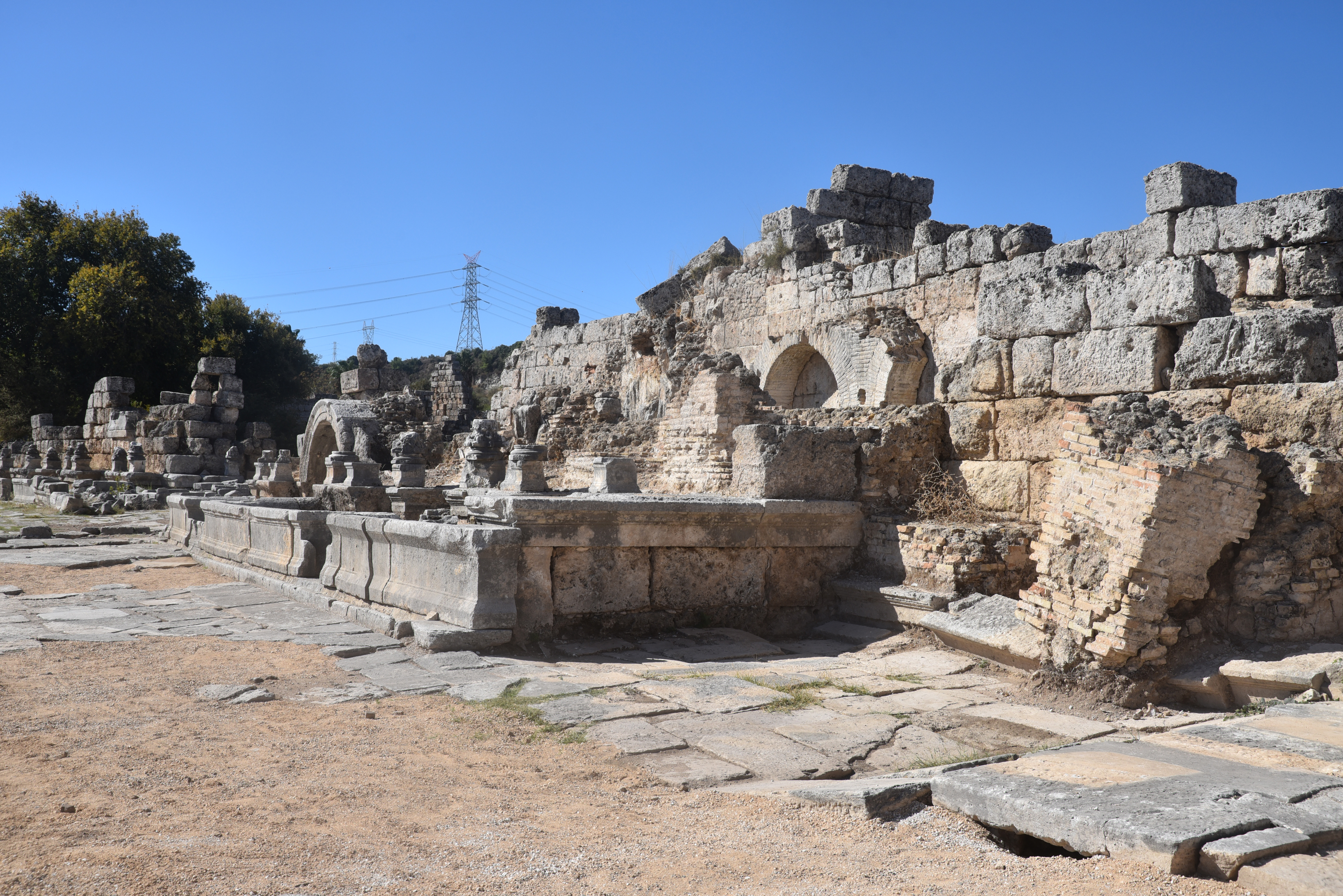
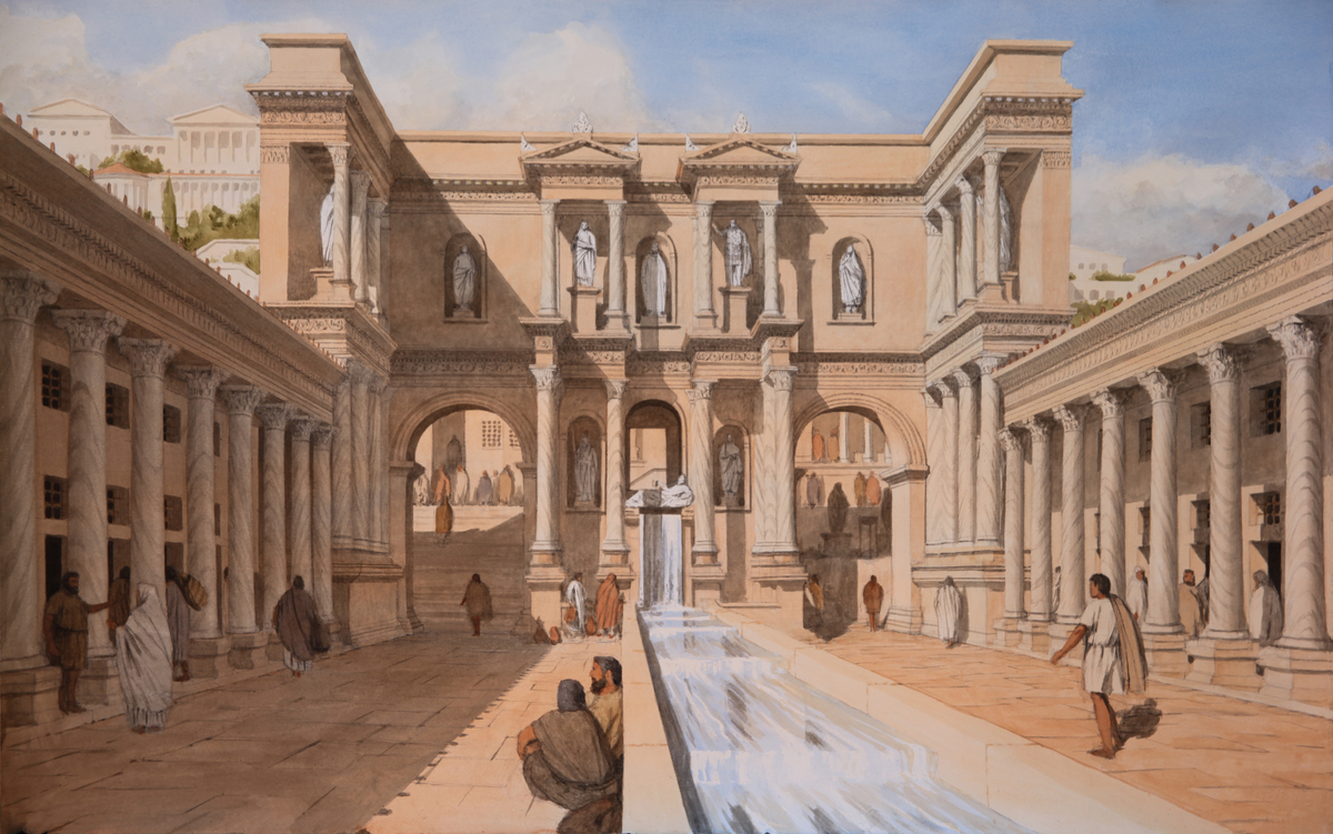
The architectural monuments and unique design choices made by Plancia Magna set a trend that influenced other wealthy women, including Aurelia Paulina, during the late 2nd and early 3rd centuries AD. She built and inaugurated a monumental nymphaeum and its ornamentation at her own expense, which she dedicated to Artemis Pergaia and the reigning emperor, Septimius Severus, along with his wife, Julia Domna, and his sons, Caracalla and Geta (IK Perge 196). The monument stood near one of the main entrances to the city of Perge, a prime location that ensured it received significant attention from both local citizens and visitors entering the city. Like Plancia Magna’s courtyard, it borrowed from the theatrical scaenae frons design with a marble colonnaded facade and niches displaying statues, to highlight her links with the gods and the imperial family.
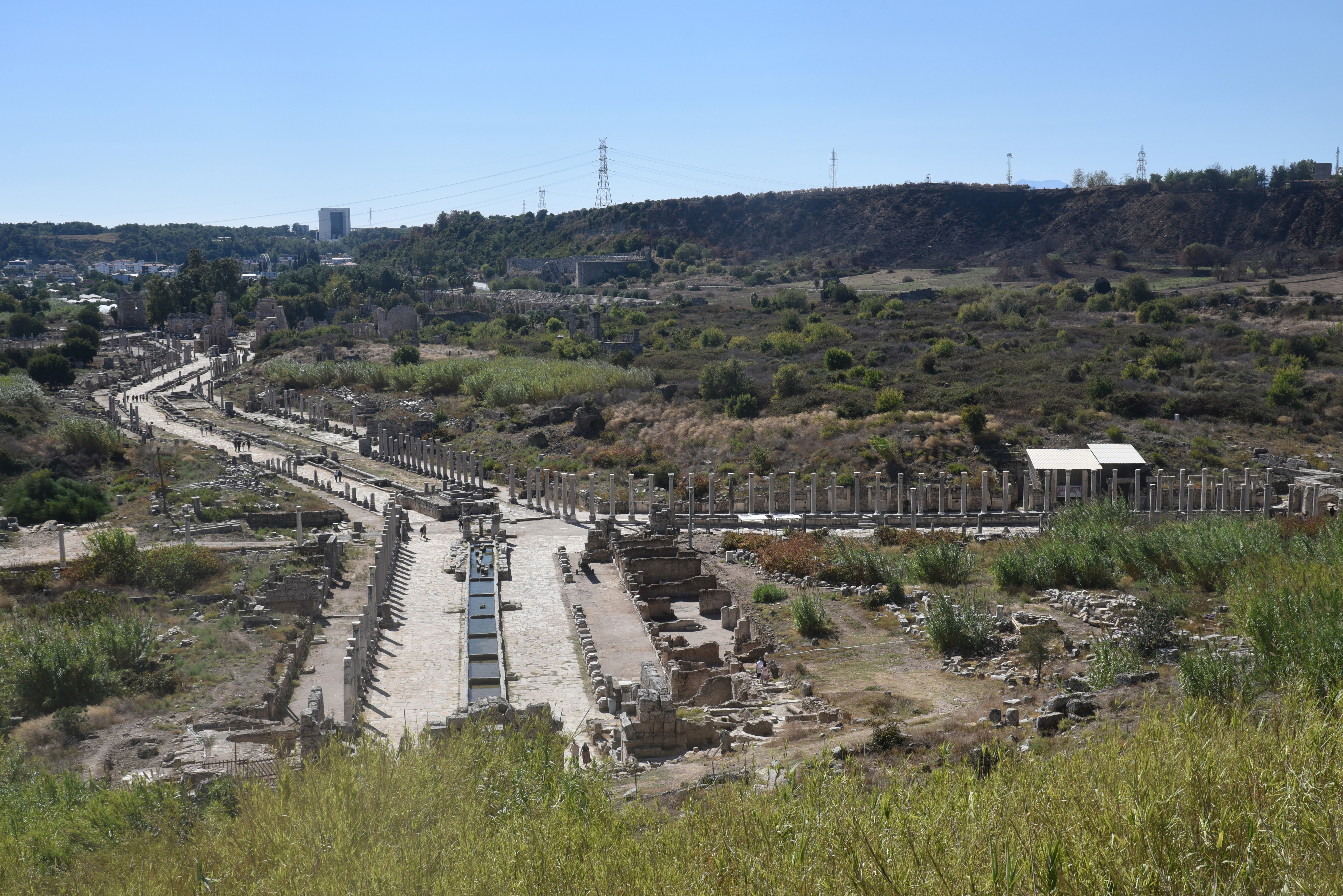
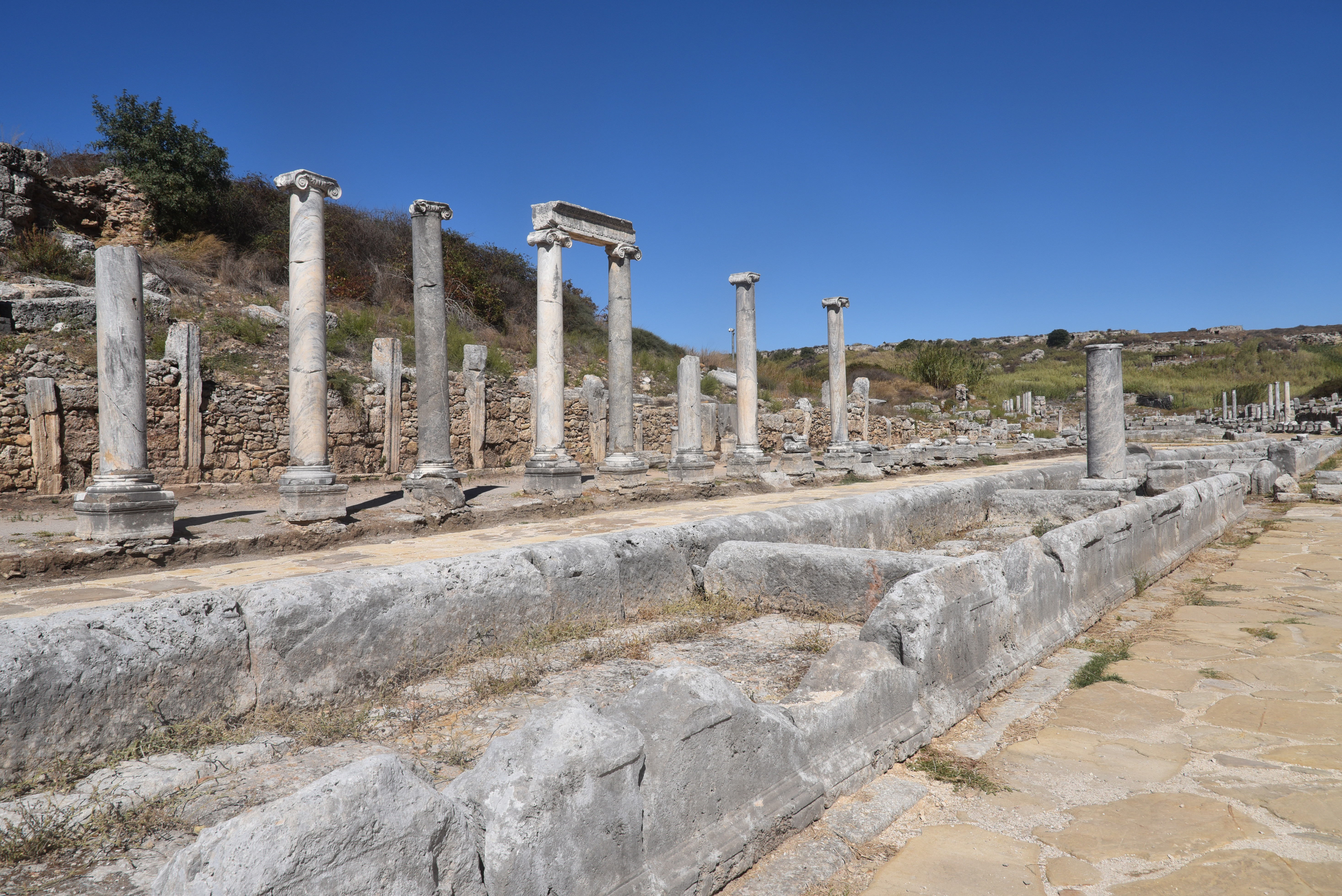
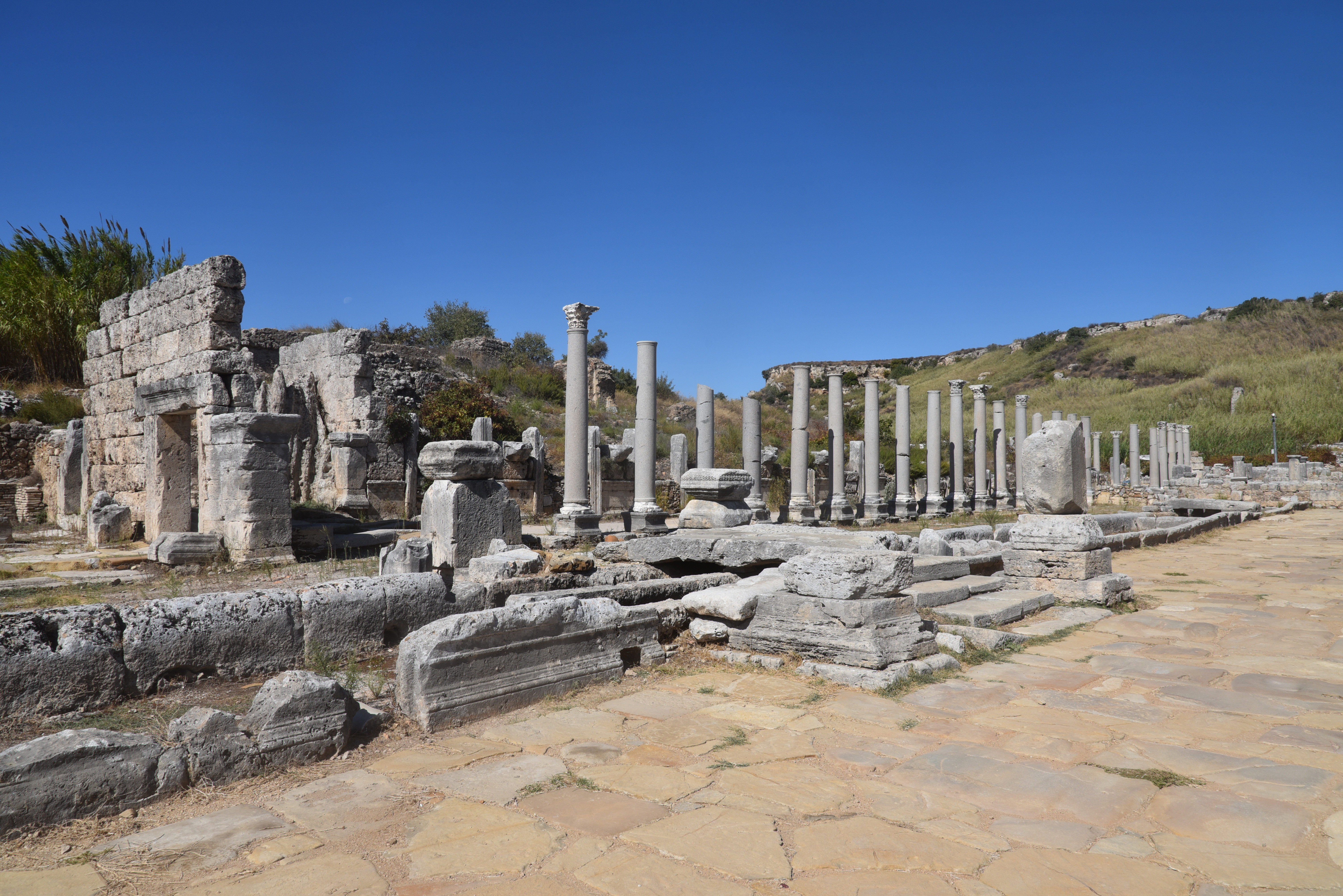
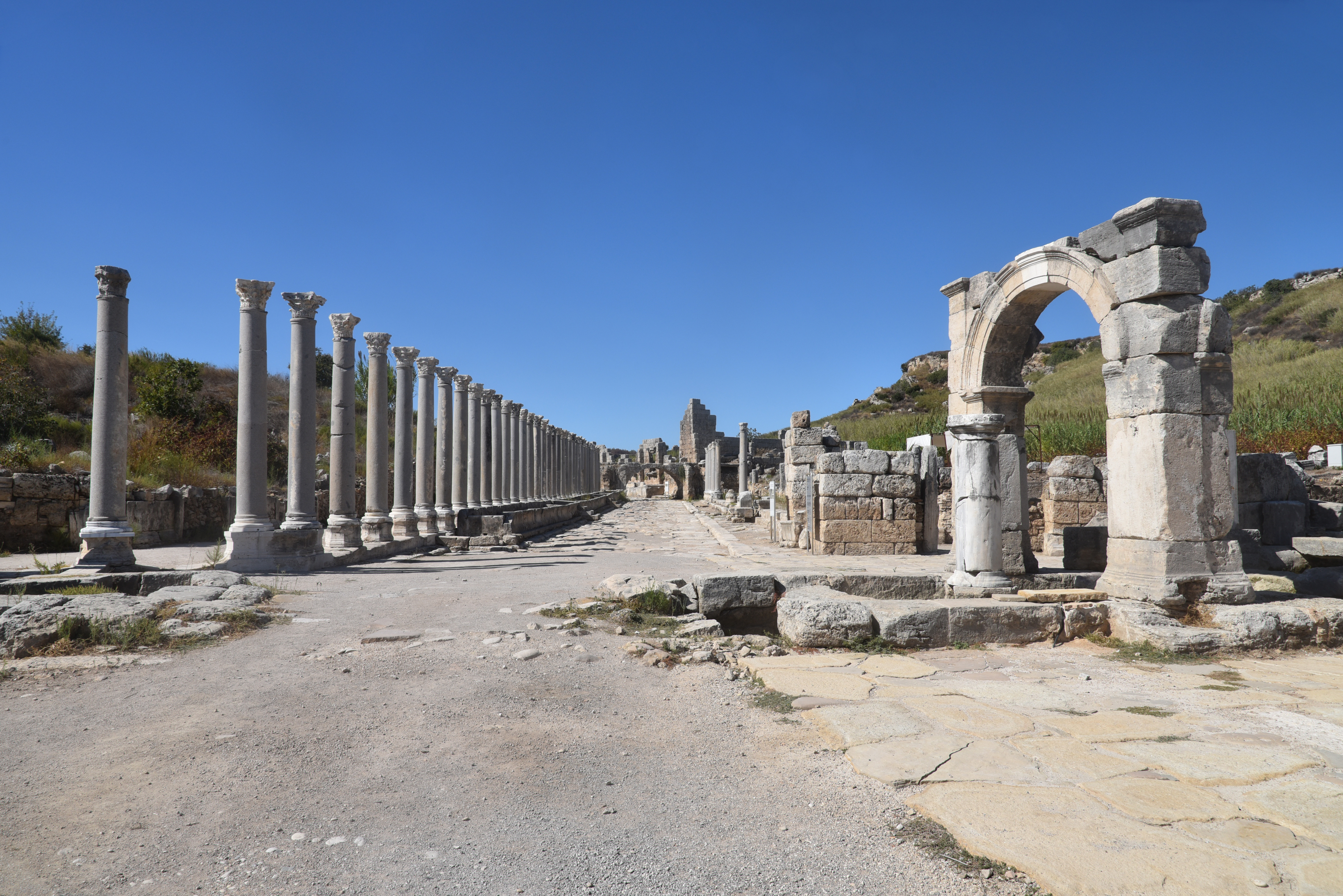
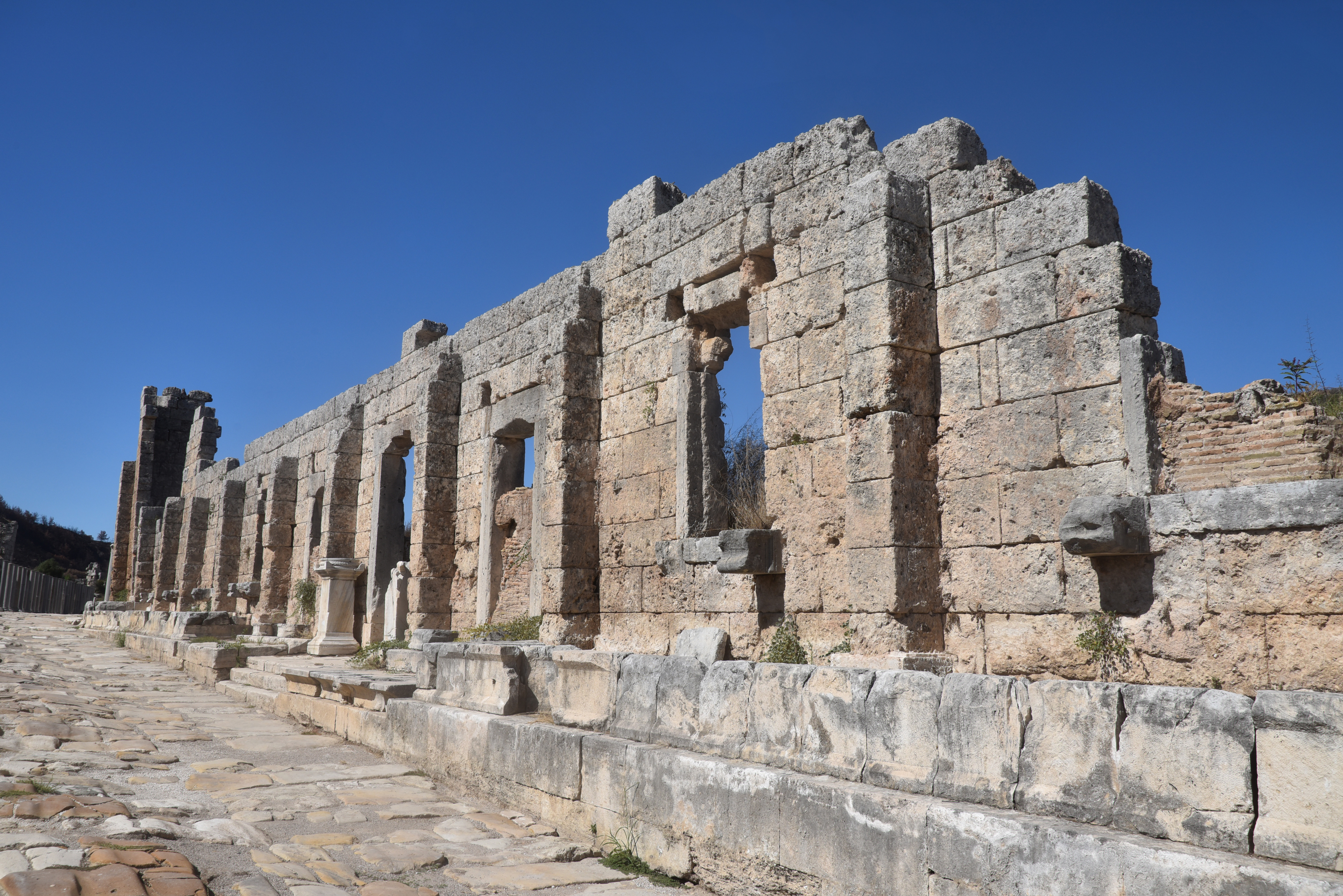
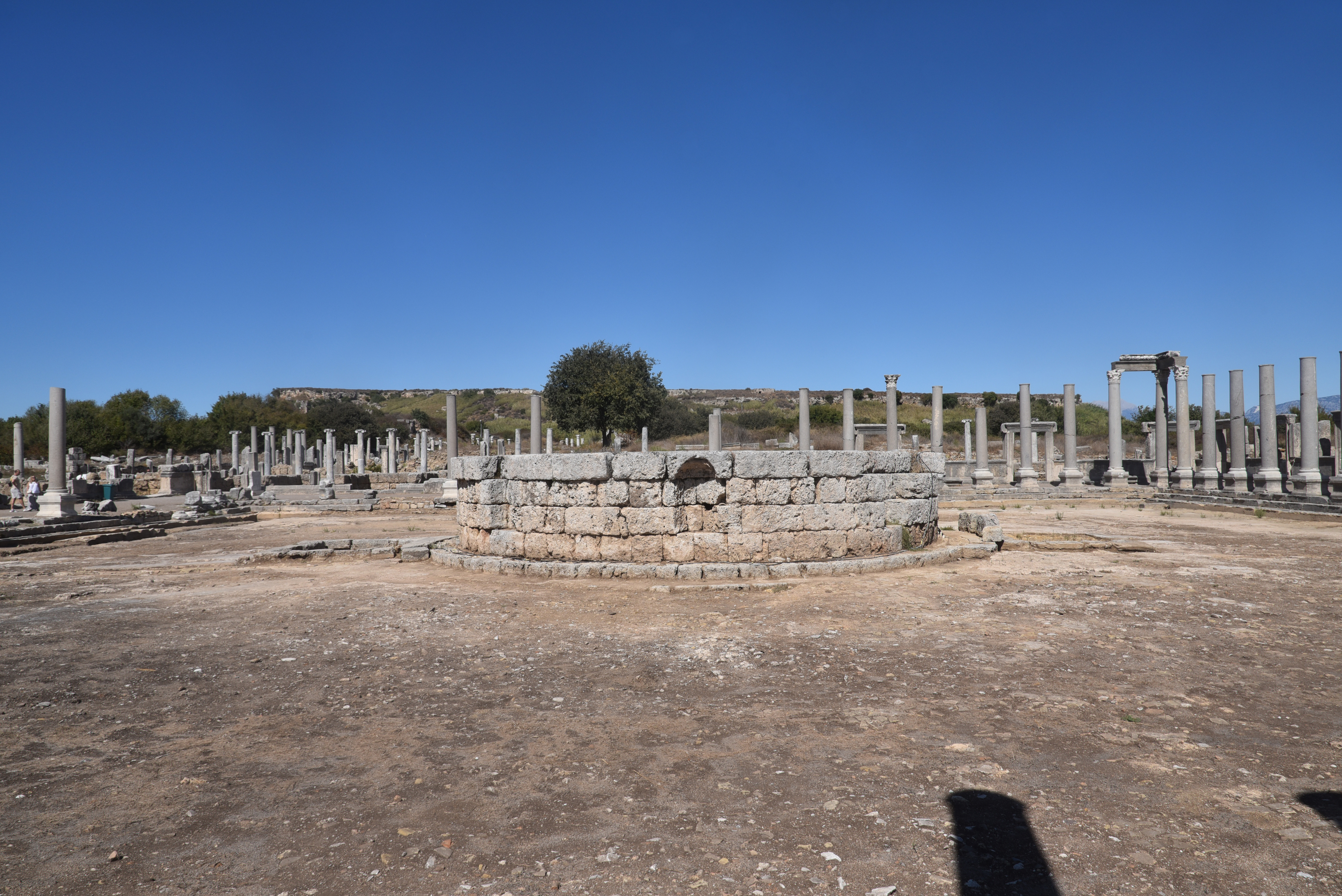
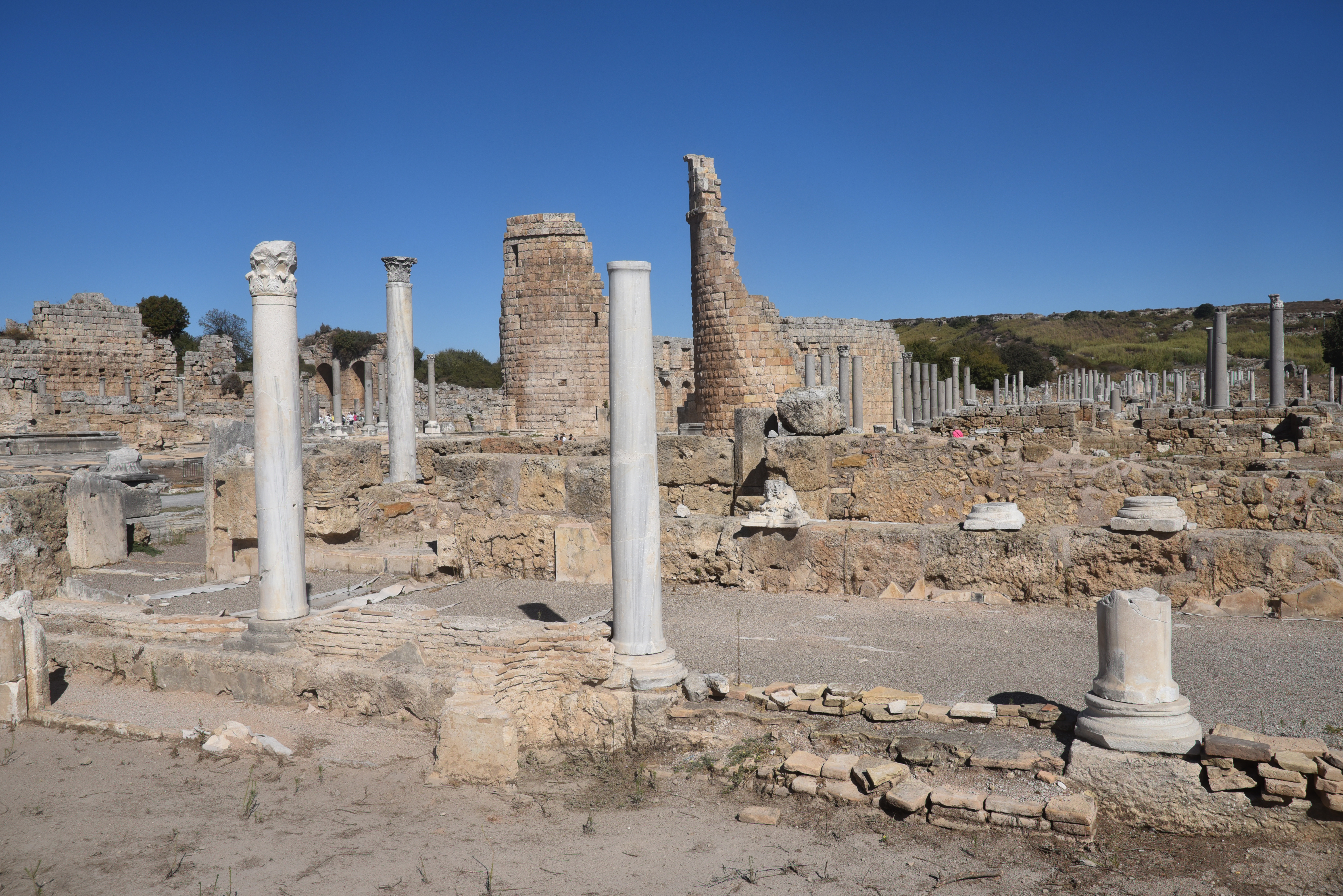
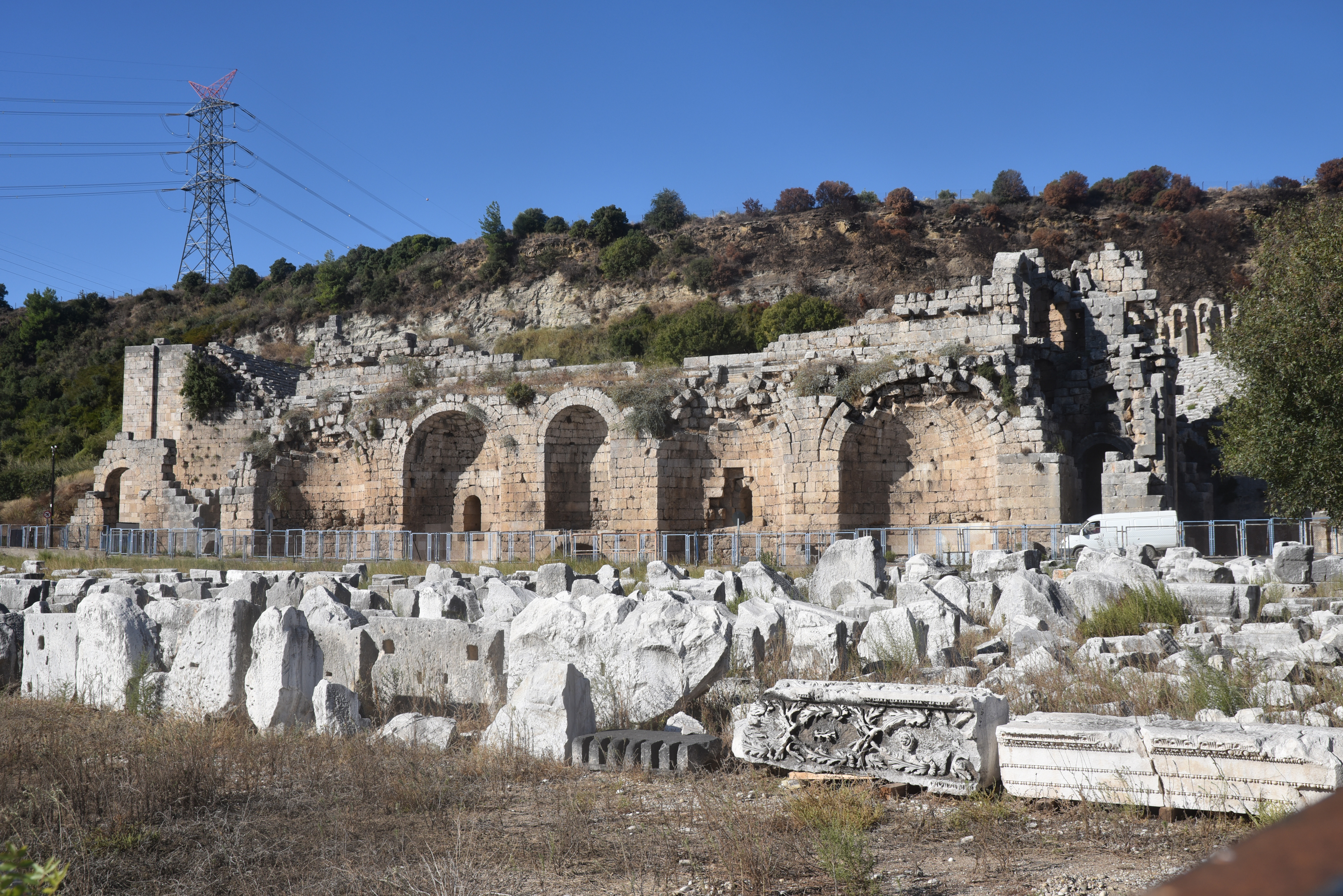
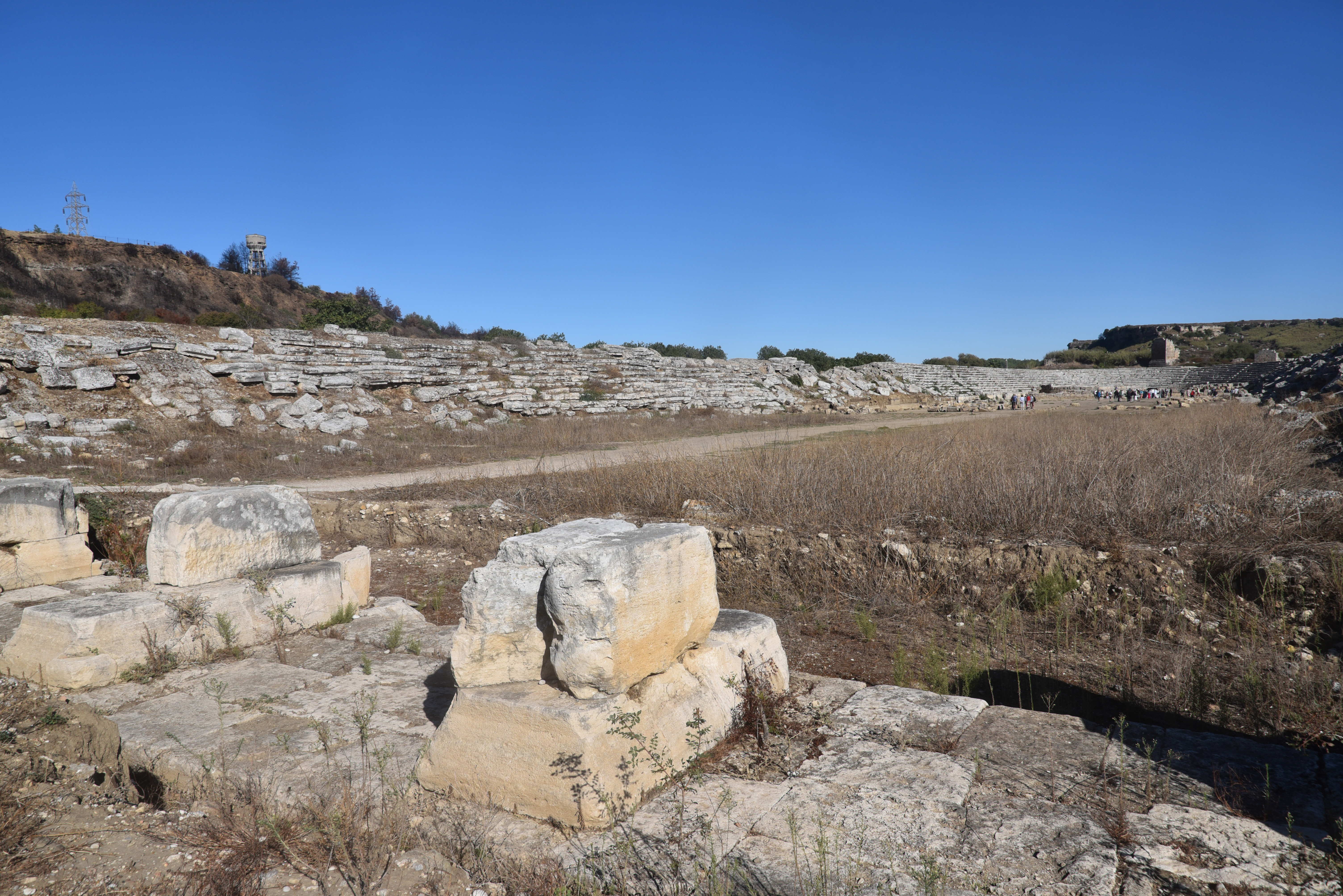
The city was divided into four quarters by two main colonnaded streets, the decumanus maximus and cardo maximus, which featured arcades, shops, and a central water channel. Key structures include the Hellenistic gate with monumental towers and marble-clad walls, the northern baths, the agora with a central tholos, and the northern nymphaeum adorned with statues. The city also housed a stadium seating 12,000 spectators, one of the best-preserved in Asia Minor, and a theatre with a capacity of 15,000, featuring intricate reliefs depicting mythological scenes.
PORTFOLIO
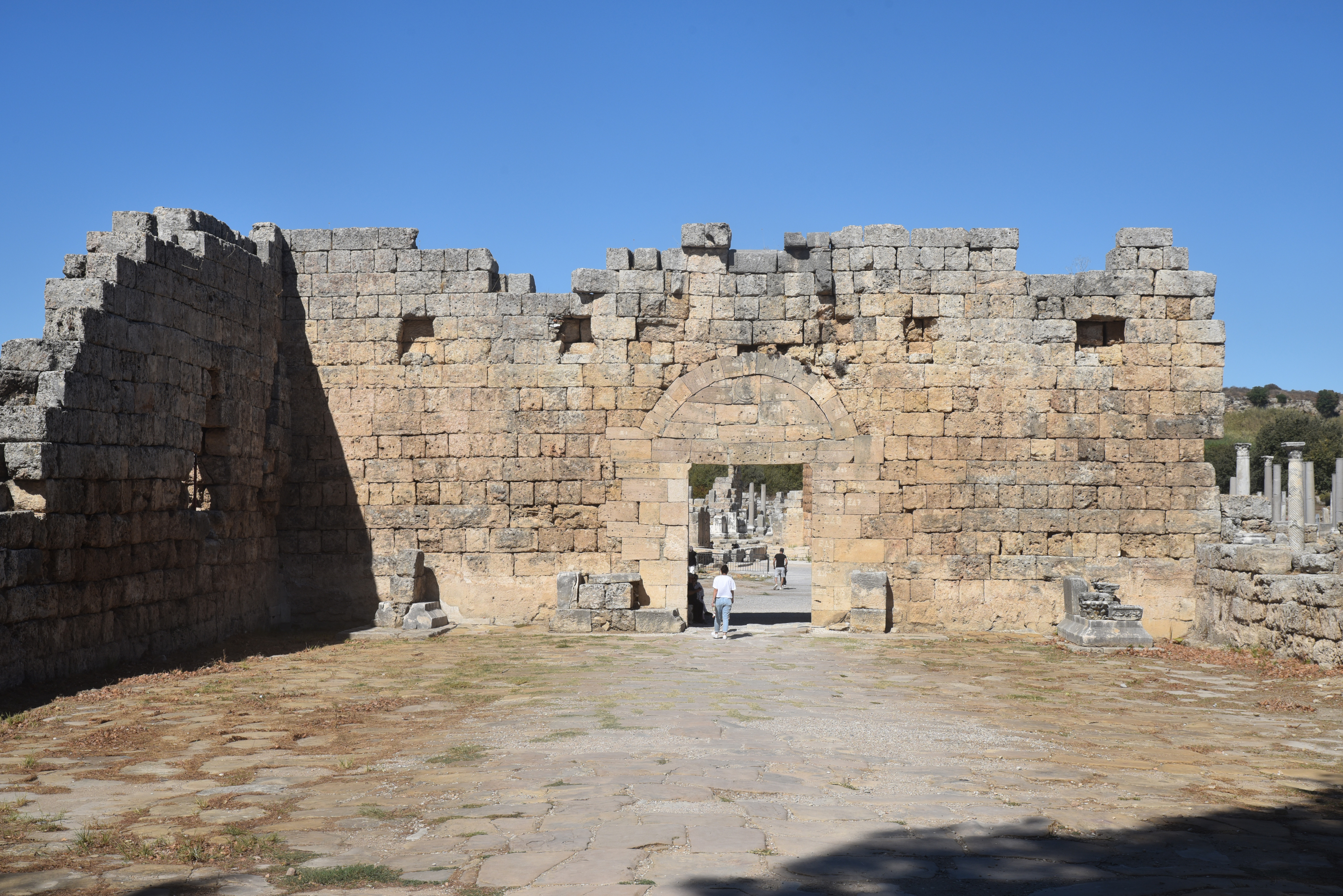
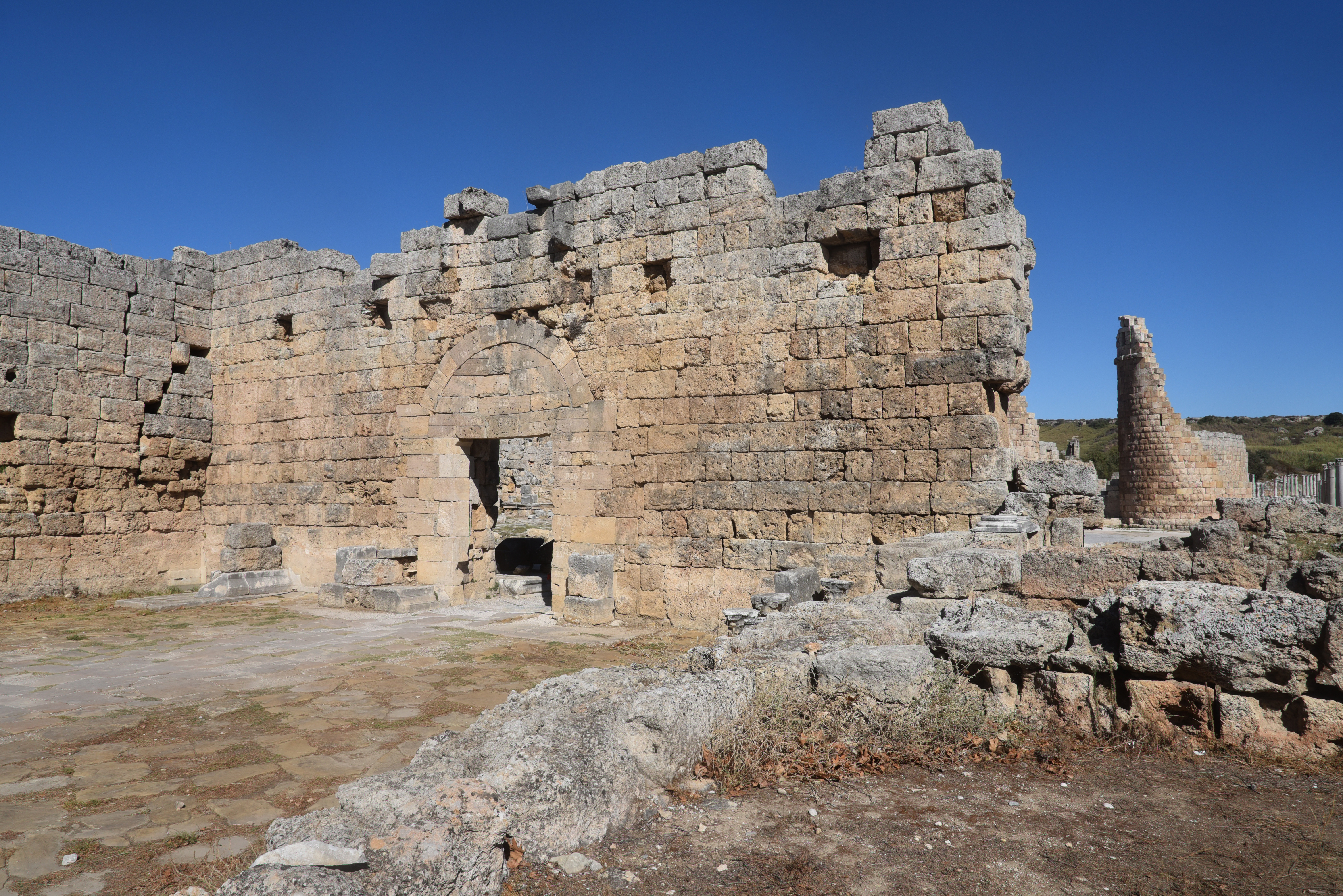
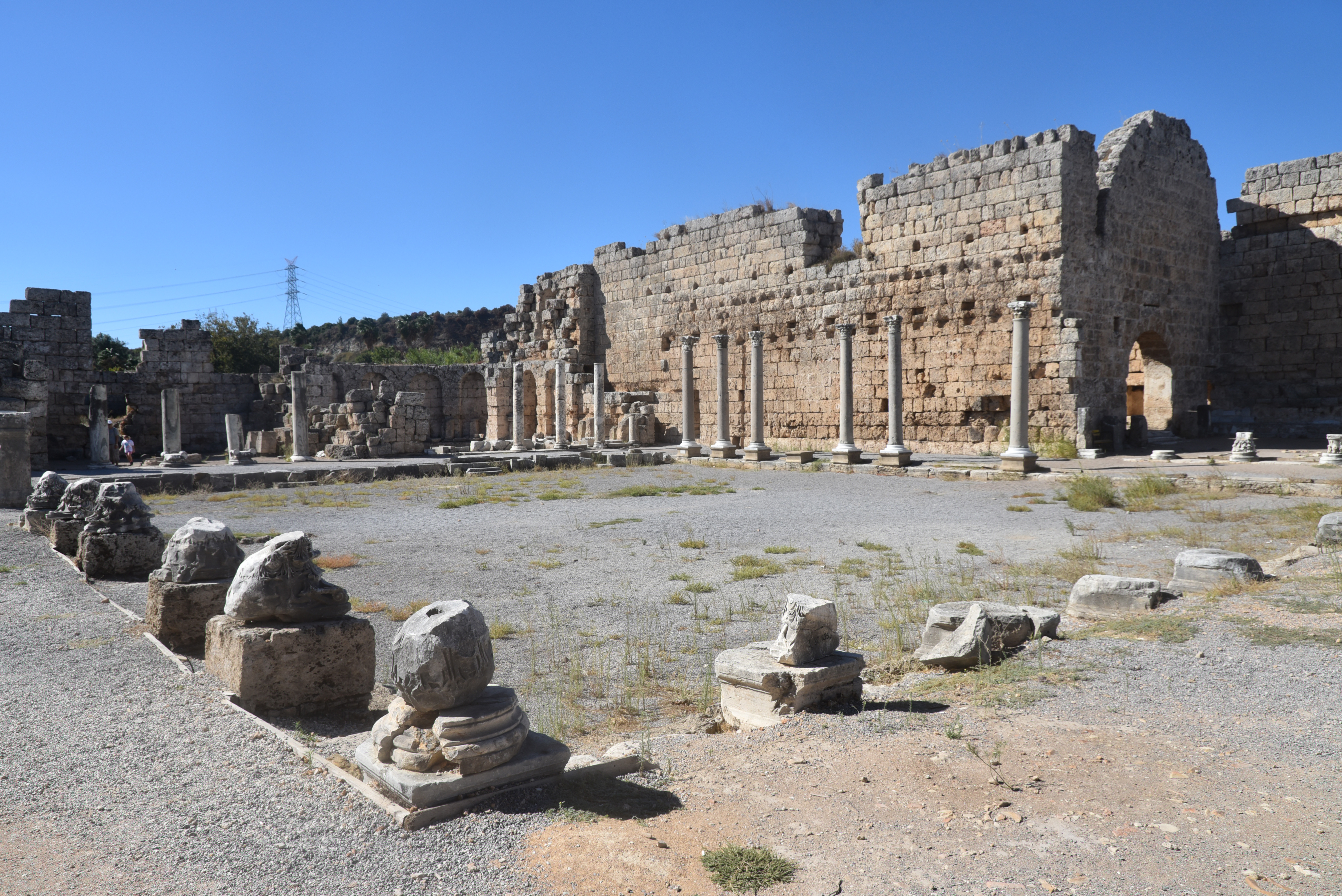
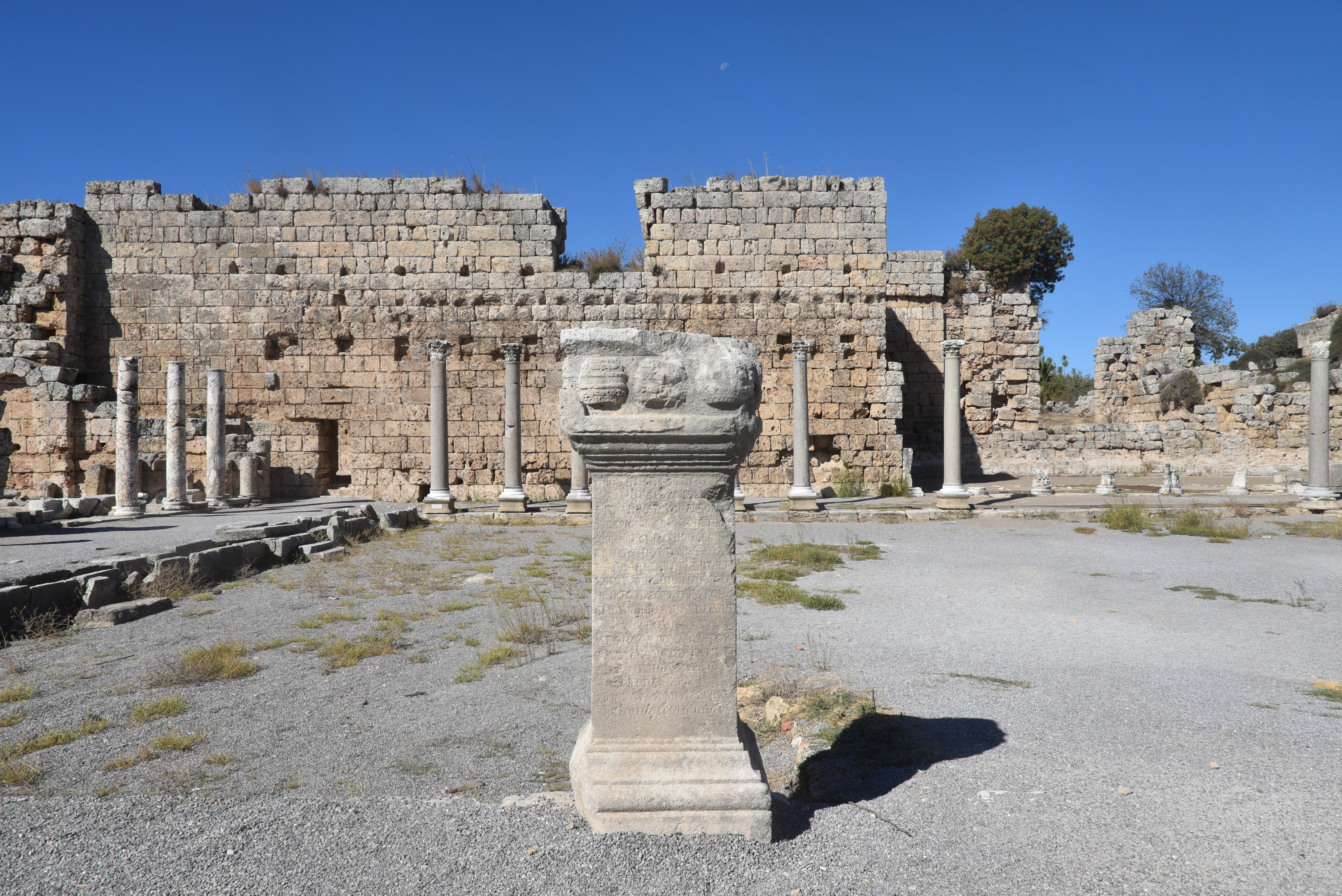
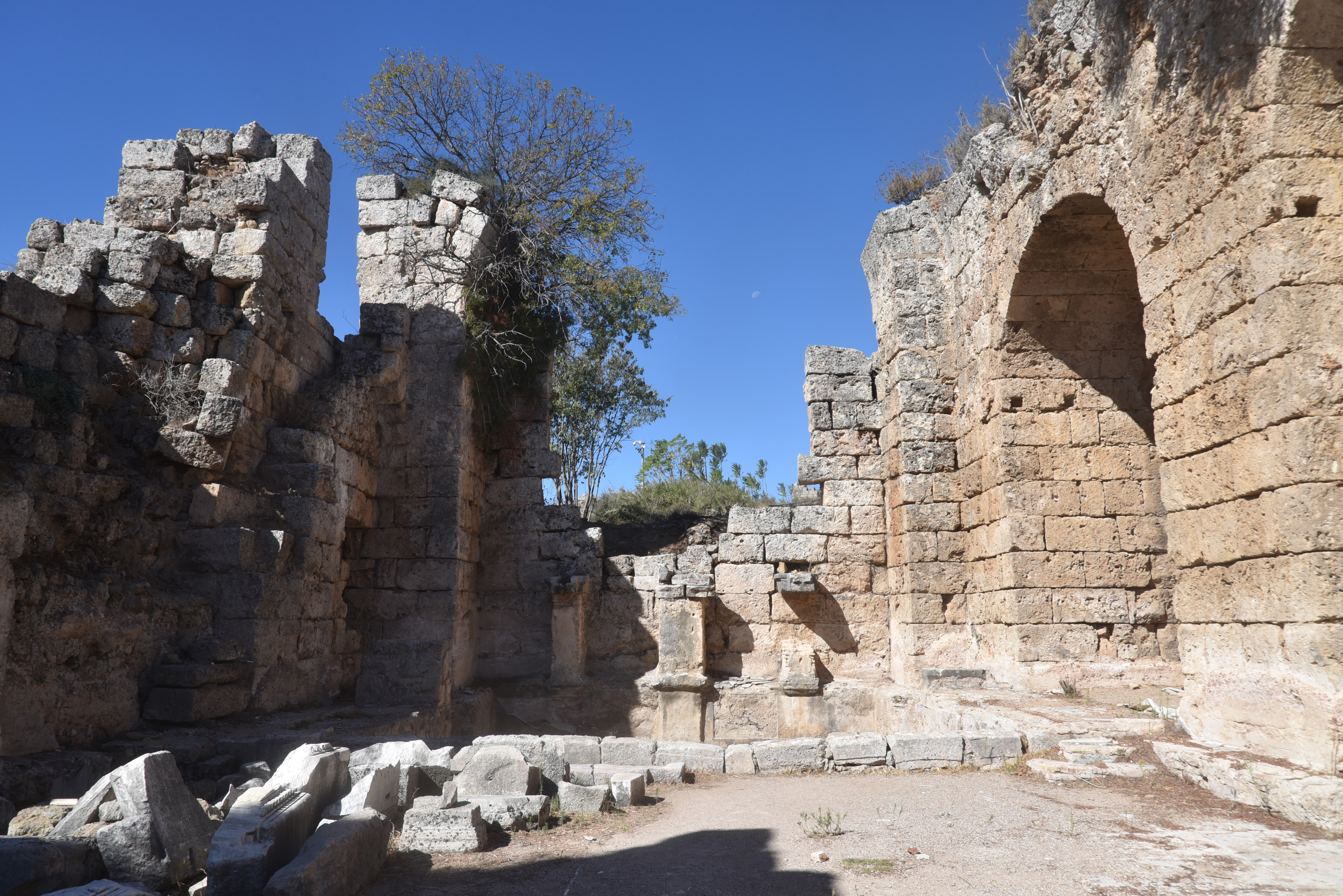
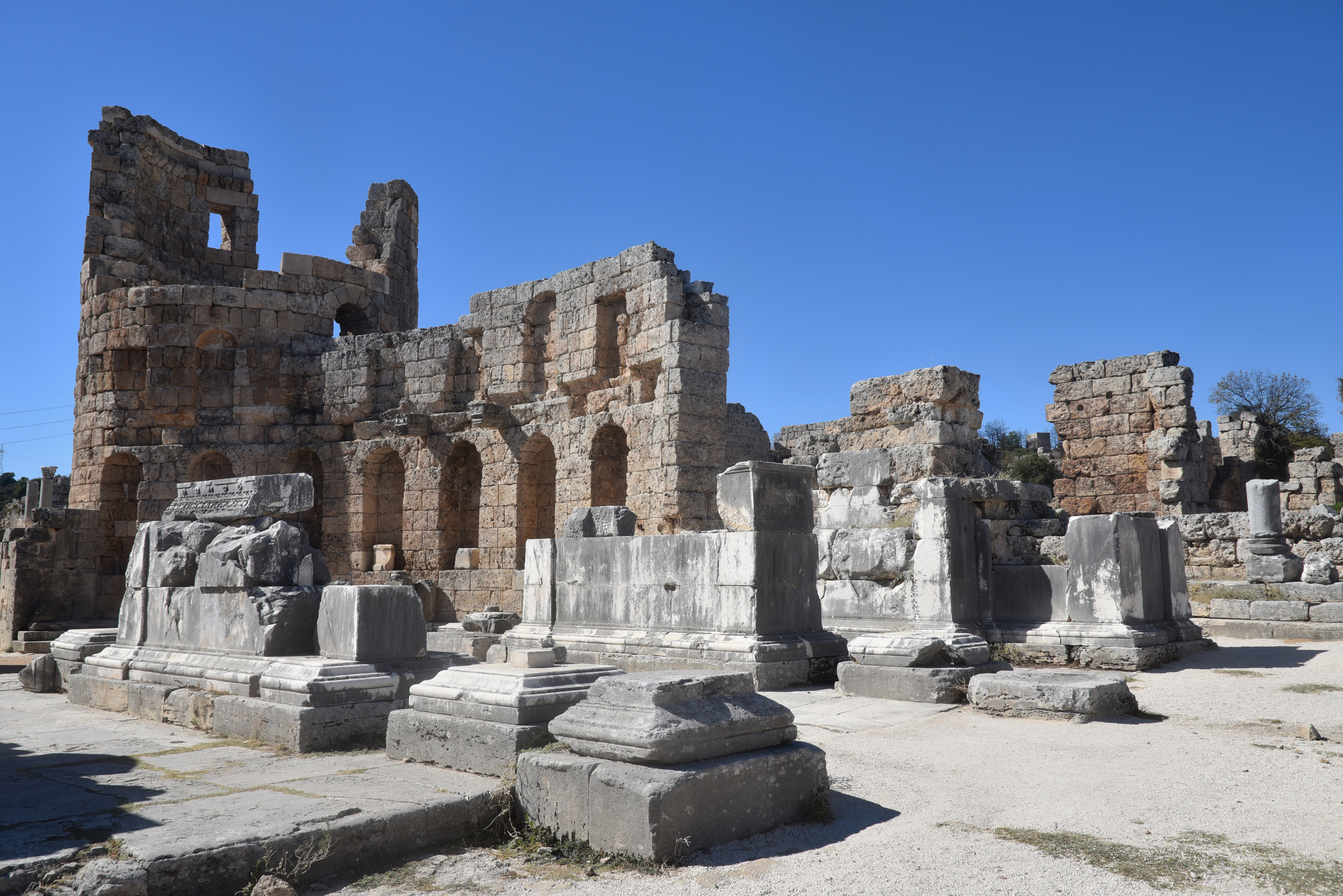
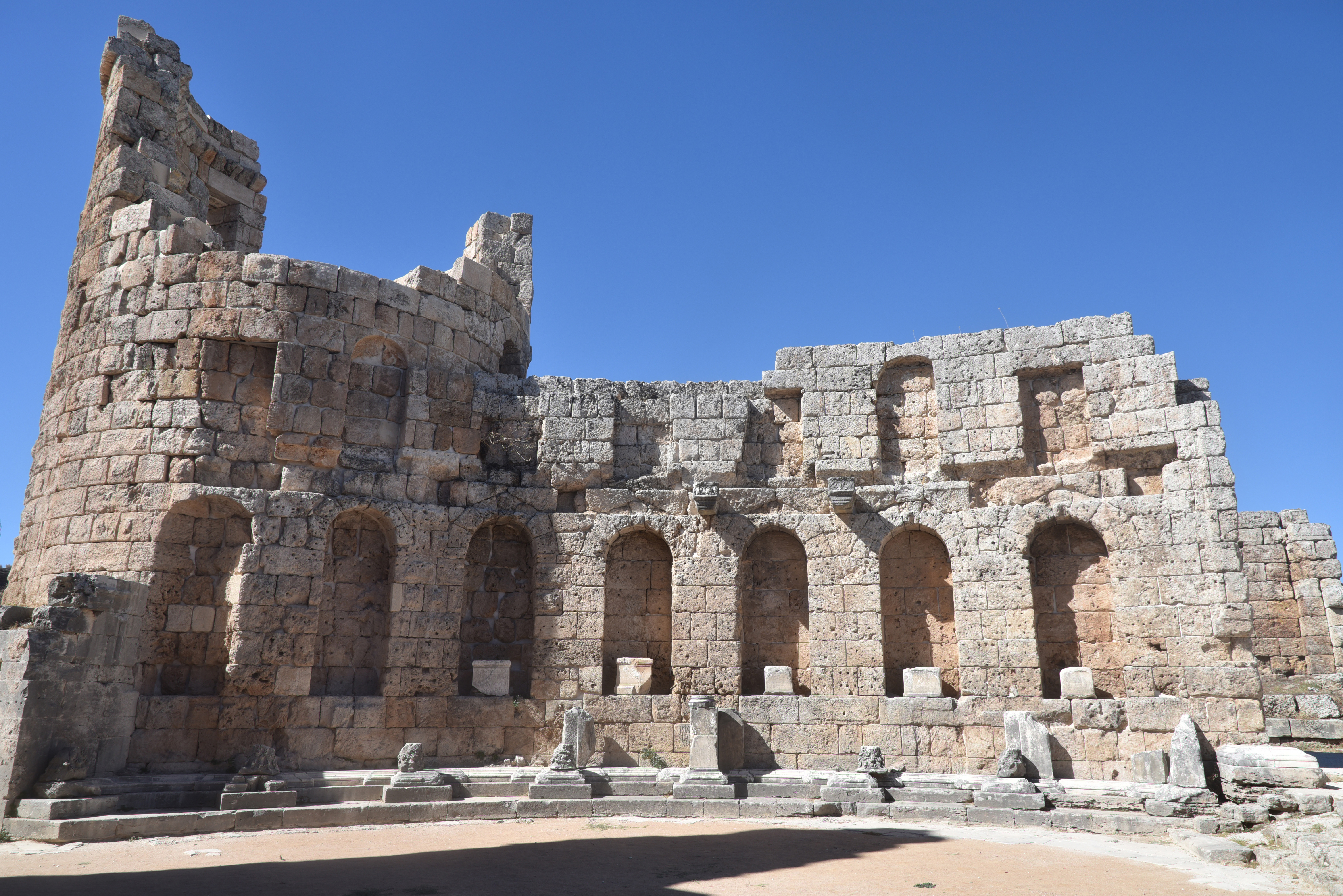
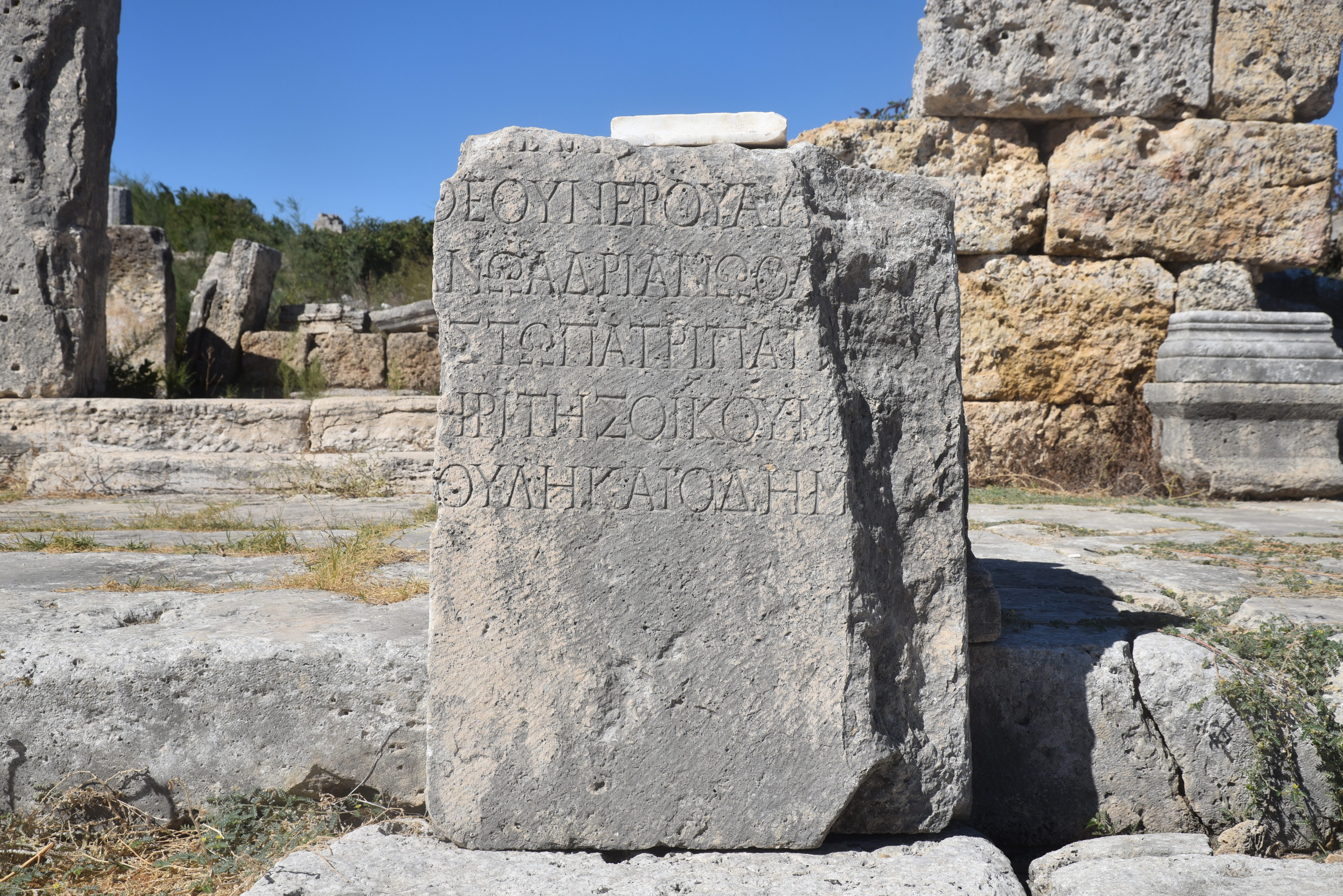
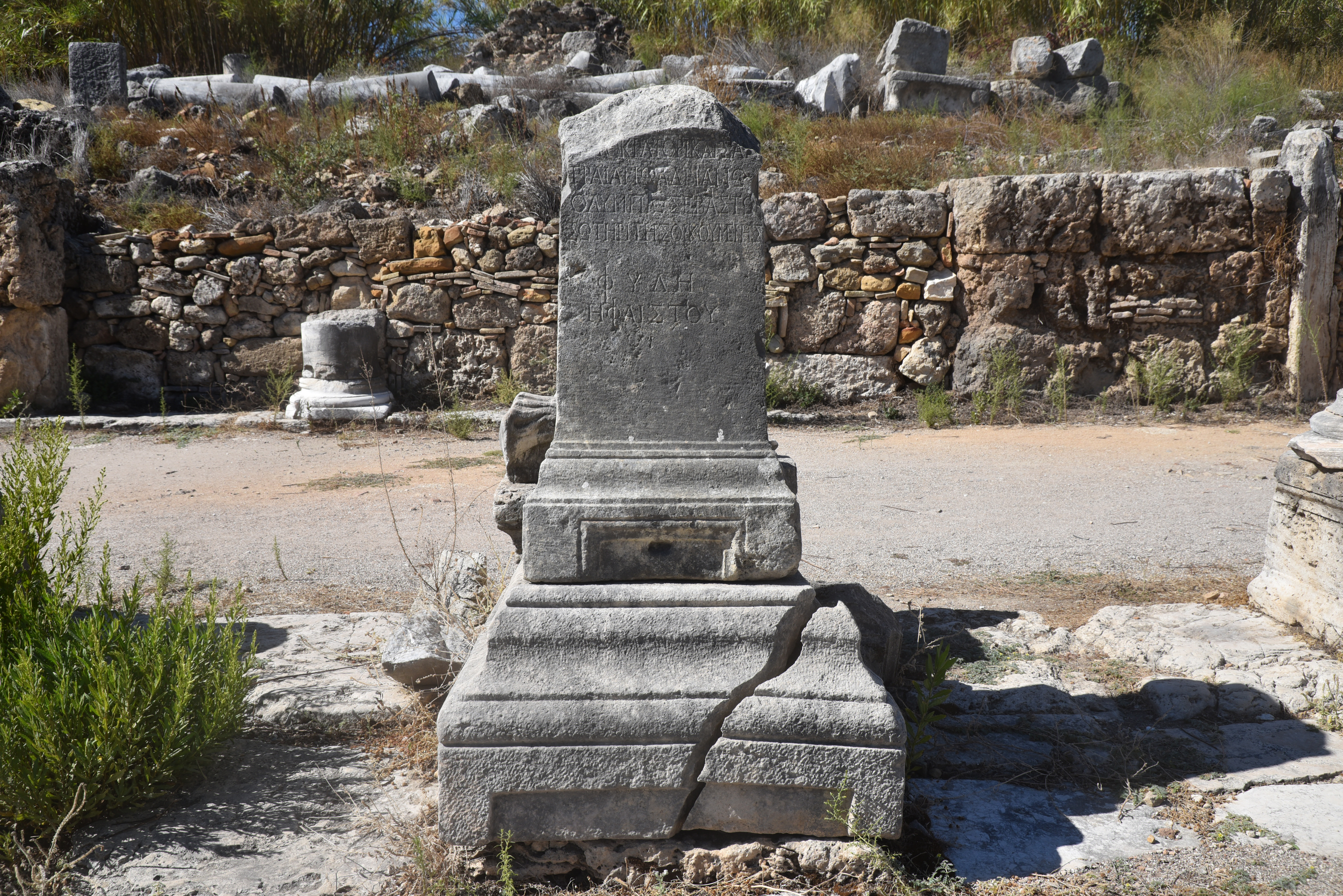
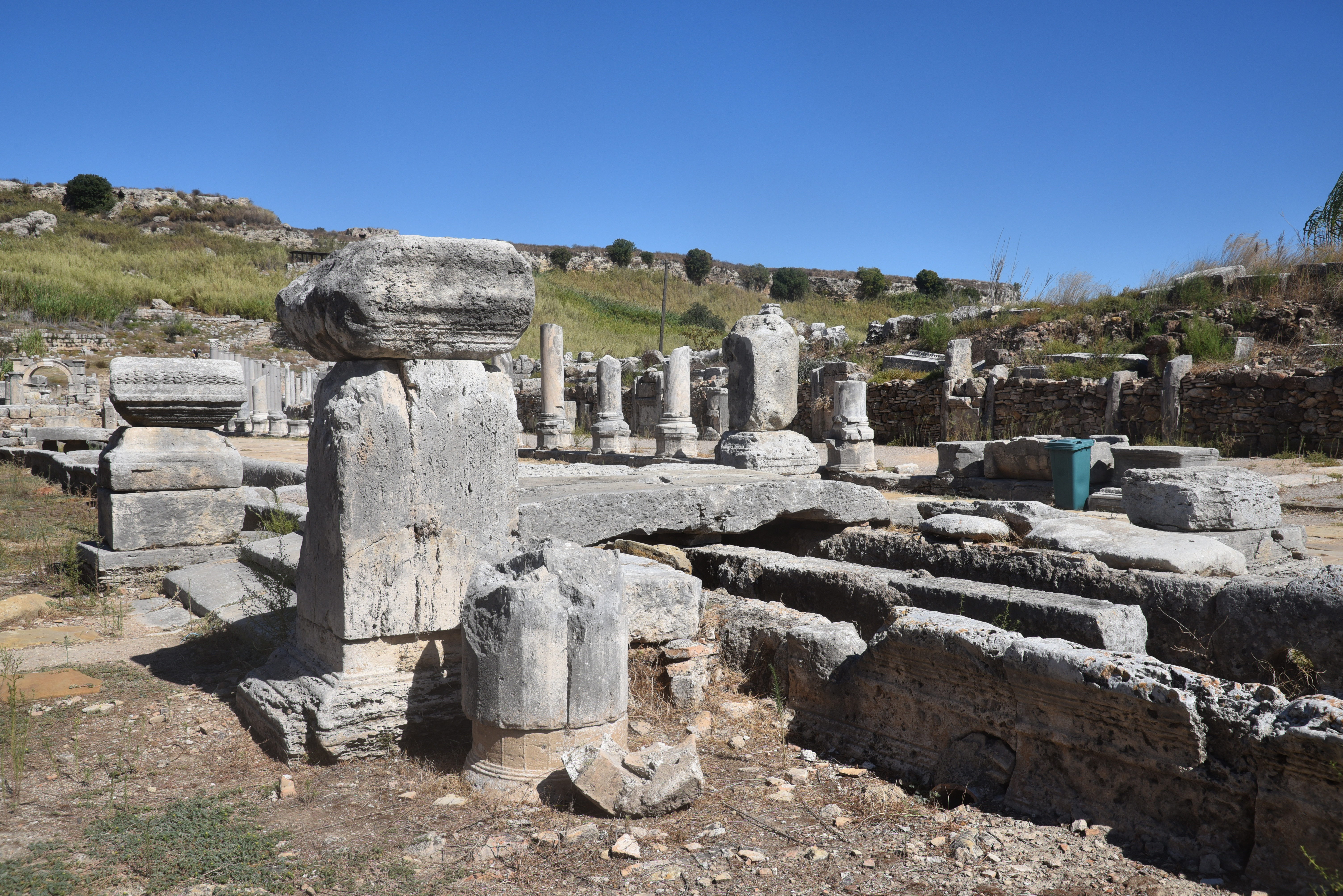
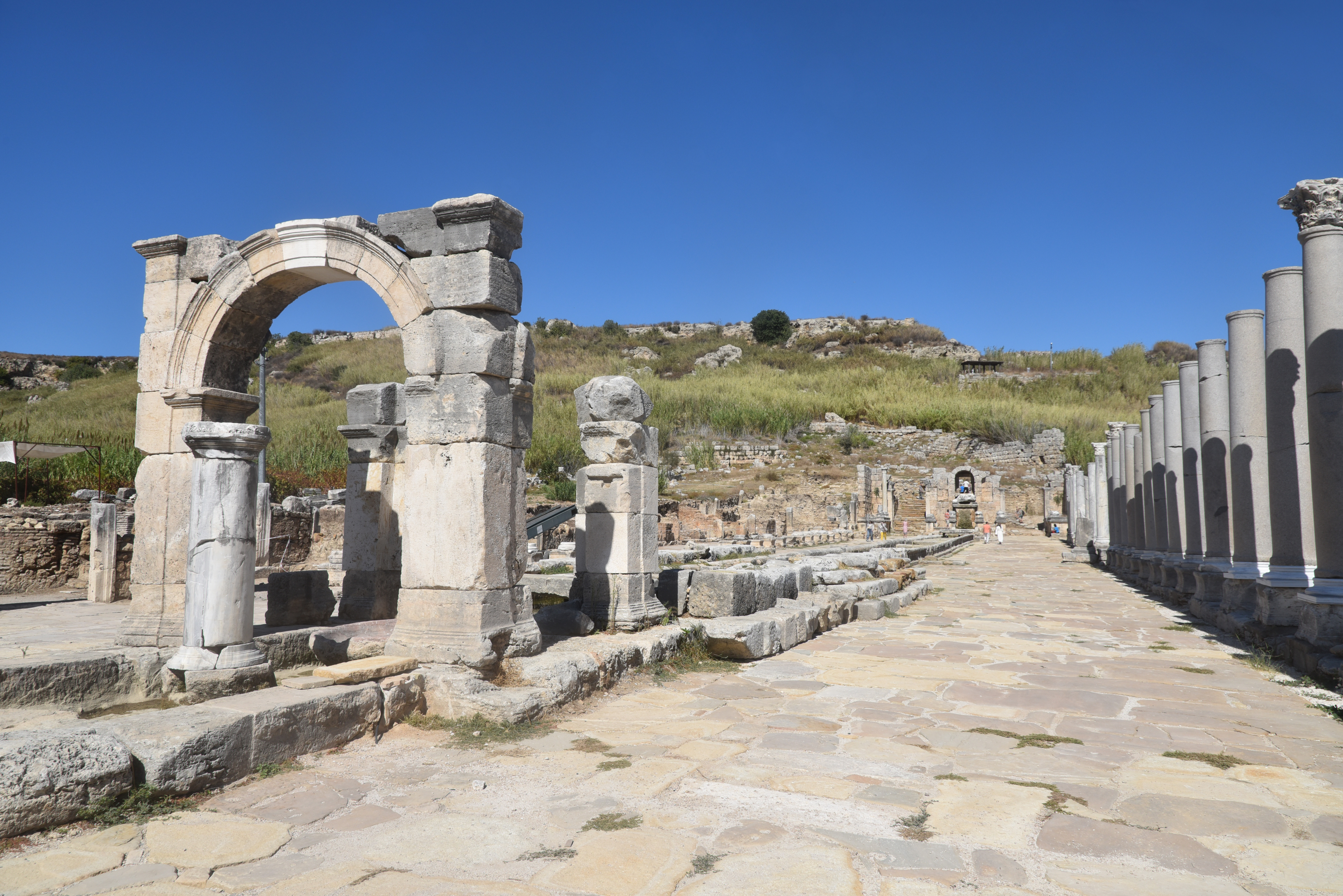
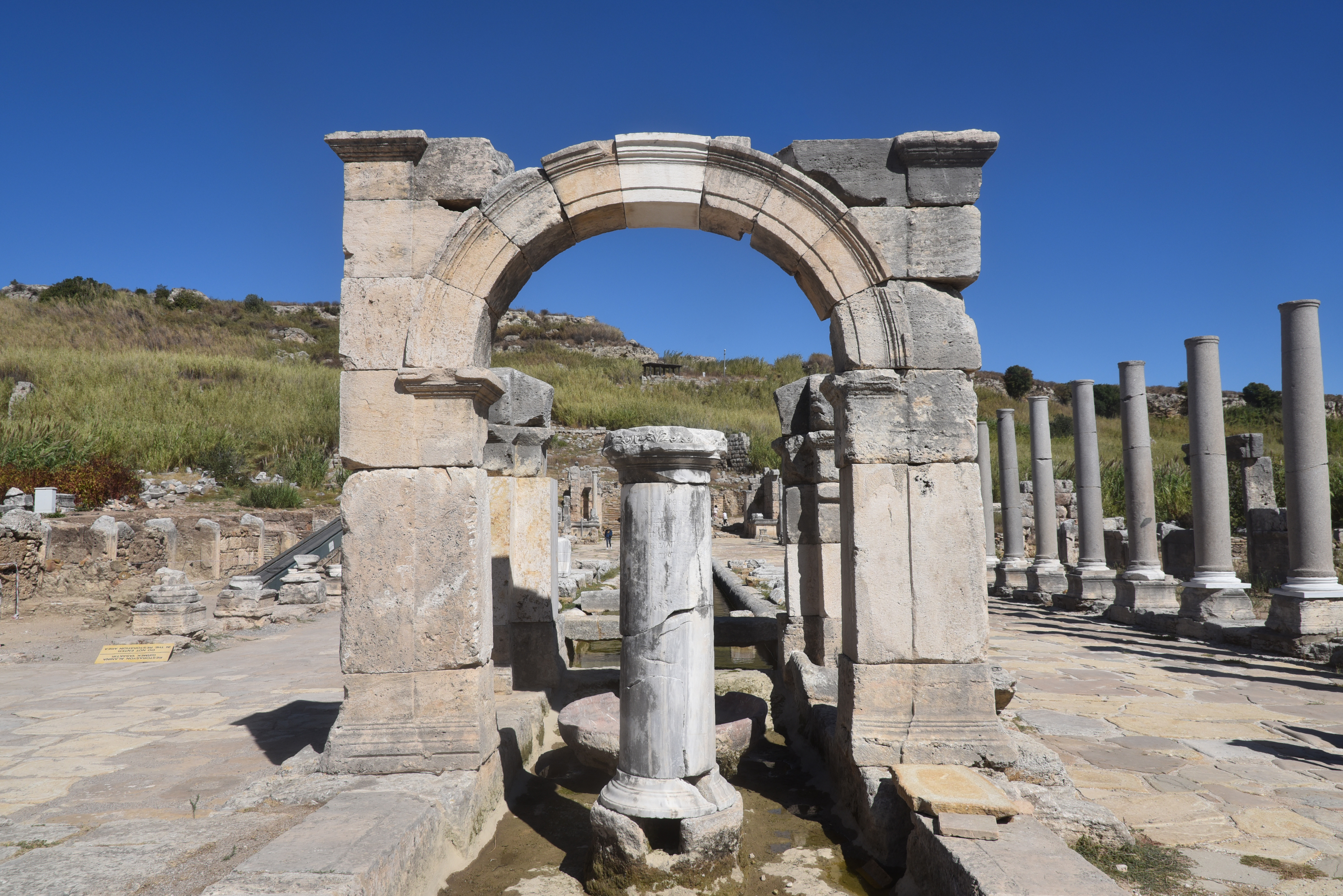
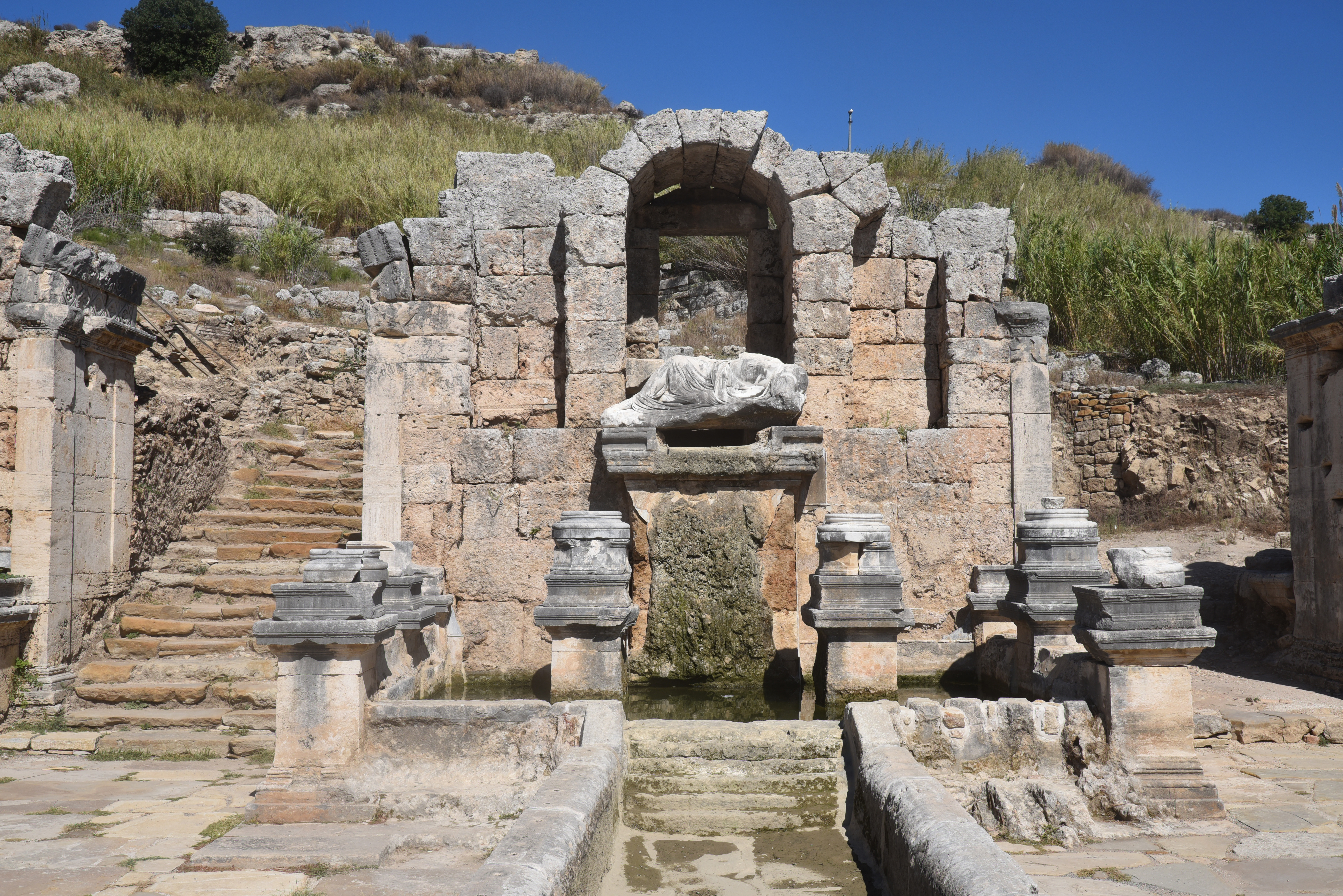
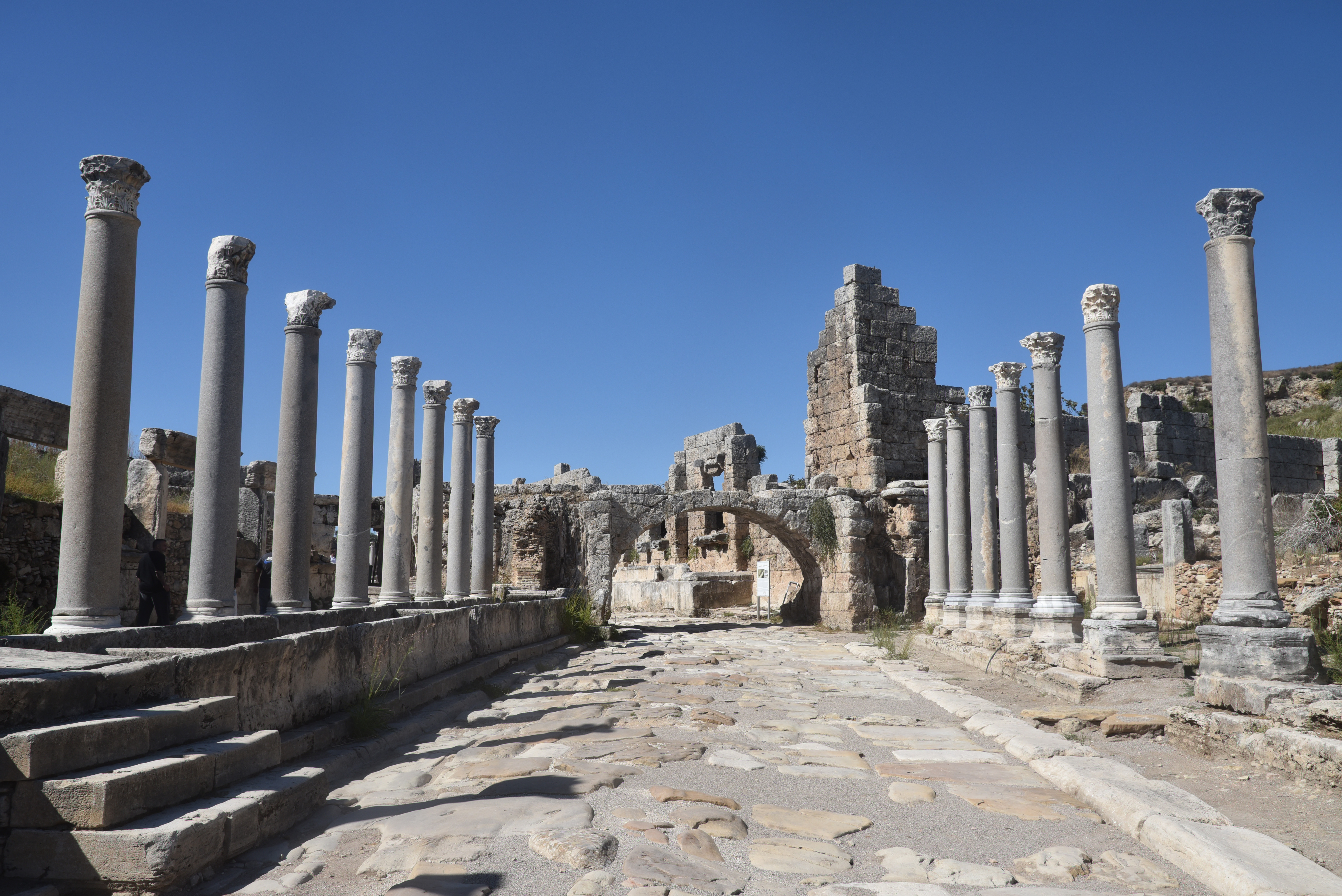
The outer gate, built during the reign of Emperor Septimius Severus in the 4th century AD. Both sides of the gate were protected by high towers.The gate opens into a courtyard, also constructed during the reign of Septimius Severus, and the city beyond.The Southern Nymphaeum (fountain), built on the orders of Aurelia Paulina between AD 198 and 211 in the courtyard of Septimius Severus.The monumental nymphaeum was dedicated to Artemis Pergaia (the local goddess of Perge) and the imperial family of Septimius Severus.Τhe central courtyard (palaestra) with Ionic colonnade of the South Baths. This monumental baths complex dates to the reigns of Trajan (98-117) or Hadrian (117-138) and was reconstructed in the reign of Septimius Severus (193-235).The palaestra of the South Baths, used for the physical exercise of the young.Room IV of the South Baths with a swimming pool (natatio), measuring 20×13 m. It was functionally connected with the palaestra.The Tepidarium (Room II) of the South Baths, measuring with a system for the circulation of hot air (hypocausts) running under the marble floor of the room.Inscribed statue base dedicated to Hadrian in Southern Baths, IK Perge 112, dated AD 131-132.The South Baths.The Hellenistic City Gate with two circular towers, dating to the 3rd century BC, was later renovated by Plancia Magna in the 2nd century AD.Monumental triple arch commissioned by Plancia Magna, a local elite woman and prominent benefactress, during the early reign of Hadrian.The interior horseshoe-shaped courtyard of the Hellenistic city gate, reconstructed in the early 2nd century AD by Plancia Magna, with niches where statues once stood, Perge.Artist reconstruction of the cardo maximus with the Hellenistic gate complex and the honorific arch. Balage Balogh / archaeologyillustrated.comStatue bases of Hadrian’s imperial family set up by Plancia Magna and placed on the monumental triple arch commissioned by her during the early reign of Hadrian.The colonnaded Cardo Maximus, the main north-south street running through the heart of the city.The Cardo Maximus is flanked on both sides by impressive marble columns, which once formed covered porticoes or walkways for pedestrians, providing shade and shelter for shoppers and citizens.A unique feature of Perge’s main street is a narrow water channel running down the middle. Water from the northern nymphaeum (monumental fountain) flowed through this channel, supplying fresh water to the city and adding to the street’s grandeur.The Cardo Maximus was paved with large stone slabs, and ruts worn by thousands of chariots are still visible in the original flagstones. Numerous shops and public buildings, some with mosaic floors, lined the street, making it the city’s primary commercial and social artery.Inscribed statue base along the Cardo Maximus dedicated to Hadrian, IK Perge 113, dated AD 131-132.Inscribed statue base along the Cardo Maximus dedicated to Hadrian, IK Perge 115, dated AD 131-132.The northern section of the colonnaded Cardo Maximus.
The northern section of the colonnaded Cardo Maximus and the Arch of Demetrius and Apollonius, a monumental Roman arch built around AD 80 and located at the intersection of the city’s two main colonnaded streets.The so-called Arch of Demetrius and Apollonius, a monumental Roman arch built around AD 80. This single-arched gate stood nearly 11 meters tall, but today only the square pylon legs remain.The northern section of the colonnaded Cardo Maximus.
The North Nymphaeum, located at the northern end of the Cardo Maximus. It is dated to the Hadrianic period.Artist reconstruction of North Nymphaeum. It was a double-storied pi-shaped nymphaeum, with two projecting side wings fronted by columnar façades. Balage Balogh / archaeologyillustrated.comThe statuary display of the North Nymphaeum included two life-sized portraits of Hadrian, one cuirassed and the other heroically nude (see here).The Western Colonnaded Street (Decumanus Maximus), one of the city’s two main arteries.The Western Colonnaded Street, one of the city’s two main arteries, is a roughly 460-meter-long, 8-meter-wide thoroughfare that runs from the main street intersection toward the Palaestra and Northern Baths.Lined with Corinthian or Ionic columns, the porticoes of the Western Colonnaded Street provided pedestrians with shaded walkways and served as a location for shops.The Western Colonnaded Street (Decumanus Maximus) with the gymnasium-palaestra complex donated by C. Iulius Cornutus Bryoninus, Iulia Tertulla and Iulia Severa and dedicated to the Emperor Claudius. The building was erected of travertine on a square plan, with sides measuring 76 meters.The facade of the gymnasium-palaestra complex.Inscriptions along the Western Colonnaded Street (Decumanus Maximus).North West City Gate, Perge, the monumental entrance gate at the western end of the Decumanus Maximus.The Caracalla Nymphaeum, a semi-circular monumental fountain located at the end of the Decuman Maximus. It was constructed on a raised podium and embellished with statues of gods and goddesses, as well as of Emperor Caracalla.The Agora/Macellum, a square-shaped (51m x 51m) surrounded by colonnades and shops built in the 4th century AD.The northern side of the Agora/Macellum.The circular structure in the centre of the Agora/Macellum served as a fountain.
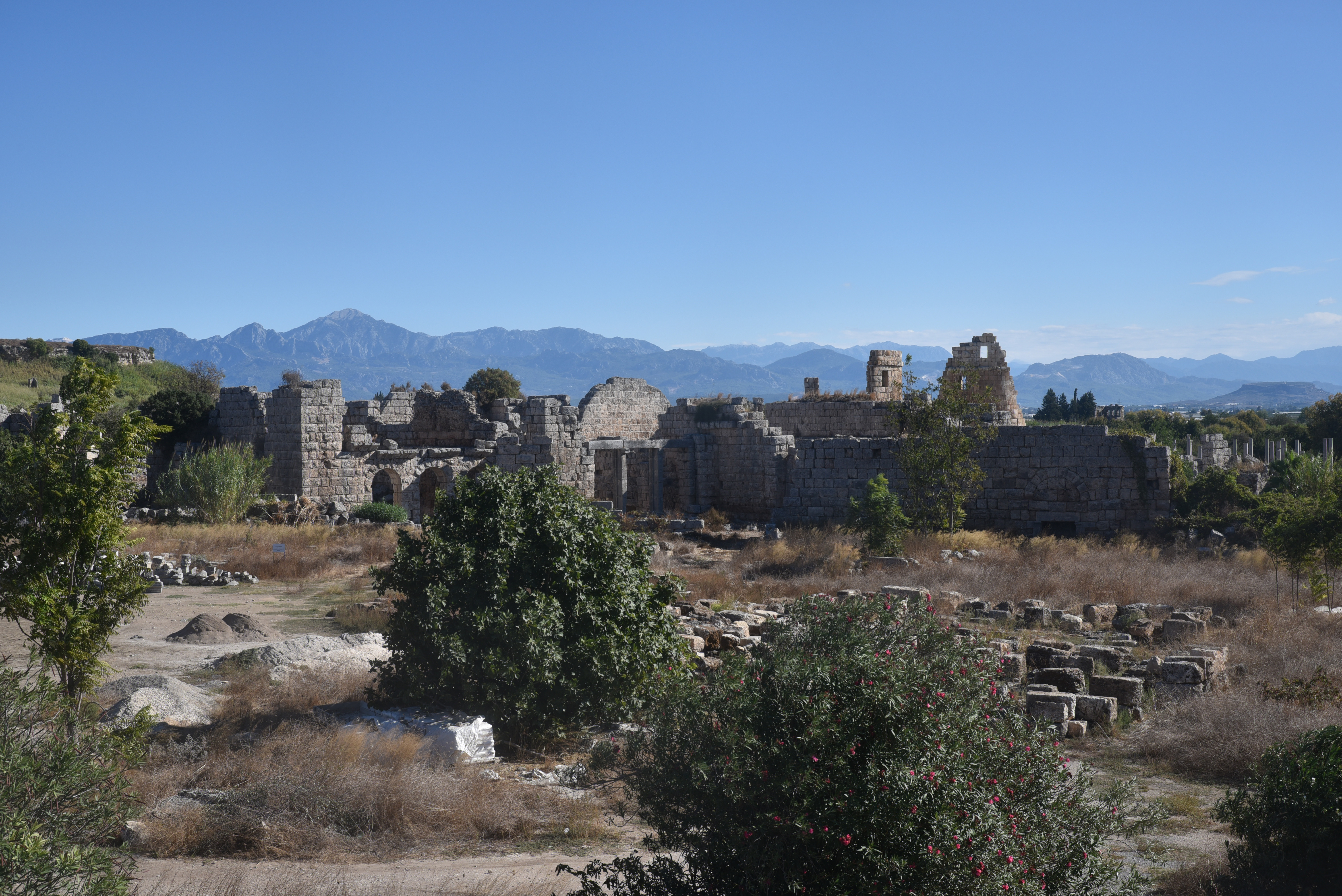
View of the Theatre, located outside the city walls on the western side, was closed to the public in October 2025. Probably built around 120 AD, could accommodate approximately 15,000 spectators.The Stadium. Built in the second half of the 1st century AD, it could accommodate 12,000 spectators.The stadium of Perge is one of the best-preserved ancient stadiums in Asia Minor. Constructed in the latter part of the 1st century AD, it measures 234 meters in length and contains twelve rows of seating.The northern end of the Stadium where bloody gladiator fights took place.The Stadium.The Stadium features barrel-vaulted construction with 30 vaults on the longer side and 9 on the northern end.View of the South Baths from the top of the Stadium.View of the fortification walls and towers from the top of the Stadium.View of the fortification towers and the South Baths from the top of the Stadium.The Southern Basilica has three naves and a narthex, dating to the 6th century AD.
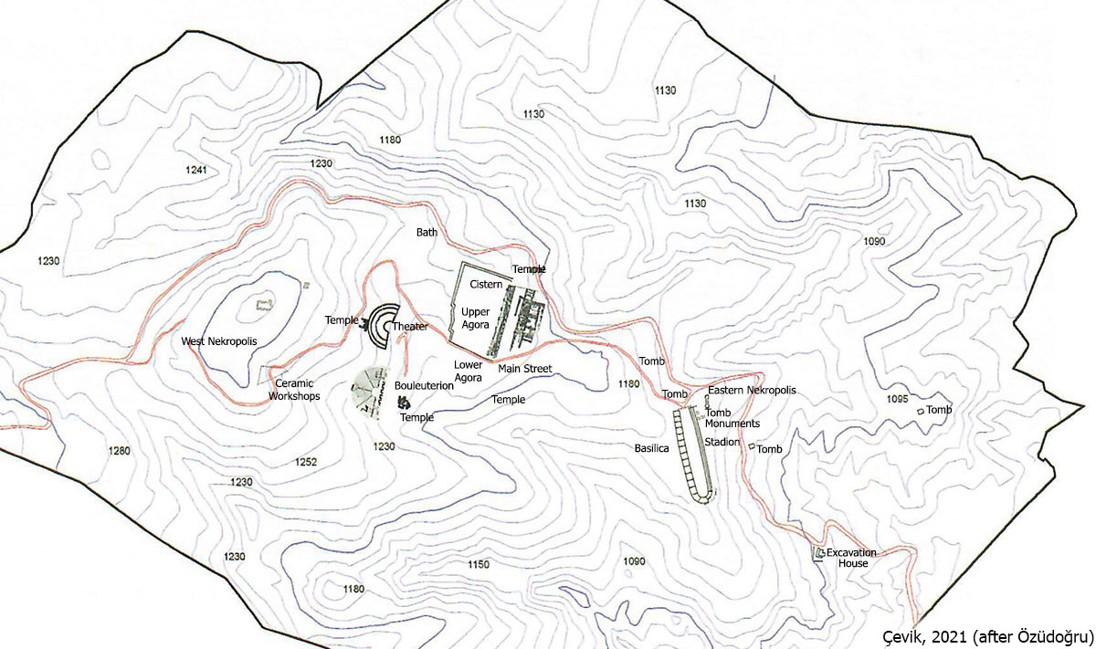
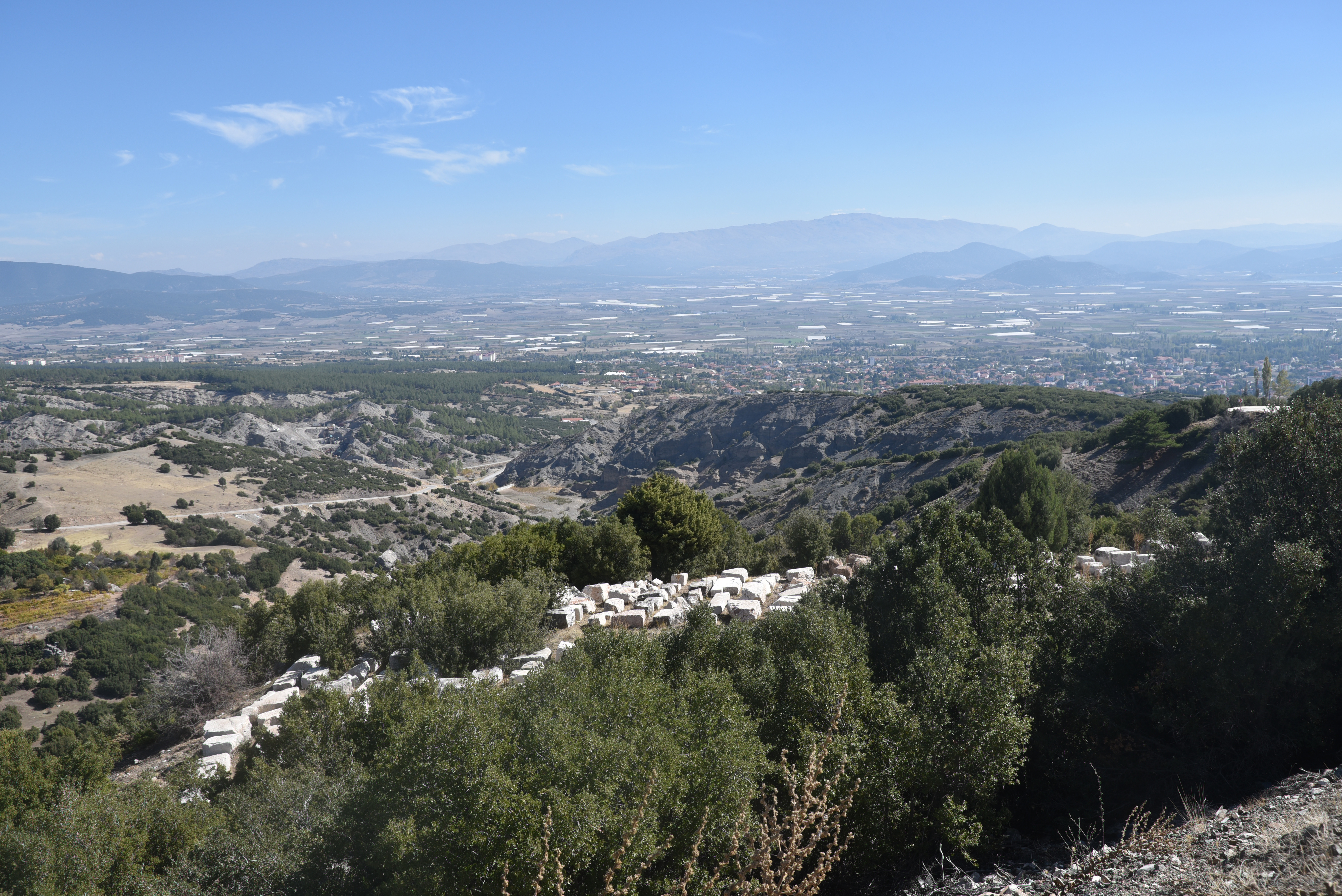
Kibyra was an ancient city located on a mountainous site, spanning three prominent hills, southwest of modern-day Gölhisar, approximately 110 kilometres from Burdur in southwestern Turkey. It was important in the ancient world due to its strategic location at the intersection of the cultural regions of Lycia, Caria, Pisidia, and Phrygia, and at the crossroads of important north–south and east–west commercial routes. The city prospered and developed during the second half of the 2nd century BC, becoming the political centre of the Kabalia or Kibyriatis region. Most of the buildings standing today were constructed in Roman times, following the city’s destruction by an earthquake in AD 23.
Geographer Strabo (13.4.17) first mentions Kibyra in ancient sources, noting that the city was founded by the Lydians and that its inhabitants spoke four languages: Pisidian, Solymian, Greek, and Lydian. Initially established near Uylupınar Lake, it was relocated to its current site in the 3rd century BC, likely for security reasons. Geographically, Kibyra lies within the Kabalis region (later known as Kibyratis), a cultural crossroads where Lycia meets Pisidia, Caria, Lydia, and Phrygia. The population of Kibyra was ethnically and linguistically diverse. Archaeological and epigraphic evidence from nearby mounds, such as Yusufça and Sorgun, shows that the area has been continuously occupied since the Late Chalcolithic and Early Iron Ages.
Kibyra rose to prominence during the Hellenistic period, coming under the control of the Kingdom of Pergamon in the early 2nd century BC under Eumenes II. Shortly thereafter, it became the leading member of a tetrapolis, known as the Kabalian League, a federation of four cities: Kibyra, Boubon, Balboura, and Oenoanda. The league was dissolved by the Roman commander L. Licianus Murena in 82 BC. Following this, Kibyra was incorporated into the Lycian League and became the administrative centre of the Roman province of Asia. After a devastating earthquake in AD 23, Emperor Tiberius provided financial aid and tax exemptions for its recovery, leading to the city being renamed Kaisareia Kibyra.
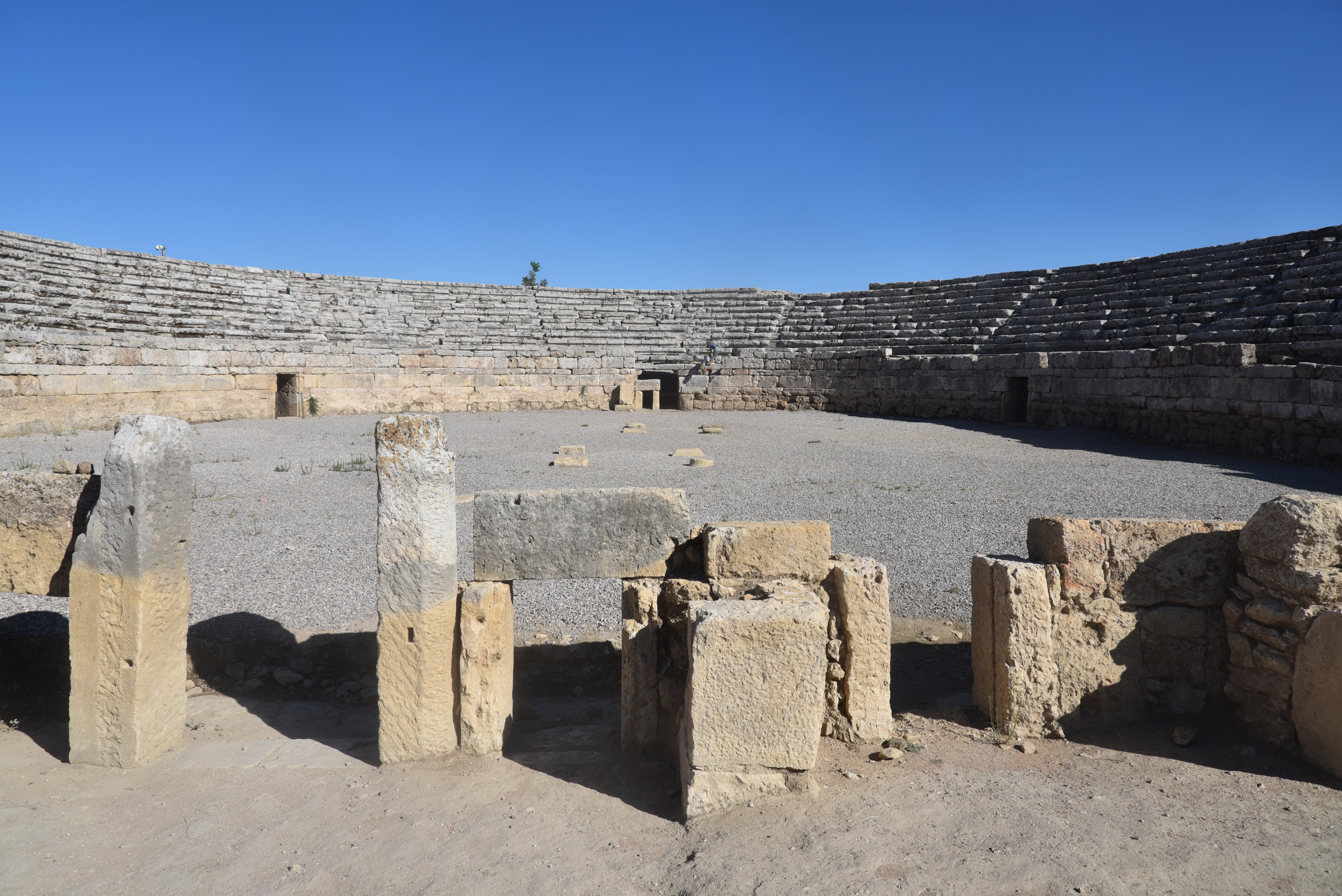
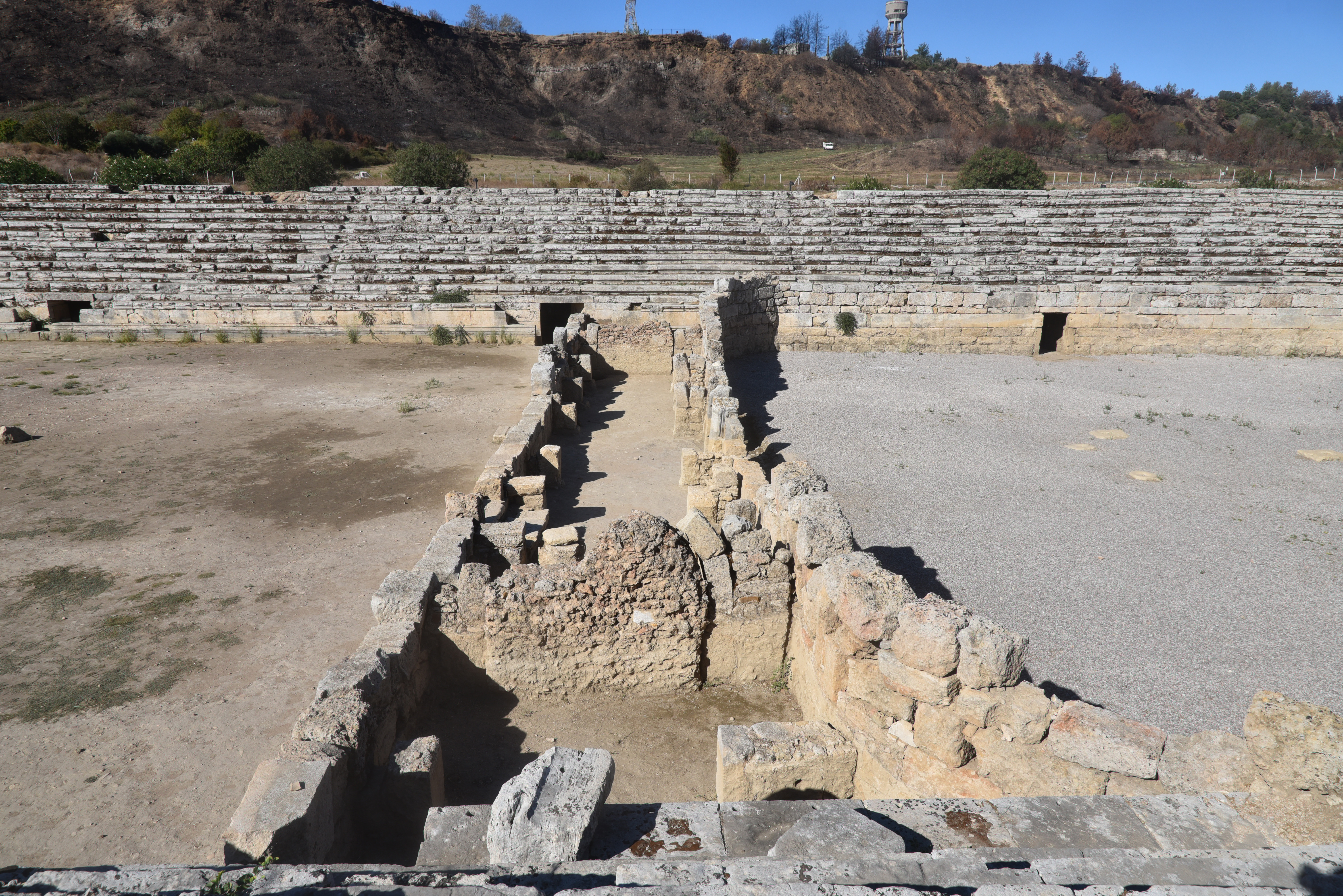
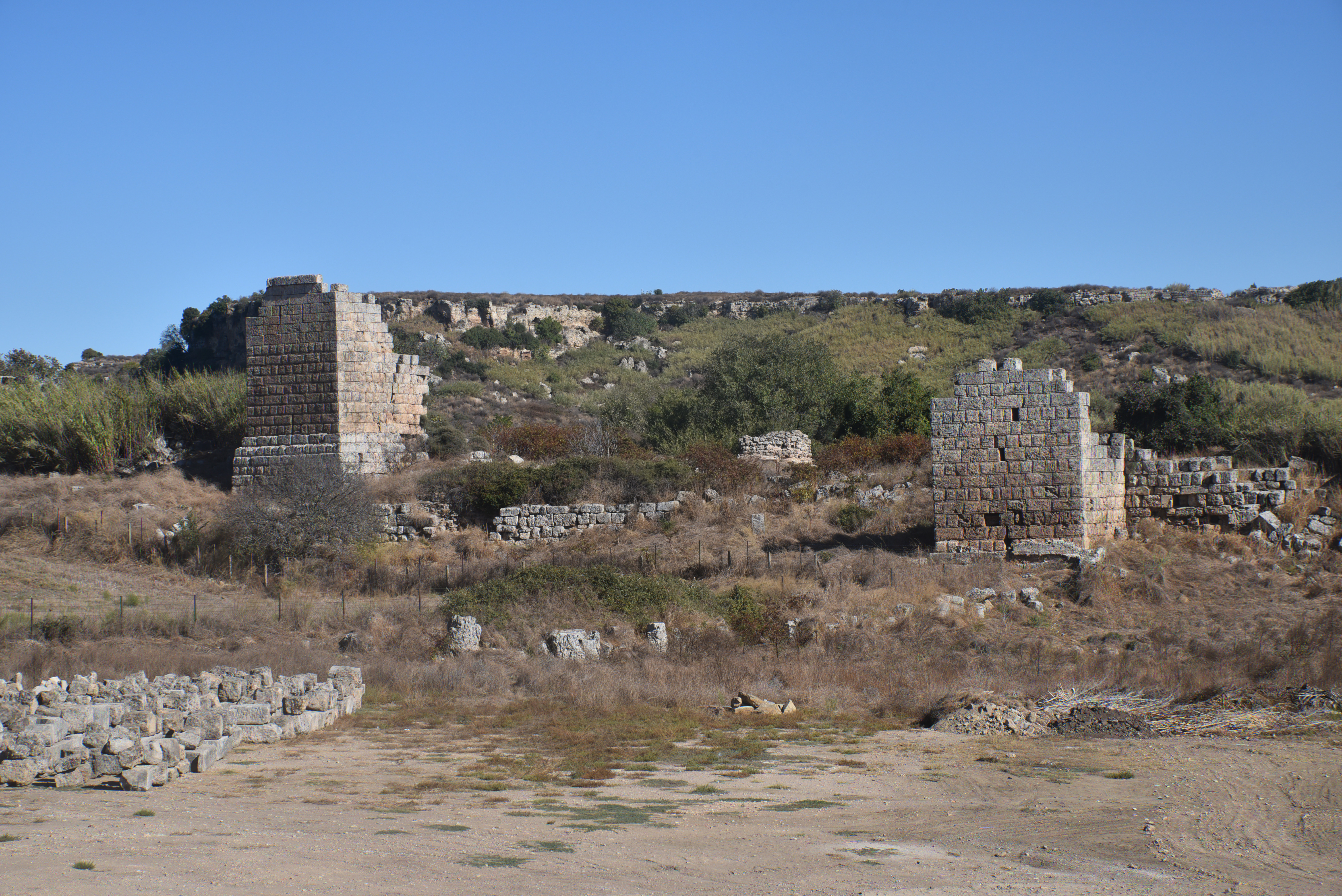
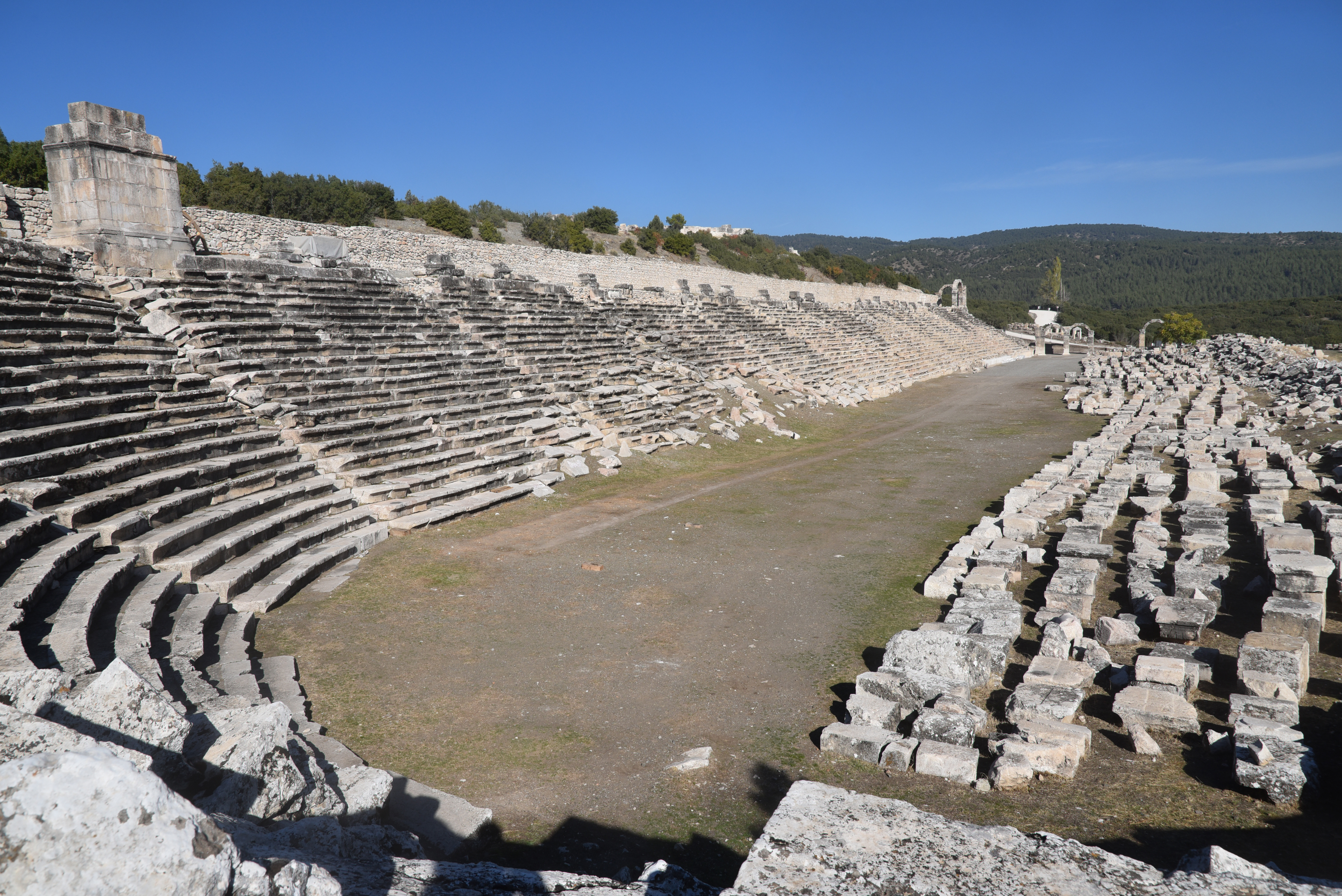
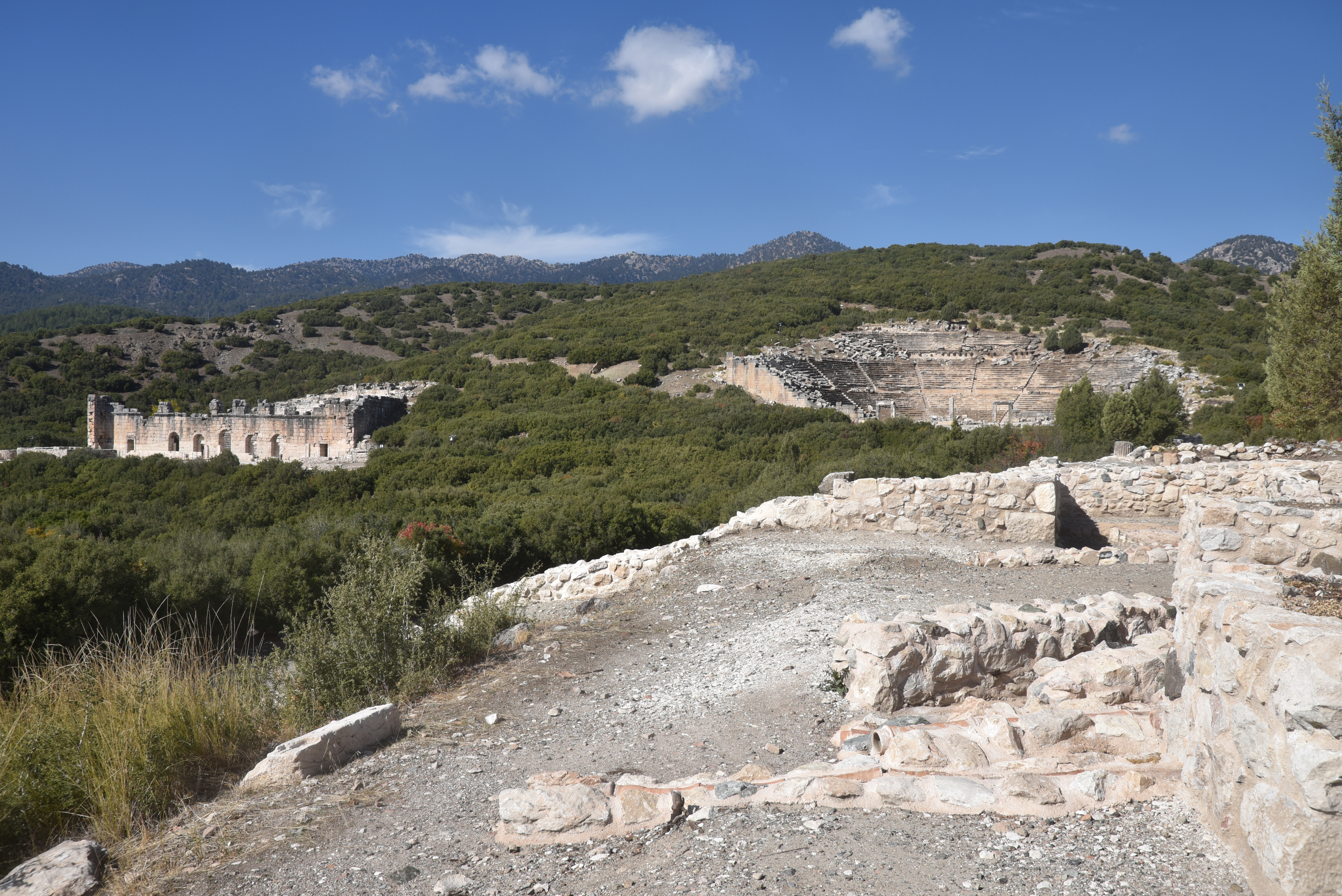
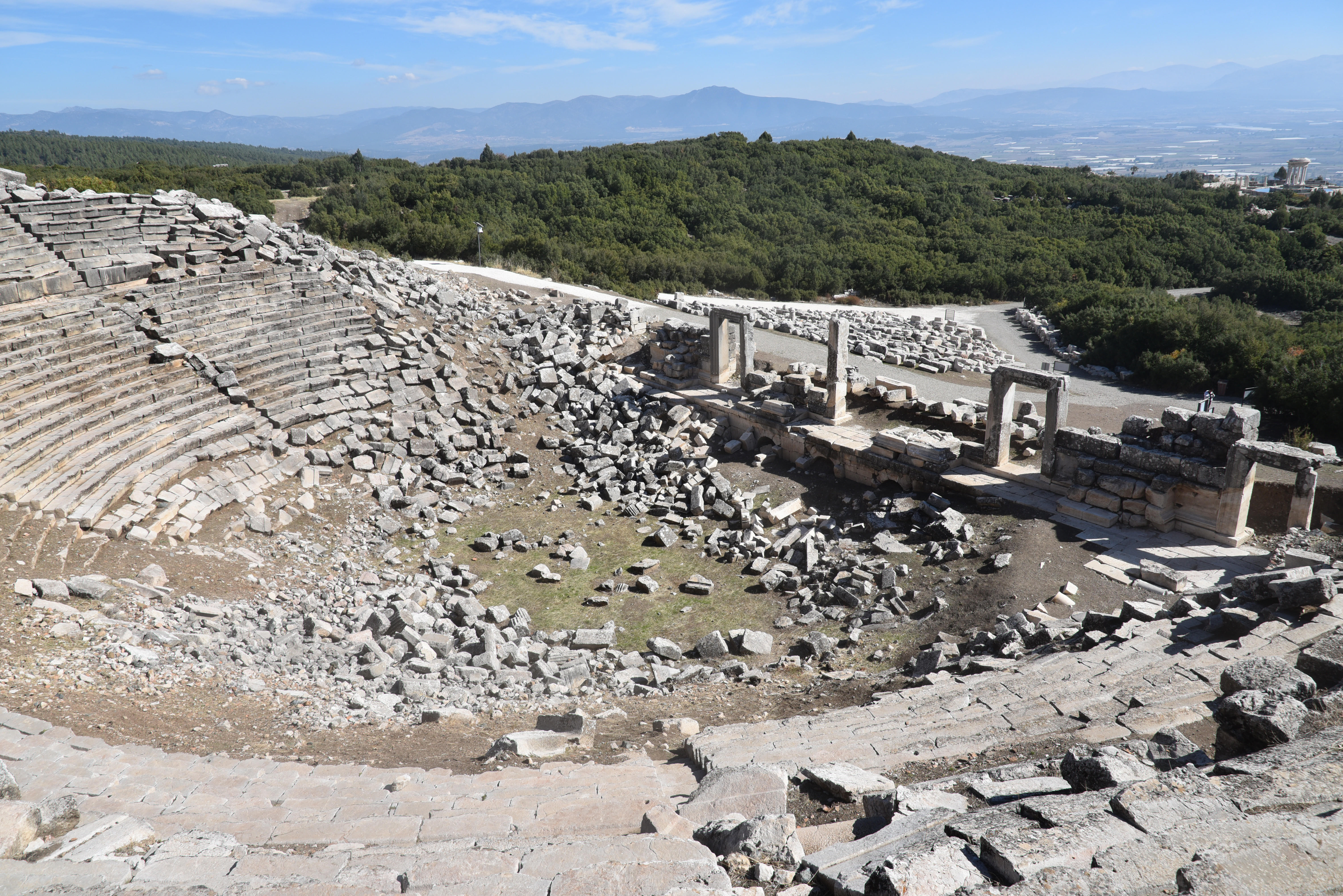
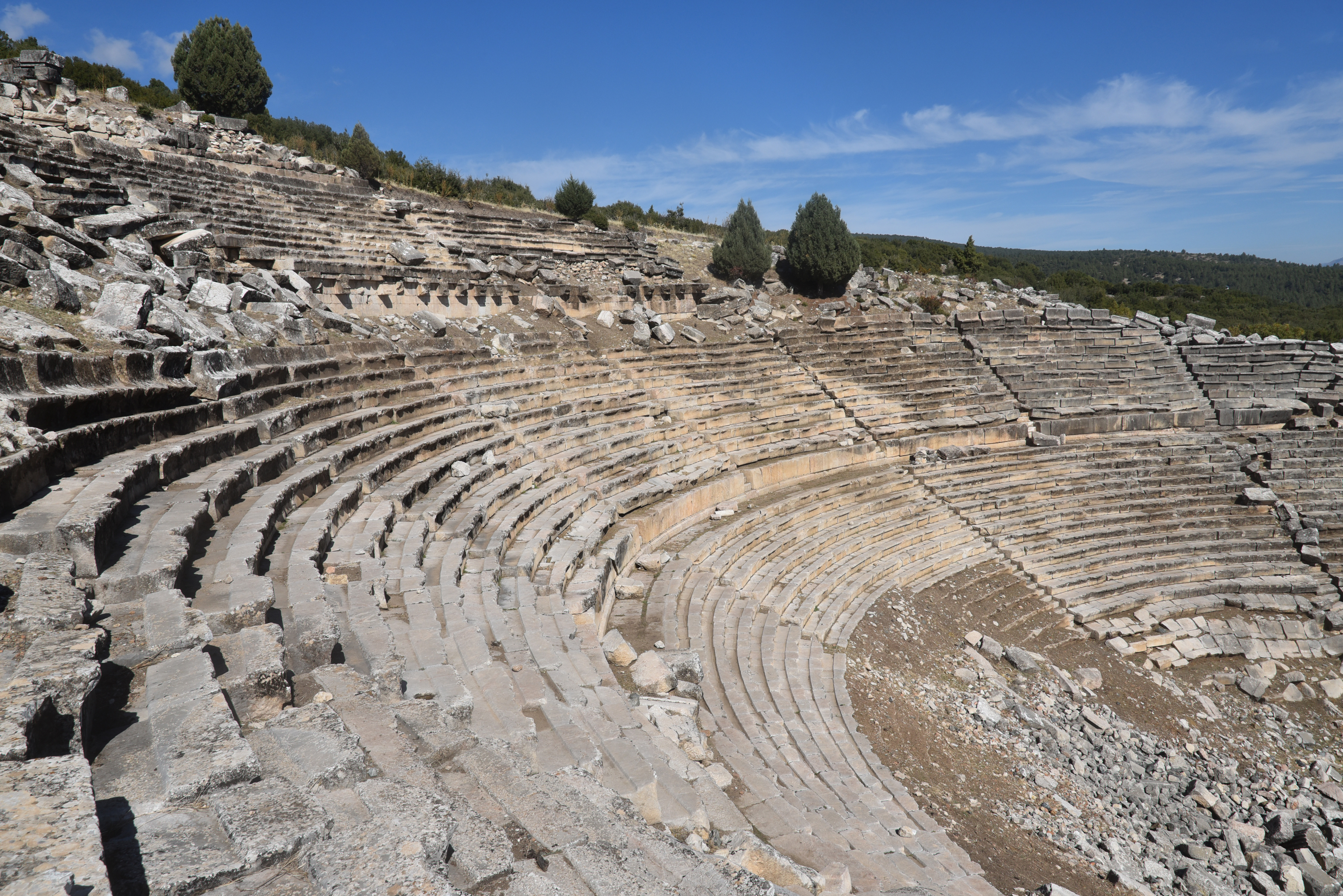
Under Roman rule, Kibyra reached its peak of prosperity. It became well-known for its agriculture, animal husbandry trade, and, particularly, its skilled production of ironwork, leather, and pottery. Kibyra was architecturally impressive, built across three hills and featuring monumental structures that highlighted its wealth and significance. Among these structures was a stadium measuring 185 meters in length, capable of accommodating around 10,000 spectators. The theatre, partially hewn into a hillside, had seating for about 9,000 people and showed evidence of a velarium and inscriptions referring to local clans and economic exchange rates. Adjacent to the theatre stood the Odeon, a multifunctional indoor theatre and council hall seating approximately 3,600. This venue was beautifully decorated with coloured marble, statues, and a distinctive Medusa mosaic in opus sectile on its orchestra floor. It is considered one of the best-preserved civic structures in Lycia. Additionally, nearby Byzantine baths featuring hypocaust systems demonstrate the region’s continuous urban development.
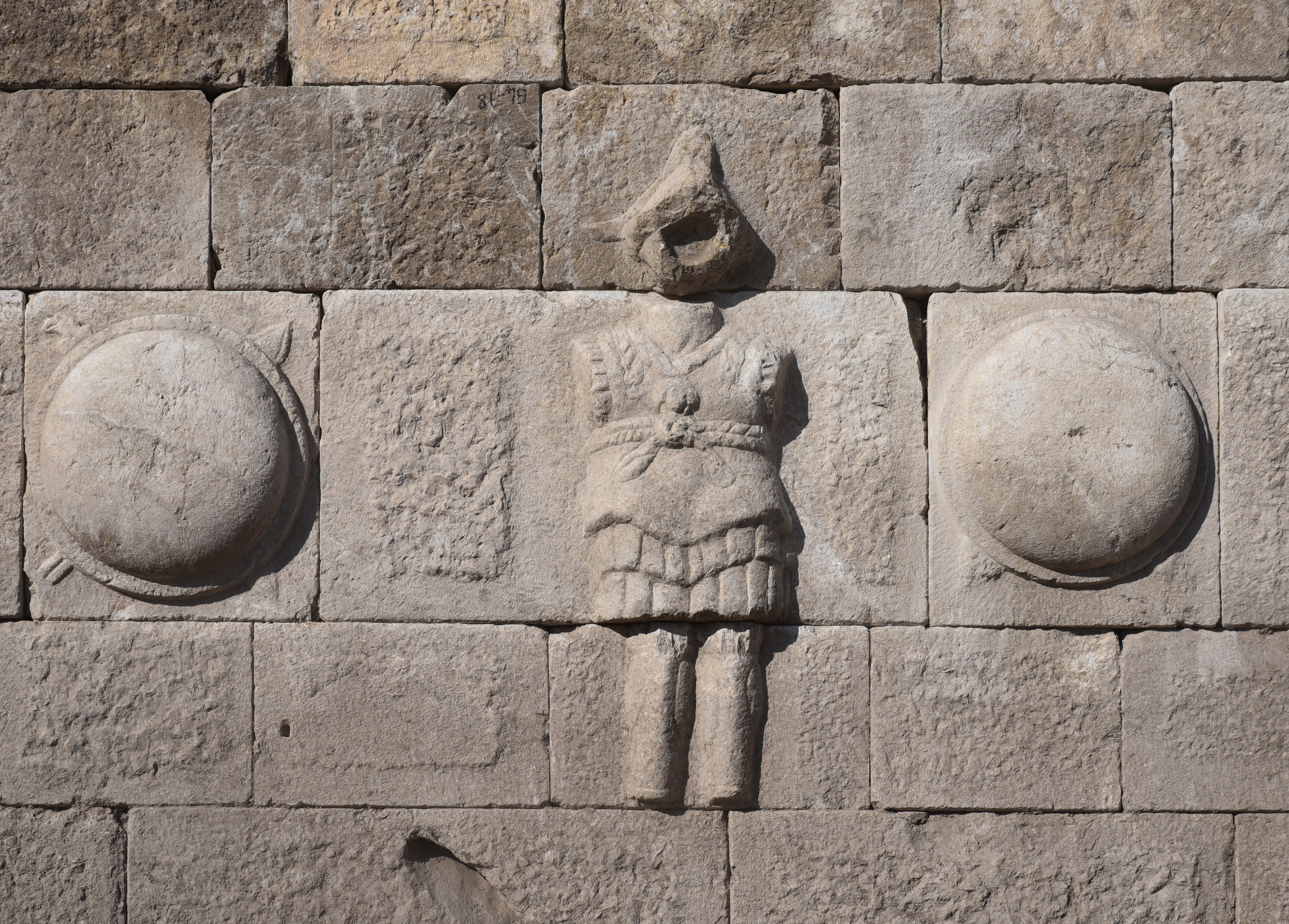
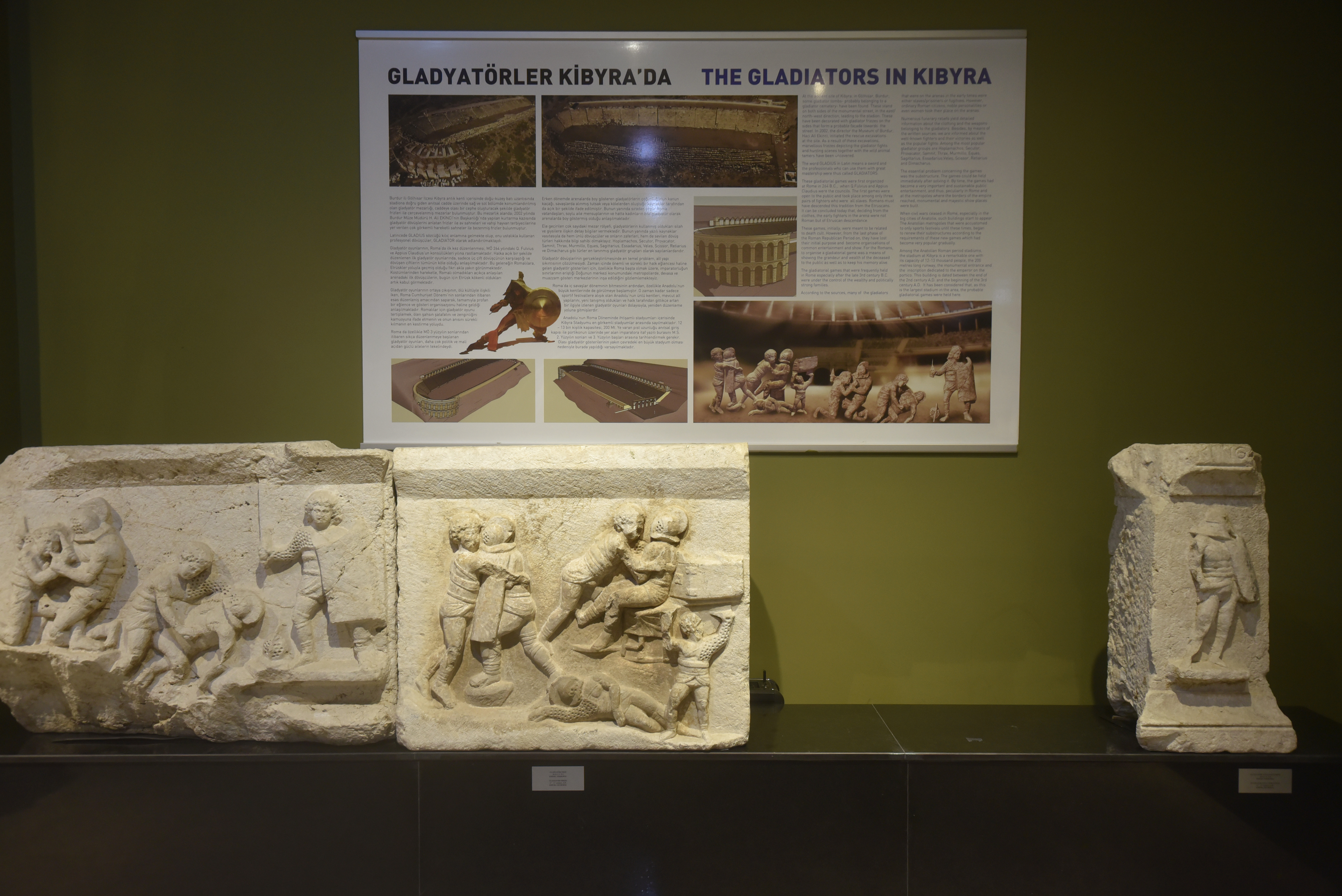
The most important finds in Kibyra are a body of architectural reliefs and stelae depicting gladiatorial contests, discovered during excavations by the Burdur Museum on the road to the necropolis east of the stadium. These friezes, which belonged to three different monumental tombs of munerarii, depict various aspects of gladiatorial games, including duels between gladiators and the hunting of animals. Along with reliefs on locally produced oil lamps, these friezes indicate that gladiators played an important role in the social life of Kibyra and that the stadium was used not only for athletic competitions but also for gladiatorial fights and venationes.
The city was repeatedly damaged by earthquakes, notably in AD 417, when a quake severely damaged the stadium and other structures. Despite these setbacks, Kibyra remained a prominent urban centre until its eventual abandonment after the 7th century AD.
PORTFOLIO
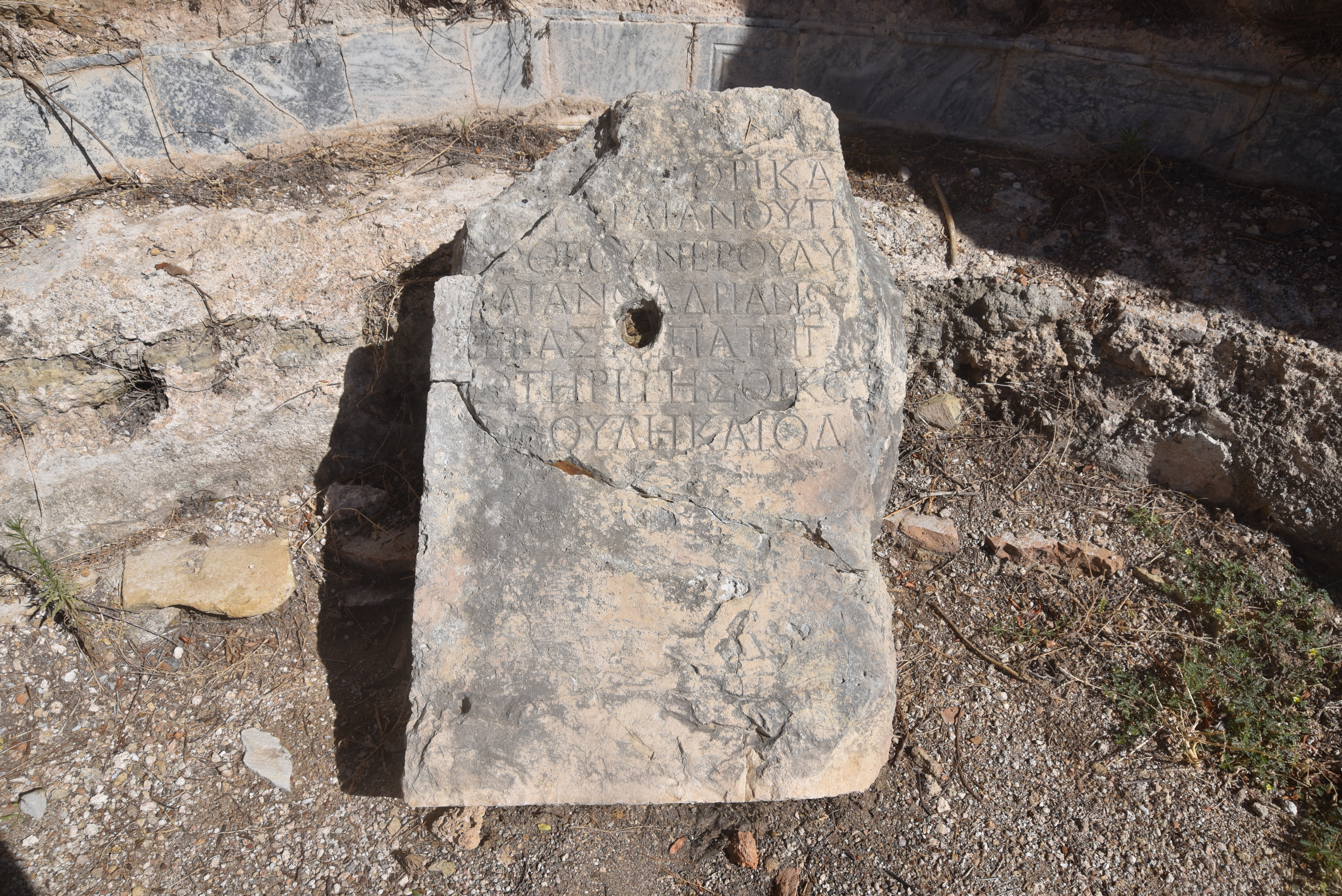
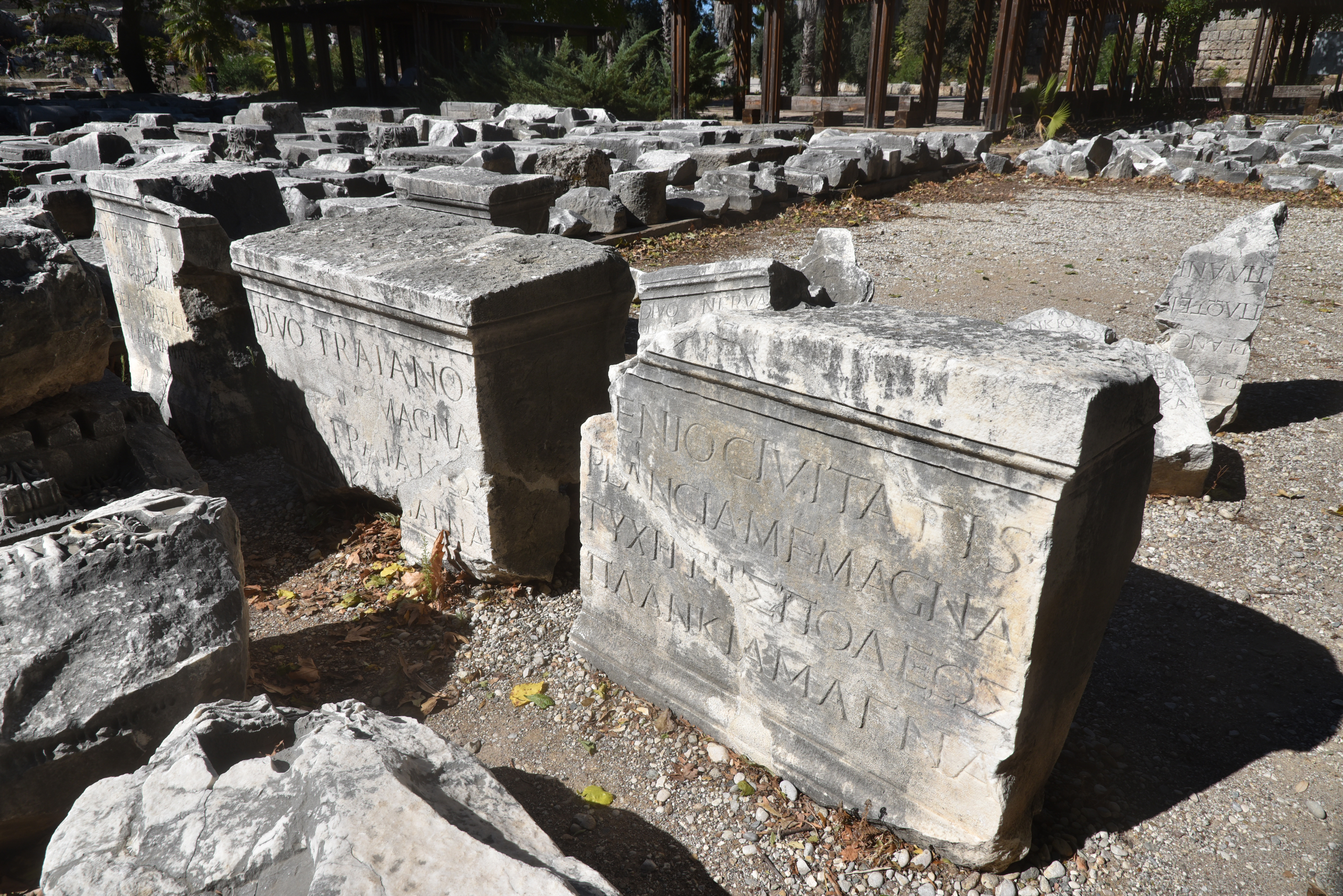
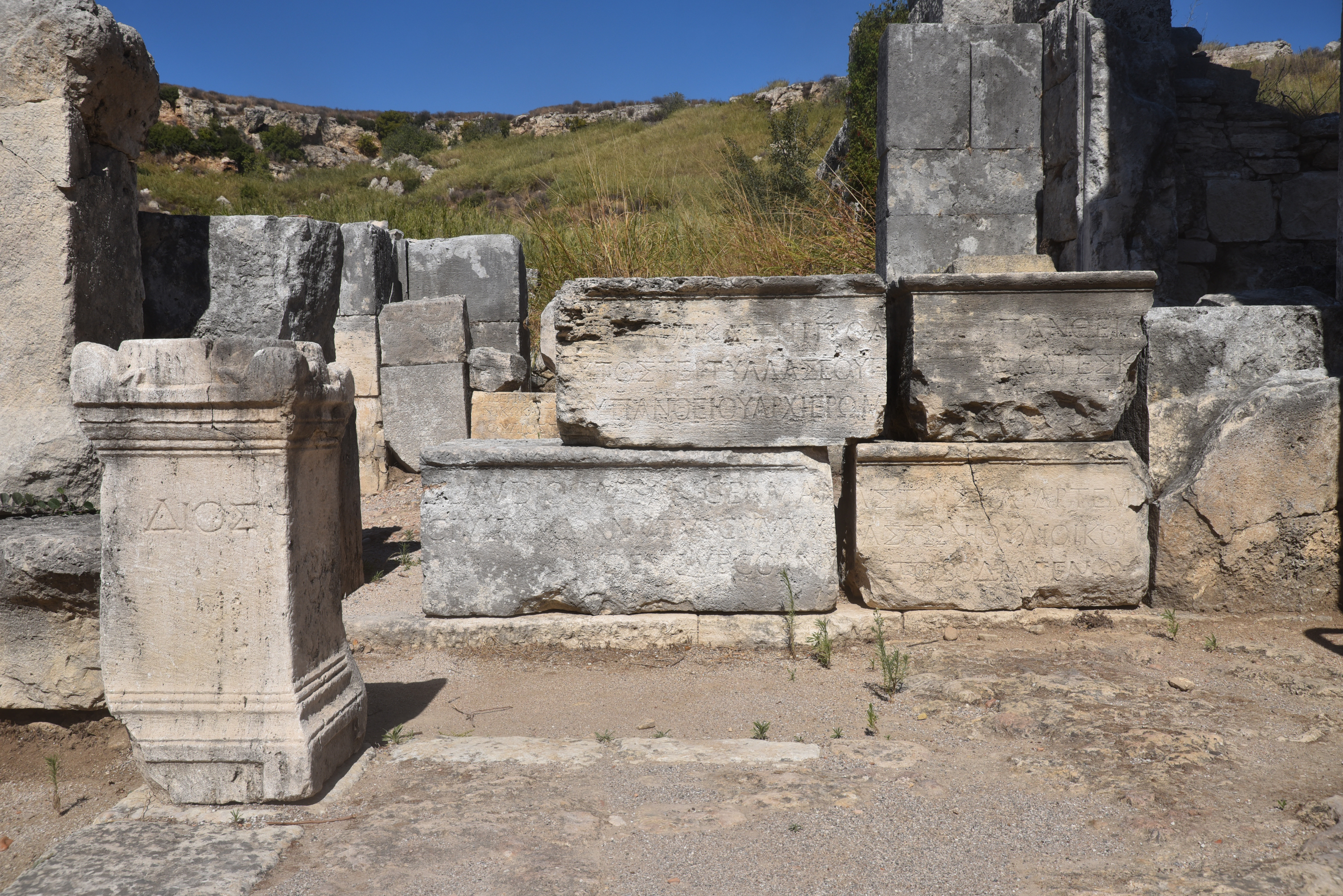
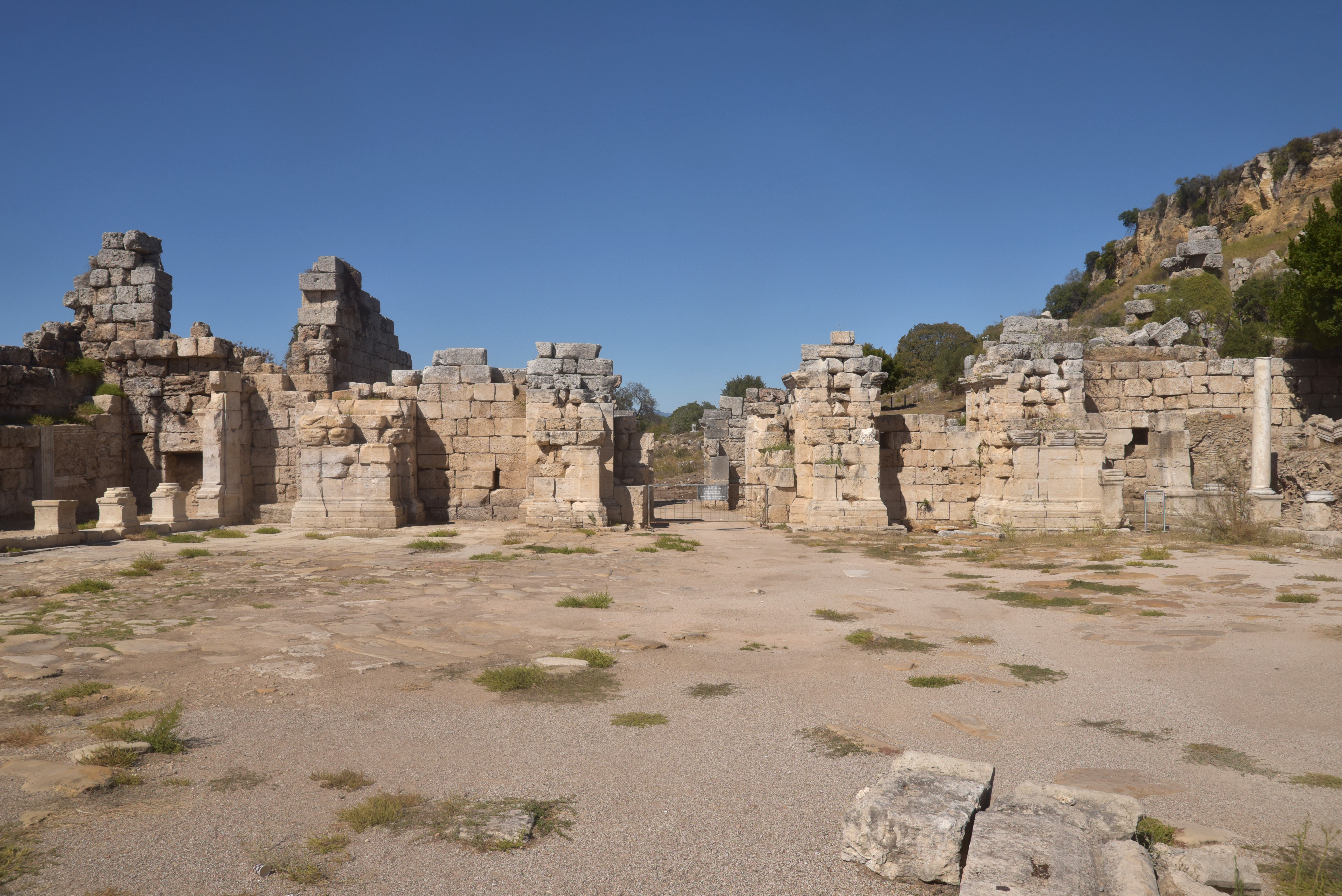
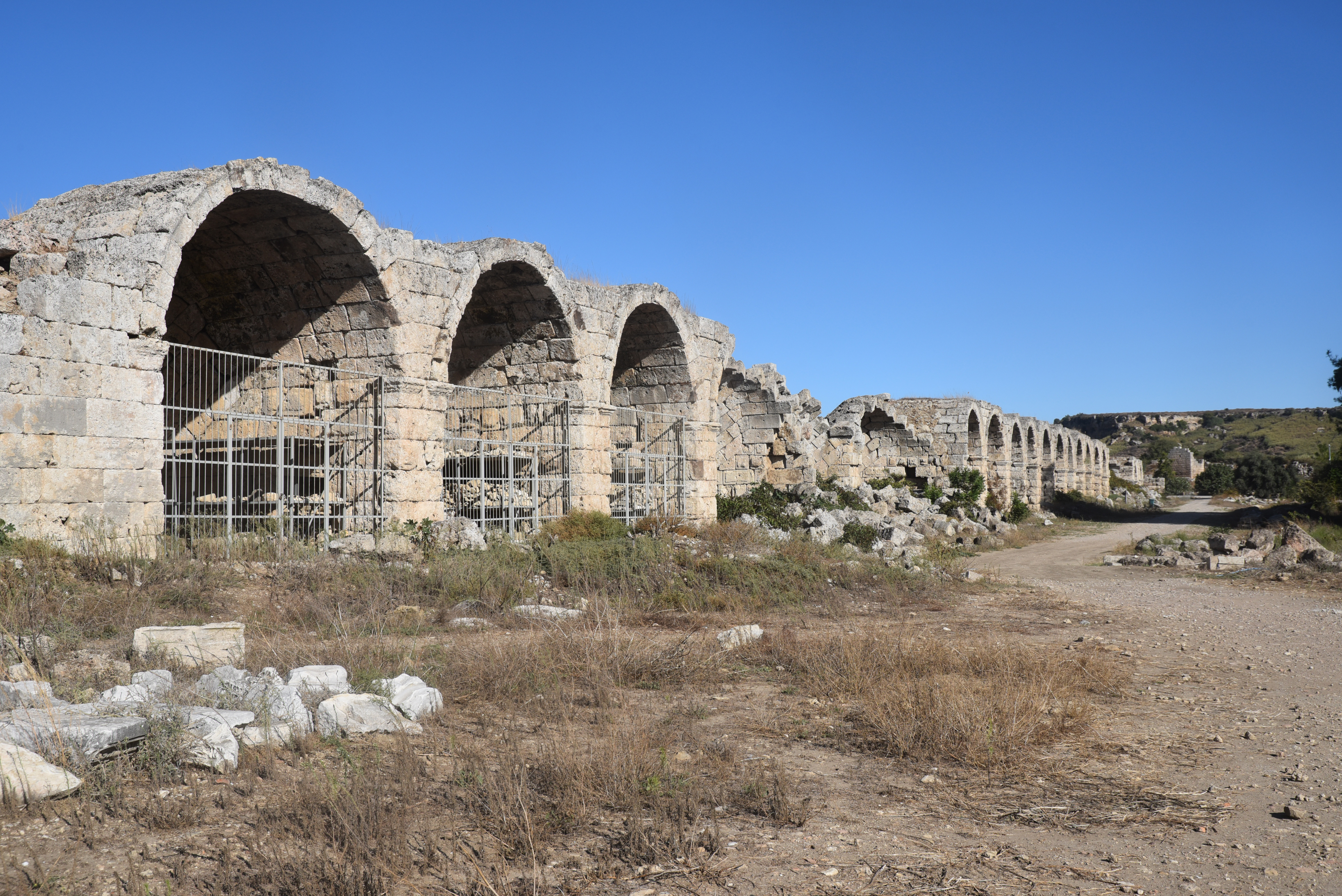
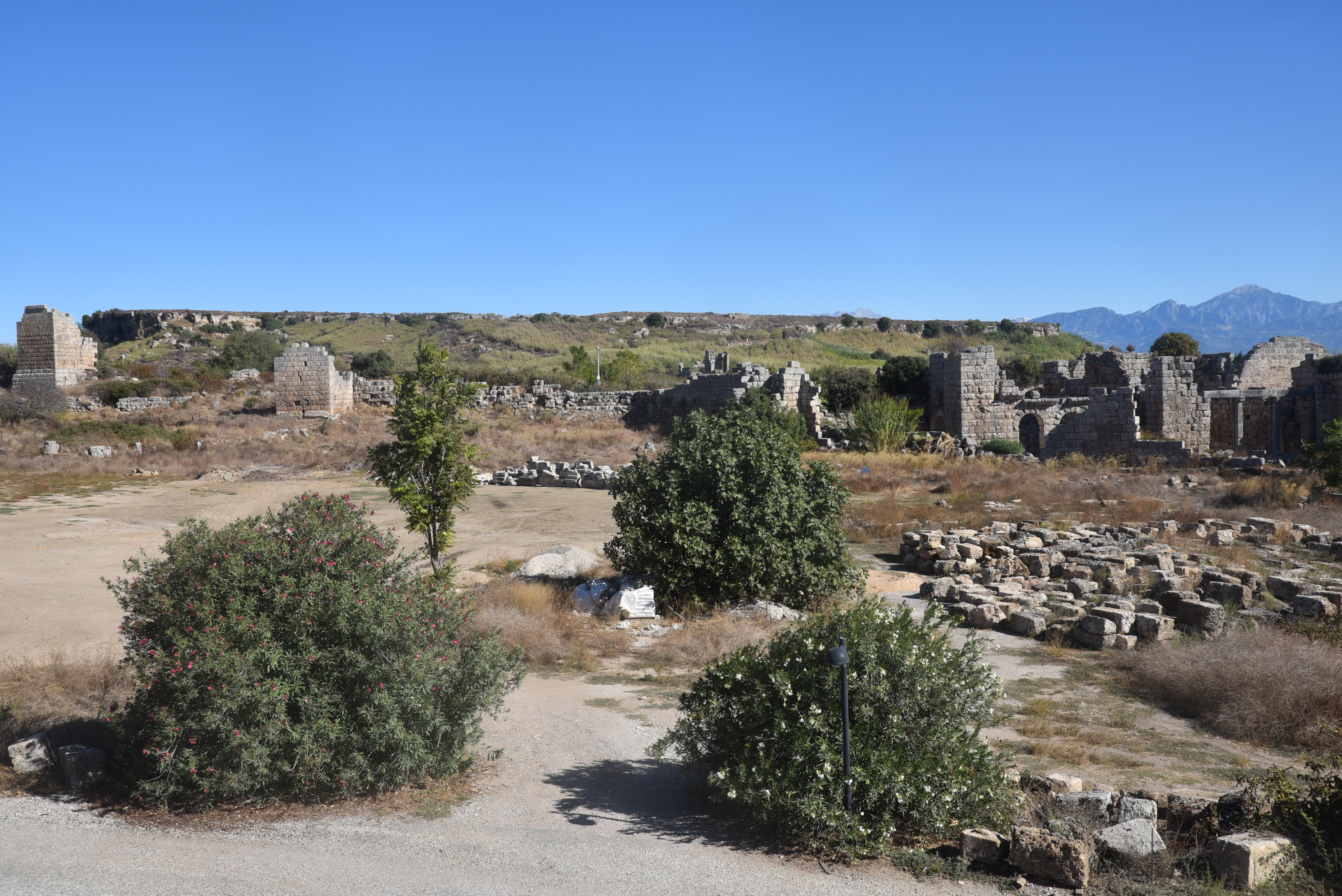
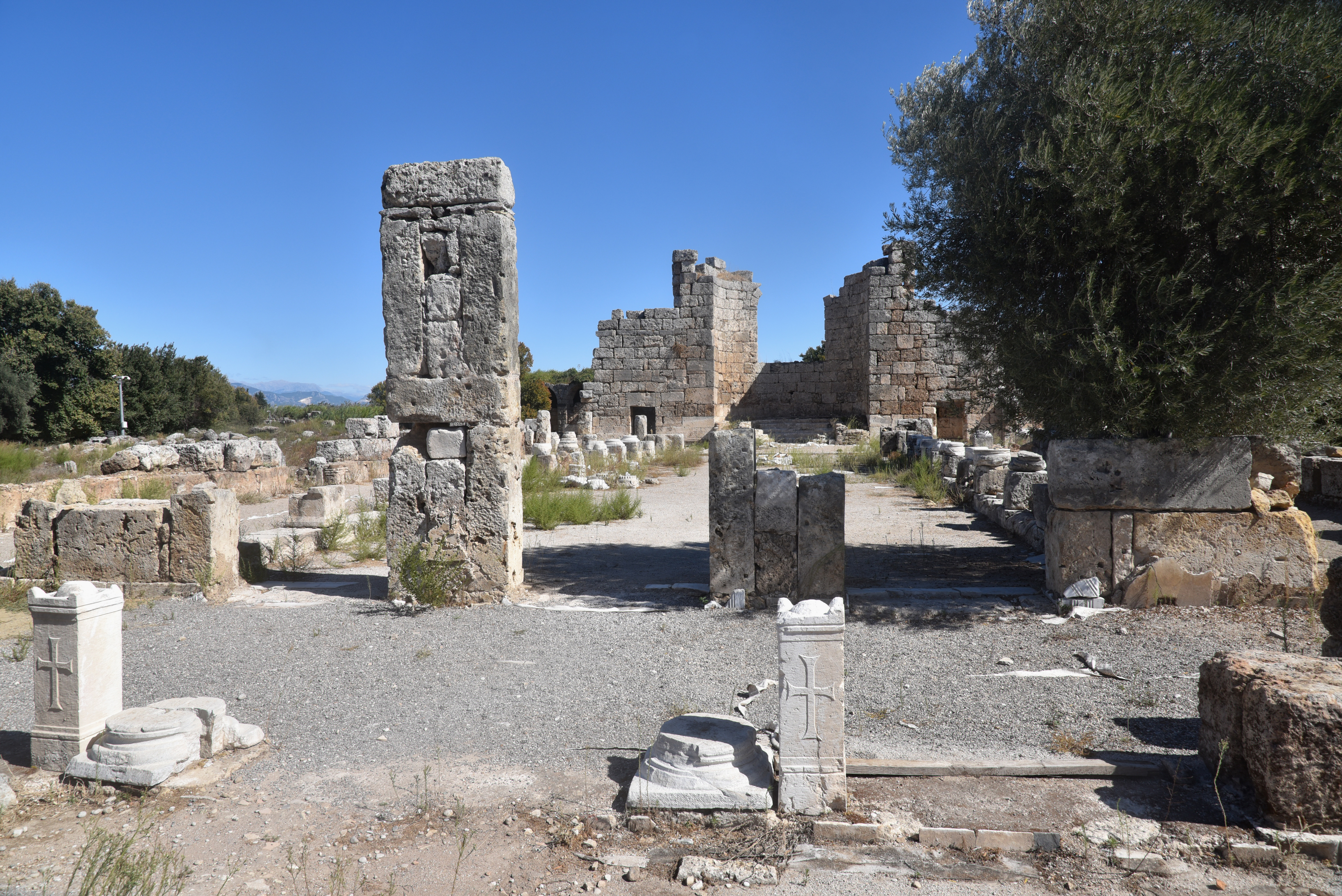
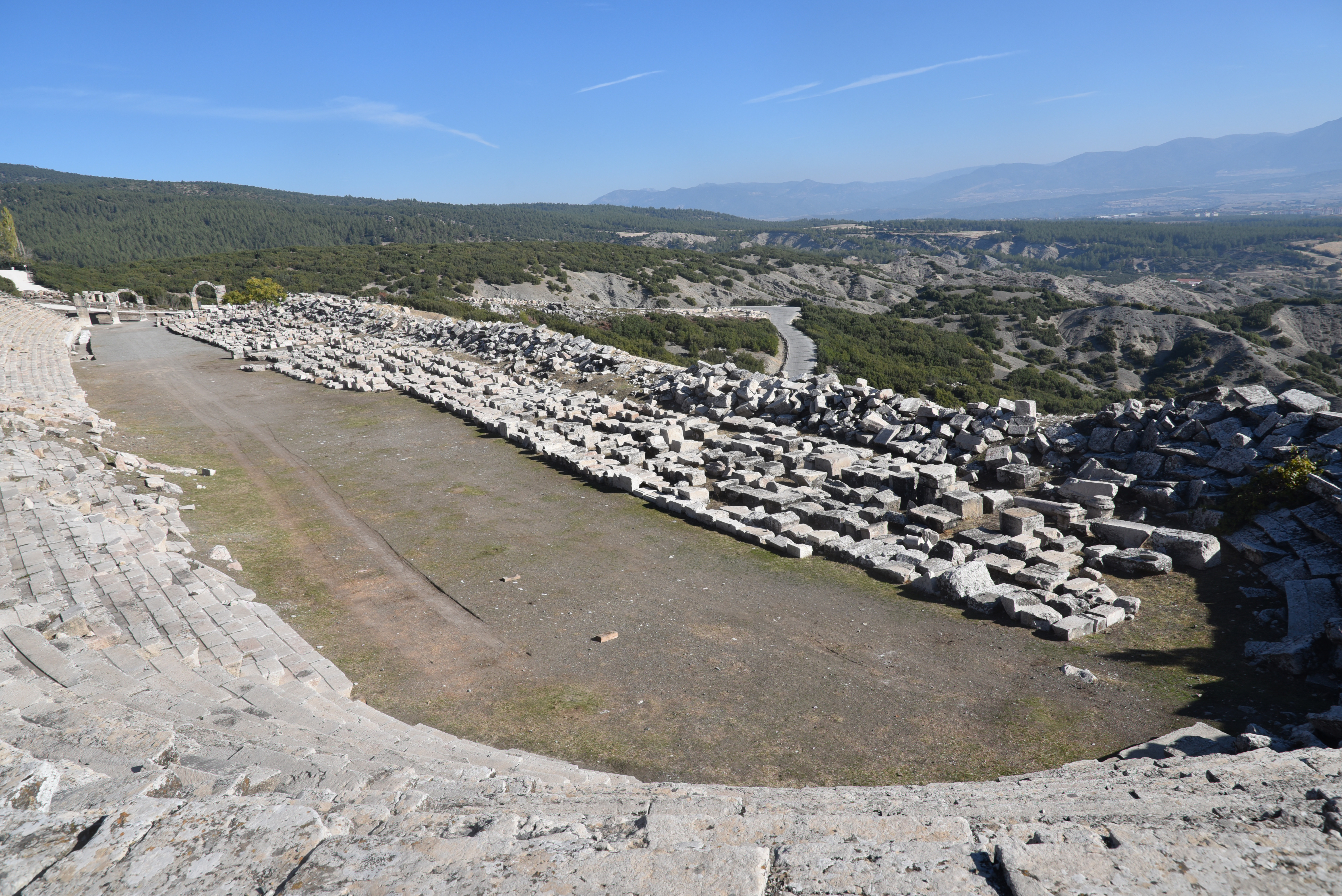
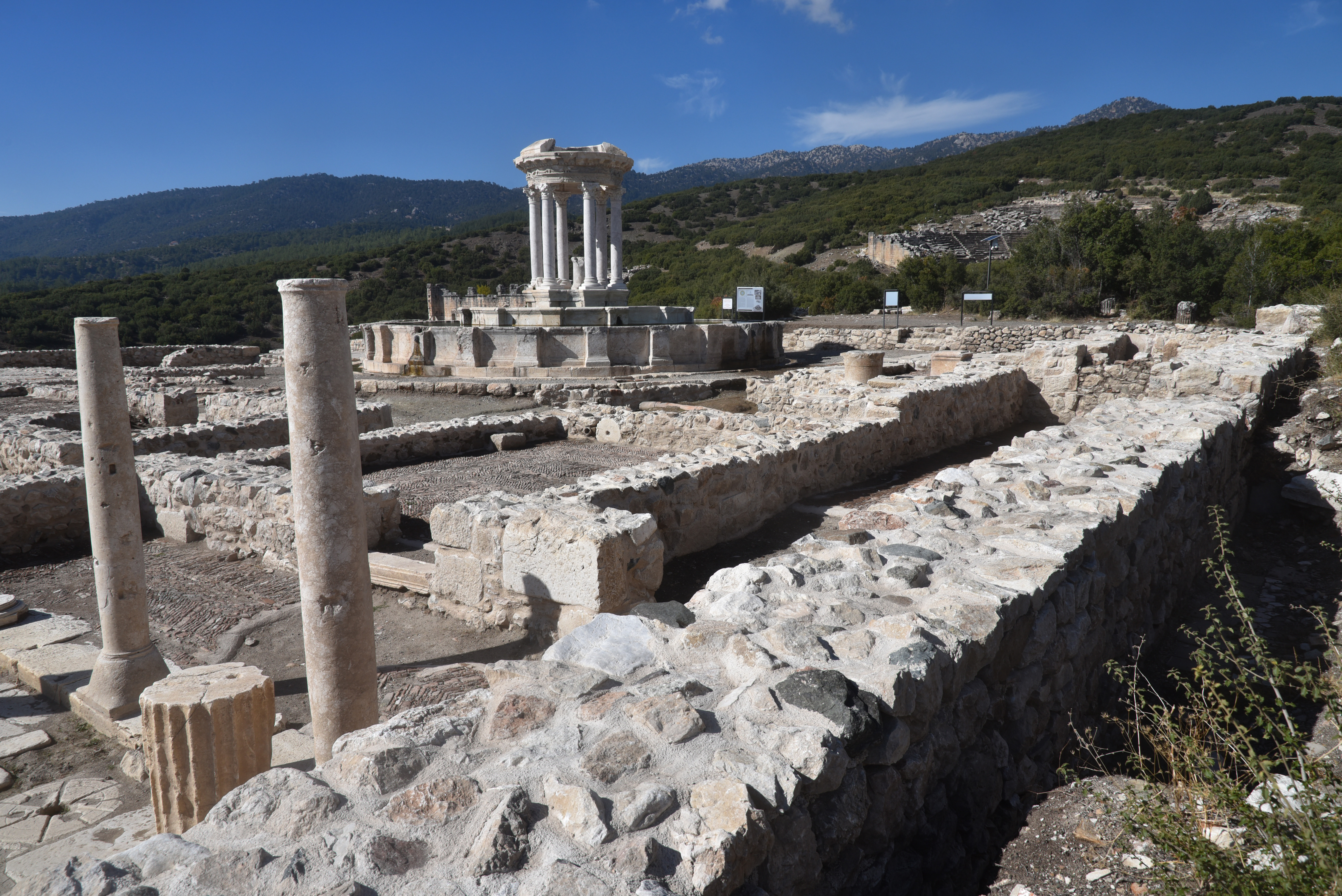
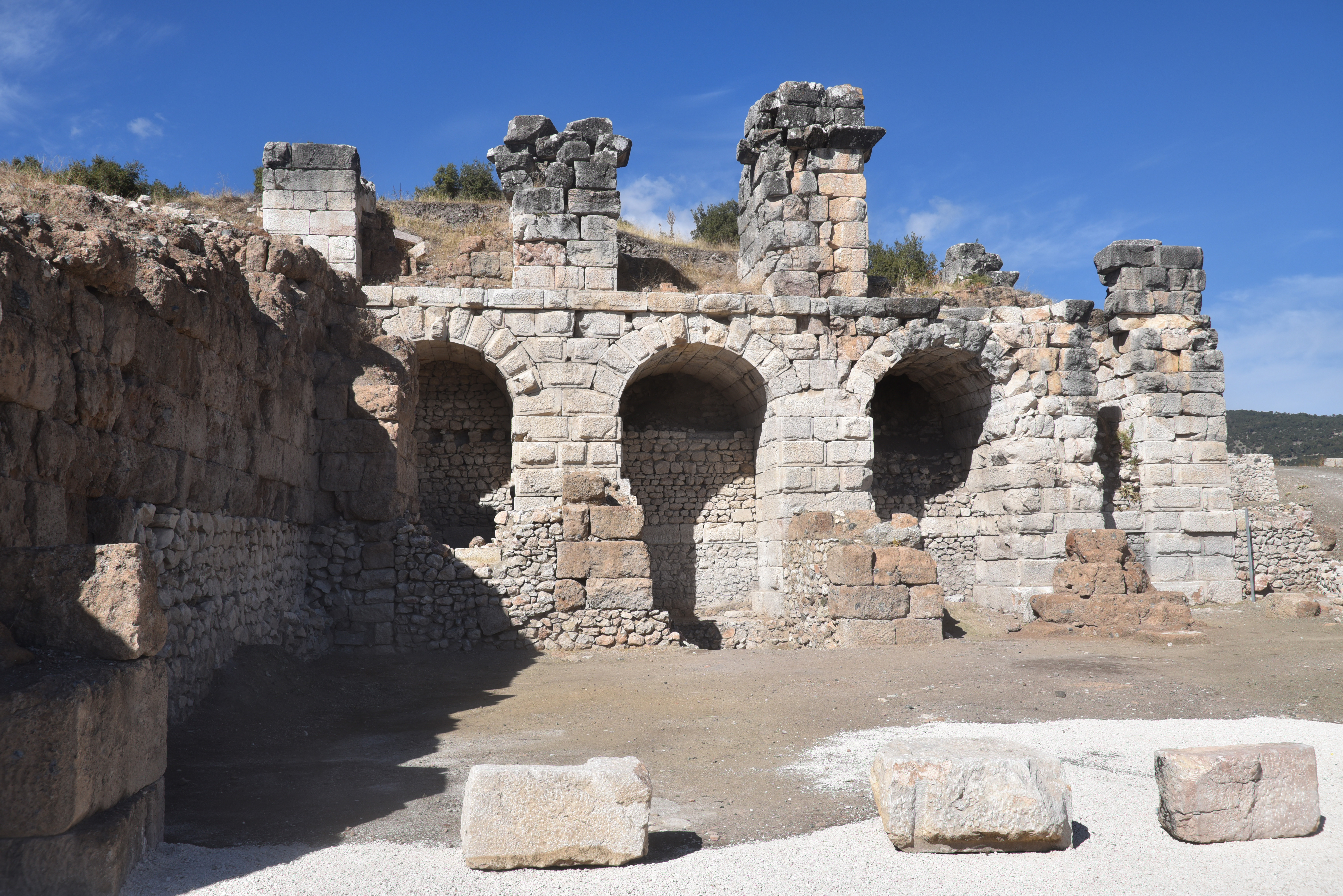
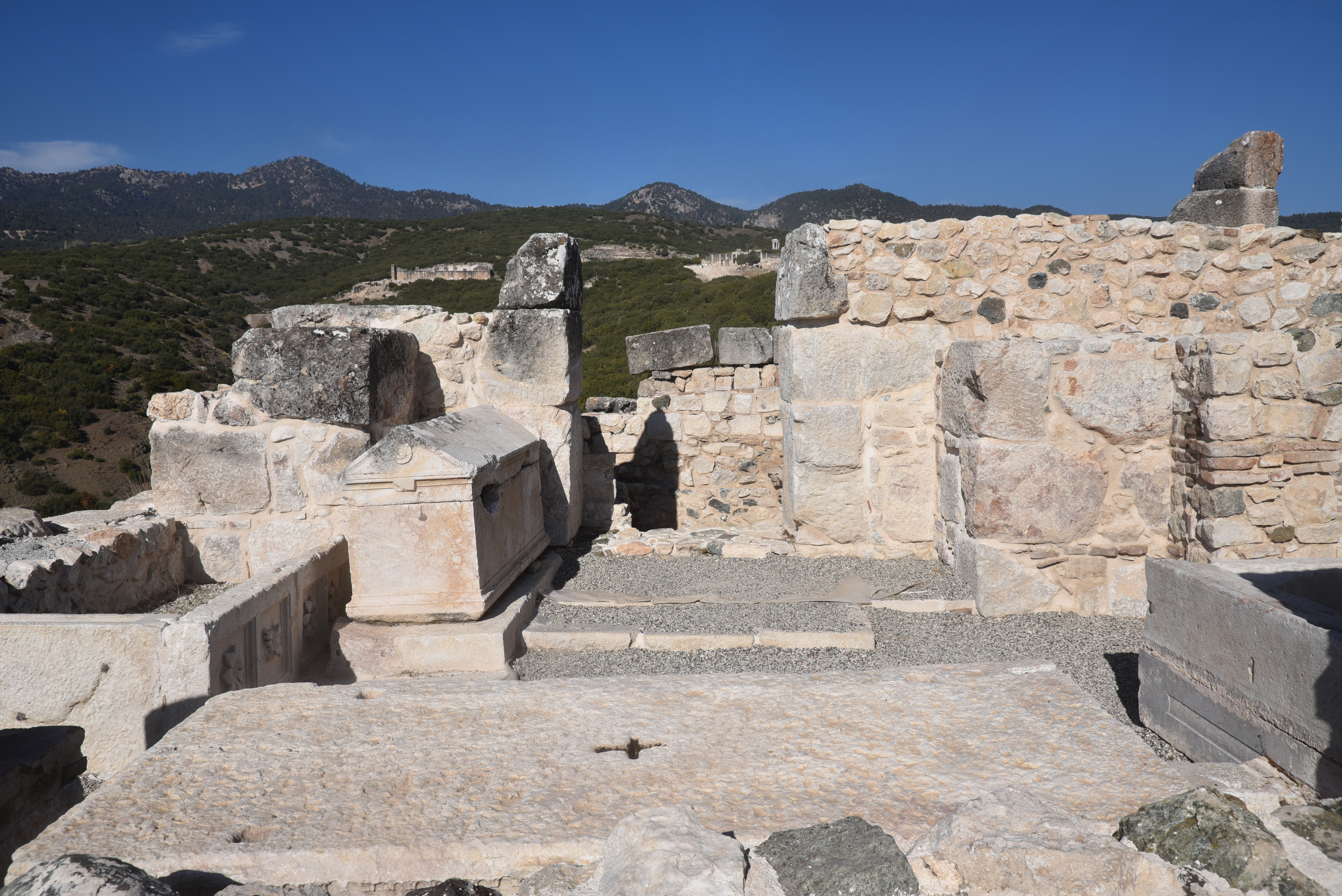
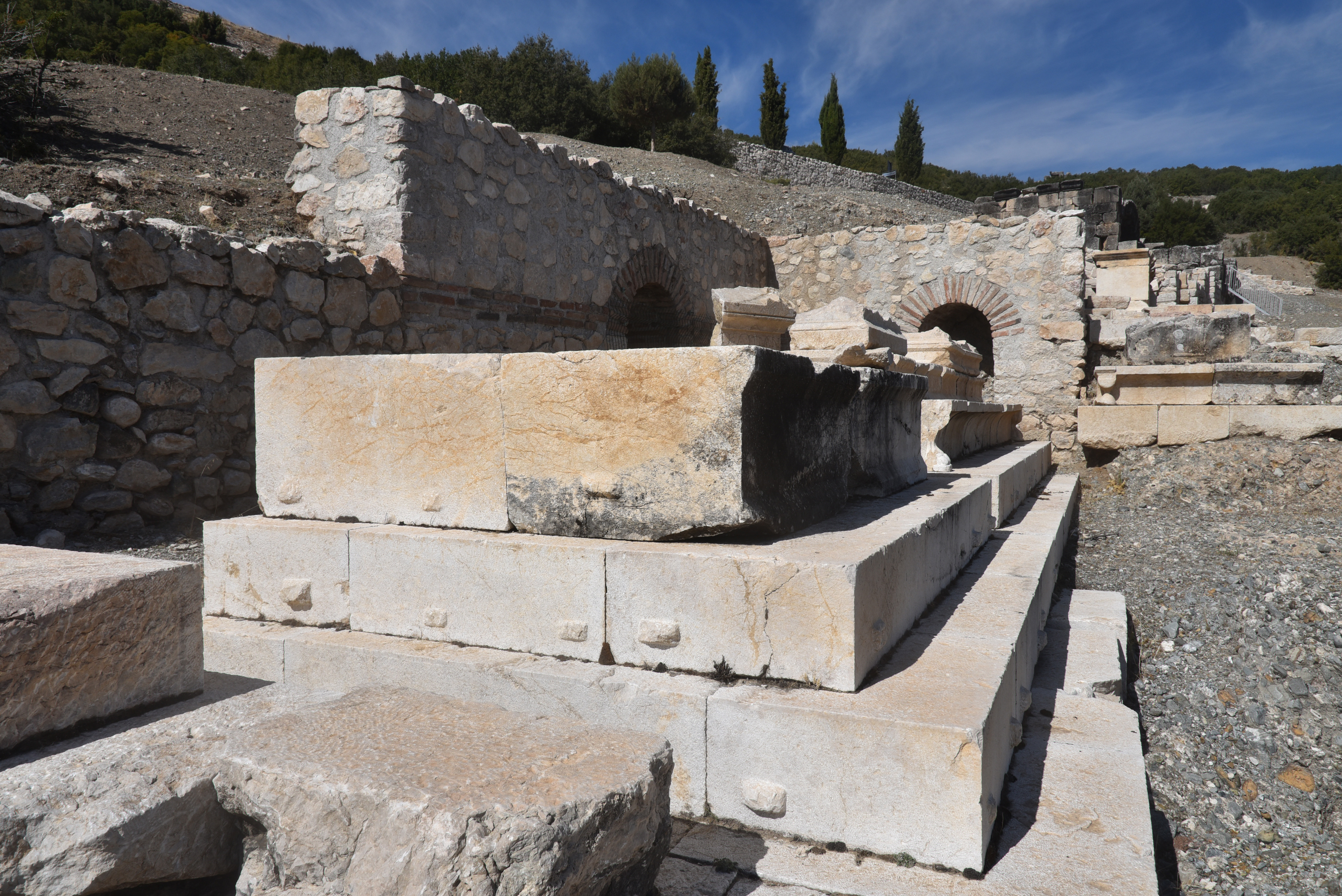
The stadium. Dated to the late 2nd to early 3rd century AD, the stadium was strategically located on the slopes of the main hill, integrated into the urban fabric of Kibyra.The stadium features a single U-shaped sphendone design, accommodating approximately 10,000 spectators.The stadium had 21 rows of seats on the western side, carved into bedrock, while the eight rows on the eastern side were supported by a retaining wall. The stadium was damaged by earthquakes, notably in AD 23 and AD 417, leading to its eventual abandonment.The stadium of Kibyra was accessed from the north through a propylon featuring five arched entrances. The propylon stood 7.94 meters high and spanned 25.35 meters in width. The estimated date of the stadium is based on an inscription found on the propylon and dated to AD 198-211.In-situ relief on the wall of the stadium, likely representing a tropaion (“trophy”) relief showing a male figure with a helmet, breastplate and greaves between two round shields with spears.The excavated 40m-long main street near the Upper Agora, which ran from the stadium to the theatre. It was approximately 800 m long, extending east to west, and was formed of stairs due to the elevation.The colonnaded street of the Upper Agora with stoas and shops on both sides.The colonnaded street of the Upper Agora.A fountain along the colonnaded street of the Upper Agora.The tholos-nymphaeum on the third terrace of the Upper Agora, unearthed during the 2016 excavations. The circular, temple-like fountain structure was dedicated to the nymphs and associated with the city’s water supply system. It was decorated with columns, embossed friezes, and sculptures.A bronze lion head water spout on the Tholos-Nymphaeum.The Tholos-Nymphaeum consists of a circular structure with a central water system made of blocks and two surrounding circular pools. The central structure is covered with a conical roof carried by columns.The Tholos-Nymphaeum was most likely constructed after the earthquake in AD 23. It underwent three phases of use: during the first phase, it featured a single pool and a circular structure with a central water system. A second pool was likely added in the late second and early third centuries AD.Terracotta water pipes surrounding the Tholos-Nymphaeum. The excavations revealed that the structure was not only a fountain but also a castellum that supplied water to its immediate surroundings.The third terrace of the Upper Agora with the Tholos-Nymphaeum.The third terrace of the Upper Agora.View of the Theatre and Odeon from the Upper Agora.The Theatre, built on a natural slope and seating around 8,000 people, dates to the Hellenistic period, but the upper cavea and the two-storey stage building were added in the 2nd century AD.The Theatre.Traces of wooden posts used to carry a velarium to protect spectators from the sun and rain can be seen on the cavea.The Odeon with its colonnaded forecourt paved with black-and-white mosaics.The Odeon was constructed in the 1st century AD and embellished in the 3rd century AD.The cavea of the Odeon has a capacity of 2,500.The orchestra floor of the Odeon with the Medusa mosaic.Kibyra’s captivating Medusa mosaic was made in opus sectile, a technique using thin marble slabs. Unearthed in 2009, the mosaic dates to the 2nd or 3rd century AD.The foundations of the temple of the imperial cult (Kaisarion), a temple dedicated by Quintus Veranius, the governor of Lycia in the Claudian period, to the emperor’s worship. It was built during the reign of Claudius (AD 41-54) and dedicated to Emperor Augustus (as Zeus Patroos Augustus) and his wife Livia (as Nea Demeter Augusta).Dedicatory inscriptions and architectural fragments from the temple of the imperial cult.The Roman Bath Complex, dated to the 1st century AD.Roman Bath Complex.The Golhisar plain at the foot of Kibyra.Basilica Church, a religious building with three naves, a triconch apse, and burial chambers, dating to the 5th century AD.Burial chambers inside the Basilica Church, dated to the 5th century AD.Burial chambers inside the Basilica Church, dated to the 5th century AD.The Main Road leading to the Stadium has a necropolis area on both sides, primarily consisting of sarcophagi.A necropolis on one side of the Main Road leading to the Stadium. Here, two sets of friezes depicting gladiators in various actions were found, belonging to two monumental gladiator tombs that, along with other tombs.The gladiator reliefs from the necropolis of Kibyra in the Burdur Museum.The gladiator reliefs from the necropolis of Kibyra in the Burdur Museum.The Eastern Necropolis, a burial area with different types of tombs built during the Roman Period.Sarcophagi in the Eastern Necropolis.The Eastern Necropolis.
Berns, C., & Ekinci, H. A. (2015). Gladiatorial games in the Greek East: a complex of reliefs from Cibyra. Anatolian Studies, 65, 143–179. http://www.jstor.org/stable/24878381
Kileci, Senkal & Önen, Nihal. (2024). Restoration Works in Kibyra during the Claudian Period: New Inscriptions, τὰ σεβαστὰ ἔργα of the Lycian Governor Quintus Veranius and New Inscriptions Concerning His Family.
Dökü, F. Eray, and M. Can Kaya. “The Architecture and Function of the Stadium of Kibyra”. Adalya, no. 16 (June 2013): 177-201.
Karabacak, Volkan & Yönlü, Önder & Dökü, Eray & Kıyak, Nafiye & Altunel, E. & Özüdoğru, Şükrü & Yalciner, Cahit Caglar & Akyuz, H. Serdar. (2013). Analyses of Seismic Deformation at the Kibyra Roman Stadium, Southwest Turkey. Geoarchaeology. 28. 531-543. 10.1002/gea.21456.