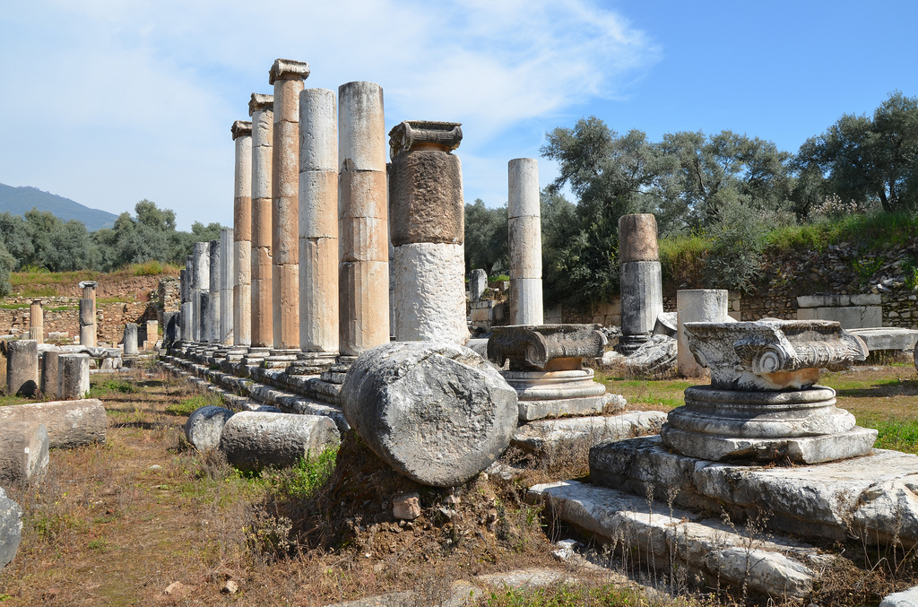
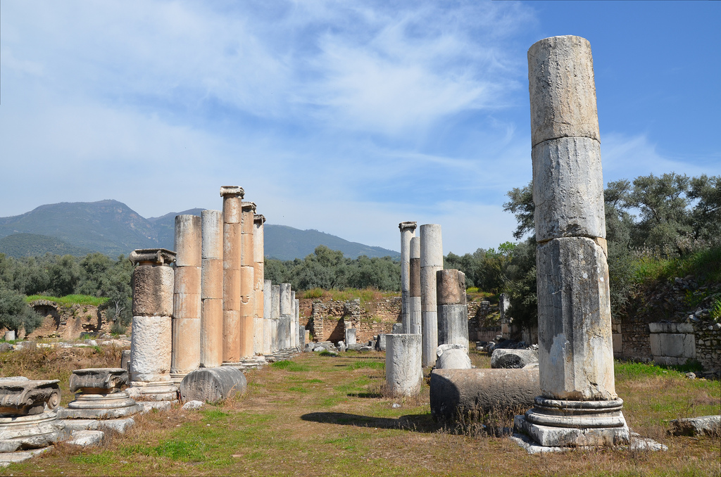
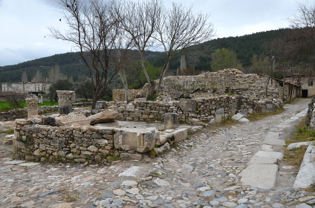
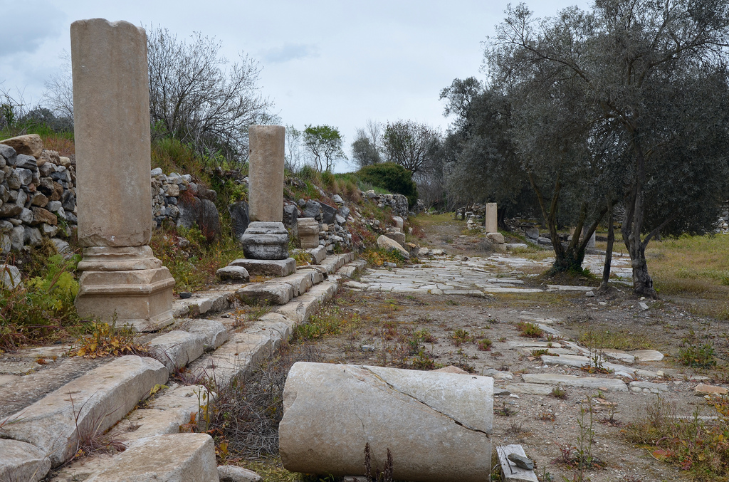
Nysa on the Maeander is a true gem of Caria, nestled deep within the valleys of the Aegean. The ancient city was a significant Carian centre, located in the northern part of the region, 50 kilometres east of the Ionian city of Ephesus. Today, it stands as a well-preserved archaeological site.
The city rose to prominence under the Romans and was home to the historian Strabo (63 BC-AD 25). Strabo described it as a combination of three towns. He mentioned that it was originally called Athymbra, but by the 2nd century BC, the settlement appears to have been renamed Nysa, possibly in honour of the wife of King Antiochus I Soter. Nysa was designed as a city with two distinct sections on either side of a mountain cliff.
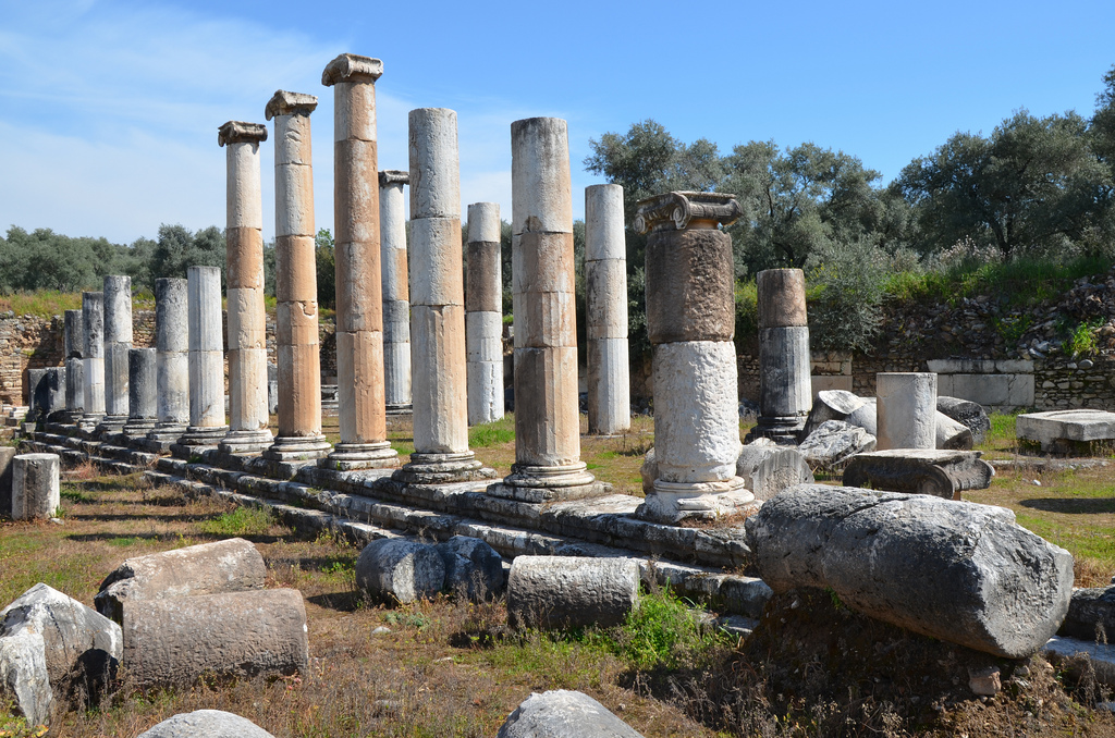
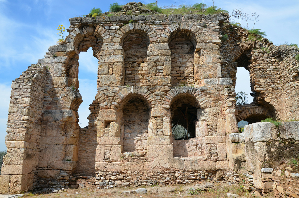
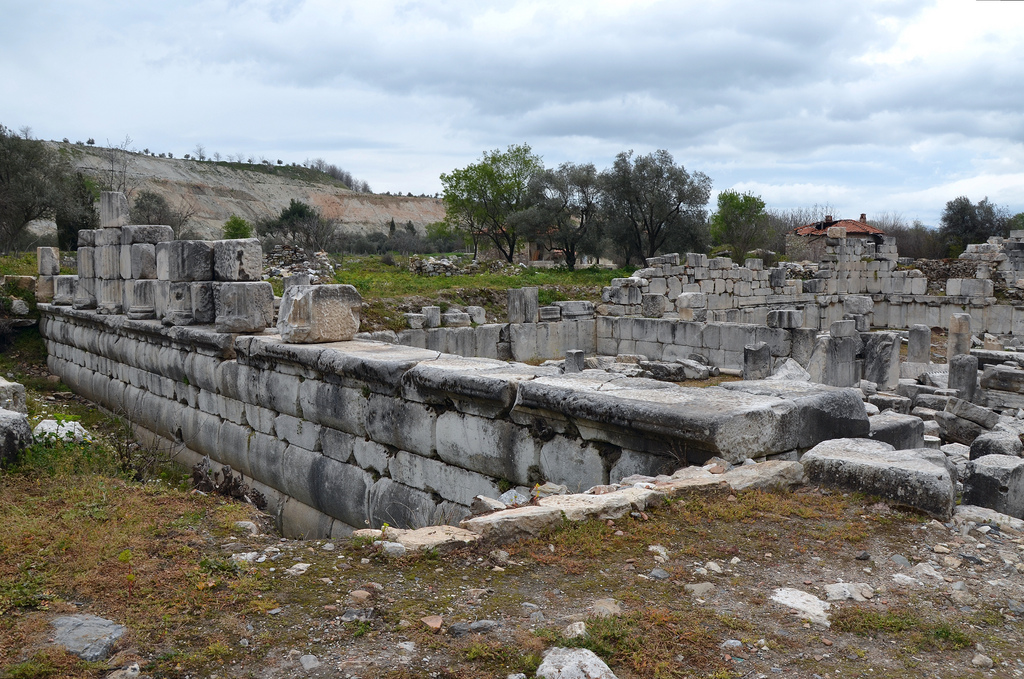
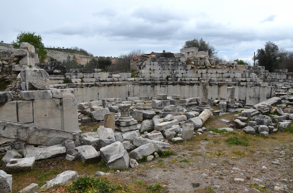
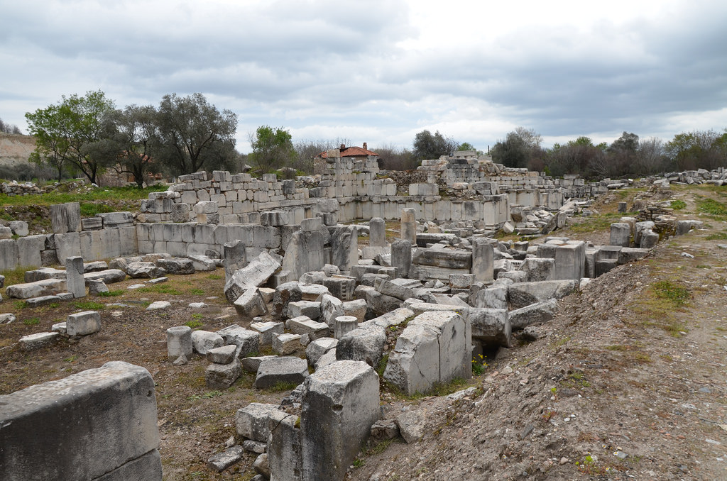
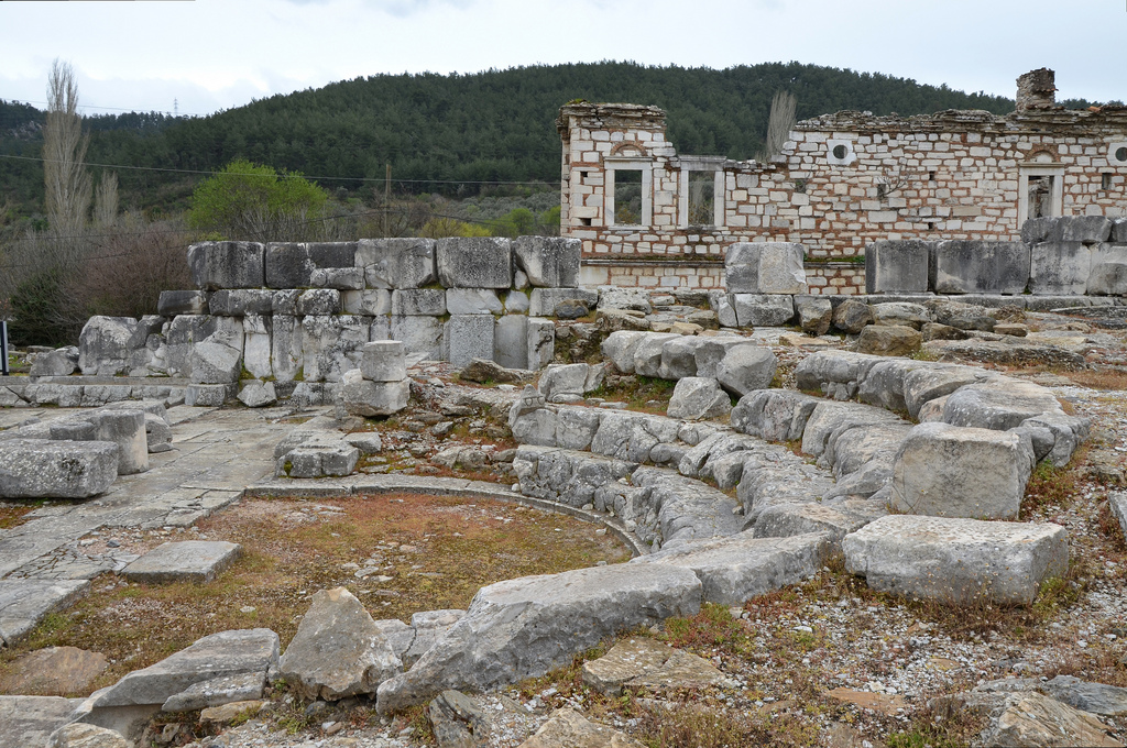
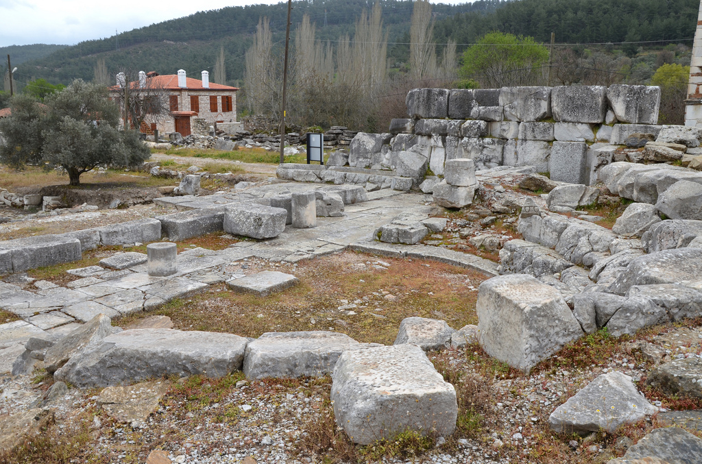
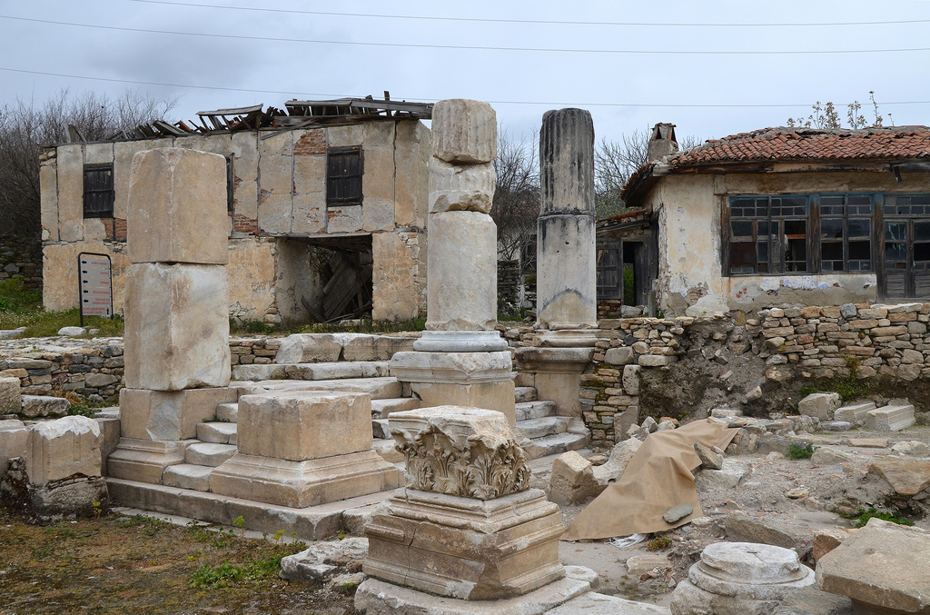
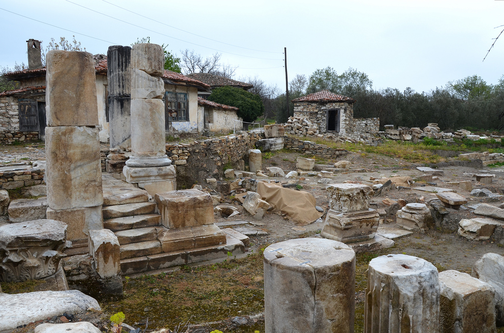
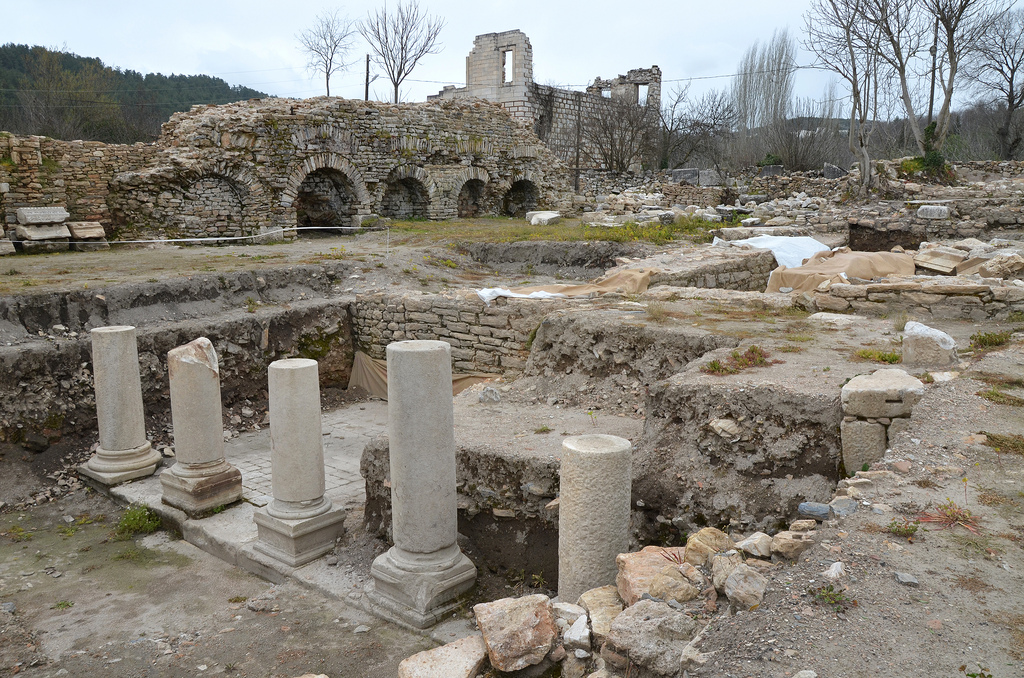
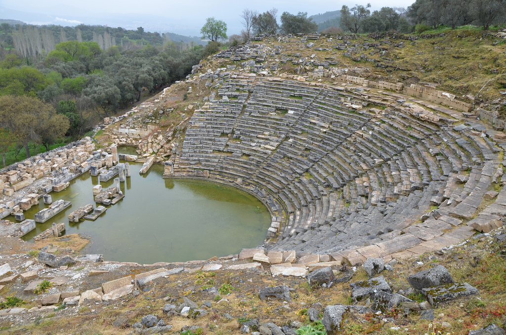
Important ruins are scattered on the mountain slope from the Hellenistic, Roman, and Byzantine periods. The well-preserved theatre, rebuilt during the Roman Imperial period, is famous for its friezes depicting the life of Dionysus and the sacred marriage (theogamia) between Persephone (daughter of the goddess Demeter) and the god of the Underworld, Pluto. With its 57 rows of marble seats, it had a capacity of 12,000 people.
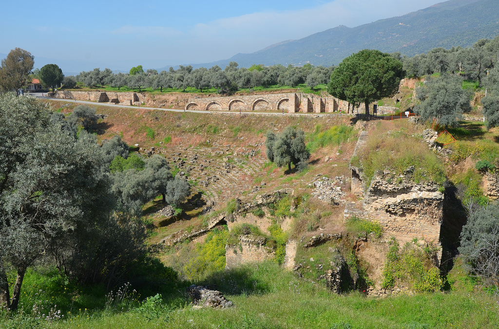
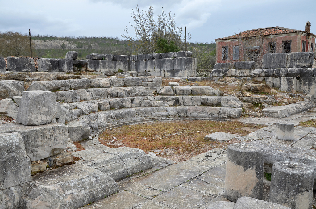
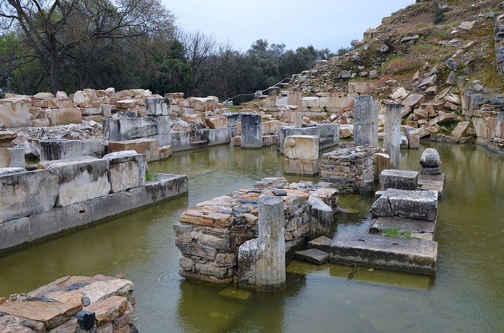
The library, dating to the 2nd century AD, is considered Turkey’s second-best-preserved ancient library structure after the Celsus Library of Ephesus. The Stadium of Nysa, partially damaged by flooding, had a capacity of 30,000. The Hellenistic gerontikon (Council House of the Elders), adapted in the 2nd century AD into an odeon, could accommodate up to 700 people.
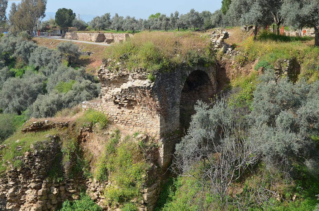
Other significant structures include the Agora (marketplace), the Gymnasium and the Roman baths. The 100 m-long Nysa Bridge was the second-largest of its kind in antiquity.
PORTFOLIO
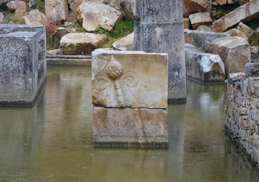
The theatre was first built in the Late Hellenistic period, but the current architectural features date to the 2nd century AD.The scaenae frons of the theatre had 5 doors and was decorated with friezes depicting the life of Dionysus.The cavea consisted of two maeniana (galleries) with 25 and 22 rows of seats.The Stadium was built at the foot of the gorge with rows of seats cut into the steep hillside. It is dated to the Late Hellenistic period.The Roman bridge was a 100 m (328 ft) long substructure spanning the ravine below the theatre. It was the second-largest of its kind in antiquity after the Pergamon Bridge.The library was built around 130 AD. It is considered Turkey’s second-best preserved ancient library structure after the “Celsus Library” of Ephesus.The library contained 16 bookshelves in two stories accessible using wooden stairways. It was renovated around the 4th century AD and finally went out of use as a public building in the 6th century AD.The gerontikon (Council House of the Elders) was originally built during the Hellenistic period and was later adapted as an odeon in the 2nd century AD with a two-storey scaenae frons.The gerontikon (Council House of the Elders) had a capacity of 700 seats and could be entered through a propylon (monumental gate) situated on the main street.The street leads to the entrance of the Agora.The east portico of the Agora (marketplace) covers an area of 113 x 130 meters. The first construction phase of the Agora is dated to the Late Hellenistic Period.The east portico of the Agora (marketplace).
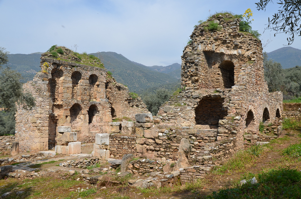
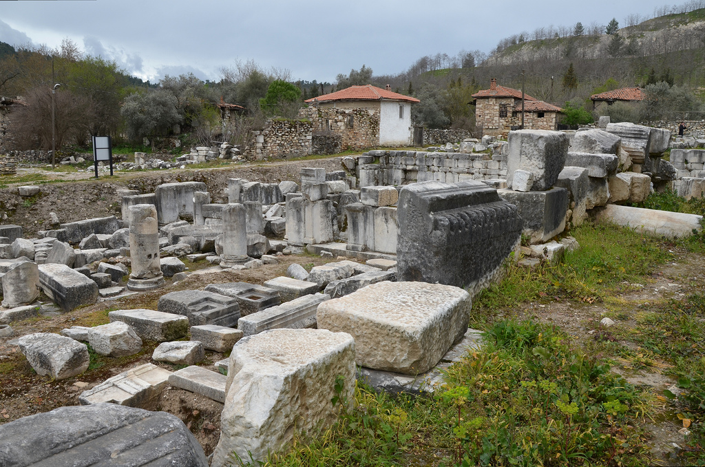
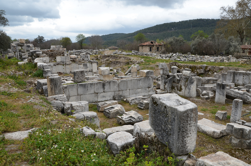
Stratonicea was an inland city built on a plain near the sources of the river Marsyas. Today, the ruins of the ancient city are located in the abandoned village of Eskihisar, 28 km east of Milas. They lie among crumbling houses and deserted cottages, which give travellers a feeling of mystery and enchantment. Stratonicea has been inhabited uninterruptedly for over 3,500 years and is considered one of the world’s largest marble cities. It has been listed on UNESCO’s tentative World Heritage Site list since 2015. Excavations are still ongoing around the site, revealing more of the forgotten city.
Stratonicea was founded in the 3rd century BC on the site of an old Carian town by the Seleucid king Antiochus I. It was named in honour of his former stepmother and later wife, Stratonice, a Syrian princess. Stratonicea was a thriving city during the Seleucid period, when, according to Strabo, it was adorned with luxurious buildings. Later, the town was ceded to the Rhodians, and in 200 BC, it came under the control of the Macedonian King Philip V for a short period. It was recovered by the Rhodians in 197 BC and held until 167 BC, when the Roman Senate declared the whole of Caria free.
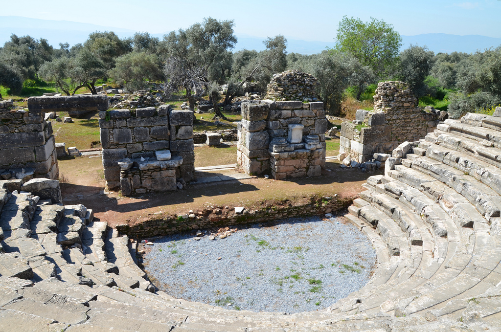
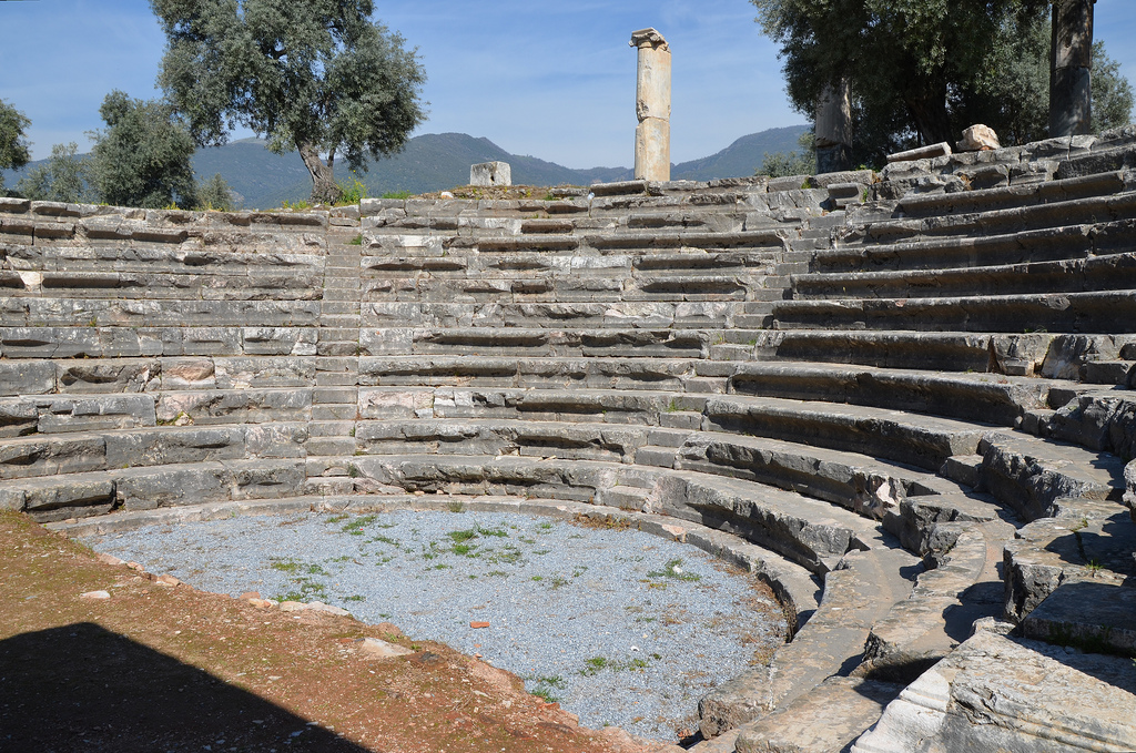
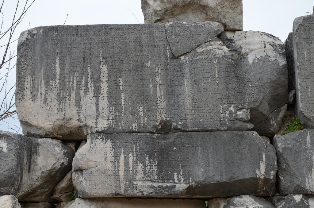
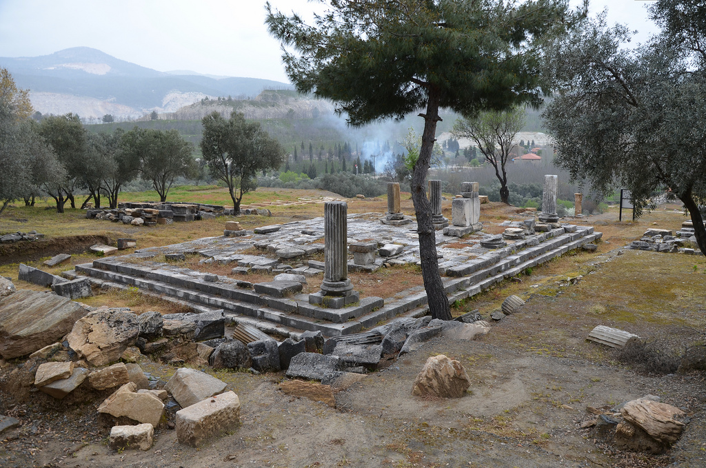
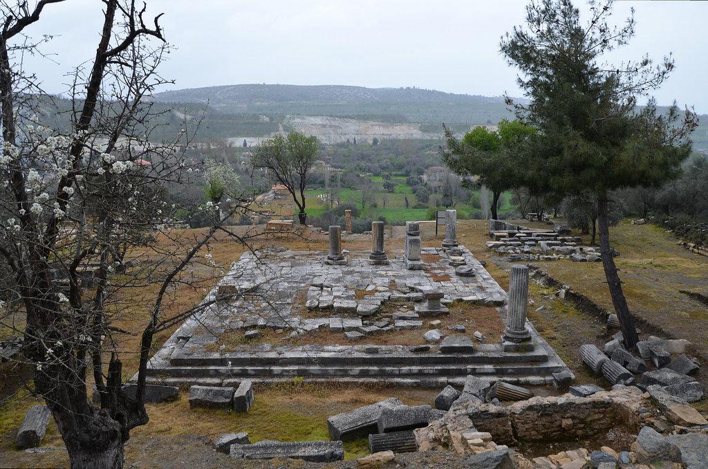
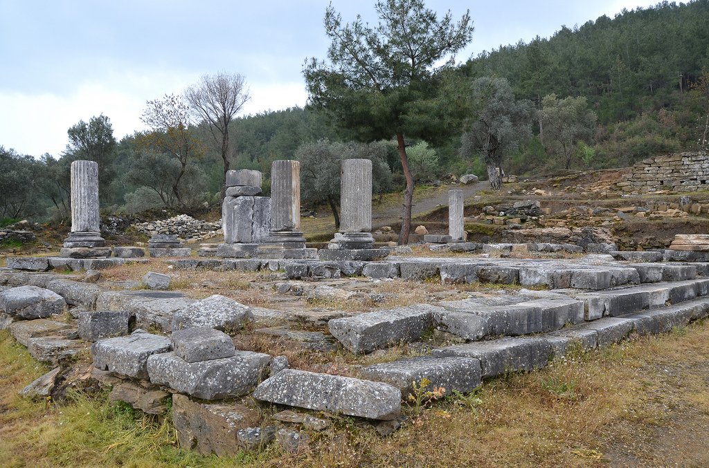
The key monuments visible to the modern visitor include a large theatre fitting 10,000 spectators, a temple of Augustus, a colonnaded street lined by mosaics, a bouleuterion (council chamber) with multiple Roman inscriptions (including a copy of Diocletian’s Price Edict of 301 AD), and an enormous Hellenistic gymnasium. The gymnasium was built in the second quarter of the 2nd century BC at the western end of the city and was richly decorated in the Corinthian order. The total length of the building is estimated at 180 meters, making it the largest known gymnasium in antiquity.
In the territory of Stratonicea, there were three important sanctuaries: Zeus Chrysaoreus, Hecate at Lagina, to the north of the city and Zeus Panamareus. A Sacred Way led to the sanctuary of Hecate, beginning from the northern gate of Stratonicea’s walls through the necropolis.
The first scientific excavations at the site began in 1977 under the direction of Prof. Dr Yusuf Boysal. Since 2008, excavations and restoration works have been carried out by Prof. Dr Bilal Söğüt from Pamukkale University. The 2015 excavations unearthed many Byzantine-era tombs.
PORTFOLIO
The Gymnasium was built in the second quarter of the 2nd century BC at the city’s west end, a small distance from the fortification wall.
The Gymnasium is estimated to be 267 m long and is thought to be the largest known gymnasium from antiquity.
The ruins of the Ephebeion were where the Ephebes received instruction in Greek culture. It was part of the Gymnasium.
The ruins of the impressive Gymnasium. The 105-metre-wide and 267-metre-long complex served as a sports centre and a classroom where history and philosophy classes were held in the past.
The Bouleuterion was located at the centre of the city. Based on the architectural elements and decoration, the building can be dated back to the second half of the 1st century BC.
The Late Hellenistic Bouleuterion has four lower rows of seats still preserved.
The Late Hellenistic Bouleuterion.
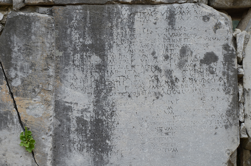
The exterior façade of the Bouleuterion provides one of the fullest versions of the long Prices Edict of Diocletian. The Latin inscription listed the prices of merchandise and services in Stratonicea in 301 AD. Therefore, the sales in the city remained under control and inflation was prevented. This inscription is the best-preserved example in Asia Minor and the only one carved on a wall of a bouleuterion.
The interior façade of the Bouleuterion also featured a Greek calendar inscription. It was made by Menippus, a native of Stratonikeia who, according to Cicero, was one of the most distinguished orators of his time.
The remains of the Propylaea, a monumental gateway.
The remains of the Propylaea, a monumental gateway.
The ruins of Stratonicea among the buildings of the old village of Eskihisar.
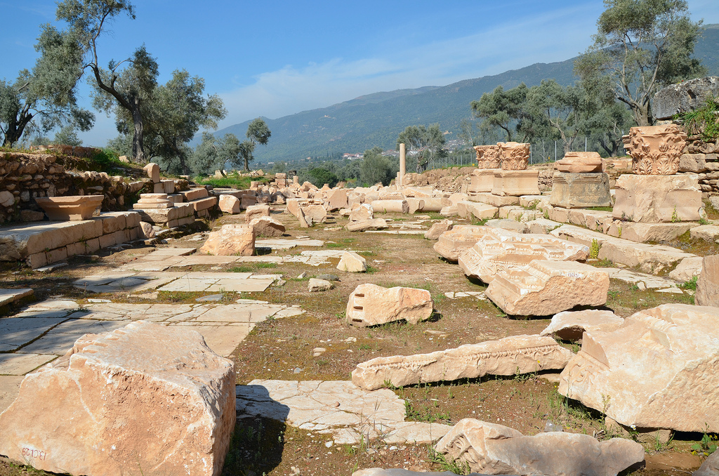
The ruins of the Stoa at the edge of the Agora.
The ruins of Stratonicea.
The peripteral temple was built in the Ionic order. It is situated on the upper terrace and was dedicated to Emperor Augustus.
The Temple of Augustus.
The Temple of Augustus.
The theatre was erected in the Hellenistic period on the north slope of the south hill. Its capacity was approximately 10,000 spectators.
The ruins of the scene (scaenae frons) of the Hellenistic Theatre.
A carved Thyrsus formed part of the scene’s decoration in the Hellenistic Theatre, the thyrsus associated with Dionysus, the god of the Theatre.