Founded by King Artaxias I (the founder of the Artaxiad dynasty) in 176 BC, Artaxata served as the capital of the Kingdom of Armenia until AD 120. The city’s strategic position in the Ararat Valley on the Silk Road soon made Artaxata a centre of bustling economy and trade and a focal point of Hellenistic culture. The city was adorned with fine bronze statues of Greek gods while the inhabitants enjoyed Greek tragedies in Armenia’s first theatre. Throughout its 300-year history, Artaxata was attacked multiple times by Roman armies until the royal court eventually moved to Dvin. Today, the remains of Artaxata consist of two mounds located just south of Armenia’s modern capital, Yerevan.
Coordinates: 39° 53′ 6″ N, 44° 34′ 35″ E
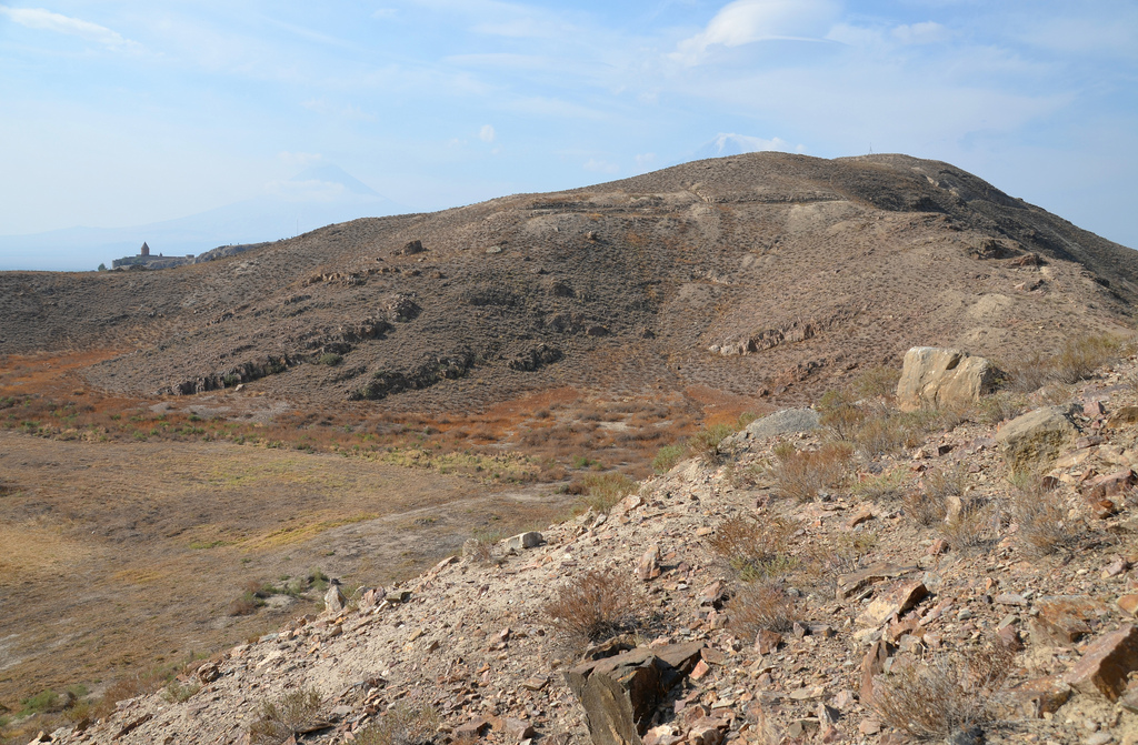
According to the accounts given by Strabo and Plutarch, Artaxata is said to have been chosen on the advice of the Carthaginian general Hannibal. However, the Armenian historian Movses Khorenatsi of the 5th century attributes the city’s founding exclusively to the desire of the new king. Artaxata was built on twelve hills at the confluence of the Araxes and Metsamor rivers, overlooking the fertile Ararat plain. On the largest of the twelve hills, excavation uncovered a large Urartian fortress abandoned for over four hundred years, indicating that Artaxias I built his city upon the remains of an old Urartian settlement. Artaxata occupied about 400 hectares of territory in its heyday and had a population of around 150,000, making it one of the largest cities in the Hellenistic world. Strabo and Plutarch describe Artaxata as a large and beautiful city and call it the “Armenian Carthage“.

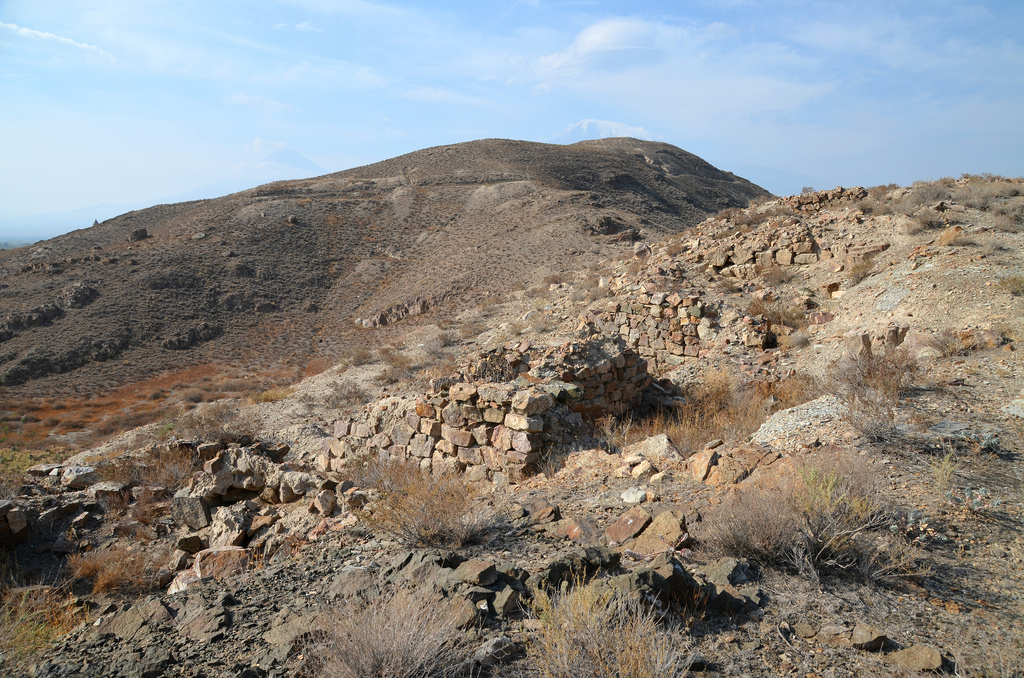
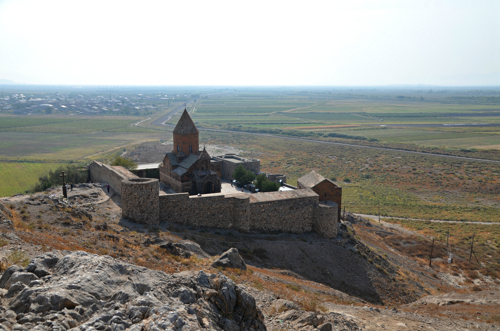
The Acropolis of Artaxata had a palace, administrative buildings, a military garrison, and an arsenal. The citadel was double-walled and well-protected (it was later named Khor Virap and gained prominence as the location where Saint Gregory the Illuminator was to be imprisoned by Tiridates the Great). The remains of the palace, located at the crest of the hill, occupied an area of 2,750 sq. metres. As described by Strabo and Tacitus, Artaxata’s fortress walls ran over 10,000 metres, of which 5,000 metres have been excavated. The walls, with round towers of 13 to 15 meters in diameter, surrounded the whole city, including the hills, the Acropolis, and the lower city. Five of the city’s gates were discovered, each with a pair of towers. The town had running water, a sewage system, and public baths.

By Franck Devedjian – CC BY-SA 4.0
A temple dedicated to Tir-Apollo and a 10-room bathhouse were discovered on the left bank of the Arax River in 2012. A previous complex of temples (189/188 BC) was destroyed at the beginning of the 1st century during the campaign led by the Roman general Corbulo. A new temple was built on the ruins of the former one during the reign of Tiridates I of Armenia in the 1st century AD. Six large steps (4.85 m) led to the eastern entrance to the temple. The walls were decorated with low-relief sculptures. The new temple was destroyed after adopting Christianity as the state religion. The public baths (see image here) were located northeast of the temple and built between the end of the 2nd century and the beginning of the 3rd. Some of the rooms were covered with mosaic floors.

By Franck Devedjian – CC BY-SA 4.0.
Artaxata was captured by Corbulo in AD 58 and was razed to the ground the following year. However, Emperor Nero recognized Tiridates I as king of Armenia in AD 66 and granted him 50 million sesterces to help reconstruct the ruined city. According to Roman writers, the city was temporarily renamed Neronia in honour of its sponsor, Nero.
Artaxata was again taken in AD 114 by Roman emperor Trajan, who deposed the Armenian king Partamasiri and ordered the annexation of Armenia to the Roman Empire as a new province. Trajan stationed two army divisions in Armenia and built a fort at Artaxata to ensure Armenia stayed a Roman province and did not become absorbed into the Persian empire. A stone inscription of the Fourth Scythian Roman Legion survives from this period and lists the various honorary titles of Trajan. The 8 m long inscription was found north of the city, outside the walls and is now displayed in the History Museum of Armenia at Yerevan.

Artashat was sacked again in AD 166 by Roman troops who established a garrison at nearby Vagharshapat, which shortly afterwards replaced Artaxata as the Armenian capital, at least for a time. Artaxata was destroyed in the 5th century and rapidly declined as the Armenian capital became fixed at nearby Dvin, with its stones taken to build the new capital. It is also believed that the changing course of the Araxes River led to the permanent abandonment of the site.
Although the entire site has been elaborately mapped, only two of the twelve hills have been excavated completely: hill 1, which seems to have been a military barrack and outpost, and hill 8, which consists of domestic quarters with private baths. Four hills were destroyed by intensive blasting for marble quarrying in the Soviet period, and the remaining hills have been investigated only partially or not at all.
PORTFOLIO


Links & sources:

Great !
LikeLike
Pingback: Dvin – following hadrian photography